We awoke around 4AM this morning and I began pouring over the charts until I felt comfortable that we could safely make the passage down the outside passage to Norfolk, VA in 4 separate legs. By staying outside we will save days if not a week of traveling inside through the Chesapeake. While we would like nothing more than to spend months exploring all the great places in Chesapeake Bay, right now we could go for some Key West sunshine.
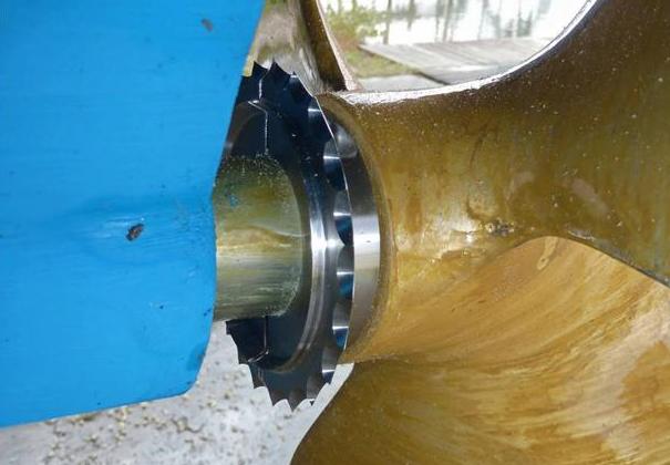
The other day we left Atlantic City and motored past the mouth of Delaware bay, I just could not bear to make a starboard turn and head up the Delaware Bay. This would mean heading North rather that South. In order to take the inside passage you must first run North up the Delaware Bay till you get to the C&D canal that connects the head of Delaware bay with the head of Chesapeake Bay. Once in Chesapeake Bay you again start heading South. It’s quite a bit longer than simply staying outside in the Atlantic Ocean. It’s also more work for the captain, who must stay vigilant to avoid other boat traffic as well as steer around lobster pots. Nobody likes getting a lobster pot line wrapped around their propeller. We installed a “shark” pot cutter in front of our propeller to hopefully chop any lines that tangle in our propeller.


The more we studied the few inlets along the outside passage, the more we realized that many of them were possibly full of shoals and shallows to be worth trying to enter. There were some that if we did enter the inlet, it was clear that once inside it we could easily run aground due to the shallows that abounded. It was also very evident to us that our 2012 electronic charts no longer match the current depths and shoal locations. I use the charts as a “guide” but keep a close eye out for breaking waves where a new shoal may have formed due to recent storm activity.
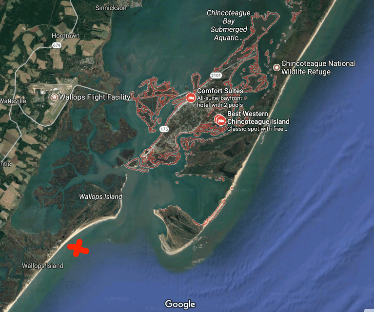
We arrived at Chincoteague Island sometime around 1PM. The journey here was pretty uneventful. We saw only one other boat and it was a large sport fishing yacht moving at twice our speed South down the coast. We studied the charts and found a nice spot to drop hook, close to the shore. MV Simple life has a 90 lb. Rocna, plow style anchor and 300′ of 3/8″ chain. I let out almost 120′ which was a ridiculous amount of scope (“anchor scope” is a ratio like 7 to 1: length of chain compared to depth of water). If we were in a crowded anchorage we’d never be able to let out that much scope as when the wind changed direction we’d swing into other boats. Along this coast there is not another boat in sight. After the anchor hooked up I applied some throttle in reverse (+200 above idle, or 800 RPM) which combined with the strong wind, buried the anchor. The extra throttle lifted the chain straight out of the water with no bounce. We believe you should always “back down” on your anchor and watch to see if the chain jumps up/down which is a clear indication that the anchor is dragging along the bottom. This can happen for many reasons but some possible causes can be the seabed could have eel grass that stops the anchor from “digging in” or the bottom might not be sandy but instead a super soft silt that is like pushing a potato chip through whip cream instead of thick cheese. Better to have your anchor drag while you’re backing down on it than when the wind picks up in the middle of the night and you are fast asleep.
After reading about the wild ponies on Chincoteague Island, I made up my mind to use the crane and drop the dinghy in the water to go find them ponies. I had no sooner raced off on the dinghy before I thought.. I’m freezing & I’m zipping along over the shallow shore and could easily run aground at full speed and wind up taking a dip in the cold Atlantic. So I put a lifejacket on and turned around and made it back to the Simple Life. DAMN, NO PONIES!!!
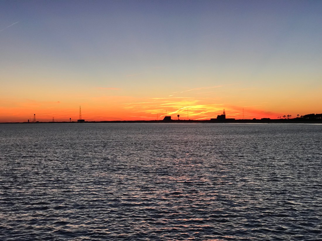
Back at the boat the heater was on and I quickly put the dinghy back on the flybridge and warmed up to an IPA 😉 That brings me to where I am now.. sitting in the pilothouse enjoying a beer or two. We’ll leave you with our sunset view — good night.

Look forward to your blog. It’s like a history, geography, and earth science lesson all in one!!
Did you see any place where Washington crossed the Delaware? What town are you in now? I like checking your weather via zip code…
LikeLike
Love to read all the posts and see the pictures. Thanks for sharing your adventures with us! Quick ( possibly dumb question 🙂 ) but just curious, what if anything do you use for internet access along the way? ( When not at a marina )
LikeLike
Great question. I needed a router/firewall device that could give me a private WiFi for every smart device onboard and it had to use the marina’s WiFi as its outgoing WAN. When we are on anchor I need the router to failover to a USB cell modem. I use a Pepwave Surf SOHO MK3.
https://www.peplink.com/products/pepwave-surf-soho/
LikeLike