Foxboro Reunion

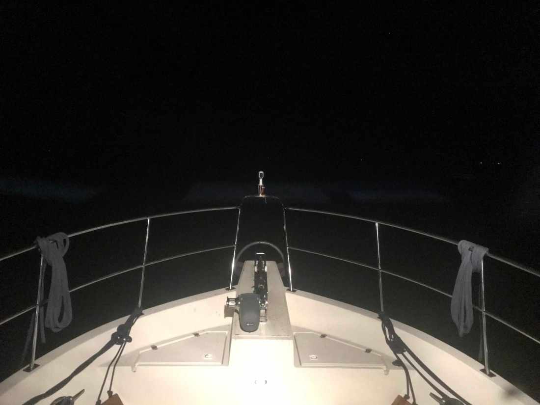
My phone rings and I answer. I had just fallen asleep after being up for over 40 hours. I answer the phone and it’s a friend asking “where are you?”. I respond instantly with … “Oh. umm, ummm. ummm. I don’t know?” Funny that when you are always waking up in a new place each morning you forget where you are sometimes.

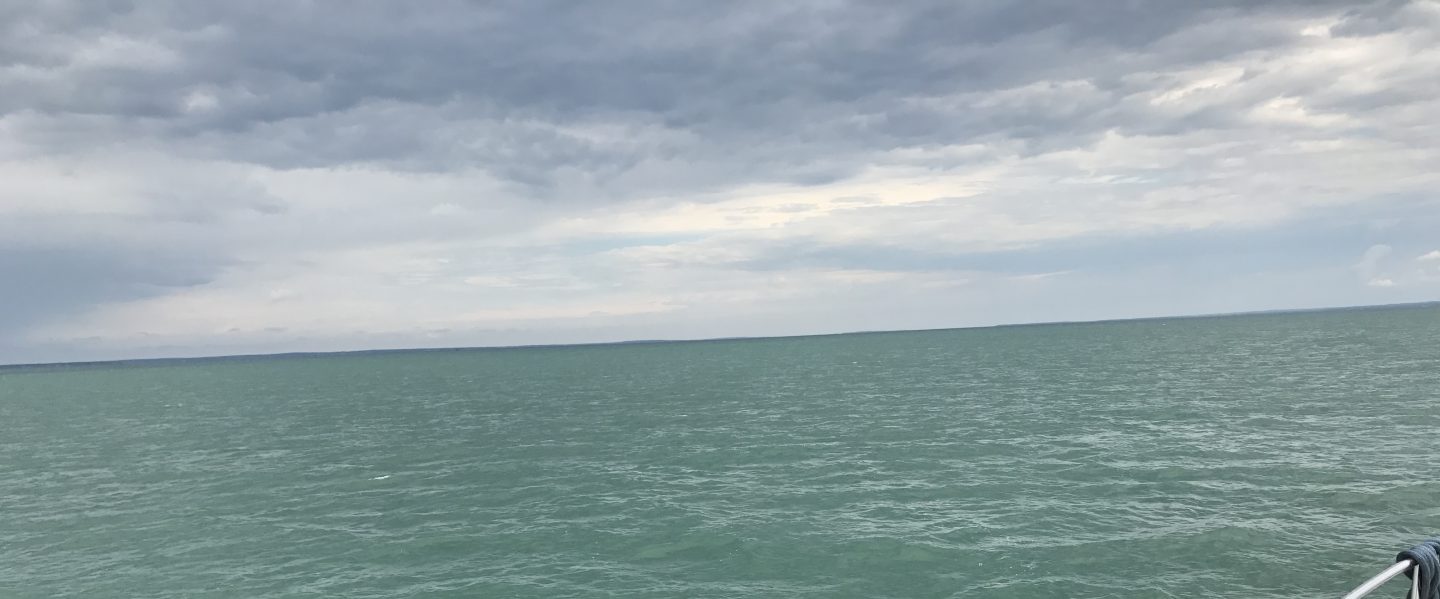
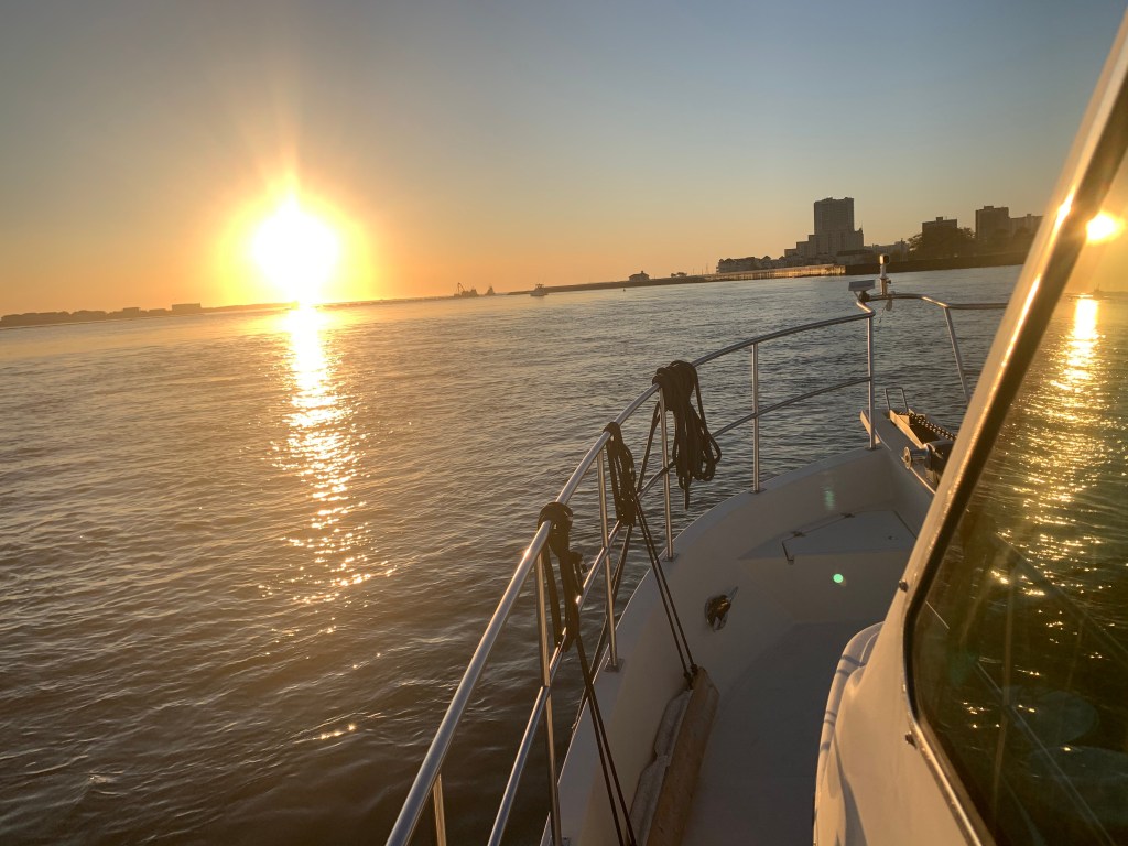
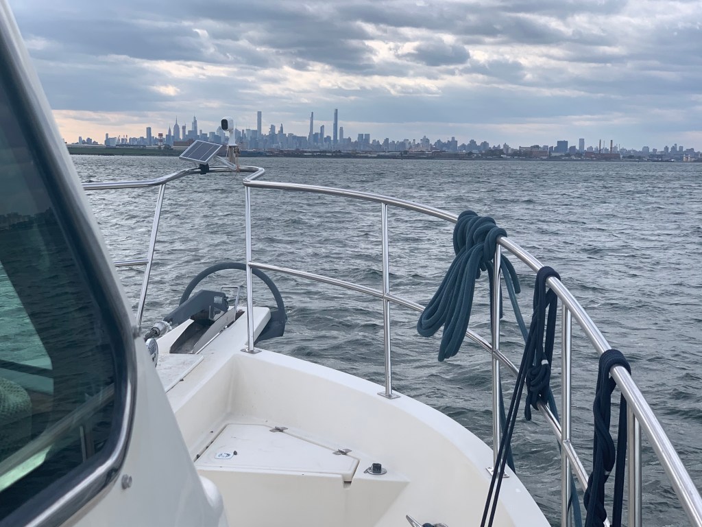
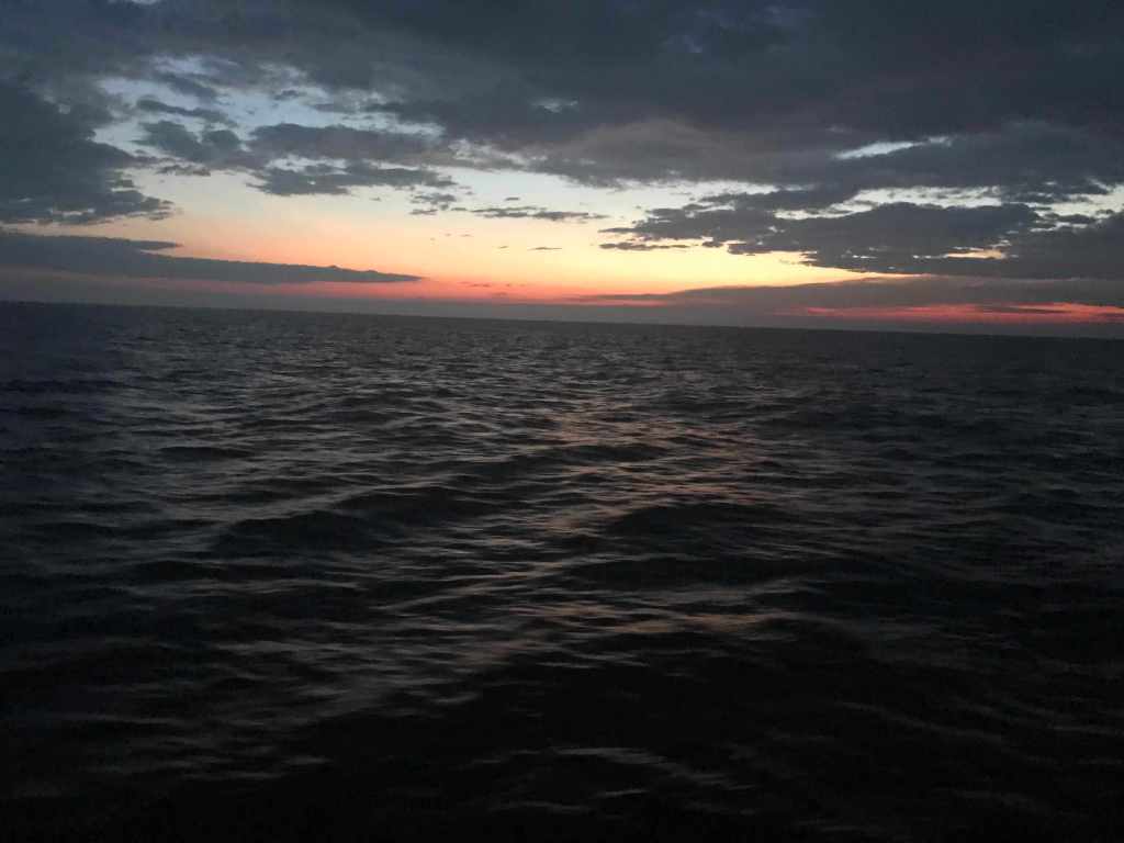
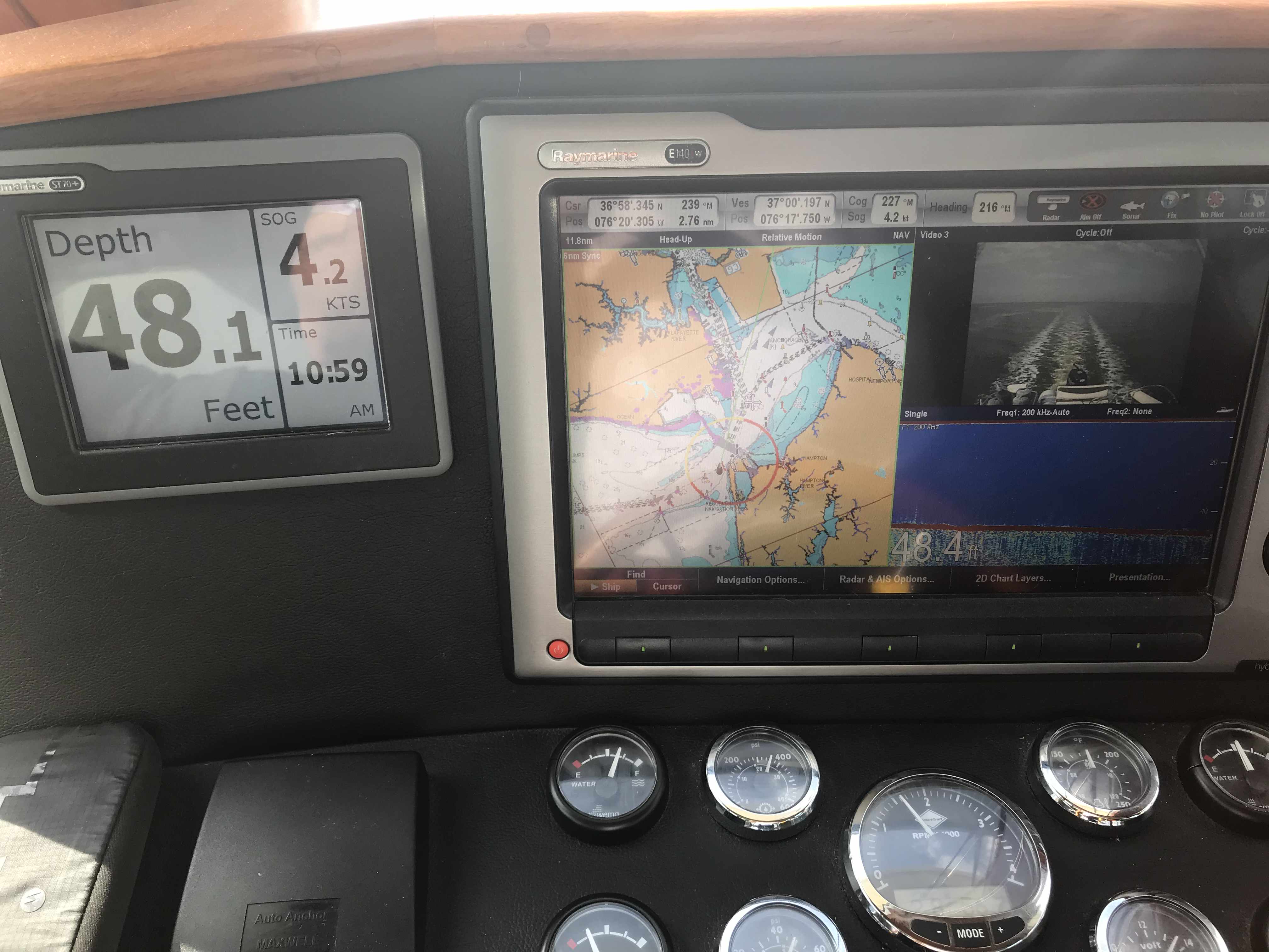
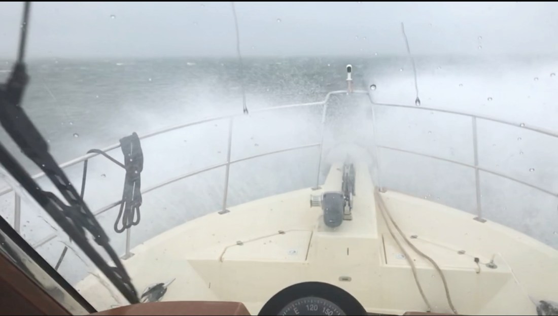
I planned on sleeping in leaving late. Why am I up and checking the weather at 5AM? Staying up for two days has knocked me off my circadian rhythm. The weather outside in the Atlantic is continuing to deteriorate with 25kt winds and 6-8′ seas. Lucky for me today’s trip will be on the inside motoring down the ICW.

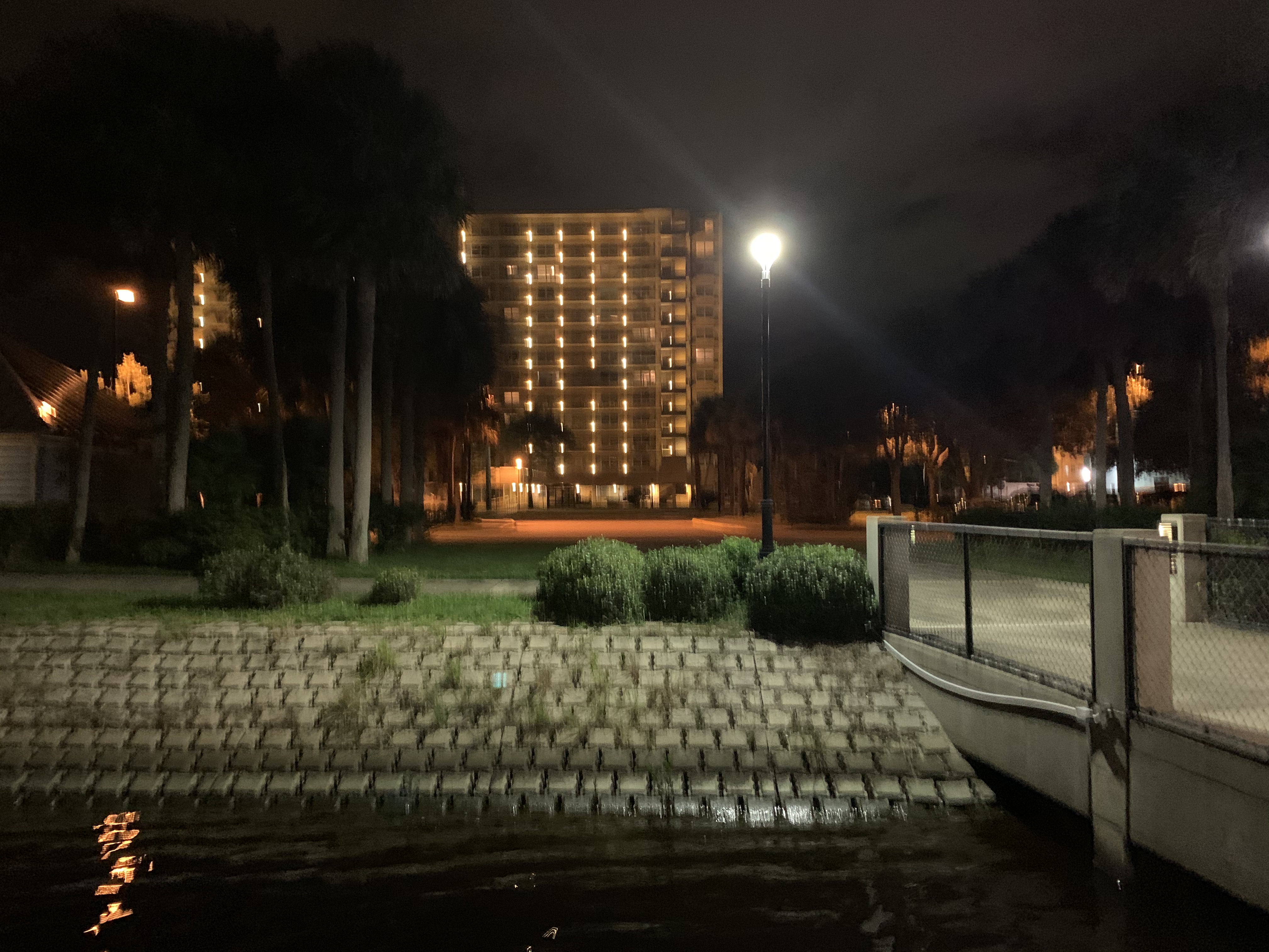
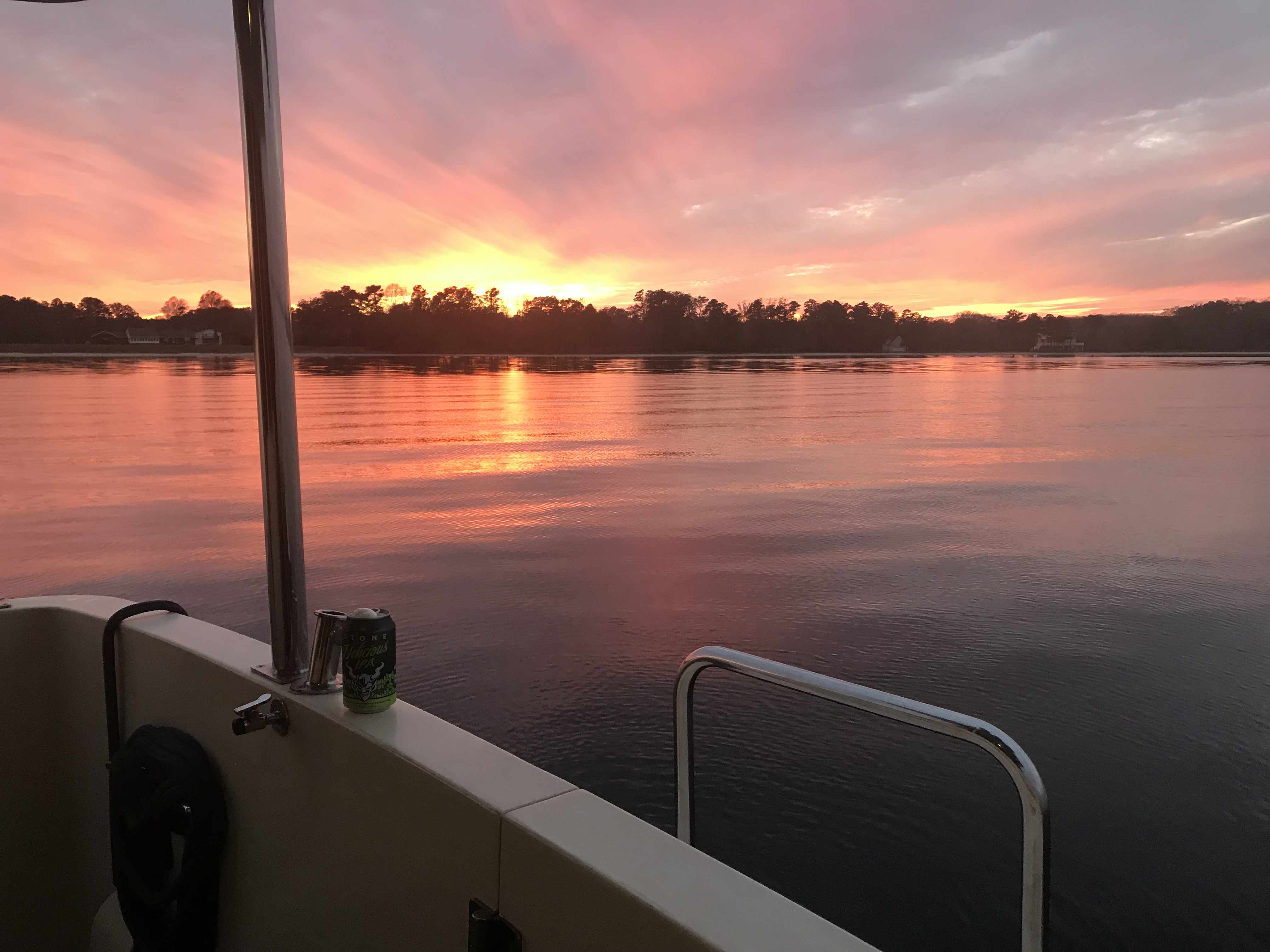
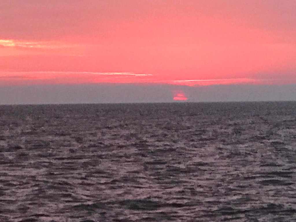
Anchored at Fort Matanzas, FL and the current is so swift that you’d swear I was underway and not on anchor.

strong current while on anchor

.

.

.

I weigh anchor and proceed about an hour south down the ICW before docking at a marina in Palm Coast. I’m here to do a walkthrough of a boat for sale. I figured as long as I’m driving by I could help a friend by FaceTiming him from the boat he was interested in buying. The boat was beautiful.

Boat showed as new

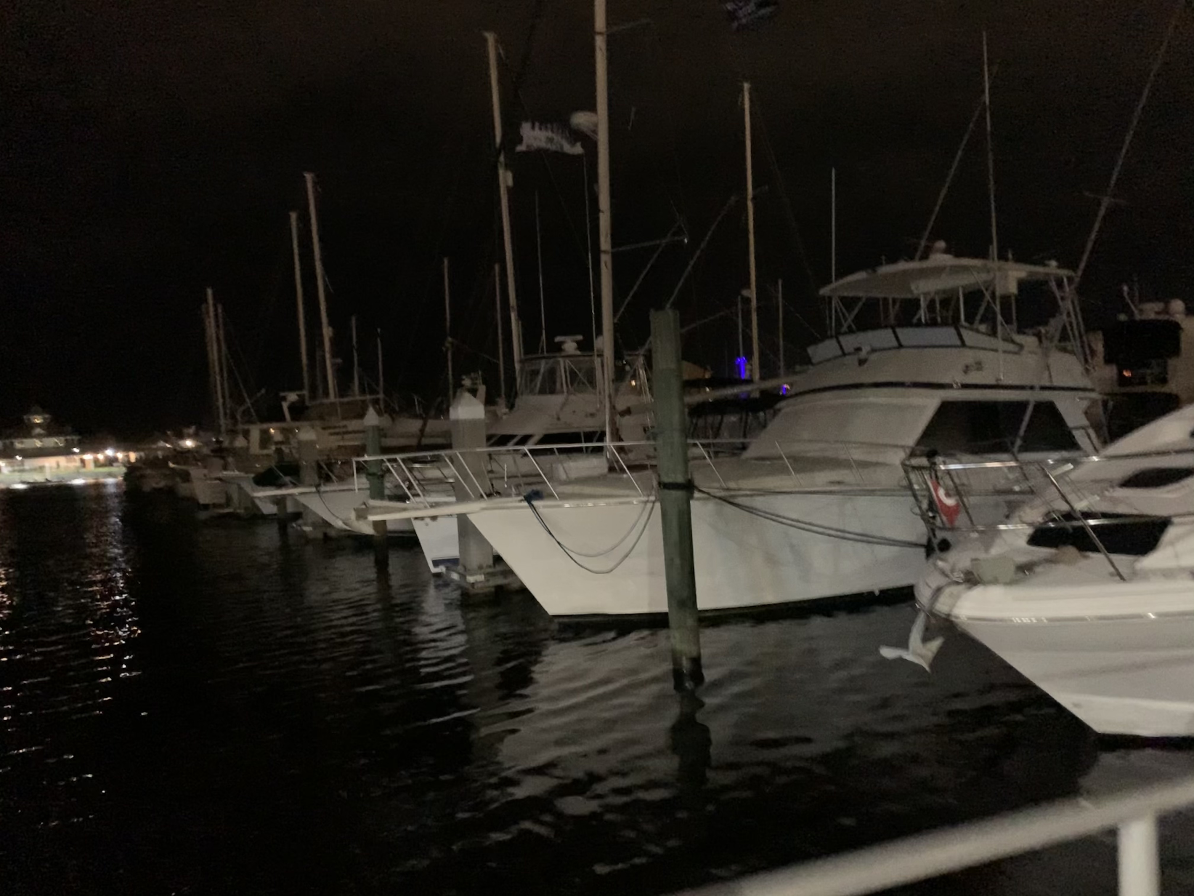
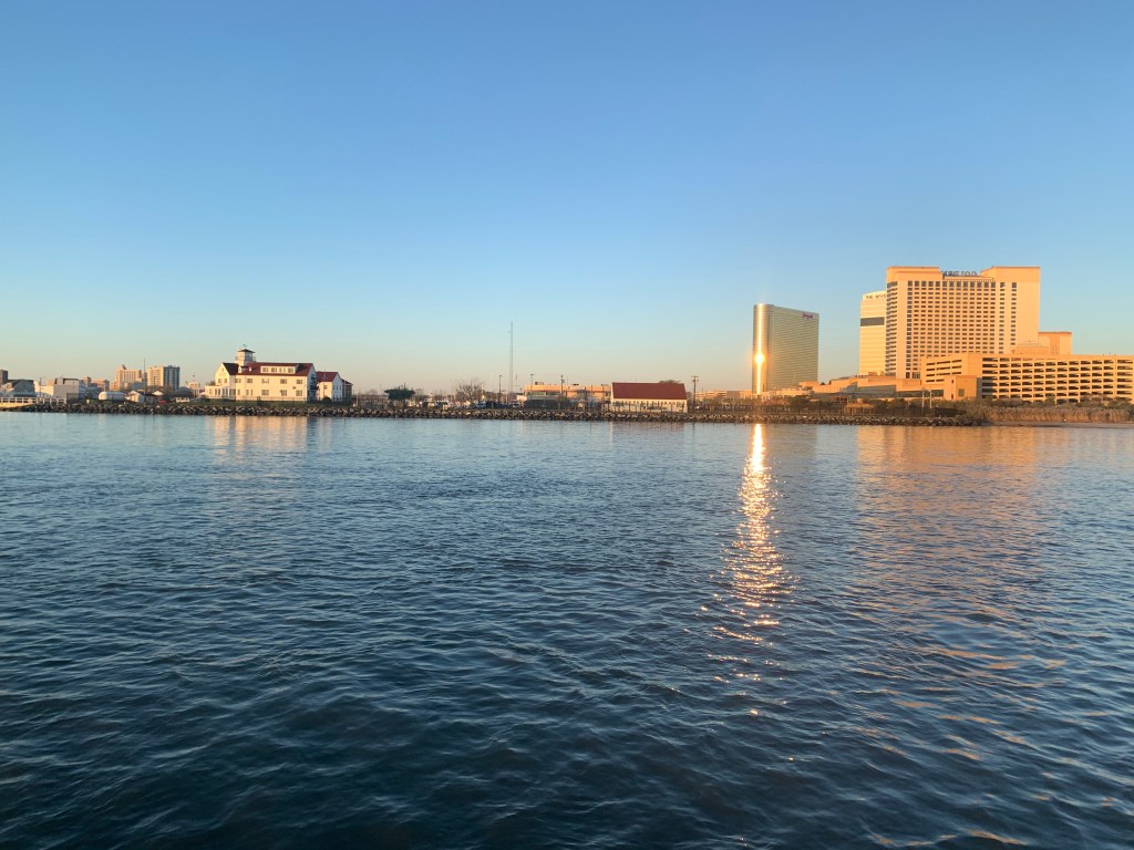
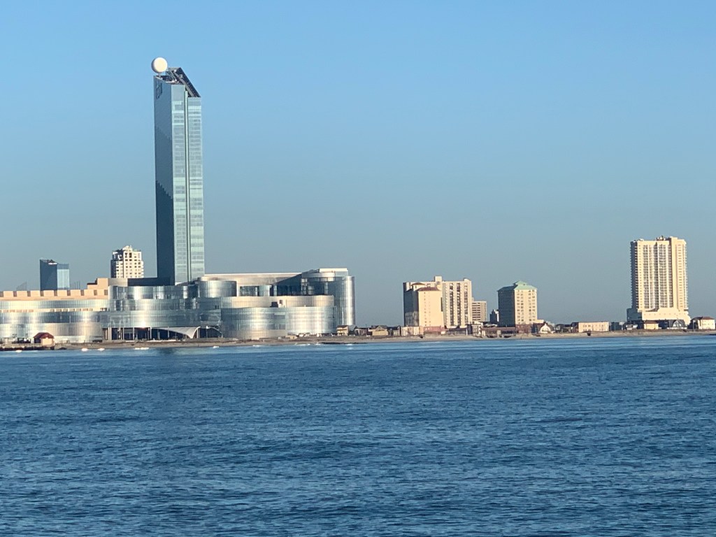
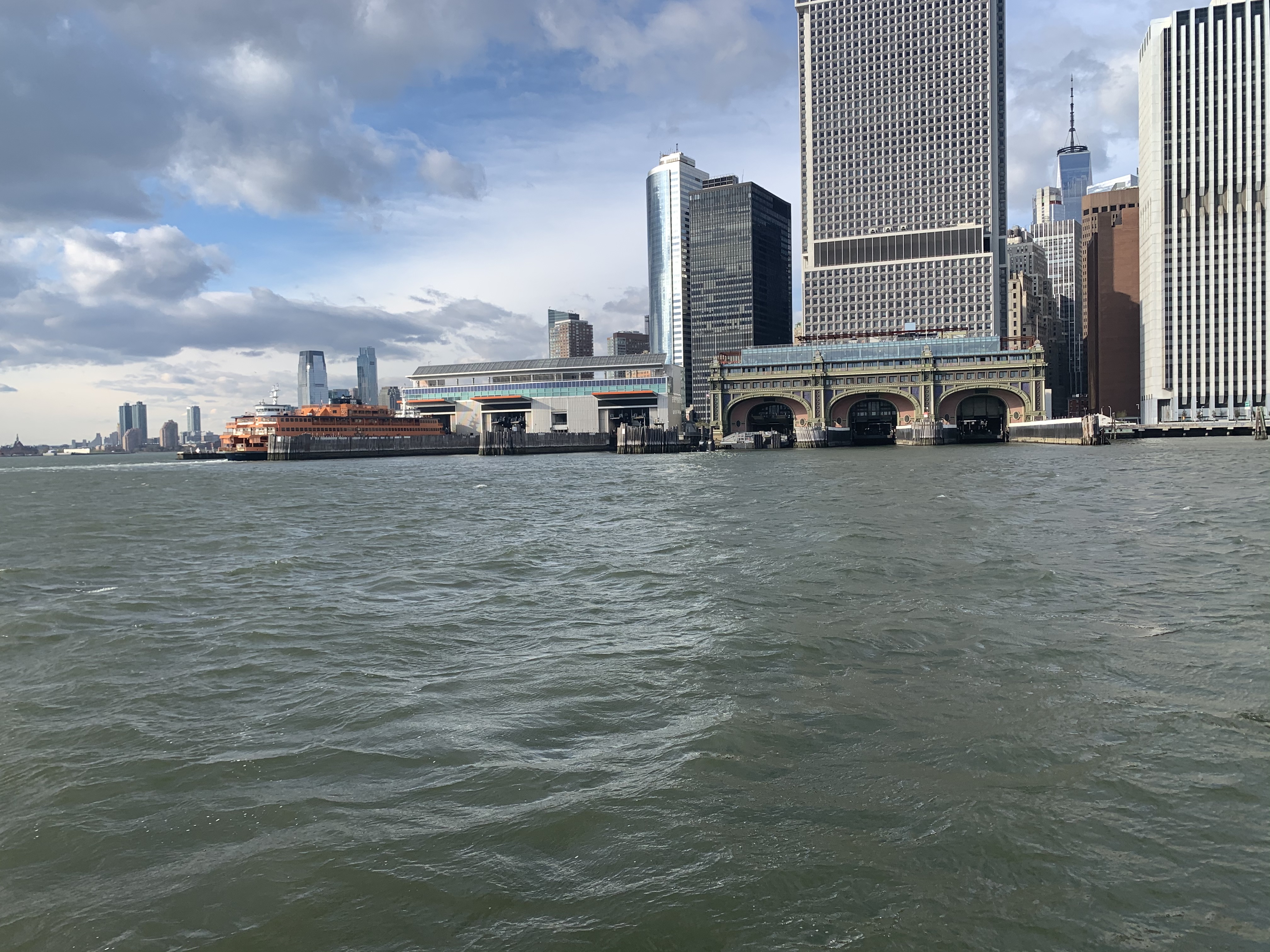
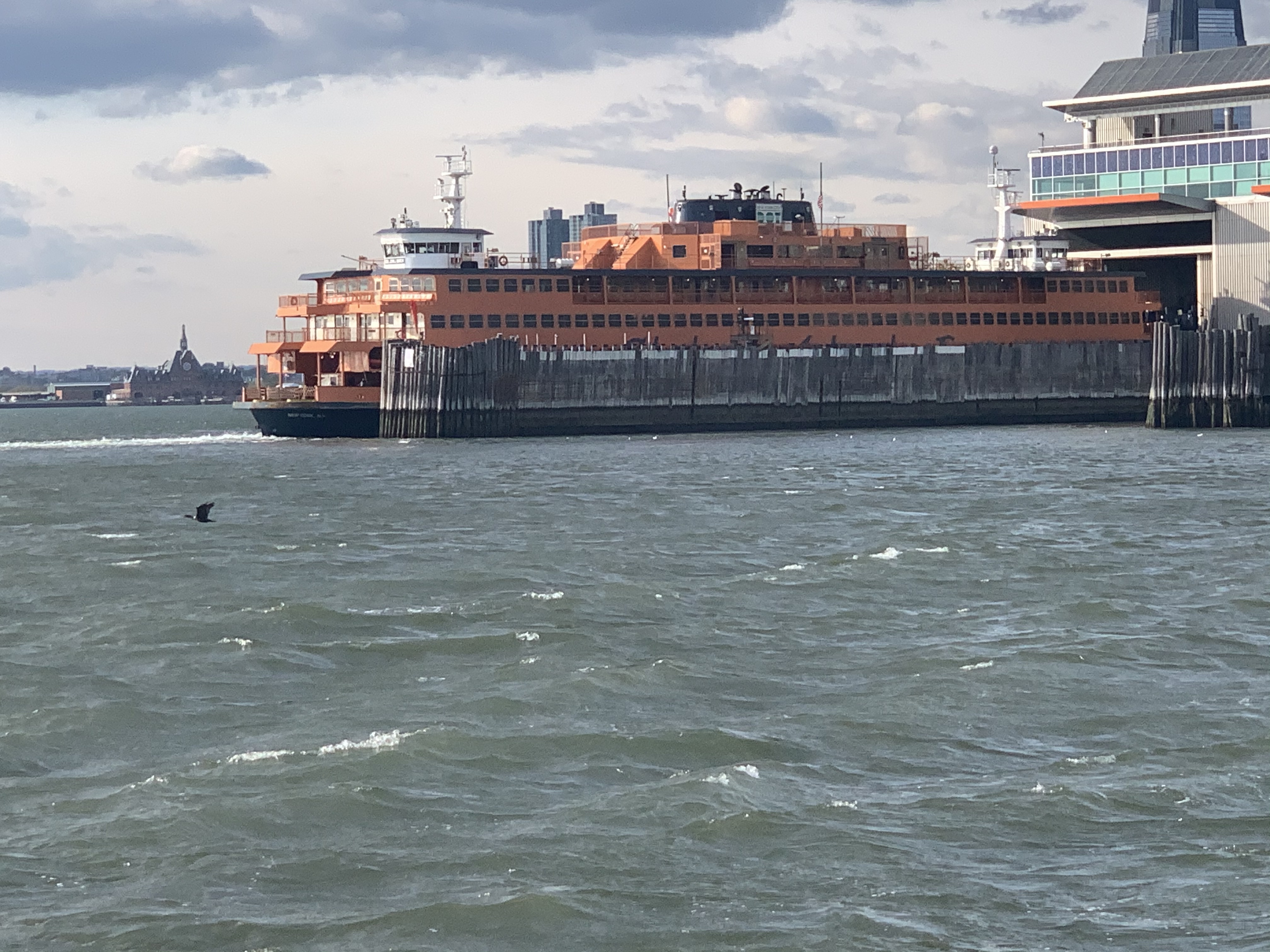
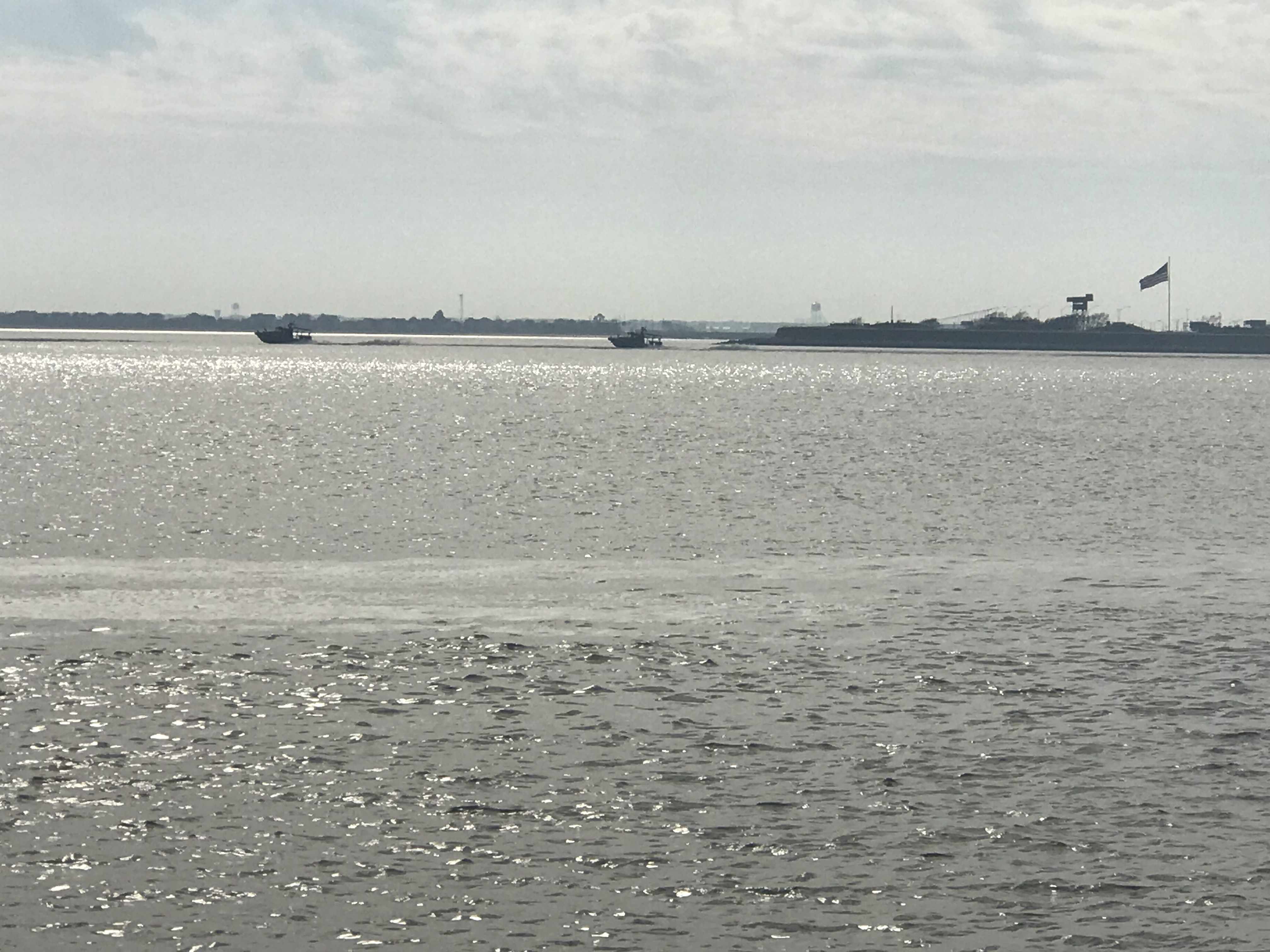
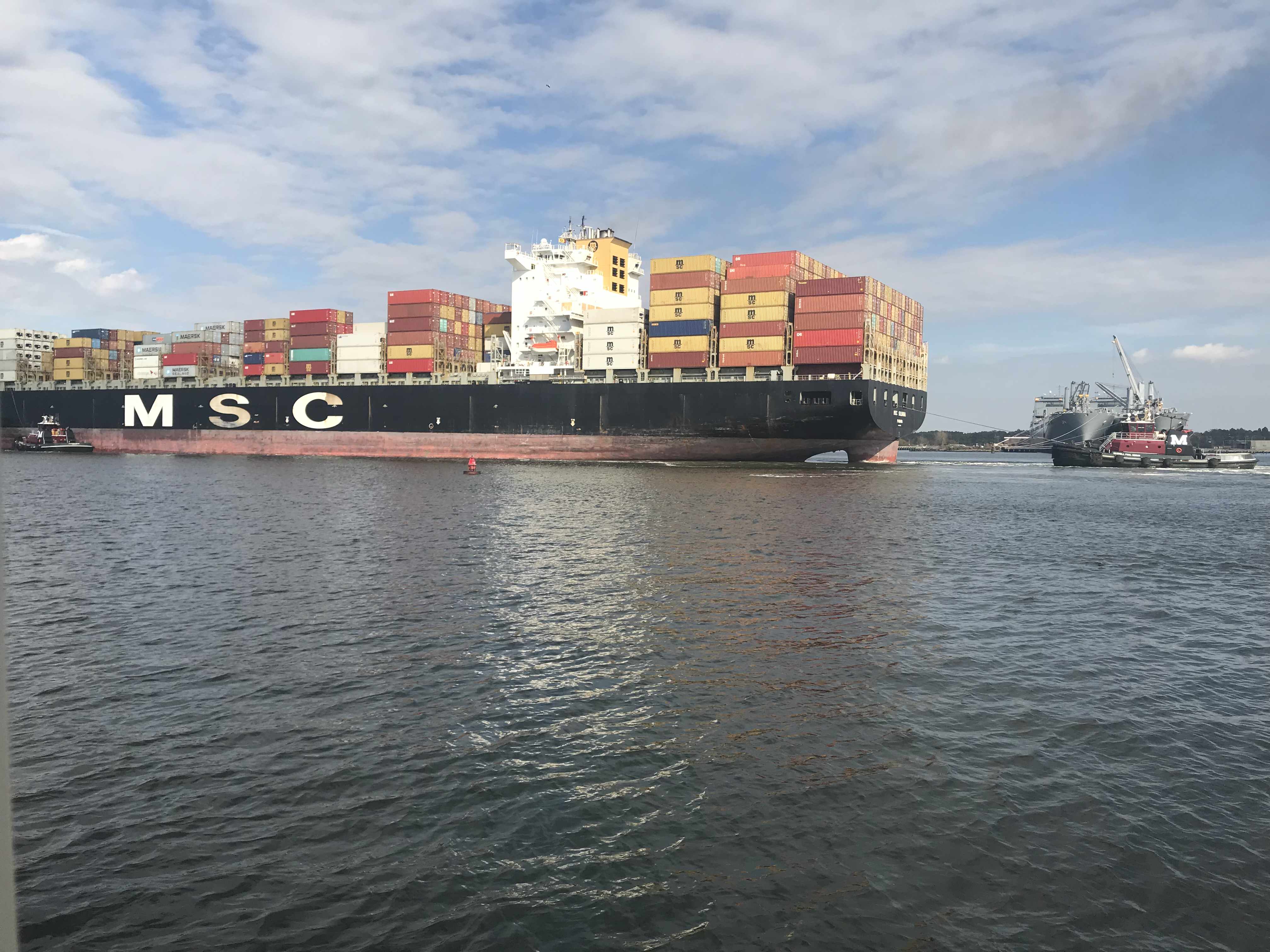
As I make my way towards Daytona Beach, FL I pass several boats along the way.

SV Parachute seen better days.
Honey, I’m just going to buy a little boat and tie it up behind our home 😉

The boat is autopilot and I’m reading a Facebook fishing group post where a FB user has posted about how he caught his biggest fish in Long Island Sound. As I look at the photo of the fish, I’m thinking…. That looks like a federally protected, endangered Atlantic Sturgeon. As I click on the photos to get a closer look FB says the photos have be removed. I’m thinking this must be a joke that nobody would post about catching an Atlantic Sturgeon. Or would they?

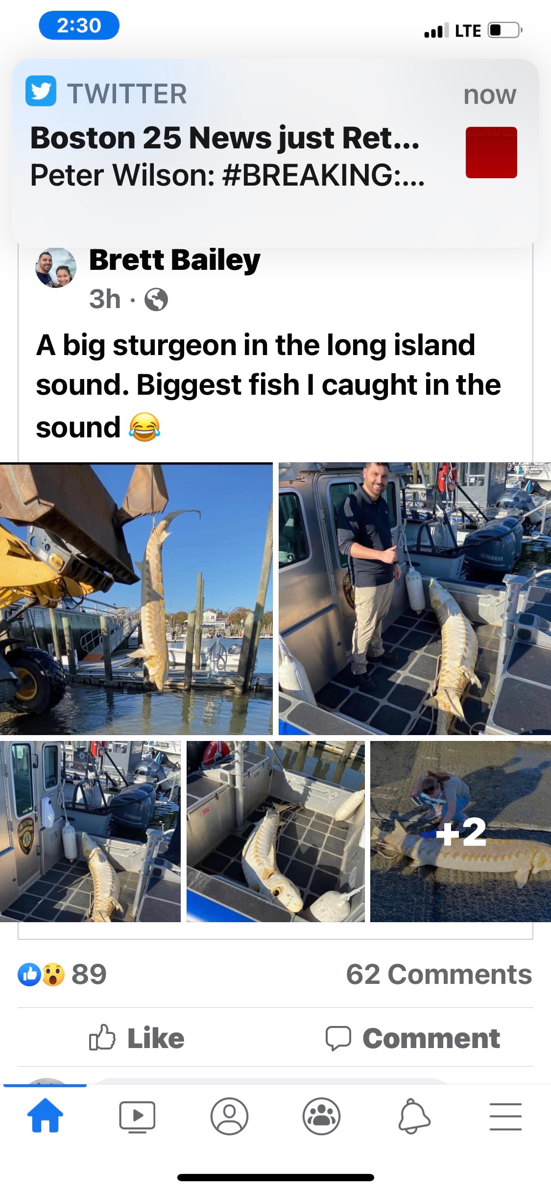
Sturgeon are living dinosaurs. Fisheries biologists have discovered that sturgeon existed as long as 200 million years ago.

The Atlantic sturgeon is one of seven species of sturgeons found in North America.  Sturgeons are prehistoric species that date back to the time of dinosaurs.  Sturgeons have physical features that separate them from other kinds of fish such as: a spiral valve stomach and cartilaginous skeleton (like sharks and rays), but they have scutes (hard, protective, large individual body plates) instead of shark’s denticles or bony-fish’s scales.  The Atlantic sturgeon has barbels located on the underside of the snout, no teeth, rubbery lips, and a suctorial mouth for vacuuming food off the water bottom.  The Atlantic sturgeon’s coloring typically is dark brown along the upper (dorsal) side, shading to a creamy white-colored belly (ASSRT 2007).  The Atlantic sturgeon is a large fish that can reach a length of 14 feet (4.3 meters), a weight of over 800 pounds (363 kilograms), and possess strength to leap nine feet (2.7 meters) into the air.

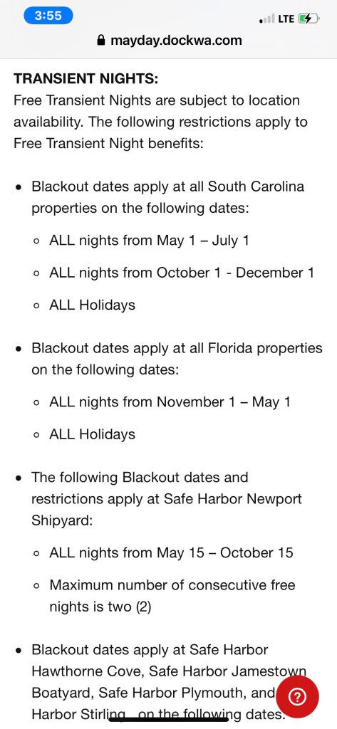
As I approach Daytona I realize I only used 2 of my 10 FREE nights at Safe Harbor Marinas. After doing some research I learn that the blackout dates in the south prohibit their use.

Included to make sure my fellow Safe Harbor slip mates are aware

As I pull into Halifax Harbor Marina the wind is blowing so I have already prepped and have my fenders out on both sides and my lines coiled on the deck but hanging within reach if there is a dockhand to help me land in the slip. As I start down the I-H dock fairway I see the dockhand is already waiting in the slip for me to back in.

Halifax Marina in Daytona Beach

My friend Jay is already waiting and within minutes of landing we are sharing a beer and catching up since our last meeting here in Daytona Beach. We make a quick call to another former Foxboro resident and we meetup at Hooligans to grab some hot wings.

It was great catching up with my Foxboro Friends. It’s great to have friends along the way to break up the month long journey.

Back at the marina I feel like I’m walking into a cage match.

And in this corner… Crusher!!!!

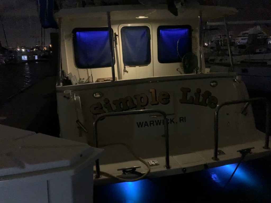
Back aboard Simple Life I plan on sleeping a bit late, enjoying my coffee and not leaving until my 11AM leave the dock deadline.

Simple Life Slipped at Halifax Harbor Marina in Daytona Beach, FL

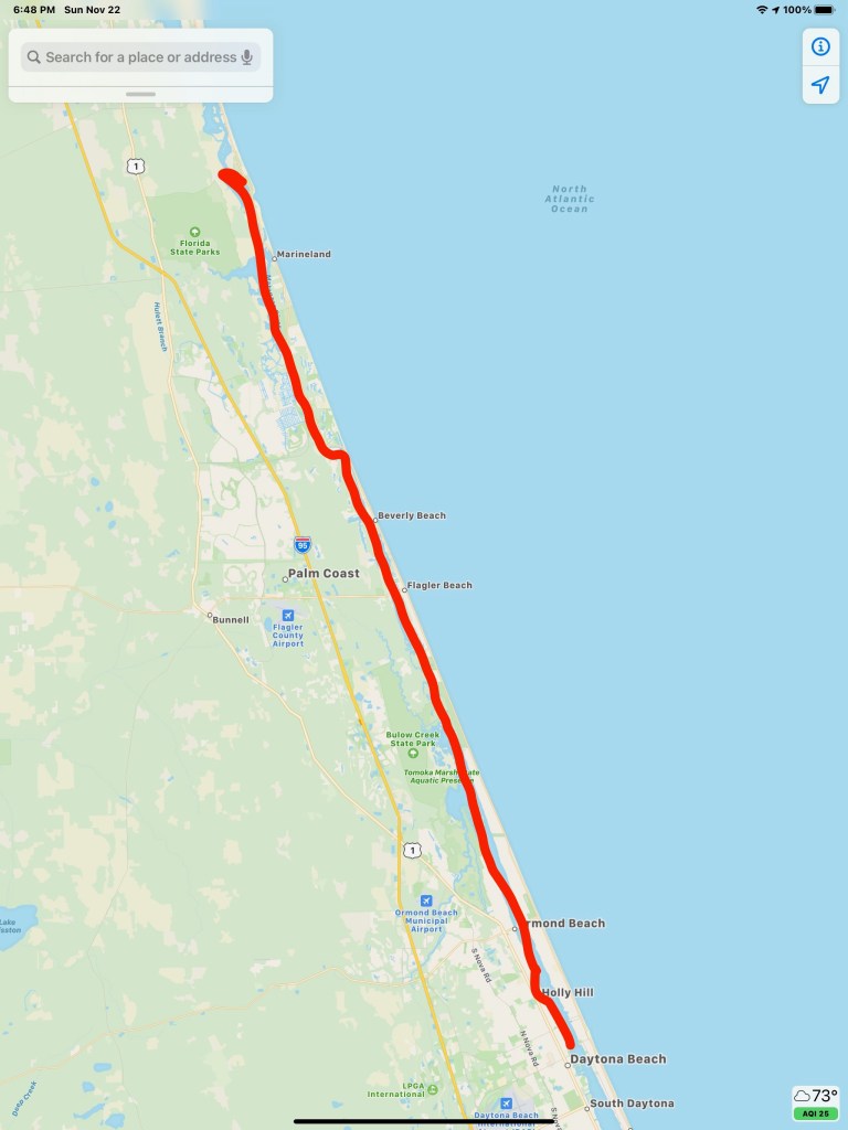
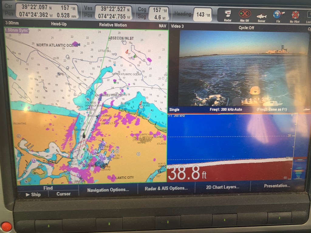
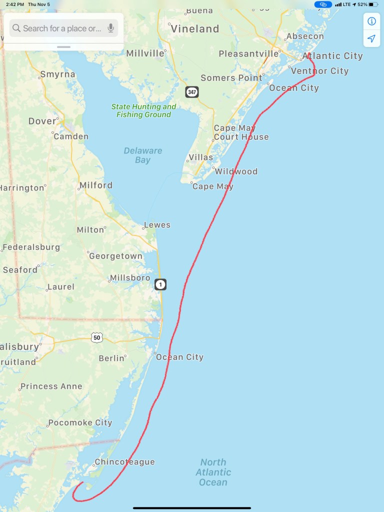
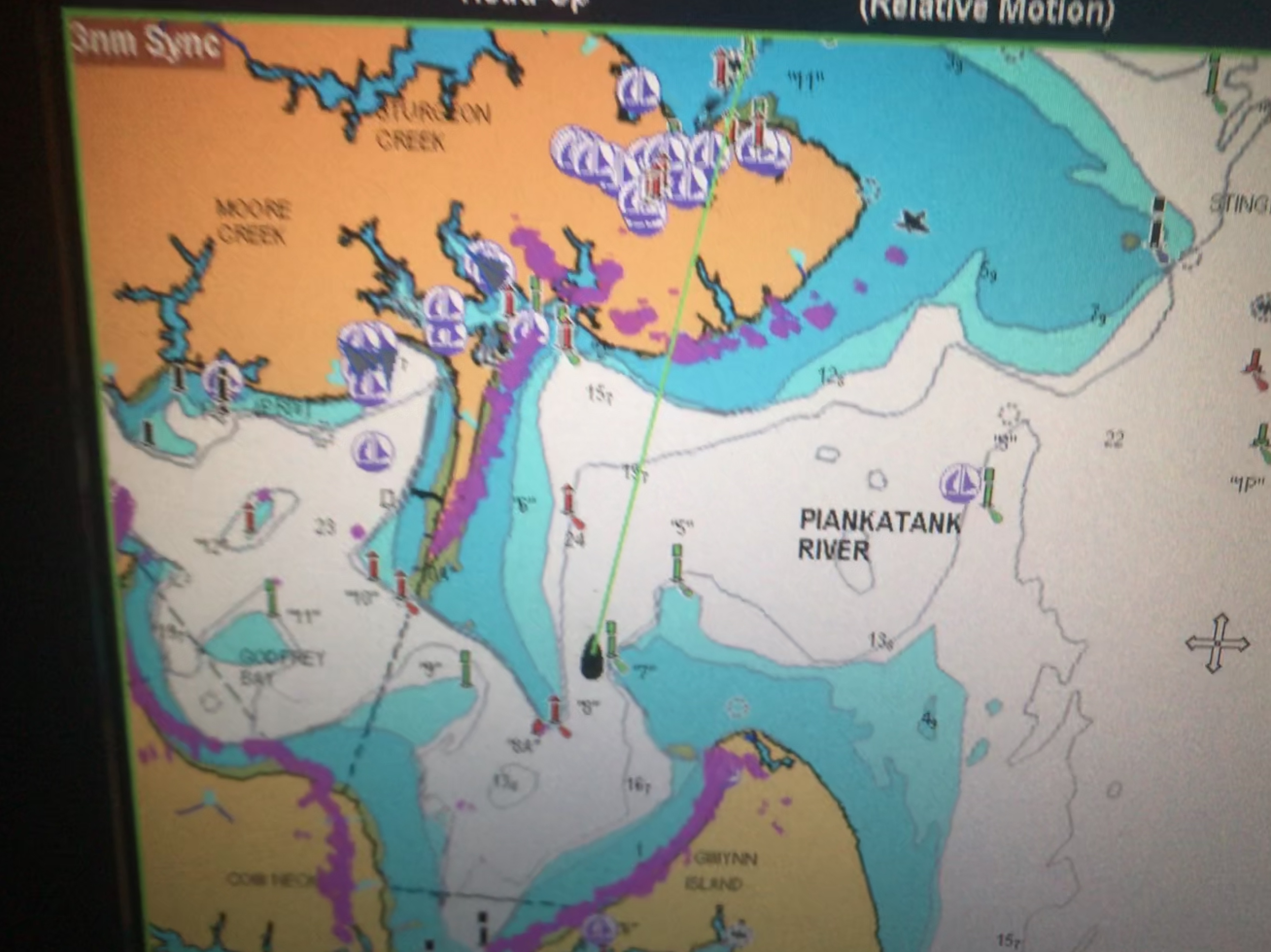
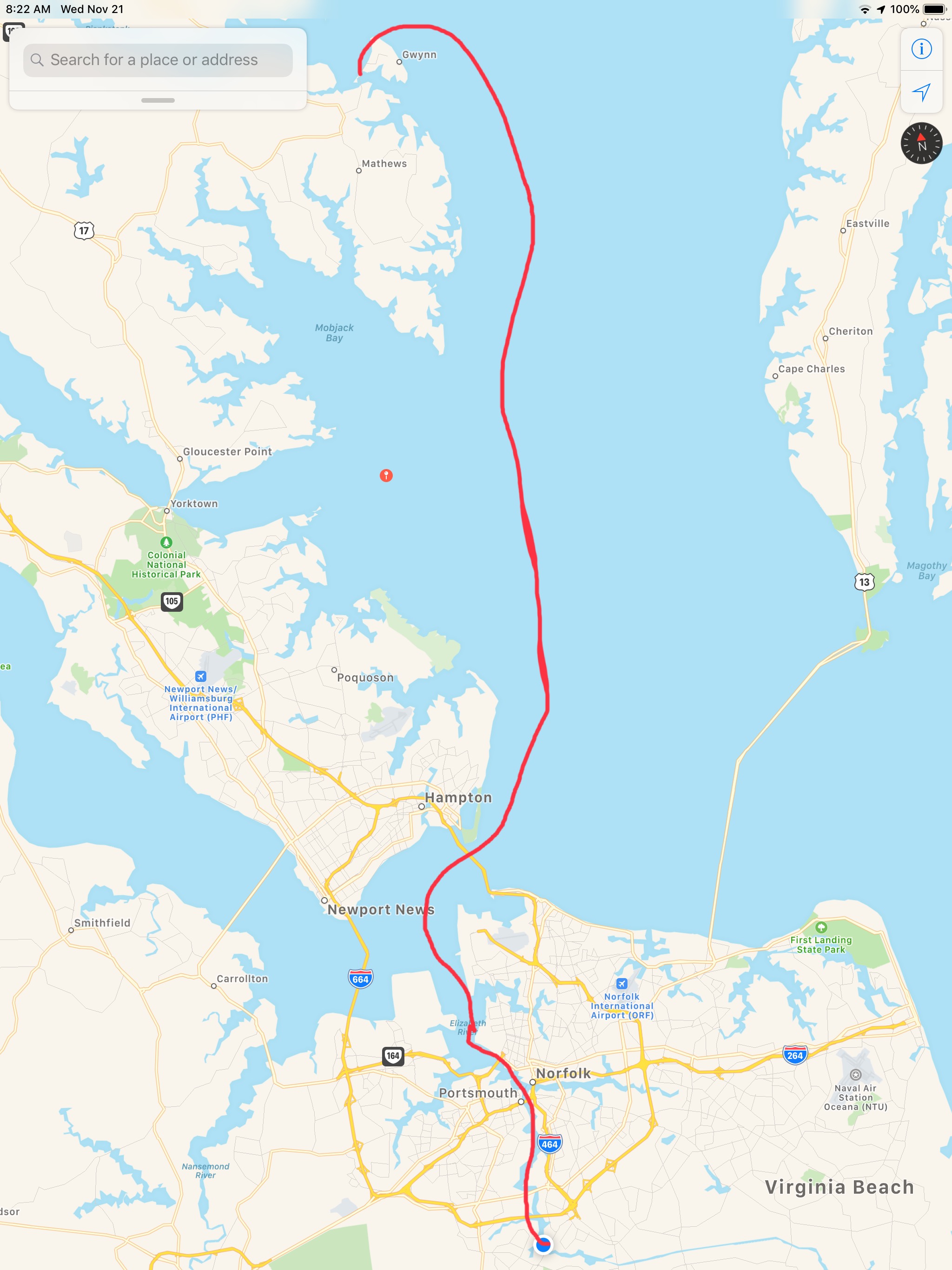
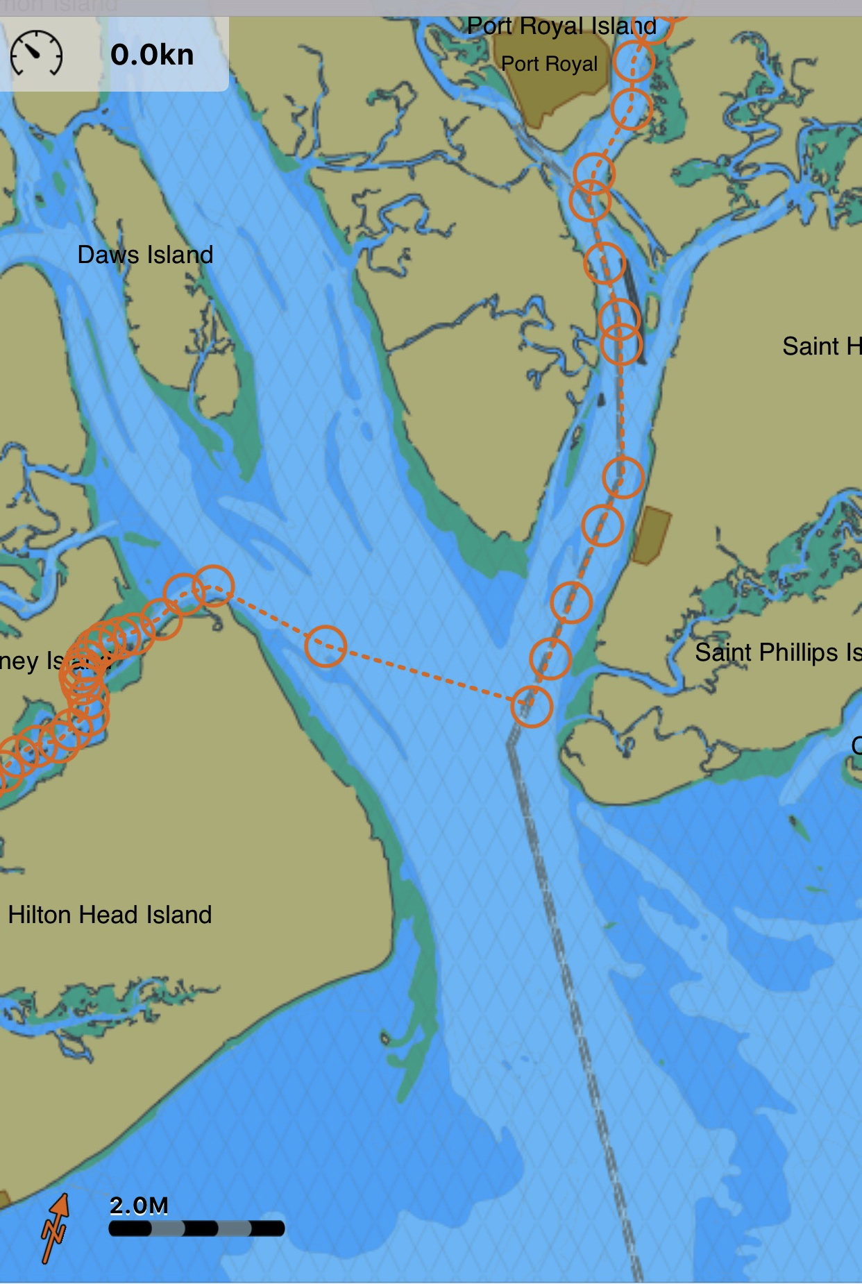
The day’s route looked something like this

W04L014 Route

Who wants a Wallop?

When my youngest sister, Janet & I were acting bad, our Dad would simply state “Who wants a wallop?” My first thought was “What’s a wallop?” Later I learned… It was code for you better starting acting right or Dad’s gonna straighten you out like a piece of wire. Lucky for us, it was rare he ever had to make good on that threat because we knew enough to stop.

You may be thinking… why is he talking about about getting a wallop? Well… ADD aaannnd tonight’s anchorage will be Wallop’s Island. There are not many places to anchor along Virginia’s Atlantic coast but this is one of the few.

Wallop’s Island along Virginia’s Atlantic Coast

Absecon Inlet

I only slept for 2 hours and awoke at first light. It’s amazing how refreshed you feel even after as little as 2 hours sleep. As I look out the pilothouse windows I can see a bright spot of sun on the metal exterior of the 430′ high Borgata Hotel Casino & Spa.

Borgata Hotel Casino & Spa

As I glance out the other side of the boat I see Ra, the ancient Egyptian sun god, has just started his journey across the cloudless sky.

Ra’s Journey Has Begun

I am not alone. Last night I weaved through three sailboats to find an empty spot to drop my anchor. I wonder if they will even know I was here?

We are not Alone

When I finally retrieve my anchor into it’s bow roller I see that it’s covered with sea lettuce. Well I’m sure there is a more technical term but I’m sure the strong current was trapping the lettuce against my anchor chain like lettuce blowing in the wind.

Fresh Salad aboard MV Simple Life

As I look in my review camera I am reminded of how deep Absecon Inlet is.

Almost 40′ deep inside Absecon Inlet

As deep as it is inside the inlet there is quite a bit of shoaling going on around it’s entrance. The Aqua Maps chart plotter view below shows a few of my past tracks entering and leaving Absecon Inlet. The pink track entering from the left of the picture was my track coming in at 3:11AM on 11/4/20. While the charts show depths like 20′ and 15′, reality was much closer to 9′ as I came across that shoal. Whenever you are navigating inlets your chart depths are not to be trusted. If you have any ocean swell action going on you’ll often see breakers wherever the shoals exist.

Brigantine Bay anchorage on left, Absecon anchorage in middle and Farley State Marina on the right

As I make my way out of the inlet I am bucking the incoming tide and it slows my normal 6.5 kt speed down to a plodding 4.6kts.

Fighting Absecon Inlet Current

Atlantic City Architecture

As I leave Atlantic City I look back at both the 710′ high Ocean Casino Resort and The Wheel @ Steel Pier (227′ high). Both of these object are lit up at night and can be seen for miles as you approach on a dark night. The ball at the top of the Ocean Casino Resort (The former Revel Casino Hotel) glows with changing colors.

Ocean Casino Resort
The Wheel
A glowing Wheel

Digital Selective Calling

The next hours many hours were spent cruising the coast with hardly a boat to be found. Then suddenly the VHF radio sprang to life.

Me ACK’ing a DSC distress message with no LAT/LON or nature of distress info in the message

VHF radios have evolved to use DSC or Digital Selective Calling which allows for making calls to select individuals or groups using their MMSI number (Maritime Mobile Service Identity). DSC also allows for making a digital distress call like the one I received. After ACK’ing the call I received, I immediately entered the boat’s MMSI number and called them back directly. No response! I tried several times for about 30 minutes while I scanned the horizon with my binoculars for any signs of boats or activity. Nothing. Other boaters have told me stories about how the distress button gets accidentally pushed on radios and when someone calls back the people won’t answer your call. Often after you accidentally push the distress button, many boaters attempt to call you back and having to repeatedly tell each of them that you accidentally pushed the button can be a humiliating experience.

Learn From My Mistakes

All that said… I still wish I had notified the USCG.

At the time I thought… there was no location or nature of distress information included in the DSC message. So I would simply be telling them that I received a message with no other info. BTW, the location information is probably one of the greatest reasons for DSC distress in the first place. You simply hookup a NMEA (National Marine Electronics Association) data wire from your Chartplotter/GPS to your VHF and the VHF automatically sends your LAT & LON coordinates as part of the digital distress message. Had the location info been sent I could have gone to the location given.

Even though I know…

  1. Buttons get pushed by accident
  2. I could see no boats or activity
  3. Whomever pushed the button never answered my reply

I realize it was a mistake not to inform the Coast Guard that I received a message. Next time, I will be prepared on how to handle this situation. Boating is a learning experience. I make mistakes and I learn everyday.

Night Approaches

The sun was setting. I settled back into my captain’s chair and prepared for dark. There was a half moon tonight but moonrise would not occur until around 8PM. I let the flybridge lights so that I would be seen by others and between radar and occasionally spotlighting I felt good as I cruised on into the night.

Tonight’s sunset behind Fenwick Island near Ocean City, MD

I adjusted the brightness of my chart plotter & instruments as well as set dark mode on my iPads. Nothing can be seen outside but the reflection of my instruments in the pilothouse windows.

I arrived at Wallop’s Island around midnight. It was a long 17 hours at the helm. I’ll be up at first light but I’m sure I won’t have any issues getting to sleep tonight!

Winter 2020 – 115NM Leg 004 looked something like this…

Atlantic City 4AM

Sleeping In

I purposely got a late departure from the marina in Port Washington because I wanted to catch a fair current. When I went to leave my slip the gale force winds were on my beam. When you are solo you must untie and leave only a front a back looped over the cleat so you can climb aboard and flick the lines off and go. The problem this morning was that after I flicked off the stern line and ran through the boat to get to the bow line I’m sure the boat would be sideways in the slip. I opted to tie the boat with a single line, jump aboard, flick the line of the cleat and try to get out of of my slip before the wind had it’s way with me. Lucky for me the slips are very wide as were the fairways.

Pulling out of Port Washington a sailboat was following me.

Blue-hulled sailboat reminds me of my old Hunter sailboat before I bought my trawler

Port Washington is just around the corner from the east end of the East River.

Port Washington is a great staging location to wait for a fair current

Under Bridges

Throgs Neck Bridge is the first bridge as you enter the E. River. You can see the Bronx – Whitstone bridge behind it. The fair current boosts my speed from 6.5kts to 8.6kts as I zip along under the bridge.

Throgs Neck Bridge East end of the E. River
8.6 kts thanks to the current

Passing Traffic

Almost immediately I’m being passed by USCG & NYPD boats as well as other boat traffic. They are everywhere as you navigate the East River.

Dystopia

The NYC skyline can be seen in the distance. On this cold grey day I can help but think it looks like a scene from some dystopian future SciFi flick.

Dystopian future skyline

Push Me Along

As I approach the infamous Hell’s Gate where the E. river & Harlem river converge my speed jumps to 11kts.

work pajamas on feet in the helm

Right of Way

Soon I had an oncoming boat that was crossing my port bow. They were on a collision course so I sounded my airhorn for a 1 whistle pass. They did not change speed or direction. I blew my horn again and again with no reaction from the oncoming boat. I finally laid on the horn turned to starboard. We exchange some hand waving before the captain got on the VHF calling me a moron. I simply explained that he did not have the right of way. He was on a collision course. He did not respond to my sound signal and left me no choice but to stop. No response.

Staten Island Ferry

As I pass the souther tip of Manhattan I see the ferry terminal and the Staten Island ferry docked.

They never stay docked very long. NYC’s fast pace as passengers rushing off and on and they are underway again passing me.

A Sexy Girl goes Past

As I’m passing the Statue of Liberty I see a radar return for something passing me on my starboard side. She’s a beauty. MV Arriva from England.

Hustle and Bustle of NYC

This is the busy part of NYC harbor and all sorts of traffic is passing me.

USACE (US Army Corp of Engineers)
Maersk Containership entering NYC harbor

The Jersey Shore

As I pass under the Verrazanno Bridge and past Sandy Hook the sun is setting and at first it’s a beautiful yellowish orange.

Yellowish, orange sunset off Sandy Hook

But minutes later it’s very pink

Pink sunset off Sandy Hook

Serenity

My AIS shows a 66′ foot yacht approaching from my stern.

AIS info transmitted between boats digitally over VHF CH#70

hmmm… 33 feet of beam I think as I wait to snap a photo of this boat with the sunset above. MV Serenity VII is a Lagoon 63 – 4 cabin, crewed power catamaran for charter. You can reserve it here for about 30K/week in the Bahamas if you like? I’d guess the crew are bringing the boat south to the Bahamas for the start of the chartering season.

Red Light District

As the sun sets I swap my salon LED lighting from blue over to red to keep my night vision.

The rest of the trip was a long dark ride to Atlantic City. The sea was calm and I was scheduled to arrive around 4AM. This leg of the journey was 16 hours. I had planned to anchor in Brigantine Bay but it was dead low tide when I arrived and every attempt at getting in the narrow entrance channel ended with the bow slowly riding up on a muddy silty shoal. Being as tired as I was, I simply found a place to drop the hook near the Golden Nugget. The anchor was no sooner set and I curled up on the pilothouse berth and was sound asleep. I plan to wake in 2 hours when the sun comes up and as I have another long 100+ NM day.

W04L003

The 113NM third leg of my Winter 2020 journey looked something like this.

W04L003

Slipping into Venus

The sunset before we went to bed was beautiful in Godfrey Bay

Sunrise in Godfrey Bay, VA

We had woken up at 4AM and decided to get underway. It was pitch black but I wanted to arrive at Top Rack Marina before they closed without having to burn more than 2.5 gals/hour.  So as we twisted and turned our way out of the Piankatank River we had to rely on the lighted buoys and cans. Recall that buoys or “nuns” are red, even numbered and have pointy “nun hat” tops, cans are green cylinders with odd numbers and flat tops. 

MV Simple Life in the center passed Red lighted beacon #8 and approaching Green lighted beacon #7
Directly above the red beacon light you can see Venus. I think the halo effect making it look even bigger in the photo

As we headed East the planet Venus was brilliantly lit up and acting as a perfect aiming target to stay on course. We were slipping our way past shoals and straight into Venus.

At times I would run with the searchlight lit to attempt to view and steer around crab pots and unlit fish weirs. This is the hazard of running at night that you can wrap a crab pot line around your propeller or become ensnared in a fish weir. 

I have a project to install LED lights under the bow to light crab pots without reflecting off the foredeck

Two hours passed and first light was upon us. Sunrise was a coming…

Danger Area… If you go to lower zoom levels to see what chart note is attached to the Danger Area you only get an annoying note that says to read NOAA’s US Coast Pilot Vol #3. That’s not very helpful as I used to keep all the Coast Pilot books printed and stored aboard but I found that I was using the online versions linked above.

Danger Area, Why? Have to look in the US Coast Pilot Vol #2

Coast Pilot is a FREE, online pdf, navigation book published by NOAA.

It’s a lot like the Maptech Embassy or Waterway Guide books that I used when I first started boating. 

The trip down to the mouth of the Chesapeake Bay was easy smooth going.

However, as we approached the inlet to Norfolk, VA the current was quickly ebbing.

Soon we were surrounded by military gun boats and helicopters buzzing overhead. On the VHF you can hear Virginia Pilots calling ships preparing to enter the harbor. They are landing on a cargo ship via helicopter for inspection of the vessel. All hatches must be open except the one the helicopter is landing on. Specific instructions were given not to have crew approach the helicopter on landing. 

Warships were everywhere to see in port but we let those boys do their work and stay clear of them. 

If you click on any of the AIS targets they come up as “military” or “US Govt”

The shipyard has some amazing mega-sized structures.

it’s looks like it climbed onto the building

As you proceed further down the Elizabeth River you are reminded that much of what’s on the shore is off-limits to anyone other than the US Government and military. 

At one point in our journey down the channel I noticed that the gigantic MSC Silvana container ship had black diesel smoke coming out of it’s stack. OMG. it’s underway and blocking the entire channel!

We had to get out of the channel to get past her

Soon we were passing this lifeboat that looked like it had lost it’s ship. These fellows were just riding around in the life boat. Maybe they are on shore leave and wanted find a restaurant 😉 


I Totally WANT one of these

I just think these are the coolest. I’m jealous of this woman getting to launch one of these free-fall lifeboats. 

How cool is she?

Soon we made our way to Top Rack Marina.

We love this stop for several reasons. 

  1. Amber Lantern Restaurant
  2. Great fuel prices
    1. $2.74/gal Diesel – we took on 306 gallons.
  3. Great slip prices
    1. $35/night any length boat (includes power)

People often ask us how cheap can you live aboard? It’s a great question and the answer is “it depends”. It depends on the life-style you want to live. Sometimes we hit marinas and restaurants every day and money seems to disappear. However, other times we spend cruising on anchor every night and spend nothing but diesel. We left Warwick, RI on Sunday, Nov 11th at around 3PM. It’s now 10 days later, Nov 21st we are at Top Rack Marina in Chesapeake, VA. Being a fan of science I believe people would rather see a data-driven answer where they can draw their own conclusion. If we “Do the Math”.

  1. We have completed 9 legs of our journey over 10 days.
  2. We put 89 Hours on the diesel
  3. 86 hours / 8 legs = 10.75 hours a leg. (skipping the first short 3 hour day)
  4. 10 hours on the genset (4 because I forgot to shut it off while underway)
  5. $242 on 2 nights dinner & drinks (I don’t recall getting back to the boat on 1 of them)
  6. 306 Gallons of diesel (main engine, genset & forced-hot-air diesel heat)
  7. $838 on diesel
  8. $150 for 3 nights at marinas

I hope that sheds some light on budget.

Our 9th leg looked something like this…

Apple Maps screen capture with hand-drawn finger route

Downtown Marina Beaufort SC

We had reservations to be at Downtown Marina in Beaufort, SC and the weather was not looking good. With 25 knot winds and gusts to 35 knots.

Gusts 35 tonight
35 knots = 40 MPG Gusts

As we rounded Hilton Head Island the only thing my radar saw was rain.

Hilton Head Rain Radar
That Magenta on the screen is rain reflecting my radar

Our route would look something like this:

Route 6 New River - Beaufort
Our Route from New River to Beaufort, SC

There were only a few locations where I knew we would have to face the wind if just for a short bit. When we rounded Hilton Head and came out of Skull Creek to cross Port Royal Sound inlet was one of them.

port royal sound inlet
Skull Creek along HH Island into Port Royal Sound Inlet and then up the Beaufort River

The weather worsened just as we were crossing Port Royal Sound Inlet. High winds shutdown the Lady Island swing bridge but luckily we have a reservation @ Downtown Marina in Beaufort, SC just feet from the shutdown bridge.

Waves maybe 3-5’ with the occasional 6-7’. The challenge was that I was hitting each new wave in under 2 seconds and having to work the throttle to slow down from say 6 kts to 4 kts for the larger waves. Being an unstabilized trawler we headed into the waves (rather take them on the beam) till we got a little shelter from the Northern side of the Inlet. Then we had to turn and run at 10 kts with the waves on our stern.

Port Royal Sound Inlet wave

As we approached Downtown Marina the Lady Island Swing bridge was shutdown due to high winds. Docking in high winds and strong currents makes for an interesting learning experience but the dockhands and fellow boaters came out in the driving rain to help catch lines. We had to put out extra fenders to keep the waves from smashing us into dock but it was time for a beer and to sit back and watch the storm.

The next day we observed the rushing sounds of water around the boat and took a short video of the current alongside the dock.

Beaufort, SC is a wonderful stop and we always enjoy the local restaurants like Plum and the gastro pub, Old Bull Tavern


We’ll use the time here to re-provision the boat and get ready for another week of anchoring out as we attempt to push North into North Carolina.


Anchored in Somewhere South Carolina

We got a late start leaving St. James Plantation Marina in North Carolina. I think we were enjoying ourselves and were just slow getting moving in the AM. Kelly eventually woke and made an amazing breakfast on the griddle and I filled the water tanks, emptied the trash and pulled the boat over the pump-out and we were off.

Pulling out of the marina we were reminded how beautiful the houses are and what a great place this is.

St. James Marina Homes

As we exited into the ICW and headed South, we were reminded that this area has strong currents and tricky shoals that form around both Lockwood Folly Inlet and Shallotte’s Inlet. To offset the danger of running aground on a shoal we spent the wee hours downloading the US ACE (Army Corp of Engineering) navigation hydrologic maps of the inlets. What a great job the ACE does surveying these tricky inlets and making the sounding maps available for FREE to snowbirds like us. Thank you.

Current rip in the inlets. US ACE - Army Corp of Engineers
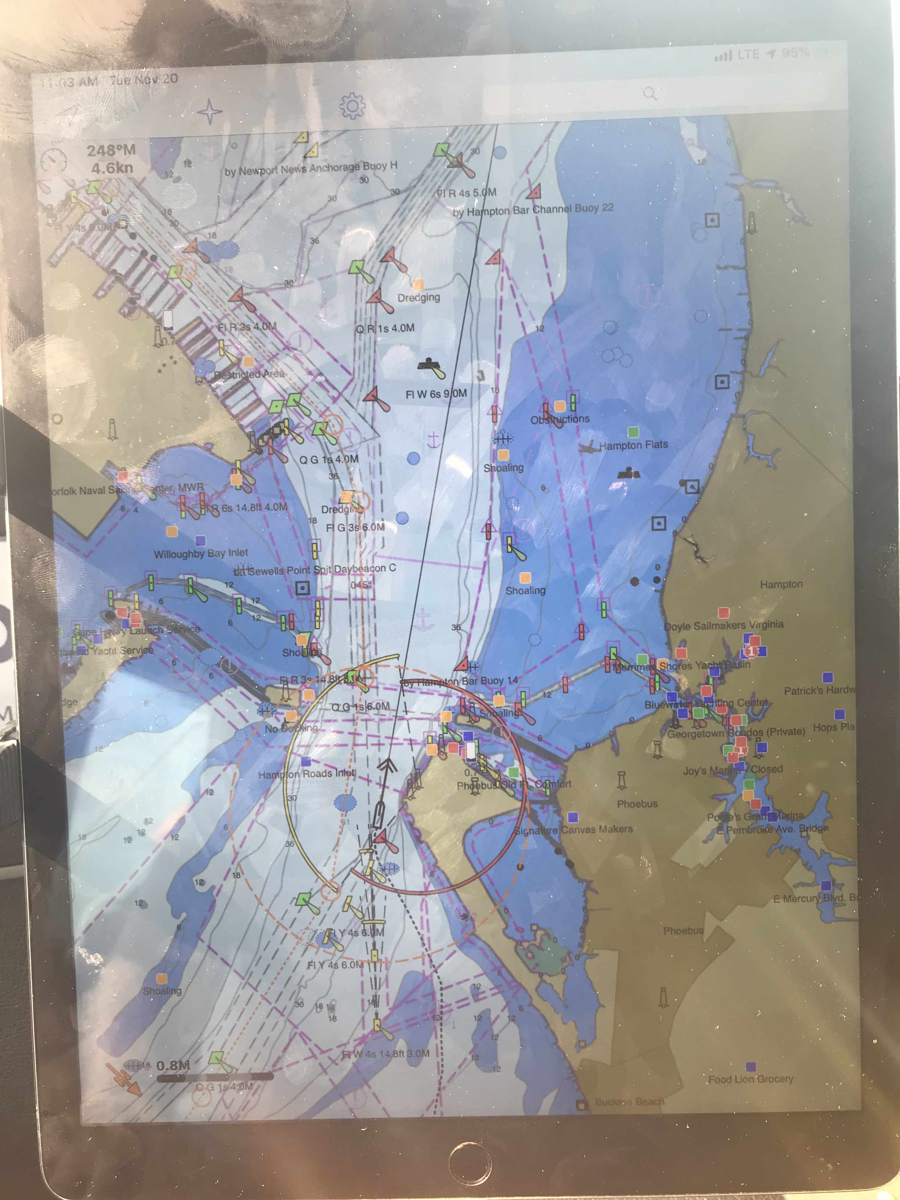
Each Division / District has its own website so you’ll have to spend some time finding the hydrologic maps from each ACE District. Ocean Isle Beach
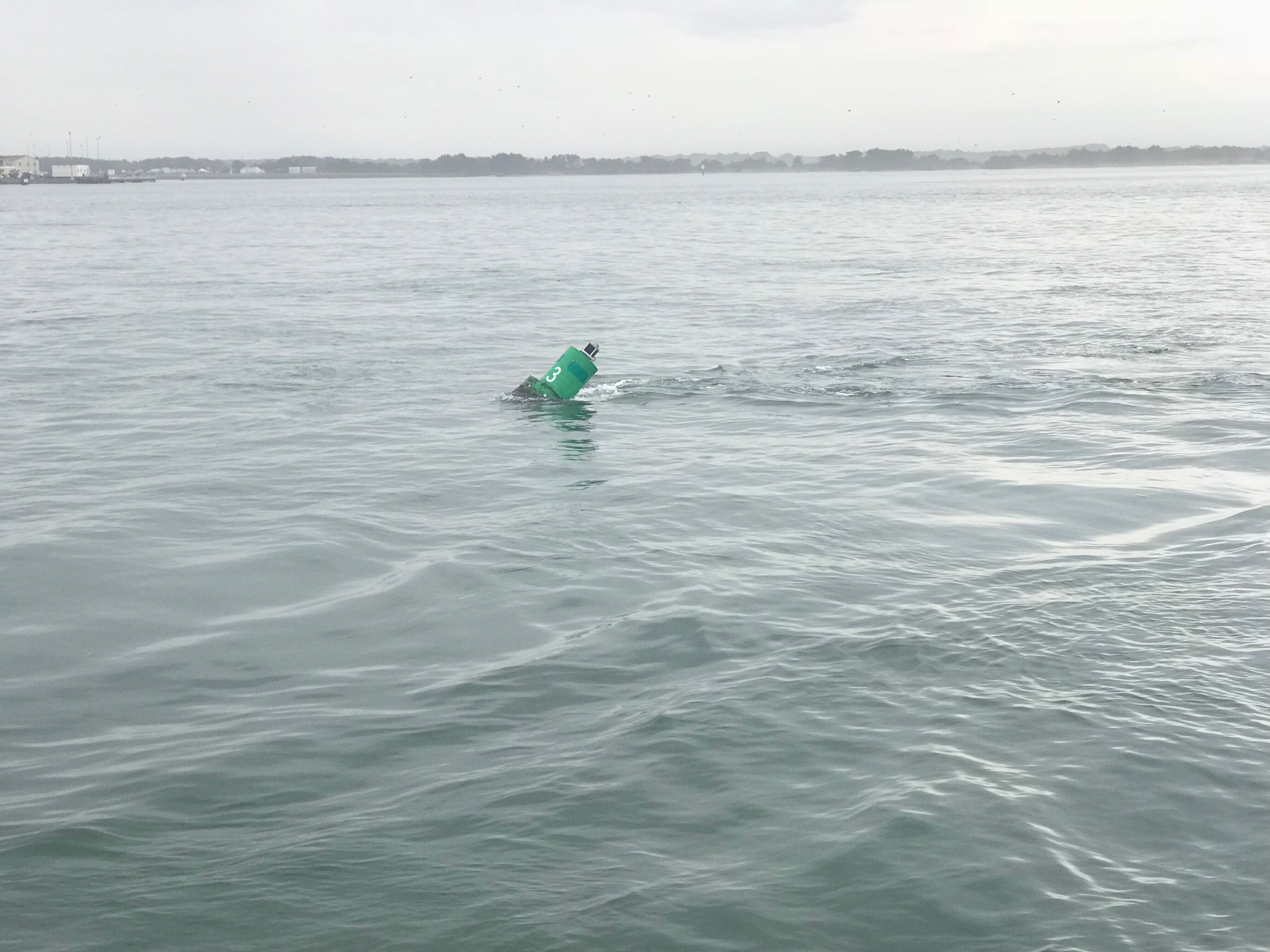
That’s a narrow drugged channel that you must stay inside of Shallotte’s Inlet Hydrologic MapsStay to Port.

As we headed South we saw many beautiful sights.

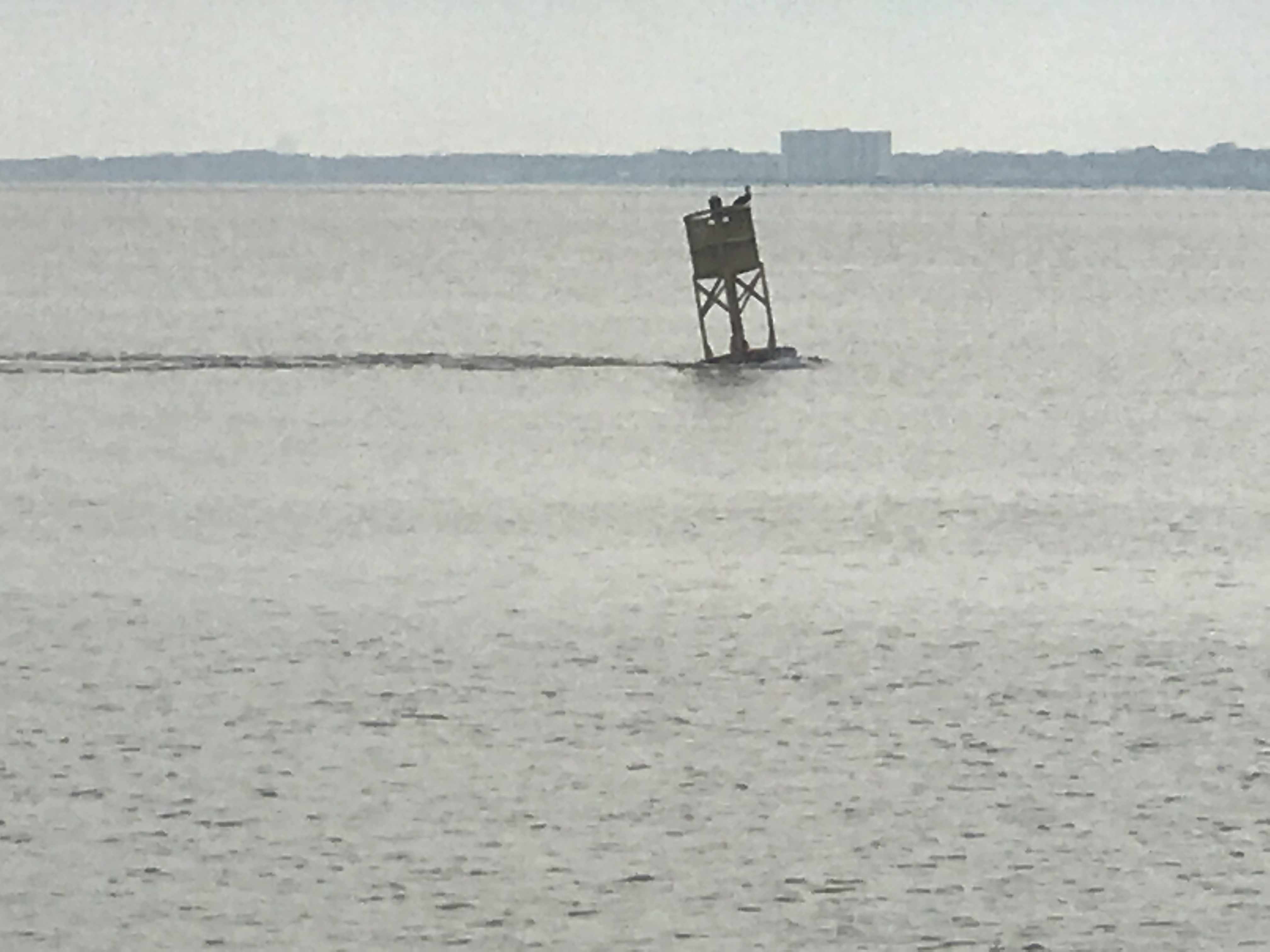
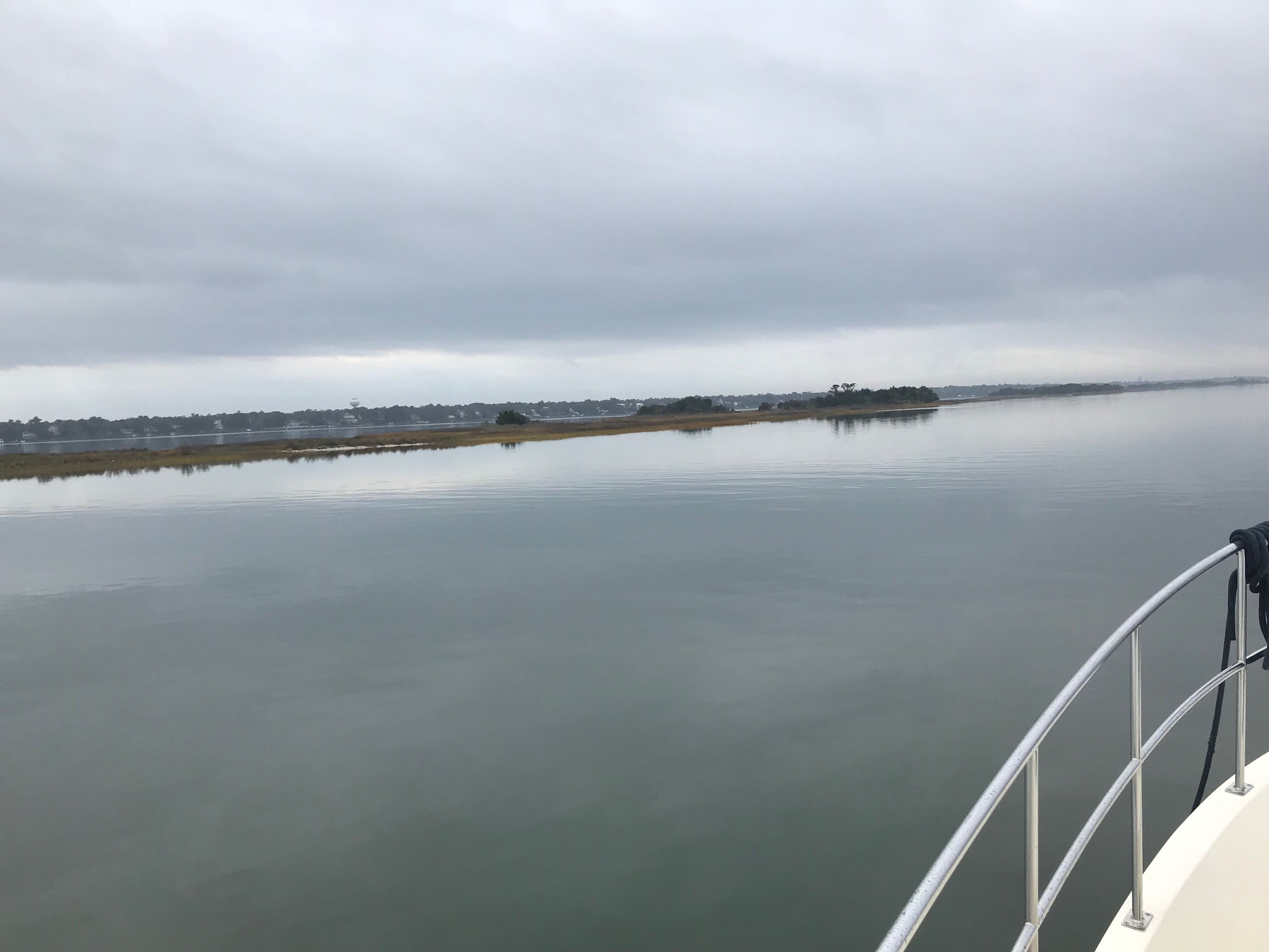
We have no idea what species of bird this is but we are committed to learning more about the aquatic bird species that inhabit the ICW.

This lighthouse was somewhere around Myrtle Beach. It’s though to see but there were Christmas lights strung off the walkway around the light.

An Atlantic Ocean inlet. Maybe this was around Lockwood Folly Inlet?

We find the breaking waves beautiful. What a great beach for walking the dog or just contemplating life.I think the sign said something like Greg Norman’s Australian grilleWe love that this guy was taking his dog for a ride. Man’s best friend loves the boat says Happy & Chief Martin Brody. “Born 200 years too late” – Jimmy BuffettSomewhere Myrtle Beach
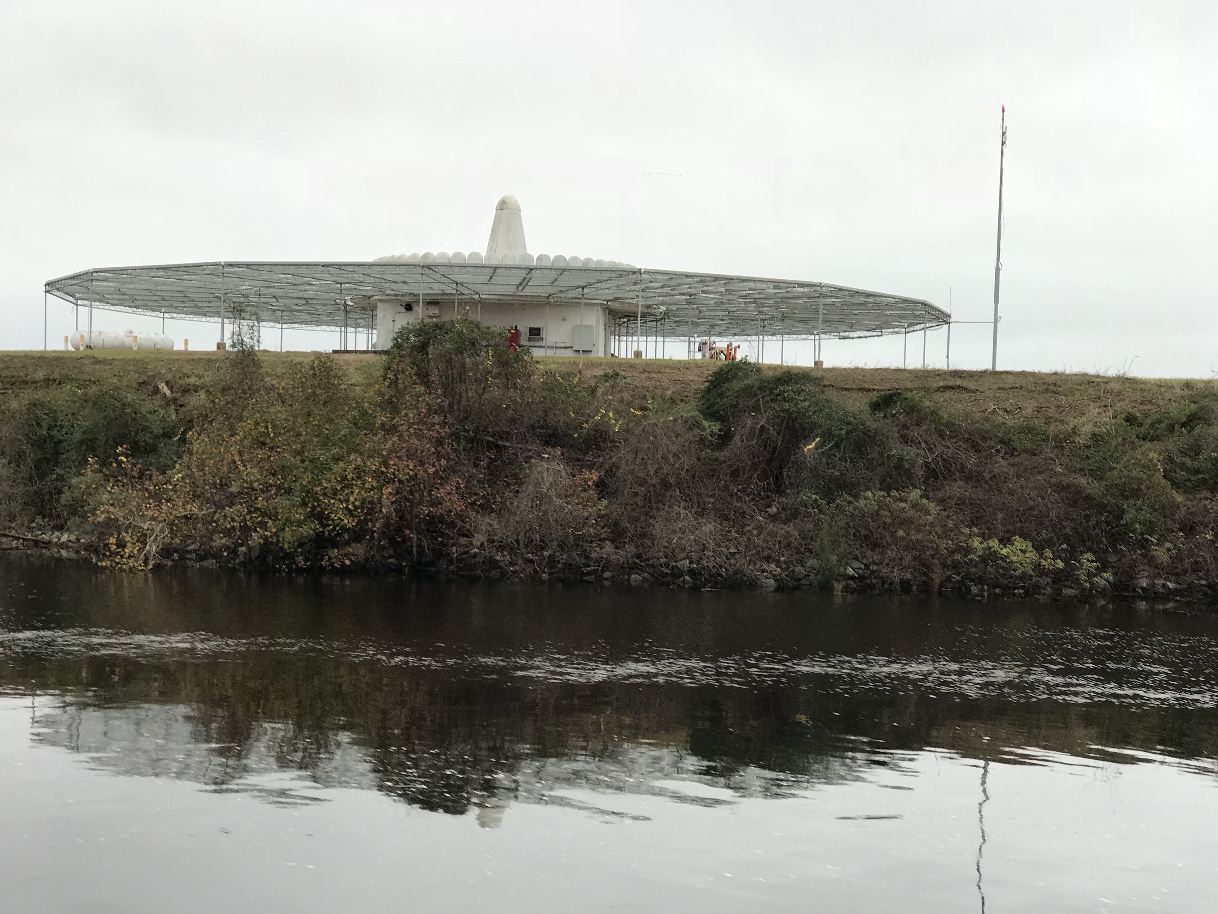
Close Encounters or an airport building, you decide.Who wants to walk under this rack with high winds and a 10K lb boat resting 80′ over your head?

There are many dangers along the ICW..

Slow down and read the signs of life… they point toward safety
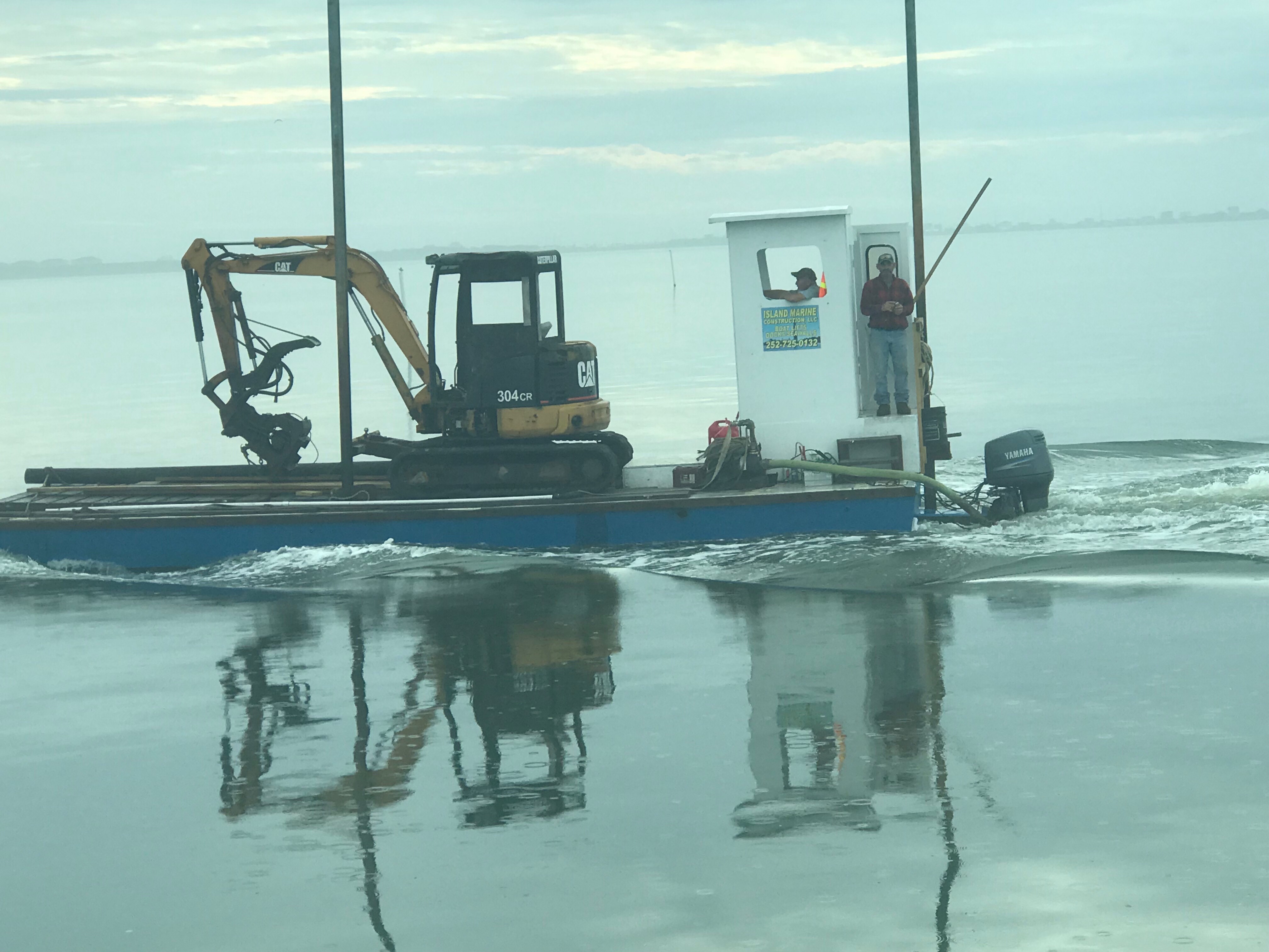
Logs are the bumps in road of life They thud your hull or fold your wheel (that’s a propeller for the un-initiated)
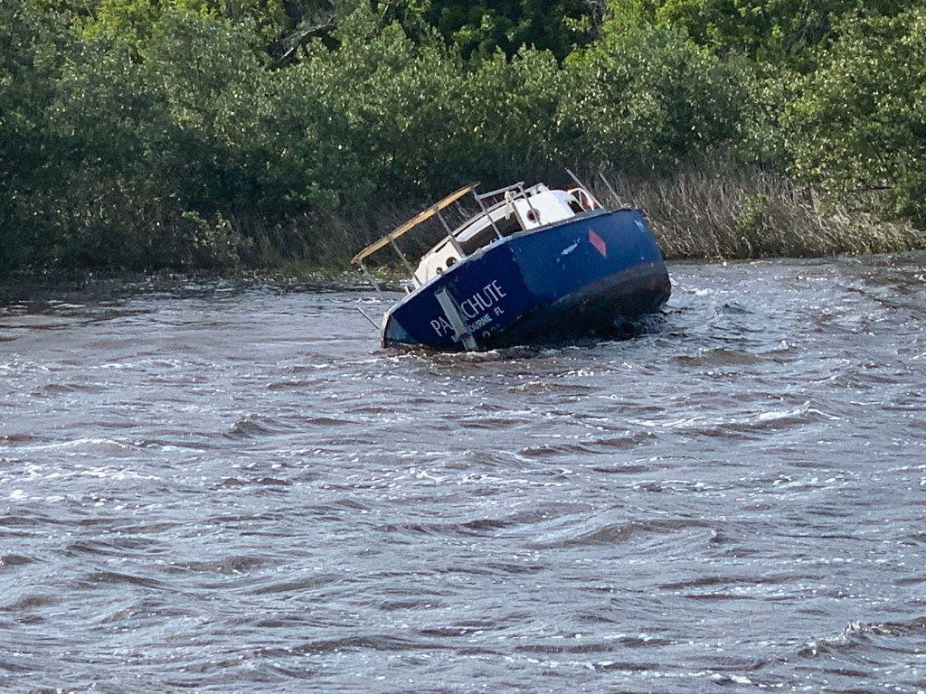
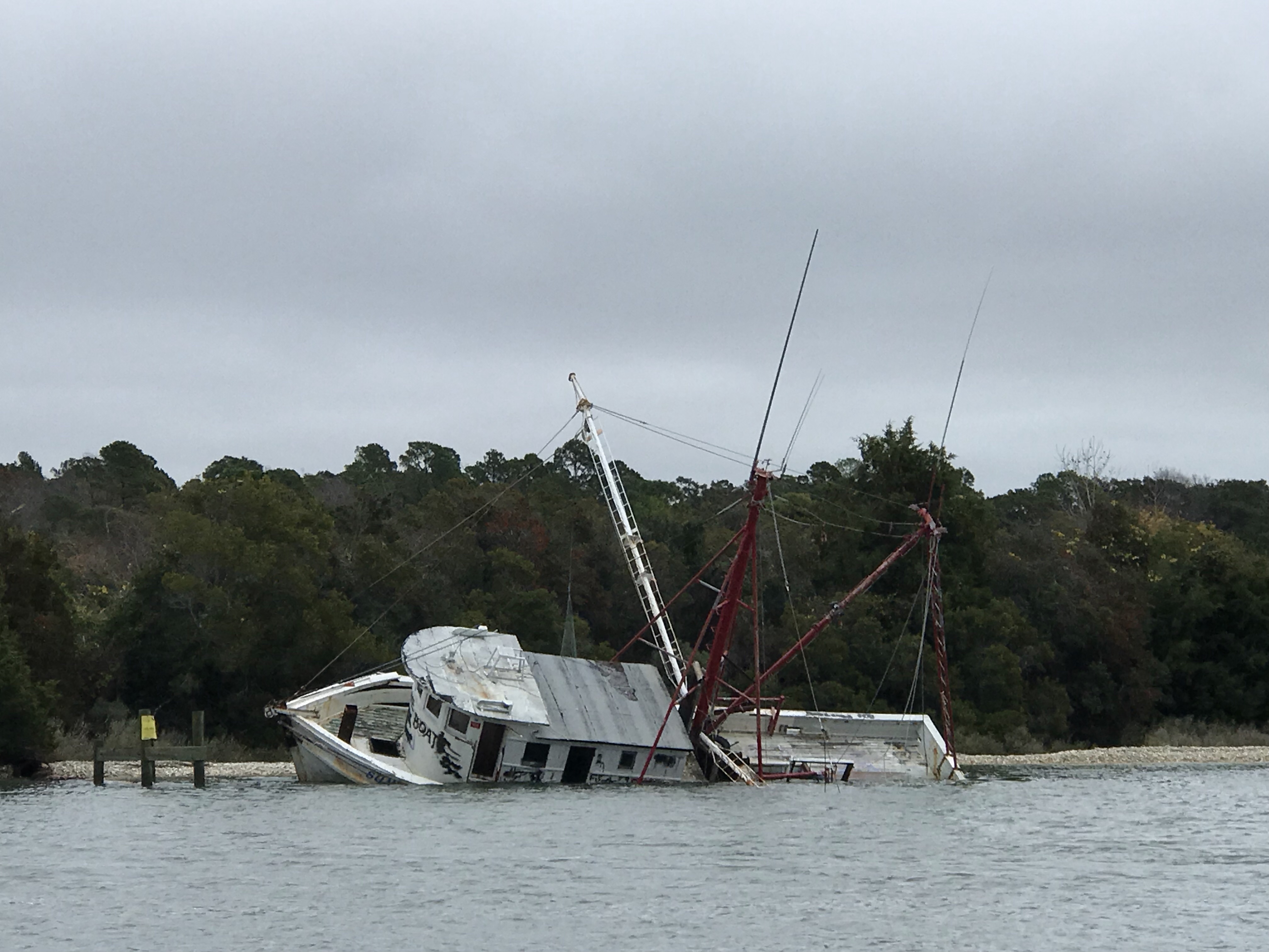
We hate to see beautiful commercial fishing boats listing on the bottom. We joke that we’d love to pull her up drain her beige, gut her and rebuild her giving her a sexy teak makeover. Kelly reminds me that the stink of a fishing boat is not washed off with soap. Ouch!

Heart breaking.

Well, we anchored in a narrow creek tonight. It’s inky black and a bit windy but we buried the 90 pound and 3/8 chain anchor deep by backing down on it. We were forced to only let out a short scope of rode. Any more and when the tide reverses we’ll swing into the banks of this narrow creek. So we’ll call it a night and make our way to Georgetown, SC in the AM.

Anchored in Somewhere South Carolina

Prince of Tides

Beaufort, North Carolina is your quintessential small southern town. It is the 3rd oldest town in North Carolina and as you walk through this quaint small town, you can’t help be taken a back by it’s charm.

Santa’s Satellite Workshop in BeaufortClock on a StickCenter of Beaufort

As we came ashore there were two monuments to local heroes within feet of where we landed. The first was Michael John Smith who gave his life for the pursuit of space exploration. Michael was a NASA space astronaut. Like so many, I believe that every human owes a great debt to astronauts who risk their lives so that the human race may have a better chance at surviving this hostile universe. They take risks that many of us might think too great. Michael was aboard the Challenger space shuttle when it exploded only 73 seconds after launch. The entire nation stood in horror at that moment, Like so many of you, I recall the shock and disbelief of this tragedy. The whole nation was forced to mourn the loss of these 7 heroes.

Michael John Smith

The second memorial stone was dedicated to a local oceanographer named John G Newton who discovered the U.S.S. Monitor using side scan sonar technology. Side scan sonar is an improvement on the DSM (Depth Sounder Module) that MV Simple Life uses to determine our depth as we came into Beaufort.

John G. Newton

Leaving Beaufort was as tricky as getting in. The currents here in Beaufort are swift. When we arrived, I had to swing MV Simple Life into a narrow fairway with an extra strong 3 knot current directly on our beam. Simple Life’s full keel gives that current a flat surface to push her down-current quickly. With some fast movements at the helm and some help from the thrusters we landed her gently into our assigned slip. The trip out of the slip was made easier by the fact the strong current was on our bow. I nudged her out of the slip and simply swung the bow a few degrees off the current and she quickly pointed out of the fairway.

The currents can be seen pulling this green can under as we were exiting Beaufort and rounding the Southern point of Radio Island.

Green can pulled under by strong current

Currents are brought on by the tides and our friend Rebecca informed us the the movie “Prince of Tides” was filmed on location here in Beaufort. Knowing now that the movie was fillmed in Beaufort, maybe it’ll make a good first-time watch while on anchor?

Prince of Tides Movie Artwork

Youtube link to 1991 Prince of Tides trailer

Our last night in Beaufort was a late one and the morning’s light was unwelcomed. We had a long trip ahead of us if we were to make Sloop Point anchorage by sunset.

Route Leg From Beaufort to Sloop Point Anchorage

We needed to make up time so we used the fast currents to our advantage and raced westward through Bouge Sound.

 MV Simple Life moving at a rare 11.4 knots thanks to fast currents

Bouge Sound is an East-West body of water trapped between main land North Carolina and a set of barrier islands. The sound has a narrow channel and marshy islands that abound. While the ocean was lumpy, Bouge Sound was a flat and reflective, like a mirror.

The only boat traffic we passed was a tiny little tug and barge with a piece of heavy equipment on it as well as one of those awkward looking front-loaded boats where you drive from the bow.

304CR CAT - I wonder what they are using this piece of equipment for?

Just looks strange to me.

A little further South and we were reminded that Camp Legune is around us. Signs along the river warn of possible live fire events.

Incoming!

This picture of a shelled APC (I’m just guessing this was an armored personnel carrier, military expertise needed here)  reminds me of a Monet or maybe a watercolor painting.  The marshy grasses in the foreground simply mush together while the island and threatening clouds in the background appear to bleed and wash out the watercolors on a canvas.

With sunset approaching we had to race to make it through the restricted Onslow Beach swing bridge.

Winslow Beach swing bridge

Every morning we research where the shoals are along the ICW. It seems the ICW’s bottom is in a constant state of evolution. You need to use sites like activecaptain.com/livemap/ to be able to use the knowledge other ICW boaters have posted to avoid running aground like this poor sailboat did.

Sailboat hard aground @ New River

We anchored in Sloop Point behind green daymark 15 and it was a peaceful night as we listed to the rain pitter-patter on the boat. The perfect background noise as we whisked off to the master stateroom.

Supermoon Where Are You?

Yesterday morning we awoke before sunrise and got underway to Beaufort, NC.

The first & last supermoon of 2017 was helping slice through the dark as we pushed away from the dock.

Supermoon 2017
Supermoon Reflecting the Sun’s Rays


Supermoon infographic
Supermooninfographic

Supermoons happen when a full moon approximately coincides with the moon’s perigee, or a point in its orbit at which it is closest to Earth. This makes the moon appear up to 14 percent larger and 30 percent brighter than usual.

December’s supermoon is actually the first of three back-to-back supermoon full moons to come in the next two months. On Jan. 1 and Jan. 31, the full moon will also occur near the moon’s arrival at perigee, according to NASA, which billed the line up as a supermoon trilogy. The Jan. 31 supermoon is also the second full moon of January, making it a Blue Moon, and also occurs during a total lunar eclipse.


As the sun got ready to sneak over the horizon there was a beautiful orange-pink hue reflecting off the water.

Before Sunrise
Before Sunrise

Today’s leg of our journey takes us from Hobucken, NC to Beaufort, NC

The Beaufort of coastal North Carolina is “BOH-fert”. The Beaufort of South Carolina is pronounced “BYOO-fert”. Established in 1709, Beaufort is the third-oldest town in North Carolina.

Leg Beaufort
Beaufort Leg of Journey

As we made our way out of Goose Creek and into Pamlico Sound, the only traffic we passed was a tug pushing a barge.

Tug and Barge
YATPB – Yet Another Tug Pushing Barge

The dominant wave set was coming from the NE and that meant we had a following sea as we turned and made our way down the Neuse River. A following sea that is slightly to one side of the stern can be annoying when you are at the helm. The waves catch up to the boat from behind and lift the stern pushing it to port or starboard. This can swing the bow as much as 30 degrees at times and it starts to feel like you are pointing the boat all over the place. I made a quick adjustment to increase the autopilot’s response rate and the bow heading deflection lessened considerably. Being a slow boat (6-9 knots) you are often at the helm from sun-up to sundown to make your destination. Autopilot is an electronic device with some firmware loaded on it that drives a hydraulic pump which turns the rudder. There are many settings that you can control but the response rate is the one you will want to adjust so that the rudder position changes are swift or slow enough for how you want the boat to point.

As weekend boaters, we were boating in destinations like Block Island, Nantucket or Provincetown. These locations are anywhere between 6-12 hours from our home port in Warwick, RI. We would be forced to run the boat at 8.5 knots and only get about 1 MPG. Now that we are full-time boaters, we slow the boat to about 6 knots and get 4 MPG. You can go 4X farther if you simply reduce your speed by 2.5 knots. (Recall 1 knot = 1.15 MPH so approximately every 6 knots you would simply add 1 to get the speed in MPH).

Even knowing this, we made the decision to up the speed to 8.5 knots and reduce the amount of time spent in the following sea.

Happy and Chief Martin Brody appreciated that we burned a a bit more fuel for their comfort.

Brody and Happy
Chief Martin Brody and his Big Sister Happy

Wake
Wake in the Neuse River

As we turned into Adam’s Creek the ride smoothed out and we dropped back down to 6 knots. The current in Adam’s Creek was swift and the DSM (Depth Sounder Module aka. Fish Finder) was showing asymmetric rippling of the creek bottom. I believe this is caused by a swift bottom current.

Adams Creek Rippled Bottom
Asymmetric Rippled Bottom of Adams Creek

The fish finder was also well, finding fish. The DSM uses sonar or high frequency sound generated by a device that protrudes through the hull and is sending a column of sound waves straight down beneath the boat. These sound waves not only reflect off the bottom but when they hit a fish the sound resonates in the fish’s swim bladder (a small air-filled sack that helps control a fish’s buoyancy) and this echo is detected and colored sharply to allow you to spot fish on the screen.

DSM Fish
Look Swim Bladders

Adam’s Creek is a lovely place with lots of sights to see.

Youtube Video of Bald Eagle in Adams Creek

Adams Creek spills out into the Newport River and it’s marshes and shallows are something that you will want to avoid.

Newport River
Newport Marshes as you Head South to Beaufort

Shallow Birds Standing.JPG
Kelly & I Often Joke… “If You Want to Know Where it’s Shallow; it’s Where the Birds are Standing”

As we pulled into our slip in Beaufort we hailed the dockmaster who warned us about the swift current running transverse to the slip we were assigned. As we pulled in to the fairway the current slammed into our full keel and began to push the boat toward the bows of the boats across the fairway. I was forced to back out quickly and reposition so that I could now take the swift current into account and position the boat for rapid spin and quick back into our slip. Kelly was quick to toss lines to the dockhands and soon we were checked in and given the keys to a “courtesy car”. Up North, I’ve never stayed at a marina that offers a fee courtesy car to marina guests. The car was a welcome treat and we put it to good use re-provisioning the boat with more food & beer.

Courtesy Car Kelly
Courtesy Car – We Got Wheels!

With all our chores completed we quickly made off to the marina bar for happy hour and spent time chatting with Bartender Kristen and fellow bar patron, Dan. Dan was an amazing fellow who told us stories of his solo sailing around the world in a small boat. He offered us some local knowledge about wild horses that roam the islands around here. I KNOW more wild horses to find!

Kelly and Dan
Kelly & Sailor Dan

After I consumed as many 50 cent pork sandwiches as a man can eat and washed them down with a great local IPA it was time to retire to the boat.

Hoppyum IPA.JPG
Great Local IPA From Foothills Brewery

We were no sooner readying for bed when we were accosted by “Monkey Bird”. This vile creature had a penetrating stare and an awful cry. I spent sometime staring into this monster’s gaze and knew it was time to lock the door and keep the crew of Simple Life safe.

So it’s off to bed.

Monkey Bird Standing.png
Monkey Bird Prowling the Docks