
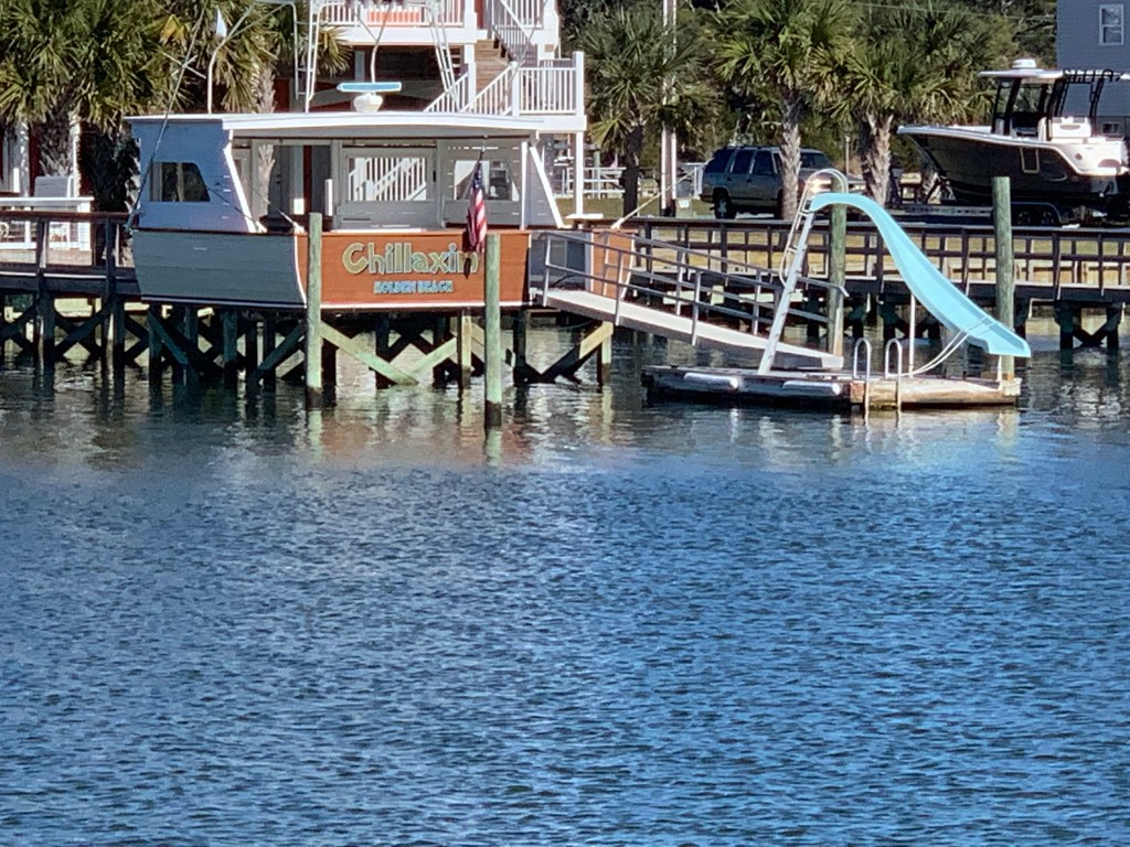
So sad what Ian did to my beautiful marina. When the winds get that high there just isn’t anything you can do to stop it once one boat slips. Thinking of my fellow boaters and hoping they can get back on the water soon.


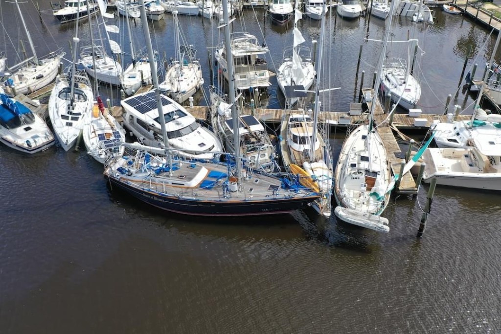


So sad what Ian did to my beautiful marina. When the winds get that high there just isn’t anything you can do to stop it once one boat slips. Thinking of my fellow boaters and hoping they can get back on the water soon.
Note:: I’m crudely writing this blog post with little to no internet but want to update readers with what happened here.
NOTE: This blog post will update more when I have time and internet so please check back later..
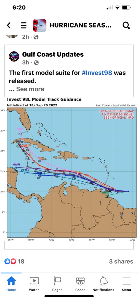
Before they are named storms they are atmospheric disturbances that need to be investigated.


When we’ll-known SWFL hurricane hunting weatherman, Jim Cantore, checked into a hotel down the street in Punta Gorda we all nervously joked that it was not a good omen.
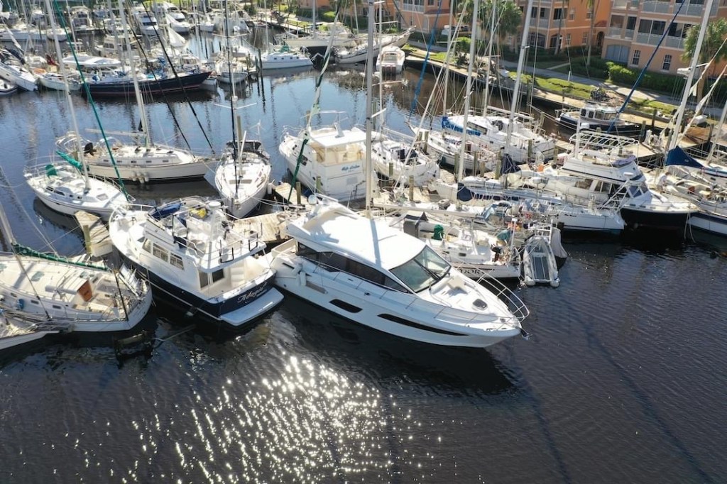
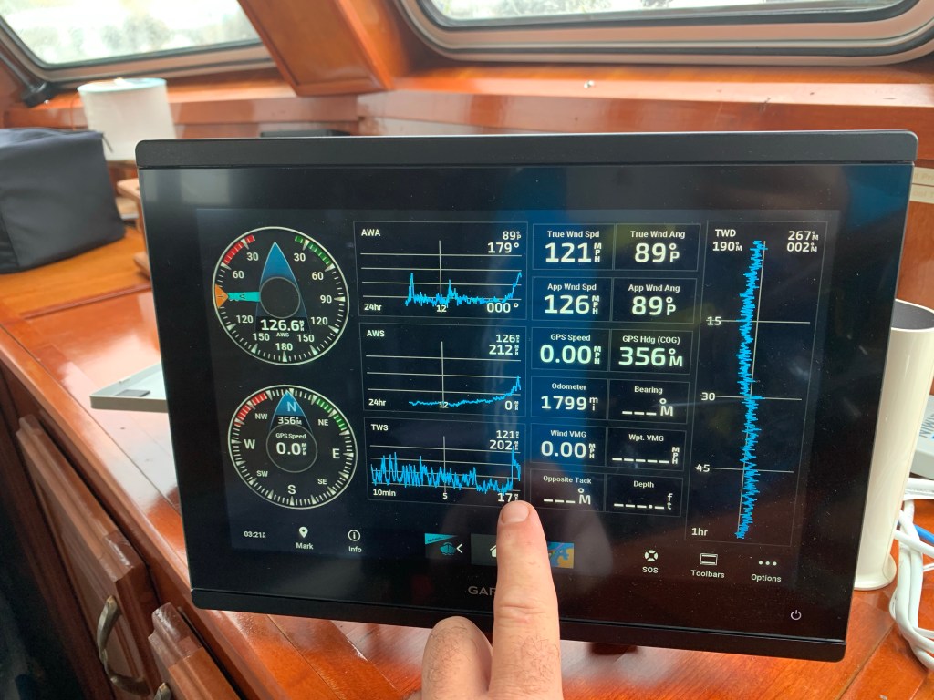
MV Simple Life is berthed just inside the entrance channel of BSM (Burnt Store Marina). The westerly wind’s friction with the ocean was creating a surface current and driving all the water out the marina entrance.
I rely on the Windfinder Pro app on my iPhone for predicted wind speed and direction forecasting.
https://apps.apple.com/us/app/windfinder-pro-wind-weather/id336901296
In the above screen capture video, you can see that blue dot is MV Simple Life in BSM. The wind was predicted to blow the marina’s water back out into Charlotte Harbor.


Getting your dock lines set to allow for such a drop and surge can be difficult and will come down to how low/high you think you will go, the line lengths you have available and cleat locations in relationship to pilings.
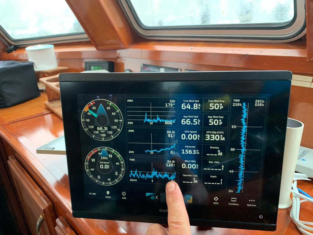
The winds were now 64 knots and gusting to 128 knots.
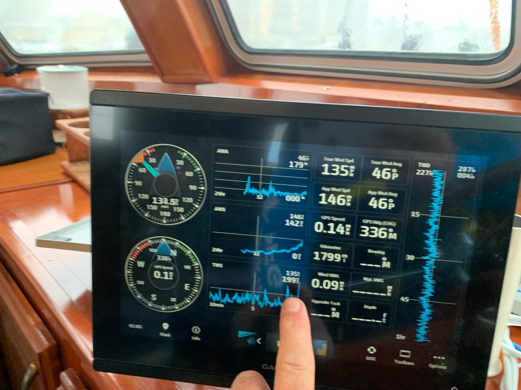
It’s now blowing 135 knots and I see my slip neighbor run outside from a neighboring condo to adjust his dinghy line to stop it from smashing into his sailboat. I quickly strap on a bicycle helmet, life jacket and a jacket to go help him. It’s extremely dangerous should the winds blow you off the dock alone. I climbed down off MV Simple Life and onto the docks but my neighbor friend is nowhere to be found. Then out of the corner of my eye I see him back on land waving his arms to get my attention. He was wisely making his way back to the safety of the condo so I climbed back aboard my boat as it was bouncing to and fro.
In the above video, just before the eye centered on the marina, I jumped onto the docks to see the condition of my fellow boaters and the marina.
Above is another video shot while Ian’s eye was nearly over us. You can see my VHF antenna has snapped. I decided to quickly tape it down so it did not get ripped off.

While cell phone texts were not going through in real-time I could occasionally receive texts from the other two boaters around me who elected to stay aboard during the storm to hopefully save their own boats.
NWS alerts were periodically sounding off on my iPhone. I was now busy making adjustments and adding lines everywhere I could to prepare for act II of Ian.

Once the eye arrived the storm surge began rushing into the marina.
The boats were quickly lifted off the bottom and even the birds floating on the surface could not paddle fast enough to keep from being pushed backwards in the flow. See the end of the video below
The rush of water just kept coming and I knew I only had a moment before I needed to be back at the helm.
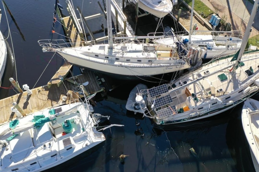
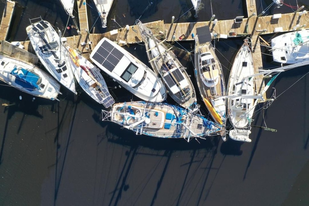
When the backside of the Ian arrived it was far worse for MV Simple Life. The wind direction did a 180 degree shift and was now blowing straight in off Charlotte Harbor. There is nothing in the way to protect MV Simple Life from the wind and waves. The stern of our boat is large and flat. My twin 8” diameter diesel exhausts we getting water forced backwards in towards the engines. Simple Life was pulling so hard on the two pilings behind my stern. I doubled up my lines prior to the the storm. The pilings began to rock back and forth as my boat and my neighbor’s pulled hard on them. If I pull these pilings over Simple Life will smash bow first into the dock and being the first boat in the marina I could only imagine a cascading failure as I keep hitting boats and docks in front of me with the wind pushing me from behind.
I quickly started the diesels to keep any water out of the engines. My yacht is 70K+ lbs. with large 5 blade props that were now running in reverse to take the strain off the pilings behind me. Occasionally, I would hear floating debris hit the propellers and flying debris hit the boat.
I had boarded up the twin cockpit doors which was protecting them from being blown out from the high winds and flying debris. The water was blowing through the door and running across the saloon floor.
I’m feeling good that the other windows are extremely thick and impact resistant.
My wind meter is mounted on the top of the boats arch. It has been recording wind speeds above 100-150 MPH with a highest gust recorded of 202 MPH. Shortly after that the wind meter was ripped from the boat.
I had a couch that I could not get off the Flybridge and had attempted to tie down. I watched as it was levitated off the flydeck by the wind and dropped back down. This happened 3 or 4 times but suddenly it just lifted straight up and flew off about 30’ high and flying fast.
Looking out the pilothouse windows at the docks I see they are 3-4 feet beneath the fast flowing storm surge. The water is black and you are not really sure where the docks beneath that murky surface. A few of the planks that make up the walking surface had been ripped off making the possibility of having your foot/leg fall through.
Getting off the boat now is no longer an option.
I was at the pilothouse helm when the flydeck hatch ripped open and the wind and water was blasting in on me. I ran quickly and managed to get ahold of it. I struggled to get it closed but each wind gust was lifting me off the floor. I in a situation where the boat is running in reverse, I’m not at the helm but trying to find some way to secure the hatch.
Lucky for me… arms length away was a fender with a short length of rope that I wrapped around the broken hatch arm. It held just long enough for me to run and get some cordage and add more lines to it. If it rips off I’m screwed. I quickly ran Dow into the engine room looking for a solution that would secure it for good when I spied half a dozen welding clamps that were exactly what I needed. I punched the wood away from the hatch to get to the solid aluminum and clamped & tied the hatch down. I felt relieved.
From the onset, my concern have been for the other three boats who opted to stay aboard and ride out the storm. They have been terrific about asking me how I was holding up as well. We setup communication plan over text and VHF radio to be able to get messages to each other.
Now as I look out the window I see that one of those boats has snapped a piling off and is violently rocking. I see him crawl out on his foredeck presumably to get her under control. I look back and don’t see him. I’m texting him to see if he got back inside safely but no answer. (Spoiler he made it back inside)
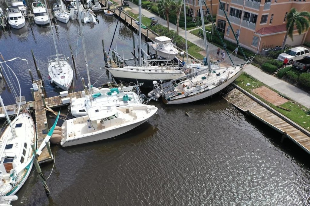
The large beautiful yacht at the end of the dock has had a hole punched through the hull and the captain and first mate were now on shore.
The last couple have been aboard from the start and they are concerned the that boat on the lift behind them is dangerously close to coming off and smashing into them.
I realize while my concerns for my friends is made worse knowing that there is no way I could get to them if they need my help.
When I drove through the open and unmanned gates into BSM Community I saw no people. It looked abandoned. That said I know some homeowners stayed. When I look at the lovely South Shore Condos I can see directly into some of the units. I hope nobody was inside.
The helm is now sounding an overheat alarm so I shut one engine down and rush back into the engine room. My sea strainers are full of flotsam as the water is murky. I quickly work to clear both sea strainers and restart the engines. I feel relieved once again.
TO BE CONTINUED…

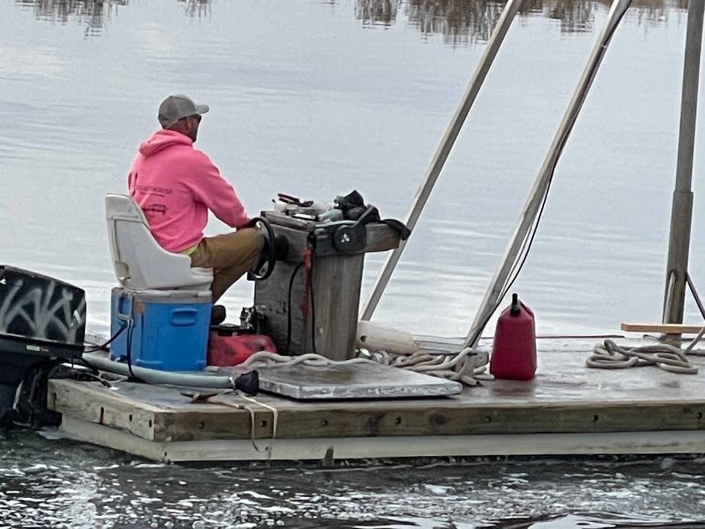
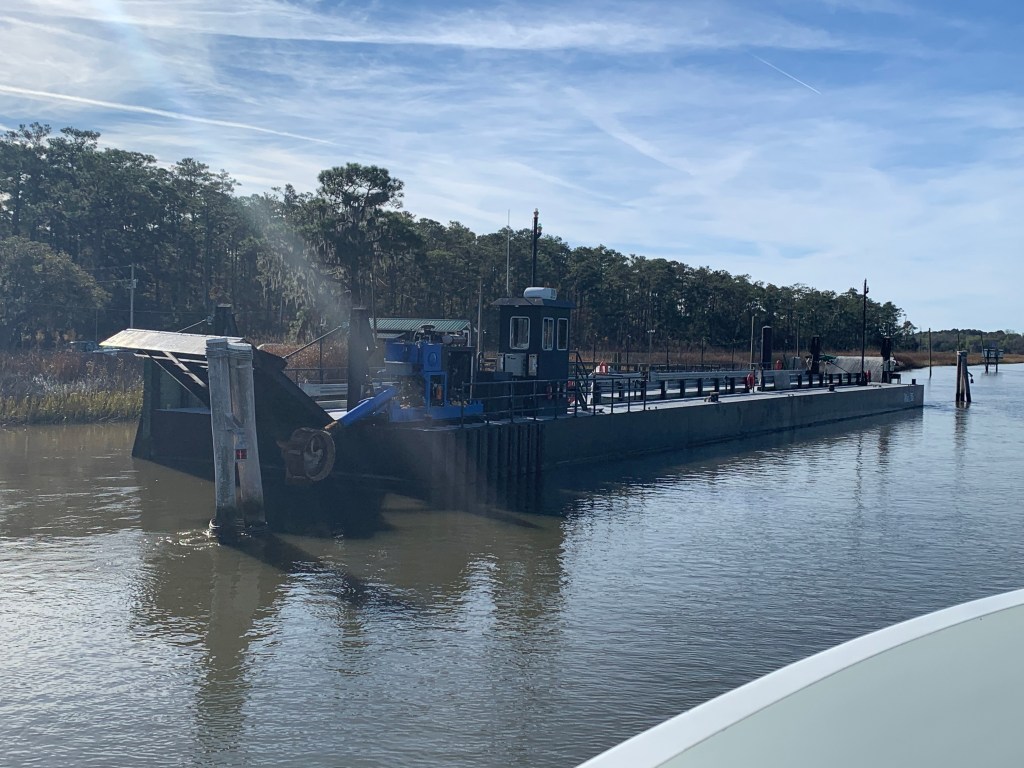
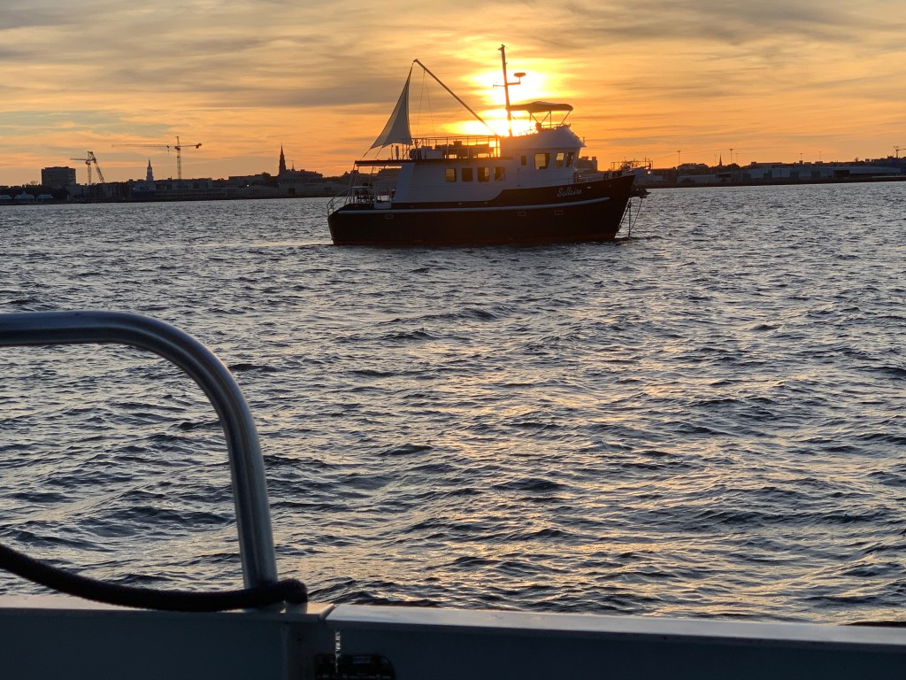
We were on our way to Southport, NC to see our friends Jim & Wende. We had to slow down to no wake speed to keep from swamping this fella who was motoring a small work barge down the ICW.
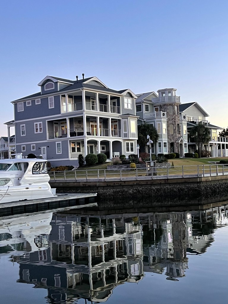
We arrived at St. James Plantation Marina just before sundown. The homes along the harbor are beautiful.


Jim and Wende let us use their truck to reprovision which was perfect as it was the day before Thanksgiving and we needed TURKEY!
Later that night Jim & Wende took us to dinner at a Joseph’s Italian Bistro @ Safe Harbor Marina. We had dinner with some good local IPAs & lots of laughs. I wish we had taken a photo but I think we were just having too much fun. Jim and Wende told us all about their trip back from Buzzards Bay, MA to Southport, NC in their new Pursuit OS 355. The weather was a bit ruff off the RI coast but they made great time with stops in places like Atlantic City.

In the AM we were off and Capt T was at the helm.

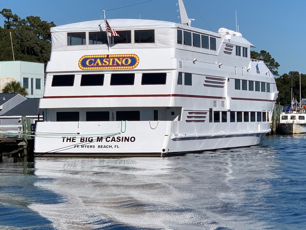
We passed a boat dock that was more boat than dock. Capt T thought she recognized a casino boat as we passed and sure enough the “Big M” hailed from Fort Myers, FL.
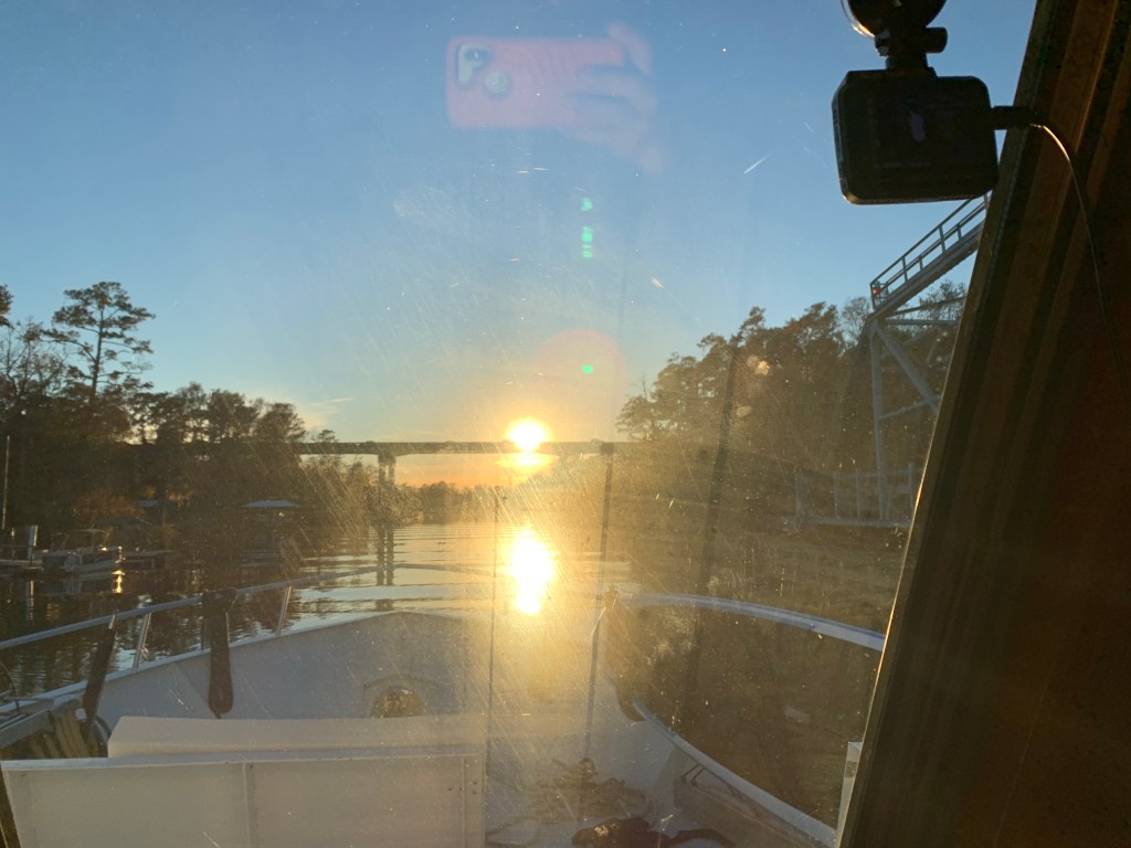
As we made our way into the Waccamaw River preserve we had to get through the Socastee swing bridge but we were staring straight into the sun. The best we could do was go slow and use the radar to see in front of the boat.
We anchored in what I call the Waccamaw River (ie. swamp) and it’s beautiful. We had a great night on anchor as the high trees provide protection from everything but the cold.
It was COLD.


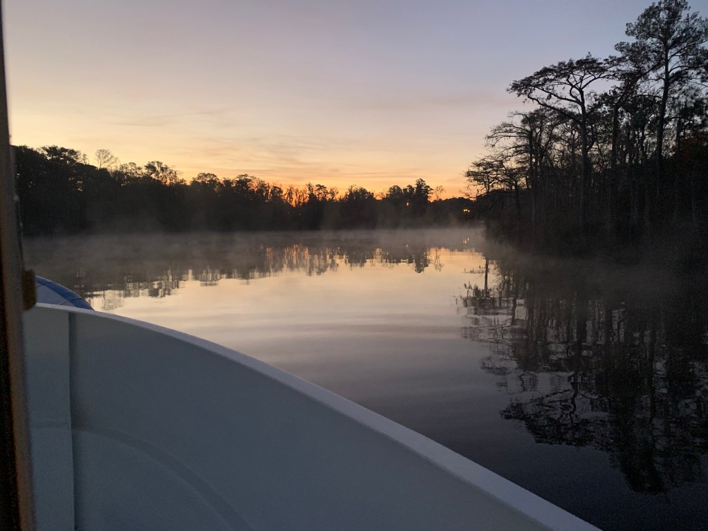
We weighed anchor at first light and the swamp was steaming due to early morning low temps.
We had to slow to no wake so as to not disturb this Nordhavn anchored right off the main ICW route.

The next swing bridge is actually a floating swing bridge. Very cool. It simply uses drop-able drive-on ramps and a huge tilt-able bow thruster.

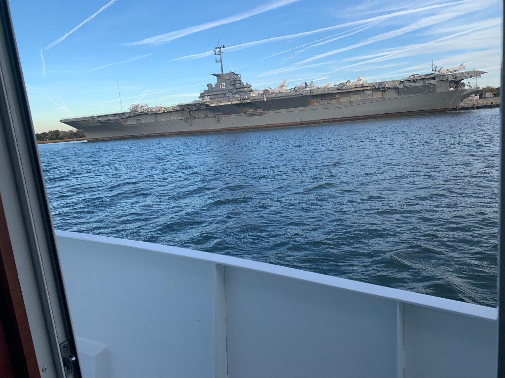
We arrived in Charleston, SC and the marina we requested a slip from had us “wait-listed”. We anchored for the night next to the USS Yorktown.
The sun was setting on Charleston.

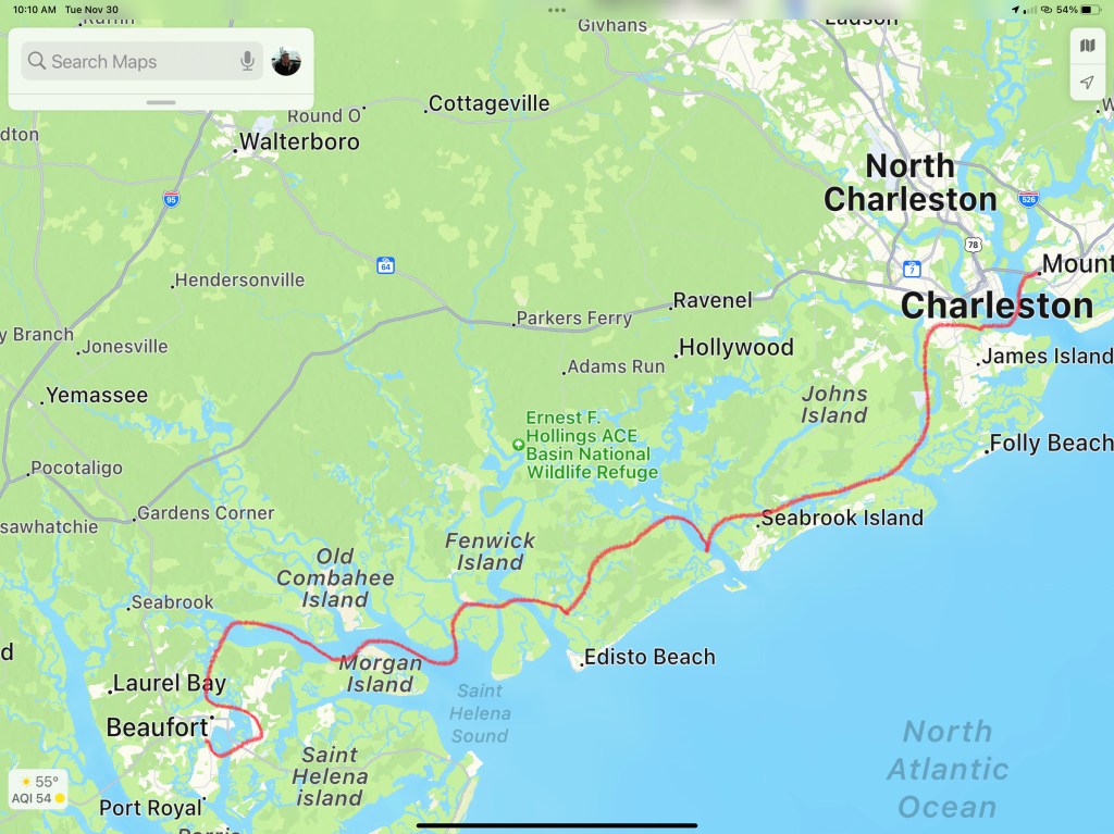
Sunrise in the AM and we were off… bound for Beaufort, SC

We anchored in Beaufort with hopes of getting off the waitlist for the marina. In the AM we called and they found a spot for us on the outer face dock.

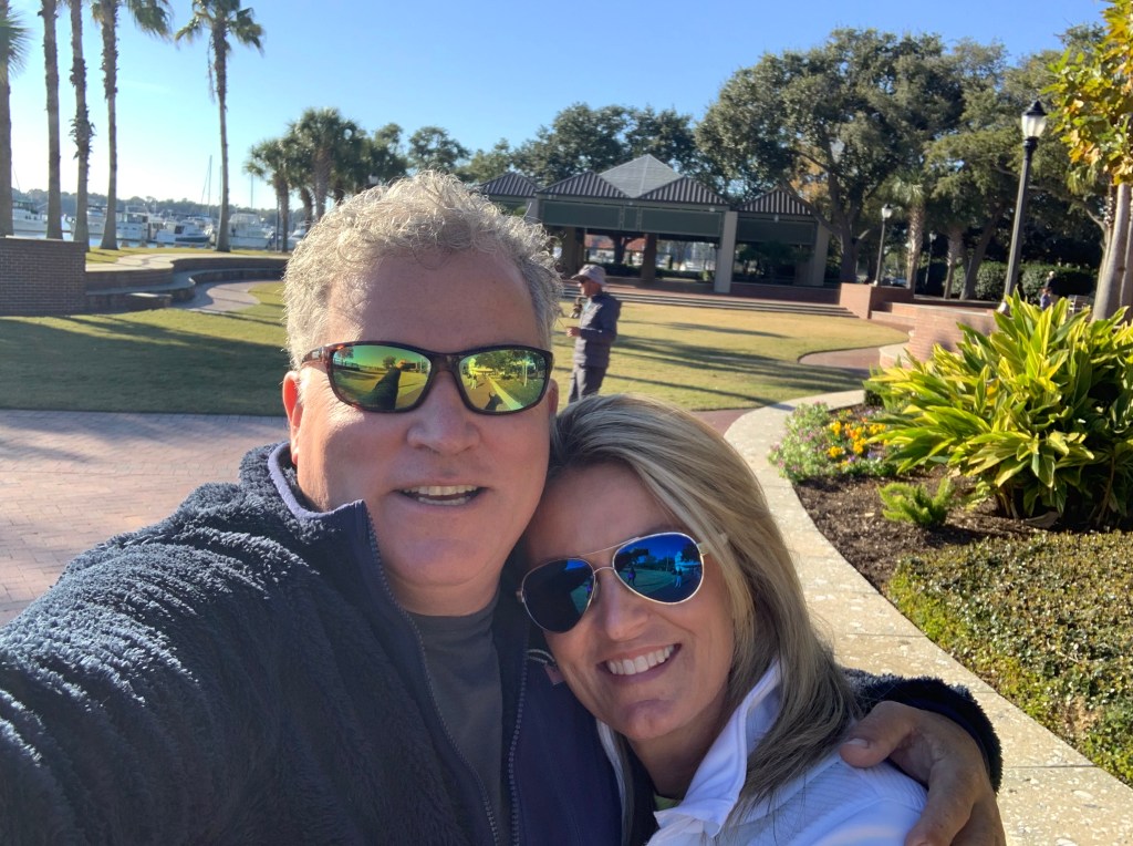
Beaufort is a fun town and we wasted no time getting ashore at Plums Restaurant for some lunch.

We napped after lunch and made a second run on the town before we would leave in the AM. Beaufort has a great outside park area right in front of the marina.

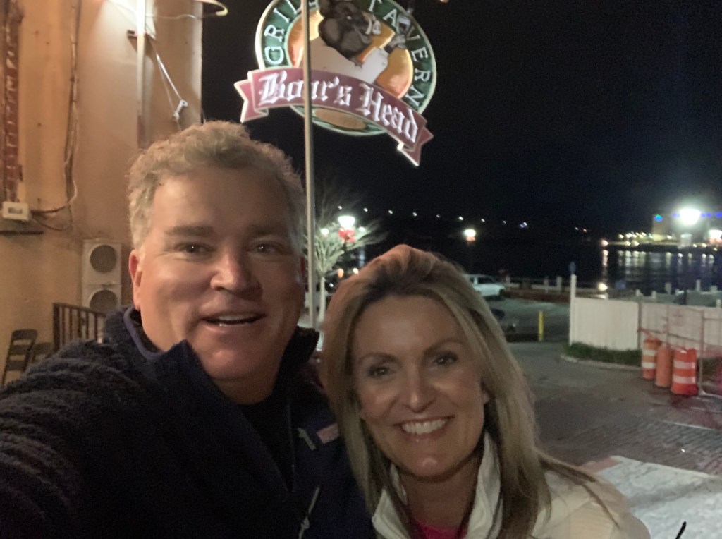
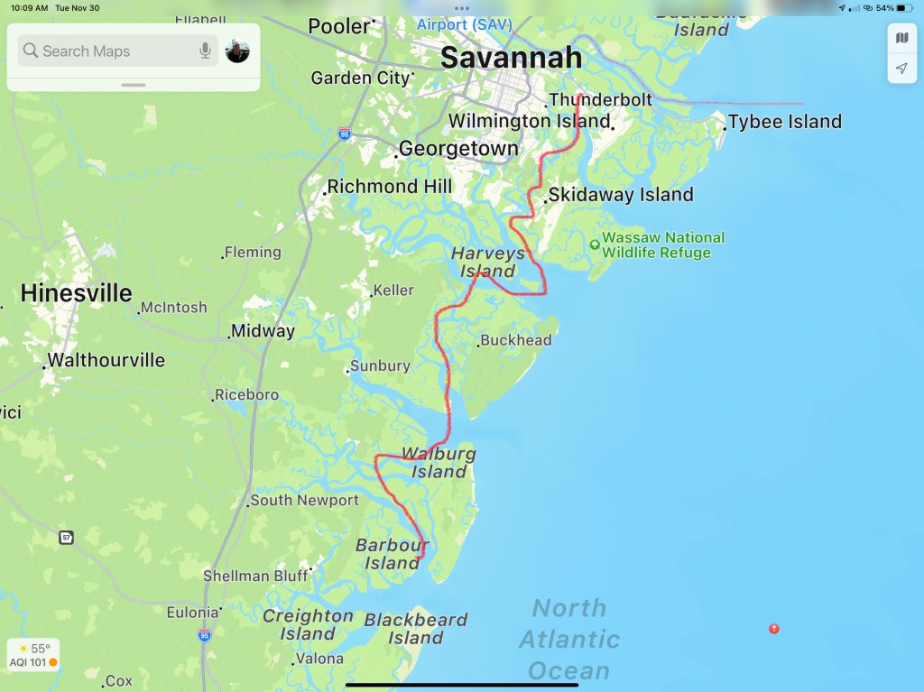
In the morning we were off to Savannah, GA. Last time I docked right in downtown around River Street but felt it a bit seedy at night. We decided to stay at Thunderbolt Marina and Uber’d into town for a Savannah pub crawl.


Are impromptu pub crawl consisted of the following venues:
We ended the night singing Journey.
Up early to a Whiskey Sunrise & potato pancakes and off to Fernandina Beach, FL

This post consists of 5 legs of our journey
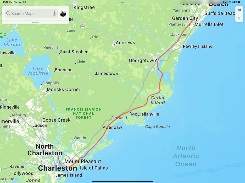


We hope everyone had a great Thanksgiving with family!!!

We left our slip in Solomons Island and the captain forgot to close the boarding gate door. We pulled up to the pumpout dock and the dockhand asked me to pull a bit more forward so the pumpout hose would reach and we heard a metal noise? The boarding gates on Simple Life open outward (very strange and a bit dangerous if you lean against an unlocked door) and when open they stick out further than the rubrail. The door caught on the fixed dock pilings and the sound was it being removed from the boat.

What to do? We are tied up at the dock and our door is 2 fathoms below us. It’s muddy brown Maryland water. Now… I love being “on the water” but I don’t like being “in the water”. Especially when the water is 57 degrees! Hmmm. Let’s call for an expert.

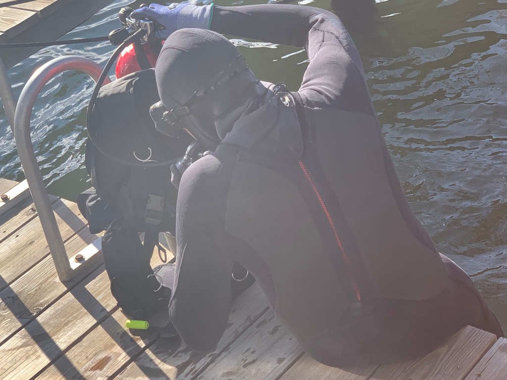
It made me nervous just to watch Jeff our diver jump into that water. When he entered the water he took quite a few loud deep breaths. It looked cold to me. Jeff disappeared for what seemed like 5-10 minutes as I watched his bubbles appearing on the surface up & down the dock. I stood there holding the line he had attached to the dock and himself. I finally gave a tug on the line (cuz I think I saw that in a movie once) and he came up empty-handed and cold. He agreed to try another spot closer to the stern of the boat and he was down another 5 minutes… He surfaced and smiled a frozen smile. He had me pull the rope and the door came to the surface. Jeff had felt with his hands in zero visibility around the bottom until he felt the metal door and rapped his dive rope around it several times. We had already turned the heat on inside MV Simple Life so it was 80 degrees inside. Teresa handed Jeff a steaming hot coffee and a towel. Judging by how he stood in the path of the heat with both hands clenching the coffee cup under his chin… I’d say he appreciated it.
We spent the end of the day chatting with Jeff and decided to stay another night at the marina.
The door was unharmed. I spent the night pounding the aluminum hinges back into shape before reattaching the door which did not even have a scratch on it. (smile)
There is a great Italian restaurant at the marina called La Vela Italian Restaurant.


The next morning we had a great breakfast and set out for Gwynn Island just south of Solomons Island, MD.

I love the lines of a Chesapeake Deadrise

We anchored just off Gwynn Island and enjoyed a beautiful sunset.

The next morning we set out for Norfolk, VA. As we passed the Norfolk Naval Yard we snapped a few photos.


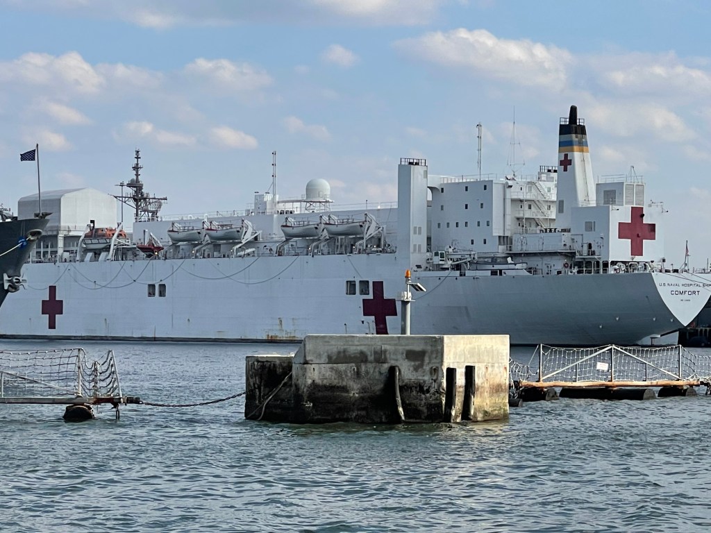


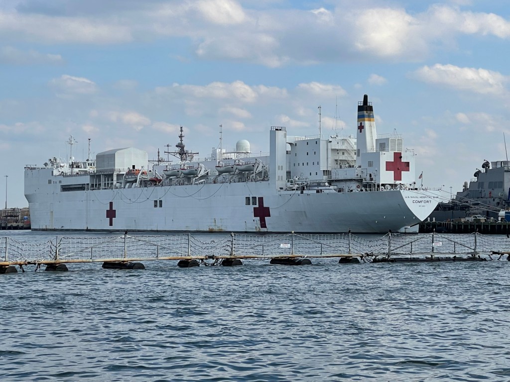
We anchored at Hospital Point right next to Tidewater Marina.
We snapped a few photos while there.

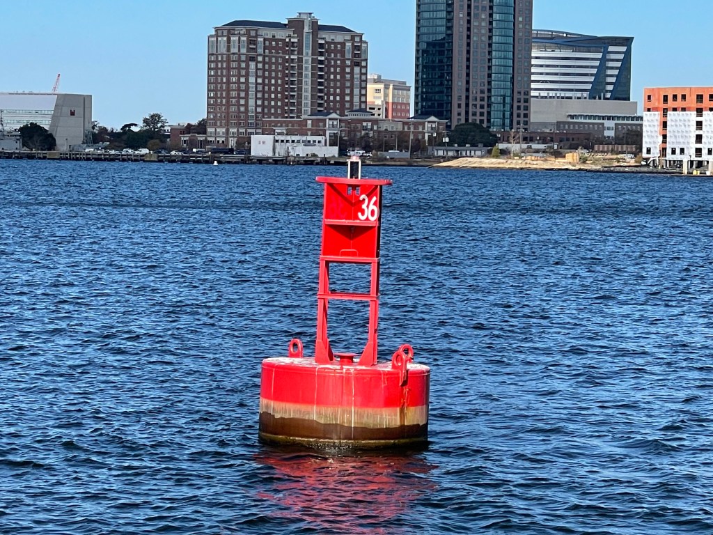
In the AM we pulled out and circled ICW Mile Marker 0 which is actually this red buoy #36
The next morning we weighed anchor and pushed southward through the Great Bridge Lock.

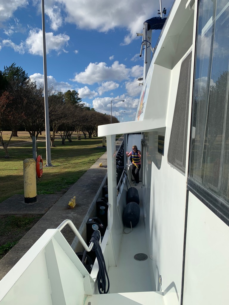
Soon we docked at AYB (Atlantic Yacht Basin) in Chesapeake, VA and noticed the 80′ Northern trawler that had passed us while we were anchored was docked near to us. We met the owners briefly and discussed some boaters that we knew in common.
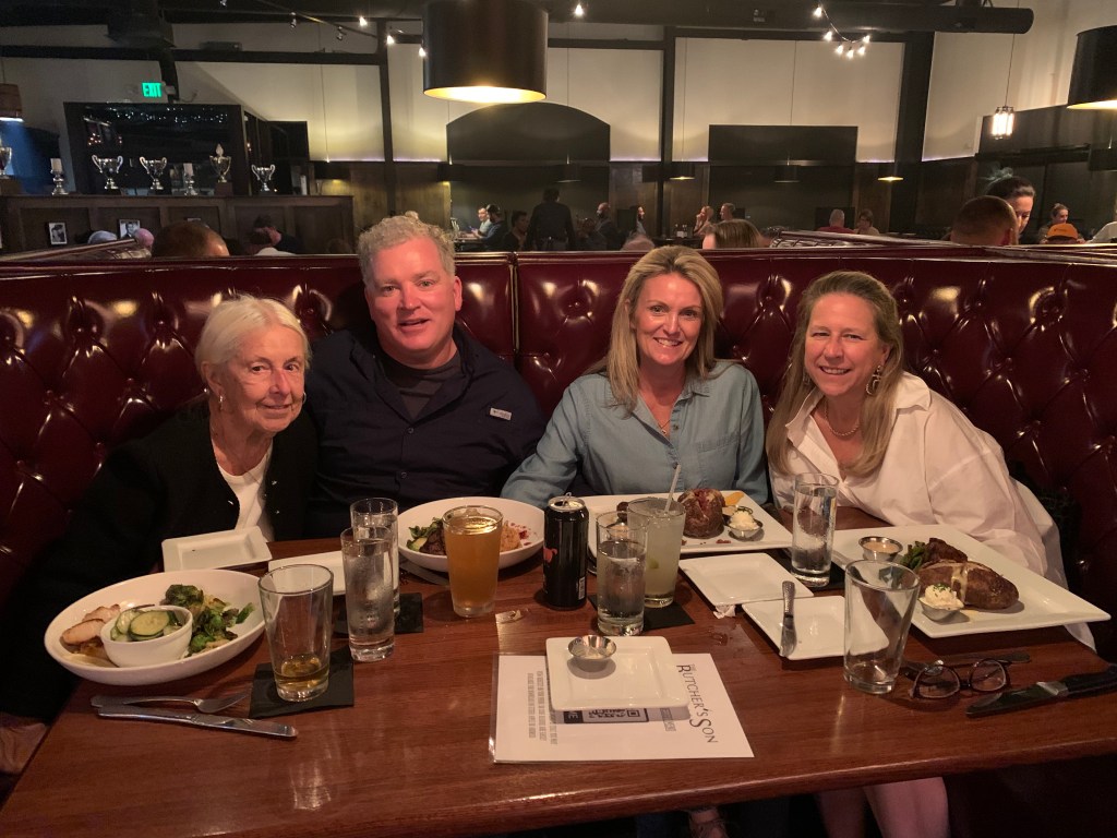
We were excited to be docked because we had just enough time to get cleaned up and go to dinner with our boater friends who were driving to Chesapeake to have dinner with us at the Butcher’s Son restaurant. Caroline and Ruth are the best friends anyone could ask for. We wished we could have kidnapped them for the rest of our trip.
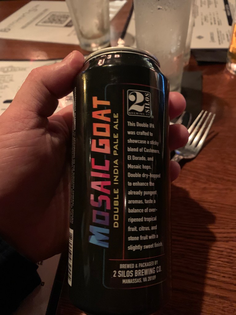
By the way that local Mosiac Goat IPA from 2 Silos Brewing was spectacular.
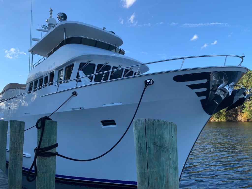
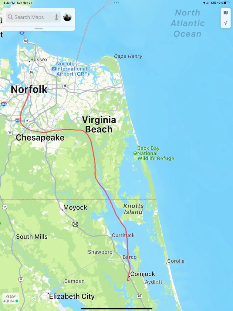
It was sad to leave our friends but the next morning we topped of the 1/2 full fuel tanks ($3000 worth of diesel) and set out for Coinjock Marina. When we arrived we saw MV iiwii was already tied up at the marina. We had just enough time to clean up and rush to get the Coinjock Restaurant’s famous 32 ounce prime rib special.


We actually ran into Fred and Sharon of MV iiwii and while waiting for a seat in the restaurant and Fred thought fast enough to tell the hostess that we would dine together as a party of 4 to make things easier. We enjoyed dinner with our new boater friends who entertained us with their boating stories from all over.
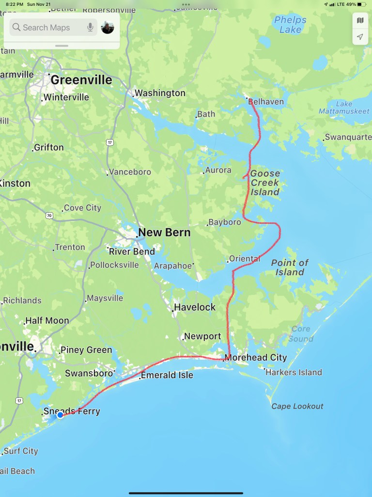
In the morning we cast off the lines and set out for Belhaven, NC. We snapped this photo of a nice looking sportfishing boat called MV McLovin which hailed from a port near me in RI.
Soon we were anchored in Belhaven, NC and enjoyed a night binge watching Friends. We are in Season #2 now.
The sunrise was amazing in the morning.

In the morning we weighed anchor and headed for Camp Legeune anchorage in Jacksonville, NC.
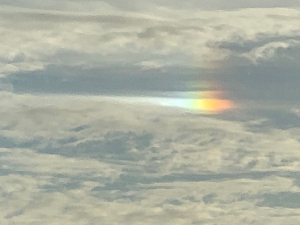
We saw the craziest rainbow spot in the sky. Not a whole rainbow but simply a dot in the sky?
We were now fast approaching Camp Lejeune.


It was a long 100NM trip here today cruising at 10kts. We left as the sun was coming up and dropped anchor just as the sun was going down.

As I sit here anchored in Camp Lejeune I am finally getting a blog post out. The five unblogged legs of our journey that got us to this location looked something like this…


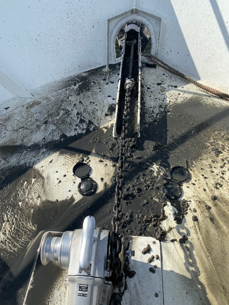
I love me some Muddy Waters. This morning’s coffee just tastes better with Muddy Waters playing on my Macbook.
As much as I love Muddy Waters… Anchoring in these muddy waters… less so. This Maryland black mud clings to and comes up with the anchor chain. I have yet to design a proper solution/method of dealing with this mud. Washing it off with a deck hose is just not working. The mud covers the foredeck and this is not mud you want to track into the boat.

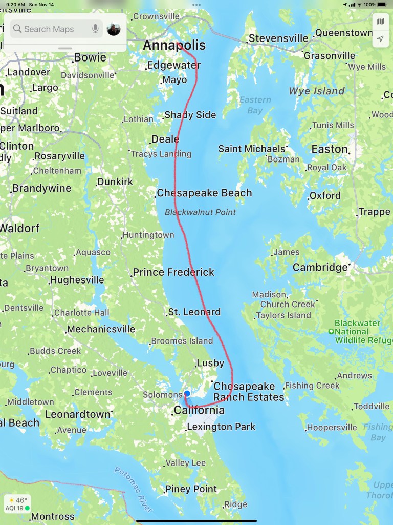
We shoved off from Annapolis and made a 6 hour 50NM run south to Solomons Island. Captain Teresa was at the helm for this trip south. It was great to sit in the 1st Mate chair and just relax as Teresa studied the route on the chartplotter and worked the helm to stay on course.
As we turned into Solomons Island we passed floating hay bails?
We had made reservations to spend the weekend at a marina in Solomons Island but left a day early as the weather would be better a day early. We slipped past Safe Harbor Marina and further up the Back River until there was nowhere else to go. A dead end. We squeezed Simple Life into a small cove surrounded by beautiful homes.


In the morning we weighed anchor and headed for the marina. As we hailed them on the VHF to find where are assigned slip was… They said the T-head of K dock.. I started to explain that without any letters on the docks I was not really sure where K-Dock was? I started to call out the names of the boats that were off my port and starboard bow. As I said the name of the second sailboat off my starboard bow, I paused. Our friends are here! We docked directly behind SV Alexandra.

We had planned to hit the Tiki Bar in Solomons Island but cleaning the decks would have to come first. While I worked the pressure washer, Teresa was baking my favorite Chocolate Chip Oatmeal cookies inside. Ain’t nothing like walking into a warm boat with the smell of cookies.
I was out on the docks when I heard my friend Carolyn yell “Marty”! Soon Carolyn and her captain Tim appeared and we made plans to catch up in Virginia while we enjoyed cookies.
The next morning we awoke to the boat rocking and realized that the wind was gusting to 20kts. A great day to stay inside and binge on the TV show Friends. We are almost done with Season 1.
I have been trying to blend in watching a SciFi show called Altered Carbon. If you are a SciFi fan like me… the storyline is amazing. It’s set in the future when human consciousness can be downloaded into cortical stacks as DHF (Digital Human Freight) allowing your consciousness can be “re-sleeved” into numerous bodies. Takeshi Kovacs battles the Protectorate as he seeks his lover from hundreds of years ago.
The imagined world includes holographic AI’s, synthetic bodies, beaming consciousness across the galaxy as well as raises questions of what if…
What if you could come back in any body when your current body wears out? What if your lover came back in the different body? How would you feel looking into the eyes of an body unfamiliar knowing it’s your lover behind them?
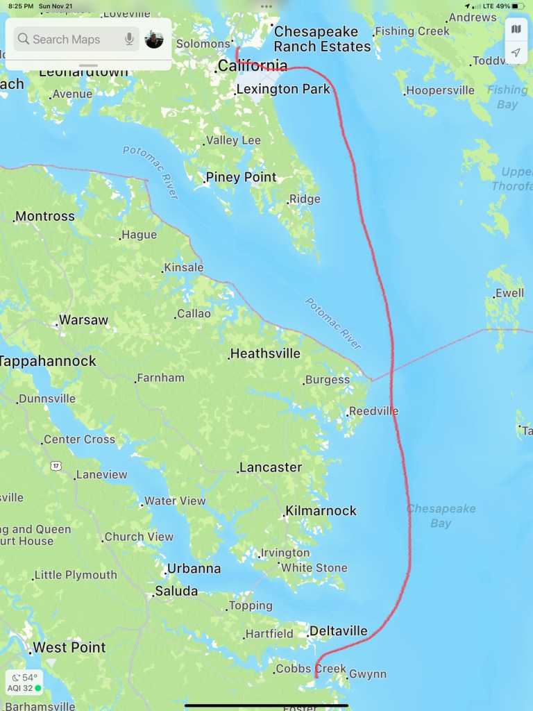
Our trip down mid Chesapeake Bay looked something like this.


We scooted off the Chesapeake City town dock in the AM and made our way south down Chesapeake Bay towards Annapolis. We dodged lots of floating objects along the way most of which turned out to simply be seaweed.
The trip down the Chesapeake was uneventful and looked something like this…

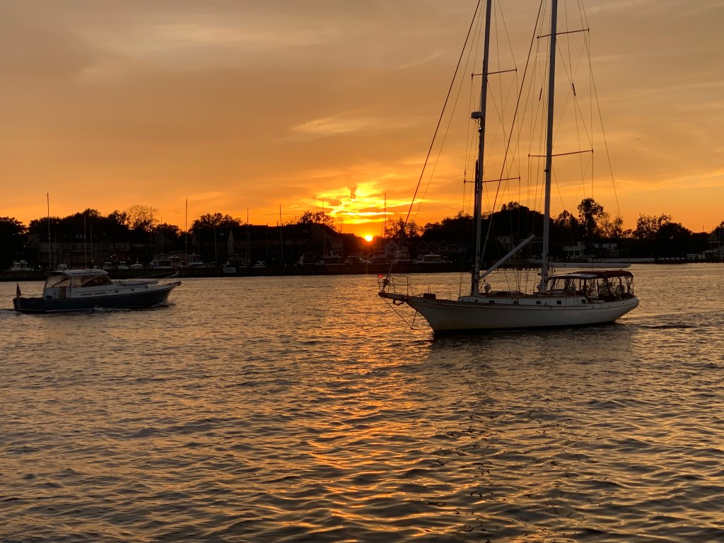
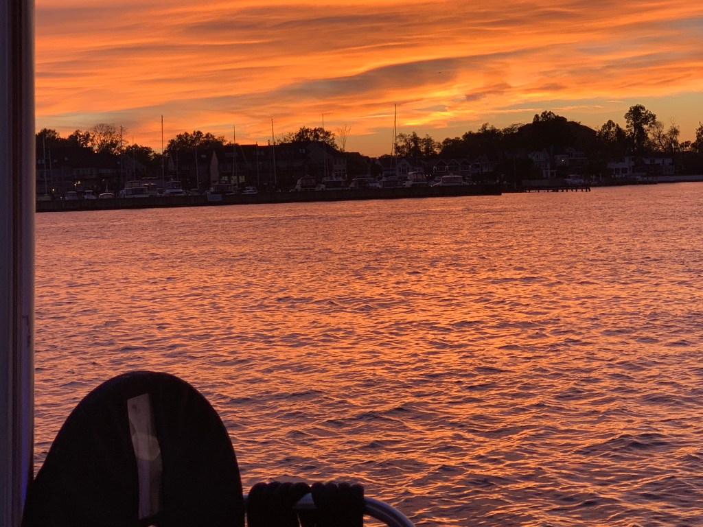
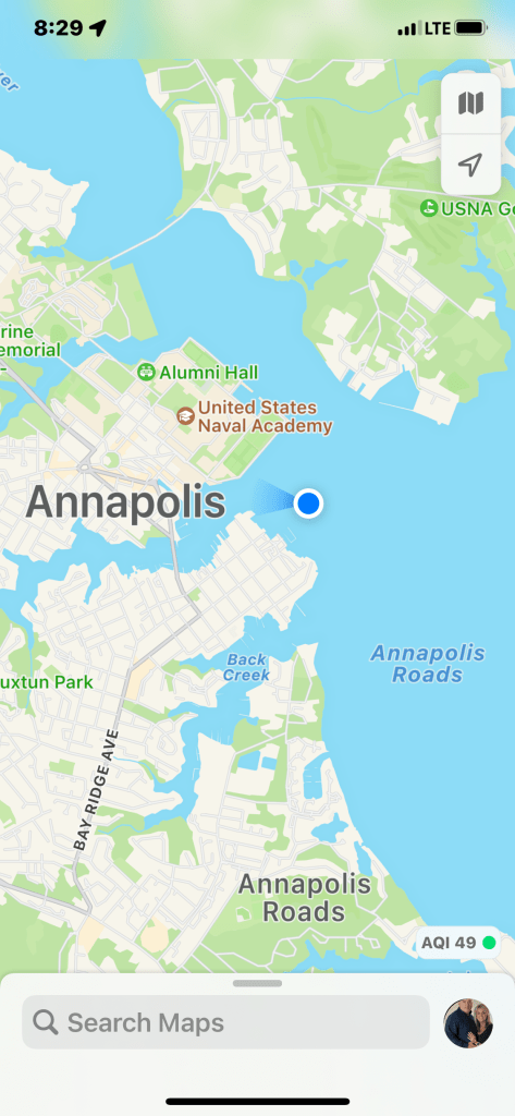
Soon we were dropping anchor in Annapolis’s outer harbor just as the sun was setting.
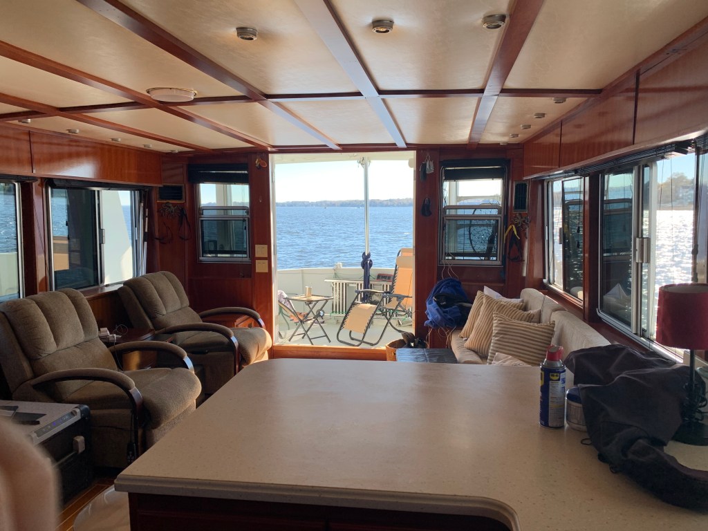
In the morning we opened all the doors and windows and enjoyed what was a great day on anchor.

In the harbor we watched as Navy ships and passenger ferry boats glided by.
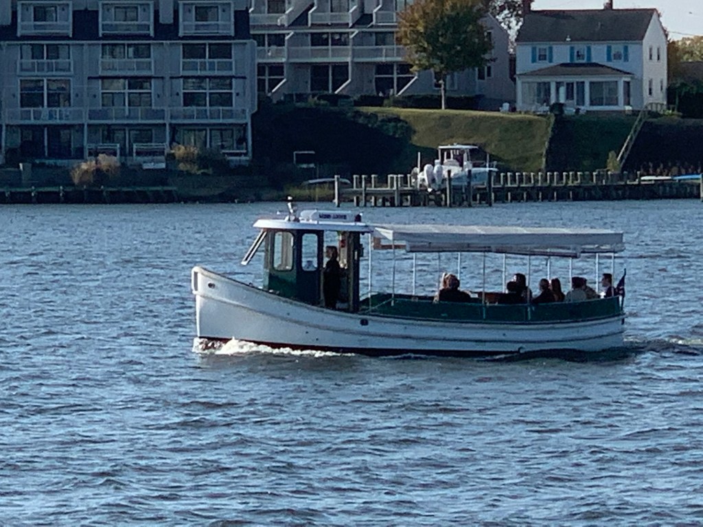

We could not wait to drop the dink and head into downtown Annapolis. I snapped a quick photo of Simple Life as we motored away from her.

Annapolis allows free dinghy dockage at the end of “Ego Alley” as it’s called right in the heart of downtown Annapolis.
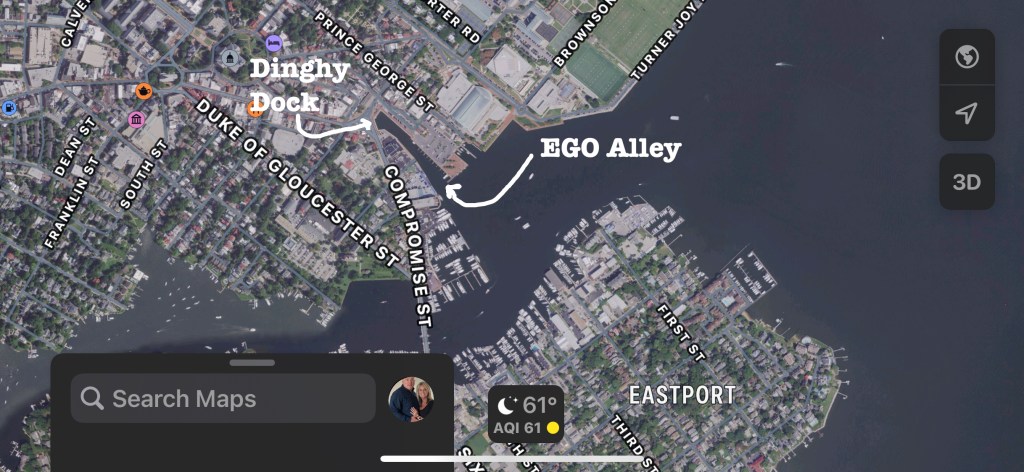
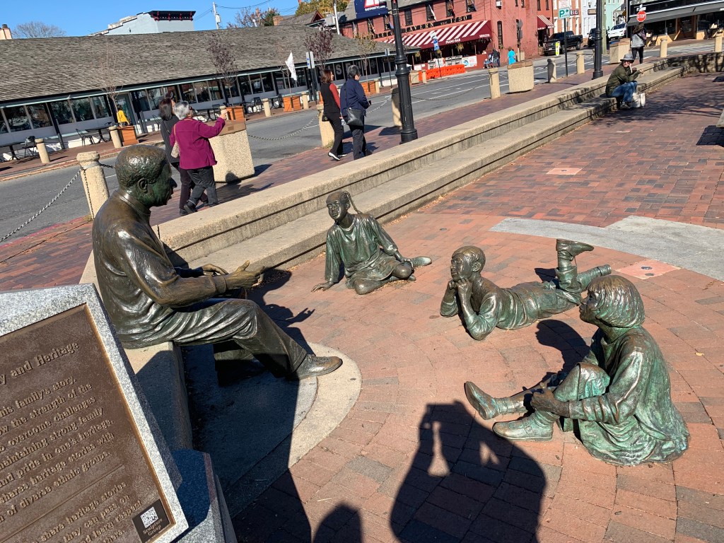
Once we tied up the dinghy you are right at the Alex Haley Roots statue.

We spied a Starbucks and Teresa smiled and took off like a shot to order her favorite espresso drink.


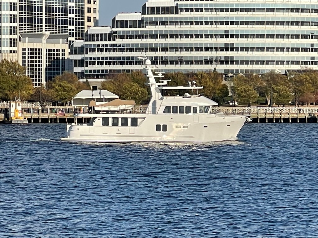
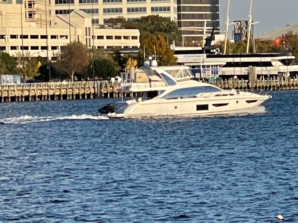
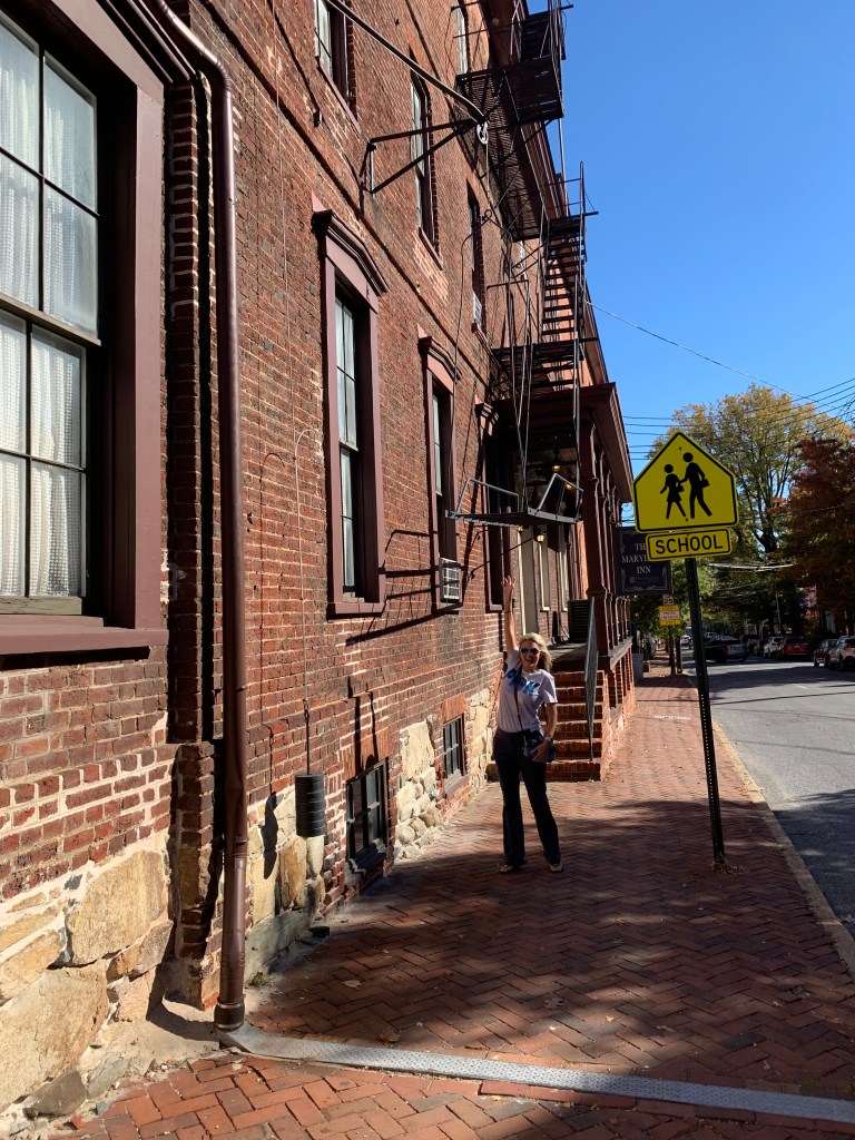
As we wandered around the city we snapped random photos of the sights we saw.


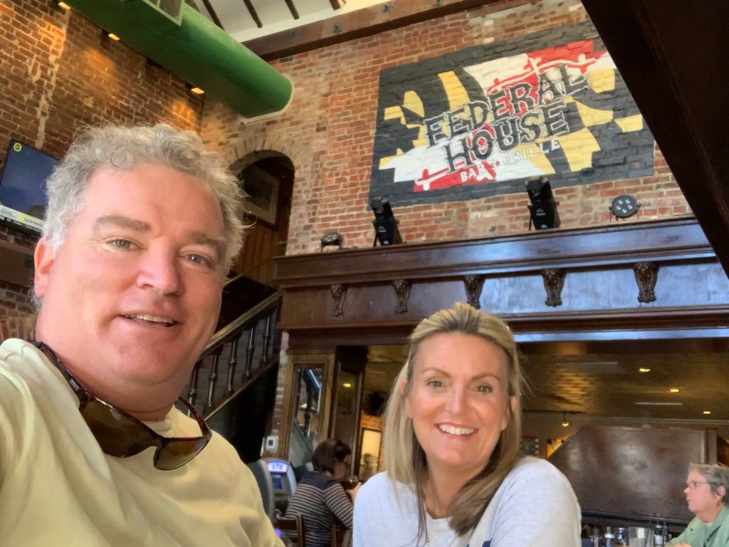
We walked to my Apple Watch declared I had set a record for outdoor activity. I think we need to get off the boat a little more often 😉 Hungry is what we were. We stopped at so many different restaurants to check the menu and finally settled on The Federal House for dinner. My “Hangover Angus Burger” and “The IPA When the Earth Stood Still” from Cult Classic Brewing were both AmaZinG!


We finished up our dinner and raced back to Simple Life to prepare for our good friends Buddy & Renee. There is nothing better than pulling into a distant port and getting to spend time with your cruising friends. Soon Buddy & Renee were tying up their dinghy on our stern and we enjoyed a sunset together.

Somehow a bottle of moonshine came out and Buddy said he could make a flamethrower… Teresa and I were thinking… we had never heard of this drink until Buddy lit up the night with his flamethrower.
We got to spend three memorable days enjoying dinner & laughs with Buddy & Renee. We look forward to when we are reunited again…

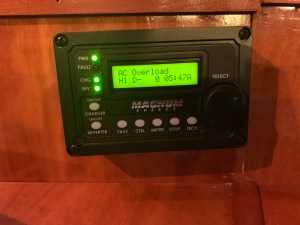
We awoke on anchor and I started the genset to recharge our house battery bank. Standing there in the pilothouse, I could not resist getting into the setup of the Magnum Energy Inverter Charger controller. There are just so many electronic gizmos aboard each with a plethora of controllable settings. Just then the power went out. Coincidence or should I stop randomly changing controller settings to observe the effect?
It took me a while of searching but I found the culprit…
a tripped circuit breaker. My guess… we are running the reverse cycle heat on the 240V AC compressors and the startup of the compressor draws a lot of juice.
Our trip up Delaware Bay sent us by the Salem & Hope Creek nuclear power plants. Their cooling tower belching puffy steam clouds set against a blue sky. There are two different nuclear power generating plants next to one another. Salem which has two pressurized water reactors (PWR) and Hope Creek which has one boiling water reactor (BWR). The main difference between a BWR and PWR is that in a BWR, the reactor core heats water, which turns to steam and then drives a steam turbine. In a PWR, the reactor core heats water, which does not boil. This hot water then exchanges heat with a lower pressure water system, which turns to steam and drives the turbine.Together these power generation stations share a large artificial island at the head of Delaware Bay. With it’s combined output of 3,572 megawatts, the Salem-Hope Creek complex is the largest nuclear generating facility in the Eastern United States and the second largest nationwide.

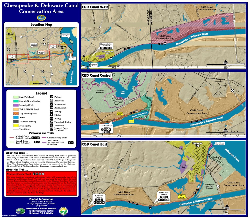
When you reach the head of Delaware Bay, there is a man-made land-cut called the the C&D Canal (shown as the red line in the picture on the right).
The Chesapeake and Delaware (C&D) Canal connects the Delaware River to the Chesapeake Bay. The C&D Canal system provides a continuous sea level channel (ie. no locks needed) connecting the Port of Baltimore to the ports of Wilmington (DE), Philadelphia, and the northern trade routes.
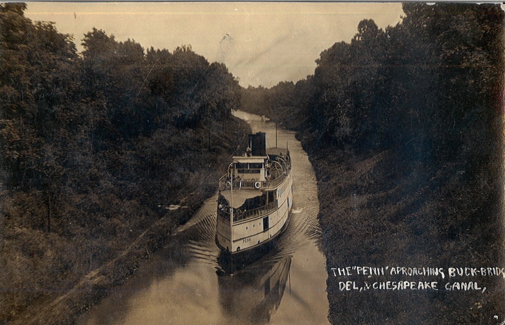
I believe the canal originally opened in 1829. I have included a picture of the steamship Penn as it traversed this early version of the C&D Canal.
This canal is currently a government 1935 authorized project given to the US Army Corp of Engineers (USACE).
The waterway channel is 35 feet deep and 450 feet wide, extending from Reedy Point on the Delaware River, about 46 miles below Philadelphia, PA, through a land-cut westward to Elk River and onto deep water near Pooles Island in the upper Chesapeake Bay.
I suppose it makes the DelMarVa (DELeware, MARyland, VirginA) peninsula more of an island? The Delmarva is a peninsular region 180 miles (290 km) long in the eastern US that includes Delaware, the Eastern Shore of Maryland, and a small strip of Virginia; it separates Chesapeake Bay from the Atlantic Ocean.

As turned to port and entered the C&D Canal. There were many locals walking the banks of the canal.
The towns have set aside the area along the bans as conservation land. It’s a peaceful area with the land high above you blocking the wind as you walk the banks waving to passing yachts.
We toot our air horns and receive waves from the locals as they stroll along.
We planned to dock at the free town dock in Chesapeake city. The town set this small dock aside for boating visitors to their town. Simple Life’s 58′ LOA makes her tougher than her previous namesake to slip into open space at a face dock. As luck would have it… We found an opening and eased her up to the dock and had to lasso the cleats from on board as our decks are too high to simply jump down onto the dock.

We quickly jumped off and wandered the pocket-sized downtown area.


We walked into a restaurant called Prime 225 that a friend told us to visit but sadly… it was a 3 hour wait!
A block away we discovered a quaint local hangout call The Tap Room. I grabbed a burger and T had the chowder. Food was good but it wasn’t the right vibe and their Goose Island IPA is OK but not my favorite.
Where to next?
When we landed on the town dock we could see a marina restaurant just 400 feet away on the tiny harbor. We walked in that direction till we saw…

As we passed beneath the sign we were greeted with the sounds of a live band singing some Fleetwood Mac – Dreams.
We band was good and the IPA was better 😉 As the band played we played “Name that tune” while I shot out to a quick lead with Fleetwood Mac it seems the band conspired with Teresa to play her music and I believe she won by a landslide in the end.
The walk back to Simple Life was short and we where thankful for that.
The town dock is free but if you plug into electricity like we did you must pay the town hall just 1 block away. So off I went to stuff an envelope of cash through their mail slot as it was Sunday.


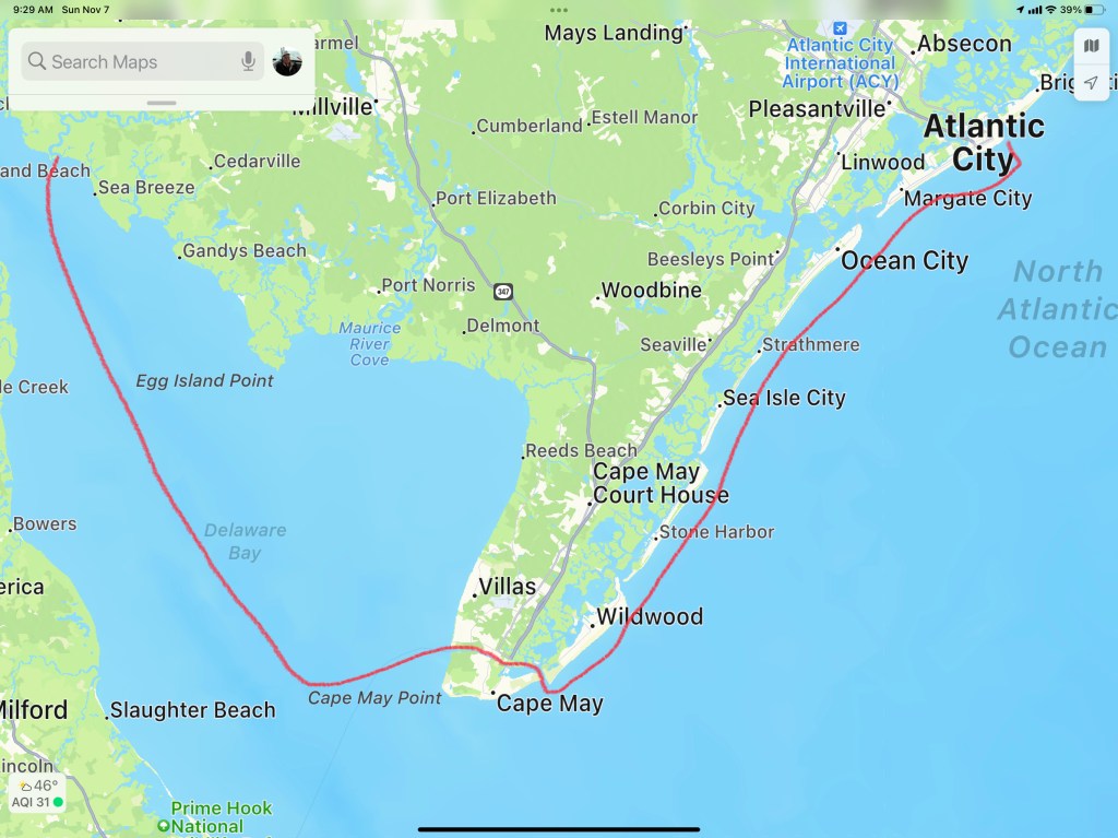
The seventh leg of our journey south looked something like this…


Leaving Atlantic City, the predicted forecast was for 4-5′ waves on our stern as we travel south to Cape May. Normally we wait for 2-3′ waves as 4-5 footers can be uncomfortable especially if they are on your beam. However, if we didn’t get out of AC on this particular day… the Atlantic zone between AC and Cape May will have waves in the 7’+ range which is nothing we wanted to travel in. So… Off we went…
The waves heights turned out to be OK and I grabbed a video of our bow wake as we headed out of Atlantic City.
We made good time heading south down the Jersey Shore. We increased speed to 12kts to add more stability to the boat.

Like most trawlers or motor yachts Simple Life has a square (hard chined) hull when you move aft. This is very common as most boats have a sharp V shape under the water at the bow and those steep V hull sides slowly turn horizontal or flat bottomed as you move from the bow to the stern of the boat. This means that the where the sides of the hull meet the bottom of the hull in the aft (rear) of the boat you have a near 90 degree corner.

Have you ever stuck you flattened out hand into the water moving past you while on a boat? If you have, your hand was thrust up and out of the water by the force of the water hitting your hand. If you try pushing your hand deeper into the water it gets pushed back up even harder. As the boat heels to one side or the other… one side of the boat is forced deeper into the water while the other side is lifted out of the water. The faster the oncoming water is hitting the bottom of the boat on the heeled-side the stronger it feels pushed back up, This has the effect of reducing the heeling motion. Likewise the side of the boat that is being lifted out of the water feels less buoyancy force pushing it up by the smaller section of hull still submerged. The forces work to return the boat to level.

If you take your captains class you will use a diagram like this with metacentric heights and righting moments. It’ll be a more formal discussion like the one found here.
https://en.wikipedia.org/wiki/Metacentric_height
Some times I just like to watch the prop wash that pops back to the surface after being pushed down by the boat riding over it.
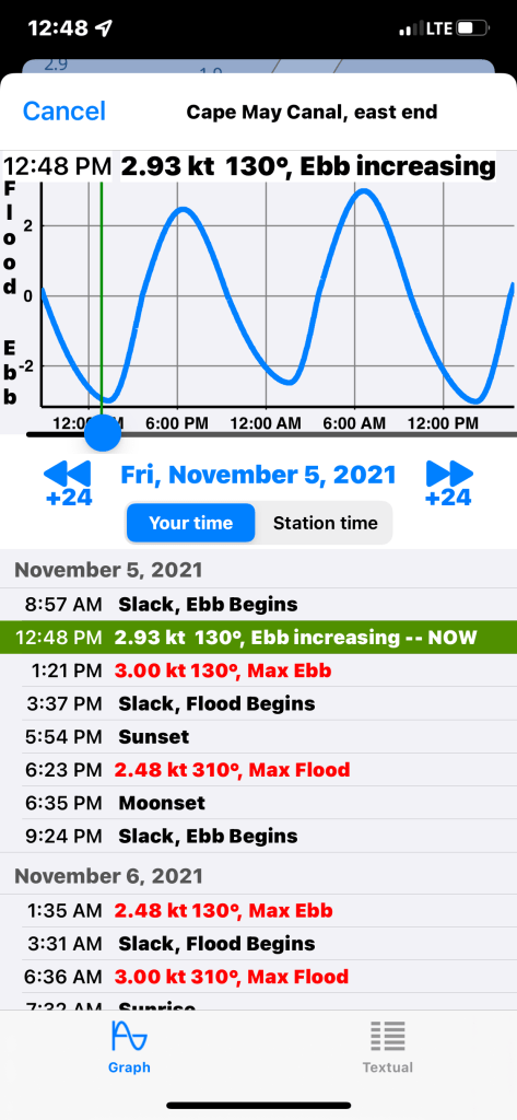
We were approaching the Cape May inlet and we already knew that we would hit the Cape May Canal as it approached maximum ebb current. Not much we could do about that other than throttle up and push through.
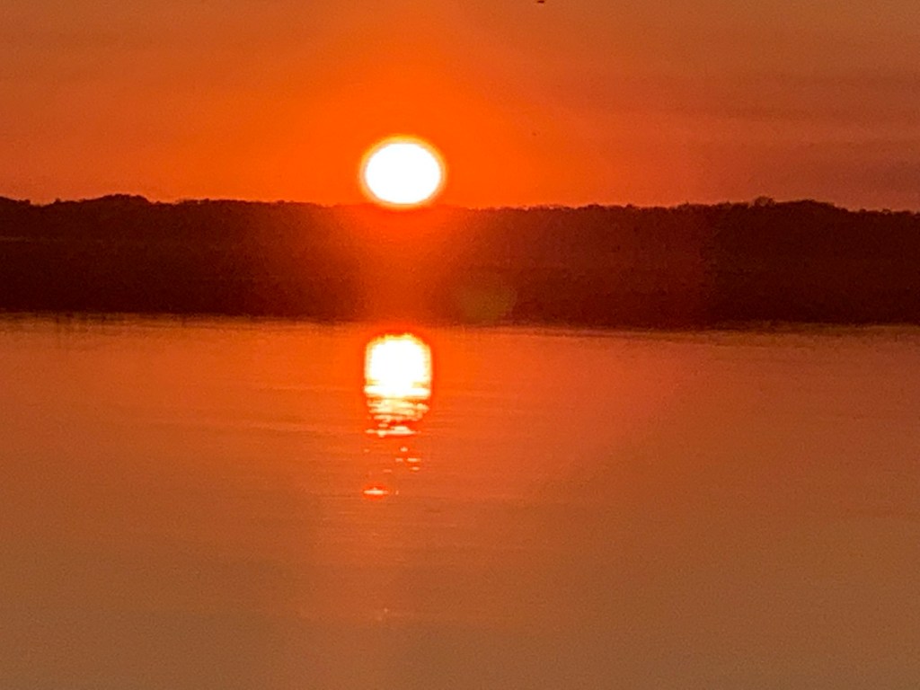
We exited the Cape May Canal and made our way up the Delaware Bay. The ride north up Delaware Bay was uneventful and we passed almost no other boat traffic. Soon we were approaching our chosen anchorage in the Cohansey River. We circled for a bit checking depths before we dropped the hook for the night. We were treated to an amazing red sunset.

Our route for Winter 05 – Leg 006 looked something like this.

We awoke on anchor in Sandy Hook, NJ. We weighed anchor and got underway by 8AM. The trip down the Jersey shore was peaceful with 2-3′ waves and a 15kts of wind. We cruised south staying about 2 miles off the beach.
We did not see much boat traffic other than small fishing boats that huddled around Manasquan & Barnegat Inlets.
Barnegat light is very conspicuous from this close distance.

Barnegat light

Barge on a Wire
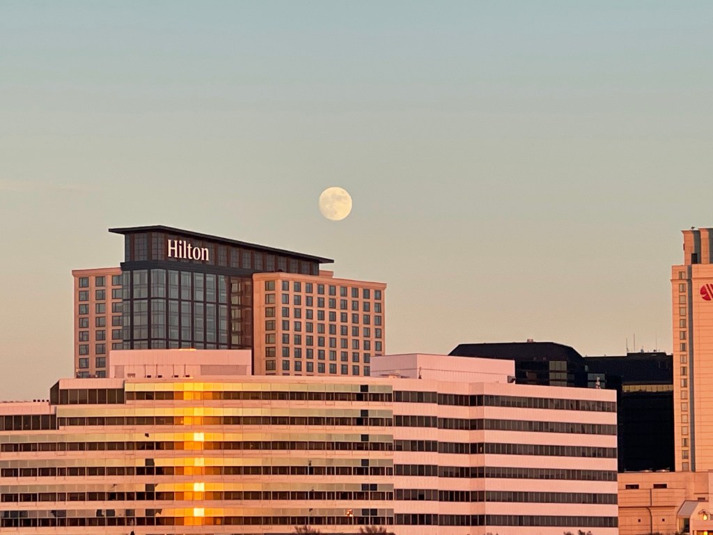
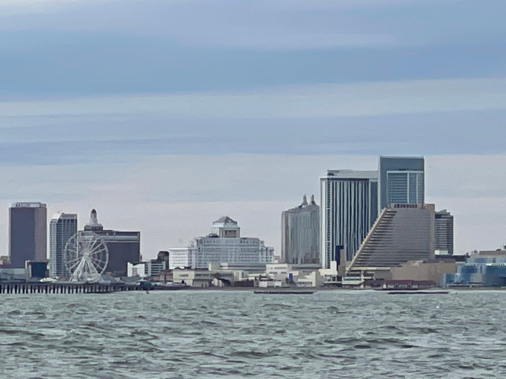
Atlantic City Skyline Tallest skyscrapers


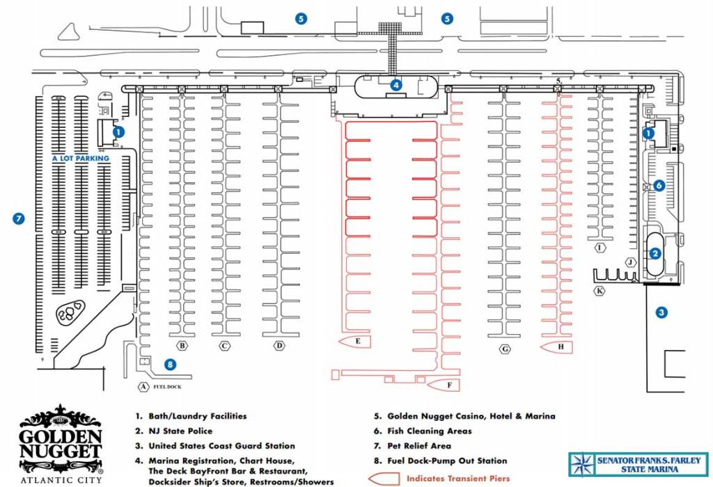
We docked at the Farley State Marina in slip E17.
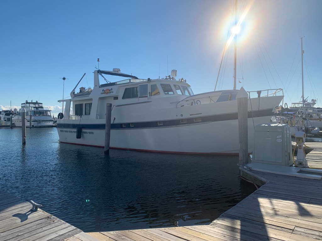
Simple Life
Here at the marina, Simple Life was not the only yacht hailing from a port in Massachusetts.

The sun was setting as we tied up the boat.

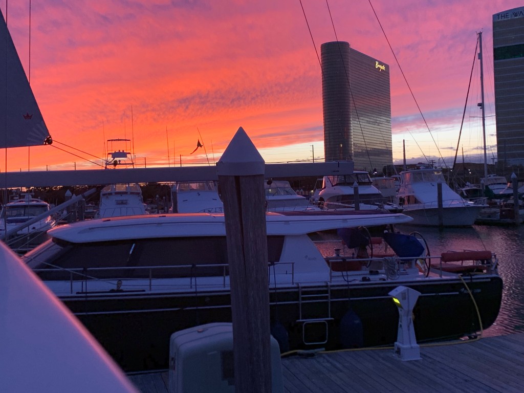

We were just feet from the Golden Nugget Casino.

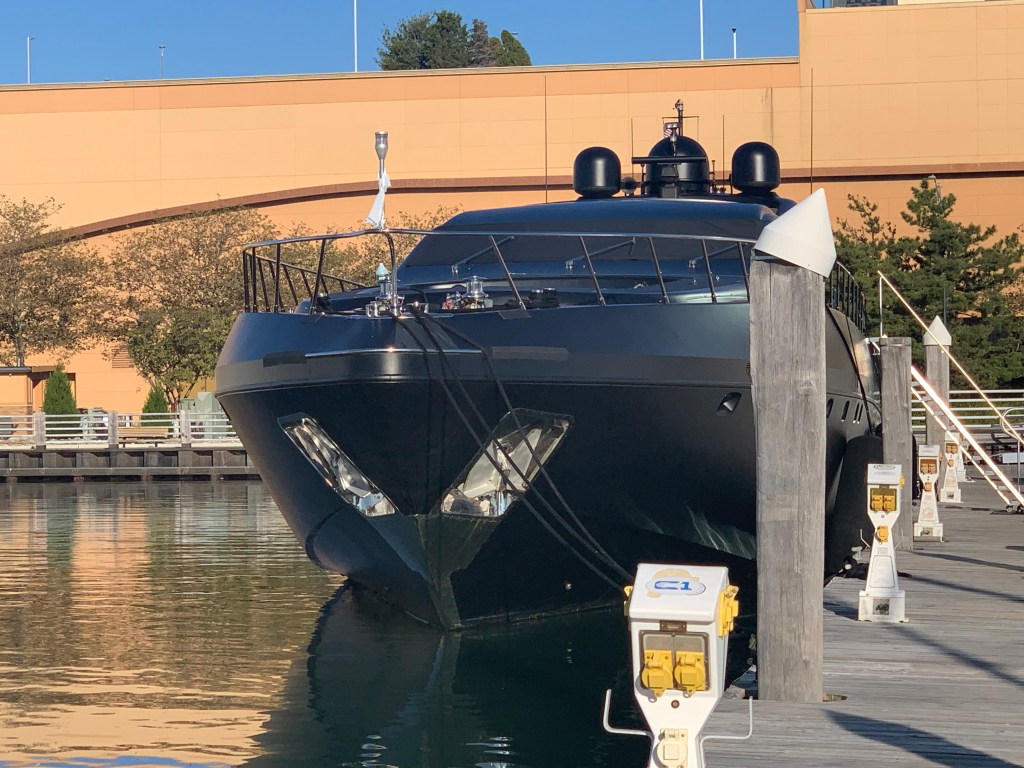
MV Neoprene is a like a fart in the shower… it just can’t be ignored.


Gambling is not our thing but we would not miss out on hitting the casino. Even if trying to enter the casino felt like we were in Alfred Hitcock’s “The Birds”.

In went us…
We played some blackjack and the slots for a bit before loosing enough money to feel like gamblers.


Time to hit the Chart House for a good steak. Our table overlooked the docks and you could see the cobalt blue lights of MV Simple Life through the window.


This leg of our journey looked something like this..

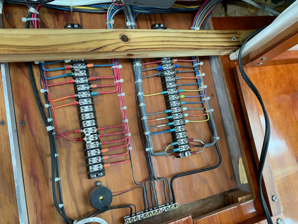
The repair of the radar turned into the install of a radome a wind transducer and a second MFD (Multi-Function Display ie. Chartplotter). This required several electric kick-scooter trips to West Marine for miscellaneous switches, cables, etc. We had to pull the inside roof of the pilothouse down in order to snake cables between the two helms (Pilothouse & Flyberidge). This took several days.

We met our neighbors Capt. John and Charlie who were bringing a 55′ Sunseeker Manhattan to Florida. If you are interested it’s for sale on YW (YachtWorld.com). $2.25M

Capt John was very knowledgable about boating technology and we discussed everything from LiPO4 batteries & BMS (Battery Management Systems) to Chinese diesel fired heaters. Capt. John had many projects going on with his own one-off sailing yacht called Myth.

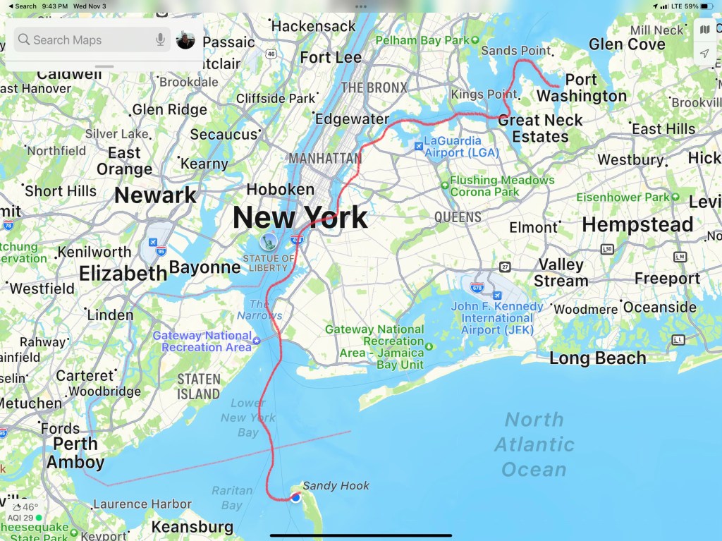
We got a late start but it felt good to be moving again. We slipped past a lonely lighthouse before entering the East River. Soon we were passing the massive prison ship in the Bronx. Vernon C. Bain Correctional Center (VCBC)

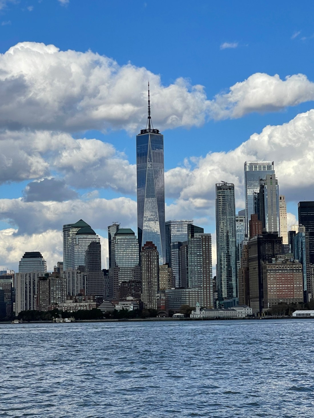
The clouds looked like cotton balls as we cruised West down the East River.

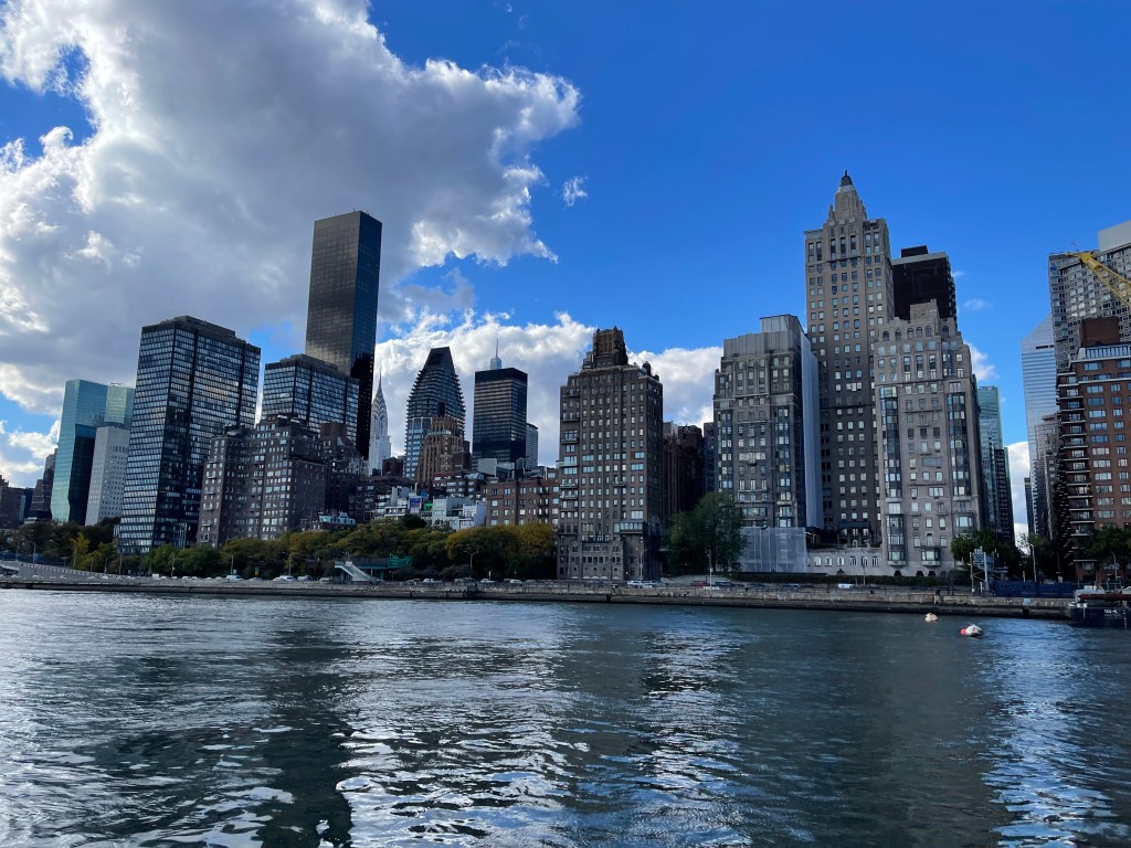
The Manhattan skyline looms like a giant.
The Brooklyn Bridge is a reminder of the past

One World Trade Center stands proud.

Lady Liberty always reminds me freedom is what everyone wants in this world.

As we scooted beneath the Verrazzano Bridge we passed a large container ship entering NYC harbor.

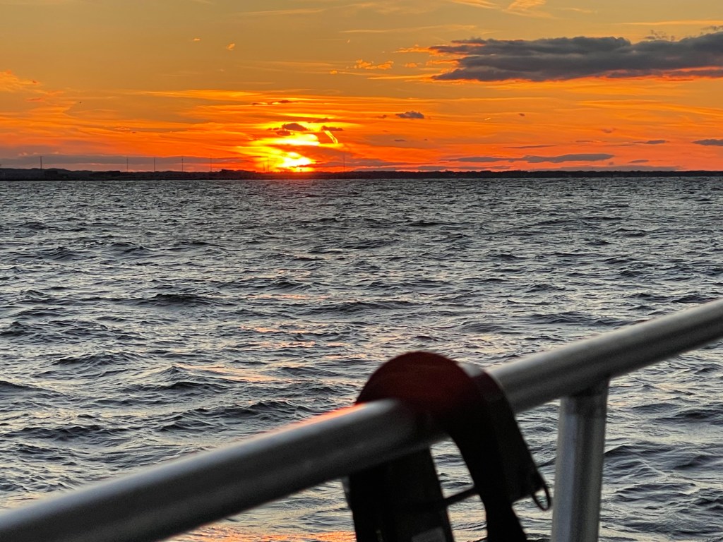
As the day came to an end we decided to drop the hook behind Sandy Hook, NJ for the night. As the sun disappeared beneath the horizon we tucked in for the night.
The days journey looked something like this…


You must be logged in to post a comment.