Gale Warnings, Snow, Sleet and a Beam Sea

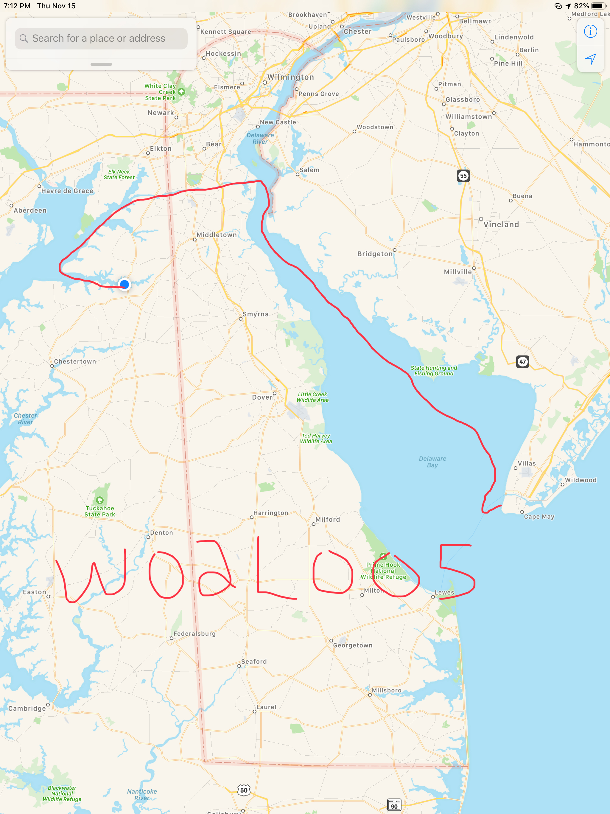
We anchored in Cape May at night and the wind was whipping. We tried to tuck in behind the Cape May canal Jetty to get some protection but alas the boat was a rocking. 

I finally had to get out of bed, weigh the anchor and re-drop as close as I could get to the jetty. It worked. Well it worked a little. We did not sleep much. 

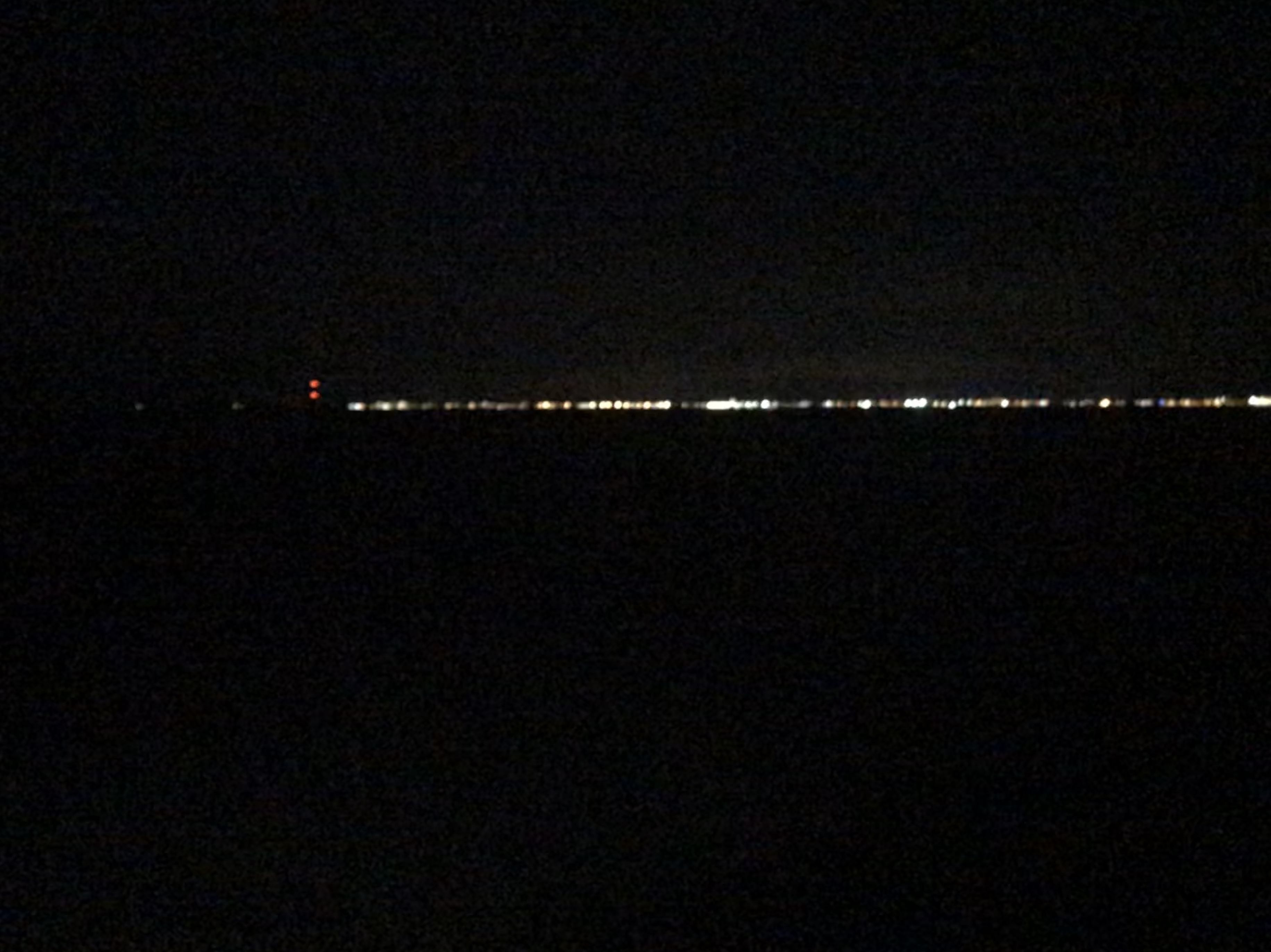
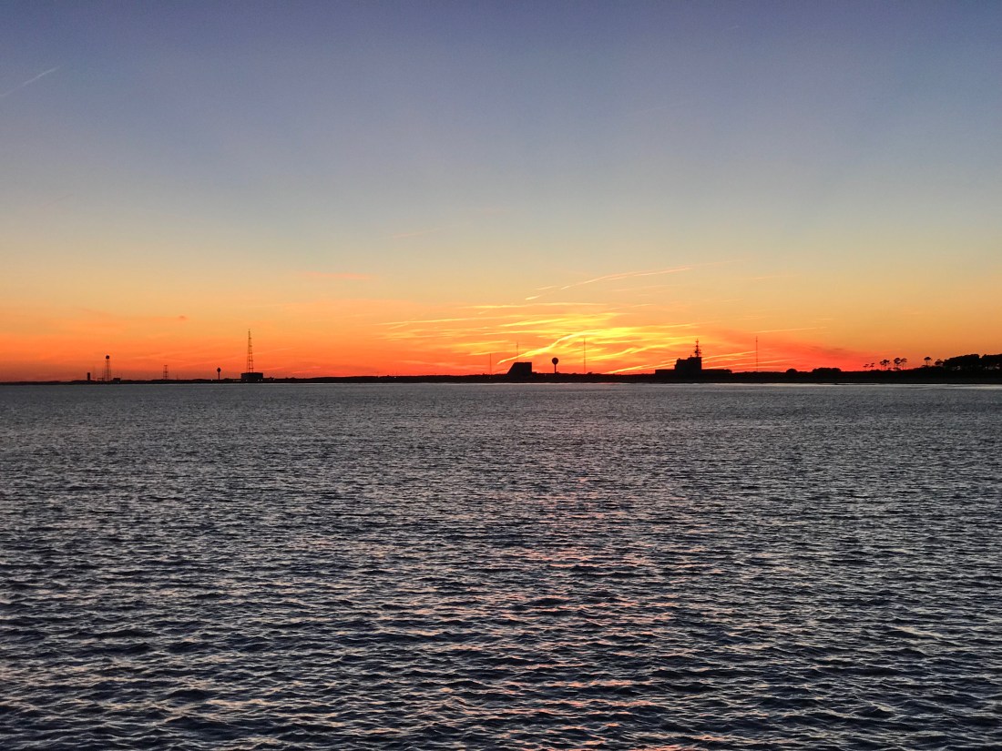
Next morning we left before sunrise because I just was not sleeping anyway. The gale warning winds were nipping at our heels as we worked our way North up Delaware Bay.

The blue dot is MV Simple Life and the red-purple are 30-40 MPH winds

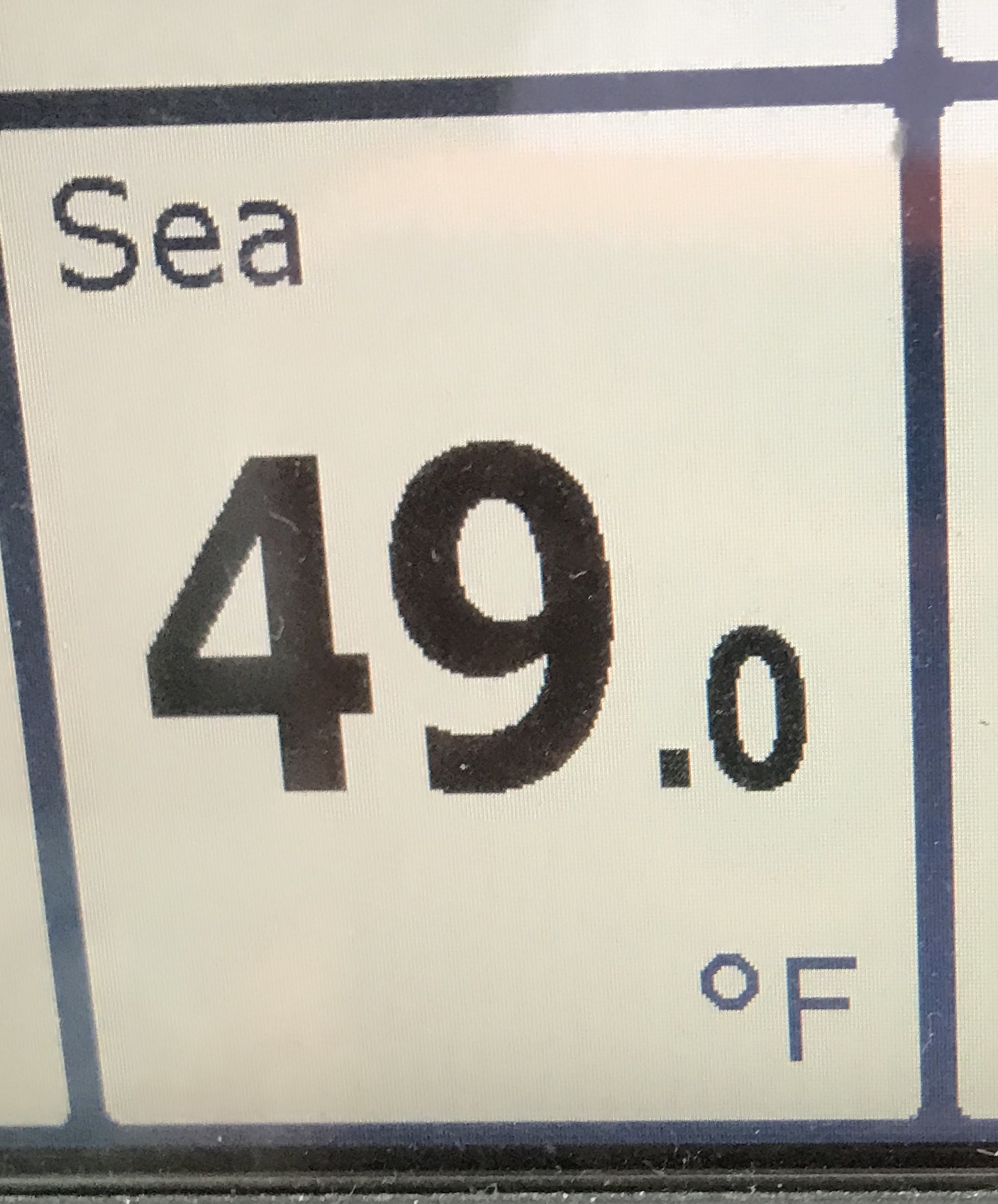
A quick check on the weather back in Warwick, RI showed it was even colder than what we were feeling in Delaware Bay.

Warwick, RI Nov 15th Temps

The water in Delaware Bay was cold. Not something you want to fall overboard into. 

Delaware Bay Sea Temp

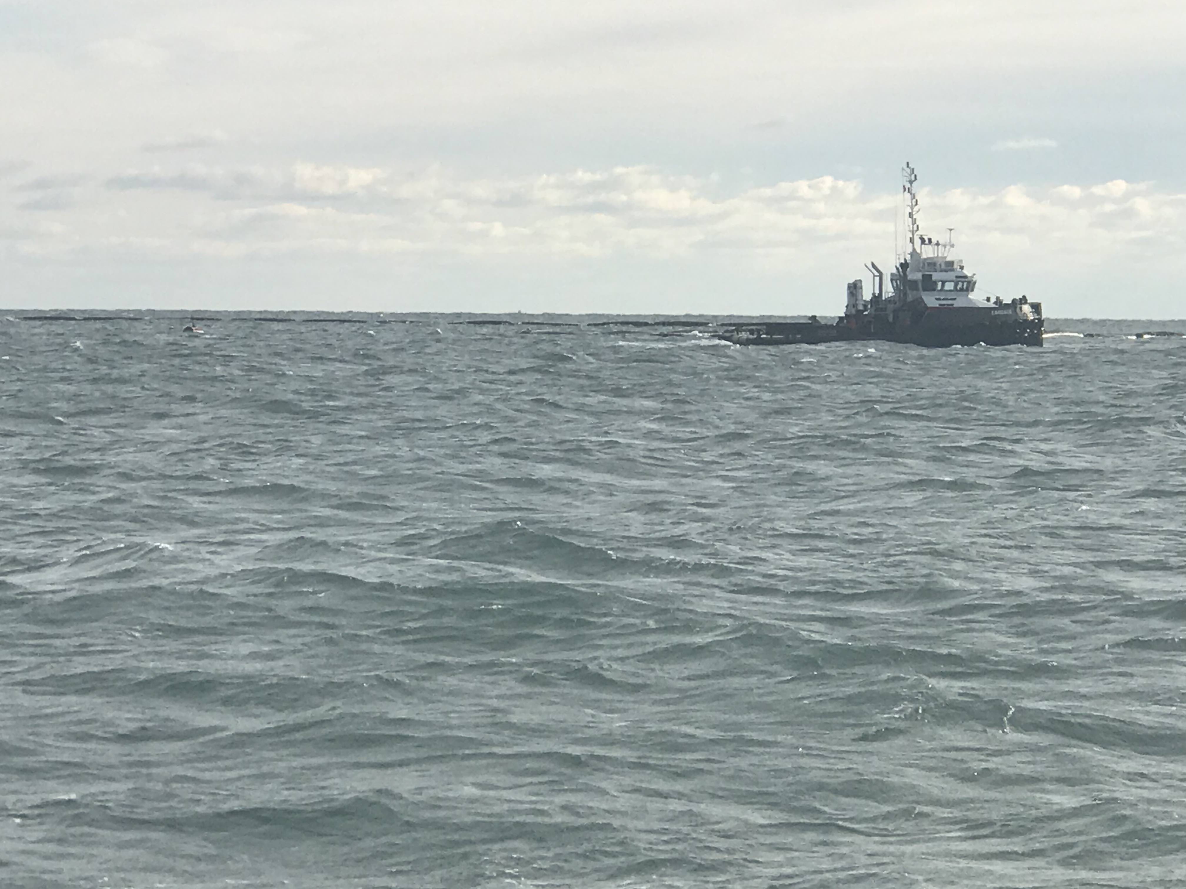
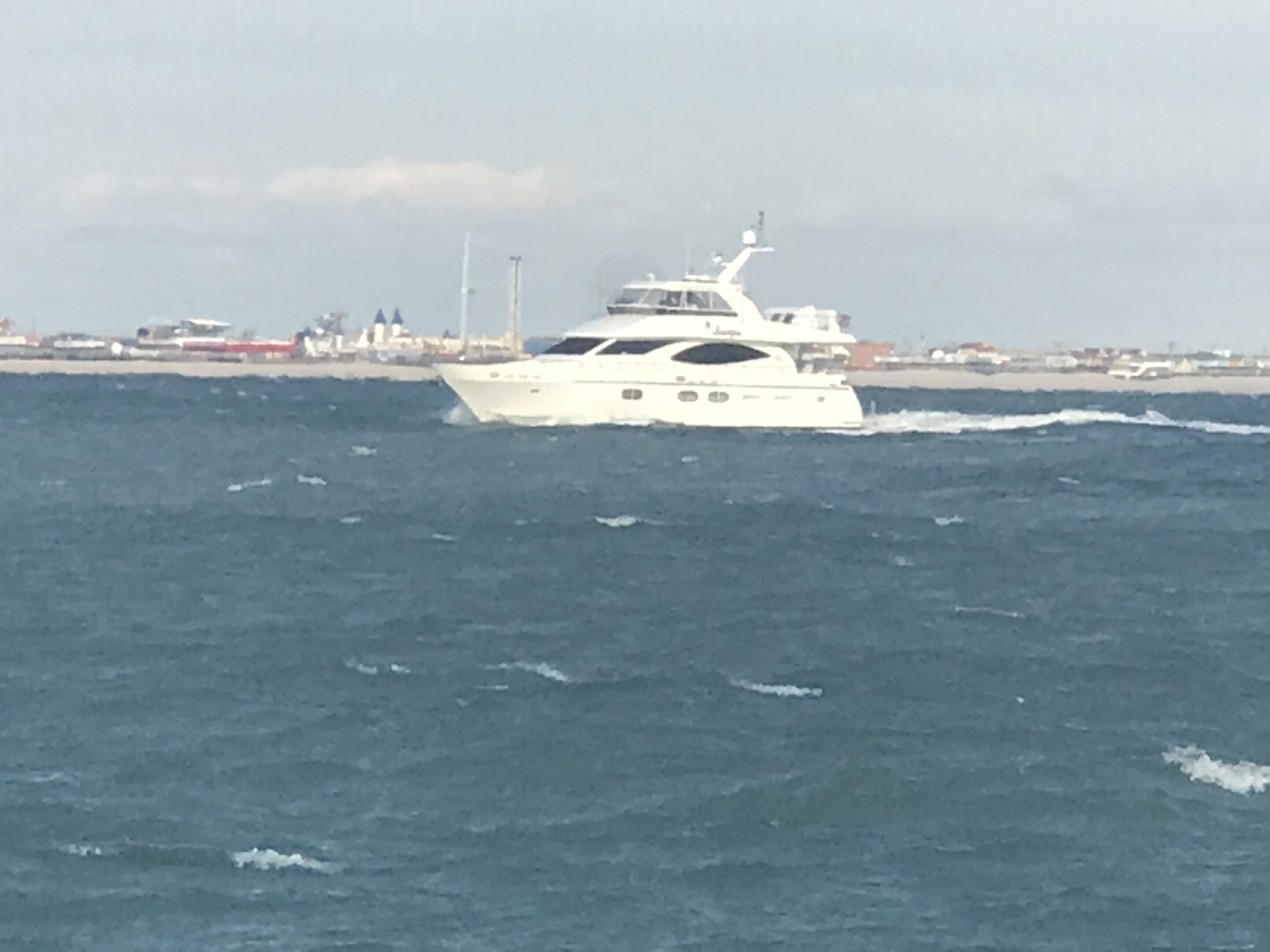
Traffic was hard to find. This Chiquita banana container ship passed us as we slipped out of the channel to give her space. I think only 2 other boats passed us on this gusty, snowy, foggy day. 

Container ship passing us in Delaware Bay

As we made our way up Delaware Bay the wind and waves were on our beam. The wind alone was giving us quite a list to port. A beam sea is never fun in a flybridge trawler with a 400lb dingy and two kayaks on the flydeck. eek.

Delaware Bay Early in the AM

Soon we could hear the sleet bouncing off the outside of the boat.

Then came the snow…

Why didn’t I bring a snow brush on this Bahamas trip?

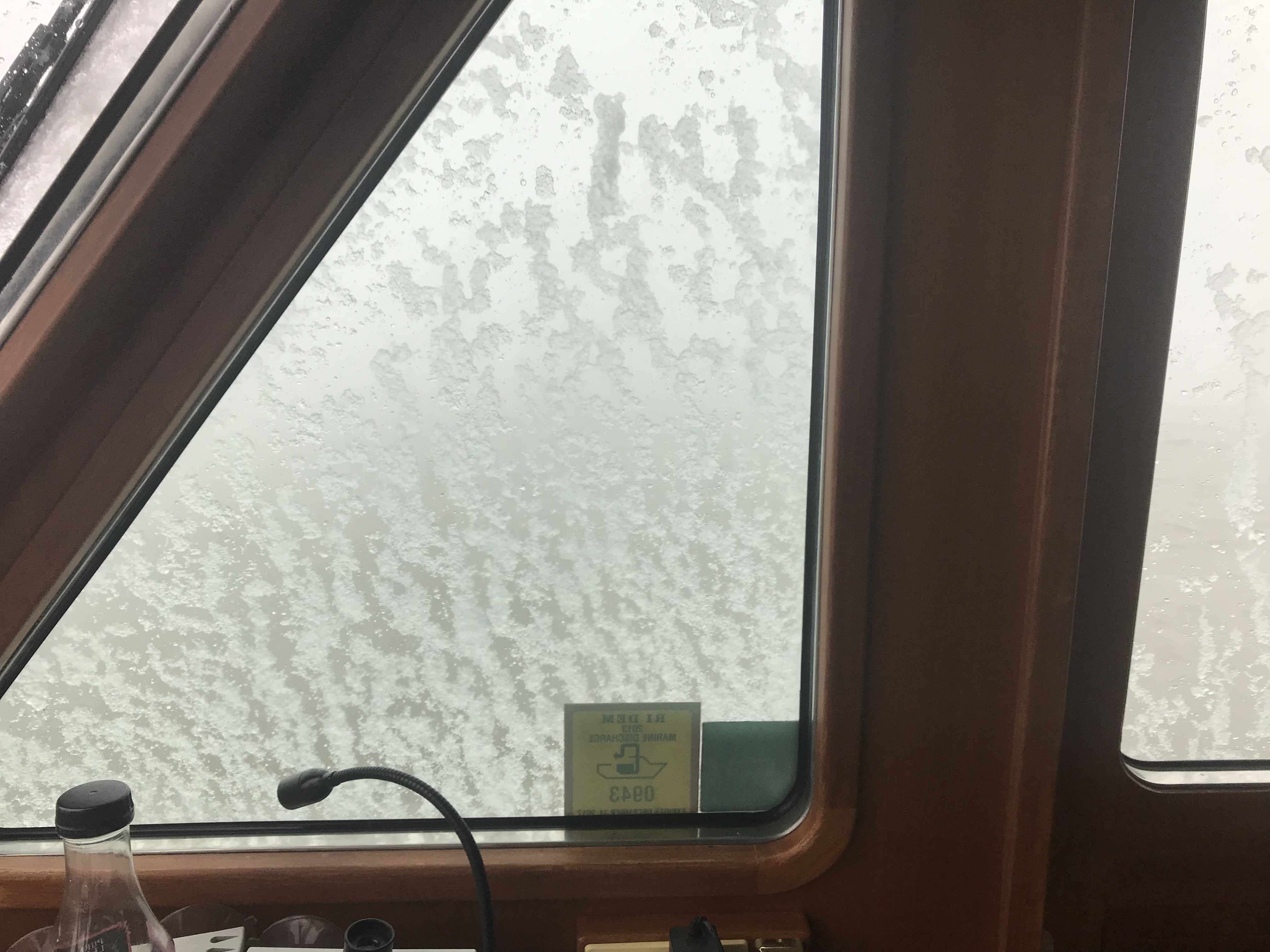
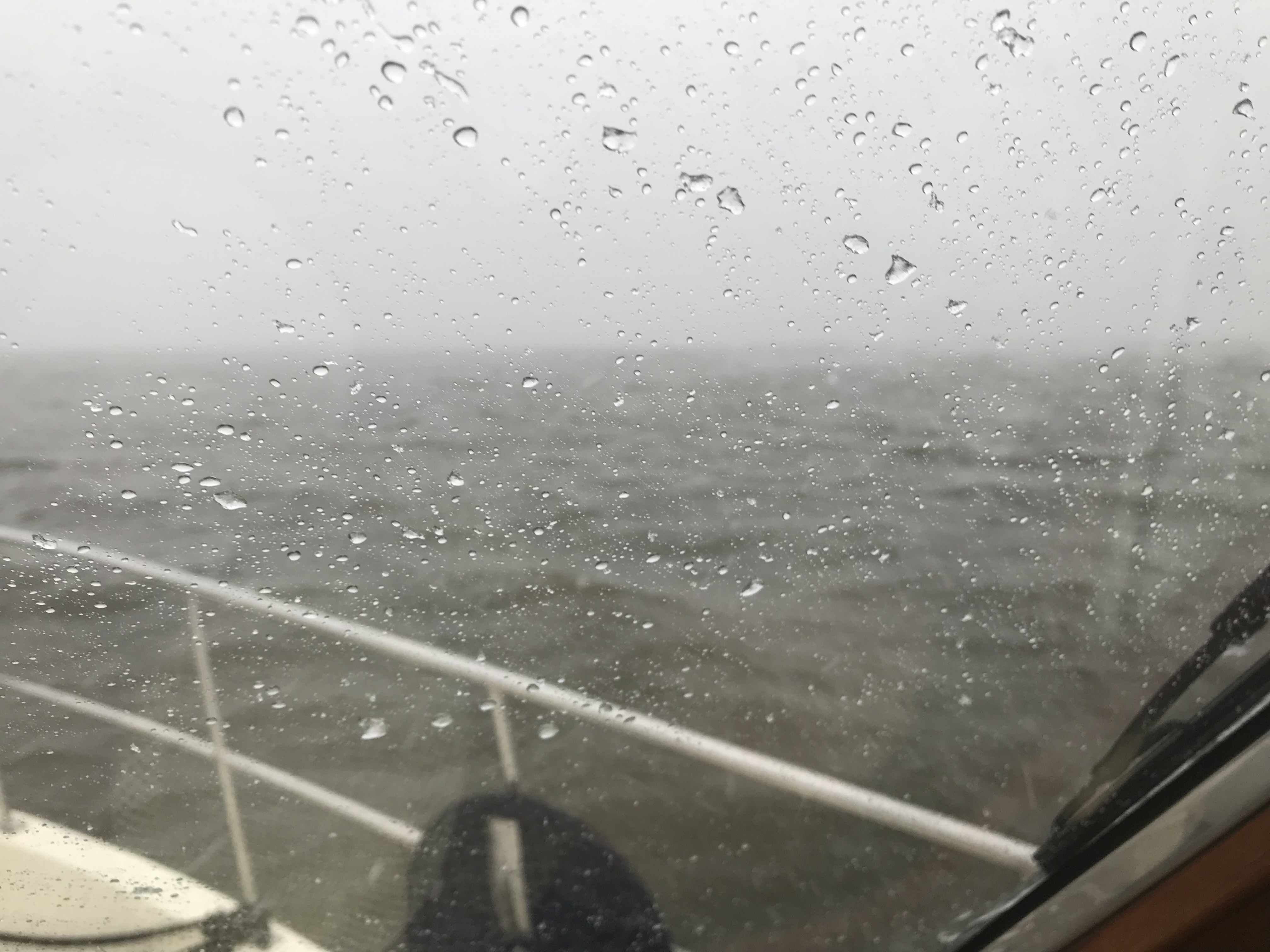
The snow brought with it FOG.

Fog starting to close in around us

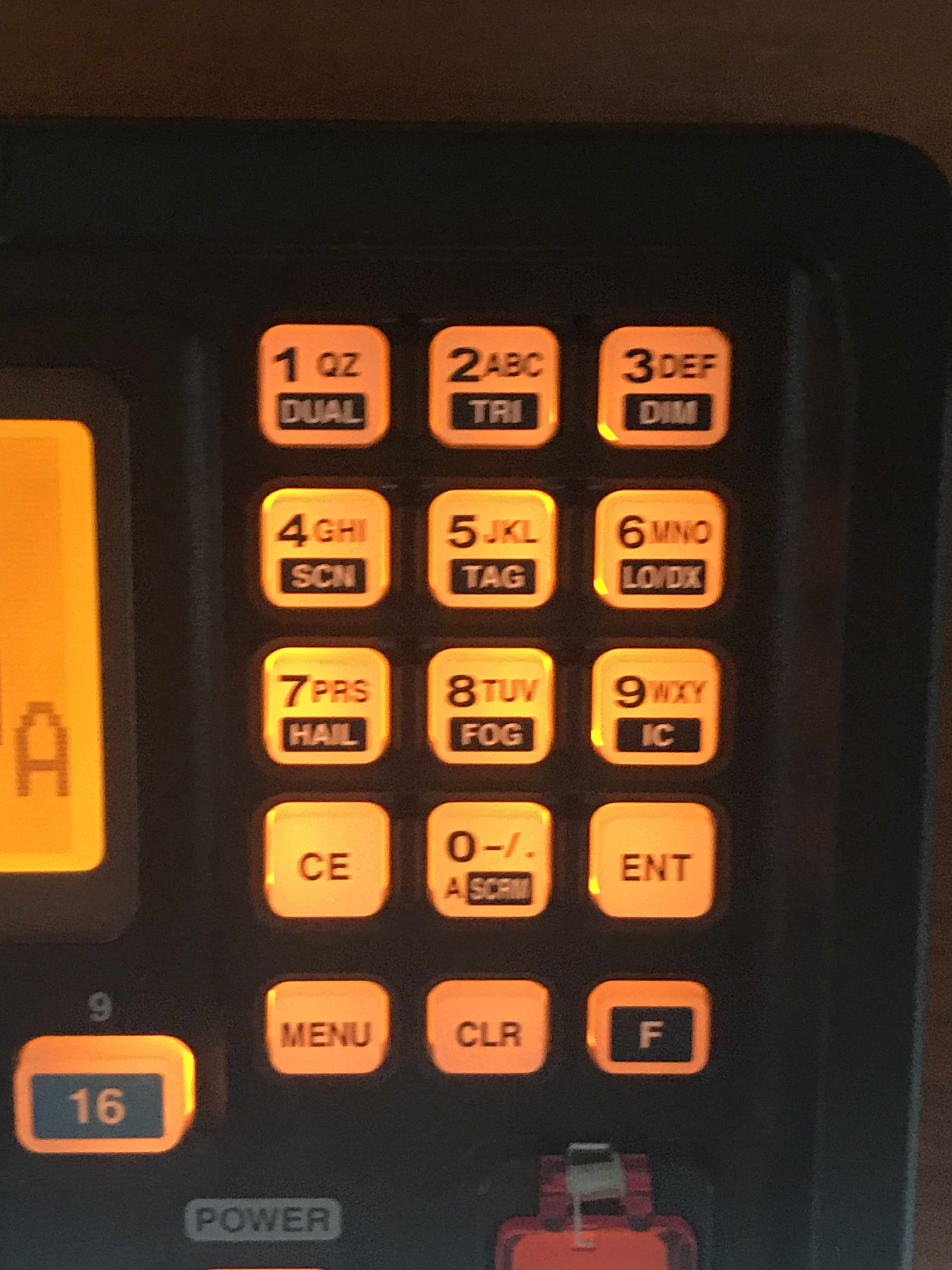
As the fog crept in on us it was time to turn on our Khalenberg automatic fog horn. If you are ever near MV Simple Life in the fog you’d think a giant tanker was bearing down on you. What made me laugh was… it stopped working in the freezing snow. With each blow of the horn it iced up more and more until it just stopped working.

Wind on the beam, Fog closed in around the boat Fog Horn wasn’t frozen yet.

Once the Fog horn froze up and stopped working it was time to go to my backup fog horn. Yes, my VHF’s loud hailer fog horn played but in the wind and snow I’m sure nobody was hearing it. Heck, there wasn’t another boat out on this day anyway. 

Function + 8 plays the ICOM VHF fog horn

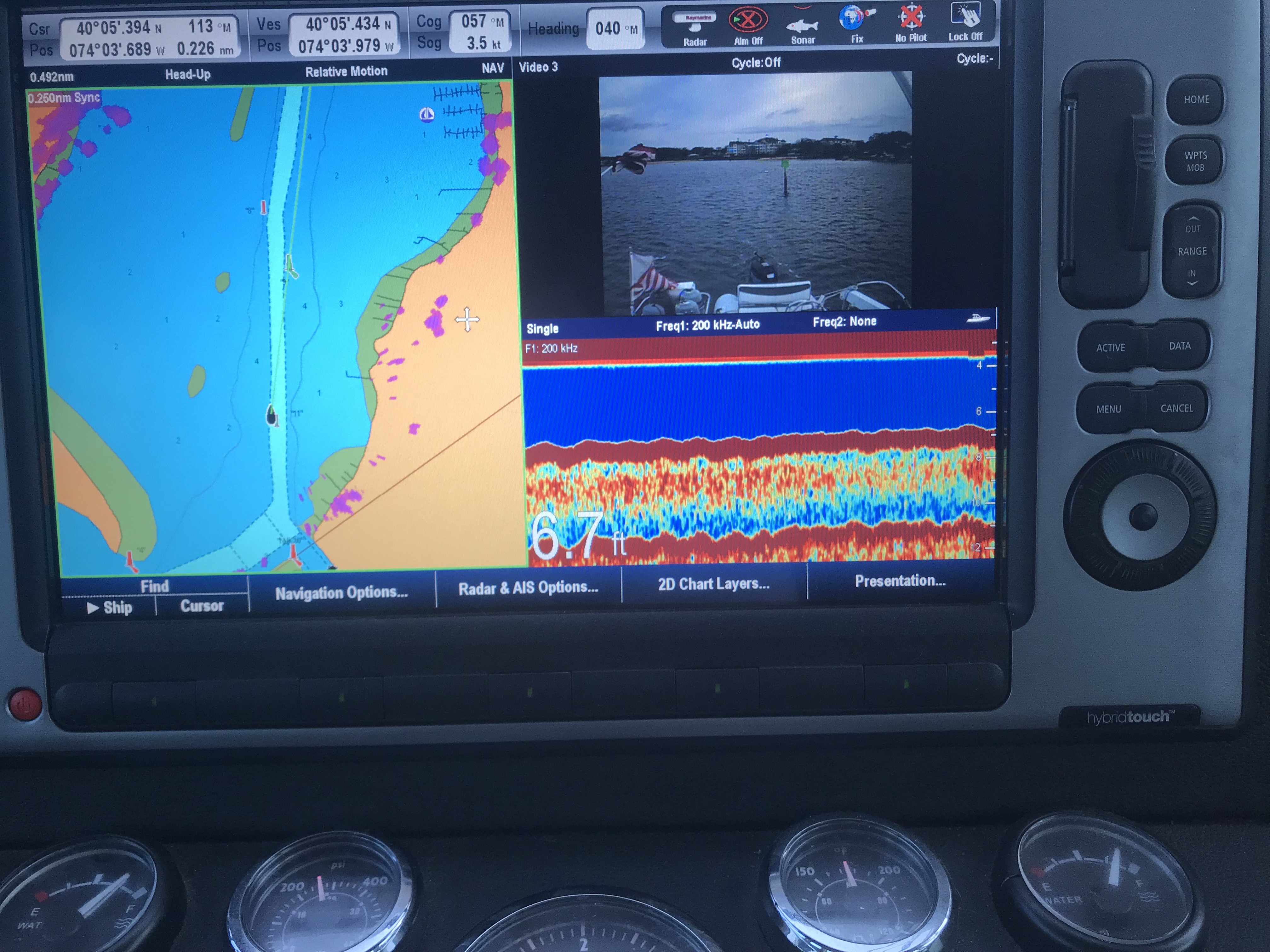
The fog had closed in so tight to the boat that we could only see a single boat length in any direction. Thankfully, we have a 4′ open array Digital HD radar with overlay right on our chart plotter that helps us identify boats from buoys. We also rely heavily on AIS (Marine Automated Identification System) to make sure we show up on the chart plotters of other boats as well as us having all the details about the boats around us (boat name, course, speed, MMSI#, etc.

We soldiered on with the idea that once we made it into the C&D canal that the weather conditions would improve. They did!

The visibility returned and the winds and waves were held at bay by the high canal hill sides. 

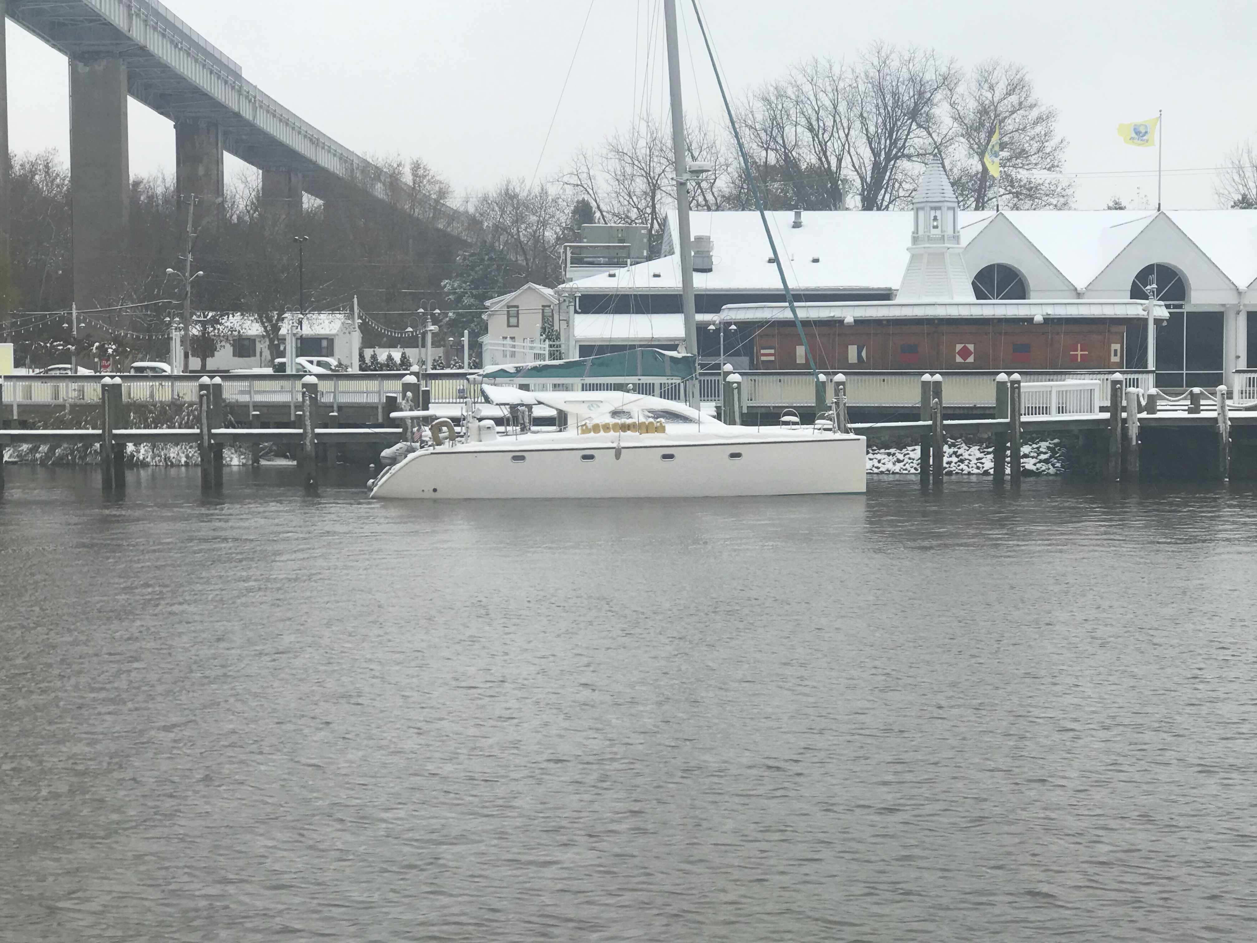
Soon we were passing marinas where the boats were covered in snow. 

Snowy Catamaran

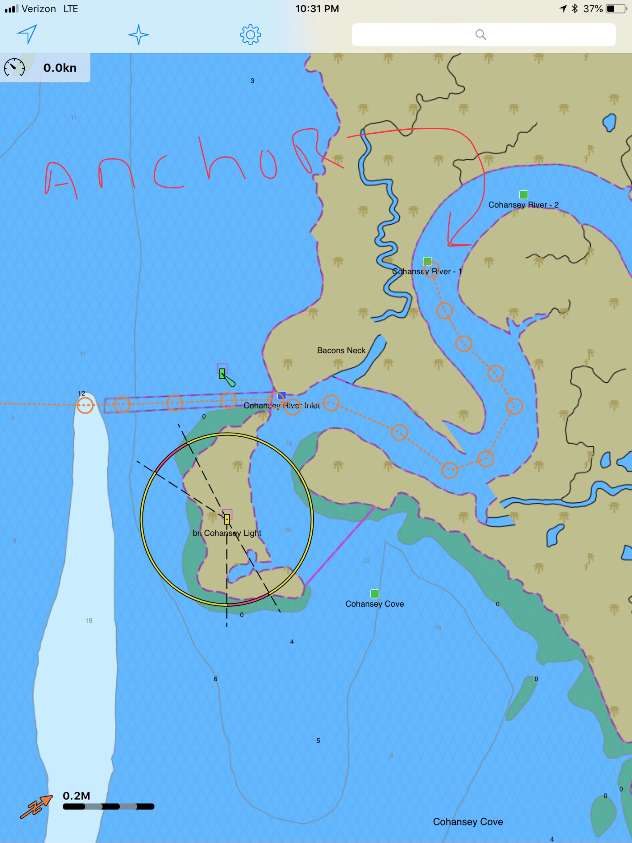
When we exited the C&D canal into the head of the Chesapeake Bay the wind was whipping up a following sea so we decided to anchor in the Bohemia River. Great plan until the depth alarms went wild when the depth dipped below 6 feet. This was not good concidering we were only minutes away from high tide. Not wanting to run aground or get stuck waiting for high-tide to return we decided to push on further to the Sassafras River.  

The sun set and we watched as the last light disappeared as we entered the Sassafras River. It’s a long trip up the river to the Granary Marina but we decided with the strong winds and rain it would be nice to sleep tied to a dock. Neither of us wanted to spend another night trying to brace ourselves in the bunk. 

The dockmaster left for the night and left us directions on how to find our assigned slip. That plan failed when we could not find our slip using our searchlight. The wind and the rain were coming down sideways and driving from the pilothouse in the dark is not a place you want to be poking down random fairways trying to find a slip. So we decided to grab any open slip and call it a night. 

Docking alone in that wind was difficult enough but when I jumped out of the pilothouse to tie up I almost slipped on the snow and wound up going swimming. 

My boat hook was buried in snow

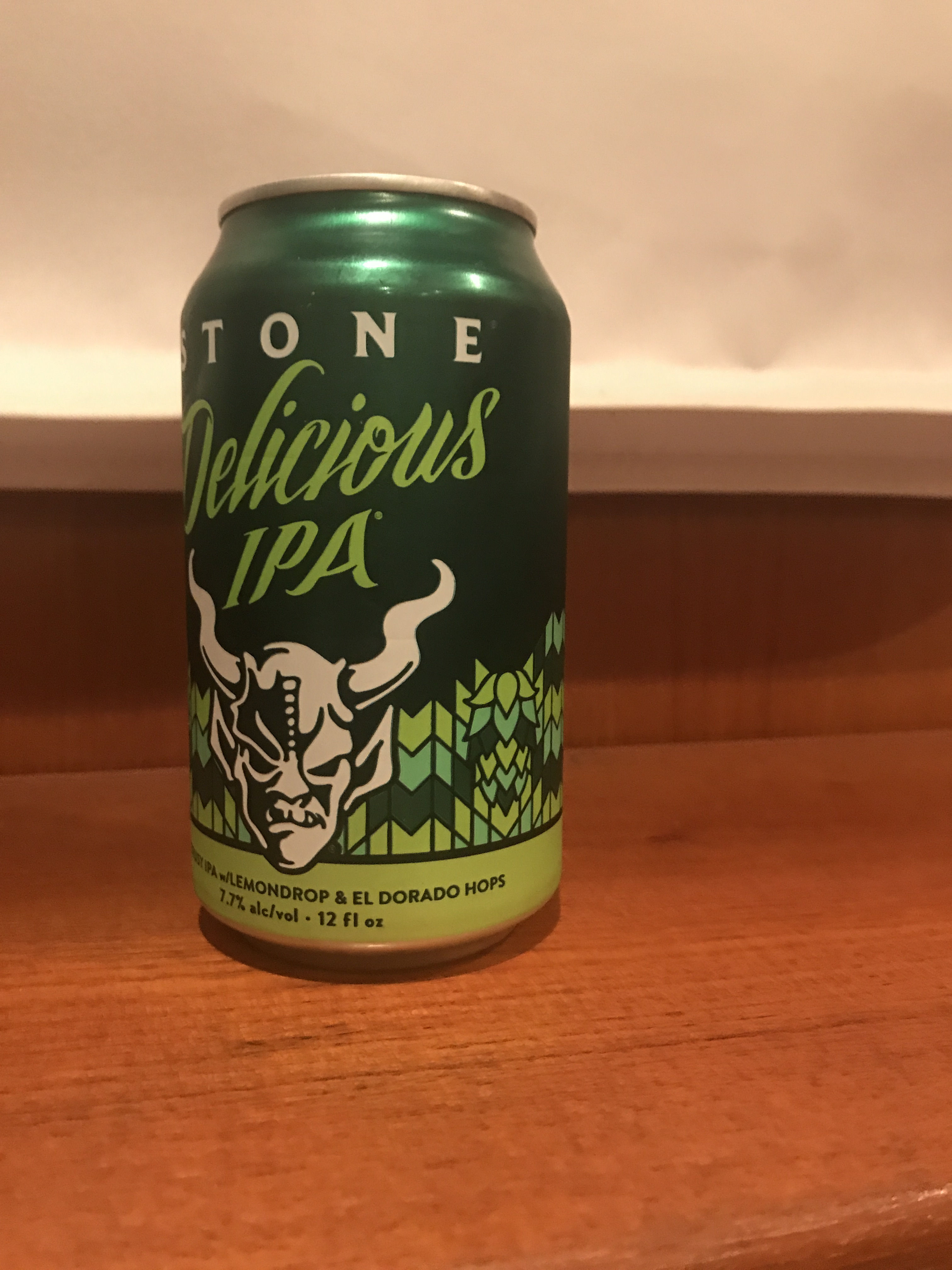
Soon we were tied up and I was changing out of my work pajamas, kicking my snow filled crocs off my frozen feet and thawing my toes by the heater while enjoying a well-deserved IPA

After 13 hours at the helm, this IPA tastes great 😉

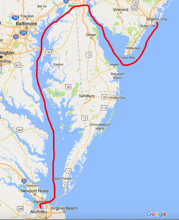
This leg of our trip is pictured below.

Winter Season #2, Leg 005

Delaware Bay – via Cape May, NJ

Dogs smell them some Maple BACON!

Well exited the Manasquan River right at slack tide which is good for reducing the currents when trying to squeeze through the narrow railroad bridge as well as the rip at the mouth of the inlet.

Manasquan Inlet Slack in 7 minutes
NJ ICW Mile 0

As we headed out the Manasquan River we looked back and saw Point Pleasant canal which is mile 0 or the start of the NJ ICW (InterCoastal Waterway).The NJ ICW ends in the Cape May entrance channel. 

Notice the 6.7′ depth 

As you work your way out of the Manasquan River be careful. My charts don’t line up perfectly with the channel’s actual location so follow the daymarks and temporary buoys and cans that are in place. 

There are two bridges on Rte. 35 and the other is an automated railway bridge. 

Approaching Rte 35 Bridge

The Rte 35 bridge gets shallow just as you are about to pass under it. So when your low water alarm goes off don’t break your focus and stay straight going through. 

 6.6′ depth just as I’m passing under it.
Normally open Railway Bridge. I heard the opening is only 48′ 

Soon we were at the inlet to the Manasquan River and we exited into the Atlantic.

Manasquan River Inlet – Leaving

There were not many boats out on the NJ coast. It is mid-November after all. 

However this FV (Fishing Vessel) Webo looked like a scene from Alfred Hitchcock’s “The Birds”. Soon I found him piloting real close up the back MV Simple Life and I swear he did it to infect us with his flock of sea birds. As he pulled away the flock split and half seemed to follow us. Kelly’s not a real fan of birds something about getting caught in her hair or something … so I just did not let her know that the birds were surrounding us. 

I could not help but notice that FV Wevo was using dayshapes to let other boaters know he was engaged in fishing. Two black cones, point to point in a vertical lines designates this. 

We also passed a fish farm or tug towing a fish pen. You need to be careful of running into these at night. 

Tug towing a fish pen

We did see one other snowbird racing south. MV Scorpio passed us doing about 11 kts compared to our 8 kts. 

This drum hazard snuck up on us and we had to adjust course to avoid hitting it. I don’t believe it was lit so keep a good helm watch at night.

Hazard Drum

Kelly is great about cooking while underway and delivered two hot bacon, egg & cheese muffin sandwiches to the helm.

Yumm

Even the dogs were licking their chops

Happy Smells Maple BACON!!

We passed Atlantic City on our way to Delaware Bay.

Atlantic City

Soon the sun went down and the overcast sky made for a dark night on the water. 

We could start to see Cape May on the horizon. 

Cape May on the Horizon

When you work your way into the Cape May inlet they provide a nice red range light that you can use to keep your boat positioned in the center of the channel. 

Red Range Light

You can see the split in the entrance channel and the range marker right at the split.

My heading line splits right through the range maker

Once in Cape May Harbor we worked our way straight through and out the Cape May canal to Delaware Bay. We anchored for the night just South of the Cape May Canal jetty. A bit of a lumpy anchorage in this wind and chop but we’ll be gone at sunrise as the stormy weather is nipping at our heals. 

Tomorrow’s forecast has 30-40kt winds were we are anchored tonight.
Today’s Leg about 100 miles. W02L004

Delaware Bay

The morning started with me readying the dinghy to be hoisted onto the flybridge. I attached the dinghy hoisting harness and untied the dinghy and walked up to the flybridge to operate the crane. I no sooner had the crane control in my hand and I looked out to see the dinghy floating away. Apparently, I had attached the lifting harness to the dinghy and not connected the crane’s hook to the harness. Oops. I had to quickly start the engine, untie from my mooring and chase the dinghy down as it was blowing across the harbor. We caught up with it just in time and used a boat hook to grab it. Crisis averted.

As we pulled out of Annapolis harbor this father, son, dog team passed us.

Guy Son 1
Father, Son, Dog Boating at it’s best

A quick check of the weather showed the SCA (Small Craft Advisory) was going to stick around for a few days.

2 SCA.PNG
SCA

As we proceeded North up the last bit of Chesapeake Bay you see many structures like this.

3 Structures in CB
What is it? I dunno?

A quick check of the currents showed me that I better increase my speed to prevent an unfavorable current while transiting the C&D canal.

4 CD Currents.jpg
C&D Canal Current Table

Entering into the C&D canal you see many interesting sights.

When you study the charts you’ll see things that cross canals like bridges and overhead power cables. When I saw an “overhead pipeline”, I was intrigued.

I also so these lighted poles that I’m guessing make navigation easier at night. These poles will also generate radar pings in areas where the canal is shallow. Without these light poles, you could imagine a ship accidentally straying outside of the dredged channel in the areas where the shoreline extended far from the channel.

CD canal lights
C&D Canal Lights

Soon we exited the East end of the C&D Canal and we turned South down Delaware Bay.

South
It’s frustrating to spend two days heading South when you are trying to get North

As we approached our anchorage the sun began to set and I was so busy trying to navigate in the small cut on the West side of the barrier island that blocks the entrance to the Cohansey River. I was so busy at the helm, I could only manage a single picture.

Sunset
Sunset in Delaware Bay

Soon we were anchored in the Cohansey River and the waves of Delaware Bay were held at bay by the river’s banks. While the river has a strong current, the river bottom has proven to have good holding power.

Delaware Bay has some interesting facts. It is home to many horseshoe crabs and their numbers are dwindling due to horseshoe crab harvesting. Not for eating, though you can eat their eggs or roe but for their blue blood. That’s right, horseshoe crabs have brilliant blue blood due to copper that carries oxygen in their bloodstream. This is very similar to the red hemoglobin that carries oxygen in our human bloodstream. Research scientists in the medical field harvest their blue blood for it’s ability to react to the presence of bacterial endotoxins. This unique ability allows medical professionals to detect bacteria in many places.

Horseshoe-crab-blood-harvest-11
Harvesting the Blue Blood of Horseshoe Crabs

Delaware bay is also home to the Red Knot bird. The red knot has one of the longest migrations of any bird. Every year it travels more than 9,000 mi (14,000 km) from the Arctic to the southern tip of South America. The exact migration routes and wintering grounds of individual subspecies are still somewhat uncertain.

Red Knot
Red Knot – A.K.A. Calidris canutus rufa

Lastly, Delaware Bay is home to a phenomenon called “Sand Waves”. This is where the sand on the bottom of the bay forms a wavy bottom surface. The wave patterns that sets up are static and have reached an equilibrium. The sand waves cause larger water waves on the surface. It’s interesting to see on your sonar picture as you go over the top of these sand waves. We saw this very same sand wave phenomenon on our sonar at the mouth of Chesapeake bay.

Sand Waves Chart
Sand Waves Depicted on my Chart

Sand Wave SF Bridge
Sand Waves West of the San Francisco Bridge

Chincoteague Island, VA – Where are the Ponies?

We awoke around 4AM this morning and I began pouring over the charts until I felt comfortable that we could safely make the passage down the outside passage to Norfolk, VA in 4 separate legs. By staying outside we will save days if not a week of traveling inside through the Chesapeake. While we would like nothing more than to spend months exploring all the great places in Chesapeake Bay, right now we could go for some Key West sunshine.

The other day we left Atlantic City and motored past the mouth of Delaware bay, I just could not bear to make a starboard turn and head up the Delaware Bay. This would mean heading North rather that South. In order to take the inside passage you must first run North up the Delaware Bay till you get to the C&D canal that connects the head of Delaware bay with the head of Chesapeake Bay. Once in Chesapeake Bay you again start heading South. It’s quite a bit longer than simply staying outside in the Atlantic Ocean.  It’s also more work for the captain, who must stay vigilant to avoid other boat traffic as well as steer around lobster pots. Nobody likes getting a lobster pot line wrapped around their propeller. We installed a “shark” pot cutter in front of our propeller to hopefully chop any lines that tangle in our propeller.

shaft shark
“Shark” Pot Cutter in Front of Propeller (Similar to MV Simple Life’s Setup)

Inside Passage Map
Inside Passage – Up Delaware Bay, Through C&D Canal and down Chesapeake Bay

4 legs map
Outside Passage – 4 Legs, 2 Anchorages

The more we studied the few inlets along the outside passage, the more we realized that many of them were possibly full of shoals and shallows to be worth trying to enter. There were some that if we did enter the inlet, it was clear that once inside it we could easily run aground due to the shallows that abounded. It was also very evident to us that our 2012 electronic charts no longer match the current depths and shoal locations. I use the charts as a “guide” but keep a close eye out for breaking waves where a new shoal may have formed due to recent storm activity.

We arrived at Chincoteague Island sometime around 1PM. The journey here was pretty uneventful. We saw only one other boat and it was a large sport fishing yacht moving at twice our speed South down the coast.  We studied the charts and found a nice spot to drop hook, close to the shore. MV Simple life has a 90 lb. Rocna, plow style anchor and 300′ of 3/8″ chain. I let out almost 120′ which was a ridiculous amount of scope (“anchor scope” is a ratio like 7 to 1: length of chain compared to depth of water). If we were in a crowded anchorage we’d never be able to let out that much scope as when the wind changed direction we’d swing into other boats. Along this coast there is not another boat in sight. After the anchor hooked up I applied some throttle in reverse (+200 above idle, or 800 RPM) which combined with the strong wind, buried the anchor. The extra throttle  lifted the chain straight out of the water with no bounce. We believe you should always “back down” on your anchor and watch to see if the chain jumps up/down which is a clear indication that the anchor is dragging along the bottom. This can happen for many reasons but some possible causes can be the seabed could have eel grass that stops the anchor from “digging in” or the bottom might not be sandy but instead a super soft silt that is like pushing a potato chip through whip cream instead of thick cheese. Better to have your anchor drag while you’re backing down on it than when the wind picks up in the middle of the night and you are fast asleep.

Chinoteague map
Red X is Where we Anchored – Off Wallops Island. Chincoteague outlined in Red

After reading about the wild ponies on Chincoteague Island, I made up my mind to use the crane and drop the dinghy in the water to go find them ponies. I had no sooner raced off on the dinghy before I thought.. I’m freezing & I’m zipping along over the shallow shore and could easily run aground at full speed and wind up taking a dip in the cold Atlantic. So I put a lifejacket on and turned around and made it back to the Simple Life. DAMN, NO PONIES!!!

Back at the boat the heater was on and I quickly put the dinghy back on the flybridge and warmed up to an IPA 😉 That brings me to where I am now.. sitting in the pilothouse enjoying a beer or two. We’ll leave you with our sunset view — good night.

Wallop Island Sunset