Cumberland Island to Pine Island

It’s 3AM do You Know Where Your Boat is?

It’s 3AM, the wind is gusting and I’m up checking weather and tides.

It’s almost low tide and I’m anchored in a narrow creek with the wind blowing me towards the creek bank. Oh great, I only got another 3 hours and 19 minutes till the that burning disc comes up.

The USCG Gale Warning is still in effect till about noon today.

USCG Gale Warning Still in Effect

Into the Mystic

OK, the sun is up and I’m underway with that still ominous sky above me.
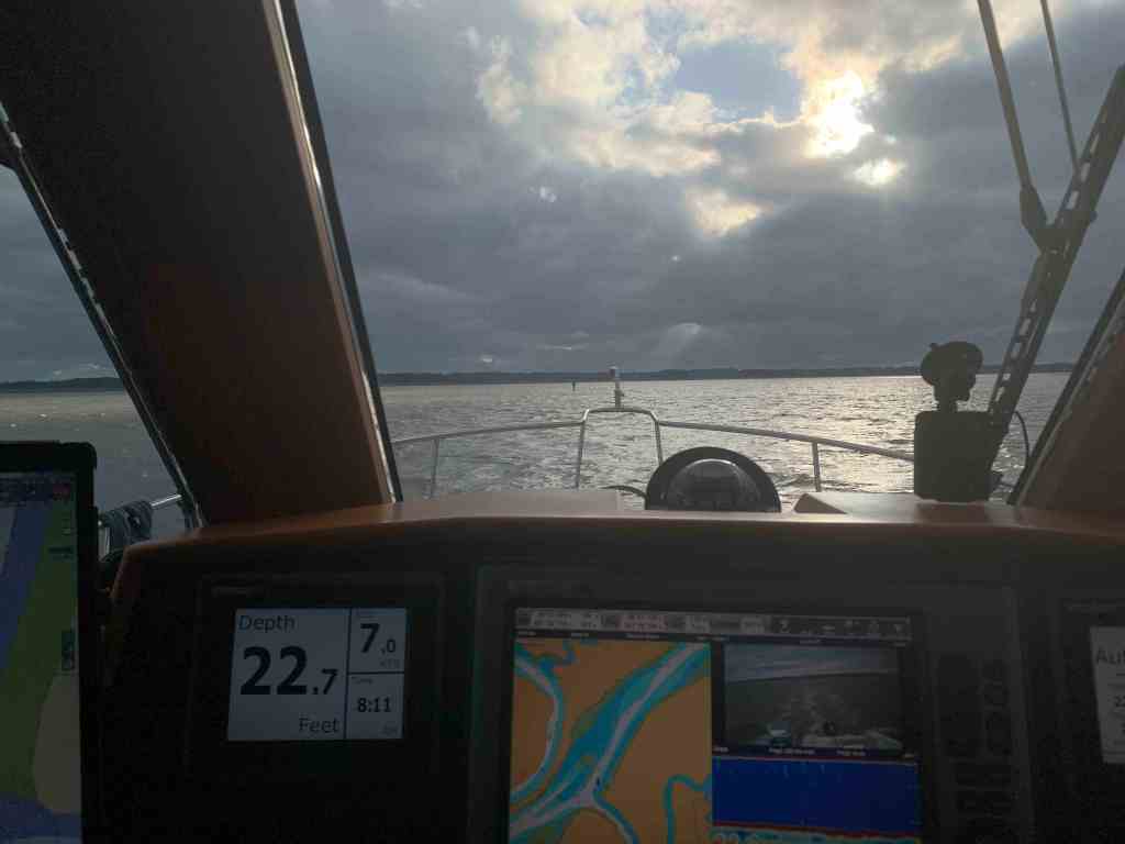
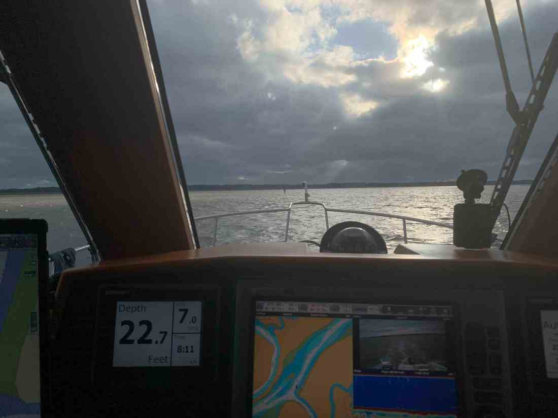
The offshore cold front has dropped the temp. Fog is building on the waters surface. It’s a strange thing to be piloting straight down a river that has the fog blowing by you from behind.

King’s Bay Naval Base

At the end of the above video you can see the USCG boat appearing out of the fog. Below is a video of them circling around me before hailing me to explain that the US Navy was carrying out exercises in Cumberland Sound that could interfere or damage my electronics if I got too close. They wanted to know what my intentions were. I explained that I was an ICW boater and would be crossing Cumberland Sound bound for the Amelia River in Fernandina Beach and points south. They politely asked me to stay 2000 yards from the naval ships or as far away as possible while still safely navigating.
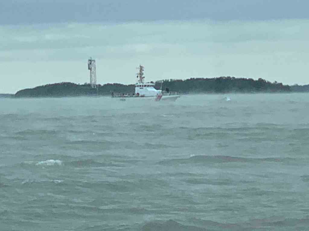
USCG Approaching MV Simple Life
USCG Boat moored on the CG mooring ball near entrance to Amelia River

Cumberland Sound is home to the King’s Bay Naval Submarines Base. There are six Trident-class submarines stationed here.  There is a a long deep channel cut through the shallow coastal shelf and muddy tidal Cumberland Sounds, to the Atlantic ocean. This allows for the submarines to pass. Every time I cross Cumberland Sound I have interactions with the Navy security boat or USCG. Recreational boaters are not permitted in the King’s Bay area west of the ICW Channel.

Entering the Amelia River I passed this USCG boat.

USCG Boat in the Amelia River

Welcome to Florida!

The St. Mary’s River divides Georgia from Florida. The town of St. Mary’s is on the northern Georgia side of the river and Fernandina Beach is on the southern Florida side. When you sail into Fernandina Beach you’ll find the WestRock Industrial wood pulp plant and CHP (Combined Heat & Power) plants along the shore. Industry began here after the great depression with a wood pulp plant. Now there is a cluster of both power, wood and packaging plants located here partly due to the railway and harbor.

I think it was Hurricane Matthew that caused a lot of damage to the Fernandina Beach area and boats.
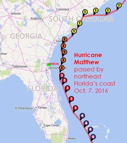
Hurricane Matthew Oct 2016 just offshore of Amelia Island

MV Acadia had followed me through the Navy exercises area and was now breaking off to go anchor in the Amelia River. I’ve anchored in the Amelia River a few times. Today however, I planned to use of all the daylight to get south of Jacksonville, FL. That would allow me to make Daytona Beach the next day.

FV Gina Ann with all her gear proudly displayed

I often see this police line-up of birds on the shore. I wonder why they group like that?

Birds of a feather…Line up together

It was lunch time and I have to keep the boat moving so I bring all my ingredients to the helm and make my lunch while I drive.

Soon I came to Jacksonville, FL and I cross over the St. John’s River and into Pablo Creek heading south. There is a tight bridge that I have gone under many times but as I approached it I could that the strong current was producing 2-3′ standing waves on the down current side of the bridge.

Pablo Creek Bridge Jacksonville, FL

I use a user sourced digital cruising guide called Active Captain to keep me aware of all the marinas, anchorages and hazards along my route. Below I pasted my review of the AC strong current hazard located at Pablo Creek bridge.

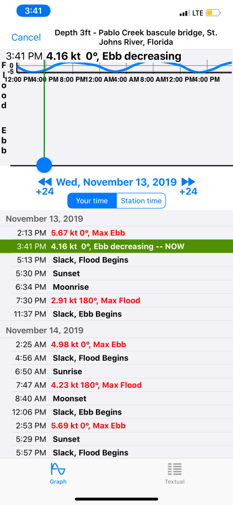
Please note: There is a current station for this bridge. In order to see it in Aqua Maps, I had to zoom way in. It was hidden under the tide station located just north of the bridge. The current station is named. “Pablo Creek bascule bridge”. 

I have been under this bridge 4 times without concern. This time I hit it right at max ebb 5.67kts on a full moon with strong opposing winds (gale warning ended 2hours earlier). There were 2’+ standing waves on the down current side of the bridge. The strong current was catching my full keel causing me to make huge port and starboard rudder corrections. 

It’s narrow between the bridge fenders.  With no boats behind me… I kicked it in neutral and it spat me out like a toddler does to their first taste of broccoli. 

I chose to anchor in the Active Captain Anchorage called “Atlantic Blvd Br.” Just NE of the bridge. I waited for it to slow down a bit. Waiting meant I’d have to burn more fuel to get to my chosen “Pine Island Anchorage” before dark. I’d rather pay a fuel bill than a fiberglass bill. Be careful if you are a full-keel trawler with low power and/or a small rudder. 

Capt Mahty
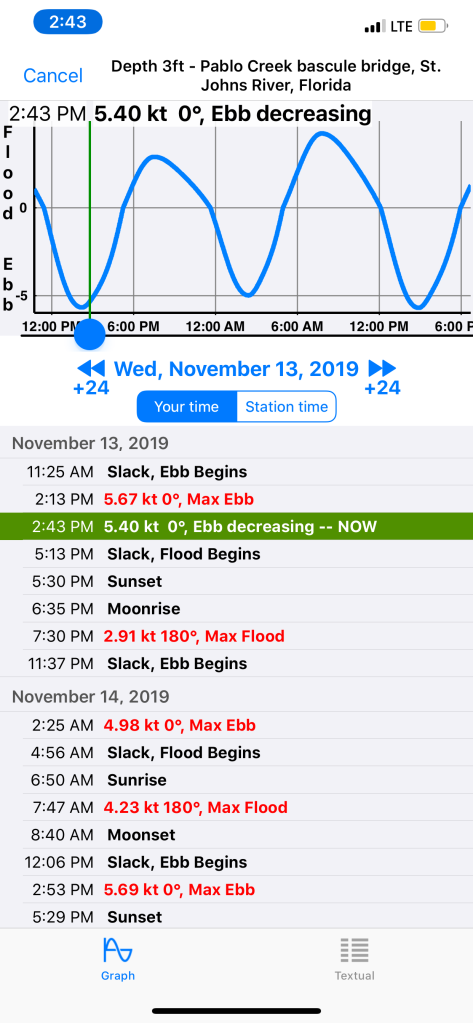
Waiting for the current to slow slightly had cost me time and I would not make it to my chosen anchorage until dark. I still say it was the right move rather than risk getting slammed into the bridge’s fender boards.

This leg of my winter journey looked something like this.
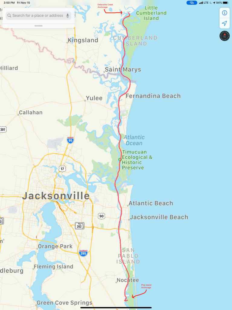
Wo3L018 – Winter 03 Leg 018

Fernandina Beach Florida

I awoke at 4AM before any of the crew. Neither Happy or Brody came out from under the covers to join me. We are in Georgia and it’s only 40 degrees when I awoke.

Heck, the temps were going to fall deeper before the 7:13AM sunrise.

Underway in the dark 6:14AM

By 6:30AM the sky was starting to lighten up on the ICW.

Looking East where the sun will rise

I decided to walk out on the bow while underway and snap a picture and a quick video before sunrise.

Not quite Sunrise

Once the sun rose you could see it burning the face of the daymarks as we passed. 

It’s high tide and the rivers are swollen around here. Daymark almost underwater. 

When you are at the helm for hours the internet is your entertainment. I was watching Mike-the-Drunken-Donkey from Mike’s Weather Page broadcasting FB Live video stream. I tuned in as Mike taught about weather and what to expect from the winter storm making its way across the US. 

Thankfully, MV Simple Life will be in Florida by the end of the day

We were amazed at how flat calm the ICW was as we pushed along at 7 knots. 

At the helm I’m wearing my work pajamas because it’s still a bit chilly even with the diesel heat on. Happy just figured out that there is HEAT coming out of that little black round duct below the AC panel door. She parked herself right under my feet to steal all the heat.

Heat Hog

We were making incredible time as we approached Cumberland Island in Georgia.

SOG (Speed Over Ground) = 10.4 knots

10.4 knots because we were enjoying a strong current on our stern. 

Then as we looked out, we could see a current line on the surface of the water. 

Opposing currents meeting causing white chop

We feared as soon as we crossed this line that our 10.4 knot speed would begin to erode. We could never have guessed just how much.

Strong Current on the nose. 10.4 => 3.9 knots

Knowing we would face this current from our trip around Cumberland Island we attempted to ride close to shore looking for an eddy current (reverse direction). But alas it was no use. We had a long slow ride around the island. 

Then it happened. We crossed over the state line into Florida’s Amelia Island A.K.A. Fernandina Beach. As we passed we saw a ship that looked like a member of the Sea Shepherd fleet. We snapped a photo on the way by and low & behold, it was a Sea Shepherd ship. 

Sea Shepherd’s – MV John Paul Dejoria

Kelly & I have always been fans of ocean conservation and the crew of Sea Shepherd work hard to keep our oceans and their inhabitants safe. 

We are currently anchored in the Amelia River just over the GA-FL state line. 

Sun is setting in the Amelia River as I finish this post

Today’s leg looked something like this finger drawn route. 

W02L021 – Darien, GA to Fernandina Beach, FL

Jacksonville Florida

Breakfast in Delaroche Creek, griddle style. YUMM!

We don’t know if we are gaining or losing weight? We don’t have a scale onboard. I’m sure cooking my favorite breakfast this morning is not helping but how can you say no to hash-n-eggs with wheat toast?

Our trip today took us from Delaroche Creek (about the middle of Cumberland Island, GA) to Jacksonville, FL.

On our way into Cumberland Sound the VHF radio crackled with a warning from the US Navy. There was a warship in the area and they advised all vessels to heed the 500 yard perimeter around the ship. M/V Simple Life does not have guns or armor plate so we made our way cautiously into Cumberland Sound with two other boats, “S/V Whiskey Me Away” and “M/V Redtail”.

M/V Redtail (pictured below) appears to be a 42′ Kadey Krogen which is similar in size and style to our 43′ North Pacific raised pilothouse. Kelly and I love the classic lines of a Kadey Krogen.

As we approached Kings Bay, this Navy patrol boat with blue lights flashing moved out of my way after we hailed them on 16. (Note the machine gun on the bow)

We passed some sort of observation tower (maybe connected to the Navy base or the nearby plant/factory?)

Next it was into the Amelia River near Fernandina Beach. As we made our way South along Amelia Island, the current was strong and there were many sights to see.

The mast pictured above was the only thing sticking above the water of this boat.

This sailboats keel was missing as she laid on the shore.

Below this Amelia Research and Recovery vessel was jacked out of the water on pilings. Note the black marine day shapes on her pilothouse roof. They are signaling her as “restricted in her ability to maneuver”.

Pictured below is a guy on some kind of tiny single chair dingy with a cooler. He seemed to be enjoying himself just cruising around.

The barge below passed us with what looks like vessel debris from Atlantic hurricane season 2017 and especially hurricane Irma which hit Jacksonville hard.

Three simultaneous hurricanes active on September 8, with Katia (left), Irma (center), and Jose (right), the first such occurrence since 2010.

Below is a boat that landed on the shore. She appears in good shape but I would not want my propeller and thru-hulls sitting in the mud like that. Especially when the tide comes back in and the wakes are rocking the boat.

A Tip of the Hat: Navigating around the shallows in this area was made easier by the .gpx downloadable routes provided by Mr. Robert Sherer. Bob and his wife Ann have a great Fleetwing sailing blog that I follow. Bob has been cruising the ICW for a few years now and helps other sailors avoid running aground.

Even the crab pots seem to find themselves aground at low tide.

When we arrived at our planned anchorage, it was clear that it was far too narrow for us to be able to anchor in for the night. We pushed on and tried several other anchorages but they were either full like the free-docks in Jacksonville or just extremely exposed to current, wakes and wind. We made the decision to go up the St. John’s River as the sun was setting. I quickly realized that this was not a good idea when I felt the strong current that was running against us. There was also large commercial traffic moving swiftly down current. This tug and barge that hailed us by name before the captain ever saw us. The captain was able to do this because of the AIS (Automatic Identification System) that Kelly & I installed. You don’t want to be stuck in that current in the path of something like this when the current is pushing her hard at you.

AIS made us aware in time to stay out of her path.

We did not want to wind up like this poor motor yacht along the shores of the St. John’s River.

We scoured the charts looking for a good location that would protect us from this strong current and picked the backside of an unnamed island near Jacksonville center.

The only challenge was there was not enough water for us to enter. It was too shallow. With the sun quickly setting, we probed to find a way in. The first two attempts had the bow pushing into a soft silty shoal. The third attempt and we found a way over the shoal with an inch or two to spare. We quickly found our way into deeper water behind the island. We anchored up and it turned out to be a wonderful peaceful anchorage for the night.