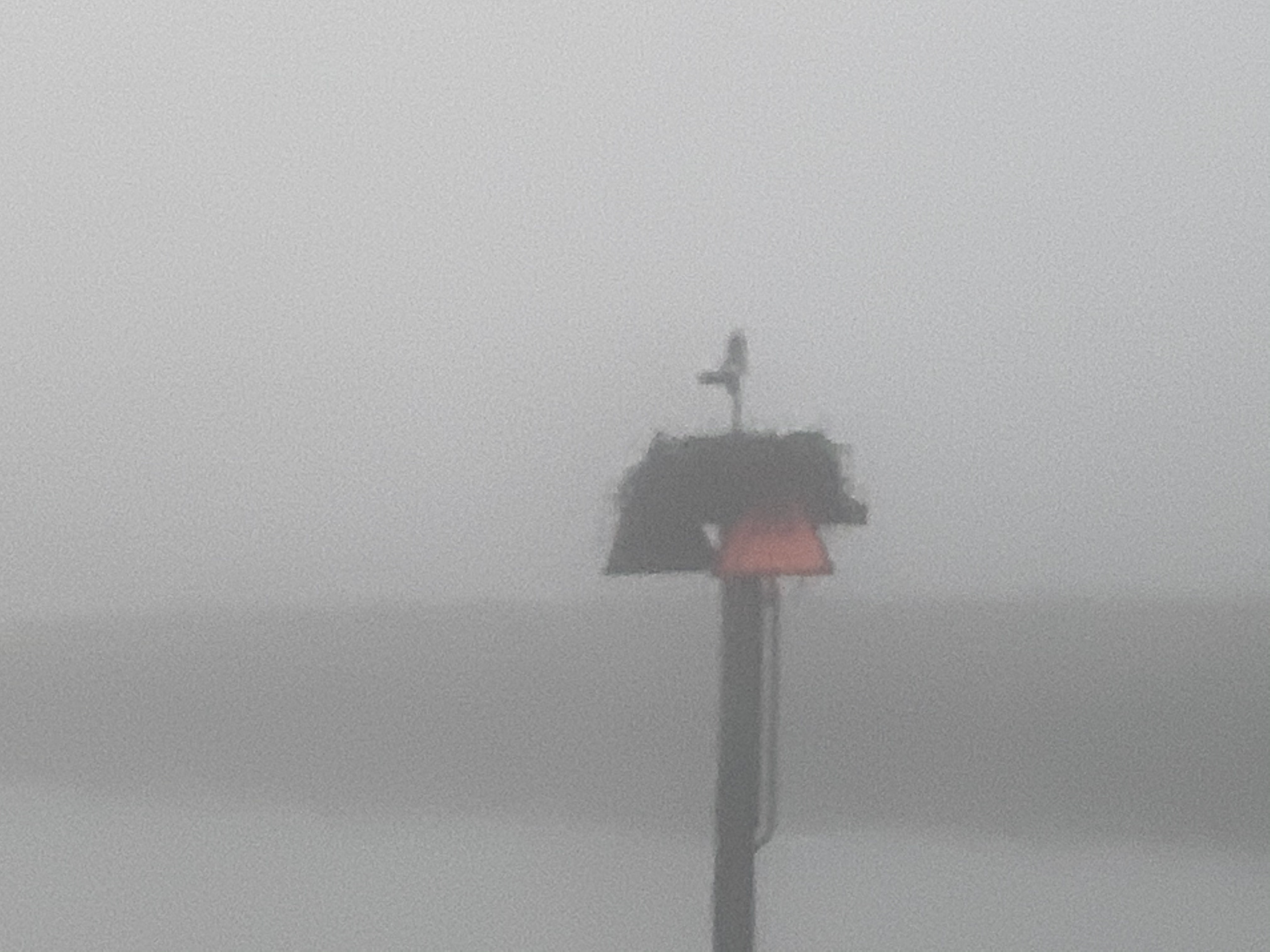
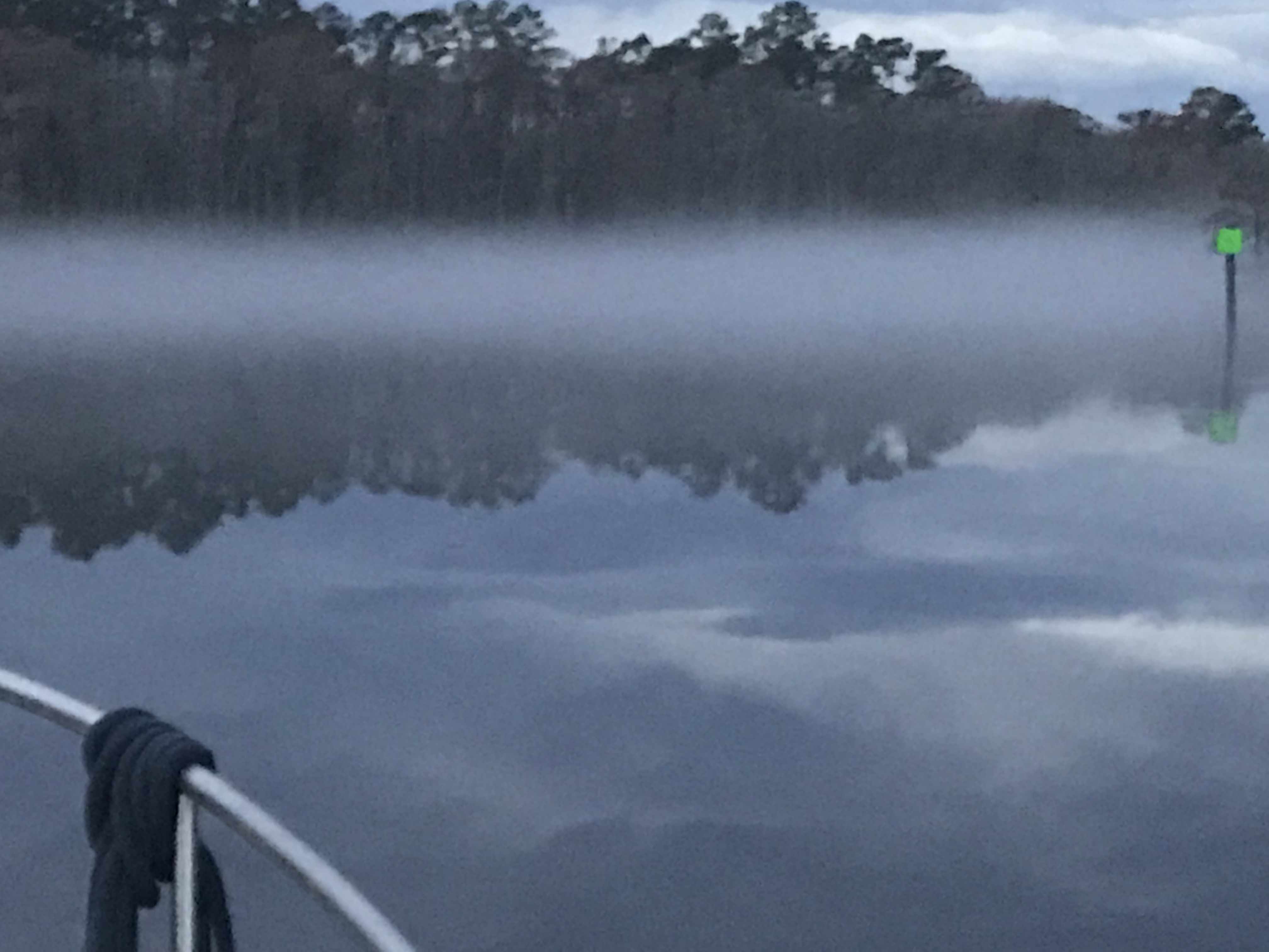
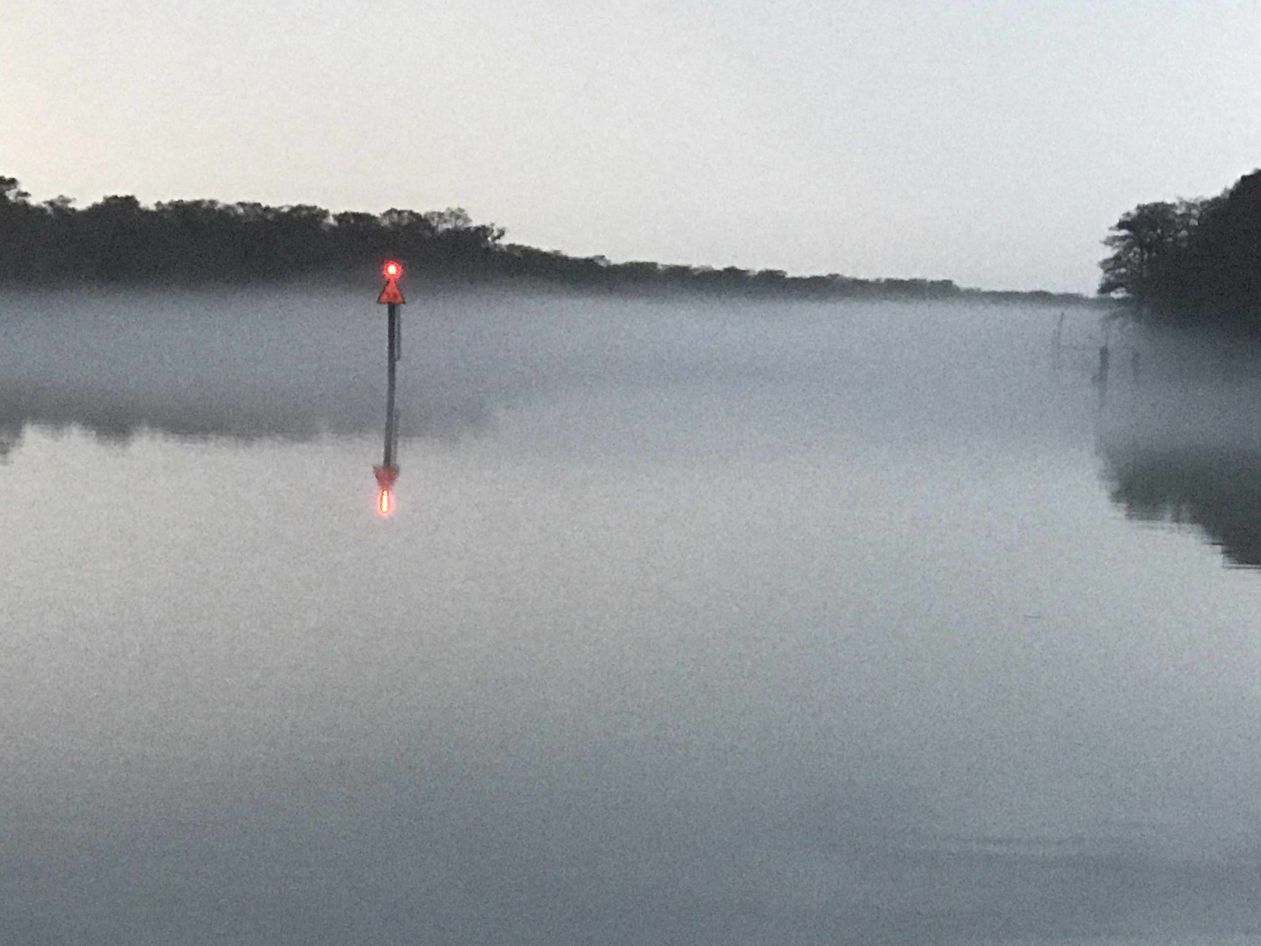
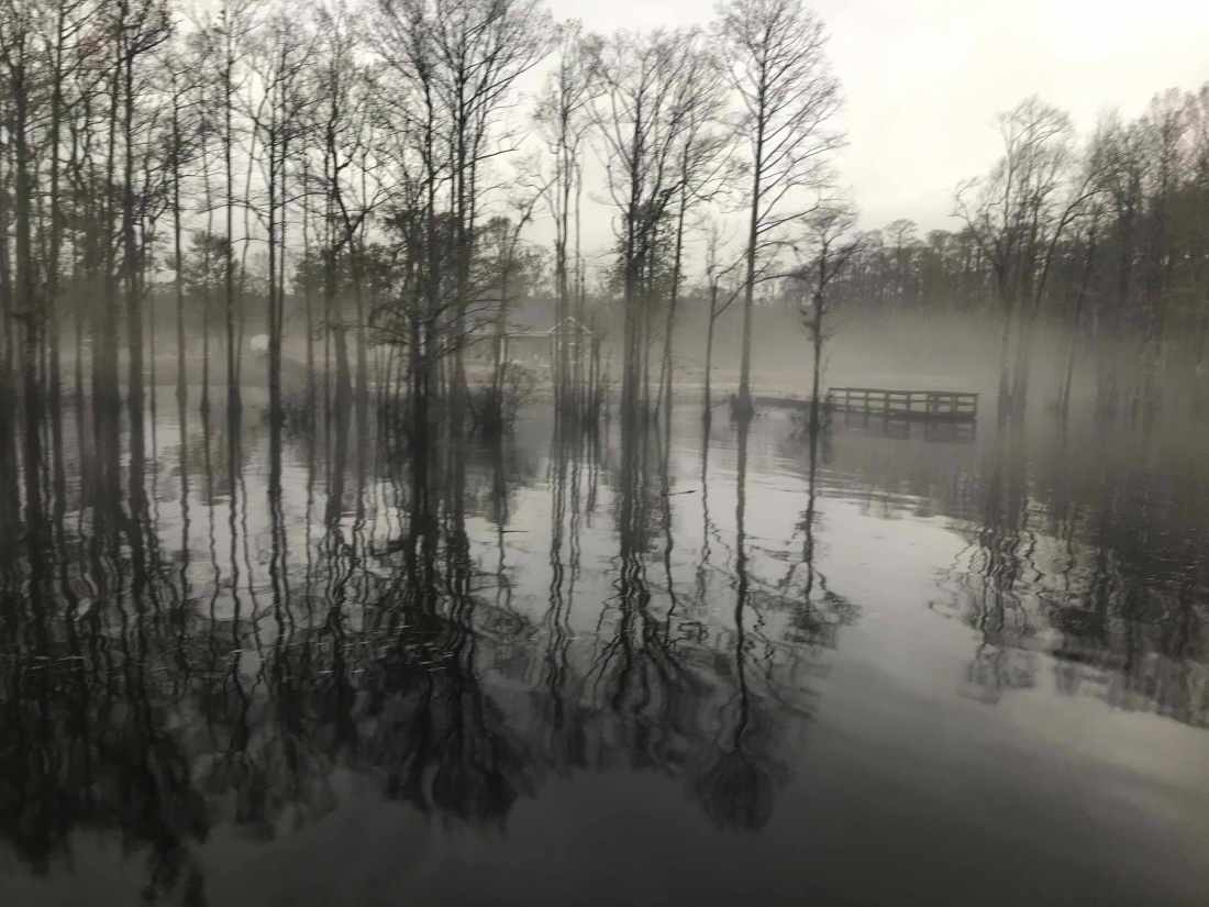
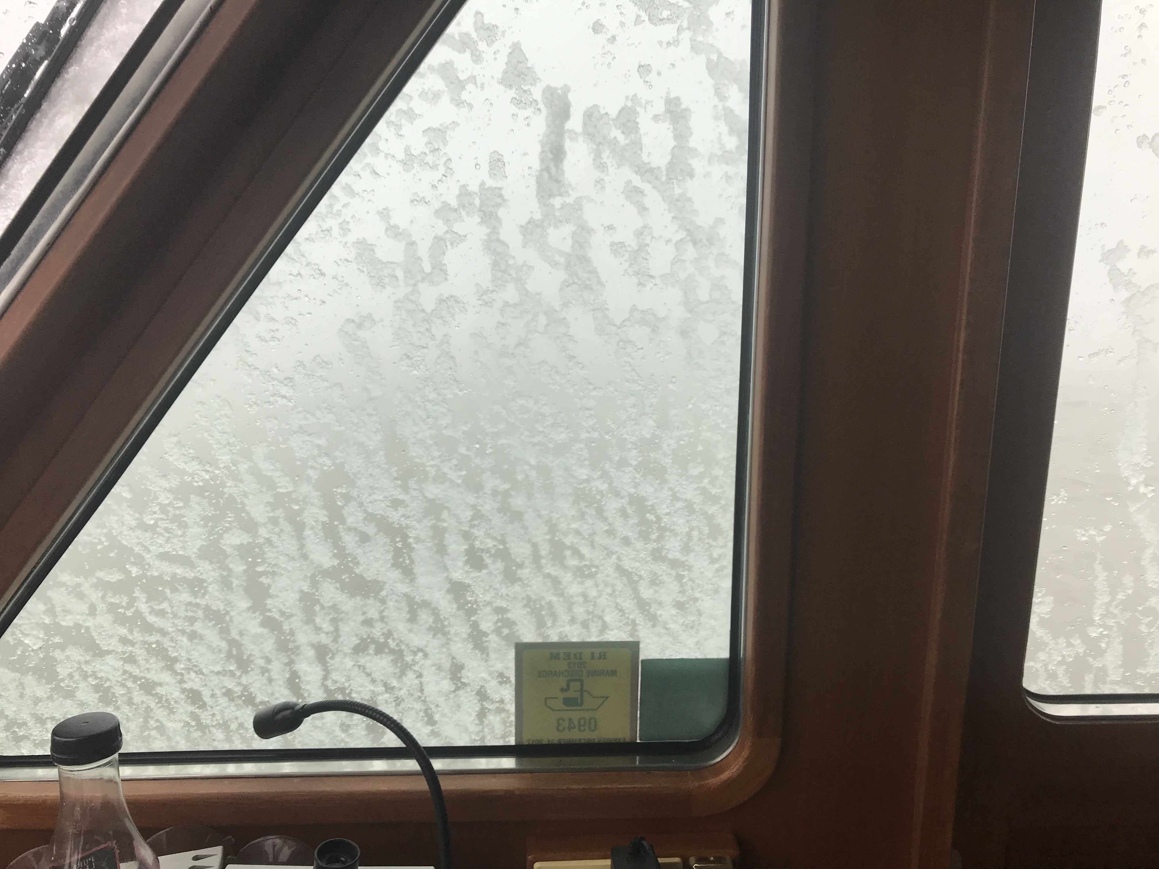
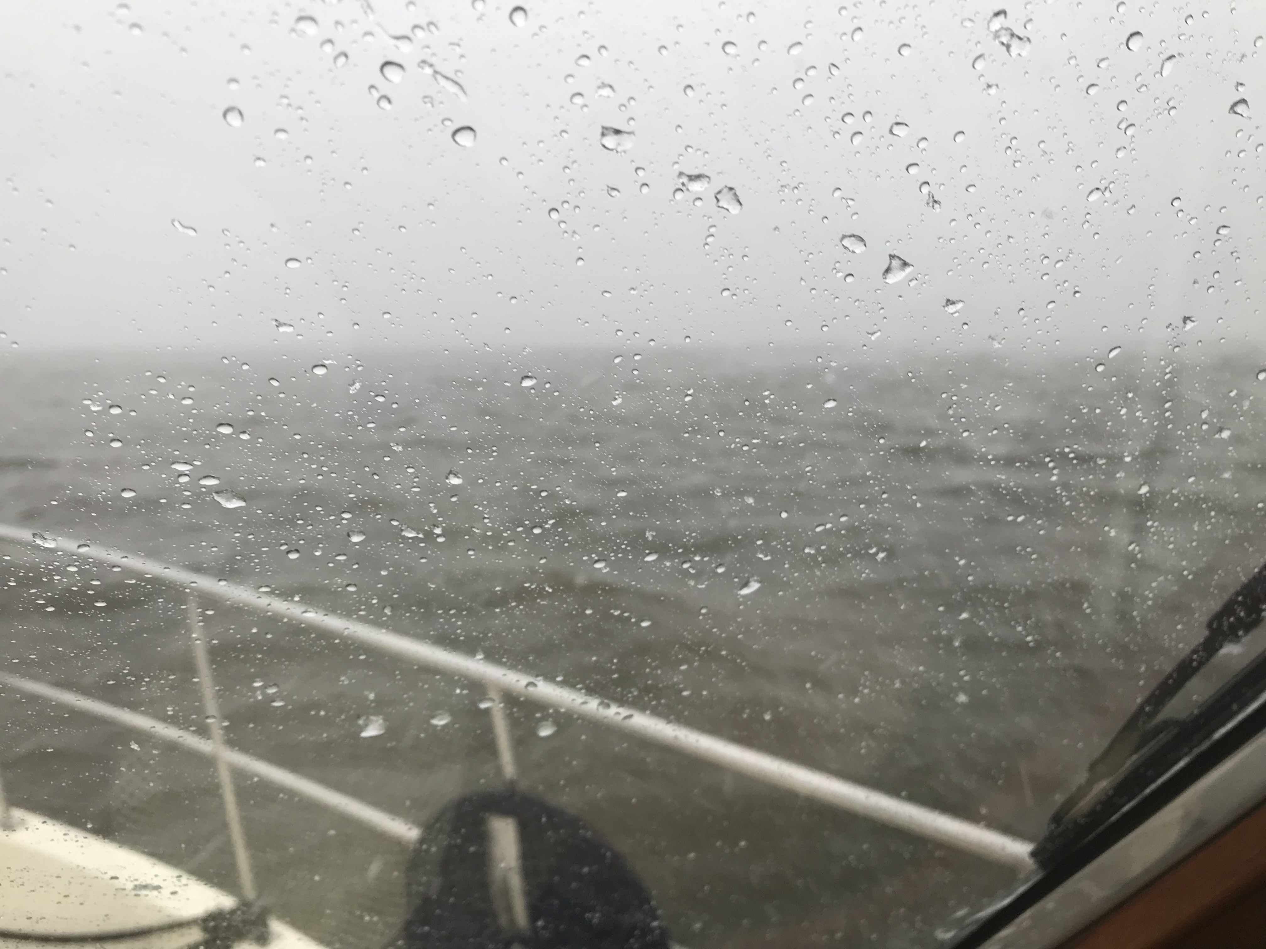
Anchor in the Alligator

Morning Fog

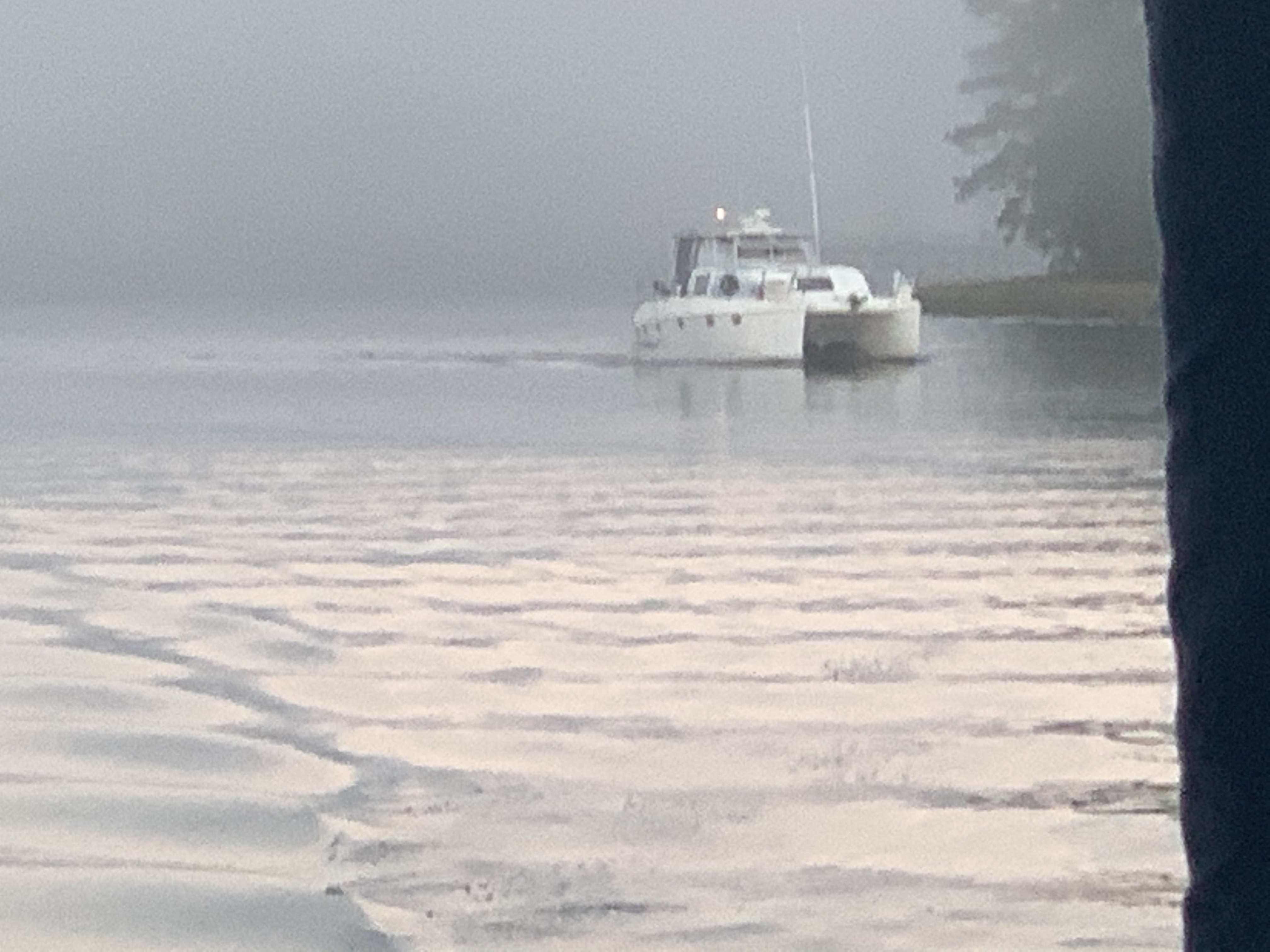
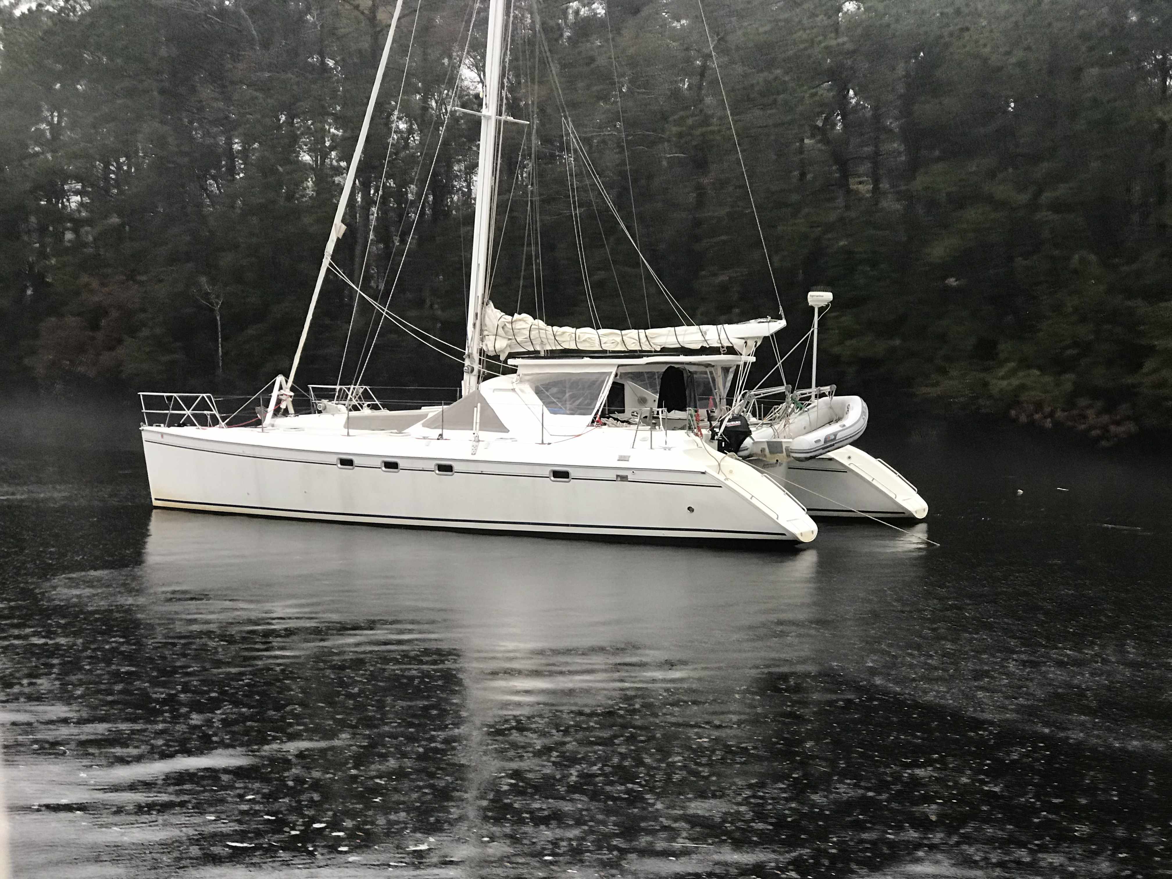
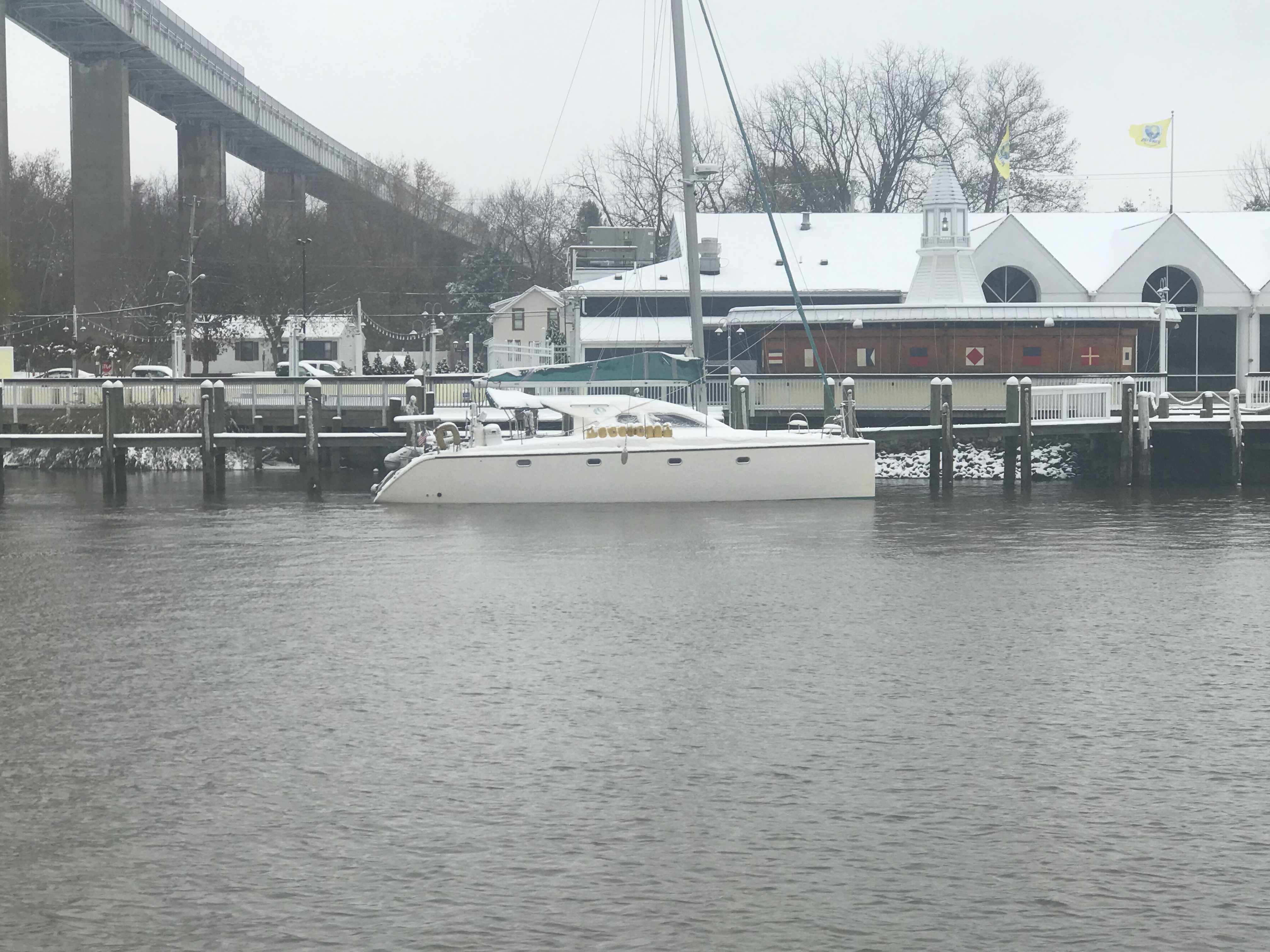
Simple Life pulled away from the dock around 6:20AM. I was drifting in the river while I stowed my lines and fenders. Once stowed I pointed the boat south through the morning’s fog. MV Effervescence IV had also pulled away from the dock and had taken up my stern .I captured a few seconds of the morning’s fog on my phone.

Morning Fog on the Elizabeth River in Virginia

Sound Signals

As we moved through the fog I had my airhorns blasting on long every two minutes.
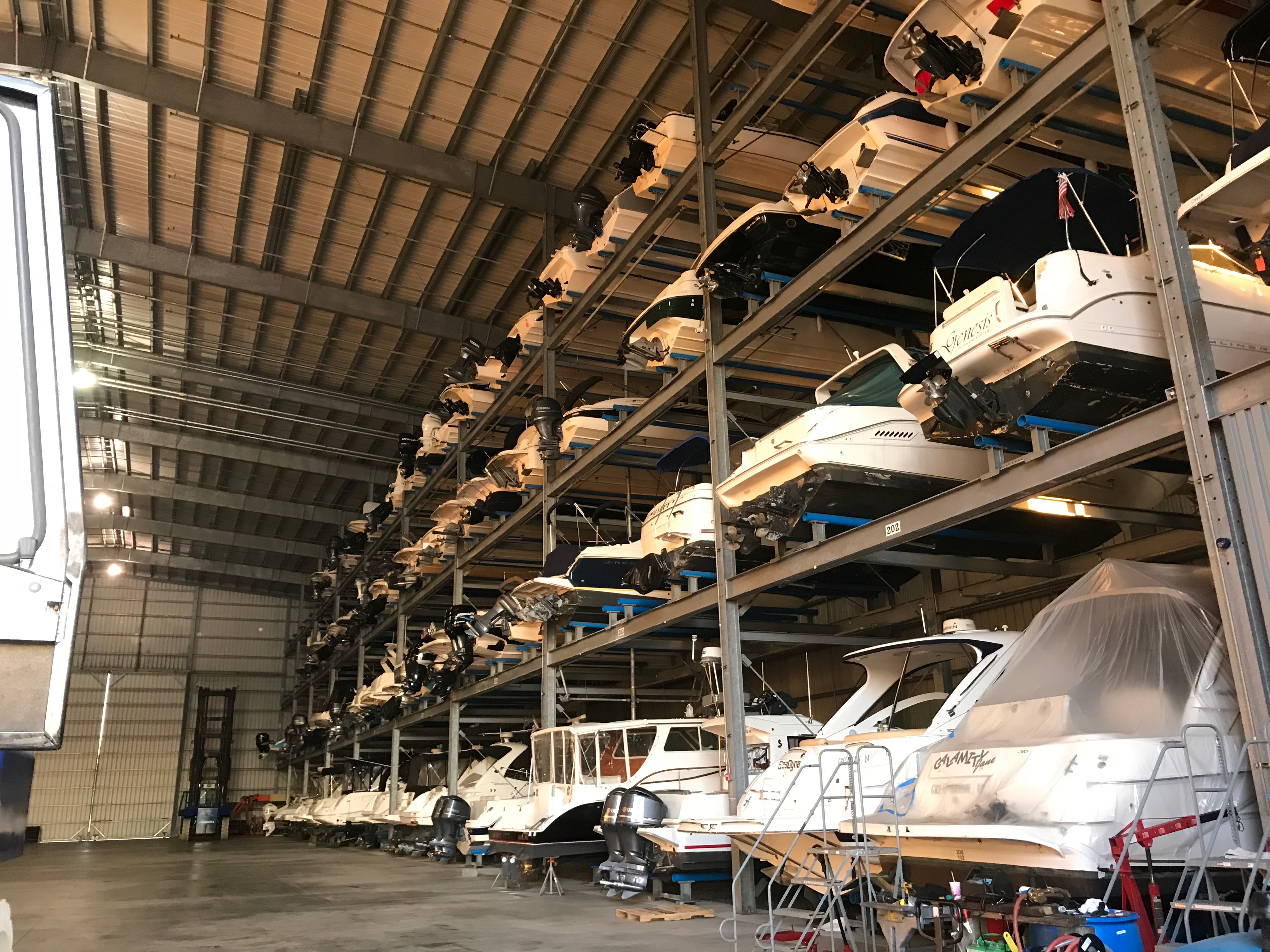
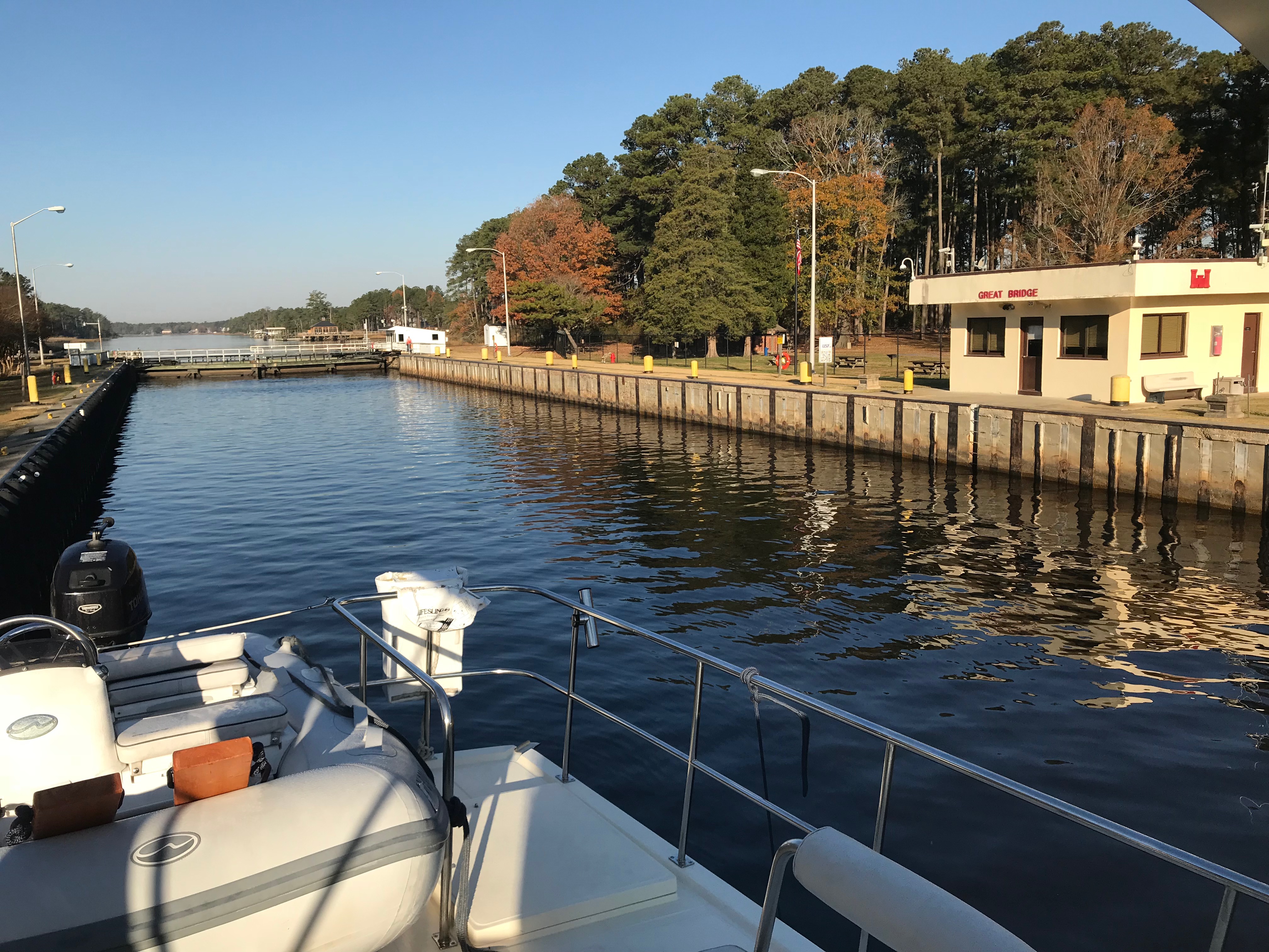
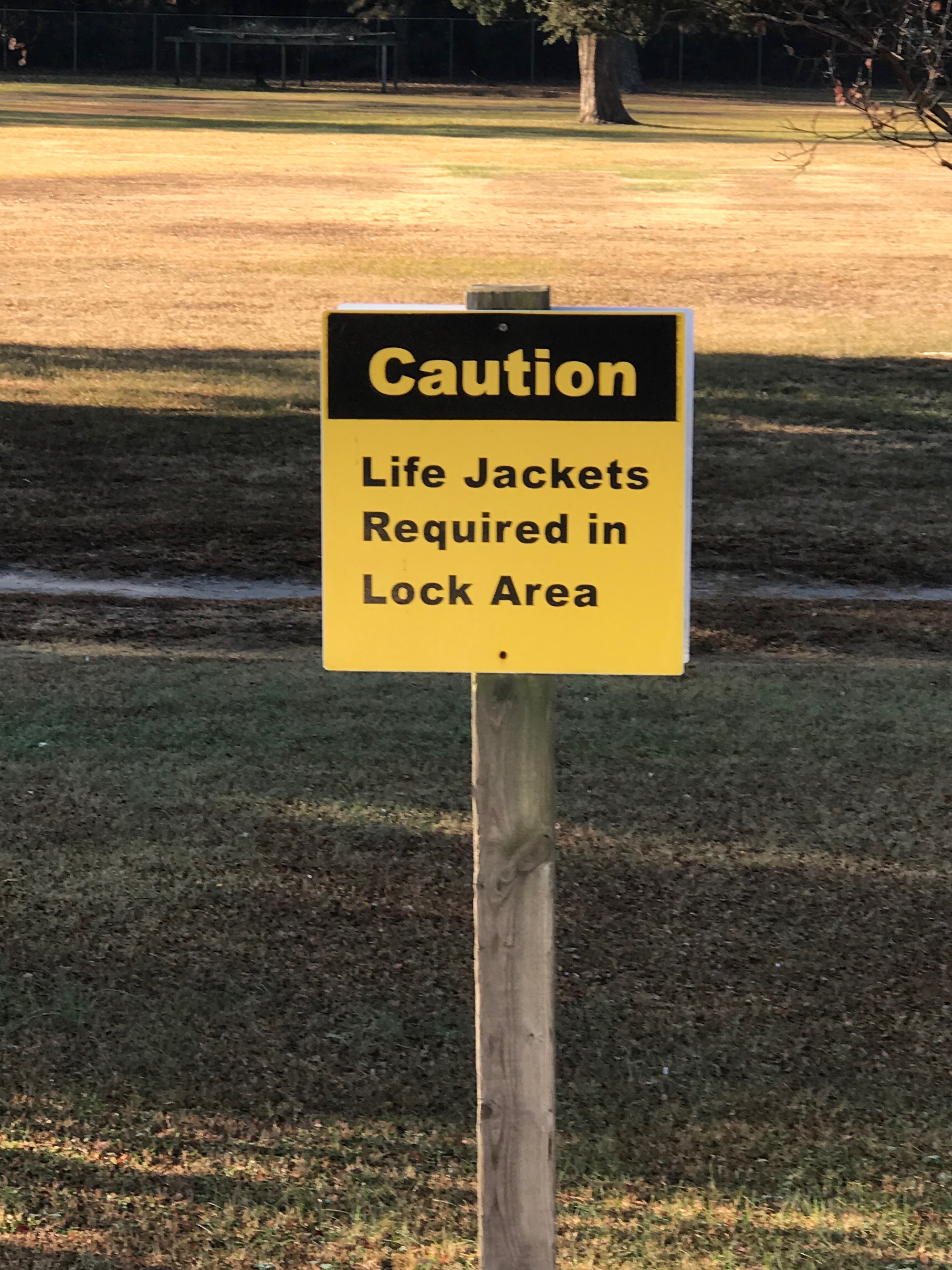
Sound Signals for Restricted Visibility Conditions

Great Bridge Lock

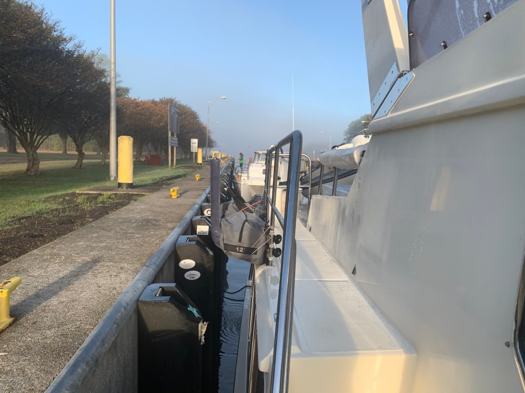
We had left the dock because just a mile or two down the river is the Great Bridge Lock. We wanted to get through the lock as quick as possible so that we could maximize the nautical miles we could put behind us by using all of the daylight. When we arrived at the lock we had to wait about 30 minutes for the next opening. Once inside the lock, we tied to the rubber numbered East wall so we did not have to set our fenders.

Great Bridge Lock
As I leave the lock I pass a steaming barge of dirt.

Great Bridge

You can see at the end of the above video that as soon as you exit the Great Bridge Lock you must stop and wait for the Great Bridge to open for you. I always remember the lock and the bridge being sync’d in time. When one let boats through the other was ready to let them through as well. Today however, we had to wait. More time spent not moving toward our nights proposed anchorage in the Alligator River.

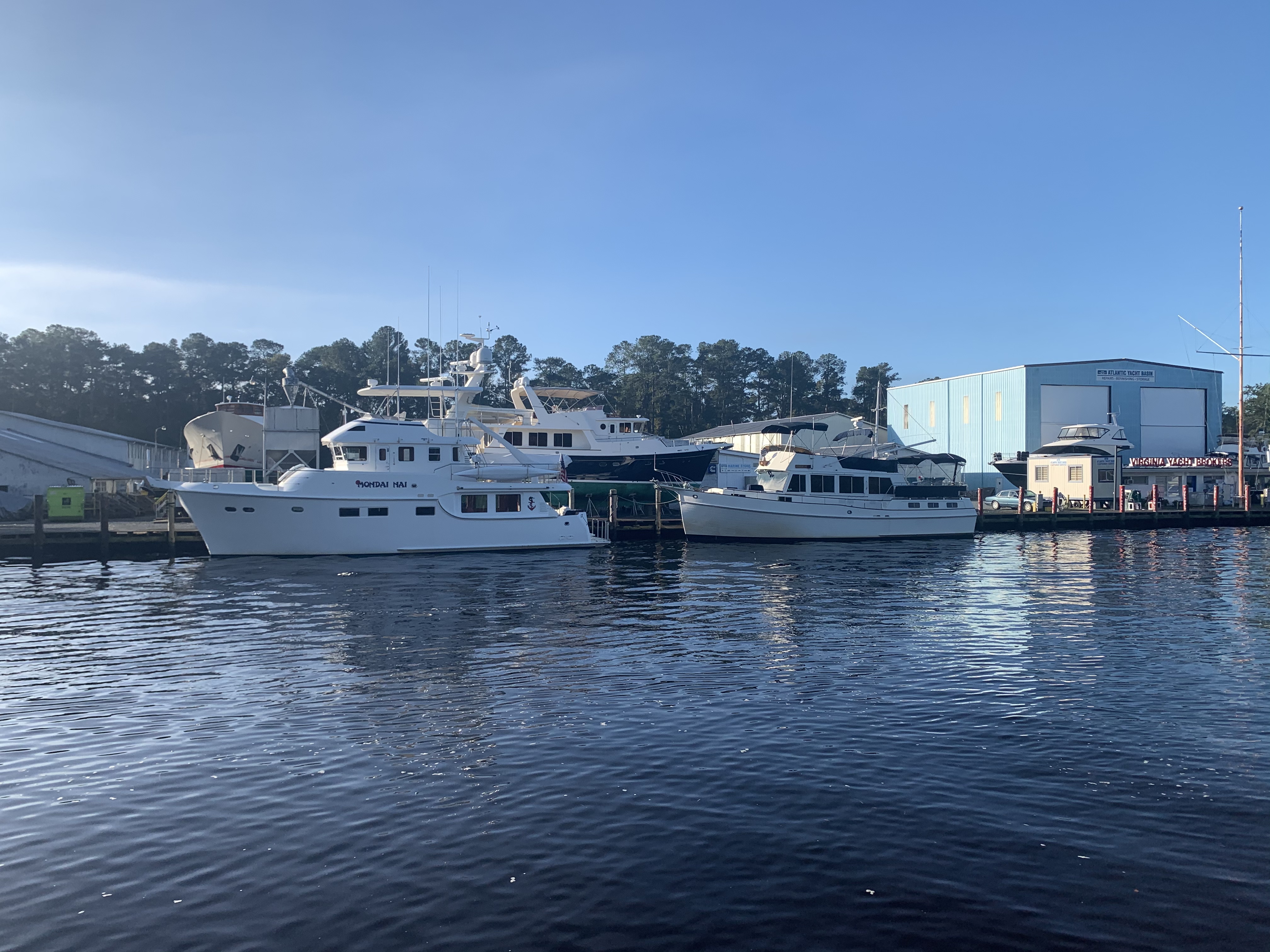
Eventually the Great Bridge opened for us and we slipped beneath it’s large raised spans to find AYB (Atlantic Yacht Basin) on just the other side.
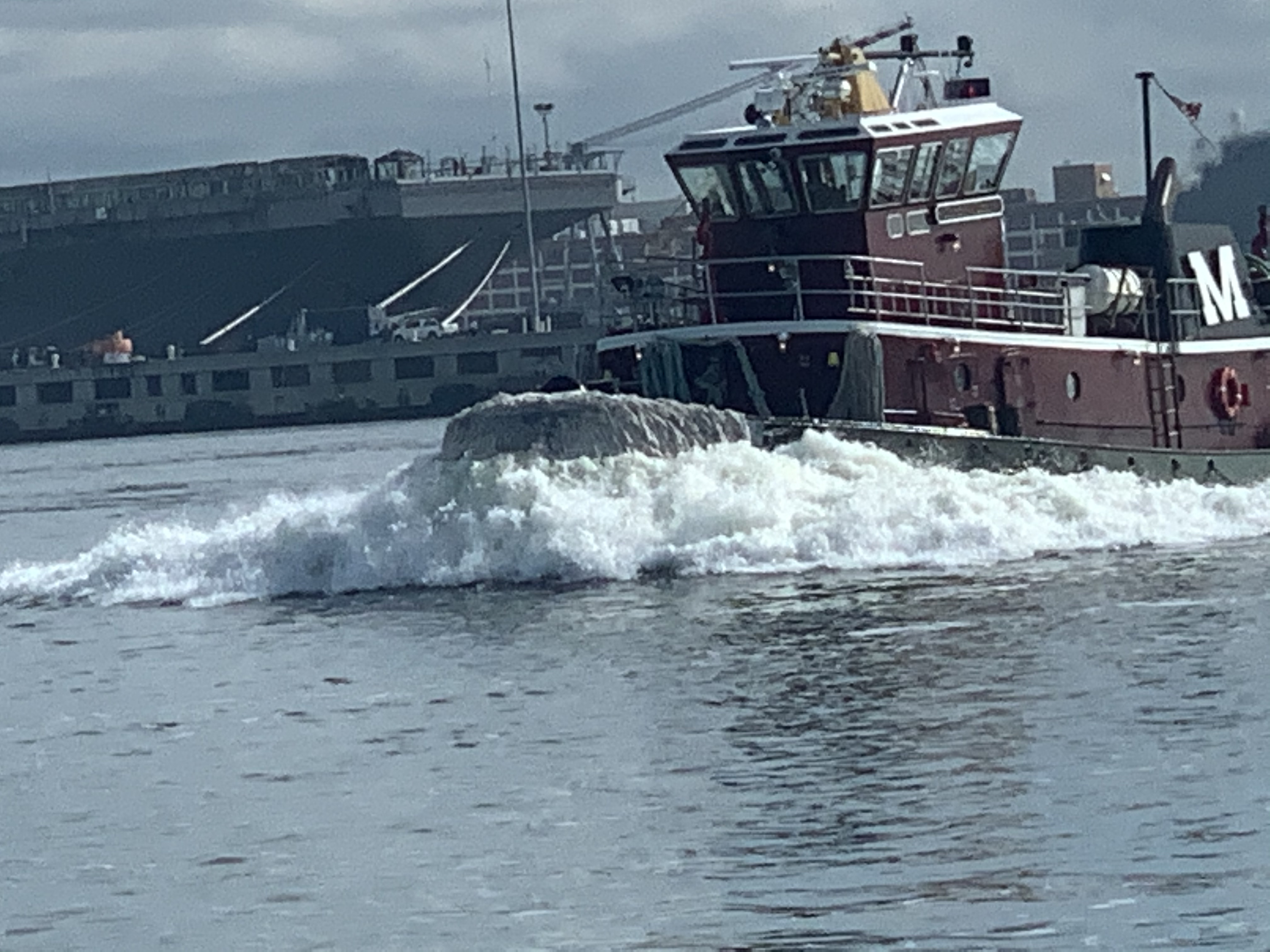
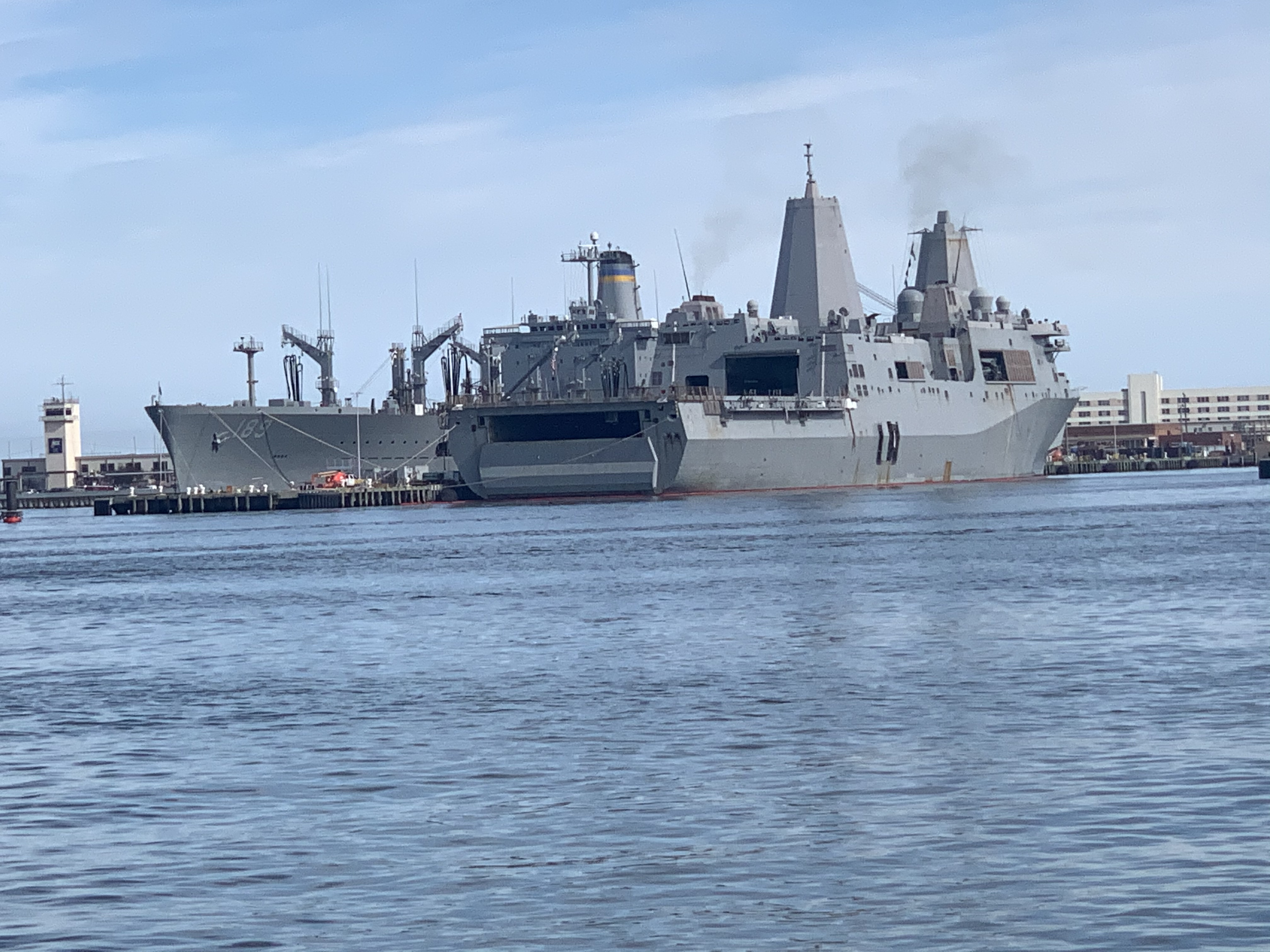
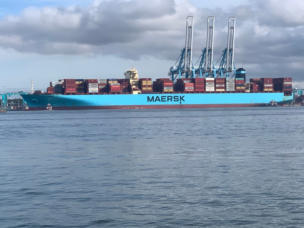
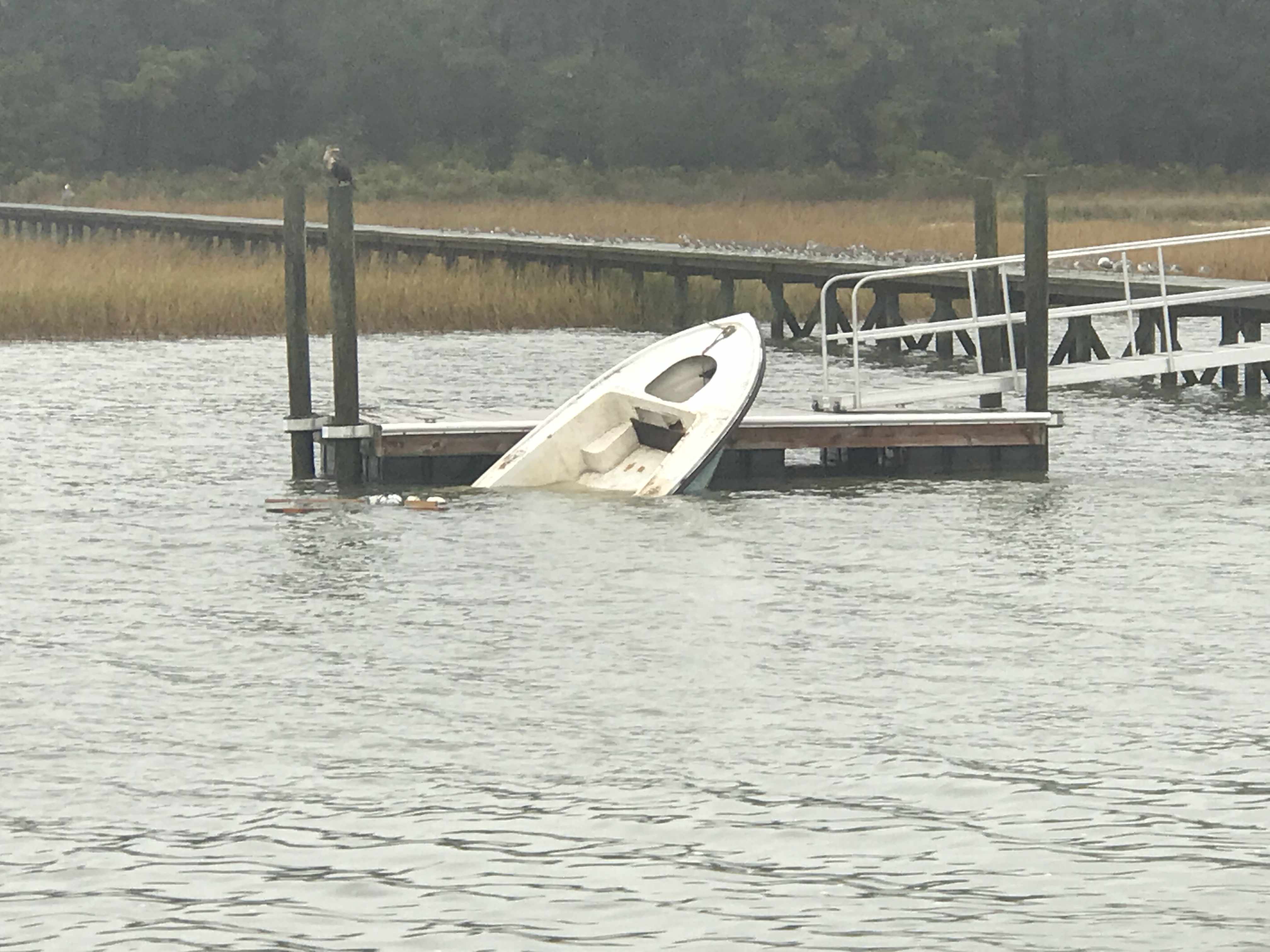
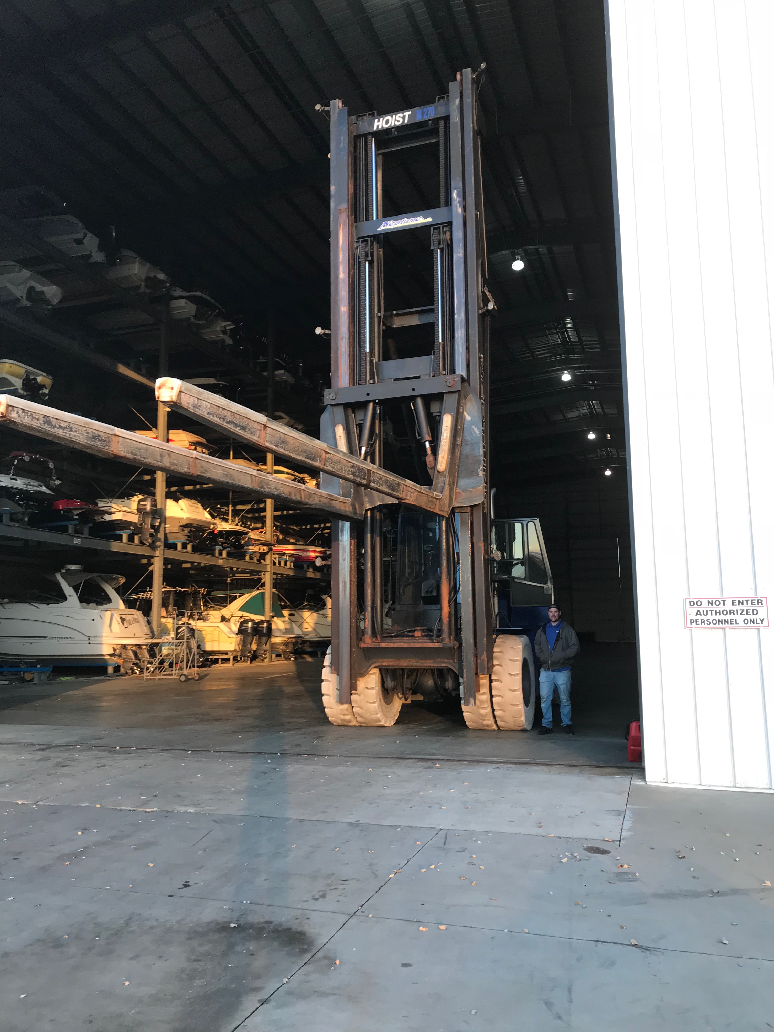
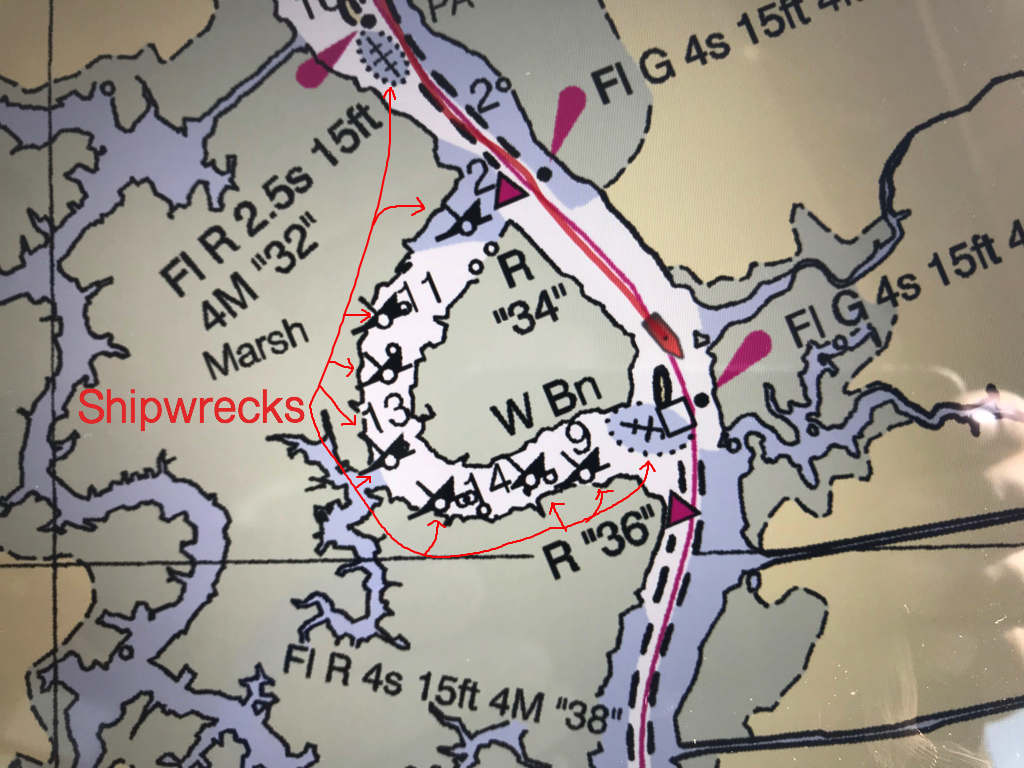
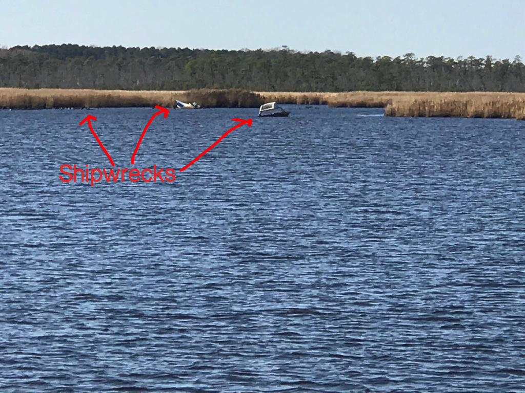
Encountering Barges

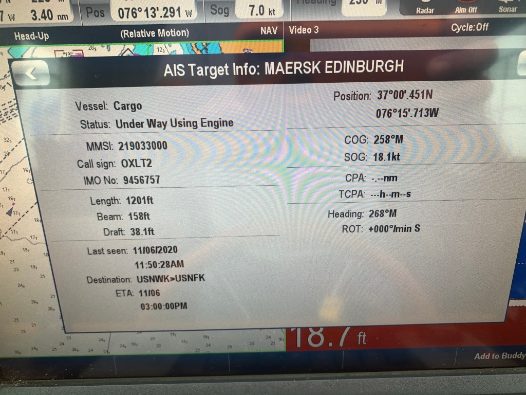
When you travel down a river the deepest part of the river is often the visual center. As you get away from the center and near the banks or edges of the river it can often shallow quickly. The ICW is a federal waterway which is responsible for moving goods up & down the US East Coast safe from storms on the Atlantic. Wide tug and barge combos will need that depth found in the center. If you need to pass a tug pushing a barge you need to give them the center. This often pushes you uncomfortably close to the shallow banks. Some boats will stop while the barge passes but most will communicate the pass over the VHF. The tugboat captain will usually say something like “I’d like a one-whistle pass” or “I’ll meet you on the one”. This jargon comes from the fact that boats use sound signals or either one or two short blasts of the horn to indicate what side of your boat they intend to pass on.

Tug, Gold Coast, pushing a barge north past recreational boaters going south

As the tug passes I check my AIS for information about the tug.

Tug Gold Coast AIS info

Crossing State Lines

When transiting the East coast I always enjoy the moments when I cross state lines. Some states I come and go in the day, ex. RI. Other states I can spend weeks in, ex. FL.
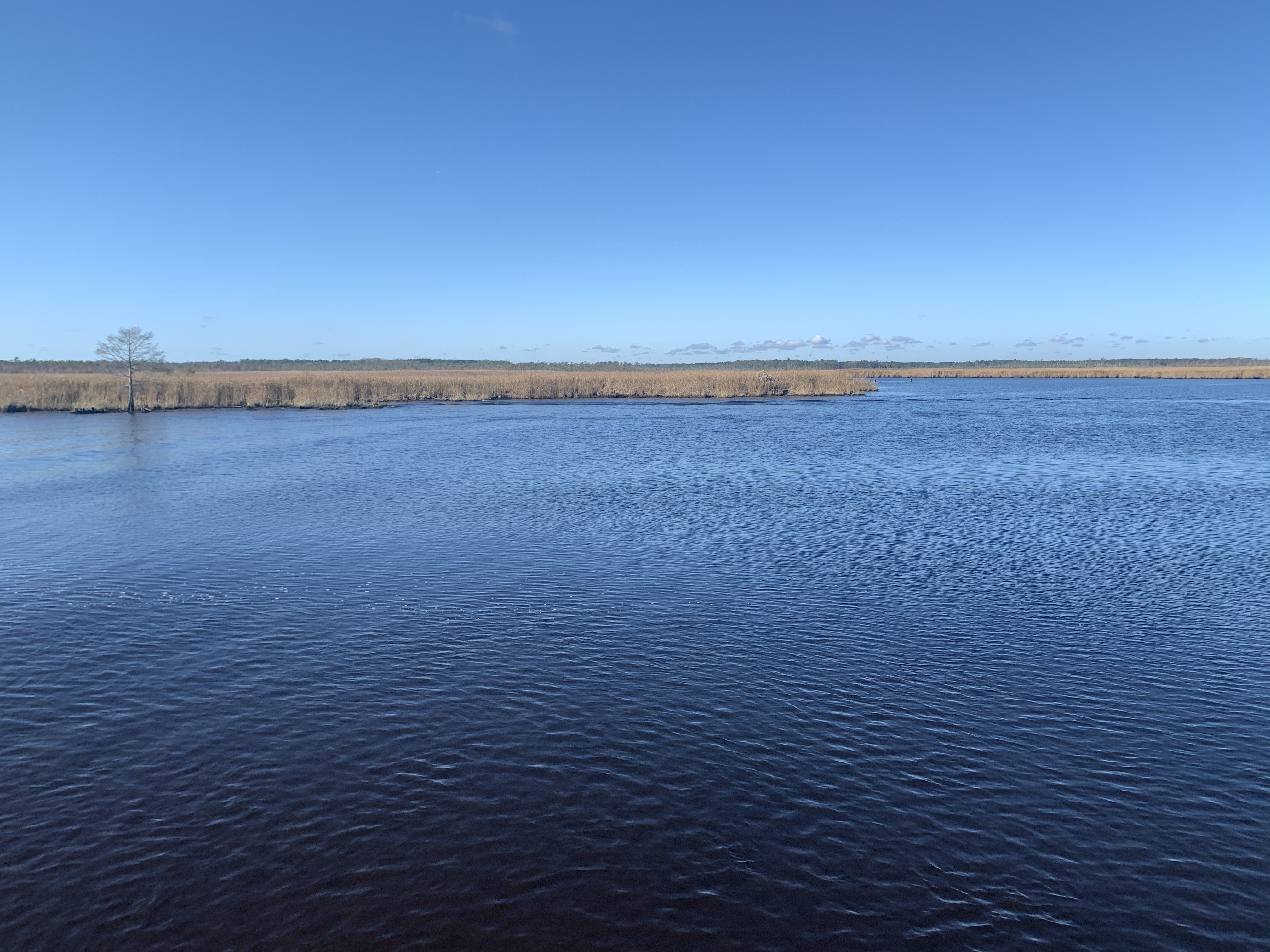
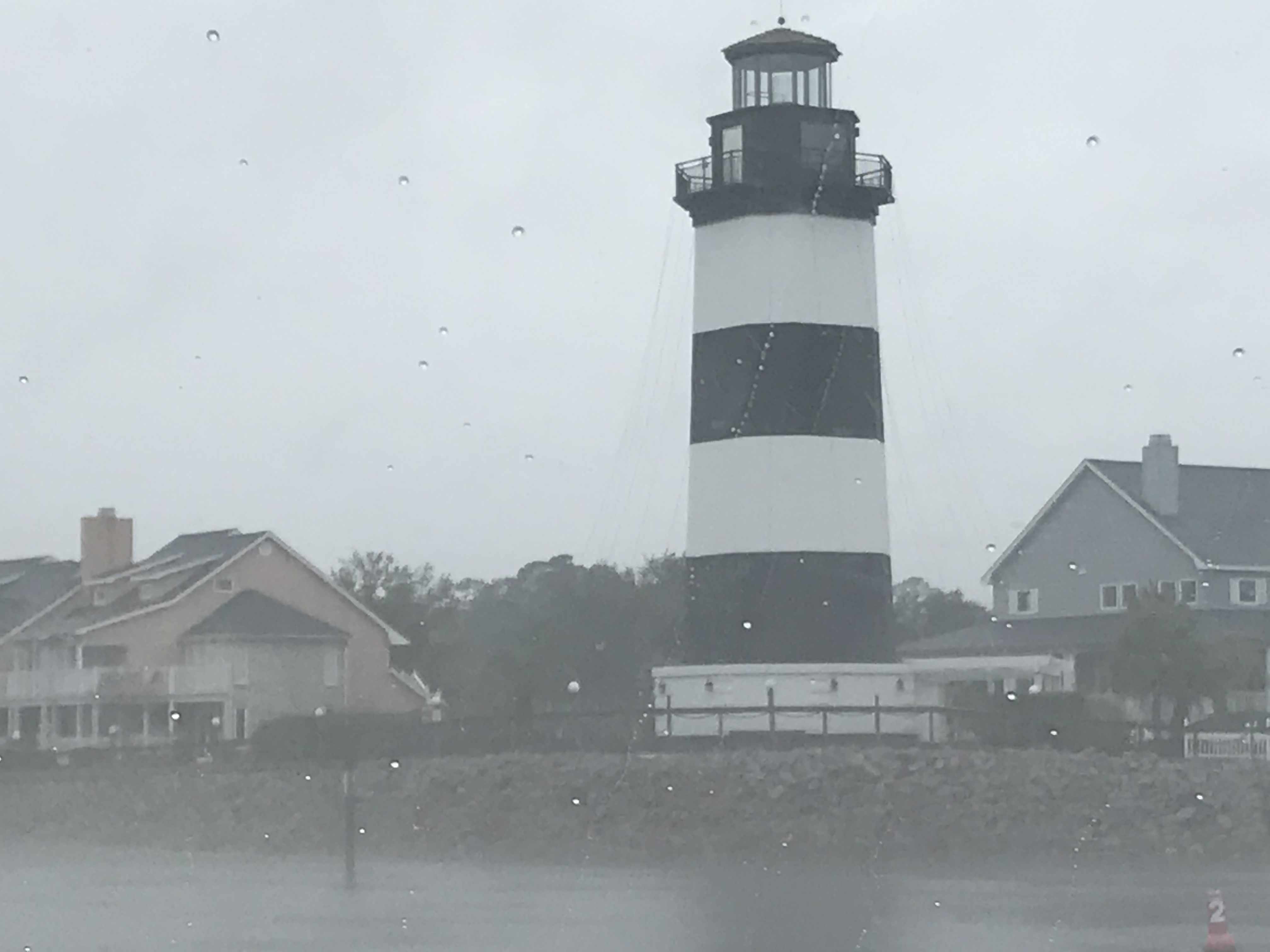
My iPhone shows Simple Life is nearing the North Carolina state line

North Carolina

Below are some of the sights as I approach North Carolina.

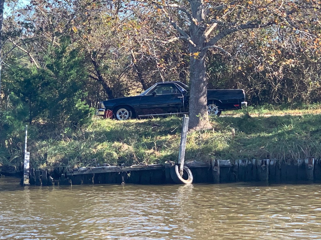
Who Doesn’t Love a Cuck?

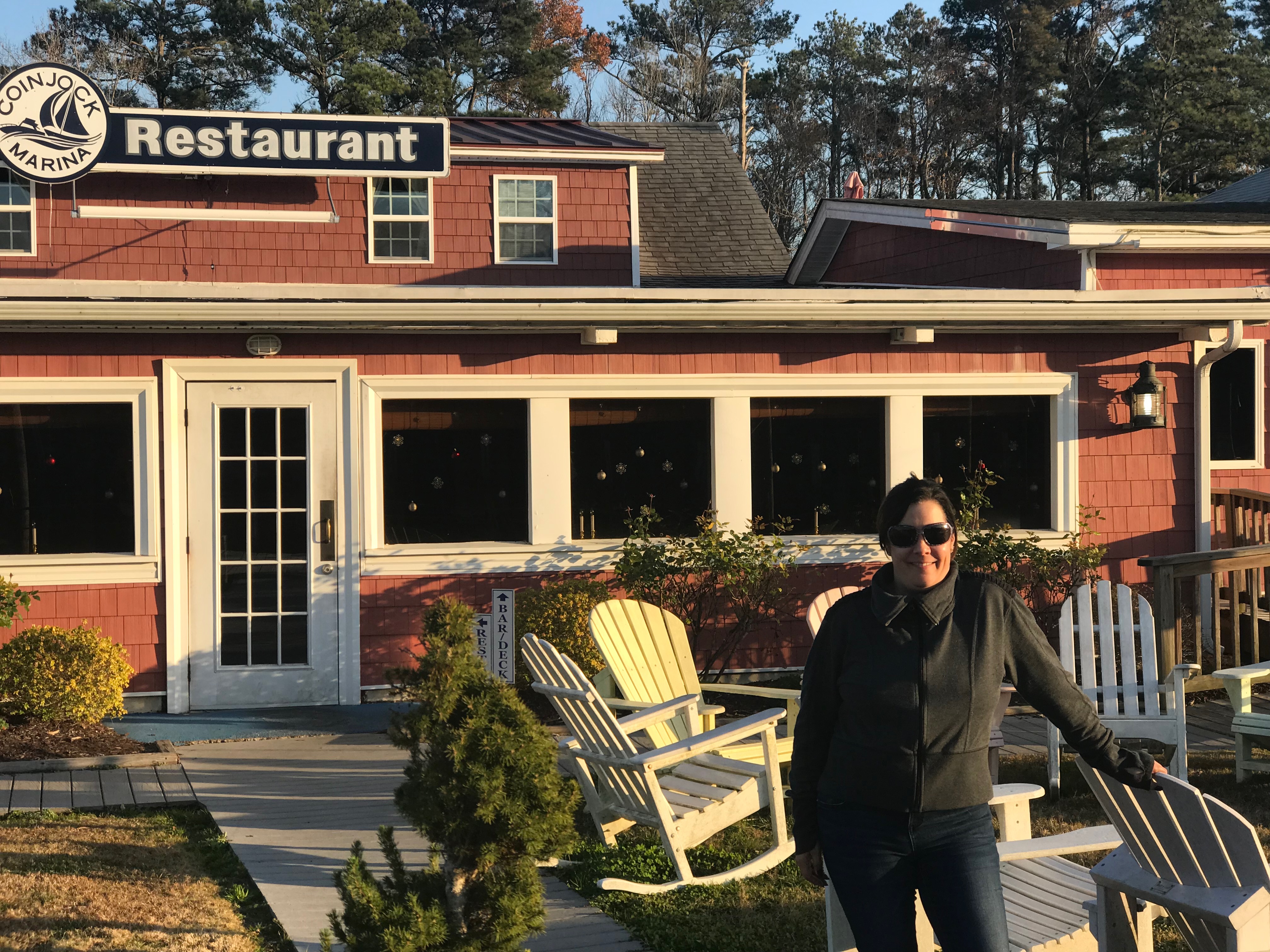
Now passing through Coinjock, NC I spy a Chevy El Camino on the shore. I don’t know why but I feel like that car is perfect for Coinjock.

It’s a car, it’s a truck… it’s a Cuck

Get up an Go

This large yacht passed me at an amazing speed for such a large yacht. They were outside the channel while performing the pass. Their wake was not that bad as much of their hull is out of the water as they plane on top at high speed.
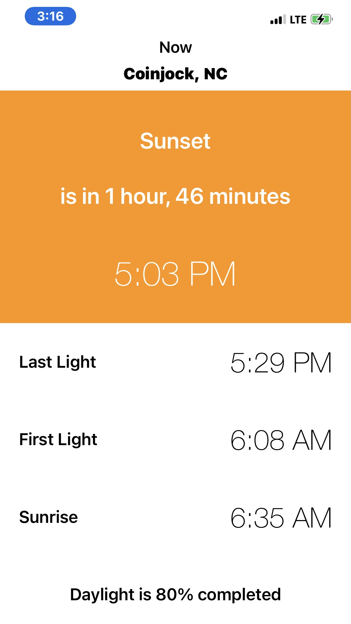
Wow that is fast for such a large boat


Daylight Fading

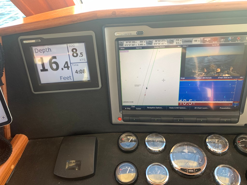
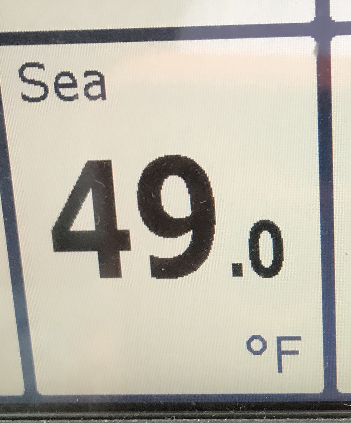
At this point in the day’s journey, we are about to cross Albemarle Sound. During the night before’s captain’s briefing, we had planned to cross Albemarle Sound and anchor just before the Alligator River Swing Bridge. Delays we encountered at the Great Bridge Lock have made it so the sun will set before we arrive at our anchorage. MV Effervescence IV has asked me if we could increase our speed so as to arrive while there is still light? The sun is setting at 5:03PM and the last quarter moon will not rise till 11:50PM. No moon makes for a dark night and nobody wants to hit a day marker piling or run over a crab pot float and get a line wrapped around your prop.

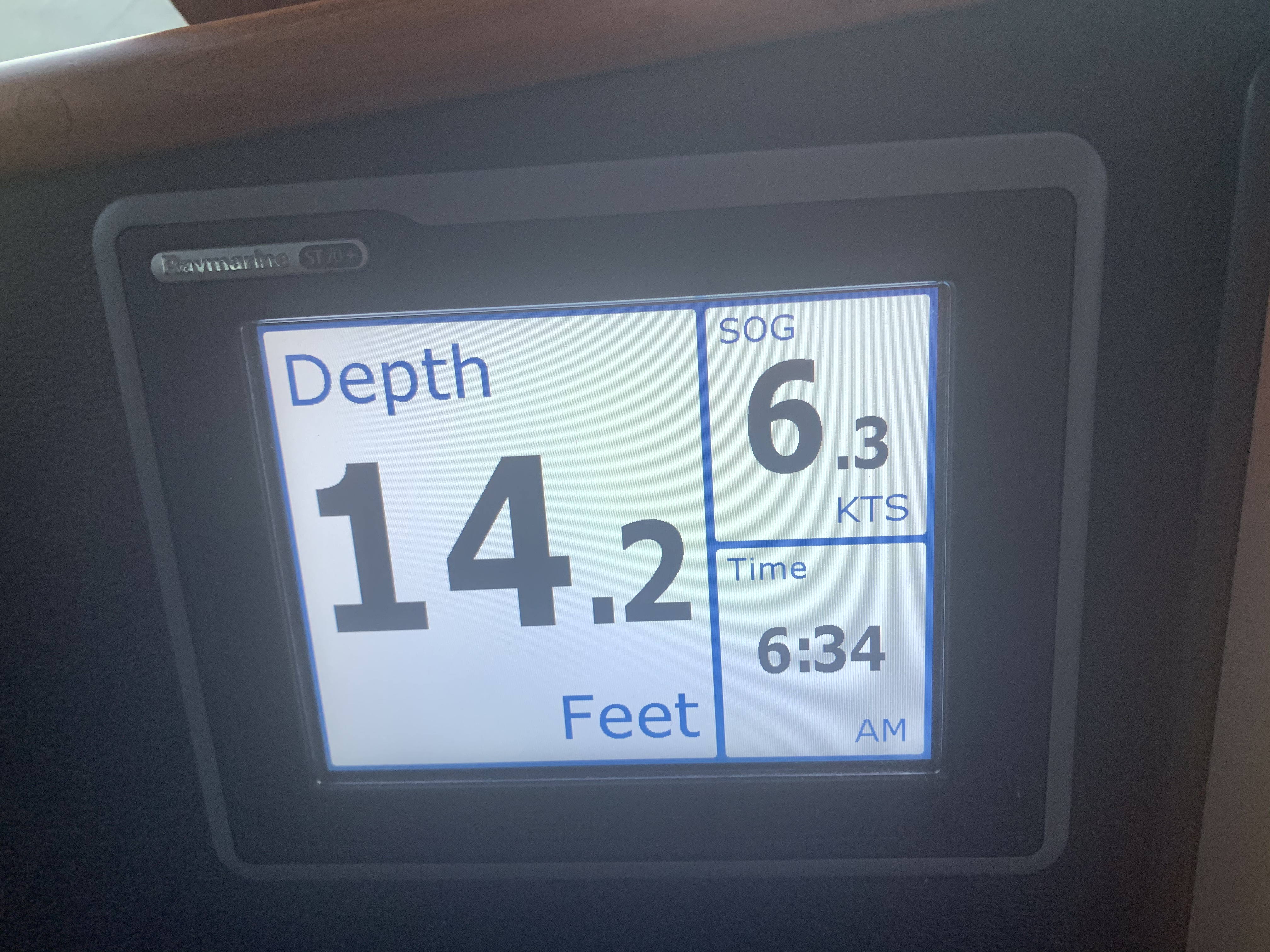
I agree to increase the speed from 6.5kts to 8.5kts.

Fuel Economy

Trawlers like most boats can get great fuel milage at a slow speed. However, for every 1/10 of a knot you go above that speed the MPG starts to plummet fast. At 6.5 kts I get 3NM/gal. At 8.5kts I get 1NM/gal. If you have to increase your speed to close to your top speed you will very quickly spike your dollars paid per mile. It is better to realize the needed increase early so you don’t have to do the worst case of increasing to near max. Planning and flexibility is the key to getting down the coast and still having $ for beer 😉

Albemarle Crossing

Today’s crossing of Albemarle Sound is one of the smoothest I’ve had.

Albemarle Sound is Flat
Scanning the Horizon
Wake

I find a boat’s wake hypnotizing to watch up close.

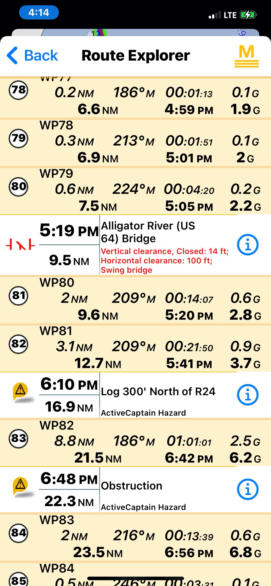
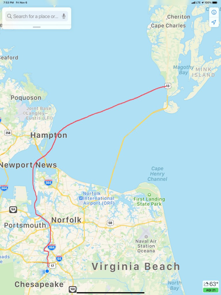
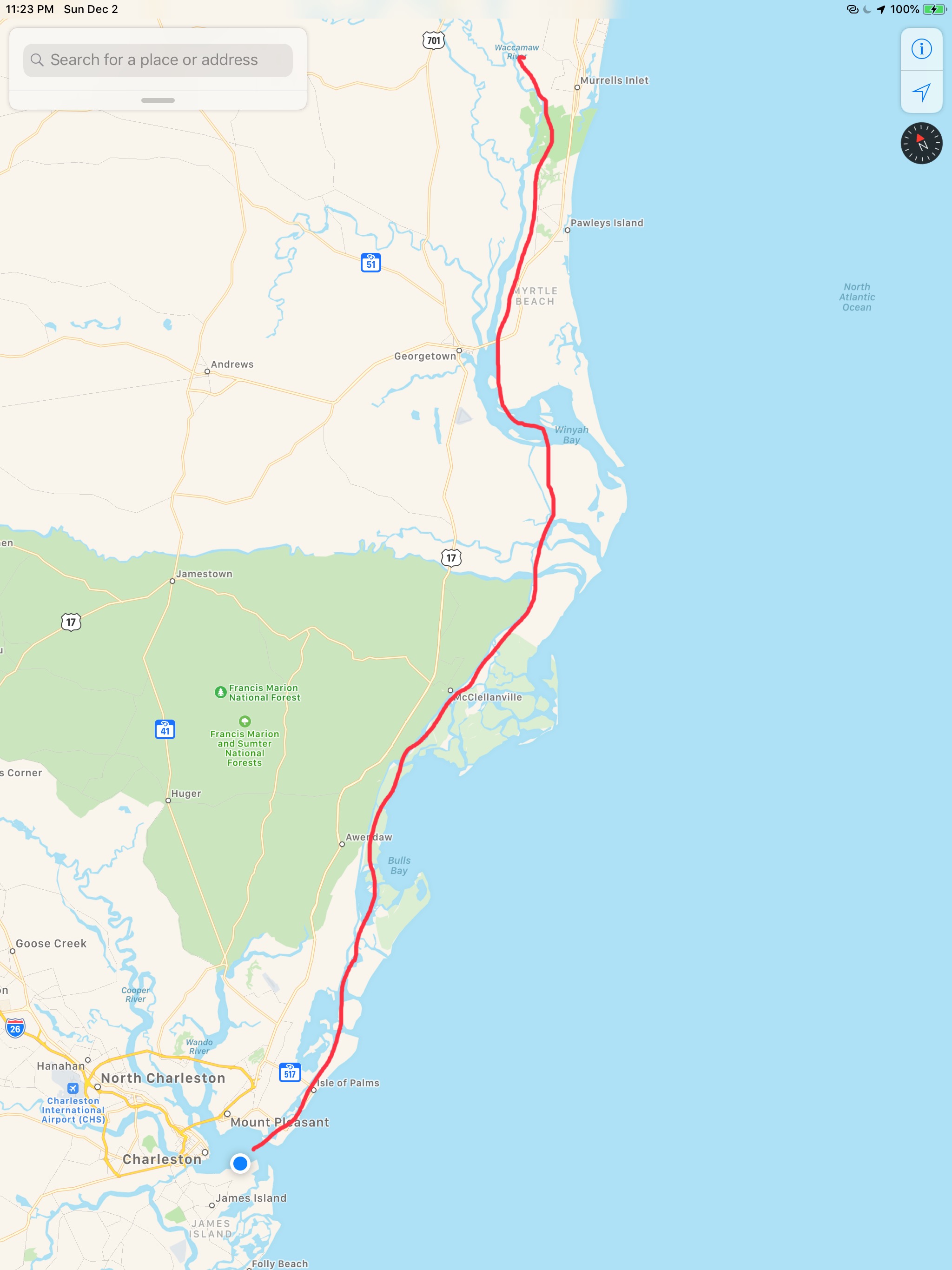
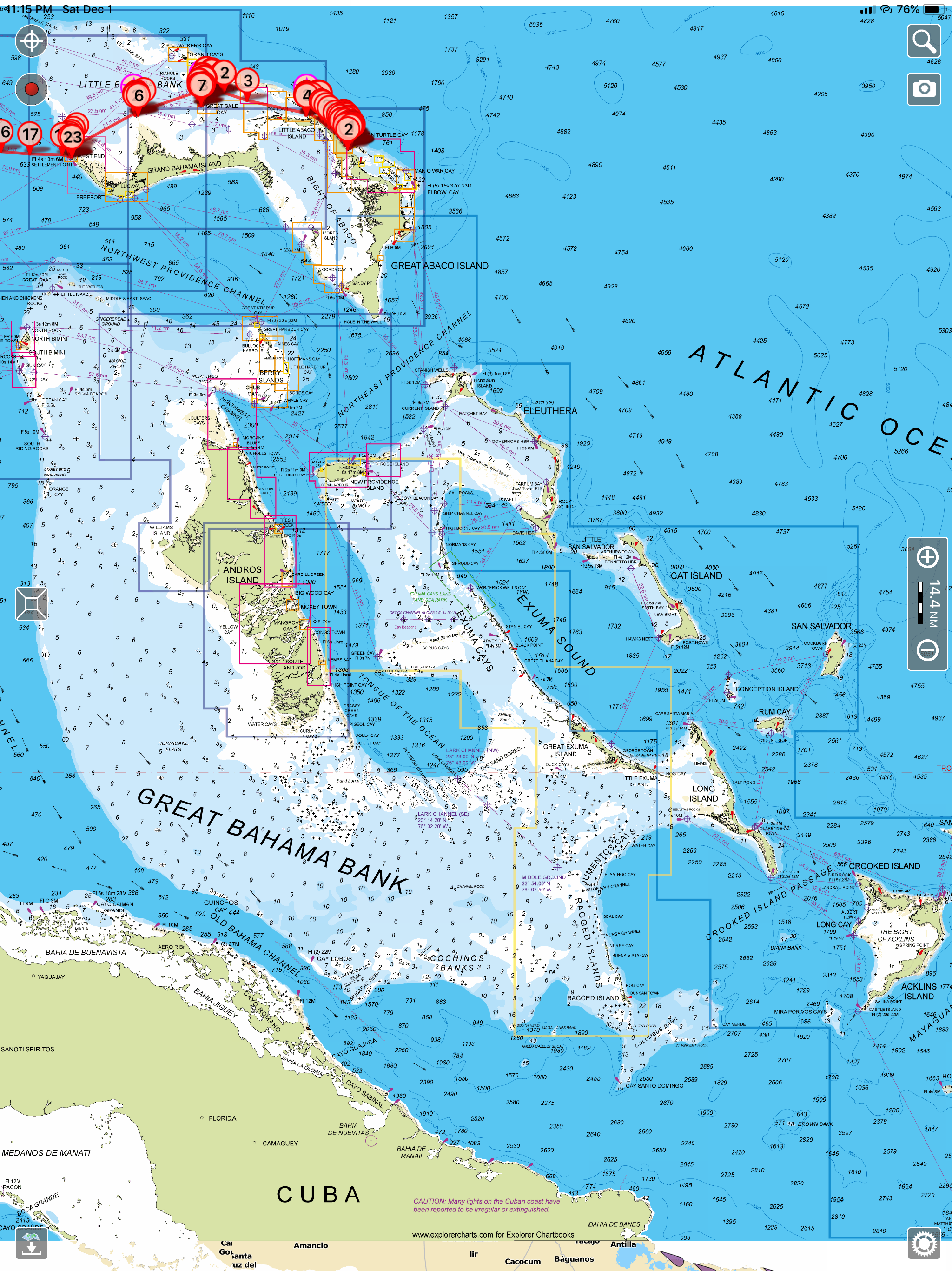
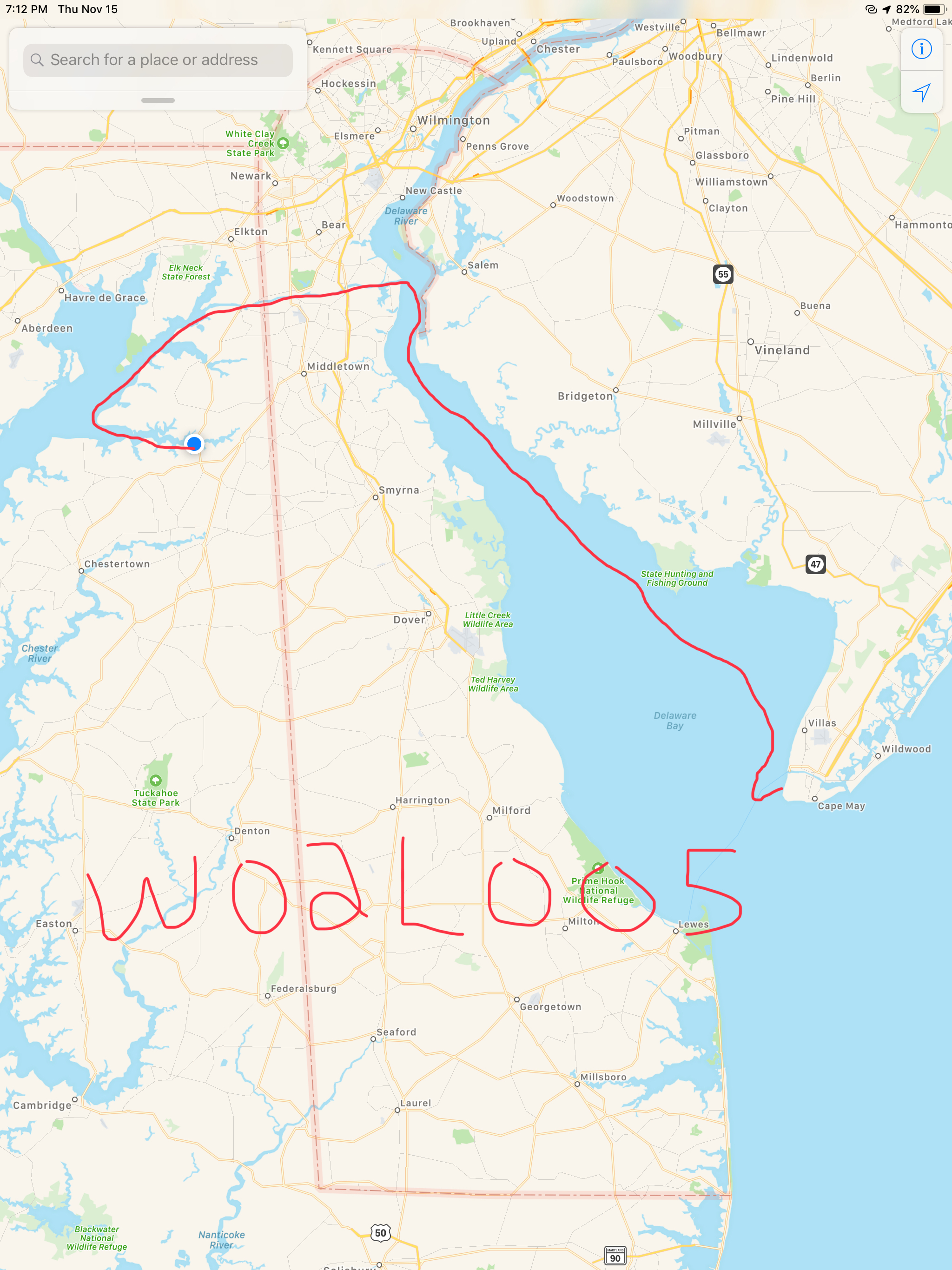
Today’s 71NM journey looked something like this…

W04L007

ICW Mile Marker 0

I awoke on anchor to find that another boat had quietly slipped into the anchorage while I was sleeping.

I could not quite read the name of this vessel

A quick look around shows dense fog was blanketing the area outside the anchorage.

The day’s planned journey was to a marina about 36 NM or 6 hours away. It’s Friday and the marina closes at 5PM so I wanted to be there by 4PM to secure a spot. I figured a late 10AM start might allow some of the fog to burn off.

As I enjoy my morning coffee, I look up at see that the other boat in the anchorage was now leaving. I can finally read the name, MV Effervescence IV. I recall this boat. Effervescence IV was on the hard next to Simple Life in Warwick, RI, one month ago. Her owner and I had introduced ourselves and exchanged numbers just incase we should wind up near each other on our trips south this winter.

It’s now 10AM and as I pull out of the anchorage, I check the AIS (automatic Identification System) and see Effervescence IV is just a just a few miles ahead of me.

MV Effervescence IV AIS info

I use the MMSI # from her AIS info and program it into my VHF to place a DSC individual call to the boat and instruct their DSC radio to automatically switch to CH#69 as soon as they ACK my DSC call.

Moments later we are discussing plans to meet up at Top Rack Marina in Chesapeake, VA.

Norfolk harbor has non-stop large ship traffic transiting its entrance channel. On this day, the USCG had issued a warning over the VHF about an Ultra Large Container Vessel (ULCV) called the Maersk Edinburgh. The Maersk Edinburgh is 1201′ long and has 158′ of beam. It is certainly not hard to spot visually but I’m having trouble seeing much of anything out the pilothouse windows.

I will have to rely on radar & AIS. Radar just shows me a large target with position and speed data but no identifying info about the vessel. AIS however, shows me all kinds of vessel information.

It’s moving at 18.1kts! 3X faster than Simple Life

As I cruise on… the fog lifts for a moment to allow me to see this sexy girl passing me.

Then just as fast as it lifted, the fog closes around me again.

Dense fog outside of the pilothouse windows

Now passing Norfolk Navel Station, the that fog has lifted and I can once again see the boats around me.

Tug moving at hull speed

To get to the start of the ICW (InterCoastal Waterway), called mile marker 0, you must pass dozens of warships in port.

Now past the warships I see the ULCV Maersk Edinburgh being pushed into her berth by several large tugs.

The tugs look tiny compared to the 1201′ long ship

I saw this tug go by with it’s funny looking tall tower that allows it to see over whatever barge it is pushing.

If I ever get a change to go up in a tugboat’s tower I’m going to jump at that opportunity.

I heard several VHF marine warnings about a 950′ long dry dock called “Titan” that was being moved through Norfolk as well. As I glance over to shore I see it being pushed into place.

Right around the corner from this new one that arrived another dry dock that has a large warship in it.

BAE Systems Dry Dock

I need to be at Top Rack Marina before 5PM to get a slip. So when this huge barge swings out blocking the channel, I find a safe way around it and under the bridge.

I was aware of the time as I know I needed to get to Top Rack Marina before 5PM and as I turn the next bend in the Elizabeth River, I see that the Norfolk Southern #7 Rail Bridge is in the down position. I watch as was seems to be the longest slowest freight trains slowly passes.

After what seemed like forever, the bridge when back up and within 20 minutes I was fueled up and in my slip at Top Rack Marina.

Simple life. can almost turn sideways the slip is so wide.

Siting in my slip, I’m aware that it’s Mike Spinney’s birthday. I think… I’m sure him and his friends are celebrating. Then this photo comes in and I can only smile.

Glen, Debbie and I had planned to visit the local restaurant but it was closed. What to do? I invited Glen and Debbie over to Simple Life for a cocktail. They obliged and bought drinks and snacks. Glen makes his own beef jerky. Jerky & IPA goes well together.

Captains Meeting

We decided to do a captain’s brief where I brought up the charts on the big screen and we walked through the next days route which would run from sun up to sun down.

Today’s 38NM leg of my journey looked something like this…

W04L006

Cumberland Island to Pine Island

It’s 3AM do You Know Where Your Boat is?

It’s 3AM, the wind is gusting and I’m up checking weather and tides.

It’s almost low tide and I’m anchored in a narrow creek with the wind blowing me towards the creek bank. Oh great, I only got another 3 hours and 19 minutes till the that burning disc comes up.

The USCG Gale Warning is still in effect till about noon today.

USCG Gale Warning Still in Effect

Into the Mystic

OK, the sun is up and I’m underway with that still ominous sky above me.

The offshore cold front has dropped the temp. Fog is building on the waters surface. It’s a strange thing to be piloting straight down a river that has the fog blowing by you from behind.

King’s Bay Naval Base

At the end of the above video you can see the USCG boat appearing out of the fog. Below is a video of them circling around me before hailing me to explain that the US Navy was carrying out exercises in Cumberland Sound that could interfere or damage my electronics if I got too close. They wanted to know what my intentions were. I explained that I was an ICW boater and would be crossing Cumberland Sound bound for the Amelia River in Fernandina Beach and points south. They politely asked me to stay 2000 yards from the naval ships or as far away as possible while still safely navigating.

USCG Approaching MV Simple Life
USCG Boat moored on the CG mooring ball near entrance to Amelia River

Cumberland Sound is home to the King’s Bay Naval Submarines Base. There are six Trident-class submarines stationed here.  There is a a long deep channel cut through the shallow coastal shelf and muddy tidal Cumberland Sounds, to the Atlantic ocean. This allows for the submarines to pass. Every time I cross Cumberland Sound I have interactions with the Navy security boat or USCG. Recreational boaters are not permitted in the King’s Bay area west of the ICW Channel.

Entering the Amelia River I passed this USCG boat.

USCG Boat in the Amelia River

Welcome to Florida!

The St. Mary’s River divides Georgia from Florida. The town of St. Mary’s is on the northern Georgia side of the river and Fernandina Beach is on the southern Florida side. When you sail into Fernandina Beach you’ll find the WestRock Industrial wood pulp plant and CHP (Combined Heat & Power) plants along the shore. Industry began here after the great depression with a wood pulp plant. Now there is a cluster of both power, wood and packaging plants located here partly due to the railway and harbor.

I think it was Hurricane Matthew that caused a lot of damage to the Fernandina Beach area and boats.

Hurricane Matthew Oct 2016 just offshore of Amelia Island

MV Acadia had followed me through the Navy exercises area and was now breaking off to go anchor in the Amelia River. I’ve anchored in the Amelia River a few times. Today however, I planned to use of all the daylight to get south of Jacksonville, FL. That would allow me to make Daytona Beach the next day.

FV Gina Ann with all her gear proudly displayed

I often see this police line-up of birds on the shore. I wonder why they group like that?

Birds of a feather…Line up together

It was lunch time and I have to keep the boat moving so I bring all my ingredients to the helm and make my lunch while I drive.

Soon I came to Jacksonville, FL and I cross over the St. John’s River and into Pablo Creek heading south. There is a tight bridge that I have gone under many times but as I approached it I could that the strong current was producing 2-3′ standing waves on the down current side of the bridge.

Pablo Creek Bridge Jacksonville, FL

I use a user sourced digital cruising guide called Active Captain to keep me aware of all the marinas, anchorages and hazards along my route. Below I pasted my review of the AC strong current hazard located at Pablo Creek bridge.

Please note: There is a current station for this bridge. In order to see it in Aqua Maps, I had to zoom way in. It was hidden under the tide station located just north of the bridge. The current station is named. “Pablo Creek bascule bridge”. 

I have been under this bridge 4 times without concern. This time I hit it right at max ebb 5.67kts on a full moon with strong opposing winds (gale warning ended 2hours earlier). There were 2’+ standing waves on the down current side of the bridge. The strong current was catching my full keel causing me to make huge port and starboard rudder corrections. 

It’s narrow between the bridge fenders.  With no boats behind me… I kicked it in neutral and it spat me out like a toddler does to their first taste of broccoli. 

I chose to anchor in the Active Captain Anchorage called “Atlantic Blvd Br.” Just NE of the bridge. I waited for it to slow down a bit. Waiting meant I’d have to burn more fuel to get to my chosen “Pine Island Anchorage” before dark. I’d rather pay a fuel bill than a fiberglass bill. Be careful if you are a full-keel trawler with low power and/or a small rudder. 

Capt Mahty

Waiting for the current to slow slightly had cost me time and I would not make it to my chosen anchorage until dark. I still say it was the right move rather than risk getting slammed into the bridge’s fender boards.

This leg of my winter journey looked something like this.

Wo3L018 – Winter 03 Leg 018

Charleston SC Thunderstorms

We weighed anchor at first light in the Waccamaw River and it was foggy. 

I felt bad that we had to put on our automatic fog horn so early in the morning as there were other boats sleeping on anchor (or at least they were sleeping). At times the fog was thick enough that you would not be able to see the small duck hunting boats that zip around in this area. 

It rained all day. Not good for the folks who lived along the river banks. The river had already overrun its banks and many of the riverbank homes were dealing with flooding. More rain was the last thing they needed. 

Rain on the pilothouse all day

Then the fog would return.

When it was clear we got to see the lowlands of South Carolina. Beautiful grasses that extend out to the Atlantic Ocean. 

Lowlands of SC

Along the way we passed a steel hulled sailboat that was anchored in the same location as when we came up this part of the ICW in the spring. I guess like many is just permanently anchored along the ICW?

SV Steel Away Permanently Anchored

We passed someone’s boat that was still tied to the dock but had sunk for some reason or another. 

Sunken Boat Still Tied to Dock

Our plan for today was to attempt to make it all the way to Charleston, SC. The currents were helping us along and there was not traffic or bridges to slow us down. We ran right up until dark and had to settle on a wide open commercial anchorage just off Fort Johnson in Charleston Harbor. Kelly asked that we pick an anchorage that had cellular service as it was football and she had been watching the Giants / Bears game but the Patriots game was on next. 

We anchored next to a large sailing catamaran and the winds were blowing. The weather was bad as there were thunderstorms moving through that were bring wind gusts up to 55 MPH. A quick look at my weather apps showed them passing directly over us on anchor. 

Storm Radar

While on anchor I captured some of the storm.

Our leg today looked something like this … (80 NM)

Waccamaw River

We had spent a fun two nights at St. James Marina with friends. Kelly & Wende got to compare charity bracelets made by their niece, Michaela over drinks. 

Ladies were both wearing their favorite bracelets

While we were at the dock I watched a sailboat snap a piling off. I felt bad for the captain as there was some mis-communication that had the sailboat backing out of a fairway in the marina and then incorrectly tying up to a T-dock that was reserved for a similar sized sailboat that had just entered the marina’s entrance. The captain quickly untied from the T-dock and attempted to back up but while he must have thought he had shifted from reverse into neutral, was clearly still accelerating in reverse. He hit the piling and snapped it off without putting a single scratch in his boat. I don’t know what the manufacturer of this sailboat is but that’s a solid boat.

After that excitement, I spent some time finding an iPad app that would give me detailed charts of the Bahamas. I settled on the Aqua Map app. I had been using Charts & Tides by Navionics.

I was not happy that when Garmin bought ActiveCaptain.com they killed the integration with other iPad navigation apps in favor of integration with their own chartplotters.

I had been using Charts & Tides for the last 15 months because it was not very expensive to purchase the Navionics charts for the US & Canada ($30 or so) and the app gave me ActiveCaptain integration. ActiveCaptain.com was a web page that had a live map and a database of crowd sourced data and reviews of marinas, anchorages, local knowledge and hazards to navigation. Better yet iPad navigation apps could download the ActiveCaptain database of information for offline display in any compatible iPad navigation app. ActiveCaptain integration is a must for cruising the ICW. It puts small icons right on your navigation screen that show you marinas, places to anchor, hazards to navigation and local knowledge of inlets and difficult areas. Charts alone don’t list the nearest place to anchor when it’s dark and you need to stop for the night. Knowing there is a shoal around the next bend in the ICW and the only way to safely get past it is to hug the red daymark to within 30 ft is knowledge that active captain gives to you right on the navigation app’s screen (if the app has active captain integration). The Charts & Tides app which is extremely easy to use and very intuitive had ActiveCaptain integration until Garmin bought them and they seem very slow to fix the broken integration. You can however buy a Garmin Chartplotter and get ActiveCaptain. hmmmm?

Before the Garmin acquisition, ActiveCaptain used to be Open and Free

I did not want to be forced to buy an expensive Garmin chartplotter.  When we purchased MV Simple Life we chose to outfit our trawler with Raymarine electronics for navigation. Expensive navigation electronics like chartplotters, radar, depth and AIS are essential but when cruising the ICW you need to use an iPad with a navigation app that supports ActiveCaptain.  

Aqua Map has ActiveCaptain integration and also allows you to purchase the very detailed Explorer charts for the Bahamas. I have never sailed around the Bahamas so step one was to purchase the charts and start studying the different islands and cays to plot my own safe routes to anchor locations of interest. 

When we awoke our friends Jim & Wende had left squid wings and fishing tackle on our swim platform. I had been asking Jim for tips on catching fish in this area of the Atlantic and advice from someone who fishes the area is exactly what we need. 

Soon we were making our way past ICW MM 325

Statute Mile 325 on the ICW – Southern NC

We made it through the Lockwood Folly section of the ICW without touching bottom near low tide. 

View from the ICW out Lockwood Folly Inlet to the Atlantic Ocean

We passed many amusing sights along the ICW shore.

We passed this sailing catamaran that must have just gotten to tired to continue or find a place to anchor off the ICW so they just dropped anchor on the edge of the ICW. They used both a bow & stern anchor to prevent swinging into the channel but I would not be comfortable with the fog that another boat would not hit us. 

Bow & Stern Anchored in the ICW

There were hazards that were floating down the ICW like this dock.

Floating Hazards

As we came into Myrtle Beach area we started to see lighthouses & golf courses.

It was raining and foggy. 

Somewhere on the ICW around Myrtle Beach, SC

Soon we were tucking into the Waccamaw River to anchor for the night.

Just outside of the Waccamaw River 
Kelly made an amazing chicken fajita dinner to enjoy as the sun was setting in our swampy anchorage. It was yummy!

Our leg today looked something like this.

Gale Warnings, Snow, Sleet and a Beam Sea

We anchored in Cape May at night and the wind was whipping. We tried to tuck in behind the Cape May canal Jetty to get some protection but alas the boat was a rocking. 

I finally had to get out of bed, weigh the anchor and re-drop as close as I could get to the jetty. It worked. Well it worked a little. We did not sleep much. 

Next morning we left before sunrise because I just was not sleeping anyway. The gale warning winds were nipping at our heels as we worked our way North up Delaware Bay.

The blue dot is MV Simple Life and the red-purple are 30-40 MPH winds

A quick check on the weather back in Warwick, RI showed it was even colder than what we were feeling in Delaware Bay.

Warwick, RI Nov 15th Temps

The water in Delaware Bay was cold. Not something you want to fall overboard into. 

Delaware Bay Sea Temp

Traffic was hard to find. This Chiquita banana container ship passed us as we slipped out of the channel to give her space. I think only 2 other boats passed us on this gusty, snowy, foggy day. 

Container ship passing us in Delaware Bay

As we made our way up Delaware Bay the wind and waves were on our beam. The wind alone was giving us quite a list to port. A beam sea is never fun in a flybridge trawler with a 400lb dingy and two kayaks on the flydeck. eek.

Delaware Bay Early in the AM

Soon we could hear the sleet bouncing off the outside of the boat.

Then came the snow…

Why didn’t I bring a snow brush on this Bahamas trip?

The snow brought with it FOG.

Fog starting to close in around us

As the fog crept in on us it was time to turn on our Khalenberg automatic fog horn. If you are ever near MV Simple Life in the fog you’d think a giant tanker was bearing down on you. What made me laugh was… it stopped working in the freezing snow. With each blow of the horn it iced up more and more until it just stopped working.

Wind on the beam, Fog closed in around the boat Fog Horn wasn’t frozen yet.

Once the Fog horn froze up and stopped working it was time to go to my backup fog horn. Yes, my VHF’s loud hailer fog horn played but in the wind and snow I’m sure nobody was hearing it. Heck, there wasn’t another boat out on this day anyway. 

Function + 8 plays the ICOM VHF fog horn

The fog had closed in so tight to the boat that we could only see a single boat length in any direction. Thankfully, we have a 4′ open array Digital HD radar with overlay right on our chart plotter that helps us identify boats from buoys. We also rely heavily on AIS (Marine Automated Identification System) to make sure we show up on the chart plotters of other boats as well as us having all the details about the boats around us (boat name, course, speed, MMSI#, etc.

We soldiered on with the idea that once we made it into the C&D canal that the weather conditions would improve. They did!

The visibility returned and the winds and waves were held at bay by the high canal hill sides. 

Soon we were passing marinas where the boats were covered in snow. 

Snowy Catamaran

When we exited the C&D canal into the head of the Chesapeake Bay the wind was whipping up a following sea so we decided to anchor in the Bohemia River. Great plan until the depth alarms went wild when the depth dipped below 6 feet. This was not good concidering we were only minutes away from high tide. Not wanting to run aground or get stuck waiting for high-tide to return we decided to push on further to the Sassafras River.  

The sun set and we watched as the last light disappeared as we entered the Sassafras River. It’s a long trip up the river to the Granary Marina but we decided with the strong winds and rain it would be nice to sleep tied to a dock. Neither of us wanted to spend another night trying to brace ourselves in the bunk. 

The dockmaster left for the night and left us directions on how to find our assigned slip. That plan failed when we could not find our slip using our searchlight. The wind and the rain were coming down sideways and driving from the pilothouse in the dark is not a place you want to be poking down random fairways trying to find a slip. So we decided to grab any open slip and call it a night. 

Docking alone in that wind was difficult enough but when I jumped out of the pilothouse to tie up I almost slipped on the snow and wound up going swimming. 

My boat hook was buried in snow

Soon we were tied up and I was changing out of my work pajamas, kicking my snow filled crocs off my frozen feet and thawing my toes by the heater while enjoying a well-deserved IPA

After 13 hours at the helm, this IPA tastes great 😉

This leg of our trip is pictured below.

Winter Season #2, Leg 005

All of the Whos in Whoville Flock to Top Rack Marina

We spent two nights at the Top Rack Marina (ICW Statute Mile 8.8) in Chesapeake, VA.

Top Rack Marina Life Ring
Top Rack Marina – a nice stop along the ICW

What a great place to stop. When we arrived at the marina, Ben was there to catch our lines and greet us with a some Virginian southern hospitality. Top Rack Marina is a “dry rack storage” marina. These style of marinas store their customer’s boats on indoor racks rather than floating in a traditional “wet slip”. Customers simply call and request their boat dropped into one of the dozen or so wet slips in the marina’s water edge.

Top Rack Marina Kelly in Slip
Kelly relaxing in the cockpit

Top Rack Rack Indoor Racks
Indoor racks hold boats like a grocery store shelf

Top Rack Marina Outside Racks
Outdoor racks act as staging locations as boats are washed, flushed and prepped

Their giant fork truck moves boats effortlessly and can be intimidating as it whirls around with a boat high in the air.

Fork Truck John
Driver John alongside for a visual comparison

YouTube Video – Hauling Boat Up and Out

We decided to stay for two nights and re-provision the boat. Usually we would have to grab a Uber to a nearby grocery store but we have found that grocery delivery services are a much faster, cheaper and a far simpler way to restock. When we were in Brick, NJ we used Peapod from Stop & Shop but here in Chesapeake, VA we used Farm Fresh Supermarket.
Jaquay was our designated shopper and he would text us with pics of substitutions for any out of stock items on our list. Jaquay picked our order, drove dockside and was kind enough to help carry our groceries aboard. Thanks Jaquay.

Jaquay
Jaquay

The marina has a great ship store and Deli and as I checked in with Brian at the front desk, Brittany was there to help me select a local IPA beer called “El Guapo IPA”. El Guapo is brewed locally in Norfolk, VA by O’Connor Brewery

El Guapo IPA
In Spanish El Guapo is a beautiful guy, a well looking male

Then it was on to dine at the Amber Lantern Restaurant. We stepped out of the elevator and hostess Courtney warmly greeted us. We got an early start at the docks and by the time the restaurant opened at 4PM, we simply poured ourselves into seats at the bar. Bartender Sydney kept us smiling the whole night.

Sydney
Sydney’s smile could warm the heart of even the crustiest sailor

Sydney and Courtney
Dynamic Duo: Sydney and Courtney

Being first into the restaurant, we had the chef to ourselves and the food was amazing. We had our fill and retired back to the boat only to wake up at the witching hour of 3AM and sing along with YouTube videos from artists in the “Forever 27 Club”. I recall some Janis Joplin was echoing out over the river… “Freedom’s just another word for nothing left to lose”…

We awoke to a ghostly fog creeping down the river and we quickly shoved off to race and catch the Great Bridge Lock opening at half-past-every-hour.

Top Rack Marina Fog
ICW fog

Once at the Lock we tied up to the Southern wall, waited for the lock doors to silently close and watched as it lowered us gently down to the height of the water on the Albemarle Sound side of the lock. I find it interesting that while the Elizabeth River side of the lock is tidal and varies about 2.7 feet the Albemarle Sound side varies only due to the winds that drive water up or out of the river. Equally as amazing is the age of the machinery that drives these locks. You watch as giant gates and machinery, built using simple principles of engineering mastered many years ago, silently close.

YouTube Video of the Great Bridge Lock’s Gates Closing

Lock
Lock gates silently shutting behind us

Lock - Life Jackets Required
If you want to walk the dogs while in the lock you’ll have to don a PFD

The opening of the lock is timed to match cruiser’s expected arrival at the Great Bridge’s on-the-hour openings.

Great Bridge Bascule
Great Bridge – a bascule bridge

The Battle of Great Bridge was fought December 9, 1775, in the area of Great Bridge, Virginia, early in the American Revolutionary War.

We kept the ICW-bridge-list.pdf displayed on the iPad we’d have the requisite knowledge at our fingertips. As you pilot the ICW you will want to be aware of such things as… What bridges are around the bend? Can you safely pass under their vertical height? Are they restricted in opening times? How to contact the bridge tender on to request an opening?

ICW Bridge List
ICW bridge list for all 1,243-miles of  ‘inland’ waterway

As you make your way down the Albemarle Chesapeake Canal you can’t help but notice it’s as straight as spaghetti. The Canal was originally conceived of in 1772 but had to wait until technology advances (circa 1856) that allowed steam-powered mechanical dredges to cut through the land. While the canal is over 70 miles long, there is only 14 miles of excavated land. There are really two different “cuts”. The 8.5 mile long Virginia Cut which connects the Elizabeth River with the North Landing River in Virginia and the North Carolina Cut which is 5 miles long and slices across the Currituck Peninsula at the village of Coinjock to enter the North River, flowing south into the Albemarle Sound.

Albemarle_Chesapeake_Canal
Historic chart denoting the Virginia and NC cuts

This canal is a wonderful part of American history. During the U.S. Civil War, when the Union Army commandeered the canal, nearly 9,000 vessels made the transit. After the War, traffic continued to increase as the waterway took over practically all of the trade passing between the Albemarle Sound and Norfolk, Virginia.

As we meander down the ICW at a leisurely pace of 6 knots (4.5 MPG) we noted the passing from Virginia into NC. Then just a short while later, we were stumped to explain why this looping side canal was littered with wrecks? How did this happen?

VA NC State Line
VA / NC State Line – ICW statute mile marker 34

Ship Wreck Alley
How did this happen?

Ship Wrecks
Gently used boat for sale

Cannon
Maybe this cannon we passed was responsible for the wrecks  😉

The scenery at this point in the ICW is amazing! The waterway is lined with tall grass and you’ll watch as the local duck hunters race by you in camouflaged flat bottom boats. We’d pass the occasional duck blind hidden in the grass and Kelly & I would jabber about the moral issues of tricking ducks with decoys into becoming dinner. I’m always intrigued by the human race’s dilemma between a desire to coexist peacefully with all the other animals on planet Earth and our need for subsistence.

We soon arrived at Coinjock Marina where dock hand, JD quickly moored us to the wall and we scurried off to the Sand Bar for an IPA, some buffalo wings and a filet mignon for Kelly.

Sandbar
A typical sailor bar along the ICW

Coinjock Marina Kelly
The restaurant is known for their amazing prime rib

Inside the bar we met Bartender Jason and shared stories with other cruisers going South down the ICW. The three captains of a brand new 45′ Hatteras sport fishing boat that was making its way South sat next to us. They showed us video of their 30 knot trip South and we joked about their 80+ g/hr burn rate vs. our 1.2 g/hr rate. “Time is money” said one of the captains as they hurried out of the bar joking that they would not wake us at sunrise as their sprint South continued. Well it’s 6:30AM and we just watched them depart silently. I’m sure today will be another fun time here in Coinjock, NC.