We got underway early, leaving the Waccamah River behind us. Alongside the ICW we found houses like this one. This home just stood out against the others. Why? Crazy downhill fence, twisty walkway? Sawgrass? 2nd level stairway? The palm trees? Or does it all work together?

Then I passed this 27′ trailerable Nimble Kodiak motorsailer. Interesting little boat. Here is a link to a random 2002 Nimble Kodiak for sale on Yachtworld.com

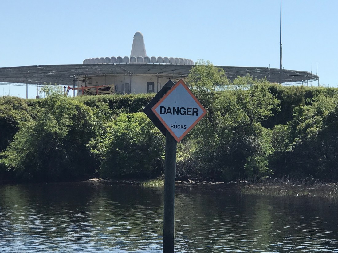
We passed the “Sombrero thing” that I could not quite figure out what this place was on our way down the ICW. Now we are heading back and I still have not looked it up.
We passed the Myrtlewood golf course right on the ICW. I’m thinking how many boats get hit with golf balls?


We also passed a home or restaurant that had all these HUGE ocean buoys all around their lot. I love red buoys and green cans but I’m not sure I’d want them as yard ornaments?


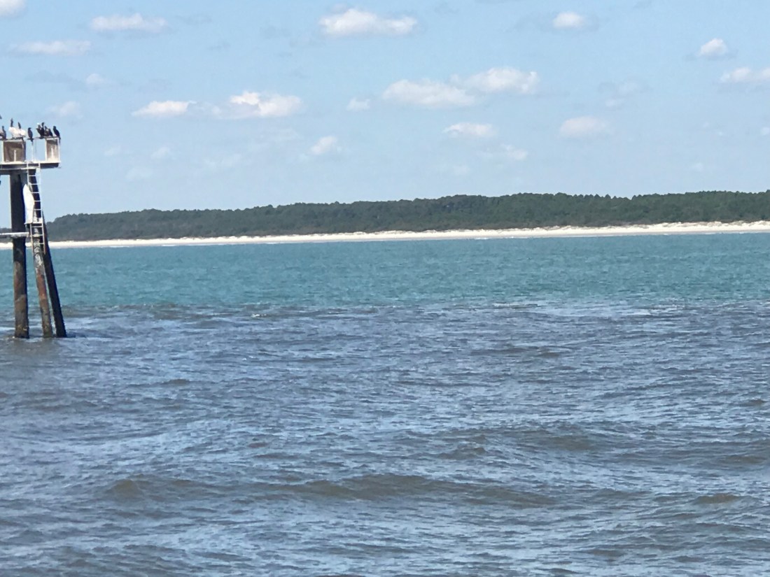
Then we came to “Little River Inlet”. You can’t miss it because it has this commercial fishing boat marking the entrance off the ICW.
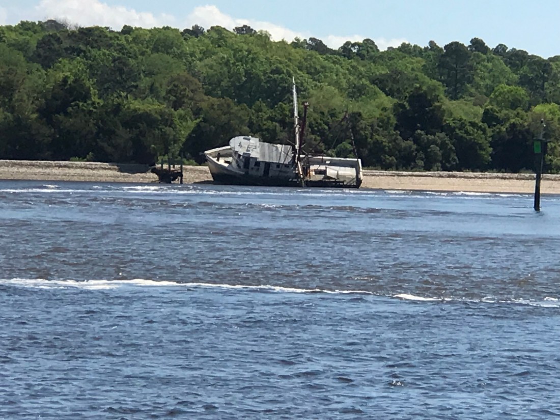
Kelly & I recall this inlet as one that we ducked into on our old sailboat, Skull & Swords. We were getting beaten up in a storm off Cape Fear and the moment we tucked into Little River Inlet it provided us with a place to anchor for the night.
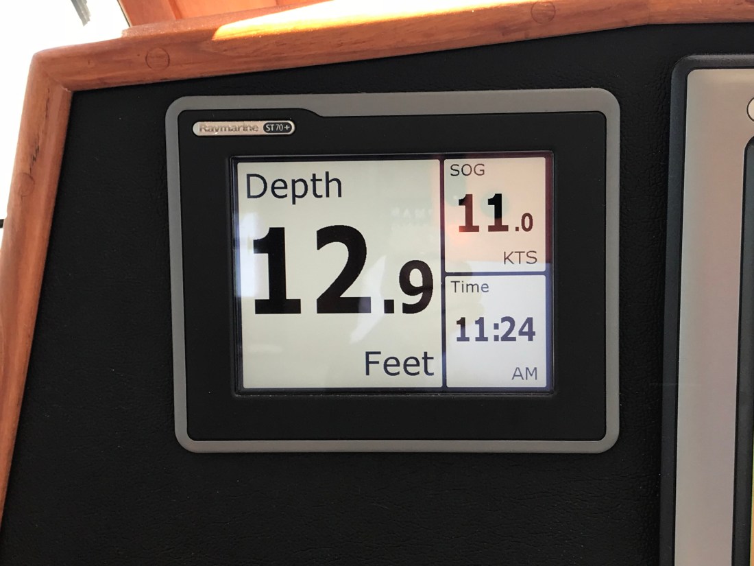
The ebbing current was running strong as we never hit 11 kts.
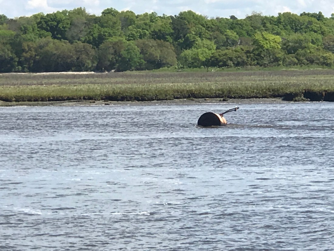
As you twist your way out to sea be careful of the floating steel drums that are just outside the channel.
Little River Inlet twists a sinuous path to the ocean.

The strong outflow created a distinct boundry between the brown, full of sediment water rushing out and the green water off the coast of NC.
Friends of ours, Jimmy and Wende had just taken their fishing boat out of Lockwood Folly Inlet and were chatting with us on the VHF. I had to raise my 45 degree lowered antennas to the upright position to get better reception. On the ICW you must lower your antennas to fit under low bridges. The reduced reception does not matter as you are really just communicating with a passing boat or a marina that you are next to. They were quick to end the call reminding me to put my antennas back up, which I just did after writing that 😉
The inlet they came out of might scare anyone who looks at it on the charts. When you see a bunch of shipwrecks dotting the inlet it might be telling you something about the inlet.

We had planned to go offshore at Little River Inlet and run the 25 or so NM to Cape Fear. However once we were outside we were enjoying making over 9 kts.

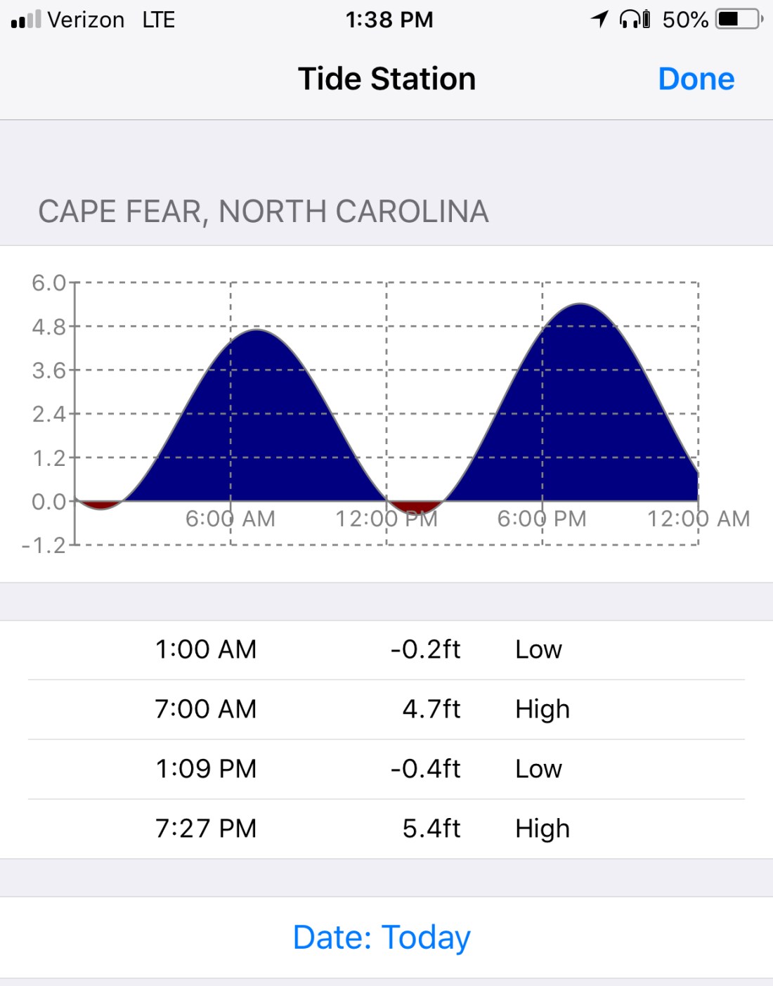
We decided to see if we could find a way through Frying Pan Shoals rather than around them. I spent some time plotting a course that in the end had us seeing 8.7′ at the lowest. Normally we would simply plot a course around Frying Pan Shoals but the added distance could mean a nighttime arrival. A check of the tides showed that we were not going to get much of a lift from the tide.
The swell presented a bit of a challenge as well. Ocean swell can push a boat closer to the sea bottom when you slide into the trough of a swell. The swell also can cause “breakers” (think breaking wave tops) where the shoals are shallow. Today however, as we cautiously motored over the shoals our path was uneventful. If you want to cross the shoal there is a path that lies about 3 nautical miles off the point of Bald Head Island. Just take your draft and everything else into consideration before you attempt.
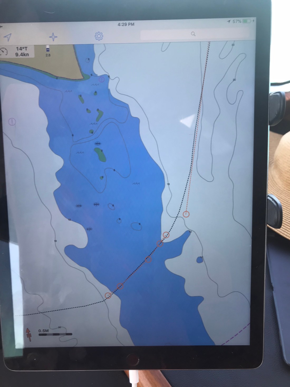
Once we rounded Cape Fear we were making good progress toward Masonboro Inlet and Wrightsville Beach. You can see on our iPad navigation app the boat icon that is us, a black dotted track line that is where we were as well as the magenta 3 mile offshore dashed line.

Once inside the inlet we quickly anchored up and watched the sun go down


While the sun was setting the full moon was already up.
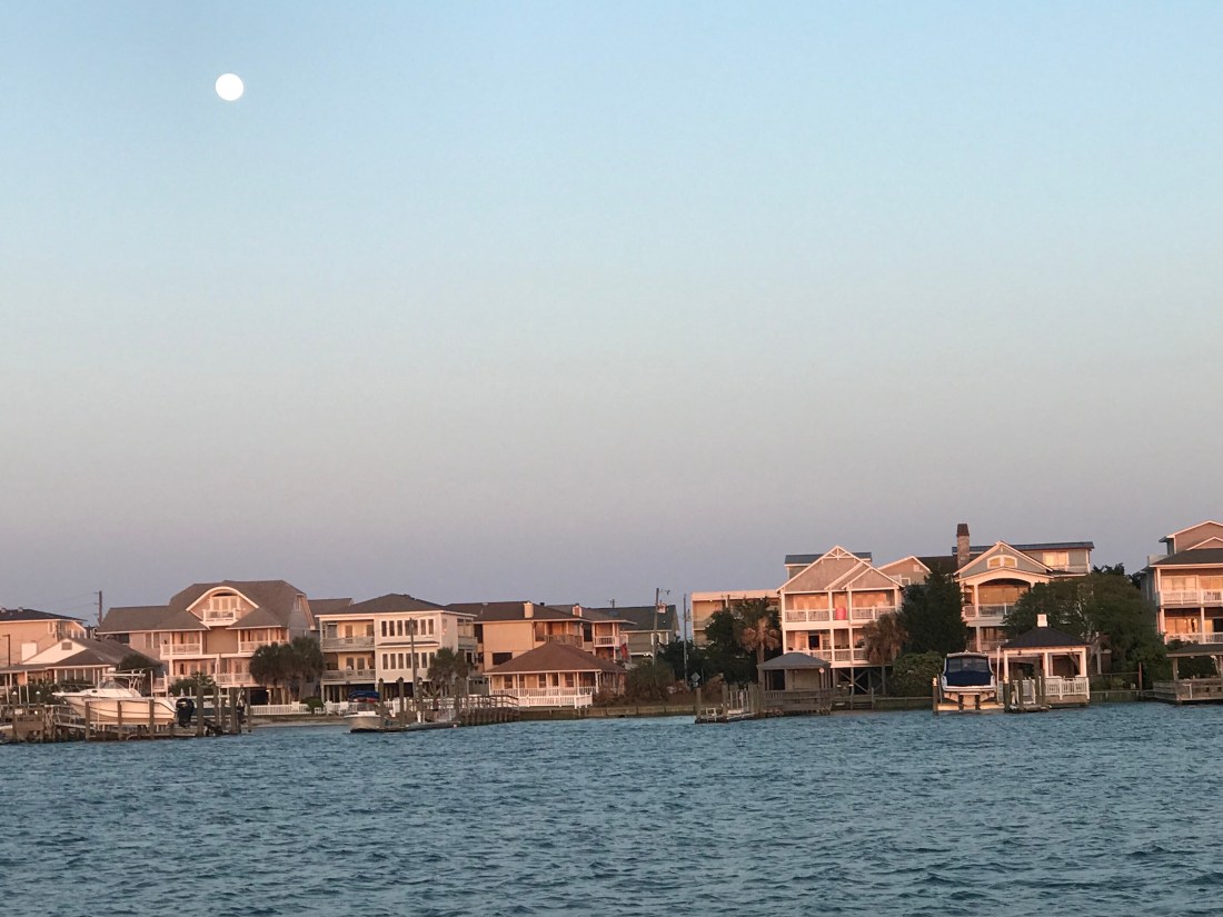
OK, it’s not technically a full moon but 98.8% is close enough. Tomorrow we’ll have a full moon.
