Because it was a 98.8% full moon, we pulled up the anchor and got underway before the sun had even risen.


As we skirted our way up the coast, we tried to minimize the length of fetch as the winds were blowing 20 kts from the NW (with gusts to 25 kts). Recall: a fetch is a distance of water that the wind has been given to blow over the top of. Wave heights build wave heights with distance.
Along the way we saw beach homes like these near Surf City


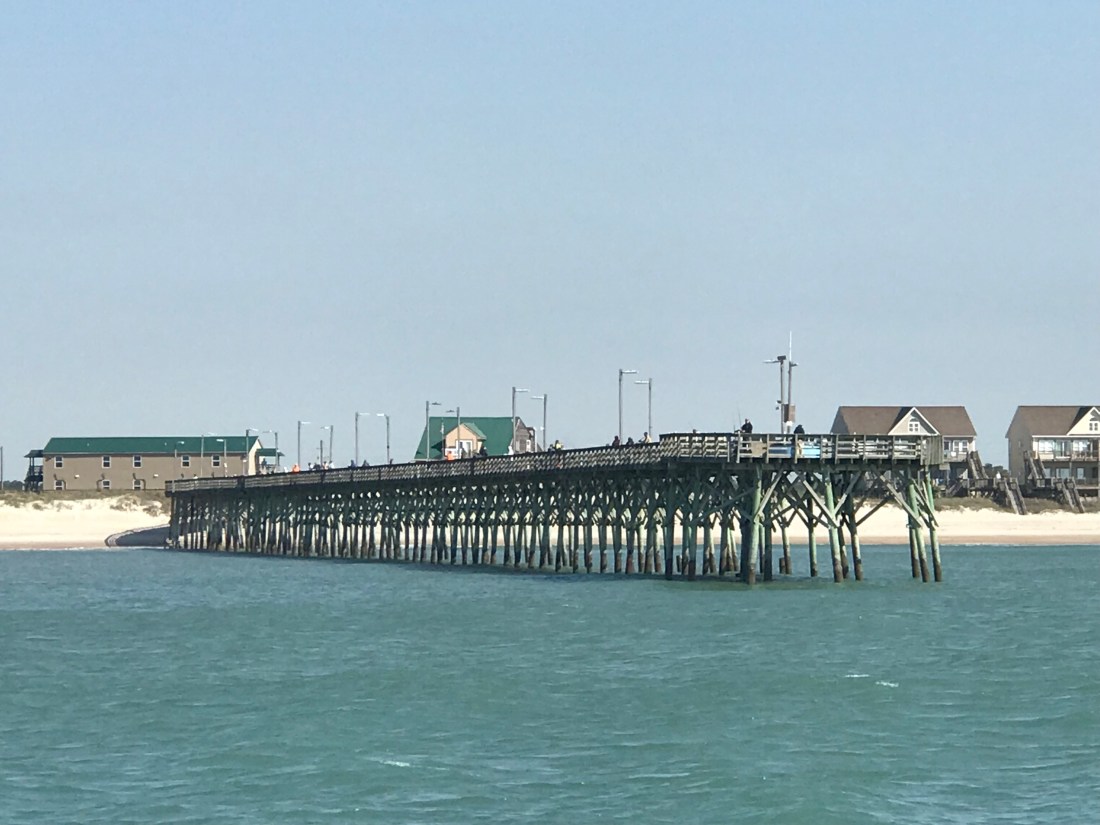
We saw a giant ocean-side pier near Top Sail Beach.
As we go, I’m always watching the depth sounder, ie sonar. It pings high frequency sound (like a dolphin) off the sea floor and displays the depth as a graphical chart over the last 60 seconds. It is very important to understand not just the instantaneous depth but also how the depths are trending over time. You need this info to ascertain quickly if you are running off a downhill slope or running aground. The steeper the incline, the faster in time the sea floor is rising up to meet you, metaphorically speaking. While watching the sonar, I repeatedly saw objects between the boat and ocean floor. I believe these depictions to be “bait balls” or schools of bait fish in a tight spherical grouping. Sometimes they are formed into these ball formations by preditors such as dolphins.


I’m no expert at reading the fish finder / depth sounder’s visually displayed ping returns, however, I also saw this fishing boat hauling a net.

The trawler’s size makes me think that they are hauling a small net sized for bait fish.
A moment later, we were passed by this Italian designed Azimut luxury motor yacht. She clearly has some horsepower in her diesels since… as big as she was, she was just skimming over Mother Ocean.

As we approached Beaufort, NC, we passed Brown’s Inlet. The ActiveCaptain description for this inlet simply says: “Browns Inlet is unmarked and used by local boats only; not recommended to strangers.”
Soon we were off Fort Macon State Park Beach which is just before Beaufort inlet, NC.


Running a dynamic inlet whose shoals change with each storm is not advisable as even the latest published charts with depth soundings will likely be incorrect. That said, we attempted to use the latest NOAA charts to sneak into Beaufort Inlet via a narrow channel close to shore. It was low tide so you don’t get any added water depth over the low water spot soudings. We entered the narrow natural channel displayed on our chartplotter. I checked the accuracy of the spot soundings (depth numbers) and the actual depths (reported by the sonar) were 3’ shallower than what my recently updated chart displayed. That was not comforting, but I still proceeded slowly at only 1.7 kts.

We will run aground at about 5’ and I was already in only 6.7’. To make matters worse, there was an ocean swell that was lifting and dropping the boat above and below the static ocean surface. I was confident that however “skinny”, “thin” or simply “shallow” the depths got that we would make it. After all my charts showed a low of about 10’ and we only needed 5’.
Well, we made it about 10’ from crossing into the deep channel when we bumped the bottom. You have to tell yourself: “resist the temptation to simply push the throttle forward and plow the next 10’ to the deep channel”. You just can’t know how shallow those next 10’ are. You could be pushing your boat up onto a shoal so shallow that the diesel engine / propeller combo won’t have the bite on the water needed to either push or pull you off the shoal. I opted to put her in reverse and spin her back the other way. We knew if we didn’t hit on the way in, we would not hit leaving.

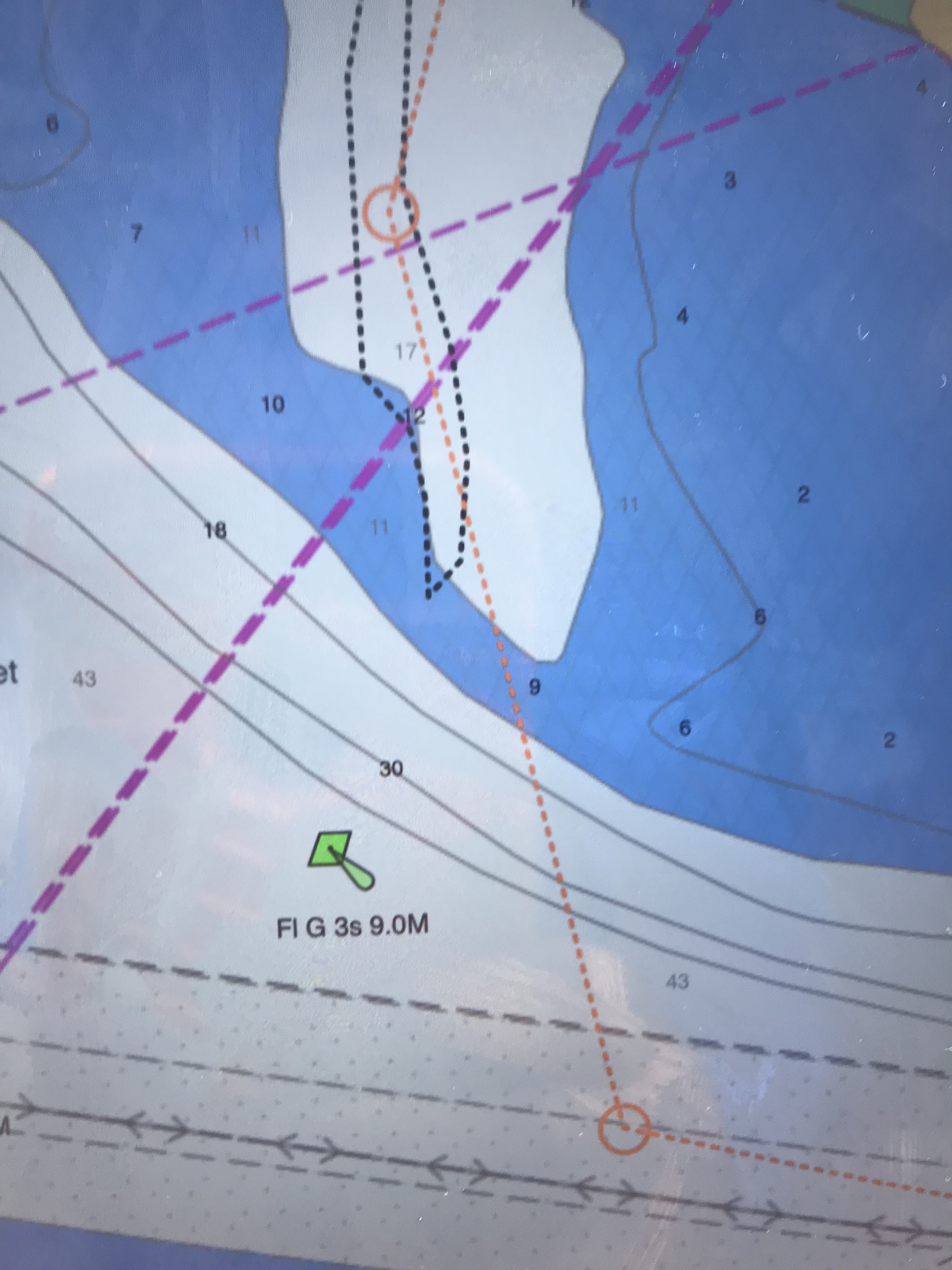
Note: The top picture showing the chart with 5.8’ depths displayed is not as recent as the chart depicted in the picture below it. We were literally 1/4 of a boat length from making it into the deep channel. You can see our track as we backed out. FYI: track = a black, dotted line or bread crumb path of where your boat has been. The dashed orange line with circular junction points is our plotted course. We backed out and came in the inlet via the mid-channel / safe water buoy. This buoy marks the center of the entrance channel. Line up with this vertical red-white striped buoy and you are heading directly in the inlet.
Confidence is a good thing as a captain but … so is restraint 😉
I was emailing with a fellow boater who was getting ready to come North from Vero Beach. They have owned their blue water trawler and traveled up and down the coast. However, I still added the below statements to my reply. I did so because, I myself, am often curious where other sailors draw the line at the decision to “go offshore or not”?
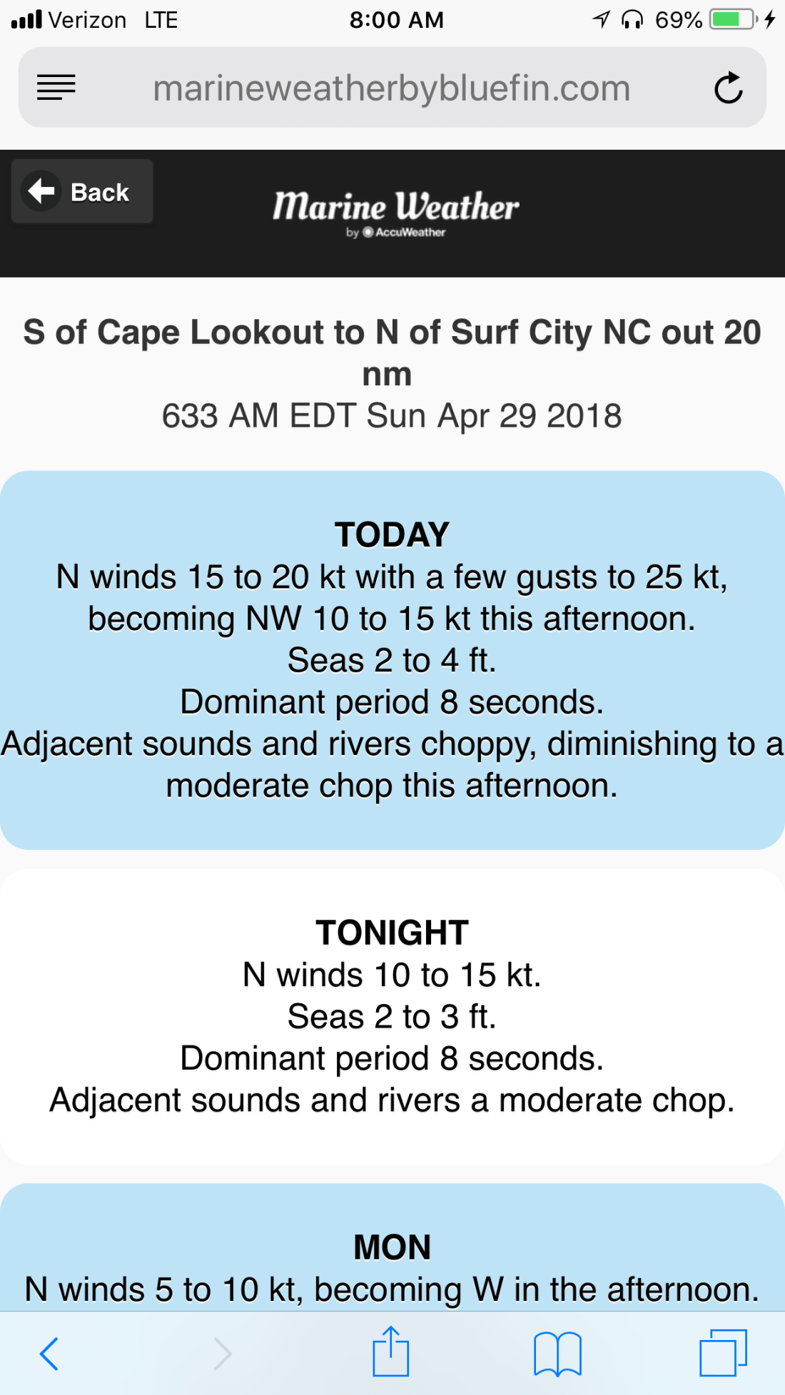
Marty Reply: I wish you fair winds and seas however, checking your weather forecast on my favorite web app: http://www.marineweatherbybluefin.com/united-states/app
The NWS weather zone just above Vero Beach shows 3-5′ waves with a 6 second period and winds out of the East. I hear that and think…
1. If the winds were instead out of the West, you could run North tight to the coast.
2. I prefer 2-4′ seas because 3-5 is the average wave height not the significant wave height.
3. Six seconds is a rather short period. I’m picturing steep waves. Your boat is stabilized, ours is not. I would not want 6 second period, 5′ possibly 7’ waves on my beam.
On my laptop, I like to use the Windfinder web app:
On my smartphone, I like to use the Windfinder Pro iOS app:
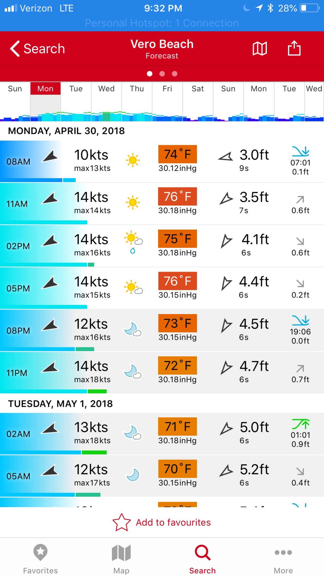
When you study the densely displayed data given by this app, you see that the waves during the daylight hours will be… at worst 4.5’, out of the NE with a 6 second period. The tide will go low about an hour before the sun sets (read that as… “about when you are entering the shoaling inlet from the sea”).
Then you say “4.5’ waves are not that bad”. However, that wave height forecast is based on a statistical wave distribution.

Make sure not to mix up “mean, median or average“
The average of the biggest 1/3 of the waves you’ll see are much larger, possibly to the height of 6.5’. That is uncomfortable to most crew in an un-stabilized trawler. Note: Blue water, top-heavy, flybridge trawlers often use active fins beneath the waterline to oppose the roll of the vessel to port or starboard. This can dramatically improve the conditions underway in a sea. Naiad is one such company who manufactures marine stabilizers.
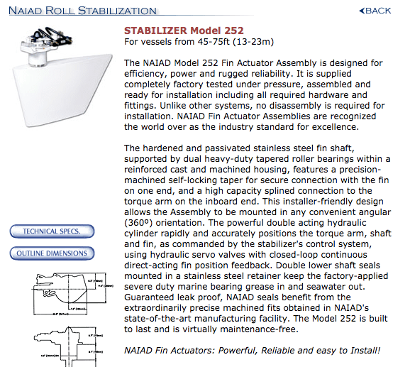
Here is a dated but decent overview of marine stabilizers:
After making our way in the inlet we passed ICW statute mile marker 200. Note: Mile 0 starts in Norfolk, VA and the ICW milage progress to statute mile 1243 in Key West.

We made it into Adam’s Creek before having to anchor up for the night. Adam’s creek offered us the last anchoring spot before we enter Pamlico Sound and must travel the next 25 or so nautical miles to the Goose Creek anchorages.
Our current anchorage does not offer wind or wave protection but the holding is good. The NE winds are forecast to be light, at only 10kts.
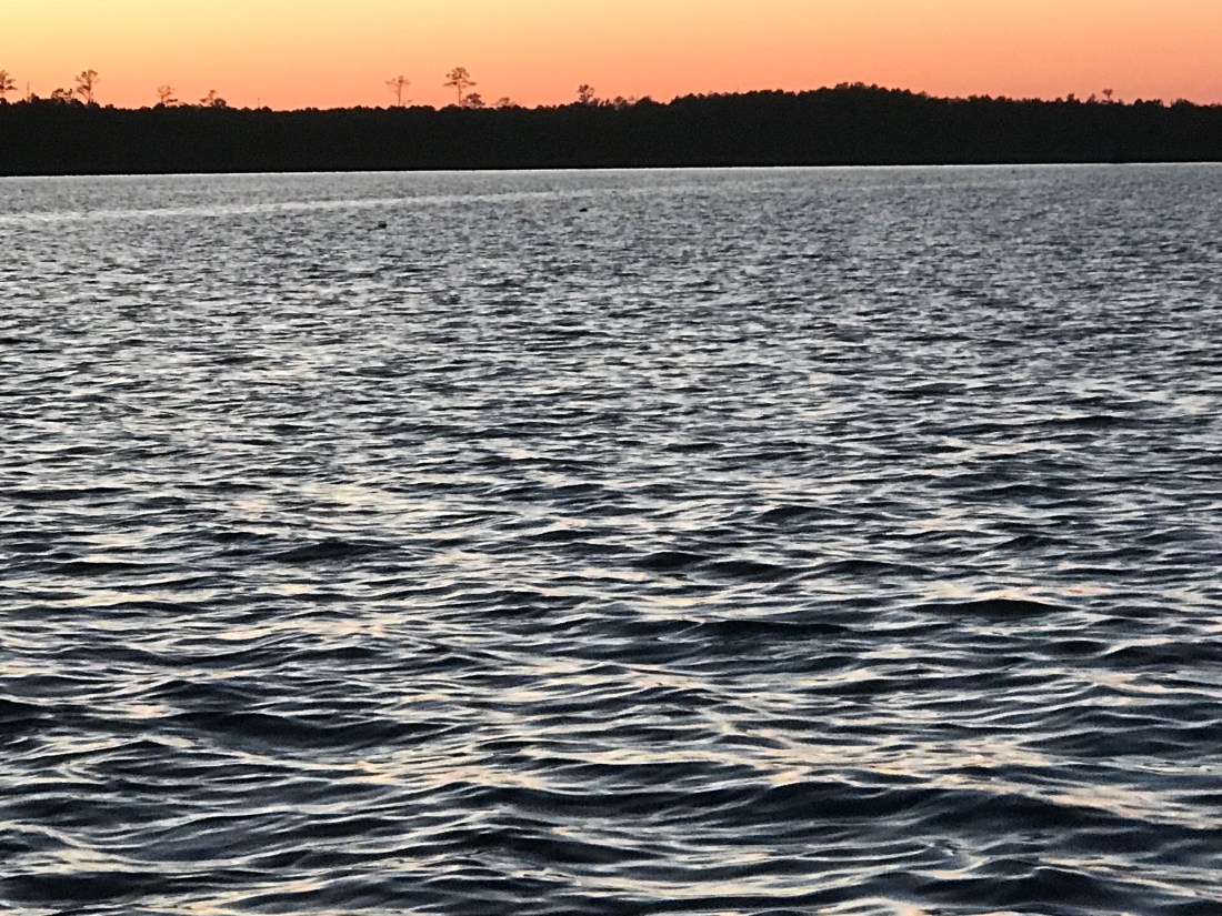
I found it interesting that we had a full moon rise off the stern and a simultaneous sunset off the bow.