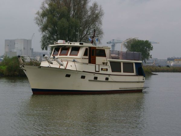
We departed Elizabeth City and I thought to myself… I’ll be back.
Terminator is leaving Elizabeth City, NC
We wanted to get ahead of the weather that was coming in two days. When you cruise on a slow boat, how far you get depends on how early and late you run. There is no “just crank up the throttle and double the distance”. That meant we were making breakfast while underway.
Captains Favorite Hash, Eggs & Bacon
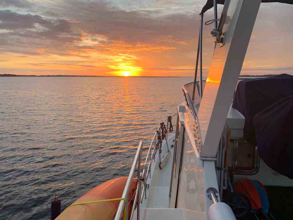
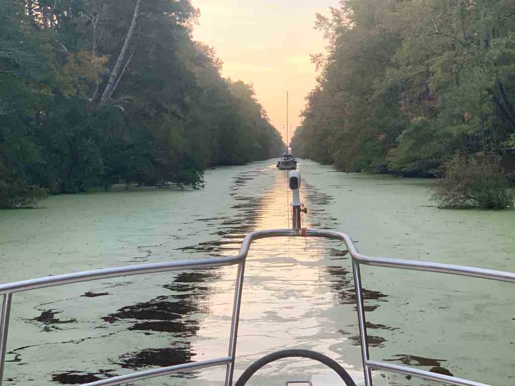
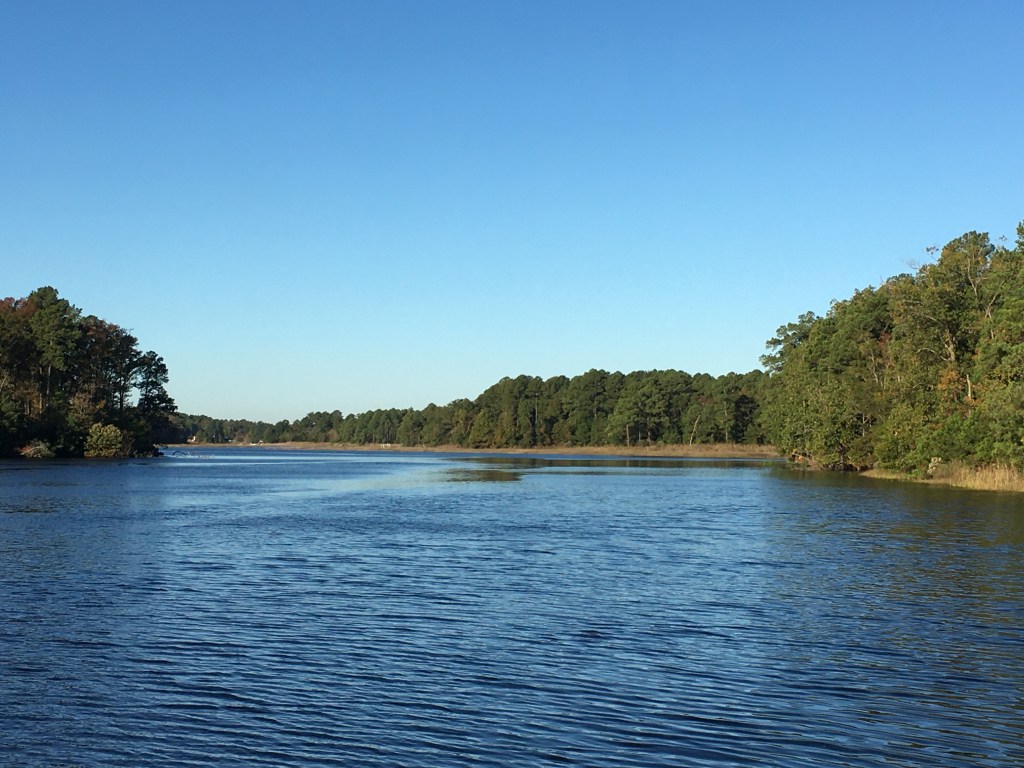
The cruise down the Pasquotank River was peaceful.
Pasquotank River Sunrise
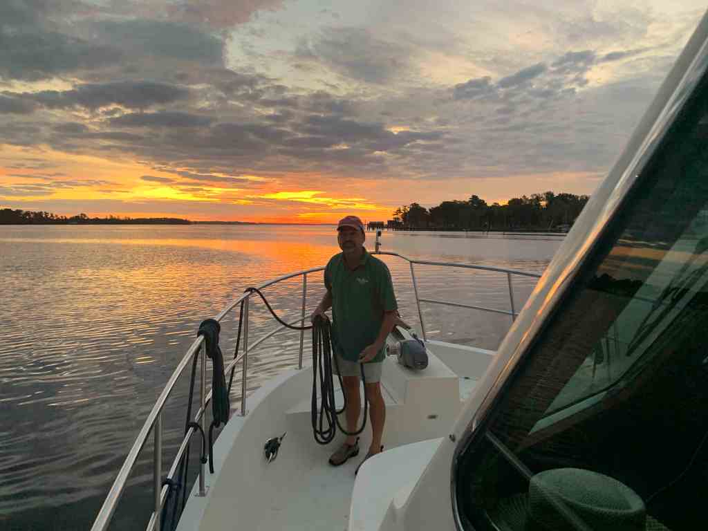
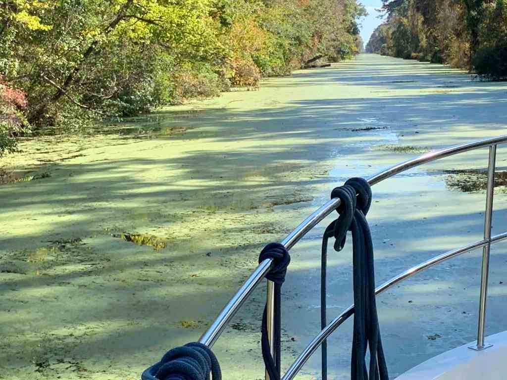
Buddy was working on the bow and the seas were flat.
Buddy Neatening our Lines on the Bow
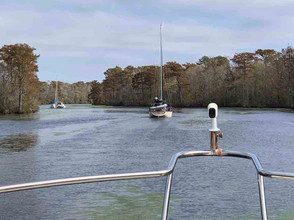
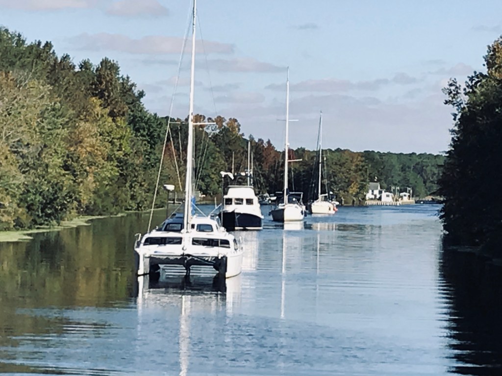
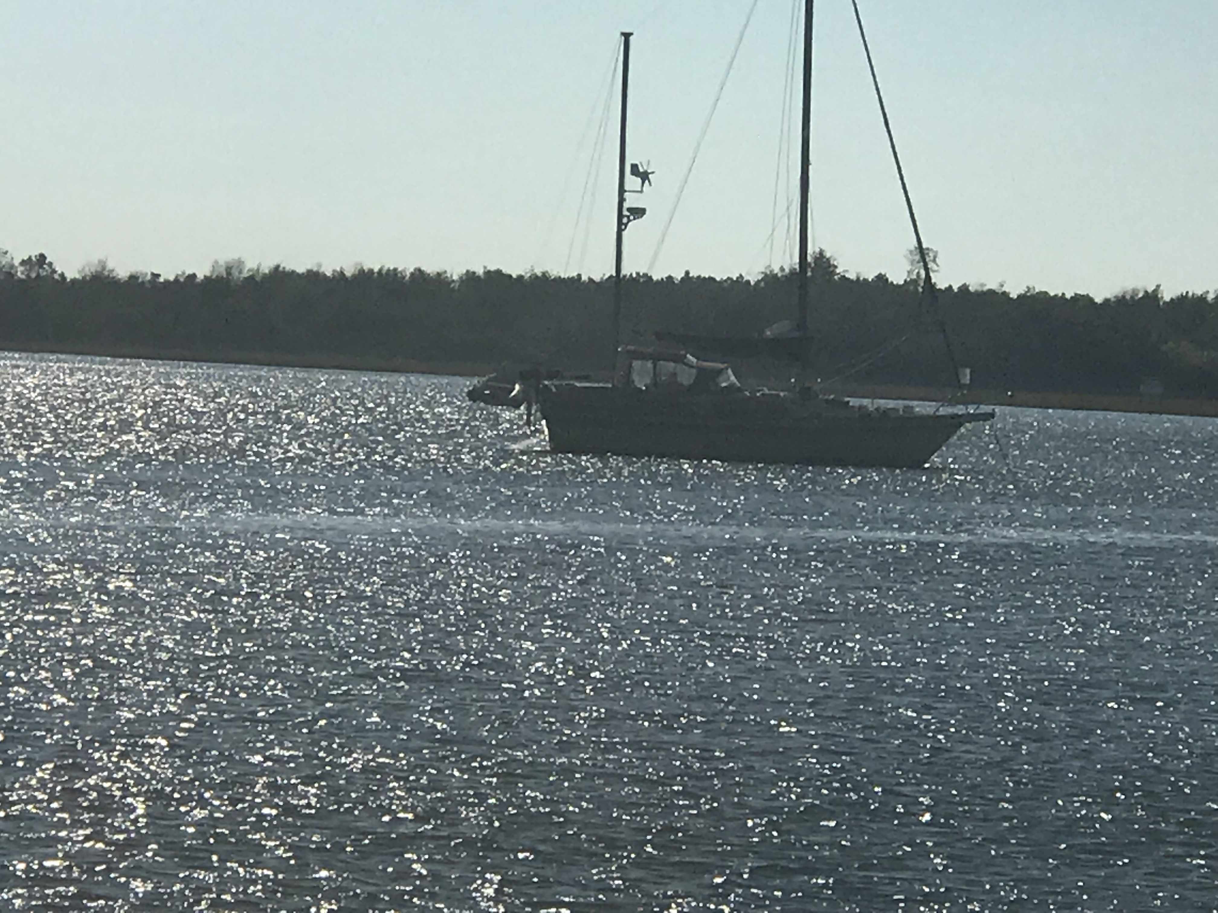
A catamaran was slowing passing us. I could not quite get the name but wonder now as I type if it was the catamaran that hailed from Alaska that we would eventually tie up next to?
Catamaran in the Pasquotank River
Buddy was quick to point out a dirigible hanger along the rivers edge. I had never seen one.
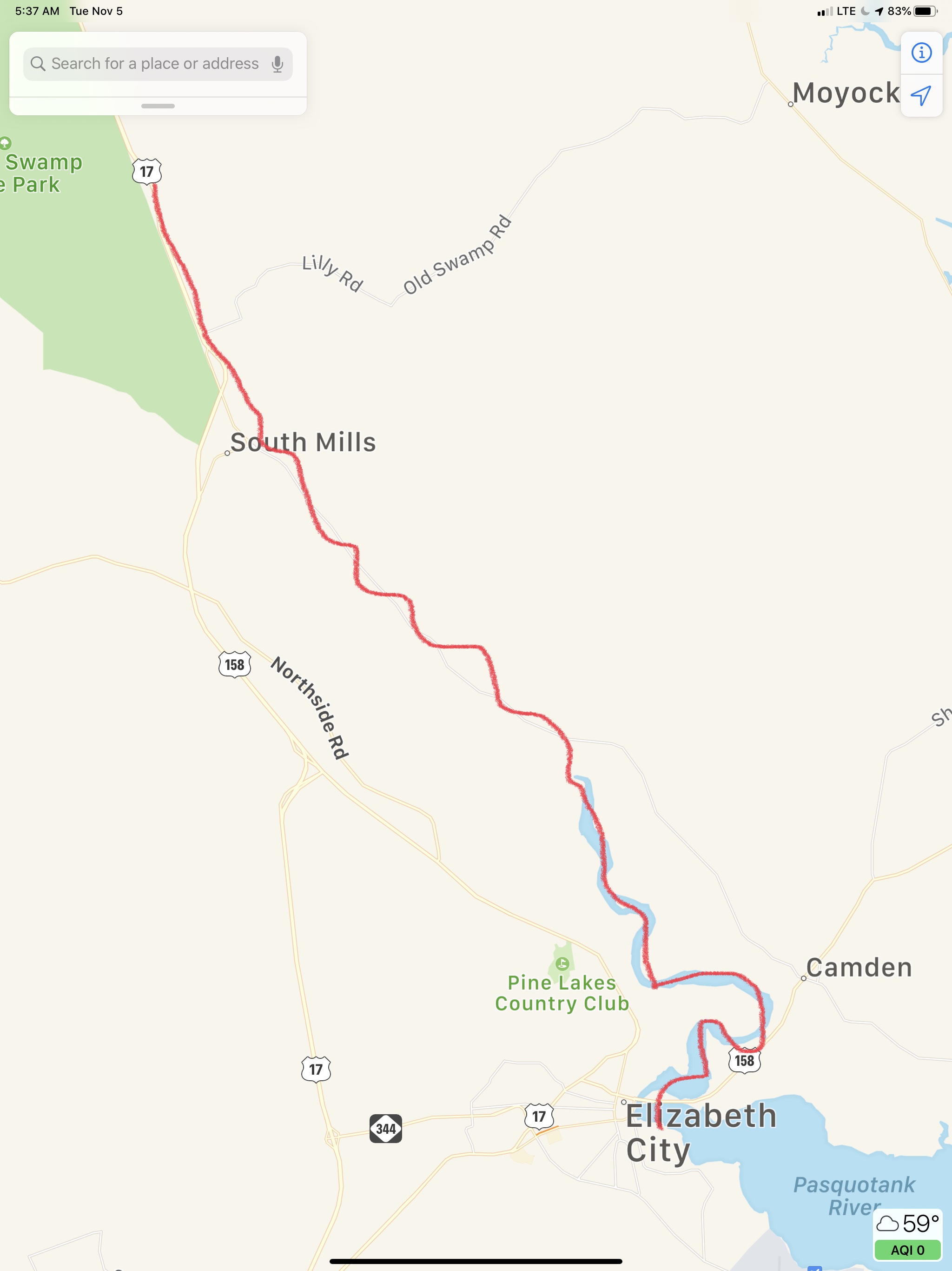
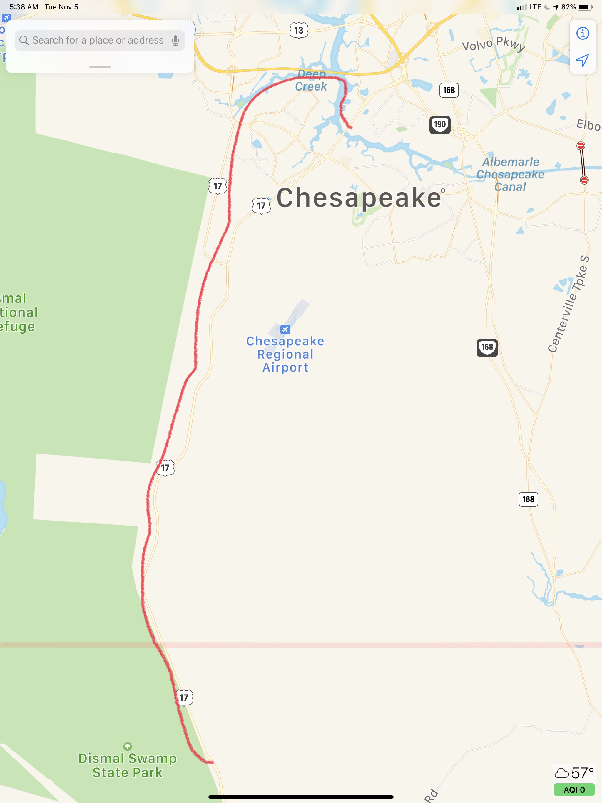
Soon we were crossing Albemarle Sound and making our way into the Alligator River. You must get through the Alligator River swing bridge before coming to the aptly named Alligator River Pungo River Canal.
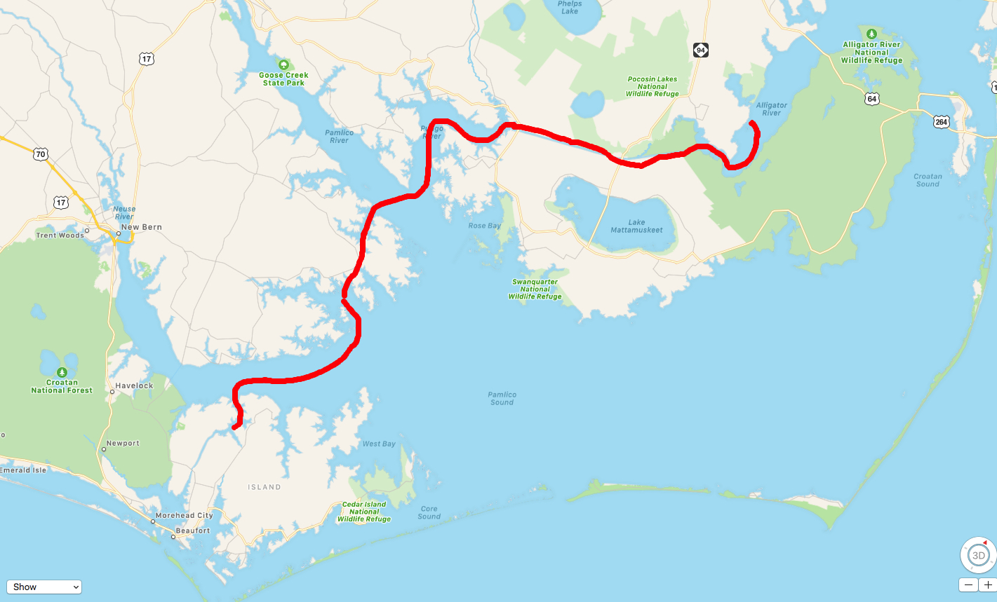
Approximation of Today’s Leg of our Journey
The southern end of the Alligator River begins to narrow and you find the entrance to the Alligator River Pungo River Canal. This canal was an engineered cut through the land and you can set the autopilot and go for what seems like miles before you have to make a tiny adjustment to your heading.
In the canal and all along the ICW you pass what are called ICW statute mile markers.
ICW Statute Mile Marker 115
You will almost definitely have to pass a tug & barge
Tug pushing a covered barge
Wave to the captain as you pass
With the day coming to a close we decided to anchor at the southern end of the canal rather than push on to the town of Belhaven, NC.
Our Anchorage for the Night
Luckily for us it was not duck hunting season or I’m sure we’d be seeing shotgun barrels poking out of the grasses that line the banks.
Early the next morning Ron & Teresa of SV Quinita casted off their lines from MV Simple Life. When you are tied to the dock and another boat is rafted to your non-dockside, extracting your vessel can be an awkward dance. They had departed so no dance required.
Today’s leg of our trip looked roughy like this.
Dismal Swamp Visitor’s Center – Elizabeth City
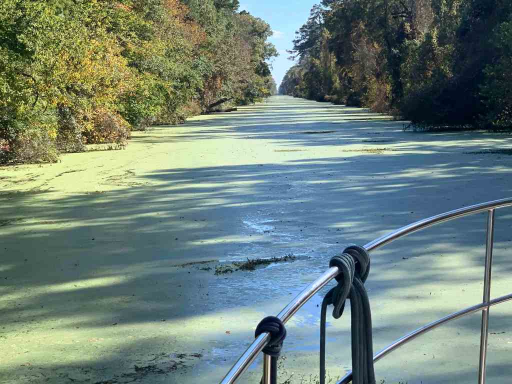
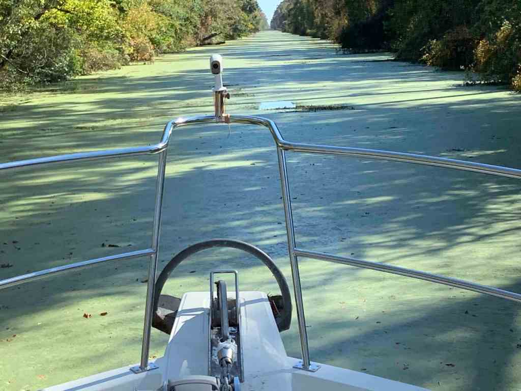
When we entered the Dismal Swamp we were the lead boat out of the lock and our new friends were following the path we cut through the duck weed. This time we were not the lead boat but following in the freshly parted duck weed. Is it better to be the lead boat or follow? We could never come to a conclusion.
Cutting a slice in the green carpetColor along the canal banks
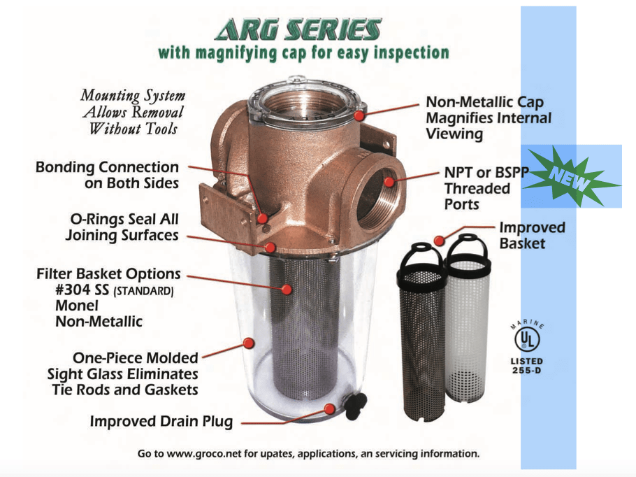
We were all aware that duck weed gets sucked into our engine’s sea water intake. This can clog the sea water strainer basket and stop the cooling water flow to your diesel. The lock master makes sure to remind every boater who enters the Dismal Swamp to maintain a close watch on your diesel’s cooling water temperature gauge. Periodically you may need to stop and clear the duck weed from your sea water strainer.
Clearing the Duck Weed from a Sea Strainer
Raw (sea) water path through heat exchanger
Groco Sea Strainer
MV Simple Life’s diesel coolant temp stayed steady at 176 degrees F throughout our entire time in the Dismal Swamp. We did however have to clean our 1/2 full sea strainer at the end of each day.
Soon we were in the second and last lock for the Dismal Swamp called the South Mills lock.
South Mills Canal Lock
Departing the South Mills lock we saw much less duck weed.
South of South Mills Lock
Our new friends Ray & Cynthia aboard SV Vela Blanca did have issues with their diesel overheating but Randy & Maureen “Moe”on SV Sailitude towed into Elizabeth City, NC where Ray was able to get the diesel engine issue taken care of and get back underway. Friends helping friends on the water (smile).
We arrived in Elizabeth City and had planned to stay at Mariner’s Wharf.
Mariner’s Wharf Elizabeth City, NC
The problem was as we watched the Elizabeth City Highway US 158 bridge gates go down to stop the highway traffic we noticed that only the first set of gates went down and the second set stayed up. The bridge never opened. We were guessing there is some form of interlock between the gates and the bridge opening mechanism. We hailed the bridge tender on VHF CH#13 and he responded that the bridge was non-functioning and no ETA to when it would work again. We circled as the bridge tender attempted several failed openings before we decided to pull Jennette Brother’s Free Dock just North of the bridge.
Jennette Brothers Free Dock
When we pulled up there was a friendly woman named Shiela who help grab our lines and get us tied up to the wall. We would later learn that Shiela and her husband Bill were traveling the ICW on a Tayana 42 Trawler. I did not get the name of their trawler but she told me it meant “Slow Turtle” in Hawaiian. Which Google translates to MV Lōkaha ka Makaula. I believe they were at Top Rack when we pulled in two days earlier. I noticed the raised pilothouse trawler because at only 42′ it had lots of great features such as a Portuguese bridge, twin diesels and just nice lines.
Not Slow Turtle but a similar Tayana 42
I guess I should have better judged how far that tree was sticking out into the water?
The wind was causing this tree to drop whatever it had on top of our fly deck.
Renee went to work on sweeping the stowaways overboard
So there we sat with no ETA on when the bridge would be fixed as we heard a sailboat coming down the river hail the bridge for an opening. The bridge tender responded that he would give it a try. I said to Buddy, “We’ll never be able to untie, get underway and through the bridge before it closes even if it does open”. Buddy was already untying the lines and suddenly the bridge began to open! I quickly started the diesel, Buddy tossed lines and jumped aboard. With a quick punch of the throttle we were slipping beneath the bridge!
Just the other side of the bridge we tied up to the free dock @ Mariner’s Wharf. Our swamp friends also grabbed spots on the free dock and we all agreed to grab dinner at Cypress Creek Grill.
Cypress Creek Grill
It’s a short walk to the restaurant but the town looks like a place we could spend a few days exploring. Maybe learn about Culpeper’s Rebellion
Tax my Tobacco I say… Revolution!!!
We Wax ALL the Things 😉
Swamp Friends at Cypress Creek Grill Front left going clockwise: M ichael & Kristen of SV Makai, Curtis & Kim of MV Blue Rhapsody, Marty, Renee & Buddy of MV Simple Life, Maureen & Randy of SV Sailitude
Dinner with swamp friends was the best end to our stay in Elizabeth City we could have asked for.
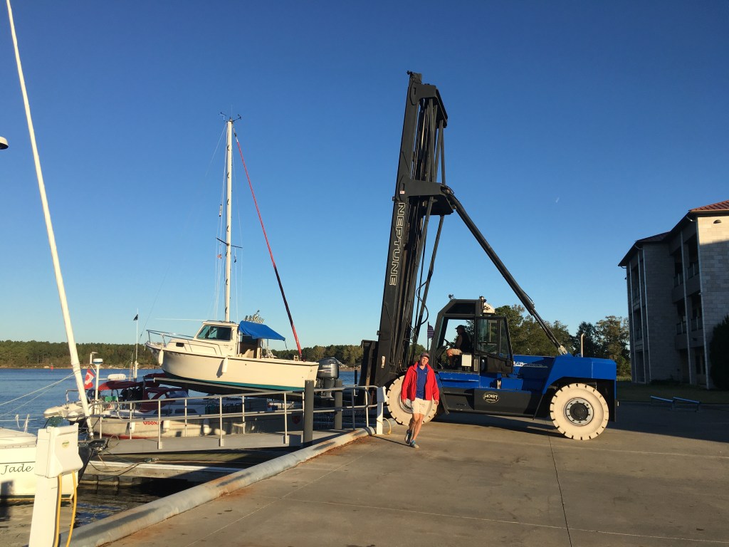
As we got ready to depart Top Rack Marina we watched as several boats were splashed down by an oversized forklift.
Forklift on Steroids
Forklift Splashing a cuddy cabin
We quickly cast off the lines and turned north putting Top Rack on our starboard side. Several boats remain in their slip for an extended stay.
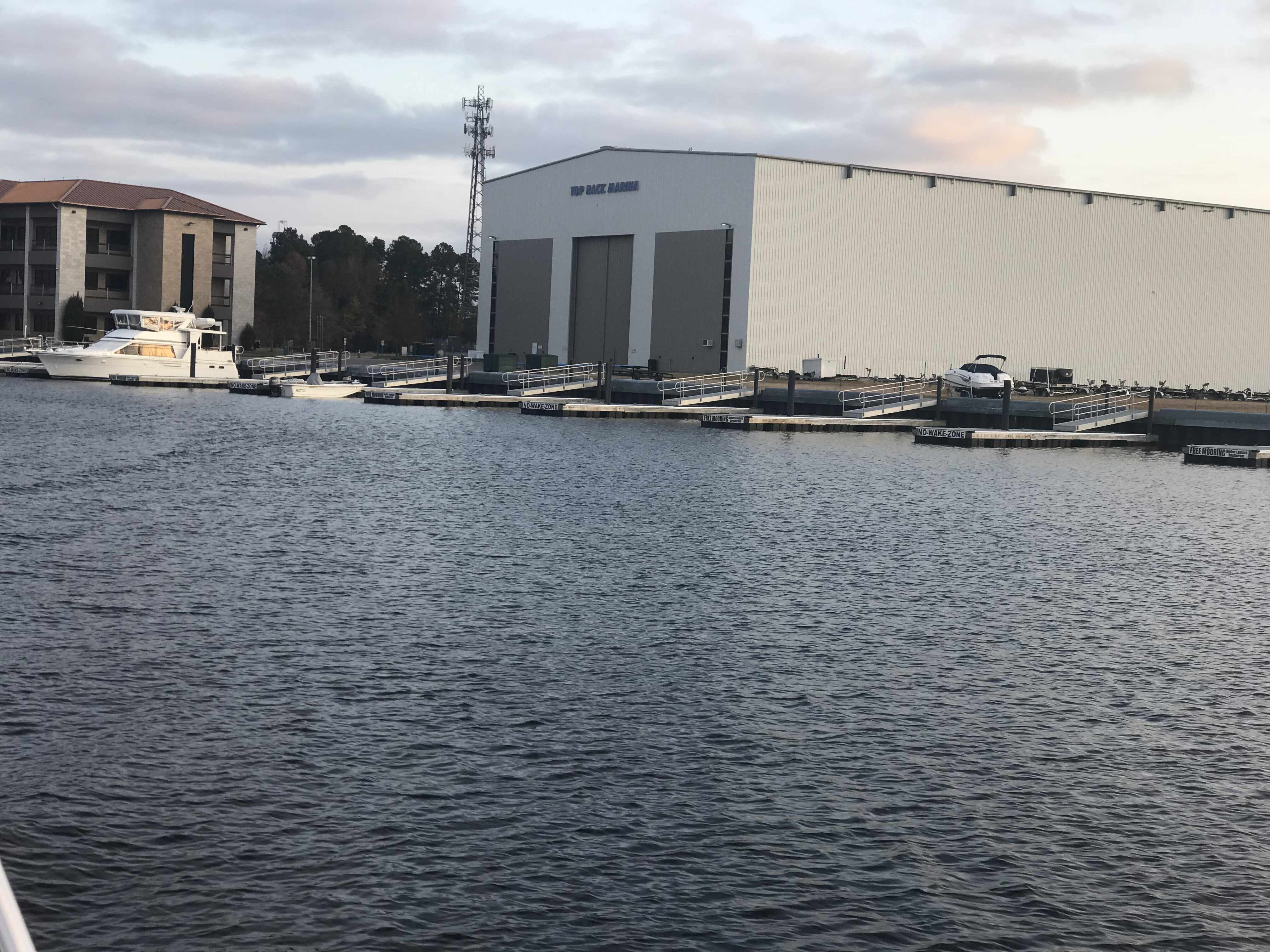
Top Rack Marina
Our planned route would land us at the Dismal Swamp Visitor’s Center.
Top Rack Marina – Dismal Swamp Visitor’s Center
The Great Dismal Swamp
In the morning we turned north instead of south because we had to backtrack about a nautical mile to get back to where the ICW bifurcates between the Great Dismal Swamp route or the Virginia Cut. Most ICW cruisers chose the Virginia Cut route as it is the preferred route south.
We chose the path less traveled…
Start of the Great Dismal Swamp Route When Heading South
Hazards
The Dismal Swamp route is beautiful but notorious for duck weed clogging your engine’s sea strainers and “dead heads” (trees stumps just barely protruding above the water’s surface or sometimes just below).
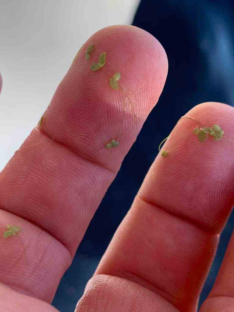
Duck Weed Drifting Past
Duck Weed 1
Duck Weed 2
Duck Weed 3
Deadhead
Being very familiar with the airline industry, I think Buddy & Renee might have an alternate definition of deadhead.
Alternate Definition: A dead head is an airline crew member, a pilot or a cabin crew, who is assigned to fly to a particular destination to assume a duty. In the flight where he or she is in, she’s not supposed to work as a crew. He or she shall be in a complete uniform, thus making him or her able to sit on a jumpseat if the flight is full. Deadheading crew are also paid based on their flying time.
Deep Creek Lock
The Dismal Swamp route requires you to pass through two locks rather than one via the Virginia Cut route. Heading south, the first of these locks is the Deep Creek Lock. This lock only opens at predefined times. Schedule: Opens 8:30am, 11:00am, 1:30pm, 3:30pm. We were a bit early so we dropped anchor in the middle of the channel to wait for the horn to sound that it was opening.
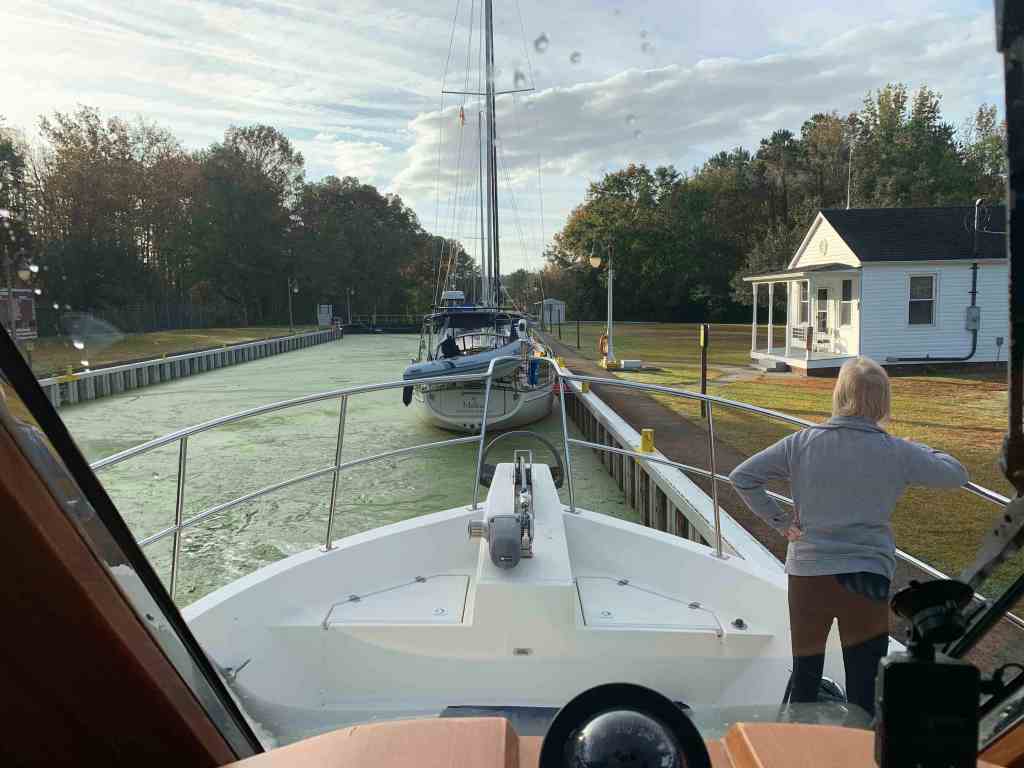
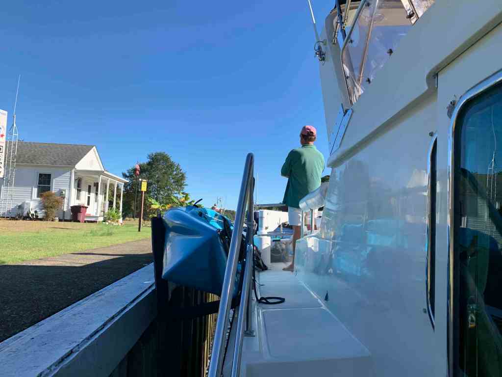
When the lock opened we weighed anchor and proceeded in following lock master Robert’s detailed instructions. We prefer when the lock master gives you explicit instructions and Robert was quick to let us know that he wanted us to hand him the stern line first. He asked for the middle of the line to be placed on the end of his boat hook leaving us to hold the bitter end. Robert would loop our lines over the bollards that line the edge of the lock. The rest of the yachts following us made their way into the lock behind us. .
Renee keeping Simple Life tight to the lock wall
Buddy in Deep Creek Lock
Yachts following us
Entering Deep Creek Lock
Lock Master Robert has been working the lock for some time now and is full of colorful info about the history of the lock that involves George Washington.
Upon the last yacht exiting the lock, Robert explains that he is also the bridge tender for the next bridge around the corner. Robert must get in his car and drive down around the corner so he can operate the Deep Creek bascule bridge.
Deep Creek Bridge
Once under the bridge we waved goodbye to Robert as he stuck his head out of the bridge tender’s house.
Deep Creek Lock Master Robert Saying Goodbye
Through the lock you instantly notice that the duck weed has gone from sporadic to a floating carpet of green.
Duck Weed Between the Locks
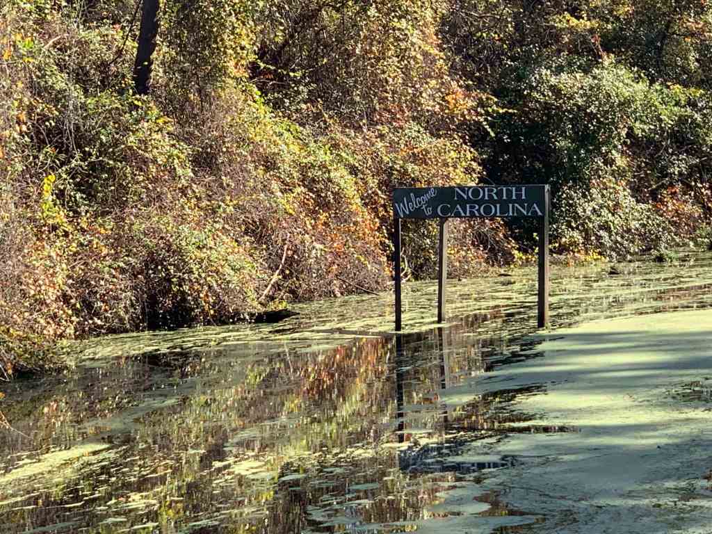
Eventually you arrive at the state line heading into North Carolina.
Arriving first at the Visitor Center’s tiny dock we quickly set fenders not only on the dock-side but also the canal-side. This would allow the boats following us to raft alongside us. Soon we would be jumping onto some of the other boats that were already docked there to help the boats behind us tie up to the other boats. Luckily the boats already there had their fenders set expecting possible raft-up buddies.
Swamp Friends
Once we were docked I went out to the foredeck to invite the other captains and crew to come aboard MV Simple Life for a cocktail or two.
Kim & Curt on the Flydeck of MV Blue Rhapsody
In no time at all every captain and crew would find themselves squeezed into the pilothouse. It was clear within seconds that this group would become our Swamp Friends.
Swamp Friends
What a fun time we had. The boater talk was non-stop and eventually turned to either “batteries or poop” as we often joke.
Yacht Battery Bank
Pumpout!
Soon it was dinner or supper time (depending on your definition of dinner) and each crew returned to their boats as we prepared sausage, pepper & onion subs with red sauce.
Trevor & Jess
As we were preparing dinner a friendly couple yelled “hell0” from out on the dock. Buddy was talking at them through the window and quickly asked them if they would like to come aboard. They accepted and came aboard for some conversation, drinks and dinner.
Trevor, Jess & Capt Mahty
From the moment Trevor and Jess came aboard we became fast friends. The couple has a YouTube channel called 9to5Less so please checkout their channel and subscribe.
Trevor and Jess light up a room the moment they walk in. These two had us laughing so hard about their misadventures aboard their houseboat as well as a catamaran that they were in the process of restoring while they cruising up the ICW.
Upon learning that their boat lacked proper lighting we knew we had found a new home for the two solar lights aboard MV Simple Life.
Trevor to Starboard, Jess to Port
They stayed until our sides hurt from laughing. We wished them well on their future cruising and told them we were sure we’d cross paths again.
We had spent the night on anchor in Mile Hammock Bay. The shore around this bay is on the property of Camp Lejeune. Marine Corps Base Camp Lejeune is a 246-square-mile United States military training facility in Jacksonville, North Carolina. The base’s 14 miles of beaches make it a major area for amphibious assault training, and its location between two deep-water ports allows for fast deployments.
Mile Hammock Bay, Camp Lejeune
I woke up in the middle of the night and it was cold.
Cold Camp Lejeune
I spent some time in awe of the stars that felt so close you could touch them. I’d have taken a picture of them but it just doesn’t work when you’re aboard a rocking boat. It reminds me that we are all spinning around on a rock in space surrounded by an endless cosmos. I like feeling small and insignificant in the cosmos. It means my life is more intimate. I chose to spend it with the folks around me and that is what gives it meaning.
It was still dark at 6:30AM as I was pulling out of the bay and onto the ICW. Disappointed that I could not share a picture of how amazing it was to lay under the stars I thought I’d leave the helm and walk to the stern to snap a picture of the proto-sunrise that was taking shape behind us.
Proto-Sunrise
Whenever I leave the helm on the ICW you must be quick. There are many times you find yourself looking down at an iPhone or iPad to measure the distance to the next bridge or calculate your arrival at your planned anchor location. Take your eye off the helm for more than 10 seconds and you may find that you’ve run over a crap pot, hit a shoal or just ran into the bank of the ICW. This fellow ICW boater ran aground when his teenage daughter spaced out while at the helm. The boat and crew were fine and while it can be embarrassing it’s something that can happen to anyone when you’re pulling 10-12 hour days staring at the helm and things passing you by.
whoops
Soon we were passing Carolina beach and the grasslands are beautiful.
Carolina Beach NC
We passed a pink house on it’s own rock island with a dock leading out to it.
Pink House on a Island of Rock
Long Fixed Dock Grants Access
As we made our way South we came to Snow’s Cut. A ‘cut’ is a canal that has literally been ‘cut’ through land to form a canal for boats to travel from one river to another. It appears as if this abandon bridge is a popular place for teen parties.
Capt
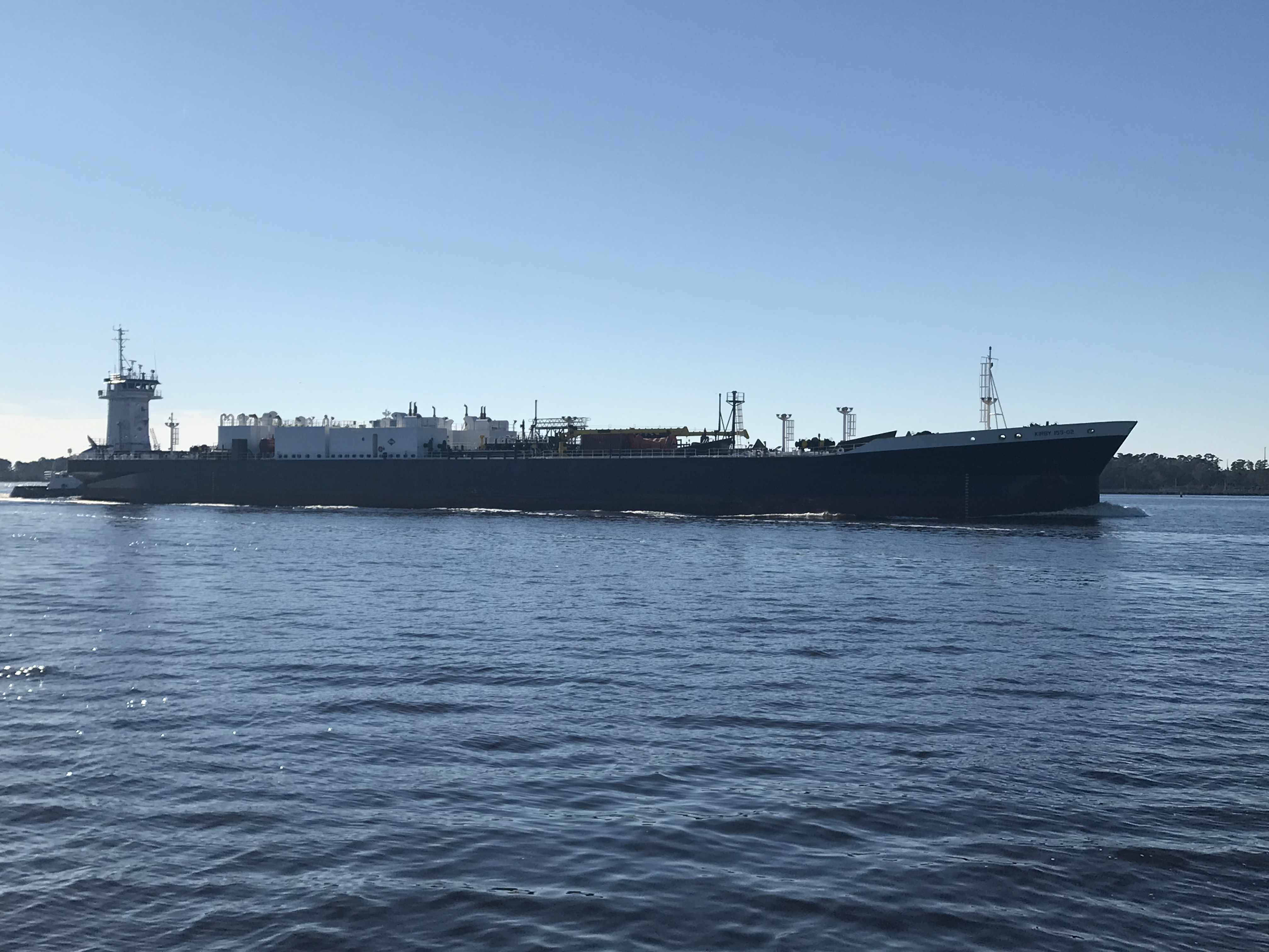
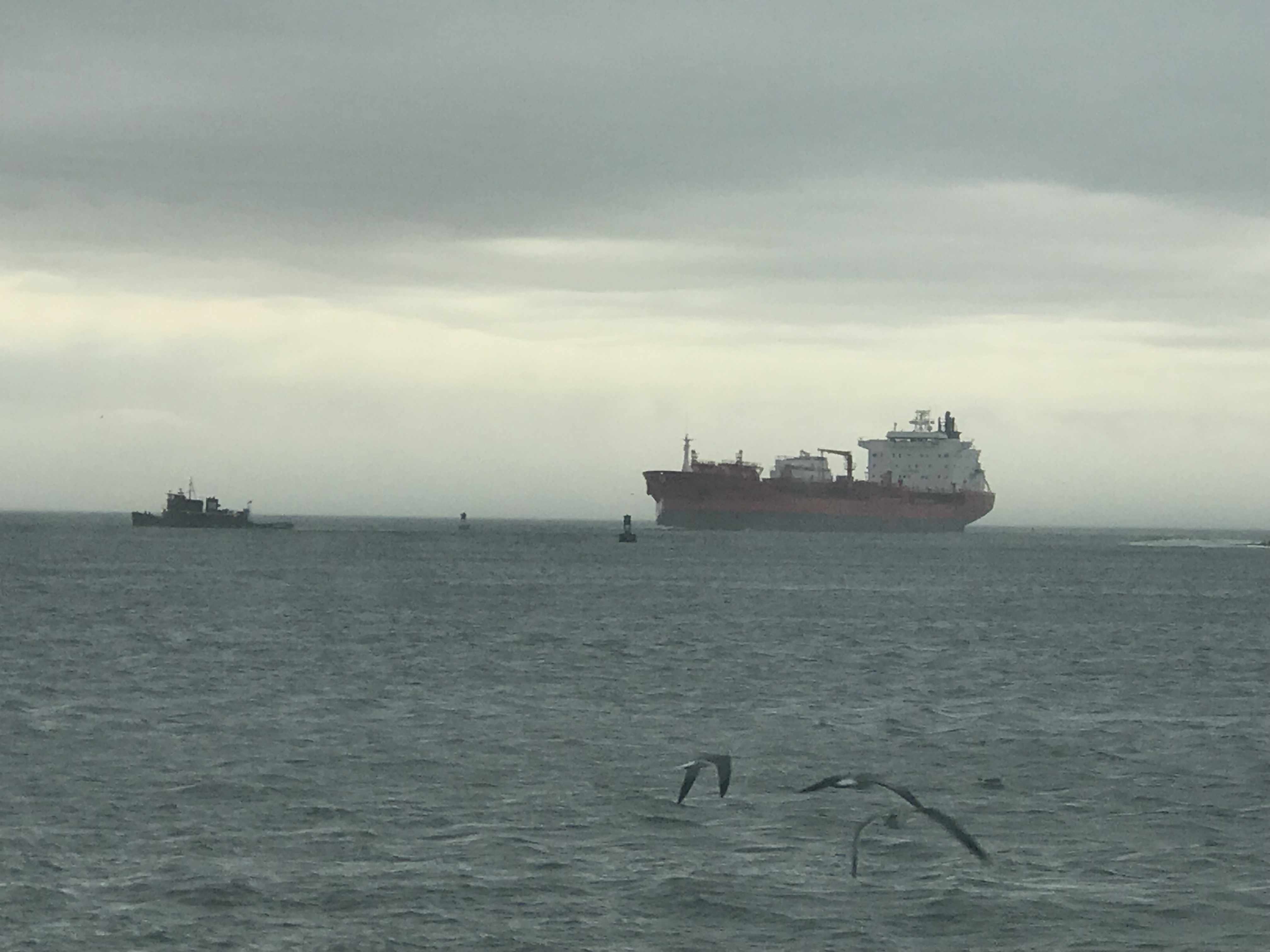
Next it was into the Cape Fear River. This river is deep and has a strong current. You must stay clear of the larger traffic in the channel like this tug pushing an LNG tanker.
Tug & LNG Tanker
To get to the marina we were going to spend two nights at we had to turn to starboard at the Frying Pan Restaurant. I recall seeing photos of this restaurant during Hurricane Florence. The restaurant was flooded. I can’t tell for sure but they look to be up and running as we passed?
Frying Pan Restaurant
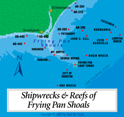
If you are familiar with Cape Fear you’d know that this restaurant is named after the famous Frying Pan Shoals that extend out some 15 miles off the coast of NC.
There is an abandoned tower that marks Frying Pan Shoals and guy bought it at auction and is now making a bed & breakfast out fo the tower that lies some 39 miles off the coast of Cape Fear. How cool would it be to stay for a night? Here is a video of someone dropping a camera off the tower and down into the water. By the way to get into the tower you must be hoisted up on a cable.
Frying Pan Tower B&B
We arrived at St. James Marina and were excited to spend some time with friends. Jim was just getting back from a fishing trip out to the gulf stream some 50 miles of the coast of Cape Fear. The weather was rough so I think it was a wet salty ride back in this fast open fishing boat.
The Marina is a beautiful place to spend time and it was worth the trip. Our trip looked something like this.
We loved our stay in Beaufort, NC but we awoke to 34 degrees and it was time to leave.
We had lots of fun in Beaufort riding around in the sexy loaner car. The car was green but the door was red. You had to pump the breaks to slow down and it had a death rattle sound as you drove down the road. We loved it. It was FREE.
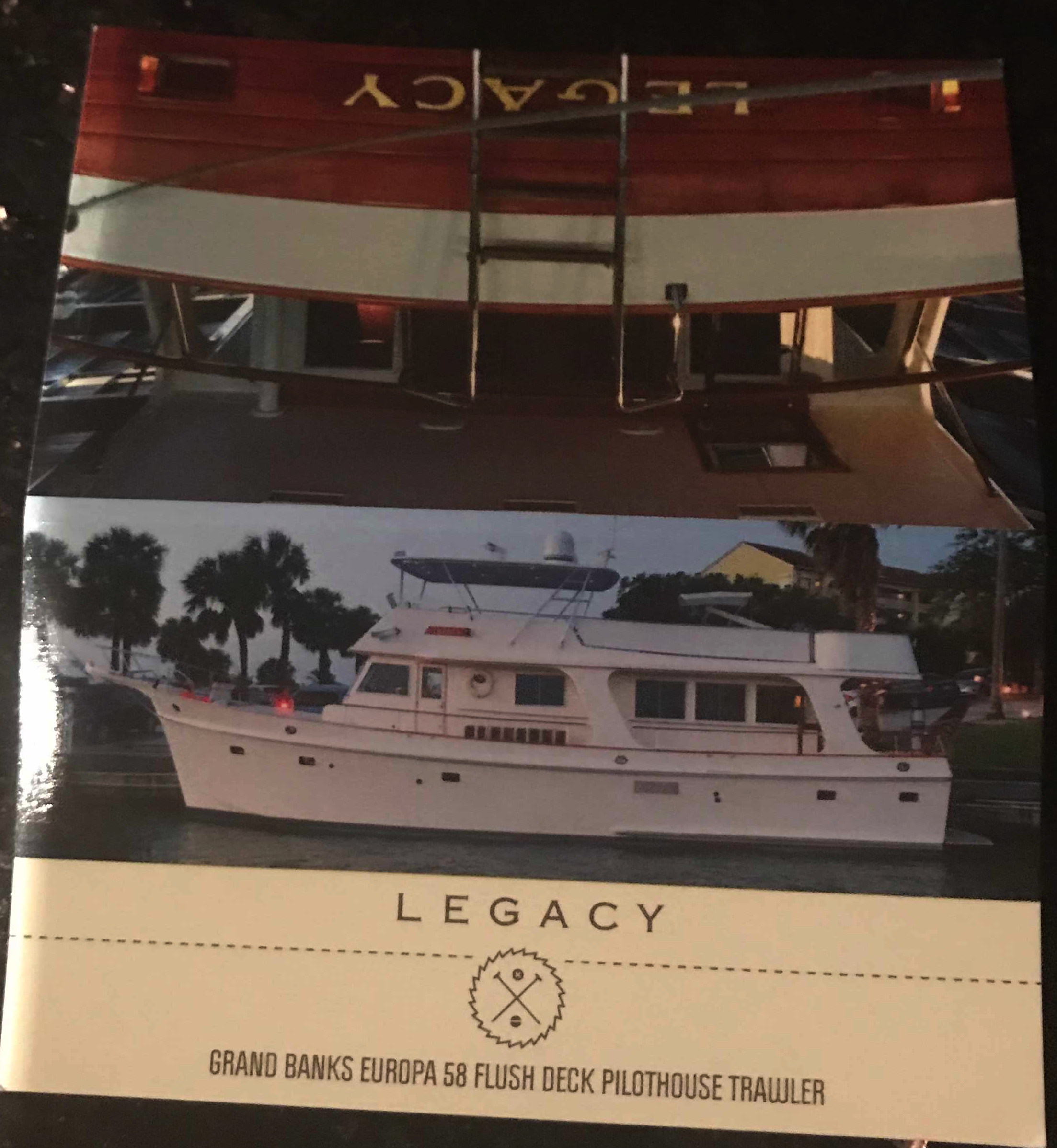
We decided to do a pub crawl through Beaufort but we only made it to the Black Sheep Bar which was 20 feet from our boat. We met Capt. Scott from MV Legacy (58′ Grand Banks). Capt Scott kept us entertained with stories about his grandparents yacht that he was now the captain of. Capt Scott even gave me a tour of MV Legacy when we left the bar and she was very impressive.
Our GPS tracker was capturing our journey as we headed South. It clearly was not recording where the straight lines are shown but it gives a reader an interesting view of our last few days of travel.
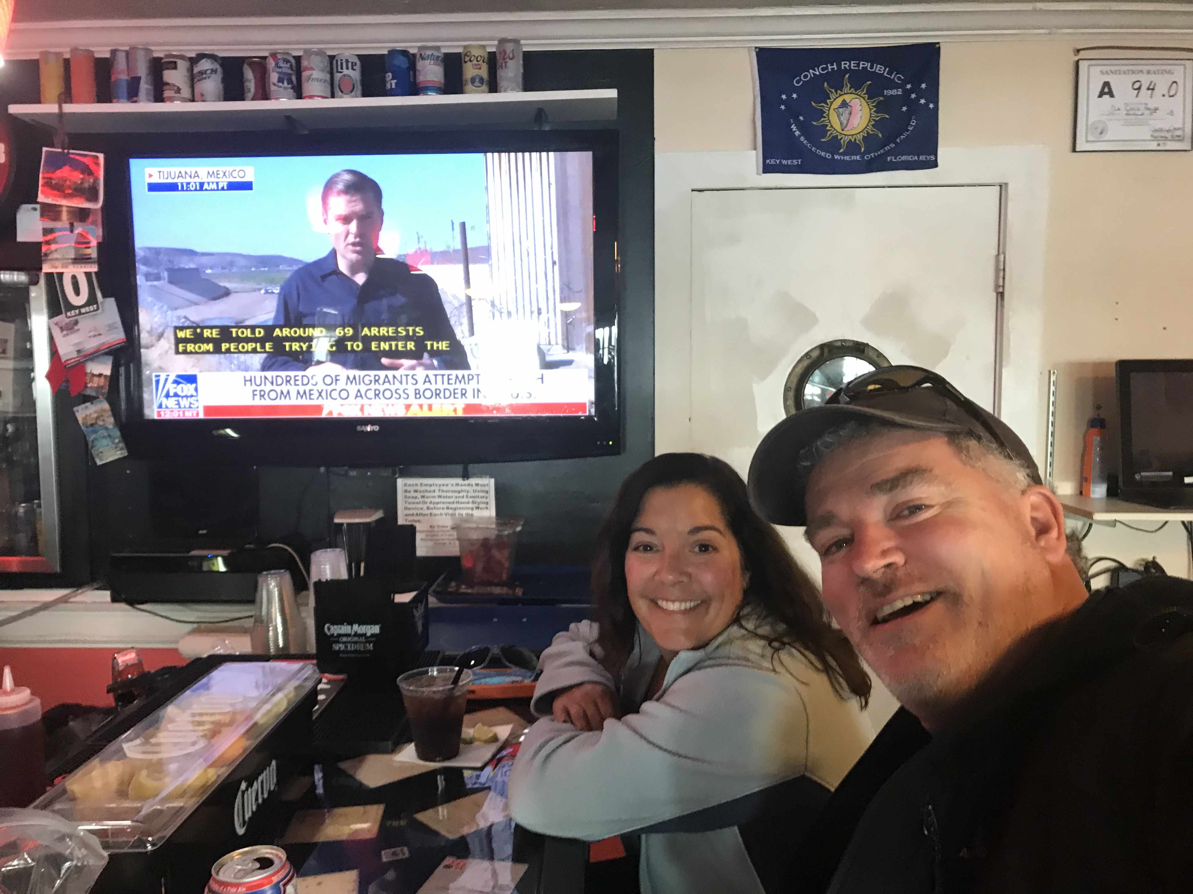
I met another fella who said he noticed my Boston accent as he was also from that part of town. When I said well I’m from Foxboro (home of the Patriots to be exact) he mentioned someone he knew from Foxboro and it turned out to be a childhood friend of mine (Small World). Turns out we knew many of the same folks from back home. I snapped a selfie as it seemed like the right thing to do in the moment.
As we made our way out of Beaufort we passed a buoy tender with two gentleman who looked quite cold.
It was a small craft advisory and the whitecaps were appearing even in the small body of water we were in.
As we made our way down Bogue Sound I hailed a boat that was anchored in the channel. Turns out they were having engine trouble but were not in need of assistance.
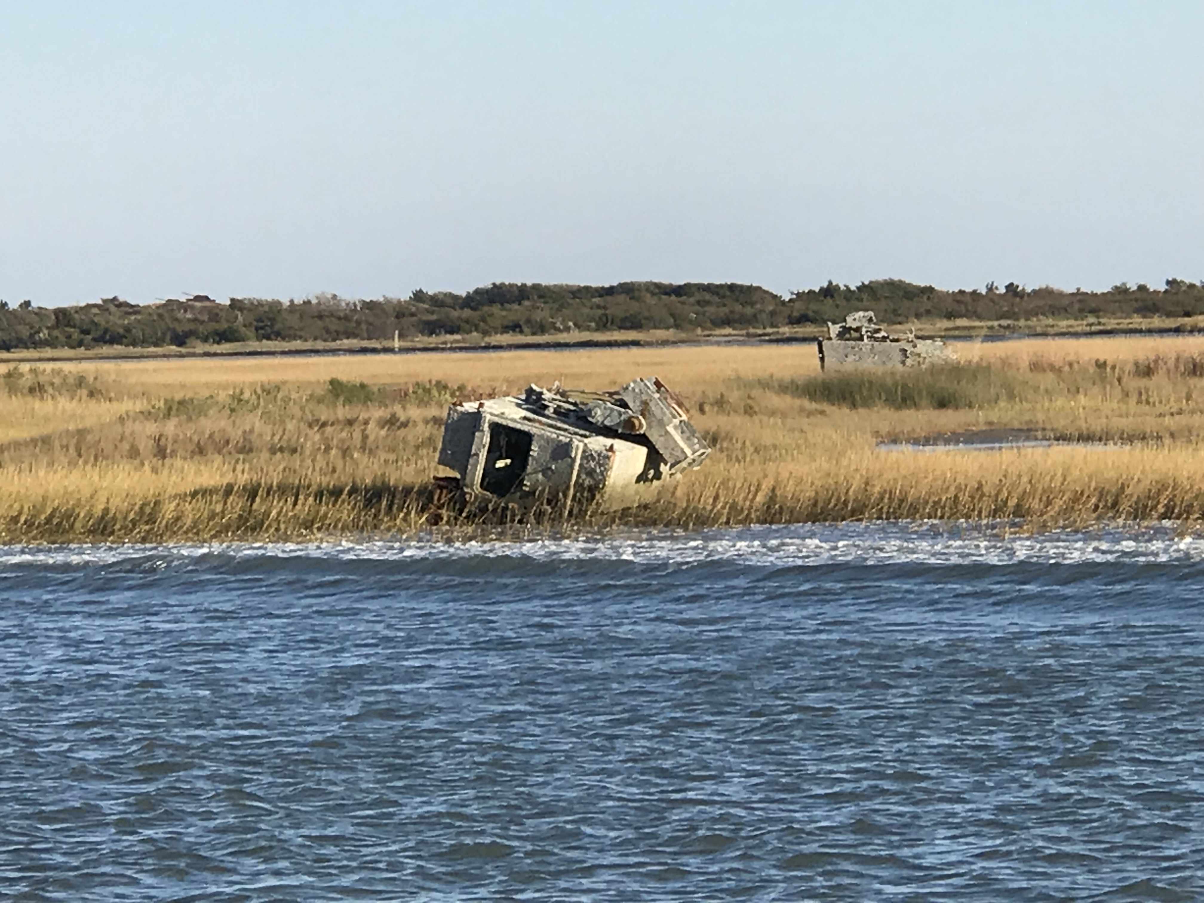
We passed this fishing vessel that had clearly sunk in the shallow waters.
And around the next corner was the Marines Camp Lejeune. They were doing live fire exercises to we were forced to stop and drop anchor.
We dropped anchor believing that no traffic could pass during the exercises but soon a tug boat was passing us on anchor. Maybe he was just slow making his way out of the firing zone?
When we were finally allowed to continue down the ICW we and all the other boats were racing to make it to the only decent anchorage within range. You must be careful when you run fast down the ICW because if you run up on a shoal going fast you may not be able to back off of it. Soon the sailboat behind us ran aground and they asked us if we would turn around and come back and wake them as hard as we could to possibly rock them off the shoal that had them stuck. We agreed knowing that it was risky as in order to wake them we’d have to run fast right next to the shoal they were stuck on. We did our best but in the end a local crab boat was the one who deserves the credit for pulling them off.
We were thrilled to see them free as it was still 2 hours away from low tide and if they had not gotten off that shoal quickly they were going to sit there into the night.
As we made our way to the anchorage at Camp Lejeune we passed many bullet riddled targets on shore.
At least until this fellow came blasting through..
Once the morning’s parade of boats down Adam’s Creek began, it was time to weigh anchor.
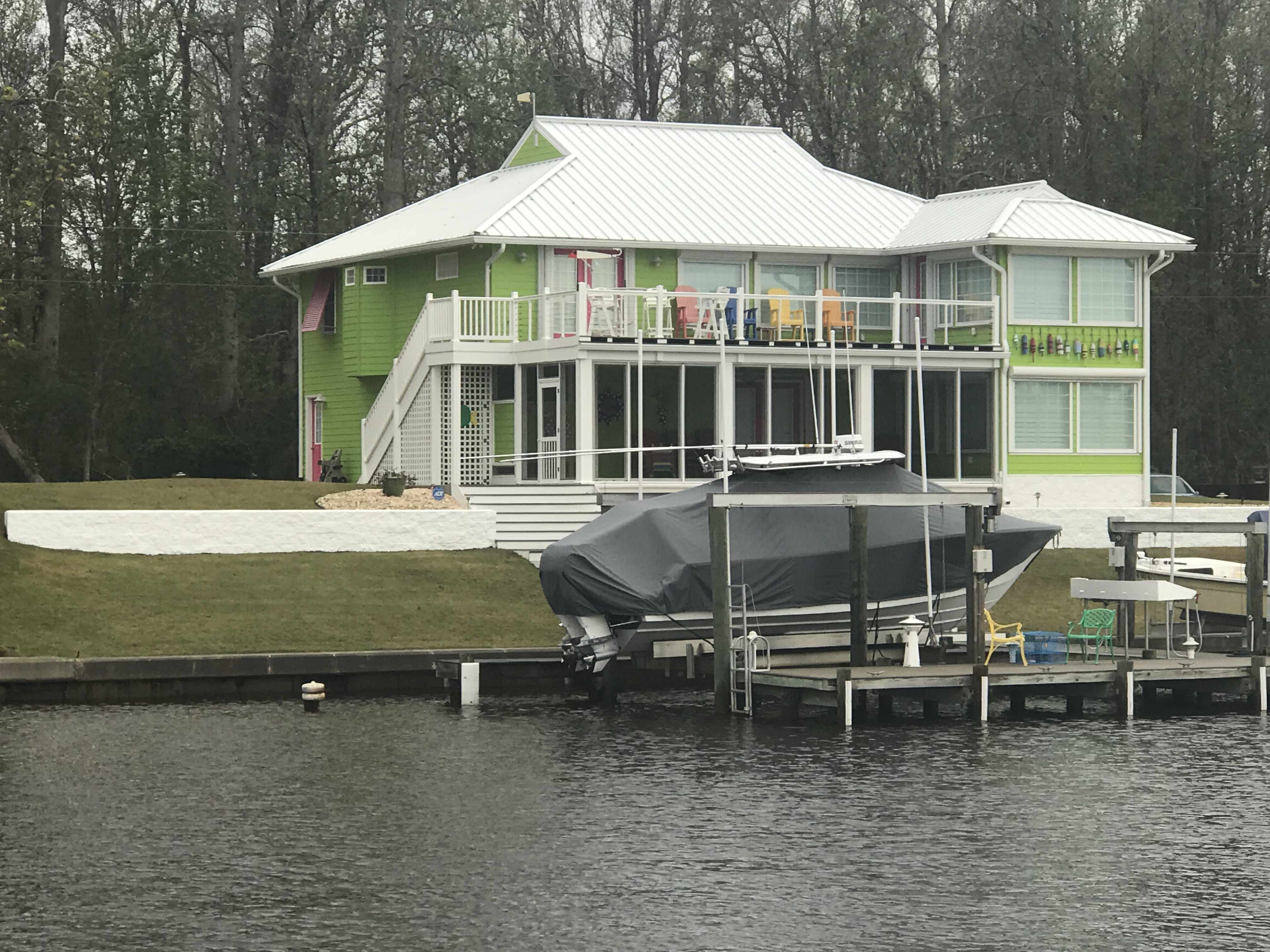
As you make your way down Adam’s Creek you’ll love the beautiful homes and boats along the water’s edge.
House had it Own Helicopter
House Painted Like it’s in the FL Keys
Red Right Returning from Sea – You did it Wrong!
Morning Girl is a Sexy Commercial Sport Fishing Boat
Adam’s Creek Wavy Bottom due to Strong Tidal Currents
Somewhere along Adam’s Creek it turns into Core Creek where we passed more ICW statute mile markers and a derelict sailboat.
ICW MM 195
Delelict Sailboat (no dinghy = nobody aboard)
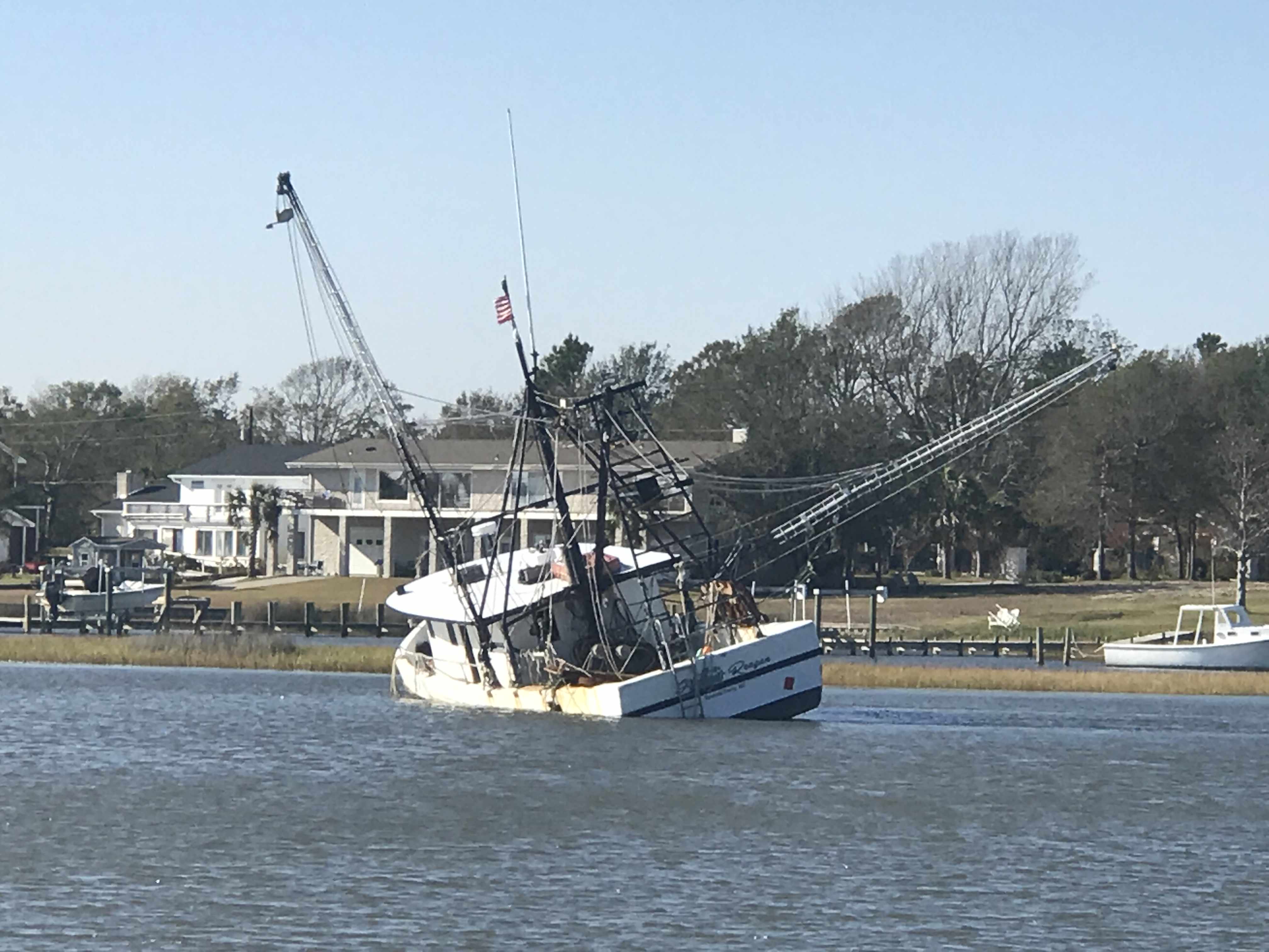
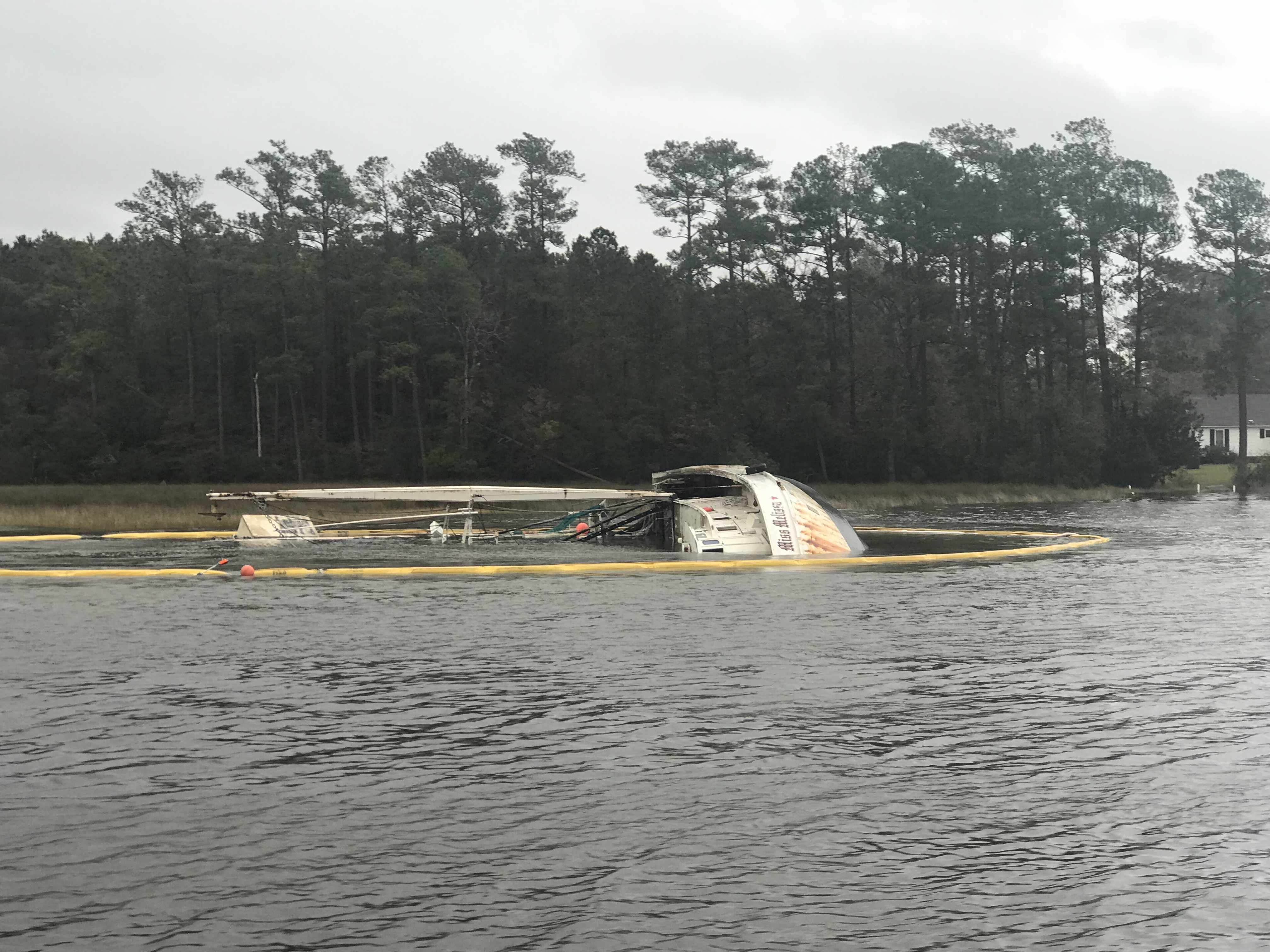
We were aware from the USCG securite warnings broadcasts that there was a 61′ capsized fishing trawler in Core Creek. When I had to dodge floating rope and netting coming down the river, I knew we were close. Then it appeared.
Boom Netting to Contain debris
Resting on her Side
FV Miss Melissa
Soon we were heading into an area called the Newport Marshes named after the nearby city of Newport, NC. This area can be a bit tricky as the channel bifurcates and we stay to starboard. I believe there is deeper water to starboard.
Crabber Working the Marshes in the Rain
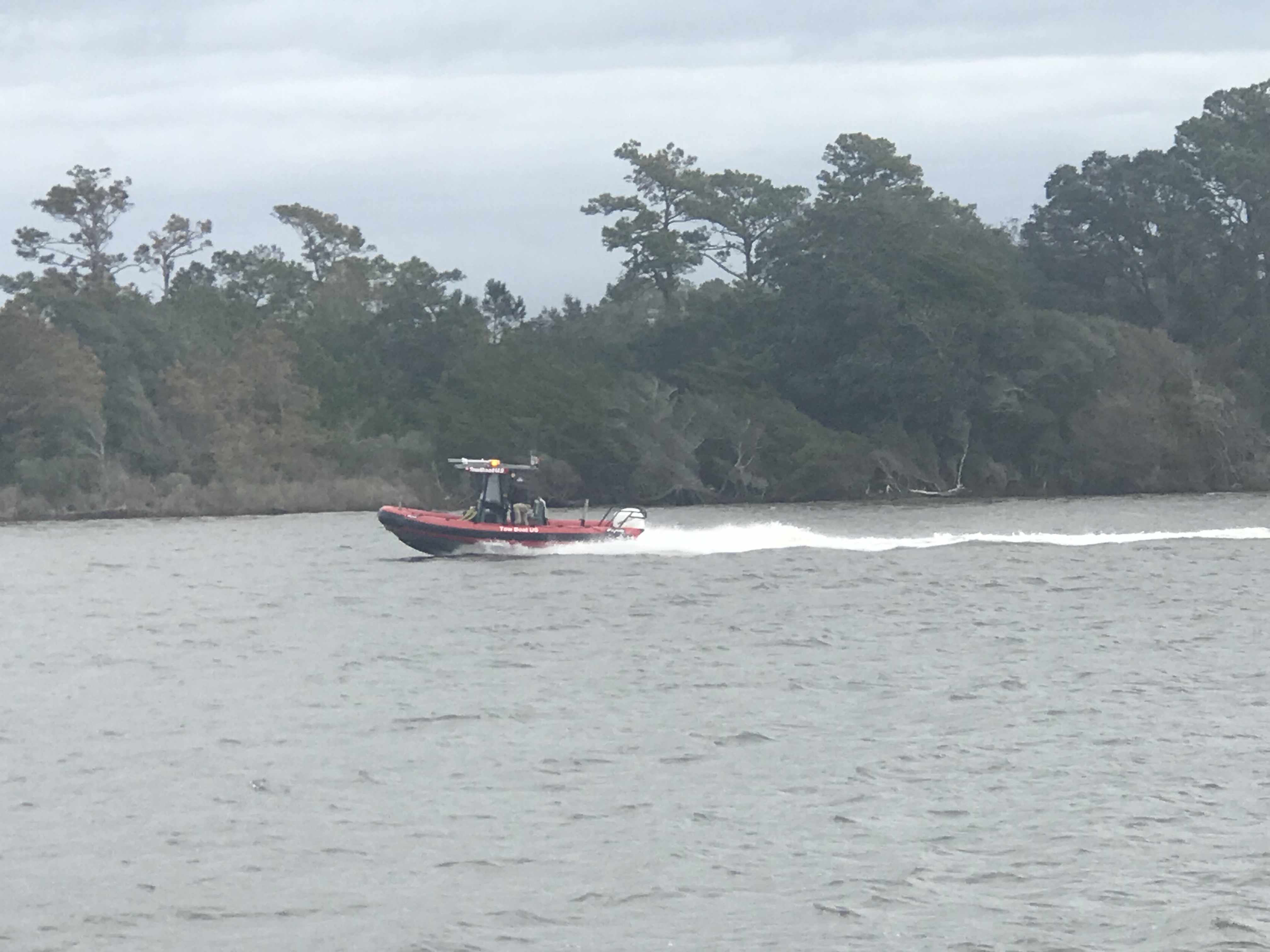
Tow Boat US Racing to Pull a Baot off a Shoal
For a brief moment we had a motoring sailboat attempt to cross our bow from the port-side. We were on a collision course so I gave them a single blast of our air horns to indicate a one-whistle-pass (meaning port to port like driving a car on the road in the US). They did not alter their course so it was time to blast it again! That did it. They waved as we passed and the rain. The rain covered dodger and a crowded cockpit were probably the reason for the distracted captain.
Morehead City, NC was next and the clouds were getting dark with rain and even some lightning strikes.
Near Morehead City NC
We were fast approaching Beaufort Inlet and the strong wind could be felt. Our rearview camera’s view of our flag atop our VHF antennas showed the flag whipping around.
To get into Beaufort using the East side entrance you need to head like your exiting Beaufort Inlet then turn hard to port after going by Radio Island. We did this as quickly as we could as a large cargo ship was fast approaching. Even the two tugs were joking on the VHF about “giving it all she had” to get out of the way of the large ship. The tug hailed the ship saying… he would have to point his bow directly at the ship but not to worry as he was crabbing his way in the wind and would soon be out of their path. On a boat unlike a car sometimes even though your bow is pointing in one direction, the wind and current can be moving you in a straight line that is not where your bow is pointing.
Large Cargo Ship Coming in Through Beaufort Inlet, NC
We had timed our arrival into Beaufort at slack current. Last time we were here we docked in a max ebb current and it took all my skill to keep MV Simple Life from crashing into other boats at the docks. A full keel trawler at 90 degrees to a strong current moves down-current quickly. It’s not something that your thrusters can overcome.
We were thankful for our pilothouse as the rain was coming down pretty good at this point.
We passed Moonrakers and some sexy boats tied up in port.
“Moonrakers,” named after the rectangle sail flown at the uppermost height of a three-mast 17th-century ship
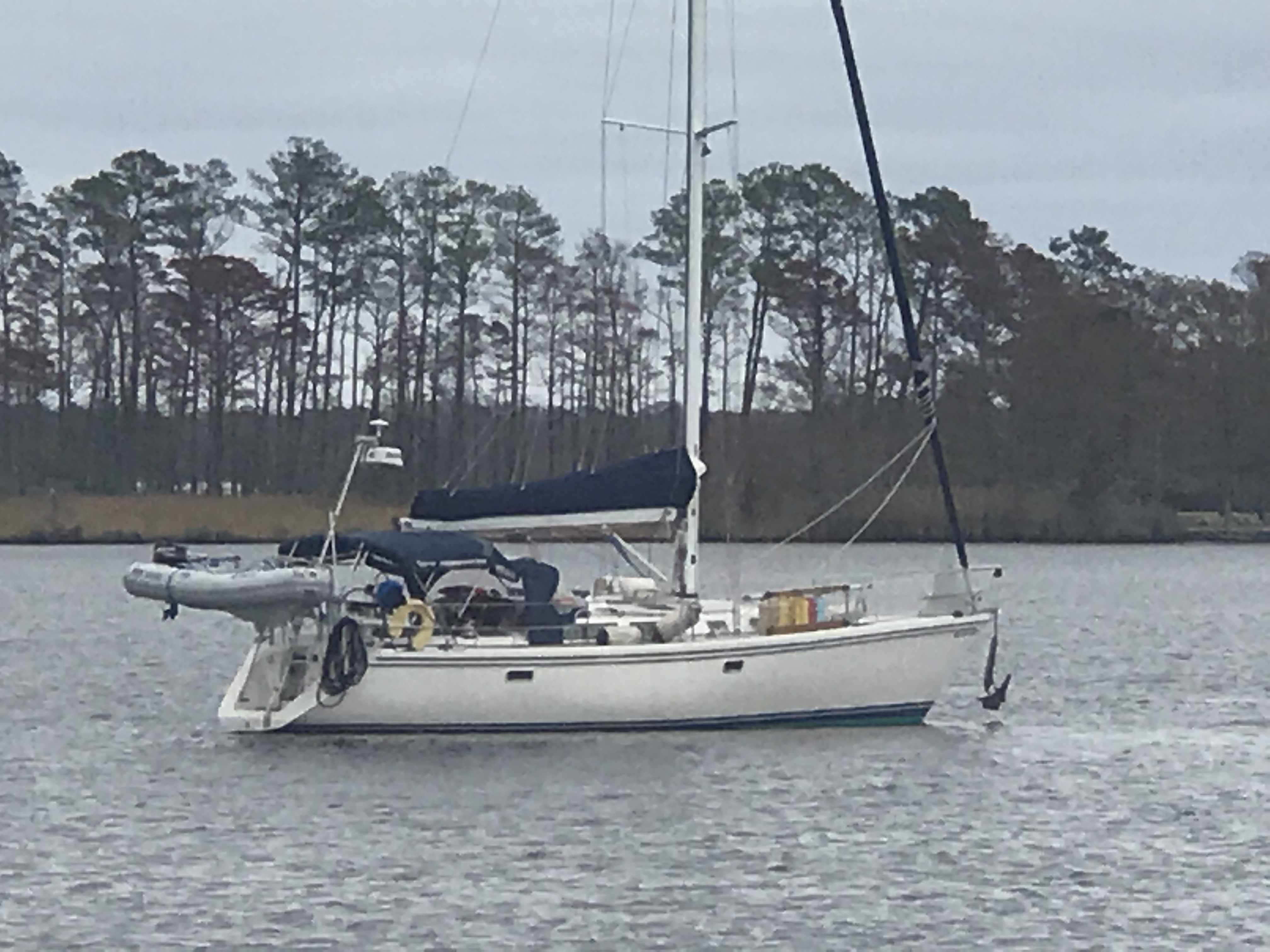
Nordhavn Trawler in Port
Sexy British Sailing Yacht
The Beaufort Docks Dockmaster had assigned us a great slip all the way in right next to the restaurant. The docking was a “breeze”, no literally, we simply turned sideways and let the breeze blow us sideways into the dock. Worked beautifully and Kelly was soon tossing our stern line to the dockhand.
1995 Saberline 43 Green Hulled Trawler Next to Us
Note our Flags Indicating a Beam Breeze
Once in our slip we quickly jumped ashore and walked the docks.
Mums Line the Docks
Walk the Docks
Betting that is the Marina Loaner Car
Santa’s Workshop in Beaufort NC
I almost forgot there was one casualty along this trip and it was my slippers. Kelly demanded that my stinky slippers stay in Beaufort, NC. I will miss my favorite slippers but our boat and crew would thank me for giving them up.
I’ll Miss You, Comfy Slippers
I checked in at the dockhouse, paid the bill, got the WiFi password and two beer tokens! My favorite part is taking those wooden tokens straight to the sailor bar at the Dock House and enjoying a well-deserved beer. We were sharing dog pics with Shelby, our bartender. She showed us pics of her 3 new hunting hounds that her dad had given to her.
Have a Draft on Us – Dock House
Welcome Shipmates
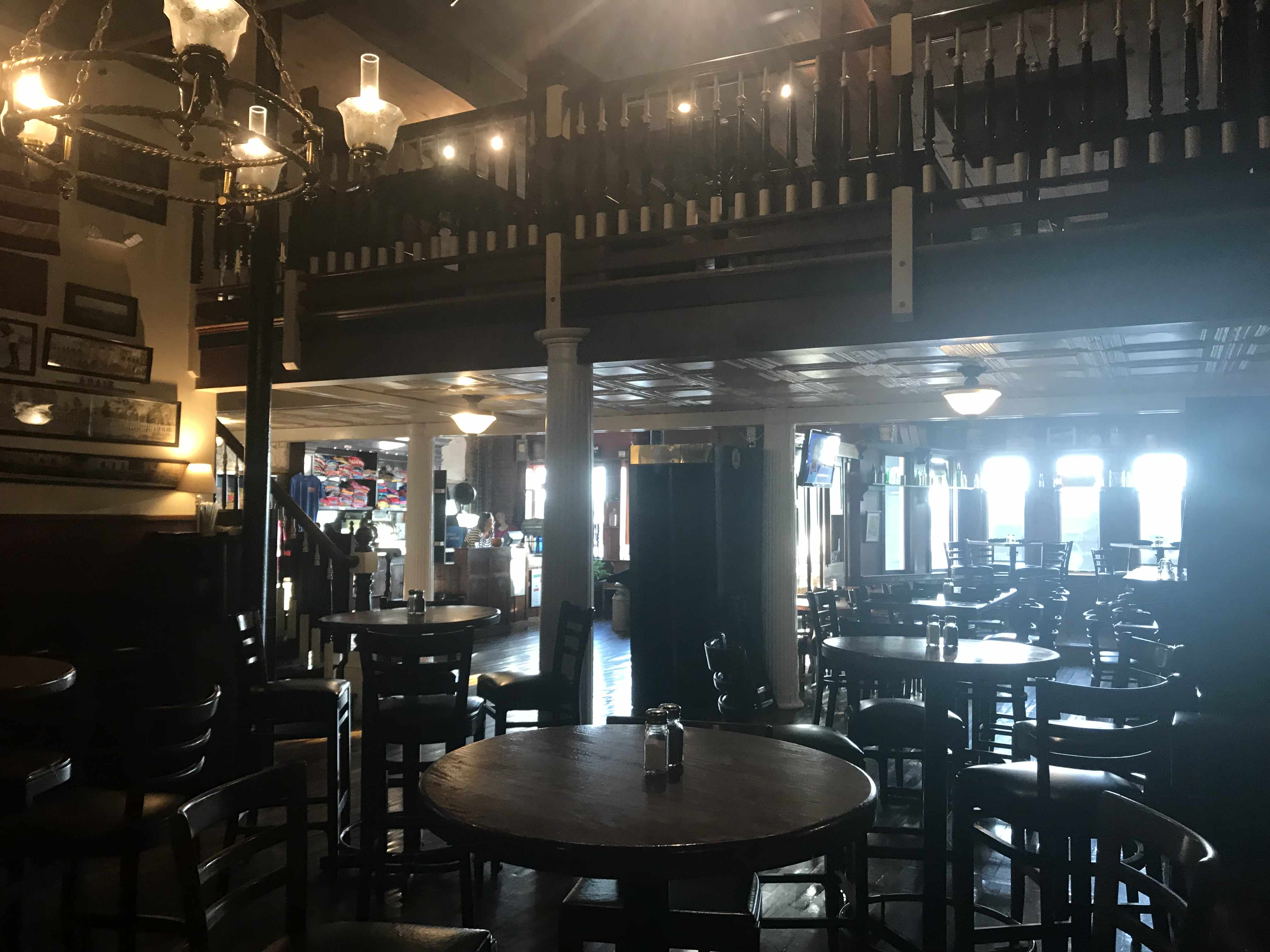
Sailor Bar Closed so we got to use the more Upscale Bar Upstairs
Clawson’s bartender, Kayla set me up with a great Hazy NE IPA and life was great.
The bar itself dates back to 1905 and Kayla was entertaining us with ghost stories about the ghost-like little girl on the third floor. She offered to take us up to the 3rd floor to look for her but we chickened out 😉
Clawson’s Bar
Ghosts Straight out of 1905
Deer head amongst Boating Motif
We are thrilled to spend two nights in Beaufort, NC.
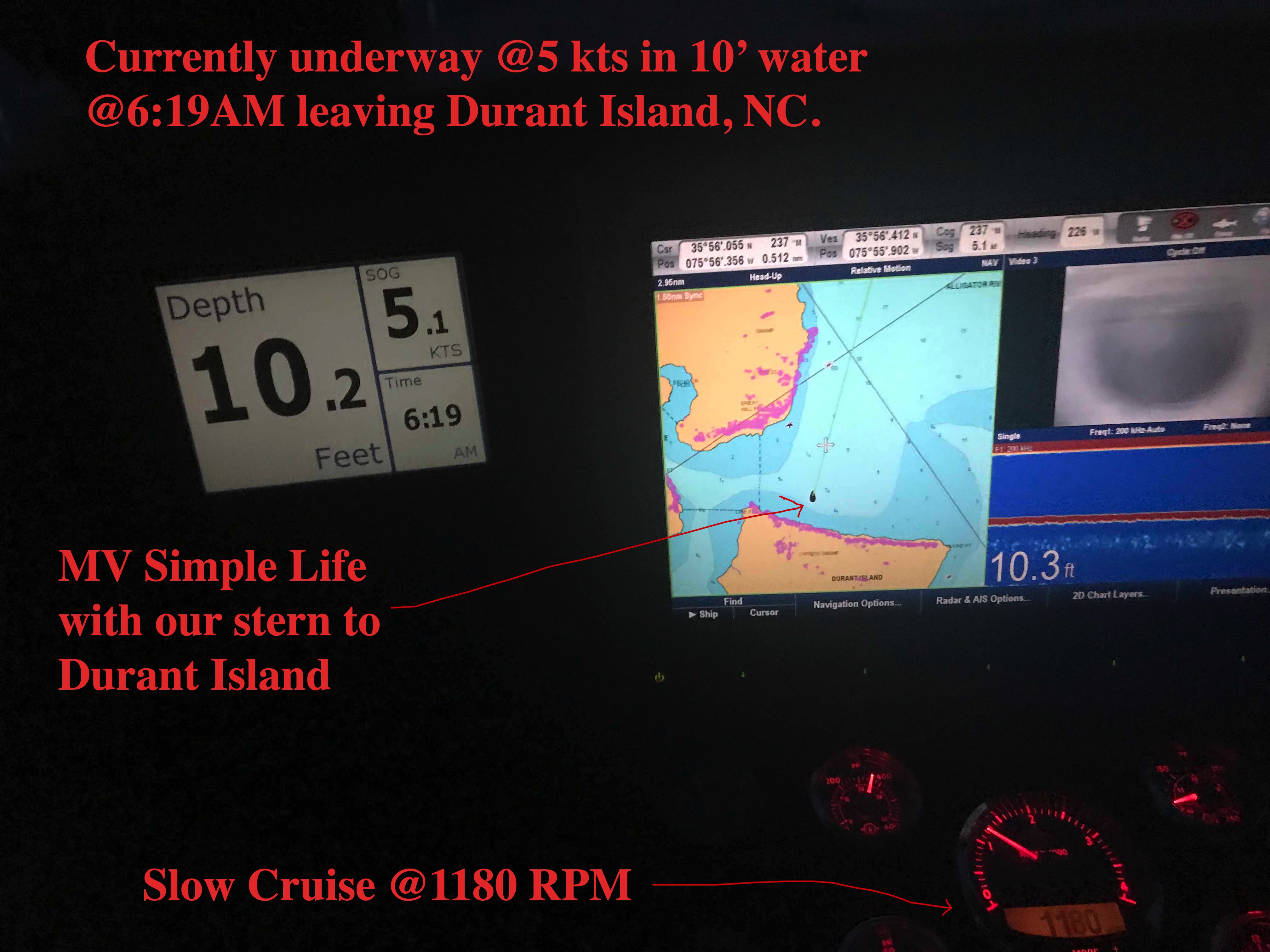
Beaufort, NC in two days requires an early departure. 6:19AM to be exact.
Departing our Anchoring Location off Durant Island, NC
Planning is a big part of cruising. It starts by thinking where you would like to get to. Then you check the weather, wind speed & direction, marine forecast, sea state, etc. If the weather is bad than you must consult the crew (wife / admiral ) and get their opinion on whether to go or stay put. If you skip this step you could find yourselves in marriage counseling.
Once you know where you want to go you must ask… “How long will this take at cruising speed?”. Slower cruising speed = better MPG = $. We conservatively plan 50 NM / day if we use the 10 hours of light that late November gives us. If we want to cover 70 or even 100 NM than we’ll have to run long into the night. Here you must know your limits. After 12 hours at the helm you may find yourself coming into an unfamiliar inlet or harbor on an inky dark, moonless night with wind & waves and other hazards. (See warning above about counseling).
I find that using every charting and weather app on your phone, tablet while underway to constantly revise your plan works best. Advise your crew that “the next two hours will be a lumpy ride but soon we’ll be enjoying a drink in a peaceful anchorage for the night”.
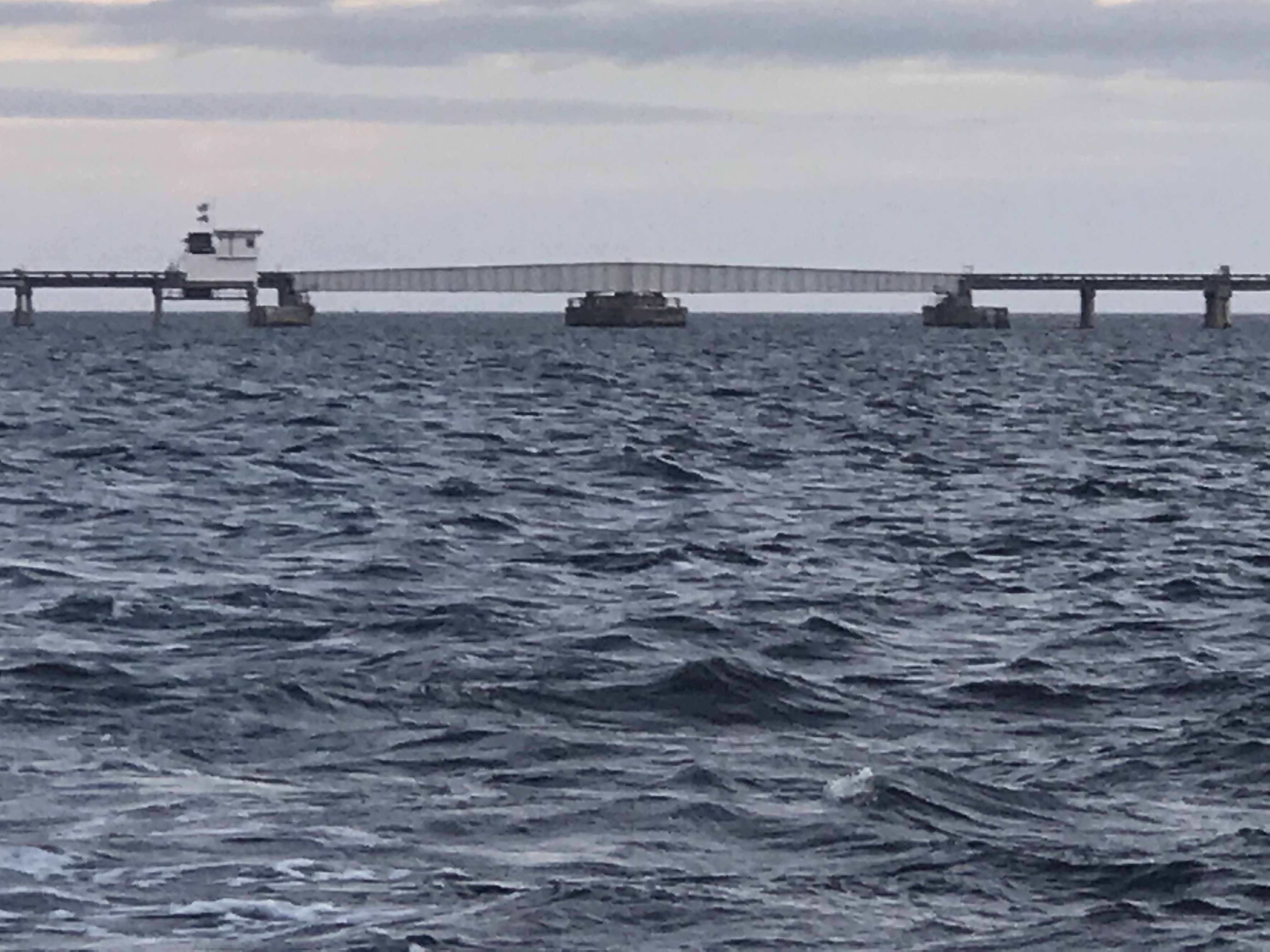
Alligator River Swing Bridge
Underway
The Alligator River Swing bridge crosses the broad mouth of the Alligator River. It must be fun driving over this long bridge that is only 20 feet or so above the River.
Sport Fishing Yacht Kelly Lynn
Slow Pass
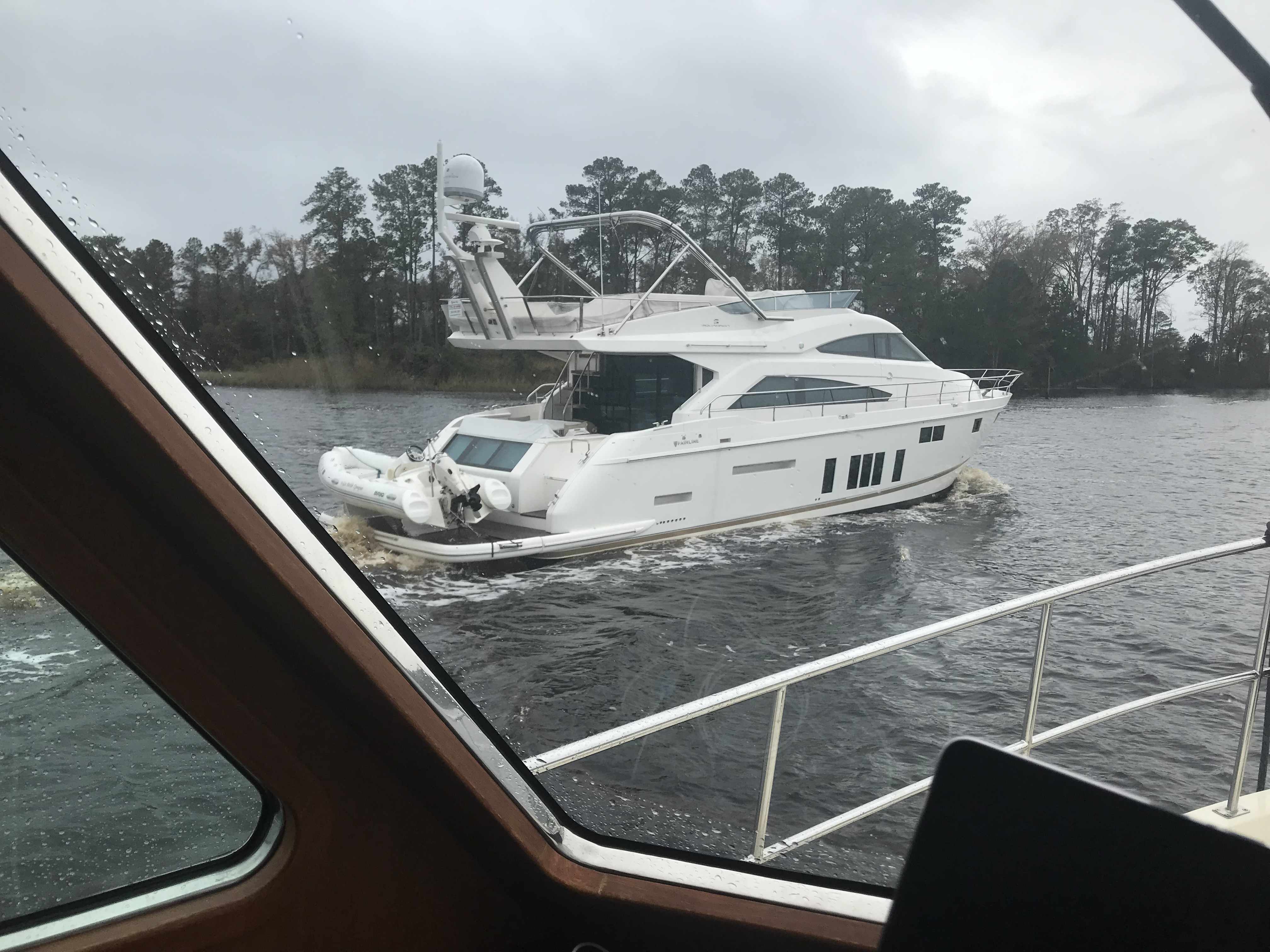
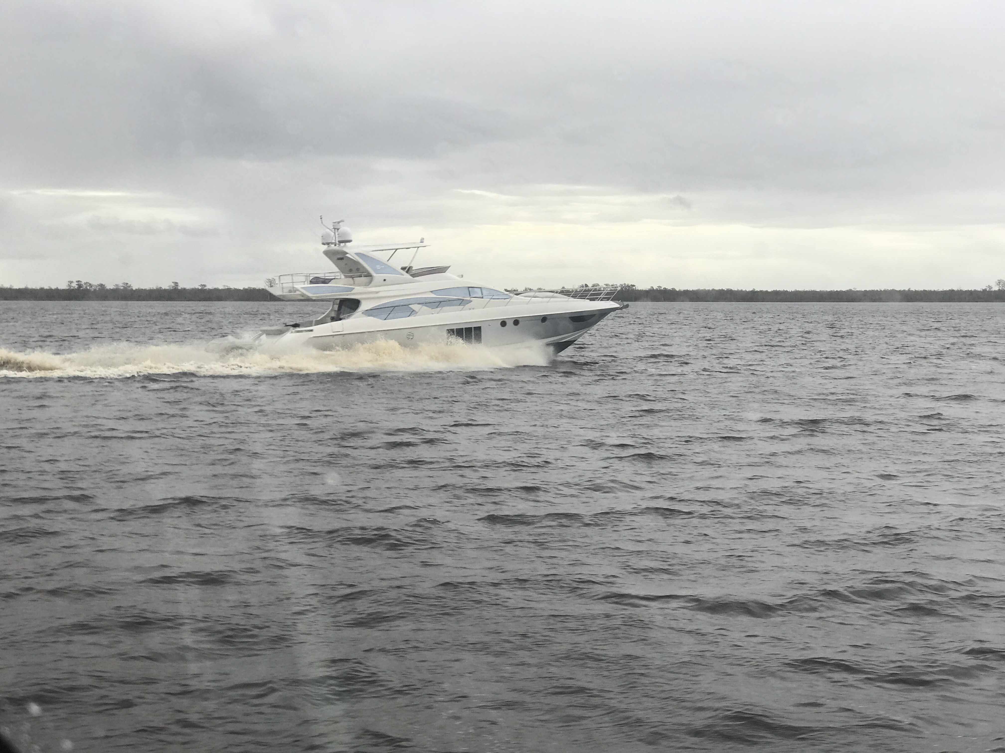
Azimut
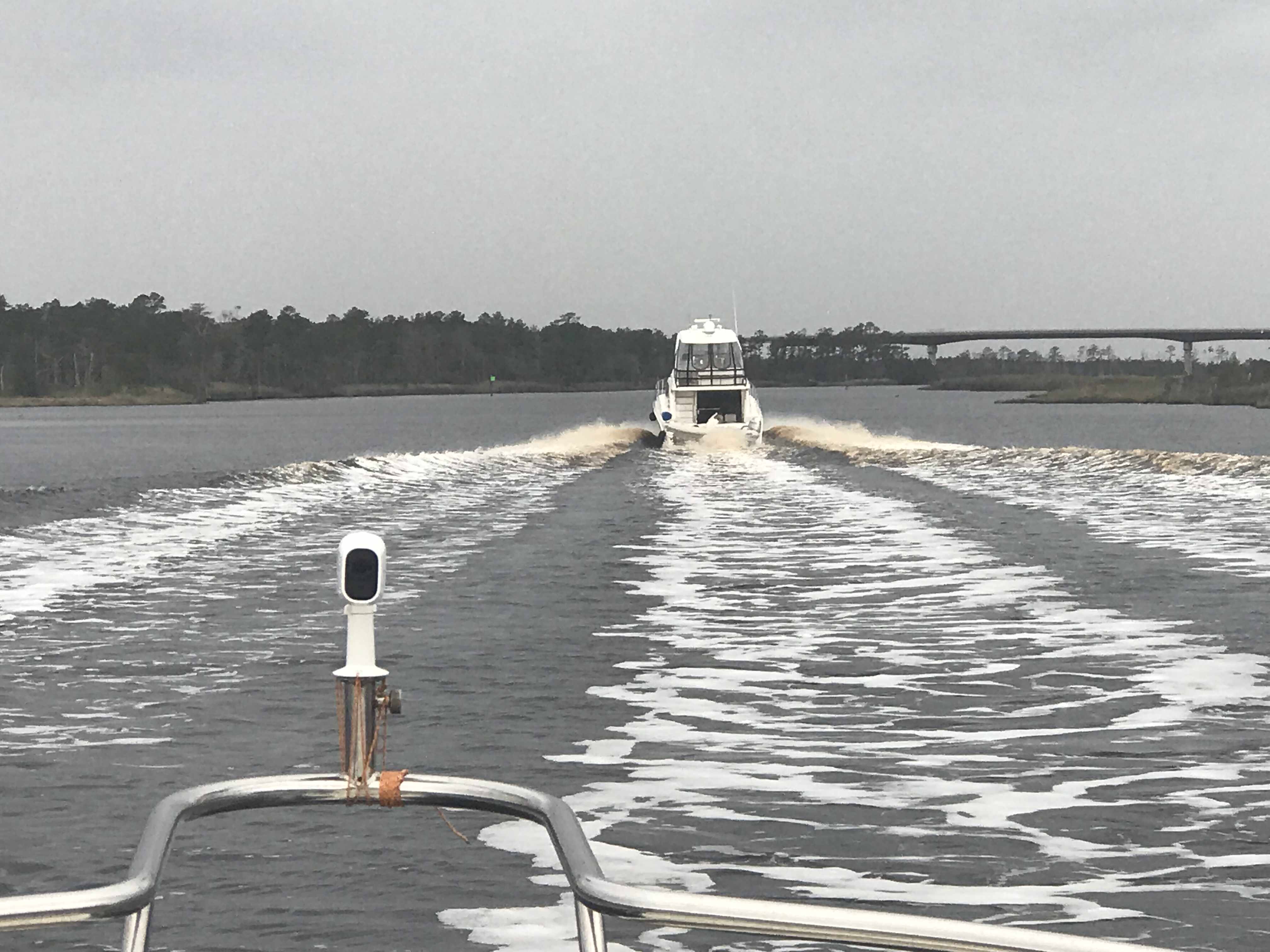
We had to keep to starboard as our radar showed many faster yachts coming up behind us. They would zoom on by and we’d have to do a quick 90 degree turn to cut their wake or get rocked.
When you reach the Southern end of the Alligator River you enter a 20 mile long canal that was cut through the land with a laser gun. OK maybe it just looks-like the ACE (Army Corp of Engineers) used a laser gun? It’s so straight we barely need to adjust the autopilot heading.
Alligator River – Pungo River Canal
While you are keeping an eye out for hazards like tree stumps and deadheads (trees snapped off at or near water surface), you’ll pass ICW Statute Mile markets reminding you that you have a long way to go.
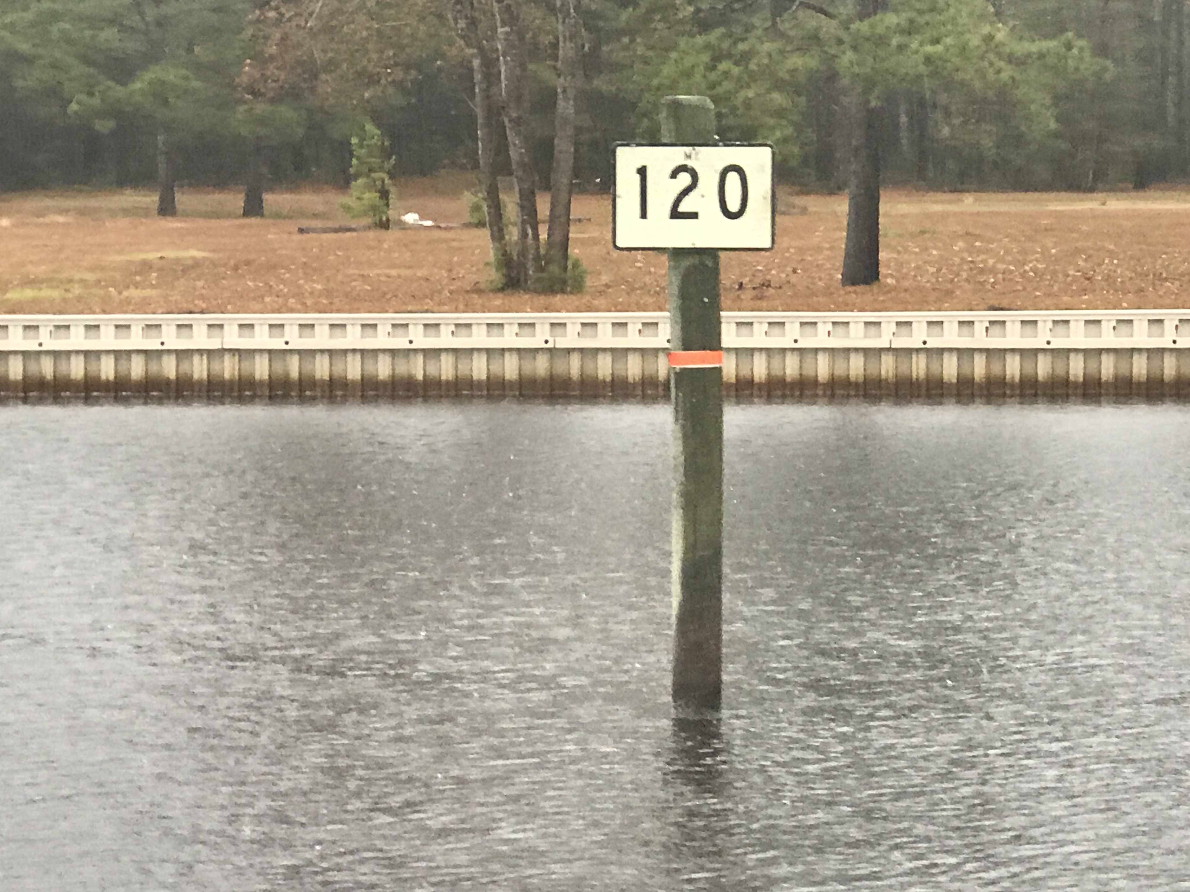
ICW MM 100
ICW MM 120
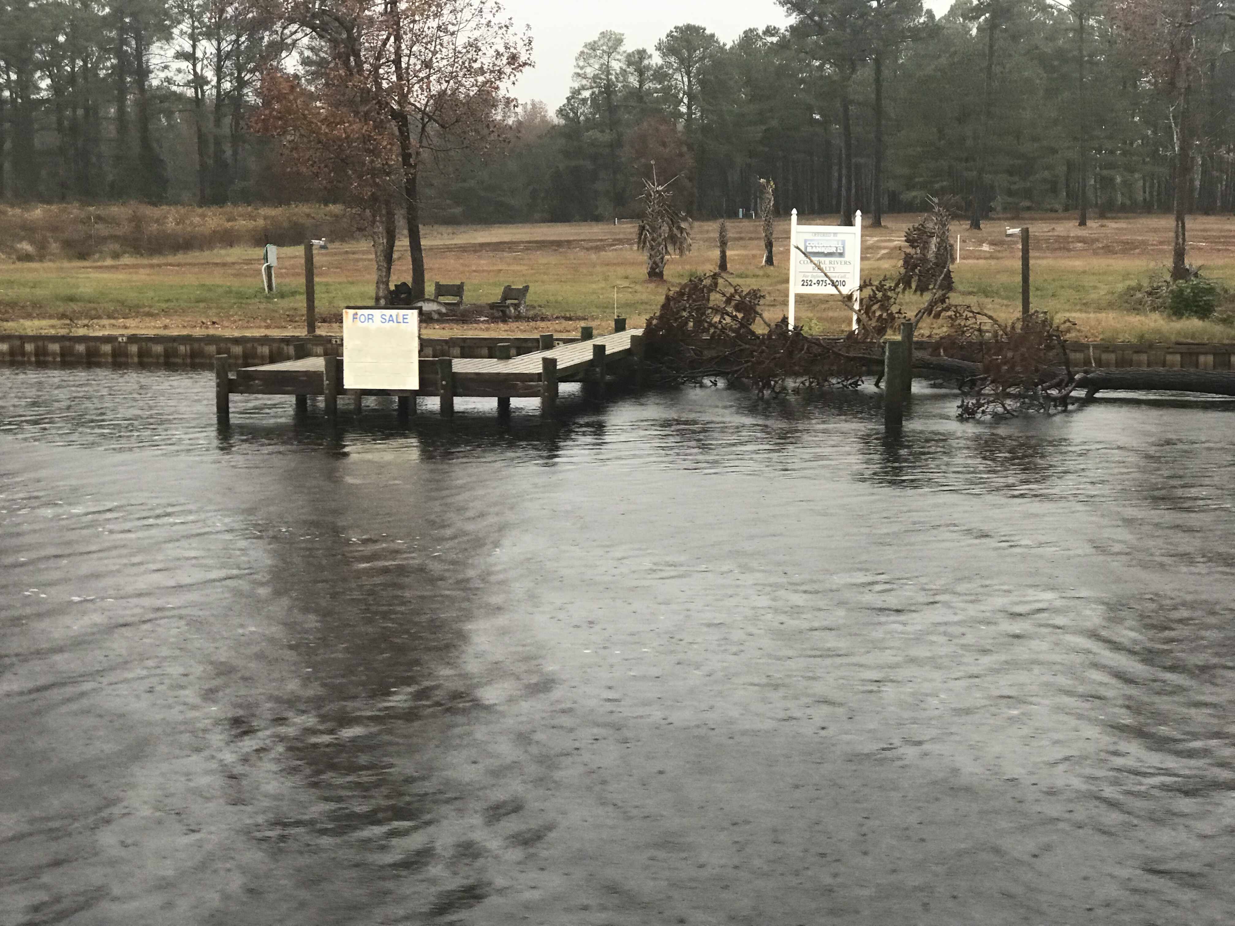
There is land for sale along the canal.
For SALE
Perfect if you like duck hunting like this hunter we passes who was picking up his duck decoys.
Decoy Ducks
Moving over for oncoming or passing traffic must be done carefully as outside the center of the canal you’ll run into shoals, stumps and other hazards.
I Don’t Think We Can Keep Up
When you see a bridge like the one in the picture above you quickly grab your phone and check for a cell signal. Yup, you’ll have a signal for maybe the next mile.
It was cold and rainy but warm inside our pilothouse.
We knew from checking the wind speed & direction that when we exited the Pungo River it would be lumpy.
Soon we were tucking into Goose Creek and then again into Campbell Creek to avoid the weather. Anchored tight to the tree-lined shore in Campbell Creek we found respite from the weather.
Anchored in Campbell Creek
Saturday’s leg looked something like this.
W02L011 – Winter 02, Leg 11
The cell signal in here is either weak or just non-existent.
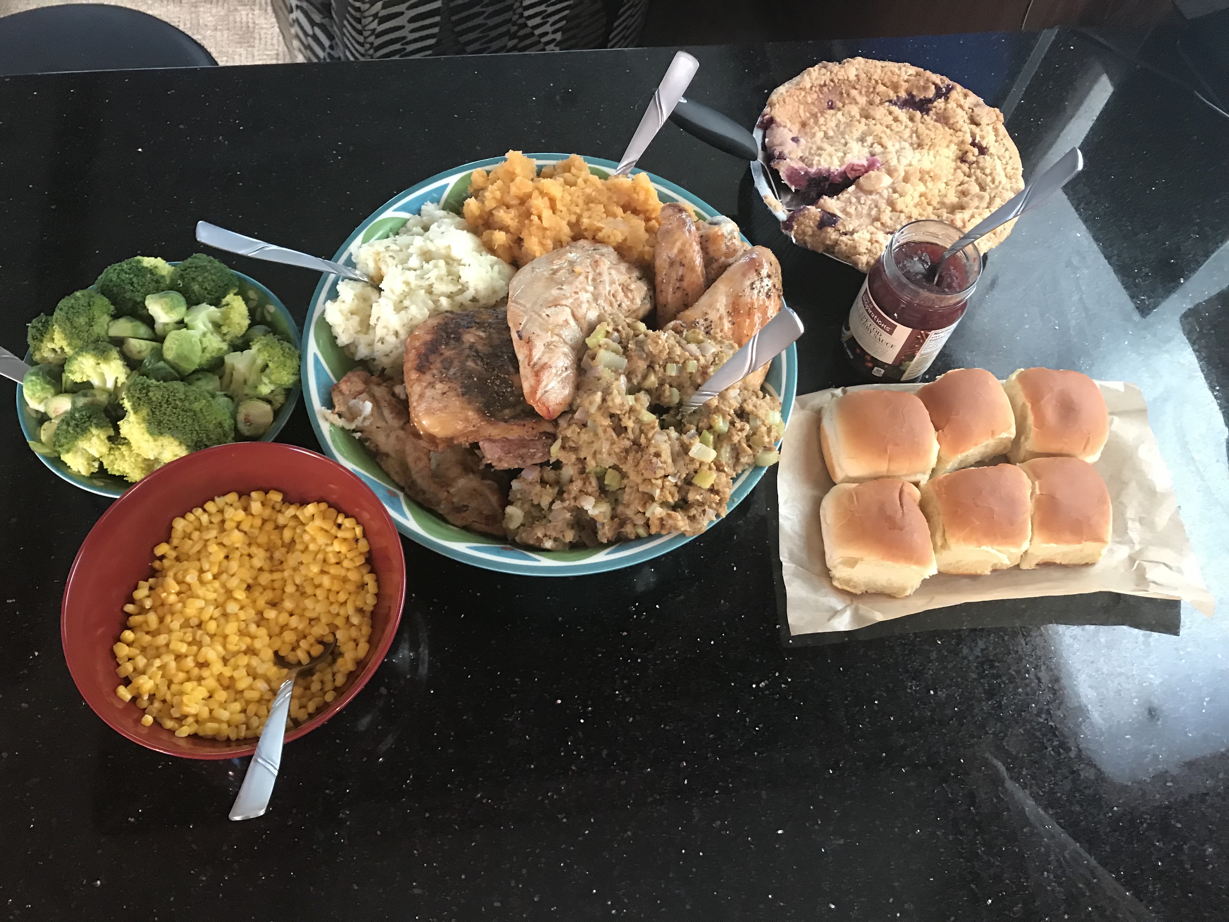
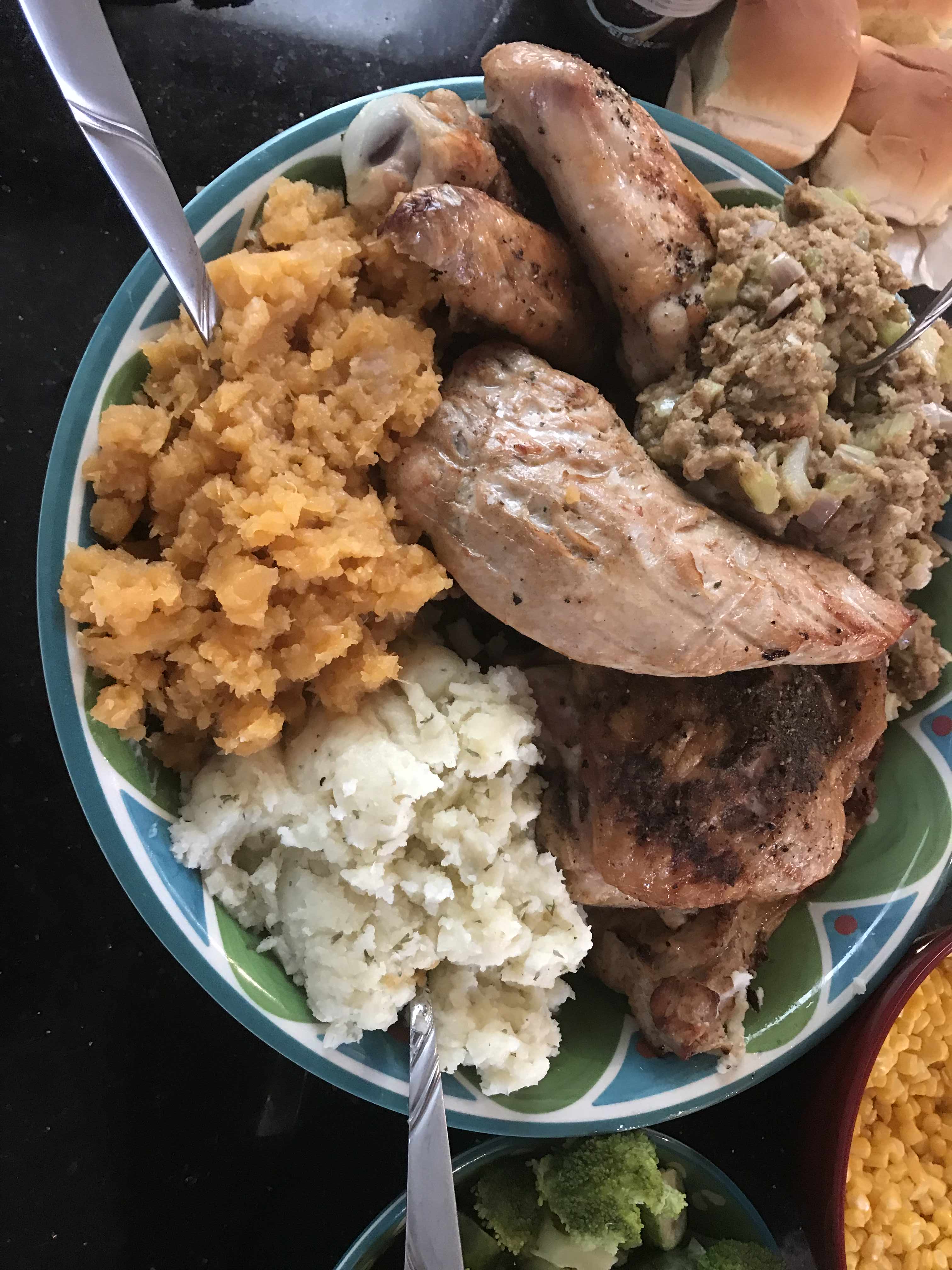
We spent Thanksgiving at Top Rack Marian. Kelly used InstaCart grocery delivery service to order everything that she needed and whipped up an amazing turkey dinner. This woman has skills :-).
All the Fix’ins
Yumm
Pie at the helm while underway
Saloon cleaned up after T-Day dinner.
We left Top Rack Marina after sharing an amazing Thanksgiving aboard. However, the temps were dipping into the 30’s at night and we needed to go South as fast as possible.
Leaving Top Rack Marina
a mile or two South down the ICW is the Great Bridge Lock. The water level only drops 2-3 ft so it’s pretty gentle as far as river locks go. However, the ICW (InterCoastal Waterway) is a federal commerce waterway and that means that it’s there for commercial boats first and pleasure boaters second. We had a stand aside while the lock tender let this huge tug and barge in ahead of us.
Tug & Barge
They asked us if we felt comfortable trying to squeeze past the tug n barge to get ahead of it in the lock. Challenge accepted.
Then it was through the “normally open except for when a train is a coming” bridge.
If a train comes and it starts a lower.. push the throttle to the pins 😉
Not long after that we were passing Coinjock Marina in NC. This is normally our stopping point for the night but the winds were going to increase early in the AM so we decided to anchor just before our Albemarle Sound crossing. On our way to our anchorage we heard a sailboat on the VHF hailing TowBoatUS to come pull them out of the shallows. It was 1.5 hours before low tide so it was only going to get worse.
This boat had wandered outside of the narrow channel and run aground
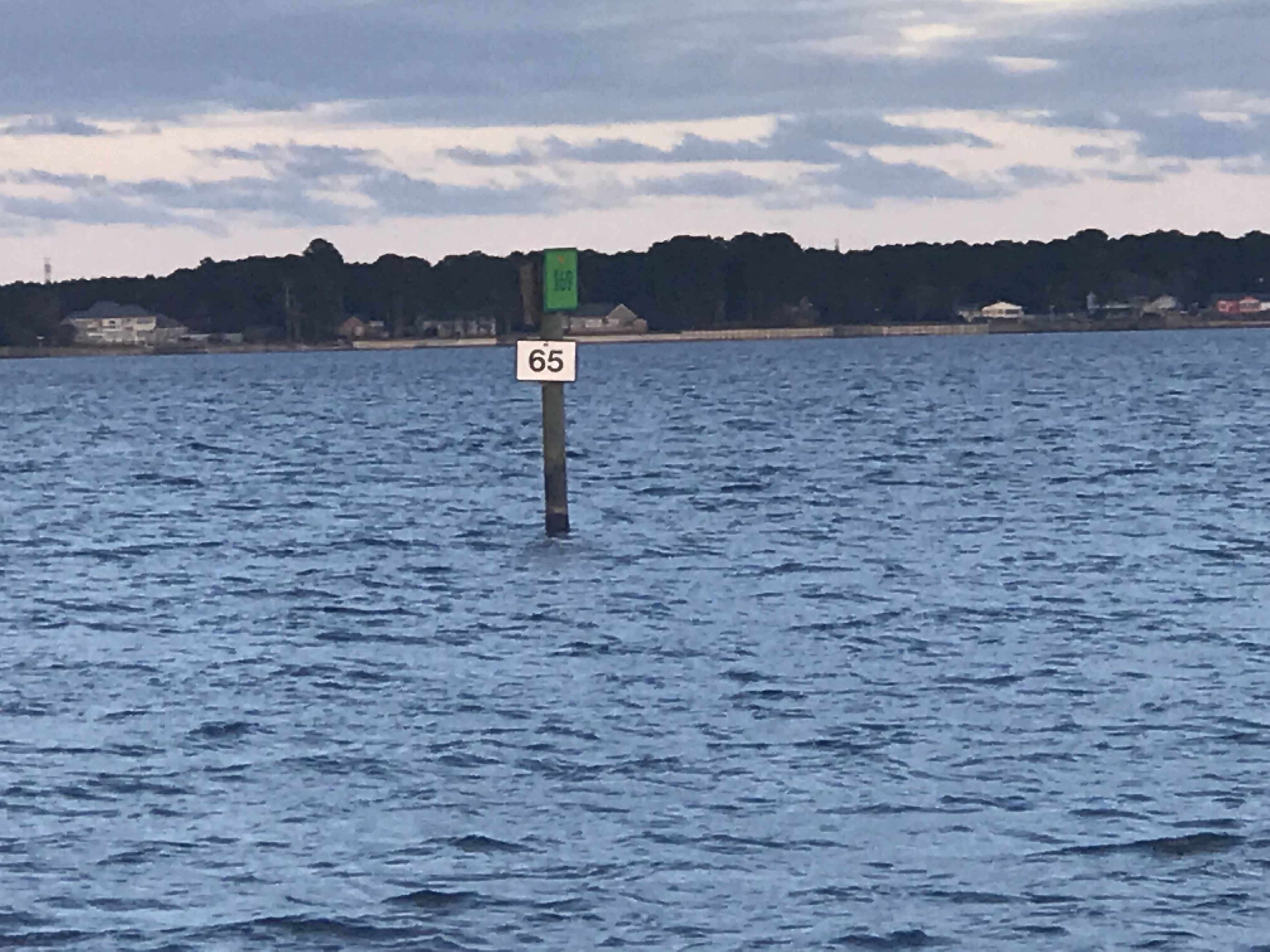
Soon we were passing ICW mile markers 55 & 65 and approaching our anchorage for the night.
I did one last check to see if the weather forecast had changed and … it had.
The strong winds were going to come before sunrise so Kelly & I decided do a nighttime crossing of Albemarle sound and anchor in the Alligator River rather than have a lumpy crossing in the AM.
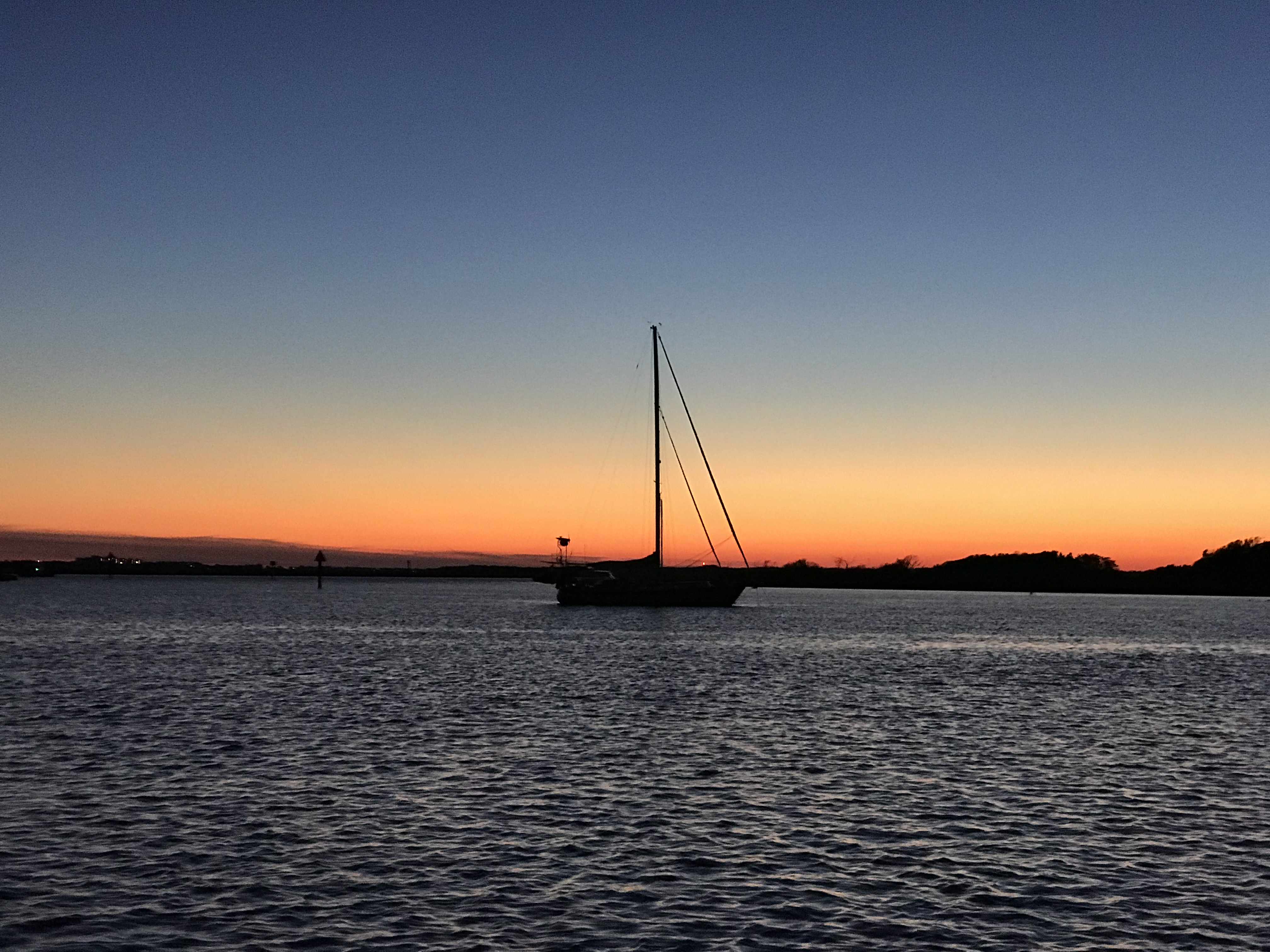
Just before the sun went down we snapped one more photo.
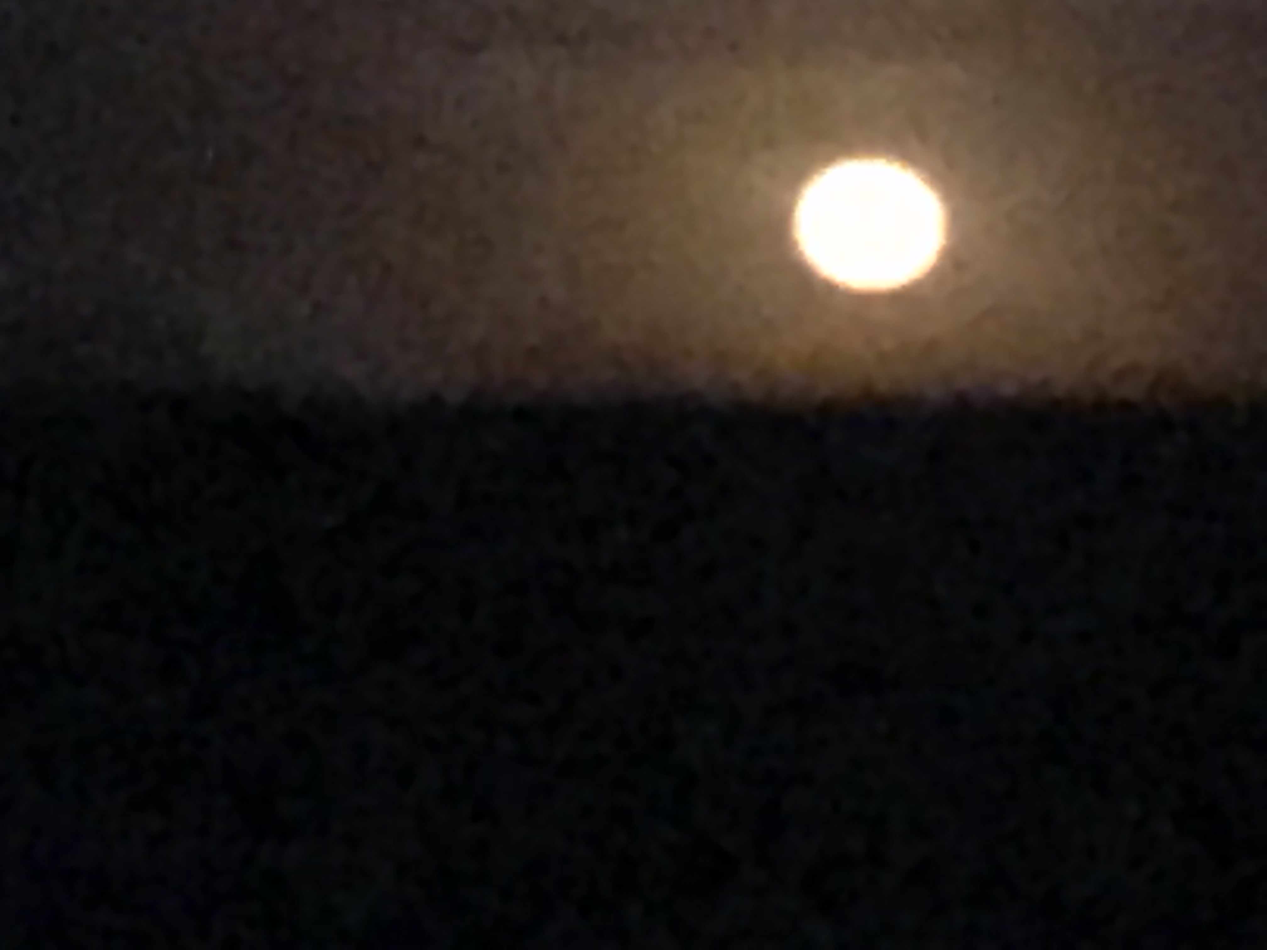
The full moon came up but we were not running into it but away from it. I always prefer to run down the moonstreak as it helps me spot crap pot floats before we run them over and wrap the line around our propeller.
Full Moon
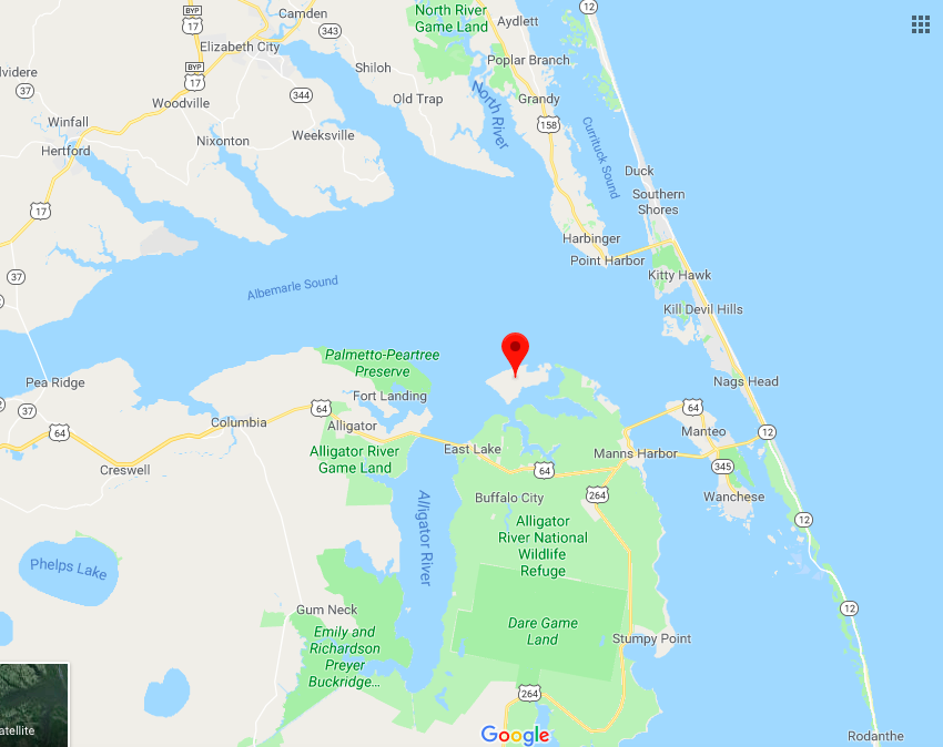
The crossing was a bit lumpy but we picked a spot to anchor behind Durant Island that would give us a lee shore. Tonight we will sleep well and get plan for a sunrise departure before the wind starts to whip in the AM.
Anchored Behind Durant Island (red marker)
Today’s leg was 70 NM from Chesapeake, VA to Durant Island, NC. This year we agreed to throttle-back to somewhere in the 6 knot range and stay in the 3 NM / gallon diesel range. We conservatively plan to make 50 NM / day. That’s 10 hours of daylight x 6 kts minus time weighing / dropping anchor and waiting for bridges to open.
Apple Maps Screen Capture with Finger Drawn Route – A Close Approximation
We had a quiet night on anchor in the Alligator River. Our anchor spot was just off the ICW and was an “easy in” and “easy out” in the morning. Note: some anchoring spots can have shallow or tricky entrances.
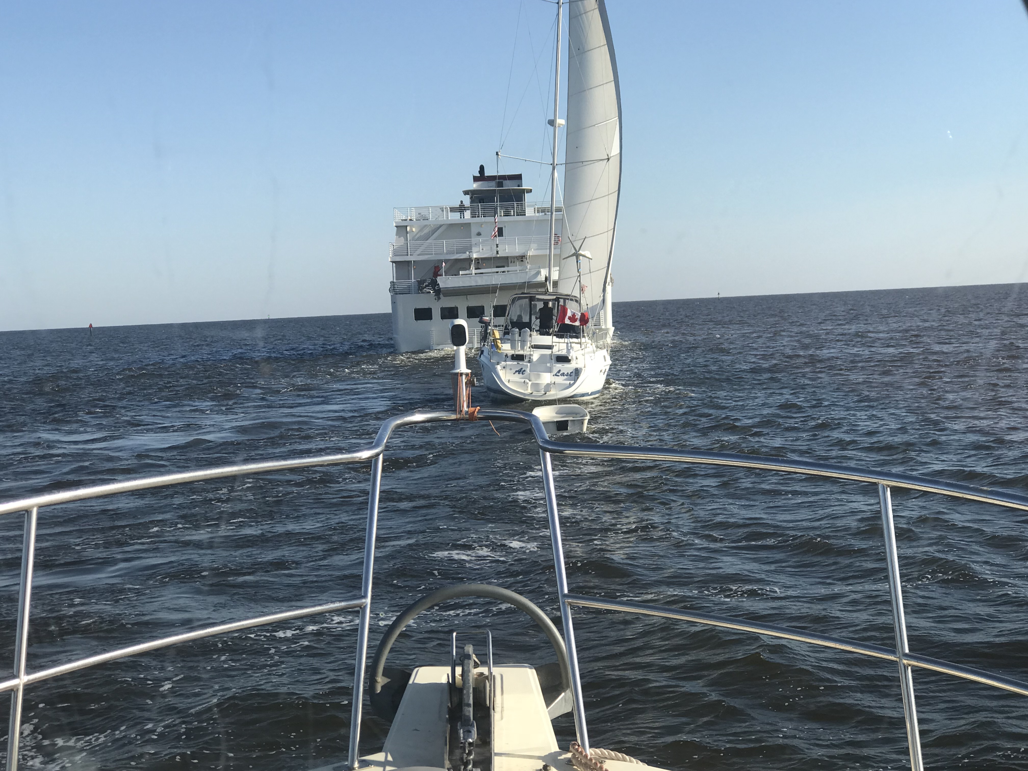
MV Independence uses AIS just like us so it was easy to acertain their ship’s name and hail them directly. I simply let the captain know that I saw they were going to overtake us and stated we would manuver to starboard and allow them exclusive use of the entire channel for a “2 whistle pass”.
American Cruise Lines, MV Independence
As the channel got narrow we had to get in line behind this sailboat who did not seem to have their VHF radio on. (repeated hails from us and the Alligator River Swing Bridge with no response). On the ICW you must monitor channel #16 (the international hailing channel).
Channel 70 (156.525 MHz) – Digital Selective Calling
DSC Discussion (skip this technical section if you like)
CH 70 or DSC or Digital Selective Calling is a new technology that uses EM wave pulses on channel 70 to send digital (1s and 0s encoded in electromagnetic pulses over a radio wave transmitted on channel #70’s designated frequency)
This channel is not for human voice transmission but for ships continually broadcasting their current position and heading. The data is received by your VHF antenna and processed by your AIS transceiver before finally being plotting on your chartplotter. Instead of just a radar blip on my chartplotter, I see a triangular icon representing the ship and if I click on it I get all sorts of info like:
Ship Name: So I can hail them by name instead of “Motor vessel off my port bow”
Heading
Speed
Ship length
MMSI #
Sail or powerboat
CPA (Closest point of approach or how close will they come to our boat if nothing changes)
CTA (at what time will they be the closest to us).
DSC also has a well hidden secret function where you can use a ship’s MMSI # (like a personal phone number) to call them directly. By this I mean you don’t hail them by name (ie. “ship name, ship name, this is motor vessel Simple Life on channel 16”. Instead you type in their MMSI number and a channel that you want their VHF radio to automatically tune to. Hit the PTT (Push To Talk) button and a loud tone plays over their VHF radio and their radio automatically jumps to the channel you wanted to communicate with them on. It’s a great feature but I must say I have not used it, nor have many other boaters. Maybe it will just take some time till the early adopters start teaching other boaters how to use it?
As we approached Coinjock, NC, there were large plumes of smoke coming from shore. I saw that the smoke which had started as grey/black was now white indicating that it was burning itself out (Where are my firefighter friends here, keep me honest).Maybe it was a controlled burn of the low lands?
Close Up
Far Away
Getting Closer
As we were pulling into Coinjock Marina, named for the NC town of the same name,we were aware that our port fuel tank was running on fumes. NOTE: we had some reserve fuel in the starboard diesel tank.
I think I need to start wiping my leather helm down with lint-free cloths 😉
We had made two long runs up the coast and at almost 9 kts and burned lots of fuel. Coinjock about 20 cents more per gallon of diesel than the marina we were heading to next. While not the cheapest place to take on over 300 gallons of diesel it was convenient. I mentioned to the dockhand that the next marina North was 20 cents cheaper a gallon and he responded, “Oh, our costs are higher because we sell more fuel than them”. I just smiled and thought, I’m pretty sure this friendly dockhand skipped school that day in business class 😉
When choosing a location for diesel be sure to chose a location that sells a lot of diesel. Common wisdom says: the more they sell, the less time the deisel sits in storage tanks acculmulating condensation water or other contaminations. If you have ever had your engine die offshore due to bad fuel you’ll agree that it’s better to spend a bit more for the likelihood of clean fuel.
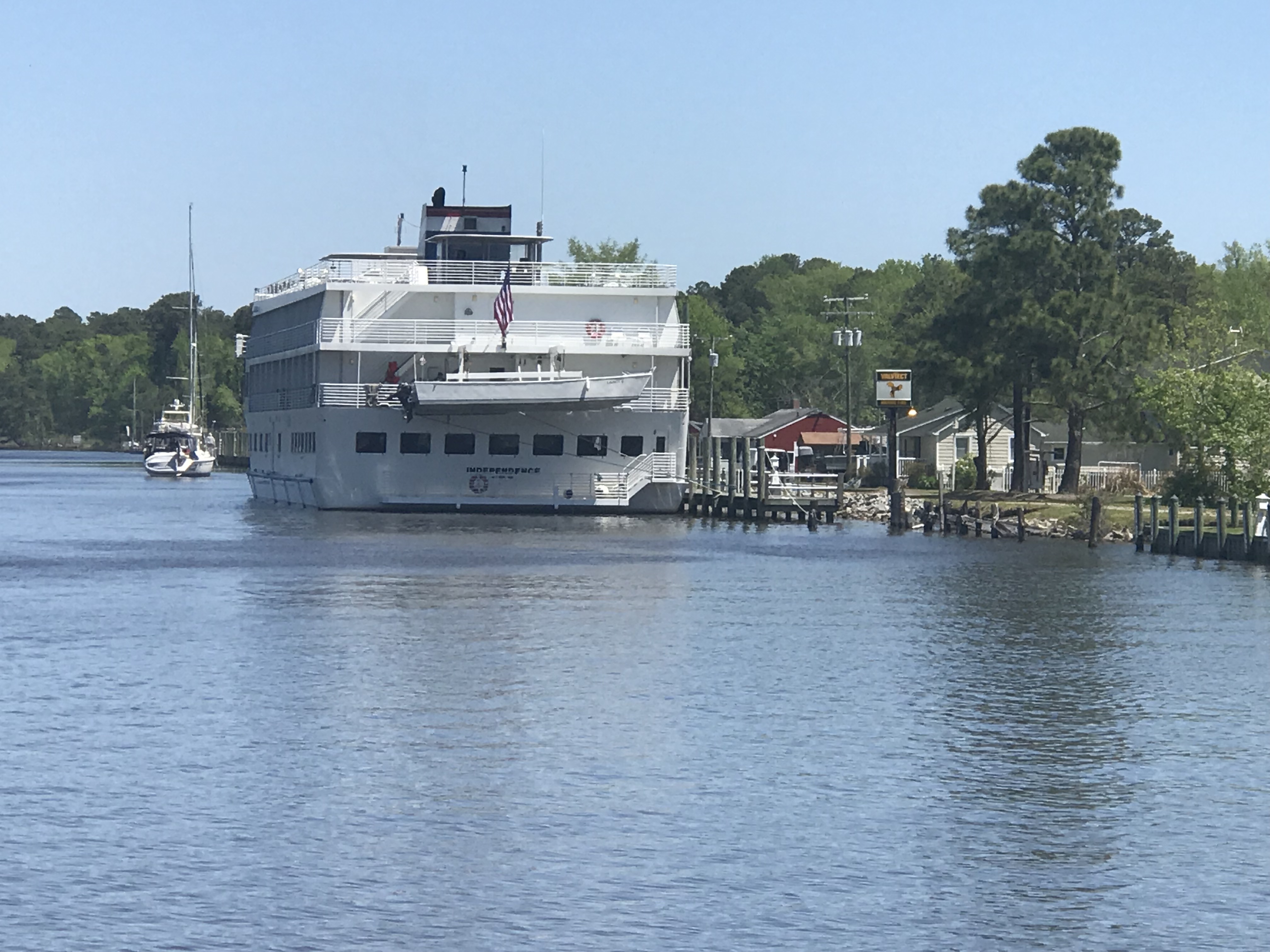
The cruise ship which had passed us on the ICW was now docked in Coinjock to take on 5000 gallons of diesel.
MV Independence Docked in Coinjock NC
I believe in large ship terminology, the captain and crew talk about the amount of diesel they have in terms of weight rather than gallons. Diesel is about 7 lbs / gallon while gasoline is about 6 lbs / gallon. When you take on 5000 gallons of diesel you need to be thinking about how much that excess fuel weighs and what it does to your ship’s draft. Draft = how deep your boat sinks into the water. Air draft = how tall is your boat is above the water for fitting under low bridges.
MV Simple Life took on about 311 gallons or 2,177 lbs of diesel while we were there. We also filled our water tanks (8.3 lbs / gallon) so that adds another 3,700 lbs to our boat. If you ever read the specs for a boat it will list it’s dry weight as well as it’s water draft. Always remember that when you load your boat up with your possessions, passengers, dogs, food, fuel, water, etc that it will sink your draft a few more inches into the water. When a boat is designed they guesstimate the weight & displacement of the boat from summing up the weight of every item in the CAD drawing. This we know thanks to the ancient Greek scholar Archimedes and his “Eureka” moment when he figured out that a body (boat) displaces it’s exact weight in water.
Boats with sharp narrow hulls must sink lower in the water to float while boxy square hulls like that of a barge need only sink a small amount to displace their weight in water. The boxy square shape to the cruise ship allowed it to have ashallower draft than MV Simple life. So don’t follow the cruise ship up the ICW thinking… ”if there is enough water in the channel for them, we can easily follow them”.
We awoke at sunrise and just before pulling anchor, I snapped a few photos of just how still this anchorage was in Adam’s Creek.
Sun Reflection off Still Waters
Active Captain Royal Thurman Anchorage
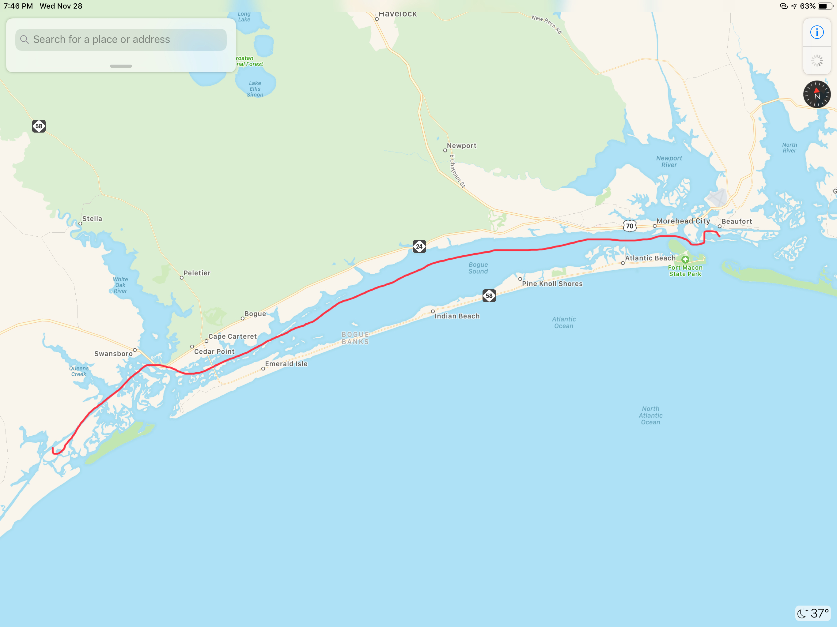
Today’s ICW route through Pamlico Sound would end just short of crossing Albemarle Sound. Our route looked something like this.
ICW Route Through Pamlico Sound and almost into Albemarle Sound
On our way out of Adam’s Creek, I hailed a loaded tug and barge to let them know we would deviate from the channel and not impede their passage. The strong current was at their back forcing them to keep their speed up. As a tug captain it’s better to be driving the barge rather than being driven by the current. It’s always better to push a barge into a current than be pushed by it. At least that is how I understand it.
Tug & Loaded Barge in Adam’s Creek Channel
We no sooner exited Adam’s Creek into the Neuse River and passed this beautiful schooner with the captain at the helm and sails set.
Capt was still in the process of raising his staysail
Once it Pamlico Sound you realize it is a pretty large sound. Wikipedia defines a sound as, “…In geography, a sound is a large sea or ocean inlet larger than a bay, deeper than a bight, and wider than a fjord; or a narrow sea or ocean channel between two bodies of land (see also strait)…”. These geography terms can be confusing.
Pamlico Sound
As we motored on, a USCG boat hailed us over VHF channel 16 and let us know to stay to port as we passed. They had a line around and were pulling what remained of a green daymark piling using their boat. Our best guess is that a boat hit the piling in the night and snapped it off. We figured they were dislodging it so that it would not float away and become a hazard to navigation?
USCG with a line off their bow to a green daymark that was broken off.
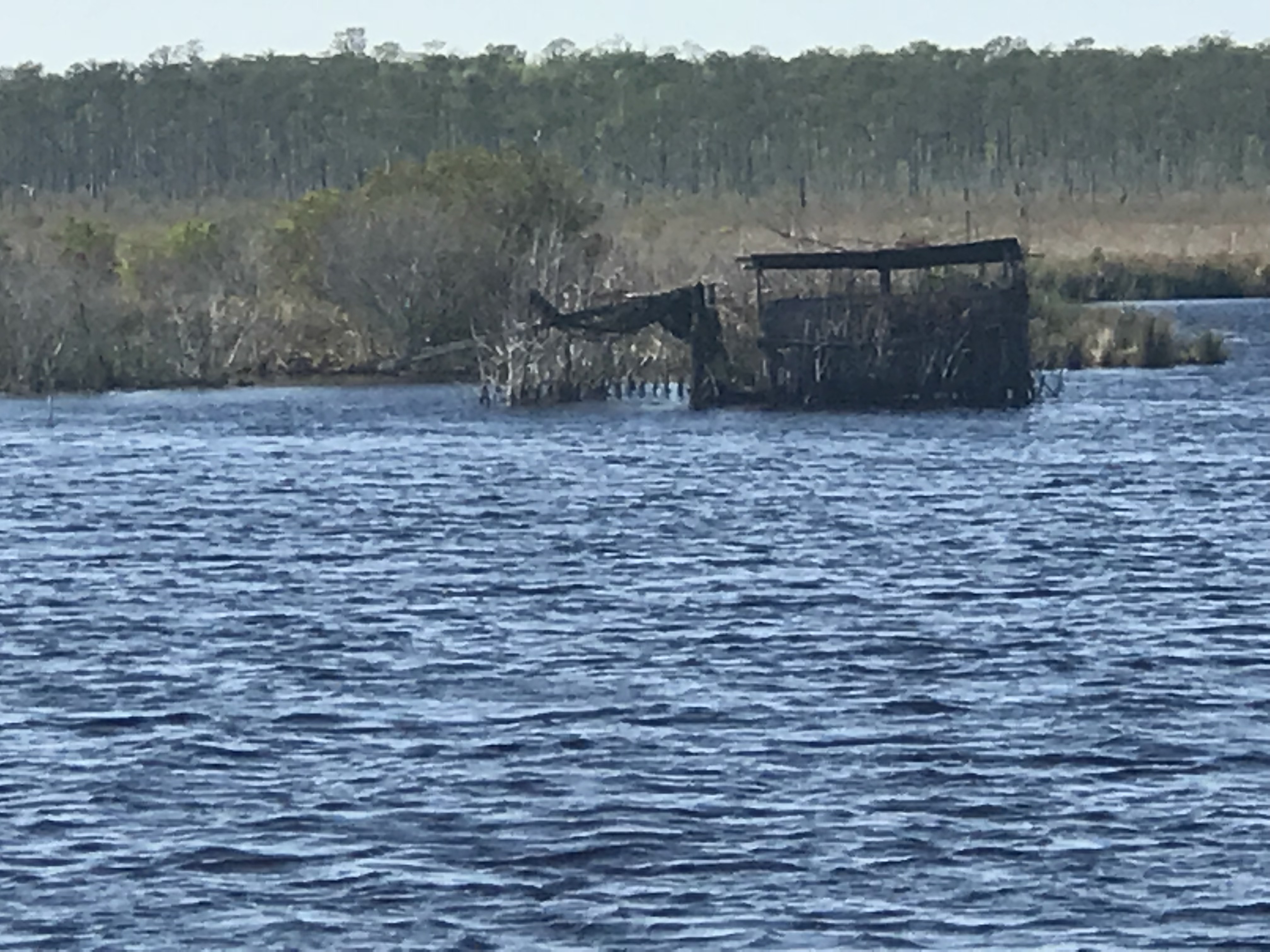
We passed a several duck blinds confirming that North Carolina is duck hunting country.
Duck Blind – Do they really fall for this?
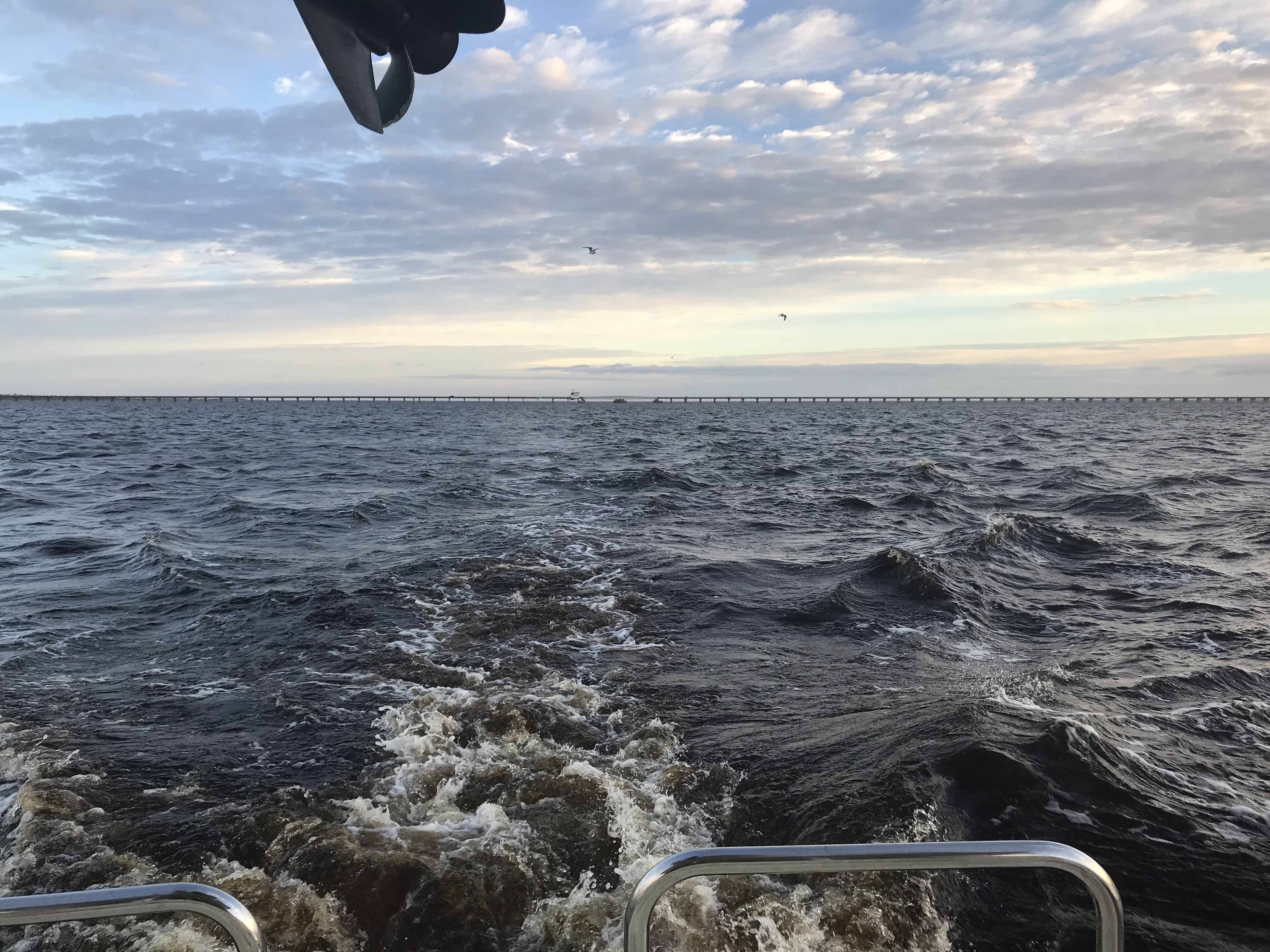
As we motored on we were reminded that we are getting closer to ICW mile marker 0 in Norfolk, VA.
Statute Mile 160
Statute Mile 125
Statute Mile 115
Statute Mile 100
The predicted forecast for Albemarle Sound had the wind out of the West at only 10-15 kts.
Albemarle Sound forecast 10-15 out of the West
We chose an anchorage with a small fetch to the West but far enough off the shore that we could open the hatches and get a good breeze while we slept.
Alligator River Anchorage
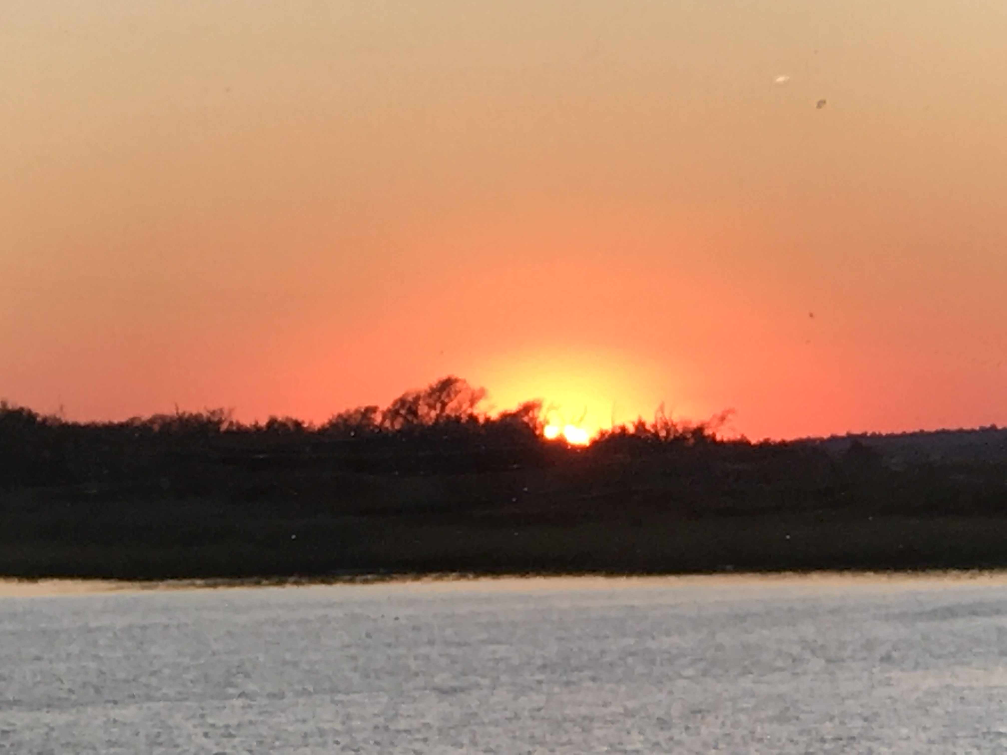
As I was setting the anchor on the bow I looked up and snapped this photo of the setting sun.


You must be logged in to post a comment.