
It’s 3AM do You Know Where Your Boat is?
It’s 3AM, the wind is gusting and I’m up checking weather and tides.
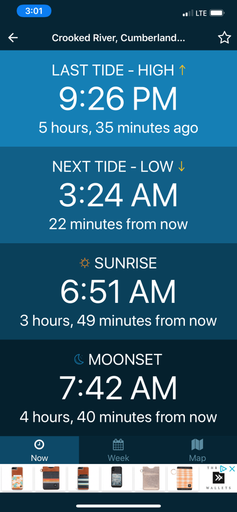
Low tide in 22 minutes 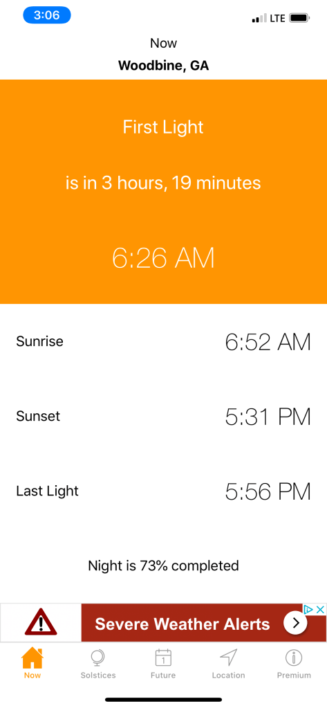
3 Hours & 19 Minutes till sunrise
It’s almost low tide and I’m anchored in a narrow creek with the wind blowing me towards the creek bank. Oh great, I only got another 3 hours and 19 minutes till the that burning disc comes up.
The USCG Gale Warning is still in effect till about noon today.
Into the Mystic
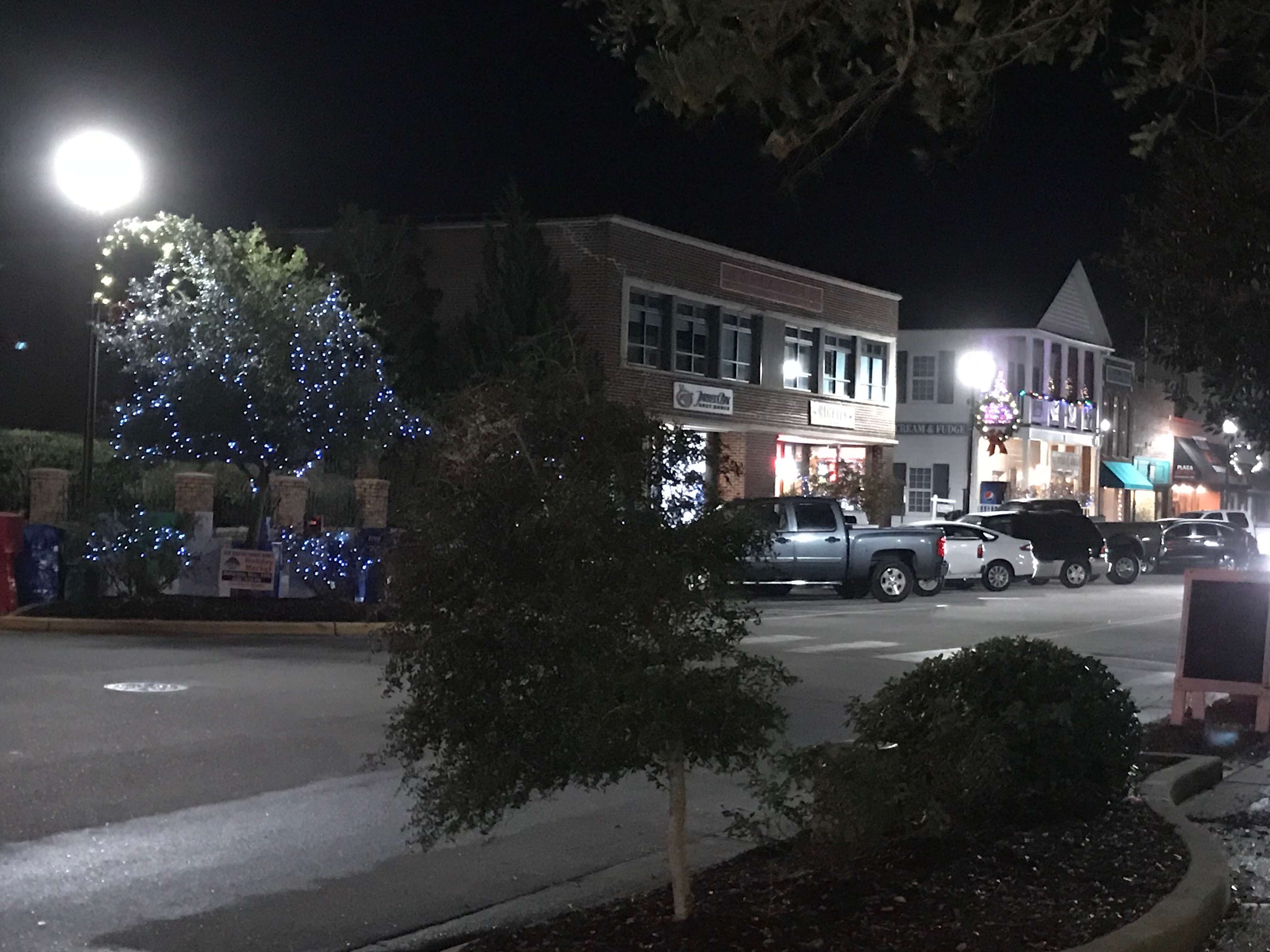
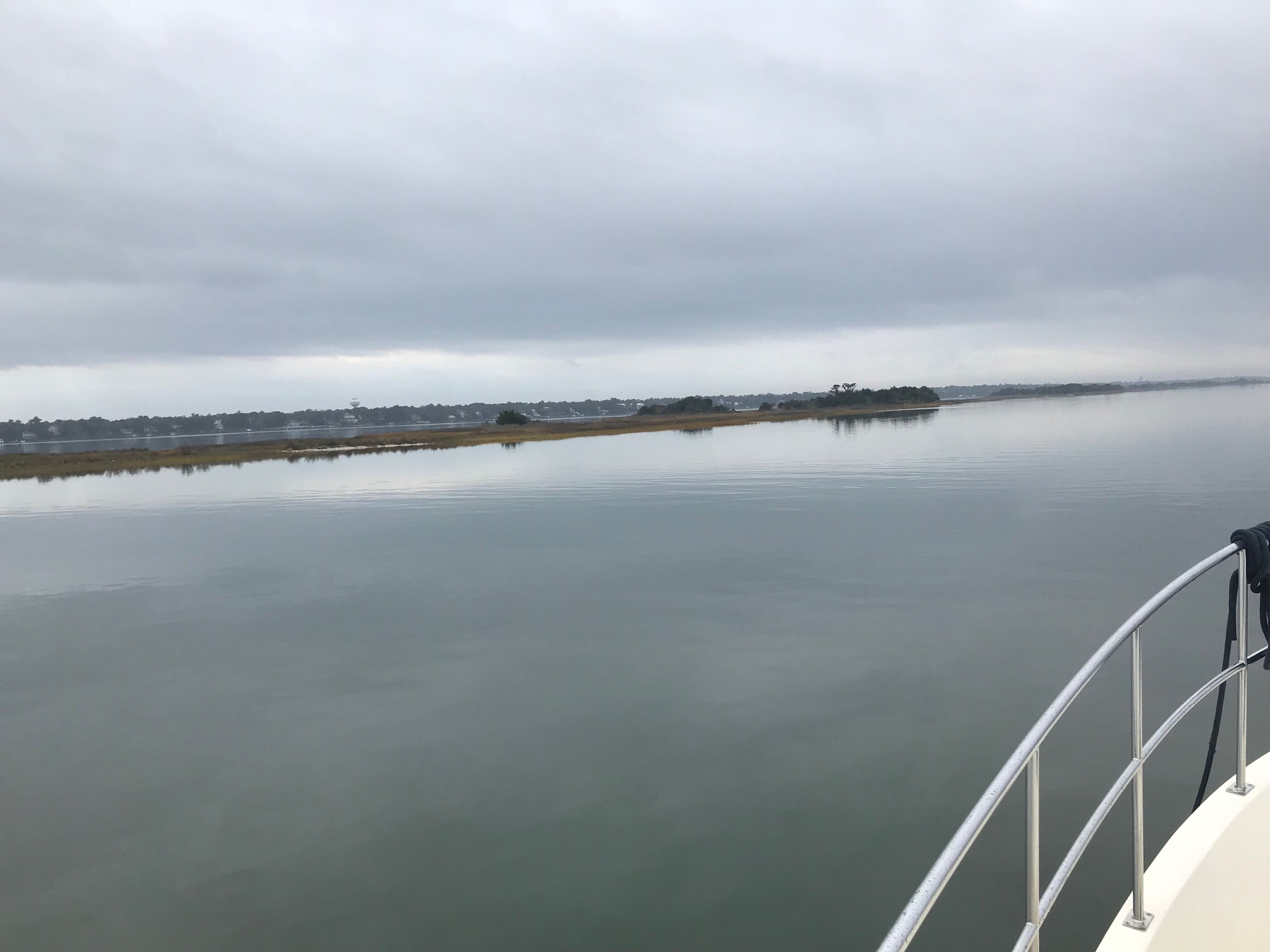
OK, the sun is up and I’m underway with that still ominous sky above me.

The offshore cold front has dropped the temp. Fog is building on the waters surface. It’s a strange thing to be piloting straight down a river that has the fog blowing by you from behind.
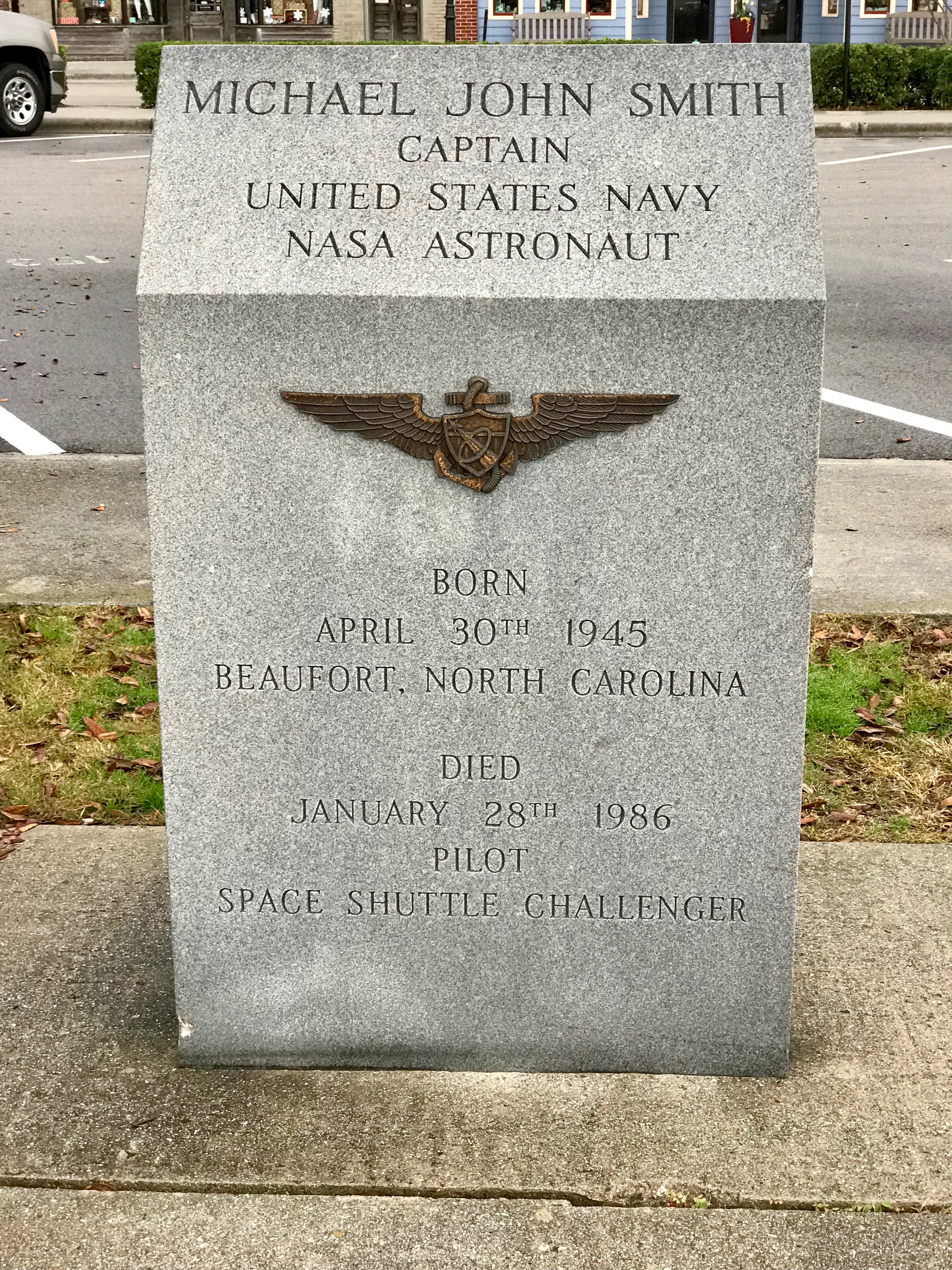
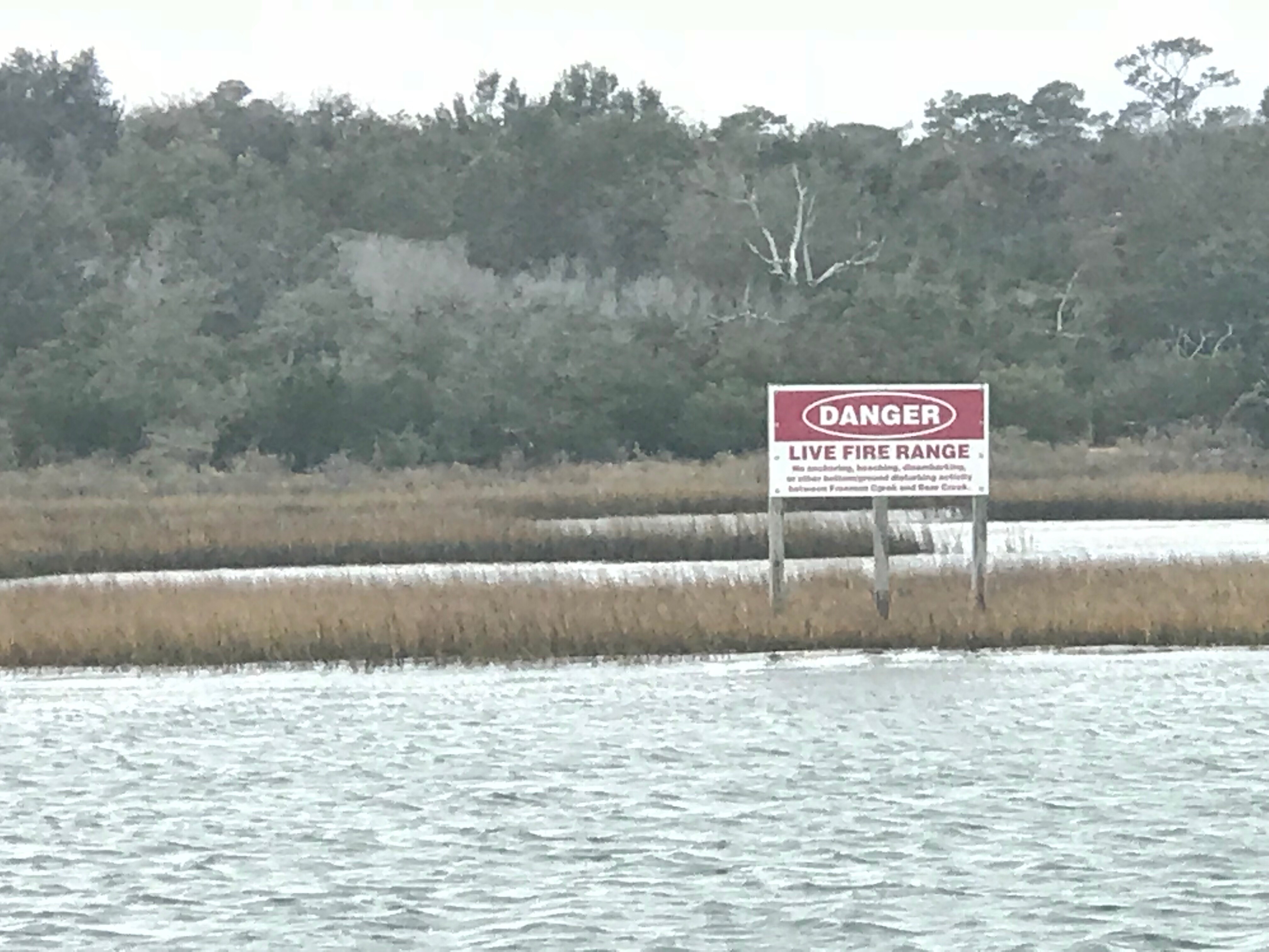
King’s Bay Naval Base
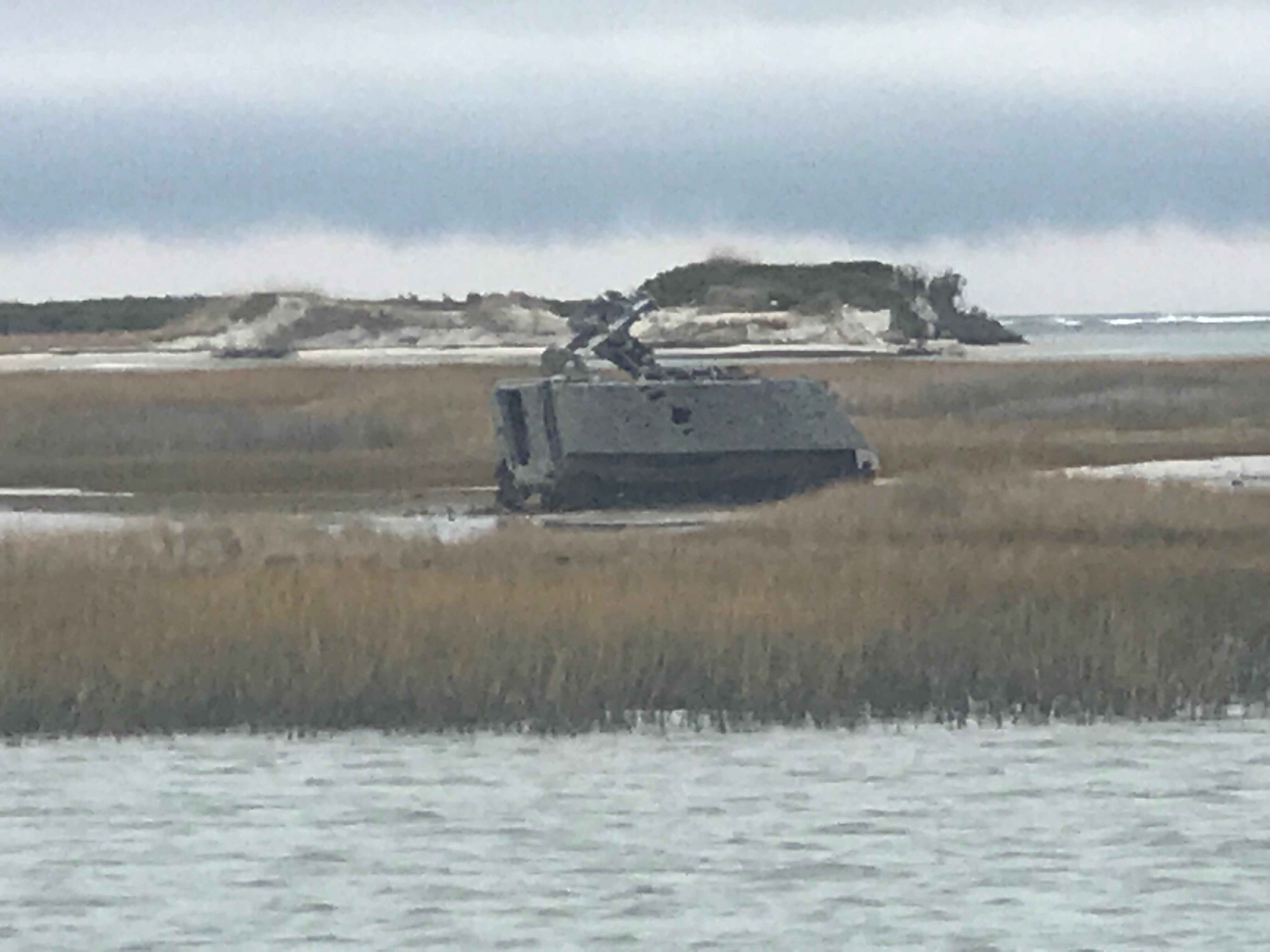
At the end of the above video you can see the USCG boat appearing out of the fog. Below is a video of them circling around me before hailing me to explain that the US Navy was carrying out exercises in Cumberland Sound that could interfere or damage my electronics if I got too close. They wanted to know what my intentions were. I explained that I was an ICW boater and would be crossing Cumberland Sound bound for the Amelia River in Fernandina Beach and points south. They politely asked me to stay 2000 yards from the naval ships or as far away as possible while still safely navigating.

Cumberland Sound is home to the King’s Bay Naval Submarines Base. There are six Trident-class submarines stationed here. There is a a long deep channel cut through the shallow coastal shelf and muddy tidal Cumberland Sounds, to the Atlantic ocean. This allows for the submarines to pass. Every time I cross Cumberland Sound I have interactions with the Navy security boat or USCG. Recreational boaters are not permitted in the King’s Bay area west of the ICW Channel.
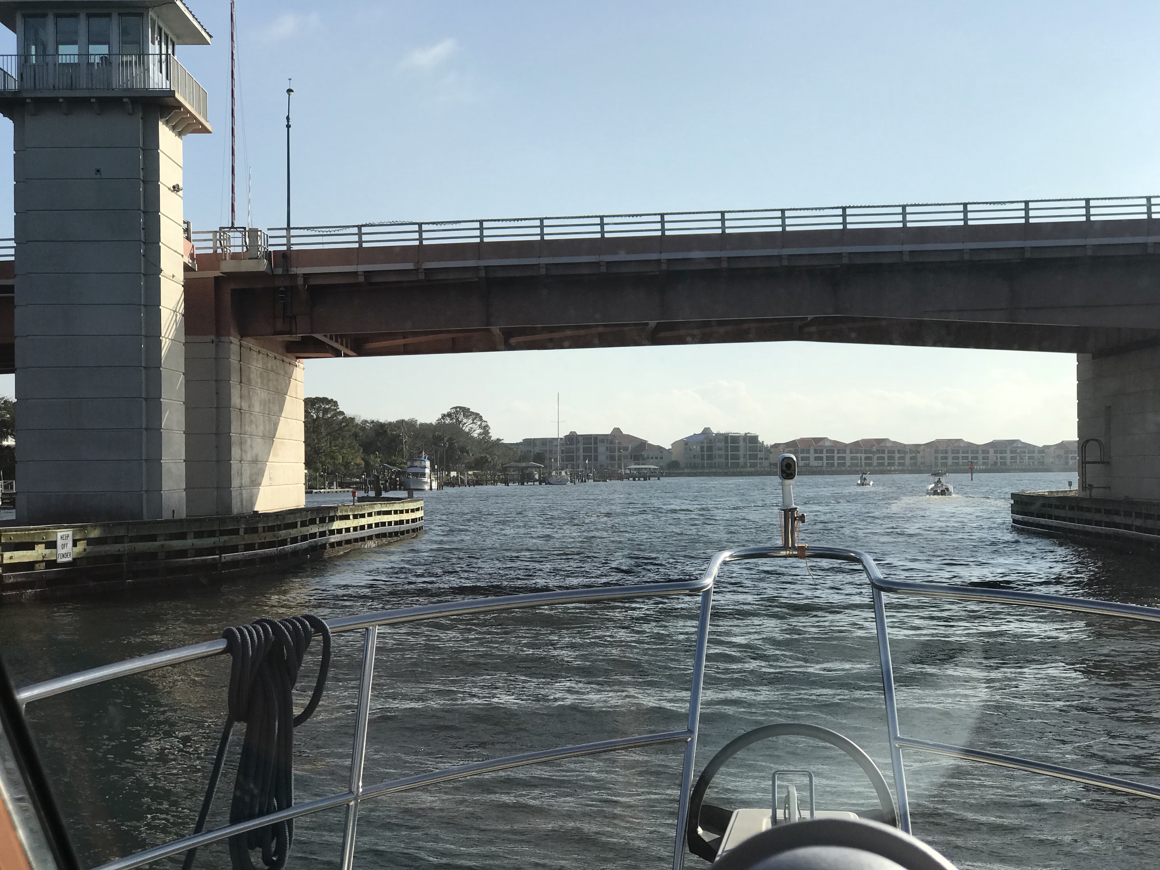
Entering the Amelia River I passed this USCG boat.
Welcome to Florida!
The St. Mary’s River divides Georgia from Florida. The town of St. Mary’s is on the northern Georgia side of the river and Fernandina Beach is on the southern Florida side. When you sail into Fernandina Beach you’ll find the WestRock Industrial wood pulp plant and CHP (Combined Heat & Power) plants along the shore. Industry began here after the great depression with a wood pulp plant. Now there is a cluster of both power, wood and packaging plants located here partly due to the railway and harbor.
I think it was Hurricane Matthew that caused a lot of damage to the Fernandina Beach area and boats.

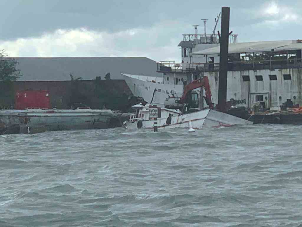
Sunk At Dock 
far away 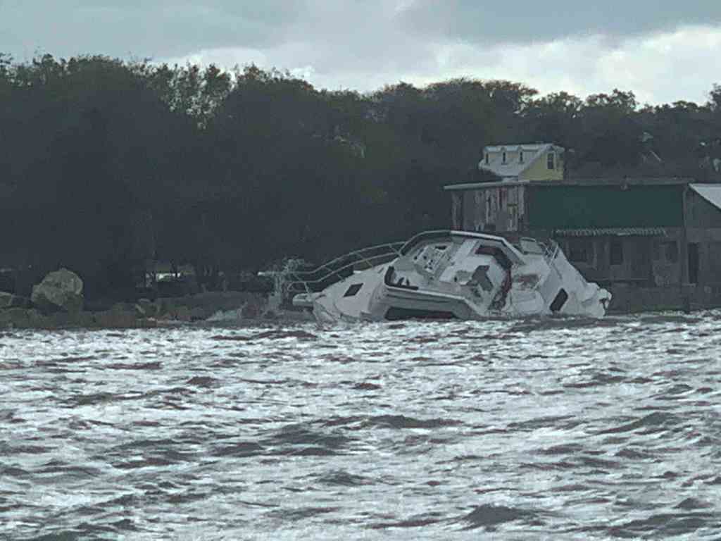
close up 
Just pull it up on the Beach
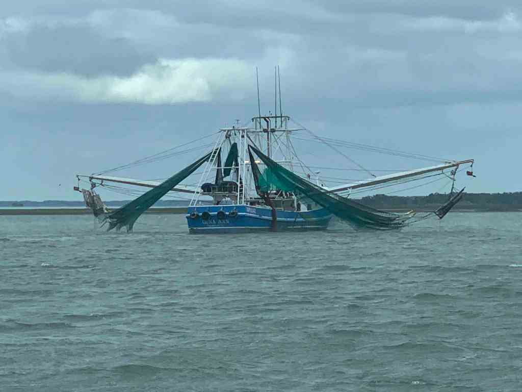
MV Acadia had followed me through the Navy exercises area and was now breaking off to go anchor in the Amelia River. I’ve anchored in the Amelia River a few times. Today however, I planned to use of all the daylight to get south of Jacksonville, FL. That would allow me to make Daytona Beach the next day.

I often see this police line-up of birds on the shore. I wonder why they group like that?

It was lunch time and I have to keep the boat moving so I bring all my ingredients to the helm and make my lunch while I drive.

Chop Chop 
nom, nom, nom…
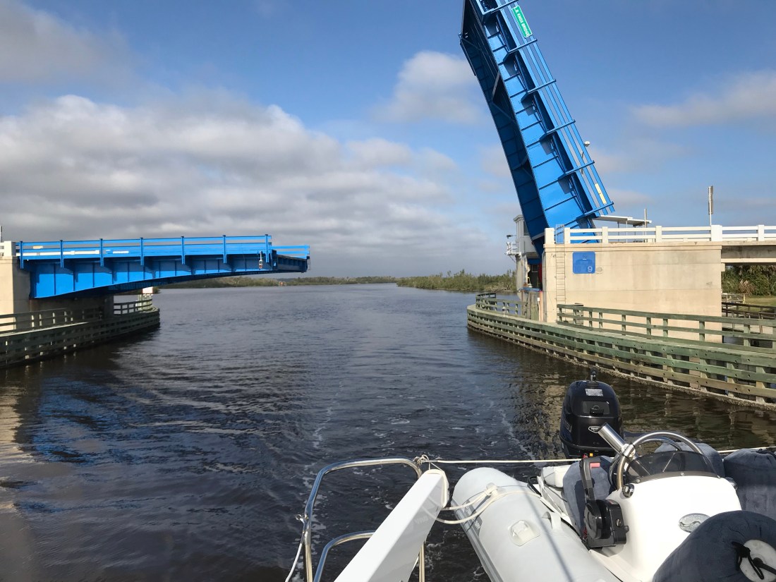
Soon I came to Jacksonville, FL and I cross over the St. John’s River and into Pablo Creek heading south. There is a tight bridge that I have gone under many times but as I approached it I could that the strong current was producing 2-3′ standing waves on the down current side of the bridge.
I use a user sourced digital cruising guide called Active Captain to keep me aware of all the marinas, anchorages and hazards along my route. Below I pasted my review of the AC strong current hazard located at Pablo Creek bridge.
Please note: There is a current station for this bridge. In order to see it in Aqua Maps, I had to zoom way in. It was hidden under the tide station located just north of the bridge. The current station is named. “Pablo Creek bascule bridge”.
I have been under this bridge 4 times without concern. This time I hit it right at max ebb 5.67kts on a full moon with strong opposing winds (gale warning ended 2hours earlier). There were 2’+ standing waves on the down current side of the bridge. The strong current was catching my full keel causing me to make huge port and starboard rudder corrections.
It’s narrow between the bridge fenders. With no boats behind me… I kicked it in neutral and it spat me out like a toddler does to their first taste of broccoli.
I chose to anchor in the Active Captain Anchorage called “Atlantic Blvd Br.” Just NE of the bridge. I waited for it to slow down a bit. Waiting meant I’d have to burn more fuel to get to my chosen “Pine Island Anchorage” before dark. I’d rather pay a fuel bill than a fiberglass bill. Be careful if you are a full-keel trawler with low power and/or a small rudder.
Capt Mahty
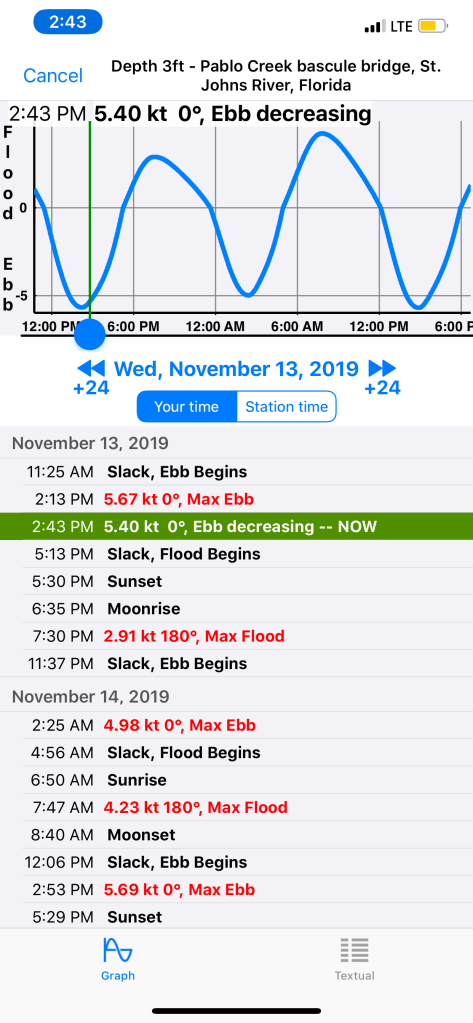
I arrived at 2:15PM – peak ebb 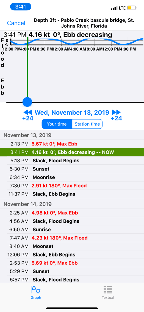
I waited till it dropped to 4.16 kts to pass under the bridge
Waiting for the current to slow slightly had cost me time and I would not make it to my chosen anchorage until dark. I still say it was the right move rather than risk getting slammed into the bridge’s fender boards.
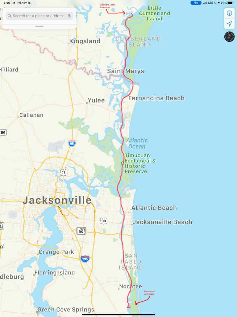
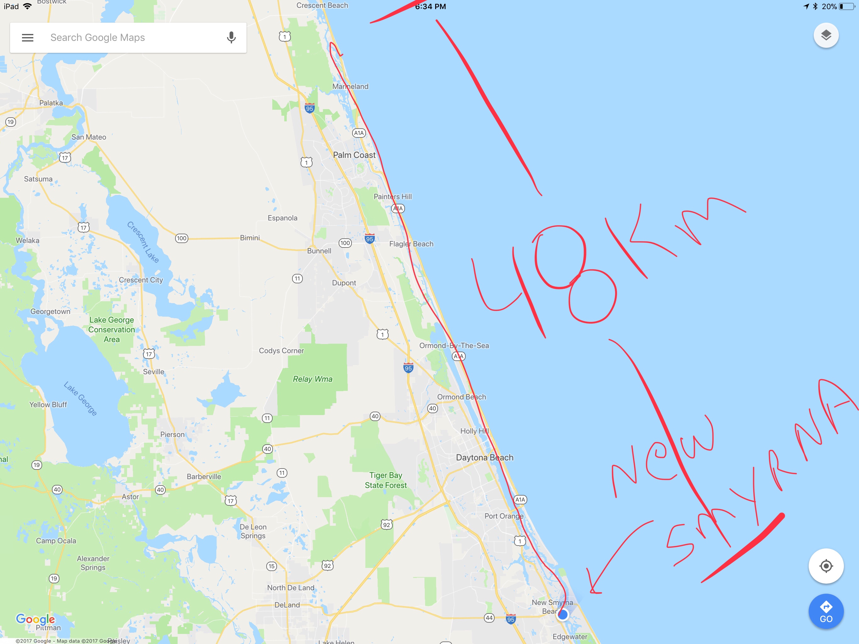
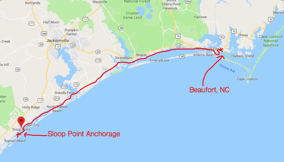
This leg of my winter journey looked something like this.


You must be logged in to post a comment.