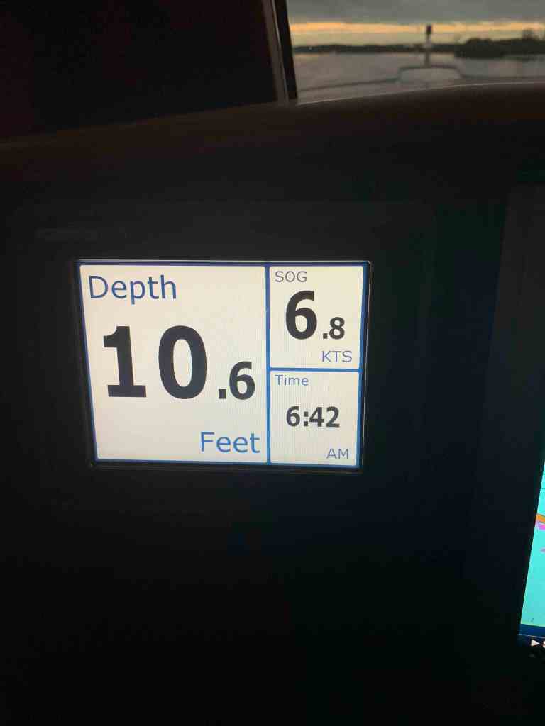
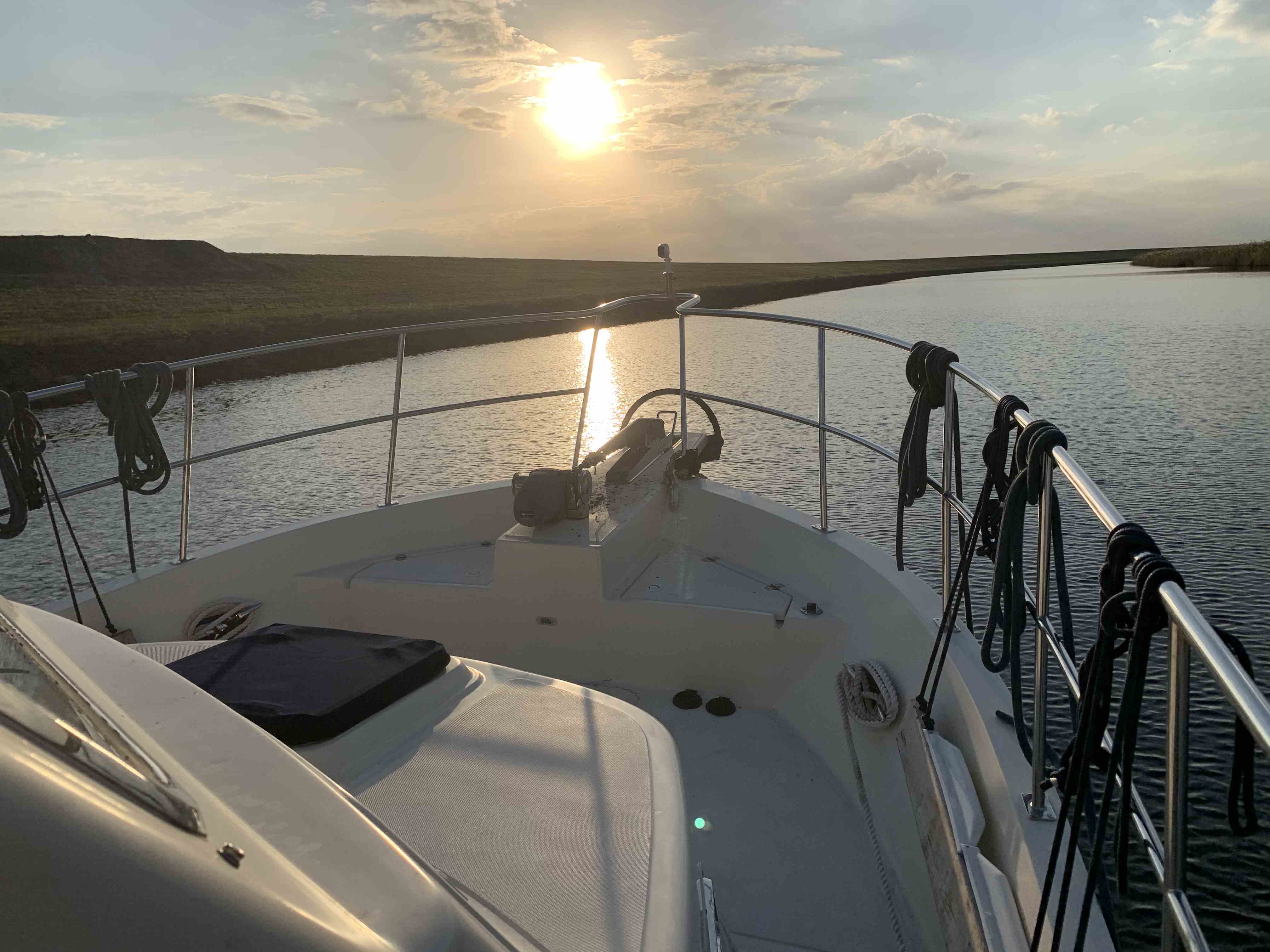
The next morning we were underway at 6:42AM and I was snapping photos as we went.
Sun’s Up and so are we
Boat House
Home
St. Lucie River
Marine Travel Lift with a Tug
Old Bridge
Tight Squeeze
Humble Abode
There are many locks on the trip to Lake O. Below is a clip as we lock-through at the St. Lucie Lock & Dam.
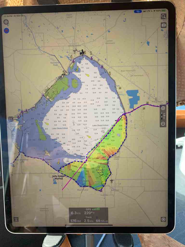
As soon as you pass through the Port Mayaca lock you enter into Lake Okeechobee. I thought about anchoring on the eastern shore of Lake O for the night. I did the math and figured we could cross the lake (22NM) and make it the 33NM to the dolphins just outside the Moore Haven Lock. Moore Haven lock closes at 5PM and all vessels must arrive by 4:30PM to be allowed to enter the lock.
Just through Port Mayaca lock and into Lake O – 22NM crossing and another 11NM of canal before our tie up location in front of Moore Haven lock.
There was a fire in the distance and the winds where carrying ash in the wind and raining it down on the decks of MV Simple Life. We had to be careful not to track the ash inside and stain the carpets.
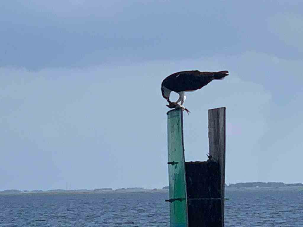
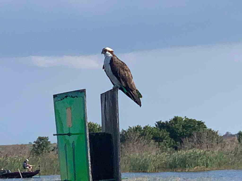
Osprey are everywhere on Lake O. Seems like every piling has it’s own Osprey.
There is a concrete cylinder in Lake O that I could only guess at what it’s function is or was?
Birds covering this concrete structure
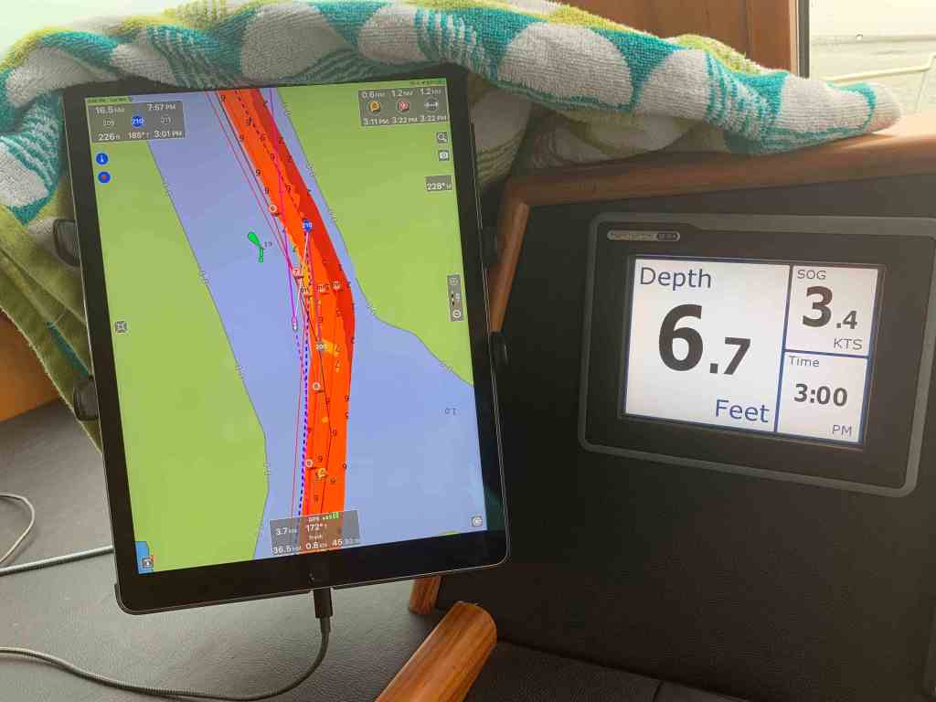
You must be careful to stay in the channel in Lake O as it can get shallow.
Under 8′ Deep
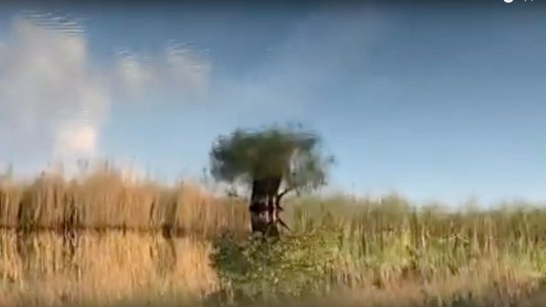
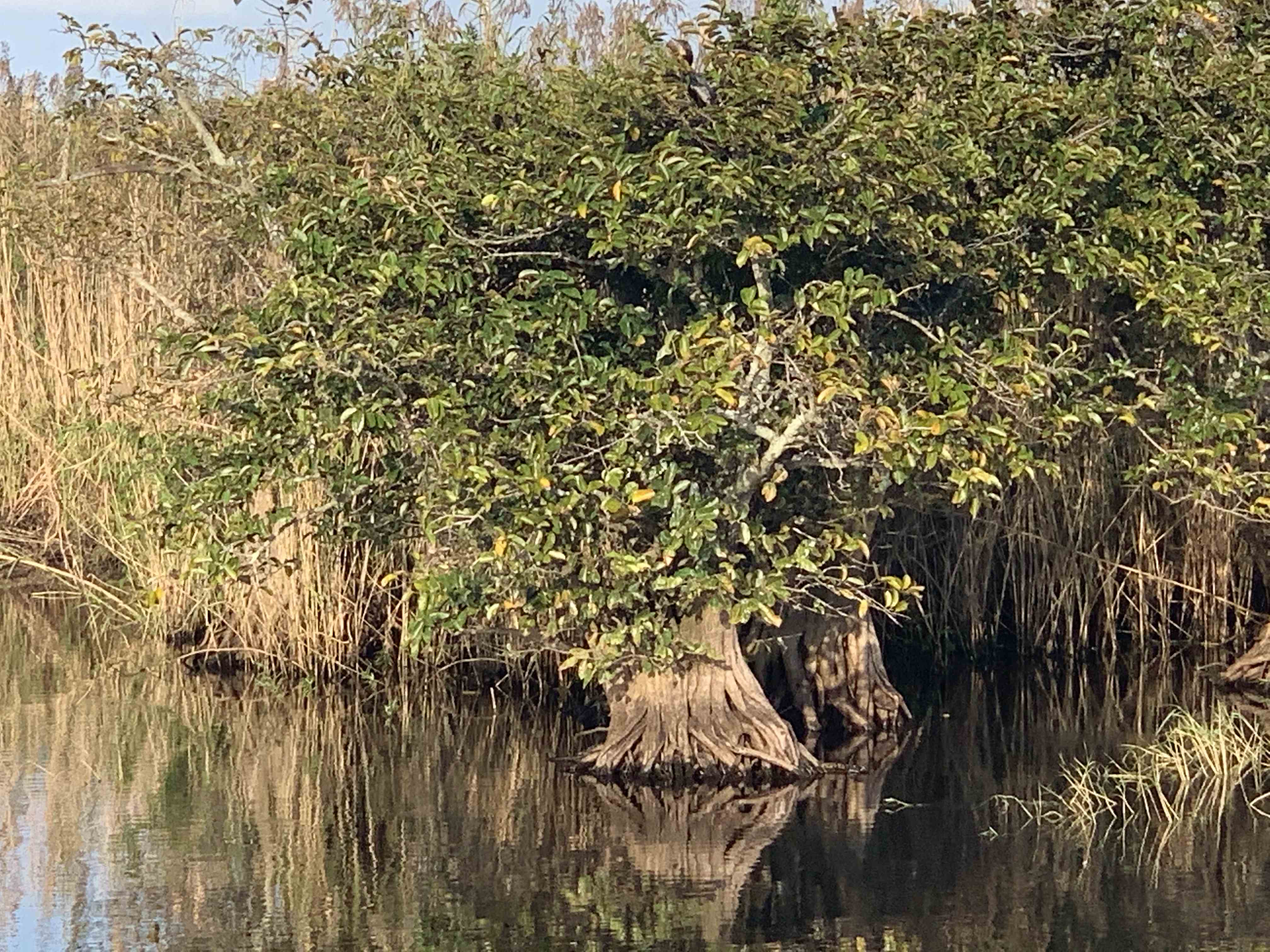
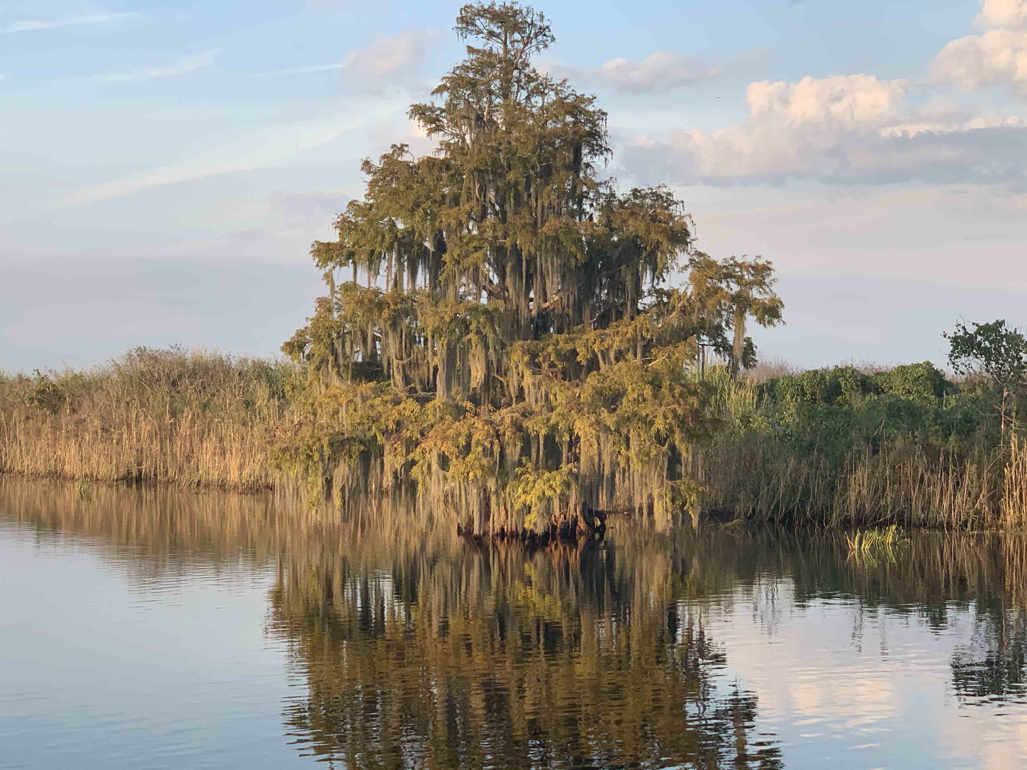
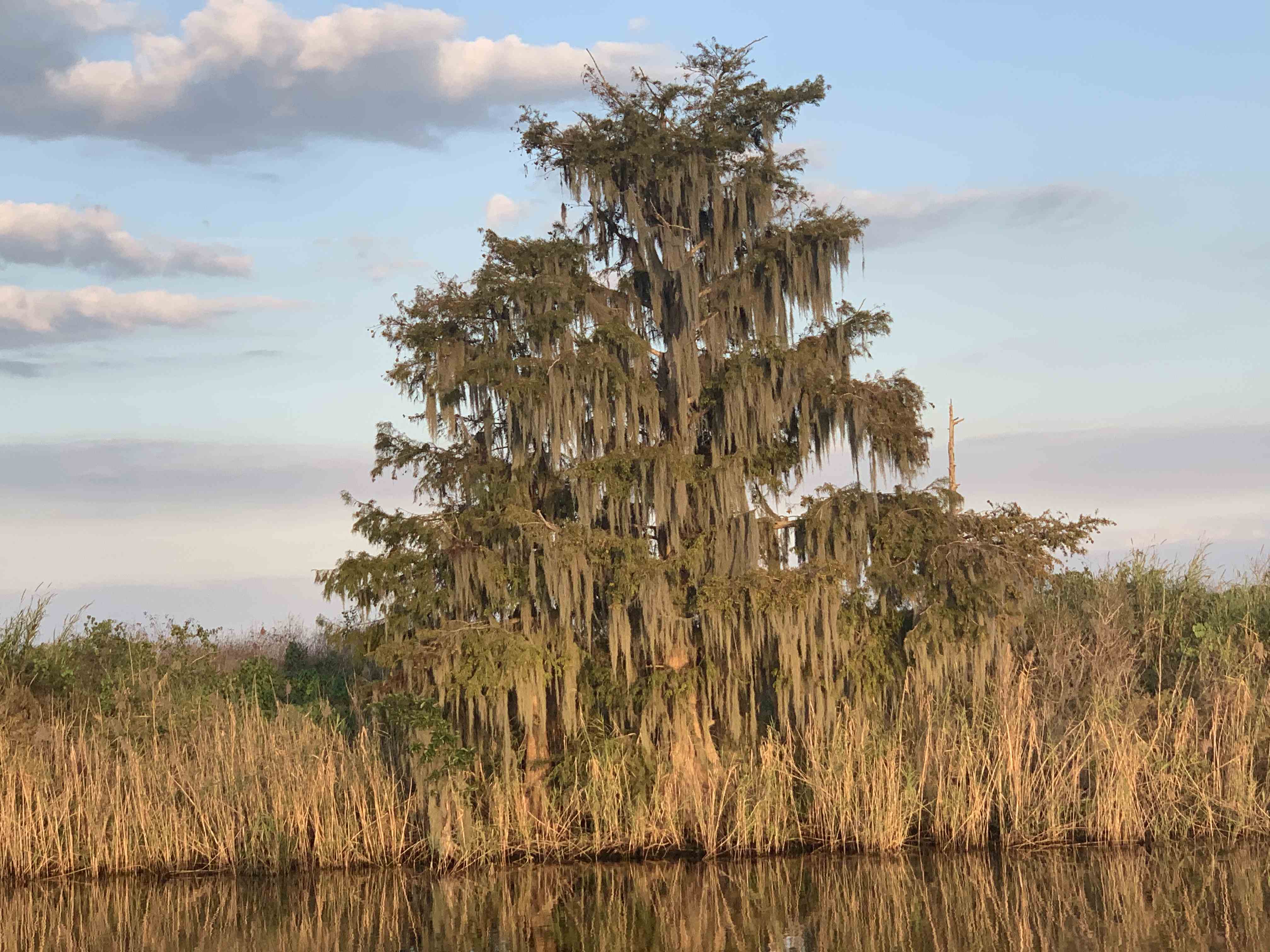
The trees and vegetation in Lake O is photo-worthy.
Gators be a lounging in what’s left of the sun…
Florida Gators
This dude was out riding in his air boat with his black lab by his side.
Black Lab Airboat Ride
There is a special feeling that Lake Okeechobee bestows upon me. It’s hard to explain but we all have places that we go to just feel like the world is right. I’ve been listening to the blues lately. More specifically, JJ Grey and the Mofros. The tune “Lochloosa” sums it up.
Where is that place you go to recharge your soul?
Homesick but it's alright
Lochloosa is on my mind
She's on my mind

I swear it's ten thousand degrees in the shade
Lord have mercy knows - how much I love it

Every mosquito every rattlesnake
Every cane break – everything

Every alligator every black water swamp
Every freshwater spring – everything

All we need is one more damn developer
Tearing her heart out

All we need is one more Mickey Mouse
Another golf course another country club
Another gated community

Lord I need her
Lord I need her
And she's slipping away

If my grandfather could see her now
He'd lay down and die

Cause every minute every second every hour
Every day - Lord she's slipping away

Homesick but it's alright
Lochloosa is on my mind
She's on my mind
The sun was getting low and it was creating a mirror on the lake.
I walked out on the bow while underway to attempt to capture just how dreamlike this crossing can get when the sun is low and the water still.
Fantasy on Lake O
We had finally arrived at Moore Haven lock and it was closed for the night. We were stuck in Lake O for the night so I decided to tie to the dolphins for the night. A dolphin is a piling that is supported by many other pilings. You often find large ships laying up against them or tied to them. Tonight I would have to pull the bow up close to one of them to get a line on it. Then I’d have to let that bowline out as I backdown on the piling to my stern. Once I get a line of the piling behind me I would adjust the two lines so MV Simple Life would sit evenly between the two dolphins for the night.
If you read the last post, I wrote about how 50 NM / day can be done but you have to get an early start. Well, I didn’t.
9:20AM Weighing of the Anchor
Tortoise and the Hare
Right of the bat I had a much faster boat pass me by. I’m sure he gets his 50NM in before noon.
Raised Salon Cruiser
Anyone Home?
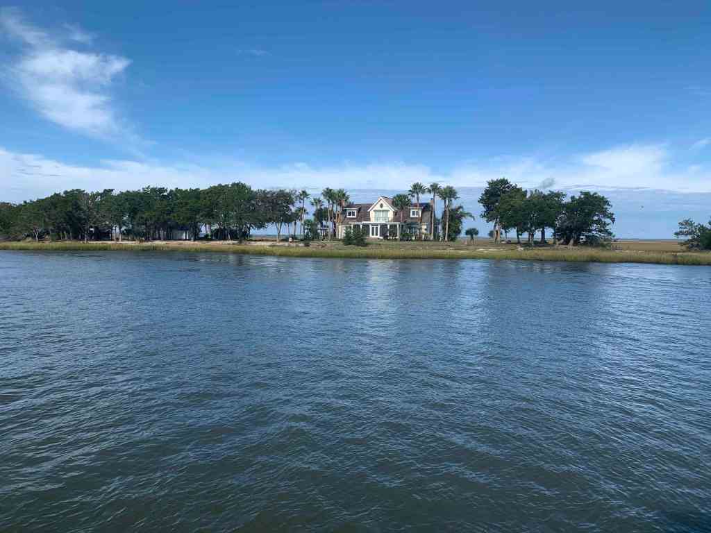
I found this home on a small island interesting as I passed.
House on a Small Island
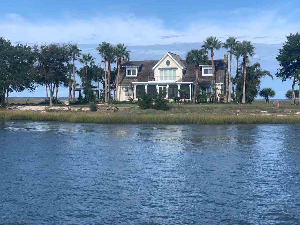
House Close Up
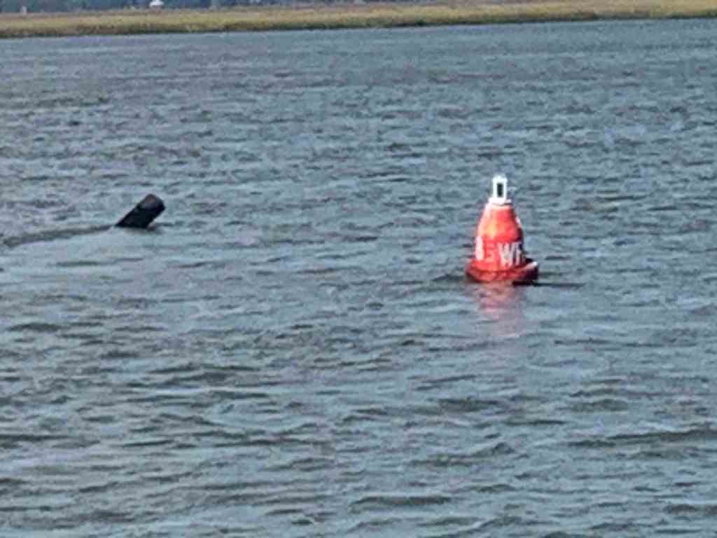
ATONs
ATONs (Aids TO Navigation) or buoys if you will, are important things to pay attention to on the ICW.
deadhead sticking up behind a buoy.
World is Ablaze
As I was approaching Brunswick, GA it looked like the world was burning.
No idea what was burning but there was a lot of smoke
Traffic
I hailed this tug & barge on the VHF and let him know that I would push over to the edge of the channel as soon as I rounded a narrow bend in the river.
Tug & Barge
T&B Close Up
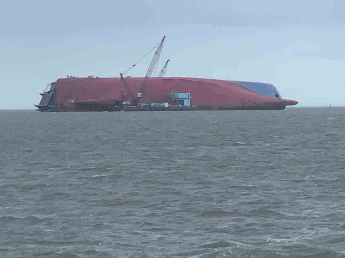
The Unexpected
Next came something I did not expect. When I first saw it I had no idea what it was. I spy’d it with my binoculars but I still could not identify it.
What is that?
Turns out this is the underside of the 656 foot long Korean RoRo cargo ship called “Golden Ray” that capsized in Cumberland Sound on September 8th, 2019. While 4 of the 24 crew members were missing 3 were later rescued and even the 4th was pulled out alive. They were trapped with a fire that was roasting them alive while they were stuffing their pockets with ice to stay cool.
Slow as She Shallows
I was making my way down Jekyll Creek just off Jekyll Island. I found shallows.
Note the slow speed for shallow water
Foreboding
As I glanced up at the sky I could see that it was getting lower and darker.
A darkened sky ahead
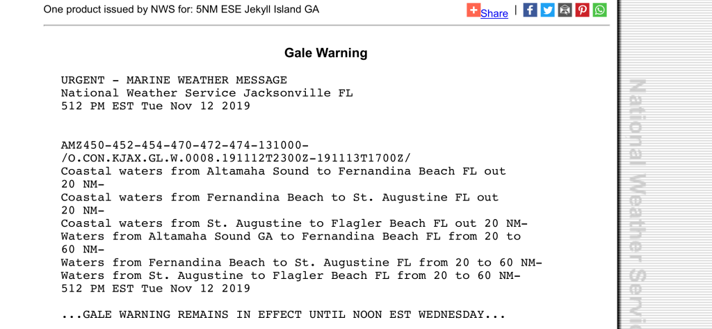
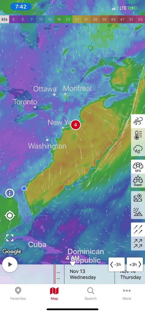
Time to stop being a lazy captain and check the weather.
Gale Warning starting at … Well NOWOffshore Weather Front
You Ain’t Be Around if You Ain’t Been Aground
I was happy that my anchorage was quickly approaching. However, before I could get to my chosen anchor location I came around a turn in the bend to find this trawler aground.
Like I always say, “If you want to know where it’s shallow… it’s where the birds are standing”
Have You Been Paying Attention?
Have you have been paying attention? Did you read my last blog post about how I plan on making 50NM legs like this leg shown below?
W03L017 Crescent River Anch – Delaroche Creek Anch
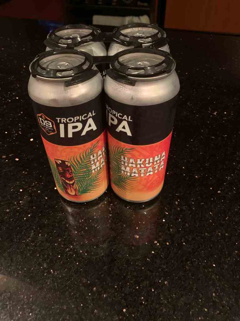
Well I got a late start, I ran into shallow water, Gale Warnings, slowed for all kinds of things like trawlers aground. When did I get to my anchorage? In the dark with gale warnings. OK, It may have been gale warnings out on the ocean but only strong gusty winds where I was anchoring. That said, I’m in the Georgia low lands. Nothing sticks up high enough to buffer the winds. I did not snap a pic while anchored because it was just black out. Anchoring did not go smoothly. I had a strong wind perpendicular to a strong current and I was challenged to find a spot that did not have the wind swinging Simple Life onto the creek bank. It’s going to be a long night on anchor. Now where did I put those IPAs?
We had a quiet night on anchor in the Alligator River. Our anchor spot was just off the ICW and was an “easy in” and “easy out” in the morning. Note: some anchoring spots can have shallow or tricky entrances.
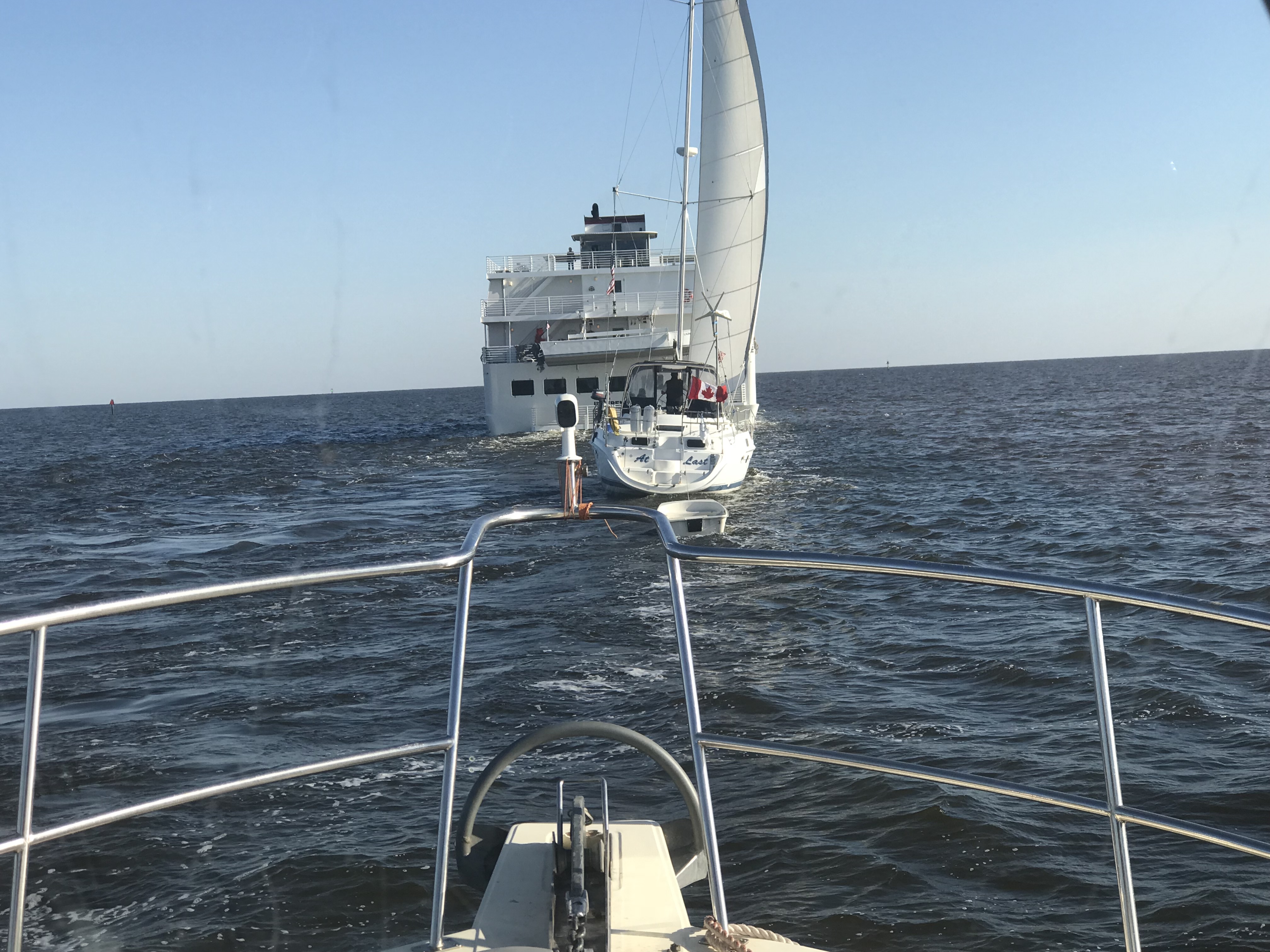
MV Independence uses AIS just like us so it was easy to acertain their ship’s name and hail them directly. I simply let the captain know that I saw they were going to overtake us and stated we would manuver to starboard and allow them exclusive use of the entire channel for a “2 whistle pass”.
American Cruise Lines, MV Independence
As the channel got narrow we had to get in line behind this sailboat who did not seem to have their VHF radio on. (repeated hails from us and the Alligator River Swing Bridge with no response). On the ICW you must monitor channel #16 (the international hailing channel).
Channel 70 (156.525 MHz) – Digital Selective Calling
DSC Discussion (skip this technical section if you like)
CH 70 or DSC or Digital Selective Calling is a new technology that uses EM wave pulses on channel 70 to send digital (1s and 0s encoded in electromagnetic pulses over a radio wave transmitted on channel #70’s designated frequency)
This channel is not for human voice transmission but for ships continually broadcasting their current position and heading. The data is received by your VHF antenna and processed by your AIS transceiver before finally being plotting on your chartplotter. Instead of just a radar blip on my chartplotter, I see a triangular icon representing the ship and if I click on it I get all sorts of info like:
Ship Name: So I can hail them by name instead of “Motor vessel off my port bow”
Heading
Speed
Ship length
MMSI #
Sail or powerboat
CPA (Closest point of approach or how close will they come to our boat if nothing changes)
CTA (at what time will they be the closest to us).
DSC also has a well hidden secret function where you can use a ship’s MMSI # (like a personal phone number) to call them directly. By this I mean you don’t hail them by name (ie. “ship name, ship name, this is motor vessel Simple Life on channel 16”. Instead you type in their MMSI number and a channel that you want their VHF radio to automatically tune to. Hit the PTT (Push To Talk) button and a loud tone plays over their VHF radio and their radio automatically jumps to the channel you wanted to communicate with them on. It’s a great feature but I must say I have not used it, nor have many other boaters. Maybe it will just take some time till the early adopters start teaching other boaters how to use it?
As we approached Coinjock, NC, there were large plumes of smoke coming from shore. I saw that the smoke which had started as grey/black was now white indicating that it was burning itself out (Where are my firefighter friends here, keep me honest).Maybe it was a controlled burn of the low lands?
Close Up
Far Away
Getting Closer
As we were pulling into Coinjock Marina, named for the NC town of the same name,we were aware that our port fuel tank was running on fumes. NOTE: we had some reserve fuel in the starboard diesel tank.
I think I need to start wiping my leather helm down with lint-free cloths 😉
We had made two long runs up the coast and at almost 9 kts and burned lots of fuel. Coinjock about 20 cents more per gallon of diesel than the marina we were heading to next. While not the cheapest place to take on over 300 gallons of diesel it was convenient. I mentioned to the dockhand that the next marina North was 20 cents cheaper a gallon and he responded, “Oh, our costs are higher because we sell more fuel than them”. I just smiled and thought, I’m pretty sure this friendly dockhand skipped school that day in business class 😉
When choosing a location for diesel be sure to chose a location that sells a lot of diesel. Common wisdom says: the more they sell, the less time the deisel sits in storage tanks acculmulating condensation water or other contaminations. If you have ever had your engine die offshore due to bad fuel you’ll agree that it’s better to spend a bit more for the likelihood of clean fuel.
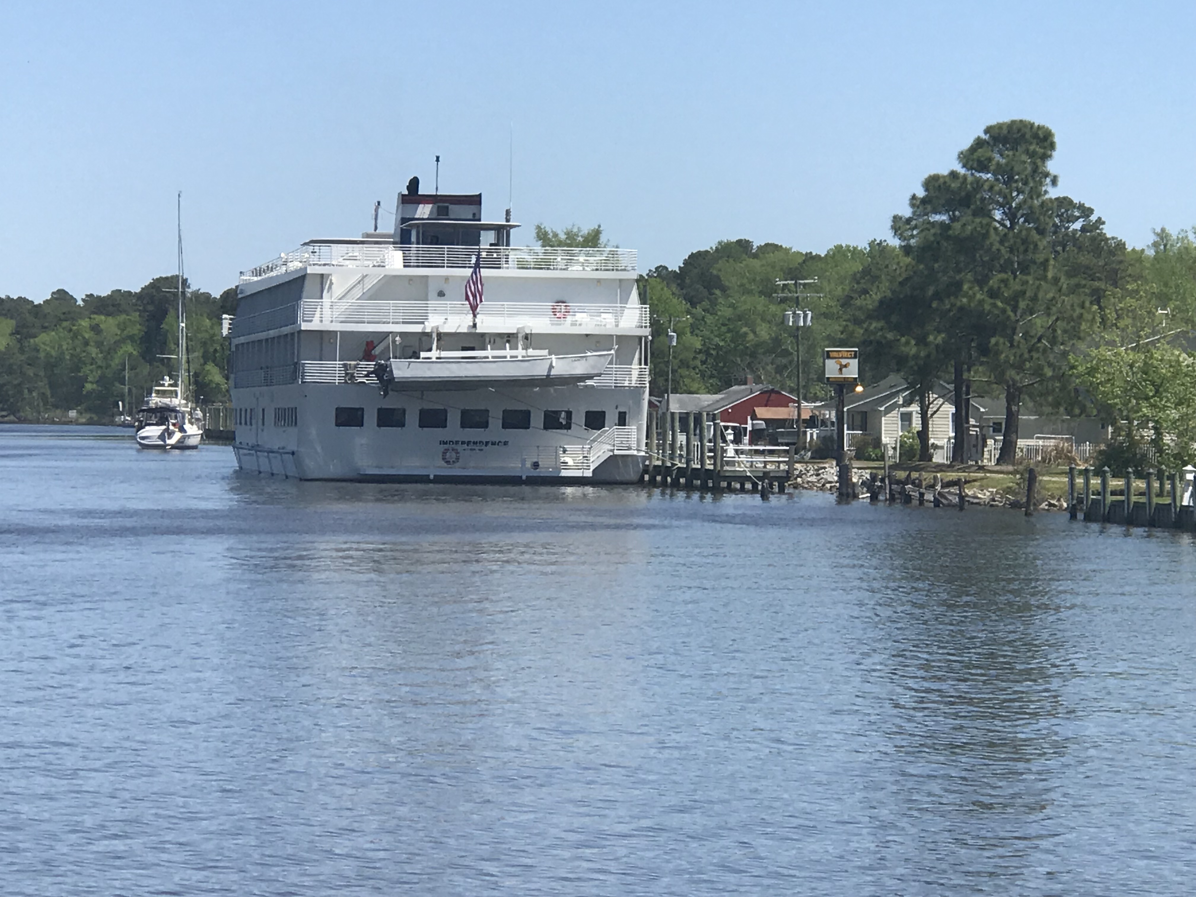
The cruise ship which had passed us on the ICW was now docked in Coinjock to take on 5000 gallons of diesel.
MV Independence Docked in Coinjock NC
I believe in large ship terminology, the captain and crew talk about the amount of diesel they have in terms of weight rather than gallons. Diesel is about 7 lbs / gallon while gasoline is about 6 lbs / gallon. When you take on 5000 gallons of diesel you need to be thinking about how much that excess fuel weighs and what it does to your ship’s draft. Draft = how deep your boat sinks into the water. Air draft = how tall is your boat is above the water for fitting under low bridges.
MV Simple Life took on about 311 gallons or 2,177 lbs of diesel while we were there. We also filled our water tanks (8.3 lbs / gallon) so that adds another 3,700 lbs to our boat. If you ever read the specs for a boat it will list it’s dry weight as well as it’s water draft. Always remember that when you load your boat up with your possessions, passengers, dogs, food, fuel, water, etc that it will sink your draft a few more inches into the water. When a boat is designed they guesstimate the weight & displacement of the boat from summing up the weight of every item in the CAD drawing. This we know thanks to the ancient Greek scholar Archimedes and his “Eureka” moment when he figured out that a body (boat) displaces it’s exact weight in water.
Boats with sharp narrow hulls must sink lower in the water to float while boxy square hulls like that of a barge need only sink a small amount to displace their weight in water. The boxy square shape to the cruise ship allowed it to have ashallower draft than MV Simple life. So don’t follow the cruise ship up the ICW thinking… ”if there is enough water in the channel for them, we can easily follow them”.


You must be logged in to post a comment.