As we weighed anchor in Robinson’s Creek you could feel the power of the wind. The airport wind speed last showed a 30 MPH gust.
25 MPH Winds with 30 MPH Gusts as we passed NE Florida Regional Airport
Even with the strong winds a pair of US Custom agent boats zoomed by, unaffected.
Our route would look something like this:
Our Route from an anchorage in St Augustine to Cumberland Island Anchorage
We would avoid many shoals:
Shoal near South Sapelo River.
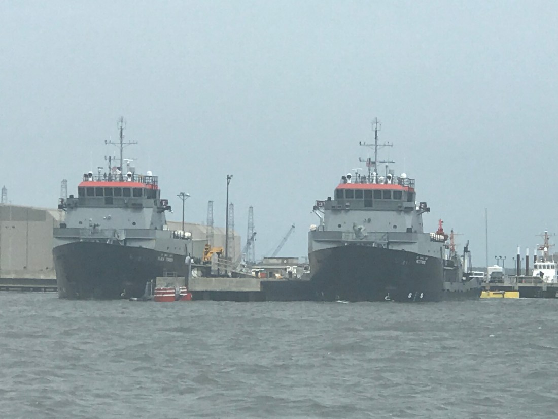
We would cross over the St. John River in Jacksonville, FL and see sights such as this Navy ship in dry dock. What a narrow beam and sharp bow these attack vessels have.
Navy Ship in Dry Dock
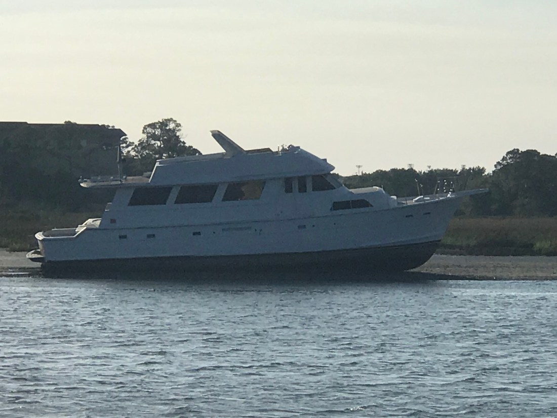
I had always wondered what a trawler would look like with a wind generator mounted on the fly deck and I just have to say I can’t imagine ever doing this..
A trawler with 3 Wind Generators on the Flydeck
The free overnight dock in Jacksonville had a spot open but we were determined to use what we had left of the light and cover more ground. Our plan was to cross over the Savannah River and into GA.
Once in the Savannah River we saw that many of the river banks had been built up possibly for storm surge.
Lone Tree standing proud on the banks of the Savannah River
As you approach Cumberland Island there is a heavy Navy presence in the area. We passed these two big Navy ships in port.
Navy Ships near Cumberland Island
We read the writeup on the Cumberland Island Anchorage.
AC Cumberland Sound Anchorage writeup
We chose this anchorage because it offered a lee in the face of strong winds.
Our Anchor spot in Cumberland Sound
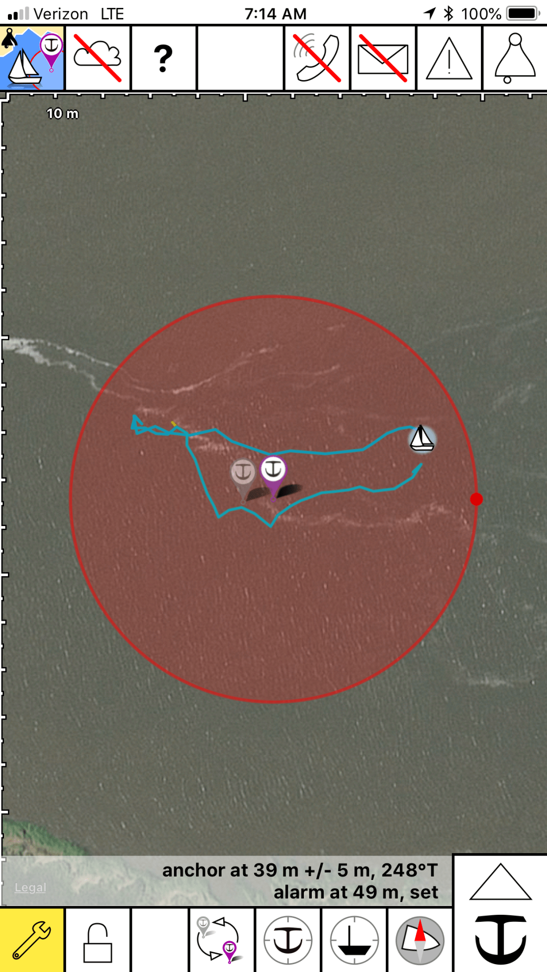
The anchorage was quite busy and the only spot we found was one tucked between two other anchored boats. I had to anchor in an area that had oyster shells and mud. Not a strong seabed for anchoring. The anchored dragged a bit as we set it at 700 RPM. I backed off a little on the throttle and this would have to do for the night. I was tired and needed sleep.
I set the anchor alarm app on my phone and drifted off to sleep.
Anchor Alarm App plays warning sounds if you drag outside of the red circle
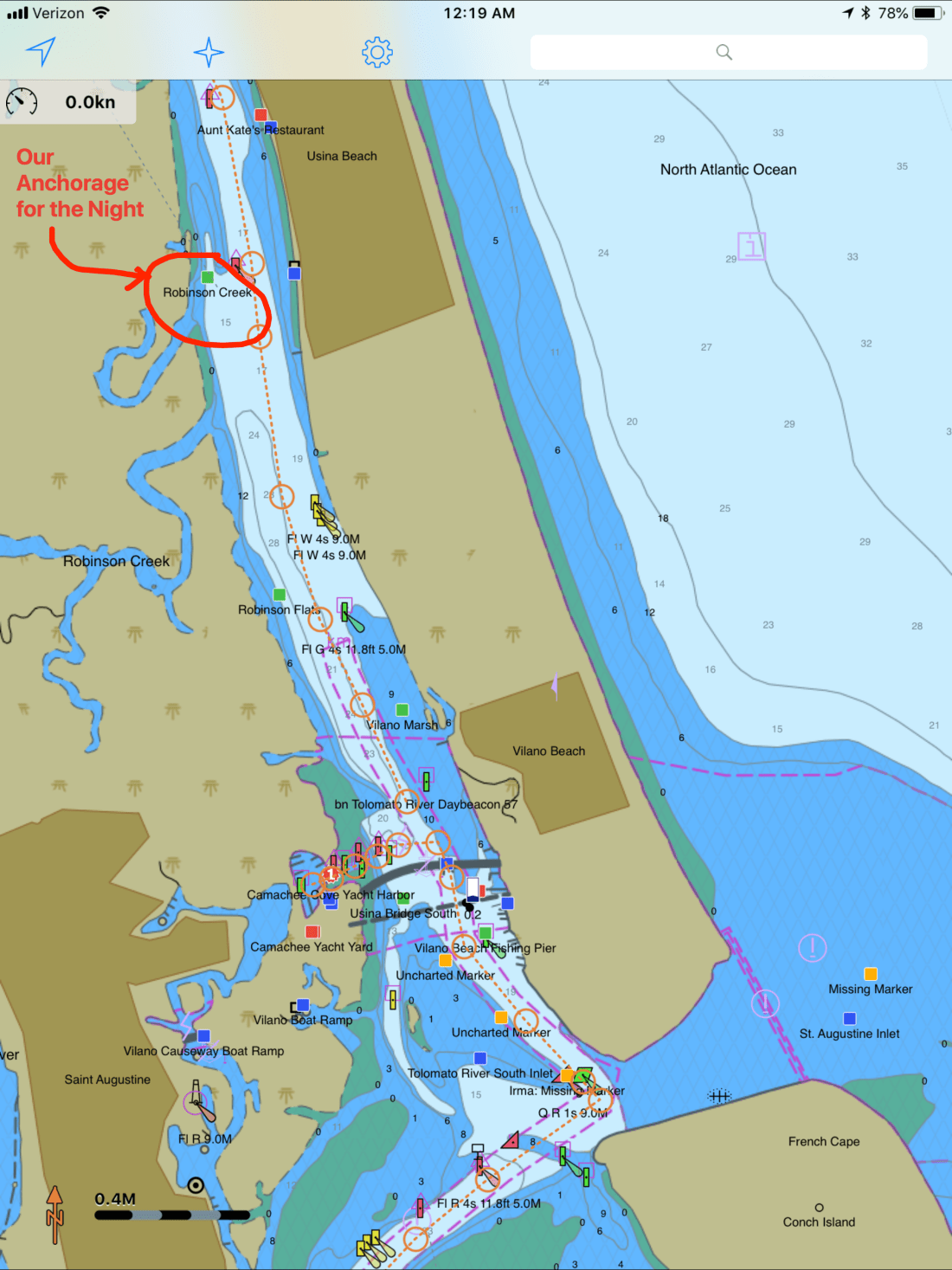
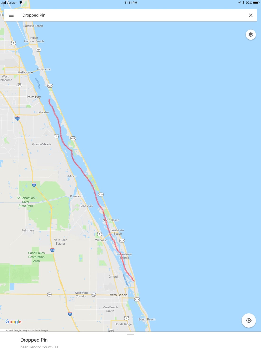
Making our way North our next anchorage, a little creek called Robinson Creek. This spot lies just North of Comanche Cove Marina in St. Augustine, FL. We stopped at Camanchee Cove for a few days on the way down.
Robinson Creek Anchorage
Our route would look something like this.
Route from Oak Hill to Robinson Creek
On our way there we passed through Daytona Beach and the airport had lots of planes flying overhead.
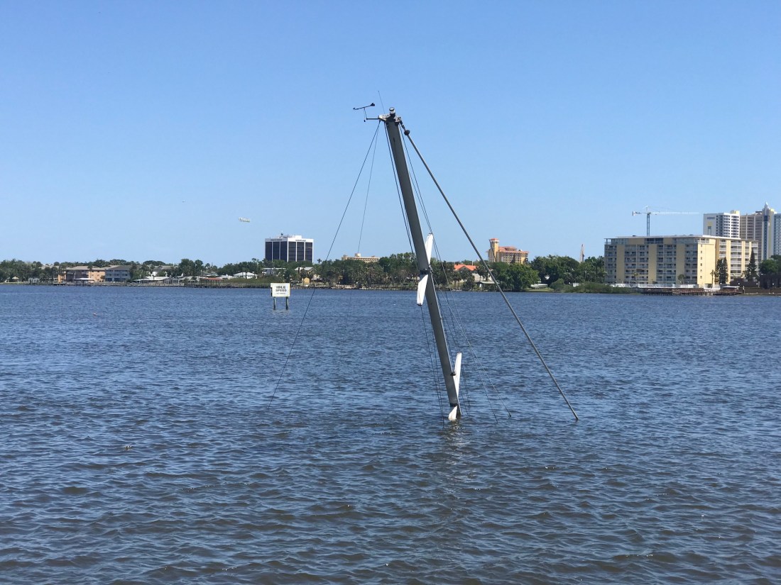
There were other hazards to watch for like this sunken sailboat. Just look for the mast 😉
Sunken Sailboat near Daytona Beach
As we traveled I trawled a fishing line from outside the pilothouse door. I heard the drag on my reel start zzz-zing and reeled in a what I would later identify as a “Ladyfish”. I quick fish app check and this is an unregulated species with poor edibility.
Ladyfish
Fish Id app
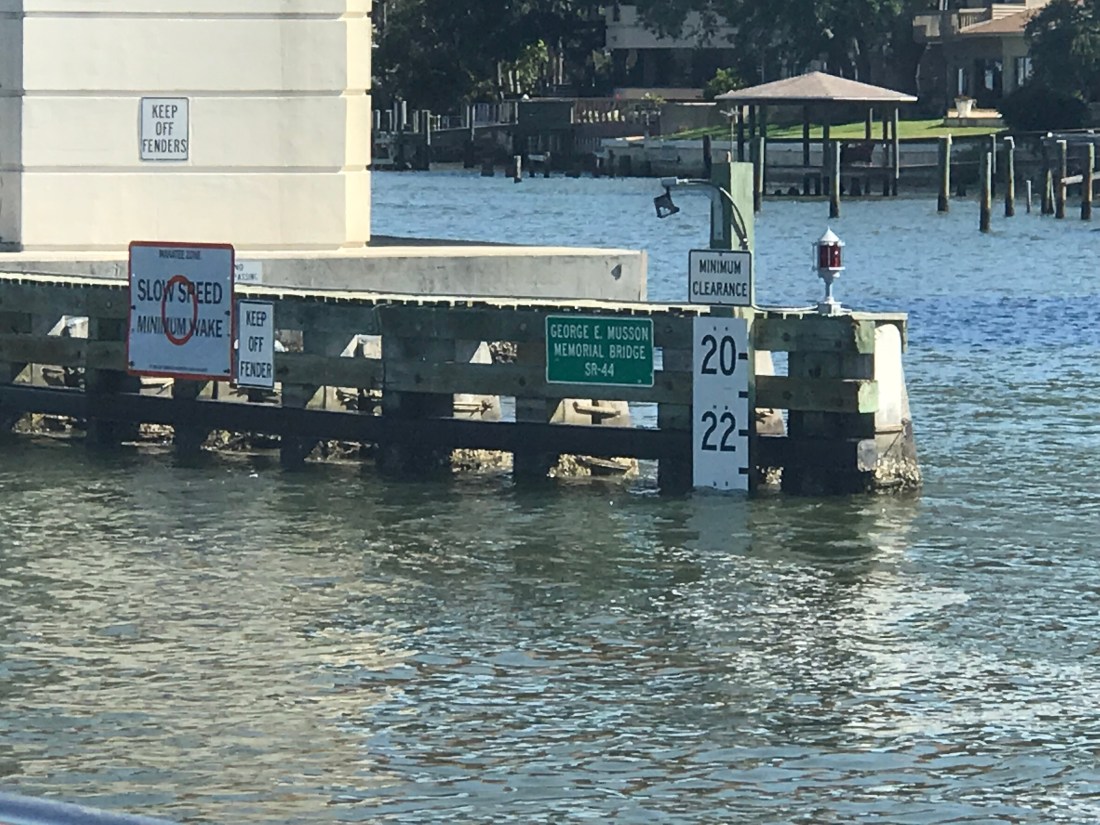
in New Smyrna Beach we had to pass under a few low bridges.Our 22’ air draft it made for a tight squeeze. Luckily the bridge is a bit taller in the middle than what is reflected by the height board.
New Smyrna North Causeway Bridge on the ICW
As we approached a bend in the ICW we saw two boats blocking our path to the North. One looks like they have thrown out an anchor to stop from getting pushed further ashore or a possible kedging off attempt. The other was in the process of being pulled off by TowBoatUS. We contacted the Towboat Captain on VHF and treaded water for about 20 minutes until the first boat was pulled clear and we could continue. The trick needed to pass was to hug the reds as close as 10′ abeam. Seems odd that the deeper water would be on the inside of the bend but was where you needed to be. This is location is right near Fort Matanzas South of St. Augustine, FL
The song playing in the pilothouse is “Devil’s Dance Floor” by Flogging Molly. A great Celtic band out of LA.
Anchored to a cloud
Lying STBD Side
Fort Matanzas Anchorage Near the Shoal
Every captain knows when you traverse the ICW, the shallow channel depths mean that you could run aground if you drift out of the channel. For this reason oncoming boats must stay “Right of Center”. This fellow captain seemed oblivious to that rule judging by the wave he gave after forcing us out of the channel. We were riding the right edge of the channel and had no choice but to either hold our ground and use sound signals (1 short blast for a 1-whistle pass – port to port) or simply move over. If you don’t know to stay right of center you wont know your sound signals either 😉
As we approached St. Augustine we saw a large trawler aground.
Large trawler aground just South of St Augustine, FL
Up early, we weighed anchor at Bluefish Point anchorage and headed North.
Our route would take us something like this..
As we were transiting Haulover Canal I had to laugh as I was flashed by a bird.
We decided on an anchorage called Mosquito Lagoon (I know, not a inviting name).
This lagoon is near Oak Hill, FL and has many fish camps where local fishermen have camps along the shore.
While listening to the VHF the USCG was warning about restricted areas around Cape Canaveral to the South of us. There was a SpaceX launch or their Titan 9 rocket and we wanted to be on anchor with a view for when it started.
Seeing a rocket fly over your head is both impressive and a bit unnerving.
Shortly after the launch we saw what may have been a re-entry from the reusable parts of the rocket? Something SpaceX pioneered.
No sooner had the rocket passed overhead and we were treated to a beautiful sunset and a present moon.
After getting a late morning start leaving Vero Beach, we decided on a short route that ended in an AC anchorage called “Bluefish Point”.
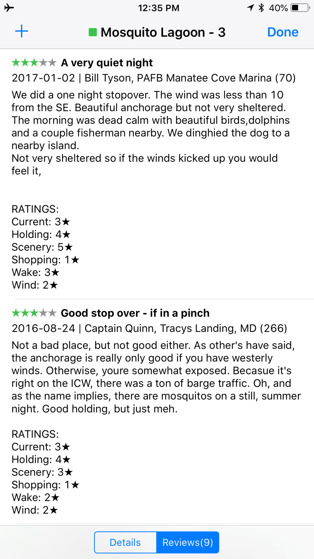
We use a app called Charts&Tides on both our iPhones and iPad that has integration with ActiveCaptain.com. AC is a website where boaters enter their favorite local anchorages, marinas, local knowledge (where the closest Westmarine.com store is) and hazards they are aware of or hit may have hit in their travels. This information is loaded into a small text database and iPad navigation apps can use your AC login to download for offline integration into the charting and plotting app.
The pic below is an example of the kind of AC information that can be pulled up by clicking on a AC green square icon in the app.
If you click on reviews you’ll find notes from AC Captains like ourselves about how best to approach, depths, currents, seabed type, onshore restaurants, etc.
Our route looked something like this:
It was a short run but along the way we were passed by several boats and this is one example of the type of VHF communications you can expect.
When passing a boat on the ICW: The overtaking boat should hail the stand-on vessel by name or description. MV Simple Life transmits our name on AIS as well as large letters on our stern. As the stand on vessel you should lower your speed to idle or the slowest speed that you can still maintain control at. The stand-on vessel should maintain a straight course and the overtaking vessel should reduce speed till their wake will not rock the boat being passed excessively. If the boat being overtaken does not slow down then the passing boat has no option but to increase speed and wake the boat as they pass. Large boats on the ICW can really rock you if they refuse to slow down. As a captain your learn that you are responsible for your own wake and any damage or injury that it causes to the boats you pass.
As we passed Sebastian, FL just North of Vero Beach and saw many great restaurants with live music and while tempted to drop anchor and go for some beer & live music, we pushed on. We need to cover as much ground in the next few days that we can.
We passed an interesting small island that looks like it would be fun to setup a beach chair and few hours relaxing on.
Coming into Fort Meyers Beach you see the same white sand found at Marco Island. Just amazing beaches. We entered using the Northern entrance channel.
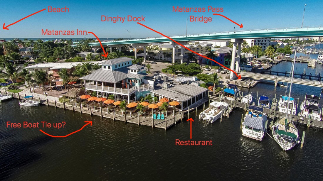
It’s all a no wake zone so about 5 knots of headway for us. We ducked under the 65’ Matanzas Pass Bridge and grabbed a mooring ball from Mantanzas Harbor Mooring Field. It’s a town mooring field but administered by Mantanzas Inn. Running a mooring field requires not just the divers to inspect the mooring anchors, chains, balls and pennant lines…
…but also someone to answer the phone, VHF, fill out the paper work and collect the money as well as enforce the rules. Sometimes you have boats that run gas-powered gensets on deck late into the night. When in the Key West mooring field a boat finally shut off their loud generator around 10PM and another boat yelled “THANK YOU” across the mooring field. I spontaneously laughed aloud but the boater with the generator had some sharp words back. Funny but not.
Upon arrival I couple, Dave & Megan & Athena (the dog) passed by in a dinghy and offered to thread my lines though the mooring ball which just like Boot Key Harbor or Key West cannot easily be pulled up to reach MV Simple Life’s foredeck. D & M announced they were on their way to a cruiser’s raft-up and extended an invite to us. I was glad they did and I had a blast meeting the FMB cruisers within minutes of arrival. They were full great stories and laughs.
Yes, that is a Macaw parrot on Doug’s shoulder. see top-left corner.
The next morning we had to go into the Mooring field office and register using our boat registration paperwork. This is something that you don’t have to do when getting on a ball up North. Up North a the mooring field or launch boat pulls alongside your boat and they ask the name of the boat and collect the money. In Florida most the moorings we rented required not just the registration of the big boat but also the dinghy as well as insurance paperwork. I now carry digital copies of all on my iPhone.
We wasted no time in finding lunch at Matanzas Inn Restaurant.
Also spent some time in the upstairs at night listening to the local singers perform.
I would have posted the video instead but the karaoke singing would have made your ears bleed.
While there I took a dinghy ride around San Carlos Island.
Approaching Hurricane Bridge you’ll pass a few cruisers who look like they have been anchored there for a bit.
Then duck under the Hurricane Pass Bridge and into Hurricane Bay.
Once under the bridge you are in Hurricane Bay and I stopped to snap a few photos of a derelict house boat aground.
The No Wake Zone ends and it was time to open the dinghy up and capture some sunset photos from Hurricane Bay.
While we were here in FMB a close family friend, Capt Mike Spinney came down on his boat and offered to give me a tour of FMB.
Mike and his friend Dave took me for a high-speed run all around FMB.
What fun to go from our normal 6kts to 35kts!
Capt Spin was quick to see that the dolphins were trailing us and mentioned that if you boost your wake a bit you can get them to do some jumps. As if right on cue..
We took a trip down to Lovers Key where there is a great white sand beach that all the boaters pull up right onto the beach and enjoy the day.
Then it was on to the Lani Kai Beach Resort a hot spot for Spring Breakers here in FMB.
Back at the boat I said goodbye to Mike and Dave and they gave us a wave as they departed through the mooring field.
Next stop, Captiva Island and the Okeechobee Waterway.
One of the best things about being a cruiser in BKH is the “BKH Cruiser’s Net” that is broadcast every 9AM on VHF channel 68. This communications link (along with their FB page) ties the live-aboard boater community together in a way I wish landlubbers did. Communicating with your boating neighbors everyday in just the two weeks connected us with more neighbors than our 13 years in our previous land-based home.
There is a format to “the net” that starts by allowing new cruisers to introduce themselves and departing cruisers to say goodbye. They then do announcements about rules of the harbor, weather, meet-ups, Charity work, etc. They allow boaters to ask questions of the group (ex. Can anyone help me program my Raymarine autopilot?) The amount of boating knowledge in the community is impressive. They hold a buy/sell/trade/give-away/ask-for different items cruisers want/don’t want. They do a trivia section and end with different boaters contacting each other on other channels to discuss business of sorts.
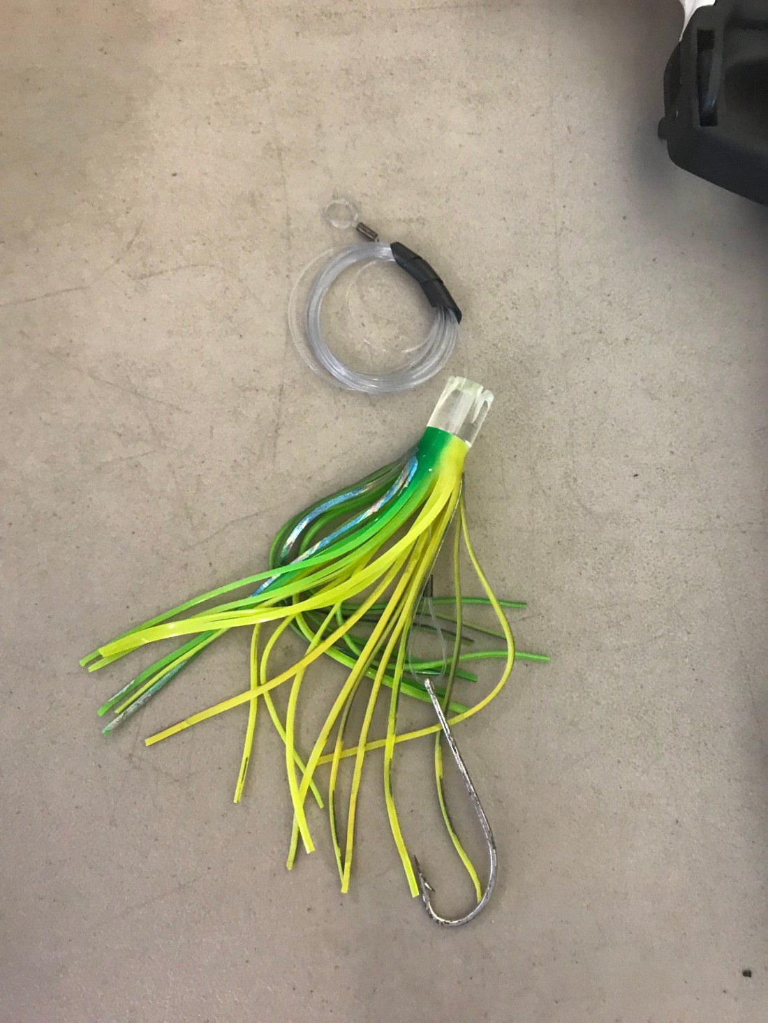
Through the Net, I learned of a cruiser, Capt. David of S/V Expectations who was offering to share his knowledge of the NW Caribbean.
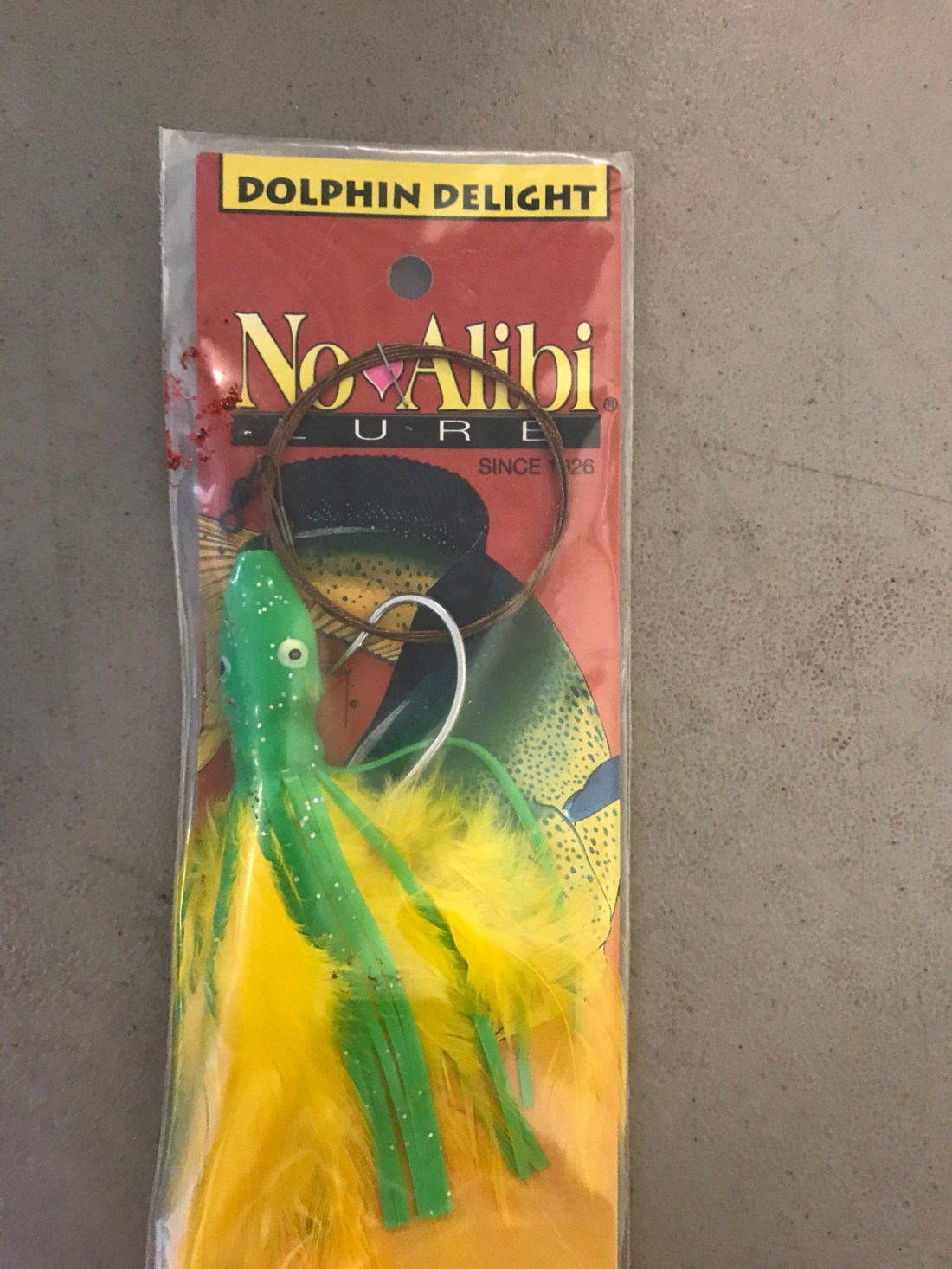
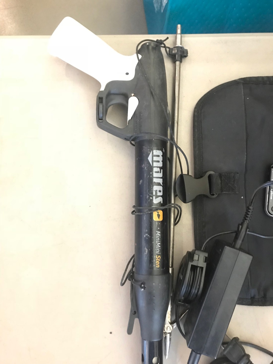
David shared a book and his notes about sailing in the NE Caribbean. A popular route from Key West is to sail along Cuba’s coast to Cozumel, MX then down to Costa Rica, Guatemala, Roatán and Honduras. I and many other captains jumped at the opportunity to talk with this life-long boater to pick his brain about navigating these areas as well as his fishing tips. Below are two lures David was suggesting as well a pneumatic spear gun in lieu of a gaff.
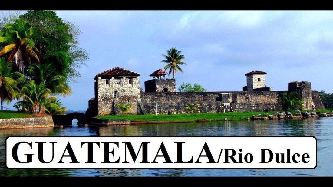
David spent many years in Rio Dulce, Guatemala where it cost him $125/month for a slip. Not a bad deal to live in paradise.
Living on a boat we often spend time staring at the night sky. When you look around boat the sailboat anchor lights sway to and fro like dancing stars.
On one particular night I was staring up at the stars when I saw a meteorite or possibly a piece of “space junk” come flaming down to Earth. It only lasted about 2-3 seconds but it was an amazing sight to see. I was moved enough that I submitted an online “Fireball Report” at amsmeteors.org
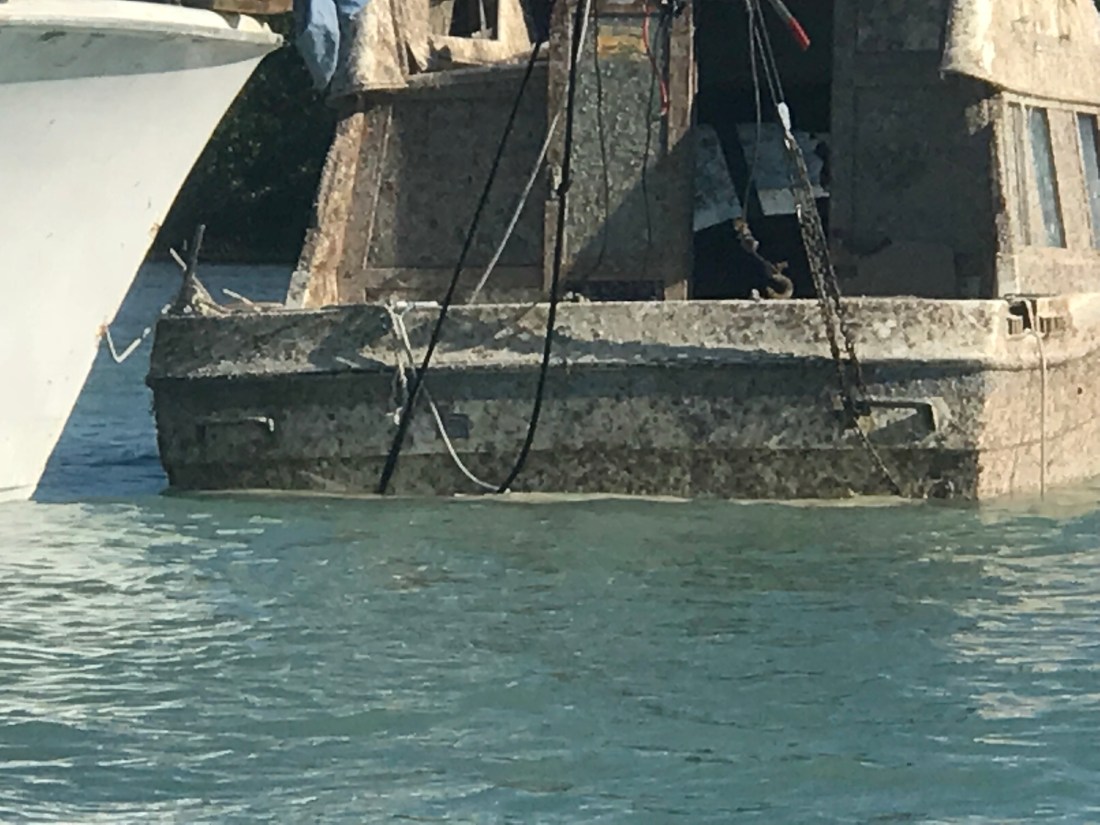
While we were in the harbor there was a salvage operation going on that included an old sport-fisher with a bar and block on it’s bow being used to raise up a sunken vessel (possible Hurricane Irma victim).
Yes, that is an outboard mounted to the back of that sport fisher. You’ll see all kinds of things like this moment where boaters just dropped a full-size fridge on the bow of their runabout to deliver to a larger boat in the harbor. The community here donates items to fellow boaters in need. Many of the boaters here live life on a shoestring budget and donations are used when the budget is dry.
While listening to the net you’ll hear requests like the one from a family of 4 living aboard a 28’ sailboat bound for Guatemala that were looking for play dates for their children as well as home-school lesson plan swapping. I look up to these cruisers for their self-sufficient life style.
Each night we join in blowing our conch horn to announce that the sun has set.
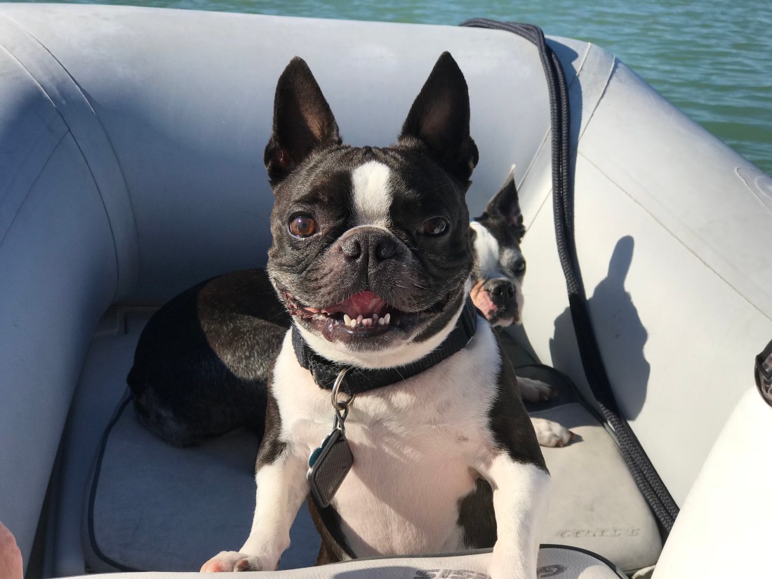
We enjoyed dinking around the harbor with the dogs
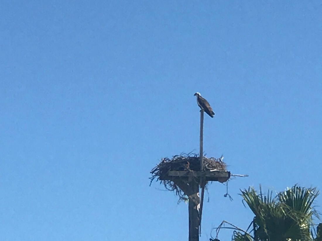
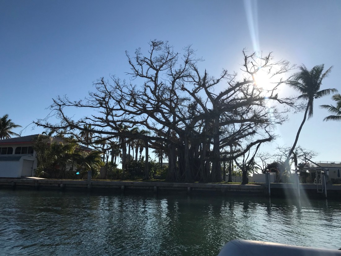
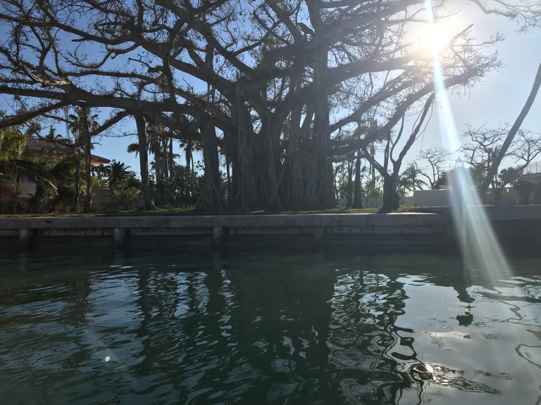
We motored through Sister’s Creek and found many great sights of birds, boats and one spectacular tree.


You must be logged in to post a comment.