Titusville by Dark

I spent the morning enjoying my coffee and checking the weather.

Winds are Still Honking

The winds off the coast are still blowing. A quick check on the Marine Zone forecast and I see that the winds have not abated and are driving the seas into the 6′-9′ range. Times like this if it were not for the ICW I’d be trapped in port.

Wifi Encryption – Known Exploits and Keeping things Private

I use the in-slip time to wash the salt off the boat and modify the encryption settings on my router. Somehow I have accidentally set my internal WiFi to WPA/WPA2 and WPA (Version 1) has a known exploit when it comes to TPIK (Temporal Key Integrity Protocol)

My iPhone is smart enough to alert me that the Wifi network I connected to supports WPA which is not secure

It’s 11AM and my time at the dock has run out. I cast my lines off and pull away from the dock with a bit more throttle than usual as the wind is blowing hard on my beam. Over to fuel dock to fuel up before heading south towards my intended destination of Titusville, FL.

New Smyrna Beach

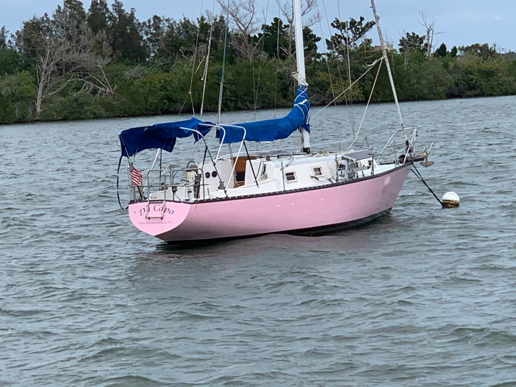
As I pass an anchorage in New Smyrna Beach I pass several anchored sailboats. New Smyrna Beach is in Volusia County. According to the International Shark Attack File maintained by the University of Florida, in 2007, Volusia County had more confirmed sharkbites than any other region in the world.

Then I come upon SV Da Capo. That’s quite a pink hull!

SV Da Capo

Big Motor Yachts Look Comfy

Soon this large, comfortable-looking, motor yacht was passing me. Hatteras I believe?

Dredge Islands?

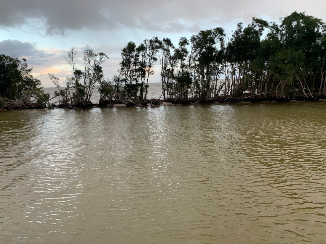
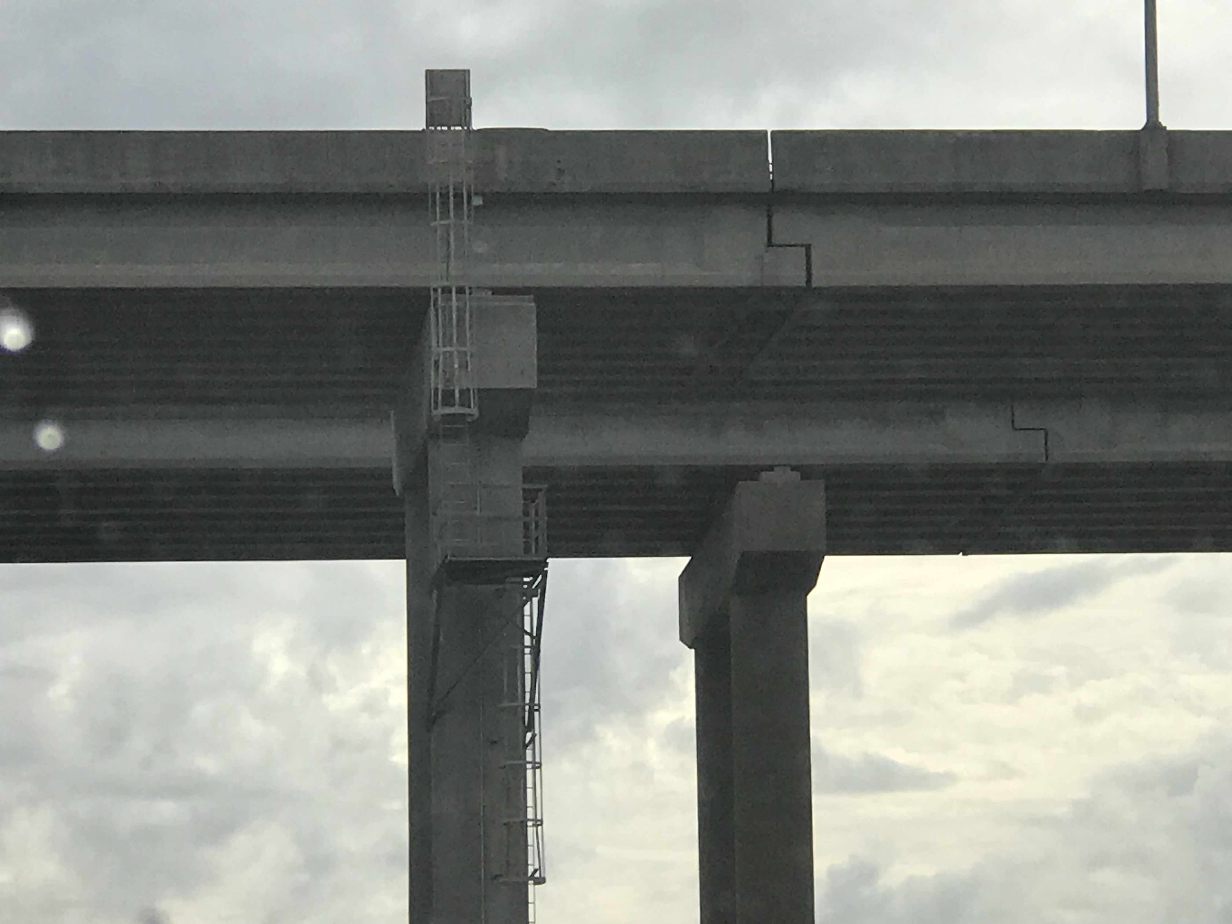
As I make my way through Haulover Canal there is a thin strip of land that is lined with small trees. This kind of natural geography seems odd to me but I encounter it often. I have always believed that you see these thin continuous strips of land along-side canals which are frequently dredged to keep a minimum center channel depth. I have always imagined that it must be far cheaper for the dredge to push the dredged material through a short outflow pipe that starts to build a new island alongside the channel. I have no specific knowledge or experience with dredging so If you do, please comment on this.

Haulover Canal is tree-lined (barely)

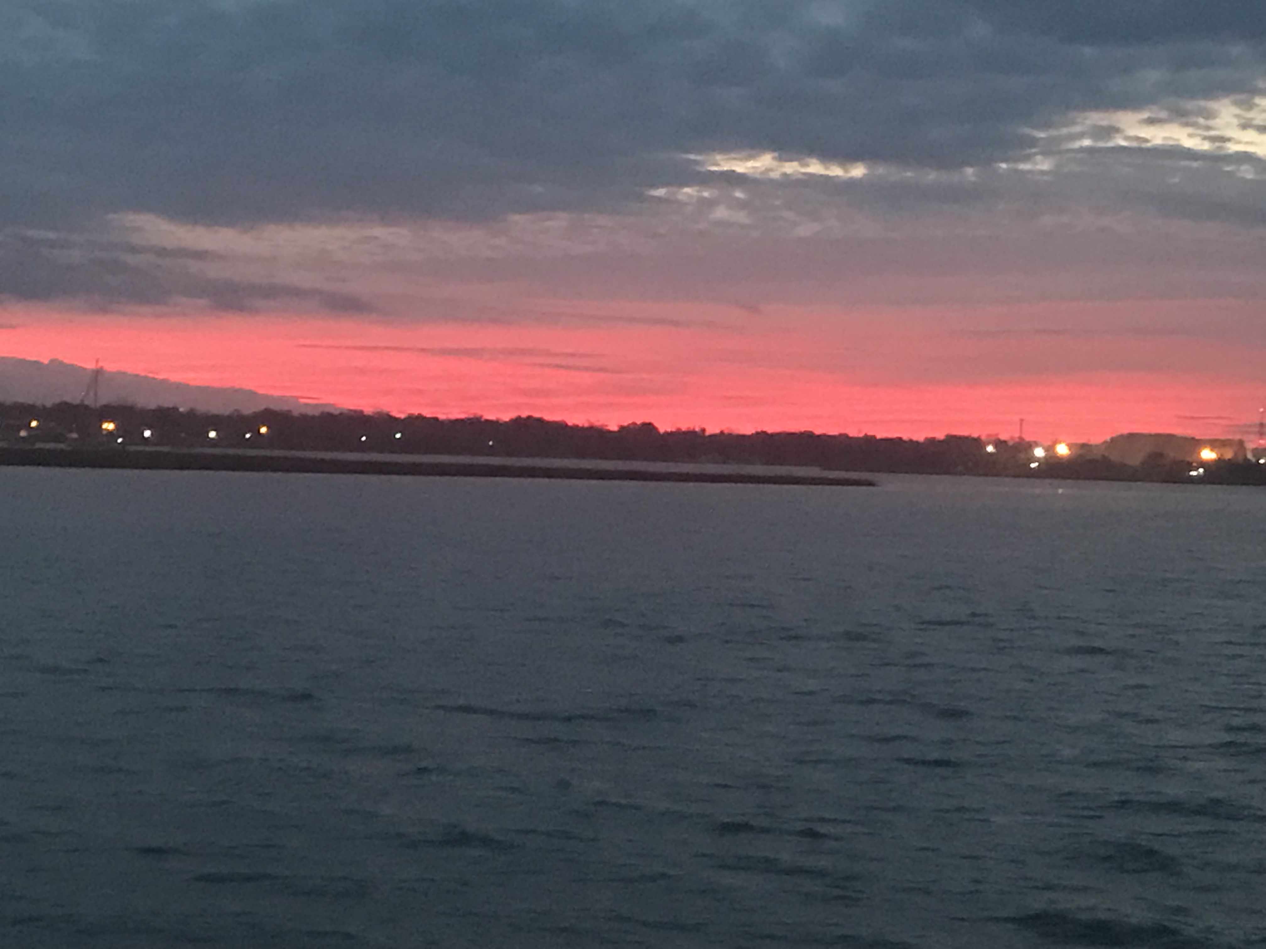
I watch as the sun sets.

Sunset leaving Haulover Canal

Burn More Diesel or Arrive at Night?

In this moment I start doing some quick calculations and realize that it’ll be dark before I reach Titusville, FL where I plan to anchor. Luckily this section of the ICW is pretty open and easy to navigate at night. I find my anchorage and let out about 70′ of anchor which is plenty for the 6′ of water I’m in. Coming in in the dark you don’t expect many ICW boats to arrive after you. The winds are forecast to be steady in their direction through the night. I won’t swing around and there is plenty of room between me and my neighbors anchored next to me.

Refined Tastes of Yacht Living

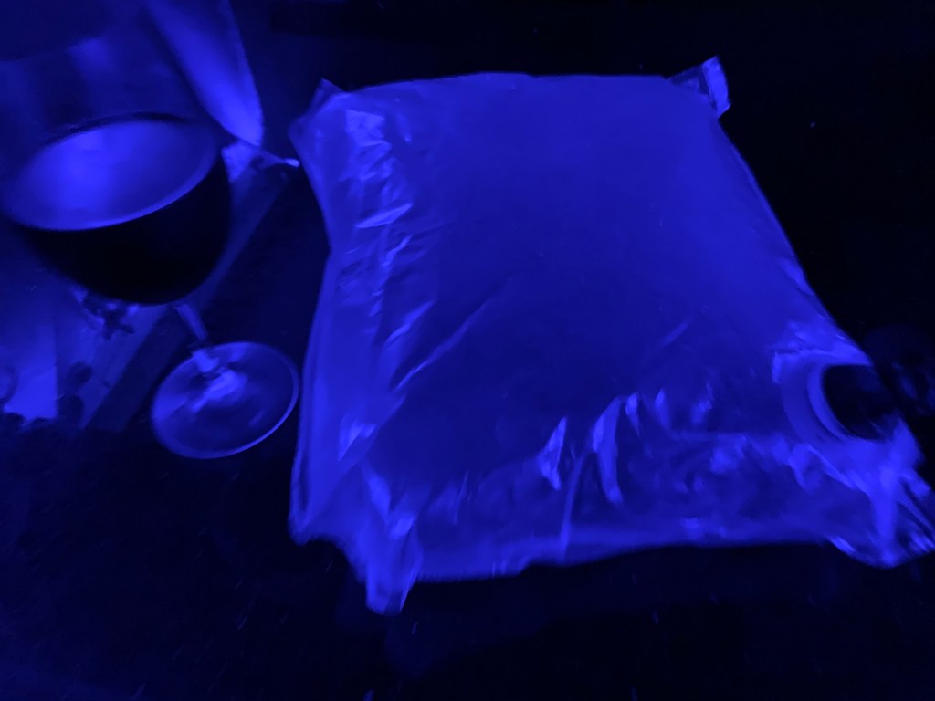
I’m tired and figure I should finish off my fanciest bag of wine before hitting the rack 😉

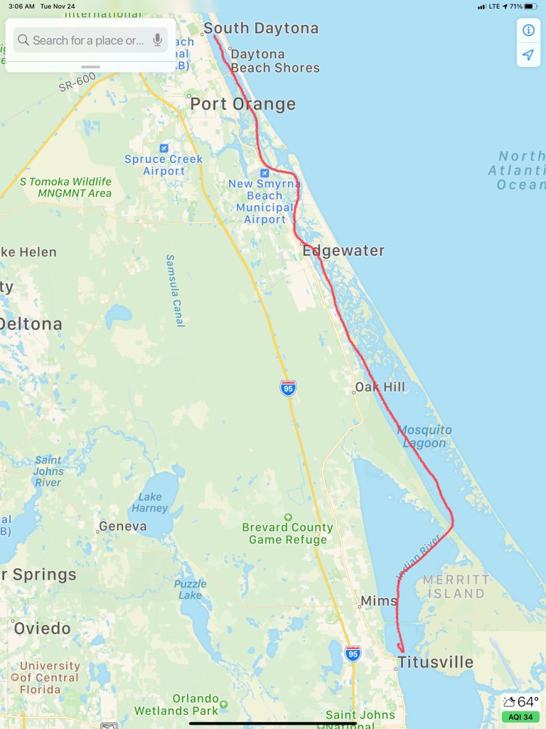
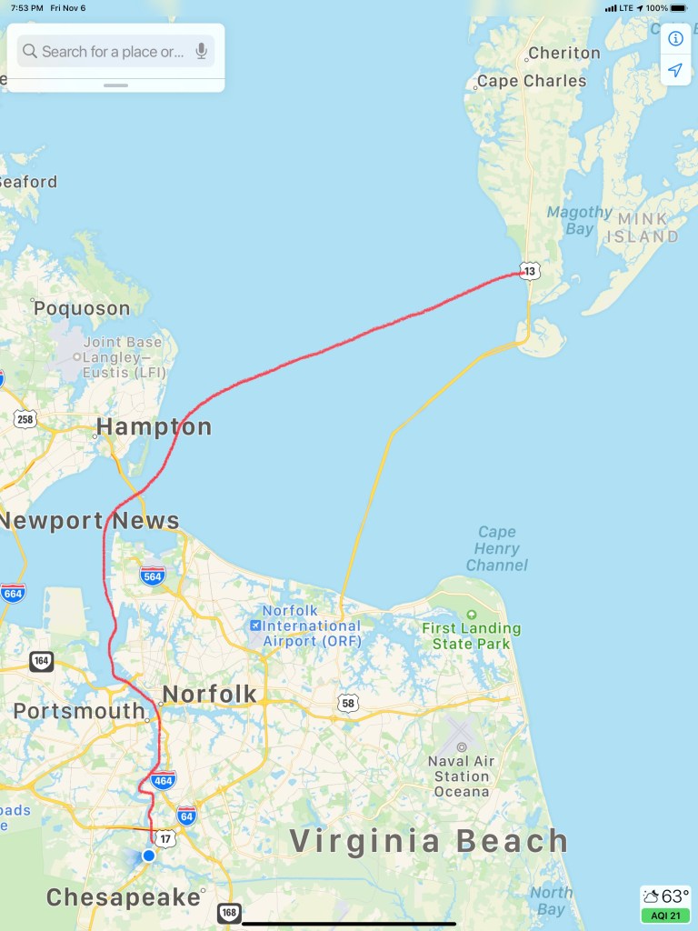
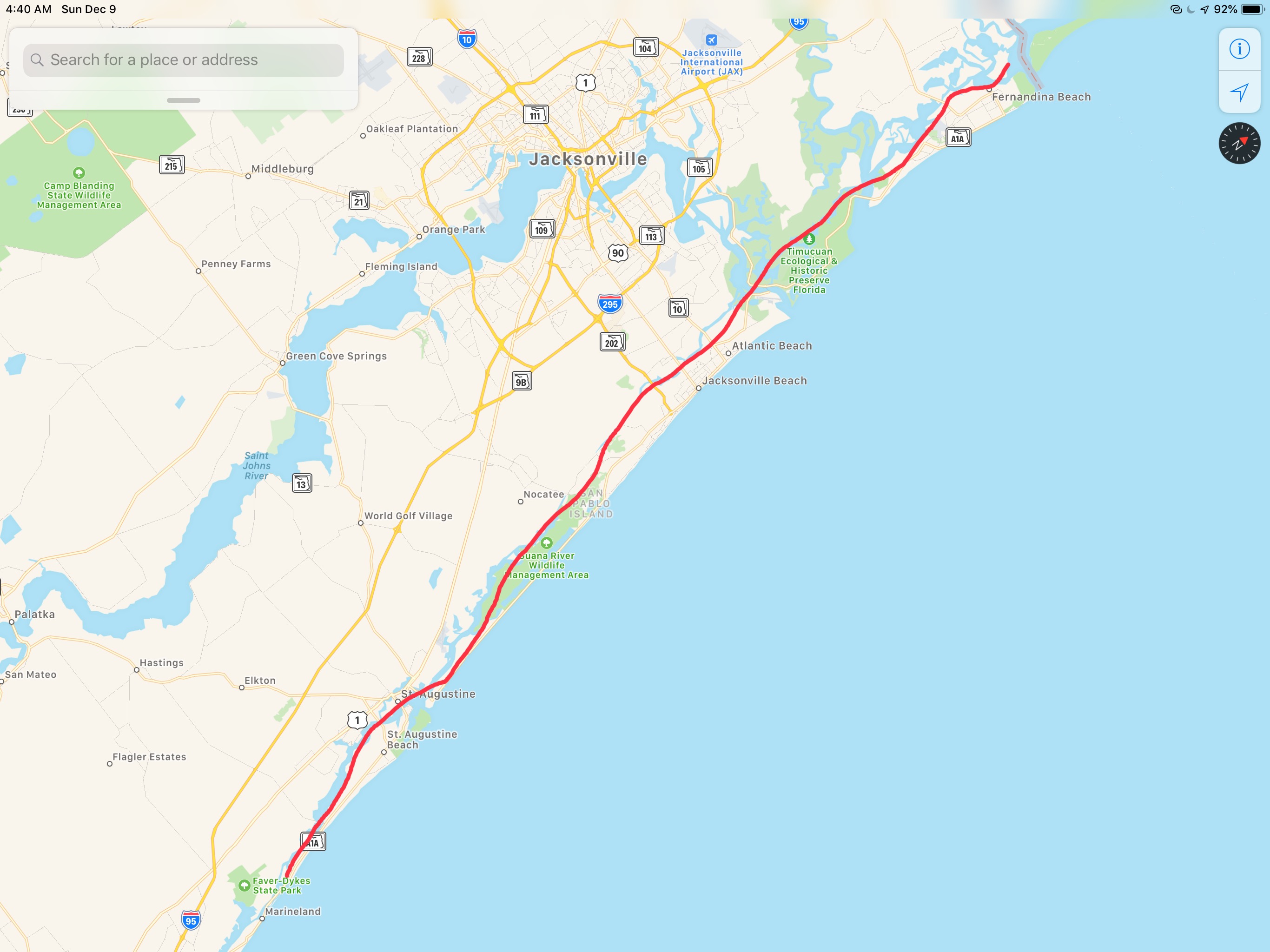
Today’s route looked something like this…

W04L015 Route

Random Thoughts

This is a new section that I thought I would add since being ADD & extraverted I often have random thoughts bouncing around in my head that I feel a need to talk about. Today’s thought is for any fellow boaters reading my blog.

Diesel Efficiency

Today’s thought was on Diesel efficiency. Before owning my 1st trawler, I owned three sailboats. As a sailboat owner, I never thought about fuel economy. Now diesel fill ups can cost as much as $1000 rather than $100. This, because my trawler style motor yacht by design has large diesel tanks for long-range cruising. It’s tempting to discuss the days that the wind was pushing my sailboat along for free but this is not about sailboats vs. trawlers. Instead, I’d like to talk about trawler diesel engine power and hull shape. I’m not an expert or this subject it’s just something I have some thoughts on.

Slow or Fast?

There are two kinds of trawlers.

  1. Slow full-displacement
  2. Fast semi-displacement

Every boat’s hull displaces it’s weight in water. The more stuff you put into your boat it sinks a little lower in the water. Ancient Greek mathematician and inventor Archimedes first screamed “Eureka! Eureka!” when he discovered this. This is known as Archimedes’ principle.

To push the hull through the water you must push the water in front of the boat down as well as part it to the sides. When it comes to the force required to move a hull forward, hull shape matters. It should seem obvious as you try to push a boat forward quickly that a slender hull with a narrow angled bow and stern will separate the water gently and then put the water back together gently without causing much swirling drag forces at the stern. A hull with a blunt bow and square stern will plow into the water at the bow and have it come crashing back together behind the stern causing eddys or swirling motions that cause the boat to be pulled backwards by drag forces.

Full Displacement Hulls

Slow trawlers are full displacement hulls and their maximum hull speed is easily calculated by this equation and the length of their waterline (the length from when the hull first splits the water to where it recombines it).

v_{{hull}}\approx 1.34\times {\sqrt  {L_{{WL}}}}

Full displacement hull shapes tend to be very round or semi-hemispherical and create little drag. They require a smaller force to push them through the water. However this round hull shape overs little resistance to healing (rocking of the boat). So you often find these hulls using ballast or weight added to the bottom of the hull to keep them upright. Since 1933 fin stabilizers such as Wesmar have been used to stabilize boats. The most modern solutions are active gyro stabilizers such as SeaKeeper. Fin stabilizers require power to move them and create drag in the water. Gyro stabilizers require running a diesel generator to keep them spinning. Full displacement may be the most economical hull shape but stabilization often requires diesel burn.

If you have a full displacement hull you only need a Diesel engine with enough HP to push it along at near it’s hull speed. If you put a larger HP diesel in the boat you will destroy your fuel economy and never go faster than hull speed. Full displacement trawlers will give you the best fuel economy due to tiny fuel sipping diesels. Full displacement trawlers with active fin stabilizers and large fuel tanks can cross oceans. Nordhavn is a popular trawler brand that comes to mind in this moment.

Semi Displacement Hulls

Semi-displacement hull shapes are designed to push water not just aside but down at a rapid rate. The water being pushed down forces the hull up out of the water. Less hull in the water means less drag and you can exceed the max hull speed for the length of your hull’s waterline. This extra downward push of the water means you need to put more HP behind the diesel. You are trading fuel economy for speed. When the waves are not exceeding large, speed can get you out of the weather and to a safe port sooner. You can also move at speeds below your hull speed and be almost as fuel efficient as a full displacement hull. Semi-displacement trawlers will have sharp angles called “chines” in the hull shape that help to create active resistance to healing. Think of a basket ball with a child’s action figure on top of it floating in your bathtub. Your basketball hull form is semi-hemispherical. The round basketball offers no resistance to heal and will likely just roll over with the first wave. Now place a box with square 90 chines at the edges of it’s hull in the bathtub. That same hull shape resists leaning to either side because to do so would displace less water on the side lifting up and more water on the side being pushed down into the water. Recall from Archimedes’ principle that displacing water creates an upward buoyancy force.

Fuel Burn per HP

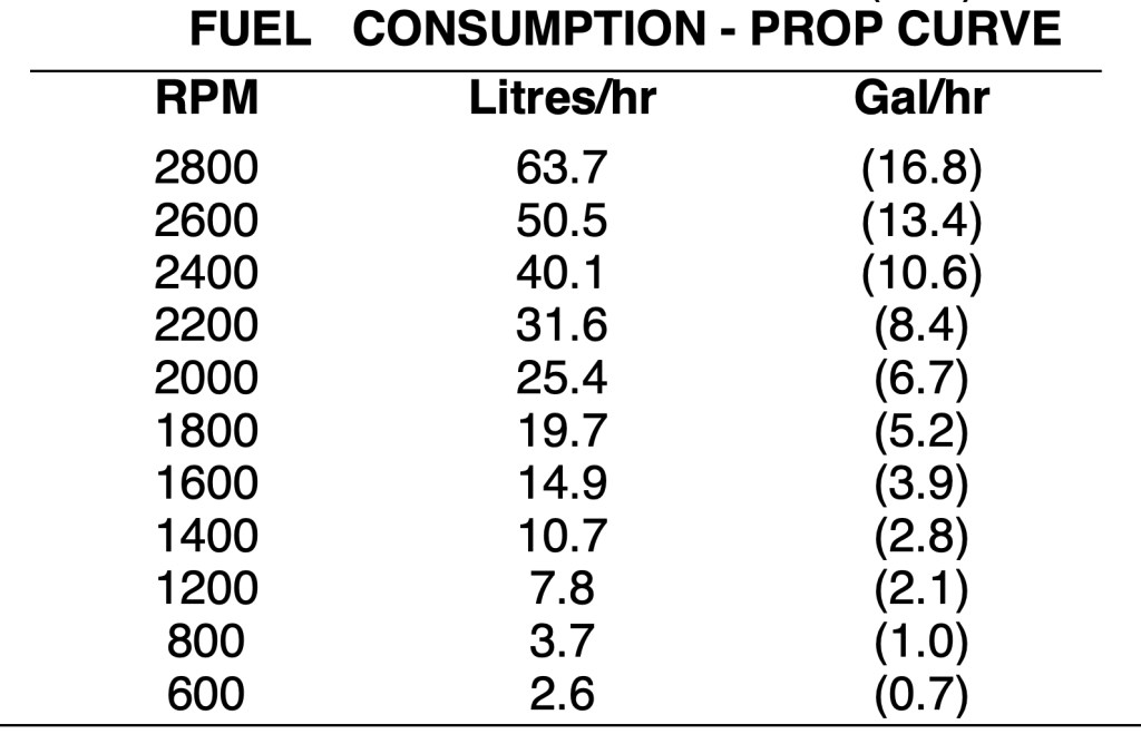
A rule of thumb often used is that modern diesels burn about 1GPH for each 20HP produced. This number is a rough estimate of how much of your diesel engine’s power (force) you are using to push your trawler’s hull form through the water at the speed you are going. You can double check this number against your diesel engine’s HP/RPM curve.

Slow or Fast Religion

What type of boat you choose is often like choosing a religion. Once you decide you often find yourself defending your decision with great fervor. Debates rage on but I’m just trying to discuss just the basics of the science behind the debate. Often I hear other boaters with much larger boats with twin diesels compared to my single diesel tell me they get twice the fuel economy as me. Hyperbole or magic? I often state that my Cummins Mercruiser Smart Craft display of fuel burn is 2 GPH at about 1400 RPM or 6.5kts of boat speed. This is a rough estimate of course since there are currents, wind forces, drag due to hull fouling, propeller diameter and pitch, etc. that come into play here.

My Cummins SmartCraft GPH Display
Cummins Manufacturer Specs on my 2012 QSB 5.9L Diesel’s Fuel Consumption to RPM Curve
Propeller Curve (lower) is based on a typical fixed propeller demand curve using a 2.7 exponent. Propeller Shaft Power is approximately 3% less than rated crankshaft power after typical reverse/reduction gear losses and may vary depending on the type of gear or propulsion system used.

Final Thoughts

There is no perfect boat. Every boat is a compromise. The discussion above is only about the tradeoff between economy and speed. I gave up economy for speed when I went with a semi-displacement trawler. I’m OK with my choice. I understand why others chose full displacement trawlers. Chose your religion wisely!

ICW Mile Marker 0

I awoke on anchor to find that another boat had quietly slipped into the anchorage while I was sleeping.

I could not quite read the name of this vessel

A quick look around shows dense fog was blanketing the area outside the anchorage.

The day’s planned journey was to a marina about 36 NM or 6 hours away. It’s Friday and the marina closes at 5PM so I wanted to be there by 4PM to secure a spot. I figured a late 10AM start might allow some of the fog to burn off.

As I enjoy my morning coffee, I look up at see that the other boat in the anchorage was now leaving. I can finally read the name, MV Effervescence IV. I recall this boat. Effervescence IV was on the hard next to Simple Life in Warwick, RI, one month ago. Her owner and I had introduced ourselves and exchanged numbers just incase we should wind up near each other on our trips south this winter.

It’s now 10AM and as I pull out of the anchorage, I check the AIS (automatic Identification System) and see Effervescence IV is just a just a few miles ahead of me.

MV Effervescence IV AIS info

I use the MMSI # from her AIS info and program it into my VHF to place a DSC individual call to the boat and instruct their DSC radio to automatically switch to CH#69 as soon as they ACK my DSC call.

Moments later we are discussing plans to meet up at Top Rack Marina in Chesapeake, VA.

Norfolk harbor has non-stop large ship traffic transiting its entrance channel. On this day, the USCG had issued a warning over the VHF about an Ultra Large Container Vessel (ULCV) called the Maersk Edinburgh. The Maersk Edinburgh is 1201′ long and has 158′ of beam. It is certainly not hard to spot visually but I’m having trouble seeing much of anything out the pilothouse windows.

I will have to rely on radar & AIS. Radar just shows me a large target with position and speed data but no identifying info about the vessel. AIS however, shows me all kinds of vessel information.

It’s moving at 18.1kts! 3X faster than Simple Life

As I cruise on… the fog lifts for a moment to allow me to see this sexy girl passing me.

Then just as fast as it lifted, the fog closes around me again.

Dense fog outside of the pilothouse windows

Now passing Norfolk Navel Station, the that fog has lifted and I can once again see the boats around me.

Tug moving at hull speed

To get to the start of the ICW (InterCoastal Waterway), called mile marker 0, you must pass dozens of warships in port.

Now past the warships I see the ULCV Maersk Edinburgh being pushed into her berth by several large tugs.

The tugs look tiny compared to the 1201′ long ship

I saw this tug go by with it’s funny looking tall tower that allows it to see over whatever barge it is pushing.

If I ever get a change to go up in a tugboat’s tower I’m going to jump at that opportunity.

I heard several VHF marine warnings about a 950′ long dry dock called “Titan” that was being moved through Norfolk as well. As I glance over to shore I see it being pushed into place.

Right around the corner from this new one that arrived another dry dock that has a large warship in it.

BAE Systems Dry Dock

I need to be at Top Rack Marina before 5PM to get a slip. So when this huge barge swings out blocking the channel, I find a safe way around it and under the bridge.

I was aware of the time as I know I needed to get to Top Rack Marina before 5PM and as I turn the next bend in the Elizabeth River, I see that the Norfolk Southern #7 Rail Bridge is in the down position. I watch as was seems to be the longest slowest freight trains slowly passes.

After what seemed like forever, the bridge when back up and within 20 minutes I was fueled up and in my slip at Top Rack Marina.

Simple life. can almost turn sideways the slip is so wide.

Siting in my slip, I’m aware that it’s Mike Spinney’s birthday. I think… I’m sure him and his friends are celebrating. Then this photo comes in and I can only smile.

Glen, Debbie and I had planned to visit the local restaurant but it was closed. What to do? I invited Glen and Debbie over to Simple Life for a cocktail. They obliged and bought drinks and snacks. Glen makes his own beef jerky. Jerky & IPA goes well together.

Captains Meeting

We decided to do a captain’s brief where I brought up the charts on the big screen and we walked through the next days route which would run from sun up to sun down.

Today’s 38NM leg of my journey looked something like this…

W04L006

Fort Matanzas

We had a peaceful night on anchor in the Amelia River. We awoke early before the sunrise.

6:50AM Anchored on the Amelia River

Somehow we did not get moving till 8AM. We have a thing about trying to cover as many miles as we can each day and that means you need to use all the daylight there is on the ICW. Not so much this morning. The good news was that we were leaving on a high tide so little worry of running into a shoal with the added 5′ of tide.

Two tugs raced past us and I was reminded that you can tell when a full displacement boat is running at near ‘Hull Speed‘ by simply looking at the bow wake length vs the boat length. You can see the smaller tug’s bow wake dips and then crests almost at the stern of the tug. They were running hard and burning fuel. They must be in a hurry to get to the next job cuz running fast = diesel = $ = expenses for them. 

Where the ICW crosses the St. Johns River in Jacksonville we always see large ships either underway or being repaired in the boatyards dotting the shore. 

Last year we passed this sailboat on a small island and it still looks out of place. How’d it get up on the island? I can only assume a barge with a crane placed it there to keep it out of the way of navigation but why leave it there?

Derelict Sailboat on stands on small island

We passed this other sailboat that was using their dingy to reset their anchor. Their sailboat was too close to the ICW channel.

There are some beautiful homes along the banks and this was just one of them.

Home Along the ICW

As we approached this bridge in Isle of Palms, FL we noticed 3 16YOish boys tied their boat to the bridge and were fishing beneath the support. This is a NO-NO in the boating world. It’s a federal law that you cannot tie a boat to any navigational buoy or bridge’s fender system (the boards that protect the bridge supports from boats as they pass through the center span).  

Boys tied to bridge

As a boater you must treat bridges with special attention. When you pass under a bridge you must do so at no wake speed (about 6.4 knots for MV Simple Life). For the boats hanging out under bridges (usually fishing) you must not block the marked channel through the center span. You must also be careful as boats passing through the fender boards may not see you if you are hidden by the boards or bridge supports.  Also after 9/11/2001 Homeland Security legally restricted areas under certain bridges and it’s a felony if you break that law. Individual states may have laws about simply being near any bridge in their state.

Florida Statute 327.44 refers to interference with navigation and states that anchoring underneath a bridge or adjacent to heavily traveled channels constitutes interference if unreasonable under the prevailing circumstances. There’s a lot of gray area here and not everyone has the same understanding of “unreasonable interference,” but you likely won’t get in trouble for anchoring under a bridge if you are well out of the way.

FWC (Fish & Wildlife Conservation) officers may stop you if you attempt to anchor under the bridge. It should be noted that the area around a bridge is more likely to have un underwater cable that either brings power to a lift or swing bridge or simply crosses over to the island. You don’t want to hook your anchor on these power cables. 

Aside from all the bridge rules of boating, I was more interested in the expansion joint on this bridge. 

Bridge Expansion

We pass many engineering structures like bridges and this pier. I’m sure the first piers were only for boats to dock but soon “pleasure piers” emerged that were simply for people to stroll out onto or fish off.

I guess they want boats to know the name of this pier?

We find it interesting that “birds of a feather flock together”. It’s like all these white pelicans said … “Hey, why don’t we all me on the banks of the ICW over where Jimmy found that big pile or old crab shells tomorrow?”.  They clearly enjoy each other’s company. 

White Pelicans crowded together

Soon we were waiting for Saint Augustine’s ‘Bridge of Lions‘ to open (every 30 minute openings). In line in front of us was a boat called ‘Yellow Bird” from Cape Cod.

MV Yellow Bird – Cape Cod @Bridge of the Lions St Augustine FL

We attempted to get a mooring ball in  Saint Augustines FL but alas the City Marina only had balls for boats with drafts under 3′. I hear it’s a fun town but our plan is to continue on tonight and find a quiet place to anchor. As the sun was setting we settled on anchoring just off Fort Matanzas. Fort Matanzas was built by the Spanish in 1742 to guard Matanzas Inlet. 

Our Sunset @Fort Matanzas did not disappoint 

Our leg today looked something like this…

W02L022 – Ferdandina Beach FL – Fort Matanzas FL