
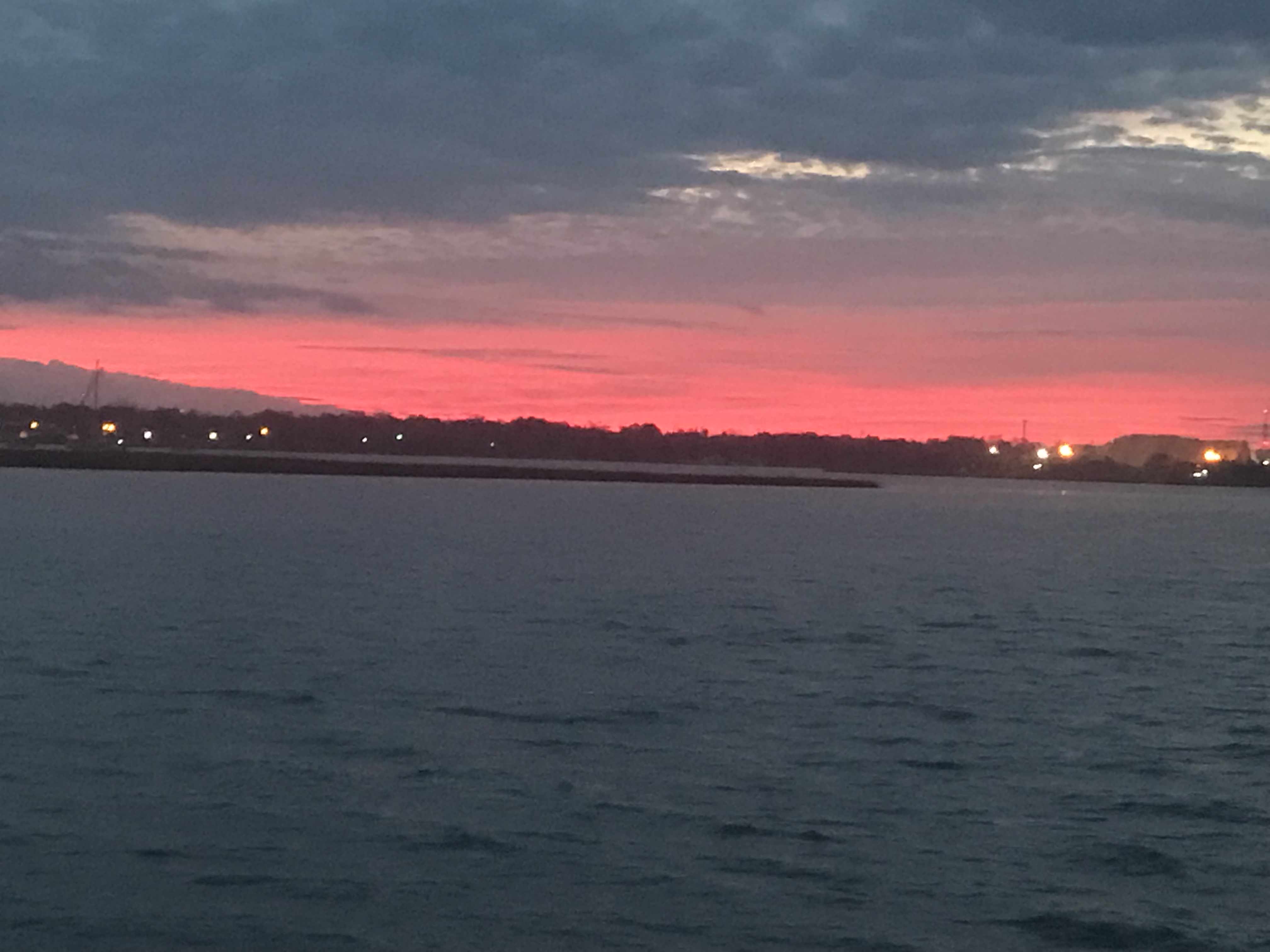
We had a peaceful night on anchor in the Amelia River. We awoke early before the sunrise.
Somehow we did not get moving till 8AM. We have a thing about trying to cover as many miles as we can each day and that means you need to use all the daylight there is on the ICW. Not so much this morning. The good news was that we were leaving on a high tide so little worry of running into a shoal with the added 5′ of tide.
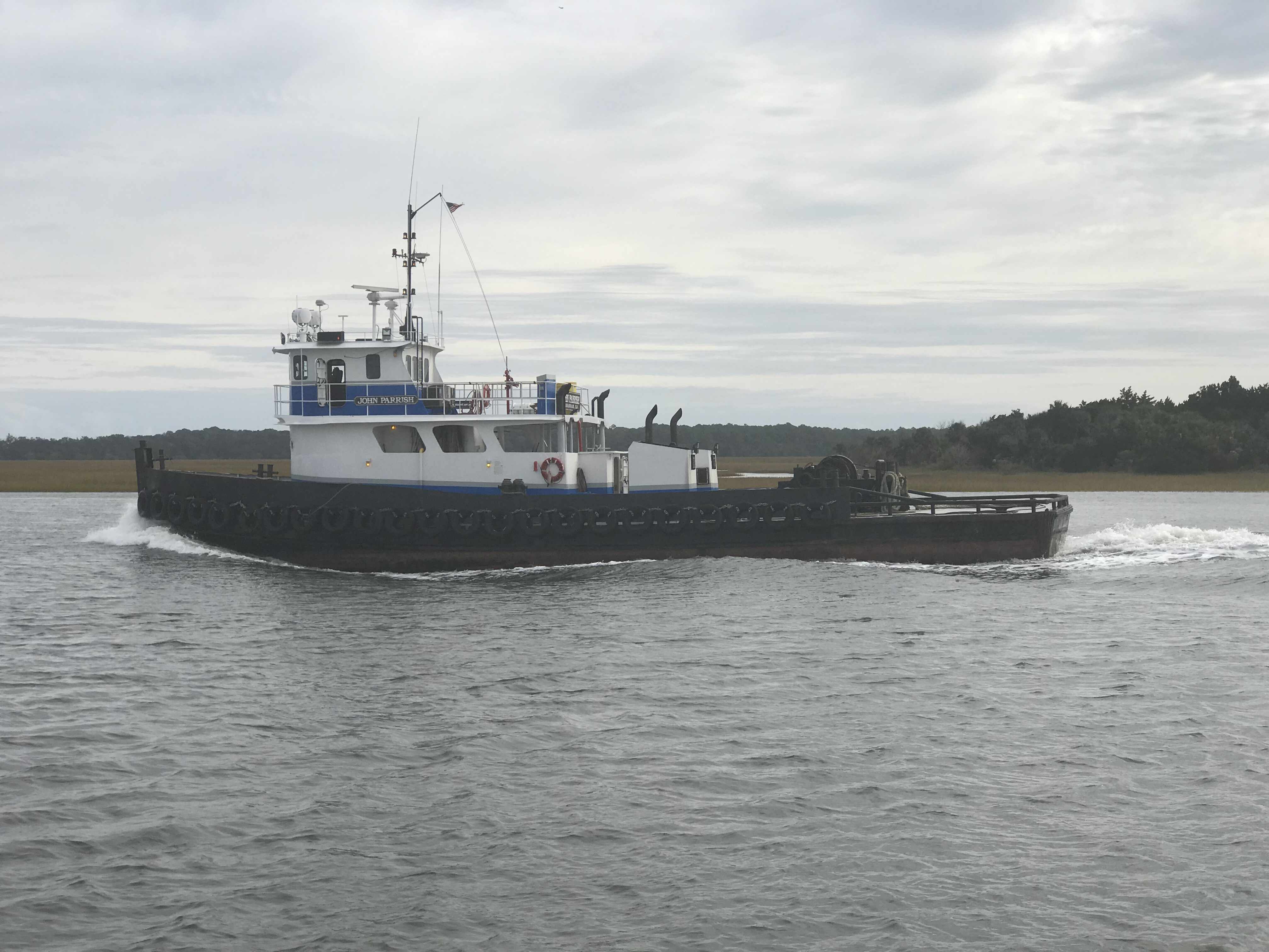
Two tugs raced past us and I was reminded that you can tell when a full displacement boat is running at near ‘Hull Speed‘ by simply looking at the bow wake length vs the boat length. You can see the smaller tug’s bow wake dips and then crests almost at the stern of the tug. They were running hard and burning fuel. They must be in a hurry to get to the next job cuz running fast = diesel = $ = expenses for them.

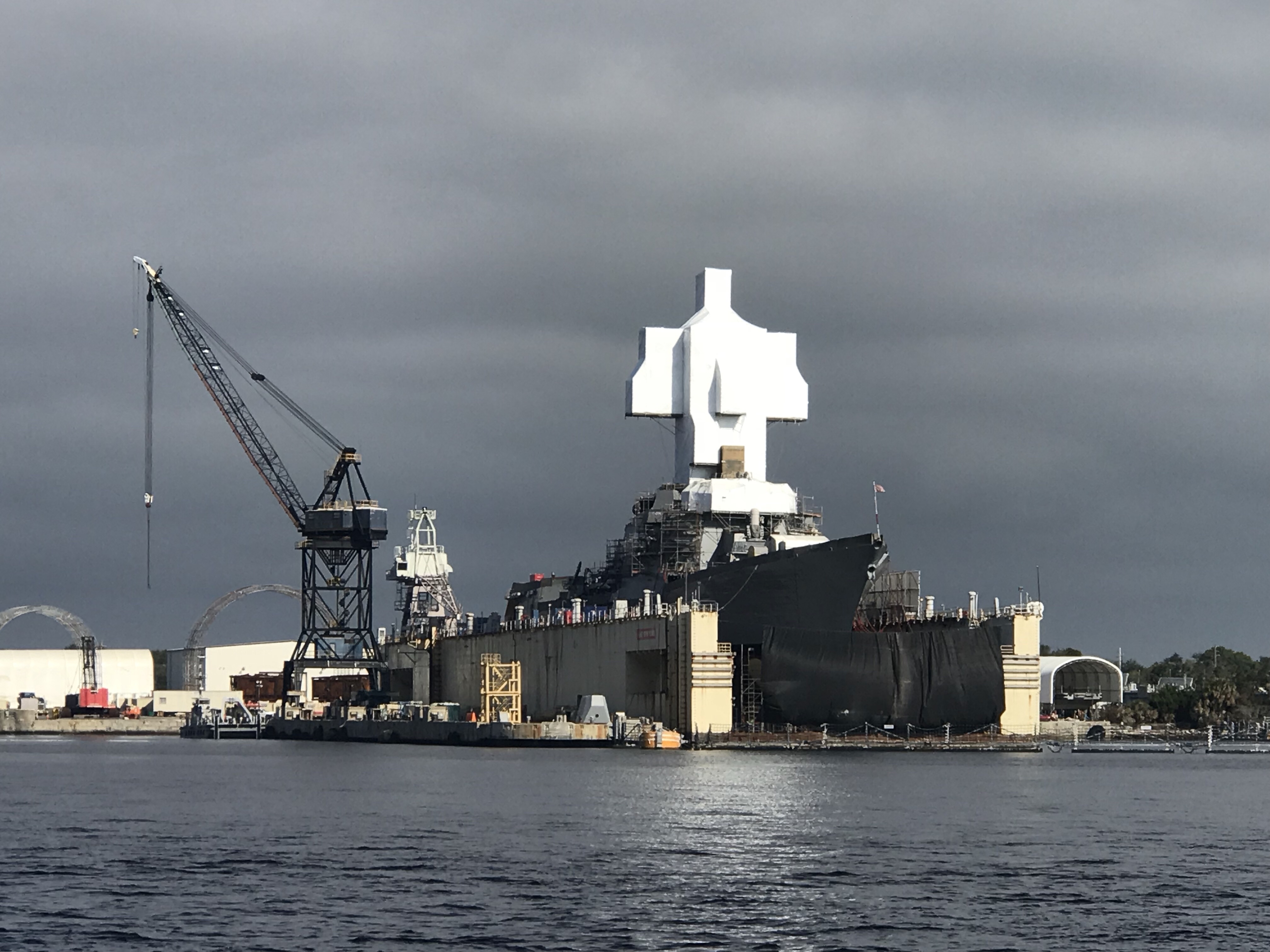
Where the ICW crosses the St. Johns River in Jacksonville we always see large ships either underway or being repaired in the boatyards dotting the shore.

MV Pegasus 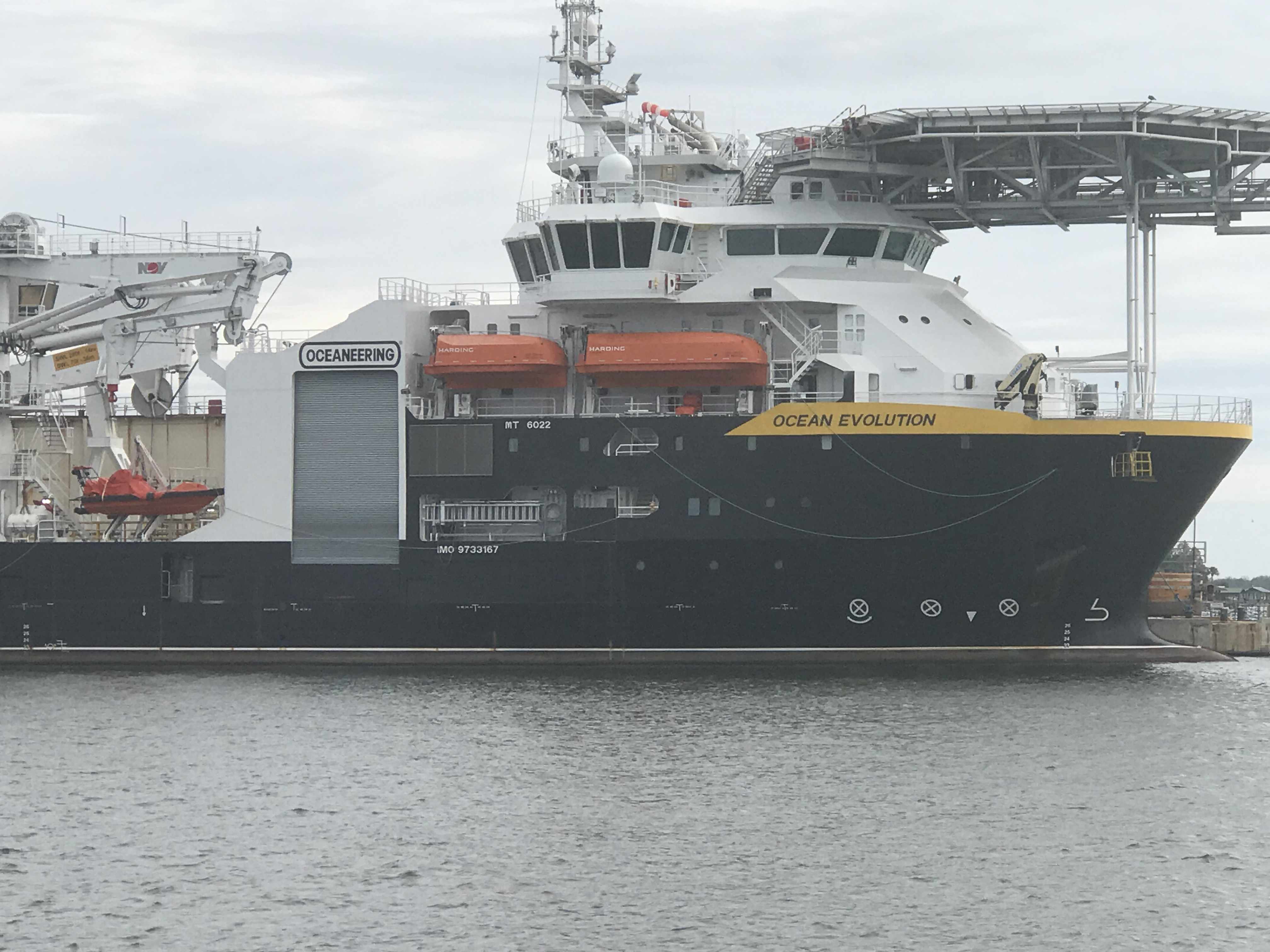
Ship Ocean Evolution’s fwd heli pad 
Georgia Queen in Dry Dock 
Underway Ship passing drift fishing boats
Last year we passed this sailboat on a small island and it still looks out of place. How’d it get up on the island? I can only assume a barge with a crane placed it there to keep it out of the way of navigation but why leave it there?

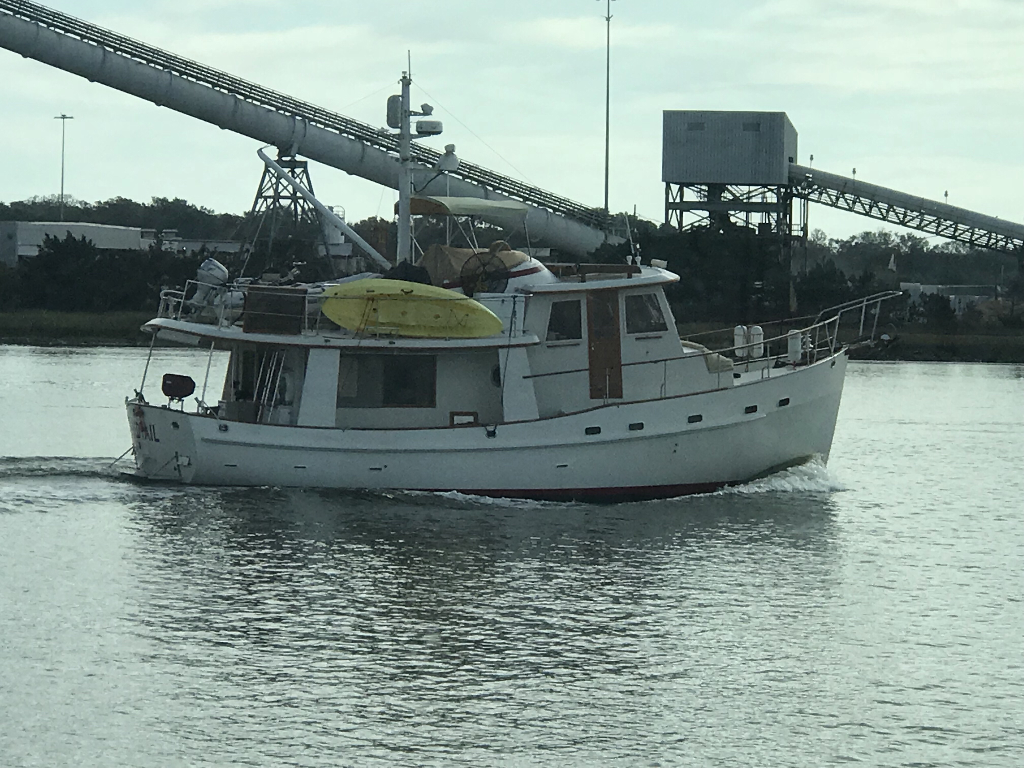
We passed this other sailboat that was using their dingy to reset their anchor. Their sailboat was too close to the ICW channel.

There are some beautiful homes along the banks and this was just one of them.

As we approached this bridge in Isle of Palms, FL we noticed 3 16YOish boys tied their boat to the bridge and were fishing beneath the support. This is a NO-NO in the boating world. It’s a federal law that you cannot tie a boat to any navigational buoy or bridge’s fender system (the boards that protect the bridge supports from boats as they pass through the center span).

As a boater you must treat bridges with special attention. When you pass under a bridge you must do so at no wake speed (about 6.4 knots for MV Simple Life). For the boats hanging out under bridges (usually fishing) you must not block the marked channel through the center span. You must also be careful as boats passing through the fender boards may not see you if you are hidden by the boards or bridge supports. Also after 9/11/2001 Homeland Security legally restricted areas under certain bridges and it’s a felony if you break that law. Individual states may have laws about simply being near any bridge in their state.
Florida Statute 327.44 refers to interference with navigation and states that anchoring underneath a bridge or adjacent to heavily traveled channels constitutes interference if unreasonable under the prevailing circumstances. There’s a lot of gray area here and not everyone has the same understanding of “unreasonable interference,” but you likely won’t get in trouble for anchoring under a bridge if you are well out of the way.
FWC (Fish & Wildlife Conservation) officers may stop you if you attempt to anchor under the bridge. It should be noted that the area around a bridge is more likely to have un underwater cable that either brings power to a lift or swing bridge or simply crosses over to the island. You don’t want to hook your anchor on these power cables.
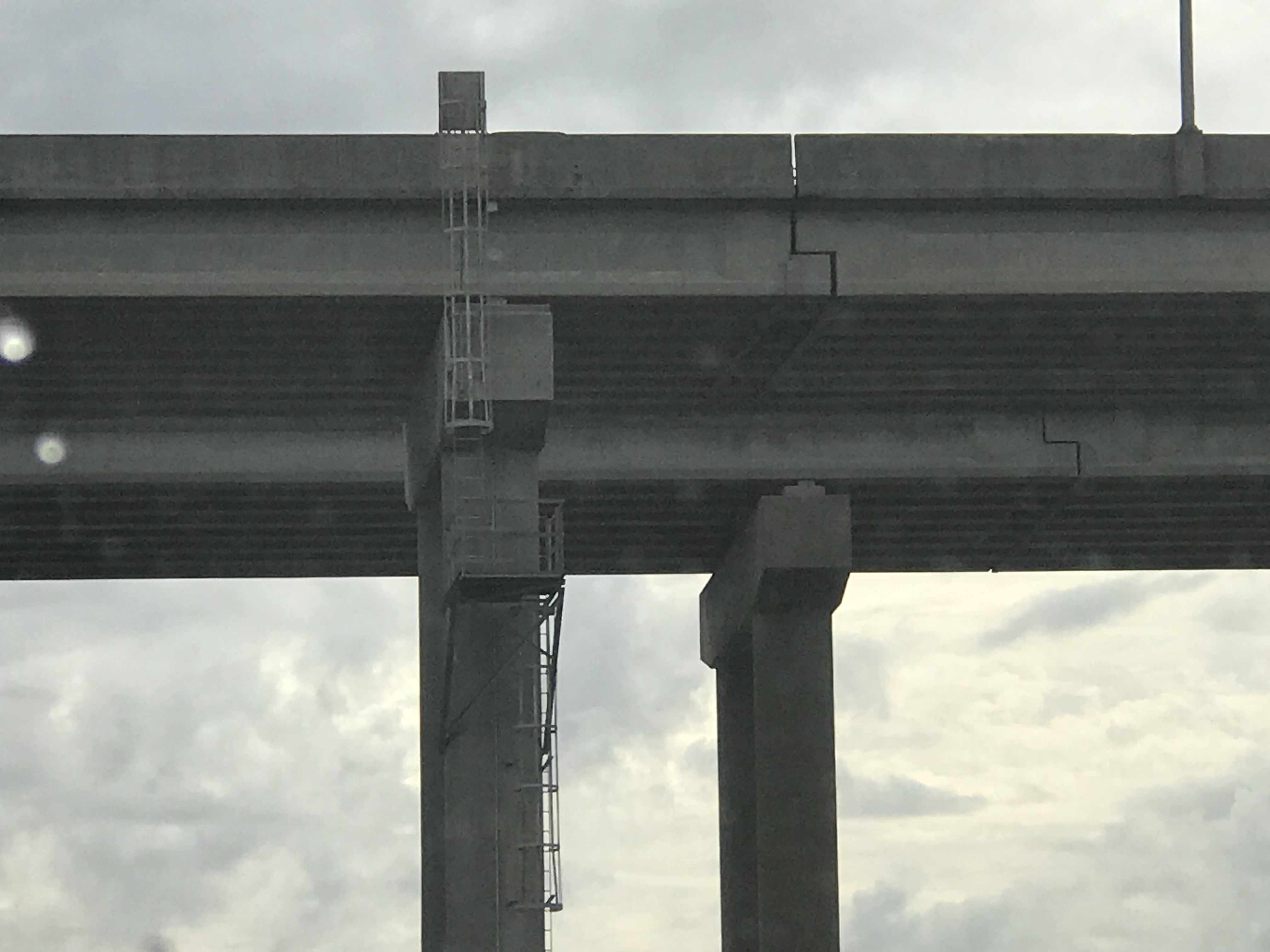
Aside from all the bridge rules of boating, I was more interested in the expansion joint on this bridge.
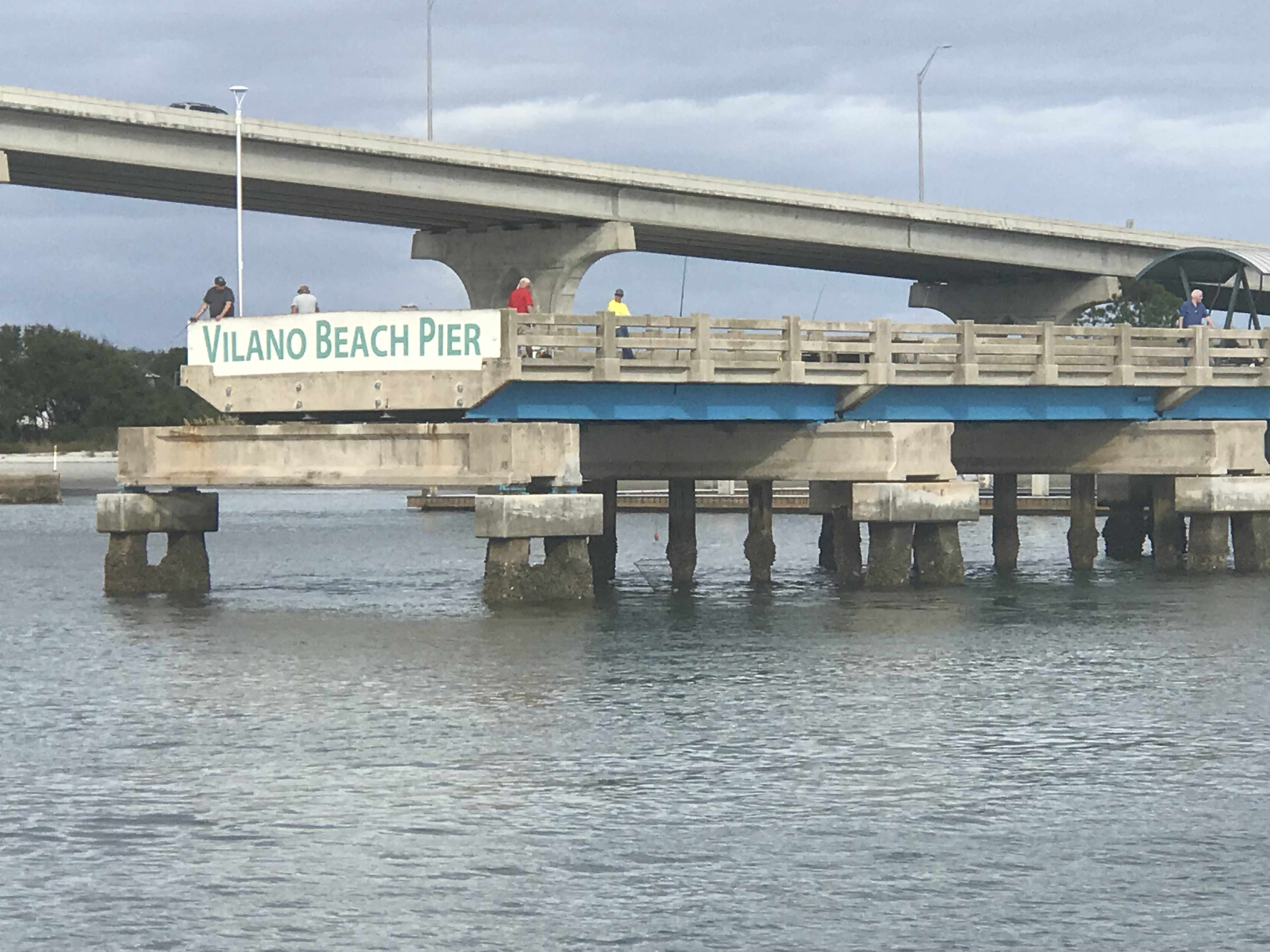
We pass many engineering structures like bridges and this pier. I’m sure the first piers were only for boats to dock but soon “pleasure piers” emerged that were simply for people to stroll out onto or fish off.
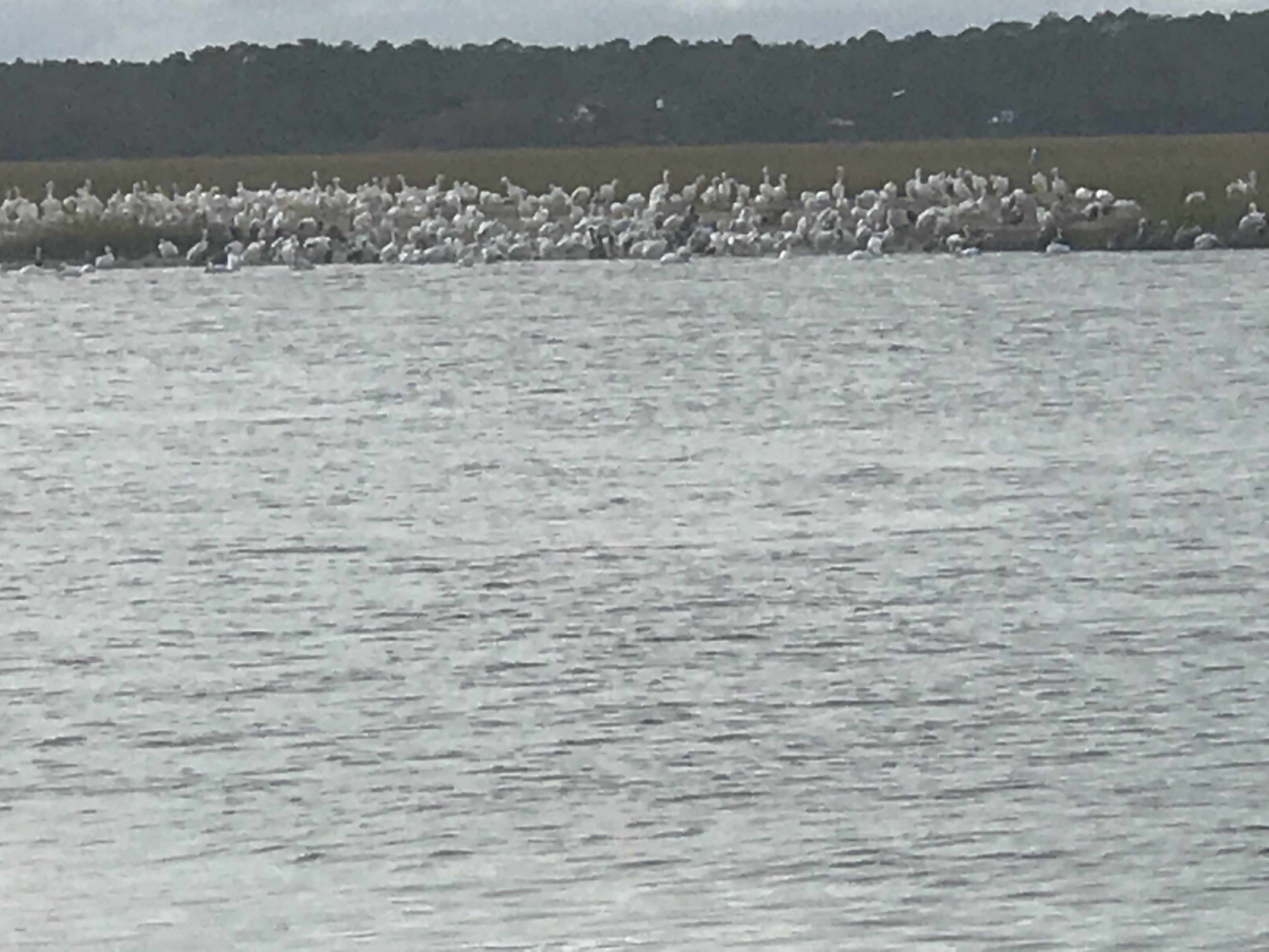
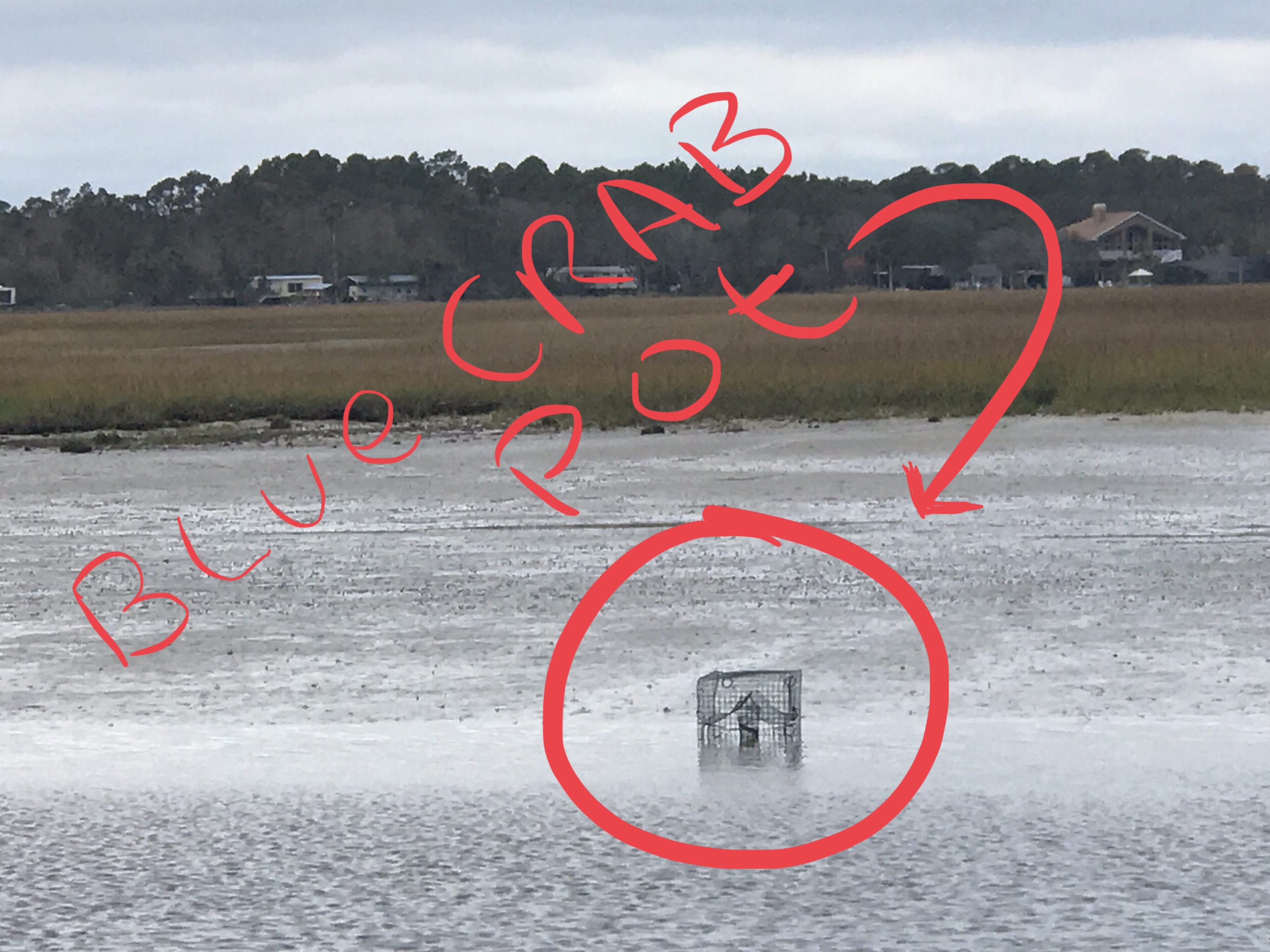
We find it interesting that “birds of a feather flock together”. It’s like all these white pelicans said … “Hey, why don’t we all me on the banks of the ICW over where Jimmy found that big pile or old crab shells tomorrow?”. They clearly enjoy each other’s company.
Soon we were waiting for Saint Augustine’s ‘Bridge of Lions‘ to open (every 30 minute openings). In line in front of us was a boat called ‘Yellow Bird” from Cape Cod.

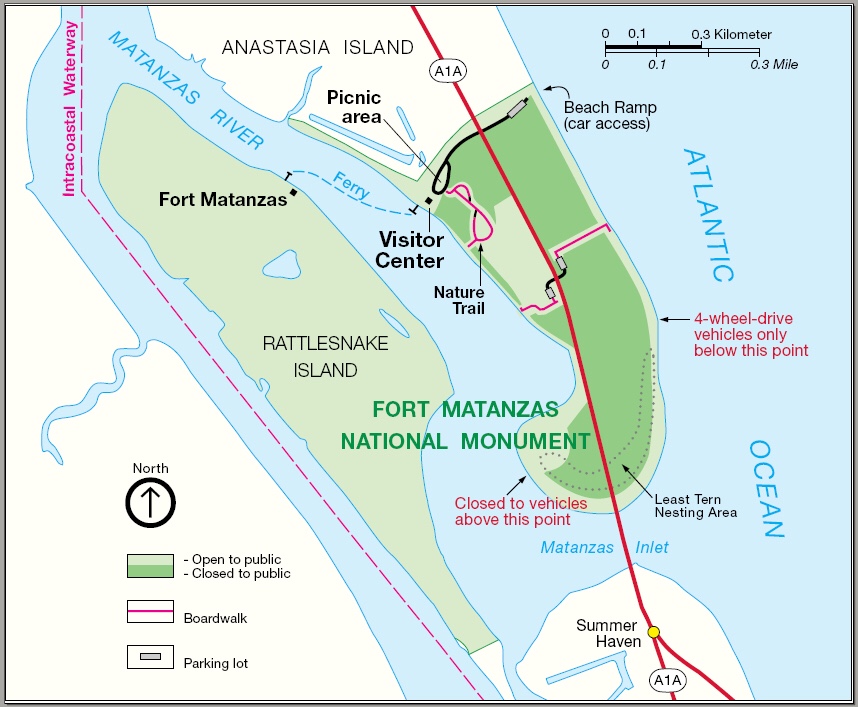
We attempted to get a mooring ball in Saint Augustines FL but alas the City Marina only had balls for boats with drafts under 3′. I hear it’s a fun town but our plan is to continue on tonight and find a quiet place to anchor. As the sun was setting we settled on anchoring just off Fort Matanzas. Fort Matanzas was built by the Spanish in 1742 to guard Matanzas Inlet.

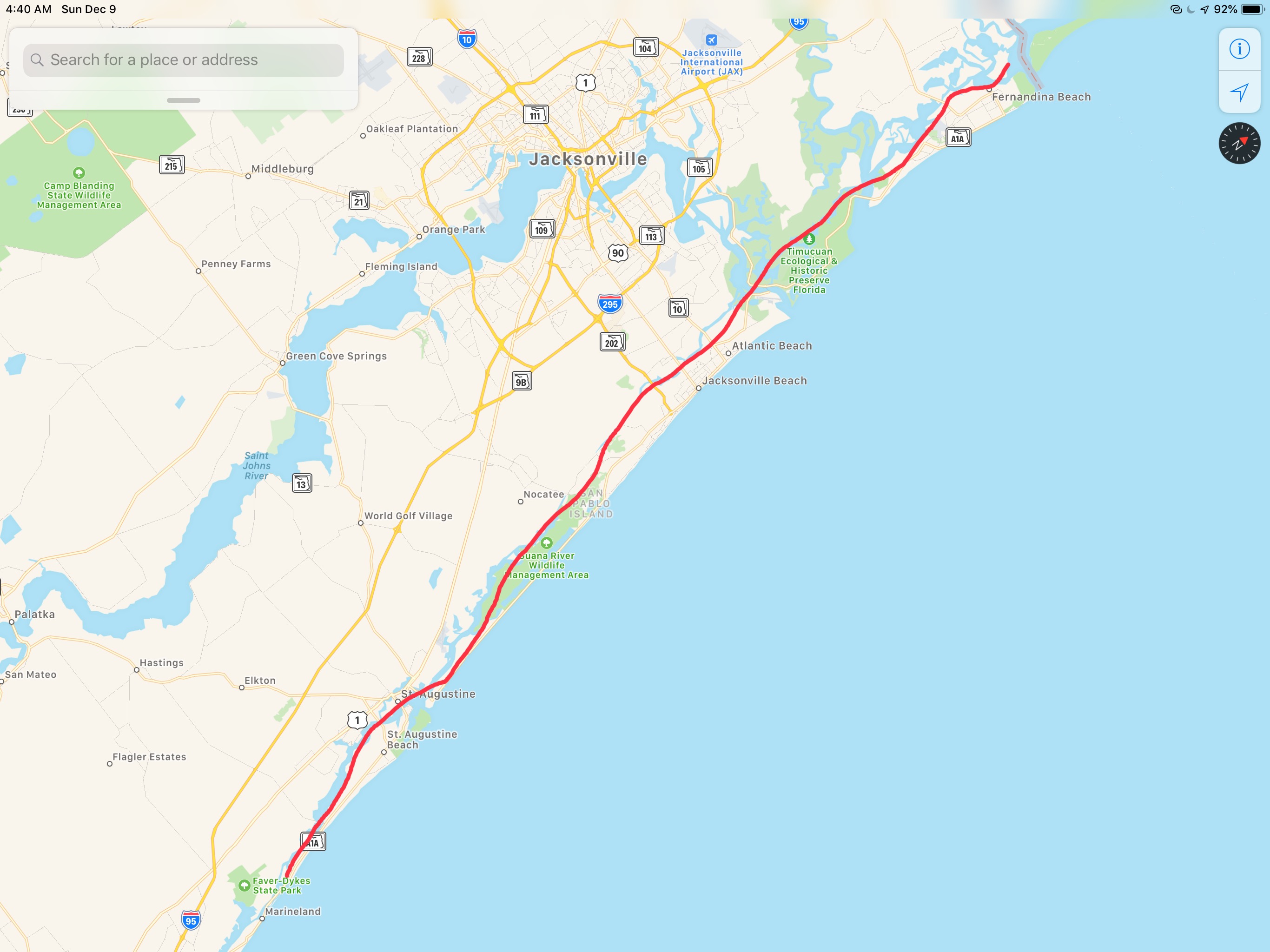
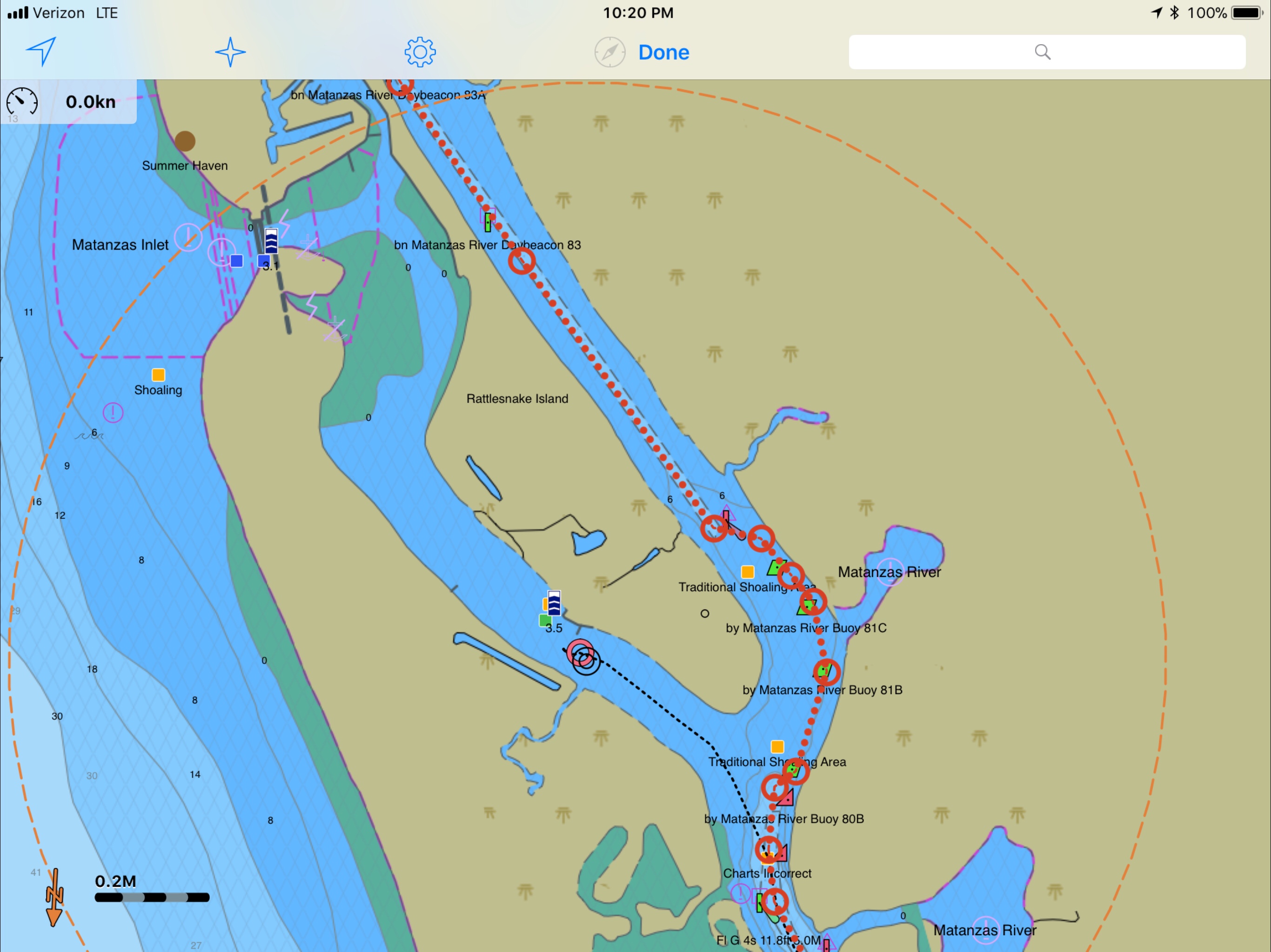
Our leg today looked something like this…


 The next morning we re-provisioned the boat using a grocery delivery service. Kelly used her iPhone to place her order and set the delivery time the night before. We awoke to texts from our personal shopper texting us that she was on her way to the marina and and she would be the “girl in the gray Toyota”. After re-provisioning we spent the day taking on some more water and while Kelly cleaned the inside of the boat, I washed the outside. It was 80 something degrees out and seemed odd as Christmas is just a few days away. The next morning we shoved off and had no sooner started South down the ICW and we ran into a restricted bascule bridge and had to anchor for 45 minutes while we waited for it’s 12:30PM opening. Along the river bank you could see the fortress called
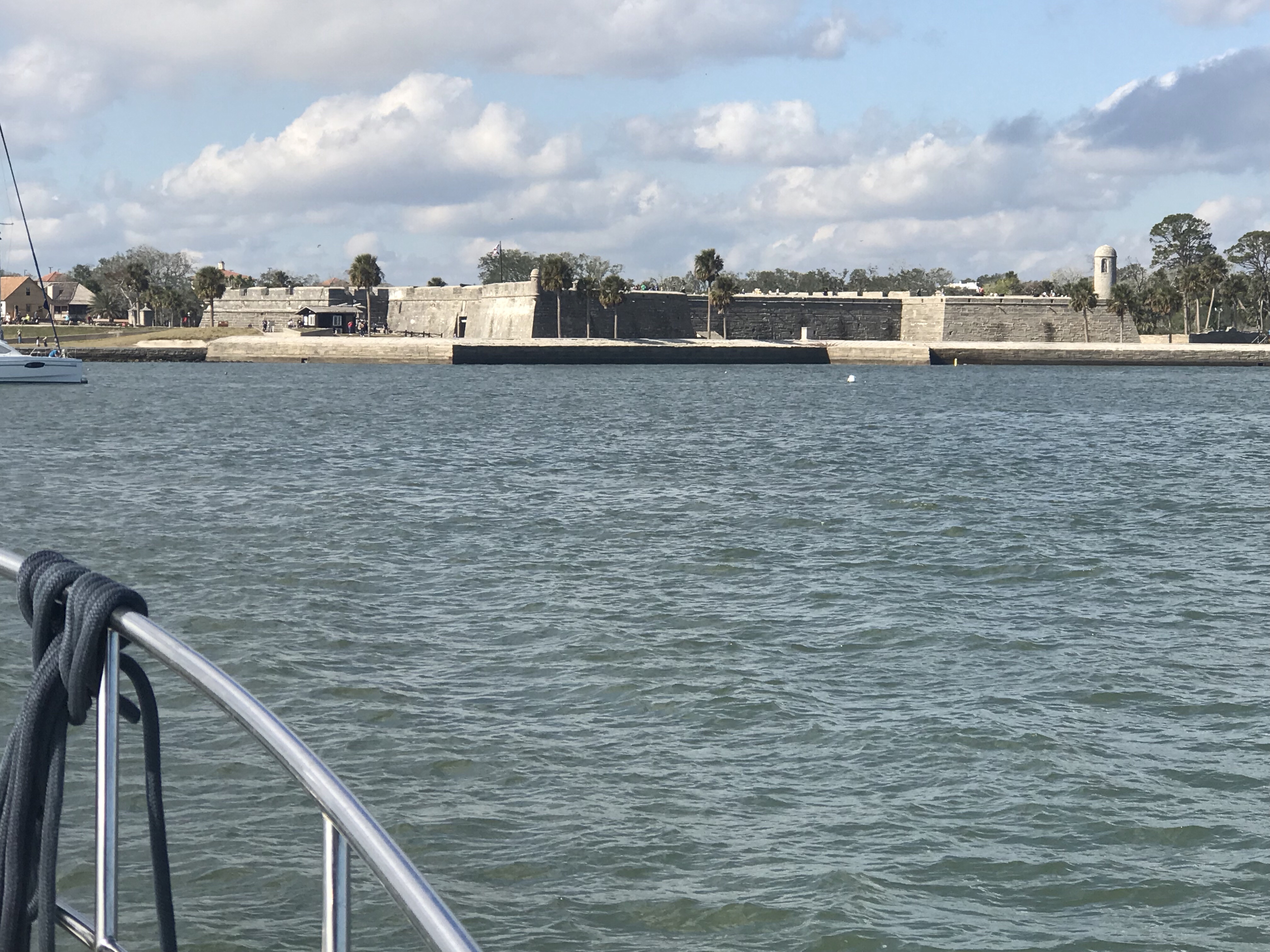


You must be logged in to post a comment.