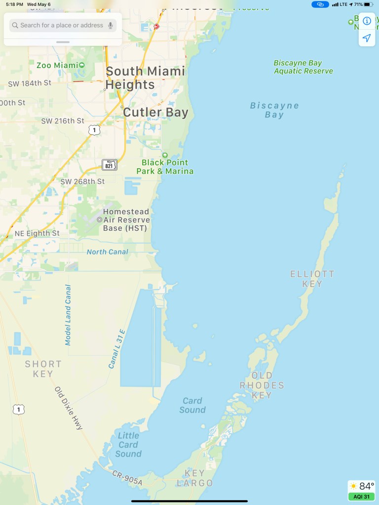
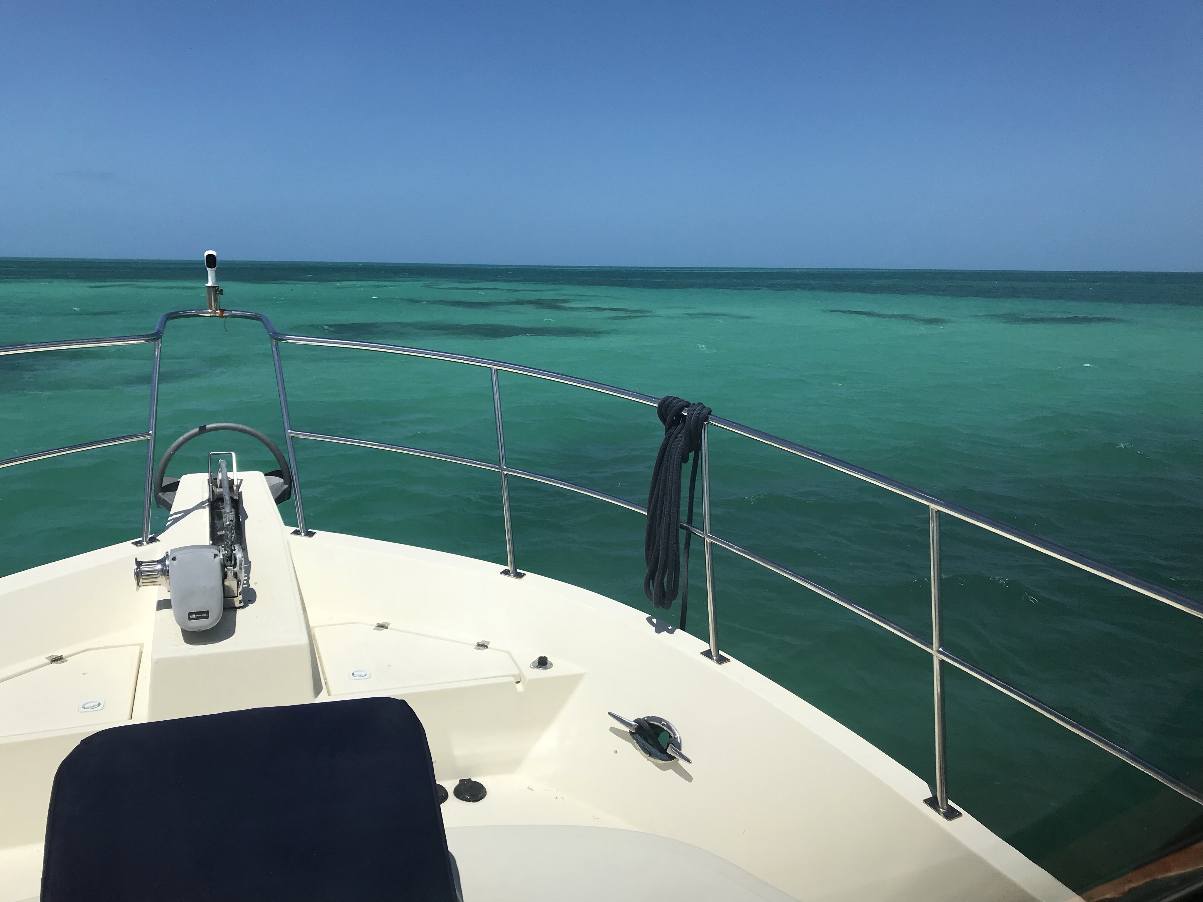
When I left Key West on March 18th, I decided to run East up the inside of the Florida Keys. The weather was both windy and wavy. This inside route can offer some protection as you run up the wind shadows behind different keys. The downside is… it’s also notoriously shallow in certain areas as we’ll see.
Simple Life underway leaving Key West
Bye, Bye Key West
I untied the lines, jumped aboard and put her in gear. The pic above was snapped just after leaving Sunset Marina. You can see Dredger’s Key on the left iPad as well as straight ahead. You can also see that I didn’t get an early start (8:32AM).
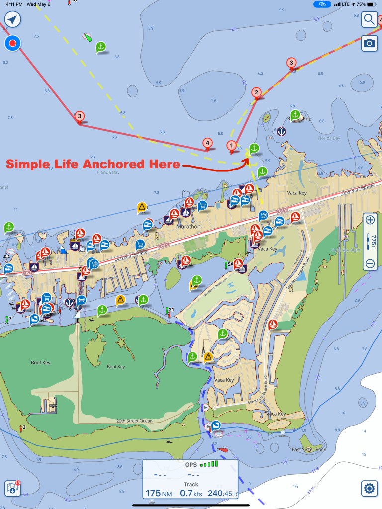
Informational Layout for Navigation
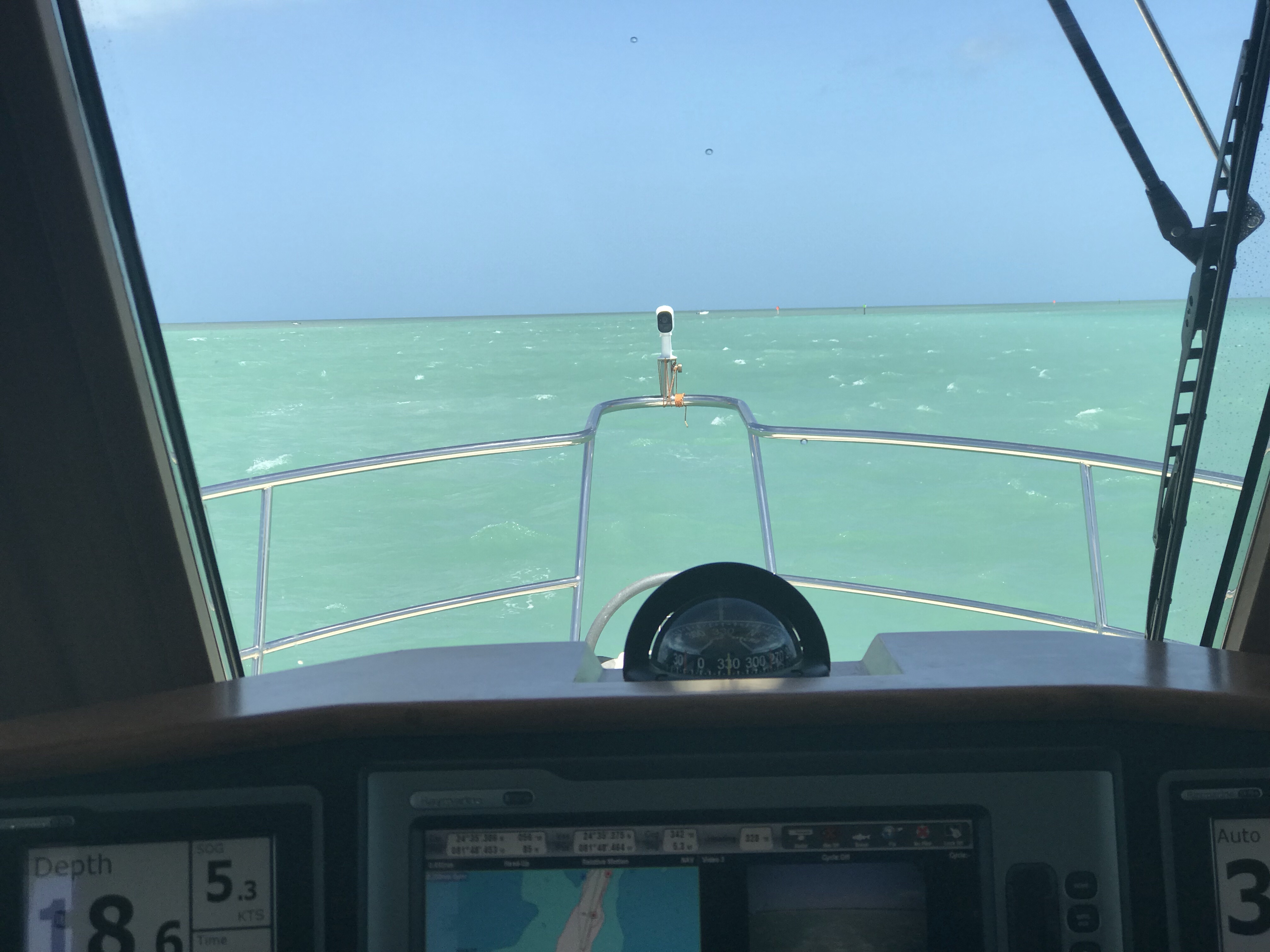
I like to navigate using twin iPads. You can see that the iPad on the left is zoomed out to get the big picture while the iPad on the right is zoomed in for more detail about depths around Simple Life. I split the screen of my MFD (Multi Function Display) to expose different pieces of data. A chart plotter on the left half of the screen, a rear-facing camera on top-right and a scrolling depth display on the bottom-right.
My chart plotter display is mainly used for showing radar & AIS targets. The rear-facing camera let’s me see boat traffic coming up behind me. The scrolling depth is very important as it gives me depth trending. The instrument display to the left of the MFD shows the current depth in real-time. I believe it is more important to understand how the depths are trending. It goes without saying that in almost every grounding case, the ocean floor came up gradually to meet the boat.
My track leaving Key West and anchoring inside Marathon. I can’t stop interpreting this picture as a view from space. A planet with the Keys curving across it’s surface.
Which Route?
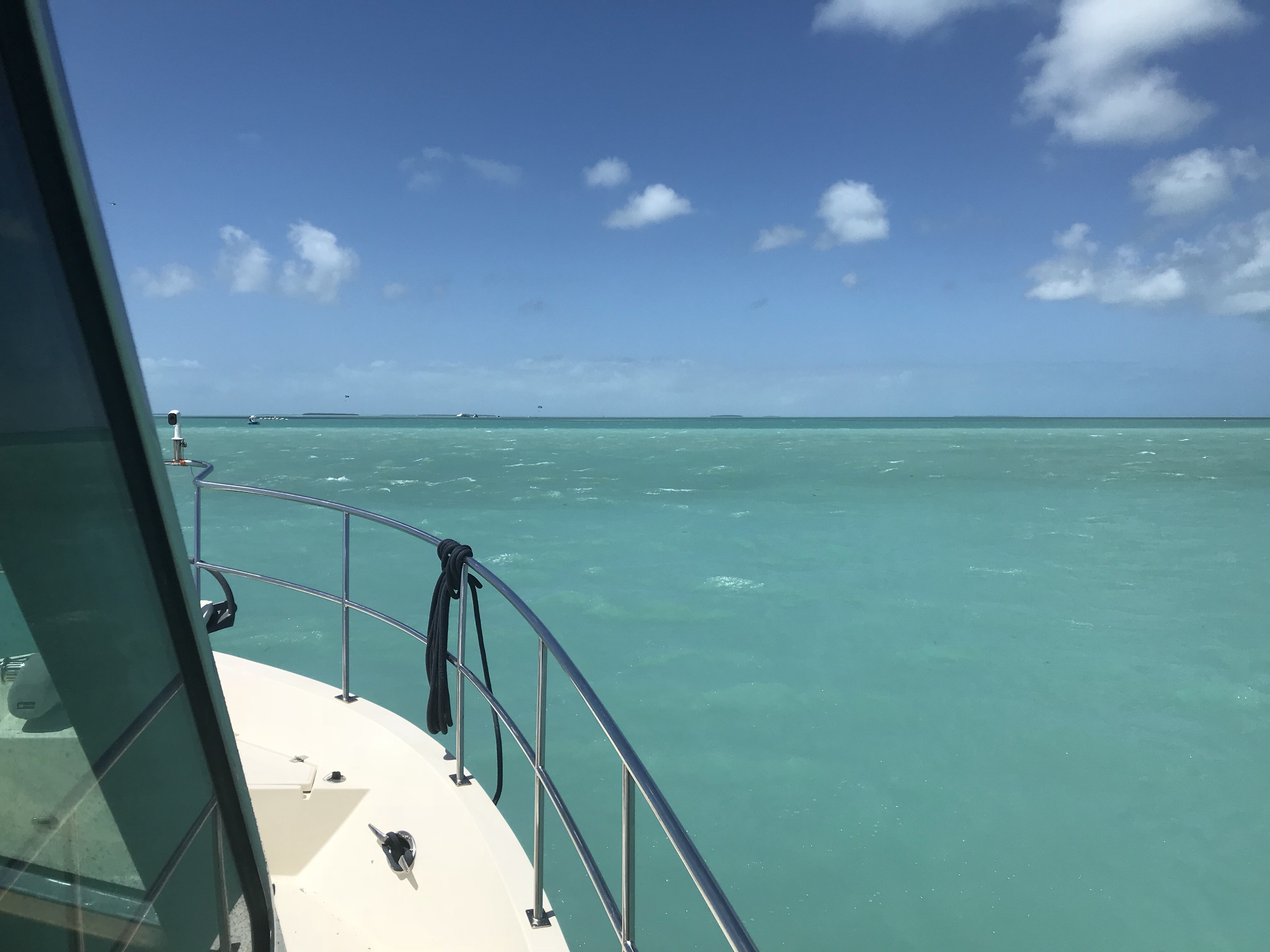
I chose to run the shallow inside of the keys and not the plenty deep “Hawks Channel” running east-west just below the keys. Running Hawk’s Channel does not require as much attention because it’s plenty deep. You’ll never worry about running aground. However, the wind had been blowing hard E-S-E for the past few days and I’m guessing the waves in Hawks Channel would have made that passage a rough one.
End of the Day and the Cruise
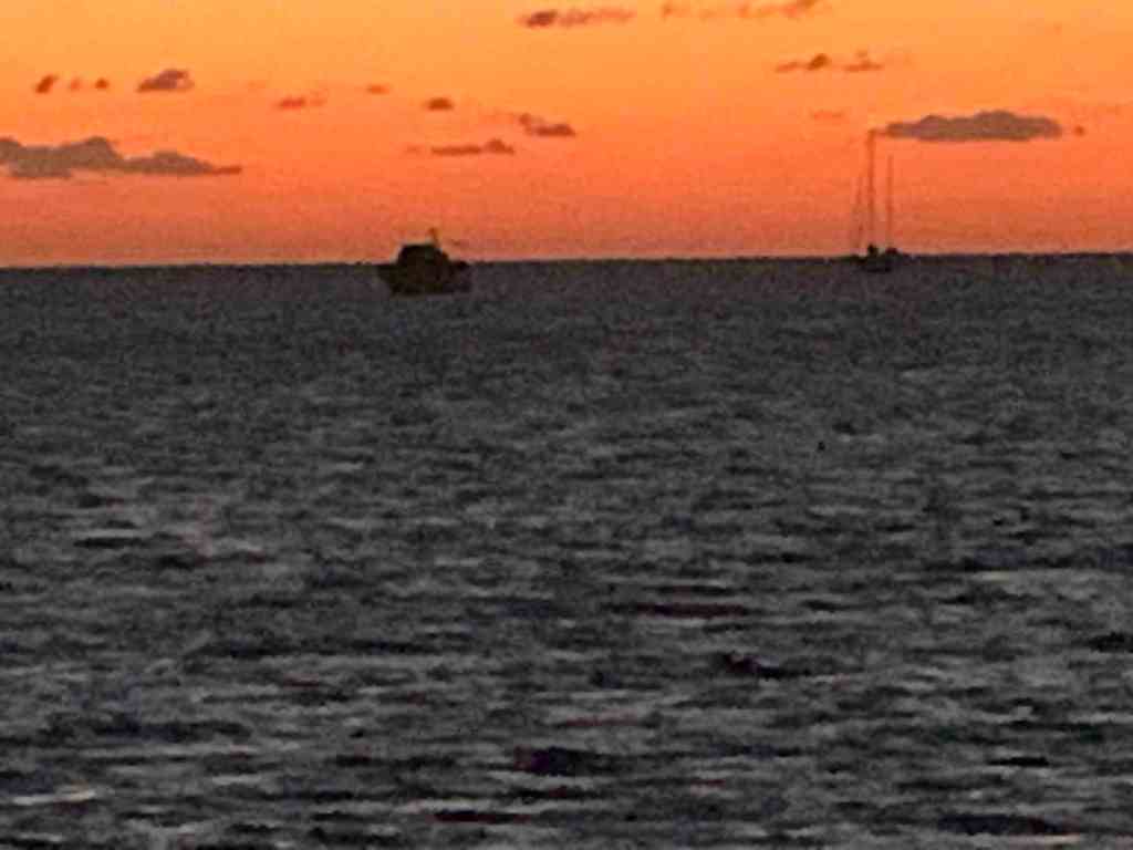
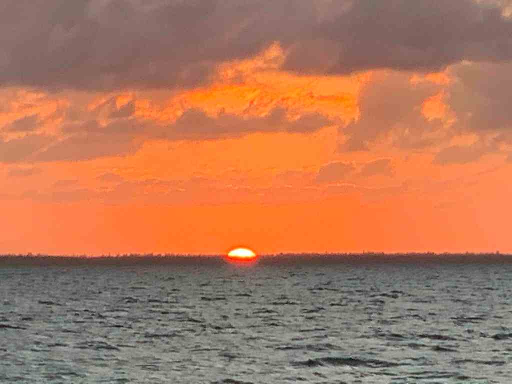
After running the inside of the Keys all day, the sun was setting. Lucky for me I did not have that much further to reach my chosen anchorage for the night.
Sunset off Marathon in the FL Keys
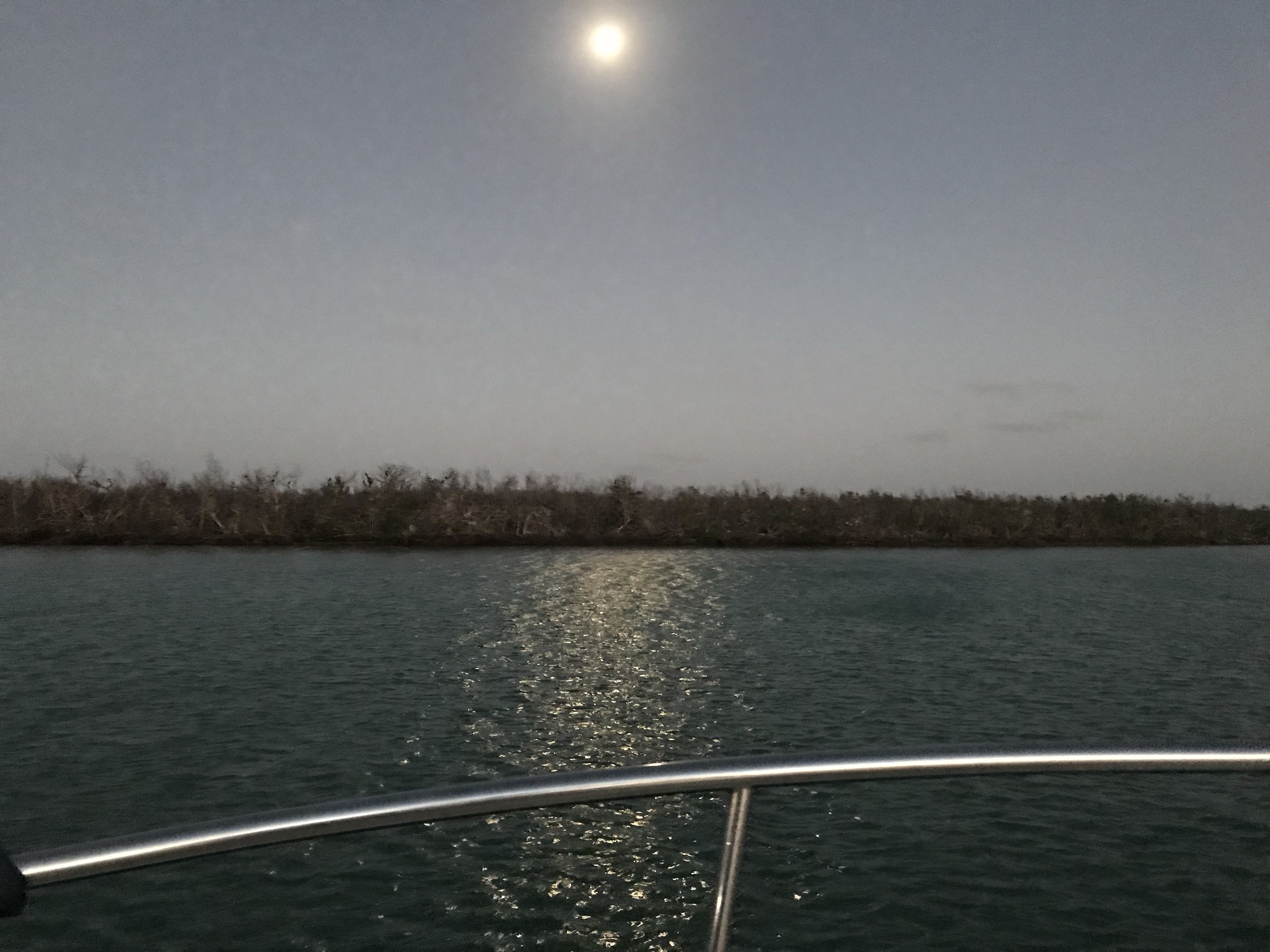
As I approached my anchoring location off Vaca Key, I made sure to tuck in close behind land. I hoped to gain a night’s shelter from the wind.
Anchored for the night off Vaca Key
As I crept closer to the shore it shallowed to only 6.1 feet deep.
Shallow as I approached Vaca Key
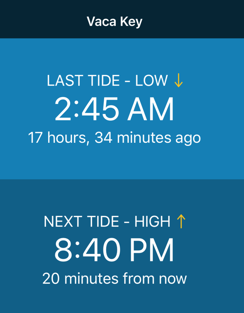
Now when I anchor, I always need enough water under Simple Life’s 5′ deep keel to make sure she is not laying on her side when low tide hits.
I had already determined that the tides here were less than a foot. It was currently high tide. The boat was in 6.1′ of water. While I’m fast asleep at 3:51AM, the next morning, I should still have an inch or two beneath the boat.
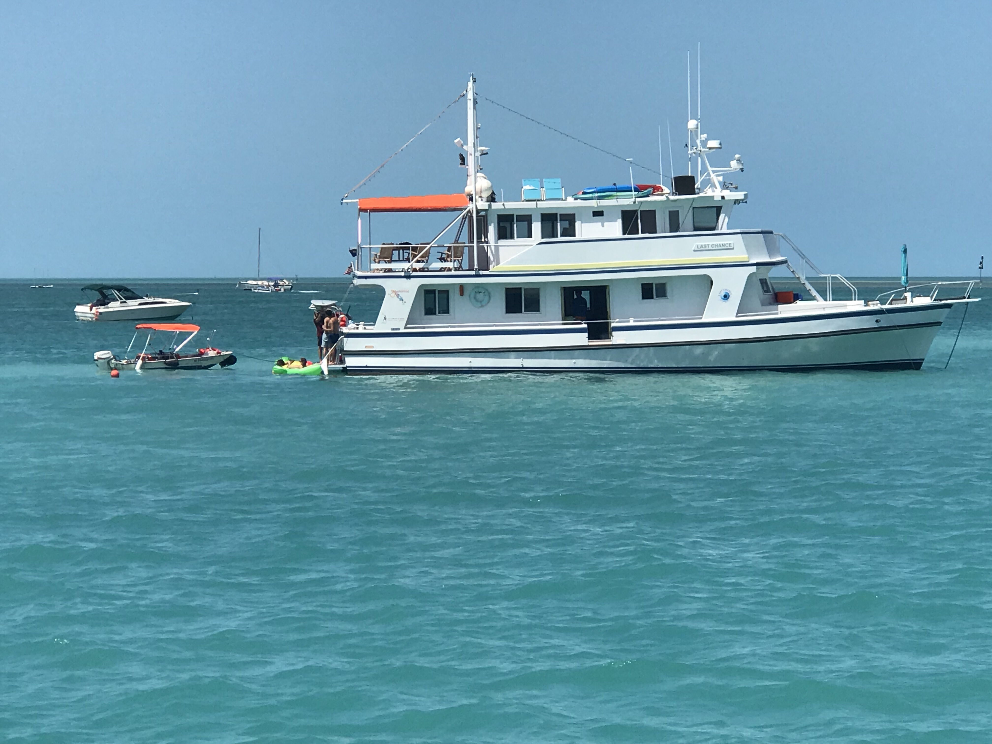
In the daylight fading you see the two other boats that I snuck past to get close to shore.
Sharing my anchor spot with these two while Social Distancing
Anchored, it’s time to celebrate todays run with an IPA (or two) before bed.
The next day’s cruise was absolutely beautiful. I decided to shoot a short video to give a 360 degree view of what the water looks near Islamorada.
Islamorada near Cotton Key
For reference I placed a marker near Cotton Key, Islamorada.
Cotton Key off Islamorada
It’s very shallow here. My shallow water alarm is set to go off below 6′. It is beeping incessantly.
Zipping along at 5 kts with inches beneath the keel.
Below I am approaching Grouper Creek in Key Largo. Here the banks starts to close in around you with mangroves.
Mangroves
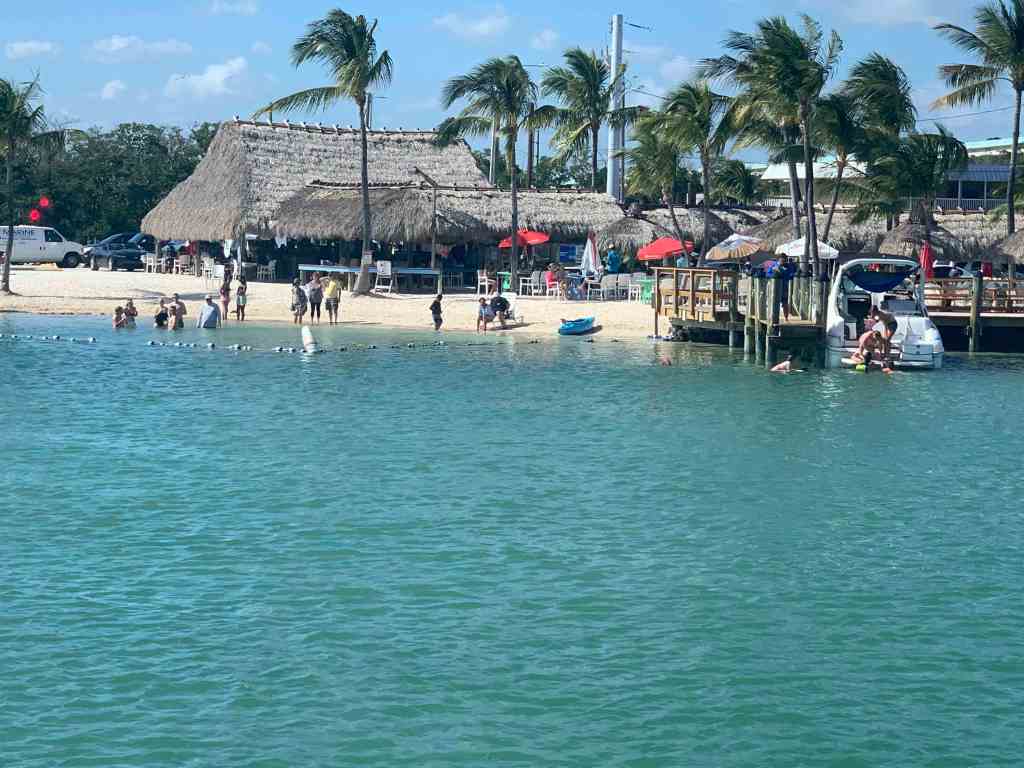
Soon I was passing Gilbert’s Resort on Key Largo. Even though Covid-19 was shutting down most activities, this place seemed alive with people enjoying the beautiful day.
At this point I was in Biscayne Bay near Elliot Key just north of Key Largo.
Elliot Key
Watching the sunset off Elliot key was beautiful.
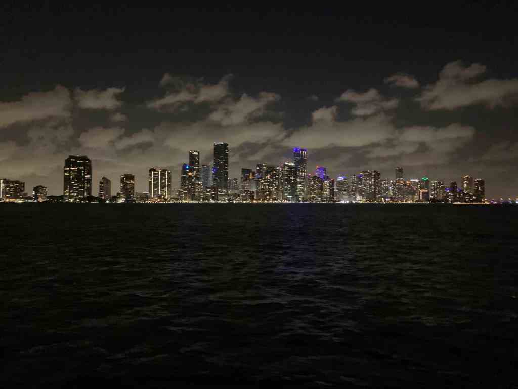
I cruised on into the night with my heart set on making it to Miami. As you approach Miami you are struck with how amazing the skyline is from the ocean at night.
Approaching Miami from the ocean at night
Visible is the bridge I must go under
From my anchored location
Close up
Miami Skyline
I’ll end this post with a short video that I took from Simple Life while on anchor.
It seems like a framed photo rather than a city all lit up and alive with activity
I had been waiting for a good friend of mine, Preppy to fly into Fort Myers. That day has arrived. As soon as he had stowed his bag in the guest stateroom we dropped the Segway scooters on the dock and it was to explore downtown Fort Myers. First stop… Ford’s Garage for a burger and some IPAs.
The Bar @Ford’s Garage in Downtown Fort Myers
Ford’s Garage’s bar has a beer cooling feature that I had never seen. It’s a refrigerated chill plate the runs the whole length of the bar. The bartenders and customers place their schooner beer glass on the chill plate to keep their drinks cold. The humid Florida air has the effect of creating a layer of frost on the chill plate that makes a great low friction, melted frost, beer spinning activity. I felt some strange addiction to spinning my IPA. Like a fidget spinner but for an IPA.
IPA spinning addiction… It’s real folks!
Fort Myers Beach
A day after Preppy arrived and my slip rental at Fort Myers Yacht Basin has come to an end. I need to push on to Key West and eventually start making my journey back home to RI. Schedules in long-range transient boating rarely work due to issues with weather, repairs, etc. You must plan to have downtime.
Preppy & I got a late start leaving Fort Myers and made a short cruise to Salty Sam’s in FMB for the night. Fort Myers Beach is a fun location and it was time to put the dink in the water and go out for some drinks. First stop… Matanzas Inn.
Oklahoma!, Oklahoma! It’s not the Safe Word but the bartender’s name!
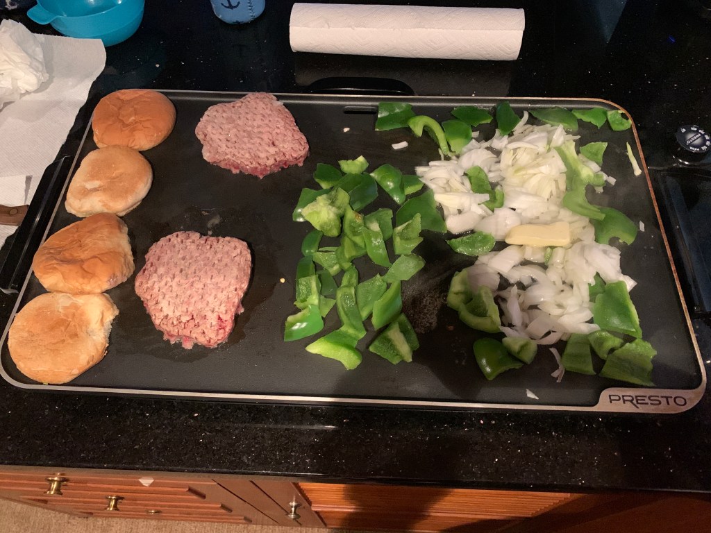
Back aboard, Preppy wasted no time cooking up Bubba burgers with peppers & onions on buttered buns.
Bubba Burgers – Yum
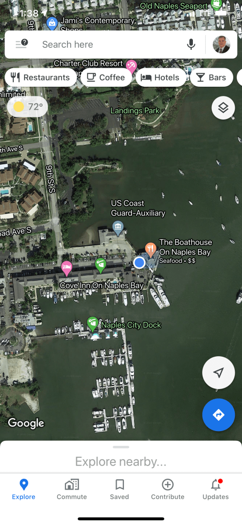
Naples Not Marco Island
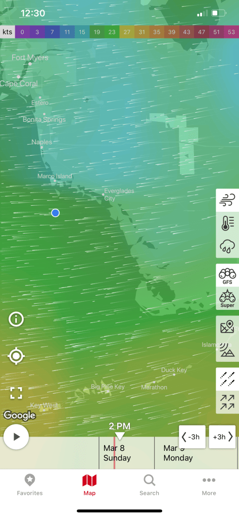
We were planning on stopping in Marco Island as a HS friend has a place there and I thought it might be nice to ping her and see if she and husband could meet up for a drink. However, the weather and Covid-19 were not making that a reality.
Windfinder Pro app shows a strong East wind that made our trip a bit lumpy
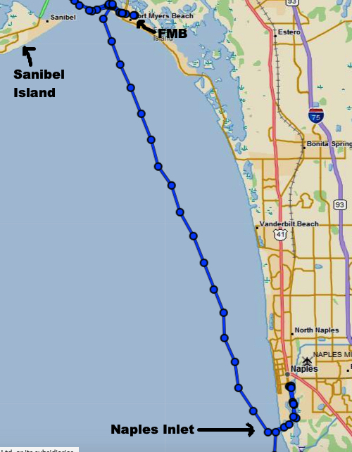
We decided that we would come in from the Gulf at the Naples inlet and find a place to anchor inside for a day or two until the weather settled. The inlet was rough with breakers on both sides but once inside it was peaceful. We motored all the way into downtown Naples searching for a marina or anchorage deep enough to hold Simple Life’s 5′ draft. Repeatedly we ran into shallows at each anchorage we attempted. With no open slips at marinas either, I thought we’d have to go back out the Naples inlet into a lumpy gulf of Mexico and forge on to Marco Island? However, there was one last anchorage just inside the inlet. Our anchorage of last resort turned out to be safe haven.
Naples Inlet and our anchorage can be seen
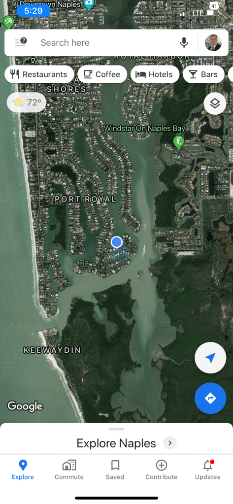
Anchorage zoomed in
Beautiful homes surround us
Hanging at The Boathouse in Naples
Music & IPAs at night
Sunrise
This Naples anchorage was peaceful and turned out to the first of two stops along our route to Key West.
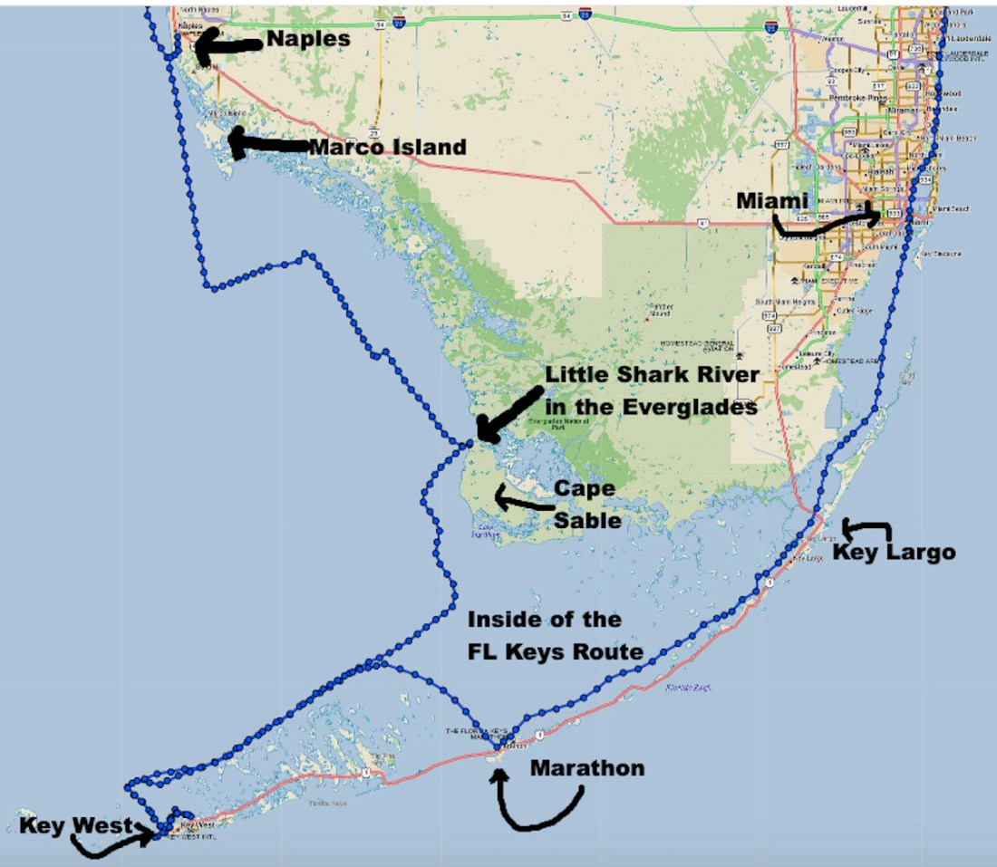
Shark River in the Everglades
When we left Naples we set a course directly for the Lower Keys and ultimately, Key West. I have read that Marathon is defined as the “Middle Keys” between Key Largo in the “Upper Keys” and Key West in the “Lower Keys”. The wind was 20+kts out of the East with gusts much higher. The path I had chosen took us quite some distance from the shore and thus gave the wind more water to blow across (properly referred to as “fetch” or the distance traveled by wind or waves across open water). The larger the fetch, the taller the waves. We needed to seek out smaller waves as taking large waves on our beam was not enjoyable. So we decided to make a 90′ turn to port and run head-on into the waves till we were closer to shore before turning southward again. This also meant that we were going to have to anchor somewhere along the shore rather than our original plan to make it to Key West before nightfall.
Our trip from Naples to the Everglades to Key West and then the inside Keys route to Miami and points north
The depths were shallow for a long way in as we approached the Little Shark River anchorage just north of Cape Sable. We found a sailboat anchored here and chatted a bit on the VHF as we dropped anchor. A friendly couple who told us she was local to the Everglades area and he was from Alaska. They said they spend quite a bit of time in this particular anchorage.
The next morning we ran south down the coast till the southern edge of Cape Sable. At this point it was advantageous to do another 90 degree turn, this time to starboard and put the now increasing waves on our stern. The rest of the trip down the lower keys was spent with a following sea.
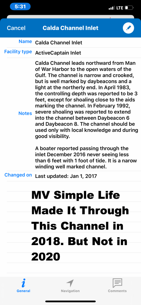
Caldera or Northwest Channel?
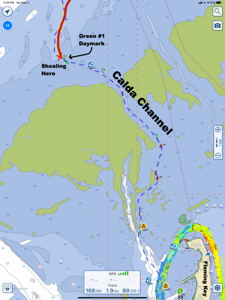
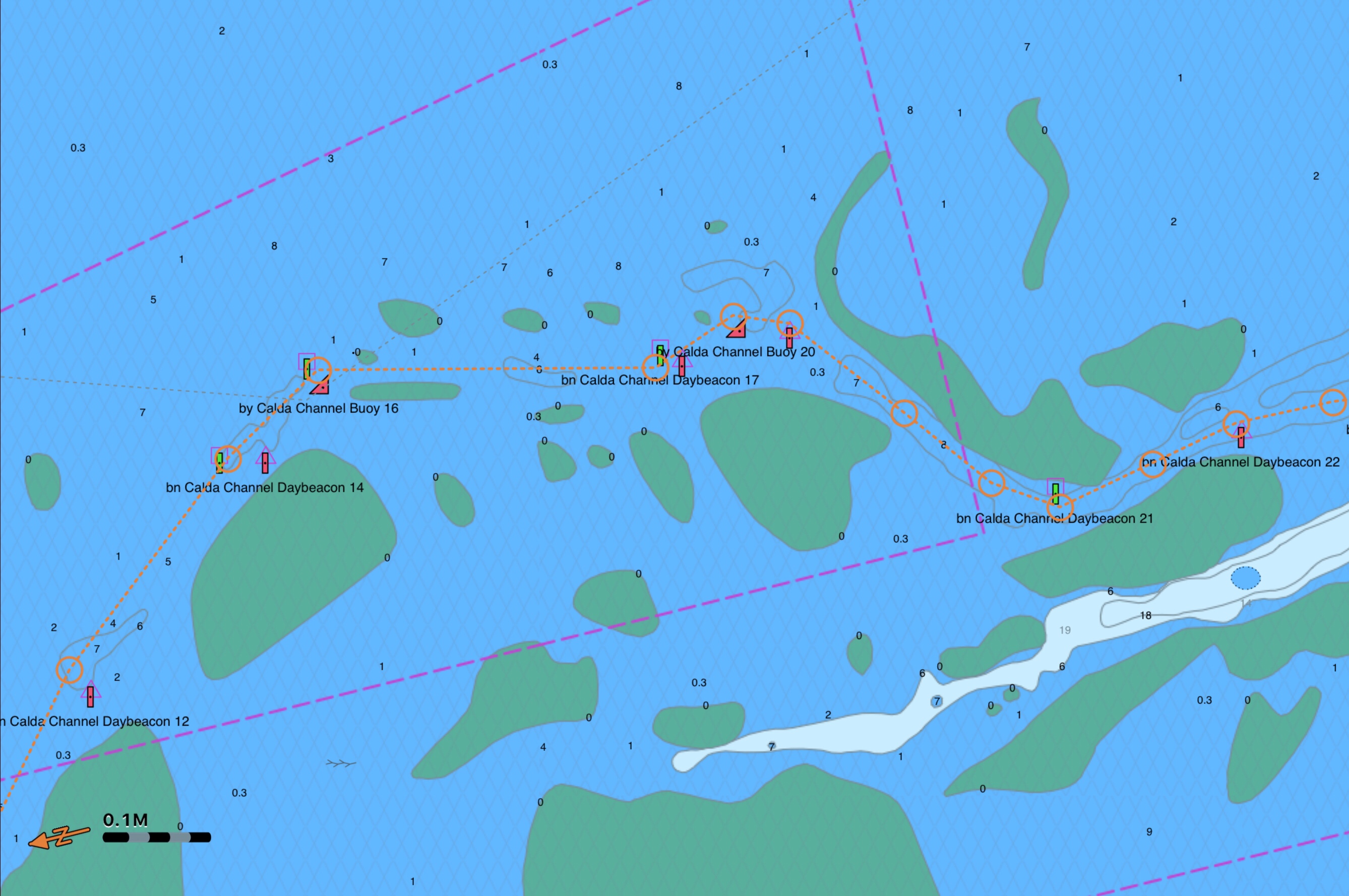
We were looking to get out of the following sea and into Key West. I decided to take the narrow and winding Calda Channel which I had successfully navigated in 2018. It’s much faster to take this channel then have to continue west till you get to the larger, much deeper Northwest Channel. The NW Channel is used by the Key West Express high speed ferries that run between Fort Myers Beach or Marco Island and Key West.
Big waves and shallow water are not a captains friend. Still traversing the Calda Channel would shave off over an hour of travel. However, we only made it to the first Green #1 Daymark before we slowly ran aground. The shallow water alarm is set at 6′ and it was blaring away. I backed up and attempted to poke the bow around to see if I could find deeper water and a path further into Calda Channel. No luck! We had to spin in the wind & waves and make our way further west to the official Northwest Channel. (see picture below)
As we entered the proper Key West Northwest Channel we found plenty of water and a wide easy to navigate channel (pictured below)
There are two ways into Key West.
1. Key West Main Channel as it is called which comes in from Hawk’s Channel which runs the whole south side of the Florida Keys.
2. The NorthWest Channel that comes in from the inside of the Lower Keys or Gulf of Mexico.
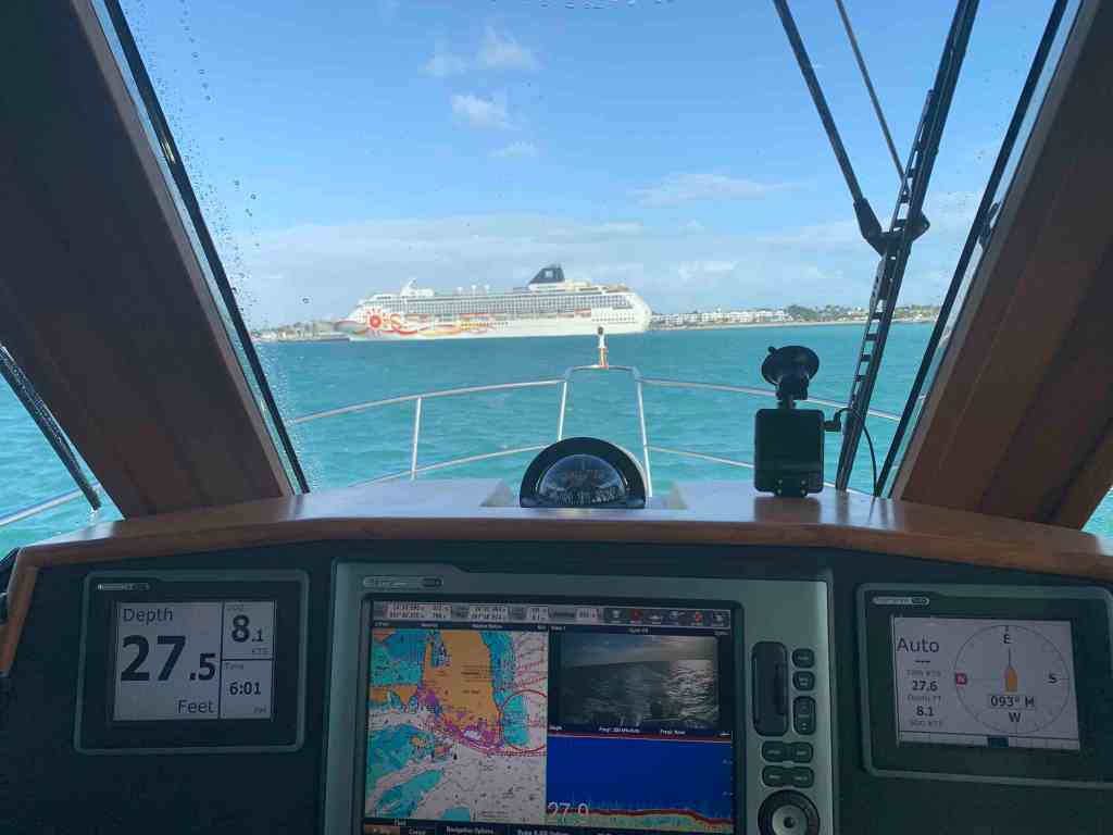
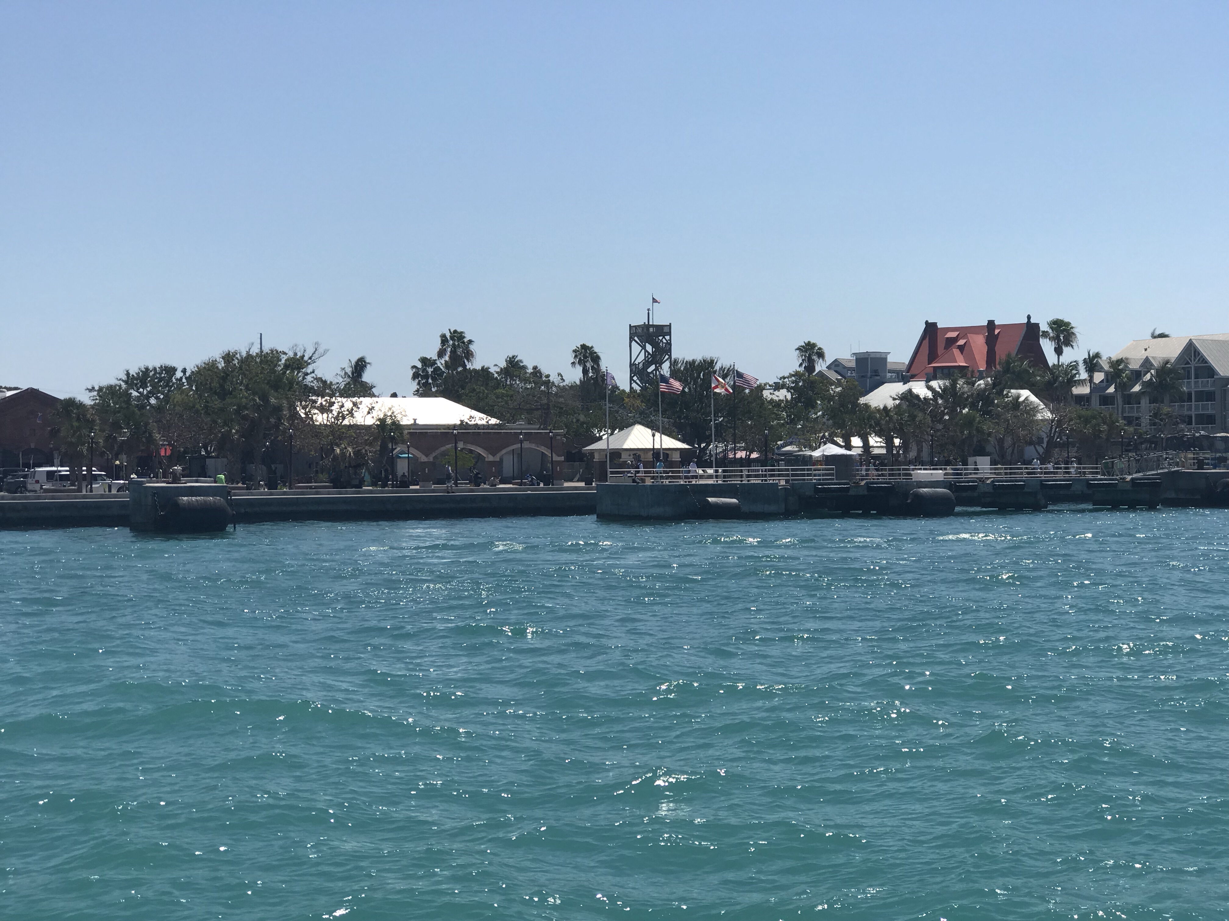
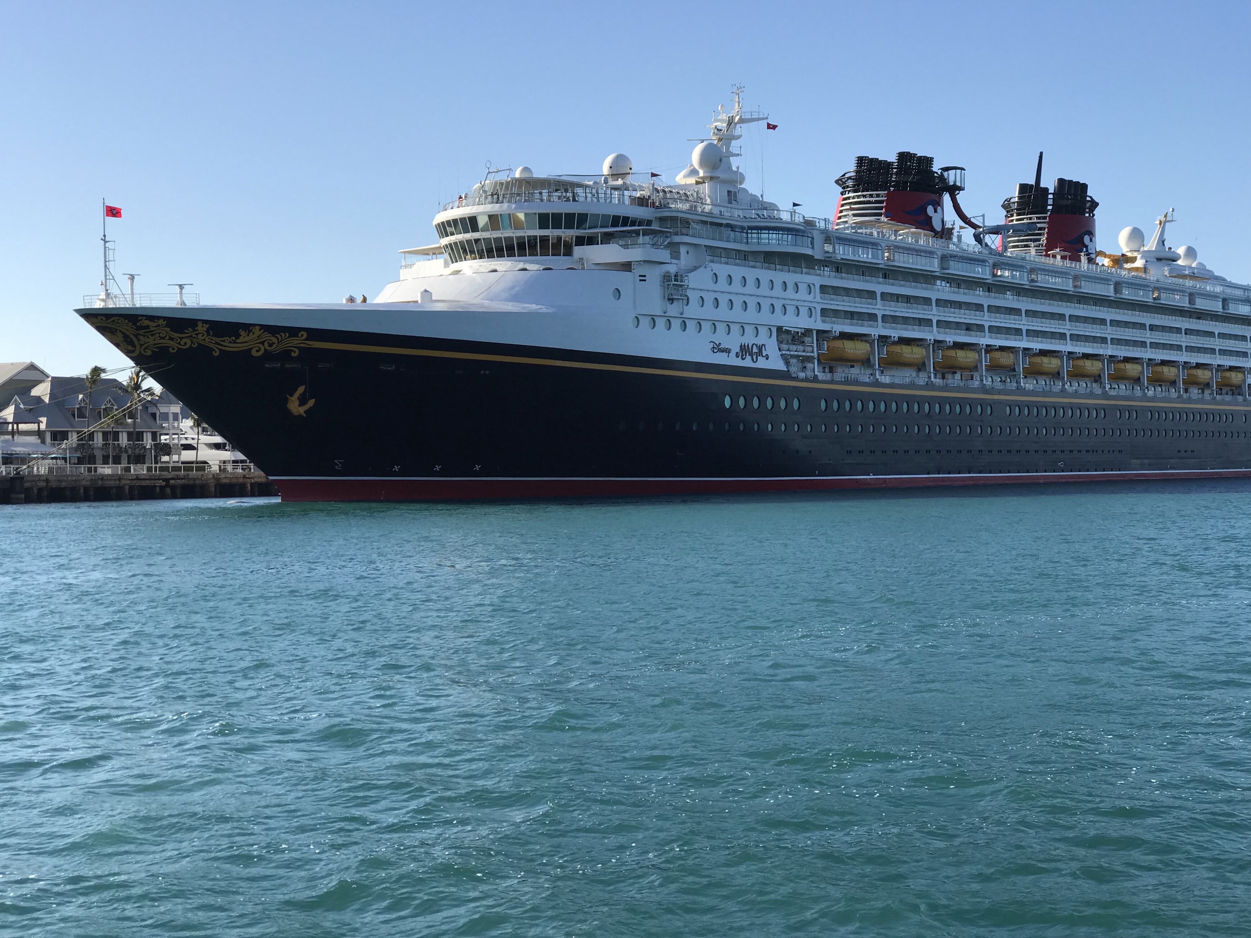
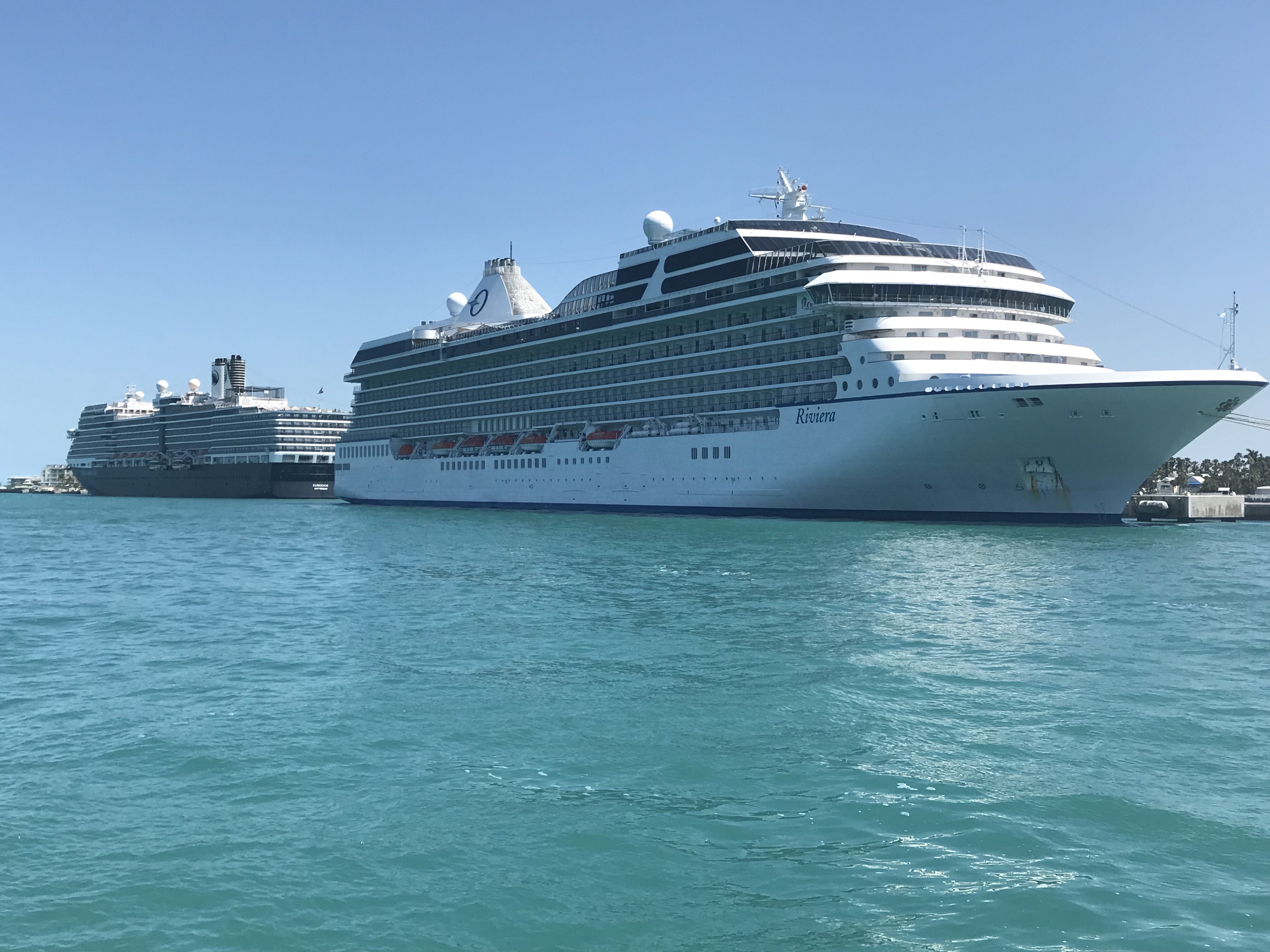
As we approached the end of the NW Channel where it meets the Key West Main Channel we saw the cruise ship which is often docked in port. It was March 9th and Covid-19 virus infections were increasing in each US state. We could only guess that the people we saw on the room balconies were crew disinfecting rooms and not passengers?
As we passed this cruise ship I’m guessing the people aboard during the Covid-19 pandemic were disinfecting it?
Wisteria Island
Now in the main channel we are passing Tank & Wisteria Islands (pictured above on left side of Key West). All around Wisteria Island is the Key West Anchorage and the boats here are mostly permanent liveaboards. Sadly, their boats are often lost to frequent hurricanes ex. Wilma, Irma, etc. Many who homes got sunk moved onto Wisteria Island and setup tents to live. There is a legal battle about who owns Wisteria Island and if it is dangerous. I have wanted to dinghy over to the island but have never done so yet. What is the truth about this island? Is it safe? IDK
Feel good story about the Children who grew up on Wisteria Island after the 2005 Hurricane season shipwrecked them – 10 min
Is Wisteria Island safe? IDK But when $ is involved you can expect corruption – 10 mins long
When you motor through the anchorage you will be amused at how creative some are with building floating log cabins or sheds to hold the things they need. It reminds me of the 1995 movie Waterworld.
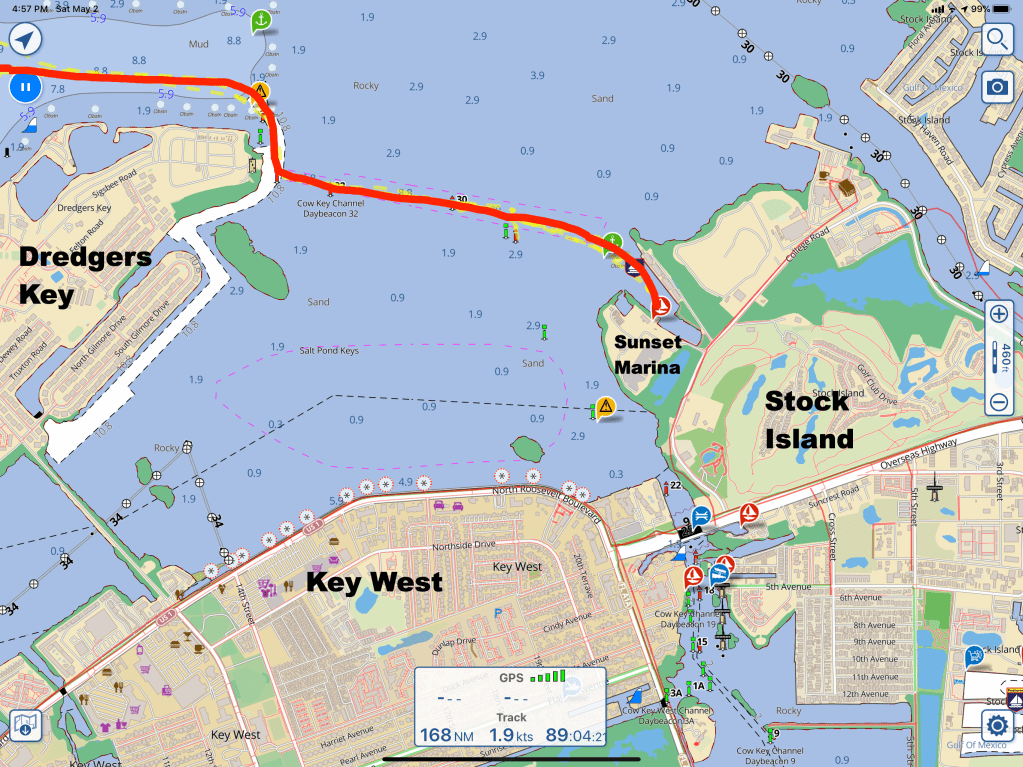
I had called several marinas and finally booked a 10 day reservation at Sunset Marina on Stock Island. Stock Island is the first island as you leave Key West.
Sunset Marina
Nobody from the marina was there to catch our lines but a couple cleaning the bottom of their boat were kind enough to catch a line as we backed in.
Simple Life docked at Sunset Marina
Once tied up at the dock it was time for some IPA and steaks.
Pub Crawl
Then drop the scooters on the dock and ride into Duval St. in Key West for some bar hoping.
Scooter ParkingWaterfront Brewery KW
Scooters
Exploring Key West on scooters is a blast. Have I mentioned that I believe the pair of scooters was a perfect addition to MV Simple Life? I bought them on Amazon if anyone is interested.
Fun Scooters
Now driving around on a scooter with a big dorky helmet can look a little silly but be sure to make sure your friend has not stuck childish pins in your helmet to make it look even worse. I did not notice this pin until I had already driven all around Duval St.
Hahaha
Beer Run Turned Police Crash
Even funnier was what happened on our way scootering back to the boat from a beer run. So Preppy and I are scootering past a pair of policemen who are sitting on the hood of their car which is blocking the road that leads to our boat. I’m not sure of the legality of scootering down the road so you try to avoid any law enforcement of such behavior. So I’m in the lead and I say “hello officers” as I speed by the front of them and prepare to stop and take a hard left turn onto the sidewalk. It’s in that moment that I hear Preppy look over at them and say “Hi guys” as I feel Preppy slam into the back of me now that I stopped to turn. It sends me flying forward on the scooter off the sidewalk and into the grass but somehow I managed to stay up even with a 20 lb. backpack full of beer. I knew the right thing to do in that moment was… DON’T STOP. Just keep on scooting like nothing happened. I was dying laughing but I’ll bet not as hard as the two officers!
Preppy Fly Home
When the day came for Preppy to fly out we called an Uber and walked past the tarpon swimming in the marina
Walking up the ramp at the dock
Closeup – Tarpon?
Uber on Stock Island
It was lots of fun having Preppy aboard but he must get back to New England especially with this Covid-19 Pandemic worsening.
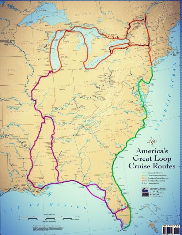
Key West is so much fun that if you are not careful you wont ever leave. That said we made impromptu plans not to return the way we came and instead take a route east up the inside of the keys and cross over to the West coast of Florida. Our float plan for the next few days includes anchoring at these locations: Crane Key, Shark River in the Everglades National Park, Big Marco River, Sanibel Island, Fort Myers Beach. Once at FMB, our plan is to cruise down the Caloosahatchee River, crossing lake Okeechobee and East out the St. Lucie River to Stuart, FL where we will rejoin the Atlantic ICW. We are excited to traverse the Okeechobee Waterway.
The Okeechobee Waterway is just a small segment of the Great loop. The Great Loop is route Kelly & I plan to traverse possibly this Fall or next year. The Great Loop takes you down through the middle of America via the river system. It’s an opportunity to see the heartland from the banks of the rivers.
We understood that many of the anchorages we would spend time at would be off the grid, ie. no cell phone reception or places to get fuel, water, ice, groceries, etc. Step one was to re-provision the boat. Kelly keeps lists of what the boat needs for food and supplies so we took the dinghy in, grabbed an Uber and it was off to Winn Dixie for some groceries. It was particularly windy and the ride back with a dinghy full of groceries was a wet one with sea spray blowing over the bow, which was weighted down with beer and food.
We let go of our mooring line in Garrison Bight Mooring field around noontime and navigated our way out a narrow channel on the North side of Key West called Calda Channel.
The “color of the water” is a phrase I keep saying here in Key West. I’m just not used to seeing such bright greens and blues.
We followed a route that kept us in the deeper water for ease of navigation until we passed Cudjoe Key where we turned into Cudjoe Channel to navigate over the 5-6 foot depths to Crane Key. The Cudjoe Channel entrance daymark and buoys were missing, forcing us to keep an eye on our location to the shallows.
Crane Key turned out to be just a small key with scrubby, low vegetation. As the sun went down it was time for refreshments on the bow.
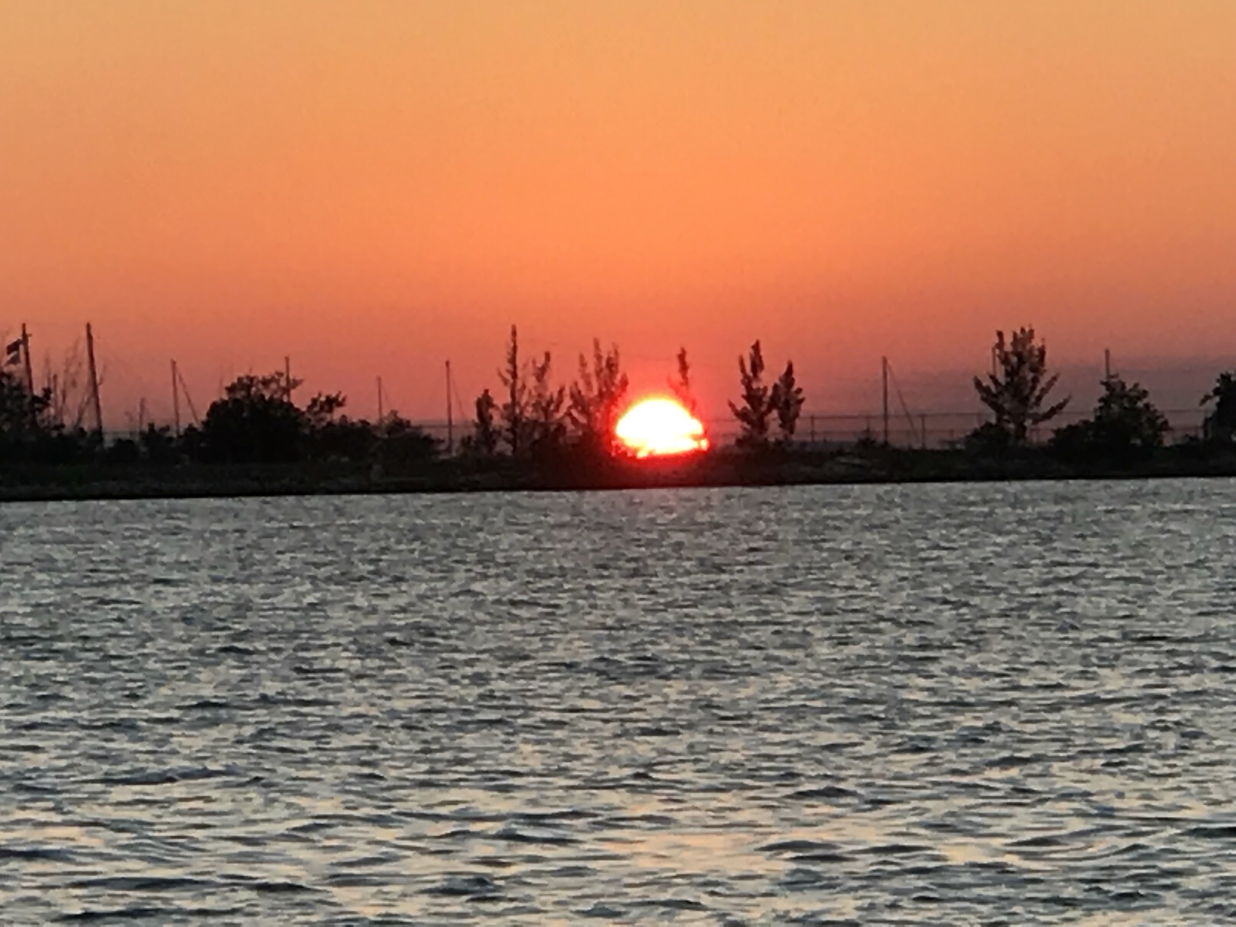
As the sun set, the 98% full moon rose. It seemed so bright in this remote location you might mistake this picture taken at 8PM as the sun.
Very early the next morning I snuck out on the back swim platform to do some night fishing under the moon streak. Luck had it and I caught a few fish!
We tossed this beast back into the sea and then began the “What kind of fish was that?” research. Thankfully, the internet is full of webpages as well as smartphone apps that help with this.
Identifying the species is just the first step. Next you need to figure out the fishing regulations for the state you are in. Size restrictions, open/closed seasons, etc.
I search the Apple App Store and found a great app called “Fish Rules App”.
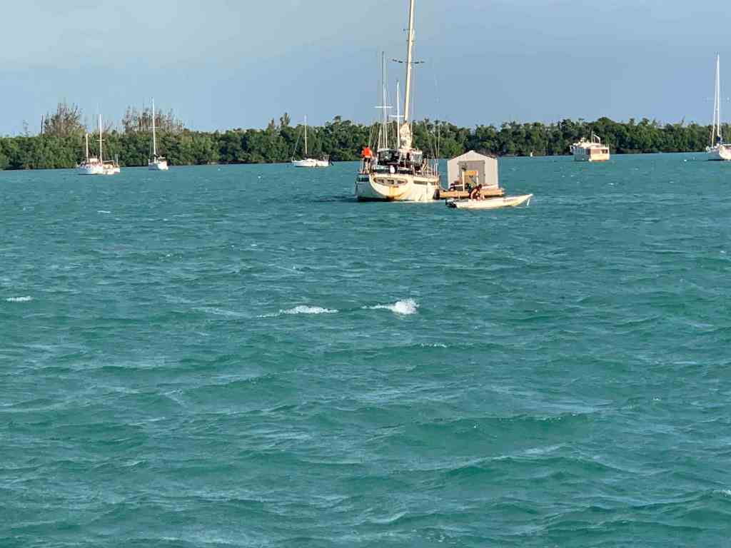
The trip down to Key West was full of things to see. It started with an overturned vessel. We saw a diver in the water possibly attempting to flip it? Hope nobody was injured?
There was a diver in the water hooking lines to the overturned hull
As we got closer to Key West, the water became a beautiful green-blue color.
We passed SV Toucan, a 40’ Manta catamaran underway and hailed them on the VHF offering to take some pics of them. Capt. Elizabeth thanked us and returned the favor.
The crew of Toucan would later invite us for a “Sundowner” which is live-aboard speak for why don’t you dinghy over to our boat just before the sun sets and we’ll do drinks and appetizers. They were terrific hosts and I enjoyed getting a tour of their amazing catamaran. If I get a copy of the selfie we took, I’ll post it here.
MV Simple Life underway to Key West
SV Toucan Underway
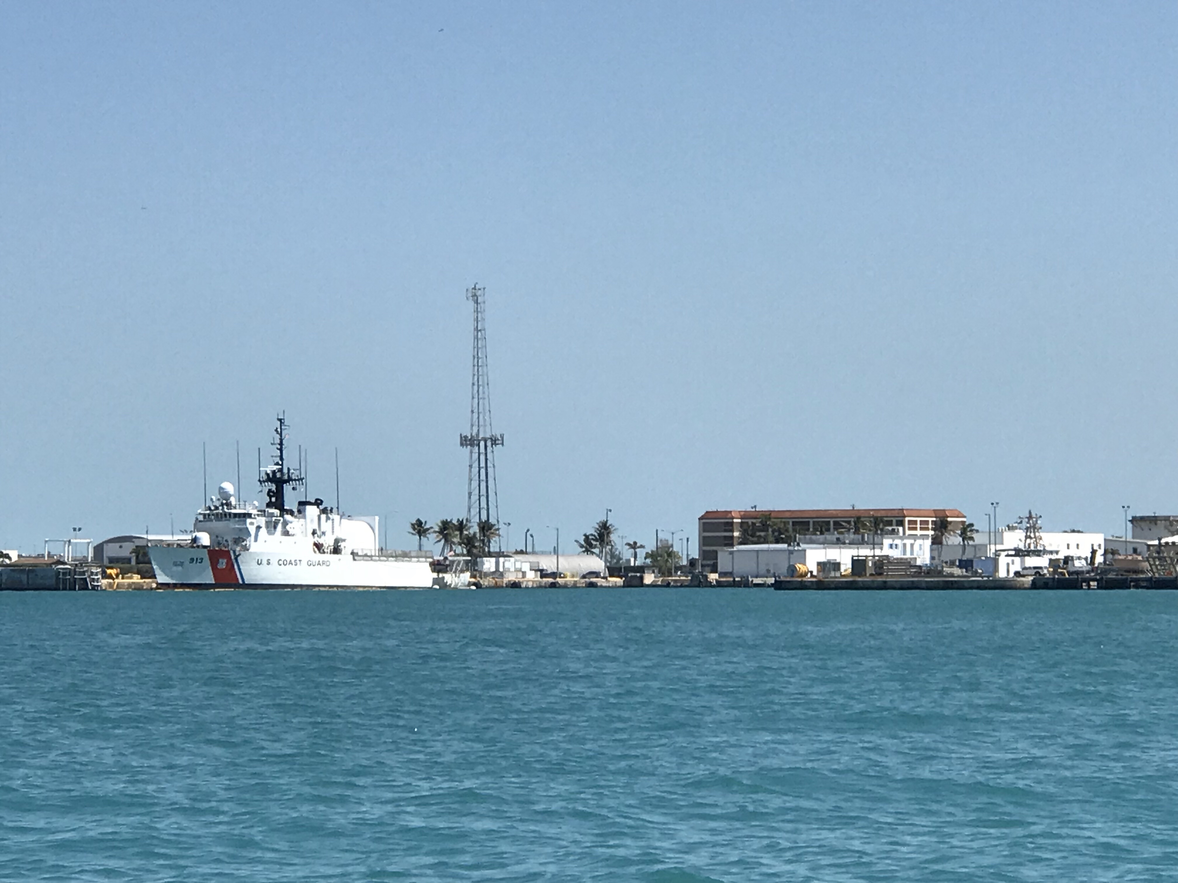
When you approach Key West from Hawk’s Channel (ocean side) you see sights such as huge cruise ships underway in the channel and others docked.
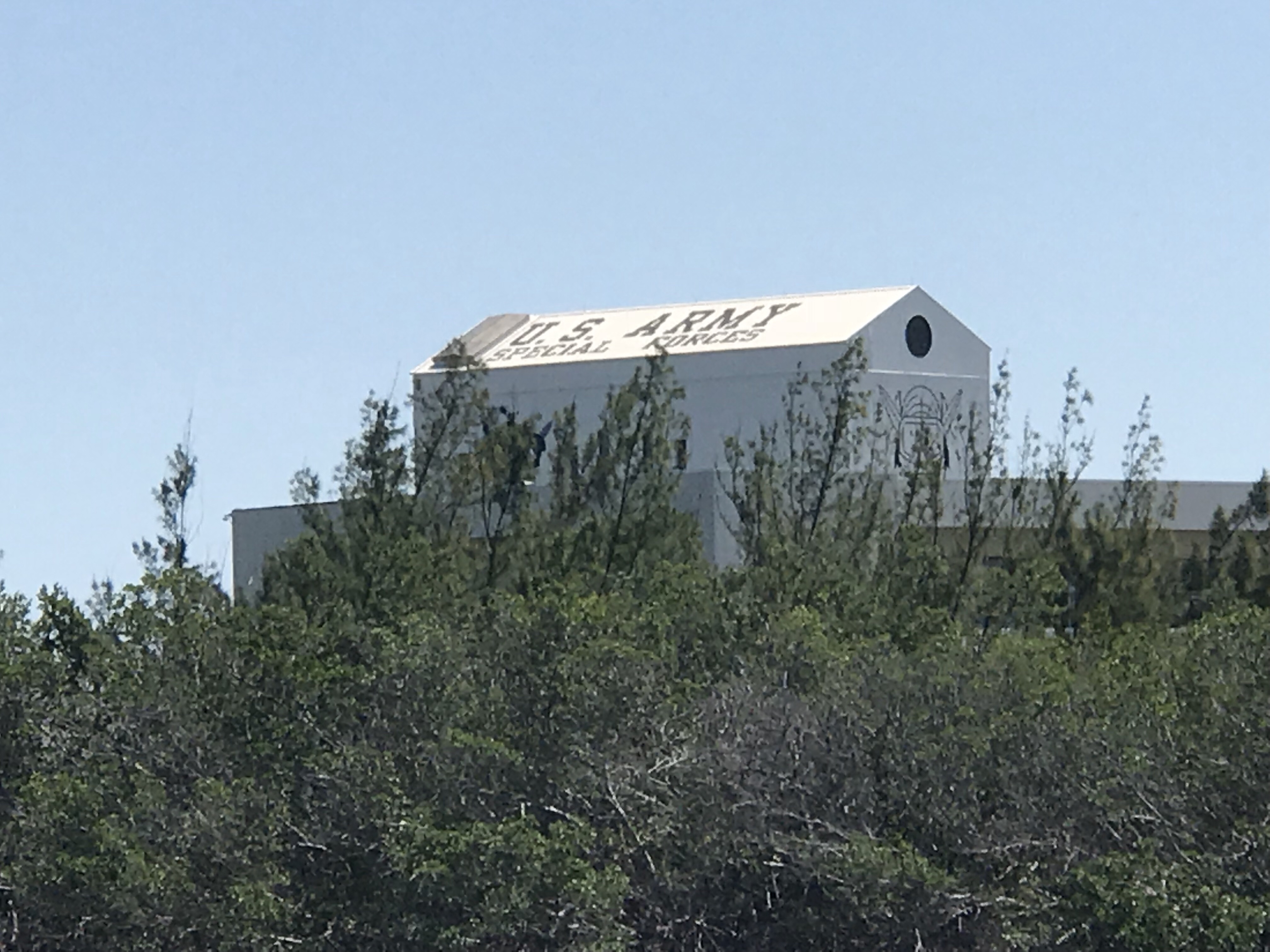
US Army Special Forces Underwater Operations building logo
US ARMY Special Forces
At one point a couple of inflatables with Army Special Forces motored by.
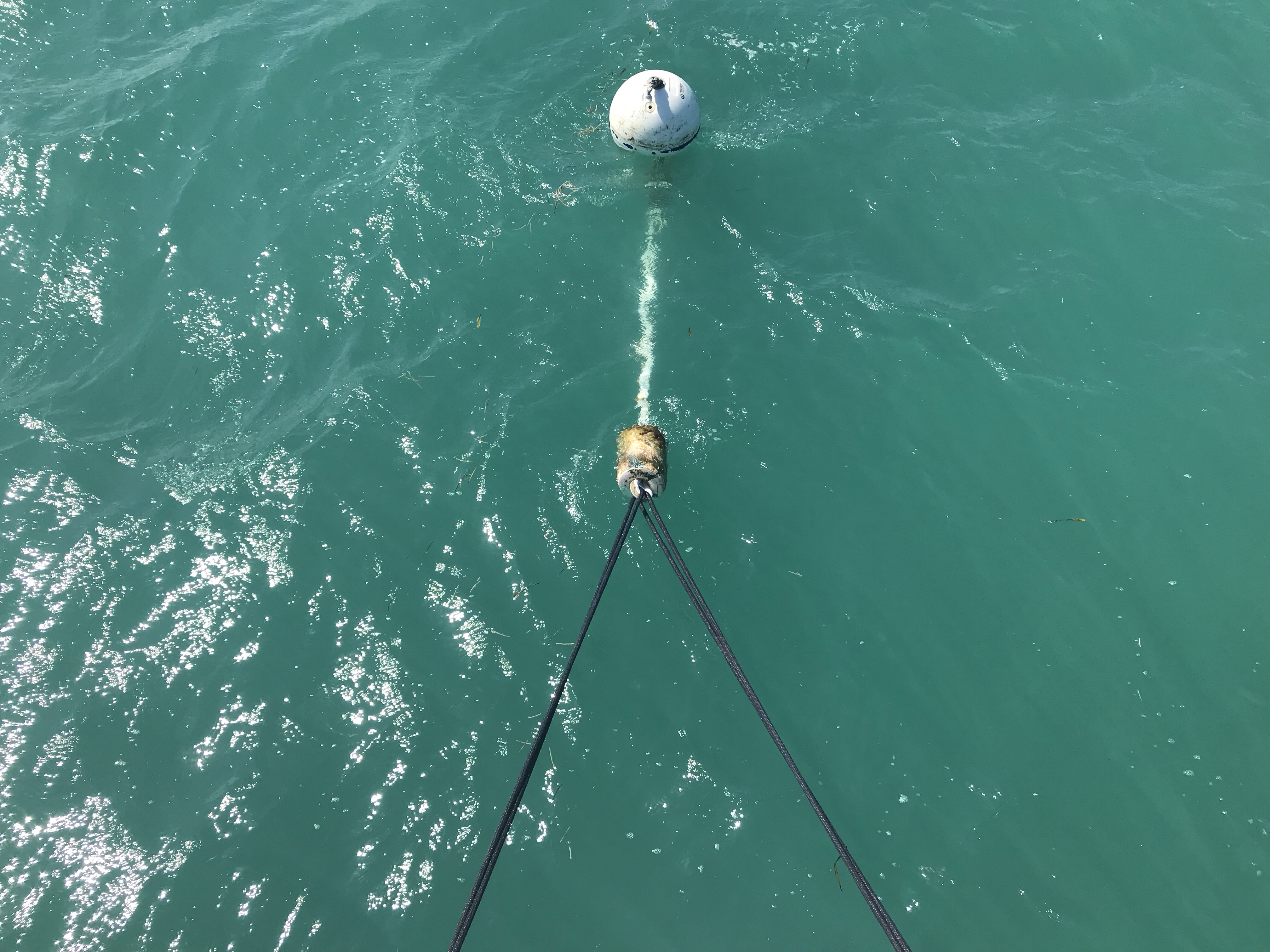
We grabbed a mooring ball in Garrison Bight Mooring field rather than fight the crowds in the different anchoring locations. Garrison Bight is the only real transient mooring field that I am aware of here in KW. The mooring field is run by Key West City Marina. Getting onto the mooring is a lot like in Boot Key Harbor where the mooring ball has a short pennant line that comes up from below the ball (rather than on the top of the mooring ball as it’s better to keep the scope angle low leading to the mooring anchor itself). Up North in Rhode Island, most mooring ball pennant lines are mounted on the top and have either a single long pennant line or a single that spits into two lines with loops for throwing over your bow cleats. Here in Key West the mooring pennant line is very short with a thimble that you must thread two of your own dock lines through. They ask that you keep a minimum of 10 feet between the boat and the thimble. The winds can really blow down here and they don’t want you short tying to the ball and potentially dragging the mooring anchor.
Dock lines through mooring pennant with thimble at end
Once tied up it was a bit of long dinghy ride into the marina office which is located in a different location than the transient dinghy dock.
Dinking it in to the dock
Key West City Marina Dinghy Docks
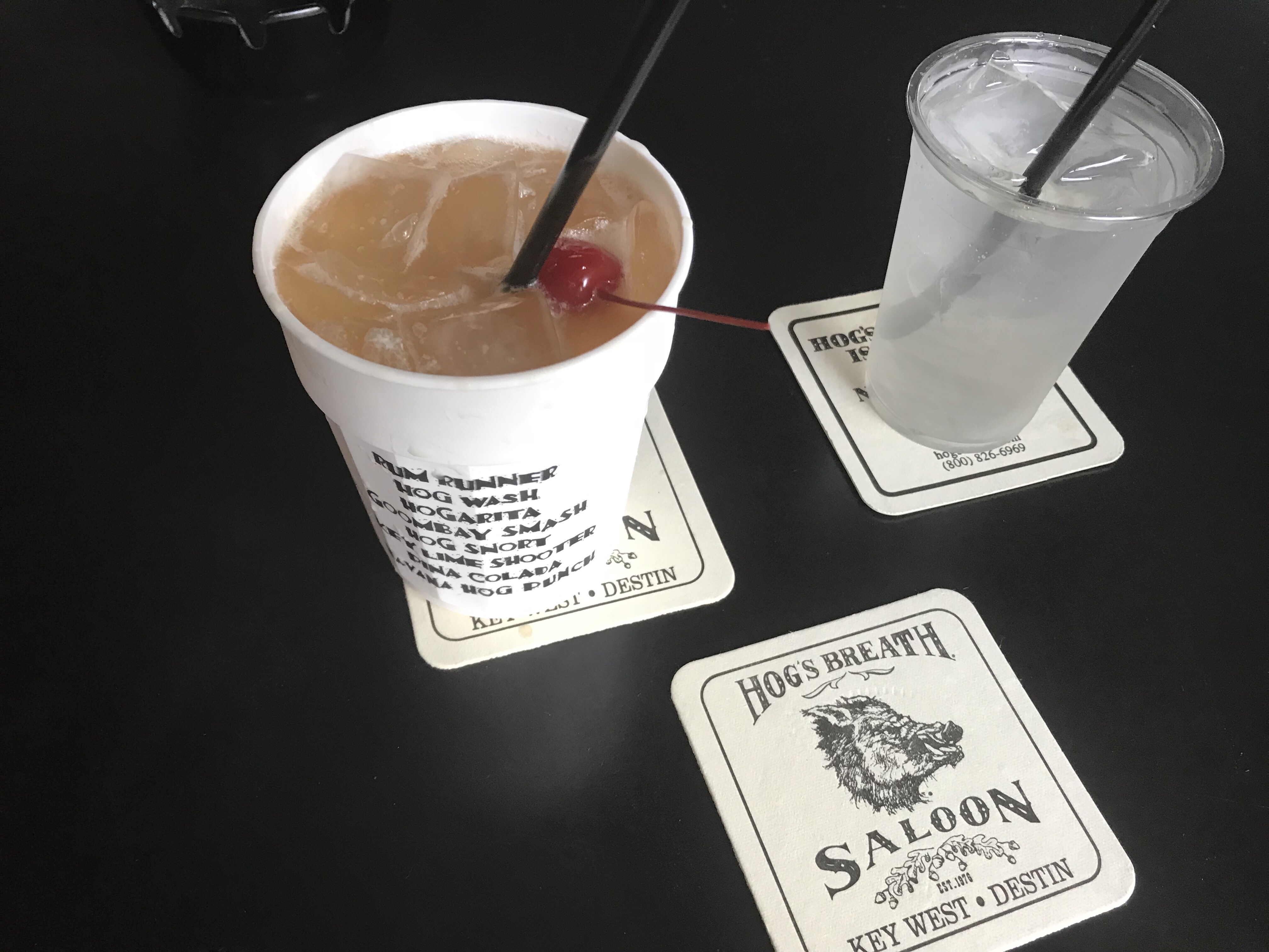
We arrived on St. Paddy’s day so we wasted no time getting an Uber to Duval St. and hitting some of the local watering holes like Hog’s Breath Saloon. Want to see the drink menu? It’s on your plastic cup (not a bad idea). I had to do a Gumbash Smash just to make Danny & Dina smile. (Inside joke)
Hog’s Breath Saloon off the main street
Every bar should do this. Starting at the top…
We found that the Sunset Pier had a good band playing and spent some time there taking selfies and enjoying the cool breeze off the ocean.
Selfies @ Sunset Pier
Don’t you just love a round bar?
We ate at Margaritaville’s and found it was less crowded than adjacent restaurants due to the St. Paddy’s day crowds. The food & drinks were good.
Food was great
The dinghy ride back to the boat was hysterical as we had not paid enough attention to where we left the big boat and we were driving around in the dink trying to find Simple Life. Fish were jumping out of the water as we skimmed over the shallows at high speed.
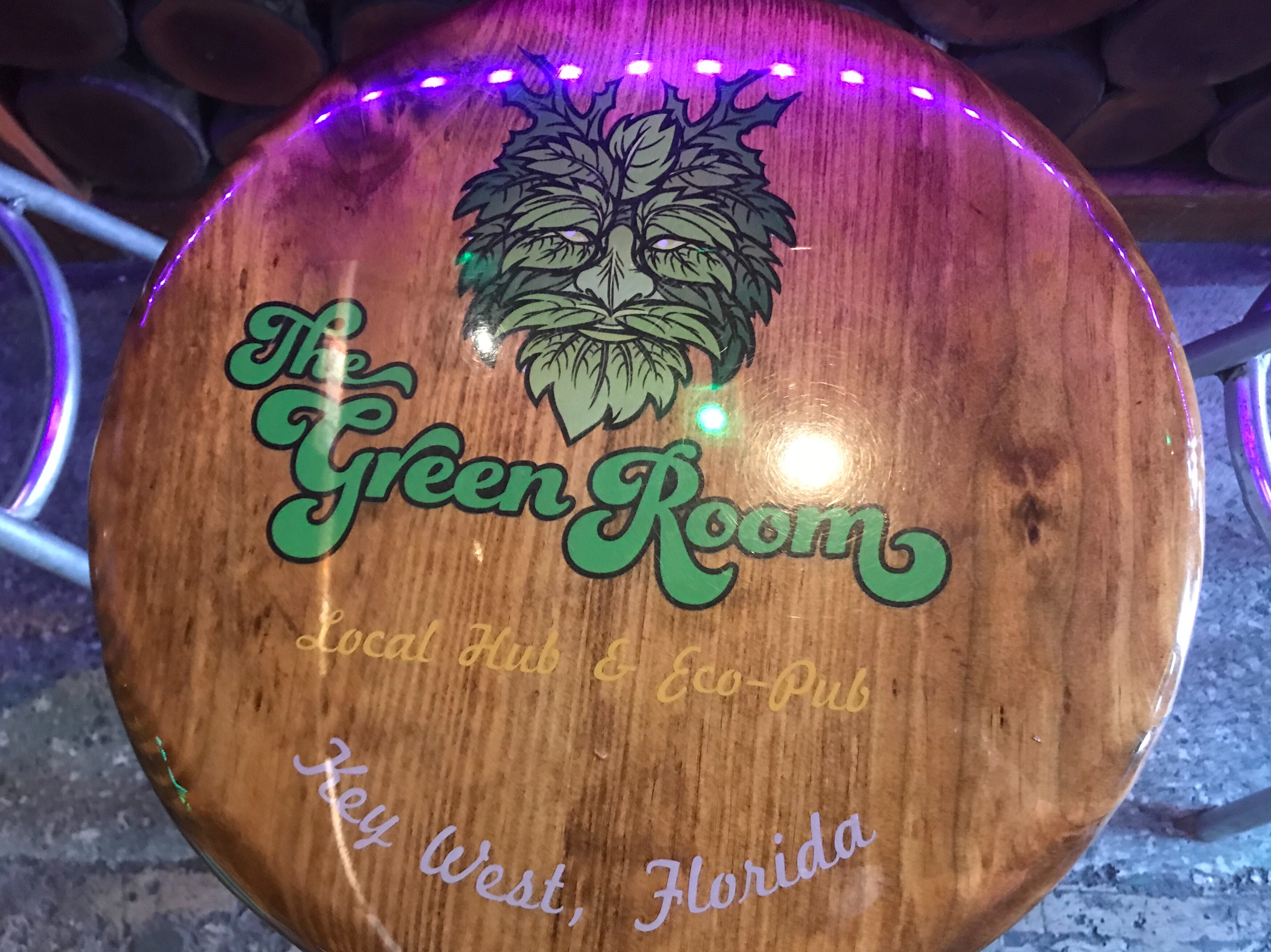
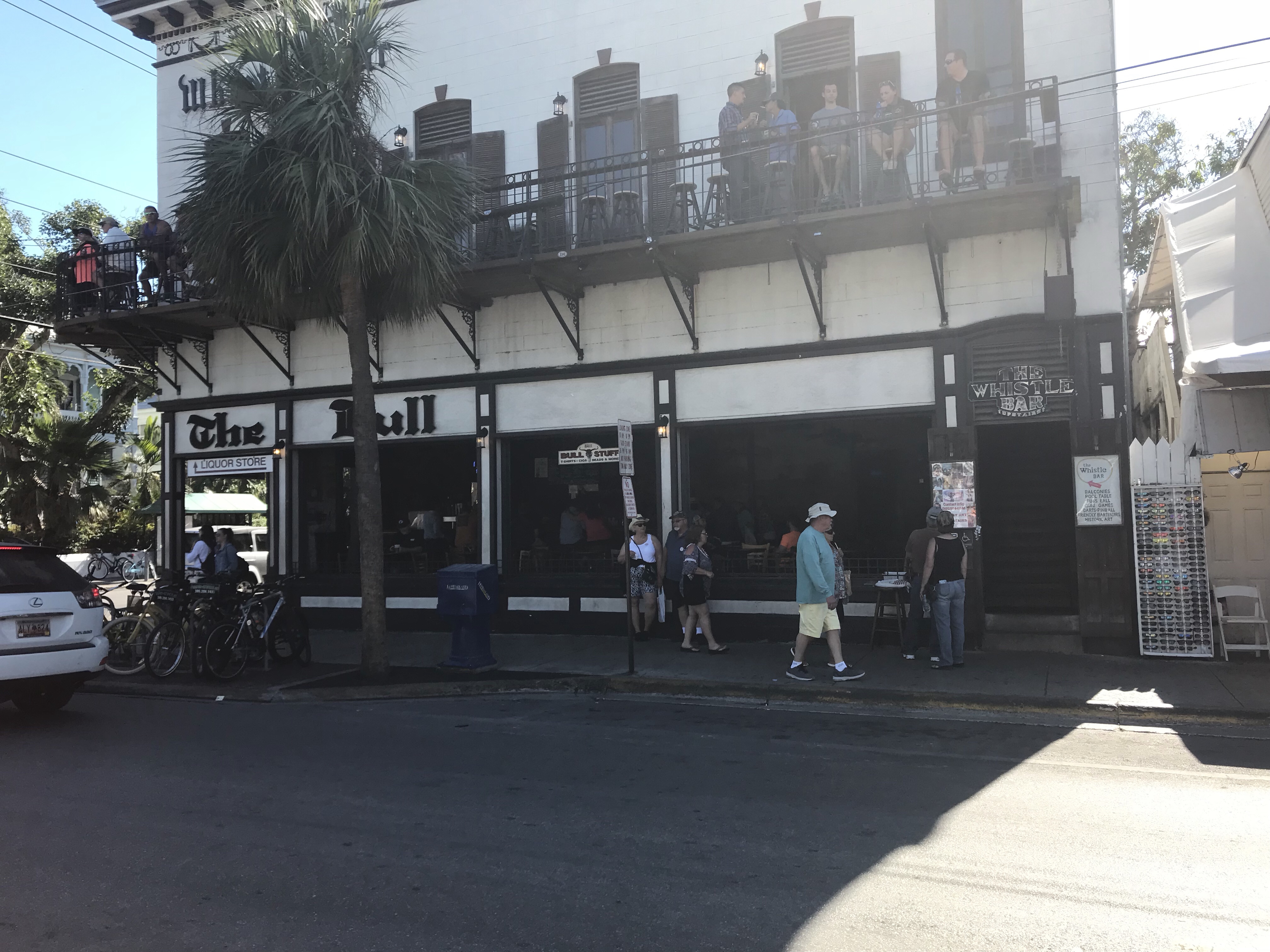
Is it the “Whistle Bar” or “The Bull”? – Branding issues?
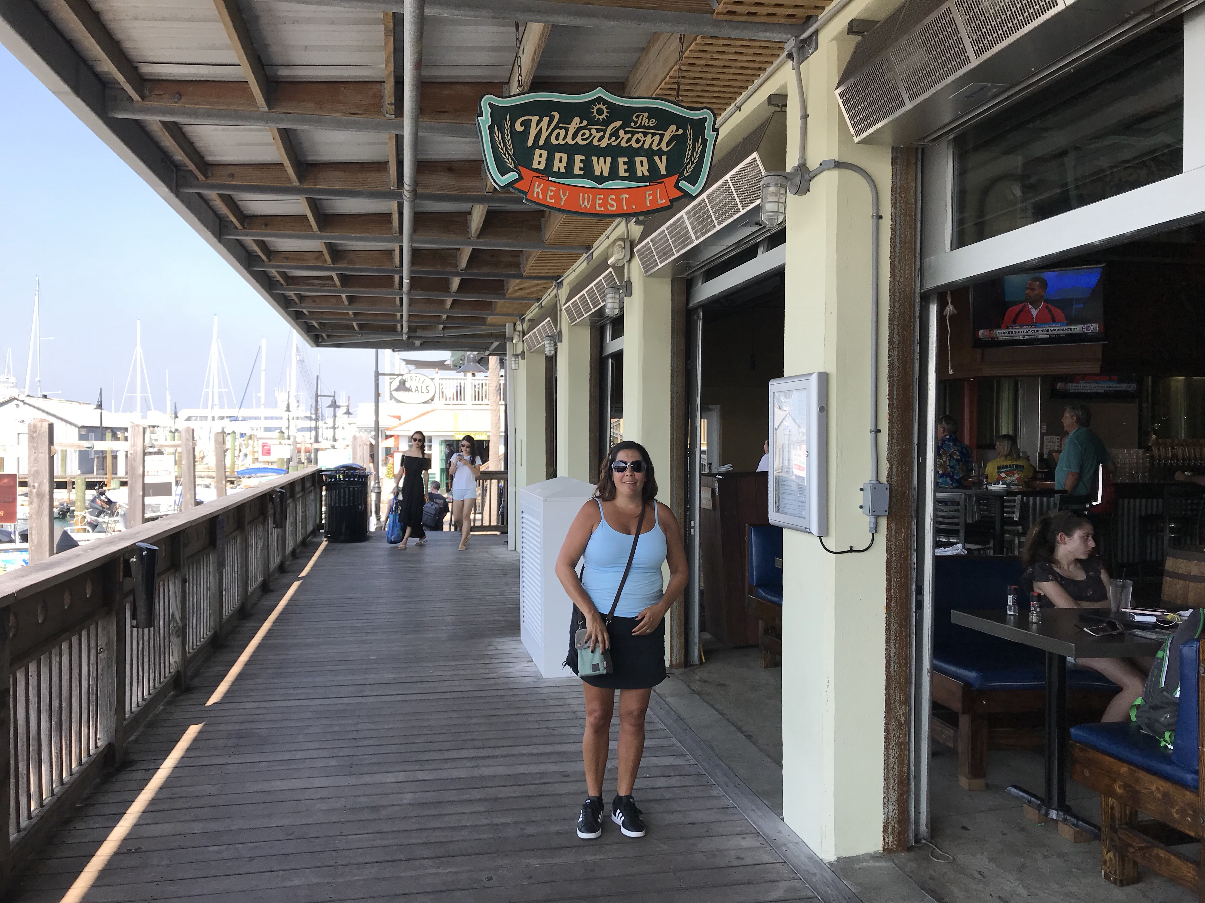
We joined the 1st ever Key West Cruisers Net Social at Key West Waterfront Brewery (right on the water). We had lots of fun sharing drinks and stories with other live-aboard cruisers.
They teased me a bit being a live-aboard cruiser on a trawler vs. Sailboat but I like to tease them back a bit 😉
Waterfront Brewery right on the water, nice breeze
Lots of fun drinking & chatting with the other cruisers
We made the first ever Official KWCN Social
Don’t you just love the banter between sailors and those who went to the dark-side?
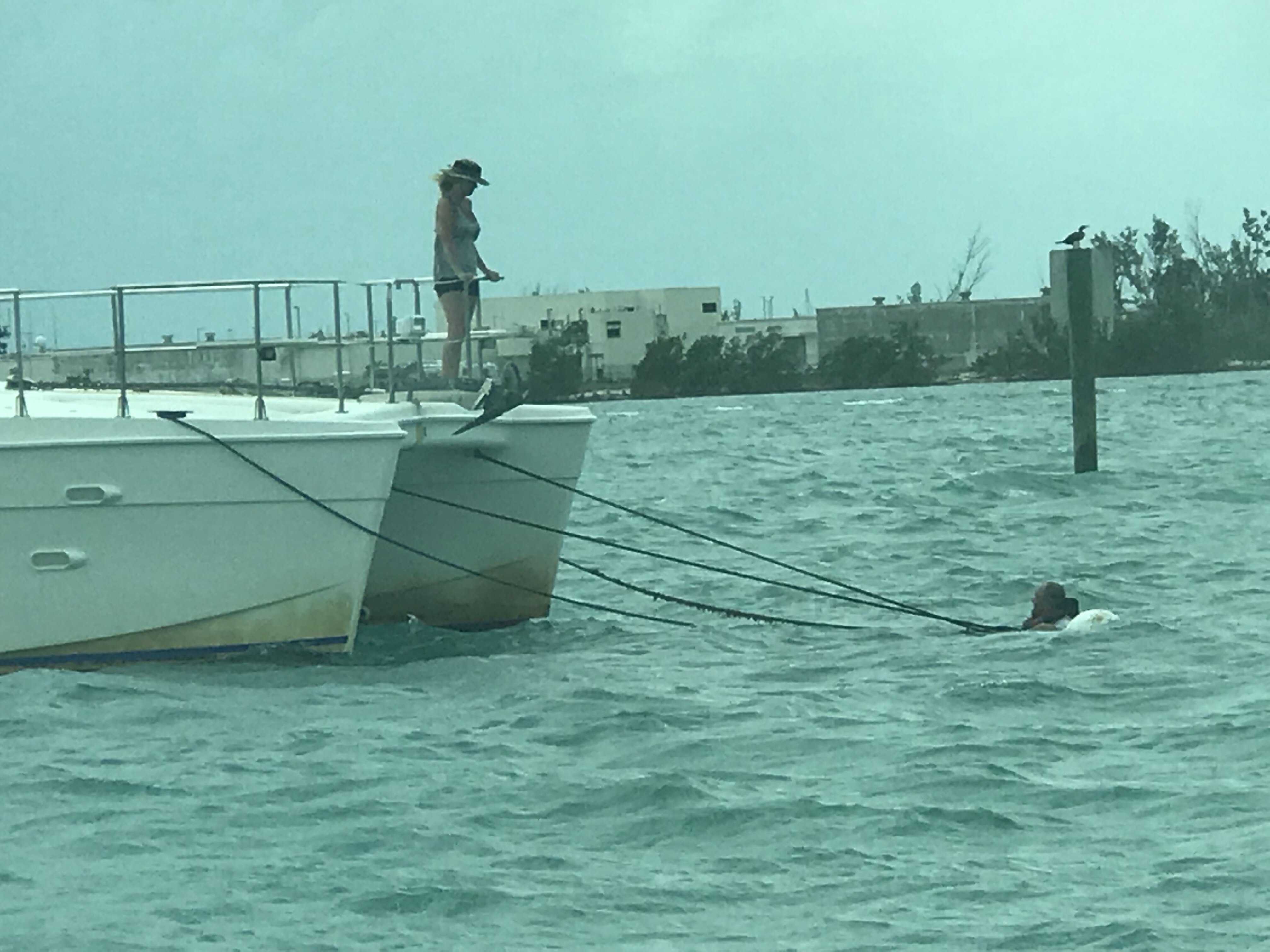
Some nights were dead calm which can get hot aboard without a breeze. Other nights the breeze was blowing in through the hatch and you needed a blanket to keep your toes warm. The funny thing about no wind is… the boats tend to spin randomly rather than all lining up with the wind. Our neighbors on a Manta 44 power catamaran had to jump in the water to untangle their mooring line that was wrapped around their mooring ball.
I offered help but they wanted to fix on their own. He’s a trooper
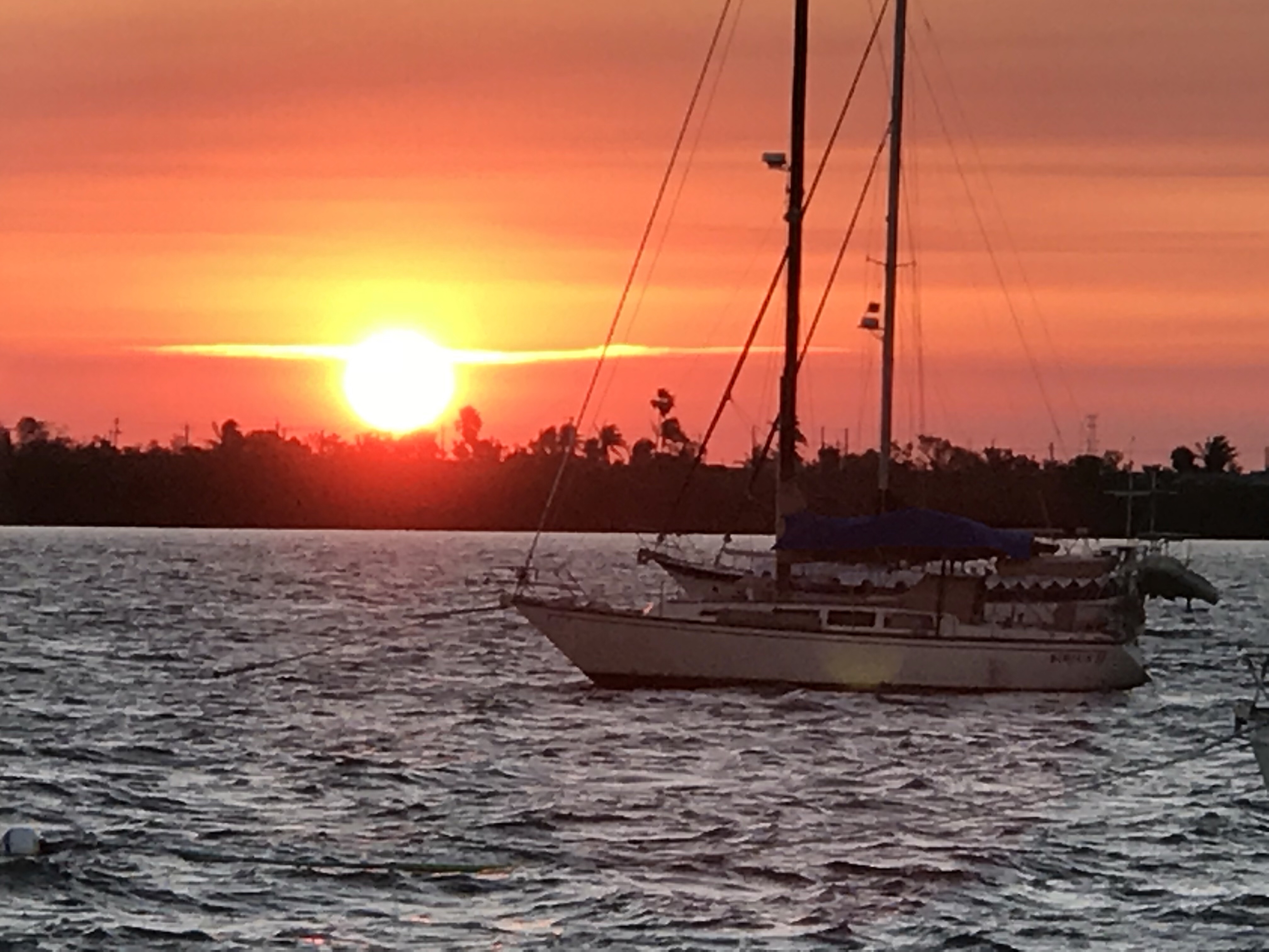
At night we would see amazing sunsets as we relaxed in the aft cockpit with a drink or two.


You must be logged in to post a comment.