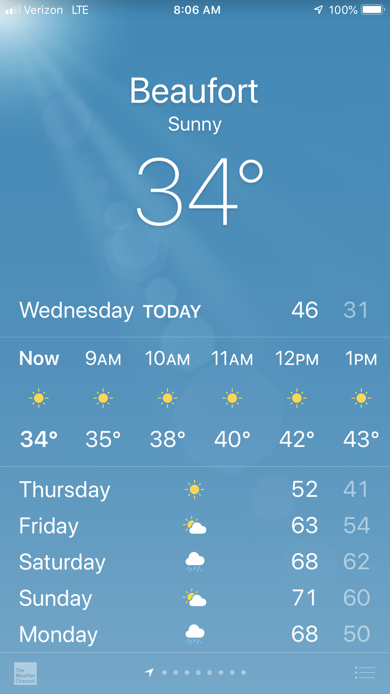
We loved our stay in Beaufort, NC but we awoke to 34 degrees and it was time to leave.
We had lots of fun in Beaufort riding around in the sexy loaner car. The car was green but the door was red. You had to pump the breaks to slow down and it had a death rattle sound as you drove down the road. We loved it. It was FREE.
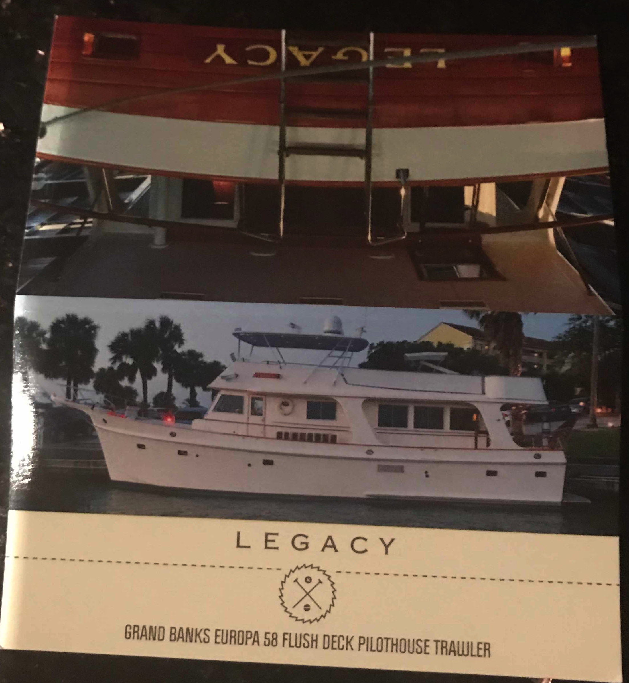
We decided to do a pub crawl through Beaufort but we only made it to the Black Sheep Bar which was 20 feet from our boat. We met Capt. Scott from MV Legacy (58′ Grand Banks). Capt Scott kept us entertained with stories about his grandparents yacht that he was now the captain of. Capt Scott even gave me a tour of MV Legacy when we left the bar and she was very impressive.
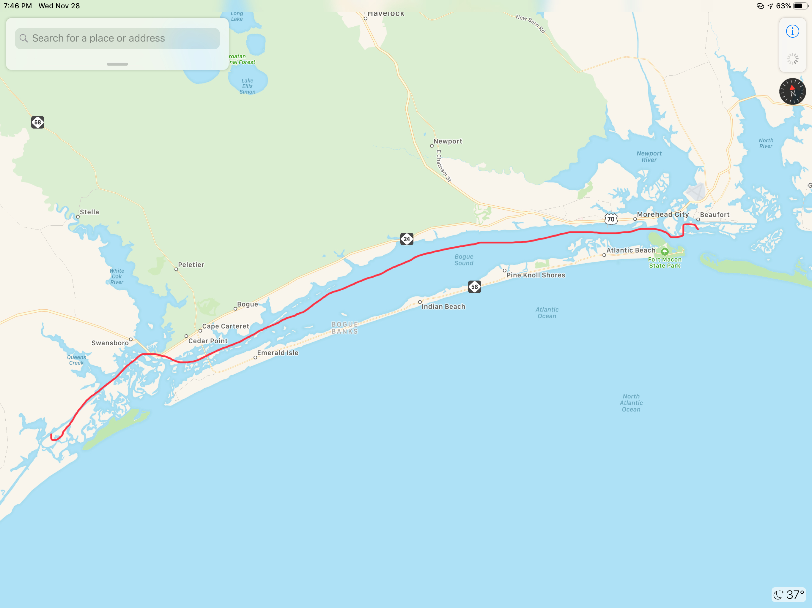
Our GPS tracker was capturing our journey as we headed South. It clearly was not recording where the straight lines are shown but it gives a reader an interesting view of our last few days of travel.
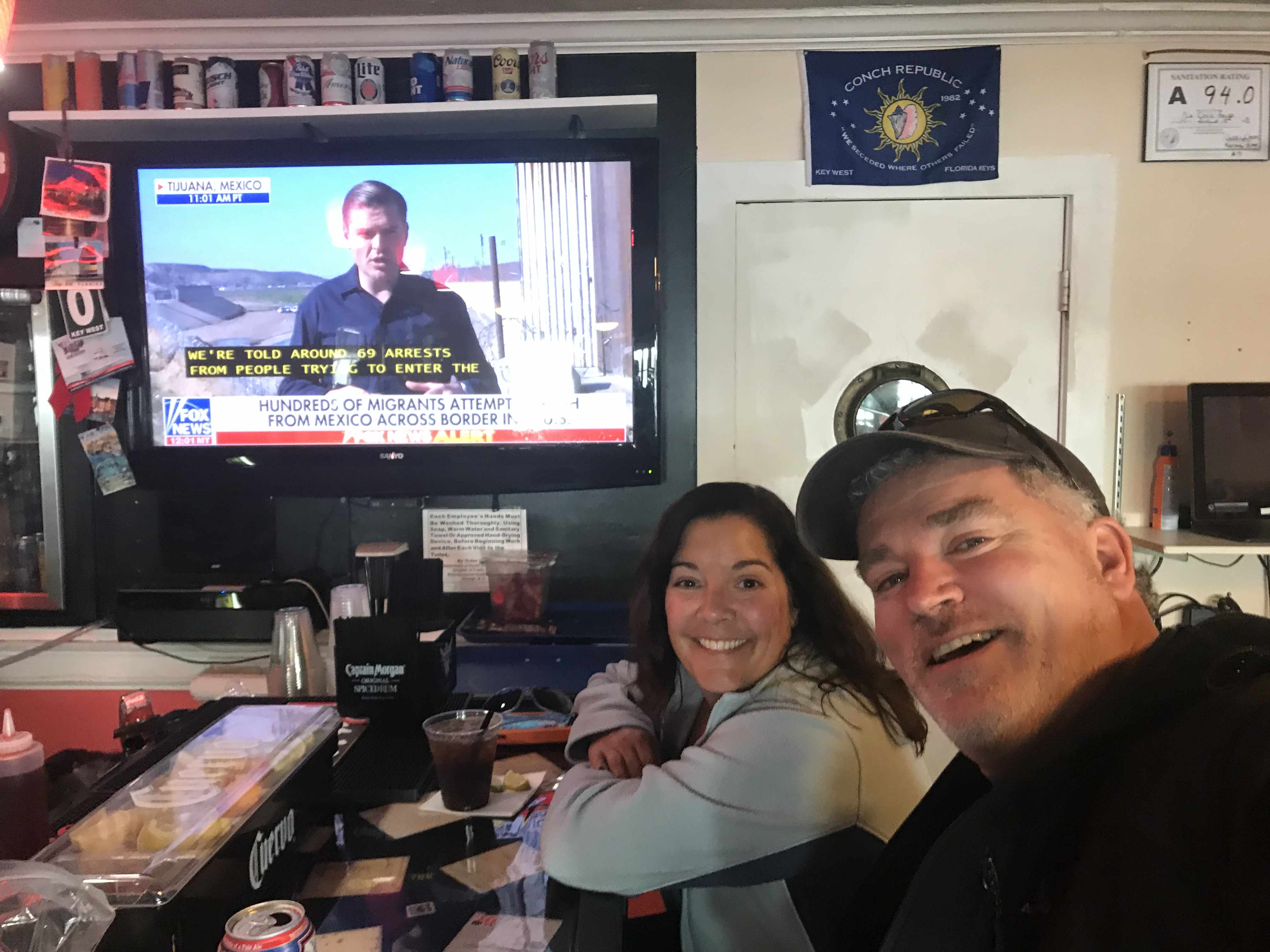
I met another fella who said he noticed my Boston accent as he was also from that part of town. When I said well I’m from Foxboro (home of the Patriots to be exact) he mentioned someone he knew from Foxboro and it turned out to be a childhood friend of mine (Small World). Turns out we knew many of the same folks from back home. I snapped a selfie as it seemed like the right thing to do in the moment.
As we made our way out of Beaufort we passed a buoy tender with two gentleman who looked quite cold.
It was a small craft advisory and the whitecaps were appearing even in the small body of water we were in.
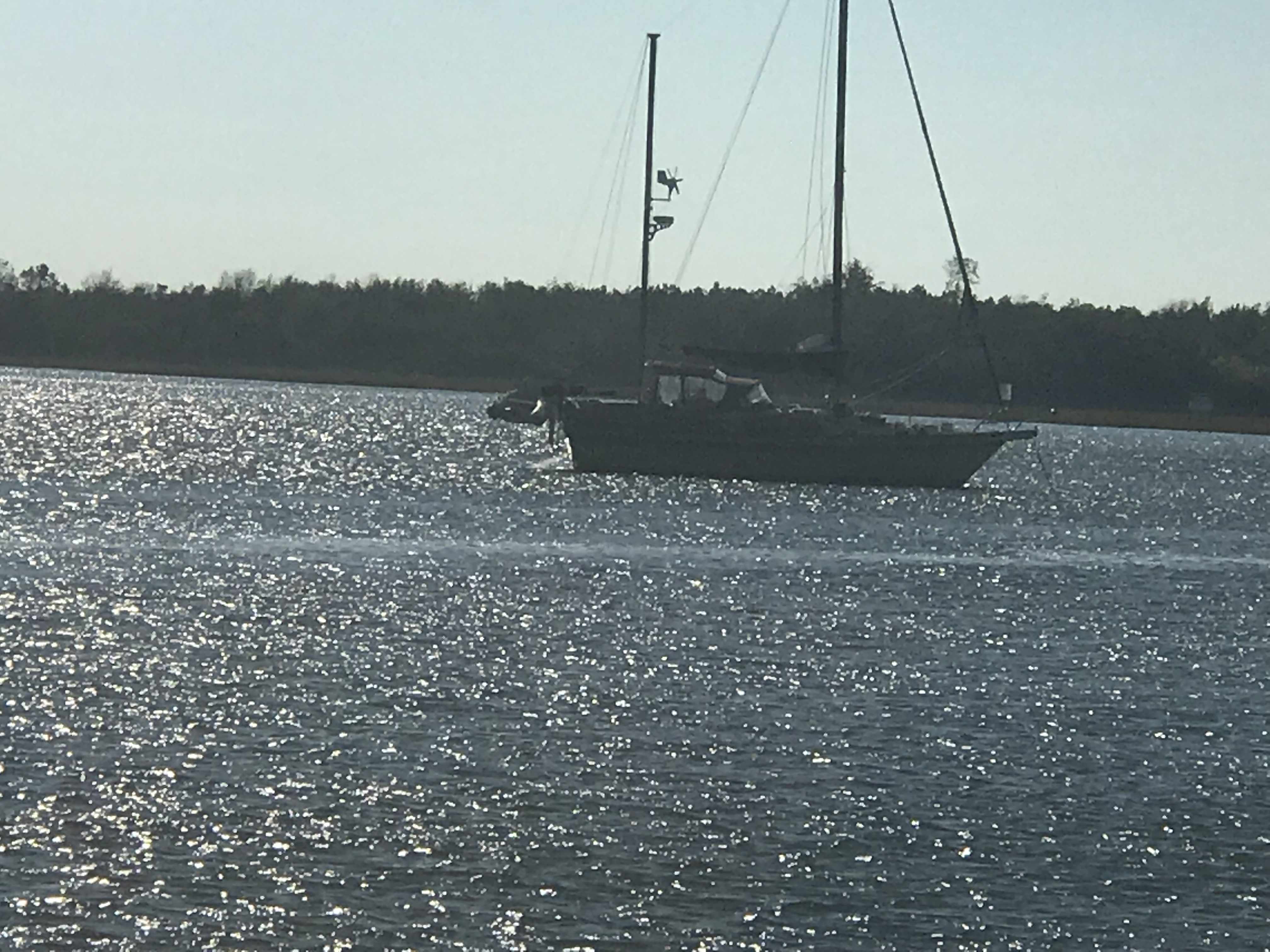
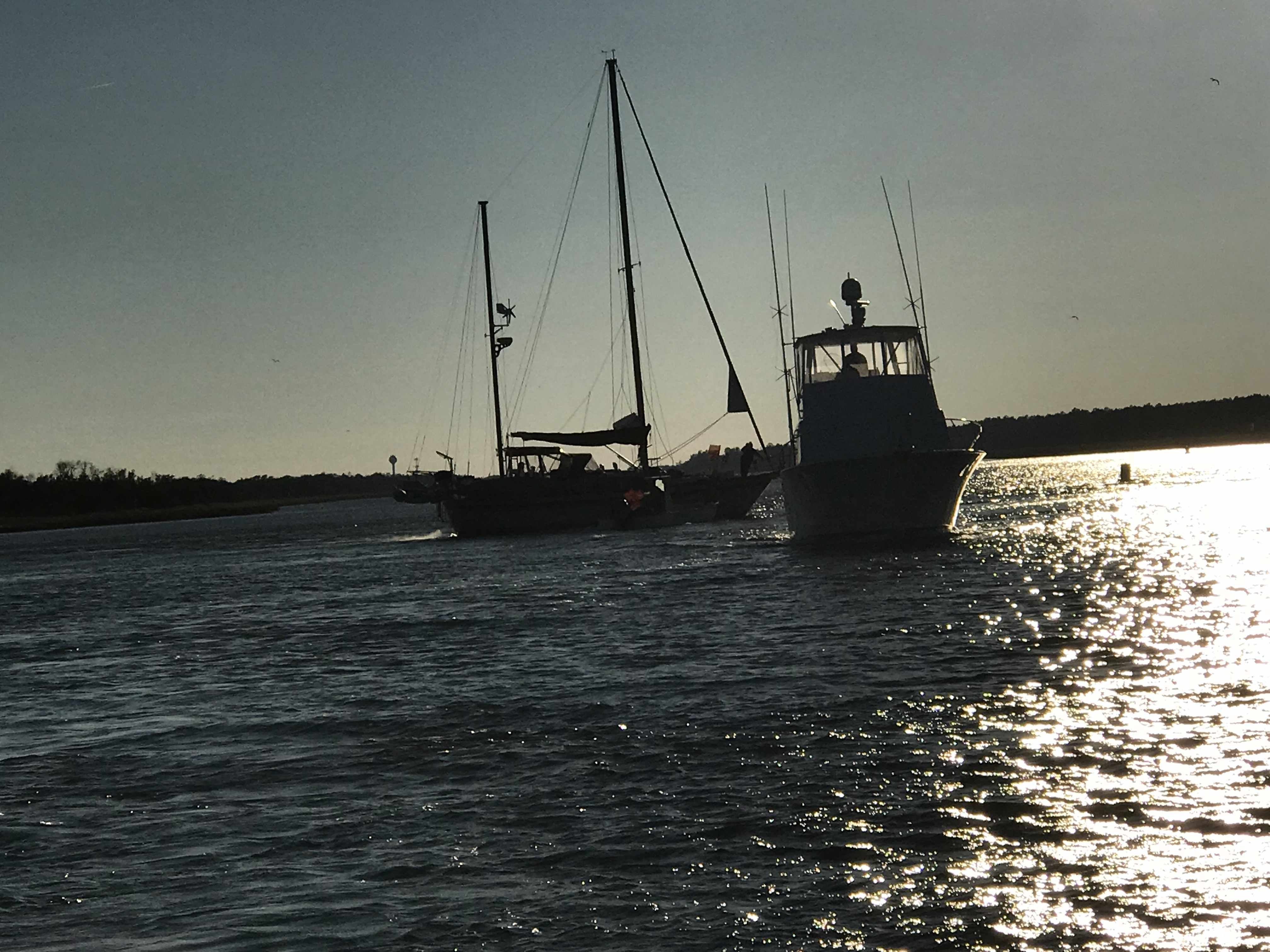
As we made our way down Bogue Sound I hailed a boat that was anchored in the channel. Turns out they were having engine trouble but were not in need of assistance.
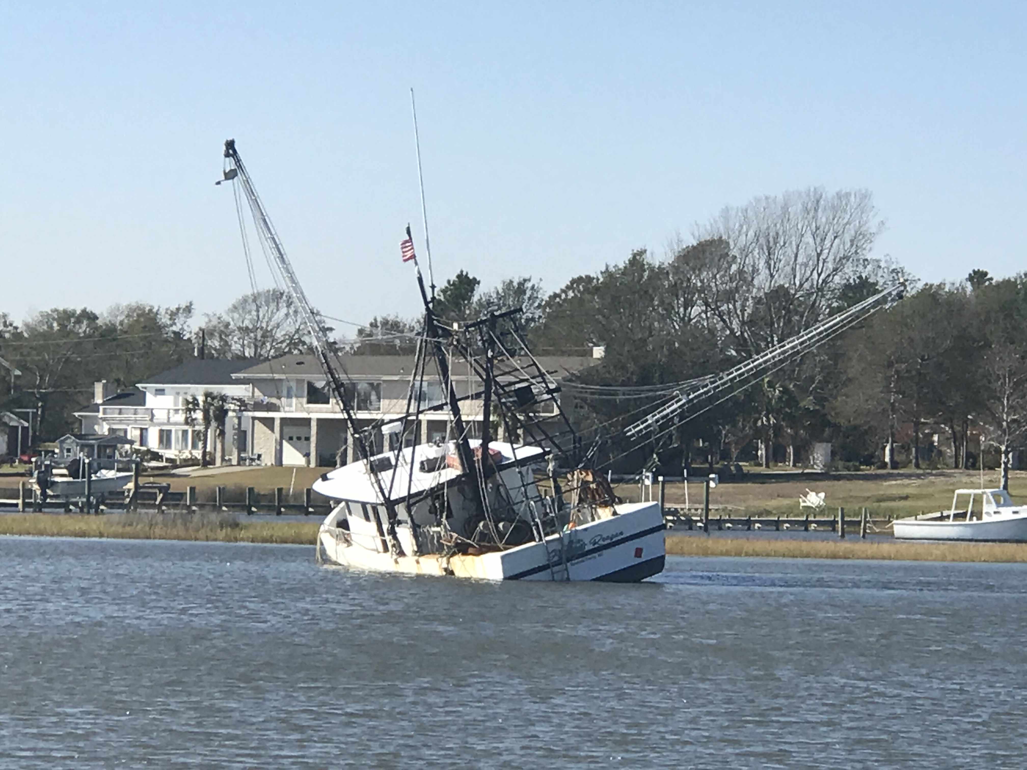
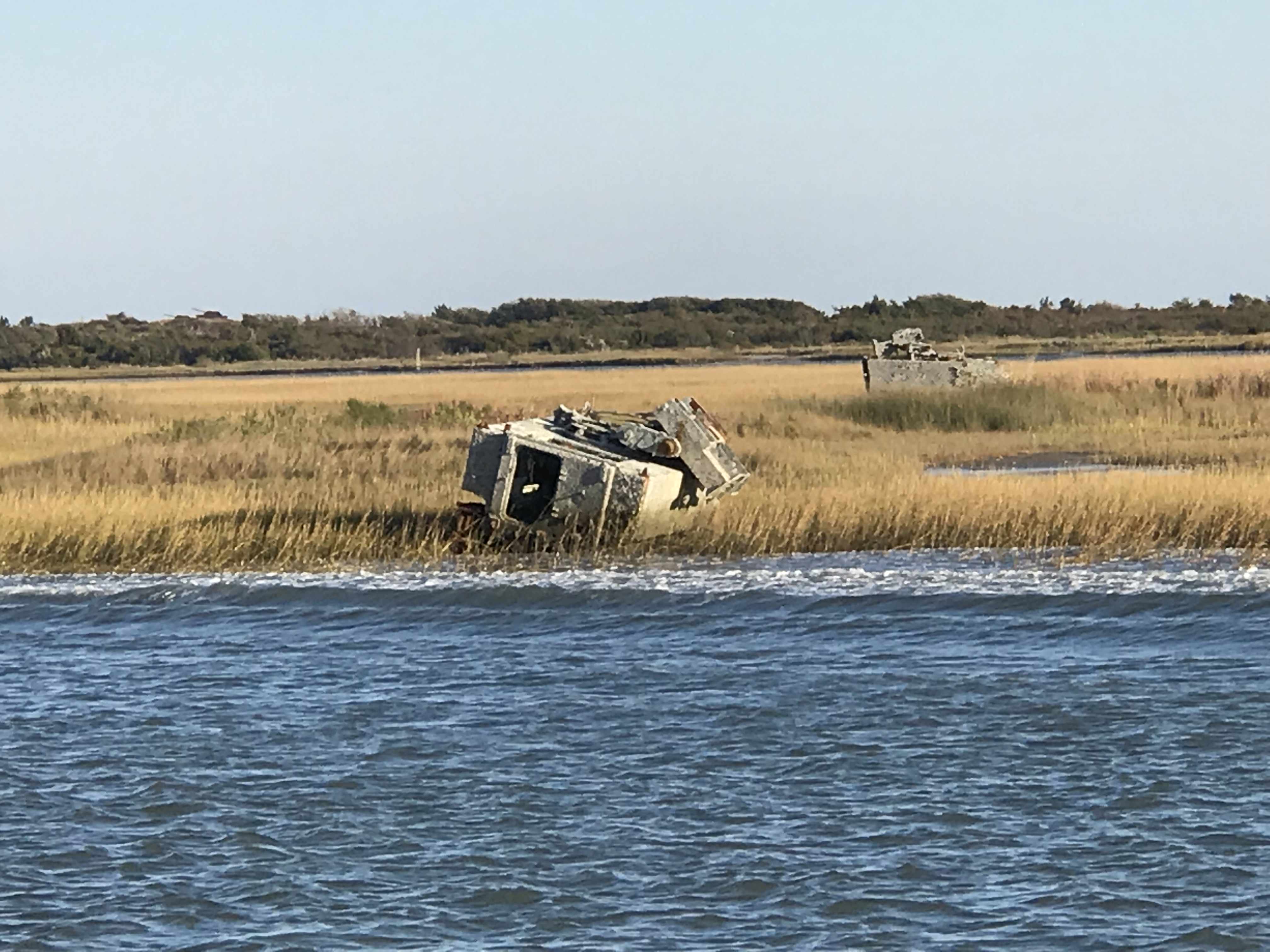
We passed this fishing vessel that had clearly sunk in the shallow waters.
And around the next corner was the Marines Camp Lejeune. They were doing live fire exercises to we were forced to stop and drop anchor.
We dropped anchor believing that no traffic could pass during the exercises but soon a tug boat was passing us on anchor. Maybe he was just slow making his way out of the firing zone?
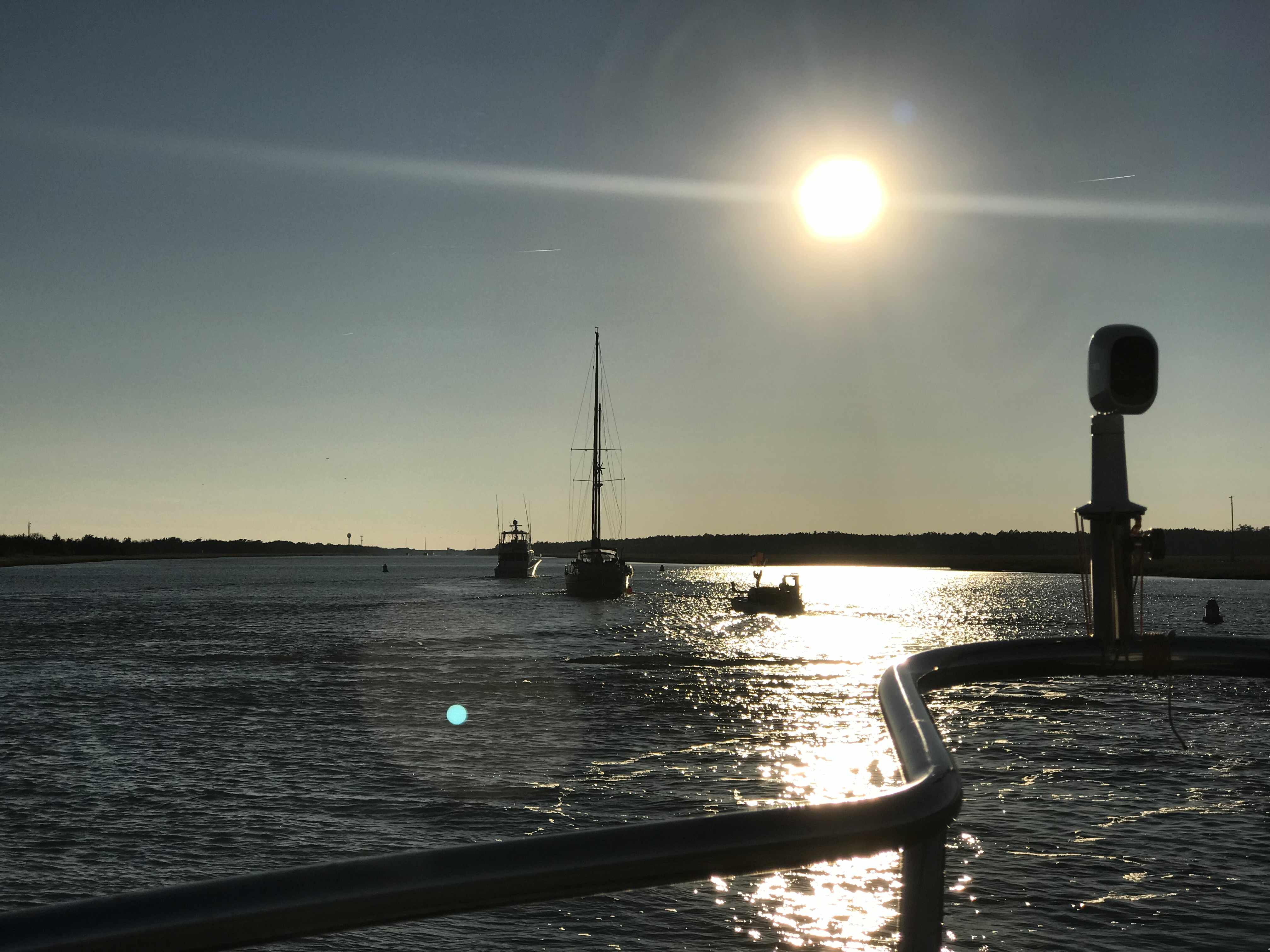
When we were finally allowed to continue down the ICW we and all the other boats were racing to make it to the only decent anchorage within range. You must be careful when you run fast down the ICW because if you run up on a shoal going fast you may not be able to back off of it. Soon the sailboat behind us ran aground and they asked us if we would turn around and come back and wake them as hard as we could to possibly rock them off the shoal that had them stuck. We agreed knowing that it was risky as in order to wake them we’d have to run fast right next to the shoal they were stuck on. We did our best but in the end a local crab boat was the one who deserves the credit for pulling them off.
We were thrilled to see them free as it was still 2 hours away from low tide and if they had not gotten off that shoal quickly they were going to sit there into the night.
As we made our way to the anchorage at Camp Lejeune we passed many bullet riddled targets on shore.
At least until this fellow came blasting through..
Once the morning’s parade of boats down Adam’s Creek began, it was time to weigh anchor.
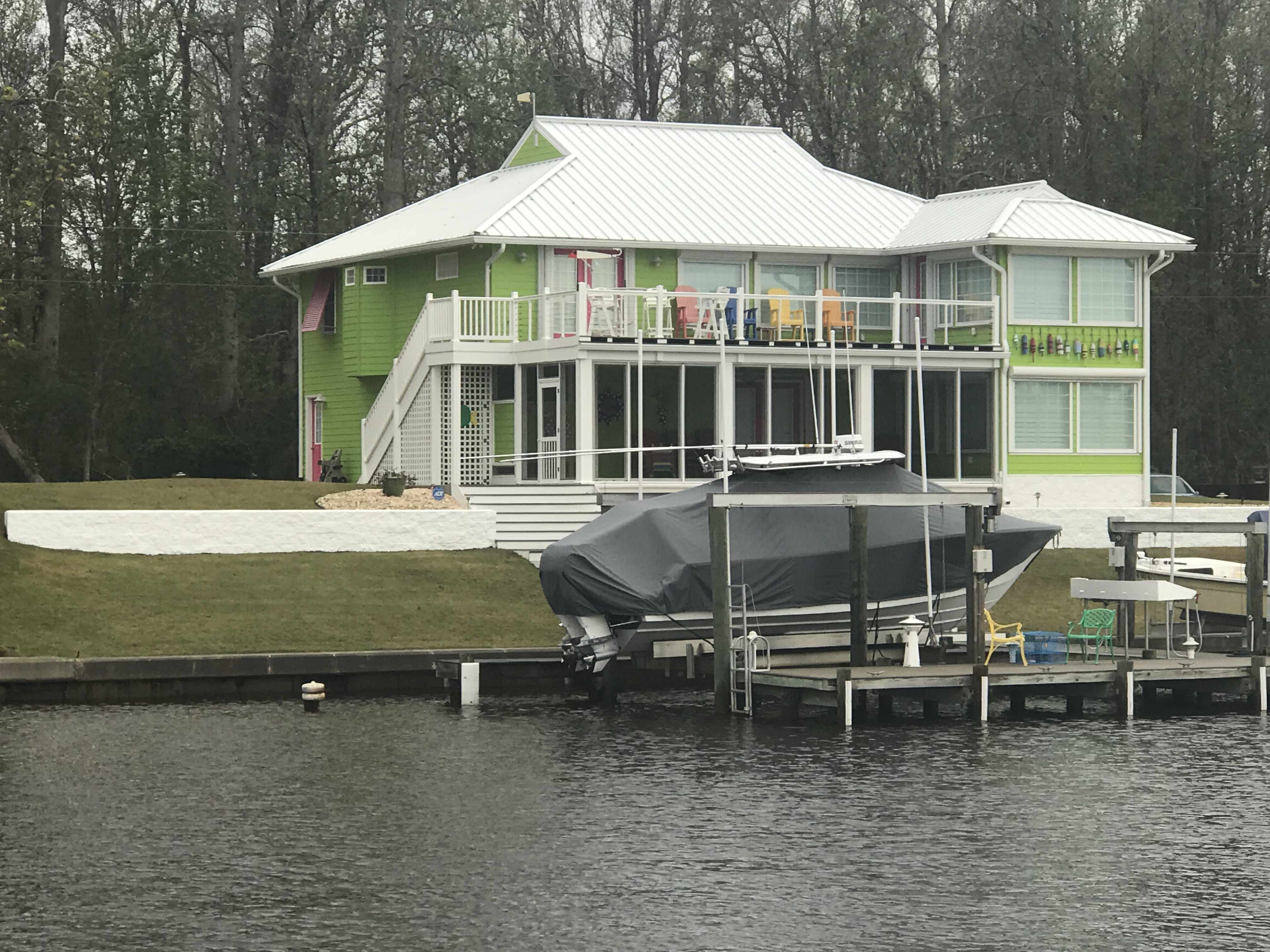
As you make your way down Adam’s Creek you’ll love the beautiful homes and boats along the water’s edge.
House had it Own Helicopter
House Painted Like it’s in the FL Keys
Red Right Returning from Sea – You did it Wrong!
Morning Girl is a Sexy Commercial Sport Fishing Boat
Adam’s Creek Wavy Bottom due to Strong Tidal Currents
Somewhere along Adam’s Creek it turns into Core Creek where we passed more ICW statute mile markers and a derelict sailboat.
ICW MM 195
Delelict Sailboat (no dinghy = nobody aboard)
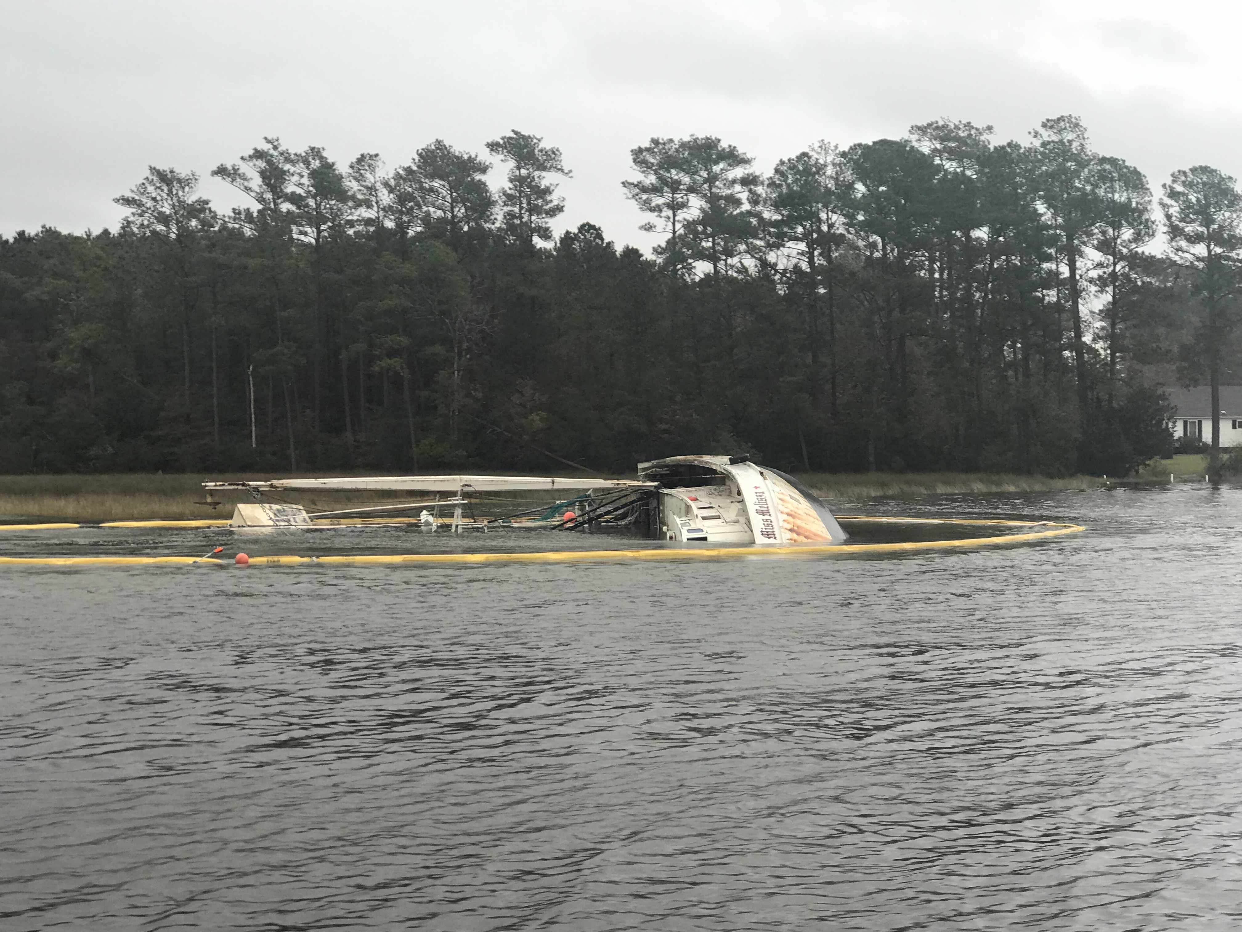
We were aware from the USCG securite warnings broadcasts that there was a 61′ capsized fishing trawler in Core Creek. When I had to dodge floating rope and netting coming down the river, I knew we were close. Then it appeared.
Boom Netting to Contain debris
Resting on her Side
FV Miss Melissa
Soon we were heading into an area called the Newport Marshes named after the nearby city of Newport, NC. This area can be a bit tricky as the channel bifurcates and we stay to starboard. I believe there is deeper water to starboard.
Crabber Working the Marshes in the Rain
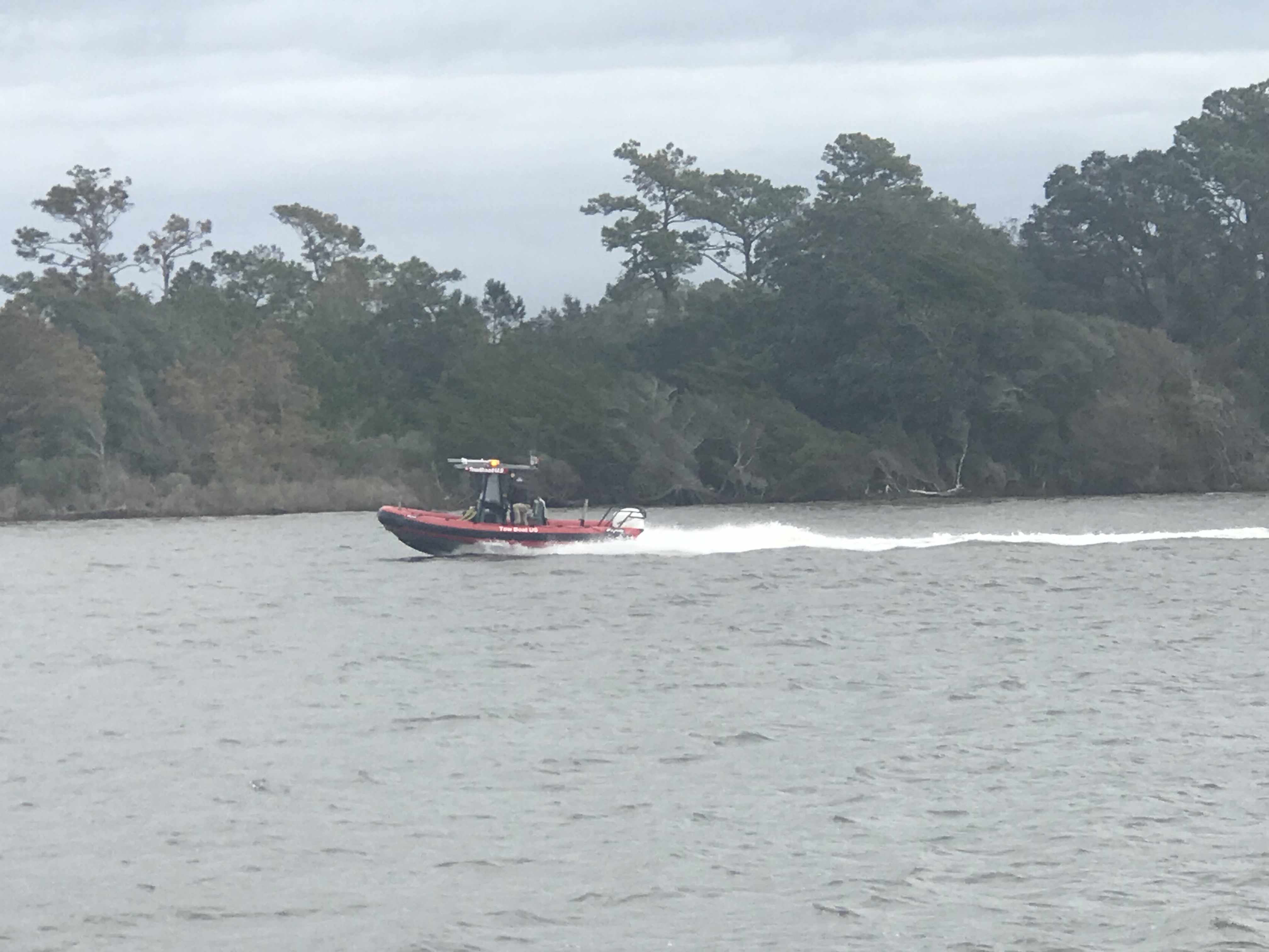
Tow Boat US Racing to Pull a Baot off a Shoal
For a brief moment we had a motoring sailboat attempt to cross our bow from the port-side. We were on a collision course so I gave them a single blast of our air horns to indicate a one-whistle-pass (meaning port to port like driving a car on the road in the US). They did not alter their course so it was time to blast it again! That did it. They waved as we passed and the rain. The rain covered dodger and a crowded cockpit were probably the reason for the distracted captain.
Morehead City, NC was next and the clouds were getting dark with rain and even some lightning strikes.
Near Morehead City NC
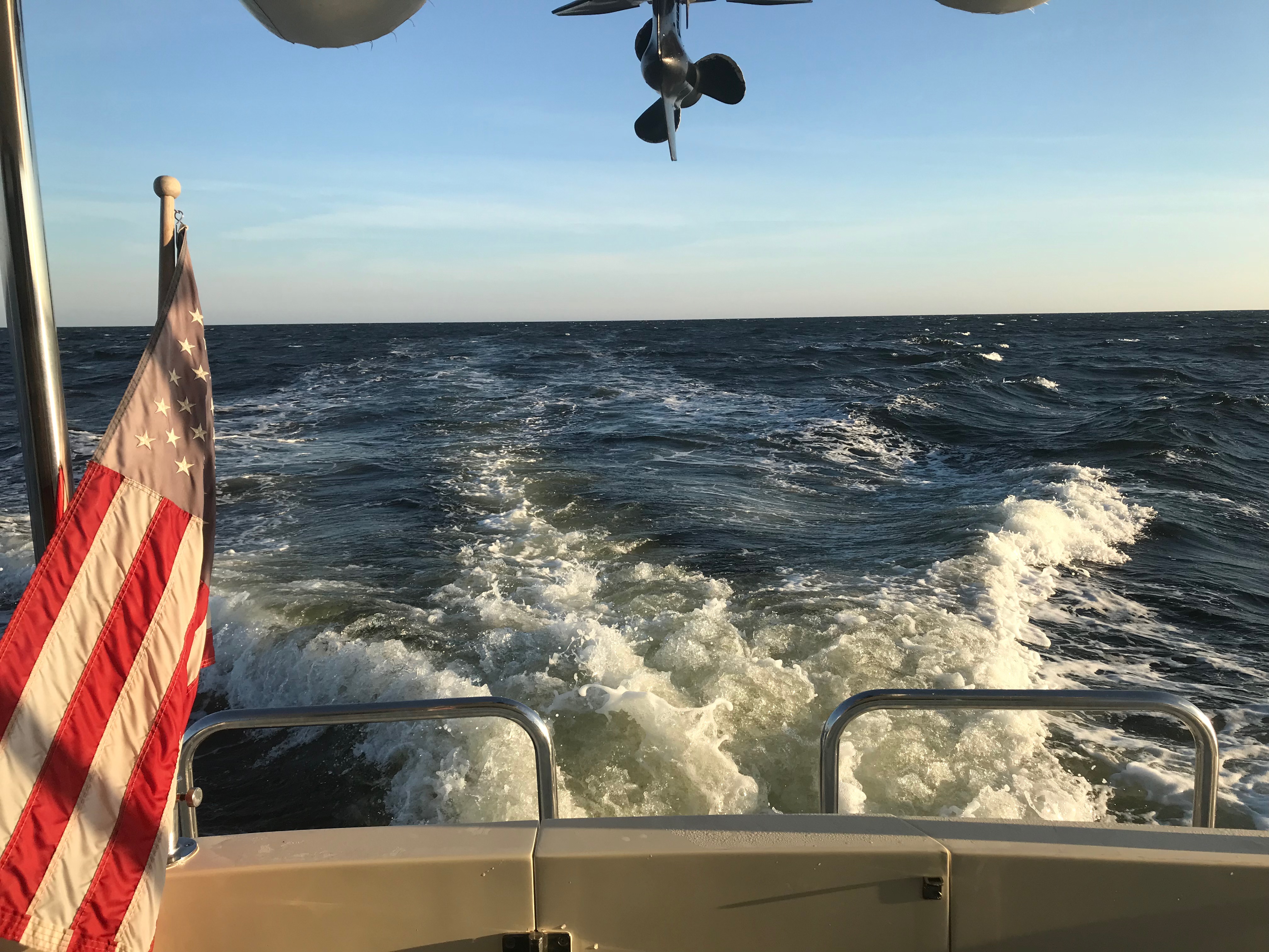
We were fast approaching Beaufort Inlet and the strong wind could be felt. Our rearview camera’s view of our flag atop our VHF antennas showed the flag whipping around.
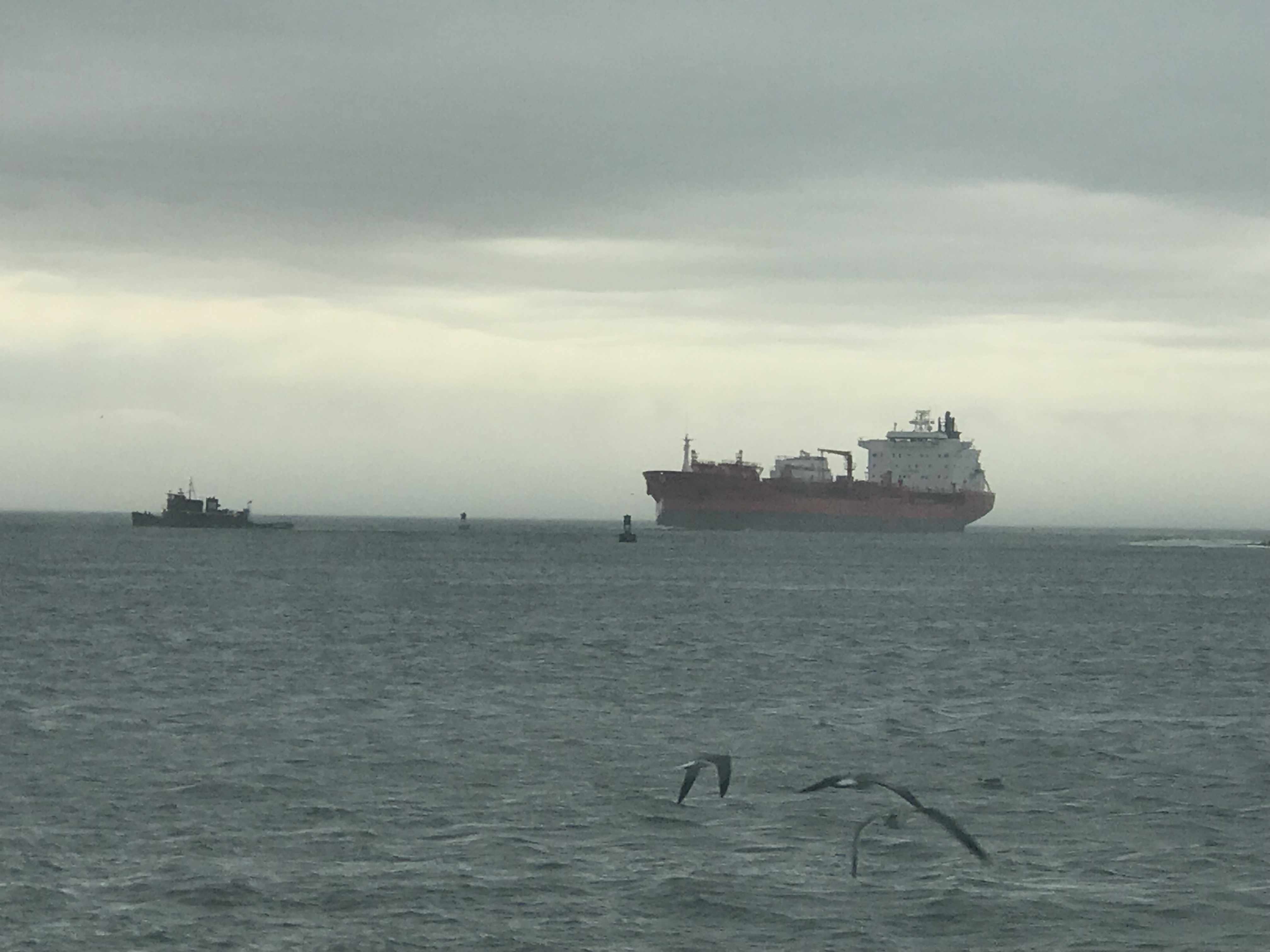
To get into Beaufort using the East side entrance you need to head like your exiting Beaufort Inlet then turn hard to port after going by Radio Island. We did this as quickly as we could as a large cargo ship was fast approaching. Even the two tugs were joking on the VHF about “giving it all she had” to get out of the way of the large ship. The tug hailed the ship saying… he would have to point his bow directly at the ship but not to worry as he was crabbing his way in the wind and would soon be out of their path. On a boat unlike a car sometimes even though your bow is pointing in one direction, the wind and current can be moving you in a straight line that is not where your bow is pointing.
Large Cargo Ship Coming in Through Beaufort Inlet, NC
We had timed our arrival into Beaufort at slack current. Last time we were here we docked in a max ebb current and it took all my skill to keep MV Simple Life from crashing into other boats at the docks. A full keel trawler at 90 degrees to a strong current moves down-current quickly. It’s not something that your thrusters can overcome.
We were thankful for our pilothouse as the rain was coming down pretty good at this point.
We passed Moonrakers and some sexy boats tied up in port.
“Moonrakers,” named after the rectangle sail flown at the uppermost height of a three-mast 17th-century ship
Nordhavn Trawler in Port
Sexy British Sailing Yacht
The Beaufort Docks Dockmaster had assigned us a great slip all the way in right next to the restaurant. The docking was a “breeze”, no literally, we simply turned sideways and let the breeze blow us sideways into the dock. Worked beautifully and Kelly was soon tossing our stern line to the dockhand.
1995 Saberline 43 Green Hulled Trawler Next to Us
Note our Flags Indicating a Beam Breeze
Once in our slip we quickly jumped ashore and walked the docks.
Mums Line the Docks
Walk the Docks
Betting that is the Marina Loaner Car
Santa’s Workshop in Beaufort NC
I almost forgot there was one casualty along this trip and it was my slippers. Kelly demanded that my stinky slippers stay in Beaufort, NC. I will miss my favorite slippers but our boat and crew would thank me for giving them up.
I’ll Miss You, Comfy Slippers
I checked in at the dockhouse, paid the bill, got the WiFi password and two beer tokens! My favorite part is taking those wooden tokens straight to the sailor bar at the Dock House and enjoying a well-deserved beer. We were sharing dog pics with Shelby, our bartender. She showed us pics of her 3 new hunting hounds that her dad had given to her.
Have a Draft on Us – Dock House
Welcome Shipmates
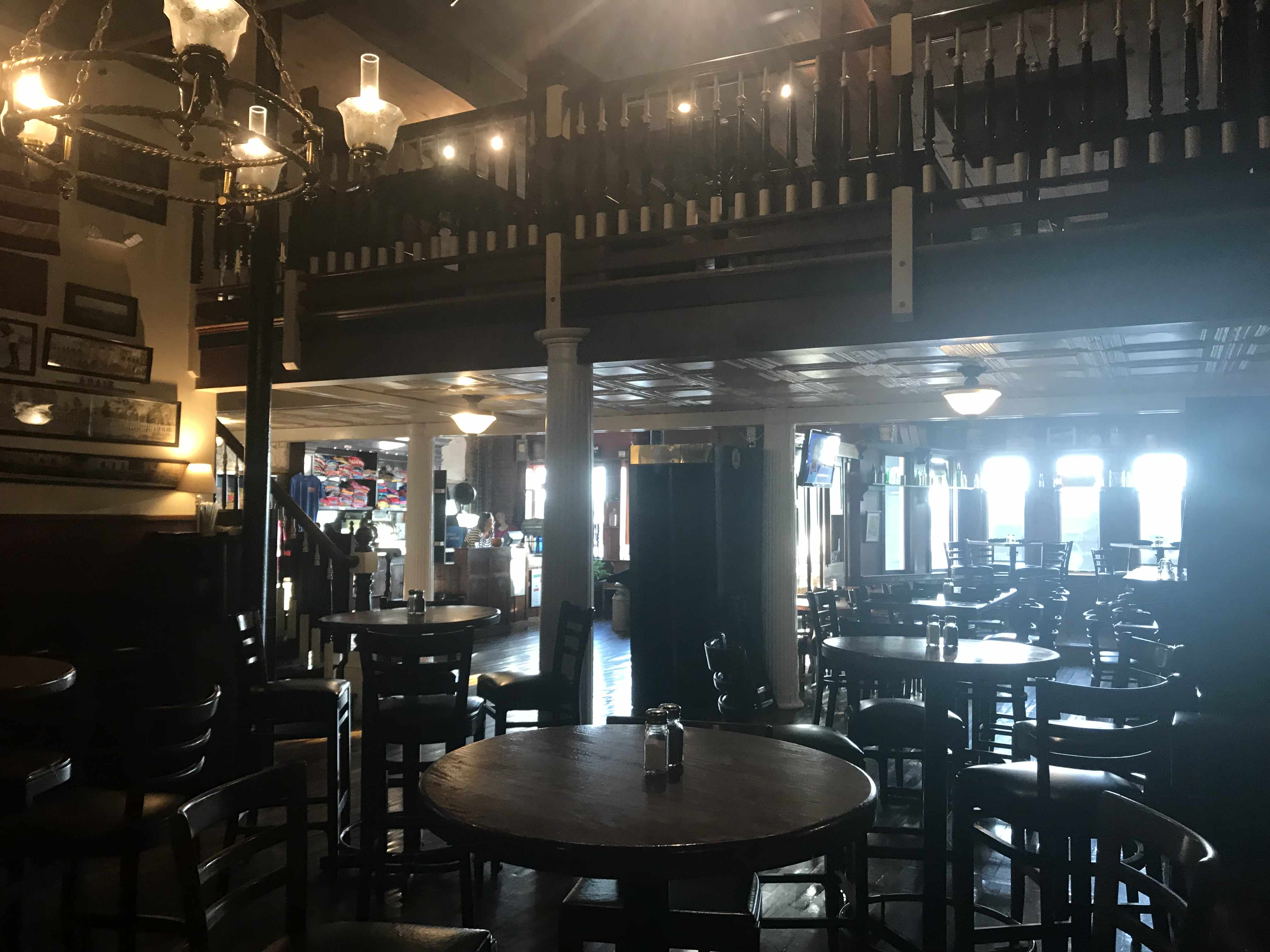
Sailor Bar Closed so we got to use the more Upscale Bar Upstairs
Clawson’s bartender, Kayla set me up with a great Hazy NE IPA and life was great.
The bar itself dates back to 1905 and Kayla was entertaining us with ghost stories about the ghost-like little girl on the third floor. She offered to take us up to the 3rd floor to look for her but we chickened out 😉
Clawson’s Bar
Ghosts Straight out of 1905
Deer head amongst Boating Motif
We are thrilled to spend two nights in Beaufort, NC.
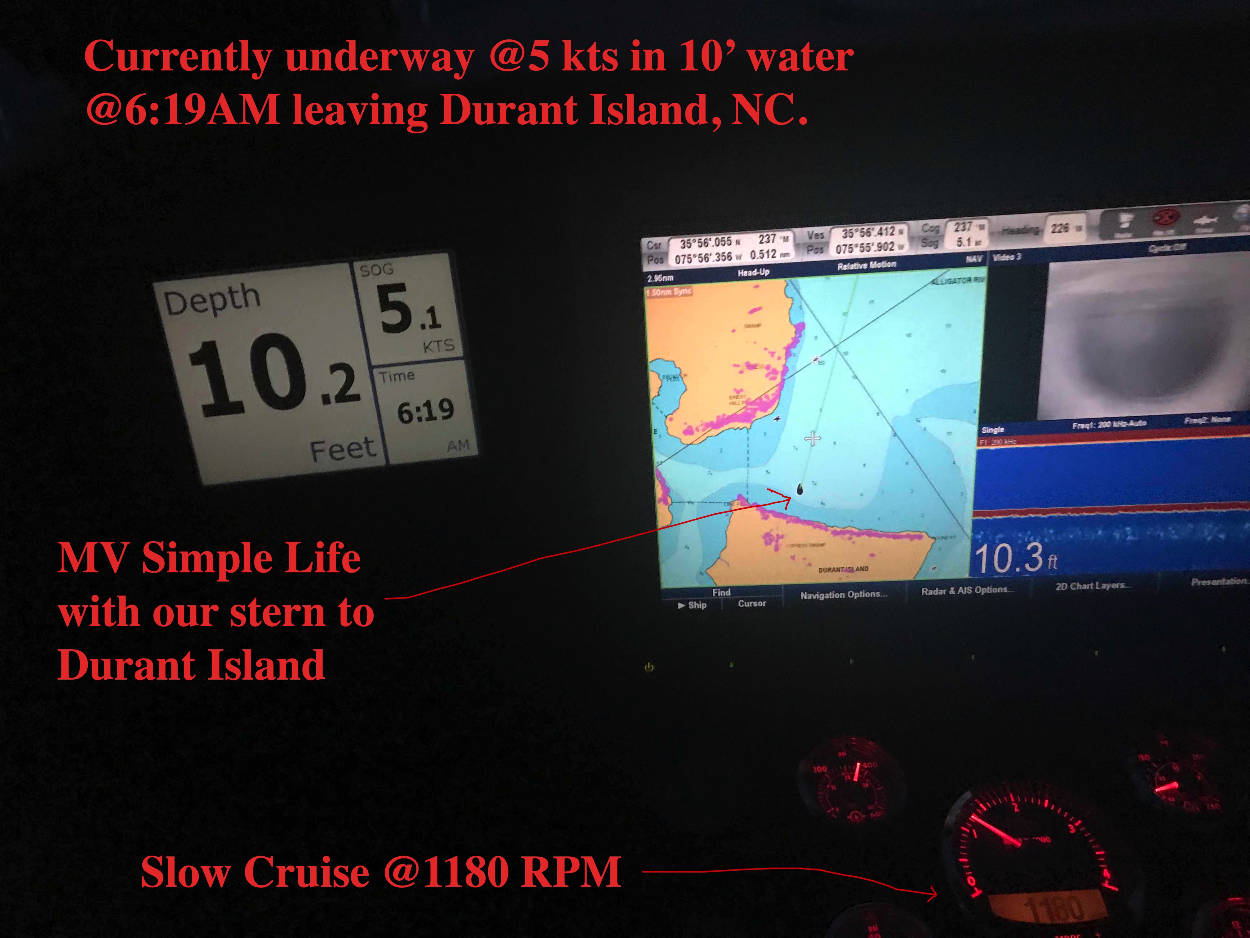
Beaufort, NC in two days requires an early departure. 6:19AM to be exact.
Departing our Anchoring Location off Durant Island, NC
Planning is a big part of cruising. It starts by thinking where you would like to get to. Then you check the weather, wind speed & direction, marine forecast, sea state, etc. If the weather is bad than you must consult the crew (wife / admiral ) and get their opinion on whether to go or stay put. If you skip this step you could find yourselves in marriage counseling.
Once you know where you want to go you must ask… “How long will this take at cruising speed?”. Slower cruising speed = better MPG = $. We conservatively plan 50 NM / day if we use the 10 hours of light that late November gives us. If we want to cover 70 or even 100 NM than we’ll have to run long into the night. Here you must know your limits. After 12 hours at the helm you may find yourself coming into an unfamiliar inlet or harbor on an inky dark, moonless night with wind & waves and other hazards. (See warning above about counseling).
I find that using every charting and weather app on your phone, tablet while underway to constantly revise your plan works best. Advise your crew that “the next two hours will be a lumpy ride but soon we’ll be enjoying a drink in a peaceful anchorage for the night”.
Alligator River Swing Bridge
Underway
The Alligator River Swing bridge crosses the broad mouth of the Alligator River. It must be fun driving over this long bridge that is only 20 feet or so above the River.
Sport Fishing Yacht Kelly Lynn
Slow Pass
Azimut
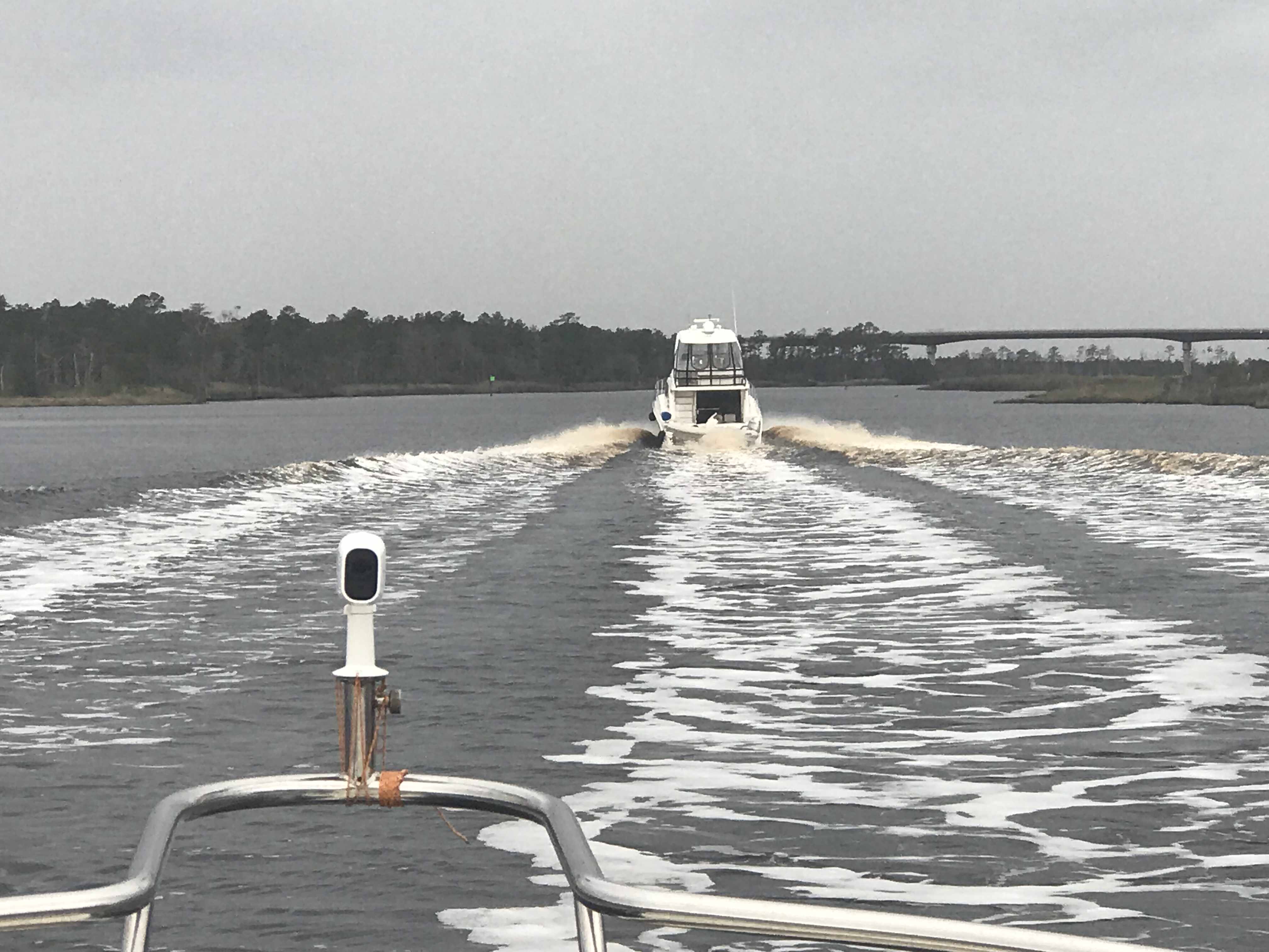
We had to keep to starboard as our radar showed many faster yachts coming up behind us. They would zoom on by and we’d have to do a quick 90 degree turn to cut their wake or get rocked.
When you reach the Southern end of the Alligator River you enter a 20 mile long canal that was cut through the land with a laser gun. OK maybe it just looks-like the ACE (Army Corp of Engineers) used a laser gun? It’s so straight we barely need to adjust the autopilot heading.
Alligator River – Pungo River Canal
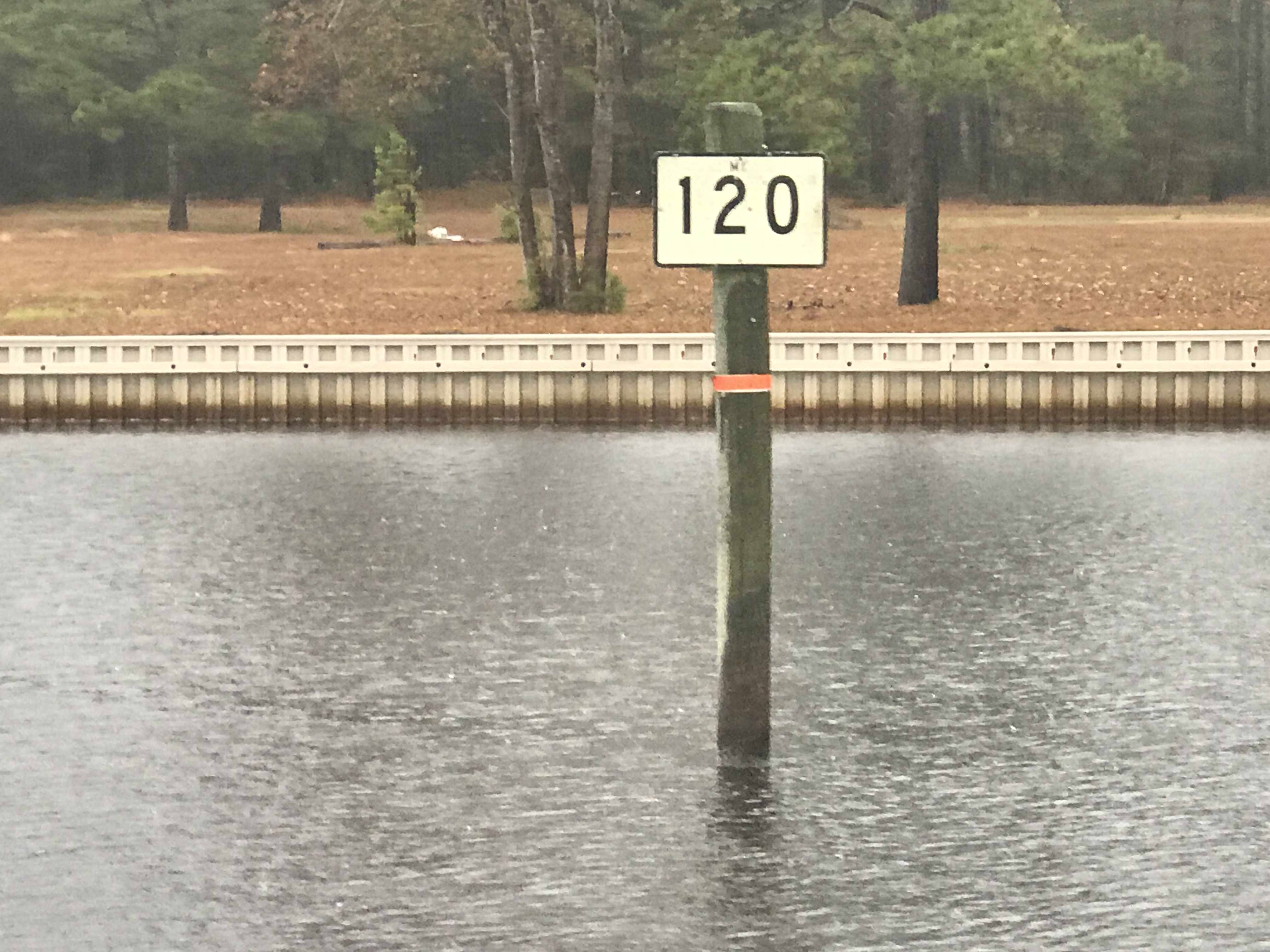
While you are keeping an eye out for hazards like tree stumps and deadheads (trees snapped off at or near water surface), you’ll pass ICW Statute Mile markets reminding you that you have a long way to go.
ICW MM 100
ICW MM 120
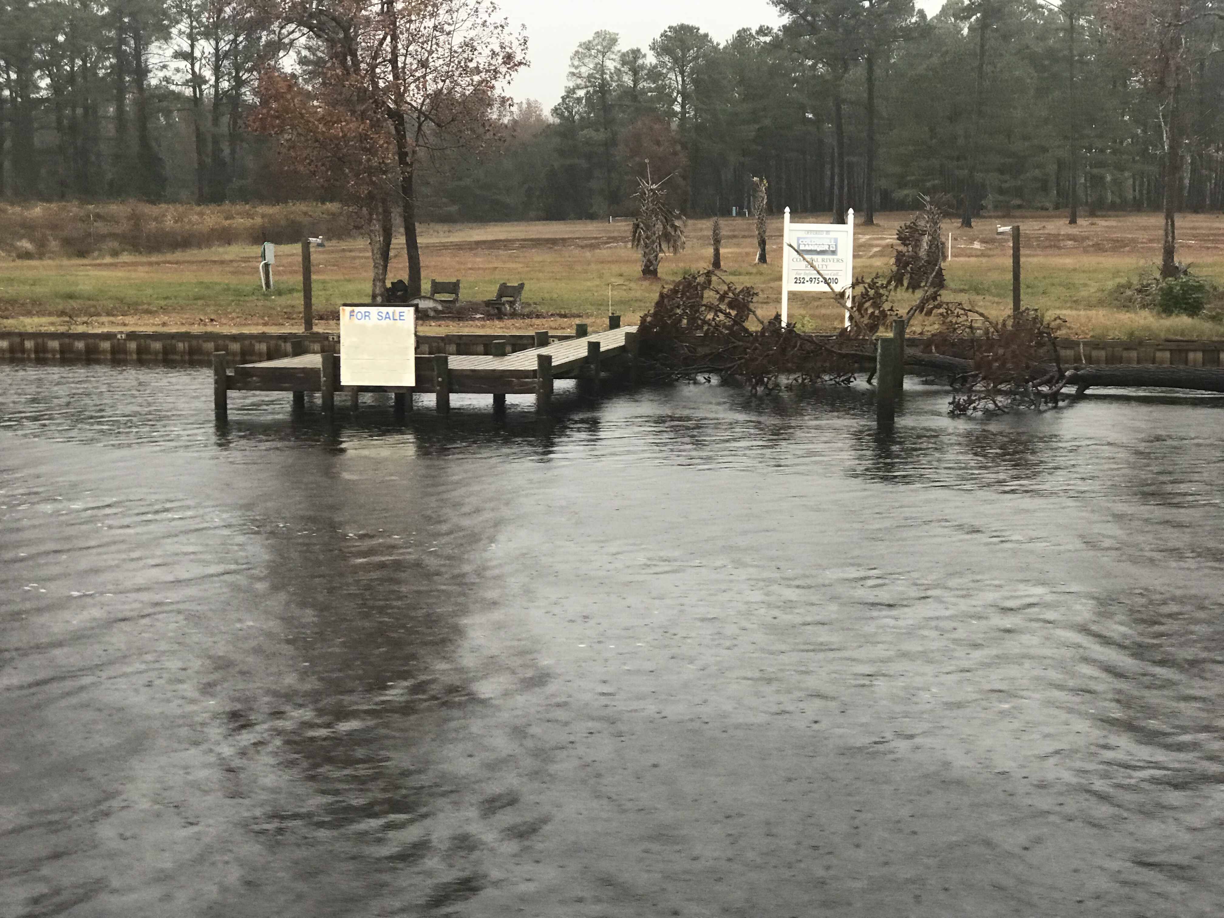
There is land for sale along the canal.
For SALE
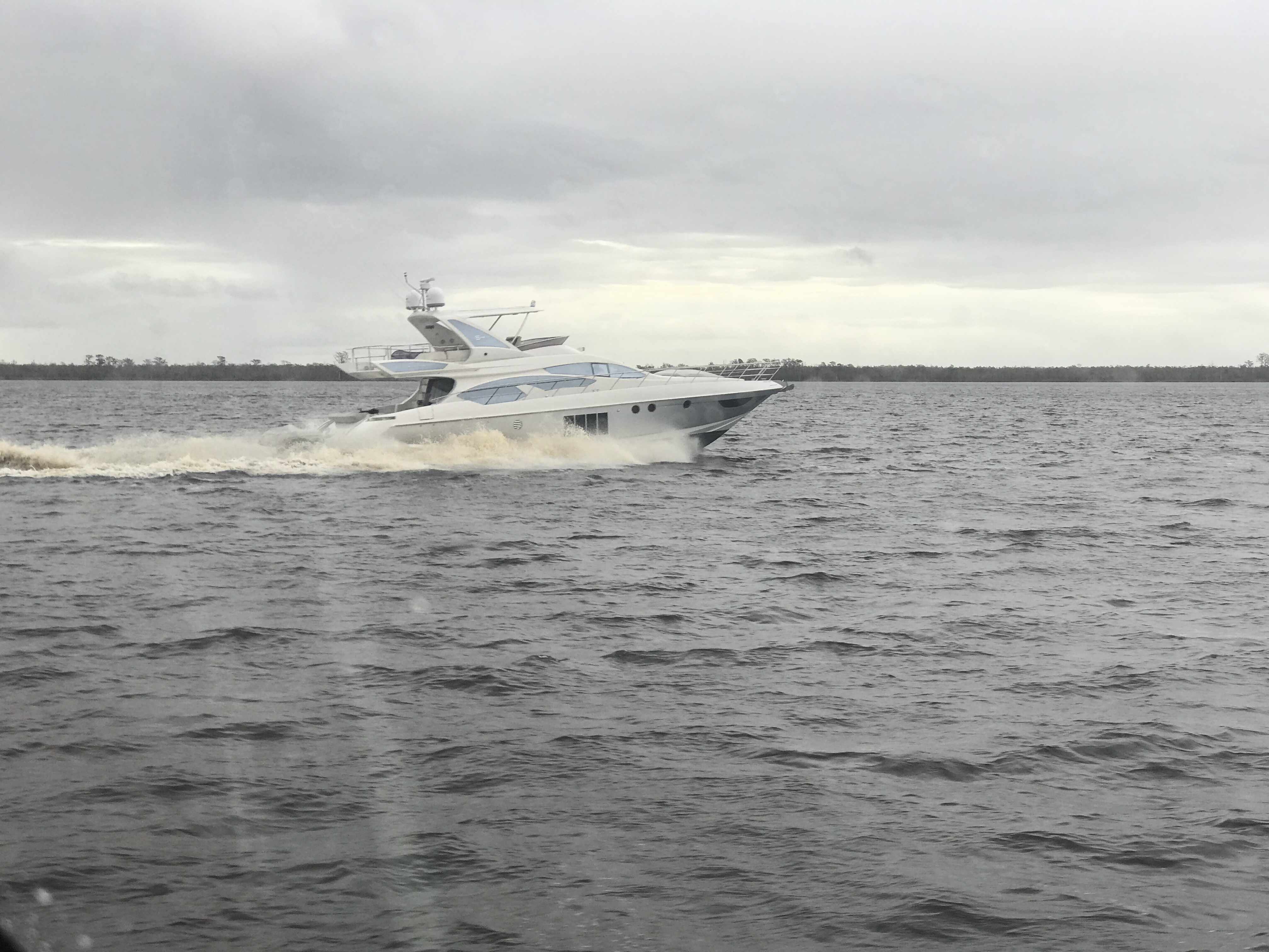
Perfect if you like duck hunting like this hunter we passes who was picking up his duck decoys.
Decoy Ducks
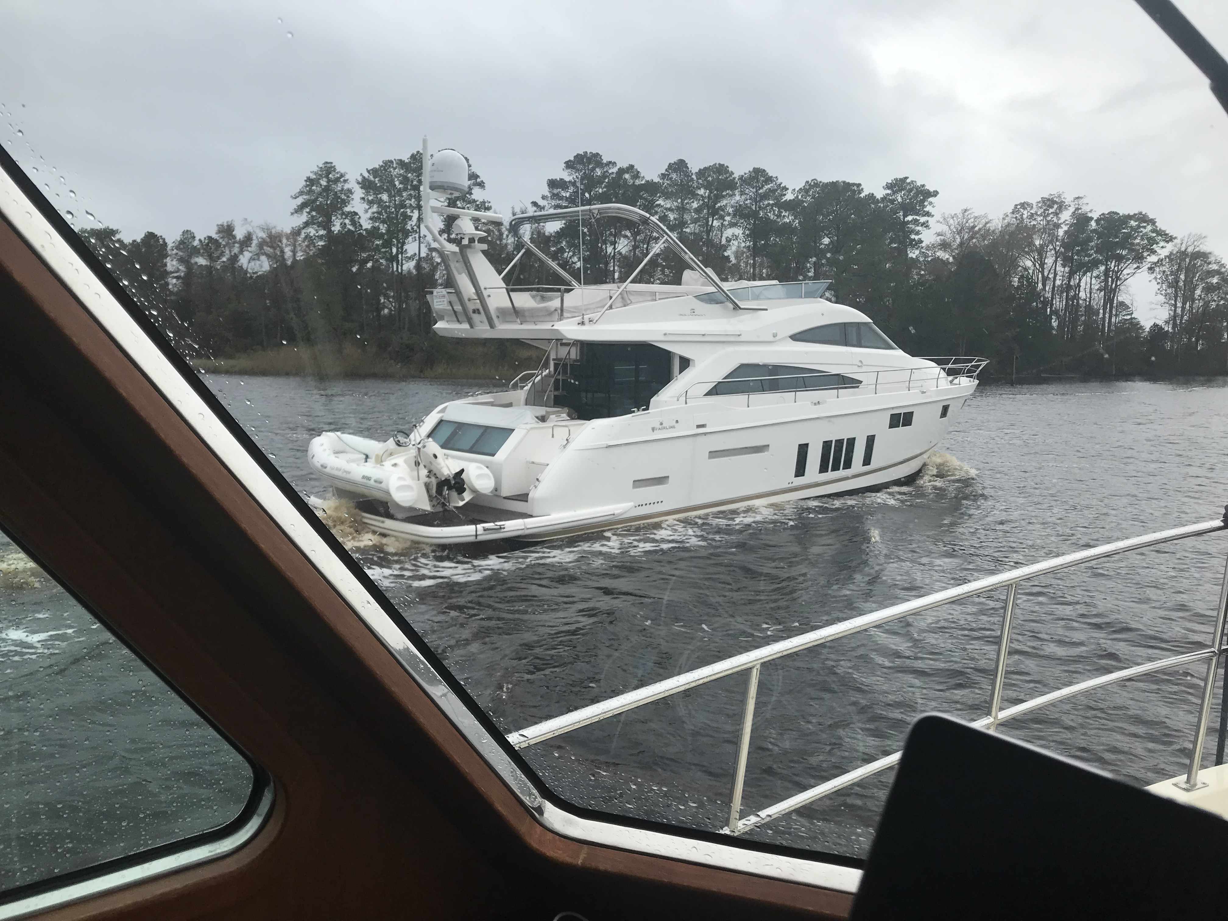
Moving over for oncoming or passing traffic must be done carefully as outside the center of the canal you’ll run into shoals, stumps and other hazards.
I Don’t Think We Can Keep Up
When you see a bridge like the one in the picture above you quickly grab your phone and check for a cell signal. Yup, you’ll have a signal for maybe the next mile.
It was cold and rainy but warm inside our pilothouse.
We knew from checking the wind speed & direction that when we exited the Pungo River it would be lumpy.
Soon we were tucking into Goose Creek and then again into Campbell Creek to avoid the weather. Anchored tight to the tree-lined shore in Campbell Creek we found respite from the weather.
Anchored in Campbell Creek
Saturday’s leg looked something like this.
W02L011 – Winter 02, Leg 11
The cell signal in here is either weak or just non-existent.
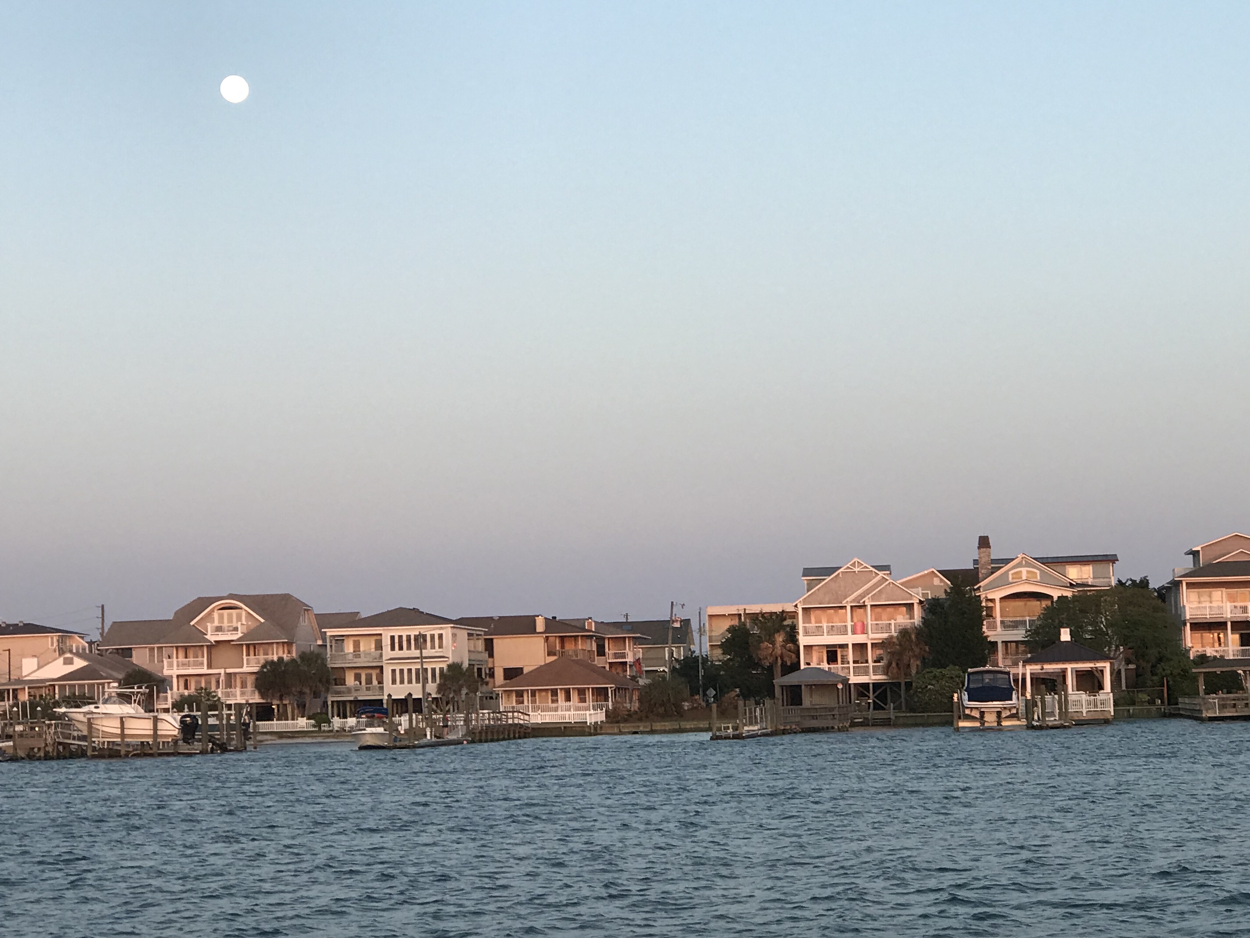
Because it was a 98.8% full moon, we pulled up the anchor and got underway before the sun had even risen.
Wrightsville Beach Anchor Location
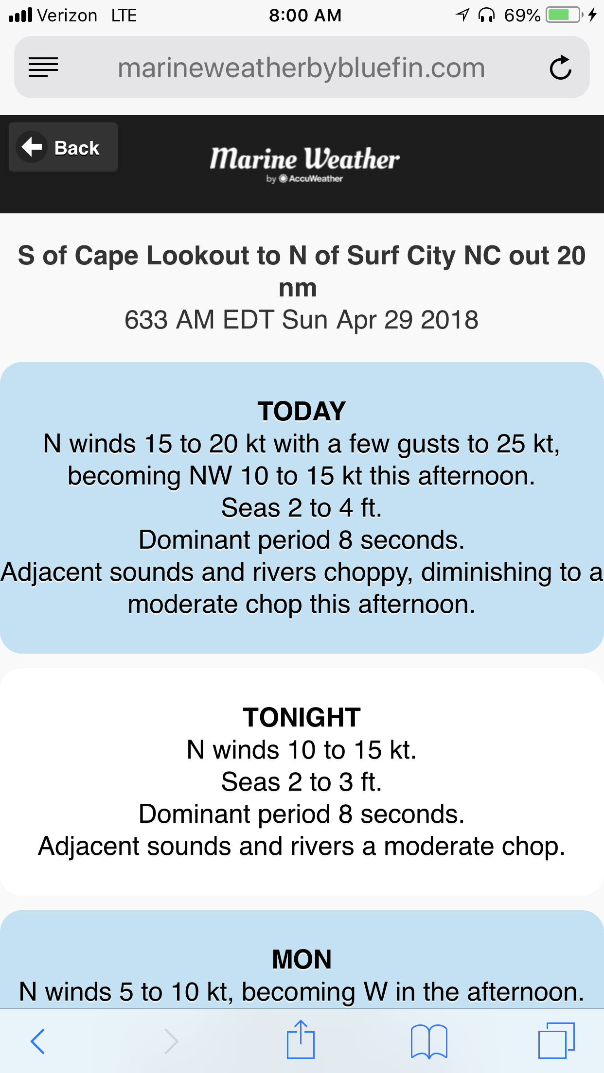
As we skirted our way up the coast, we tried to minimize the length of fetch as the winds were blowing 20 kts from the NW (with gusts to 25 kts). Recall: a fetch is a distance of water that the wind has been given to blow over the top of. Wave heights build wave heights with distance.
25kt Gusts
Along the way we saw beach homes like these near Surf City
Surf City Beach Homes
Surf City Beach Homes
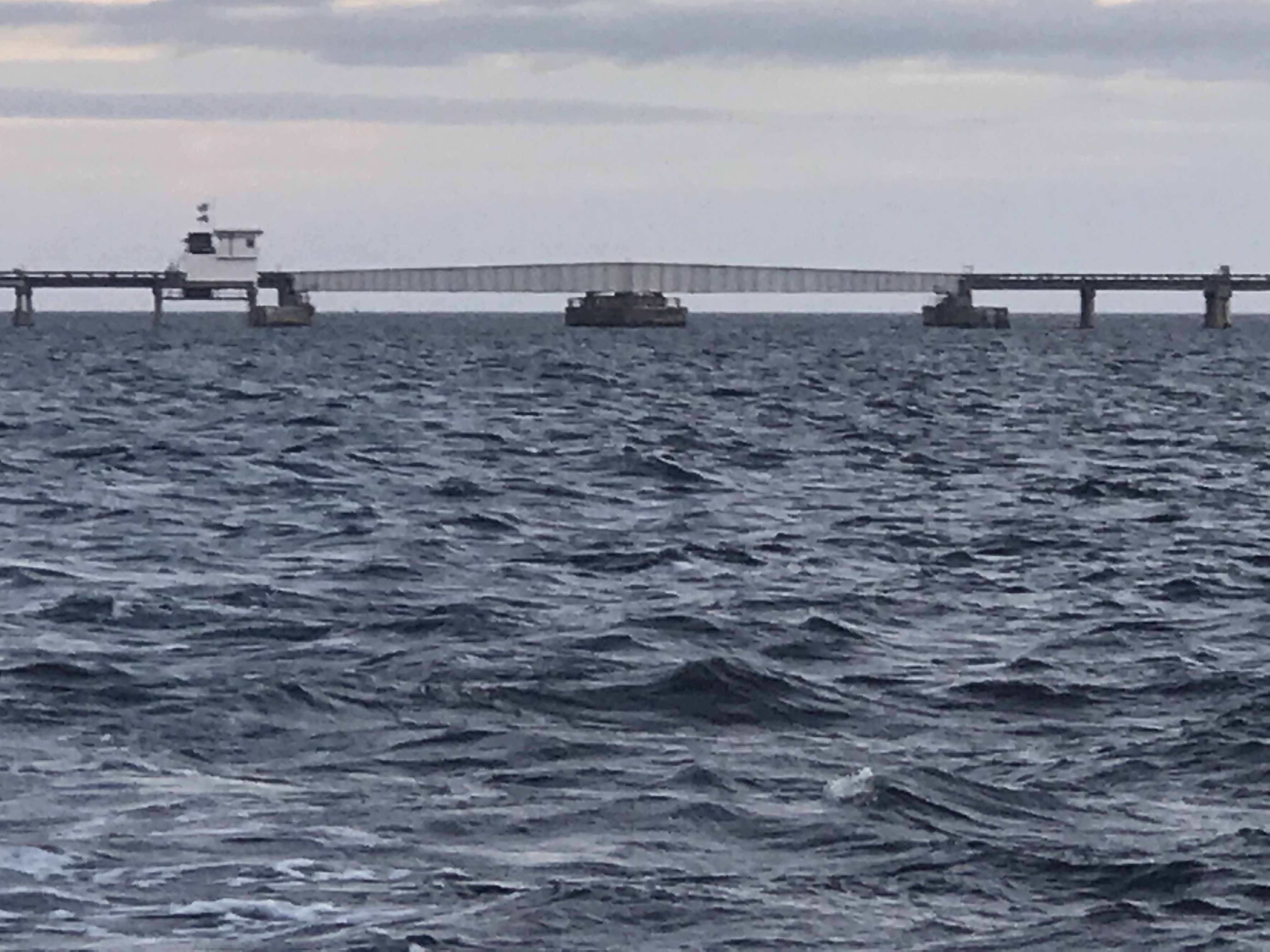
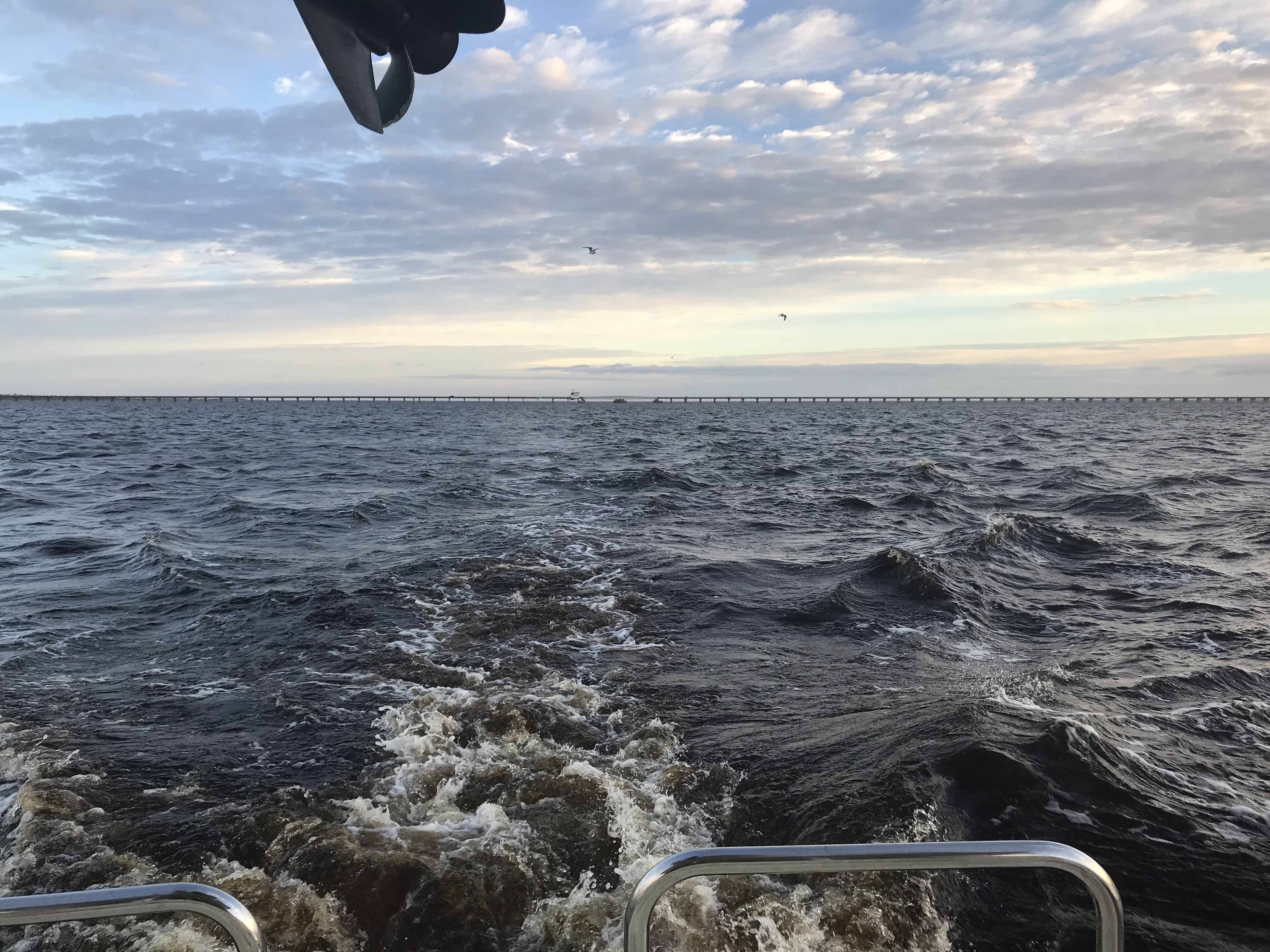
We saw a giant ocean-side pier near Top Sail Beach.
Top Sail Beach Pier
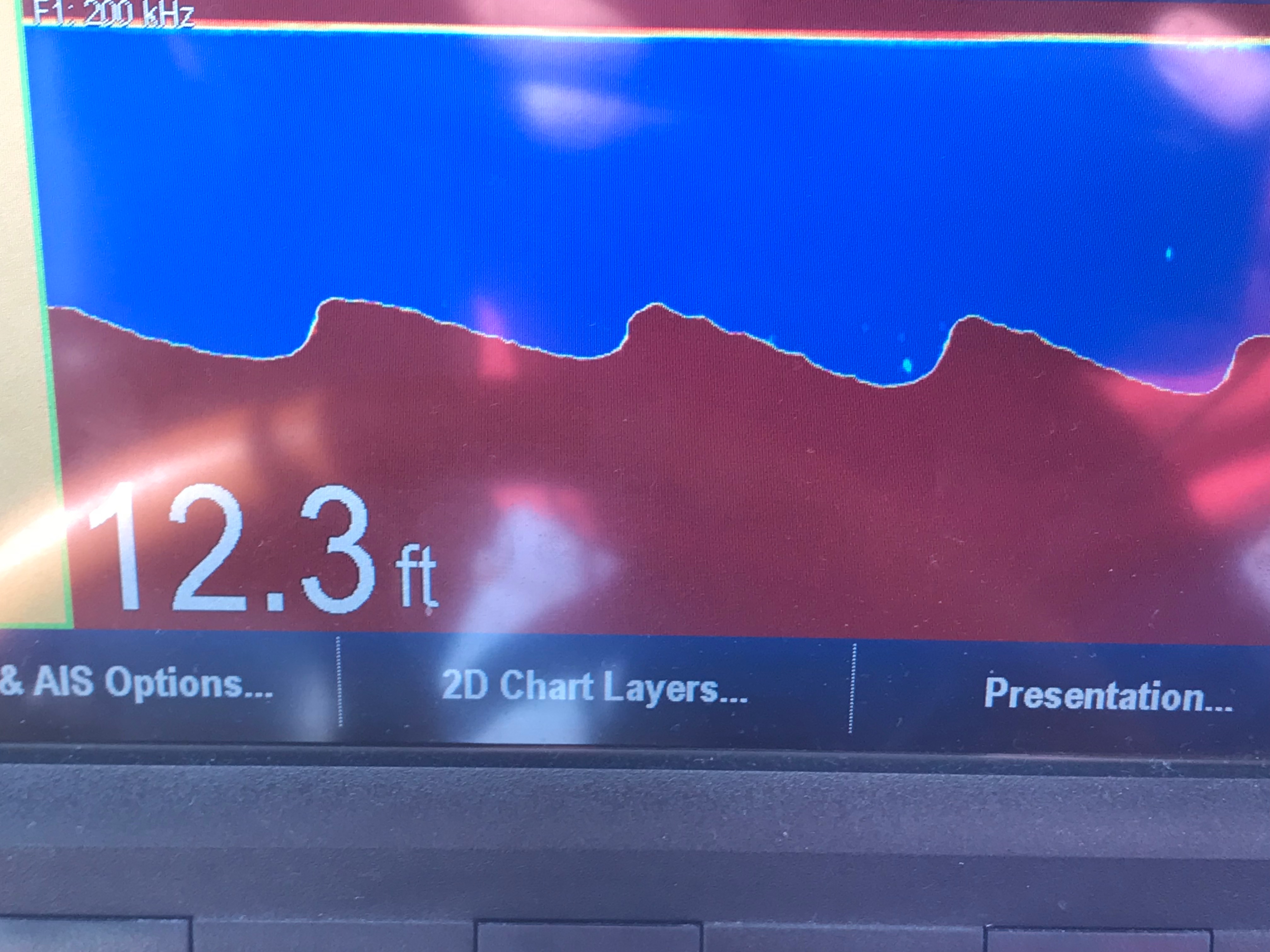
As we go, I’m always watching the depth sounder, ie sonar. It pings high frequency sound (like a dolphin) off the sea floor and displays the depth as a graphical chart over the last 60 seconds. It is very important to understand not just the instantaneous depth but also how the depths are trending over time. You need this info to ascertain quickly if you are running off a downhill slope or running aground. The steeper the incline, the faster in time the sea floor is rising up to meet you, metaphorically speaking. While watching the sonar, I repeatedly saw objects between the boat and ocean floor. I believe these depictions to be “bait balls” or schools of bait fish in a tight spherical grouping. Sometimes they are formed into these ball formations by preditors such as dolphins.
I’m no expert at reading the fish finder / depth sounder’s visually displayed ping returns, however, I also saw this fishing boat hauling a net.
Small Trawler Netting Bait Fish
The trawler’s size makes me think that they are hauling a small net sized for bait fish.
A moment later, we were passed by this Italian designed Azimut luxury motor yacht. She clearly has some horsepower in her diesels since… as big as she was, she was just skimming over Mother Ocean.
Azimut on plane
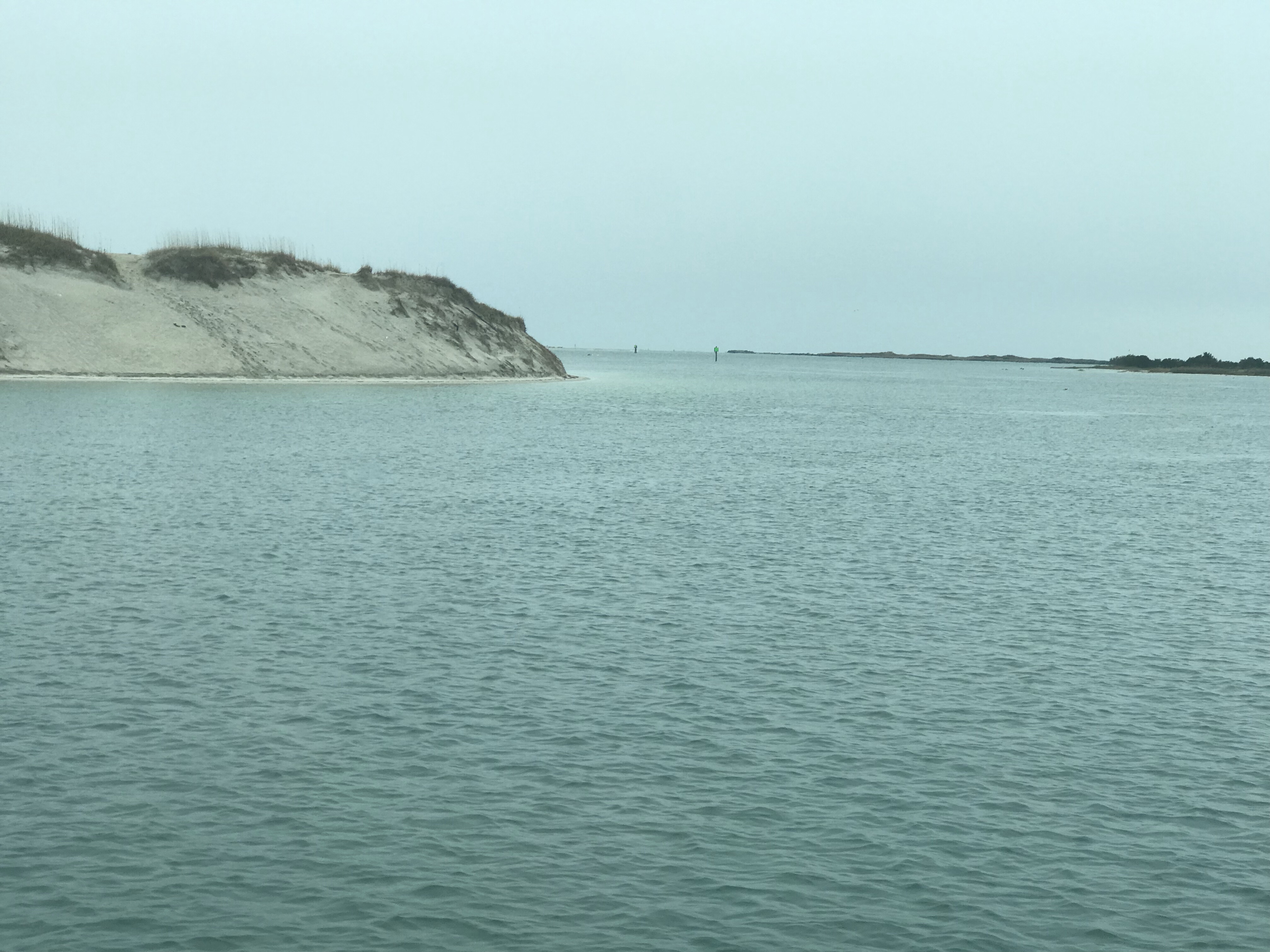
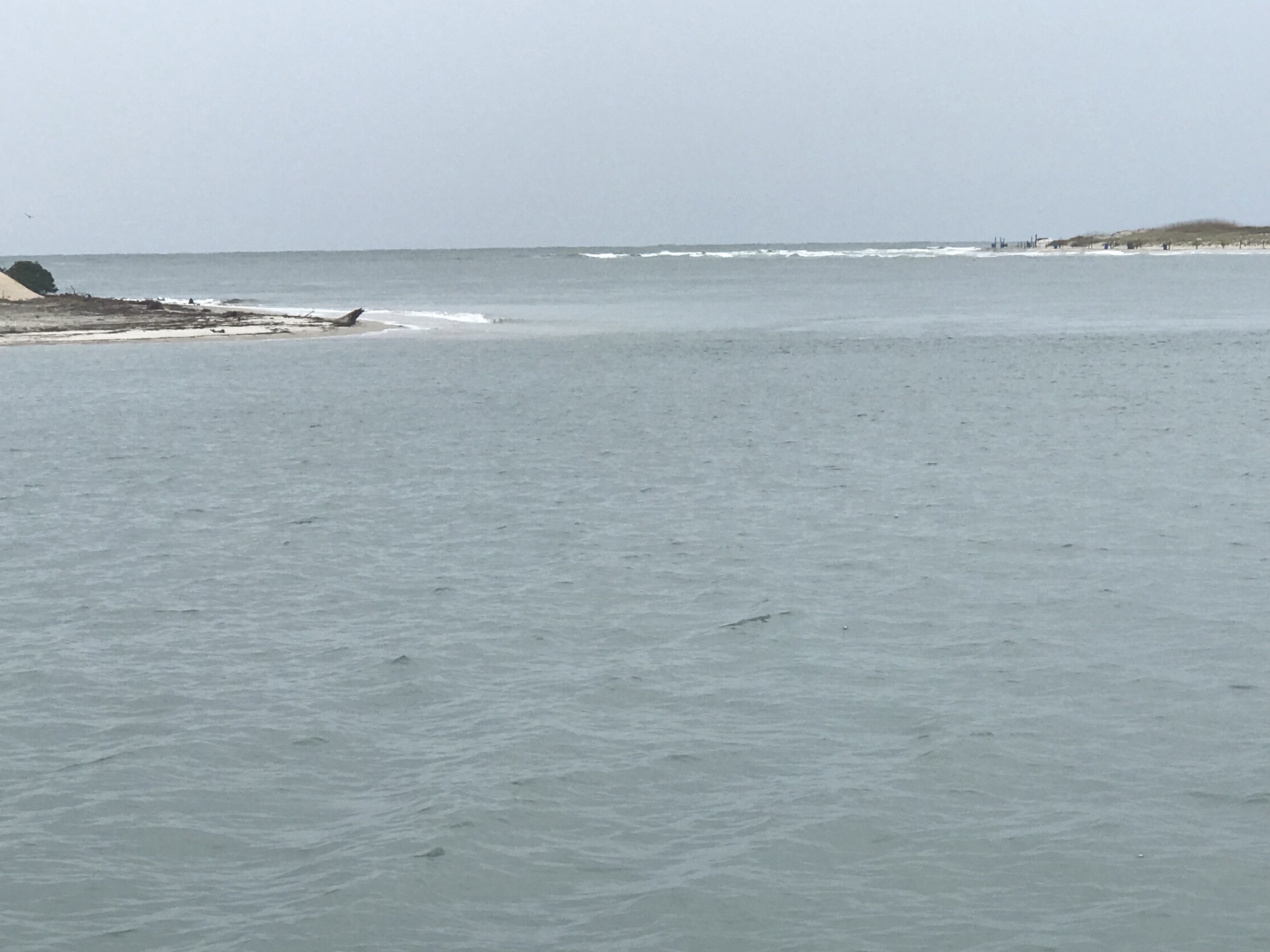
As we approached Beaufort, NC, we passed Brown’s Inlet. The ActiveCaptain description for this inlet simply says: “Browns Inlet is unmarked and used by local boats only;not recommended to strangers.”
Soon we were off Fort Macon State Park Beach which is just before Beaufort inlet, NC.
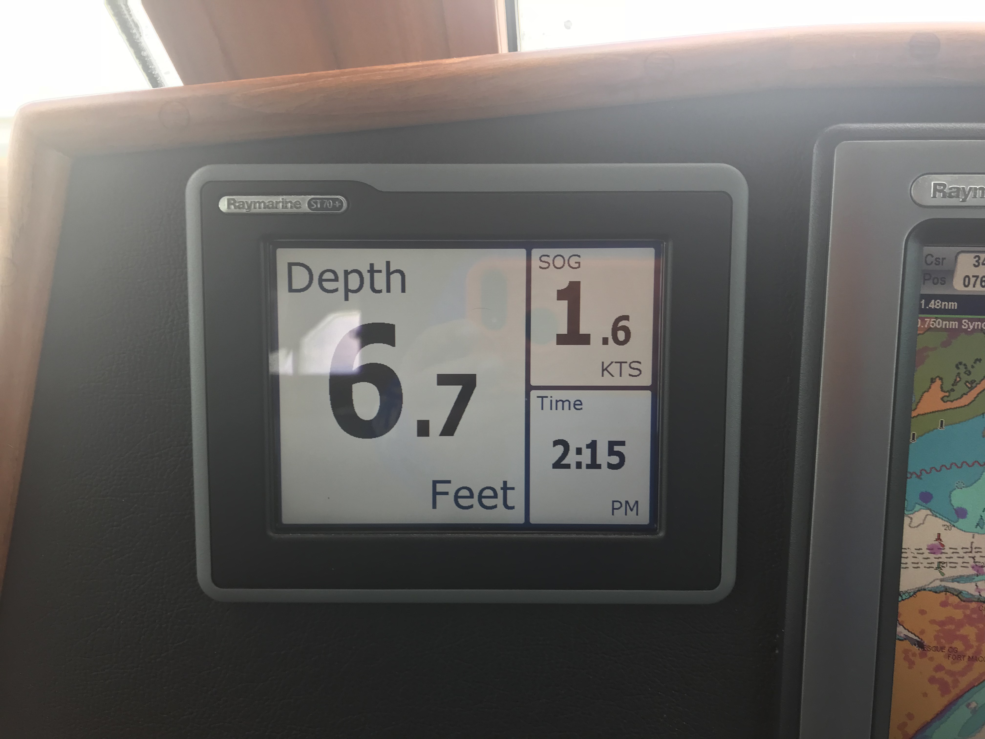
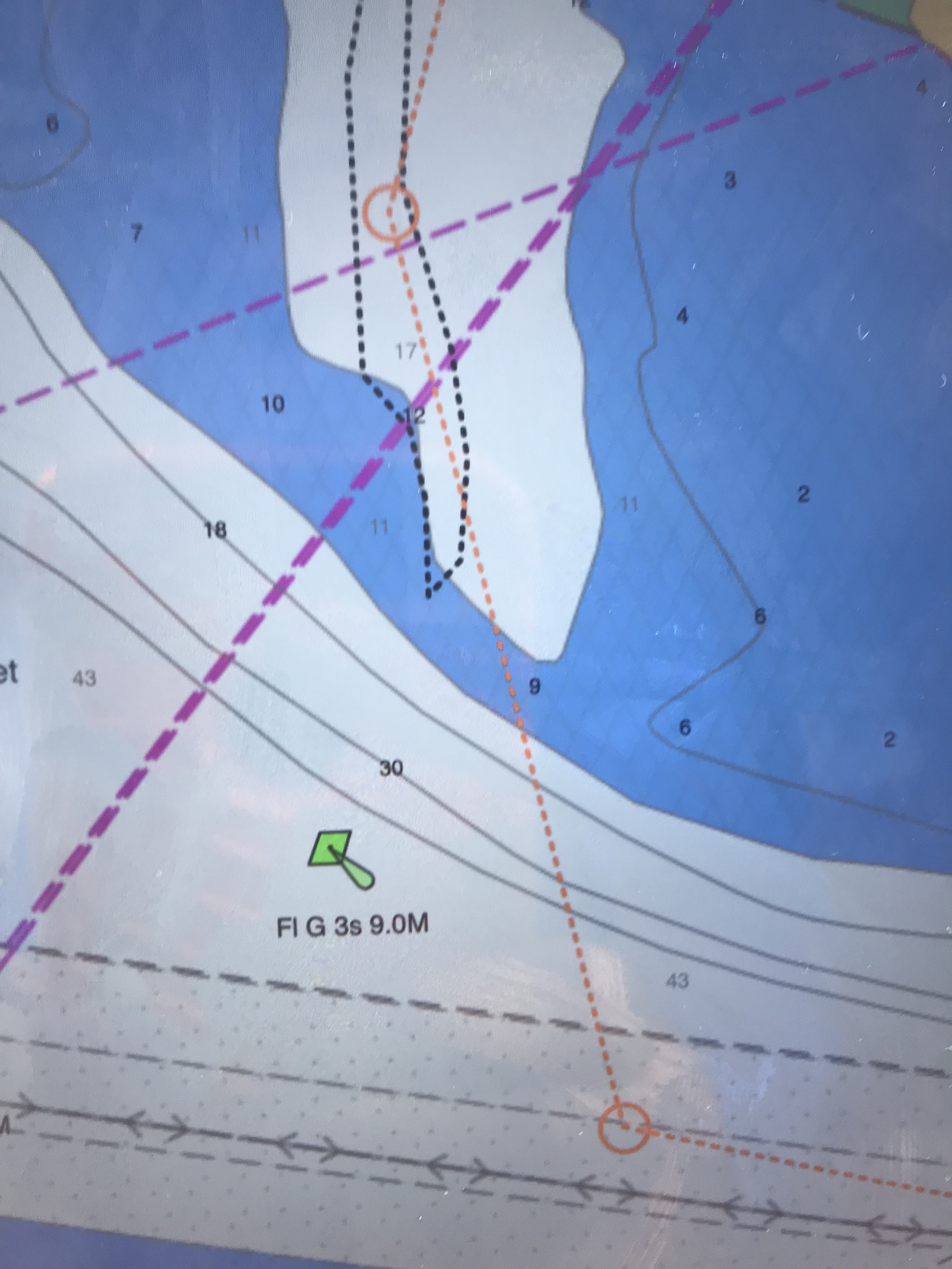
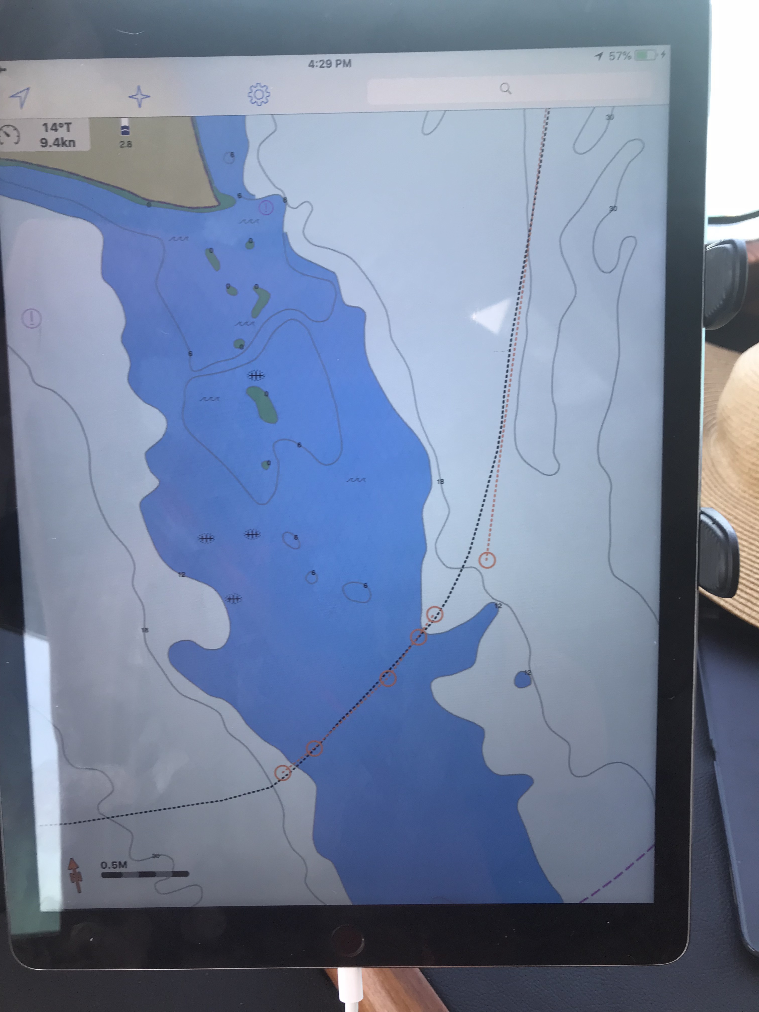
Running a dynamic inlet whose shoals change with each storm is not advisable as even the latest published charts with depth soundings will likely be incorrect. That said, we attempted to use the latest NOAA charts to sneak into Beaufort Inlet via a narrow channel close to shore. It was low tide so you don’t get any added water depth over the low water spot soudings. We entered the narrow natural channel displayed on our chartplotter. I checked the accuracy of the spot soundings (depth numbers) and the actual depths (reported by the sonar) were 3’ shallower than what my recently updated chart displayed. That was not comforting, but I still proceeded slowly at only 1.7 kts.
1.6 kts is slow forward
We will run aground at about 5’ and I was already in only 6.7’. To make matters worse, there was an ocean swell that was lifting and dropping the boat above and below the static ocean surface. I was confident that however “skinny”, “thin” or simply “shallow” the depths got that we would make it. After all my charts showed a low of about 10’ and we only needed 5’.
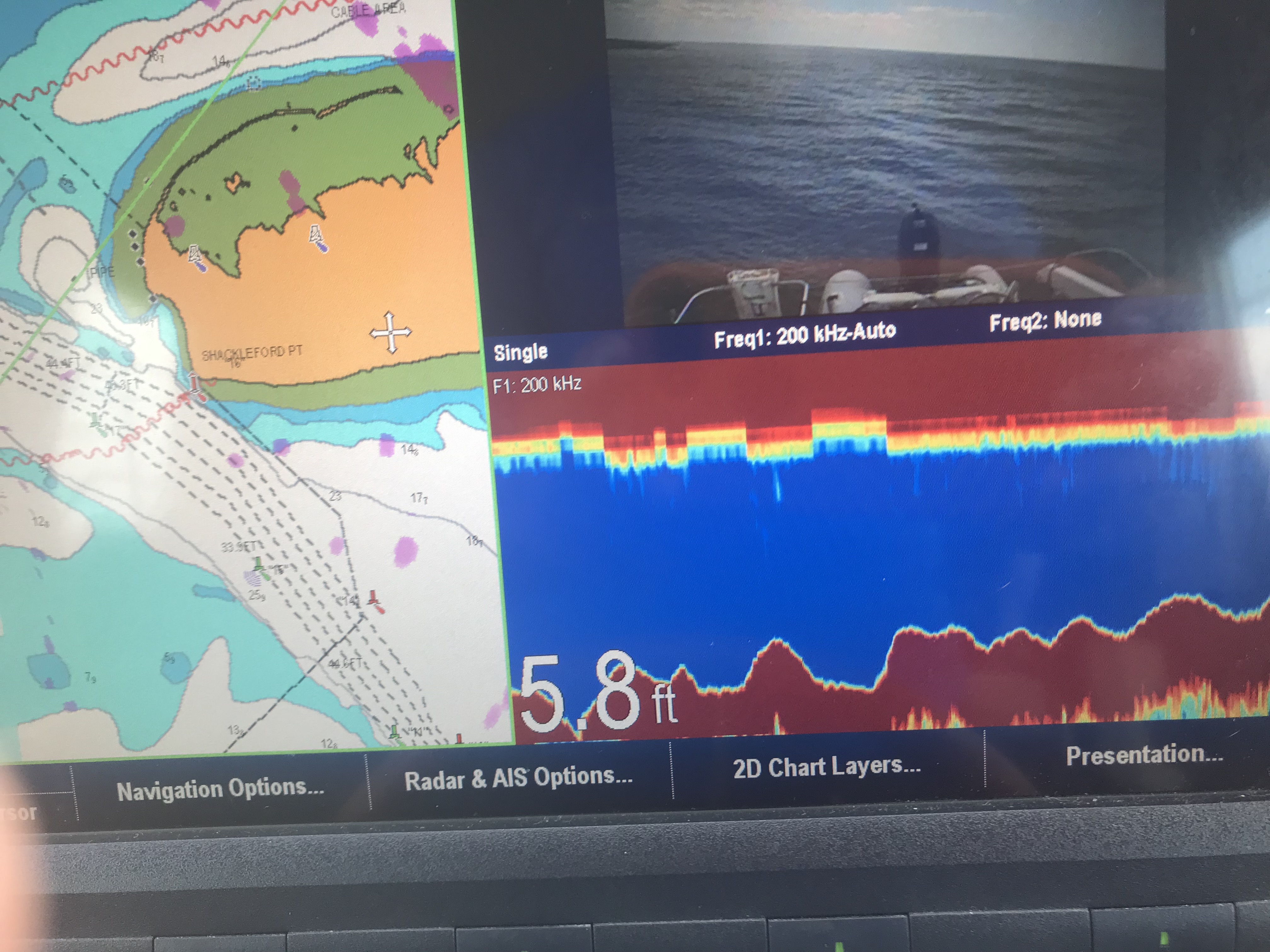
Well, we made it about 10’ from crossing into the deep channel when we bumped the bottom. You have to tell yourself: “resist the temptation to simply push the throttle forward and plow the next 10’ to the deep channel”. You just can’t know how shallow those next 10’ are. You could be pushing your boat up onto a shoal so shallow that the diesel engine / propeller combo won’t have the bite on the water needed to either push or pull you off the shoal. I opted to put her in reverse and spin her back the other way. We knew if we didn’t hit on the way in, we would not hit leaving.
5.8 is Shallow
10′ more and we could have made it into the deep channel
Note: The top picture showing the chart with 5.8’ depths displayed is not as recent as the chart depicted in the picture below it. We were literally 1/4 of a boat length from making it into the deep channel. You can see our track as we backed out. FYI: track = a black, dotted line or bread crumb path of where your boat has been. The dashed orange line with circular junction points is our plotted course. We backed out and came in the inlet via the mid-channel / safe water buoy. This buoy marks the center of the entrance channel. Line up with this vertical red-white striped buoy and you are heading directly in the inlet.
Confidence is a good thing as a captain but … so is restraint 😉
I was emailing with a fellow boater who was getting ready to come North from Vero Beach. They have owned their blue water trawler and traveled up and down the coast. However, I still added the below statements to my reply. I did so because, I myself, am often curious where other sailors draw the line at the decision to “go offshore or not”?
3. Six seconds is a rather short period. I’m picturing steep waves. Your boat is stabilized, ours is not. I would not want 6 second period, 5′ possibly 7’ waves on my beam.
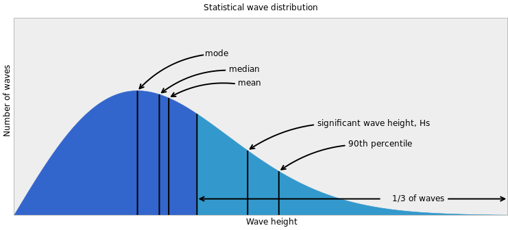
When you study the densely displayed data given by this app,you see that the waves during the daylight hours will be… at worst 4.5’, out of the NE with a 6 second period. The tide will go low about an hour before the sun sets (read that as… “about when you are entering the shoaling inlet from the sea”).
Then you say “4.5’ waves are not that bad”. However, that wave height forecast is based on a statistical wave distribution.
The average of the biggest 1/3 of the waves you’ll see are much larger, possibly to the height of 6.5’. That is uncomfortable to most crew in an un-stabilized trawler. Note: Blue water, top-heavy, flybridge trawlers often use active fins beneath the waterline to oppose the roll of the vessel to port or starboard. This can dramatically improve the conditions underway in a sea. Naiad is one such company who manufactures marine stabilizers.
After making our way in the inlet we passed ICW statute mile marker 200. Note: Mile 0 starts in Norfolk, VA and the ICW milage progress to statute mile 1243 in Key West.
ICW Mile Marker 200
We made it into Adam’s Creek before having to anchor up for the night. Adam’s creek offered us the last anchoring spotbefore we enter Pamlico Sound and must travel the next 25 or so nautical miles to the Goose Creek anchorages.
Our current anchorage does not offer wind or wave protection but the holding is good. The NE winds are forecast to be light, at only 10kts.
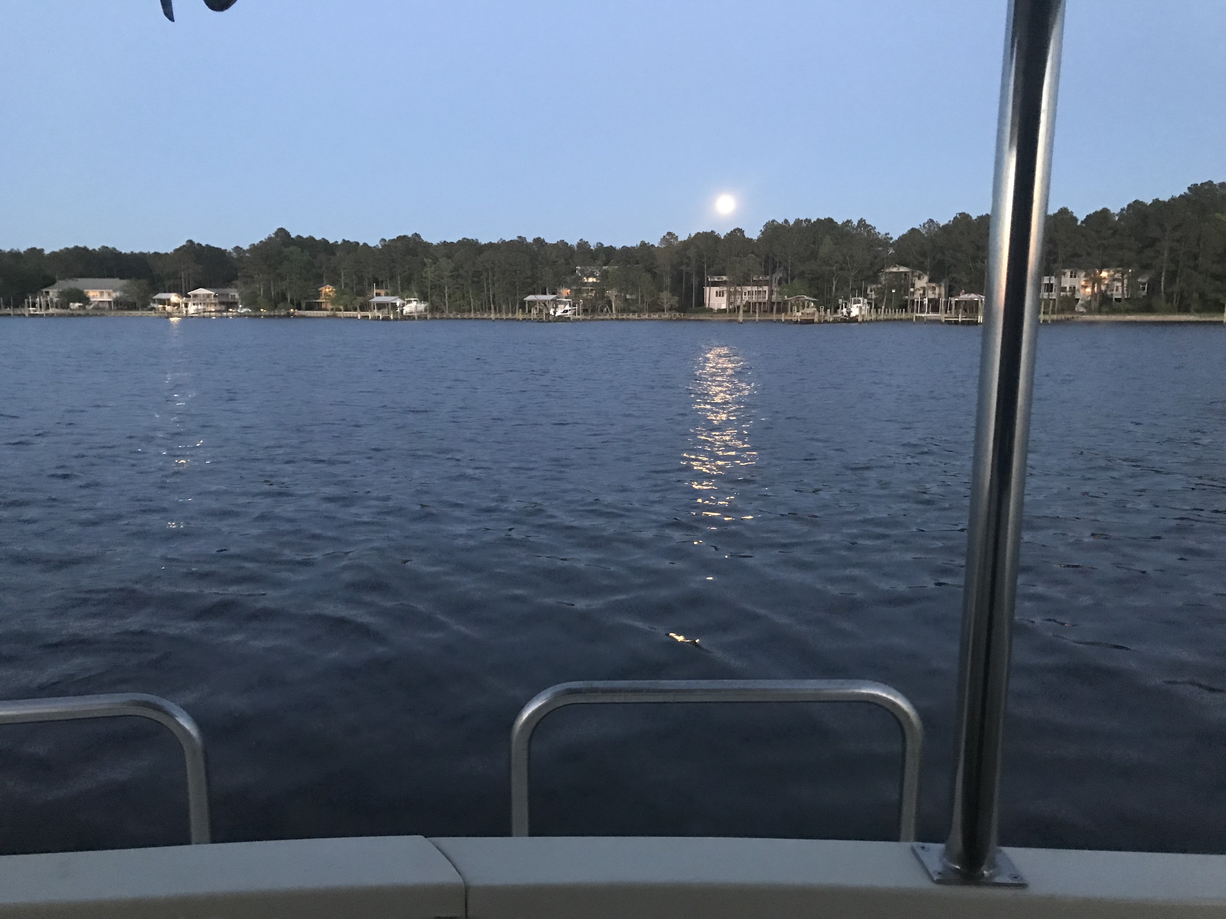
I found it interesting that we had a full moon rise off the stern and a simultaneous sunset off the bow.
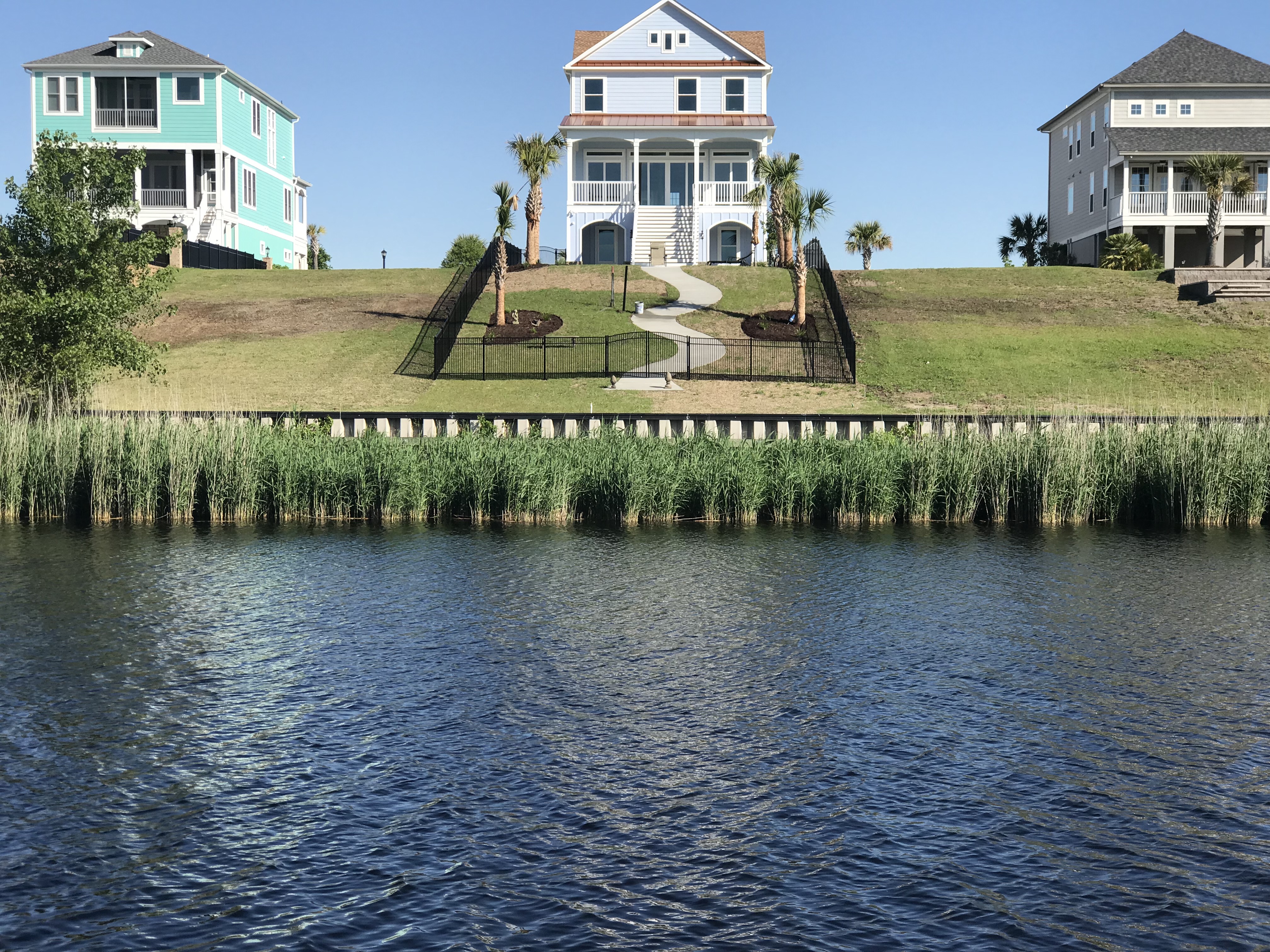
We got underway early, leaving the Waccamah River behind us. Alongside the ICW we found houses like this one. This home just stood out against the others. Why? Crazy downhill fence, twisty walkway? Sawgrass? 2nd level stairway? The palm trees? Or does it all work together?
Breathtaking, like that Seinfeld episode with the ugly baby
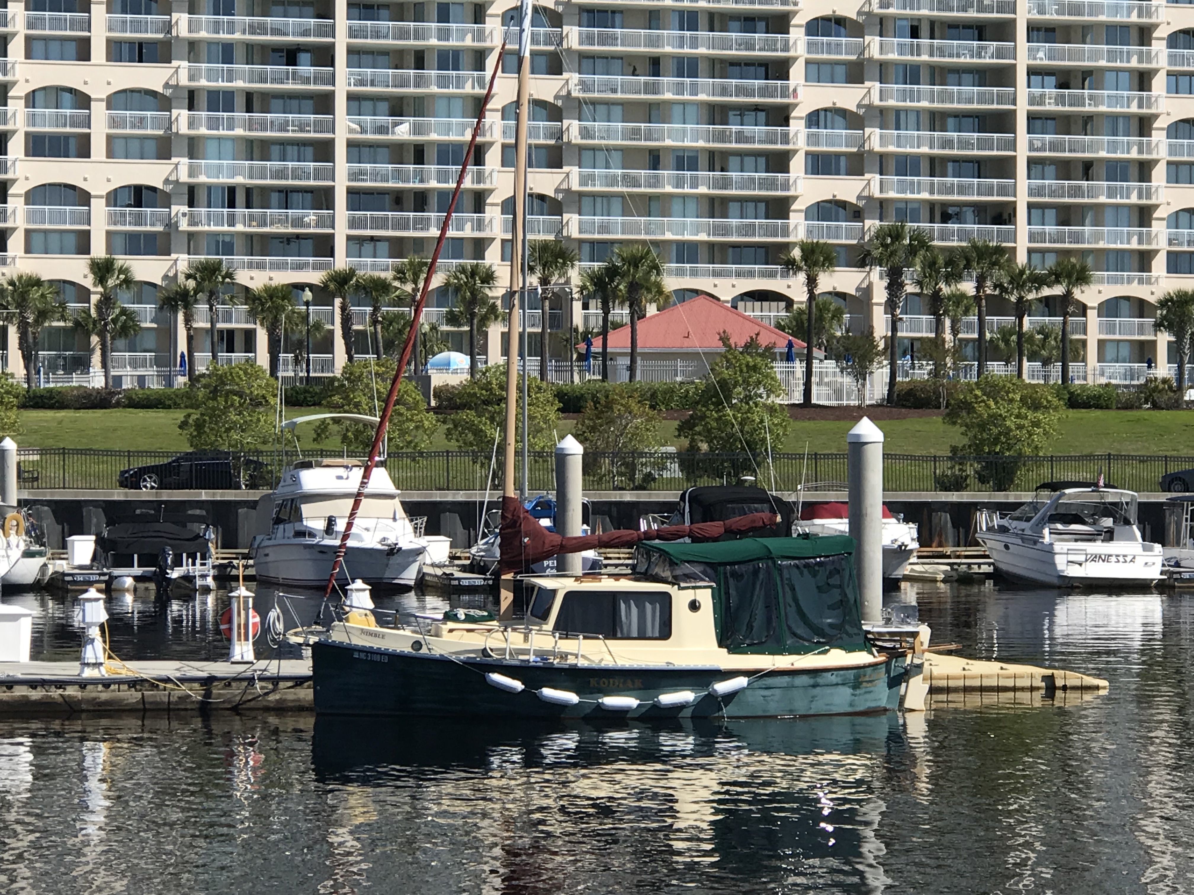
Then I passed this 27′ trailerable Nimble Kodiak motorsailer. Interesting little boat. Here is a link to a random 2002 Nimble Kodiak for sale on Yachtworld.com
27′ Nimble Kodiak trailerable motorsailer
We passed the “Sombrero thing” that I could not quite figure out what this place was on our way down the ICW. Now we are heading back and I still have not looked it up.
Sombrero thing and Yes there are propeller eating rocks on the ICW
We passed the Myrtlewood golf course right on the ICW. I’m thinking how many boats get hit with golf balls?
We also passed a home or restaurant that had all these HUGE ocean buoys all around their lot. I love red buoys and green cans but I’m not sure I’d want them as yard ornaments?
Big Red Buoy
Green Bell
Then we came to “Little River Inlet”. You can’t miss it because it has this commercial fishing boat marking the entrance off the ICW.
I guess even the pros can have an oops moment?
Kelly & I recall this inlet as one that we ducked into on our old sailboat, Skull & Swords. We were getting beaten up in a storm off Cape Fear and the moment we tucked into Little River Inlet it provided us with a place to anchor for the night.
The ebbing current was running strong as we never hit 11 kts.
11 kts SOG – Speed Over Ground (GPS calculated)
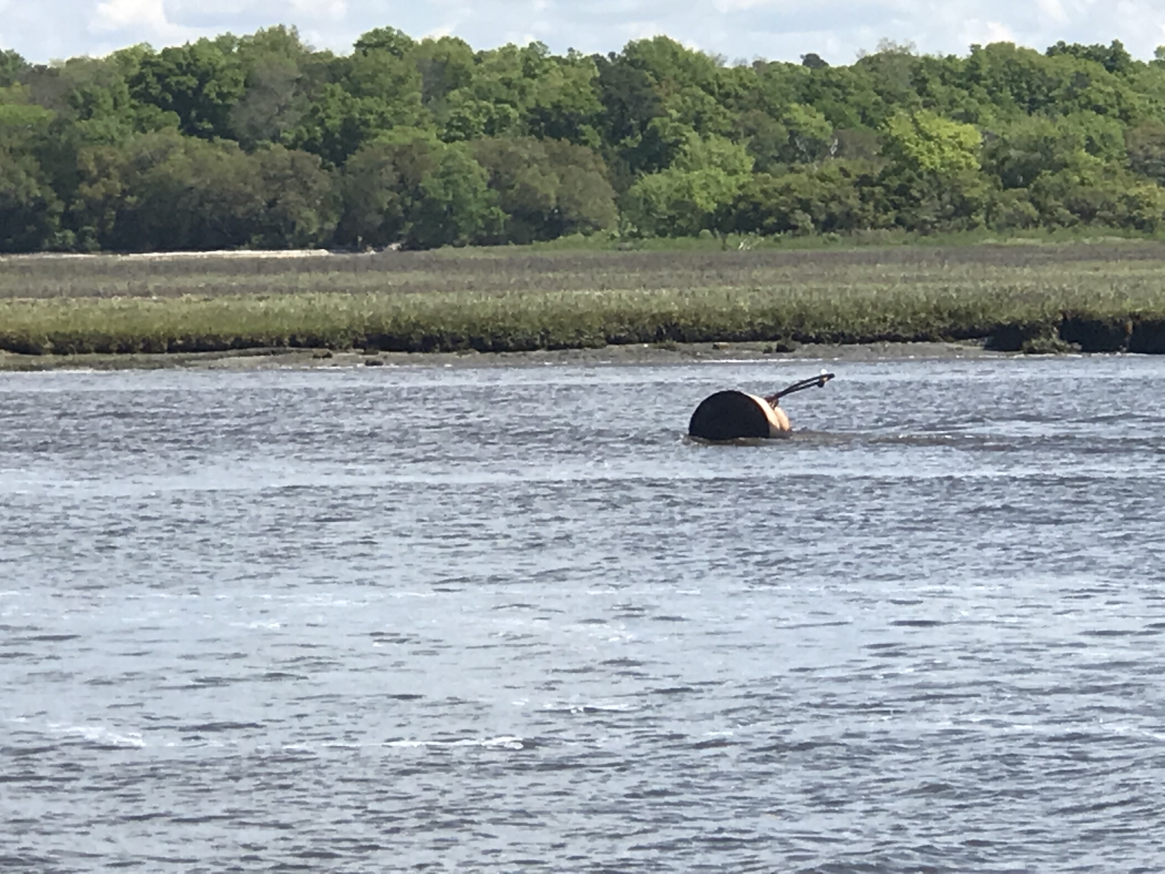
As you twist your way out to sea be careful of the floating steel drums that are just outside the channel.
Would not want to hit that at night
Little River Inlet twists a sinuous path to the ocean.
Snaking it’s way to the ocean
The strong outflow created a distinct boundry between the brown, full of sediment water rushing out and the green water off the coast of NC.
Sediment laden waters flowing into the green sea
Friends of ours, Jimmy and Wende had just taken their fishing boat out of Lockwood Folly Inlet and were chatting with us on the VHF. I had to raise my 45 degree lowered antennas to the upright position to get better reception. On the ICW you must lower your antennas to fit under low bridges. The reduced reception does not matter as you are really just communicating with a passing boat or a marina that you are next to. They were quick to end the call reminding me to put my antennas back up, which I just did after writing that 😉
The inlet they came out of might scare anyone who looks at it on the charts. When you see a bunch of shipwrecks dotting the inlet it might be telling you something about the inlet.
That’s a lot of boat bones
We had planned to go offshore at Little River Inlet and run the 25 or so NM to Cape Fear. However once we were outside we were enjoying making over 9 kts.
Making good time
We decided to see if we could find a way through Frying Pan Shoals rather than around them. I spent some time plotting a course that in the end had us seeing 8.7′ at the lowest. Normally we would simply plot a course around Frying Pan Shoals but the added distance could mean a nighttime arrival. A check of the tides showed that we were not going to get much of a lift from the tide.
Barely 2 hours after a negative low. won’t add much water to the chart soundings
The swell presented a bit of a challenge as well. Ocean swell can push a boat closer to the sea bottom when you slide into the trough of a swell. The swell also can cause “breakers” (think breaking wave tops) where the shoals are shallow. Today however, as we cautiously motored over the shoals our path was uneventful. If you want to cross the shoal there is a path that lies about 3 nautical miles off the point of Bald Head Island. Just take your draft and everything else into consideration before you attempt.
Our Actual Path over Frying Pan Shoals – 3 miles out
Once we rounded Cape Fear we were making good progress toward Masonboro Inlet and Wrightsville Beach. You can see on our iPad navigation app the boat icon that is us, a black dotted track line that is where we were as well as the magenta 3 mile offshore dashed line.
Us rounding Cape Fear
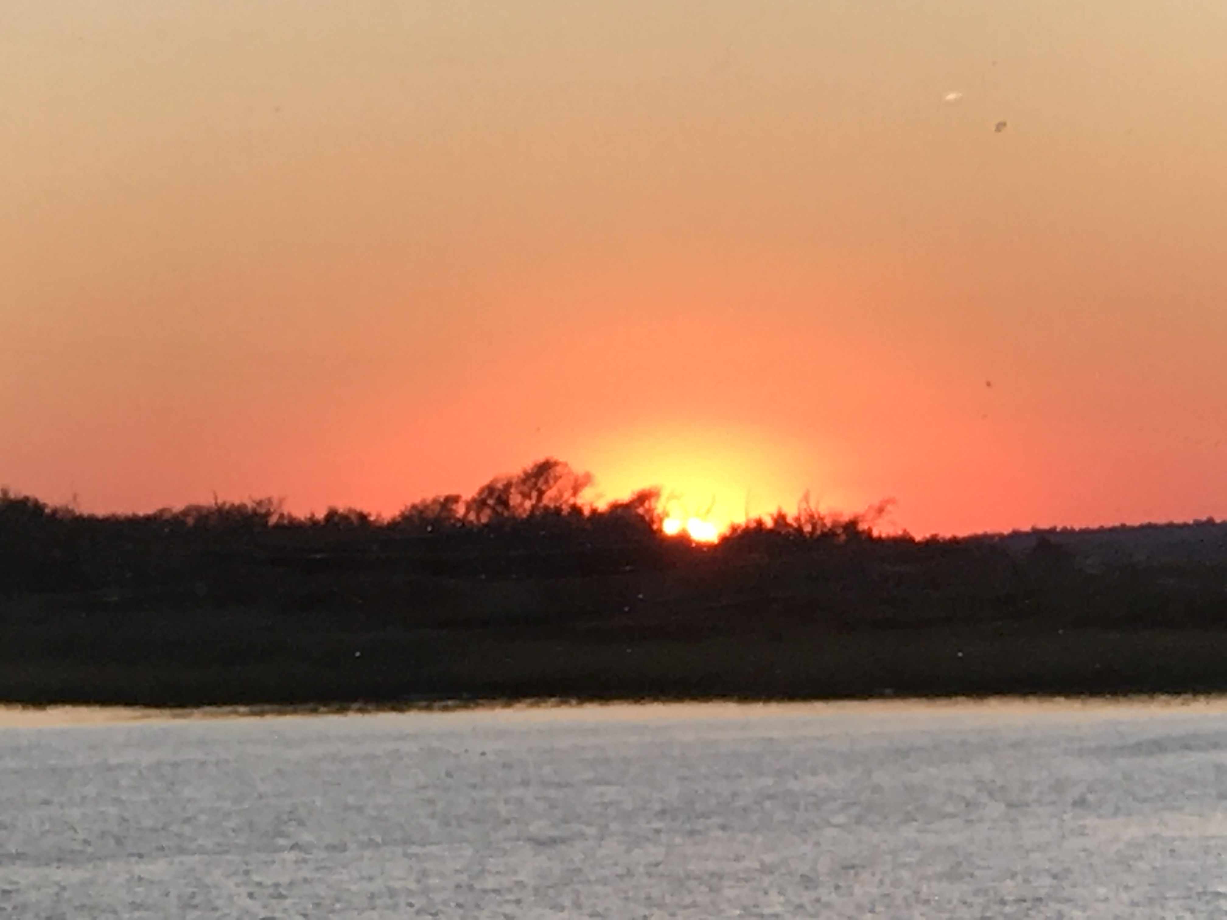
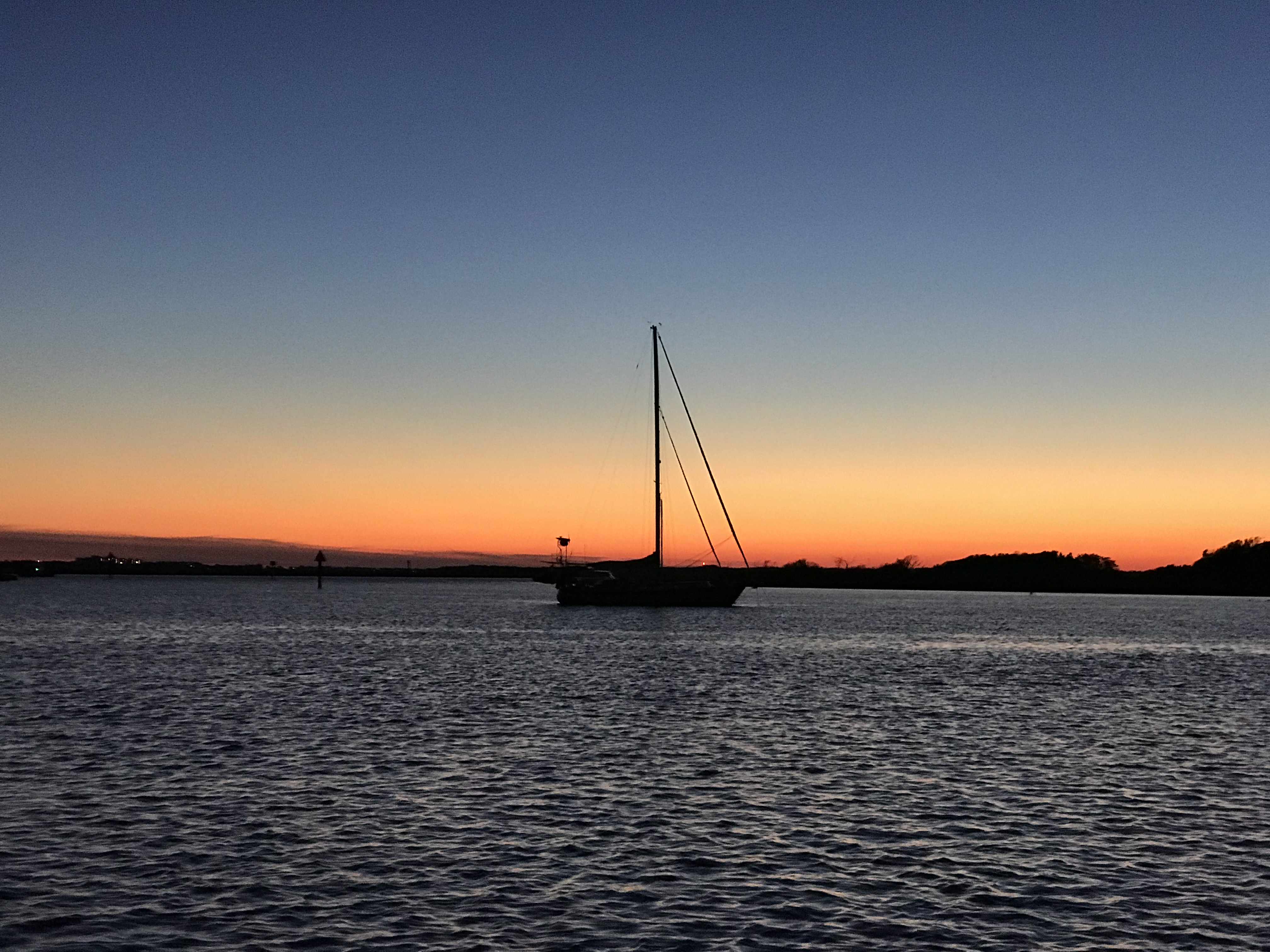
Once inside the inlet we quickly anchored up and watched the sun go down
Setting sun
Dipping below the horizon
Gone
While the sun was setting the full moon was already up.
OK, it’s not technically a full moon but 98.8% is close enough. Tomorrow we’ll have a full moon.
We are leaving St. James Plantation Marina in Southport, NC this morning but made a promise to come back and spend more time with our friends Jim & Wende. They were very gracious hosts while we were here and we got to share in the experience of being in a “private town”. So very interesting though I must say Kelly & I will have to investigate exactly what that means?
Thanks Jim & Wende, you showed us a great night off the boat and we promise to come back and spend more time.
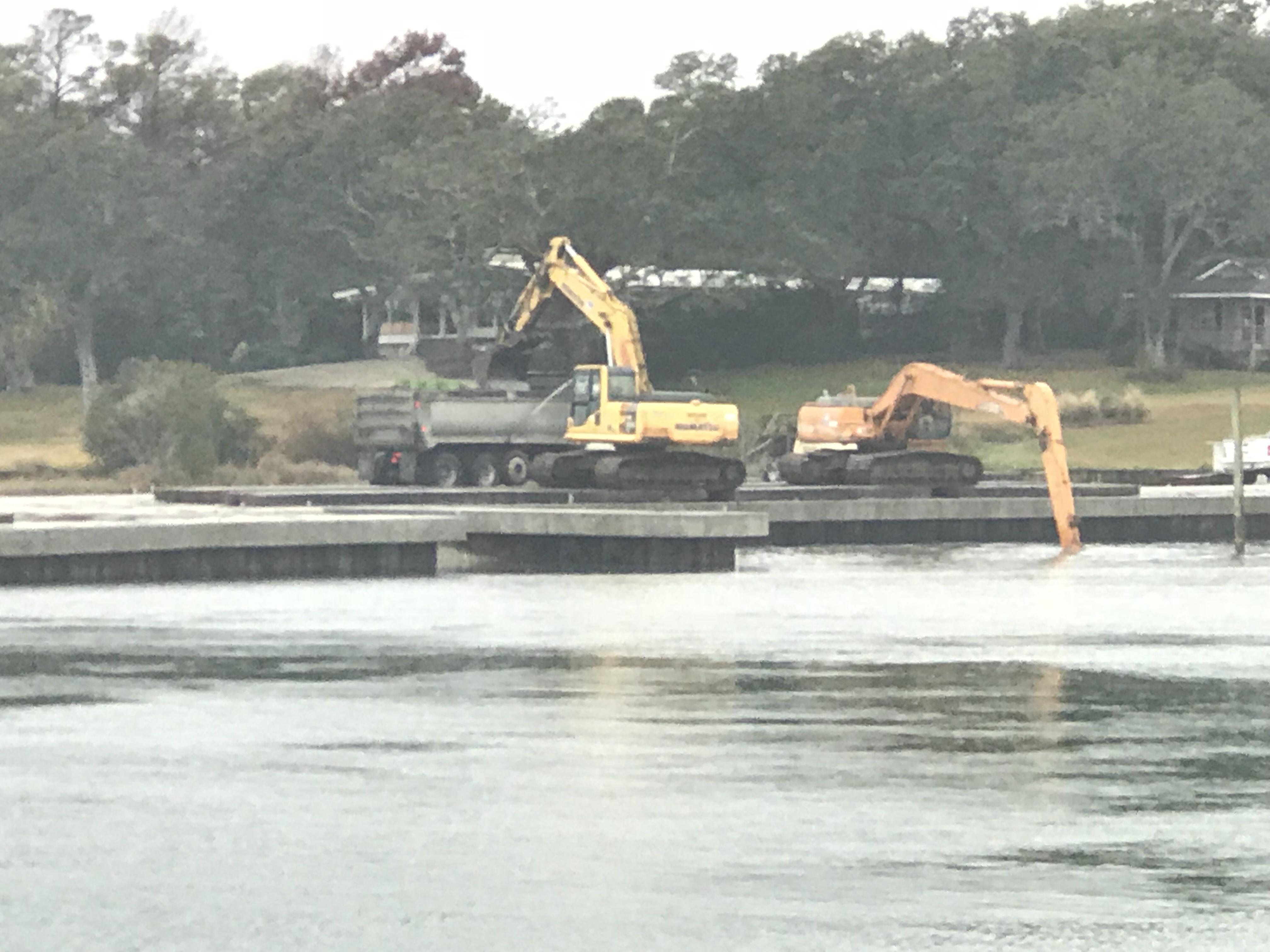
The night before we had anchored in Sloop Point, NC and the trip down to Southport was an interesting one. We saw heavy equipment dredging around what looked like a new pier going in. I know what salt water does to steel and I still shudder at the thought of dipping an excavator’s arm into salty water. I’m sure the water in the ICW is brackish but still.
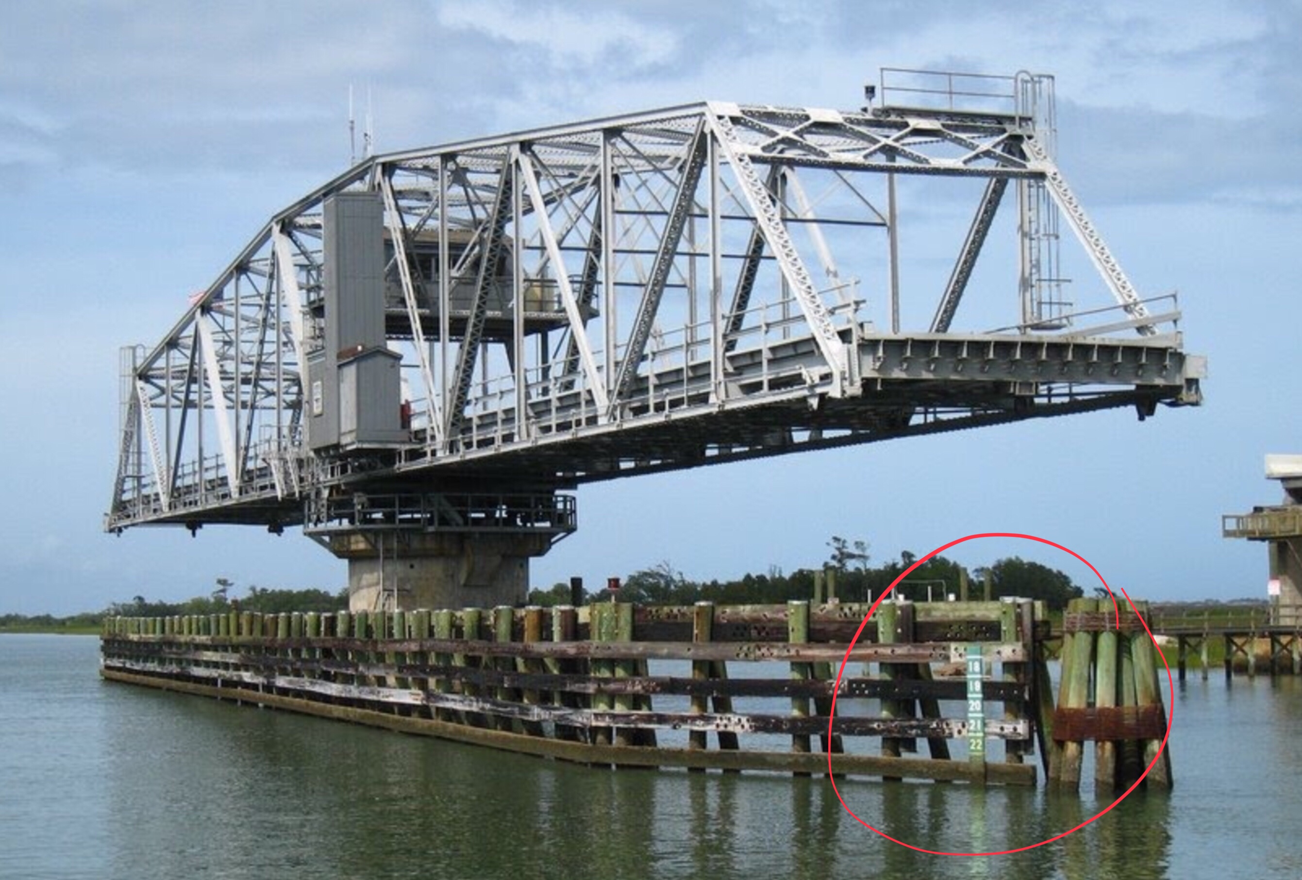
I was checking my ICW bridge list and realized that I would not make the Figure Eight Swing Bridge in time for their restricted opening time. This meant that I would be waiting for the next opening. However the bridge tender who I had hailed on the VHF asked me about my air-draft. Your “draft” is your vessels depth in the water and your “air-draft” is your vessel’s height above the water. I replied that I believed it was somewhere between 21-22 feet. The bridge tender remarked that he currently had 22′ of clearance. Every bridge along the ICW has a “height board” that is partially submerged under the water with height markers at the waterline. While all bridges on your nautical charts will list their height at an average high tide, the actual vertical clearance varies with the height of the water. The bridge tender offered to come out of his office and stand under the bridge to check my clearance if I wished to approach the bridge slowly. This can be a tricky maneuver as there was a current pushing Simple Life toward the bridge. I slowly edged the boat idling in reverse to the bridge and bridge tender assured me that I had a good 6″ of gap between the top of our boat and the bottom of the bridge. MV Simple Life’s air-draft is 21′ 6″.
Below is a stock photo of the Figure Eight Swing Bridge as I was too busy at the helm to snap pictures. You can see I circled the “height board” and at the time this picture was taken there was slightly less water under the bridge giving even more clearance than the 22′ we had the other day.
Just a few more miles down the ICW and we had to pass through the Wrightsville Beach Bascule Bridge located at statute mile 278 along the ICW. This is a restricted bridge that only opens on the top of the hour.
As we continued on to Cape Fear (Southport, NC) we were delighted at the scenery.
We passed many Atlantic Ocean inlets that had high sandy bluffs and marshy islands dotting the entrances. You could see and hear the surf breaking in the shallow inlets and it makes for nice scenery. The last of those 4 photos is one of a fixed dock that just barely exceeds the height of the water level. Interesting choice of fixed dock heights as this surely must be slightly submerged at times? Slightly submerged docks must be fun to walk along but just like submerged rock jetties that often protect many of the ports we enter they can be dangerous if boats come into contact with them.
As we got the point where the ICW connects with the Cape Fear River via “Snow’s Cut” we were passed by a US Army Corp of Engineers survey boat. These folks use sophisticated sonar to accurately probe the depths of these constantly changing waterways. He kindly slowed down as he passed and got back on plane once he was in front of us. However, just then the VHF crackled on channel 16, “Trawler in Snow’s Cut, are you OK?”. I quickly answered the hail with “comeback to the trawler in Snow’s Cut”. It was a boat in a marina that was hailing us stating that they “saw what had happened”. I replied, “If you are referring to the ACE boat that passed us, yes we are OK”. I found this communication amusing and I can only guess that the survey boat had passed the marina giving a large wake and making the marina boat unhappy and maybe this was her way of shaming the ACE boat publicly on the VHF?
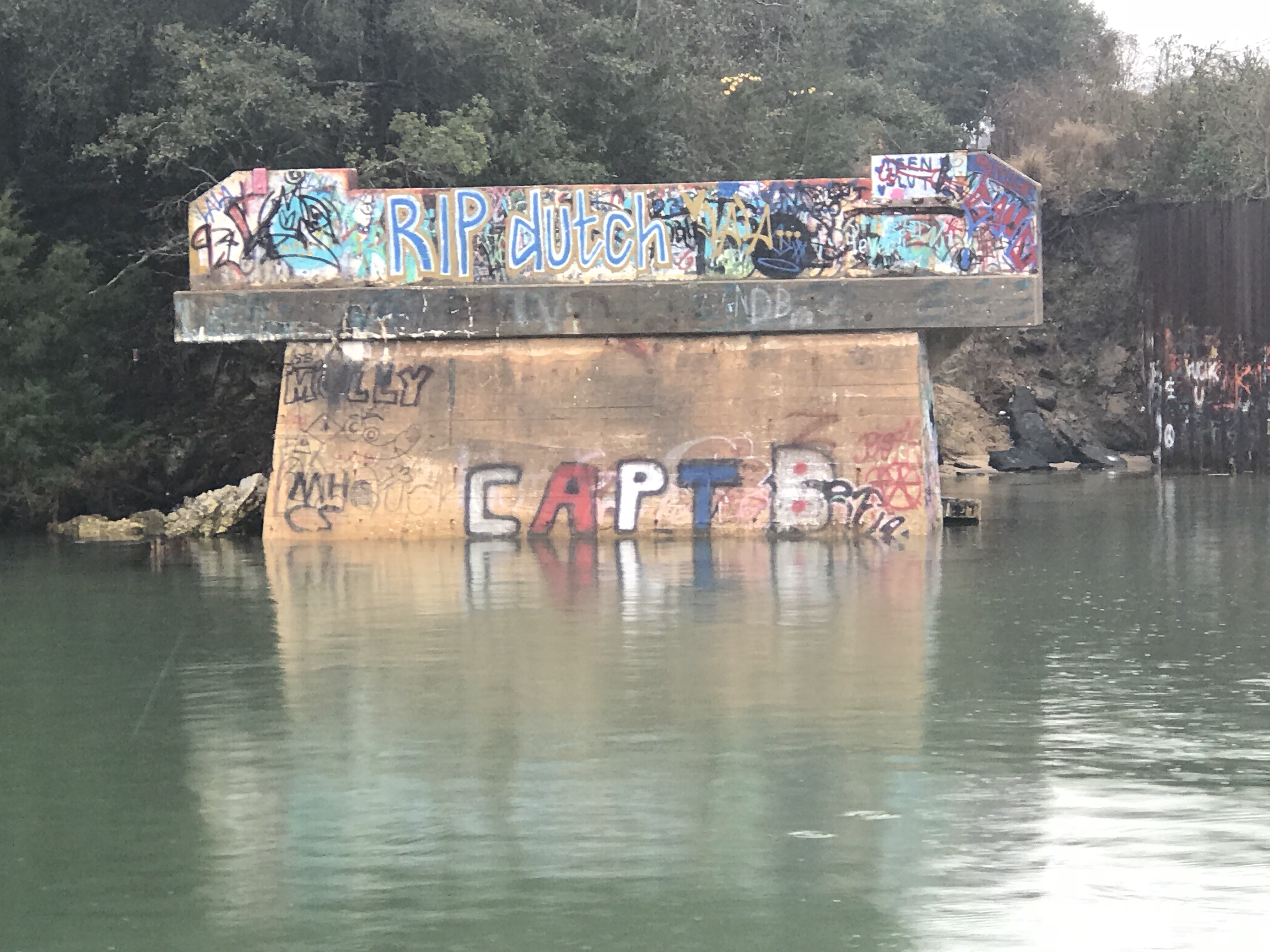
It would seem the kids in Snow’s Cut like to party at this old bridge abutment. “Party on” Capt B.
Once in the Cape Fear River it became quickly apparent from the size of the docks that extend out into the river that this river is used by large ships. Passing these behemoths must be done at a distance.
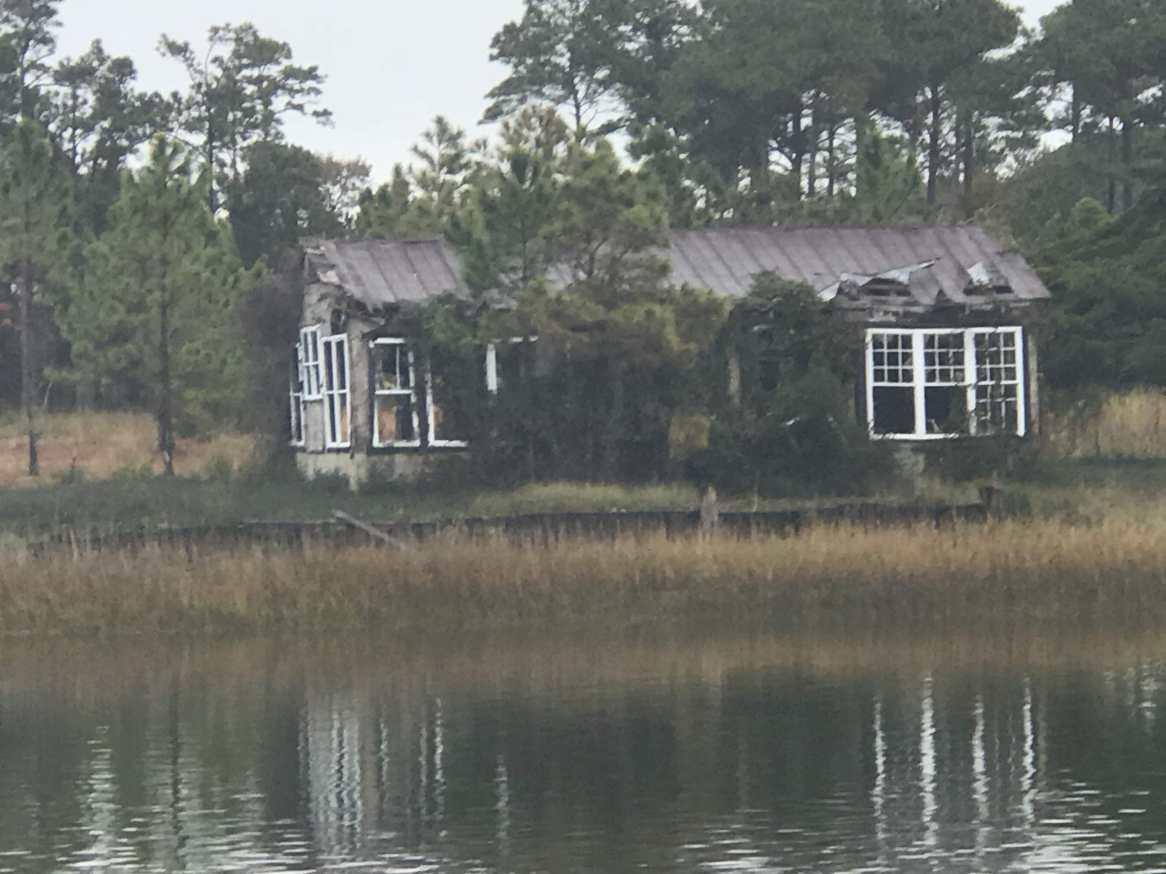
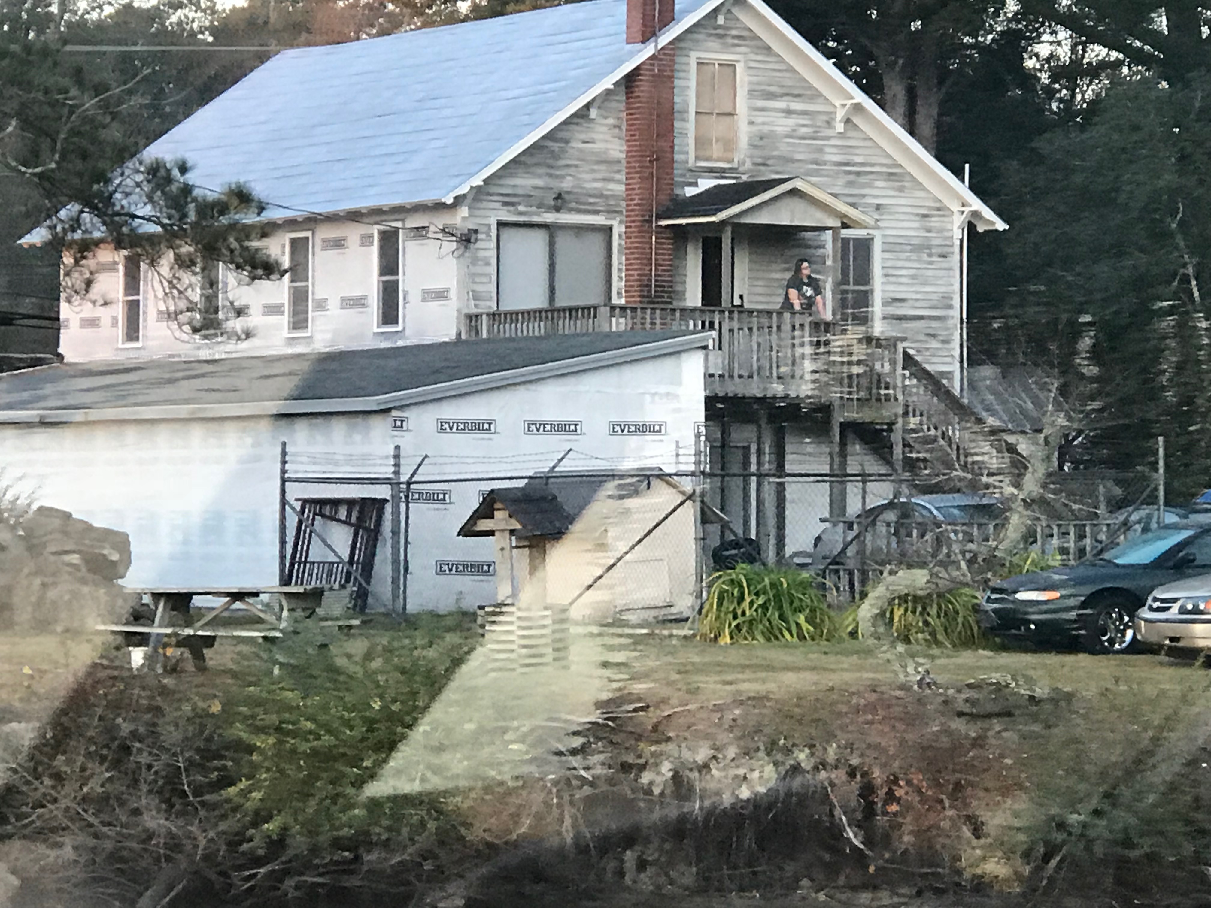
A quick turn back onto the ICW, by a dilapidated building and we arrived at St. James Marina.
Time to push on to Georgetown, SC where we’ll update with a new post of what we saw along the way.
Yesterday morning we awoke before sunrise and got underway to Beaufort, NC.
The first & last supermoon of 2017 was helping slice through the dark as we pushed away from the dock.
Supermoon Reflecting the Sun’s Rays
Supermooninfographic
Supermoons happen when a full moon approximately coincides with the moon’s perigee, or a point in its orbit at which it is closest to Earth. This makes the moon appear up to 14 percent larger and 30 percent brighter than usual.
December’s supermoon is actually the first of three back-to-back supermoon full moons to come in the next two months. On Jan. 1 and Jan. 31, the full moon will also occur near the moon’s arrival at perigee, according to NASA, which billed the line up as a supermoon trilogy. The Jan. 31 supermoon is also the second full moon of January, making it a Blue Moon, and also occurs during a total lunar eclipse.
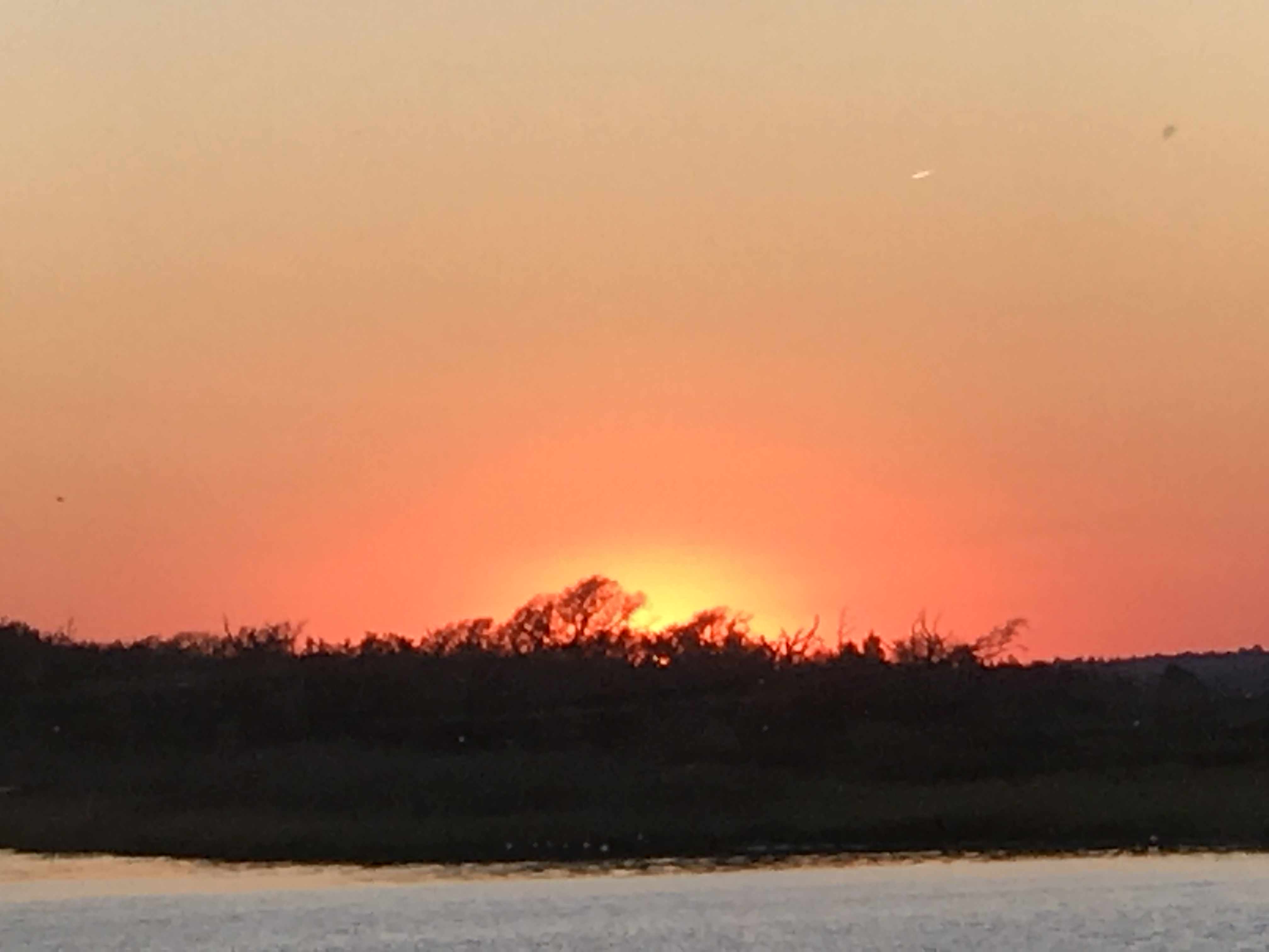
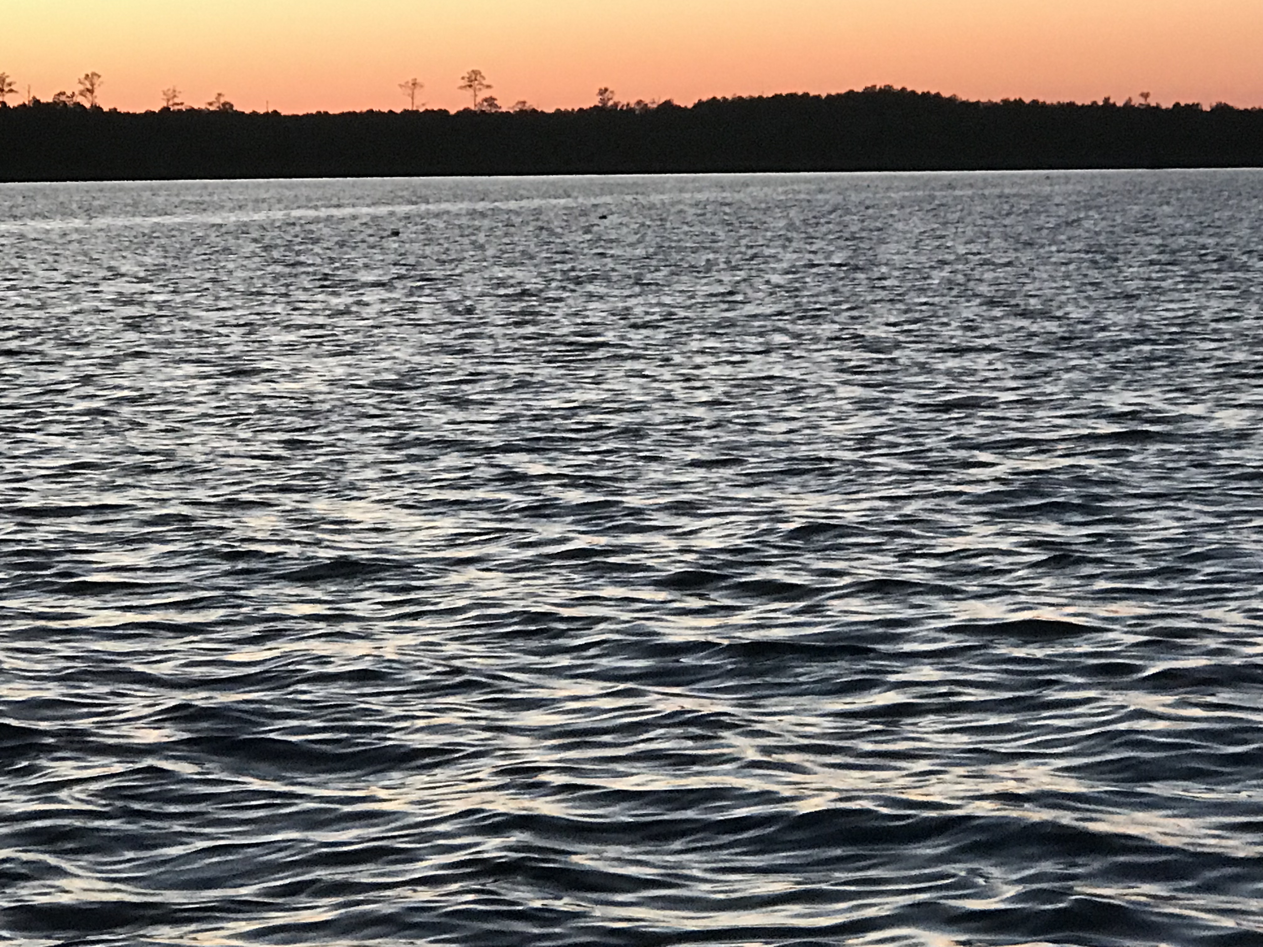
As the sun got ready to sneak over the horizon there was a beautiful orange-pink hue reflecting off the water.
Before Sunrise
Today’s leg of our journey takes us from Hobucken, NC to Beaufort, NC
The Beaufort of coastal North Carolina is “BOH-fert”. The Beaufort of South Carolina is pronounced “BYOO-fert”. Established in 1709, Beaufort is the third-oldest town in North Carolina.
Beaufort Leg of Journey
As we made our way out of Goose Creek and into Pamlico Sound, the only traffic we passed was a tug pushing a barge.
YATPB – Yet Another Tug Pushing Barge
The dominant wave set was coming from the NE and that meant we had a following sea as we turned and made our way down the Neuse River. A following sea that is slightly to one side of the stern can be annoying when you are at the helm. The waves catch up to the boat from behind and lift the stern pushing it to port or starboard. This can swing the bow as much as 30 degrees at times and it starts to feel like you are pointing the boat all over the place. I made a quick adjustment to increase the autopilot’s response rate and the bow heading deflection lessened considerably. Being a slow boat (6-9 knots) you are often at the helm from sun-up to sundown to make your destination. Autopilot is an electronic device with some firmware loaded on it that drives a hydraulic pump which turns the rudder. There are many settings that you can control but the response rate is the one you will want to adjust so that the rudder position changes are swift or slow enough for how you want the boat to point.
Autopilot Control
Autopilot Display
As weekend boaters, we were boating in destinations like Block Island, Nantucket or Provincetown. These locations are anywhere between 6-12 hours from our home port in Warwick, RI. We would be forced to run the boat at 8.5 knots and only get about 1 MPG. Now that we are full-time boaters, we slow the boat to about 6 knots and get 4 MPG. You can go 4X farther if you simply reduce your speed by 2.5 knots. (Recall 1 knot = 1.15 MPH so approximately every 6 knots you would simply add 1 to get the speed in MPH).
Even knowing this, we made the decision to up the speed to 8.5 knots and reduce the amount of time spent in the following sea.
Happy and Chief Martin Brody appreciated that we burned a a bit more fuel for their comfort.
Chief Martin Brody and his Big Sister Happy
Wake in the Neuse River
As we turned into Adam’s Creek the ride smoothed out and we dropped back down to 6 knots. The current in Adam’s Creek was swift and the DSM (Depth Sounder Module aka. Fish Finder) was showing asymmetric rippling of the creek bottom. I believe this is caused by a swift bottom current.
Asymmetric Rippled Bottom of Adams Creek
The fish finder was also well, finding fish. The DSM uses sonar or high frequency sound generated by a device that protrudes through the hull and is sending a column of sound waves straight down beneath the boat. These sound waves not only reflect off the bottom but when they hit a fish the sound resonates in the fish’s swim bladder (a small air-filled sack that helps control a fish’s buoyancy) and this echo is detected and colored sharply to allow you to spot fish on the screen.
Look Swim Bladders
Adam’s Creek is a lovely place with lots of sights to see.
Bonus Points for Parking Your Helicopter in Front of Your Mobile Home
Boat Slip only $75K
I’m Pretty Sure The War Over Slavery Ended?
Adams Creek spills out into the Newport River and it’s marshes and shallows are something that you will want to avoid.
Newport Marshes as you Head South to Beaufort
Kelly & I Often Joke… “If You Want to Know Where it’s Shallow; it’s Where the Birds are Standing”
As we pulled into our slip in Beaufort we hailed the dockmaster who warned us about the swift current running transverse to the slip we were assigned. As we pulled in to the fairway the current slammed into our full keel and began to push the boat toward the bows of the boats across the fairway. I was forced to back out quickly and reposition so that I could now take the swift current into account and position the boat for rapid spin and quick back into our slip. Kelly was quick to toss lines to the dockhands and soon we were checked in and given the keys to a “courtesy car”. Up North, I’ve never stayed at a marina that offers a fee courtesy car to marina guests. The car was a welcome treat and we put it to good use re-provisioning the boat with more food & beer.
Courtesy Car – We Got Wheels!
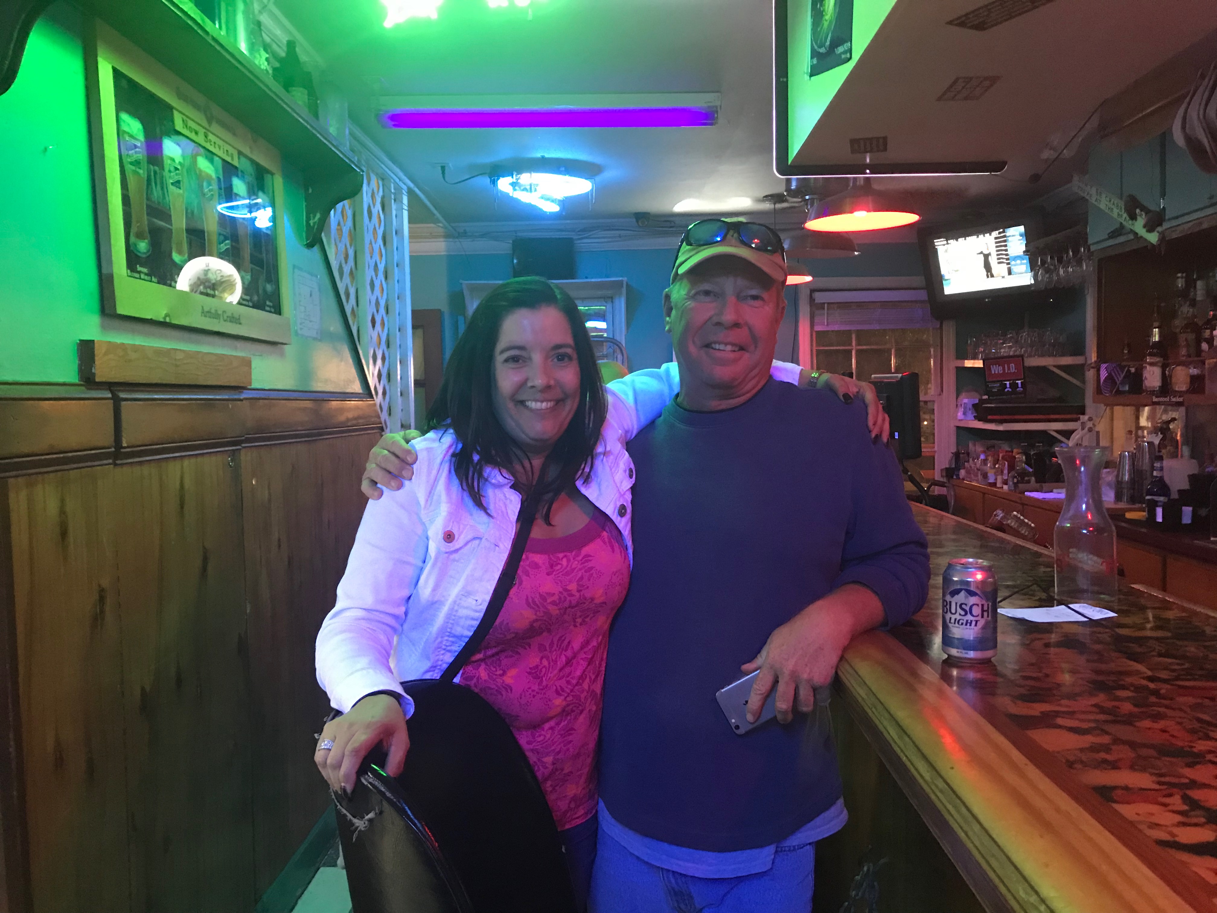
With all our chores completed we quickly made off to the marina bar for happy hour and spent time chatting with Bartender Kristen and fellow bar patron, Dan. Dan was an amazing fellow who told us stories of his solo sailing around the world in a small boat. He offered us some local knowledge about wild horses that roam the islands around here. I KNOW more wild horses to find!
Kelly & Sailor Dan
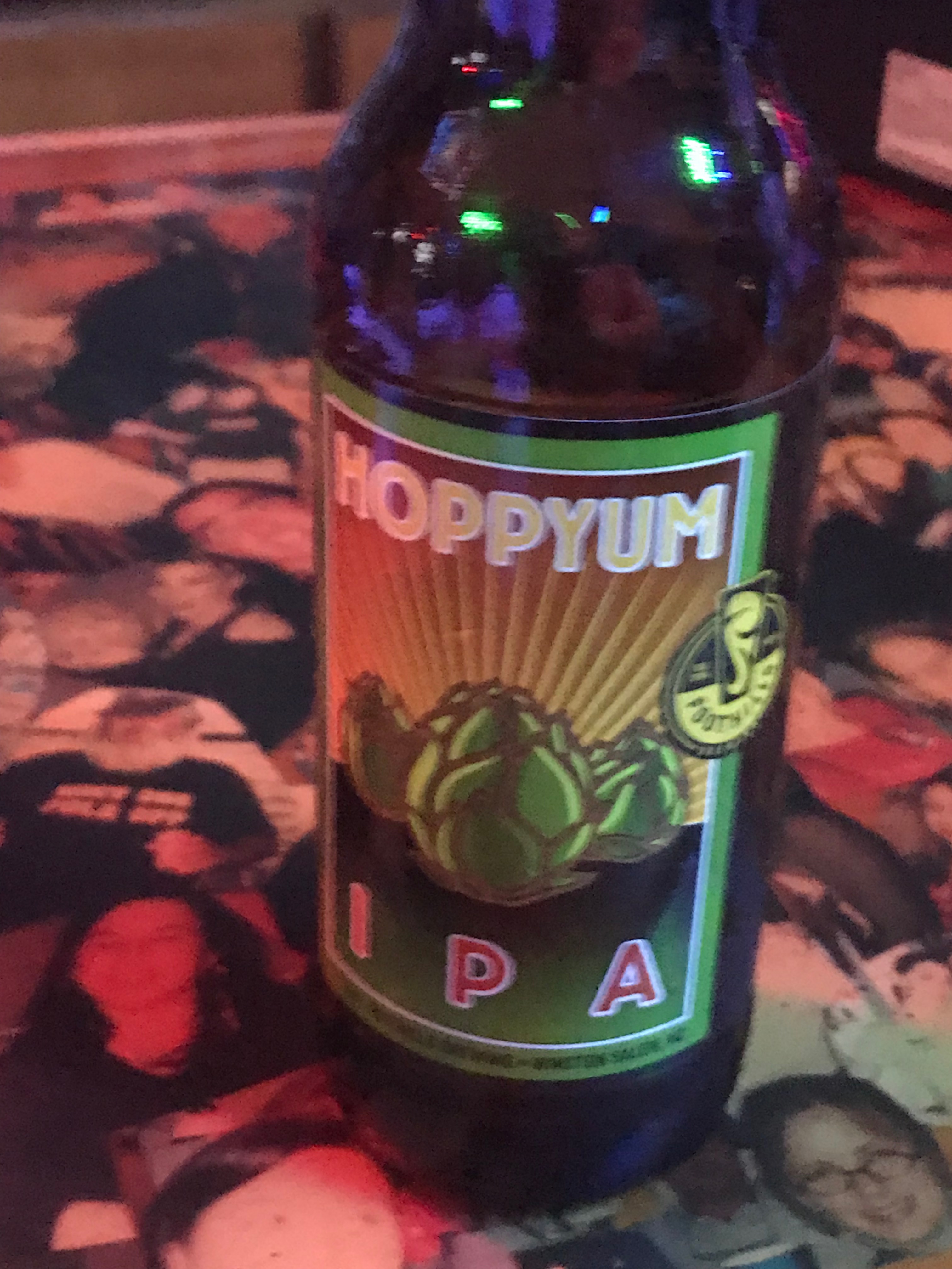
After I consumed as many 50 cent pork sandwiches as a man can eat and washed them down with a great local IPA it was time to retire to the boat.
We were no sooner readying for bed when we were accosted by “Monkey Bird”. This vile creature had a penetrating stare and an awful cry. I spent sometime staring into this monster’s gaze and knew it was time to lock the door and keep the crew of Simple Life safe.
Coinjock Marina is a great place to stop along the ICW. The Sandbar even had an Xmas tree up.
Too Early?
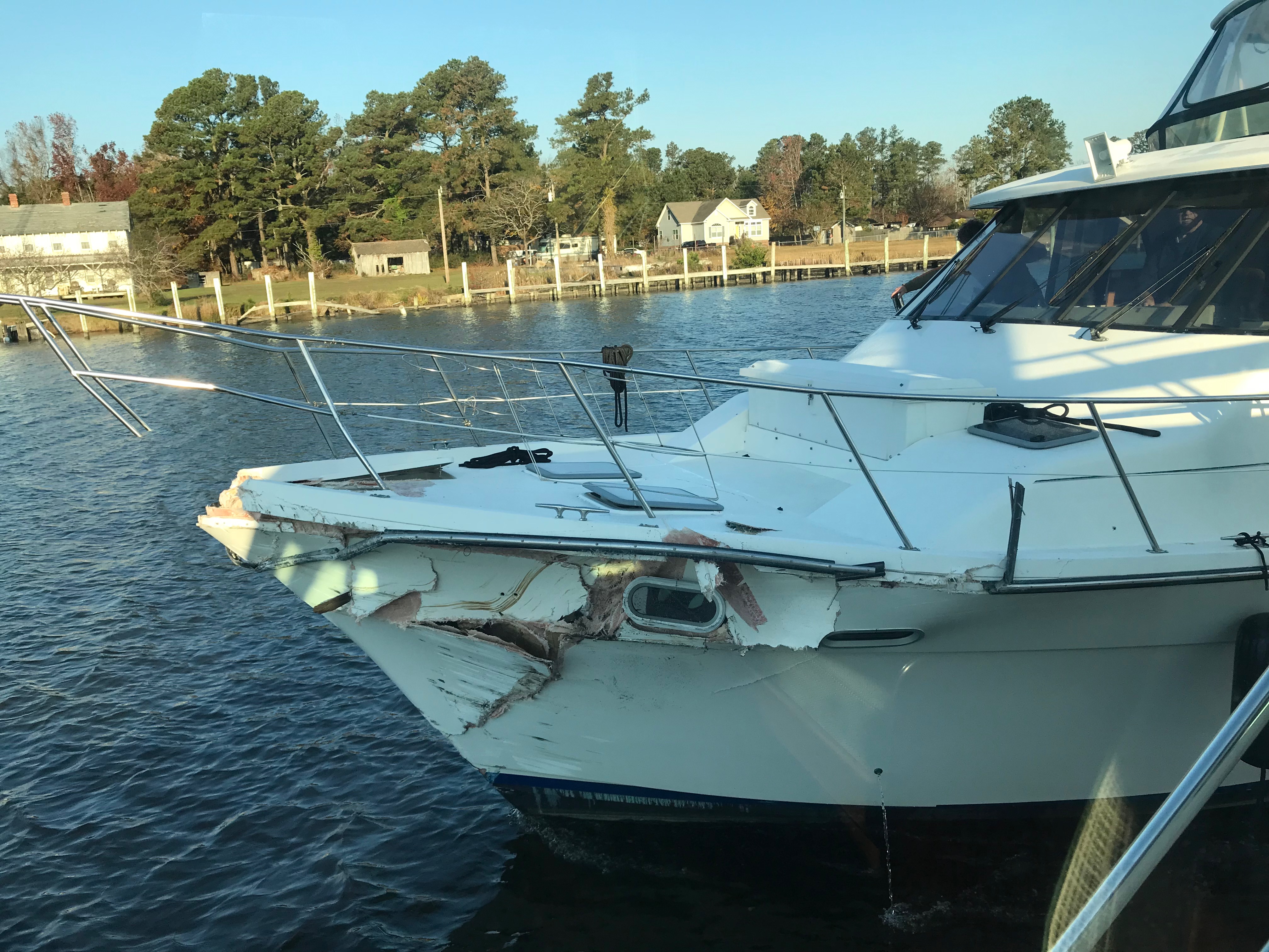
While we were at the pier a 1998 Bayliner 4788 arrived during the night and as they passed us we saw the severe damage to their bow.
Hope Nobody was Injured
It was a reminder about how dangerous boating down the ICW can be (especially when traveling at night). I hope nobody was seriously hurt. After having a crash like that you’d think you’d stay far away from everyone but as they passed us I thought for a second that they might hit us.
Yikes – This Pic Snapped Out My Pilothouse Window!
At that moment I went out in my PJs and attached two fenders to the canal side (just in case 😉 )
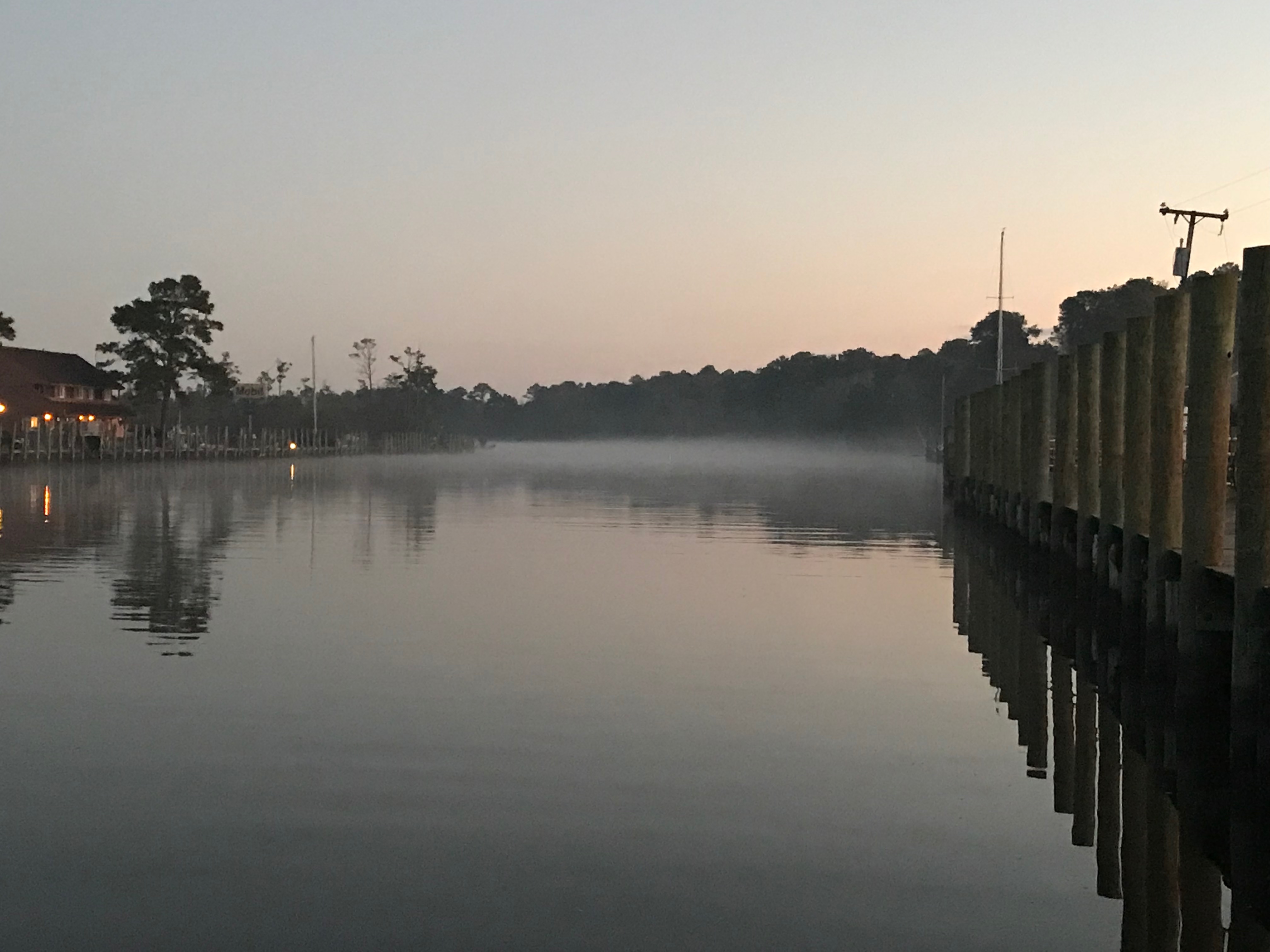
When we left Coinjock Marina it was foggy.
Coinjock Pier Looking Off our Stern
Even as we headed down the canal we had to rely on our radar to see any far out vessels.
Fog Was Worse Than This at Times
As you travel down these canals you will find homes along the canal and people going about their daily business.
Me Waving from the Pilothouse to the Locals
As we traveled along we saw several boats anchored just outside the channel. Being anchored well after sunrise is a sign that someone is having a peaceful morning enjoying their coffee.
Peaceful Morning on Anchor
We continued South down the North River and into Albemarle Sound. There was not a single boat to be found in the sound. We had the crossing to ourselves. While approaching the mouth of Alligator River I saw, what I thought were boats but upon closer binocular examination, I see they are some sort of mini islands? I’m not sure of their purpose? They look to big to be duck blinds?
I Need to Figure Out What These Are?
We anchored at the head of the Alligator River as we lost daylight. The anchorage was quiet with no boats passing but the cellular signal was dead. During much of the transit we would see our cell signal go from LTE => 3G => Extended 1X => blank. At times we would be excited to see 3G and upon trying to connect, we’d see the signal instantly drop to “Extended 1X” which did not work at all.
What Kind of Tomfoolery is this?
The Alligator River – Pungo River Canal was long and straight.
I Can See For Miles
Along the banks of this canal you can see the erosion from passing wakes.
Geology Experts of the Future Will be Doing Molecular Analysis on That Green Line
You will see many birds as you float along. It’s a reminder to me to improve my ornithological skills.
Where are my Ornithology experts?
Where is His Beak?
You’ll see other things that you’ll want to stay clear of like …
Fishing Nets
Sticks = Hazard
Are We Too Heavy for This Dock?
At times this can be difficult as you run straight down the sun heading South. While the camera does well looking into the sun, I was struggling at times.
Staring Match With The Sun
We arrived in Hobucken, NC and tied to an old dock for the night.
2 Days Journey
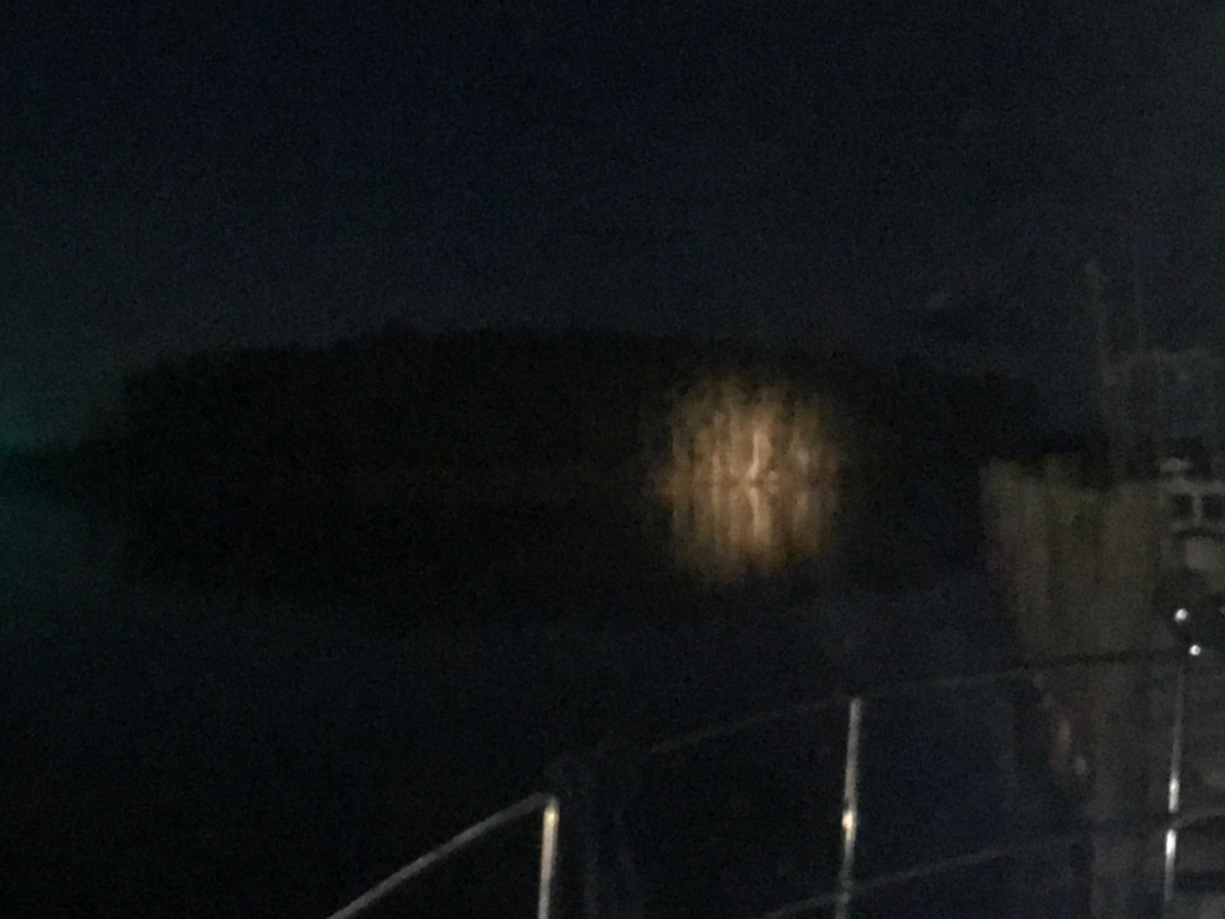
It’s been quiet here except for the passing tug pushing a barge down the river at night. At one point I was staring at a stand of tall trees that were illuminated on the shore and I could not for the life of me see the source of that light?
A Stand of Trees Illuminated
It became apparent moments later that it was the spotlight of an approaching tug and we braced for it’s passing wake.


You must be logged in to post a comment.