
Making our way North our next anchorage, a little creek called Robinson Creek. This spot lies just North of Comanche Cove Marina in St. Augustine, FL. We stopped at Camanchee Cove for a few days on the way down.
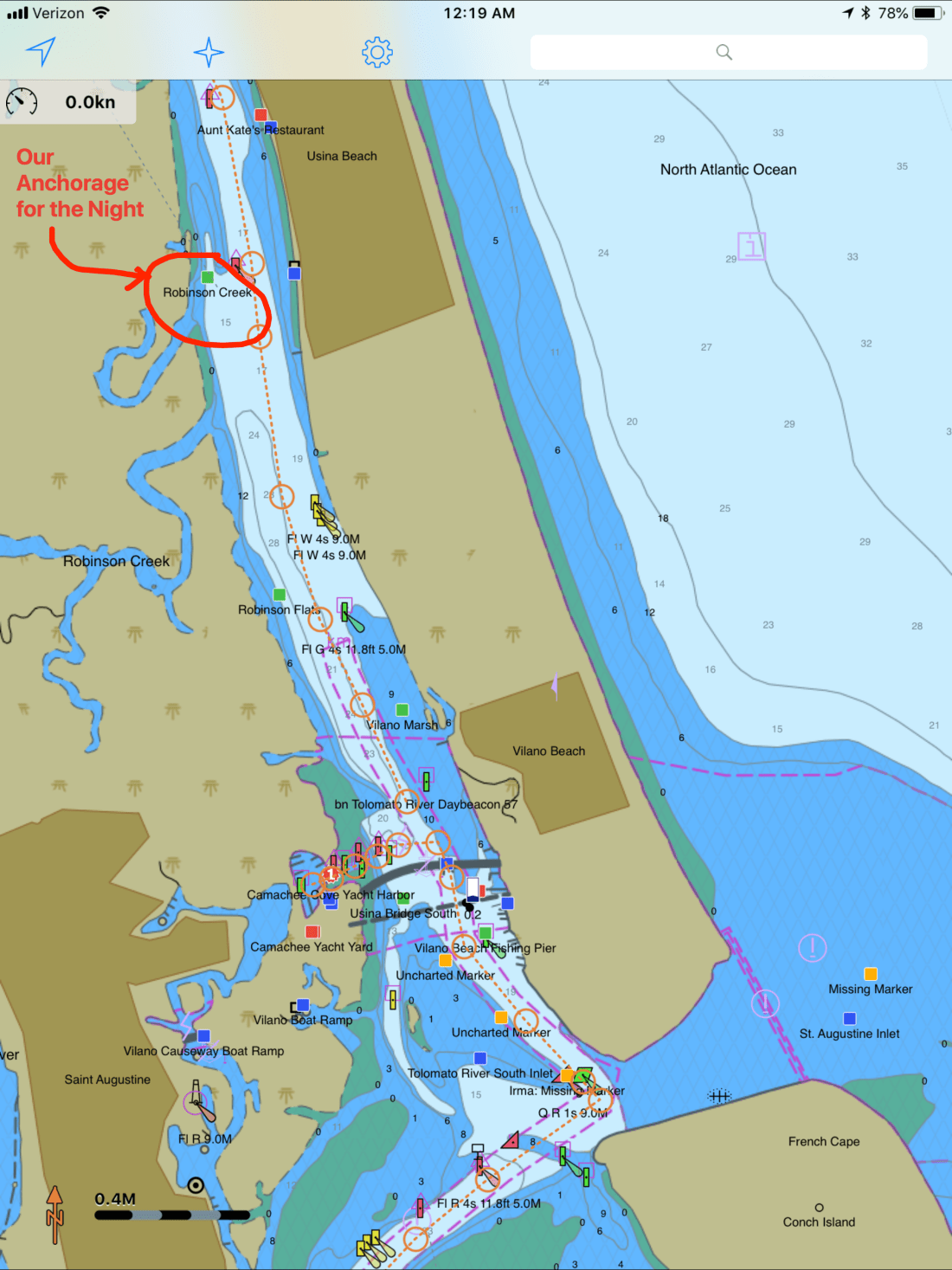
Our route would look something like this.

On our way there we passed through Daytona Beach and the airport had lots of planes flying overhead.
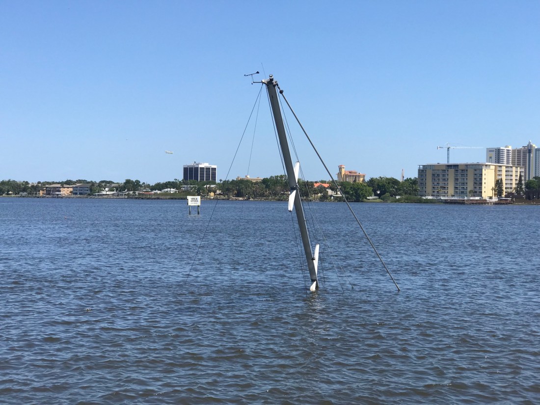
There were other hazards to watch for like this sunken sailboat. Just look for the mast 😉
As we traveled I trawled a fishing line from outside the pilothouse door. I heard the drag on my reel start zzz-zing and reeled in a what I would later identify as a “Ladyfish”. I quick fish app check and this is an unregulated species with poor edibility.


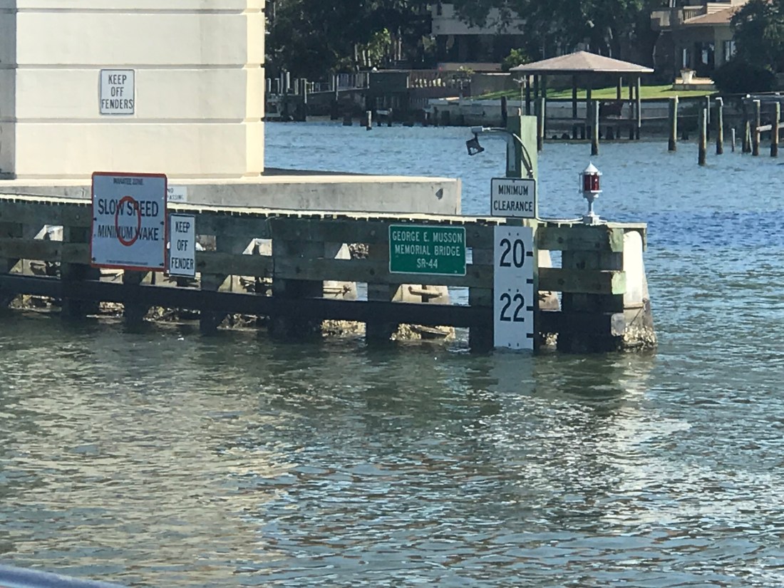
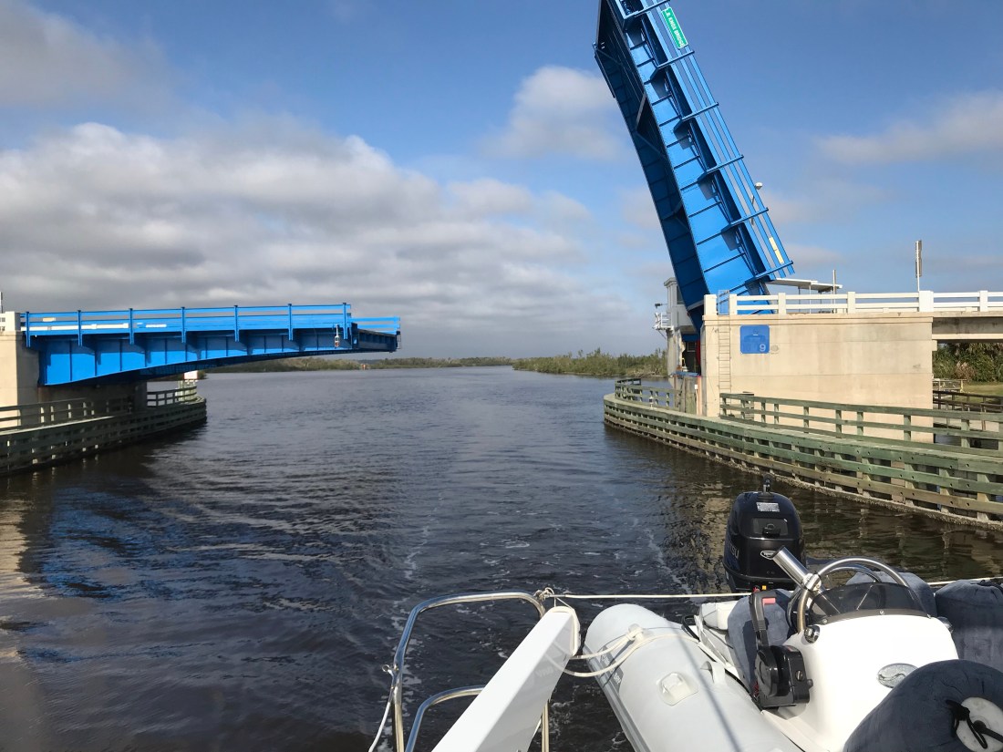
in New Smyrna Beach we had to pass under a few low bridges. Our 22’ air draft it made for a tight squeeze. Luckily the bridge is a bit taller in the middle than what is reflected by the height board.
As we approached a bend in the ICW we saw two boats blocking our path to the North. One looks like they have thrown out an anchor to stop from getting pushed further ashore or a possible kedging off attempt. The other was in the process of being pulled off by TowBoatUS. We contacted the Towboat Captain on VHF and treaded water for about 20 minutes until the first boat was pulled clear and we could continue. The trick needed to pass was to hug the reds as close as 10′ abeam. Seems odd that the deeper water would be on the inside of the bend but was where you needed to be. This is location is right near Fort Matanzas South of St. Augustine, FL
The song playing in the pilothouse is “Devil’s Dance Floor” by Flogging Molly. A great Celtic band out of LA.


Every captain knows when you traverse the ICW, the shallow channel depths mean that you could run aground if you drift out of the channel. For this reason oncoming boats must stay “Right of Center”. This fellow captain seemed oblivious to that rule judging by the wave he gave after forcing us out of the channel. We were riding the right edge of the channel and had no choice but to either hold our ground and use sound signals (1 short blast for a 1-whistle pass – port to port) or simply move over. If you don’t know to stay right of center you wont know your sound signals either 😉
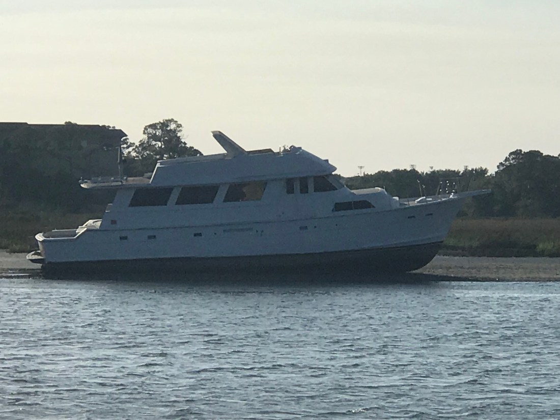
As we approached St. Augustine we saw a large trawler aground.
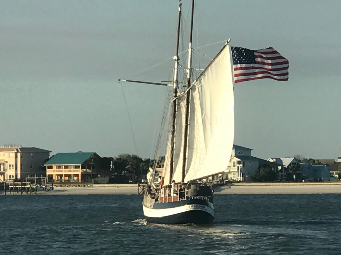
We passed the magnificent schooner Freedom
The night ended with a warm orange-pink sunset.


You must be logged in to post a comment.