ICW Mile Marker 0

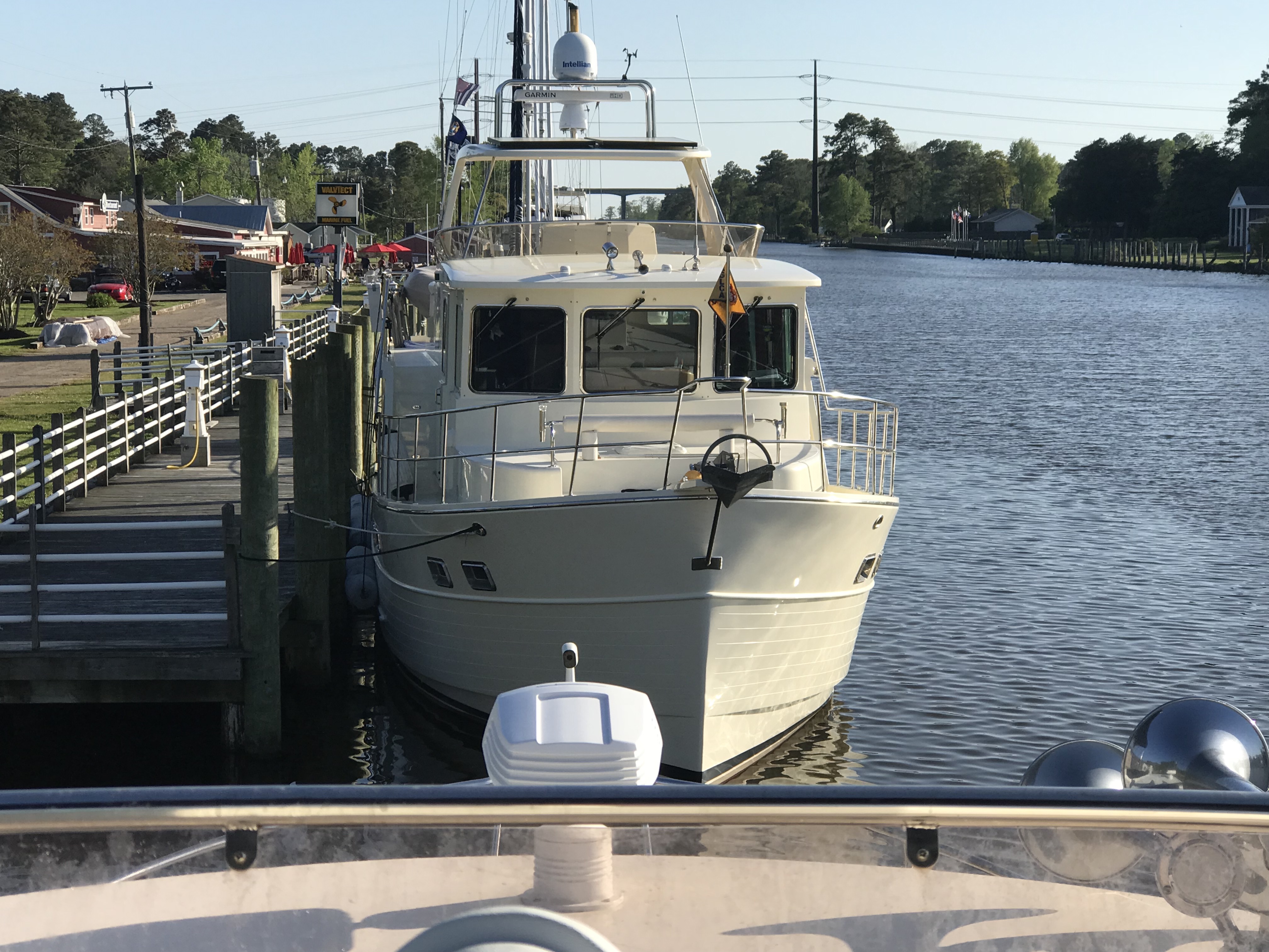
I awoke on anchor to find that another boat had quietly slipped into the anchorage while I was sleeping.

I could not quite read the name of this vessel

A quick look around shows dense fog was blanketing the area outside the anchorage.

The day’s planned journey was to a marina about 36 NM or 6 hours away. It’s Friday and the marina closes at 5PM so I wanted to be there by 4PM to secure a spot. I figured a late 10AM start might allow some of the fog to burn off.

As I enjoy my morning coffee, I look up at see that the other boat in the anchorage was now leaving. I can finally read the name, MV Effervescence IV. I recall this boat. Effervescence IV was on the hard next to Simple Life in Warwick, RI, one month ago. Her owner and I had introduced ourselves and exchanged numbers just incase we should wind up near each other on our trips south this winter.

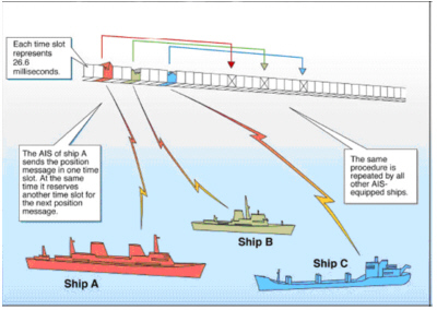
It’s now 10AM and as I pull out of the anchorage, I check the AIS (automatic Identification System) and see Effervescence IV is just a just a few miles ahead of me.

MV Effervescence IV AIS info

I use the MMSI # from her AIS info and program it into my VHF to place a DSC individual call to the boat and instruct their DSC radio to automatically switch to CH#69 as soon as they ACK my DSC call.

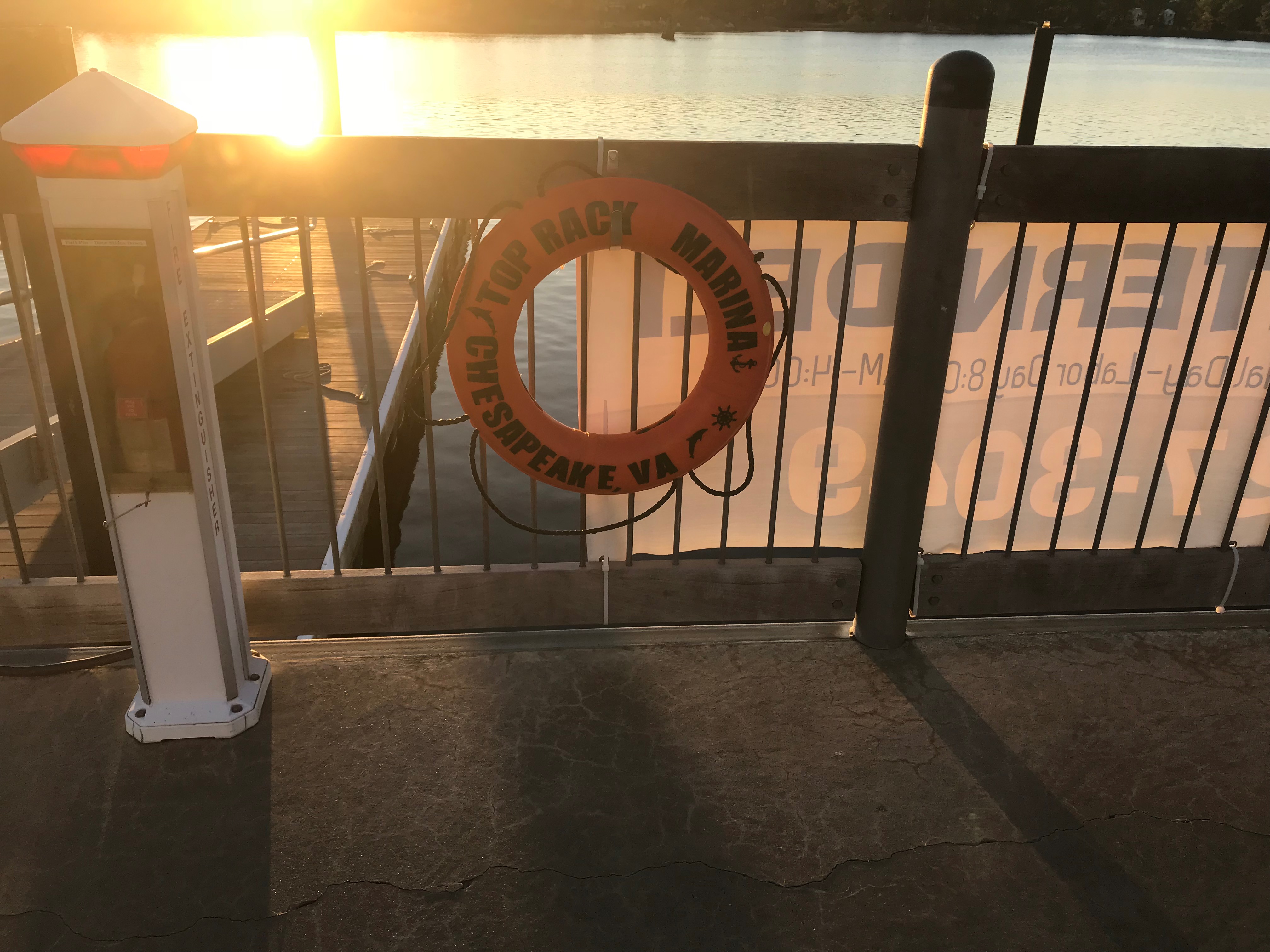
Moments later we are discussing plans to meet up at Top Rack Marina in Chesapeake, VA.

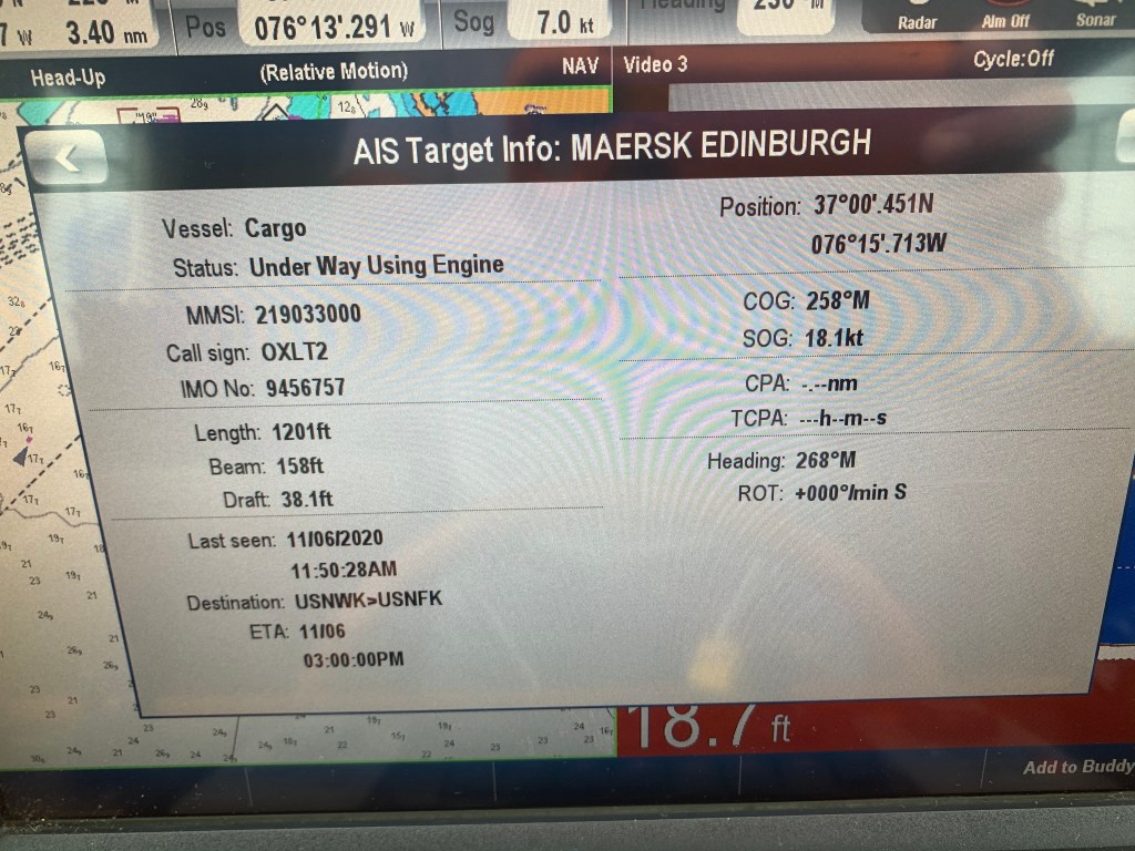
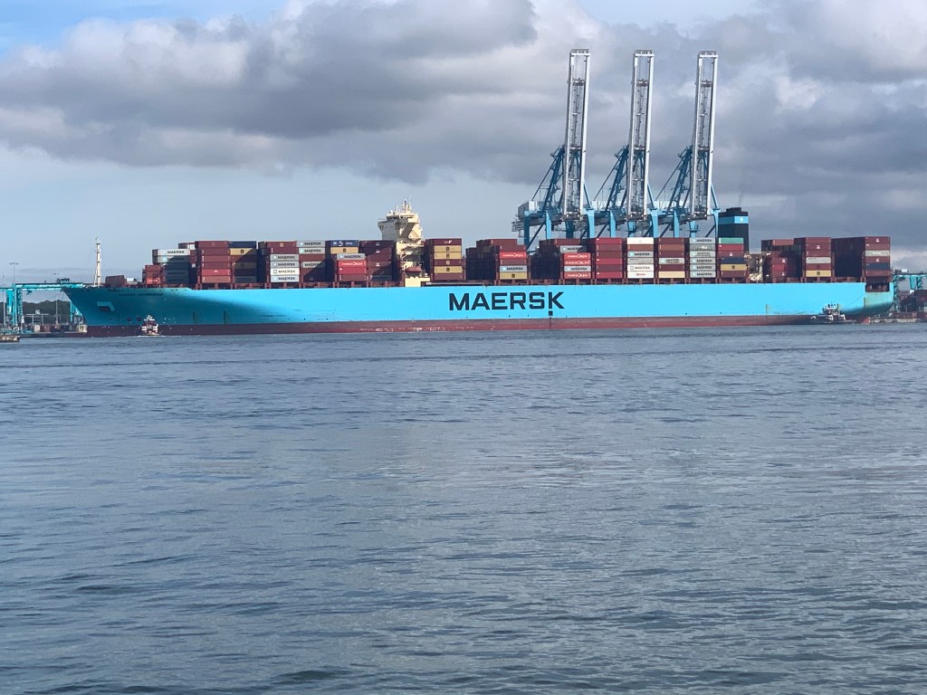
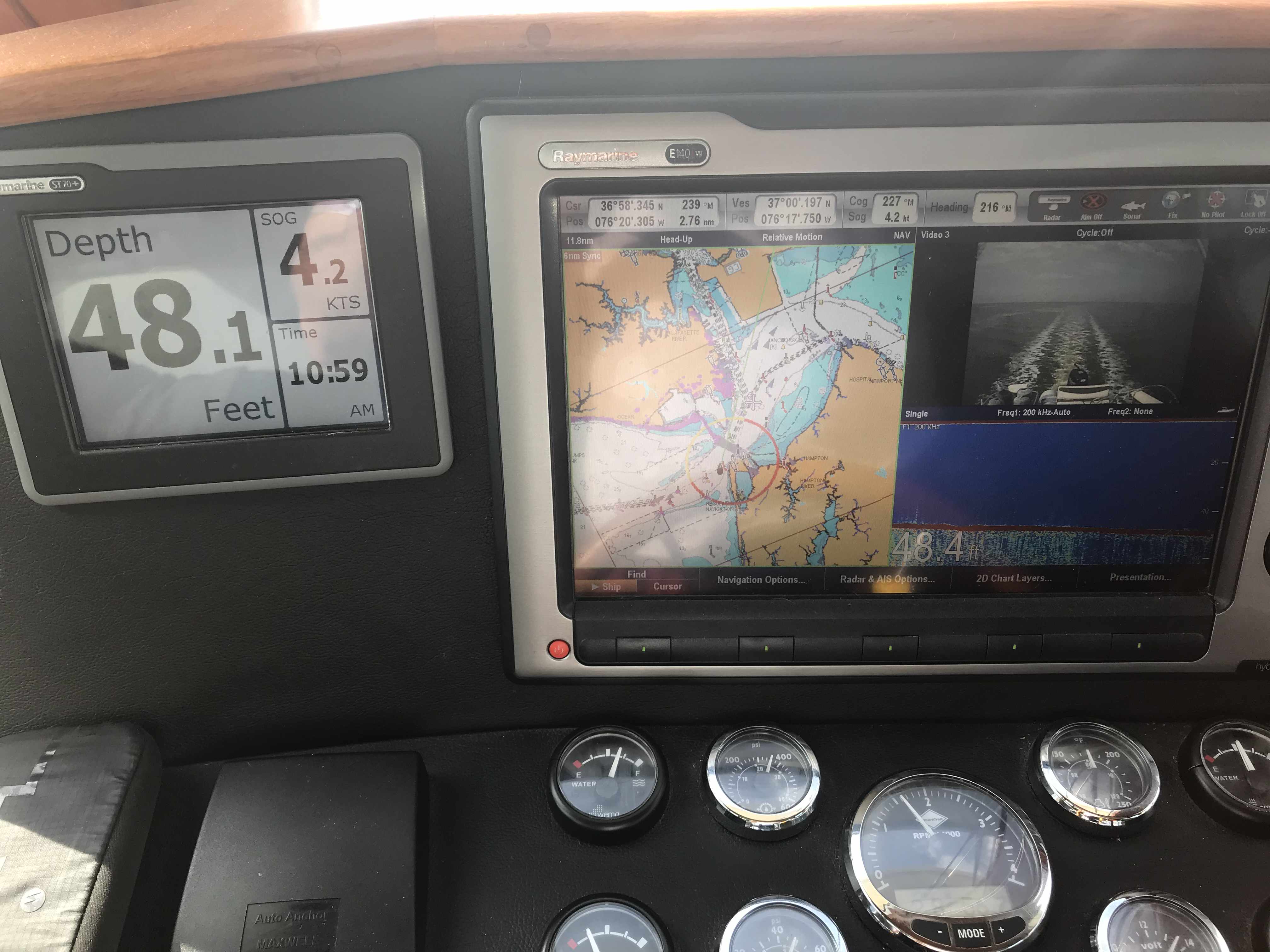
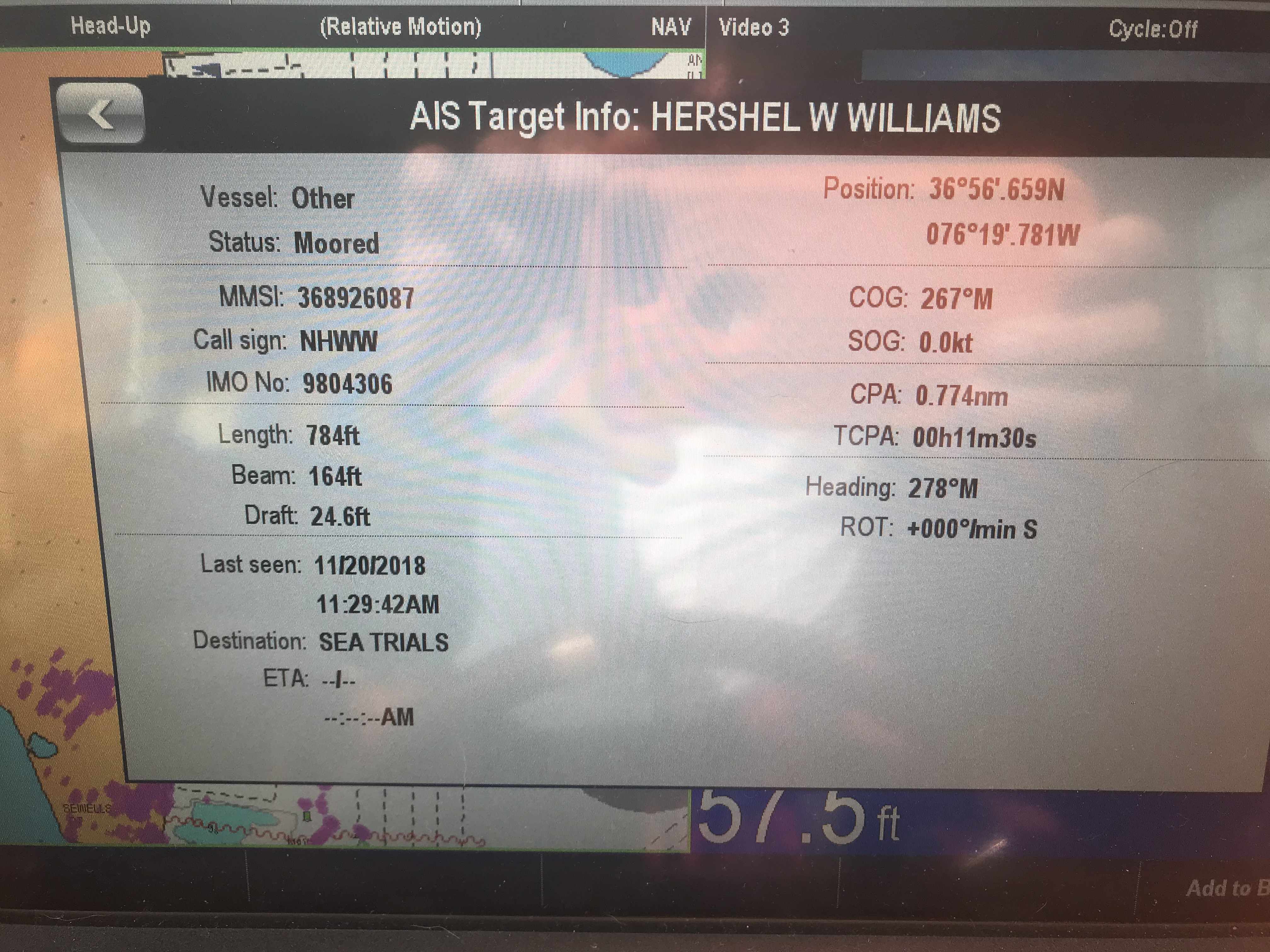
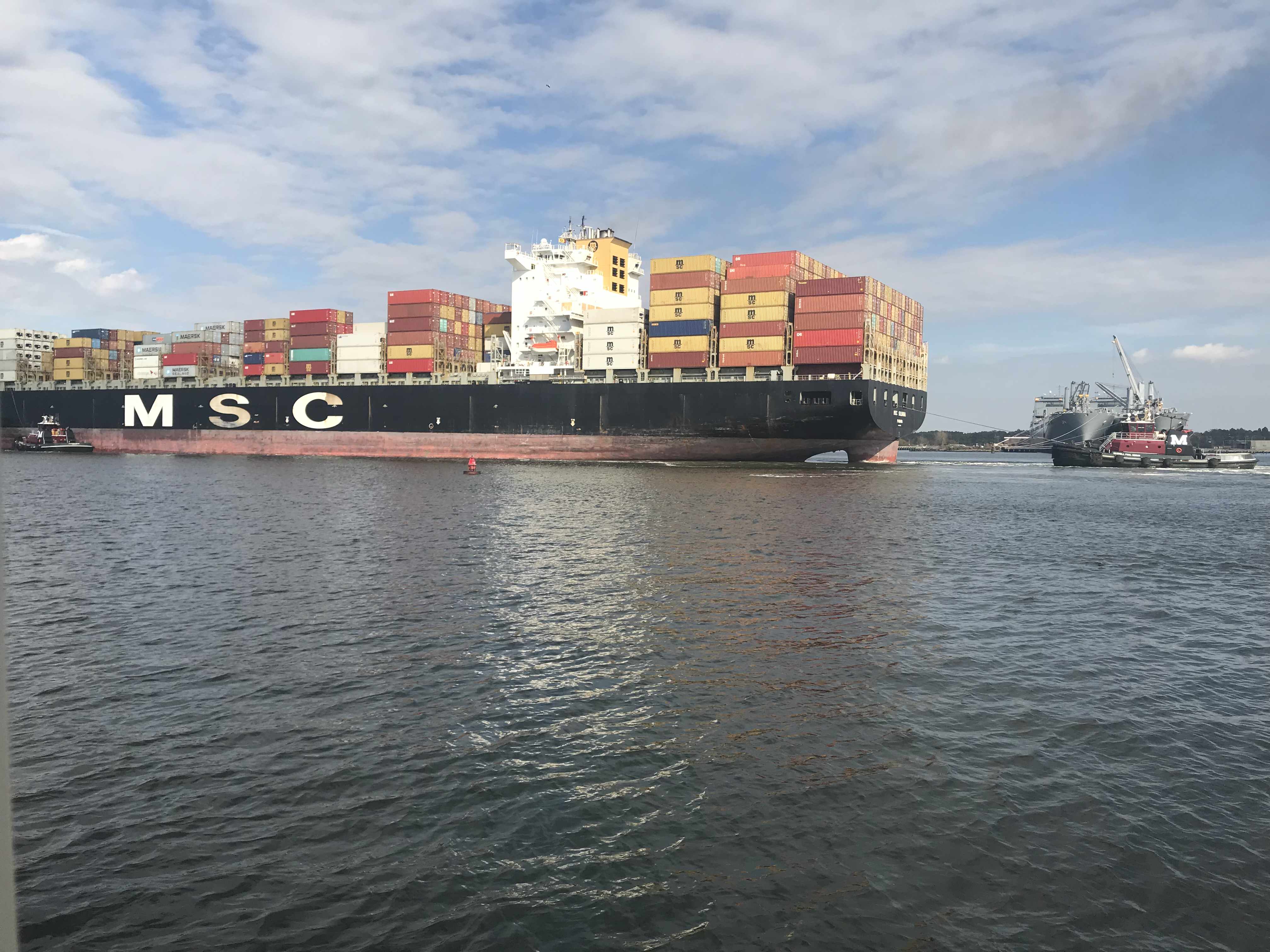
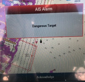
Norfolk harbor has non-stop large ship traffic transiting its entrance channel. On this day, the USCG had issued a warning over the VHF about an Ultra Large Container Vessel (ULCV) called the Maersk Edinburgh. The Maersk Edinburgh is 1201′ long and has 158′ of beam. It is certainly not hard to spot visually but I’m having trouble seeing much of anything out the pilothouse windows.

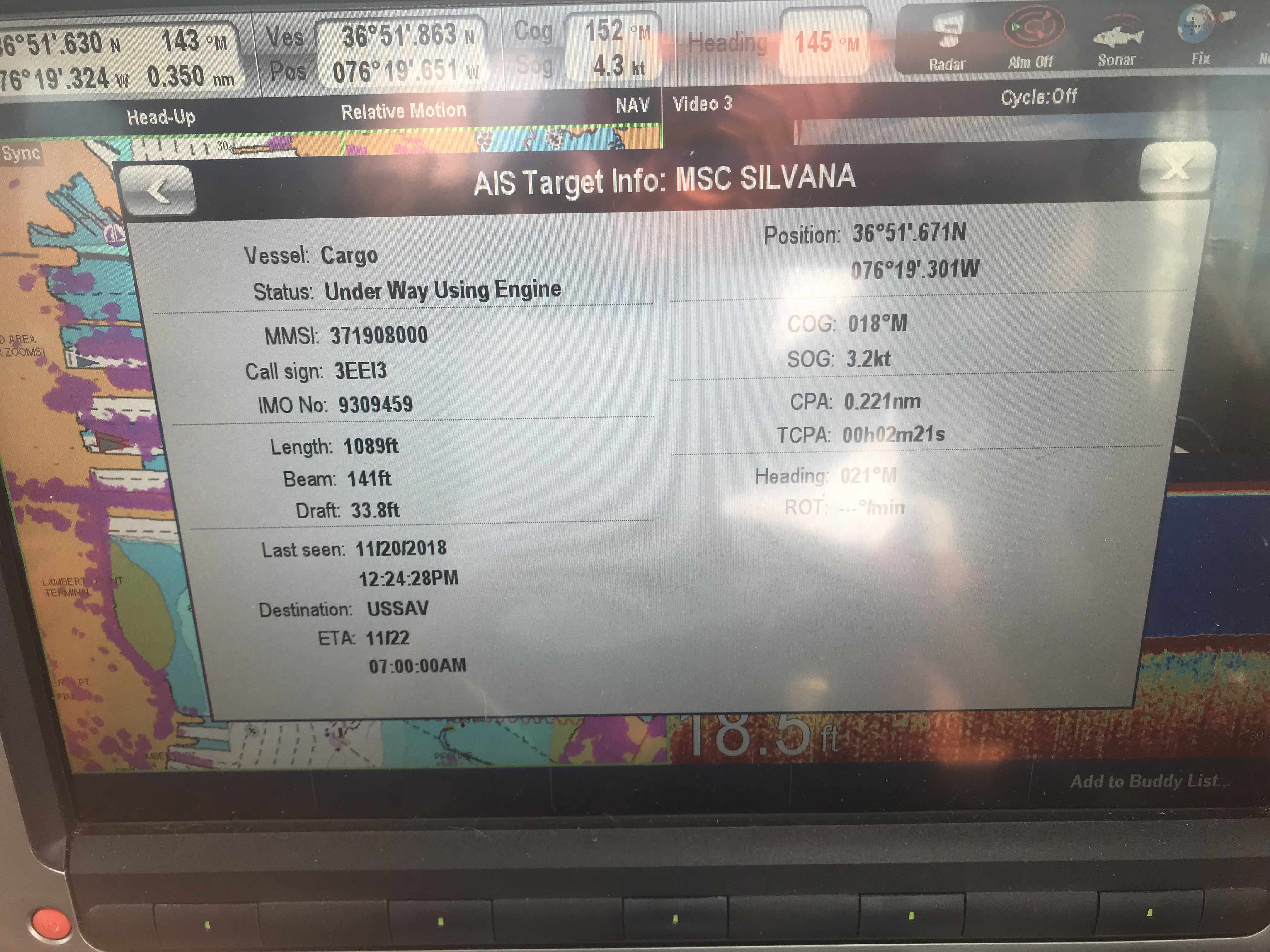
I will have to rely on radar & AIS. Radar just shows me a large target with position and speed data but no identifying info about the vessel. AIS however, shows me all kinds of vessel information.

It’s moving at 18.1kts! 3X faster than Simple Life

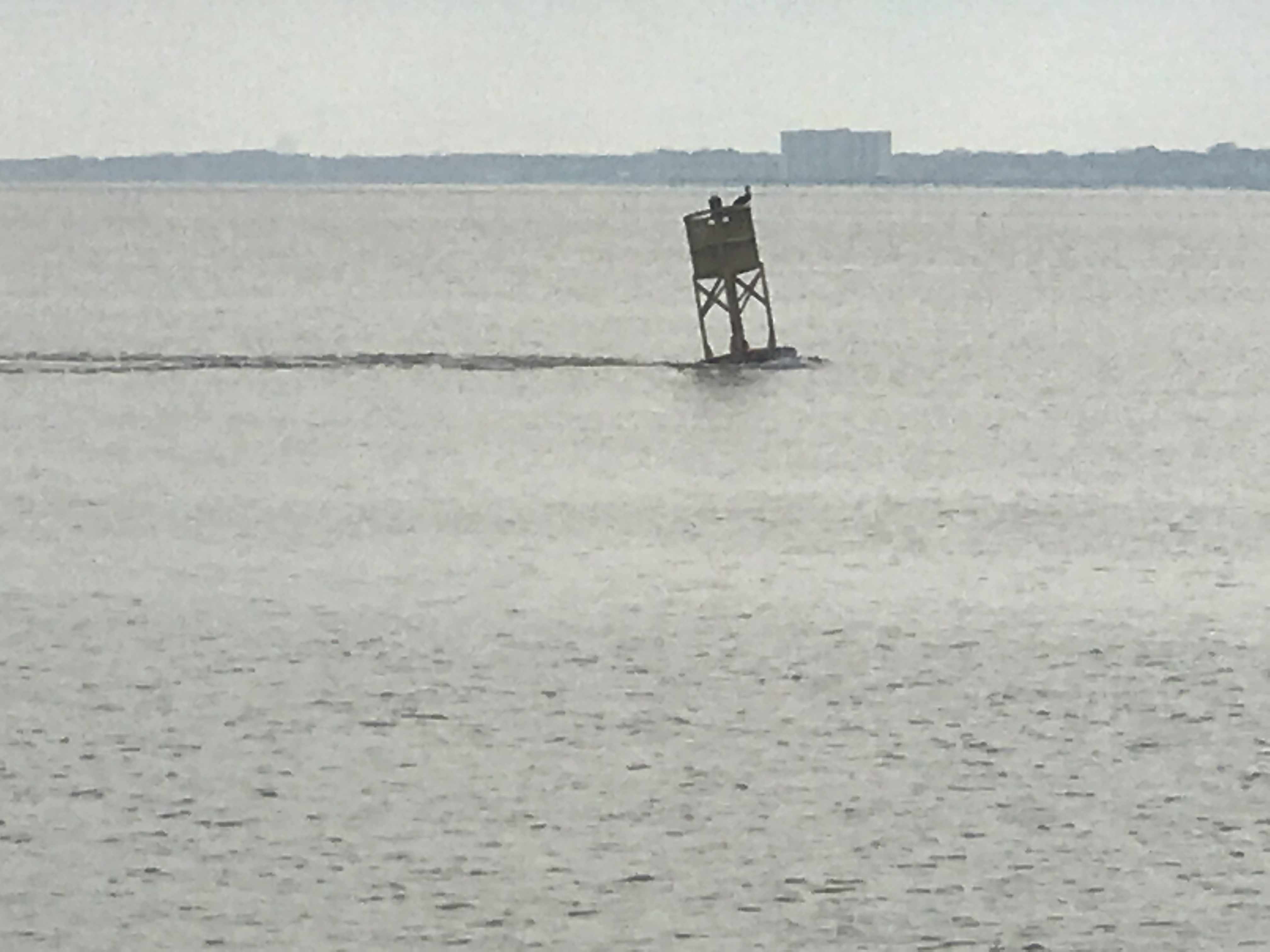
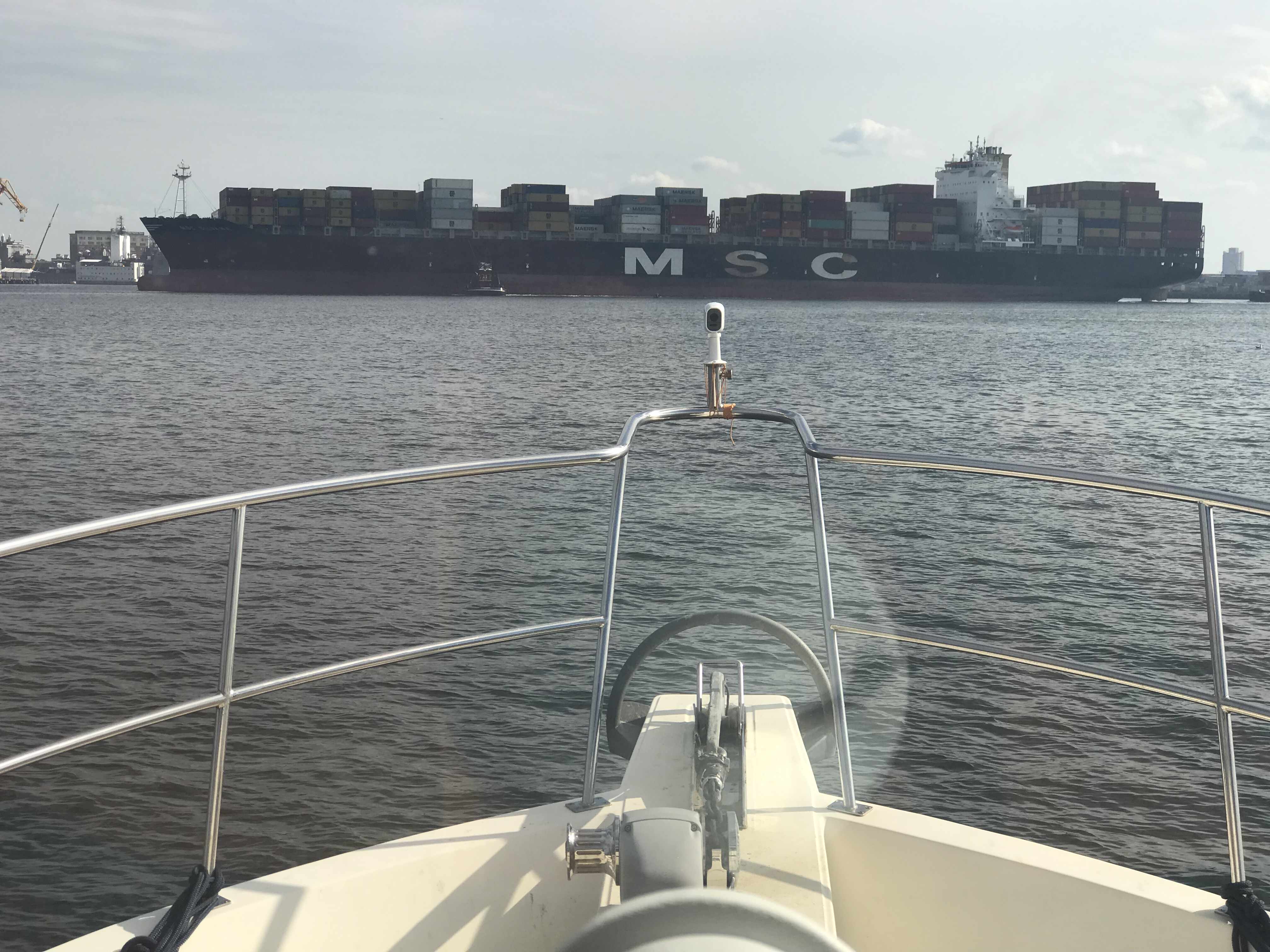
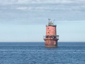
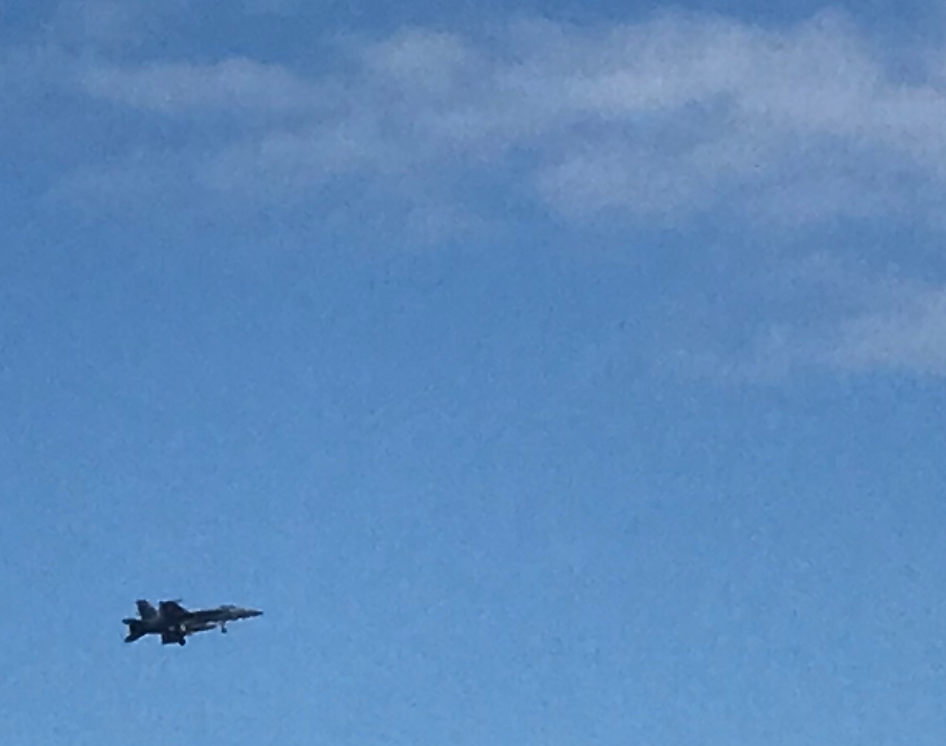
As I cruise on… the fog lifts for a moment to allow me to see this sexy girl passing me.

Then just as fast as it lifted, the fog closes around me again.

Dense fog outside of the pilothouse windows

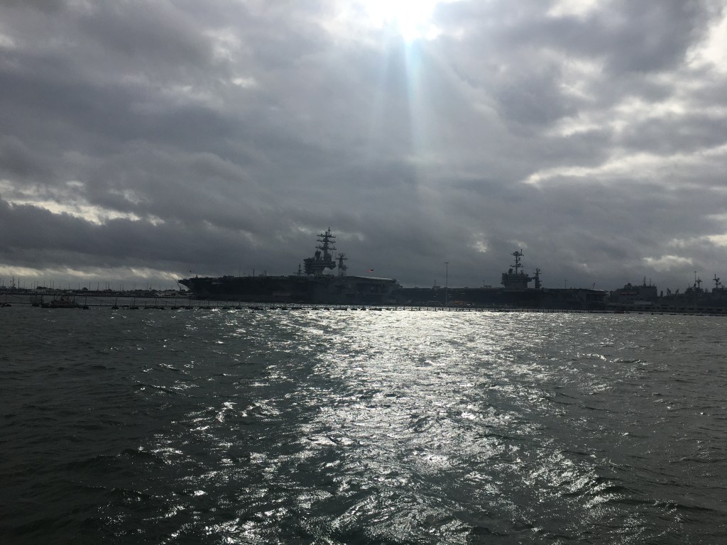
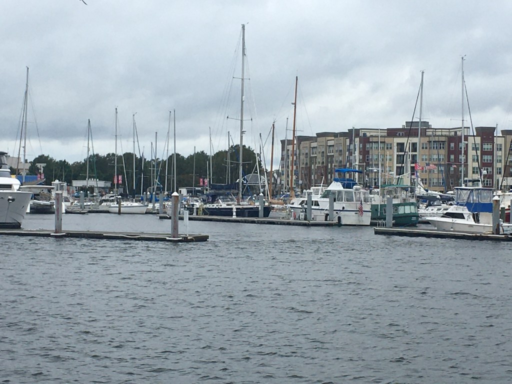
Now passing Norfolk Navel Station, the that fog has lifted and I can once again see the boats around me.

Tug moving at hull speed

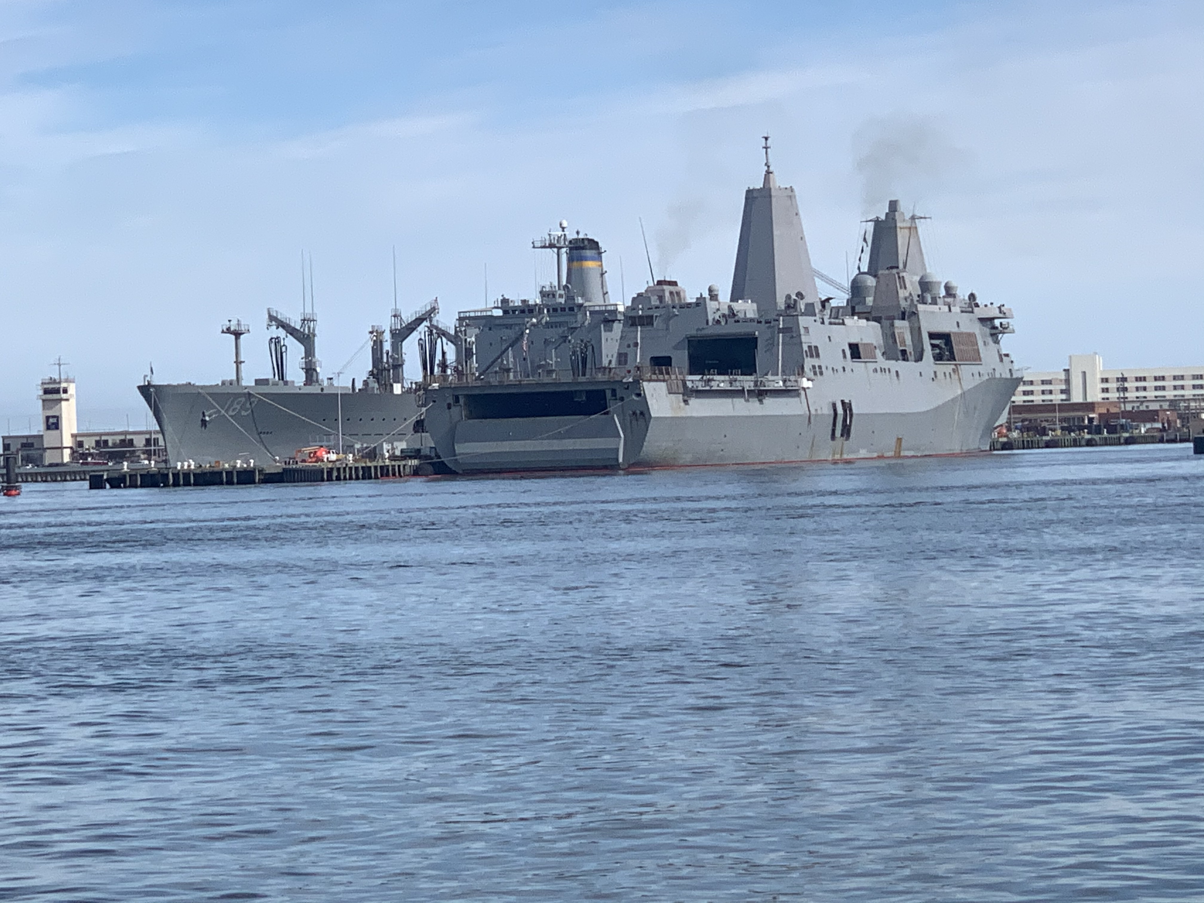
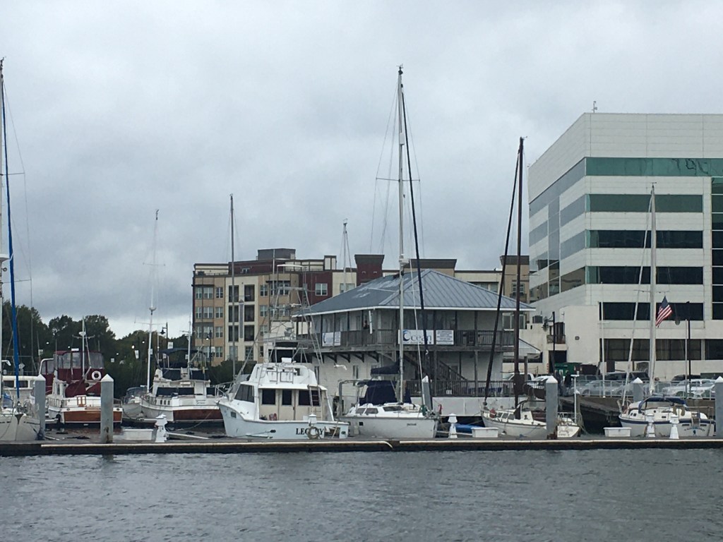
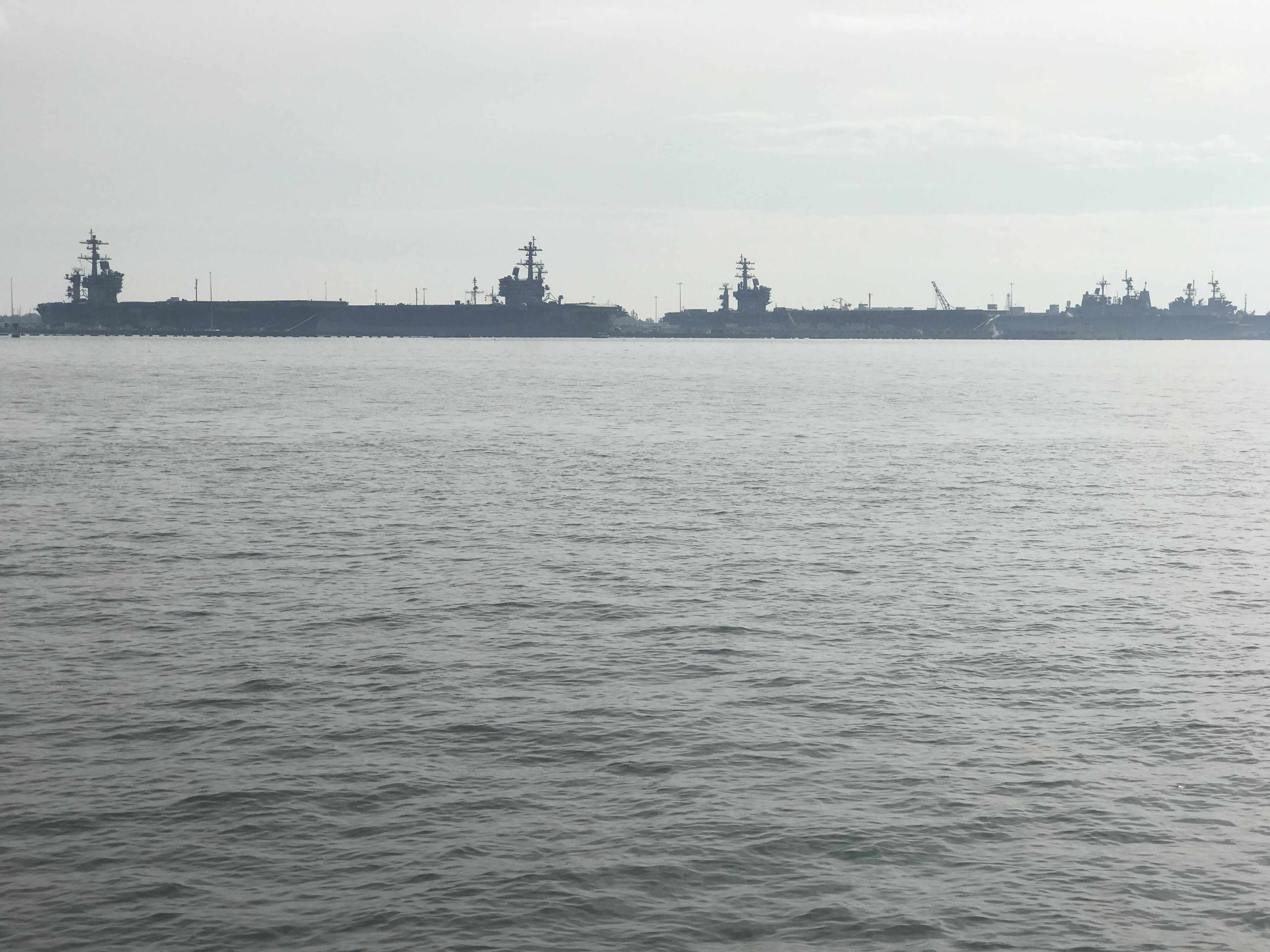
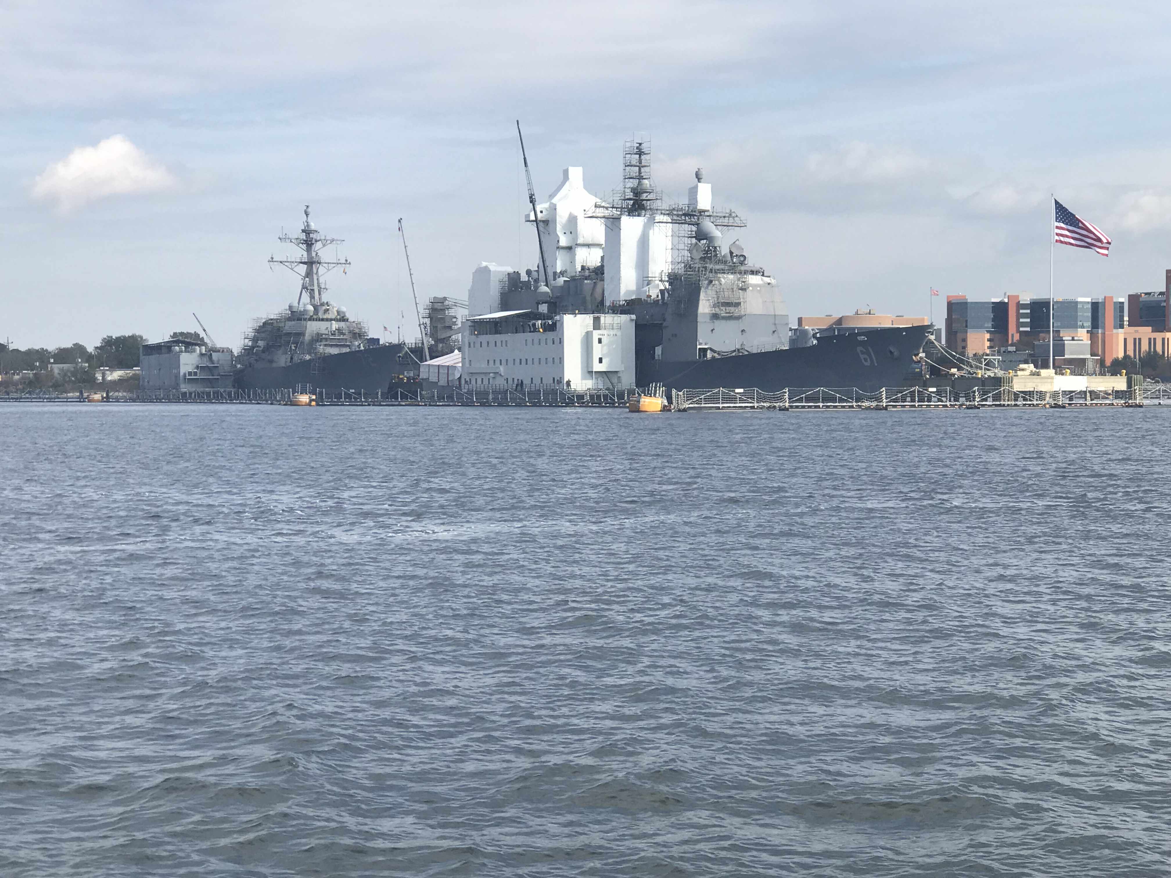
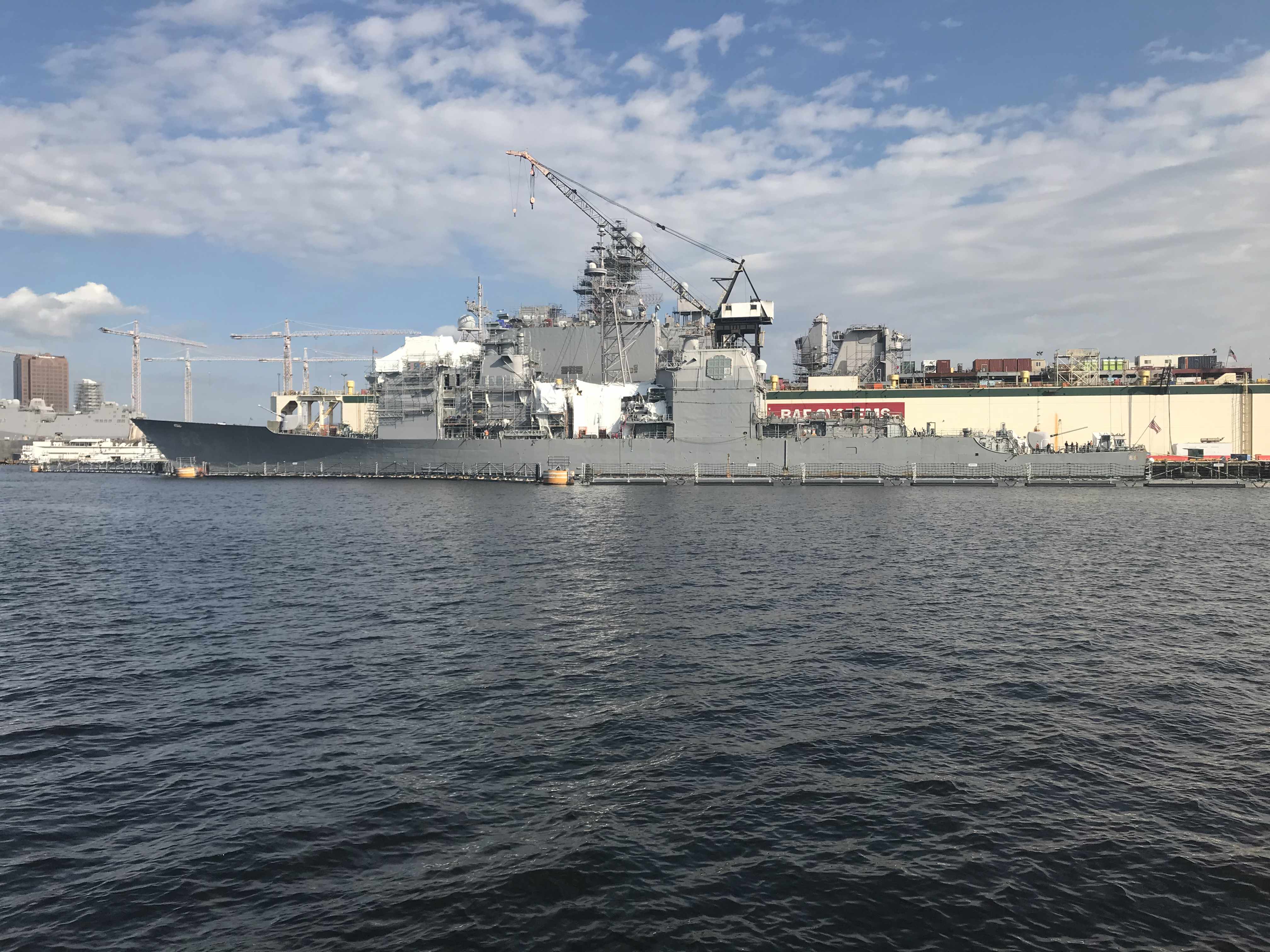
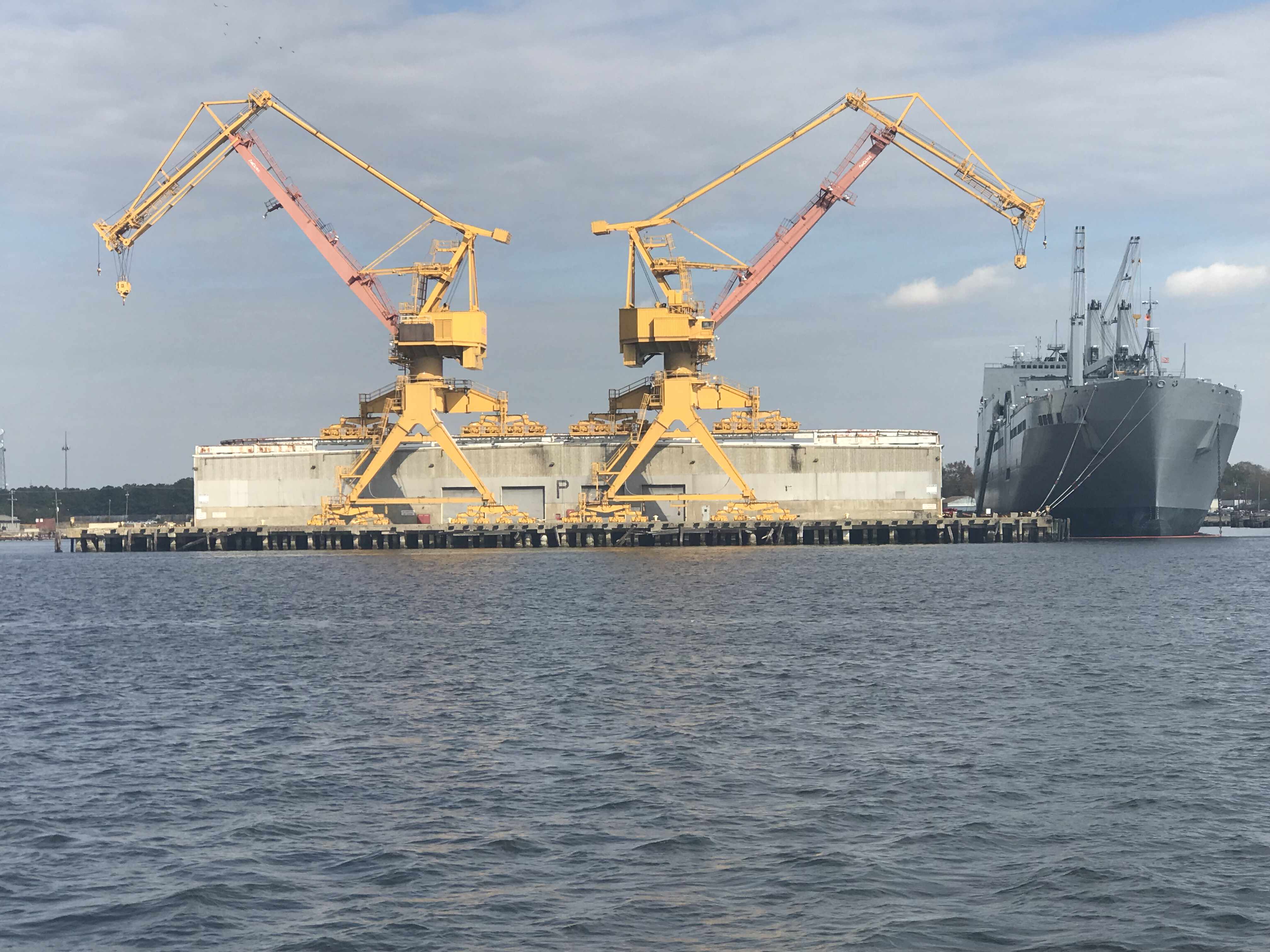
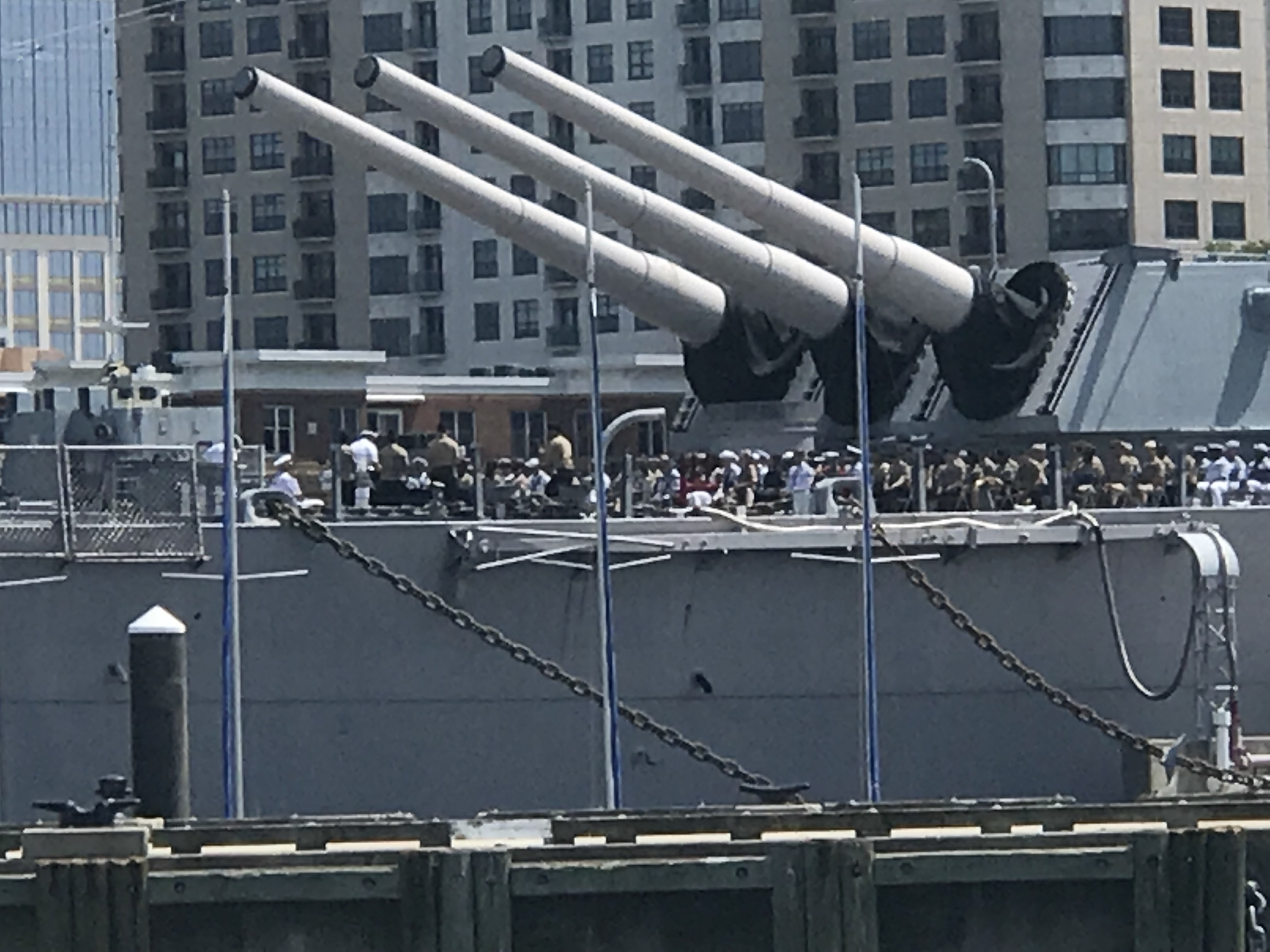
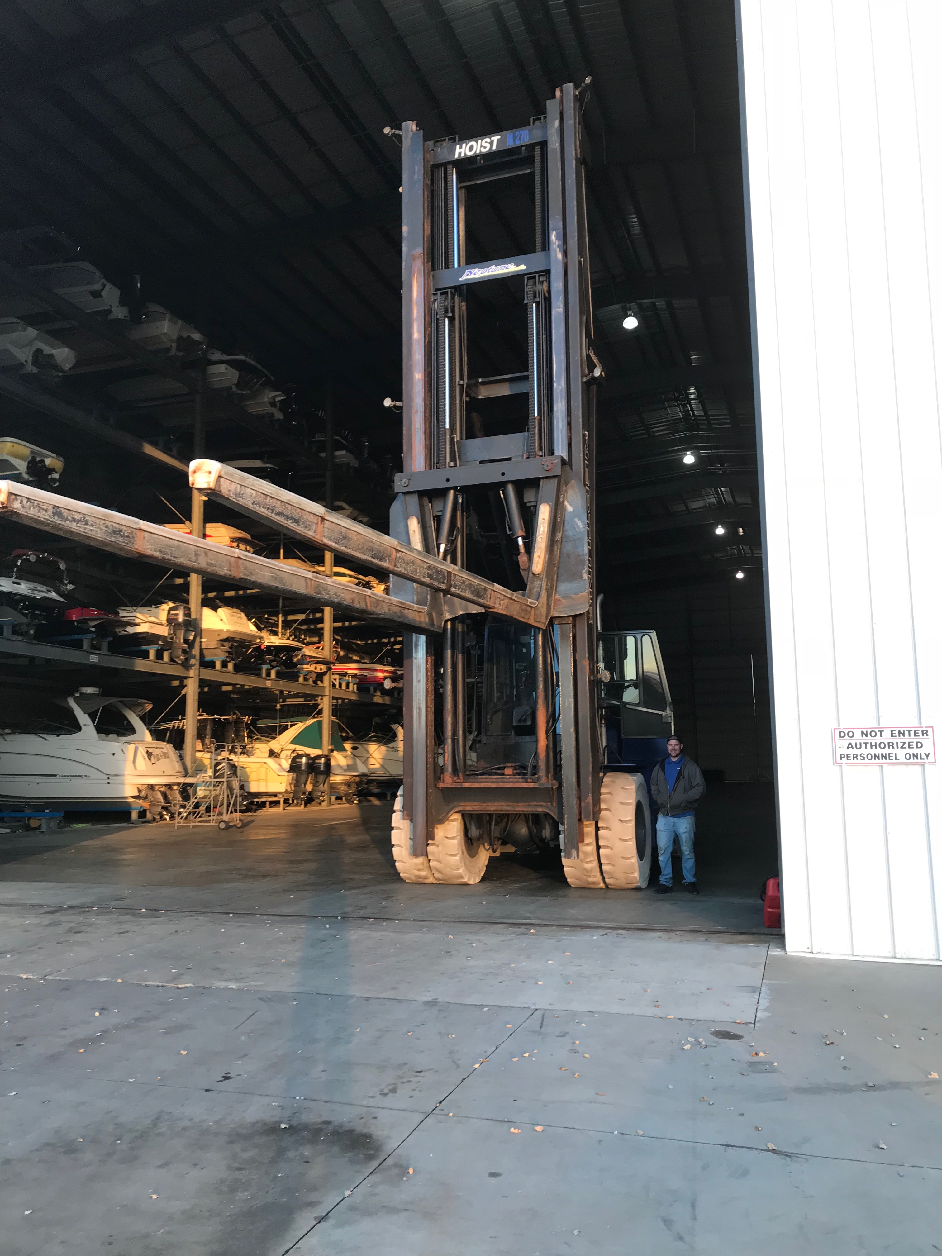
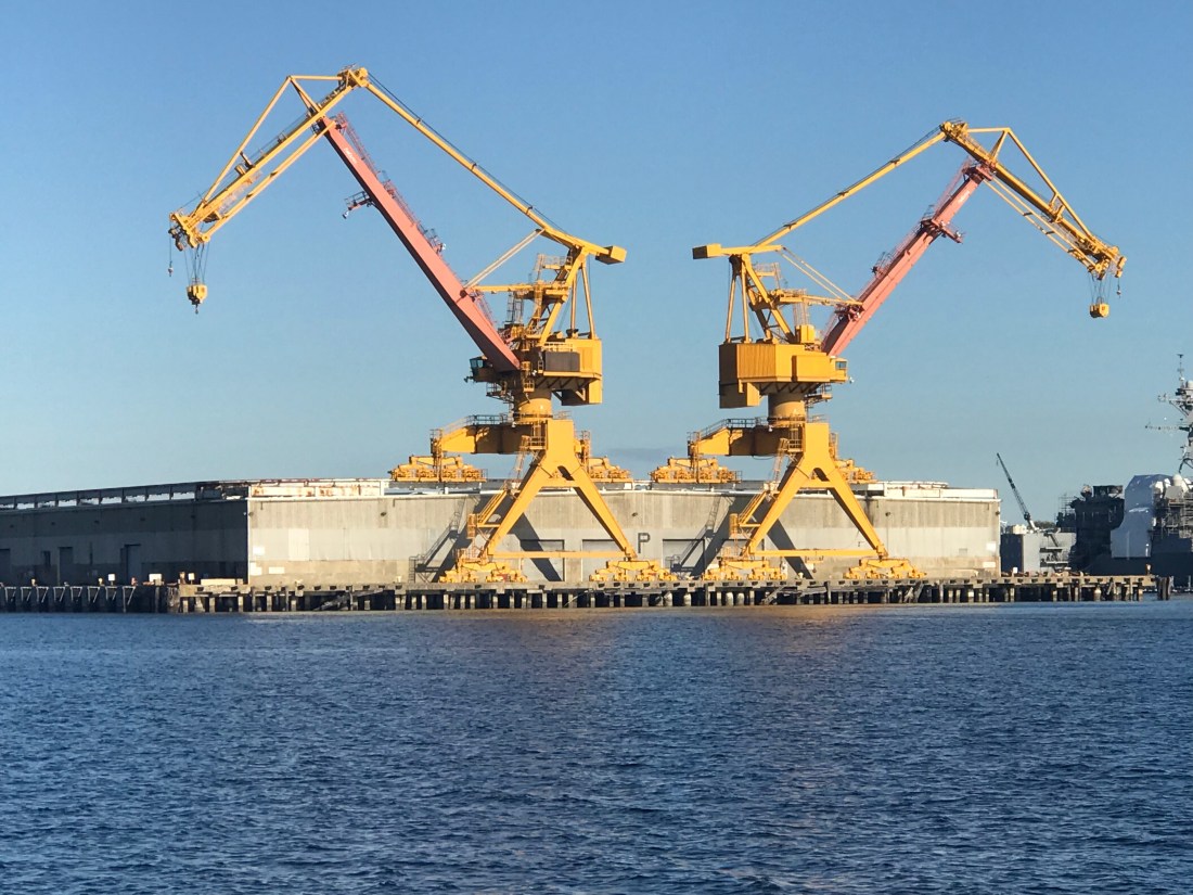
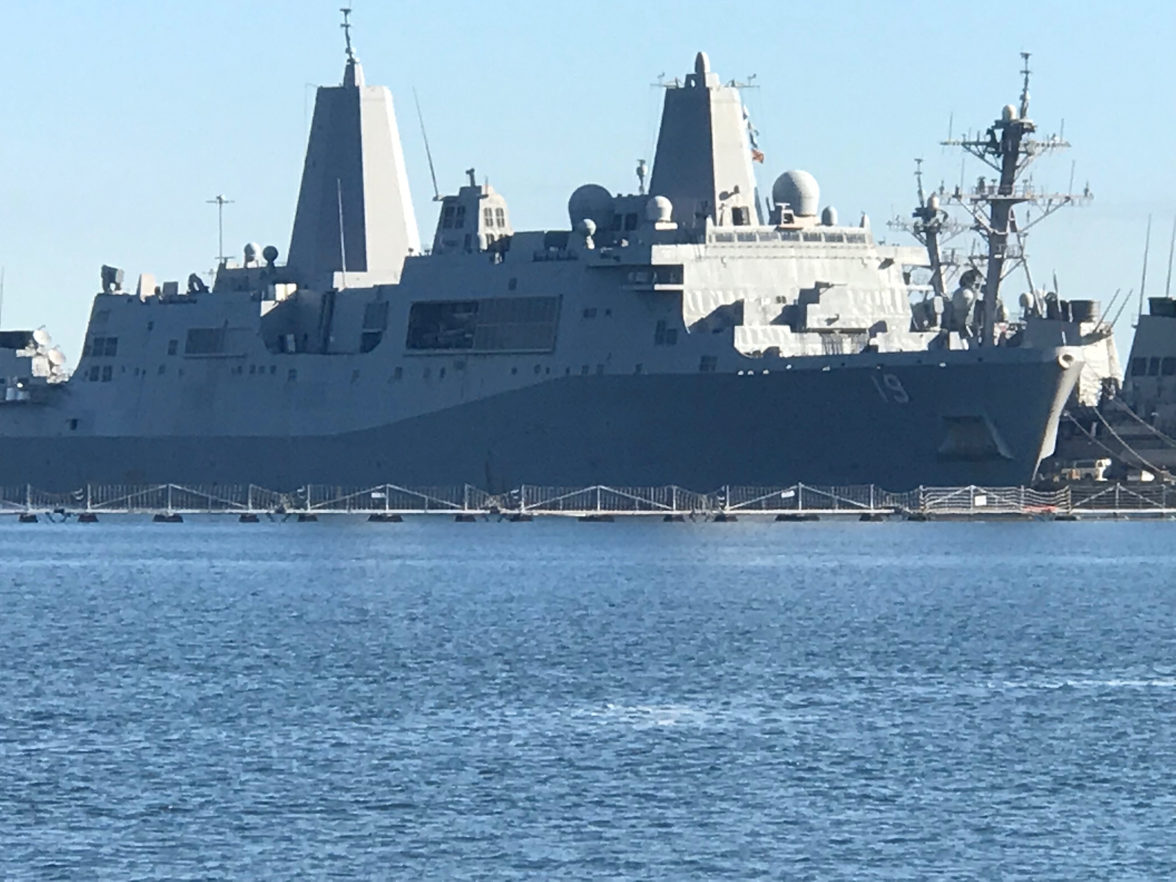
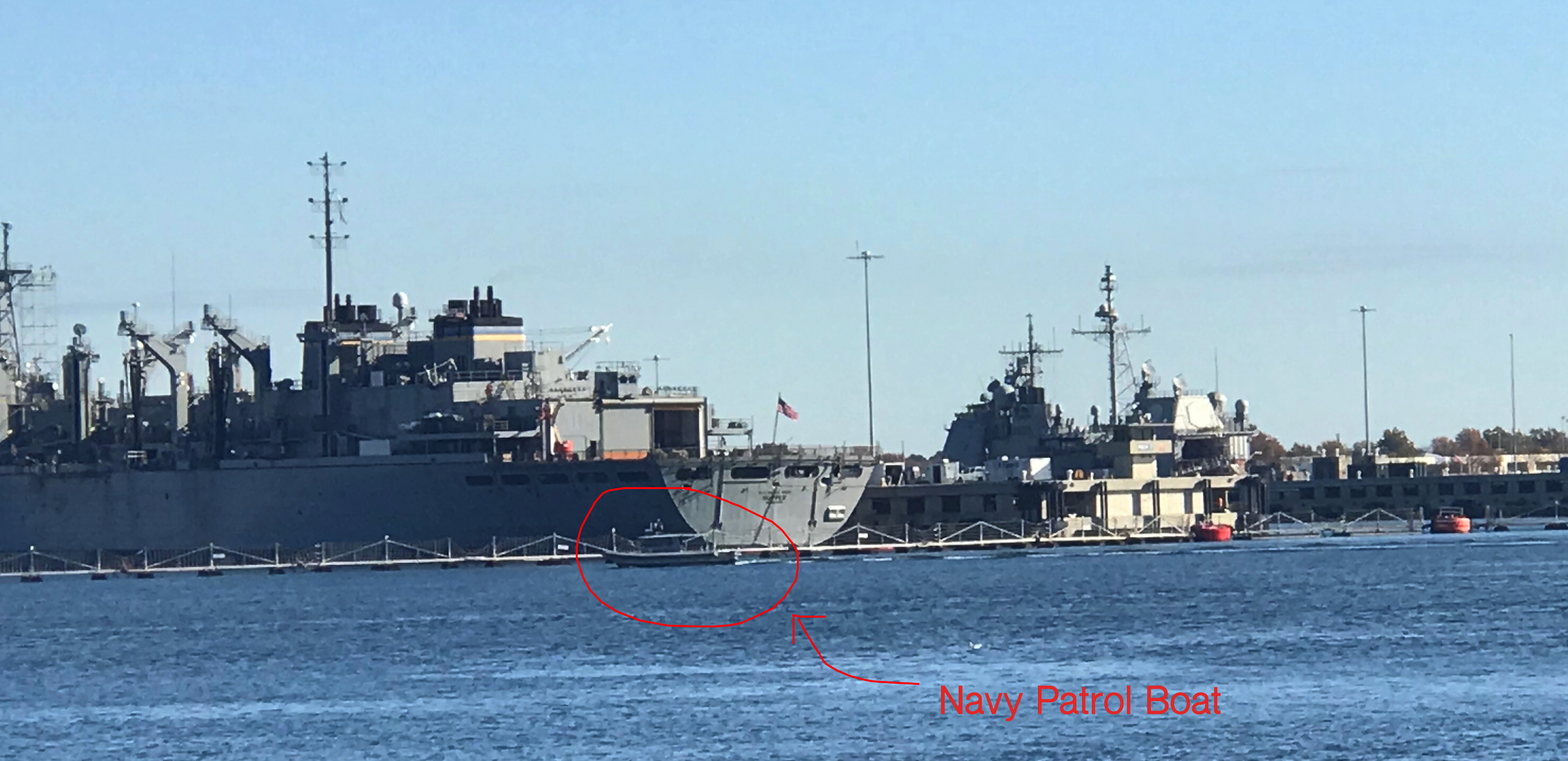
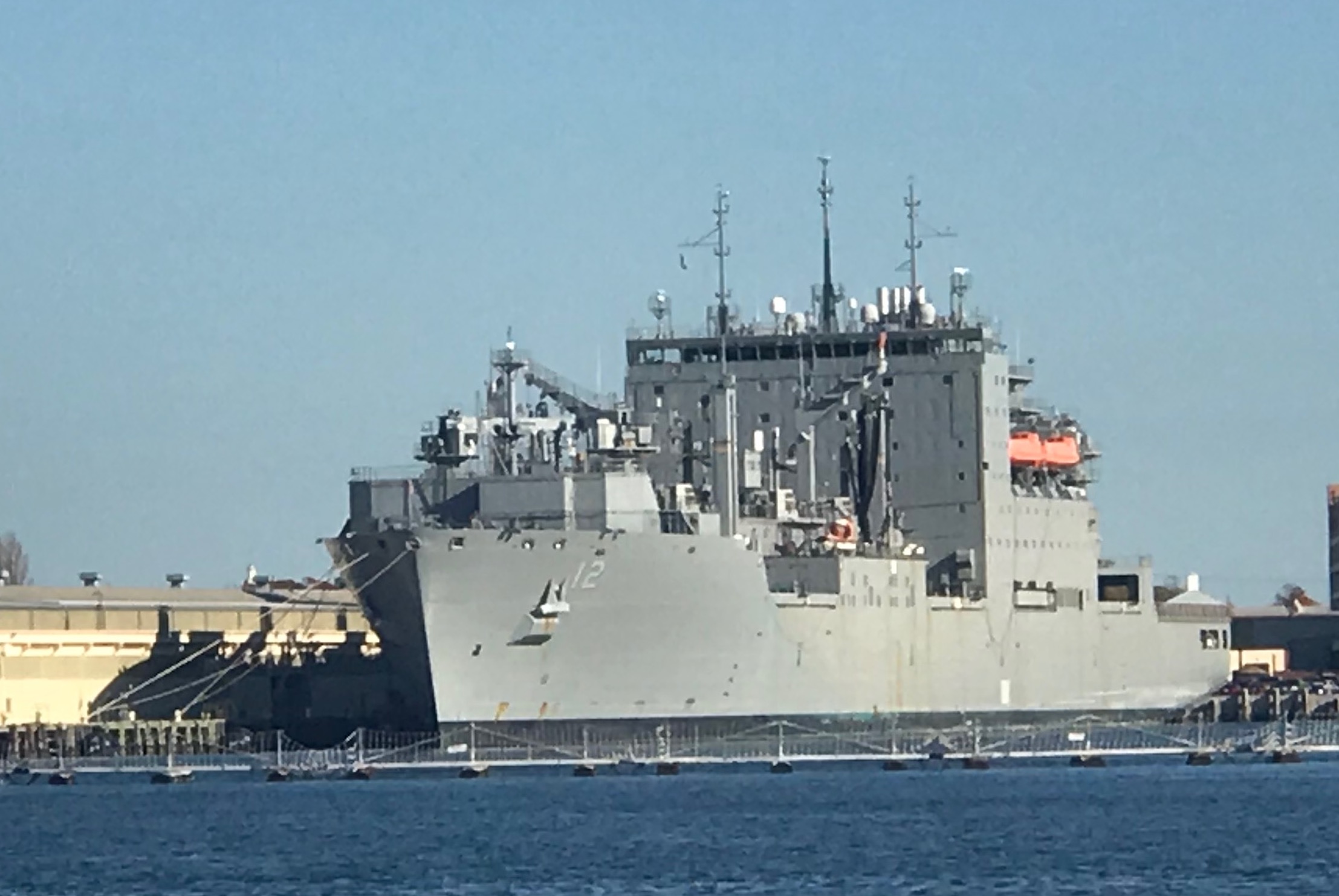
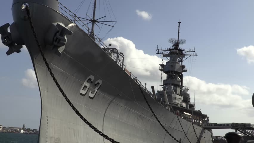
To get to the start of the ICW (InterCoastal Waterway), called mile marker 0, you must pass dozens of warships in port.

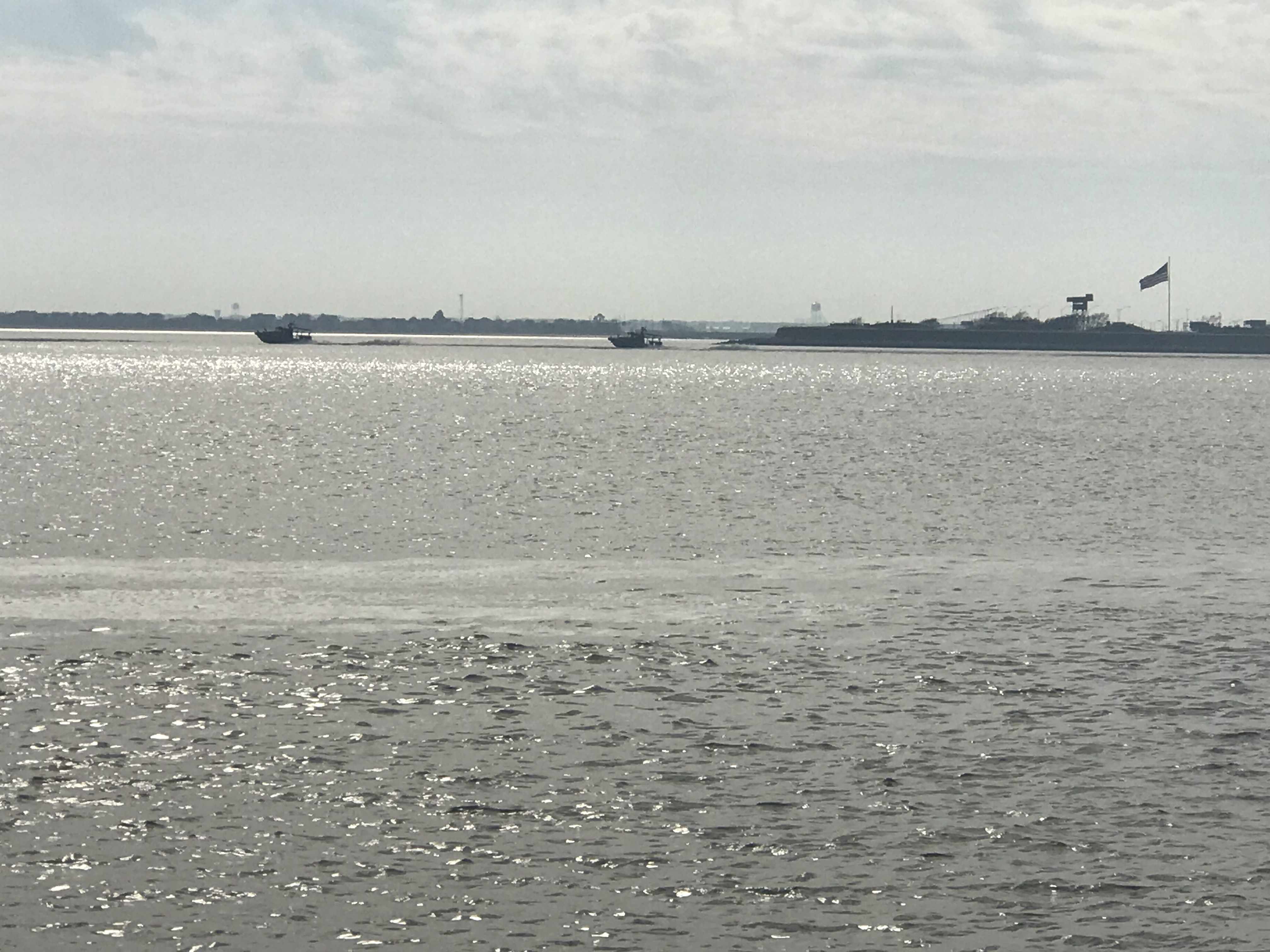
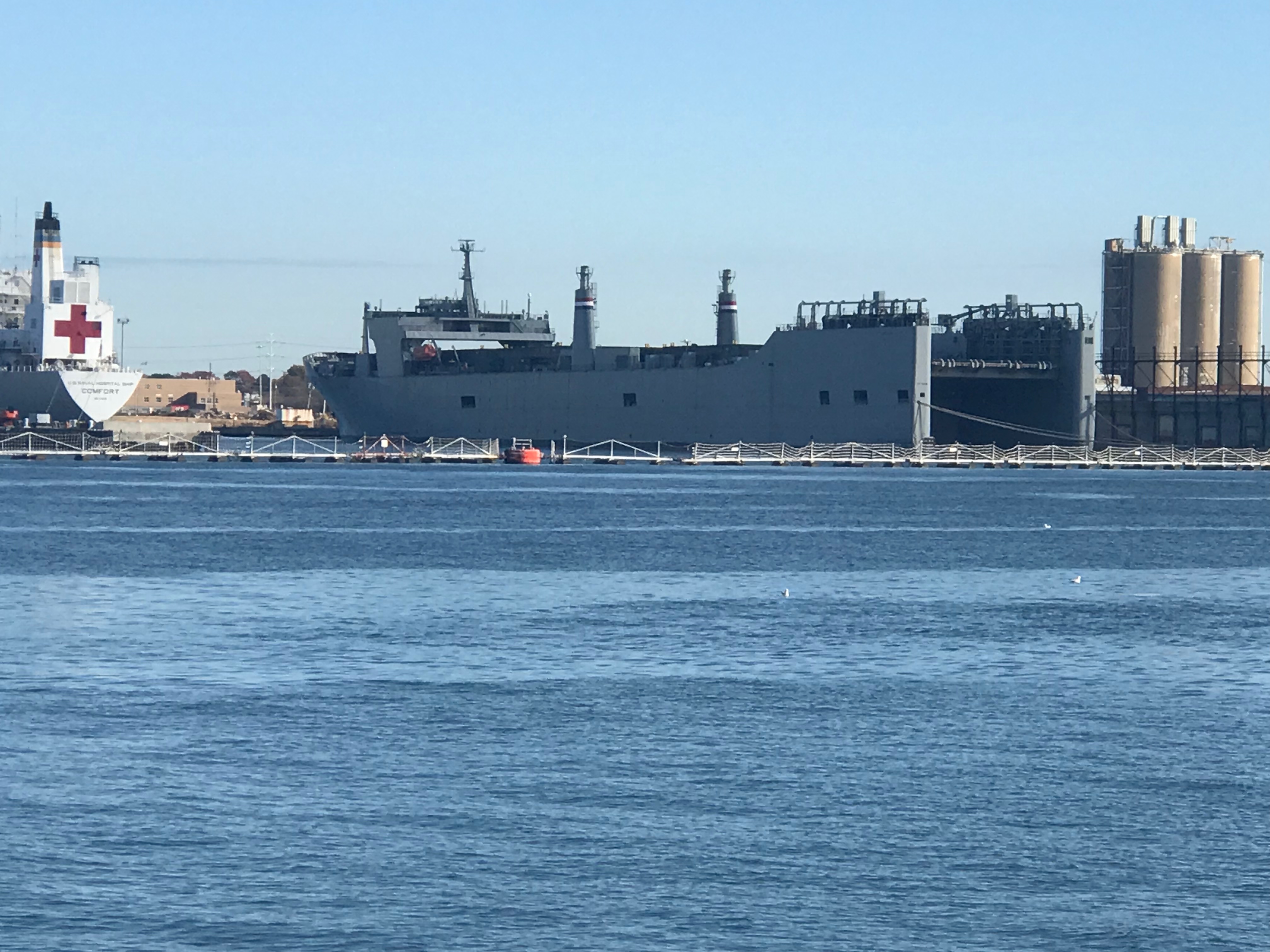
Now past the warships I see the ULCV Maersk Edinburgh being pushed into her berth by several large tugs.

The tugs look tiny compared to the 1201′ long ship

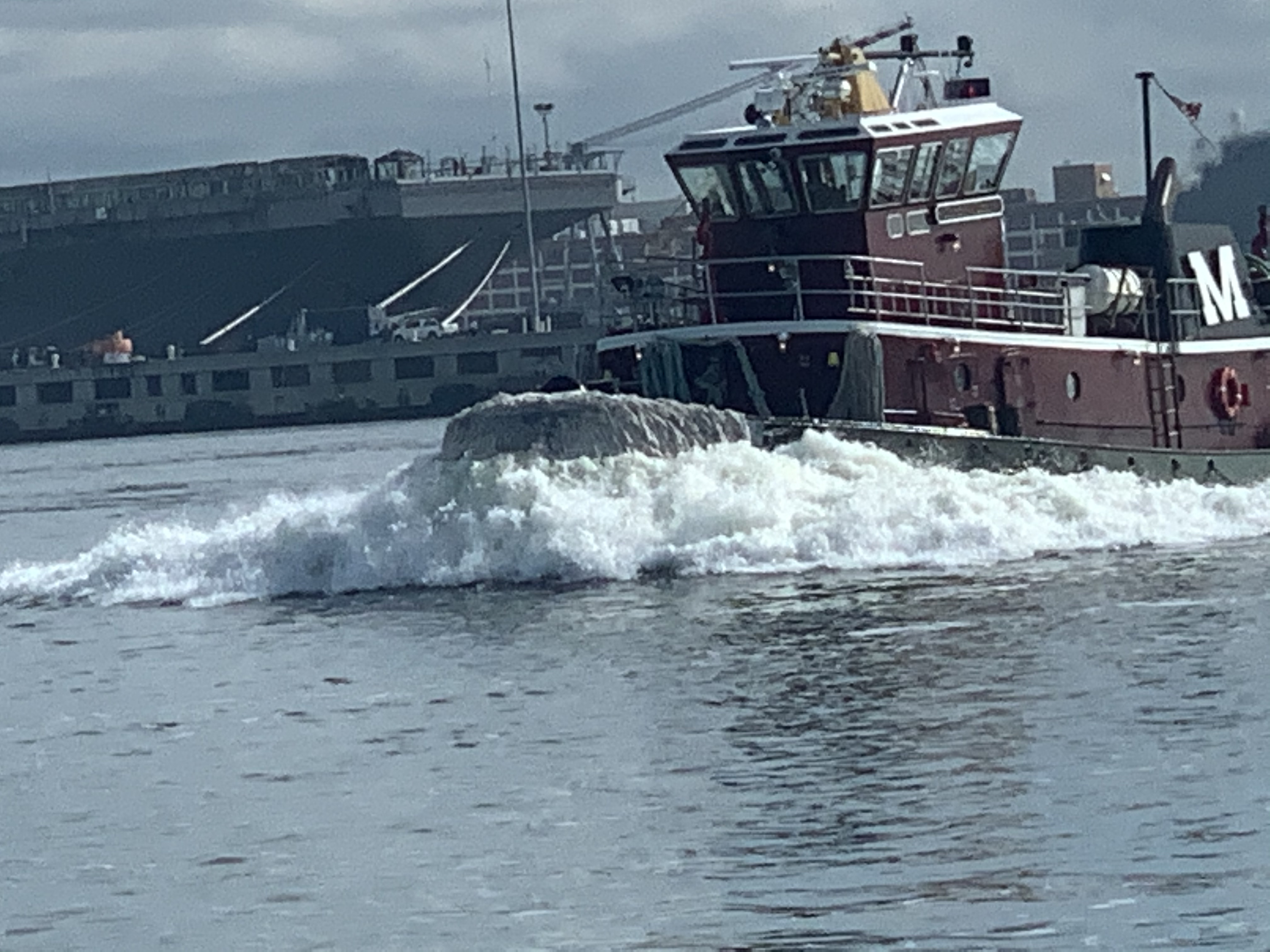
I saw this tug go by with it’s funny looking tall tower that allows it to see over whatever barge it is pushing.

If I ever get a change to go up in a tugboat’s tower I’m going to jump at that opportunity.

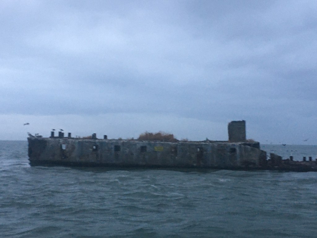
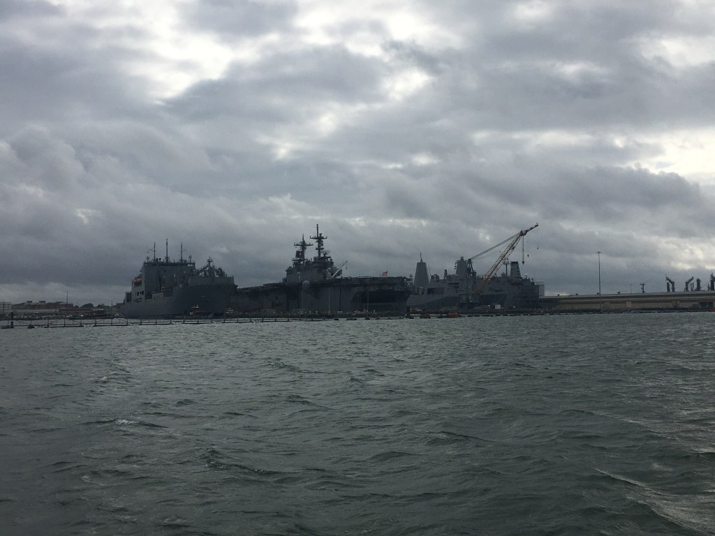
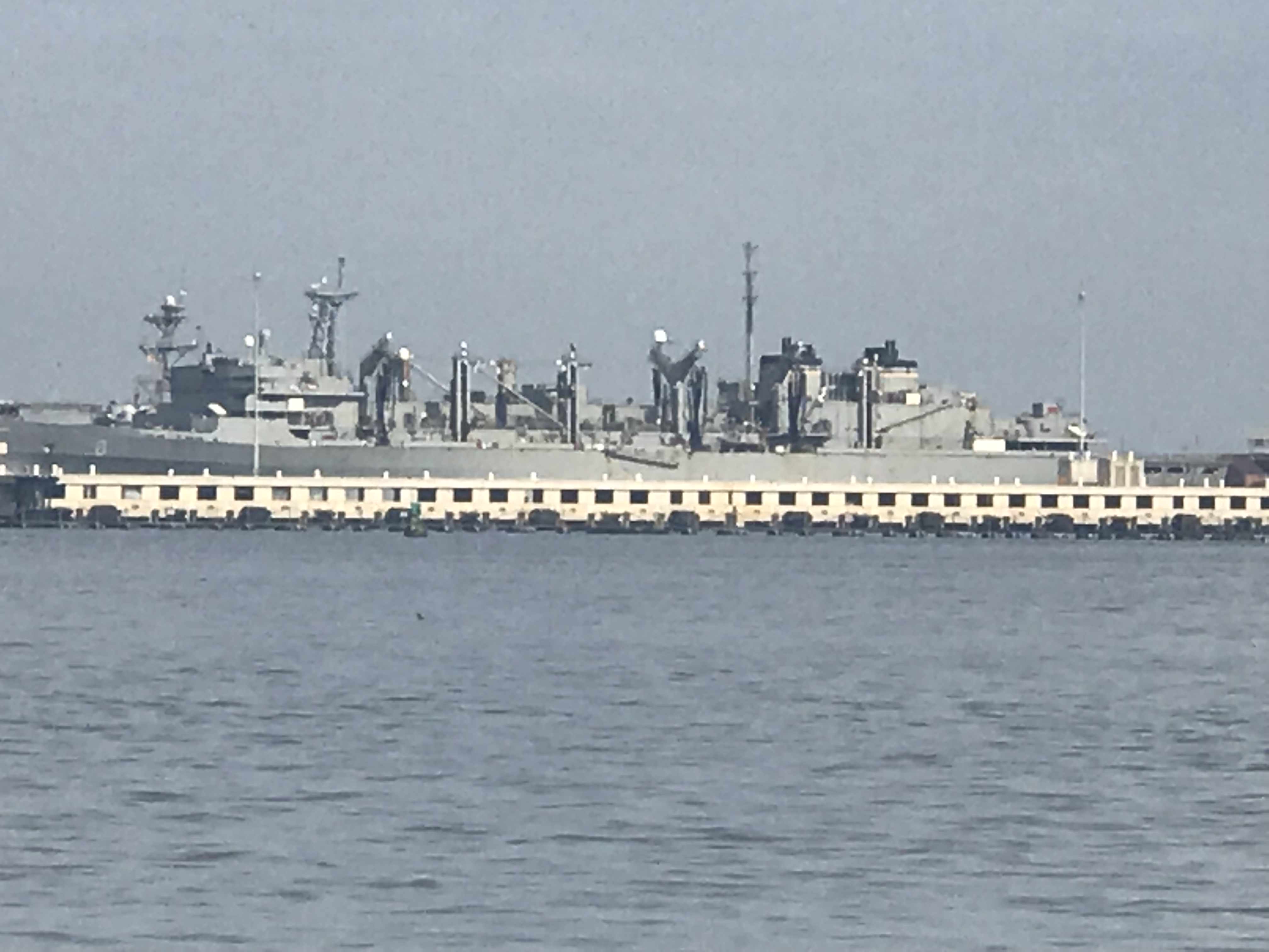
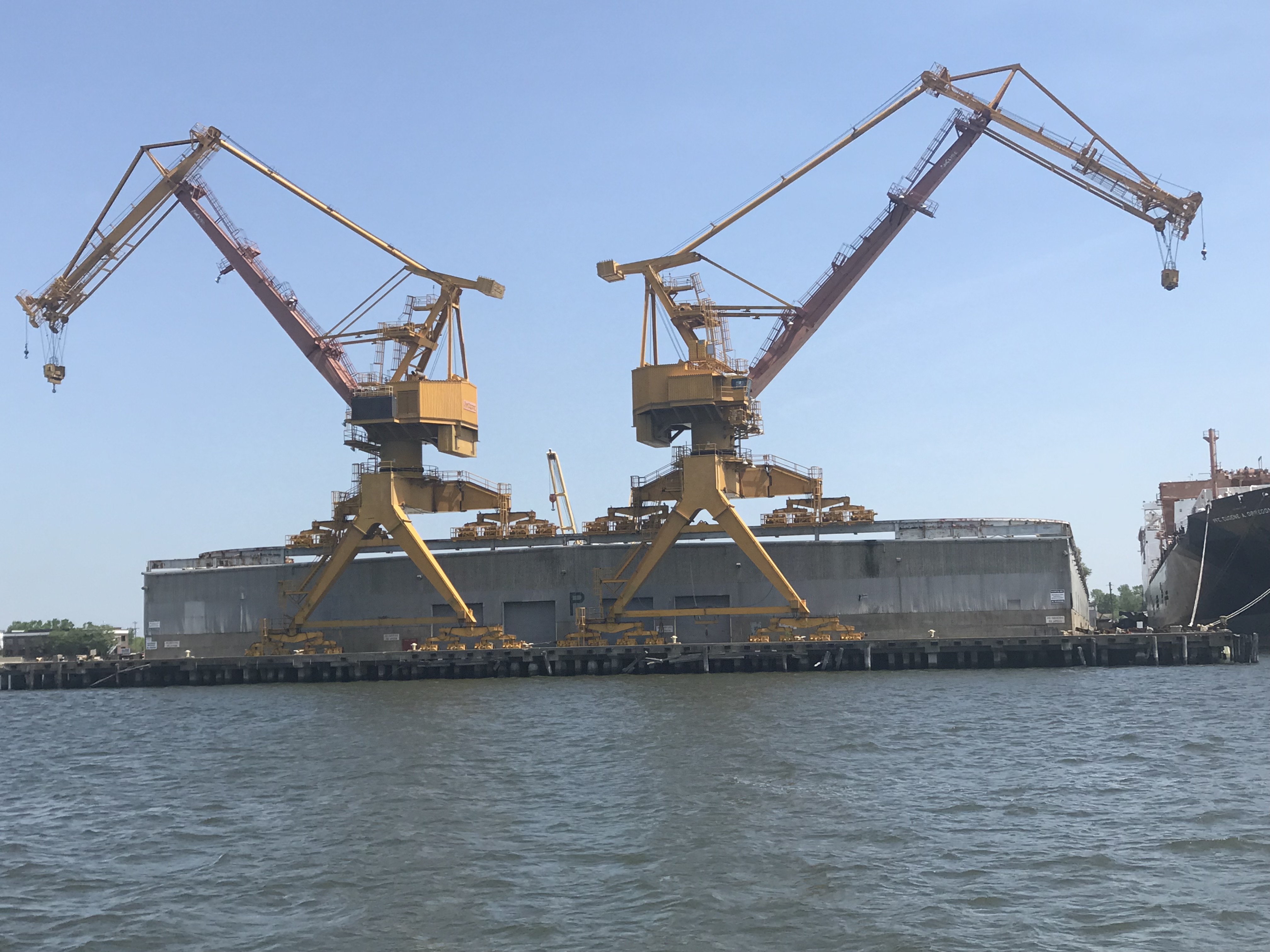
I heard several VHF marine warnings about a 950′ long dry dock called “Titan” that was being moved through Norfolk as well. As I glance over to shore I see it being pushed into place.

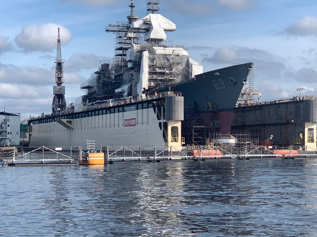
Right around the corner from this new one that arrived another dry dock that has a large warship in it.

BAE Systems Dry Dock

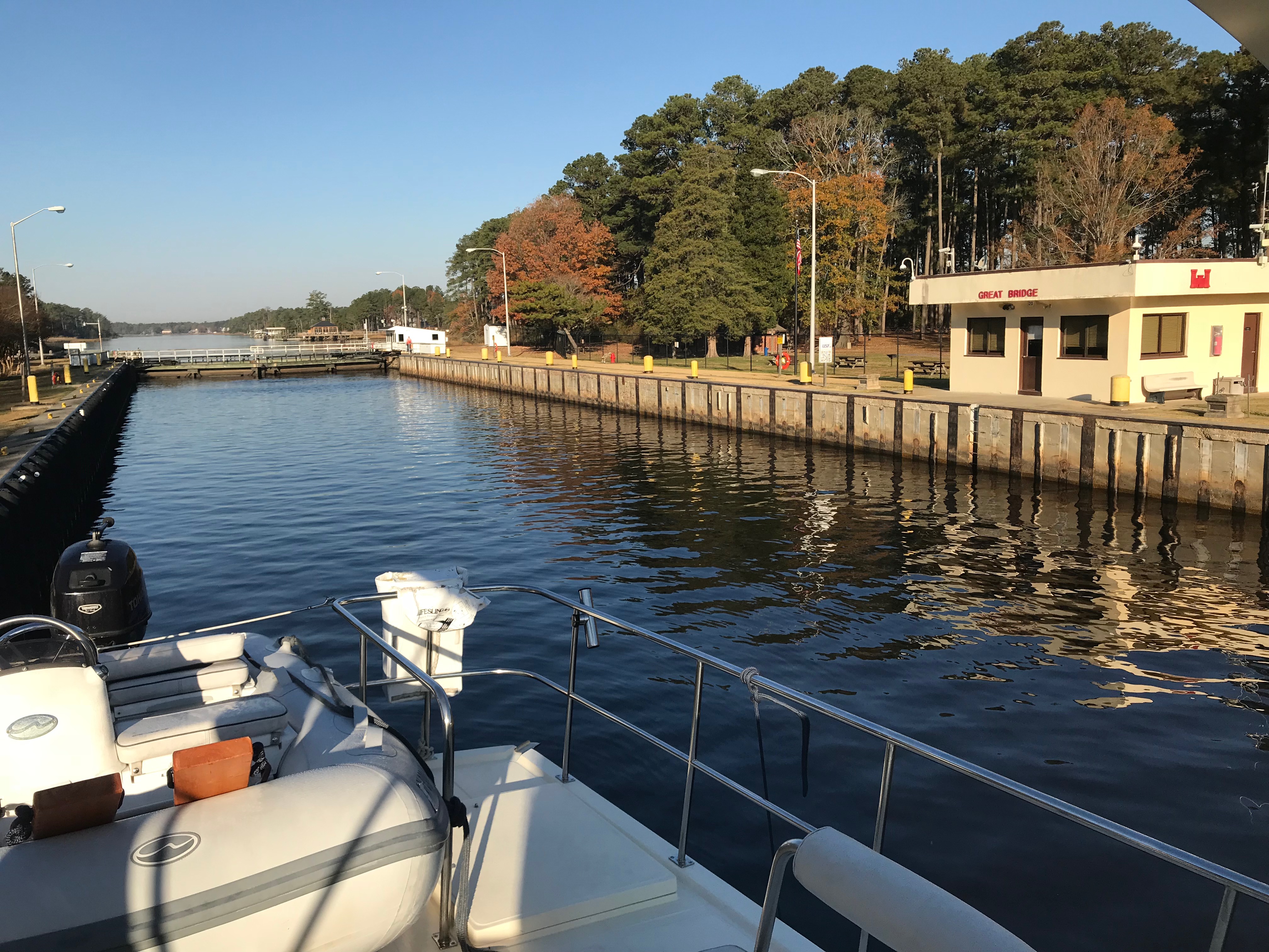
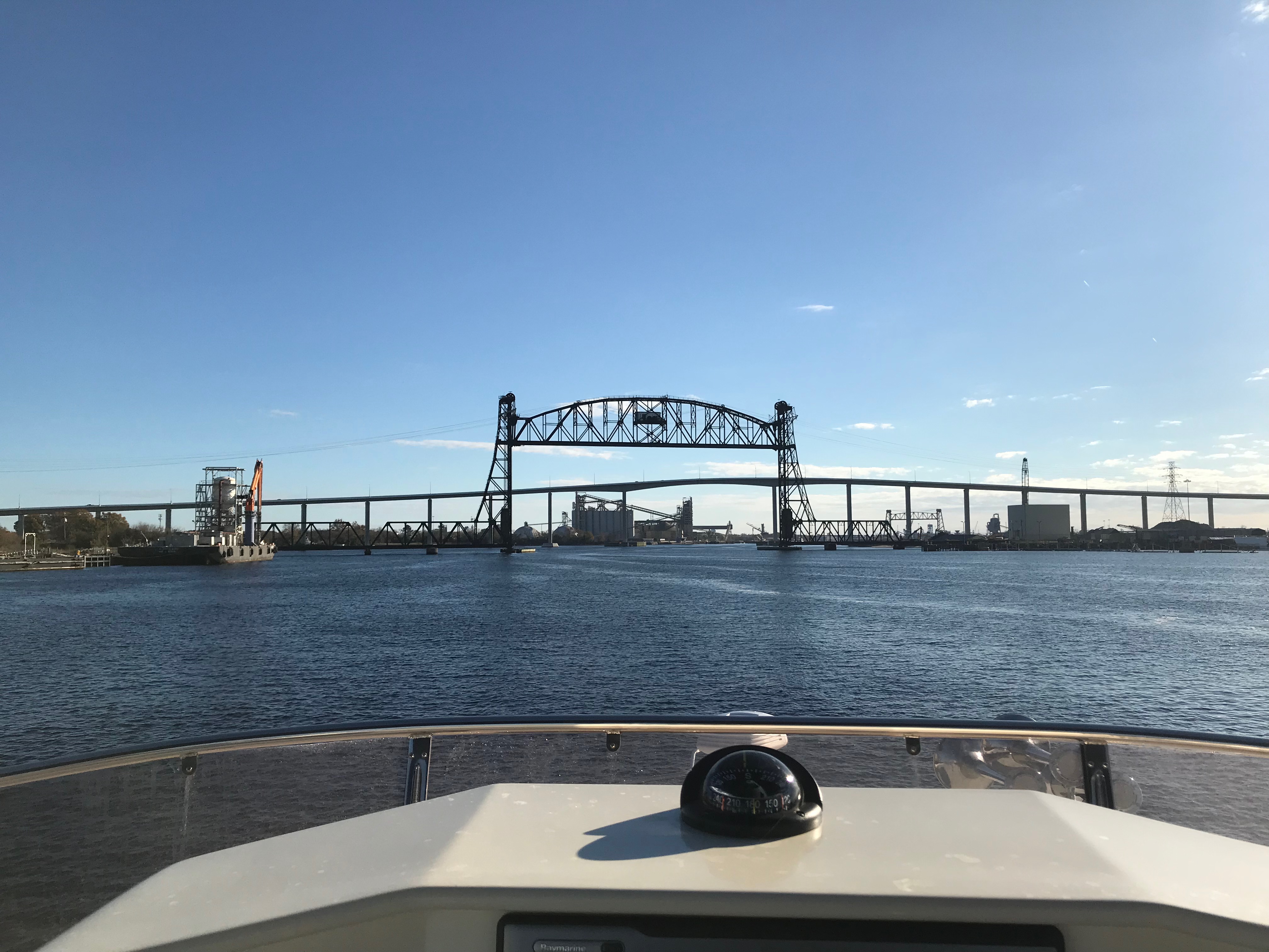
I need to be at Top Rack Marina before 5PM to get a slip. So when this huge barge swings out blocking the channel, I find a safe way around it and under the bridge.

I was aware of the time as I know I needed to get to Top Rack Marina before 5PM and as I turn the next bend in the Elizabeth River, I see that the Norfolk Southern #7 Rail Bridge is in the down position. I watch as was seems to be the longest slowest freight trains slowly passes.

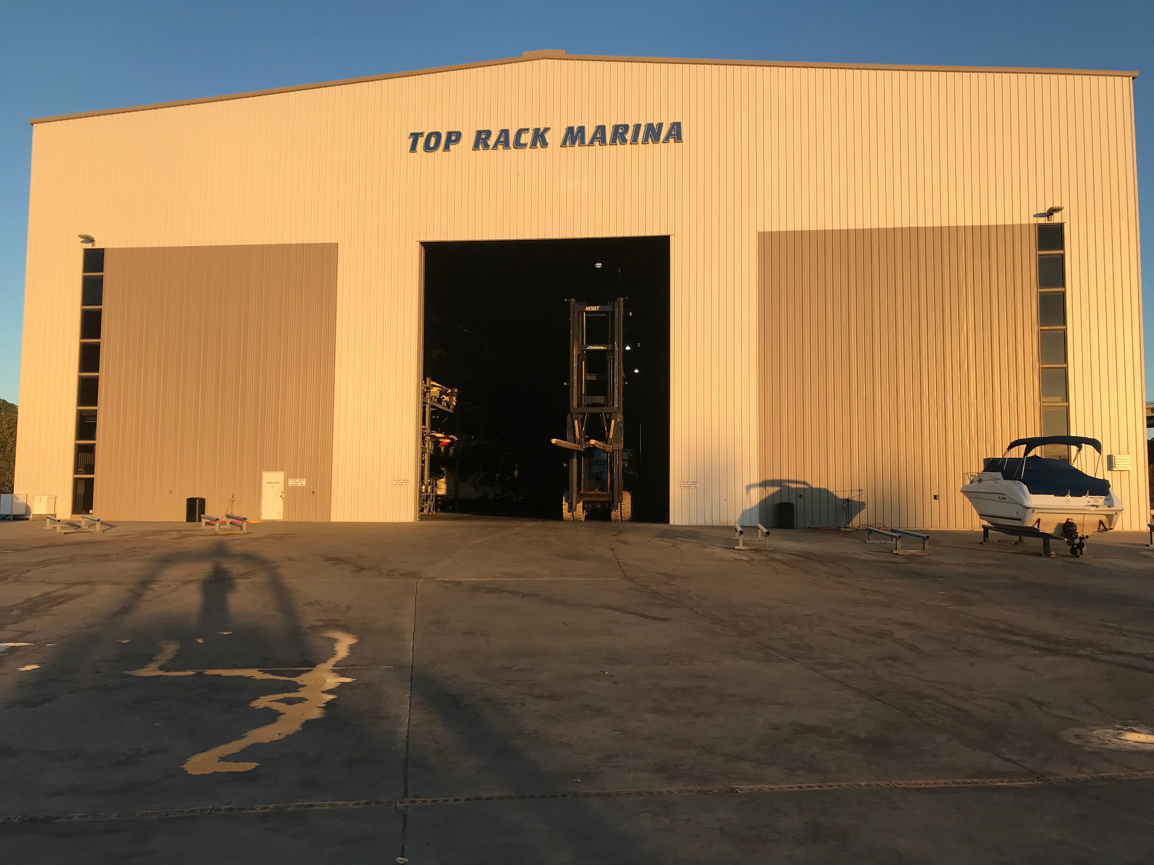
After what seemed like forever, the bridge when back up and within 20 minutes I was fueled up and in my slip at Top Rack Marina.

Simple life. can almost turn sideways the slip is so wide.

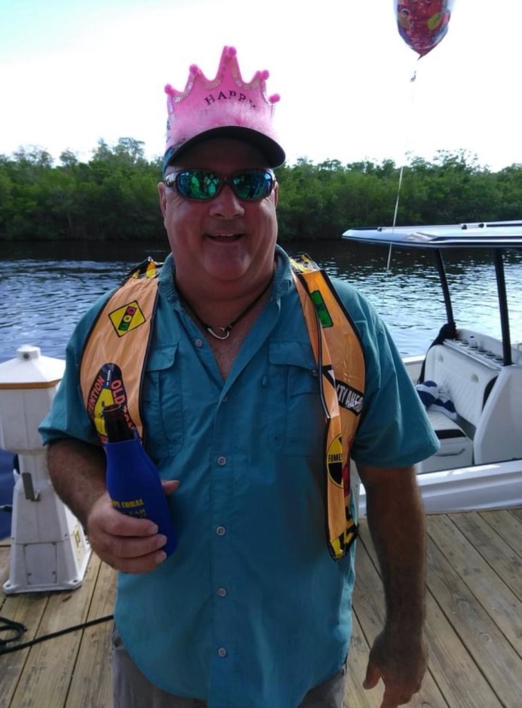
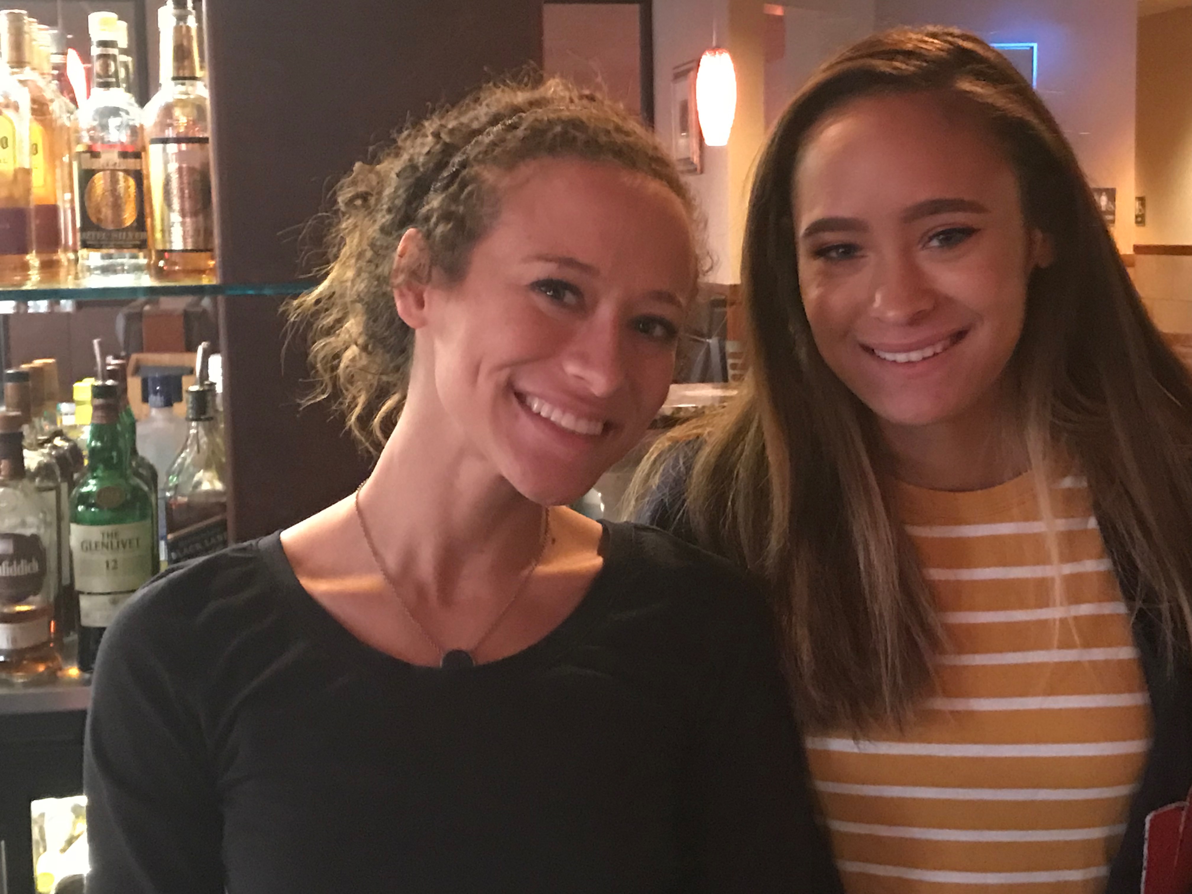
Siting in my slip, I’m aware that it’s Mike Spinney’s birthday. I think… I’m sure him and his friends are celebrating. Then this photo comes in and I can only smile.

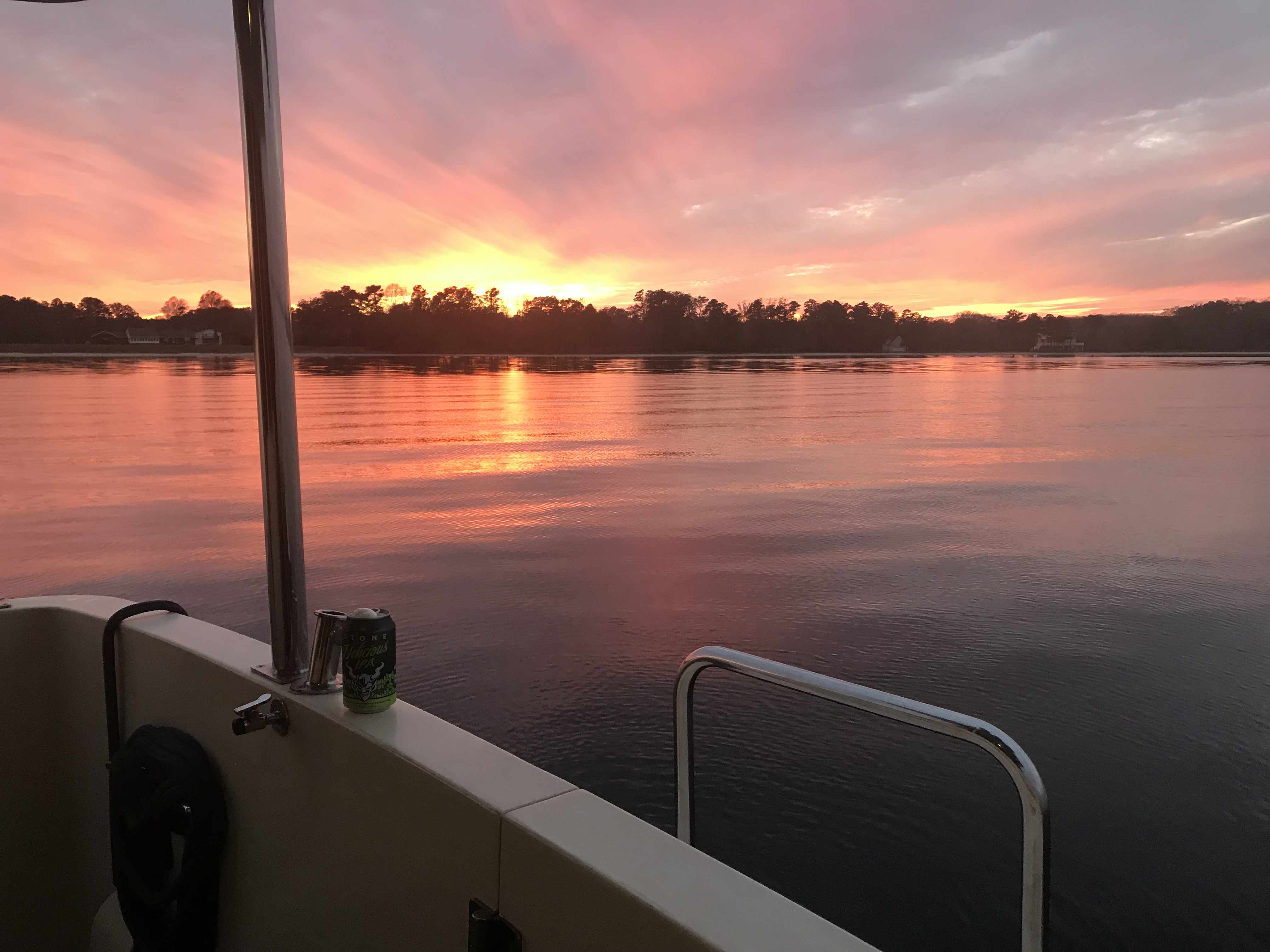
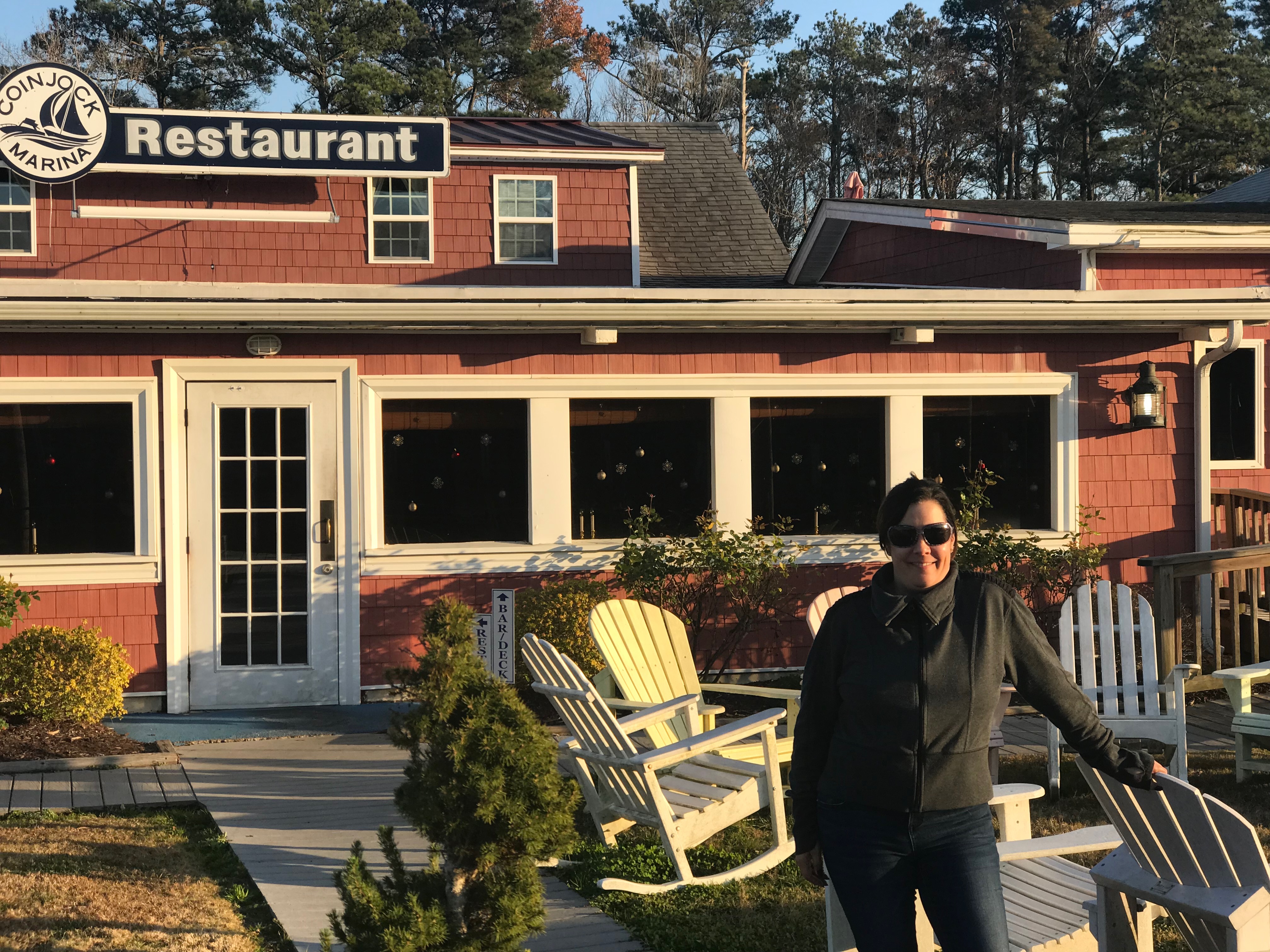
Glen, Debbie and I had planned to visit the local restaurant but it was closed. What to do? I invited Glen and Debbie over to Simple Life for a cocktail. They obliged and bought drinks and snacks. Glen makes his own beef jerky. Jerky & IPA goes well together.

Captains Meeting

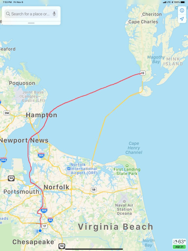
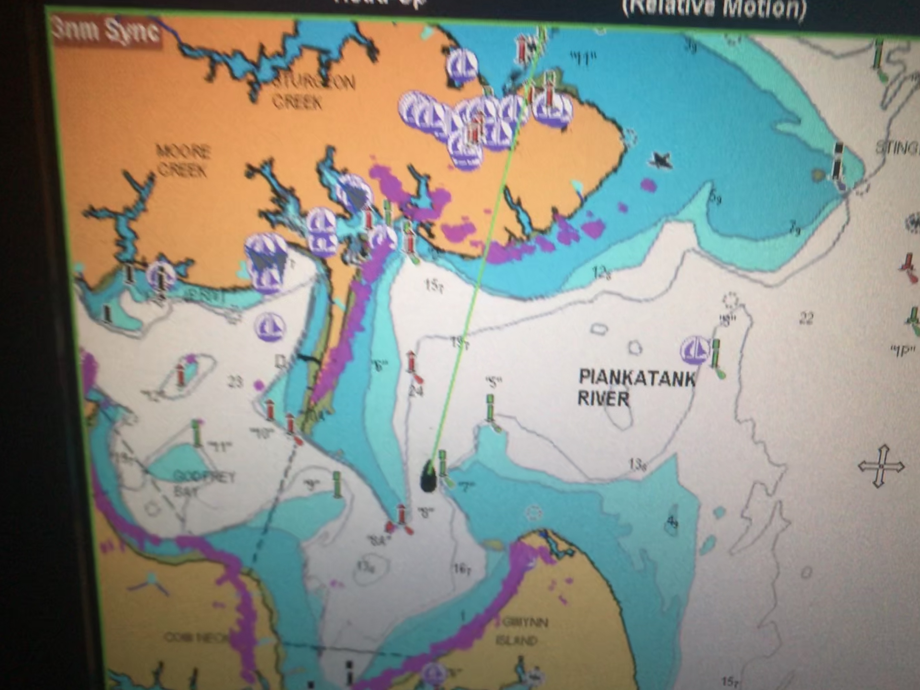
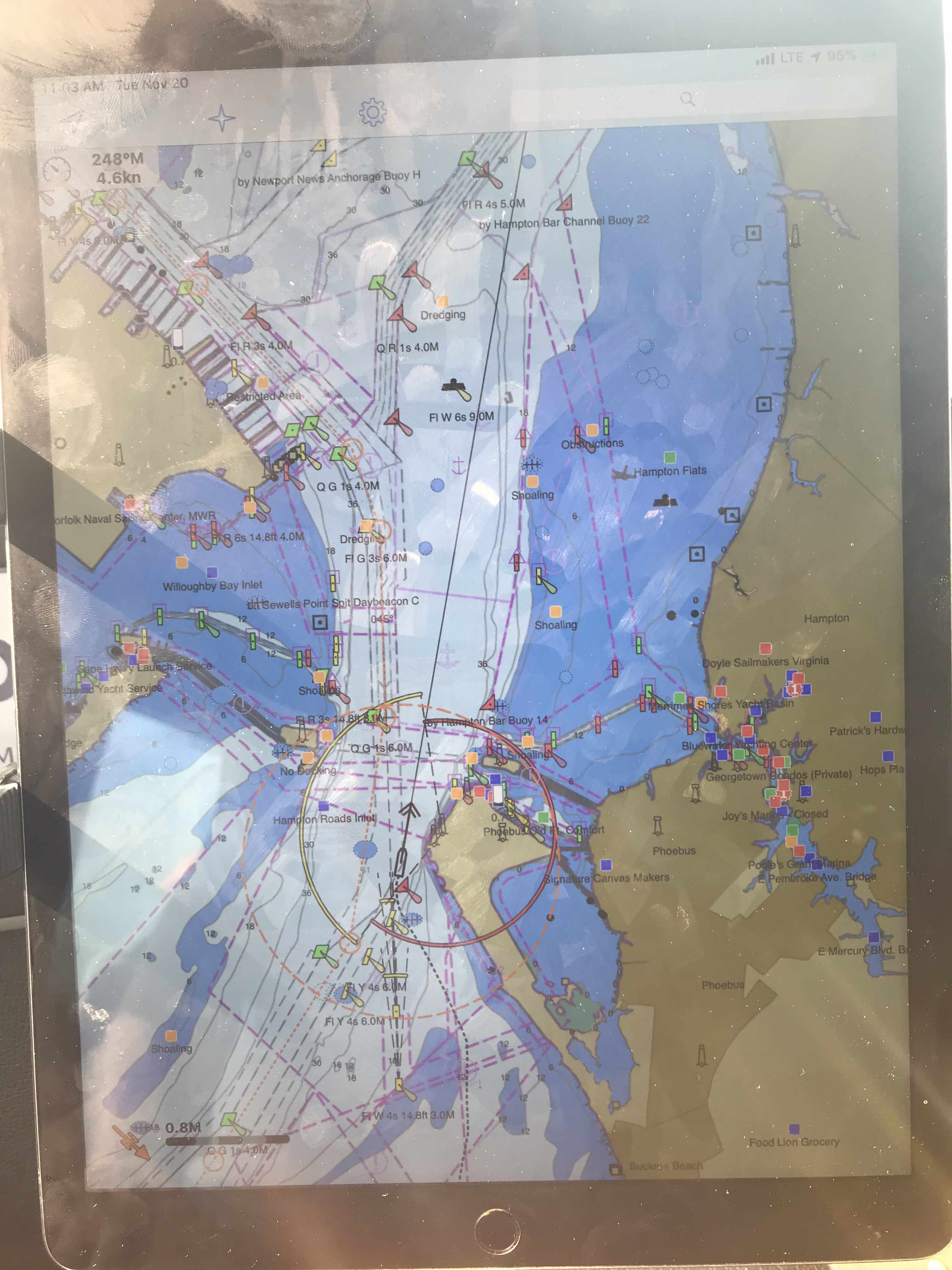
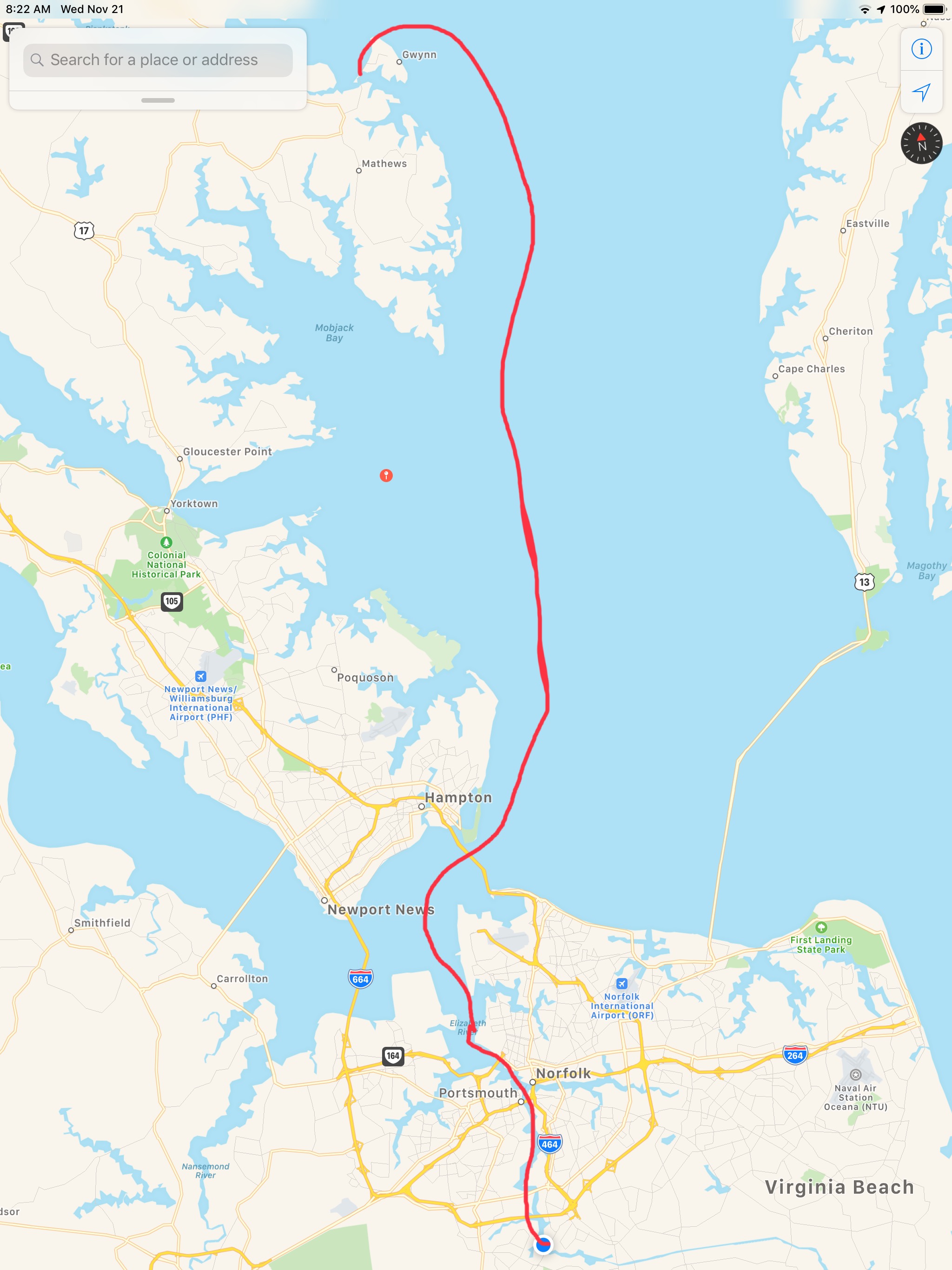
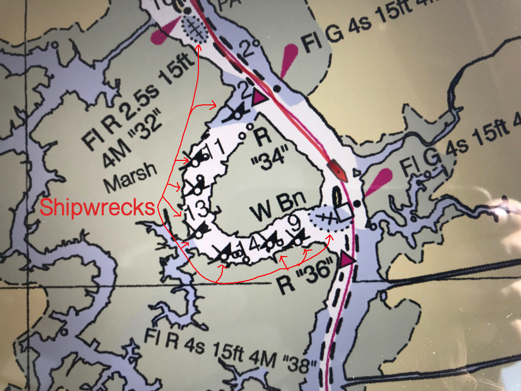
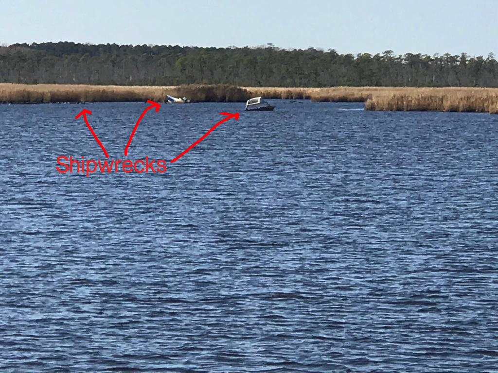
We decided to do a captain’s brief where I brought up the charts on the big screen and we walked through the next days route which would run from sun up to sun down.

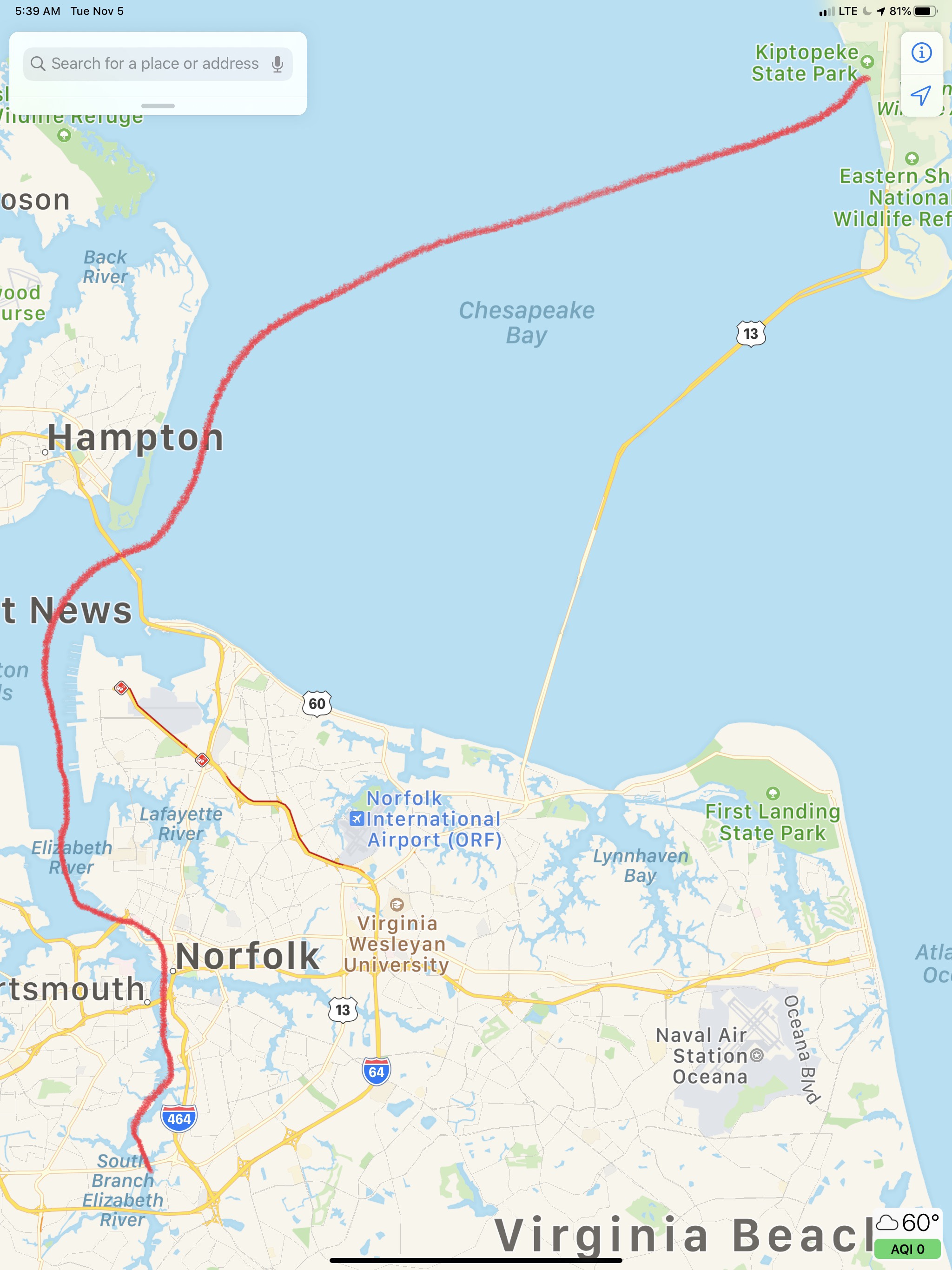
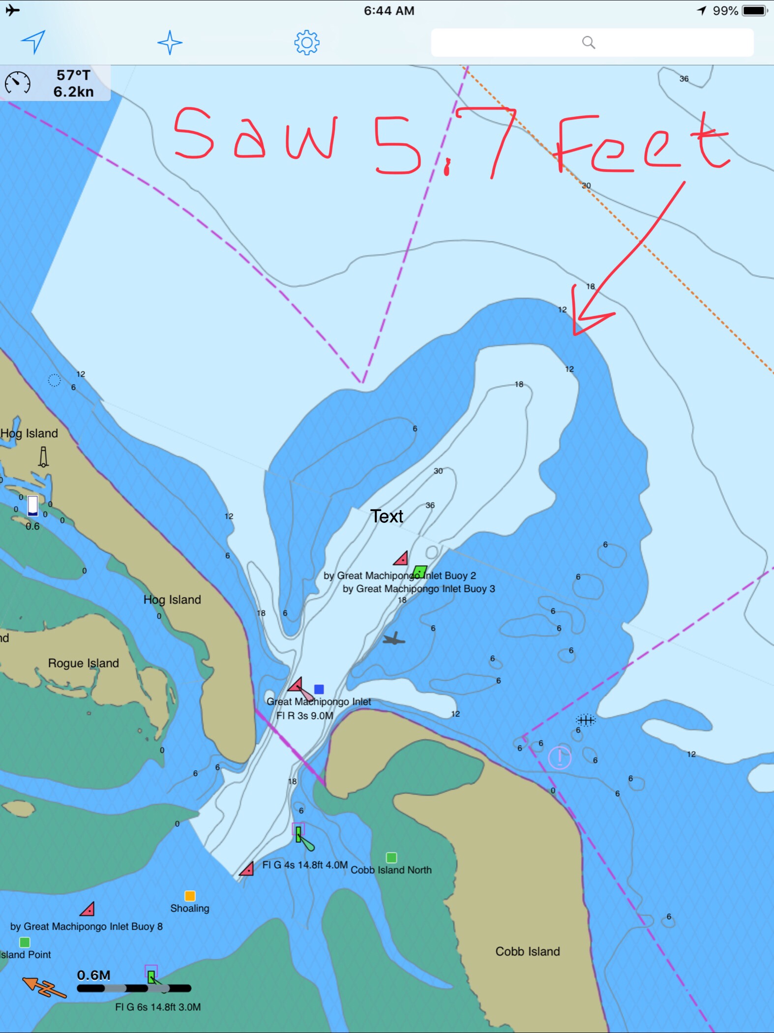
Today’s 38NM leg of my journey looked something like this…

W04L006

Cape Charles – Chesapeake

It was enjoyable to set the hook after a 33 hour run outside. Our night’s stay on anchor flanked by the ghost ships was beautiful.

Saying Goodbye to the Concrete Ghost Ships

Now we were crossing the lower portion of the Chesapeake Bay and taking the stern of crossing cargo ships.

Turning to starboard to take the stern of a cargo ship near Thimble Shoal

Today’s route through Norfolk looked roughly like this.

Kiptopeke State Park – Chesapeake, VA

Shortly after getting underway we enjoyed one of my breakfast favorites, “Bacon Hash & Eggs”.

YUMM

Soon we were passing all the warships docked at Norfolk Naval Base.

After you pass the Navy base you come to the Portsmouth ship yard where you’ll find lots of large ocean going vessels in port for repairs or to unload their cargo. Tidewater marina is located here and it’s a popular stop for ICW cruisers.

A bit further south and we were at the official start of the ICW or mile marker 0.

We rounded a bend in the Elizabeth River and found that the Norfolk Southern Rail Road Bridge was currently in the down position. This meant doing circles while we waited and watched two separate trains go past. One train was leaving with what looked like a full load of coal. The other train appeared empty and inbound.

Once the Norfolk Southern RR Bridge opened, it was time to slip beneath it

When we arrived at Top Rack Marina in Chesapeake, VA, we took on 292 gallons of diesel. We had last filled the diesel tanks in Warwick, RI. While we could have saved fuel by pulling back the throttles a bit, we have been making good time ever since we departed Warwick, RI. Warmer weather is in front of us.

Then we moved over from the diesel fill slip to our assigned slip for the night.

Renee in the cockpit at Top Rack

With provisions running a bit low, I used my Instacart app to buy groceries for the next week or so of our journey. Instacart grocery delivery is great and our shopper delivered our groceries right to our boat.

We struggled to find all the room in the refrigerator for the large order we placed.

Fridge #1 is FULL

Luckily I have a dometic AC/DC fridge/freezer combo that allows either of the two sides of the chest be either fridge or freezer. We quickly emptied everything from the freezer into a single side and raised the temp from 2 degrees F to 34 degrees F and moved whatever would not fit in the fridge in the newly created second refrigerator.

Raised Temp from 2 -> 34 Degrees on Left Side

Tied to the slip with all our provisions put away, it was time for a great meal at the Amber Lantern Restaurant.

Amber Lantern Restaurant

Stay tuned for tomorrow’s leg to the Great Dismal Swamp!

Slipping into Venus

The sunset before we went to bed was beautiful in Godfrey Bay

Sunrise in Godfrey Bay, VA

We had woken up at 4AM and decided to get underway. It was pitch black but I wanted to arrive at Top Rack Marina before they closed without having to burn more than 2.5 gals/hour.  So as we twisted and turned our way out of the Piankatank River we had to rely on the lighted buoys and cans. Recall that buoys or “nuns” are red, even numbered and have pointy “nun hat” tops, cans are green cylinders with odd numbers and flat tops. 

MV Simple Life in the center passed Red lighted beacon #8 and approaching Green lighted beacon #7
Directly above the red beacon light you can see Venus. I think the halo effect making it look even bigger in the photo

As we headed East the planet Venus was brilliantly lit up and acting as a perfect aiming target to stay on course. We were slipping our way past shoals and straight into Venus.

At times I would run with the searchlight lit to attempt to view and steer around crab pots and unlit fish weirs. This is the hazard of running at night that you can wrap a crab pot line around your propeller or become ensnared in a fish weir. 

I have a project to install LED lights under the bow to light crab pots without reflecting off the foredeck

Two hours passed and first light was upon us. Sunrise was a coming…

Danger Area… If you go to lower zoom levels to see what chart note is attached to the Danger Area you only get an annoying note that says to read NOAA’s US Coast Pilot Vol #3. That’s not very helpful as I used to keep all the Coast Pilot books printed and stored aboard but I found that I was using the online versions linked above.

Danger Area, Why? Have to look in the US Coast Pilot Vol #2

Coast Pilot is a FREE, online pdf, navigation book published by NOAA.

It’s a lot like the Maptech Embassy or Waterway Guide books that I used when I first started boating. 

The trip down to the mouth of the Chesapeake Bay was easy smooth going.

However, as we approached the inlet to Norfolk, VA the current was quickly ebbing.

Soon we were surrounded by military gun boats and helicopters buzzing overhead. On the VHF you can hear Virginia Pilots calling ships preparing to enter the harbor. They are landing on a cargo ship via helicopter for inspection of the vessel. All hatches must be open except the one the helicopter is landing on. Specific instructions were given not to have crew approach the helicopter on landing. 

Warships were everywhere to see in port but we let those boys do their work and stay clear of them. 

If you click on any of the AIS targets they come up as “military” or “US Govt”

The shipyard has some amazing mega-sized structures.

it’s looks like it climbed onto the building

As you proceed further down the Elizabeth River you are reminded that much of what’s on the shore is off-limits to anyone other than the US Government and military. 

At one point in our journey down the channel I noticed that the gigantic MSC Silvana container ship had black diesel smoke coming out of it’s stack. OMG. it’s underway and blocking the entire channel!

We had to get out of the channel to get past her

Soon we were passing this lifeboat that looked like it had lost it’s ship. These fellows were just riding around in the life boat. Maybe they are on shore leave and wanted find a restaurant 😉 


I Totally WANT one of these

I just think these are the coolest. I’m jealous of this woman getting to launch one of these free-fall lifeboats. 

How cool is she?

Soon we made our way to Top Rack Marina.

We love this stop for several reasons. 

  1. Amber Lantern Restaurant
  2. Great fuel prices
    1. $2.74/gal Diesel – we took on 306 gallons.
  3. Great slip prices
    1. $35/night any length boat (includes power)

People often ask us how cheap can you live aboard? It’s a great question and the answer is “it depends”. It depends on the life-style you want to live. Sometimes we hit marinas and restaurants every day and money seems to disappear. However, other times we spend cruising on anchor every night and spend nothing but diesel. We left Warwick, RI on Sunday, Nov 11th at around 3PM. It’s now 10 days later, Nov 21st we are at Top Rack Marina in Chesapeake, VA. Being a fan of science I believe people would rather see a data-driven answer where they can draw their own conclusion. If we “Do the Math”.

  1. We have completed 9 legs of our journey over 10 days.
  2. We put 89 Hours on the diesel
  3. 86 hours / 8 legs = 10.75 hours a leg. (skipping the first short 3 hour day)
  4. 10 hours on the genset (4 because I forgot to shut it off while underway)
  5. $242 on 2 nights dinner & drinks (I don’t recall getting back to the boat on 1 of them)
  6. 306 Gallons of diesel (main engine, genset & forced-hot-air diesel heat)
  7. $838 on diesel
  8. $150 for 3 nights at marinas

I hope that sheds some light on budget.

Our 9th leg looked something like this…

Apple Maps screen capture with hand-drawn finger route

Retreat from the Waves

Before leaving Coinjock Marina, we received an email alert that MV Meanders had left Port: Coinjock. MV Meanders had been docked bow to bow with us. They had stealthily slipped away while we were making coffee.

Meanders Marine Traffic
Marinetraffic.com email alert for a boat as it leaves a port

MV Meanders is a beautiful 49’ North Pacific yachts RPH trawler. She’s a bigger version of our boat with reverse raked PH windows. MV Meanders was recently sold to a nice couple named Tom & Nancy who stopped to say “hi” when they saw our NP43 fueling up on the docks. Meanders was previously owned by friends of ours, Andy & Marty. Andy was my boat broker and took me for my first ride in their NP43. I was smitten. I setup the MarineTraffic alert when Andy & Marty were living aboard their boat and traveling to many different ports. At that time, I was working and enjoyed getting alerts about all the interesting places they were visiting. I would think to myself.. “soon that will be Kelly & I and the dogs”.

Meanders
MV Meanders a 49′ NP RPH docked off our bow in Coinjock, NC

We had to delay our departure momentarily to allow for a passing tug pushing not one but two barges. We don’t want to be in the way of something like this.

Tug 2 barges 3
Tug Pushing 2 Barges up the ICW

As we traveled down the ICW were chasing a 1935 boat called “MV NAN” out of Osterville, MA. A beautiful old boat that hails out of a marina that we have visited once or twice.

At the helm, I was using my iPhone’s charting app to measure distances to restricted bridges and locks. Many bascule, lift or swing bridges only operate at certain times like “top of the hour” or on the “half hour”. You need to measure the distance to the next bridge opening and adjust your speed to arrive on time. If you don’t you’ll find yourself treading water till the next opening. As I looked up from my iPhone, I saw this log floating down the river and had to swerve to avoid hitting it. iPhones make it even easier to run into a hazard on the ICW.

Hazzard Log 4
Hazards to Navigation are everywhere in the ICW

Just before arriving at Top Rack Marina you pass this school bus hanging precariously over a precipice. They put a sign in the window that says, “Fire Rescue Training in Progress”. I imagine they added that after someone called 911 to say that “a school bus was about to fall into the ICW!”

Fire Rescue 2
Fire & Rescue Training Using a School Bus About to Plunge into the ICW

Soon we were at Top Rack Marina and enjoying a well deserved dinner at the Amber Lantern Restaurant. What great food this restaurant has. Kudos to the Chef.

AmberLantern
Amber Lantern Bar

When we awoke in the AM we could not depart due to an emergency! We were out of dog food! I hailed an Uber with the app and raced off to the local Petco. Dogs fed; we untied and headed North to Norfolk, VA.

Coming into Norfolk you feel small compared to the many warships lining the channel.

How cool is it to have a Navy ceremony seated beneath the “Big Guns”?

Navy Ceremony 2
Navy Ceremony – Battleship Wisconsin?

I always admire this thing as if it was a cool sculpture of sorts.

Star Wars 2
Star Wars?

One large container ship appeared to be washing their anchor. I wish I had a dedicated anchor wash system. Sometimes when our anchor comes up, it can be covered in muck from the sea bottom.

Anchor Wash 3
Anchors Getting Washed

We exited Norfolk harbor and pointed the boat up the coast. The weather was supposed to be 2-4 ft with 20kt winds.

We soon realized that the waves which were on our beam were far larger than predicted and made for a miserable ride. When we arrived at our planned anchorage which was just inside the “Great Machipongo Inlet”.  We had only to cross over the bar shoal at the entrance. By now the waves had built into large breaking waves that were pushing us from behind toward the bar. As we progressed slowly over the bar I watched the depths with dread. 10’, 9’, 8’, 7, 6’!!! When I saw 5.7, we did an immediate hard spin and raced back out to sea the way we came in. You don’t want to run aground in breakers 30 miles from anyone.

As the spray from the waves washed over the pilothouse, Kelly & I had an emergency discussion about what to do?

We had 4 Options:

  1. Hold the bow into the large waves until the tide rises and attempt to cross the bar again. It would probably be dark before we got enough lift from the tide.
  2. Continue North 70+ miles to Ocean City, MD. I was exhausted and did not think I could make it another 10 hours into the night.
  3. Continue North 30+ miles to the MARS anchorage. Zero protection against the large waves would have made for an unbearable night on anchor and the next day was predicting 25 kt winds and larger waves.
  4. Return the 30+ miles back the way we came and tuck around Fisherman’s Island and into Chesapeake Bay to find an anchorage.

We chose option 4. This was hard for me because I often say to Kelly,  “I hate moving backward or retracing steps”. I think this comes from a combination of being A.D.D and always not wanting to go backwards for something that you forgot and just a desire to never see the same scenery twice. Always seeing something new brings happiness.

As we made our way back into the bay, the sea began to soften and the ride became smoother.

Cape Charles Sunset 4
Sunset off Fisherman’s Island, VA

We selected an anchorage called Sunset Grille Anchorage. As we approached it was very overcast and dark. Radar pings were showing two docks extending far out from shore on either side of our intended anchorage spot.  If we didn’t approach from exactly perpendicular to the shore we’d have slammed into these pilings on this dark night. Thankfully we have radar and a remote searchlight to identify hazards the radar pings.

We anchored and tried to get some sleep.

1AM and the boat was ROCKING. The wind had picked back up and the current had aligned us so the waves were on our beam. The boat was rocking violently. So much so that eventually, I had to start the boat and pull anchor and leave into the blackness. It’s always better to stay on anchor than attempt to navigate an unfamiliar harbor on a black night. But spend 4 hours in a boat that is rocking like an amusement ride and you’ll take your chances underway.

The wind had picked up and we were on the wrong side of a 20 mile fetch of water that was now battering us with large waves. We fought our way to the calmer side of the bay and then turned North looking for an anchorage that would give us protection against the strong Southerly wind and waves. We motored our way to Godfrey Bay and anchored in a calm protected bay, safe from the day’s harsh weather. It was only 11AM and I could barely keep my eyes open even with the 3 cups of coffee I had pumped into myself.

As we entered the anchorage, we passed this classic Chesapeake crab boat.

Crabber 20
Looks like a painting I’d hang on my wall

Now peacefully on anchor. We are plotting a new course that takes us up the Chesapeake Bay.

We’ll traverse the C&D canal and then have to sail down Delaware Bay, round Cape May and go North up the coast toward NYC.

All of the Whos in Whoville Flock to Top Rack Marina

We spent two nights at the Top Rack Marina (ICW Statute Mile 8.8) in Chesapeake, VA.

Top Rack Marina Life Ring
Top Rack Marina – a nice stop along the ICW

What a great place to stop. When we arrived at the marina, Ben was there to catch our lines and greet us with a some Virginian southern hospitality. Top Rack Marina is a “dry rack storage” marina. These style of marinas store their customer’s boats on indoor racks rather than floating in a traditional “wet slip”. Customers simply call and request their boat dropped into one of the dozen or so wet slips in the marina’s water edge.

Top Rack Marina Kelly in Slip
Kelly relaxing in the cockpit

Top Rack Rack Indoor Racks
Indoor racks hold boats like a grocery store shelf

Top Rack Marina Outside Racks
Outdoor racks act as staging locations as boats are washed, flushed and prepped

Their giant fork truck moves boats effortlessly and can be intimidating as it whirls around with a boat high in the air.

Fork Truck John
Driver John alongside for a visual comparison

YouTube Video – Hauling Boat Up and Out

We decided to stay for two nights and re-provision the boat. Usually we would have to grab a Uber to a nearby grocery store but we have found that grocery delivery services are a much faster, cheaper and a far simpler way to restock. When we were in Brick, NJ we used Peapod from Stop & Shop but here in Chesapeake, VA we used Farm Fresh Supermarket.
Jaquay was our designated shopper and he would text us with pics of substitutions for any out of stock items on our list. Jaquay picked our order, drove dockside and was kind enough to help carry our groceries aboard. Thanks Jaquay.

Jaquay
Jaquay

The marina has a great ship store and Deli and as I checked in with Brian at the front desk, Brittany was there to help me select a local IPA beer called “El Guapo IPA”. El Guapo is brewed locally in Norfolk, VA by O’Connor Brewery

El Guapo IPA
In Spanish El Guapo is a beautiful guy, a well looking male

Then it was on to dine at the Amber Lantern Restaurant. We stepped out of the elevator and hostess Courtney warmly greeted us. We got an early start at the docks and by the time the restaurant opened at 4PM, we simply poured ourselves into seats at the bar. Bartender Sydney kept us smiling the whole night.

Sydney
Sydney’s smile could warm the heart of even the crustiest sailor

Sydney and Courtney
Dynamic Duo: Sydney and Courtney

Being first into the restaurant, we had the chef to ourselves and the food was amazing. We had our fill and retired back to the boat only to wake up at the witching hour of 3AM and sing along with YouTube videos from artists in the “Forever 27 Club”. I recall some Janis Joplin was echoing out over the river… “Freedom’s just another word for nothing left to lose”…

We awoke to a ghostly fog creeping down the river and we quickly shoved off to race and catch the Great Bridge Lock opening at half-past-every-hour.

Top Rack Marina Fog
ICW fog

Once at the Lock we tied up to the Southern wall, waited for the lock doors to silently close and watched as it lowered us gently down to the height of the water on the Albemarle Sound side of the lock. I find it interesting that while the Elizabeth River side of the lock is tidal and varies about 2.7 feet the Albemarle Sound side varies only due to the winds that drive water up or out of the river. Equally as amazing is the age of the machinery that drives these locks. You watch as giant gates and machinery, built using simple principles of engineering mastered many years ago, silently close.

YouTube Video of the Great Bridge Lock’s Gates Closing

Lock
Lock gates silently shutting behind us

Lock - Life Jackets Required
If you want to walk the dogs while in the lock you’ll have to don a PFD

The opening of the lock is timed to match cruiser’s expected arrival at the Great Bridge’s on-the-hour openings.

Great Bridge Bascule
Great Bridge – a bascule bridge

The Battle of Great Bridge was fought December 9, 1775, in the area of Great Bridge, Virginia, early in the American Revolutionary War.

We kept the ICW-bridge-list.pdf displayed on the iPad we’d have the requisite knowledge at our fingertips. As you pilot the ICW you will want to be aware of such things as… What bridges are around the bend? Can you safely pass under their vertical height? Are they restricted in opening times? How to contact the bridge tender on to request an opening?

ICW Bridge List
ICW bridge list for all 1,243-miles of  ‘inland’ waterway

As you make your way down the Albemarle Chesapeake Canal you can’t help but notice it’s as straight as spaghetti. The Canal was originally conceived of in 1772 but had to wait until technology advances (circa 1856) that allowed steam-powered mechanical dredges to cut through the land. While the canal is over 70 miles long, there is only 14 miles of excavated land. There are really two different “cuts”. The 8.5 mile long Virginia Cut which connects the Elizabeth River with the North Landing River in Virginia and the North Carolina Cut which is 5 miles long and slices across the Currituck Peninsula at the village of Coinjock to enter the North River, flowing south into the Albemarle Sound.

Albemarle_Chesapeake_Canal
Historic chart denoting the Virginia and NC cuts

This canal is a wonderful part of American history. During the U.S. Civil War, when the Union Army commandeered the canal, nearly 9,000 vessels made the transit. After the War, traffic continued to increase as the waterway took over practically all of the trade passing between the Albemarle Sound and Norfolk, Virginia.

As we meander down the ICW at a leisurely pace of 6 knots (4.5 MPG) we noted the passing from Virginia into NC. Then just a short while later, we were stumped to explain why this looping side canal was littered with wrecks? How did this happen?

VA NC State Line
VA / NC State Line – ICW statute mile marker 34

Ship Wreck Alley
How did this happen?

Ship Wrecks
Gently used boat for sale

Cannon
Maybe this cannon we passed was responsible for the wrecks  😉

The scenery at this point in the ICW is amazing! The waterway is lined with tall grass and you’ll watch as the local duck hunters race by you in camouflaged flat bottom boats. We’d pass the occasional duck blind hidden in the grass and Kelly & I would jabber about the moral issues of tricking ducks with decoys into becoming dinner. I’m always intrigued by the human race’s dilemma between a desire to coexist peacefully with all the other animals on planet Earth and our need for subsistence.

We soon arrived at Coinjock Marina where dock hand, JD quickly moored us to the wall and we scurried off to the Sand Bar for an IPA, some buffalo wings and a filet mignon for Kelly.

Sandbar
A typical sailor bar along the ICW

Coinjock Marina Kelly
The restaurant is known for their amazing prime rib

Inside the bar we met Bartender Jason and shared stories with other cruisers going South down the ICW. The three captains of a brand new 45′ Hatteras sport fishing boat that was making its way South sat next to us. They showed us video of their 30 knot trip South and we joked about their 80+ g/hr burn rate vs. our 1.2 g/hr rate. “Time is money” said one of the captains as they hurried out of the bar joking that they would not wake us at sunrise as their sprint South continued. Well it’s 6:30AM and we just watched them depart silently. I’m sure today will be another fun time here in Coinjock, NC.


Entering the ICW

Norfolk Leg
Route from The Great Machipongo Inlet to Top Rack Marina, Chesapeake, VA

Well we woke up early and left The Great Machipongo Inlet. The dolphins once again escorted us out and I turned South with the sun streaming in the port side pilothouse windows so hard I had to close the curtains and use the radar alone to tell what was on that side of the boat.

The sea was as flat as a model’s tummy so I lowered the RPMs on the diesel to get 2 MPG rather than 1 MPG. Simply by slowing the boat 1.3 knots we double our fuel efficiency! Don’t you wish that were the case for your car?

Thimble Shoal Light - Norfolk VA
Thimble Shoal Light

In a few hours we had snuck through the Chesapeake Bay Bridge Tunnel, past Thimble Shoal lighthouse and we were approaching Norfolk Navel Station.


What an amazing sight to get to these American Navy ships up close.

Warship 19
USS Mesa Verde (LPD 19) – Amphibious Transport Dock Ship

You can see the barrier fence that they stretch across the opening and that fence line is protected by a Navy Patrol boat with a machine gun on the bow.

Navy Patrol boat

A local news story revealed just a few months ago there were six bomb threats called in to the naval station and you can call NCIS if you know anything. I wonder if you can call and ask for “Leroy Jethro Gibbs” or “Tony DiNozzo”?

Jethro and Tony

USNS William McLean (T-AKE 12) - Military Sealift Command
USNS William McLean (T-AKE 12)
– Military Sealift Command

USS Leyte Gulf (CG-55)
USS Leyte Gulf (CG-55) – Ticonderoga-Class Guided Missile Cruiser

USS San Jacinto CG-56
USS San Jacinto (CG-56) –  Ticonderoga-Class Cruiser

MH-53E Sea Dragon
MH-53E Sea Dragon Buzzed Us From Overhead

Dangerous Target
AIS (Automated Information System) Alarm on my Chartplotter warning of other AIS traffic that has a narrow CPA (Closest Point of Approach)

As the Sea Dragon buzzed us my navigation system popped up forcing me to ACKNOWLEDGE the fact that there was a “Dangerous Target” nearby. The Helicopter was not alone and there were a pair of jets making that deafening sound that seems to well up from a simple background rumble to a roar.

Jet
McDonnell Douglas F/A-18 Hornet – Screeching Across the Sky

I believe that is a McDonnell Douglas F/A-18 Hornet? Maybe one of our military aficionados will comment if I got any of this incorrect?

DryDock 2
Norfolk Virginia Dry Dock


Dry dock ship
I Believe this is the Stern of a Amphibious Transport Ship?

Medical Ship
USS Jason Dunham (DDG-109) – Arleigh Burke-Class Destroyer Alongside The Hospital Ship Comfort

The Hospital Ship Comfort made it’s way down to Puerto Rico as part of the relief efforts.

News Story about Hospital ship and it’s relief efforts.

So after navigating past all the warships and being careful to keep our distance it’s on to the Norfolk International Terminals and the Virginia Port Authority.

Star Wars
Star Wars AT-AT Walkers were all I could think about.

Crane
Large Cranes Loom Overhead

Hapag-Lloyd Passing By
Hapag-Lloyd Container Ship Passing By

North PBL RR Bridge and Jordan Fixed Bridge
North PBL RR Bridge and Jordan Fixed Bridge, ICW’s First Set of Bridges – Many More to Come

Norfolk Southern Railway Bridge 36 Feet
Norfolk Southern Railway Bridge @36 Feet – Room to Spare

Paddle Wheel James C Echoles 2
Paddle Wheel James C Echoles 2 Passing us By

You can’t help but notice that everywhere along the shore seems posted “WARNING – US Government Property – Restricted Area – KEEP OUT”

Tower
US Gov Manned Towers with searchlights Guard Wharf Entrances

Finally, we arrived at our chosen destination, Top Rack Marina.

Top Rack Marina setting sun
Top Rack Marina in the Setting Sun

I promise to post more about this terrific marina and the on site restaurant called the Amber Lantern that we plan on having dinner at tonight.

New Haven CT & Gale Warnings

PtJudithSunrise2
Pt. Judith, RI – Harbor of Refuge @ Sunrise

We departed Harbor of Refuge @ sunrise this morning. We felt a sense of urgency due to a gale warning (gusts to 35 knots) which is in effect beginning Thursday afternoon. The cause is two separate low pressures that are having a complex interaction West of our current location.


GaleWatch
NWS Gale Warning NYC

Below is a rough depiction of our second leg of our journey South. Our course took us from Pt. Judith’s Harbor of Refuge, outside Fishers Island to Morris Cove Anchorage in New Haven, CT.

Leg2
Leg #2 of #Run2Sun2017

Today’s cruise was long but relaxing. The sun was streaming in windows making the pilothouse warm as we made way @ 8.5kts West down Long Island Sound.

We saw only a few sport fishing boats and had to dodge the occasional ferry crossing our path.

Ferry
Ferry Crossing Long Island Sound

Every captain knows it’s better to take the stern of larger vessels rather than attempt to cross her bow. Ten or so years ago I had a close with a US battleship @3AM in pea-soup fog in Norfolk, Virginia’s entrance channel. Our close call was not a crossing issue but instead the warship was inbound in the channel and was not basting fog signals. After they suddenly appeared on radar from under the Chesapeake Bay bridge/tunnel we quickly blasted our horn. When they responded with their horn I swear my ears blew out. The warship quickly passed us not 100′ off our port beam (frightening in the fog). A shout out to that day’s offshore crew – Eddie, Sean and Amy who can attest to this poop-your-pants experience.

warship
Stay Clear of Warships

Kahlenberg Air Horns

After this harrowing experience, we installed Kahlenberg triple trumpet air horns as well as AIS (Automatic Identification System) in Simple Life.

AIS
How AIS Works


AIS equipped vessels can each view on their chart plotter the other’s vessel name, size, speed, heading and course-magnetic. AIS works by sending & receiving digital data over VHF channel 70 so that two ships can see each other on their chartplotter screens even without radar. I  have also learned to that programming your marine VHF with a MMSI # make ship2ship communications easier when it’s dark or foggy.


Hells Gate
Hell’s Gate Current Table

Tomorrow our plan is to push west down the coast of Connecticut with hopes of catching the 4.8kt ebb tide through the East River (where the dead bodies are found on many Law & Order episodes). Kelly & I always enjoy the East River’s Hell’s Gate (where the Harlem River meets the East River). Hell’s Gate is infamous due to the strong currents that mix in the way a washing machine mixes water.

We hope to make the Liberty Island Marina in Jersey City by sunset on Thursday. We’ll spend two nights at the marina while we wait for more favorable weather for our trip down the Jersey coast. Until then we’ll just sit on anchor watching the lights from New Haven.

New Haven at Night
Lights of New Haven as seen from Morris Cove