Retreat from the Waves

Before leaving Coinjock Marina, we received an email alert that MV Meanders had left Port: Coinjock. MV Meanders had been docked bow to bow with us. They had stealthily slipped away while we were making coffee.

Meanders Marine Traffic
Marinetraffic.com email alert for a boat as it leaves a port

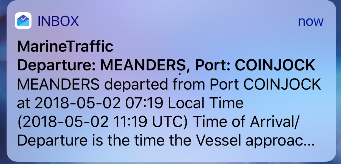
MV Meanders is a beautiful 49’ North Pacific yachts RPH trawler. She’s a bigger version of our boat with reverse raked PH windows. MV Meanders was recently sold to a nice couple named Tom & Nancy who stopped to say “hi” when they saw our NP43 fueling up on the docks. Meanders was previously owned by friends of ours, Andy & Marty. Andy was my boat broker and took me for my first ride in their NP43. I was smitten. I setup the MarineTraffic alert when Andy & Marty were living aboard their boat and traveling to many different ports. At that time, I was working and enjoyed getting alerts about all the interesting places they were visiting. I would think to myself.. “soon that will be Kelly & I and the dogs”.

Meanders
MV Meanders a 49′ NP RPH docked off our bow in Coinjock, NC

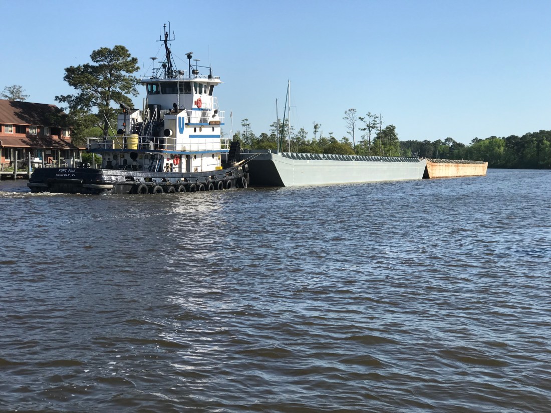
We had to delay our departure momentarily to allow for a passing tug pushing not one but two barges. We don’t want to be in the way of something like this.

Tug 2 barges 3
Tug Pushing 2 Barges up the ICW

As we traveled down the ICW were chasing a 1935 boat called “MV NAN” out of Osterville, MA. A beautiful old boat that hails out of a marina that we have visited once or twice.

At the helm, I was using my iPhone’s charting app to measure distances to restricted bridges and locks. Many bascule, lift or swing bridges only operate at certain times like “top of the hour” or on the “half hour”. You need to measure the distance to the next bridge opening and adjust your speed to arrive on time. If you don’t you’ll find yourself treading water till the next opening. As I looked up from my iPhone, I saw this log floating down the river and had to swerve to avoid hitting it. iPhones make it even easier to run into a hazard on the ICW.

Hazzard Log 4
Hazards to Navigation are everywhere in the ICW

Just before arriving at Top Rack Marina you pass this school bus hanging precariously over a precipice. They put a sign in the window that says, “Fire Rescue Training in Progress”. I imagine they added that after someone called 911 to say that “a school bus was about to fall into the ICW!”

Fire Rescue 2
Fire & Rescue Training Using a School Bus About to Plunge into the ICW

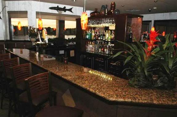
Soon we were at Top Rack Marina and enjoying a well deserved dinner at the Amber Lantern Restaurant. What great food this restaurant has. Kudos to the Chef.

AmberLantern
Amber Lantern Bar

When we awoke in the AM we could not depart due to an emergency! We were out of dog food! I hailed an Uber with the app and raced off to the local Petco. Dogs fed; we untied and headed North to Norfolk, VA.

Coming into Norfolk you feel small compared to the many warships lining the channel.

How cool is it to have a Navy ceremony seated beneath the “Big Guns”?

Navy Ceremony 2
Navy Ceremony – Battleship Wisconsin?

I always admire this thing as if it was a cool sculpture of sorts.

Star Wars 2
Star Wars?

One large container ship appeared to be washing their anchor. I wish I had a dedicated anchor wash system. Sometimes when our anchor comes up, it can be covered in muck from the sea bottom.

Anchor Wash 3
Anchors Getting Washed

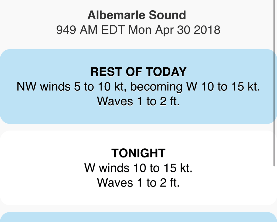
We exited Norfolk harbor and pointed the boat up the coast. The weather was supposed to be 2-4 ft with 20kt winds.

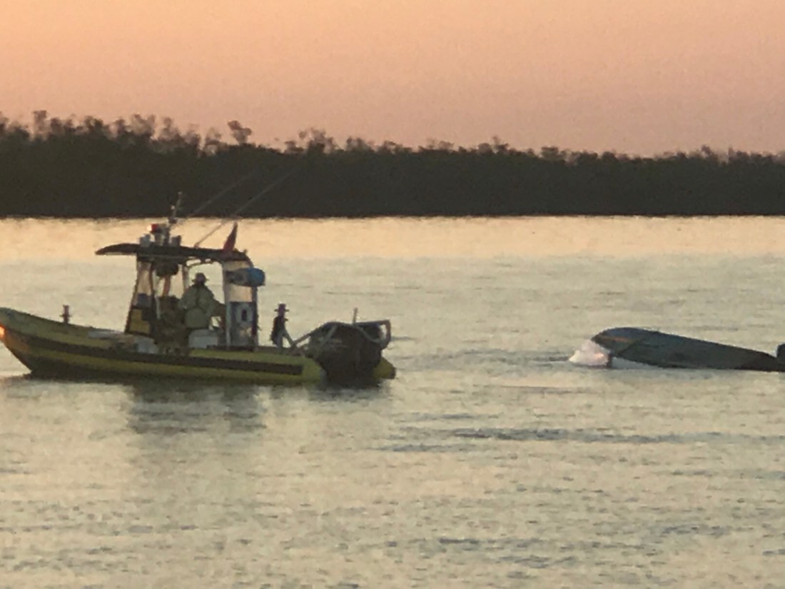
We soon realized that the waves which were on our beam were far larger than predicted and made for a miserable ride. When we arrived at our planned anchorage which was just inside the “Great Machipongo Inlet”.  We had only to cross over the bar shoal at the entrance. By now the waves had built into large breaking waves that were pushing us from behind toward the bar. As we progressed slowly over the bar I watched the depths with dread. 10’, 9’, 8’, 7, 6’!!! When I saw 5.7, we did an immediate hard spin and raced back out to sea the way we came in. You don’t want to run aground in breakers 30 miles from anyone.

As the spray from the waves washed over the pilothouse, Kelly & I had an emergency discussion about what to do?

We had 4 Options:

  1. Hold the bow into the large waves until the tide rises and attempt to cross the bar again. It would probably be dark before we got enough lift from the tide.
  2. Continue North 70+ miles to Ocean City, MD. I was exhausted and did not think I could make it another 10 hours into the night.
  3. Continue North 30+ miles to the MARS anchorage. Zero protection against the large waves would have made for an unbearable night on anchor and the next day was predicting 25 kt winds and larger waves.
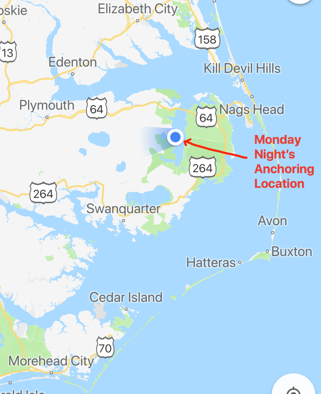
  4. Return the 30+ miles back the way we came and tuck around Fisherman’s Island and into Chesapeake Bay to find an anchorage.

We chose option 4. This was hard for me because I often say to Kelly,  “I hate moving backward or retracing steps”. I think this comes from a combination of being A.D.D and always not wanting to go backwards for something that you forgot and just a desire to never see the same scenery twice. Always seeing something new brings happiness.

As we made our way back into the bay, the sea began to soften and the ride became smoother.

Cape Charles Sunset 4
Sunset off Fisherman’s Island, VA

We selected an anchorage called Sunset Grille Anchorage. As we approached it was very overcast and dark. Radar pings were showing two docks extending far out from shore on either side of our intended anchorage spot.  If we didn’t approach from exactly perpendicular to the shore we’d have slammed into these pilings on this dark night. Thankfully we have radar and a remote searchlight to identify hazards the radar pings.

We anchored and tried to get some sleep.

1AM and the boat was ROCKING. The wind had picked back up and the current had aligned us so the waves were on our beam. The boat was rocking violently. So much so that eventually, I had to start the boat and pull anchor and leave into the blackness. It’s always better to stay on anchor than attempt to navigate an unfamiliar harbor on a black night. But spend 4 hours in a boat that is rocking like an amusement ride and you’ll take your chances underway.

The wind had picked up and we were on the wrong side of a 20 mile fetch of water that was now battering us with large waves. We fought our way to the calmer side of the bay and then turned North looking for an anchorage that would give us protection against the strong Southerly wind and waves. We motored our way to Godfrey Bay and anchored in a calm protected bay, safe from the day’s harsh weather. It was only 11AM and I could barely keep my eyes open even with the 3 cups of coffee I had pumped into myself.

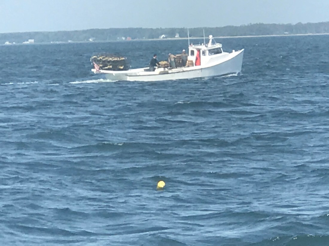
As we entered the anchorage, we passed this classic Chesapeake crab boat.

Crabber 20
Looks like a painting I’d hang on my wall

Now peacefully on anchor. We are plotting a new course that takes us up the Chesapeake Bay.

We’ll traverse the C&D canal and then have to sail down Delaware Bay, round Cape May and go North up the coast toward NYC.

Alligator River NC

We awoke at sunrise and just before pulling anchor, I snapped a few photos of just how still this anchorage was in Adam’s Creek.

Today’s ICW route through Pamlico Sound would end just short of crossing Albemarle Sound. Our route looked something like this.

ICW NC Route
ICW Route Through Pamlico Sound and almost into Albemarle Sound

On our way out of Adam’s Creek, I hailed a loaded tug and barge to let them know we would deviate from the channel and not impede their passage. The strong current was at their back forcing them to keep their speed up. As a tug captain it’s better to be driving the barge rather than being driven by the current. It’s always better to push a barge into a current than be pushed by it. At least that is how I understand it.

Tug Barge
Tug & Loaded Barge in Adam’s Creek Channel

We no sooner exited Adam’s Creek into the Neuse River and passed this beautiful schooner with the captain at the helm and sails set.

Schooner
Capt was still in the process of raising his staysail

Once it Pamlico Sound you realize it is a pretty large sound. Wikipedia defines a sound as, “…In geography, a sound is a large sea or ocean inlet larger than a bay, deeper than a bight, and wider than a fjord; or a narrow sea or ocean channel between two bodies of land (see also strait)…”. These geography terms can be confusing.

Pamlico Sound.JPG
Pamlico Sound

As we motored on, a USCG boat hailed us over VHF channel 16 and let us know to stay to port as we passed. They had a line around and were pulling what remained of a green daymark piling using their boat. Our best guess is that a boat hit the piling in the night and snapped it off.  We figured they were dislodging it so that it would not float away and become a hazard to navigation?

USCG Pulling Daymark
USCG with a line off their bow to a green daymark that was broken off.

We passed a several duck blinds confirming that North Carolina is duck hunting country.

Duck Blind
Duck Blind – Do they really fall for this?

As we motored on we were reminded that we are getting closer to ICW mile marker 0 in Norfolk, VA.

The predicted forecast for Albemarle Sound had the wind out of the West at only 10-15 kts.

Forecast
Albemarle Sound forecast 10-15 out of the West

We chose an anchorage with a small fetch to the West but far enough off the shore that we could open the hatches and get a good breeze while we slept.

Alligator River Anchorage

As I was setting the anchor on the bow I looked up and snapped this photo of the setting sun.

Sunset Framed.JPG
Sunset in Alligator River, NC

Key West

The trip down to Key West was full of things to see. It started with an overturned vessel. We saw a diver in the water possibly attempting to flip it? Hope nobody was injured?

There was a diver in the water hooking lines to the overturned hull

As we got closer to Key West, the water became a beautiful green-blue color.


Near Fort Zachary Taylor
SpaTerre Key West – Lodging
Who doesn’t love a cursing tiki bar?
Mallory Square


Beach umbrellas match the water

We passed SV Toucan, a 40’ Manta catamaran underway and hailed them on the VHF offering to take some pics of them. Capt. Elizabeth thanked us and returned the favor.

The crew of Toucan would later invite us for a “Sundowner” which is live-aboard speak for why don’t you dinghy over to our boat just before the sun sets and we’ll do drinks and appetizers. They were terrific hosts and I enjoyed getting a tour of their amazing catamaran. If I get a copy of the selfie we took,  I’ll post it here.

MV Simple Life underway to Key West
SV Toucan Underway

When you approach Key West from Hawk’s Channel (ocean side) you see sights such as huge cruise ships underway in the channel and others docked.

Disney “Magic”
OCEANIA CRUISES’ RIVIERA

You pass Margaritaville Marina and many anchored boats.

Love Ole Glory!
img_6709
What a beautiful trawler


Old School baby!
Waverunners are everywhere


Looked like they had student sailors aboard?

The US Coast Guard Key West station is down here and they have a large ship docked.

USCG Ship

The Navy’s Naval Air Station and Army Special Forces Underwater Operations have a presence in Key West. We passed the many buildings with military logos and such.

US Army Special Forces Underwater Operations building logo


US ARMY Special Forces

At one point a couple of inflatables with Army Special Forces motored by.


We grabbed a mooring ball in Garrison Bight Mooring field rather than fight the crowds in the different anchoring locations. Garrison Bight is the only real transient mooring field that I am aware of here in KW. The mooring field is run by Key West City Marina. Getting onto the mooring is a lot like in Boot Key Harbor where the mooring ball has a short pennant line that comes up from below the ball (rather than on the top of the mooring ball as it’s better to keep the scope angle low leading to the mooring anchor itself). Up North in Rhode Island, most mooring ball pennant lines are mounted on the top and have either a single long pennant line or a single that spits into two lines with loops for throwing over your bow cleats. Here in Key West the mooring pennant line is very short with a thimble that you must thread two of your own dock lines through. They ask that you keep a minimum of 10 feet between the boat and the thimble. The winds can really blow down here and they don’t want you short tying to the ball and potentially dragging the mooring anchor.

Dock lines through mooring pennant with thimble at end

Once tied up it was a bit of long dinghy ride into the marina office which is located in a different location than the transient dinghy dock.

Dinking it in to the dock
Key West City Marina Dinghy Docks

We arrived on St. Paddy’s day so we wasted no time getting an Uber to Duval St. and hitting some of the local watering holes like Hog’s Breath Saloon. Want to see the drink menu? It’s on your plastic cup (not a bad idea). I had to do a Gumbash Smash just to make  Danny & Dina smile. (Inside joke)

Hog’s Breath Saloon off the main street
Every bar should do this. Starting at the top…

We found that the Sunset Pier had a good band playing and spent some time there taking selfies and enjoying the cool breeze off the ocean.

Selfies @ Sunset Pier
Don’t you just love a round bar?

We ate at Margaritaville’s and found it was less crowded than adjacent restaurants due to the St. Paddy’s day crowds. The food & drinks were good.

Food was great

The dinghy ride back to the boat was hysterical as we had not paid enough attention to where we left the big boat and we were driving around in the dink trying to find Simple Life. Fish were jumping out of the water as we skimmed over the shallows at high speed.

While there I got to visit places like The Green Room.

These guys at the bar were great
I love the stool tops

The Whistle Bar (AKA the Bull)

Is it the “Whistle Bar” or “The Bull”? – Branding issues?

We joined the 1st ever Key West Cruisers Net Social at Key West Waterfront Brewery (right on the water). We had lots of fun sharing drinks and stories with other live-aboard cruisers.

They teased me a bit being a live-aboard cruiser on a trawler vs. Sailboat but I like to tease them back a bit 😉

Waterfront Brewery right on the water, nice breeze
Lots of fun drinking & chatting with the other cruisers
We made the first ever Official KWCN Social
Don’t you just love the banter between sailors and those who went to the dark-side?

Some nights were dead calm which can get hot aboard without a breeze. Other nights the breeze was blowing in through the hatch and you needed a blanket to keep your toes warm. The funny thing about no wind is… the boats tend to spin randomly rather than all lining up with the wind. Our neighbors on a Manta 44 power catamaran had to jump in the water to untangle their mooring line that was wrapped around their mooring ball.

I offered help but they wanted to fix on their own. He’s a trooper

At night we would see amazing sunsets as we relaxed in the aft cockpit with a drink or two.

I enjoyed this sunset
love the hues
boats on the other side of Fleming Key
light is fading

Gale Winds and Manasquan River Inlet

YCWe awoke while it was still dark. Checked the forecast one last time. Active gale warnings withstanding, we decided that there was a short weather window. A few hours in the early morning to make our passage South down the Jersey shore.

forecast Manasqan
Small Weather Window Early Sat Morning

We left NYC @ Sunrise. I returned our dock key, untied our lines and crept out of our slip before anyone knew we were gone. There was a beautiful sunrise over NYC Harbor.

Liberty Landing Sunrise
Manhattan Skyline @ Sunrise

We quickly headed out of NYC Harbor which was littered with commercial traffic (tugs, barges, tankers, cruise ships, etc).

Tanker NYC
Passing a Tanker Entering NYC Harbor

Under the Verrazano Narrows bridge and out to sea.

Verrazano Narrows Bridge
Passing Under the Verrazano Narrows Bridge

This was Leg 4 of our journey South looked like below

Leg 4
Leg 4 of our Southbound Journey

The sea conditions were great but as early morning gave way to late morning the sea state started to deteriorate a bit as the winds backed around to the South.

We made a steady 9 kts down the coast and arrived @ Manasquan River Inlet just in time for max ebb.

Manasquan River Inlet Current arrival
Max Ebb 11:31AM

Entering an inlet off the Atlantic ocean can be hazardous due to currents, standing waves, shoaling, etc. The best time to enter most inlets is during slack current but max ebb is better than max flood. It’s better to have the current rushing under your bow and pushing you backward than running under your stern and pushing you forward.
Every boater has had that nightmare where the currents are pushing you fatefully towards a narrow or too low bridge! Piloting can get tricky.

manasquan_satellite2
Manasquan River Inlet Satellite

We chose a North Pacific Yachts raised pilot house 43 for many reasons but the one I’ll talk about now was the full keel. North Pacific 43 Pilothouse


A full keel is reassuring when you run the Manasquan River channel that at times almost dragged our keel on the bottom. While offshore boaters would be horrified at the though of “running aground”, in the ICW it’s simply a fact of life. Dredging the channels to keep a controlled depth of 6′ is costly and difficult to keep up with. MV Simple Life has a draft of
4’6″ dry but closer to 5′ loaded the way we are. If you must run aground, do it with a full keel and skeg like ours to protect the running gear (propeller and rudder) from damage.
That said when the current is pushing you the full keel can get caught in the current and cause the boat to veer to port & starboard. Our Raymarine auto pilot has a “response” setting that when set to “9” will turn the rudder as fast as it can to keep the bow pointed straight ahead. Switching to auto pilot to standby (off) in favor of hand steering can be even more harrowing. As we passed through the Manasquan River Railroad bridge @ max ebb we were forced to throttle up to avoid an untimely bow swing that could bring the boat close to the bridge abutments.

Manasquan River Railroad Bridge2
Manasquan River Railroad Bridge

While the river is full of passing traffic and shallows we made it to Crystal Point Marina and Dockmaster Todd caught a line for us as we pulled into our slip.

Crystal Point Marina 1
MV Simple life Slipped @ Crystal Point Marina

After a short walk under a bridge we arrived at River Rock Bar in Brick, NJ. River Rock Bar in Brick, NJ

Bridge Fall
Kelly joking that she would likely fall in the cold water

Right away we spotted the Captain Morgan behind the bar and knew we had landed in the right place 😉

River Rock Marina Bar 2
Kelly’s Down with the Captain

There was a local artist playing acoustic guitar in the corner and they had Sculpin IPA on tap! We had a great dinner & drinks and made it back under the bridge to retire for the night.