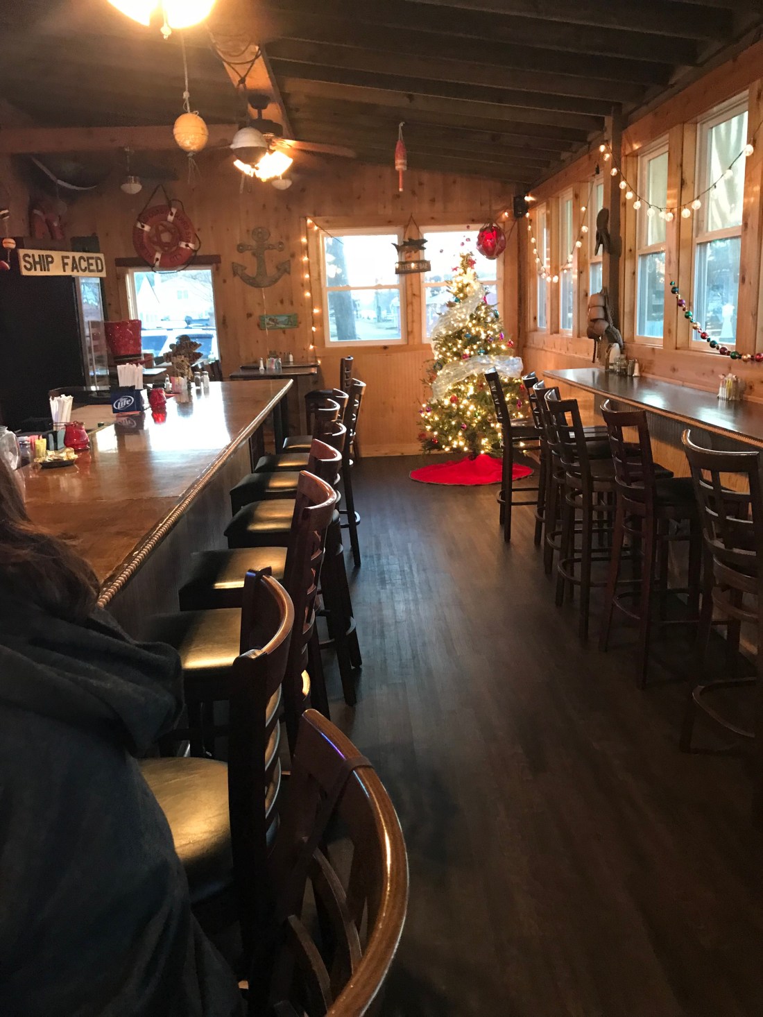
Coinjock Marina is a great place to stop along the ICW. The Sandbar even had an Xmas tree up.
Too Early?
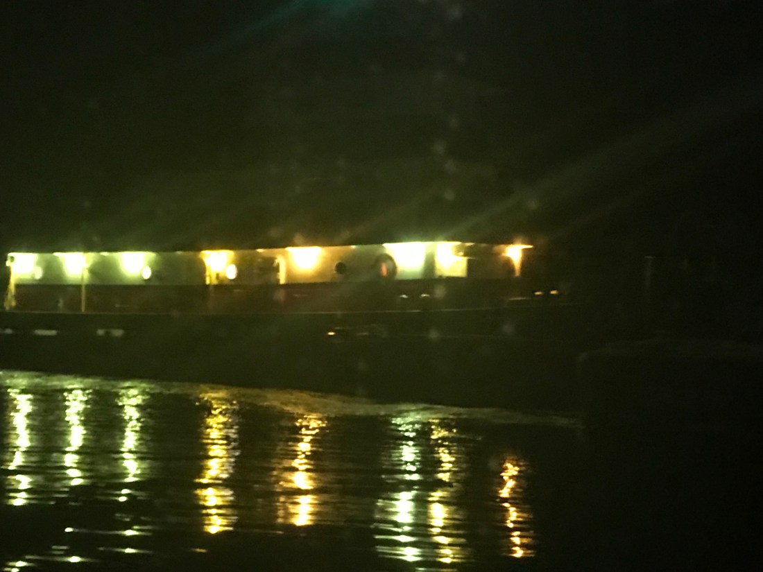
While we were at the pier a 1998 Bayliner 4788 arrived during the night and as they passed us we saw the severe damage to their bow.
Hope Nobody was Injured
It was a reminder about how dangerous boating down the ICW can be (especially when traveling at night). I hope nobody was seriously hurt. After having a crash like that you’d think you’d stay far away from everyone but as they passed us I thought for a second that they might hit us.
Yikes – This Pic Snapped Out My Pilothouse Window!
At that moment I went out in my PJs and attached two fenders to the canal side (just in case 😉 )
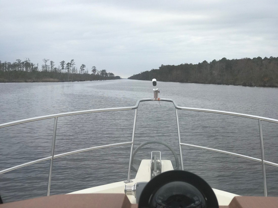
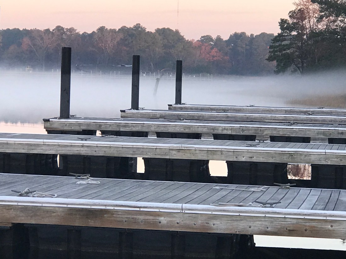
When we left Coinjock Marina it was foggy.
Coinjock Pier Looking Off our Stern
Even as we headed down the canal we had to rely on our radar to see any far out vessels.
Fog Was Worse Than This at Times
As you travel down these canals you will find homes along the canal and people going about their daily business.
Me Waving from the Pilothouse to the Locals
As we traveled along we saw several boats anchored just outside the channel. Being anchored well after sunrise is a sign that someone is having a peaceful morning enjoying their coffee.
Peaceful Morning on Anchor
We continued South down the North River and into Albemarle Sound. There was not a single boat to be found in the sound. We had the crossing to ourselves. While approaching the mouth of Alligator River I saw, what I thought were boats but upon closer binocular examination, I see they are some sort of mini islands? I’m not sure of their purpose? They look to big to be duck blinds?
I Need to Figure Out What These Are?
We anchored at the head of the Alligator River as we lost daylight. The anchorage was quiet with no boats passing but the cellular signal was dead. During much of the transit we would see our cell signal go from LTE => 3G => Extended 1X => blank. At times we would be excited to see 3G and upon trying to connect, we’d see the signal instantly drop to “Extended 1X” which did not work at all.
What Kind of Tomfoolery is this?
The Alligator River – Pungo River Canal was long and straight.
I Can See For Miles
Along the banks of this canal you can see the erosion from passing wakes.
Geology Experts of the Future Will be Doing Molecular Analysis on That Green Line
You will see many birds as you float along. It’s a reminder to me to improve my ornithological skills.
Where are my Ornithology experts?
Where is His Beak?
You’ll see other things that you’ll want to stay clear of like …
Fishing Nets
Sticks = Hazard
Are We Too Heavy for This Dock?
At times this can be difficult as you run straight down the sun heading South. While the camera does well looking into the sun, I was struggling at times.
Staring Match With The Sun
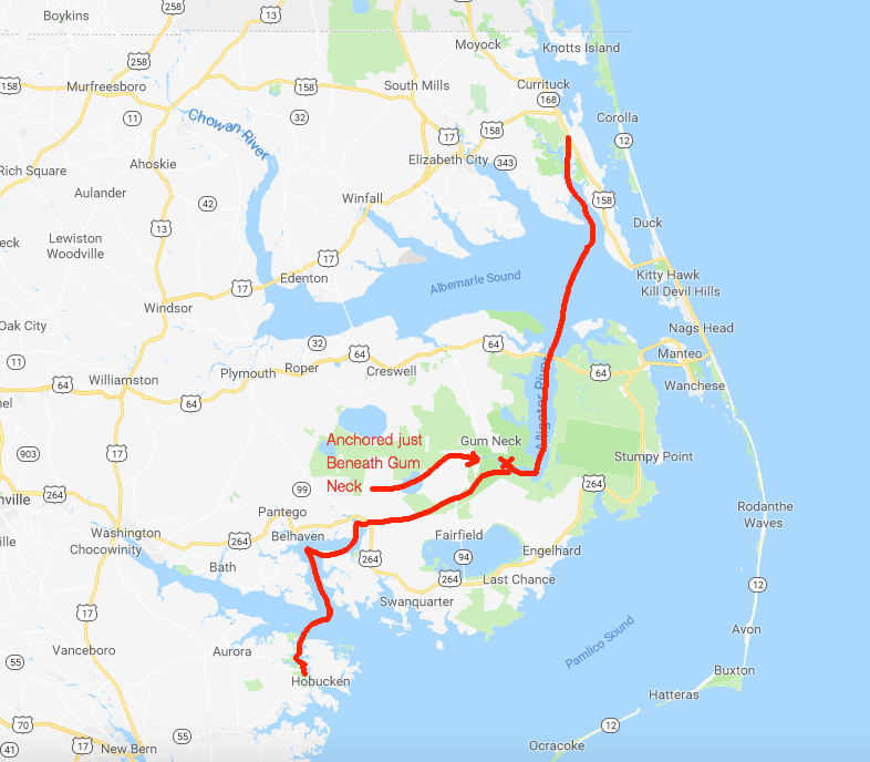
We arrived in Hobucken, NC and tied to an old dock for the night.
2 Days Journey
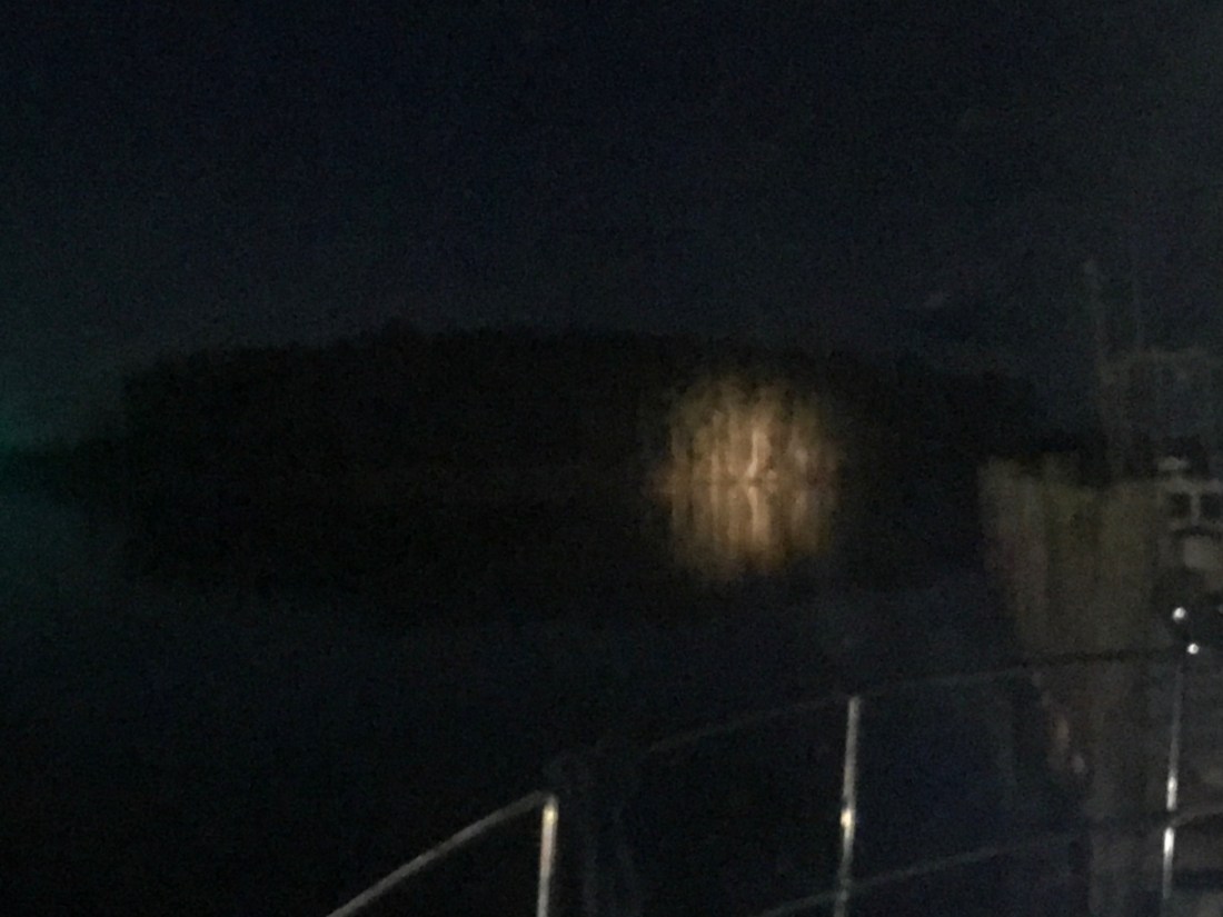
It’s been quiet here except for the passing tug pushing a barge down the river at night. At one point I was staring at a stand of tall trees that were illuminated on the shore and I could not for the life of me see the source of that light?
A Stand of Trees Illuminated
It became apparent moments later that it was the spotlight of an approaching tug and we braced for it’s passing wake.
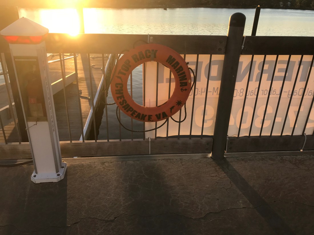
We spent two nights at the Top Rack Marina (ICW Statute Mile 8.8) in Chesapeake, VA.
Top Rack Marina – a nice stop along the ICW
What a great place to stop. When we arrived at the marina, Ben was there to catch our lines and greet us with a some Virginian southern hospitality. Top Rack Marina is a “dry rack storage” marina. These style of marinas store their customer’s boats on indoor racks rather than floating in a traditional “wet slip”. Customers simply call and request their boat dropped into one of the dozen or so wet slips in the marina’s water edge.
Kelly relaxing in the cockpitIndoor racks hold boats like a grocery store shelfOutdoor racks act as staging locations as boats are washed, flushed and prepped
Their giant fork truck moves boats effortlessly and can be intimidating as it whirls around with a boat high in the air.
We decided to stay for two nights and re-provision the boat. Usually we would have to grab a Uber to a nearby grocery store but we have found that grocery delivery services are a much faster, cheaper and a far simpler way to restock. When we were in Brick, NJ we used Peapod from Stop & Shop but here in Chesapeake, VA we used Farm Fresh Supermarket.
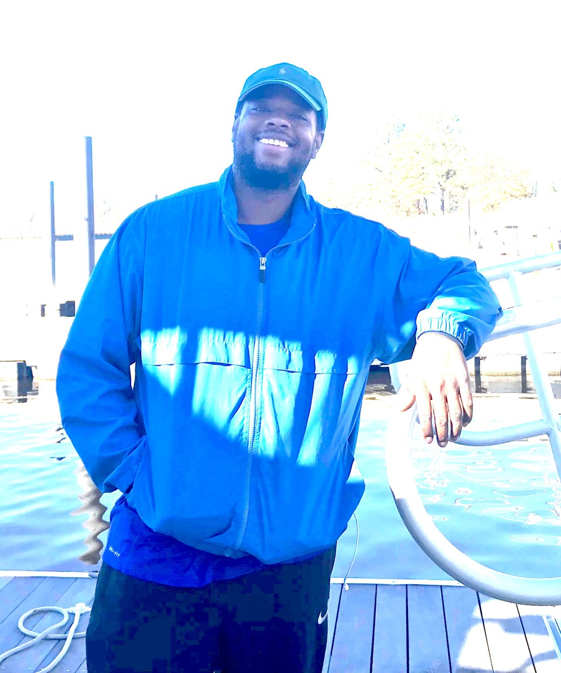
Jaquay was our designated shopper and he would text us with pics of substitutions for any out of stock items on our list. Jaquay picked our order, drove dockside and was kind enough to help carry our groceries aboard. Thanks Jaquay.
Jaquay
The marina has a great ship store and Deli and as I checked in with Brian at the front desk, Brittany was there to help me select a local IPA beer called “El Guapo IPA”. El Guapo is brewed locally in Norfolk, VA by O’Connor Brewery
In Spanish El Guapo is a beautiful guy, a well looking male
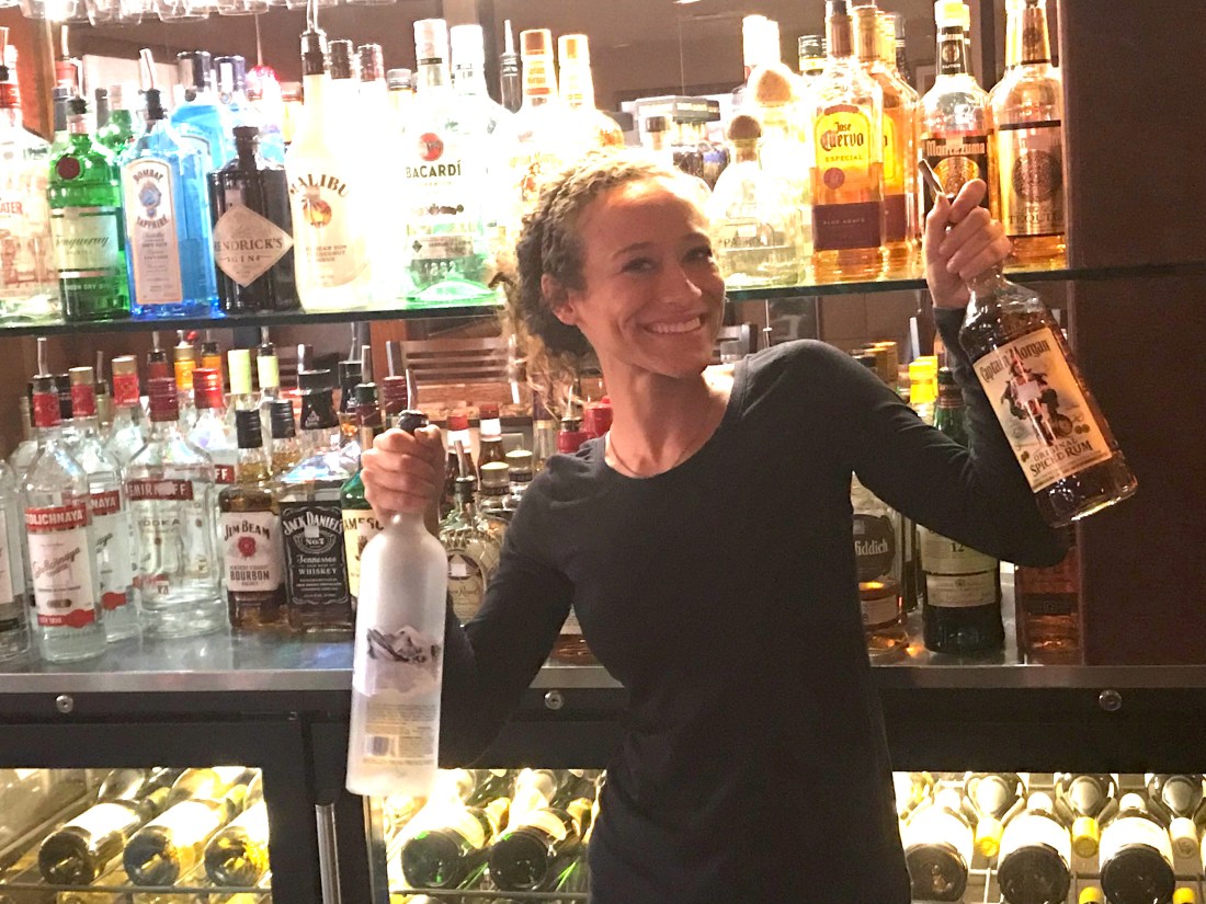
Then it was on to dine at the Amber Lantern Restaurant. We stepped out of the elevator and hostess Courtney warmly greeted us. We got an early start at the docks and by the time the restaurant opened at 4PM, we simply poured ourselves into seats at the bar. Bartender Sydney kept us smiling the whole night.
Sydney’s smile could warm the heart of even the crustiest sailorDynamic Duo: Sydney and Courtney
Being first into the restaurant, we had the chef to ourselves and the food was amazing. We had our fill and retired back to the boat only to wake up at the witching hour of 3AM and sing along with YouTube videos from artists in the “Forever 27 Club”. I recall some Janis Joplin was echoing out over the river… “Freedom’s just another word for nothing left to lose”…
We awoke to a ghostly fog creeping down the river and we quickly shoved off to race and catch the Great Bridge Lock opening at half-past-every-hour.
ICW fog
Once at the Lock we tied up to the Southern wall, waited for the lock doors to silently close and watched as it lowered us gently down to the height of the water on the Albemarle Sound side of the lock. I find it interesting that while the Elizabeth River side of the lock is tidal and varies about 2.7 feet the Albemarle Sound side varies only due to the winds that drive water up or out of the river. Equally as amazing is the age of the machinery that drives these locks. You watch as giant gates and machinery, built using simple principles of engineering mastered many years ago, silently close.
We kept the ICW-bridge-list.pdf displayed on the iPad we’d have the requisite knowledge at our fingertips. As you pilot the ICW you will want to be aware of such things as… What bridges are around the bend? Can you safely pass under their vertical height? Are they restricted in opening times? How to contact the bridge tender on to request an opening?
ICW bridge list for all 1,243-miles of ‘inland’ waterway
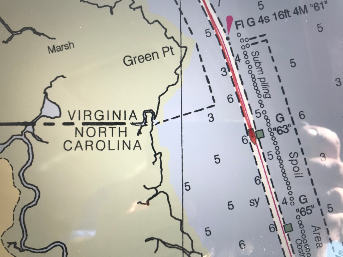
As you make your way down the Albemarle Chesapeake Canal you can’t help but notice it’s as straight as spaghetti. The Canal was originally conceived of in 1772 but had to wait until technology advances (circa 1856) that allowed steam-powered mechanical dredges to cut through the land. While the canal is over 70 miles long, there is only 14 miles of excavated land. There are really two different “cuts”. The 8.5 mile long Virginia Cut which connects the Elizabeth River with the North Landing River in Virginia and the North Carolina Cut which is 5 miles long and slices across the Currituck Peninsula at the village of Coinjock to enter the North River, flowing south into the Albemarle Sound.
Historic chart denoting the Virginia and NC cuts
This canal is a wonderful part of American history. During the U.S. Civil War, when the Union Army commandeered the canal, nearly 9,000 vessels made the transit. After the War, traffic continued to increase as the waterway took over practically all of the trade passing between the Albemarle Sound and Norfolk, Virginia.
As we meander down the ICW at a leisurely pace of 6 knots (4.5 MPG) we noted the passing from Virginia into NC. Then just a short while later, we were stumped to explain why this looping side canal was littered with wrecks? How did this happen?
VA / NC State Line – ICW statute mile marker 34How did this happen?Gently used boat for saleMaybe this cannon we passed was responsible for the wrecks 😉
The scenery at this point in the ICW is amazing! The waterway is lined with tall grass and you’ll watch as the local duck hunters race by you in camouflaged flat bottom boats. We’d pass the occasional duck blind hidden in the grass and Kelly & I would jabber about the moral issues of tricking ducks with decoys into becoming dinner. I’m always intrigued by the human race’s dilemma between a desire to coexist peacefully with all the other animals on planet Earth and our need for subsistence.
We soon arrived at Coinjock Marina where dock hand, JD quickly moored us to the wall and we scurried off to the Sand Bar for an IPA, some buffalo wings and a filet mignon for Kelly.
A typical sailor bar along the ICWThe restaurant is known for their amazing prime rib
Inside the bar we met Bartender Jason and shared stories with other cruisers going South down the ICW. The three captains of a brand new 45′ Hatteras sport fishing boat that was making its way South sat next to us. They showed us video of their 30 knot trip South and we joked about their 80+ g/hr burn rate vs. our 1.2 g/hr rate. “Time is money” said one of the captains as they hurried out of the bar joking that they would not wake us at sunrise as their sprint South continued. Well it’s 6:30AM and we just watched them depart silently. I’m sure today will be another fun time here in Coinjock, NC.


You must be logged in to post a comment.