
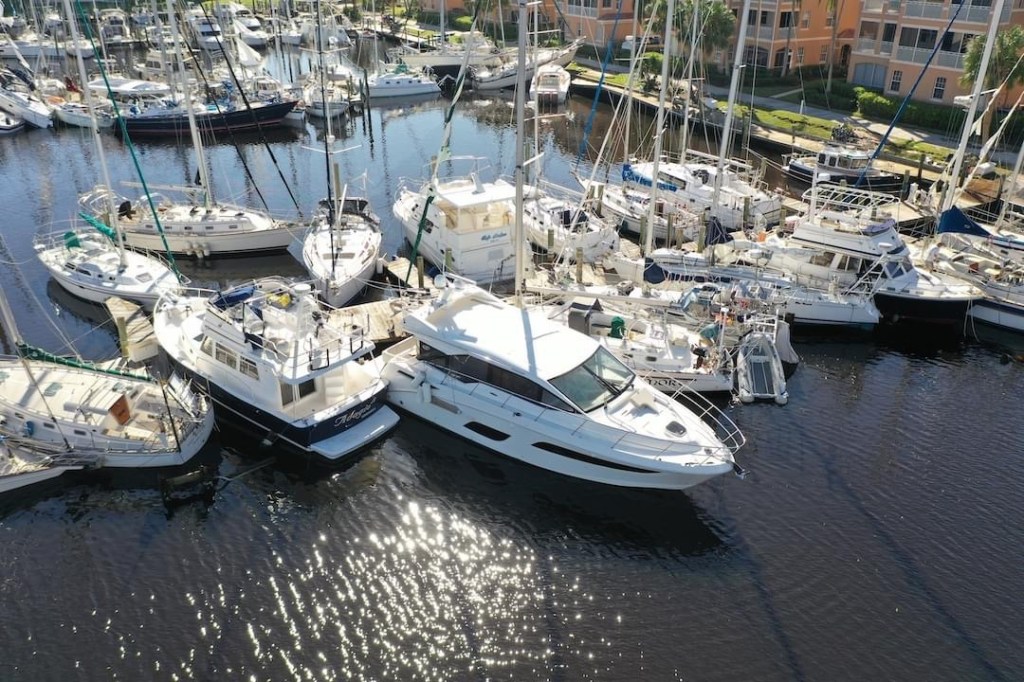
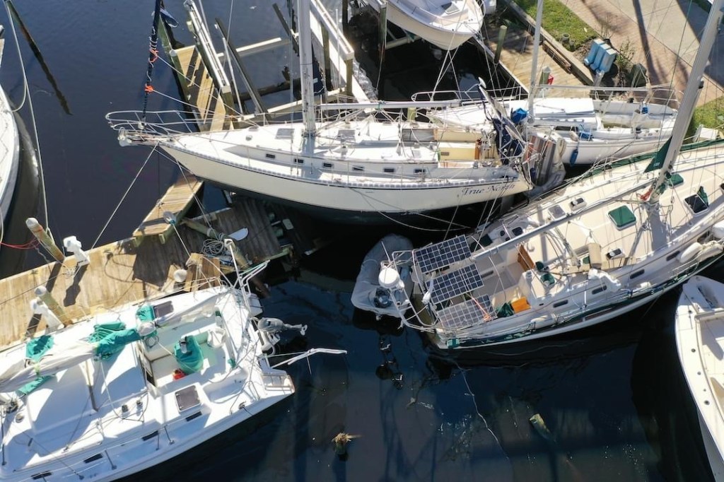
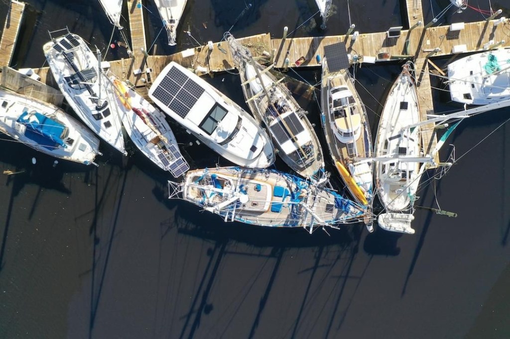
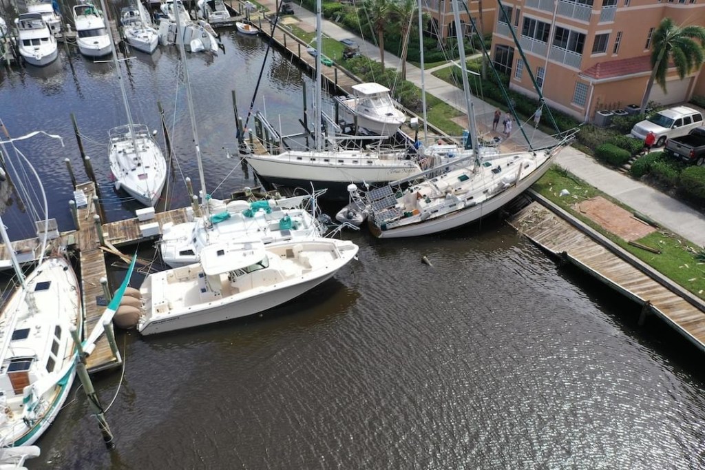
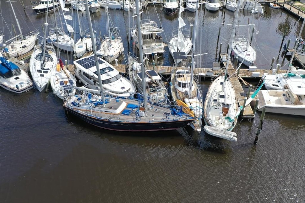
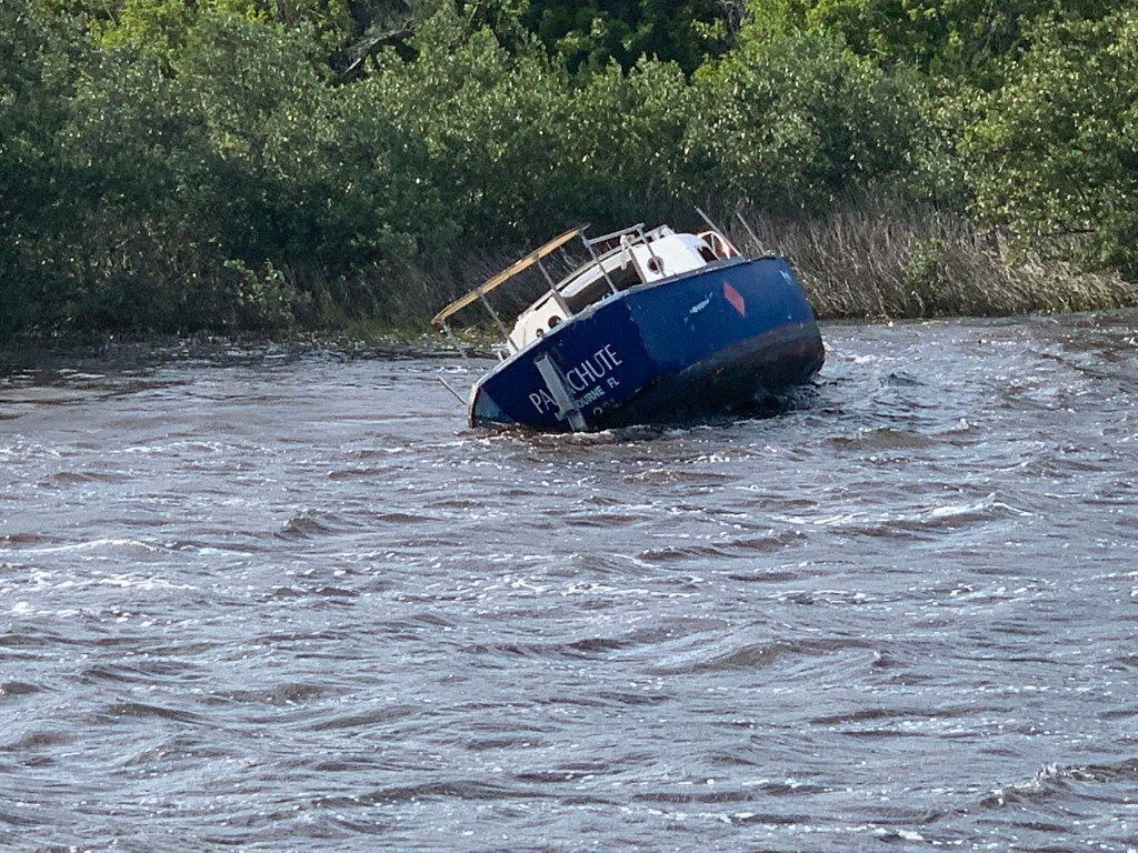
So sad what Ian did to my beautiful marina. When the winds get that high there just isn’t anything you can do to stop it once one boat slips. Thinking of my fellow boaters and hoping they can get back on the water soon.


So sad what Ian did to my beautiful marina. When the winds get that high there just isn’t anything you can do to stop it once one boat slips. Thinking of my fellow boaters and hoping they can get back on the water soon.
Note:: I’m crudely writing this blog post with little to no internet but want to update readers with what happened here.
NOTE: This blog post will update more when I have time and internet so please check back later..
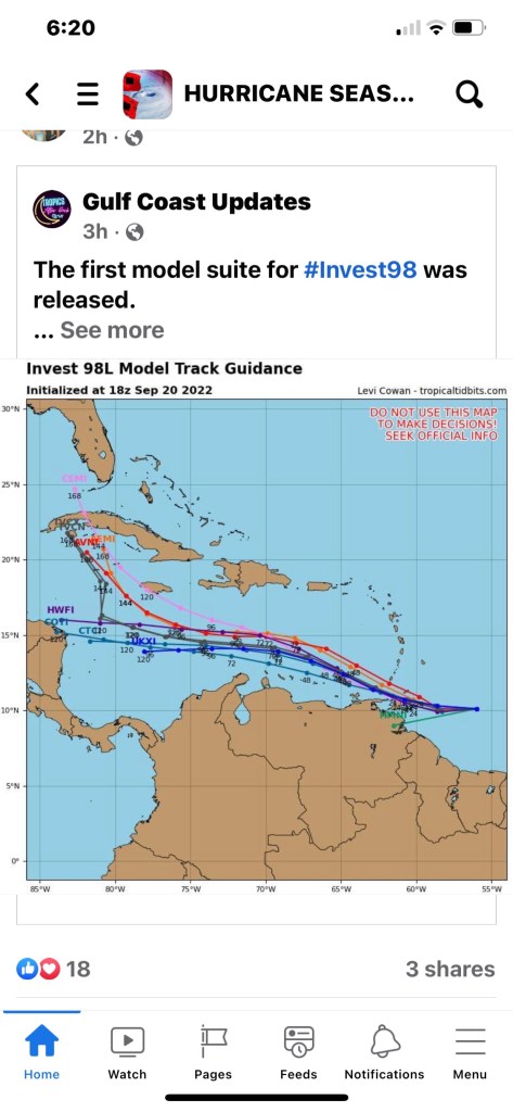
Before they are named storms they are atmospheric disturbances that need to be investigated.


When we’ll-known SWFL hurricane hunting weatherman, Jim Cantore, checked into a hotel down the street in Punta Gorda we all nervously joked that it was not a good omen.
MV Simple Life is berthed just inside the entrance channel of BSM (Burnt Store Marina). The westerly wind’s friction with the ocean was creating a surface current and driving all the water out the marina entrance.
I rely on the Windfinder Pro app on my iPhone for predicted wind speed and direction forecasting.
https://apps.apple.com/us/app/windfinder-pro-wind-weather/id336901296
In the above screen capture video, you can see that blue dot is MV Simple Life in BSM. The wind was predicted to blow the marina’s water back out into Charlotte Harbor.


Getting your dock lines set to allow for such a drop and surge can be difficult and will come down to how low/high you think you will go, the line lengths you have available and cleat locations in relationship to pilings.
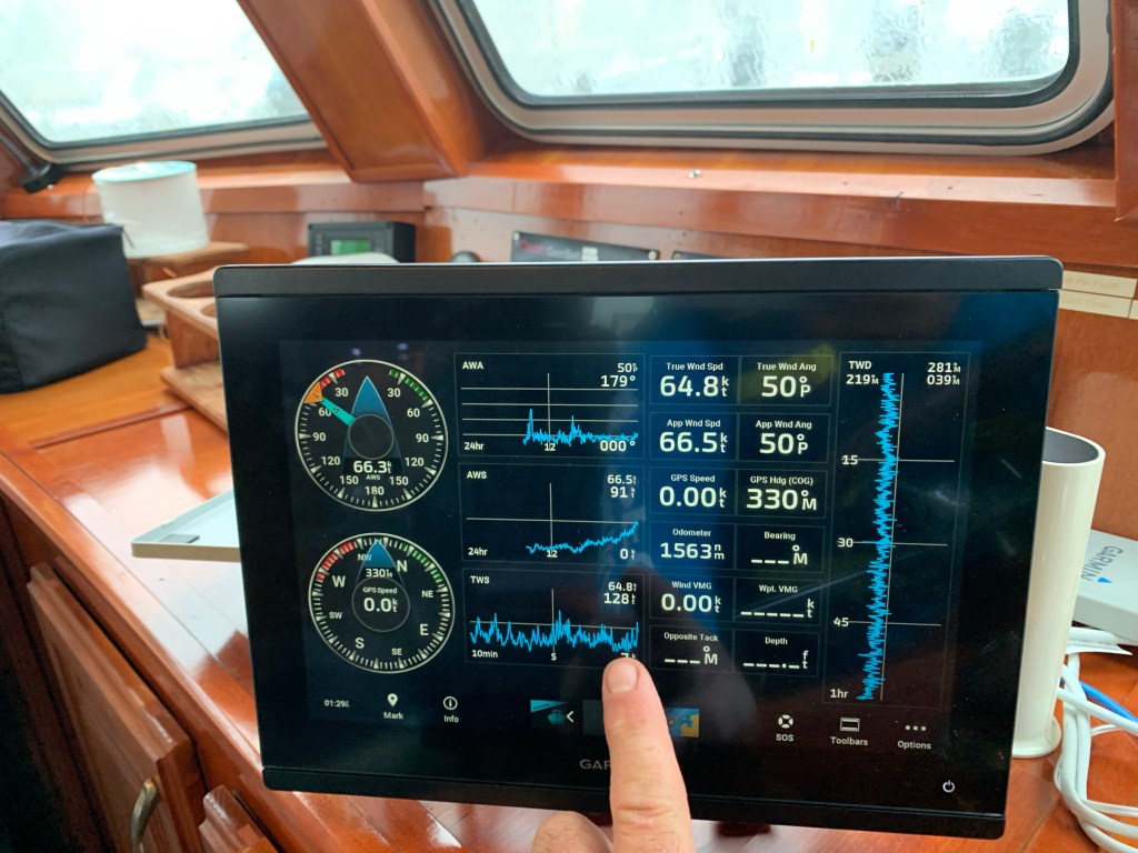
The winds were now 64 knots and gusting to 128 knots.
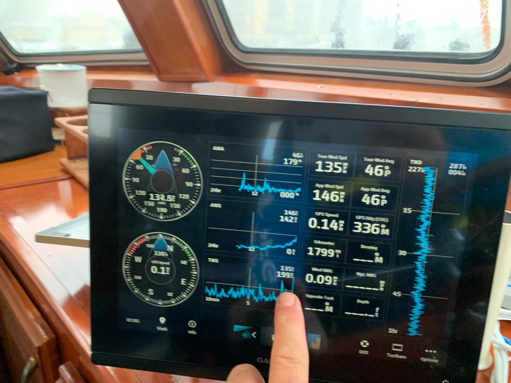
It’s now blowing 135 knots and I see my slip neighbor run outside from a neighboring condo to adjust his dinghy line to stop it from smashing into his sailboat. I quickly strap on a bicycle helmet, life jacket and a jacket to go help him. It’s extremely dangerous should the winds blow you off the dock alone. I climbed down off MV Simple Life and onto the docks but my neighbor friend is nowhere to be found. Then out of the corner of my eye I see him back on land waving his arms to get my attention. He was wisely making his way back to the safety of the condo so I climbed back aboard my boat as it was bouncing to and fro.
In the above video, just before the eye centered on the marina, I jumped onto the docks to see the condition of my fellow boaters and the marina.
Above is another video shot while Ian’s eye was nearly over us. You can see my VHF antenna has snapped. I decided to quickly tape it down so it did not get ripped off.

While cell phone texts were not going through in real-time I could occasionally receive texts from the other two boaters around me who elected to stay aboard during the storm to hopefully save their own boats.
NWS alerts were periodically sounding off on my iPhone. I was now busy making adjustments and adding lines everywhere I could to prepare for act II of Ian.

Once the eye arrived the storm surge began rushing into the marina.
The boats were quickly lifted off the bottom and even the birds floating on the surface could not paddle fast enough to keep from being pushed backwards in the flow. See the end of the video below
The rush of water just kept coming and I knew I only had a moment before I needed to be back at the helm.
When the backside of the Ian arrived it was far worse for MV Simple Life. The wind direction did a 180 degree shift and was now blowing straight in off Charlotte Harbor. There is nothing in the way to protect MV Simple Life from the wind and waves. The stern of our boat is large and flat. My twin 8” diameter diesel exhausts we getting water forced backwards in towards the engines. Simple Life was pulling so hard on the two pilings behind my stern. I doubled up my lines prior to the the storm. The pilings began to rock back and forth as my boat and my neighbor’s pulled hard on them. If I pull these pilings over Simple Life will smash bow first into the dock and being the first boat in the marina I could only imagine a cascading failure as I keep hitting boats and docks in front of me with the wind pushing me from behind.
I quickly started the diesels to keep any water out of the engines. My yacht is 70K+ lbs. with large 5 blade props that were now running in reverse to take the strain off the pilings behind me. Occasionally, I would hear floating debris hit the propellers and flying debris hit the boat.
I had boarded up the twin cockpit doors which was protecting them from being blown out from the high winds and flying debris. The water was blowing through the door and running across the saloon floor.
I’m feeling good that the other windows are extremely thick and impact resistant.
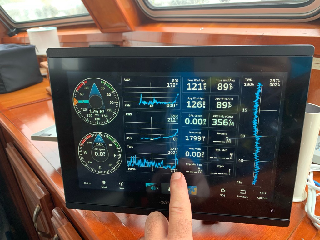
My wind meter is mounted on the top of the boats arch. It has been recording wind speeds above 100-150 MPH with a highest gust recorded of 202 MPH. Shortly after that the wind meter was ripped from the boat.
I had a couch that I could not get off the Flybridge and had attempted to tie down. I watched as it was levitated off the flydeck by the wind and dropped back down. This happened 3 or 4 times but suddenly it just lifted straight up and flew off about 30’ high and flying fast.
Looking out the pilothouse windows at the docks I see they are 3-4 feet beneath the fast flowing storm surge. The water is black and you are not really sure where the docks beneath that murky surface. A few of the planks that make up the walking surface had been ripped off making the possibility of having your foot/leg fall through.
Getting off the boat now is no longer an option.
I was at the pilothouse helm when the flydeck hatch ripped open and the wind and water was blasting in on me. I ran quickly and managed to get ahold of it. I struggled to get it closed but each wind gust was lifting me off the floor. I in a situation where the boat is running in reverse, I’m not at the helm but trying to find some way to secure the hatch.
Lucky for me… arms length away was a fender with a short length of rope that I wrapped around the broken hatch arm. It held just long enough for me to run and get some cordage and add more lines to it. If it rips off I’m screwed. I quickly ran Dow into the engine room looking for a solution that would secure it for good when I spied half a dozen welding clamps that were exactly what I needed. I punched the wood away from the hatch to get to the solid aluminum and clamped & tied the hatch down. I felt relieved.
From the onset, my concern have been for the other three boats who opted to stay aboard and ride out the storm. They have been terrific about asking me how I was holding up as well. We setup communication plan over text and VHF radio to be able to get messages to each other.
Now as I look out the window I see that one of those boats has snapped a piling off and is violently rocking. I see him crawl out on his foredeck presumably to get her under control. I look back and don’t see him. I’m texting him to see if he got back inside safely but no answer. (Spoiler he made it back inside)
The large beautiful yacht at the end of the dock has had a hole punched through the hull and the captain and first mate were now on shore.
The last couple have been aboard from the start and they are concerned the that boat on the lift behind them is dangerously close to coming off and smashing into them.
I realize while my concerns for my friends is made worse knowing that there is no way I could get to them if they need my help.
When I drove through the open and unmanned gates into BSM Community I saw no people. It looked abandoned. That said I know some homeowners stayed. When I look at the lovely South Shore Condos I can see directly into some of the units. I hope nobody was inside.
The helm is now sounding an overheat alarm so I shut one engine down and rush back into the engine room. My sea strainers are full of flotsam as the water is murky. I quickly work to clear both sea strainers and restart the engines. I feel relieved once again.
TO BE CONTINUED…

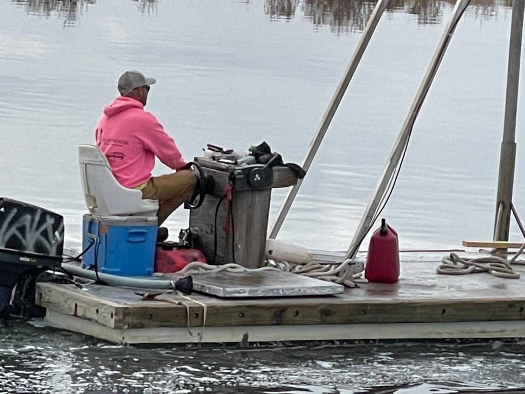
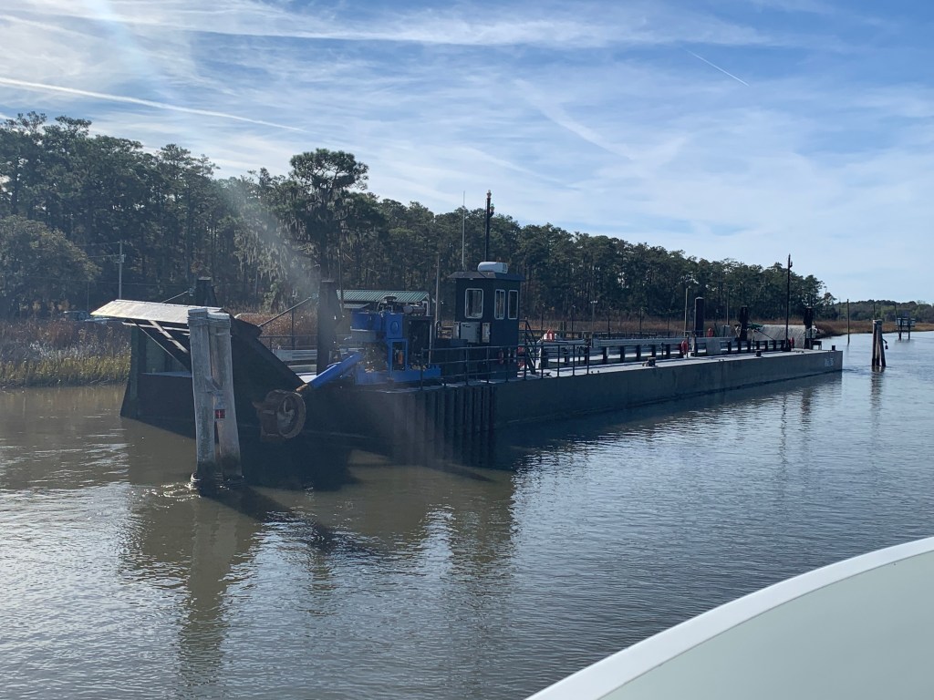
We were on our way to Southport, NC to see our friends Jim & Wende. We had to slow down to no wake speed to keep from swamping this fella who was motoring a small work barge down the ICW.
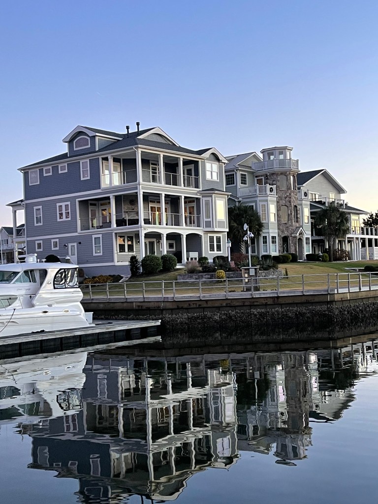
We arrived at St. James Plantation Marina just before sundown. The homes along the harbor are beautiful.


Jim and Wende let us use their truck to reprovision which was perfect as it was the day before Thanksgiving and we needed TURKEY!
Later that night Jim & Wende took us to dinner at a Joseph’s Italian Bistro @ Safe Harbor Marina. We had dinner with some good local IPAs & lots of laughs. I wish we had taken a photo but I think we were just having too much fun. Jim and Wende told us all about their trip back from Buzzards Bay, MA to Southport, NC in their new Pursuit OS 355. The weather was a bit ruff off the RI coast but they made great time with stops in places like Atlantic City.

In the AM we were off and Capt T was at the helm.

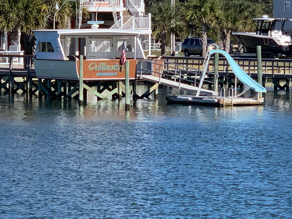
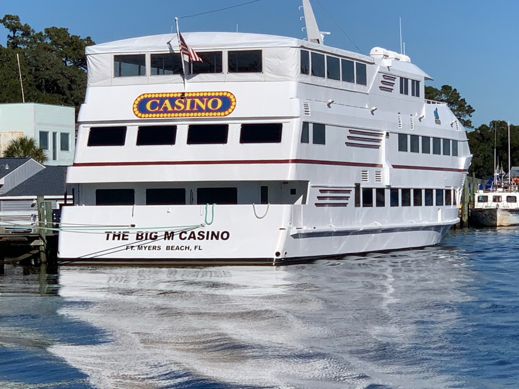
We passed a boat dock that was more boat than dock. Capt T thought she recognized a casino boat as we passed and sure enough the “Big M” hailed from Fort Myers, FL.
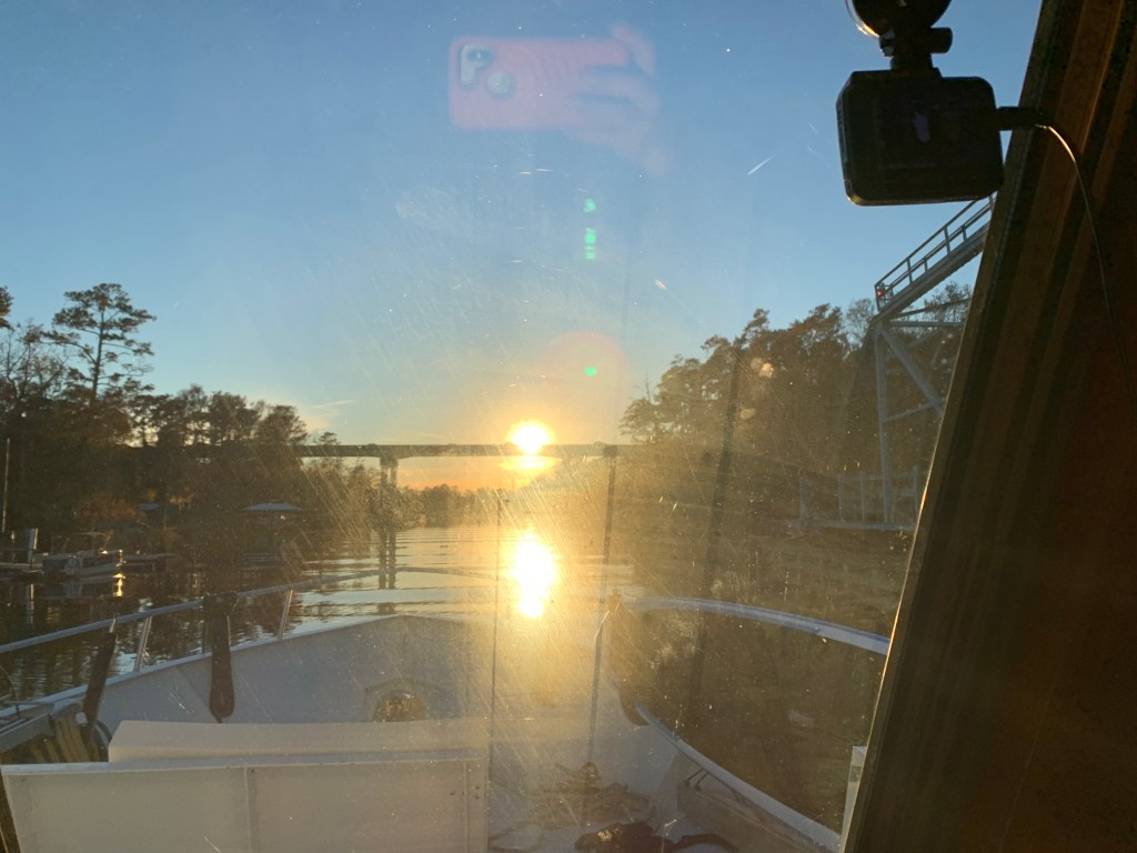
As we made our way into the Waccamaw River preserve we had to get through the Socastee swing bridge but we were staring straight into the sun. The best we could do was go slow and use the radar to see in front of the boat.
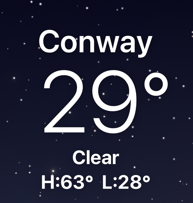
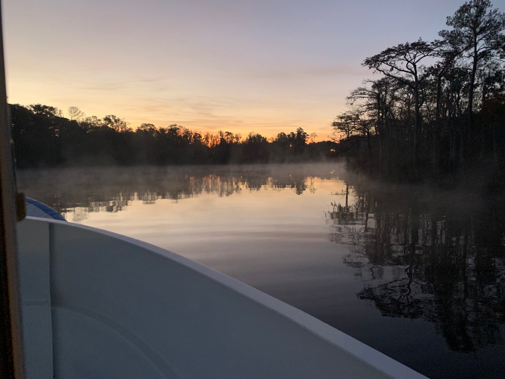
We anchored in what I call the Waccamaw River (ie. swamp) and it’s beautiful. We had a great night on anchor as the high trees provide protection from everything but the cold.
It was COLD.


We weighed anchor at first light and the swamp was steaming due to early morning low temps.
We had to slow to no wake so as to not disturb this Nordhavn anchored right off the main ICW route.

The next swing bridge is actually a floating swing bridge. Very cool. It simply uses drop-able drive-on ramps and a huge tilt-able bow thruster.

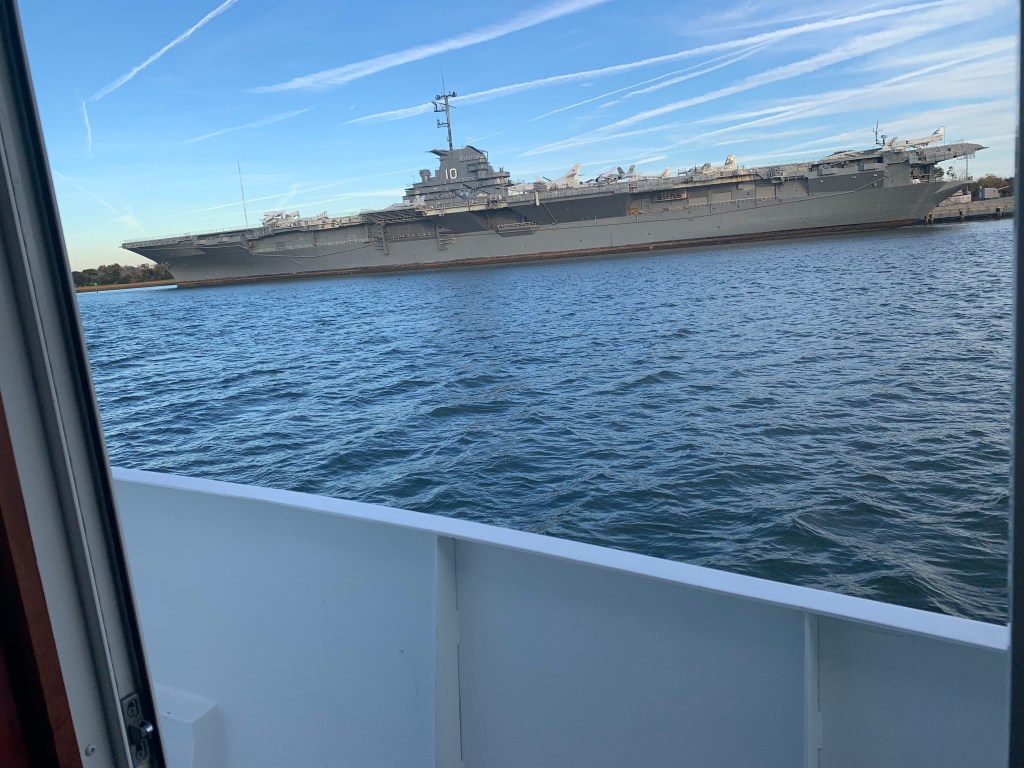
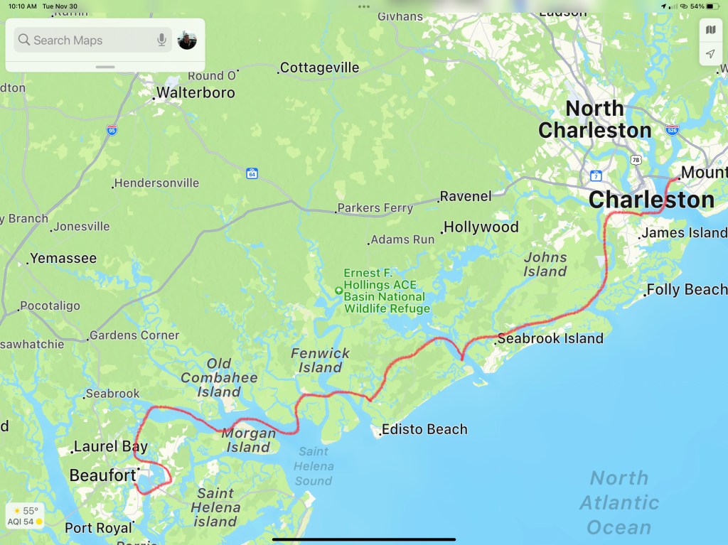
We arrived in Charleston, SC and the marina we requested a slip from had us “wait-listed”. We anchored for the night next to the USS Yorktown.
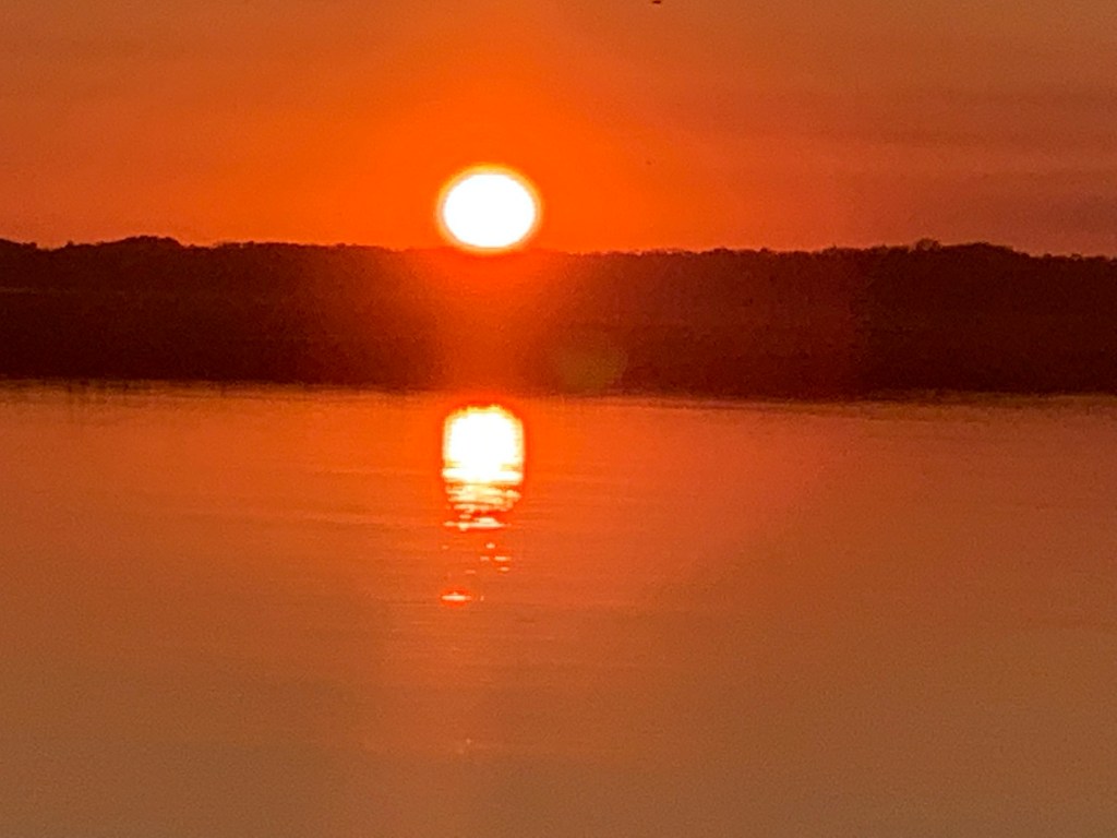
The sun was setting on Charleston.
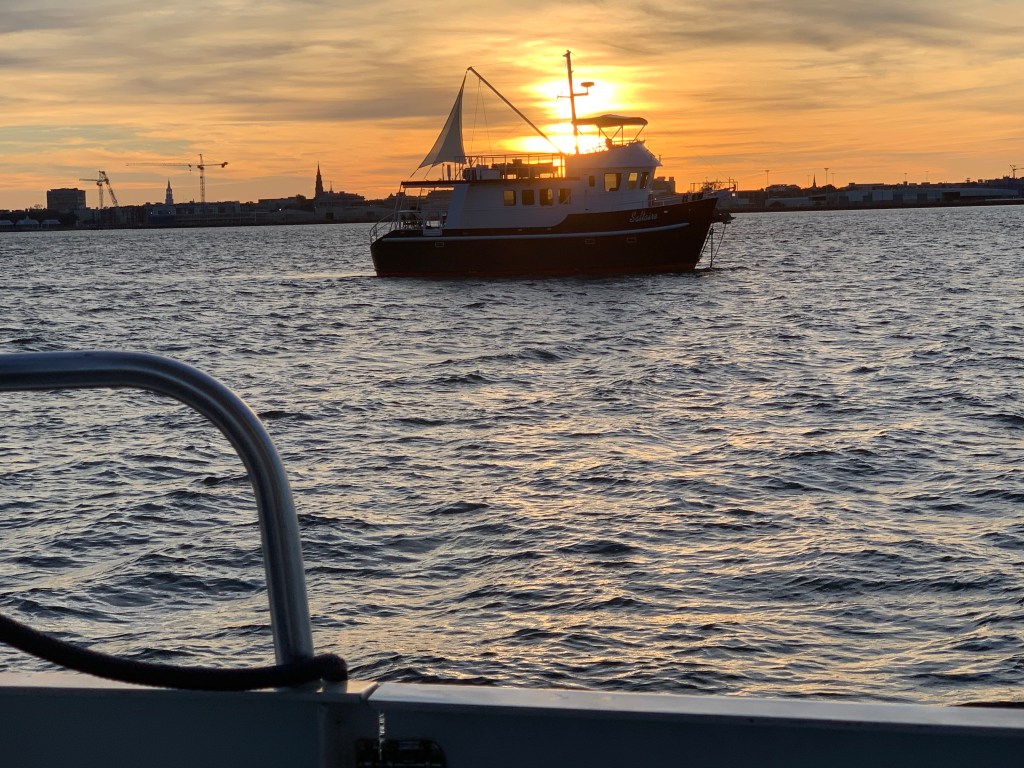

Sunrise in the AM and we were off… bound for Beaufort, SC

We anchored in Beaufort with hopes of getting off the waitlist for the marina. In the AM we called and they found a spot for us on the outer face dock.

Beaufort is a fun town and we wasted no time getting ashore at Plums Restaurant for some lunch.

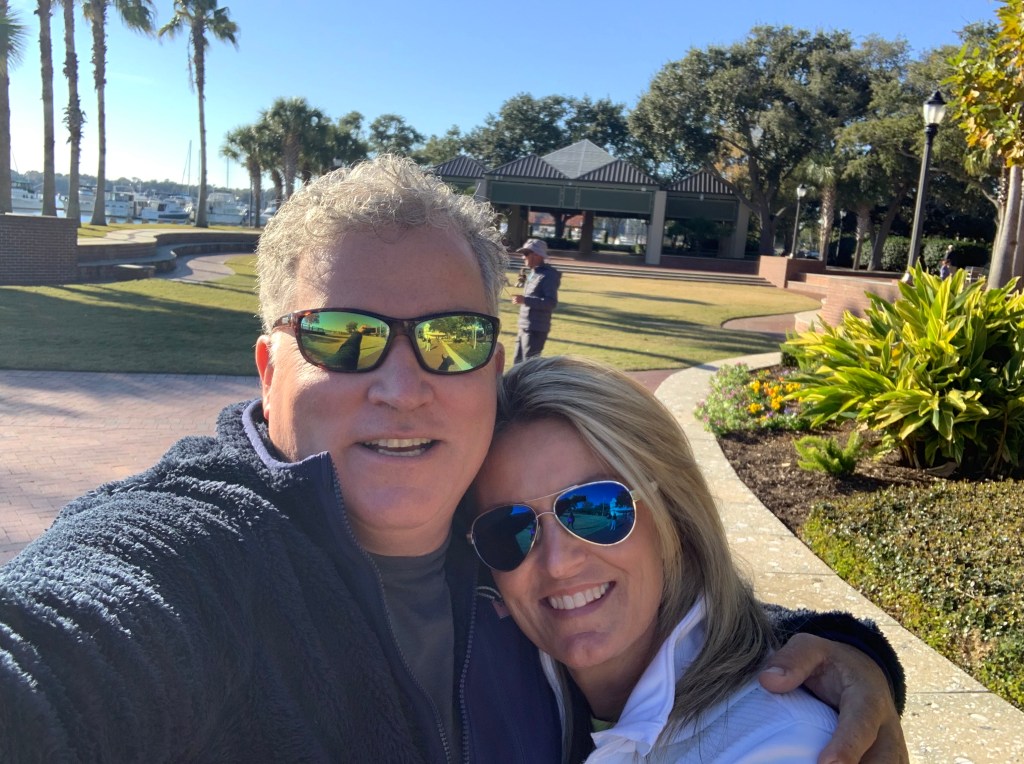
We napped after lunch and made a second run on the town before we would leave in the AM. Beaufort has a great outside park area right in front of the marina.

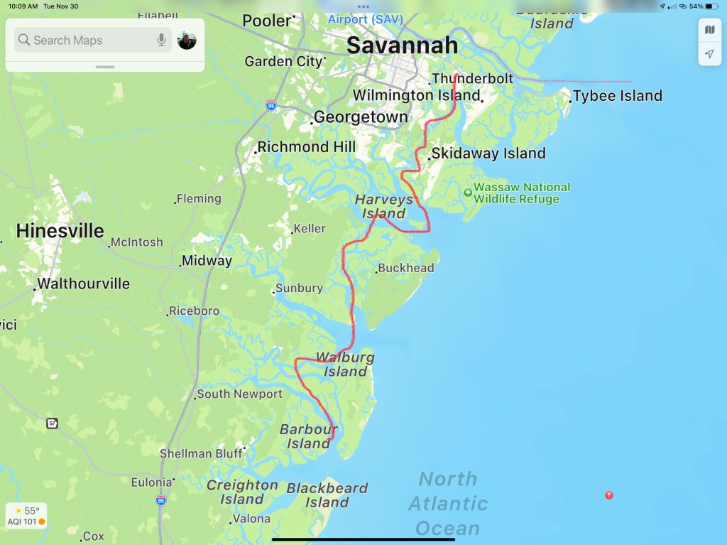
In the morning we were off to Savannah, GA. Last time I docked right in downtown around River Street but felt it a bit seedy at night. We decided to stay at Thunderbolt Marina and Uber’d into town for a Savannah pub crawl.


Are impromptu pub crawl consisted of the following venues:
We ended the night singing Journey.
Up early to a Whiskey Sunrise & potato pancakes and off to Fernandina Beach, FL

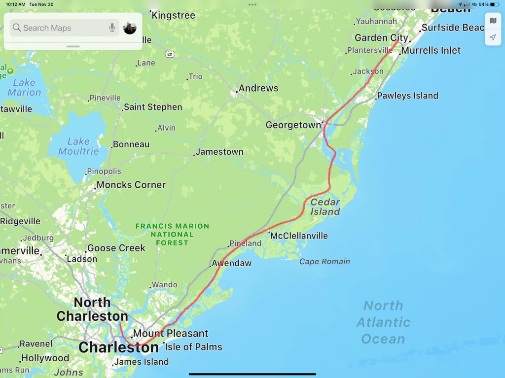
This post consists of 5 legs of our journey


We hope everyone had a great Thanksgiving with family!!!

This was the 19th and last leg of my winter 2020 journey to Florida. It usually takes me a month to get to the Georgia / Florida boarder.
I left on Halloween and arrived in SW Florida in Cape Coral on 11/25. 26 days, broken up over 19 legs.
I was about to do a full breakdown of each leg complete with milage and fuel burn but I think I’ll save that for another winter 2020 summary post.

[=\ c`
We tied between the dolphins in front of the Moore Haven Lock last night. It can take some maneuvering to pull the bow right up to the dolphins and loop a line over the top. Then you have to let the boat idle in reverse and slowly slip out the bow line until you almost hit the dolphin behind you. Now you tie to the dolphin off your stern and take up slack on the forward line until the boat rests evenly between the two dolphins.
It’s the morning and as I go outside to untie the lines and the boat is covered in little noseeums. Lake O has bugs! I start using the cockpit shower to wash the sleeping stowaways off the outside of the boat. It’s a mistake.. Now there are clouds of woke bugs flying all around. I quickly untie the lines and run to the safety of the inside. I am a believer that we must share this great planet with all of its inhabitants however, I hate bugs!

Now I’m back outside in bug land setting fenders while the lock tender awaits me entering the lock.
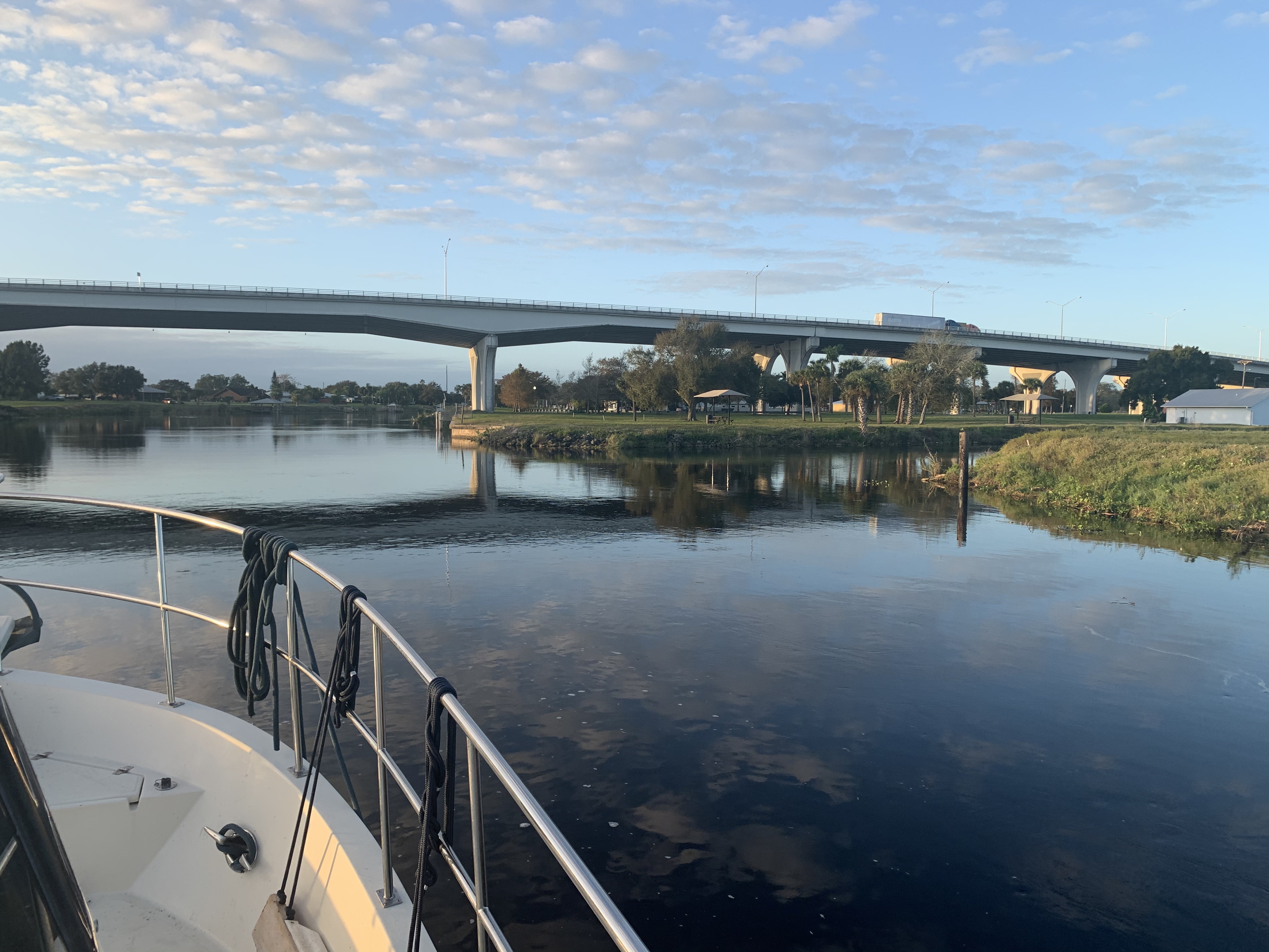
Once through the lock we pass through a tight railroad bridge, under a highway bridge and town of Moore Haven is on our starboard side.

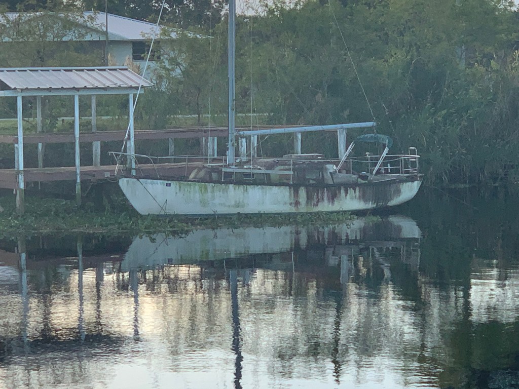
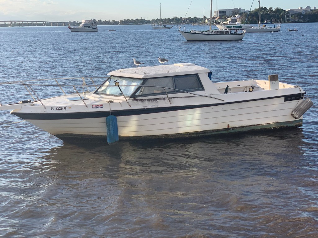
I wish I had taken a nice photo of the town of Moore Haven but the only photo I took was of this old sailboat that has not felt love in years.

There are many locks on the Okeechobee Waterway and now we are at Ortana Lock.

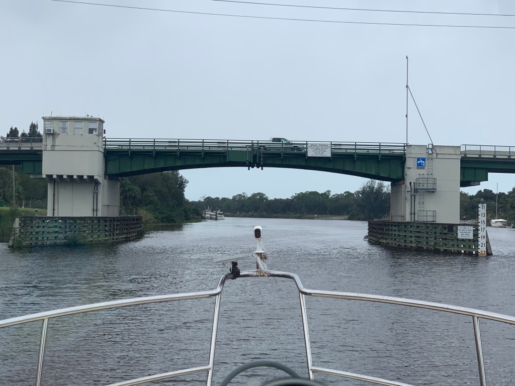
The height board on the right shows over 23′ so we hail the bridge tender and let them know that we will cruise right on under without requesting a bridge opening.
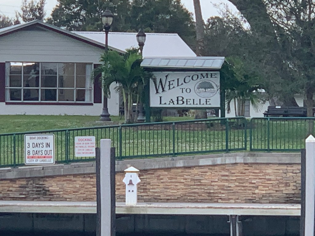
I see this dock and believe it’s a free dock. I think the sign is trying to say you can stay for 3 days but must leave for 8 days before you return again? It does not matter as Nathan and I are not stopping. Instead we are throttle down trying to make it to Cape Coral for Thanksgiving.

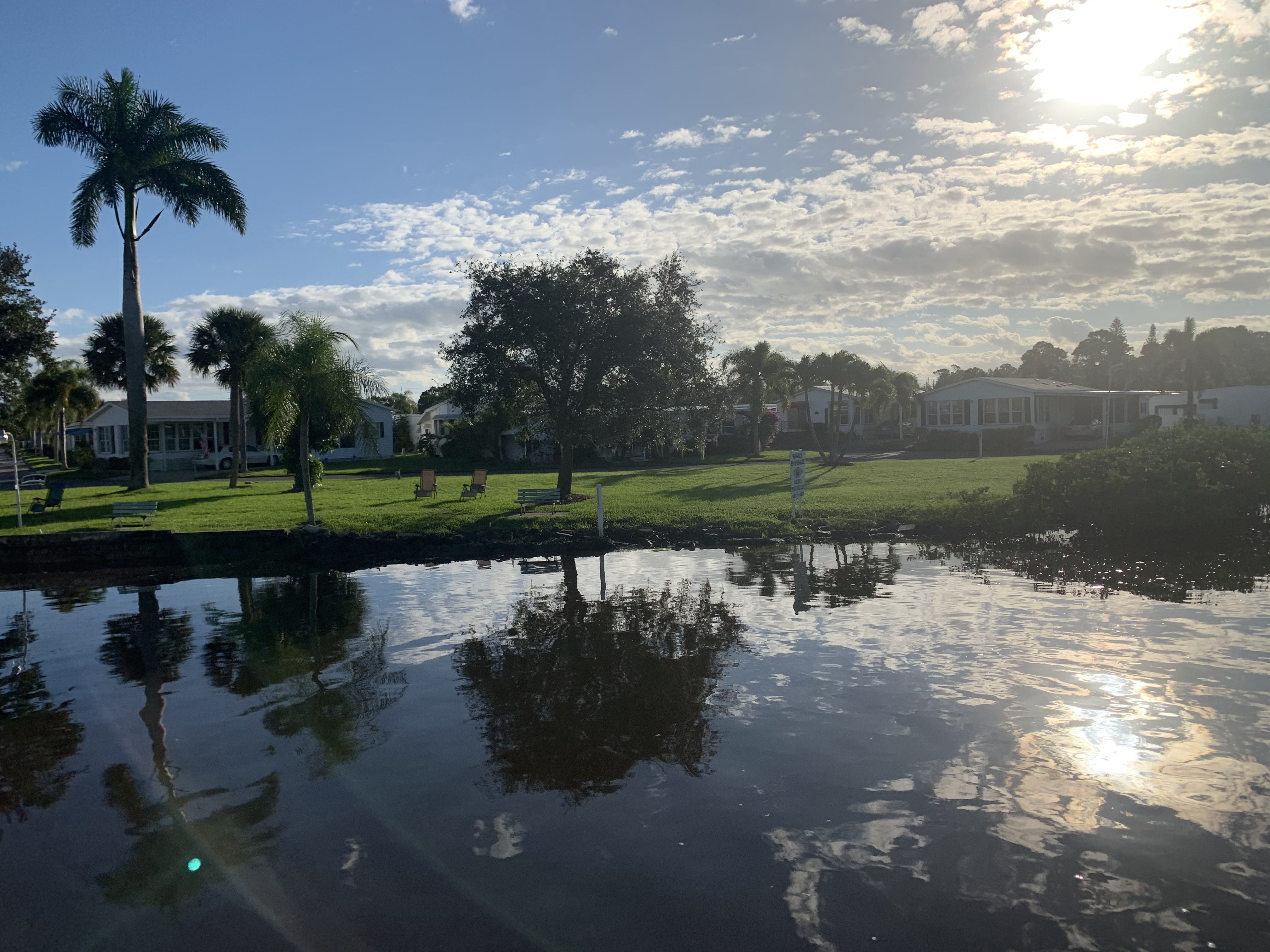
This section of the Coloosahatchee River as beautiful as it is… is far from over developed. A great place to buy a river front home that has access to the Florida gulf.

I passed this group of young people enjoying the nice weather and thought… I wonder if they know both their bilge pumps are running? I did not appear to be low in the water as I passed and they did not seem at all concerned.
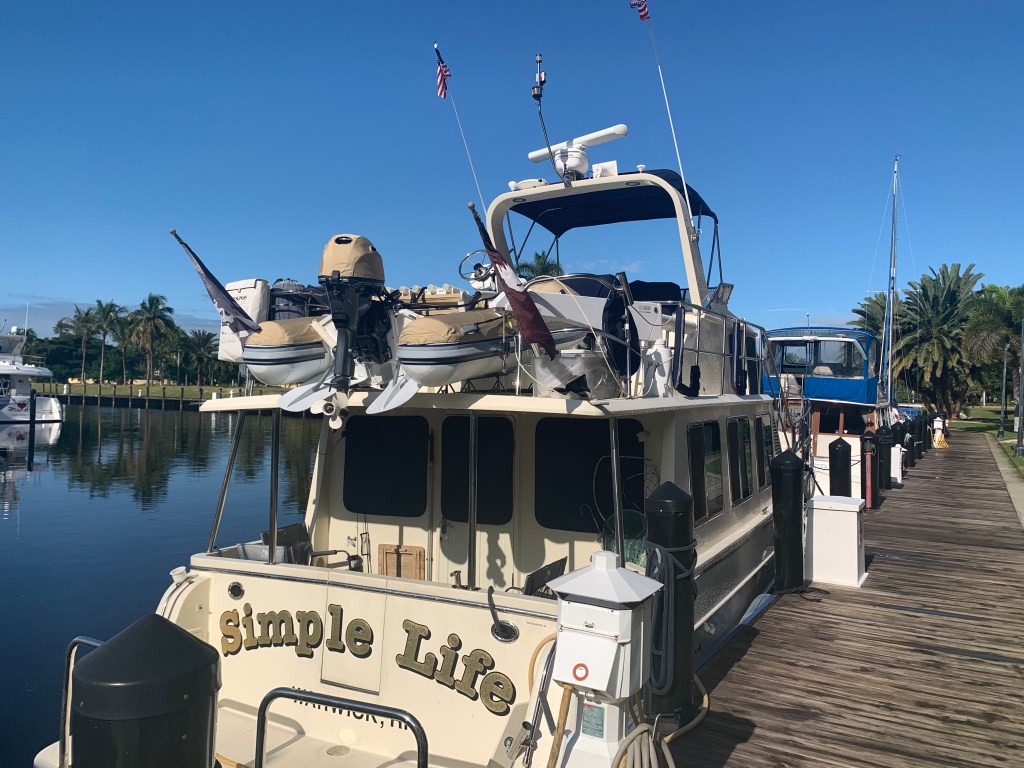
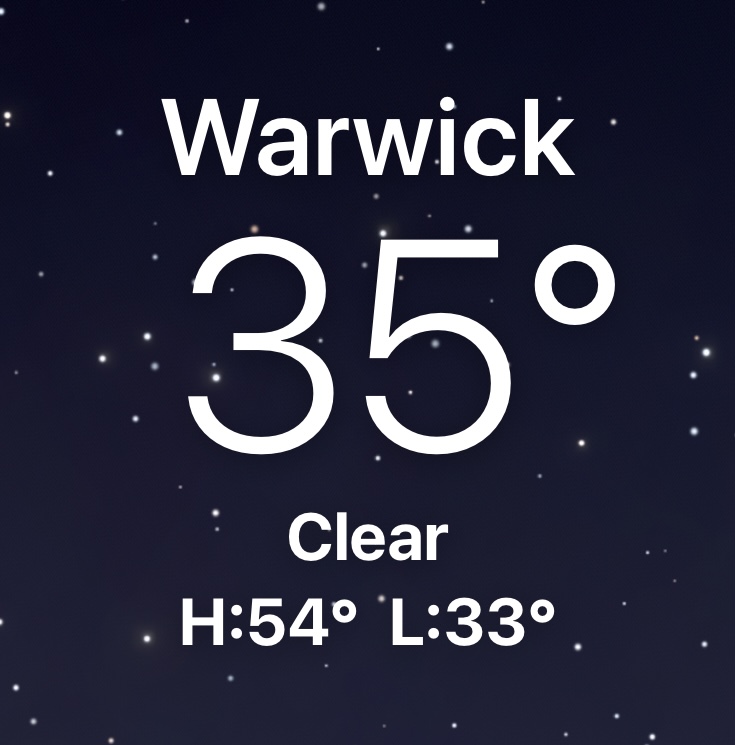
Soon I was tying Simple Life to the dock and counting the number of days and legs it took to get to Cape Coral, FL from Warwick, RI. – 19 legs in 26 Days. A new record.

Above is what the 19th leg route looked like.
I’m posting this blog entry almost a year late but I promise to start posting again as I prepare for my Winter 2021 season to start.

As we cruise out of the anchorage in the AM we get a good look at some of the boats anchored. It’s a great wide open anchorage but many of the boats taking up space appear to be derelict rather than actively transiting the ICW.
Having traversed the Okeechobee Waterway a few times, I should have checked the water height of Lake O before even starting down the Saint Lucie River. I figured that Hurricane Eta dumped so much rain on the watershed that dumps into Lake O … it would not an issue. I do a quick check of the USACE website and it is 16+ feet. The highest I have ever seen it.

The ICW is a federal waterway so there is lots of debate about weather “No Wake” signs are enforceable. Either way… “Do unto others as you would have done unto you”. I find it rude when I’m in an anchorage and a passing boat does not slow to reduce their wake and items in my salon go-a flying. You will always find a few ICW boaters who turn off their AIS boat name broadcasting as well as mount their dinghy so nobody and read their boat name. After feeling anonymous they blast through “No Wake” areas. You always hear someone from the anchorage attempt to hail them on VHF CH#16 but they never answer. They don’t answer because they know nobody is going to have anything nice to say to them.
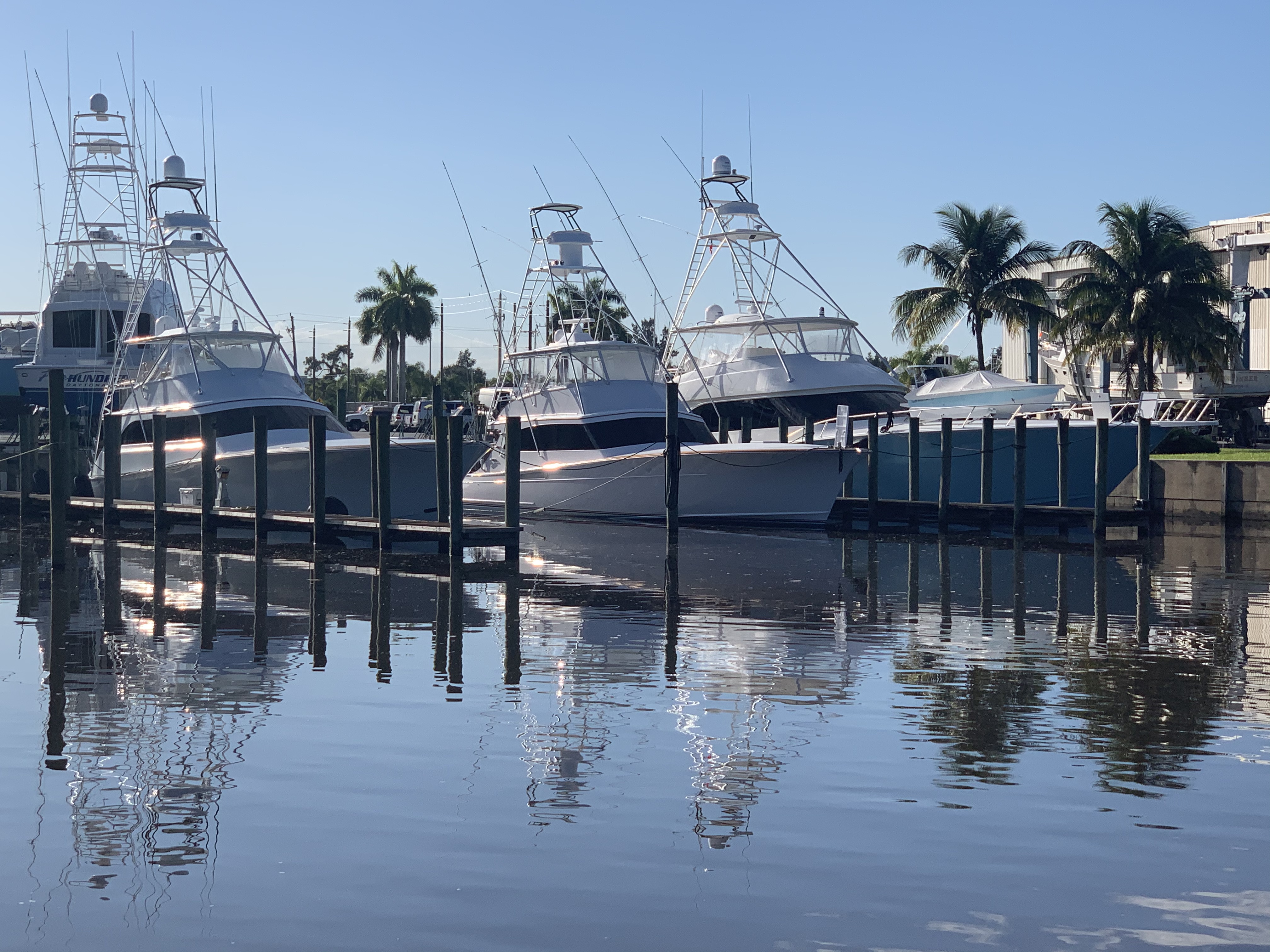
As I pass this marina that is full of Fleming Yachts.

I just did a quick search of Fleming dealers and low and behold… There is a Burr Yacht Sales Fleming Dealer in Stuart, FL.
I do understand why they have resorted to placing this sign out front of their dealership.

There are many beautiful homes and properties in this area. I’m digging the oversized stork lawn art.


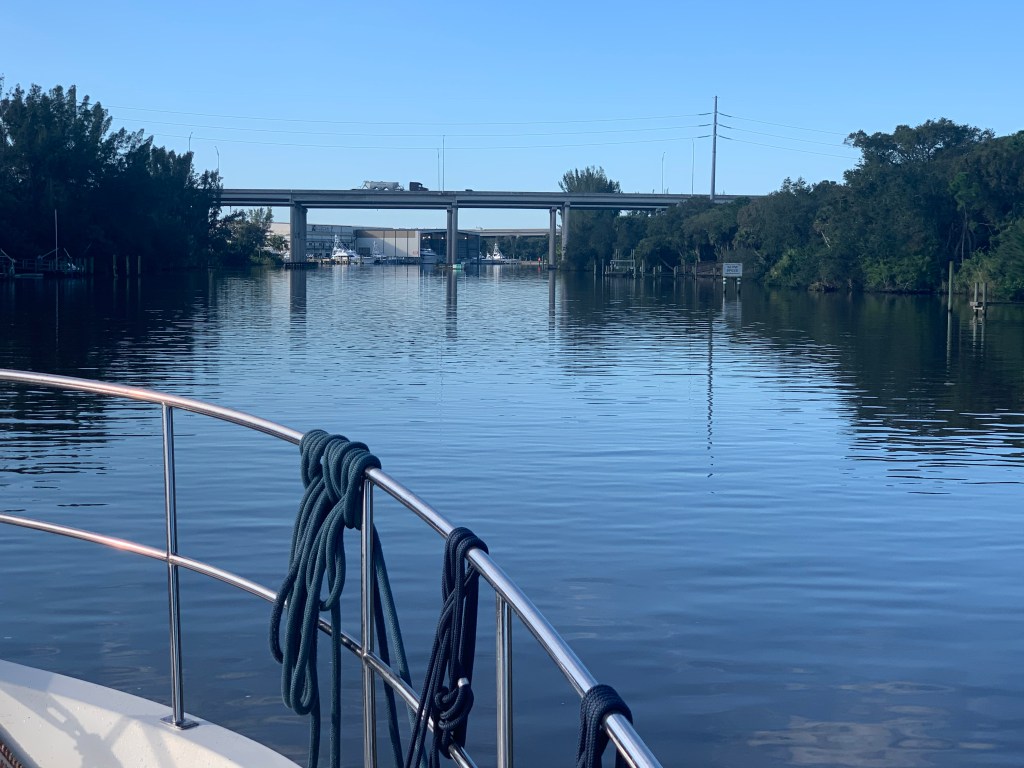
Very quickly you are passing beneath the route 95 bridges that us northerners cross over on our drive to southern Florida.
American Custom Yachts has many beautiful custom yachts and a protected boathouse.


We arrive at the first lock going west on the Okeechobee Waterway. It’s the Saint Lucie Lock with a 14′ drop.
Soon a sailboat passes us and I think the captain and crew look really relaxed as they pass.

Then after it passes I notice that TowBoatUS has them on a hip tow.

At this point my track looks something like this as we approach Lake O

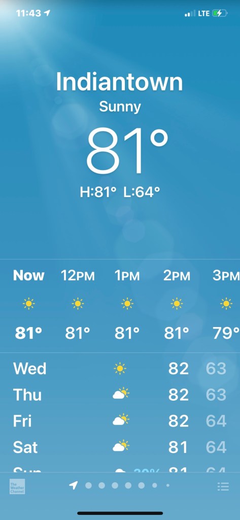
The weather is beautiful
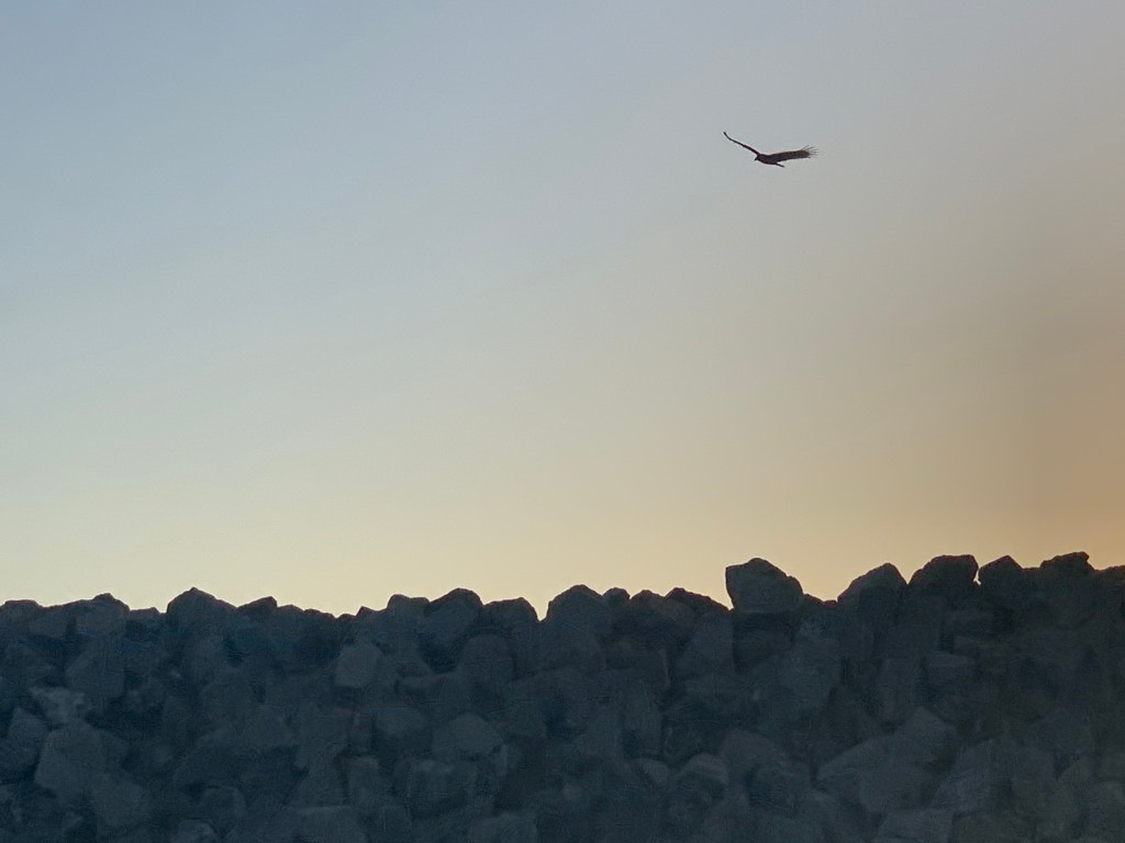
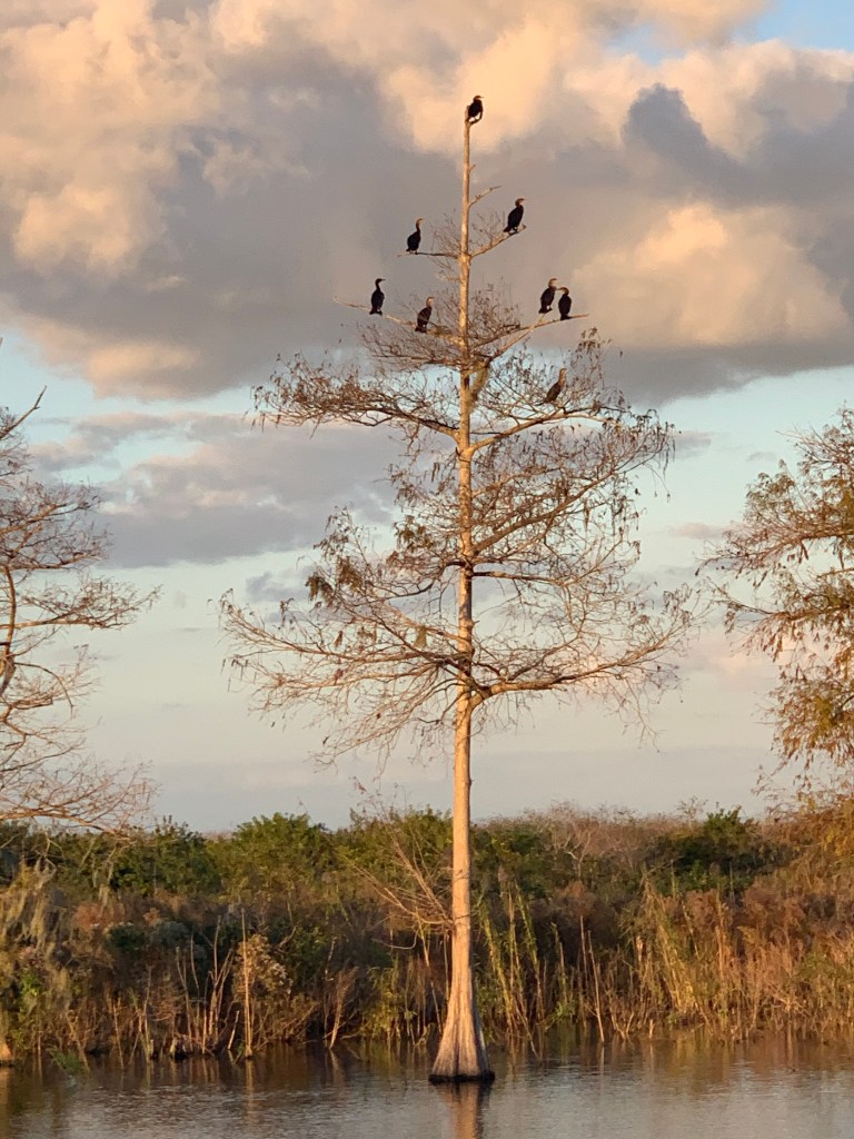
After crossing Lake O and arriving in Clewiston we must go north around the rim channel to Moore Haven. The natural landscape and birds are something to see in this area.

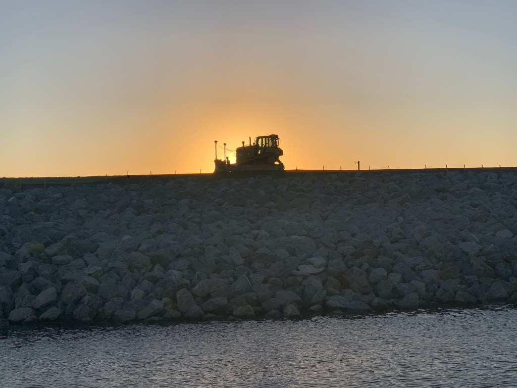
There are many construction vehicles on the dike. It appears as if they are increasing the height of the dike.
Leg #18 of Winter 04 looked something like this…

Nathan and I slept late and just as we were about to cast off the lines and leave, I see a Facebook comment from boating friends stating if I come to Suntex Vero Beach Marina to stop in and say “Hi”. I think… “how serendipitous and timely”. I say this because MV Simple Life is always ahead of my blog posts in time. I post in arrears so to speak. They just happened to be in the same marina that Simple Life was just about to leave. So Nathan & I set out to find our fellow cruising friends in the marina and we end up walking ALL the docks before finding them on the last dock. The Simple Life philosophy states that life is about people and experiences, not things. The cruising lifestyle often has you meeting people for the first time and then running into them months or years later in different ports. It’s a great feeling to catch up with people you met along your journey and theirs. We missed Miles as he was out biking to the store for something or other. We enjoyed chatting with Barb and asking about their Bahamas adventure last winter.
As we depart the marina we point Simple Life south with the intention of entering the Okeechobee Waterway so we can transit to Cape Coral by traveling straight across Florida’s interior.

Just a short way south down the ICW and we are being passed MV Windward. This good looking yacht has direct access to the engine room from the swim platform. Something I always thought was a nice feature on a yacht. I also found it interesting that they attempted to make the boat name more readable when the engine room door was locked in the open position. I just don’t see how that can work though with the yacht’s name spanning the door opening? No worries as the name is also displayed on her sides. I love the stairs to the cockpit and flybridge as opposed to ladders. I do not know what make this yacht is? Leave a comment if you know.

It’s windy today but Nathan & I are enjoying ourselves inside the pilothouse as we make our way south.
MV Patty Wagon passes us. She is a cockpit motor yacht with a sundeck style of yacht. I’m not sure that is the proper name for this style but you can see the sundeck on the aft of this yacht is kind of a mezzanine level (floor between floors). The enclosed sundeck sits above the cockpit yet beneath the flybridge and allows for stowage of their dinghy on the roof of the sundeck. Without the addition of the open cockpit on the stern, if you boarded from the swim platform you’d have to climb a ladder to get to the sundeck area. the addition of the cockpit not only gives you a great place for fishing or sitting out but allows you a safe place to climb that ladder up into the sundeck. If you fall on the ladder you fall in the cockpit and not onto a swim platform or off the yacht and into the water.

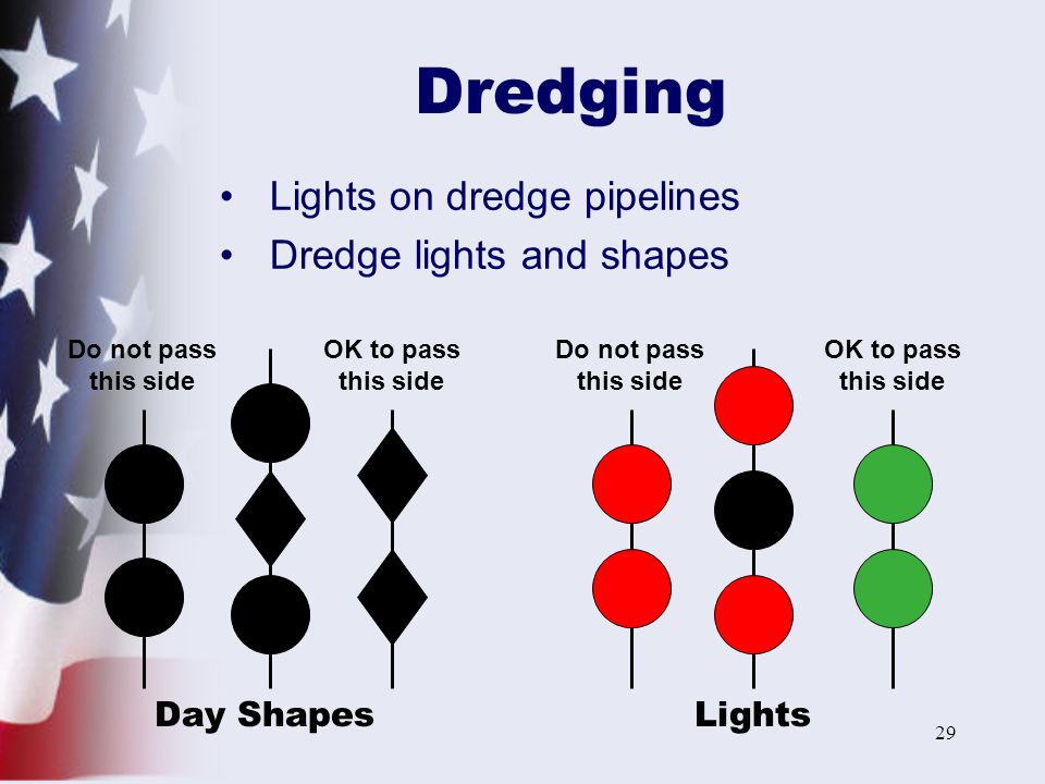
Soon we come upon a dredge in Fort Pierce, FL. The pic from afar shows the piping on the surface that carries the dredged material away. You must use caution when attempting to pass a dredge at night. Passing on the wrong side can have you running into the metal piping on the surface.

I have included this close up of the dredge where you can clearly see the black day shapes that are required by law. Every captain must learn these day shapes to understand what the dredge is trying to communicate.

In this case you can see the two vertical black balls are hung to the side with the piping. You can see the two vertical black diamonds are hung to the side you can safely pass. At night the dredge uses two vertical red lights on the pipe side and two vertical green lights on the passing side. The photo of dredge shapes and lights below also includes a RAM (Restricted in Ability to Maneuver) day shapes and lights.
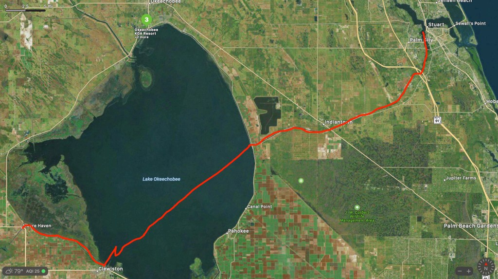
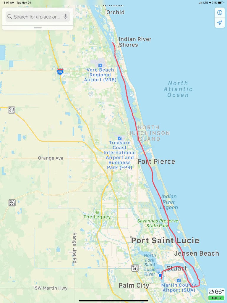
You can see the shoaling that the dredges must keep keep dredging in the below satellite photo. I marked our path as well as the St. Lucie Inlet, a cool looking development right at the inlet as well as where we anchored for the night in Stuart (blue dot).

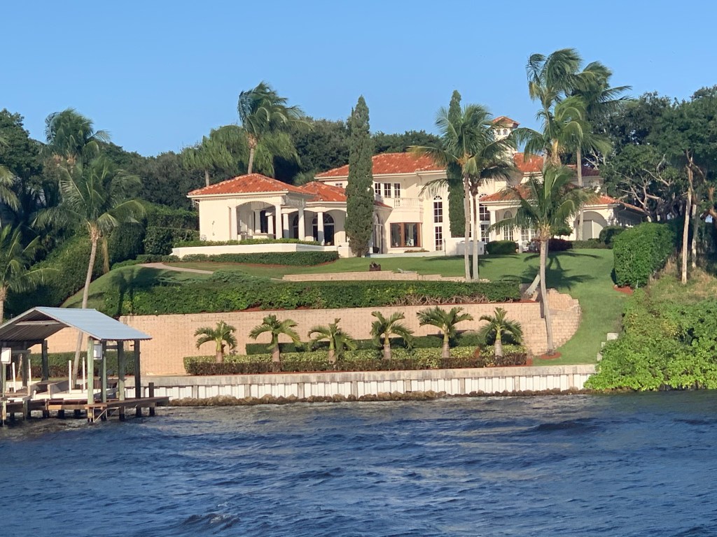
The homes as you enter Hoggs Cove are palatial.

We raced to make it to the Old Roosevelt Bascule Bridge for its publicized 4:30 opening but are told it will not open till 4:45 when we arrive. We circle in the wind and current while we await the opening.
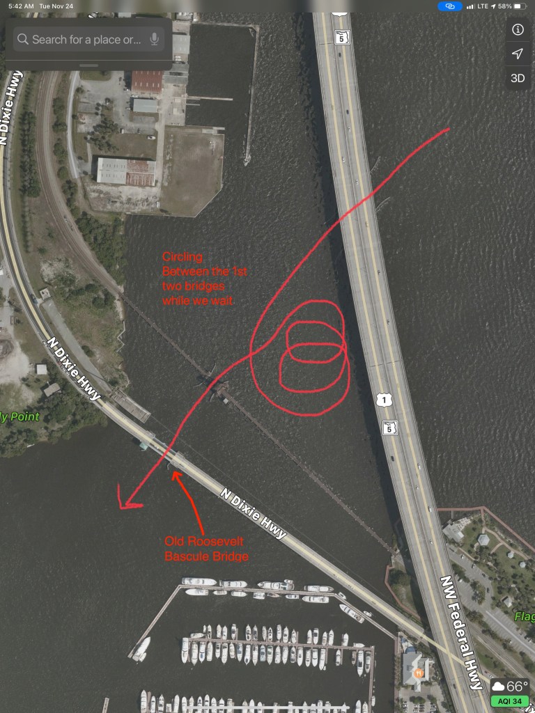
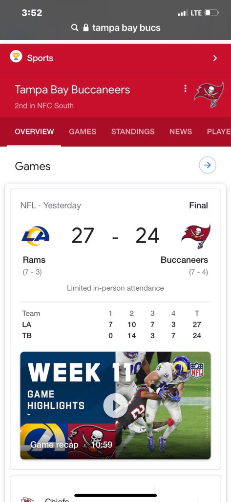
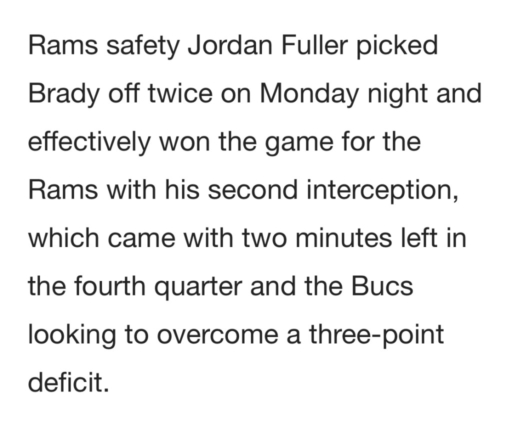
Just on the other side is our anchorage in Pendarvis Cove. The sun sets while we are on anchor as we prepare to watch the Tampa Bay Buccaneers vs. LA Rams game in NFL Week 11.

TB12 and Gronk. It feels like I’m watching the Patriots game to me.
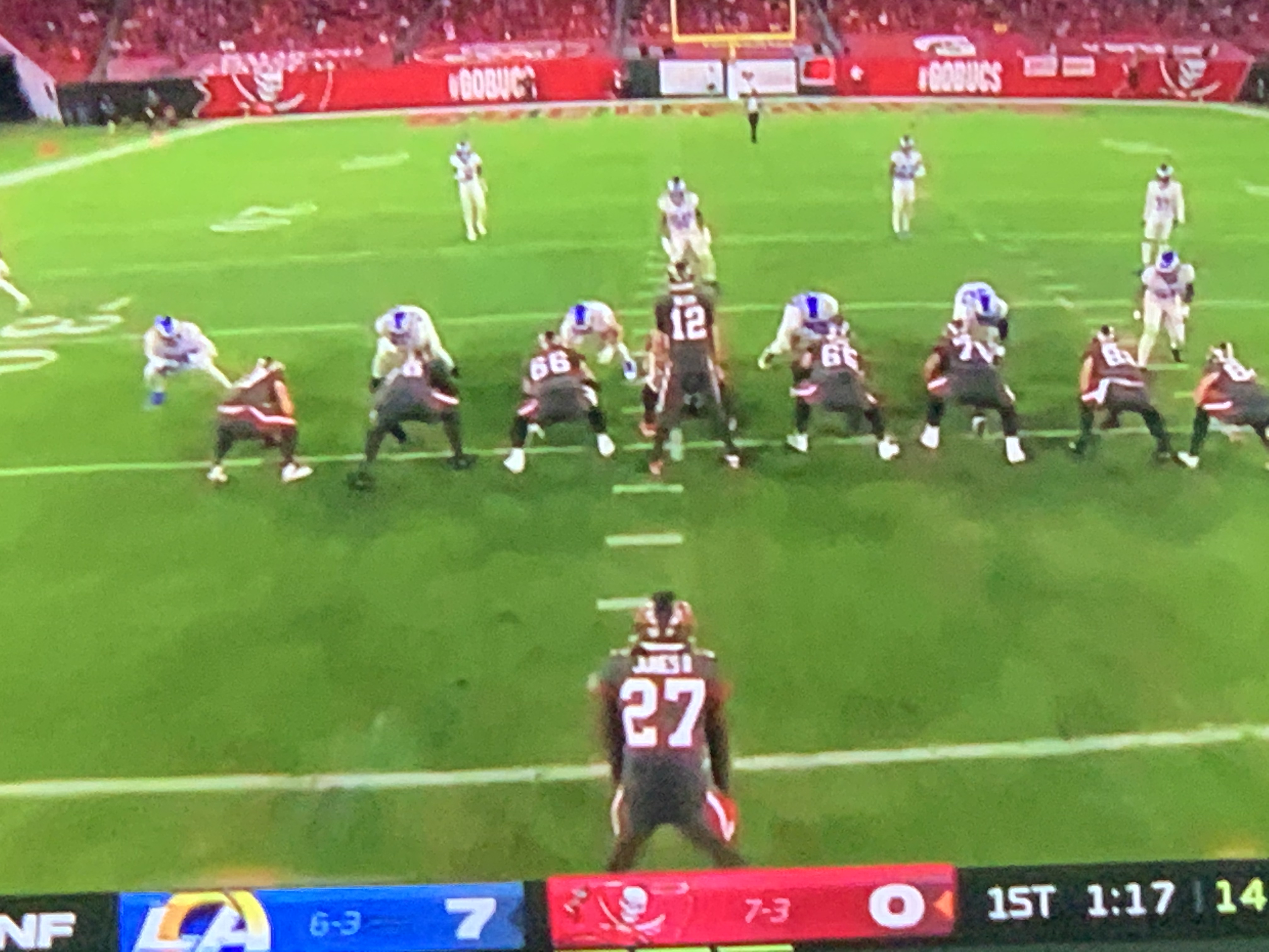
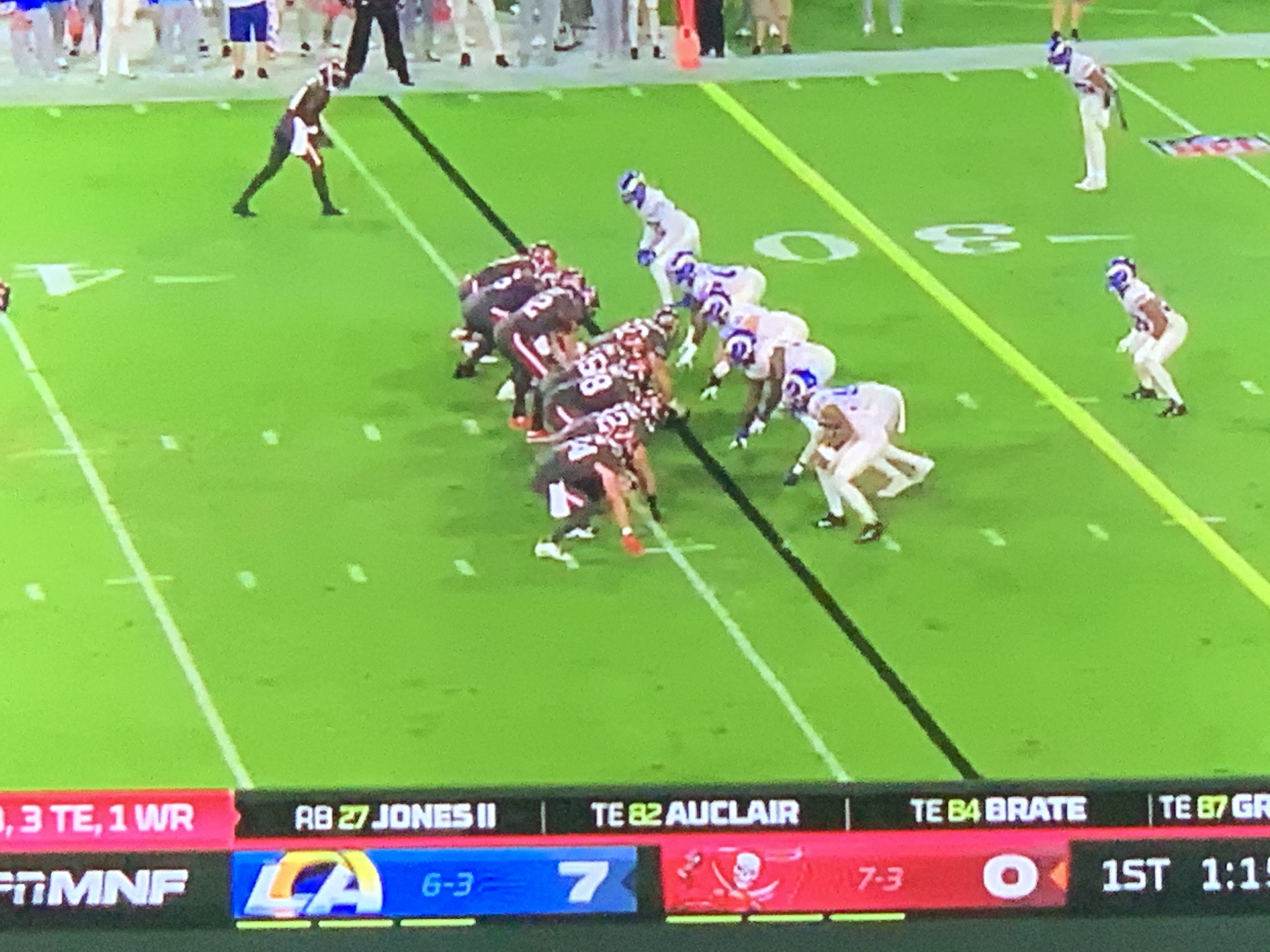


The final score was not what I wanted but I enjoyed watching.
The days journey looks something like this…
I spent the morning enjoying my coffee and checking the weather.
The winds off the coast are still blowing. A quick check on the Marine Zone forecast and I see that the winds have not abated and are driving the seas into the 6′-9′ range. Times like this if it were not for the ICW I’d be trapped in port.

I use the in-slip time to wash the salt off the boat and modify the encryption settings on my router. Somehow I have accidentally set my internal WiFi to WPA/WPA2 and WPA (Version 1) has a known exploit when it comes to TPIK (Temporal Key Integrity Protocol)

It’s 11AM and my time at the dock has run out. I cast my lines off and pull away from the dock with a bit more throttle than usual as the wind is blowing hard on my beam. Over to fuel dock to fuel up before heading south towards my intended destination of Titusville, FL.
As I pass an anchorage in New Smyrna Beach I pass several anchored sailboats. New Smyrna Beach is in Volusia County. According to the International Shark Attack File maintained by the University of Florida, in 2007, Volusia County had more confirmed sharkbites than any other region in the world.


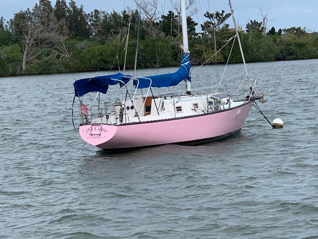
Then I come upon SV Da Capo. That’s quite a pink hull!
Soon this large, comfortable-looking, motor yacht was passing me. Hatteras I believe?

As I make my way through Haulover Canal there is a thin strip of land that is lined with small trees. This kind of natural geography seems odd to me but I encounter it often. I have always believed that you see these thin continuous strips of land along-side canals which are frequently dredged to keep a minimum center channel depth. I have always imagined that it must be far cheaper for the dredge to push the dredged material through a short outflow pipe that starts to build a new island alongside the channel. I have no specific knowledge or experience with dredging so If you do, please comment on this.

I watch as the sun sets.

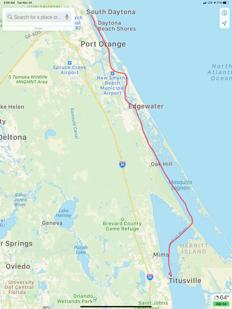
In this moment I start doing some quick calculations and realize that it’ll be dark before I reach Titusville, FL where I plan to anchor. Luckily this section of the ICW is pretty open and easy to navigate at night. I find my anchorage and let out about 70′ of anchor which is plenty for the 6′ of water I’m in. Coming in in the dark you don’t expect many ICW boats to arrive after you. The winds are forecast to be steady in their direction through the night. I won’t swing around and there is plenty of room between me and my neighbors anchored next to me.

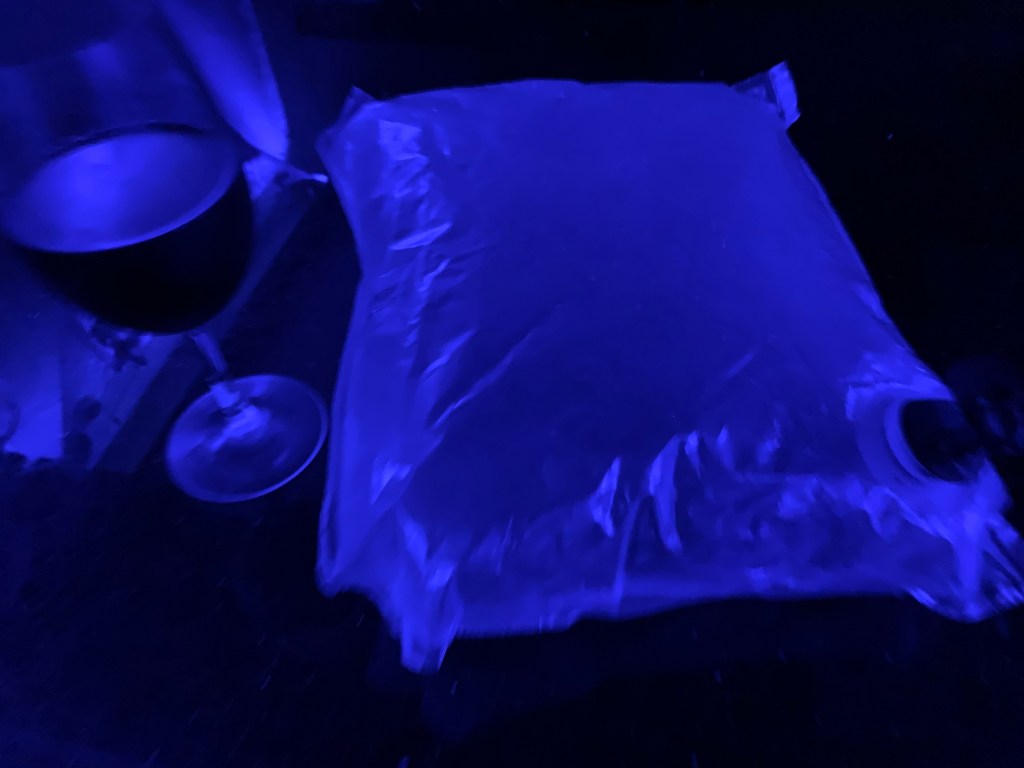
I’m tired and figure I should finish off my fanciest bag of wine before hitting the rack 😉
Today’s route looked something like this…
This is a new section that I thought I would add since being ADD & extraverted I often have random thoughts bouncing around in my head that I feel a need to talk about. Today’s thought is for any fellow boaters reading my blog.
Today’s thought was on Diesel efficiency. Before owning my 1st trawler, I owned three sailboats. As a sailboat owner, I never thought about fuel economy. Now diesel fill ups can cost as much as $1000 rather than $100. This, because my trawler style motor yacht by design has large diesel tanks for long-range cruising. It’s tempting to discuss the days that the wind was pushing my sailboat along for free but this is not about sailboats vs. trawlers. Instead, I’d like to talk about trawler diesel engine power and hull shape. I’m not an expert or this subject it’s just something I have some thoughts on.
There are two kinds of trawlers.
Every boat’s hull displaces it’s weight in water. The more stuff you put into your boat it sinks a little lower in the water. Ancient Greek mathematician and inventor Archimedes first screamed “Eureka! Eureka!” when he discovered this. This is known as Archimedes’ principle.
To push the hull through the water you must push the water in front of the boat down as well as part it to the sides. When it comes to the force required to move a hull forward, hull shape matters. It should seem obvious as you try to push a boat forward quickly that a slender hull with a narrow angled bow and stern will separate the water gently and then put the water back together gently without causing much swirling drag forces at the stern. A hull with a blunt bow and square stern will plow into the water at the bow and have it come crashing back together behind the stern causing eddys or swirling motions that cause the boat to be pulled backwards by drag forces.
Slow trawlers are full displacement hulls and their maximum hull speed is easily calculated by this equation and the length of their waterline (the length from when the hull first splits the water to where it recombines it).

Full displacement hull shapes tend to be very round or semi-hemispherical and create little drag. They require a smaller force to push them through the water. However this round hull shape overs little resistance to healing (rocking of the boat). So you often find these hulls using ballast or weight added to the bottom of the hull to keep them upright. Since 1933 fin stabilizers such as Wesmar have been used to stabilize boats. The most modern solutions are active gyro stabilizers such as SeaKeeper. Fin stabilizers require power to move them and create drag in the water. Gyro stabilizers require running a diesel generator to keep them spinning. Full displacement may be the most economical hull shape but stabilization often requires diesel burn.
If you have a full displacement hull you only need a Diesel engine with enough HP to push it along at near it’s hull speed. If you put a larger HP diesel in the boat you will destroy your fuel economy and never go faster than hull speed. Full displacement trawlers will give you the best fuel economy due to tiny fuel sipping diesels. Full displacement trawlers with active fin stabilizers and large fuel tanks can cross oceans. Nordhavn is a popular trawler brand that comes to mind in this moment.
Semi-displacement hull shapes are designed to push water not just aside but down at a rapid rate. The water being pushed down forces the hull up out of the water. Less hull in the water means less drag and you can exceed the max hull speed for the length of your hull’s waterline. This extra downward push of the water means you need to put more HP behind the diesel. You are trading fuel economy for speed. When the waves are not exceeding large, speed can get you out of the weather and to a safe port sooner. You can also move at speeds below your hull speed and be almost as fuel efficient as a full displacement hull. Semi-displacement trawlers will have sharp angles called “chines” in the hull shape that help to create active resistance to healing. Think of a basket ball with a child’s action figure on top of it floating in your bathtub. Your basketball hull form is semi-hemispherical. The round basketball offers no resistance to heal and will likely just roll over with the first wave. Now place a box with square 90 chines at the edges of it’s hull in the bathtub. That same hull shape resists leaning to either side because to do so would displace less water on the side lifting up and more water on the side being pushed down into the water. Recall from Archimedes’ principle that displacing water creates an upward buoyancy force.
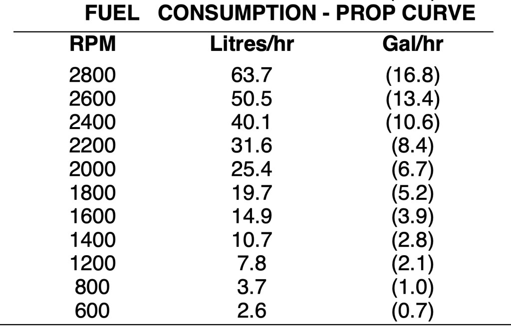
A rule of thumb often used is that modern diesels burn about 1GPH for each 20HP produced. This number is a rough estimate of how much of your diesel engine’s power (force) you are using to push your trawler’s hull form through the water at the speed you are going. You can double check this number against your diesel engine’s HP/RPM curve.
What type of boat you choose is often like choosing a religion. Once you decide you often find yourself defending your decision with great fervor. Debates rage on but I’m just trying to discuss just the basics of the science behind the debate. Often I hear other boaters with much larger boats with twin diesels compared to my single diesel tell me they get twice the fuel economy as me. Hyperbole or magic? I often state that my Cummins Mercruiser Smart Craft display of fuel burn is 2 GPH at about 1400 RPM or 6.5kts of boat speed. This is a rough estimate of course since there are currents, wind forces, drag due to hull fouling, propeller diameter and pitch, etc. that come into play here.


There is no perfect boat. Every boat is a compromise. The discussion above is only about the tradeoff between economy and speed. I gave up economy for speed when I went with a semi-displacement trawler. I’m OK with my choice. I understand why others chose full displacement trawlers. Chose your religion wisely!

My phone rings and I answer. I had just fallen asleep after being up for over 40 hours. I answer the phone and it’s a friend asking “where are you?”. I respond instantly with … “Oh. umm, ummm. ummm. I don’t know?” Funny that when you are always waking up in a new place each morning you forget where you are sometimes.
I planned on sleeping in leaving late. Why am I up and checking the weather at 5AM? Staying up for two days has knocked me off my circadian rhythm. The weather outside in the Atlantic is continuing to deteriorate with 25kt winds and 6-8′ seas. Lucky for me today’s trip will be on the inside motoring down the ICW.


Anchored at Fort Matanzas, FL and the current is so swift that you’d swear I was underway and not on anchor.
.
.
.
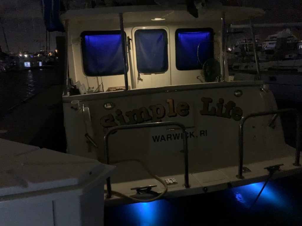
I weigh anchor and proceed about an hour south down the ICW before docking at a marina in Palm Coast. I’m here to do a walkthrough of a boat for sale. I figured as long as I’m driving by I could help a friend by FaceTiming him from the boat he was interested in buying. The boat was beautiful.

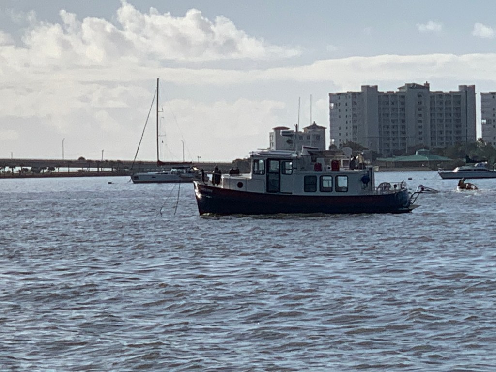
As I make my way towards Daytona Beach, FL I pass several boats along the way.

The boat is autopilot and I’m reading a Facebook fishing group post where a FB user has posted about how he caught his biggest fish in Long Island Sound. As I look at the photo of the fish, I’m thinking…. That looks like a federally protected, endangered Atlantic Sturgeon. As I click on the photos to get a closer look FB says the photos have be removed. I’m thinking this must be a joke that nobody would post about catching an Atlantic Sturgeon. Or would they?
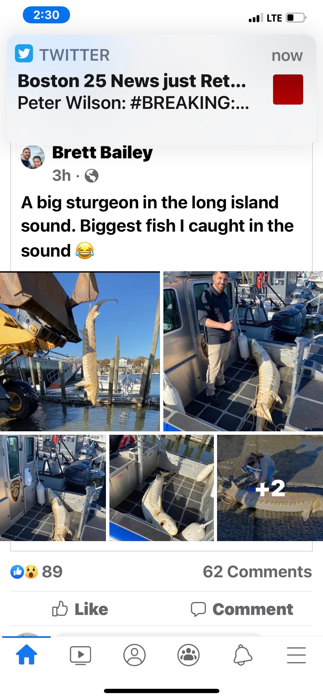


Sturgeon are living dinosaurs. Fisheries biologists have discovered that sturgeon existed as long as 200 million years ago.
The Atlantic sturgeon is one of seven species of sturgeons found in North America. Sturgeons are prehistoric species that date back to the time of dinosaurs. Sturgeons have physical features that separate them from other kinds of fish such as: a spiral valve stomach and cartilaginous skeleton (like sharks and rays), but they have scutes (hard, protective, large individual body plates) instead of shark’s denticles or bony-fish’s scales. The Atlantic sturgeon has barbels located on the underside of the snout, no teeth, rubbery lips, and a suctorial mouth for vacuuming food off the water bottom. The Atlantic sturgeon’s coloring typically is dark brown along the upper (dorsal) side, shading to a creamy white-colored belly (ASSRT 2007). The Atlantic sturgeon is a large fish that can reach a length of 14 feet (4.3 meters), a weight of over 800 pounds (363 kilograms), and possess strength to leap nine feet (2.7 meters) into the air.
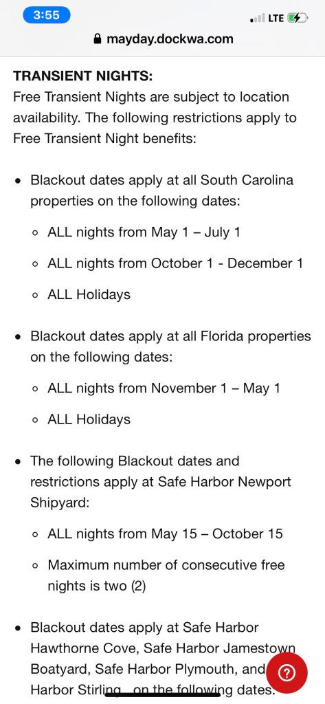
As I approach Daytona I realize I only used 2 of my 10 FREE nights at Safe Harbor Marinas. After doing some research I learn that the blackout dates in the south prohibit their use.
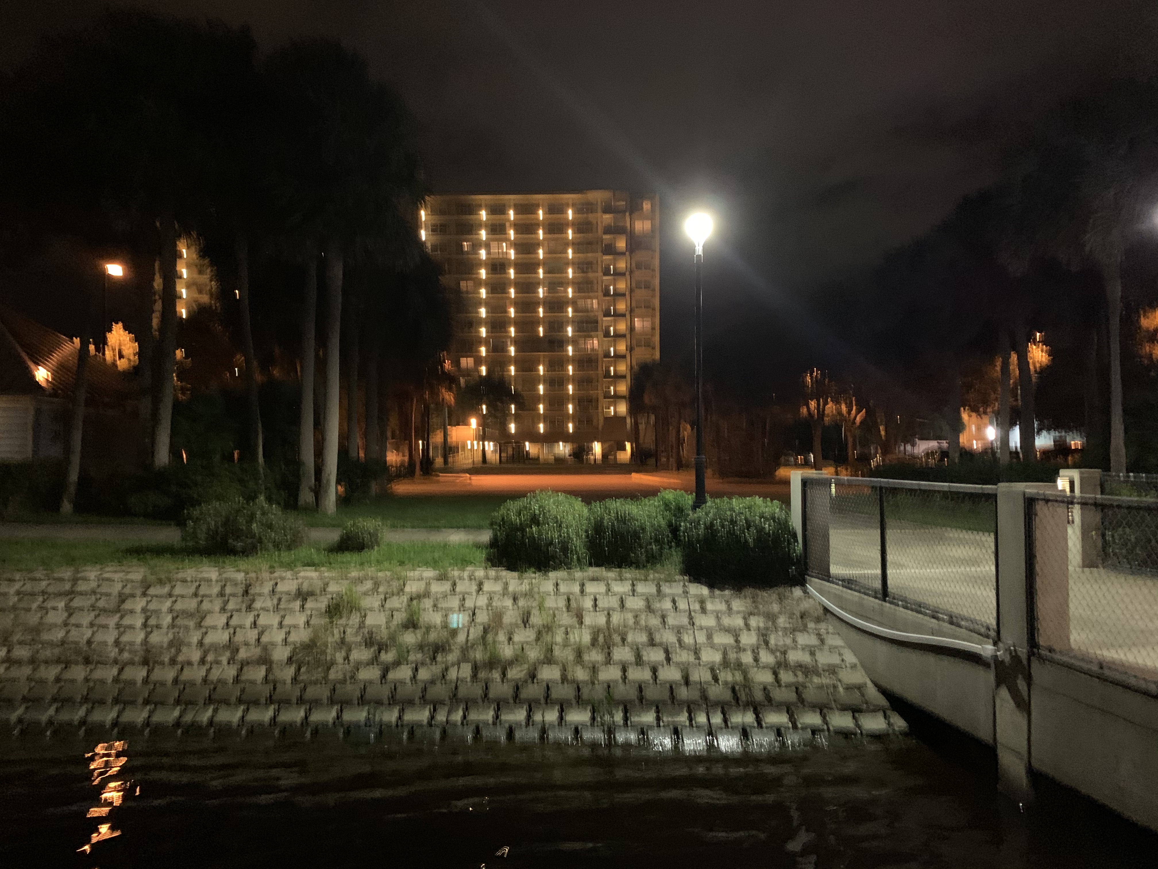
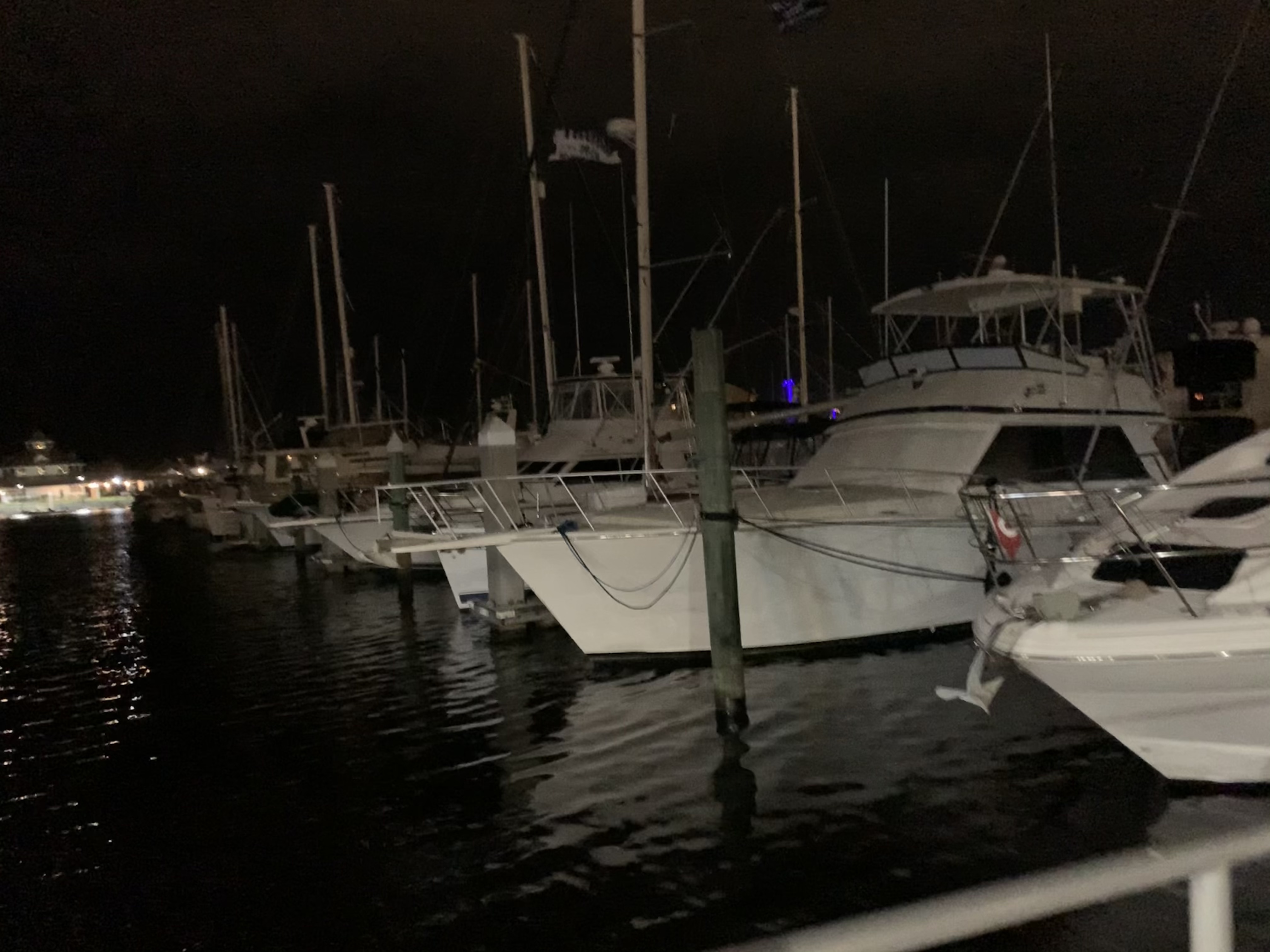
As I pull into Halifax Harbor Marina the wind is blowing so I have already prepped and have my fenders out on both sides and my lines coiled on the deck but hanging within reach if there is a dockhand to help me land in the slip. As I start down the I-H dock fairway I see the dockhand is already waiting in the slip for me to back in.

My friend Jay is already waiting and within minutes of landing we are sharing a beer and catching up since our last meeting here in Daytona Beach. We make a quick call to another former Foxboro resident and we meetup at Hooligans to grab some hot wings.

It was great catching up with my Foxboro Friends. It’s great to have friends along the way to break up the month long journey.
Back at the marina I feel like I’m walking into a cage match.

Back aboard Simple Life I plan on sleeping a bit late, enjoying my coffee and not leaving until my 11AM leave the dock deadline.
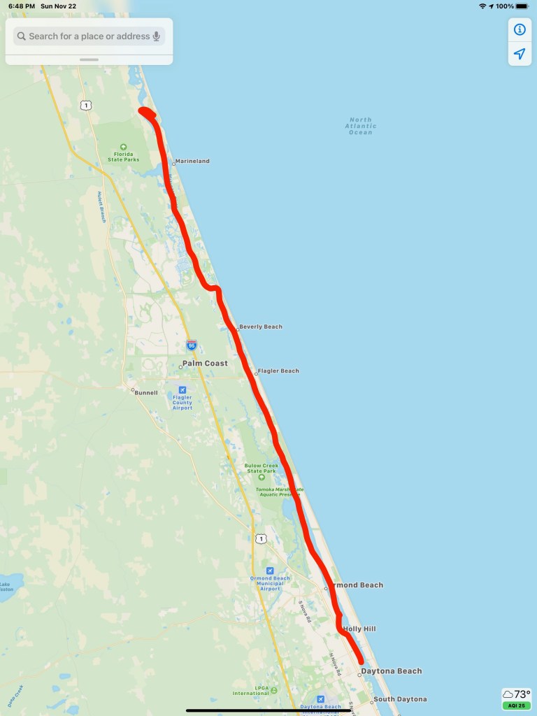
The day’s route looked something like this

The morning light exposed my neighboring anchored boats. I have no idea what make boat this is? I don’t think I have ever seen anything like it?

I’m thinking the boat pictured below is a Nordic Tug?
I have no idea what this trawler below is but I think it’s pretty cool looking. Boat make identification is much harder than cars. We often talk about the style of the boat as being a pilothouse or trawler or Sportfisher, etc but it takes practice to notice the subtle details within the styles to be able to name the boat maker or brand.

Leaving Titusville, I pass under the Max Brewer Bridge.

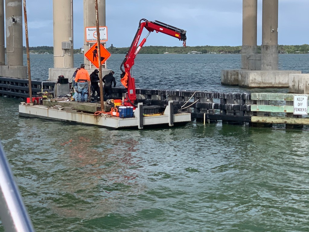
Before I make it to Vero Beach I slow down to minimize my wake as I pass workers diving on a bridge.
I’m now approaching the Vero Beach marina that I reserved for Saturday and Sunday night. However, I won’t check in till the AM so I must find a suitable anchorage. The anchorage I planned to stay at turned out to be to small to fit me so I pushed on into the night until I found a more suitable anchorage. However, my first attempt at anchoring had my 88# Rocna anchor dragging when I backed down at only 730 RPM. I motored around the anchorage to try and find another spot but found much of the anchorage too shallow for me. It was dark and I was getting tired of circling around the already anchored boats so I just decided to drop again in the same spot. This time I successfully backed down at 800 RPM for a solid 2 minutes while I waited to see if the anchor would budge. It did not so I shutdown the diesel and tucked in for the night.
The morning’s light showed a calm water’s surface.
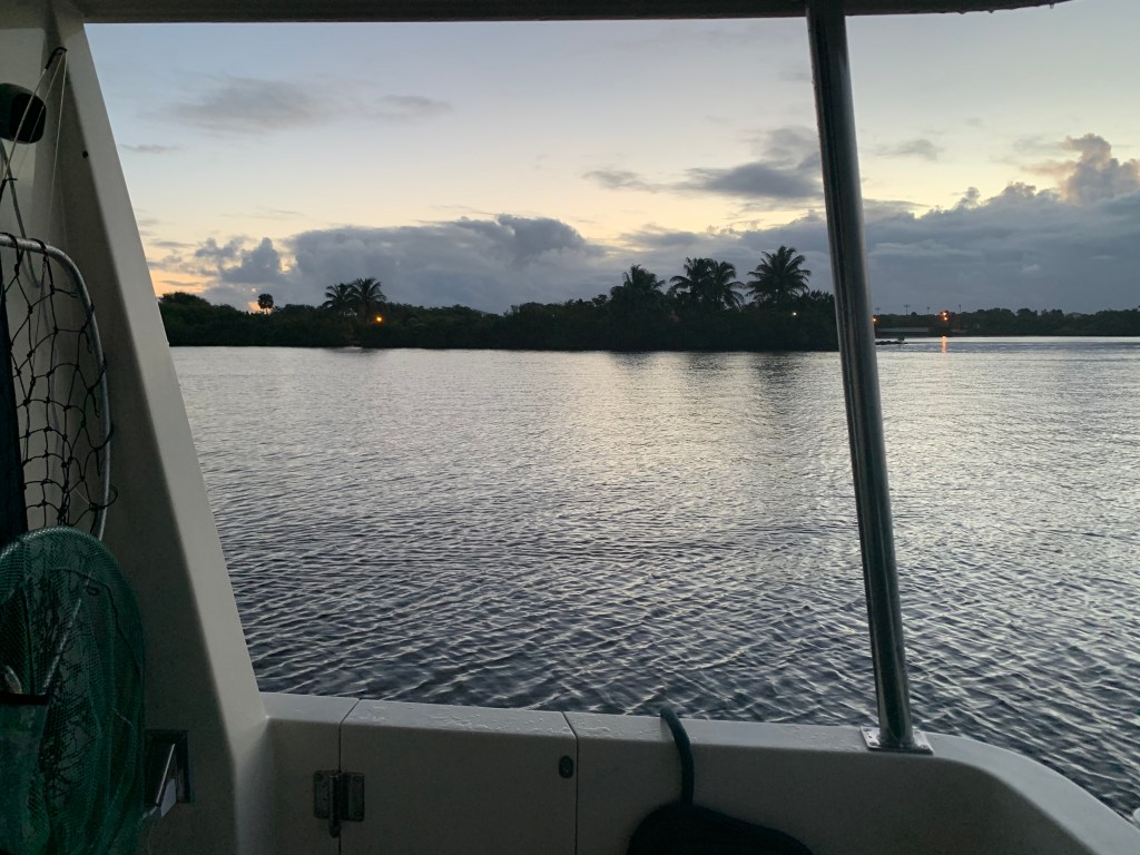
I hung around enjoying the view and my coffee while I waited to be sure that the marina crew would be there to accept my arrival. Soon I was passing under the Merrill Barber bridge. This area is a manatee zone so you must move very slowly to prevent an accidental strike with a manatee.
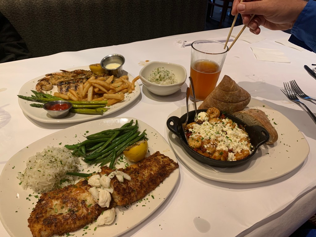
Once at the marina I only had to wait an hour or so and Teresa and Nathan were pulling into visit for the weekend. Soon we were off to the Bonefish Grill in Vero Beach for some seafood and drinks.

The next day we just hung out enjoying each other’s company and watched different boats come and go.

Nathan and I caught the Patriots game and the Jets game.

The journey to Vero Beach looked something like this.


4AM and my iPhone alarm is buzzing. I need to weigh anchor and get underway before the 4:38AM start of the Winyah Bay inlet’s flood current. Somehow I lose track of time and don’t get underway till 5AM.

First light won’t occur until 6:24AM.

I weave my way through the other anchored boats quietly without shining my spotlight directly on them. It’s dark but the radar and spotlight are helping me find the daymarks and buoys that line the channel out the inlet and into the Atlantic.
Now at 6:05, 19 minutes before first light, if I look to the east, I can differentiate sky from the sea.

Moments later and First Light has arrived.
Now it’s 7AM and at the sun is looking like a giant lightbulb on the eastern horizon.

Friends have found me.
As the day goes on the following sea can be felt. As I walk through the salon I can hear the rhythmic sound of my wine glasses rocking back and forth in their upside down holder.
I open the back door to get a better look at the following sea.
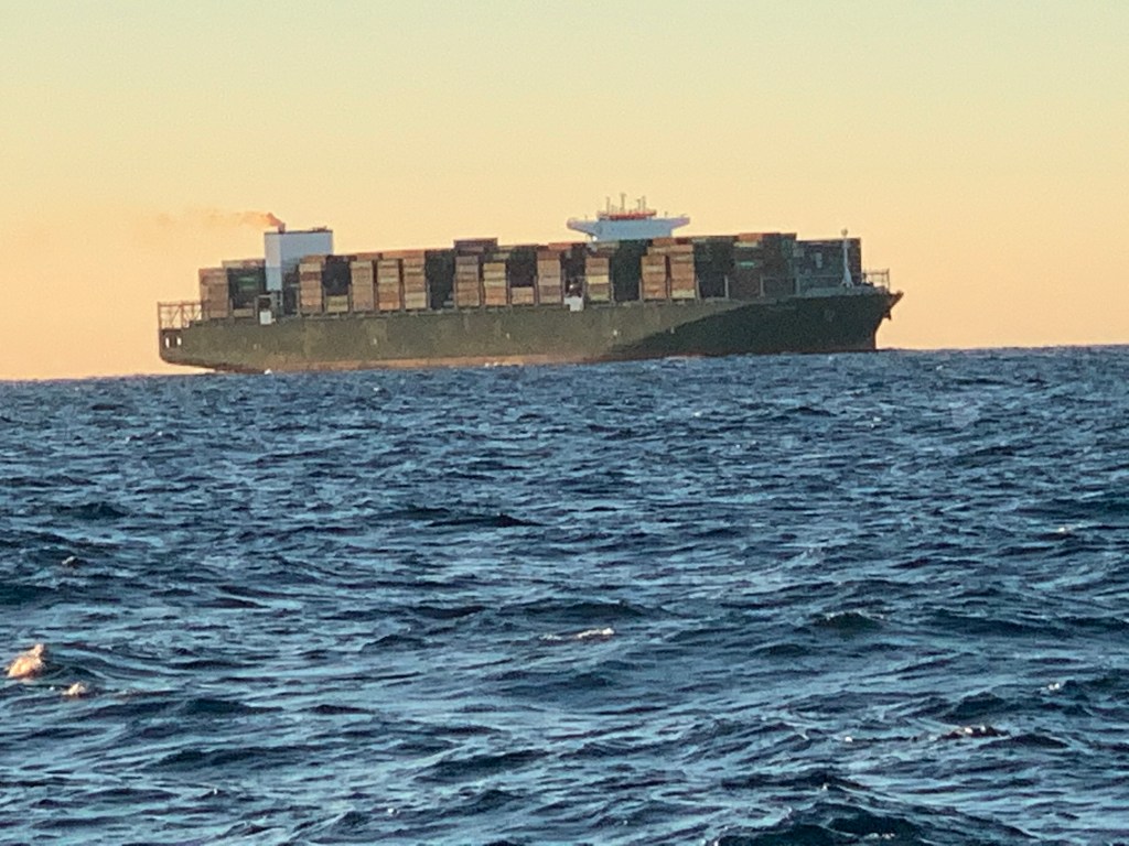
I spot my first ship around 2PM.

It’s cargo vessel Triton and it will pass less than a mile from me with our current course and speeds.

Though I will not pass any other recreational traffic this far out I do come upon a second, equally as massive container ship on a crossing path.
I decide to spend some time on the bow and video as I go
The sun has begun to set.

I settle in for the long night. When I go offshore as opposed to running in the ICW or “The Ditch” as it is called, there isn’t much to do. I plan my route and set my course and speed. The autopilot is engaged so no need to hold the helm. I do however need to maintain a constant watch for buoys or passing ships. My chosen route is a rhumb line between Winyah Bay Inlet and St. Augustine Inlet. Rhumb lines are courses navigators use to make it easy on themselves. A rhumb line only requires the captain to steer a constant magnetic bearing. I can hear the geometry nerds shouting… “The shortest route on the surface of a sphere is actually the arc of a great circle!”. On mercator projection charts a rhumb line is a straight line. My rhumb line route takes me about 45NM offshore.
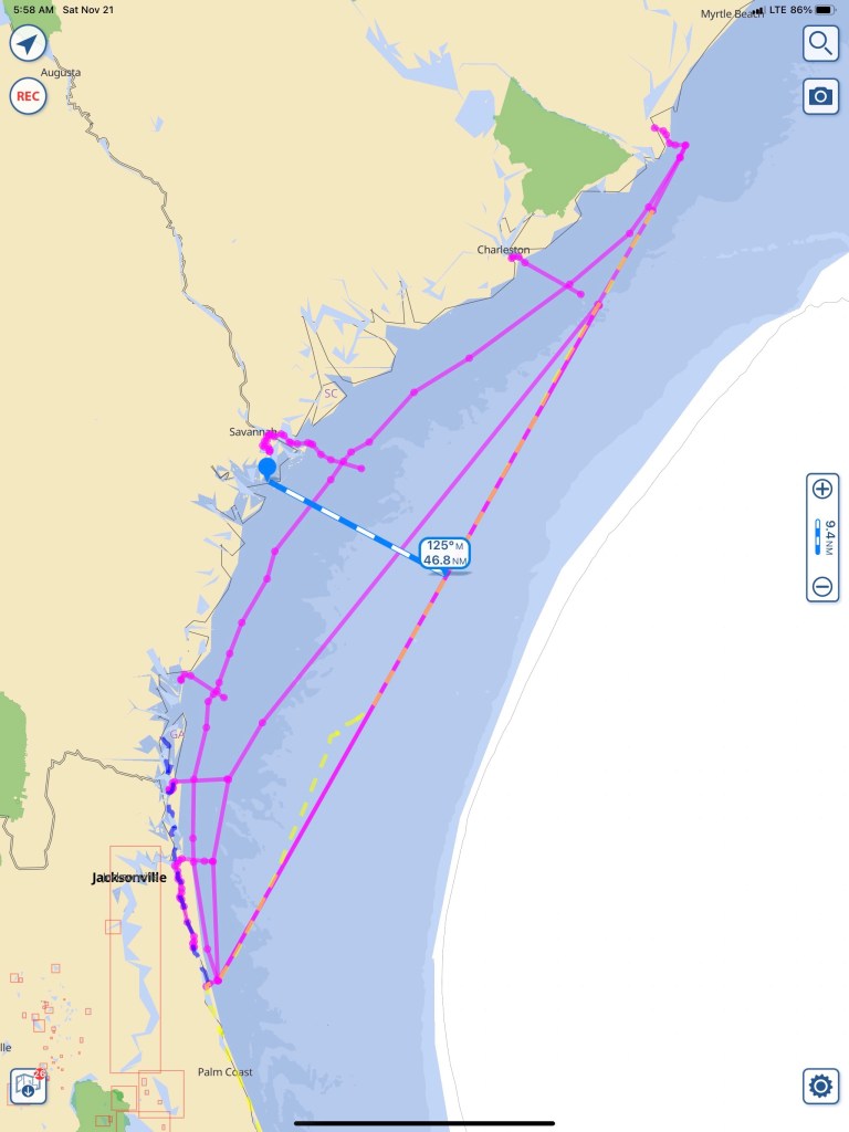
Explained another way… If you stare at the picture of “globe Earth” below, keep this in mind. The longitudinal lines come together at the North Pole. If you are sailing either of the two routes drawn below, your compass needle’s would align to the longitude lines. The “rhumb line” route you steer a constant heading according to the compass while the shorter “great circle” route has you starting out at one compass heading and constantly steering more east as you go from left to right.

I don’t anticipate seeing many ships or buoys this far out. My watch duties are reduced to:

With minimal watch required it’s time to watch movies while at the helm. I preload media onto my iPads so when a cell signal is nowhere to be found… I still have entertainment.
Tonight’s Sunset is a burning sky.
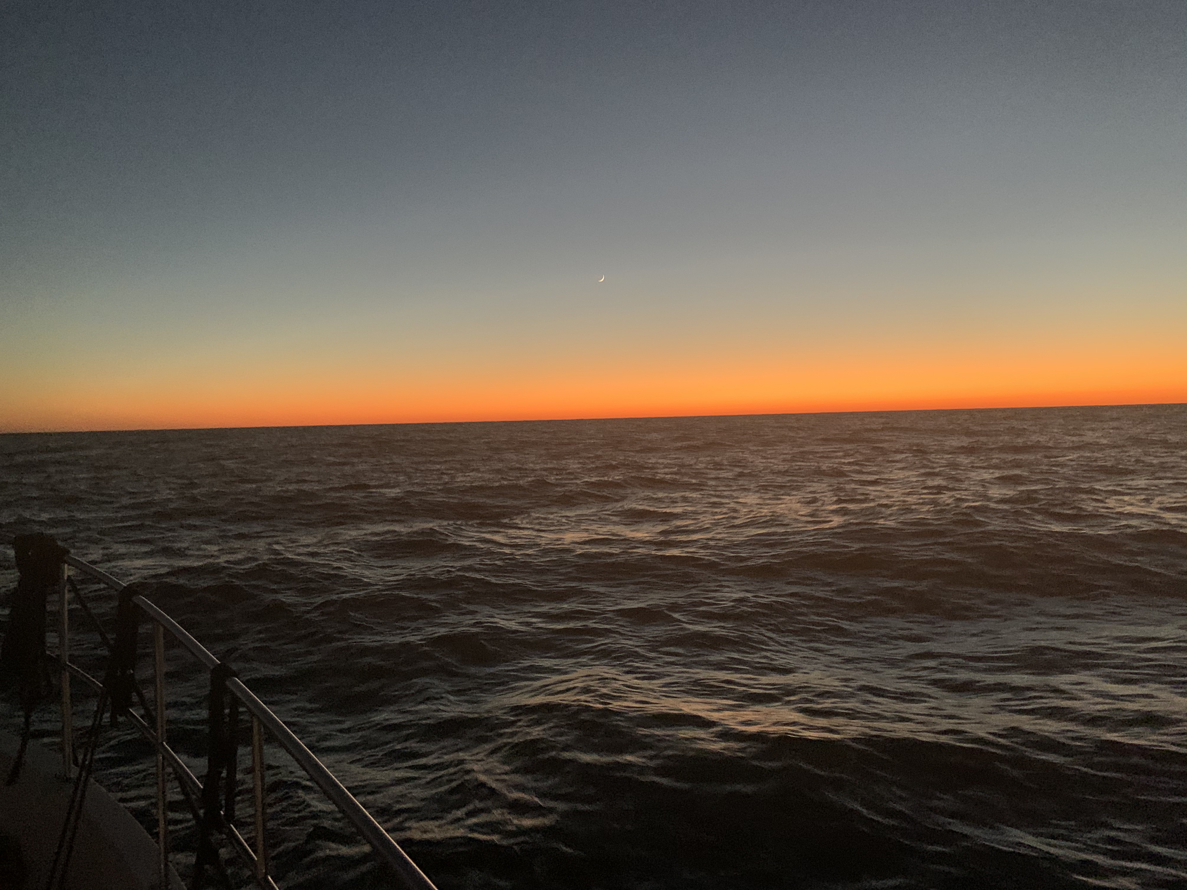

As the sun sets… the burning sky gives way to a night sky. This is why we boat. This is an addicting drug.

The sun slides beneath the waves. A waxing crescent, hangs above the flames of a burning horizon. I’m sure I’ve seen this surreal painting. An artist’s dream or mine? In a mere hour’s time, the moon follows her partner beneath that distant horizon. The boat surges forward with each wave, piercing the black velvet bedsheet stretched before her. The blackness offers up a gift. The stars are the only things left around. This far out to sea, the glow from land is all but snuffed out. The moment is now. I douse all the lights aboard and run to the bow. My bare feet upon the cold salty deck. The diesel’s growl is but a whisper to the parting ocean that crashes to both sides of me. The deck pitches, yaws and rolls and I am forced to a seated position. Forward facing into a brisk invisible wind. I lay prone. Above me the stars fixed in their galactic positions sway to and fro. It’s an undeniable existential moment. Your presence in this universe comes rushing into your headspace. Why am I here? I am here! I am certain my presence is to be the mirror mother universe uses to gaze upon herself.
CaptMahty
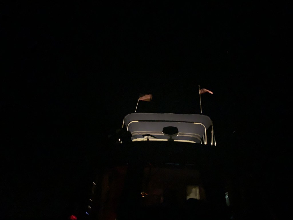
At night when I’m underway laying on the bow my steaming light illuminates the American flags I fly on my VHF antennas.

Sometimes If I want to be seen, I turn on my flybridge lights to better illuminate for passing ships.
As I look down at my iPhone’s moon app. I notice that as the boat is rocking the app developers have coded the moon app’s background to move with the iPhone’s accelerometer. The apps stars appear to sway like the ones above my head.
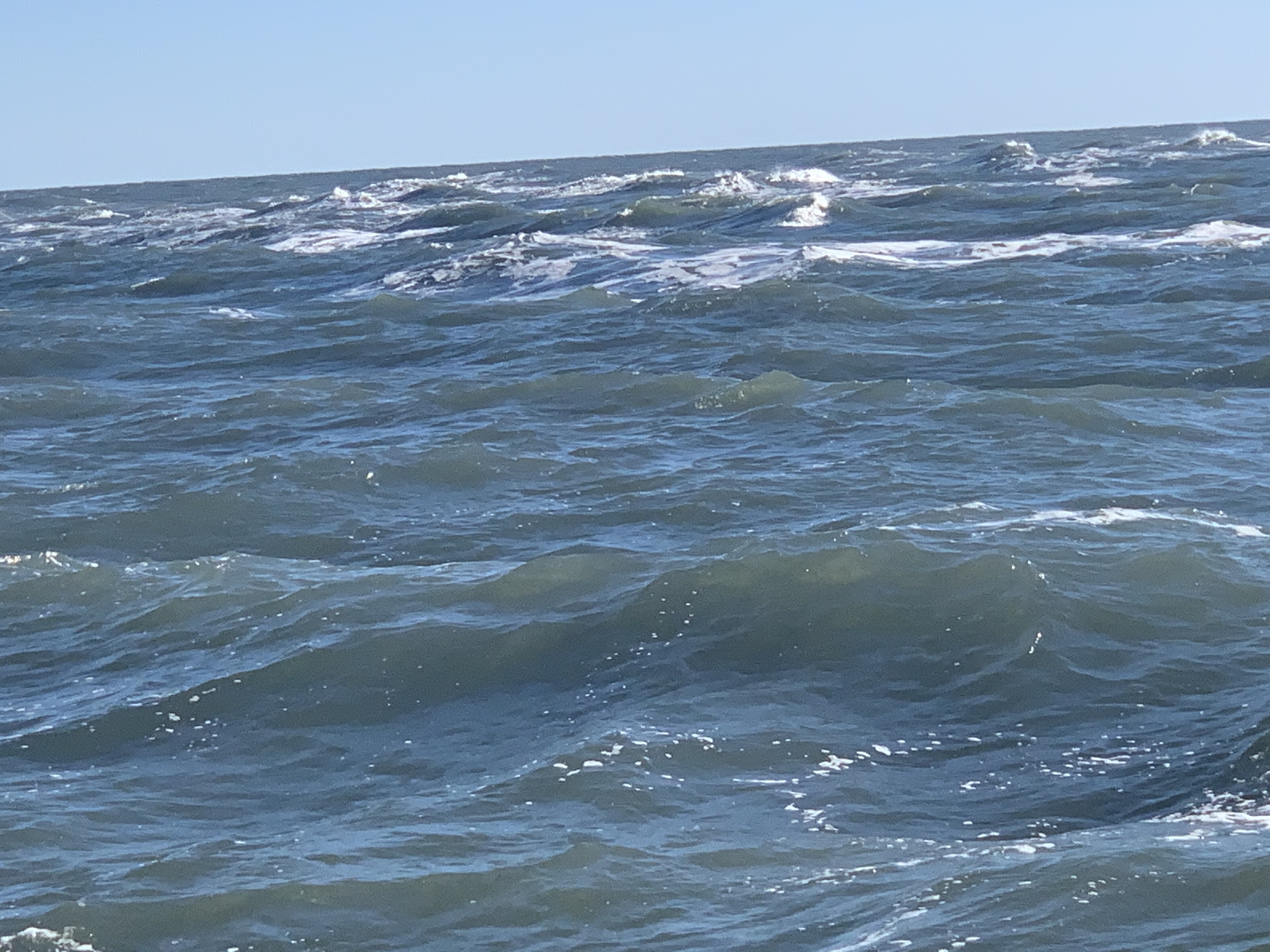
The night was long and dark. The 5’ following sea could occasionally be seen as its white froth breaks and roars past the front of the boat. I cannot keep pace with the following sea so each wave lifts the boat’s stern and eventually I slide down the face of the wave as it slips past me.
When Sunrise comes my weariness subsides and I feel a second-wind.

Friends are here.
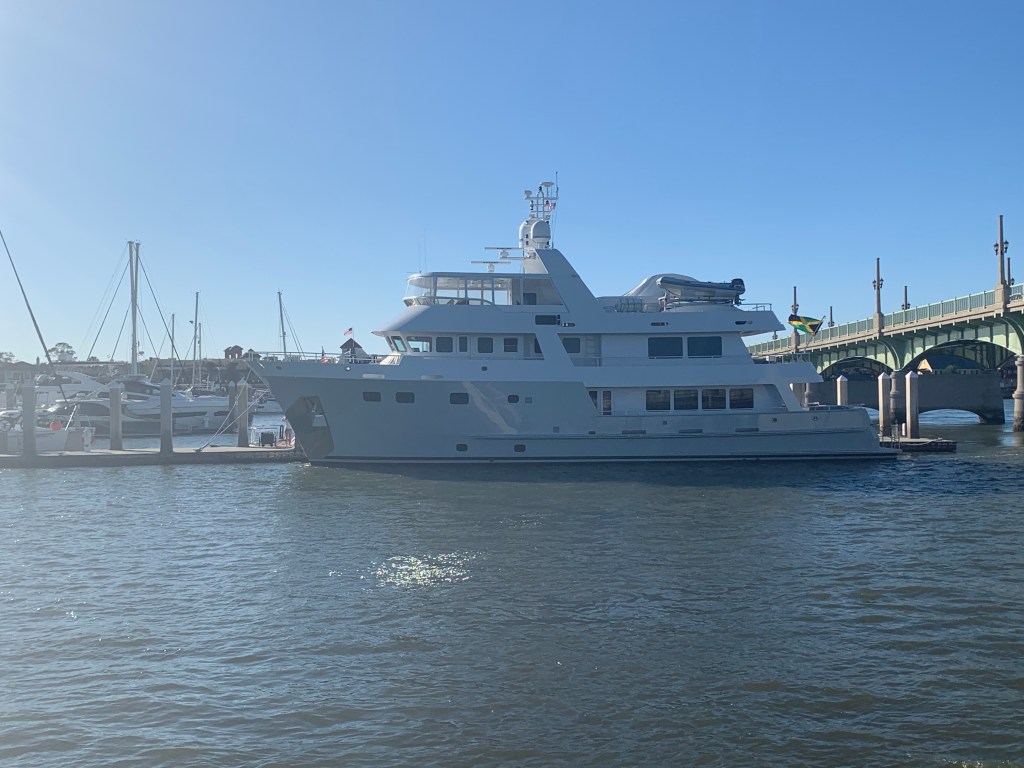
Now 3PM, I’m making my way into St. Augustine Inlet. Hurricane Dorian wiped out all the inlet markers so there are no buoys found marking the channel. No worries though as with the incoming waves it’s not hard to spot where the shoals are.

As I make my way in the inlet a beautiful Palm Beach motor yacht passes me.
Once inside the jetty walls I find a sailboat peacefully making way.

I have been told that St. Augustine is a favorite by many a cruiser. Seems every time I arrive here I’m in a hurry to be someplace else. This time is no different. As I pass St. Augustine’s City Marina I view this beautiful yacht resting against the outer dock.
The Sun is getting low as I make my way south of St. Augustine, FL.
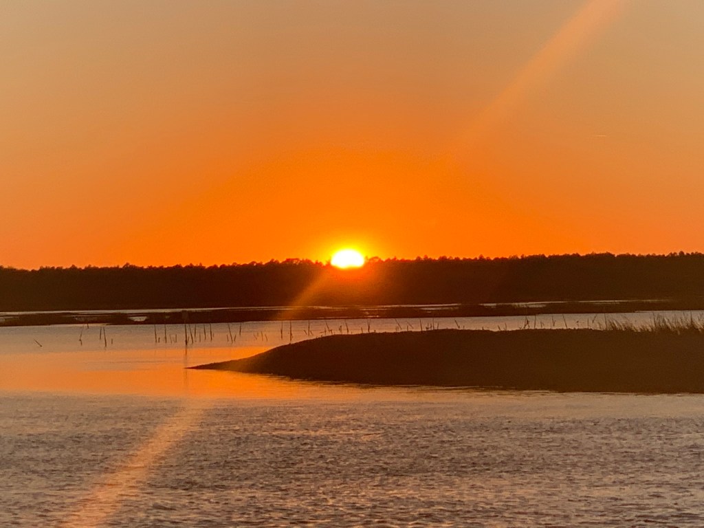
My anchorage for the night is Matanzas as it puts me close to where I want to be around noon tomorrow.
Now with the anchor down I can finally relax and close my eyes.

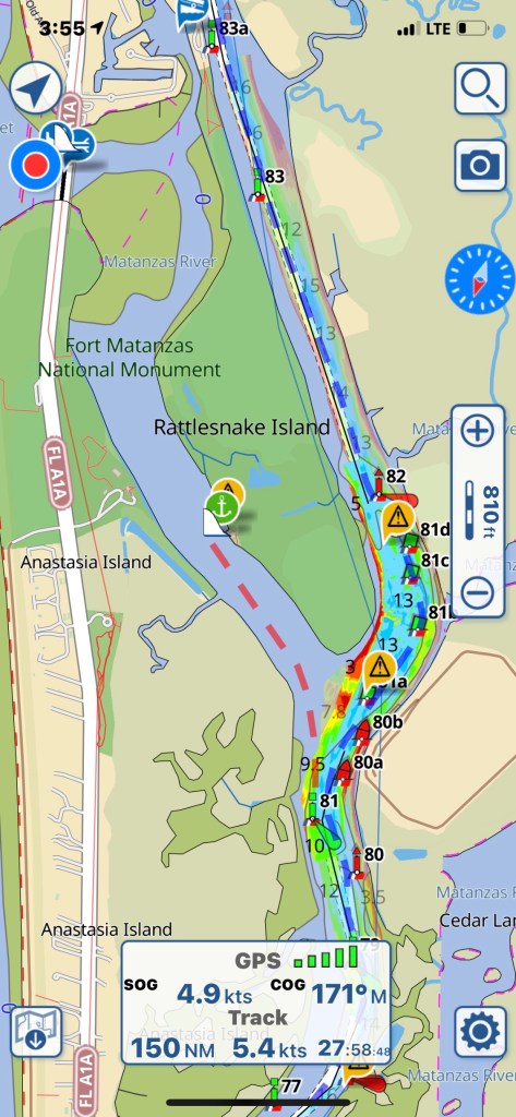
Today’s W04L013 route looked like this.


You must be logged in to post a comment.