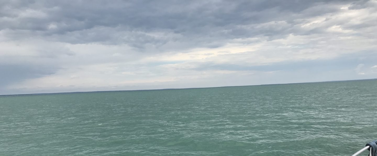
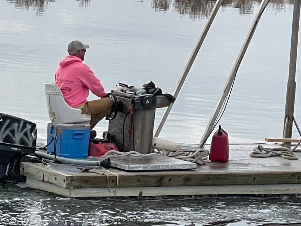
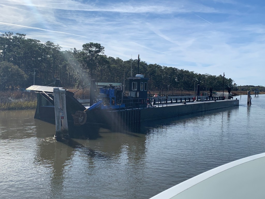
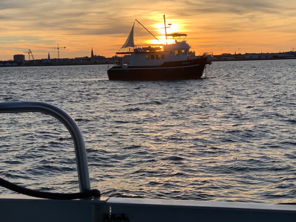
We were on our way to Southport, NC to see our friends Jim & Wende. We had to slow down to no wake speed to keep from swamping this fella who was motoring a small work barge down the ICW.
Cooler Seat Captain
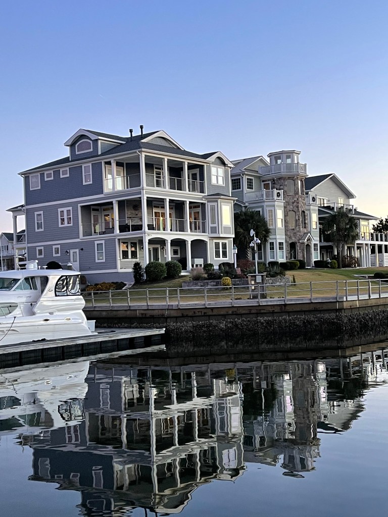
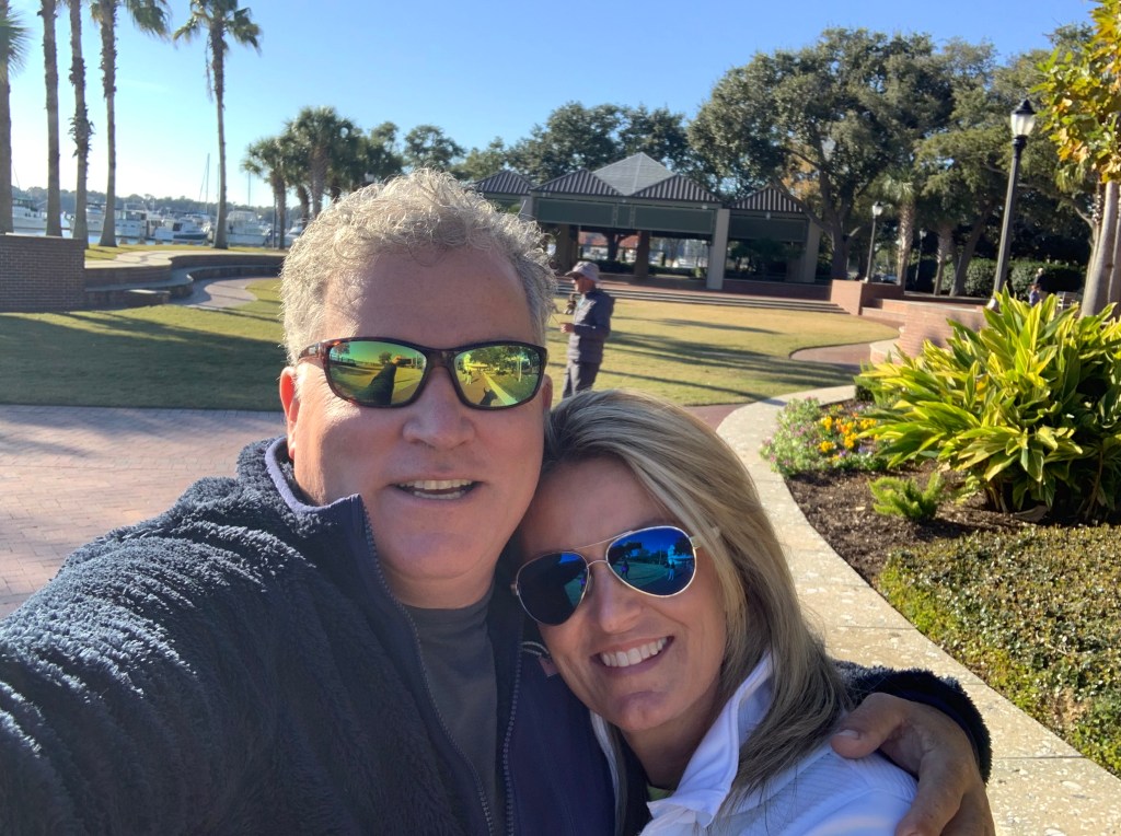
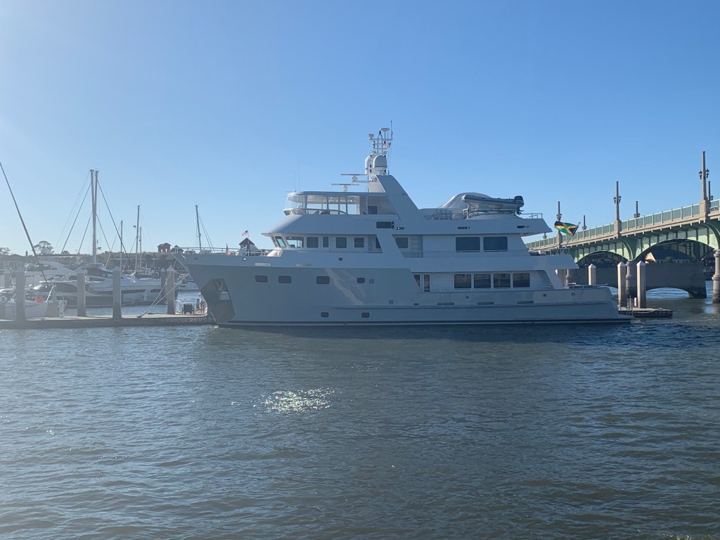
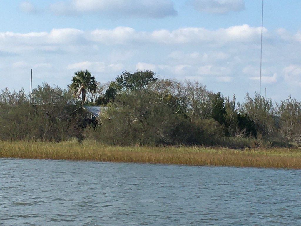
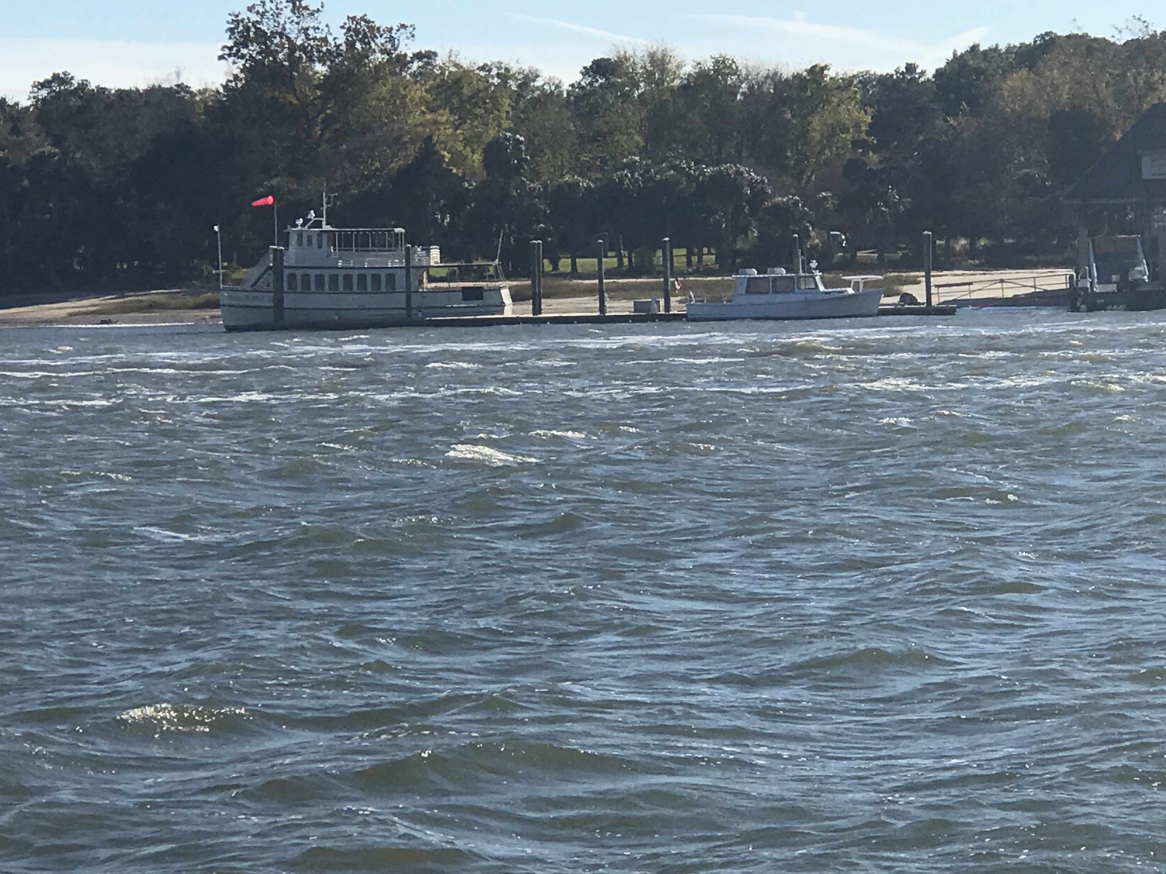
We arrived at St. James Plantation Marina just before sundown. The homes along the harbor are beautiful.
St. James Plantation Marina
The Big 😀
Jim and Wende let us use their truck to reprovision which was perfect as it was the day before Thanksgiving and we needed TURKEY!
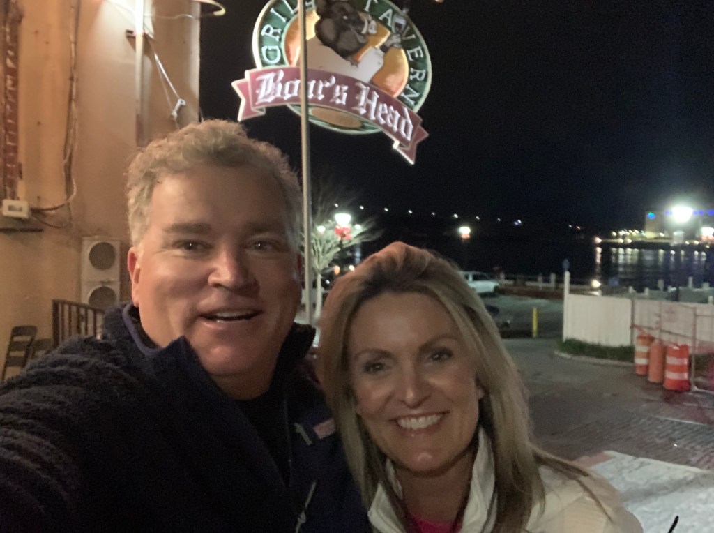
Later that night Jim & Wende took us to dinner at a Joseph’s Italian Bistro @ Safe Harbor Marina. We had dinner with some good local IPAs & lots of laughs. I wish we had taken a photo but I think we were just having too much fun. Jim and Wende told us all about their trip back from Buzzards Bay, MA to Southport, NC in their new Pursuit OS 355. The weather was a bit ruff off the RI coast but they made great time with stops in places like Atlantic City.
Capt Jim & Wende
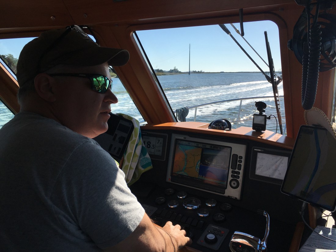
In the AM we were off and Capt T was at the helm.
Capt T @Helm
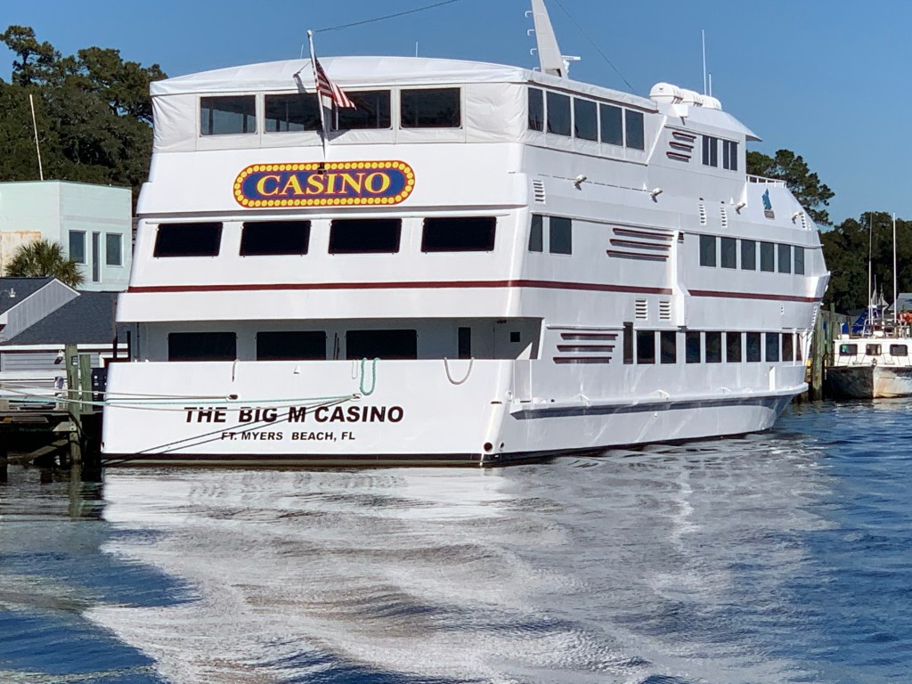
We passed a boat dock that was more boat than dock. Capt T thought she recognized a casino boat as we passed and sure enough the “Big M” hailed from Fort Myers, FL.
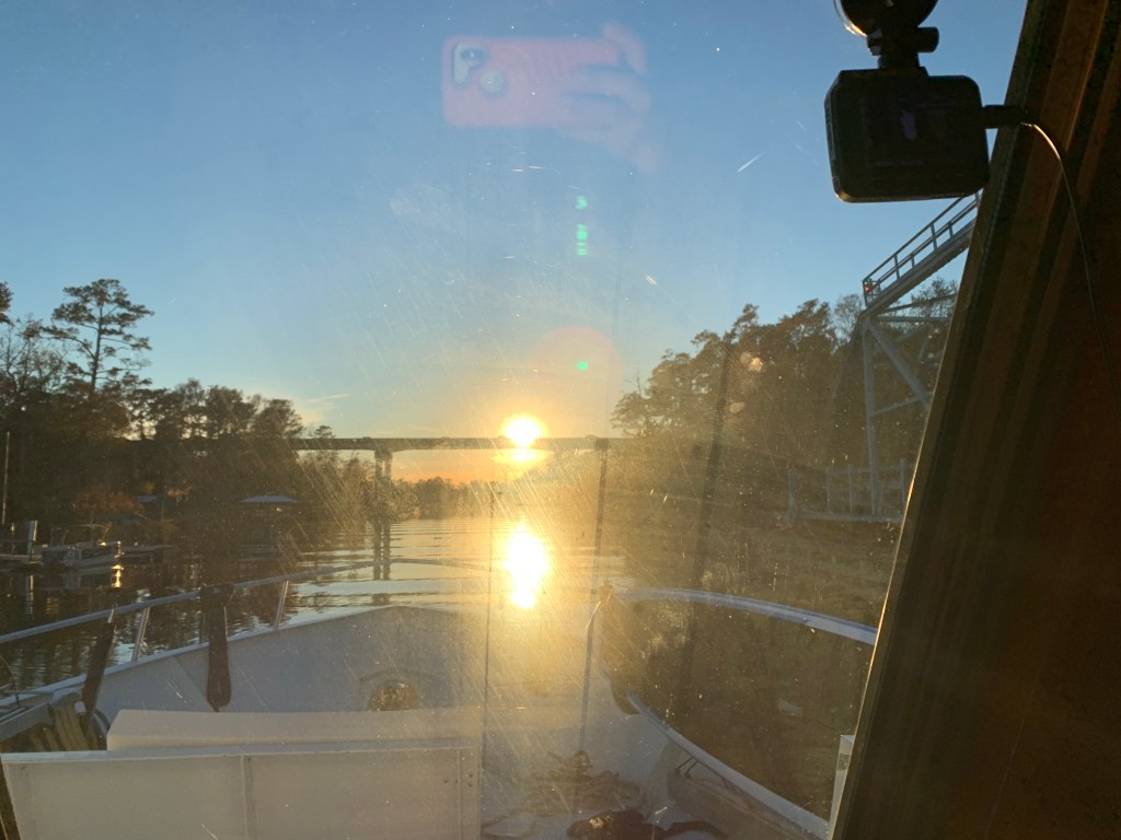
As we made our way into the Waccamaw River preserve we had to get through the Socastee swing bridge but we were staring straight into the sun. The best we could do was go slow and use the radar to see in front of the boat.
Camera may see the swing bridge on the right but we only saw a bright spot looking out the pilothouse
We anchored in what I call the Waccamaw River (ie. swamp) and it’s beautiful. We had a great night on anchor as the high trees provide protection from everything but the cold.
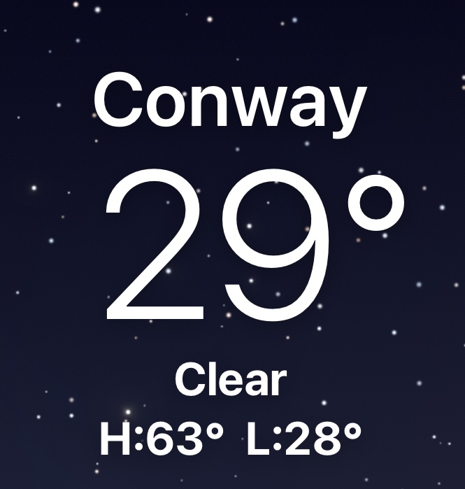
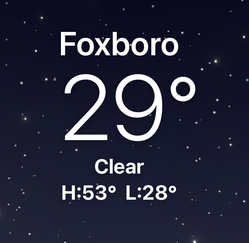
It was COLD.
Cape Coral, FLConway, SCFoxboro, MaWarwick, RIHere in Conway, SC it’s the same freezing temp as back home in Foxboro, MA
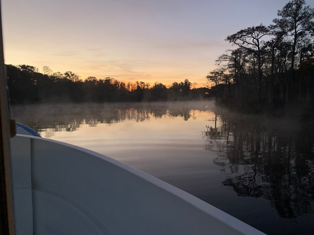
We weighed anchor at first light and the swamp was steaming due to early morning low temps.
Waccamaw River pre-dawn
We had to slow to no wake so as to not disturb this Nordhavn anchored right off the main ICW route.
Peaceful Anchorage
The next swing bridge is actually a floating swing bridge. Very cool. It simply uses drop-able drive-on ramps and a huge tilt-able bow thruster.
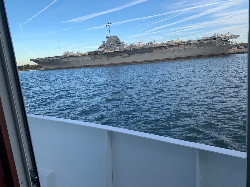
We arrived in Charleston, SC and the marina we requested a slip from had us “wait-listed”. We anchored for the night next to the USS Yorktown.
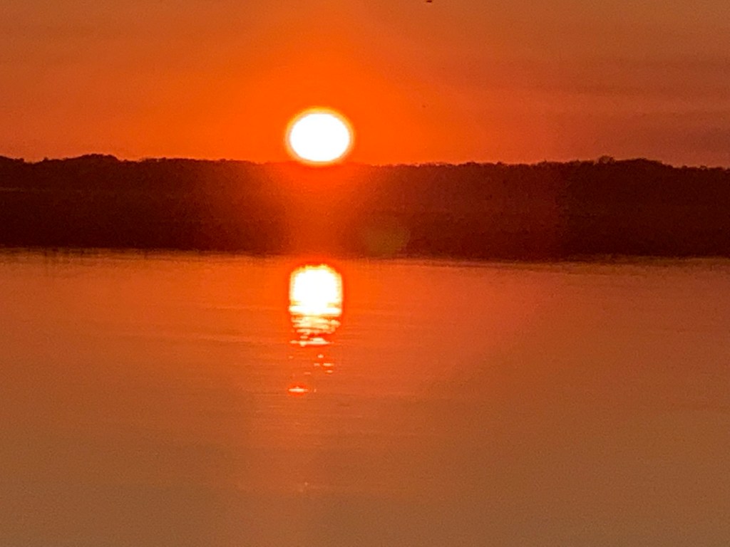
The sun was setting on Charleston.
Sunrise in the AM and we were off… bound for Beaufort, SC
Sunrise in Charleston, SC
We anchored in Beaufort with hopes of getting off the waitlist for the marina. In the AM we called and they found a spot for us on the outer face dock.
Docked at Safe Harbor Beaufort, SC
Beaufort is a fun town and we wasted no time getting ashore at Plums Restaurant for some lunch.
Plums in Beaufort, SC
We napped after lunch and made a second run on the town before we would leave in the AM. Beaufort has a great outside park area right in front of the marina.
Beaufort ParkSwings along the Water
In the morning we were off to Savannah, GA. Last time I docked right in downtown around River Street but felt it a bit seedy at night. We decided to stay at Thunderbolt Marina and Uber’d into town for a Savannah pub crawl.
Are impromptu pub crawl consisted of the following venues:
Spanky’s
Boar’s Head Grill
The Cotton Exchange
Huey’s
The Warehouse Bar
We ended the night singing Journey.
Up early to a Whiskey Sunrise & potato pancakes and off to Fernandina Beach, FL
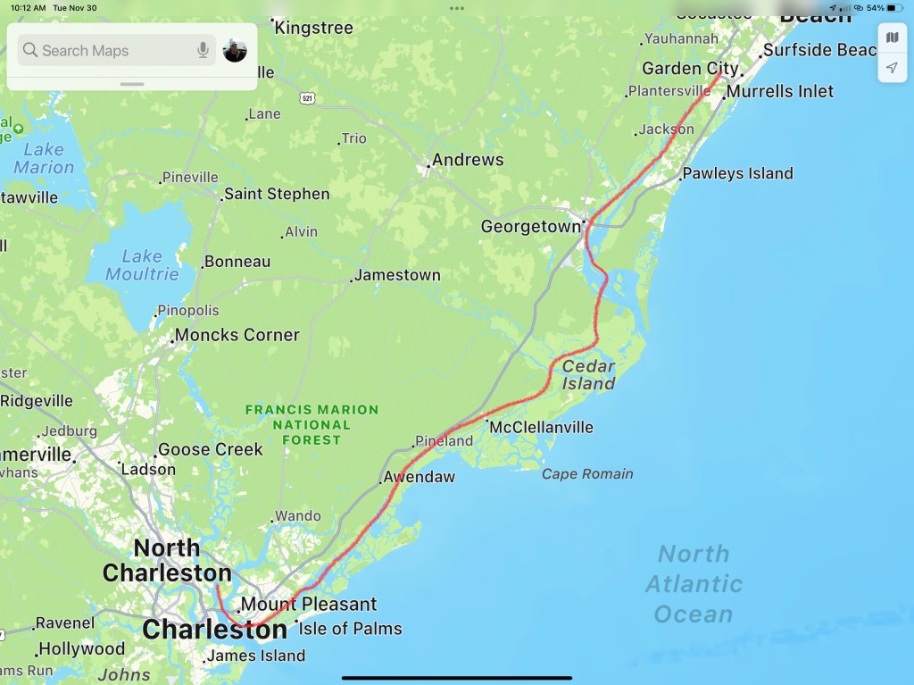
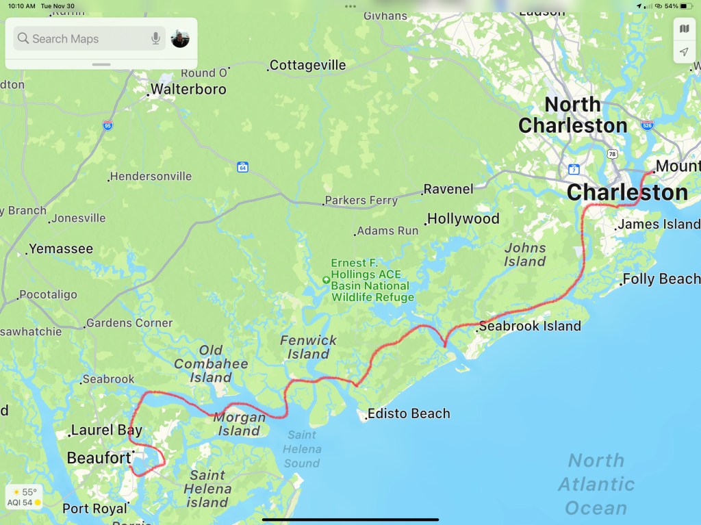
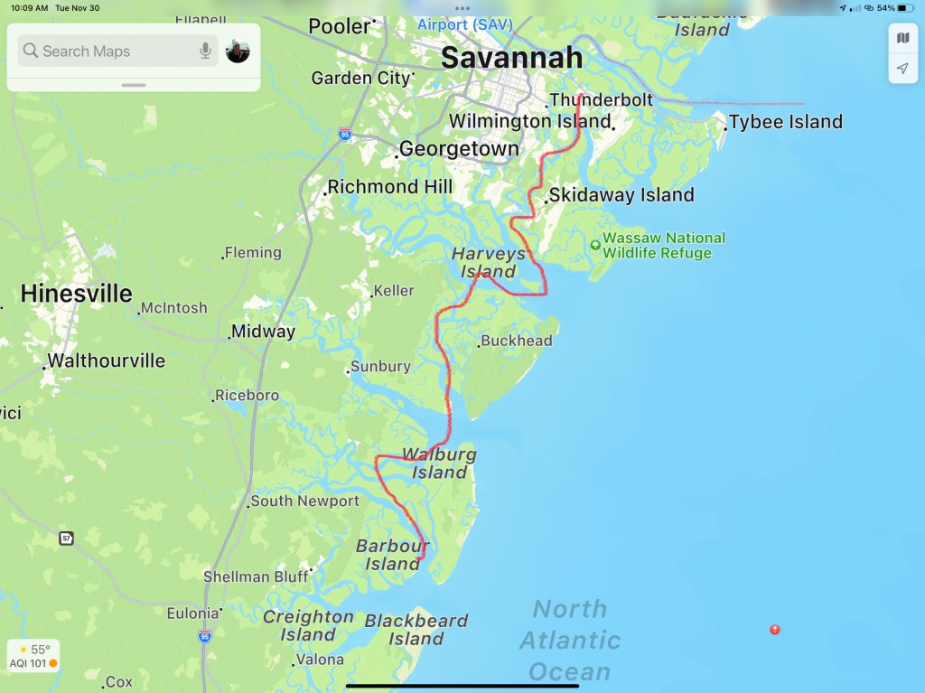
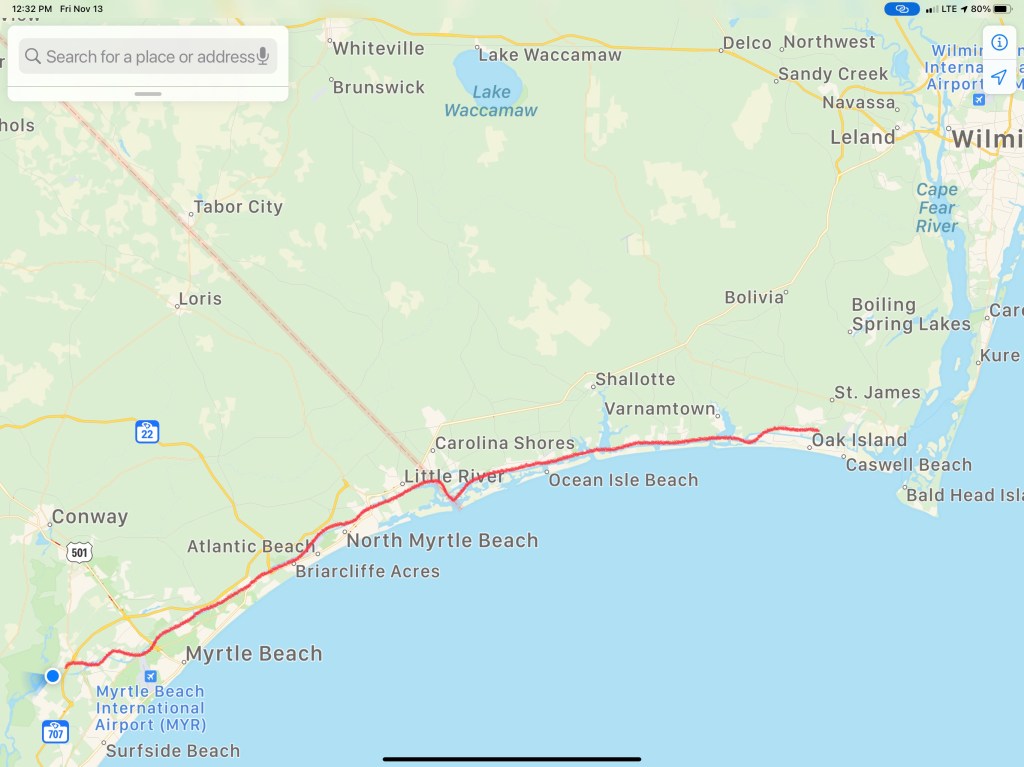
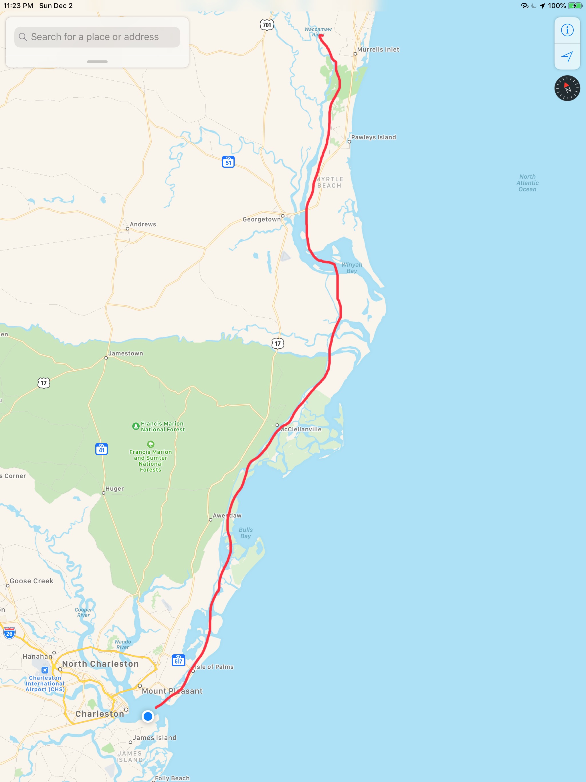
This post consists of 5 legs of our journey
Leg 15 – Waccamaw River, SC to Charleston, SCLeg 16 – Charleston, SC to Beaufort, SCLeg 17 – Beaufort, SC to Thunderbolt Marina, GALeg 18 – Thunderbolt Marina to St. Catherine’s Island, GALeg 19 – St. Catherine’s Island, GA to Ferdandina Beach, FL
We hope everyone had a great Thanksgiving with family!!!
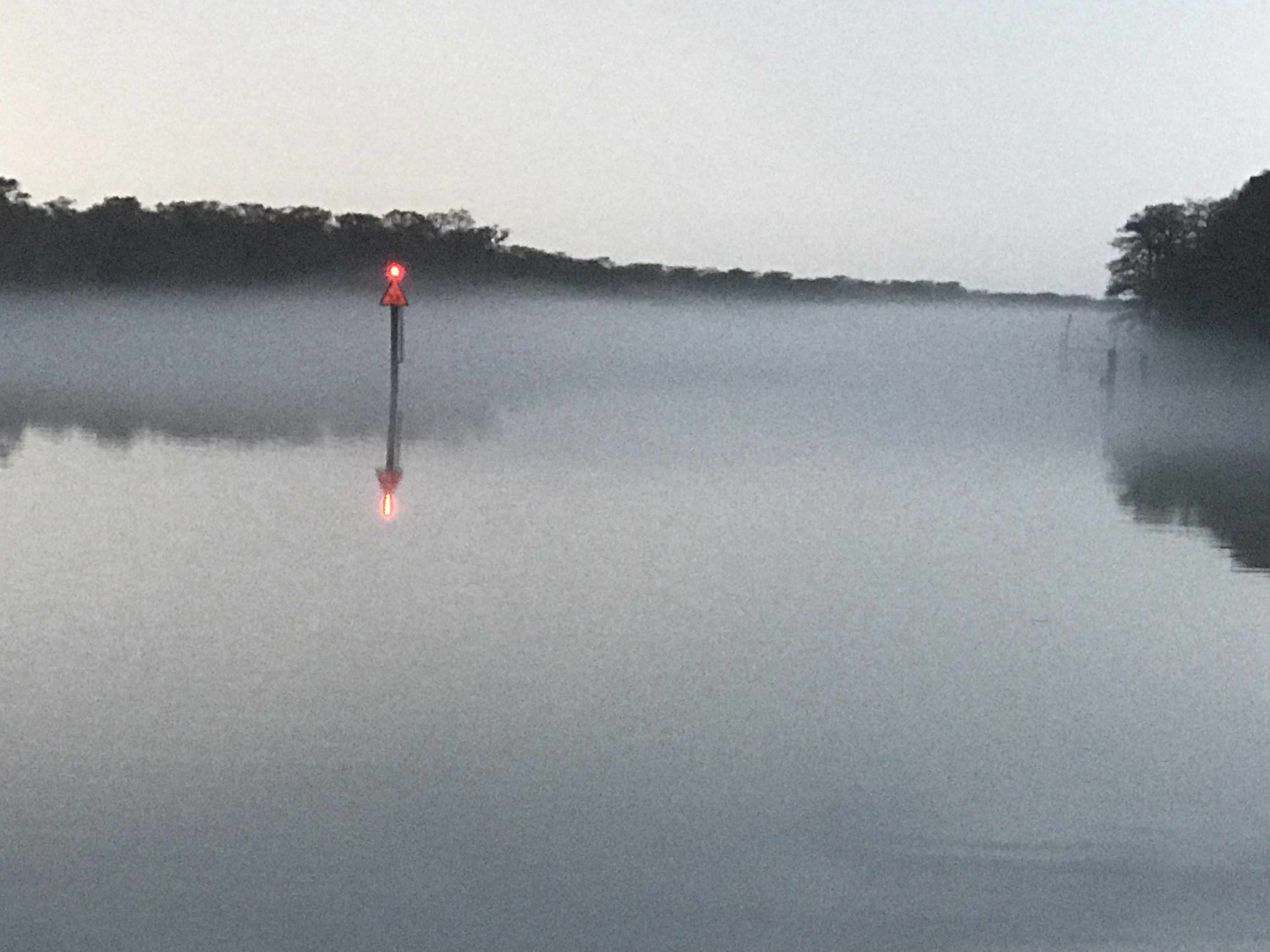
4AM and my iPhone alarm is buzzing. I need to weigh anchor and get underway before the 4:38AM start of the Winyah Bay inlet’s flood current. Somehow I lose track of time and don’t get underway till 5AM.
Flood Current in Winyah Bay Inlet
First light won’t occur until 6:24AM.
First Light is 6:24AM
I weave my way through the other anchored boats quietly without shining my spotlight directly on them. It’s dark but the radar and spotlight are helping me find the daymarks and buoys that line the channel out the inlet and into the Atlantic.
Now at 6:05, 19 minutes before first light, if I look to the east, I can differentiate sky from the sea.
Darkness is lifting
Moments later and First Light has arrived.
First Light on the Atlantic
Now it’s 7AM and at the sun is looking like a giant lightbulb on the eastern horizon.
Giant glowing lightbulb
Friends have found me.
I am amazed that they appear to glide without tail movements for quite some time
As the day goes on the following sea can be felt. As I walk through the salon I can hear the rhythmic sound of my wine glasses rocking back and forth in their upside down holder.
Wine Glasses making squeaking sounds
I open the back door to get a better look at the following sea.
Following Sea is catching me
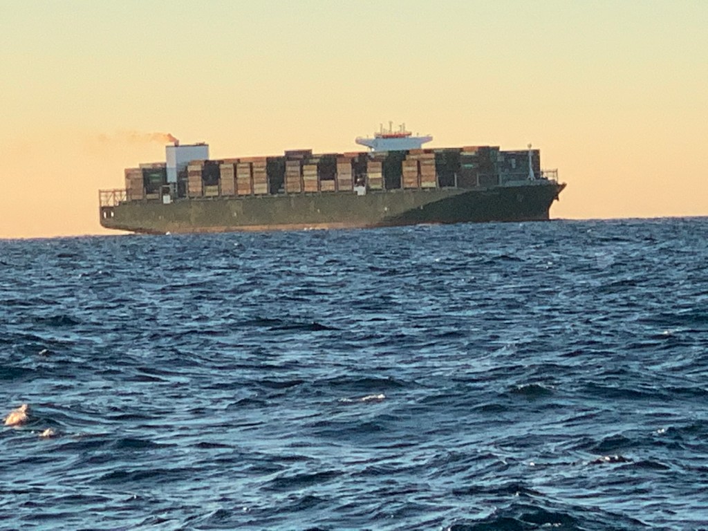
I spot my first ship around 2PM.
First ship spotted
It’s cargo vessel Triton and it will pass less than a mile from me with our current course and speeds.
1211′ long and moving at 20.2kts
Though I will not pass any other recreational traffic this far out I do come upon a second, equally as massive container ship on a crossing path.
Container Ship crossing my path
I decide to spend some time on the bow and video as I go
20NM East of Charleston, SC
The sun has begun to set.
Sunset on the Atlantic
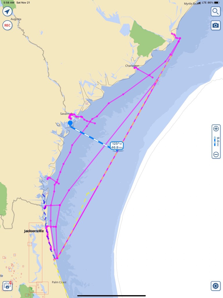
I settle in for the long night. When I go offshore as opposed to running in the ICW or “The Ditch” as it is called, there isn’t much to do. I plan my route and set my course and speed. The autopilot is engaged so no need to hold the helm. I do however need to maintain a constant watch for buoys or passing ships. My chosen route is a rhumb line between Winyah Bay Inlet and St. Augustine Inlet. Rhumb lines are courses navigators use to make it easy on themselves. A rhumb line only requires the captain to steer a constant magnetic bearing. I can hear the geometry nerds shouting… “The shortest route on the surface of a sphere is actually the arc of a great circle!”. On mercator projection charts a rhumb line is a straight line. My rhumb line route takes me about 45NM offshore.
Shoreline Route is the closest, St. Mary’s Inlet route middle and St. Augustine Route is the furthest offshore. Bailout routes in the inlets have been platted as well
Explained another way… If you stare at the picture of “globe Earth” below, keep this in mind. The longitudinal lines come together at the North Pole. If you are sailing either of the two routes drawn below, your compass needle’s would align to the longitude lines. The “rhumb line” route you steer a constant heading according to the compass while the shorter “great circle” route has you starting out at one compass heading and constantly steering more east as you go from left to right.
I don’t anticipate seeing many ships or buoys this far out. My watch duties are reduced to:
Scanning the horizon
Checking radar
Checking my boats position to my route every three minutes or so.
Note: you can see I zoomed way in and make small adjustments to the autopilot to stay close to my route line.
With minimal watch required it’s time to watch movies while at the helm. I preload media onto my iPads so when a cell signal is nowhere to be found… I still have entertainment.
Red Alert!
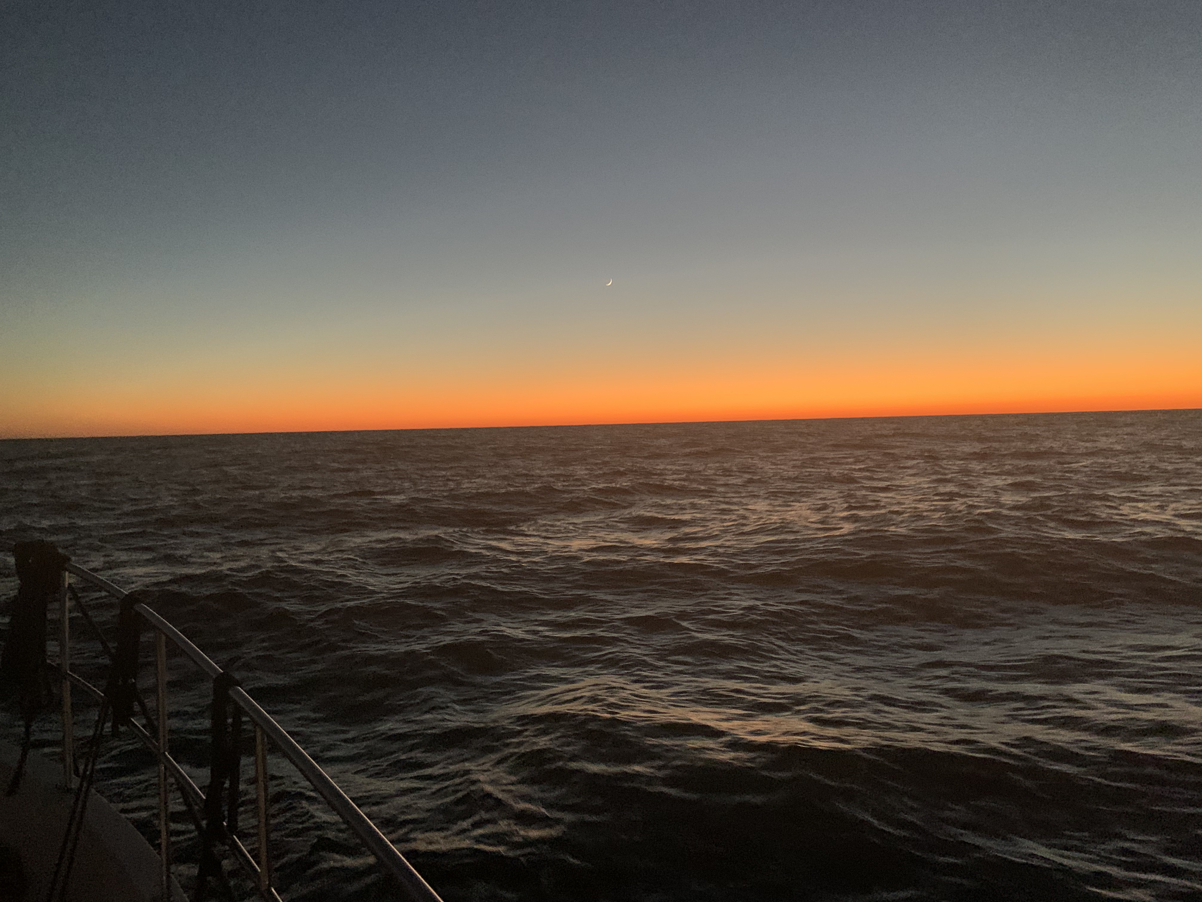
Tonight’s Sunset is a burning sky.
As the sun sets… the burning sky gives way to a night sky. This is why we boat. This is an addicting drug.
Crescent moon hangs over a horizon of fire
The sun slides beneath the waves. A waxing crescent, hangs above the flames of a burning horizon. I’m sure I’ve seen this surreal painting. An artist’s dream or mine? In a mere hour’s time, the moon follows her partner beneath that distant horizon. The boat surges forward with each wave, piercing the black velvet bedsheet stretched before her. The blackness offers up a gift. The stars are the only things left around. This far out to sea, the glow from land is all but snuffed out. The moment is now. I douse all the lights aboard and run to the bow. My bare feet upon the cold salty deck. The diesel’s growl is but a whisper to the parting ocean that crashes to both sides of me. The deck pitches, yaws and rolls and I am forced to a seated position. Forward facing into a brisk invisible wind. I lay prone. Above me the stars fixed in their galactic positions sway to and fro. It’s an undeniable existential moment. Your presence in this universe comes rushing into your headspace. Why am I here? I am here! I am certain my presence is to be the mirror mother universe uses to gaze upon herself.
CaptMahty
At night when I’m underway laying on the bow my steaming light illuminates the American flags I fly on my VHF antennas.
Steaming light on the American flags
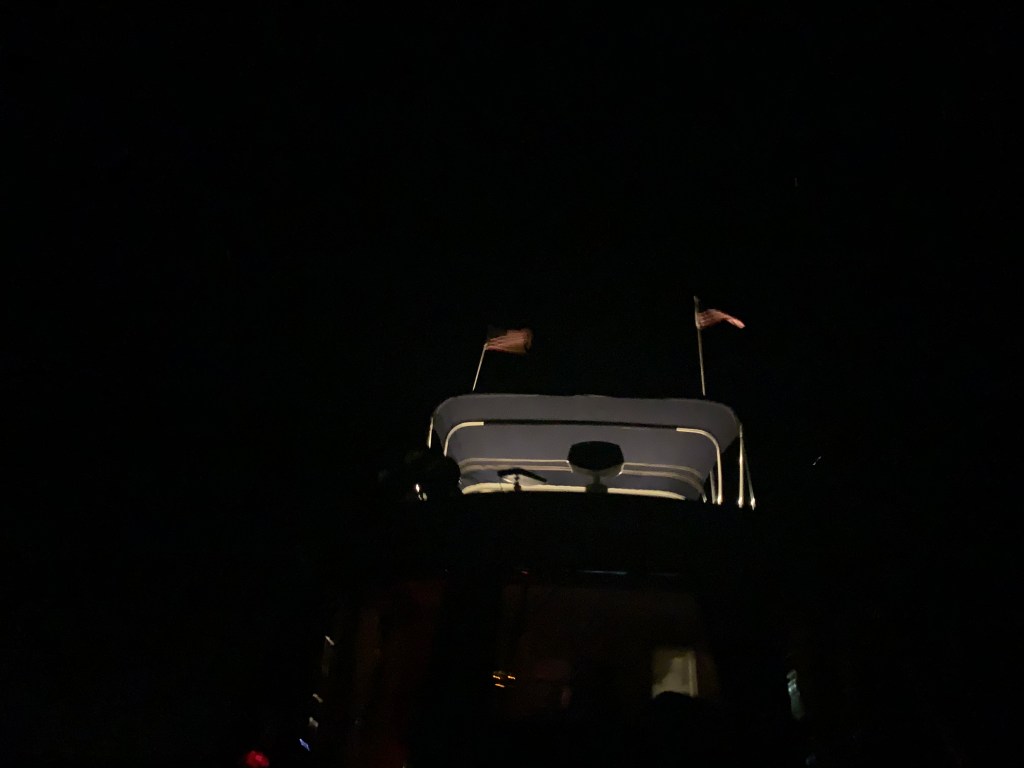
Sometimes If I want to be seen, I turn on my flybridge lights to better illuminate for passing ships.
Flydeck lights on
As I look down at my iPhone’s moon app. I notice that as the boat is rocking the app developers have coded the moon app’s background to move with the iPhone’s accelerometer. The apps stars appear to sway like the ones above my head.
iPhone Accelerometer
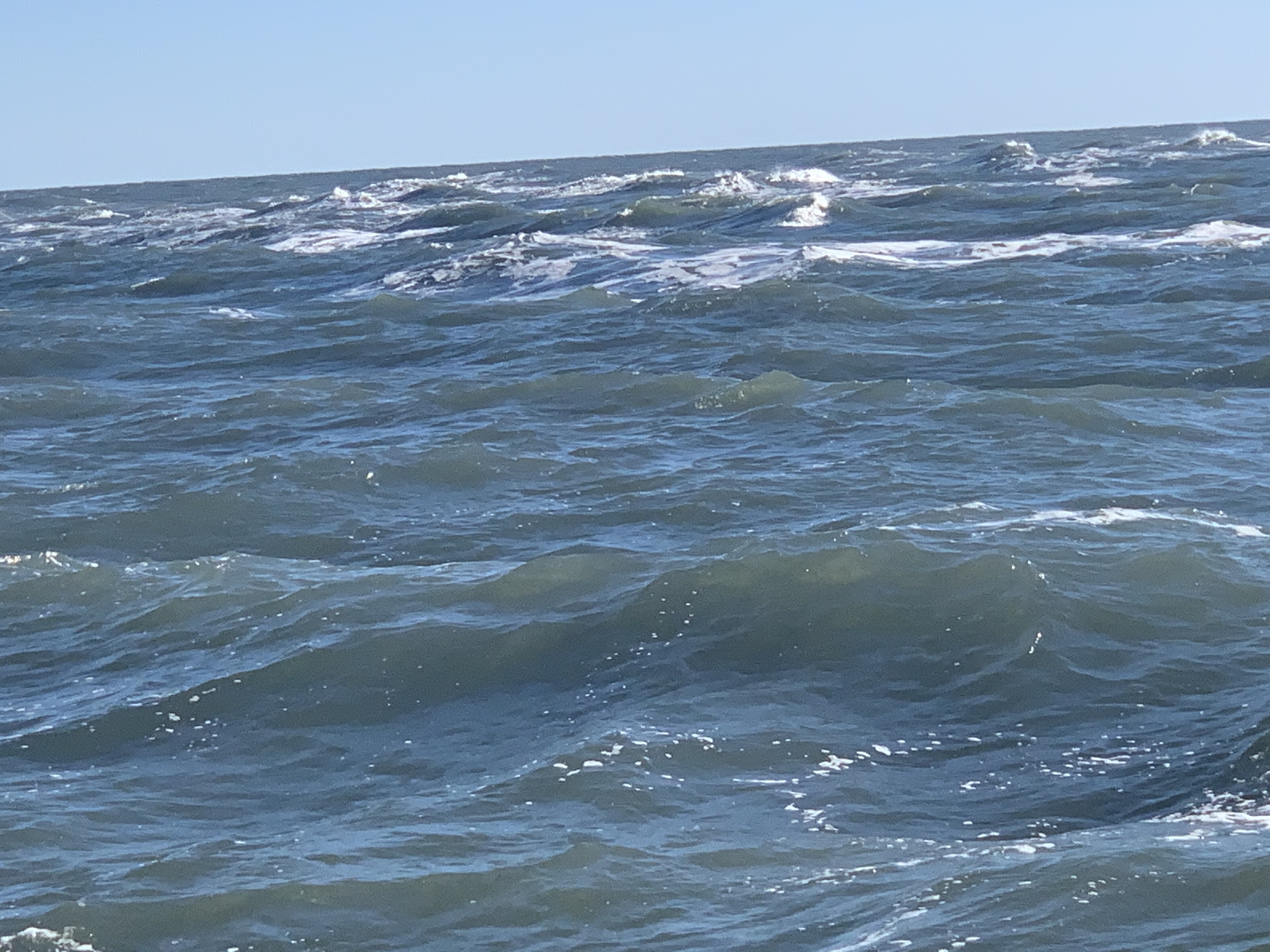
The night was long and dark. The 5’ following sea could occasionally be seen as its white froth breaks and roars past the front of the boat. I cannot keep pace with the following sea so each wave lifts the boat’s stern and eventually I slide down the face of the wave as it slips past me.
When Sunrise comes my weariness subsides and I feel a second-wind.
I welcome the arrival of the sun
Friends are here.
They glide through the water with so little effort
Now 3PM, I’m making my way into St. Augustine Inlet. Hurricane Dorian wiped out all the inlet markers so there are no buoys found marking the channel. No worries though as with the incoming waves it’s not hard to spot where the shoals are.
Shoals on the South side of the STA Inlet entrance
As I make my way in the inlet a beautiful Palm Beach motor yacht passes me.
STA Inlet Palm Beach yacht
Once inside the jetty walls I find a sailboat peacefully making way.
Peaceful
I have been told that St. Augustine is a favorite by many a cruiser. Seems every time I arrive here I’m in a hurry to be someplace else. This time is no different. As I pass St. Augustine’s City Marina I view this beautiful yacht resting against the outer dock.
I wonder what the make of this beautiful yacht is?
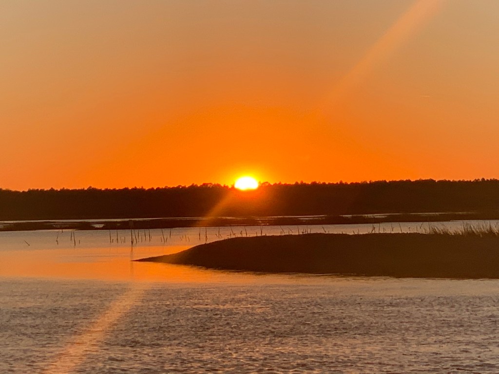
The Sun is getting low as I make my way south of St. Augustine, FL.
Sun is setting.. better find a place to anchor
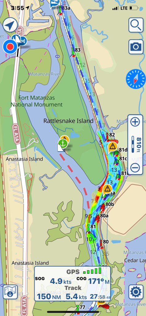
My anchorage for the night is Matanzas as it puts me close to where I want to be around noon tomorrow.
Anchorage off Rattlesnake Island
Now with the anchor down I can finally relax and close my eyes.
I can finally stop driving the boat and close my eyes
Before leaving Osprey Marina I figured I ought to get some Simple Life maintenance done.
I pulled back the rug and removed the teak & holly access panel to expose my Cummins 5.9L QSB diesel. You can see the hose dropped down into the engine room so that I can clean the bilge.
Teak & Holly floor covered since new with carpet and pad
Sitting in the engine room doing maintenance was hot so I decided that I would use up any non-IPA beers in the bottom of my fridge.
Those are work Pajamas
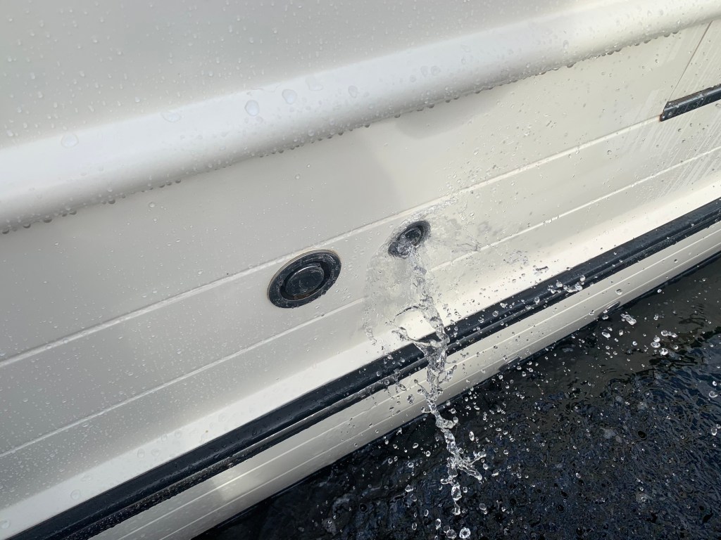
Simple Life carries 340 gallons of potable water. Depending on use, that should last a month but might as well fill the tanks while I’m at the dock. When I fill my water tanks I like to use a portable water filter from Home Depot. I also overfill the tanks so that water is pushed out the breather tube. Any tank that you fill must have a breather to allow the air being replaced to escape and on boats that tube exits on the outside of the boat high enough so that when the boat heals over you don’t have seawater intrusion. Little flying things can attempt to enter the breathers so flushing them with each fill is a good idea even though multiple filters catch anything in the tanks.
Flush out your water tank breather lines
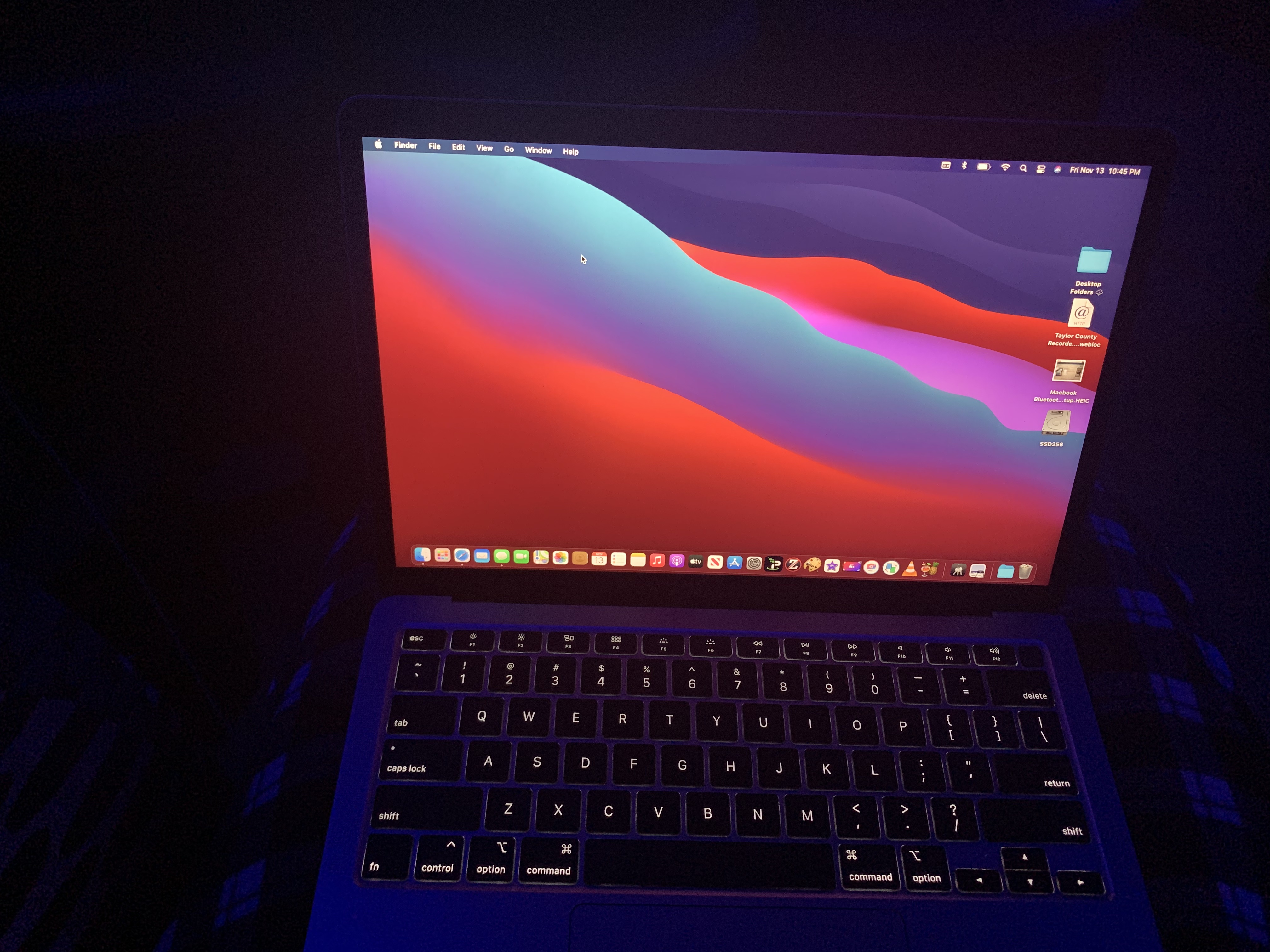
Along with boat maintenance I was upgrading my MacBook Air to Big Sur. If you are a Apple Mac fan you know Apple just announced their new line of Macs that run on their new Apple silicon processors. This is big news for apple and will align their Mac computers with iPhone and iPad which already run Apple silicon. Why is this important? Well for starters iPhone and iPad apps which were written to run on Apple silicon can now be run on Mac computers to make Mac users like me happy that we can use similar apps across the three different platforms.
Before taking off I sat down to plot my next leg of the trip. I generally plan for 50NM each day. That is a very conservative estimate as I often run 80NM / day or more.
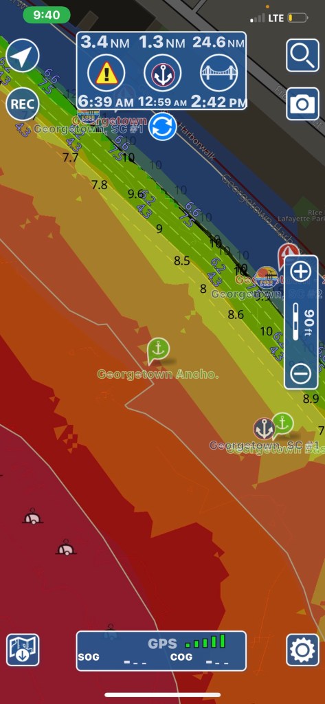
I decide to anchor in Georgetown, SC. I have always wanted to visit Georgetown. A quick check of the harbor shows several anchorages in very shallow water.
Red is a no-go and I stay out of orange areas if I can help it.
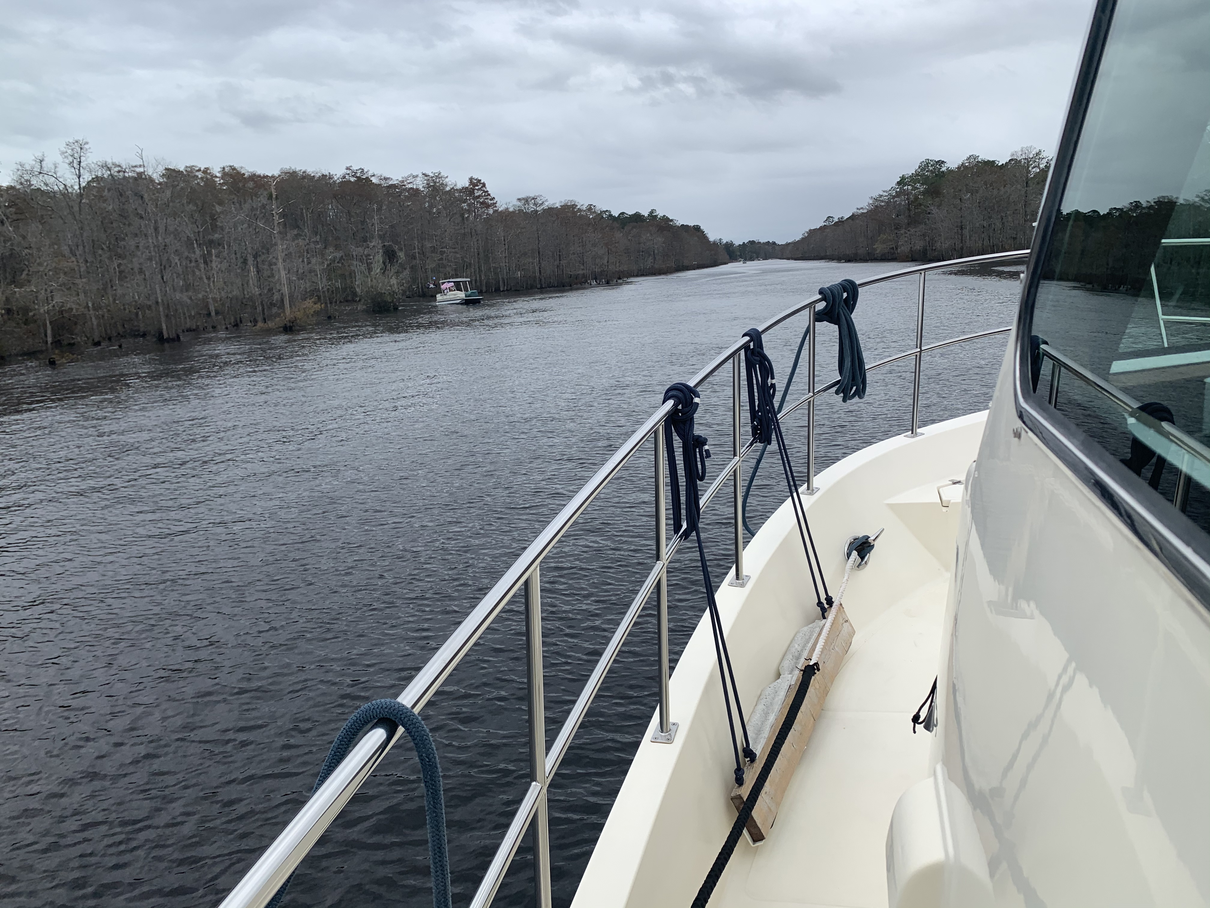
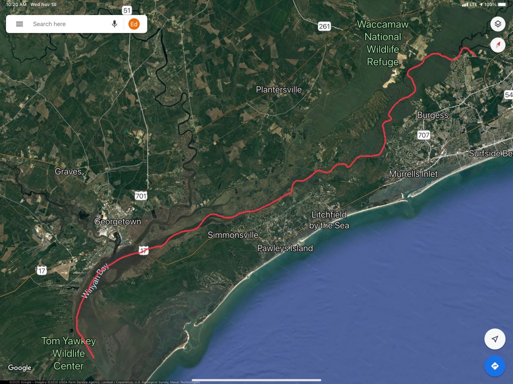
I untie my lines, jump aboard and put her in gear as I say my goodbye to Osprey Marina. Traveling south down the Waccamaw River, I pass marinas as well as people just pulling up to the banks to party.
The Waccamaw River is deep and the current (seen pushing over the no wake buoy above) is pushing me along at 7.8 knots. It’s raining but I enjoying the day in the pilothouse.
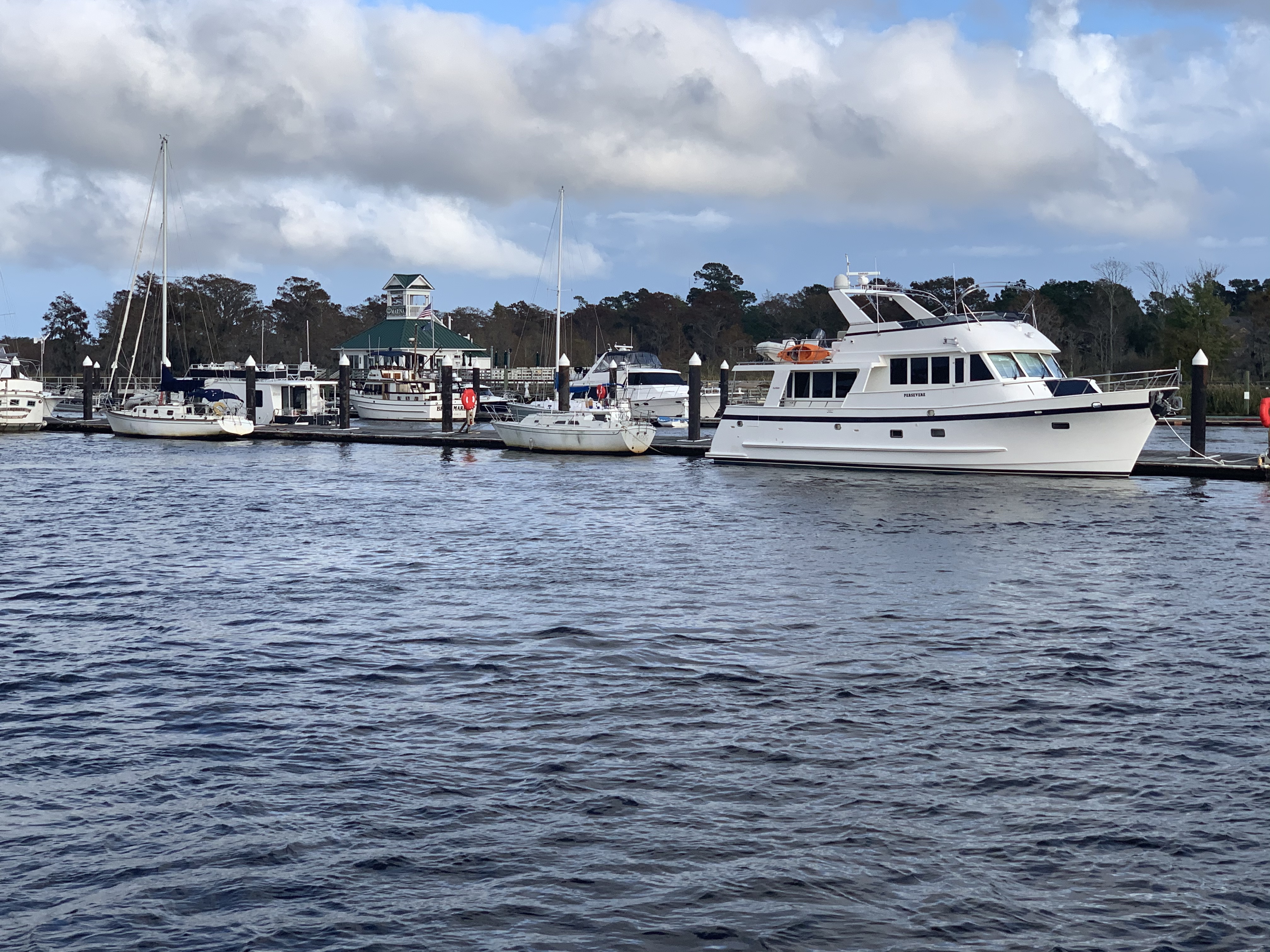
As I pass under Ocean Highway Bridge the entrance to Georgetown will be on my starboard side.
Near Georgetown, South Carolina
You can see the position of the sun in the video above and there is still more time in the day. I start thinking… Maybe I’ll push on and find an anchorage further south down the ICW?
I push on through Winyah Bay until the sun sets.
Sunset in Winyah Bay, South Carolina
I settle on an anchorage just before the ICW takes a 90 degree turn leaving Winyah Bay. The anchorage is protected by a small, low island called Middle Ground and ithas plenty of water and swing room.
Good Anchorage
This anchorage is large for the ICW and several sailboats have already dropped anchor.
Sailboats anchored off my bow
My plan was to anchor here for the night before heading on to Charleston, South Carolina. However, plans are made to be broken. I instead do a quick check of the weather offshore and decide to make a 36 hour run offshore to St. Augustine, FL. This long voyage will skip over the rest of South Carolina as well as Georgia and the very northern part of Florida. Georgia passed an anchoring law last year with draconian rules about where you can anchor. Some people just don’t like boats anchoring anywhere near their waterfront homes. Skipping Georgia has the side-effect of avoiding all their confusing anchoring laws.
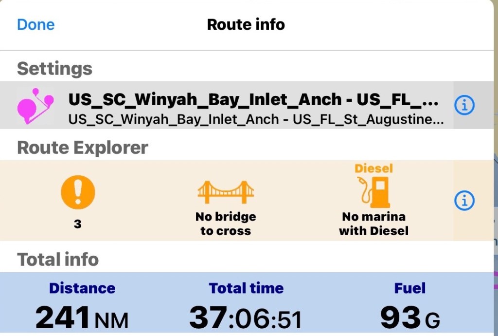
I prepare my route for the next day. I add a lay line run straight from Winyah Bay, SC to St. Augustine, FL. I notice the sea is expected to be 3-4′ waves and increasing to 5′ over time. I add a second direct route to Saint Mary’s Inlet right at the GA/FL line. If it’s nasty I’ll know it pretty quickly and I’ll divert to this shorter route. I also plot out routes going in each navigable inlet as premade bailout routes incase anything goes wrong. Doing long solo offshore runs you need to be prepared incase I injure myself underway and need to get back inland quick.
St. Mary’s Inlet route breaks off around even with Charleston, SC
The math for the St. Augustine’s run looks like this.
I do a check of the currents leaving the Winyah Bay Inlet and find that if I don’t want to fight the 7:14AM Max flood current getting out I better leave soon after the 4:38AM start to flood.
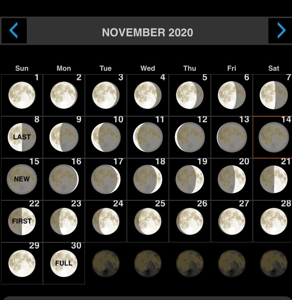
We just had a new moon tonight so navigating tomorrow morning, you won’t get any help from the moon.
I settle on a 5AM weigh anchor time and decide to navigating the inlet in the dark is better than waiting till first light and fighting the current to get out.
I’ll be out of the inlet before first light
This leg of the journey looked something like this…
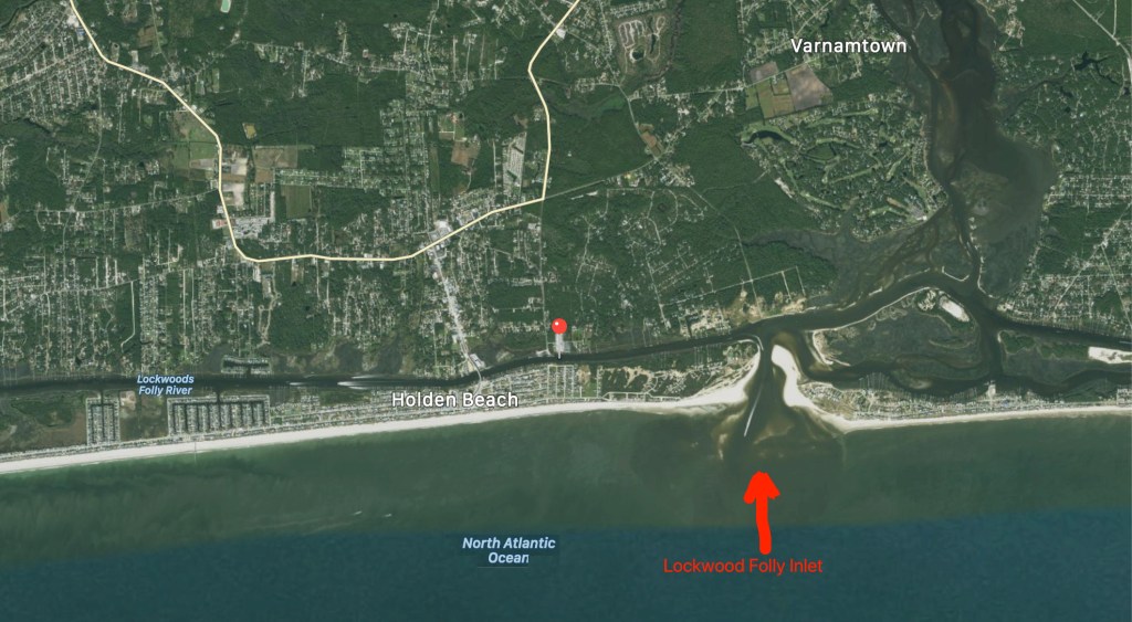
Lockwood’s Folly inlet comes upon you quickly after leaving SJP Marina and heading south.
Lockwood’s Folly is a known trouble spot for ICW shoaling. Every year, I download Bob Sherer’s (AKA Bob423) track that he uploads for free to his Facebook group called ICW Cruising Guide by Bob423 and his Fleetwing Blog. I used to stay up late each night after anchoring while I plotted my route for the next morning. Then a few years ago, I came across Bob posting his track online in a downloadable .GPX file format. I downloaded it and realized that he was quite skilled at making routes that avoided the many ICW hazards. I quickly realized the value in using his month-old track as well as Bob423’s 2020 ICW Cruising Guide. I’m on my fourth year of navigating from RI to the FL Keys. After eight years of doing the same, Bob joined the Waterway Guide, another popular ICW guide book/website.
Bob423’s Track
Bob’s track seen below in dark blue. It shows the proper shore-side route through Lockwood’s Folly.
Bob423’s Lockwood’s Folly route
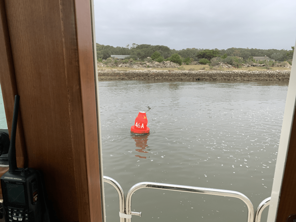
The tide is two hours before low as I make my way south.
I play “hug a buoy” as I pass closely by a red buoy.
ATON 46A in Lockwood’s Folly
You can see the Atlantic Ocean as you look east out the inlet.
Atlantic Ocean surf can be heard as I pass
Rough Atlantic
Hearing the surf, I think… I’m glad I did not exit Southport this morning and take my chances running the outside. When making the inside vs. outside decision, I use apps like the NOAA Marine Forecast & Weather app on my iPhone.
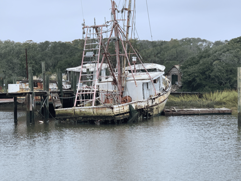
As I travel through Holden Beach I can’t help but notice what appears to be storm damage possibly from Hurricane Isaias back in August of 2020?
I’m not sure I can blame Hurricane Isaias for the fishing boat pictured below. The Second Law of Thermodynamics is at work here. Even Mother Nature has to follow the rules!
Increasing Entropy
Shallotte Inlet
The next inlet is Shallotte Inlet and it’s the same shallow story replayed.
USACE Hydrology coloring overplayed on charts using Aqua Map iPad app
If you want to know where it’s shallow… it’s where the birds are standing!
Sea birds facing into the wind
Beware of Boaters
Traveling the ICW you will encounter many boats that pass you in ways you don’t appreciate. Many times it is simply because the captain was not paying attention leading up your meeting. I’m guilty of loosing focus myself. Traveling solo in the helm seat for 10+ hours a day you can imagine I have zoned out quite a few times only to look up surprised by an oncoming boat.
I see a boat that is not staying “Right of Center” like you do on any road in America. I think to myself the captain will get right of center as we near each other.
Please keep right of center
I used to be bothered by this but it happens multiple times on every trip. You need to be ready to come to a complete stop if you must to avoid others on the ICW.
Less than an hour later I notice a small fishing boat crossing in front of me in the channel.
Small boat crossing ICW channel
As I approach they don’t make any gestures to alert me to the fact that they appear to be towing what I think was a net behind them in the channel. Luckily for me, they had a buoy marking the net’s approximate location in the water behind them. As I turned to avoid the net I heard my low water alarm go off and the boat start to slow as it plowed into the silty bottom. I quickly backed out and as I passed I heard someone from the small boat yell “sorry”.
Sexy Ladies
These sexy ladies passed me near Sunset Beach, NC. I believe they were a Hinckley, a Lazzara and an Outer Reef. The extra frothy wake from the Hinckley made me suspect a jet drive system rather than propeller?
Welcome to South Carolina
Finally I crossed into South Carolina. I like to acknowledge crossing state boarders even if… I am the only one aboard.
Just over the border
I am now cruising on a rising tide as I pass Little River Inlet.
Dunn Sound
More increasing entropy.
Every year I see less and less of this fishing boat still standing
Captain Poo
I made my way through the Little River Swing Bridge or as it is formally known since 2018, Captain Archie Neil Poo McLauchlin Swing Bridge. It’s named in honor of a local North Myrtle Beach boat captain who the locals enjoyed so much they nicknamed him Poo?
Cap’n Poo Bridge
Tropical Storm Eta
Tropical Storm Eta has the winds swirling and rain coming down at all angles today.
Winds from Eta as she passes near Myrtle Beach, SC
Sadly, multiple deaths from Eta flooding have been reported in the sounding area.
Eta was a lethal tropical storm for North Carolinians
As I travel down this stretch of the ICW, you can watch the storm water as it finds its way from the watershed to the river.
There is a lot of debris floating down the river. I’ve seen everything from a pumpkin float by…
Not sure why my iPhone photo coloring is so off?
… to full trees resting near the channel’s edge.
As I go by pilings sitting on the river’s bank, you can easily imagine these objects floating from the bank as the river rises.
hard rain washing objects into ICW
Rains from Tropical Storm Eta are falling like bullets on glass.
Bullet proof glass
#BigDeckEnergy
I go by this deck and grin.
All the confidence of a man in full control of his lawn …
#BigDeckEnergyFeeling confident Captain 😉
Pronounced Sock-Ass-Tee
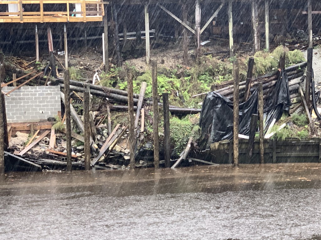
As I arrive at the 11 ft high Socastee Swing I am aware that it will not open with sustained winds 25+ mph. The bridge tender is not keen on letting me through but does.
Stock photo from a beautiful day unlike today
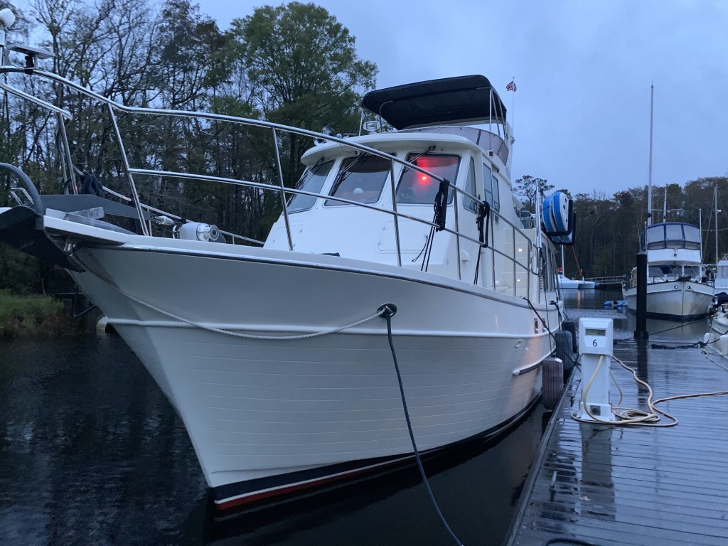
Osprey Marina
Rather than anchor in the Wacamaw river, I opt to stop at Osprey Marina.
Osprey Marina docks in the rainEta is not damping the mood aboard Simple Life. It is IPA O’clock!
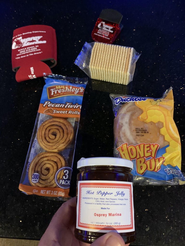
Hot Pepper Jelly
I have stayed here several times before and I waste no time checking in so I can get my Osprey Marina goodie bag that always contains some crackers and yummy hot pepper jelly!
Osprey Marina Goodie bag contains their coveted Hot Pepper JellySignage in the Osprey Marina dock house of the Hot Jelly Ladies
Winter 04 – Leg 011
The eleventh leg of my journey looked something like this…
We pulled out of Beaufort, SC and I was at the helm again.
At the Helm
Listening to USCG hazard to navigation broadcasts about a submerged object.
We had dolphins off the bow as we passed Hilton Head Island.
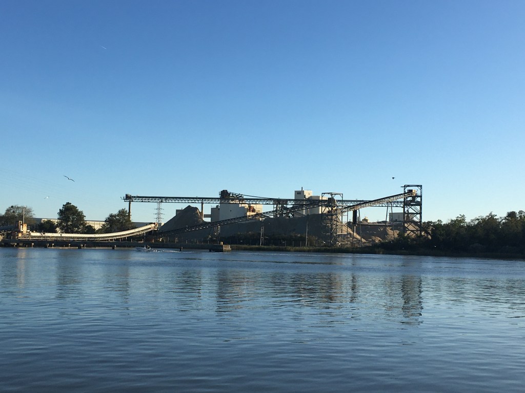
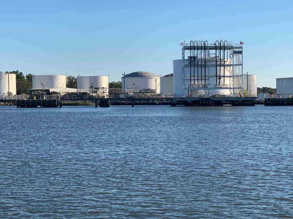
As made our way down the Savannah river you notice that the banks for the river have been artificially made high and that there are large gas tanks and other industrial structures along the shore.
Fort of some kind
Tanks line the shore
Conveyor Belts
Gas Tanks of sorts
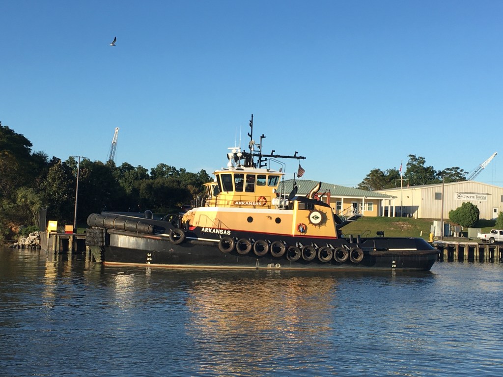
There are many tug boats in the river to assist the large tankers and container ships that seem to be everywhere in the river.
Edward J Moran
Tug
Laura K Moran
Tanker
High Bridge for them to tuck under
The Mighty Tug
Just another big ship
Stern full of containers
I think I can
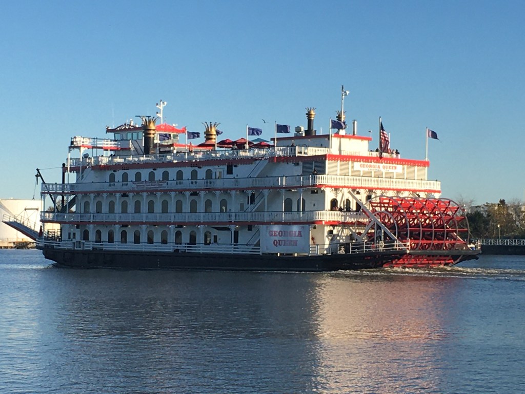
Several passenger ferries past us as well.
Georgia Queen
Savannah Belles Ferry
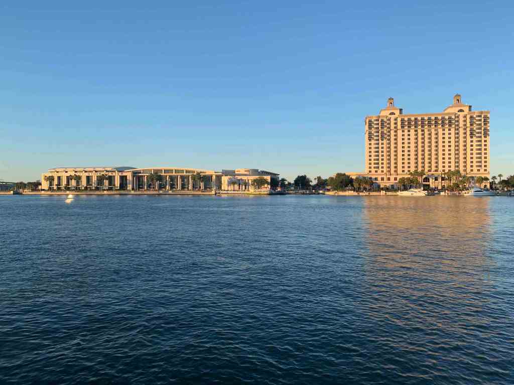
I had called the Westin hotel earlier in the day to reserve a slip in front of their hotel but the woman who answered the phone kept trying to rent me a hotel room. I kept explaining that we were a boat and needed a slip at their marina but she just did not seem to understand. Oh well.
Savannah Convention Center & Westin Hotel
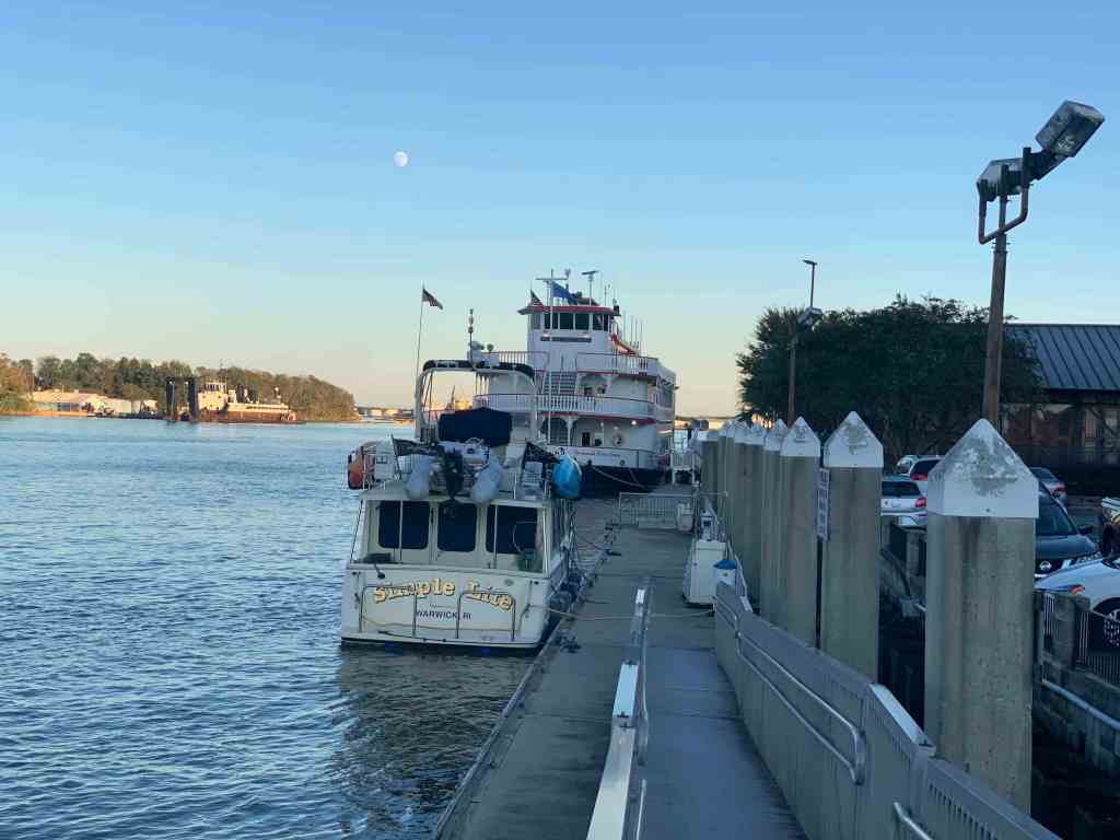
I called a River Street Dock just across the river and it worked out great. Turns out it’s right in the heart of everything.
The Savannah River was full of huge container ships that if they ever took the turn wide they’d crush us flat.
Rather than Spanky’s, we chose instead to go to the Boar’s Head Grill & Tavern for dinner. It turned out to be a great choice. The food was excellent and the beer brought to me made me laugh. I asked Charlene “Shaalean” our waitress for the double IPA “Beeyah” (with my Boston accent). She came back with a different IPA called “Damn Yankee”. Should have seen that coming.
After a boat-load of Damn Yankee’s we came back to find the current slamming into the stern hard enough to push debris onto the swim platform.
Early the next morning it was time for my guests to depart. We had so much fun in the short time they were aboard. I will miss their laughter and amazing meals they made. They were even kind enough to cook up some dishes and put them in the freezer for me. I look forward to seeing them when I return to RI.
Uber driver showed early in the AM
Oh, I almost forgot the best part, Buddy wrote a MV Simple Life theme song!
MV Simple Life Theme Song
Simple Life
When enough ain’t enough You’re just talking about stuff, And your stuff is wearing you down. It’s time for a change, Time to rearrange Your position that’s got you all wound.
You can learn from the man Who finally understands You can ditch the traffic and strife. Take the soft way through the world And another will unfurl, You can live the Simple Life.
Sell it all but the boat And what you require for the float Leave the shore, your troubles behind. Authentic is real. You must believe what you feel, The Simple Life always feels fine.
From the man who knows, When you’re caught in the throes Of the rat race that you’ll never win. There’s another choice, Trust your inner voice, Cast your doubts to the following wind.
Cast off your ways, Imagine simpler days. Cruise in a way that rewards. Make dozens of friends, Share beers in the wind, Find your world without discord.
Breathe deeply the air, Feel the salt in your hair, Know that you’re doing it right. Bring your girl (or your wife) You’ll never feel more alive Softly living the Simple Life.
We started the day with a Mexican breakfast on the griddle.
warm tortillas
Then it was onto the Dawhoo River which has some depth issues.
North Creek near Dawhoo River
We would occasionally have to move over and let a tug pushing a barge past.
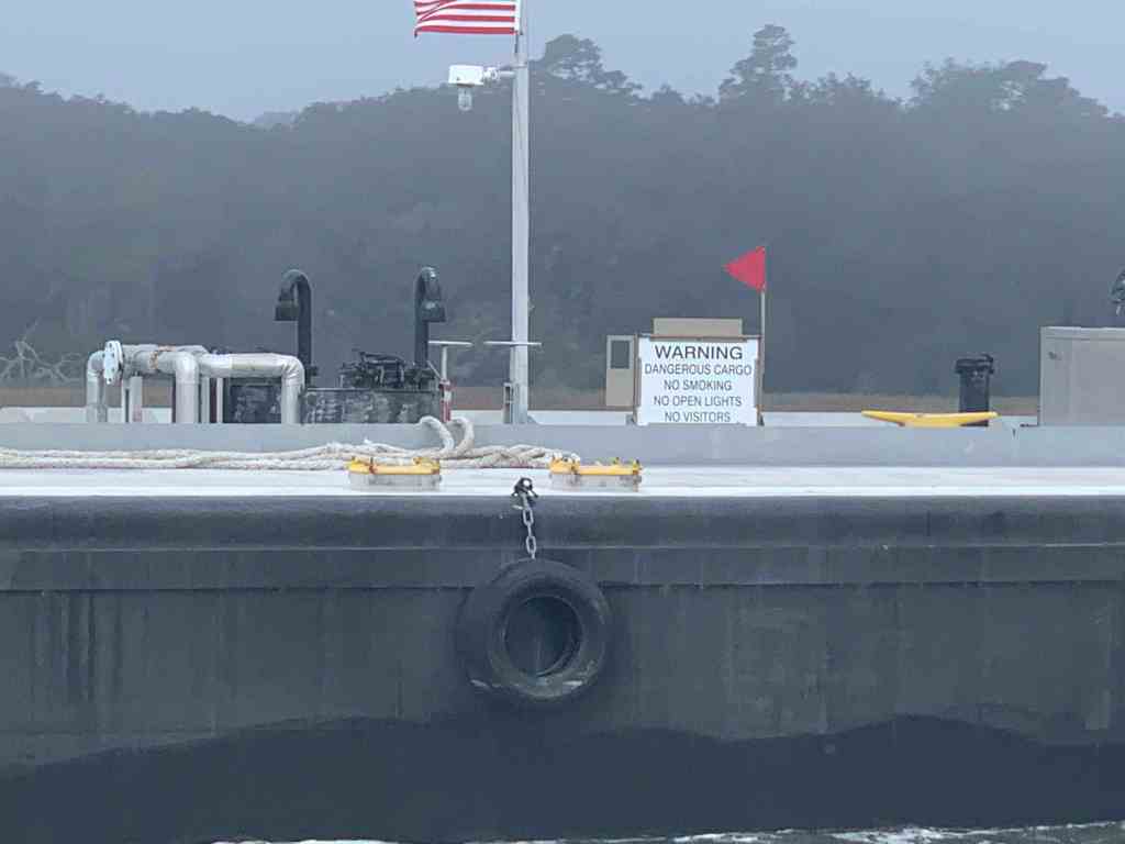
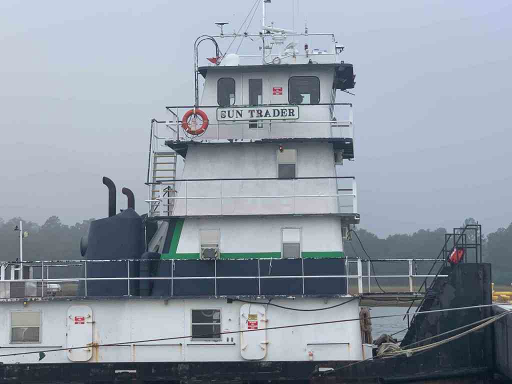
Approaching Tug/Barge
Dangerous Cargo
Gun Trader or Sun Trader
This home sadly lost it’s live oak to a bit of wind it would seem.
Such good looking trees if there is such a thing?
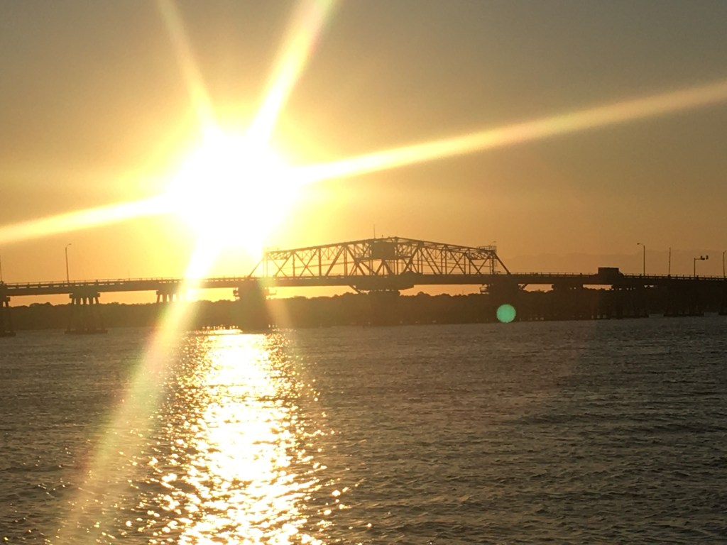
Soon we passed under the ladies Island Swing bridge, hailed Beaufort Downtown Marina on the VHF radio. They responded back “Safe Harbor Beaufort”. Safe Harbor is the same marina corporation that purchased my marina in RI. Heck, Safe Harbor seems to be buying dozens of east coast marinas.
Safe Harbor taking over the world of marinas
The Safe Harbor Beaufort marina has a strong tide that is not quite parallel to the face dock. This means as you pull up to the dock, the current is either pushing you onto or away from the dock. I took an approach that kept the current aligned to my keel and soon we were tied up and plugged in.
MV Simple Life on the back side of the face dock
We snapped a few quick photos of a sun low in the sky.
Sun on Safe Harbor Beaufort docksSun over Ladies Island Swing Bridge
The large 100+ foot yacht next to us lit up as night arrived.
Large Yacht Lit
Not to be outdone, MV Simple Life lit our lights 😉
MV Simple Life Lit
When you walk off the docks there is a beautiful waterfront park.
Henry C. Chambers Waterfront Park in Beaufort, SC
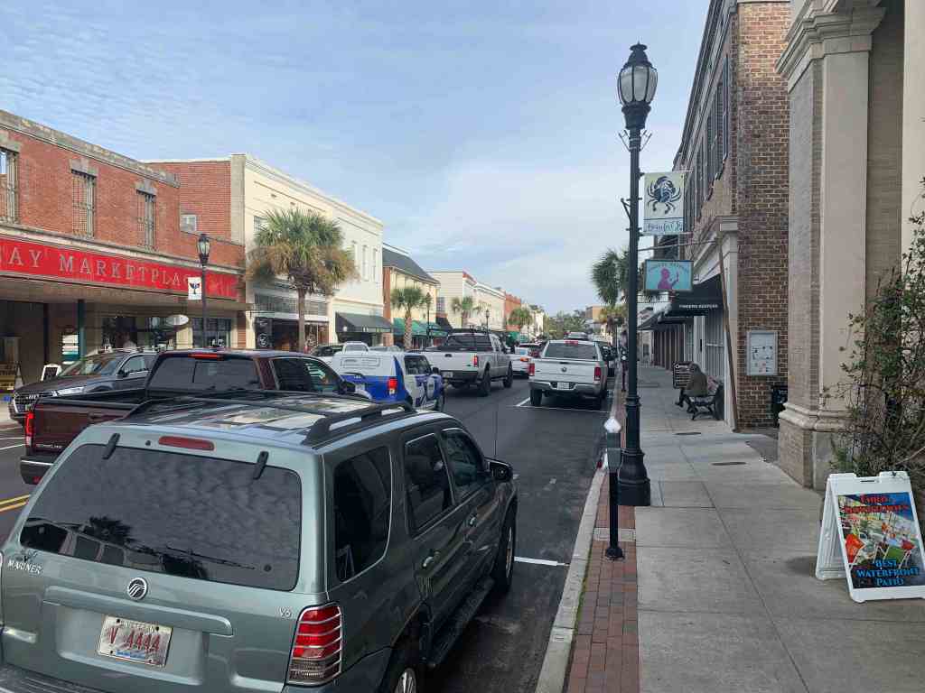
Walking along Bay street in front of the marina you’ll find many restaurants and shops.
Bay Street
Panini’s – Live Music
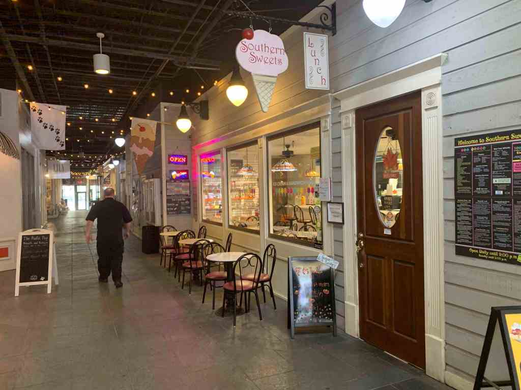
Southern Sweets Ice Cream Shop
Downtown Beaufort, SC
We decided to stay two nights in Beaufort so we could hit some of the local restaurants and pubs.
Wood Fired Pizza Guy
Menu Front
Menu Back
Telephone booth leads to the next room
Bull Tavern in Beaufort SC
We wanted live music and that can always be dangerous. I’ve had the mic turned off while singing karaoke and lets just say it does not get any better with IPAs.
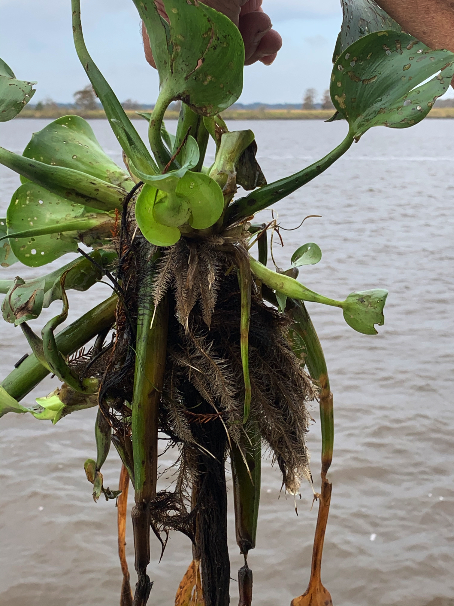
When we left Osprey Marina we were back in the Waccamaw River which was full of flora. We stopped to pull a water hyacinth out of the river to view it’s structure.
I was at the helm as we approached an infamous shallow location known as McClellanville.
Capt Marty @HelmMcClellanville has Shallow Water
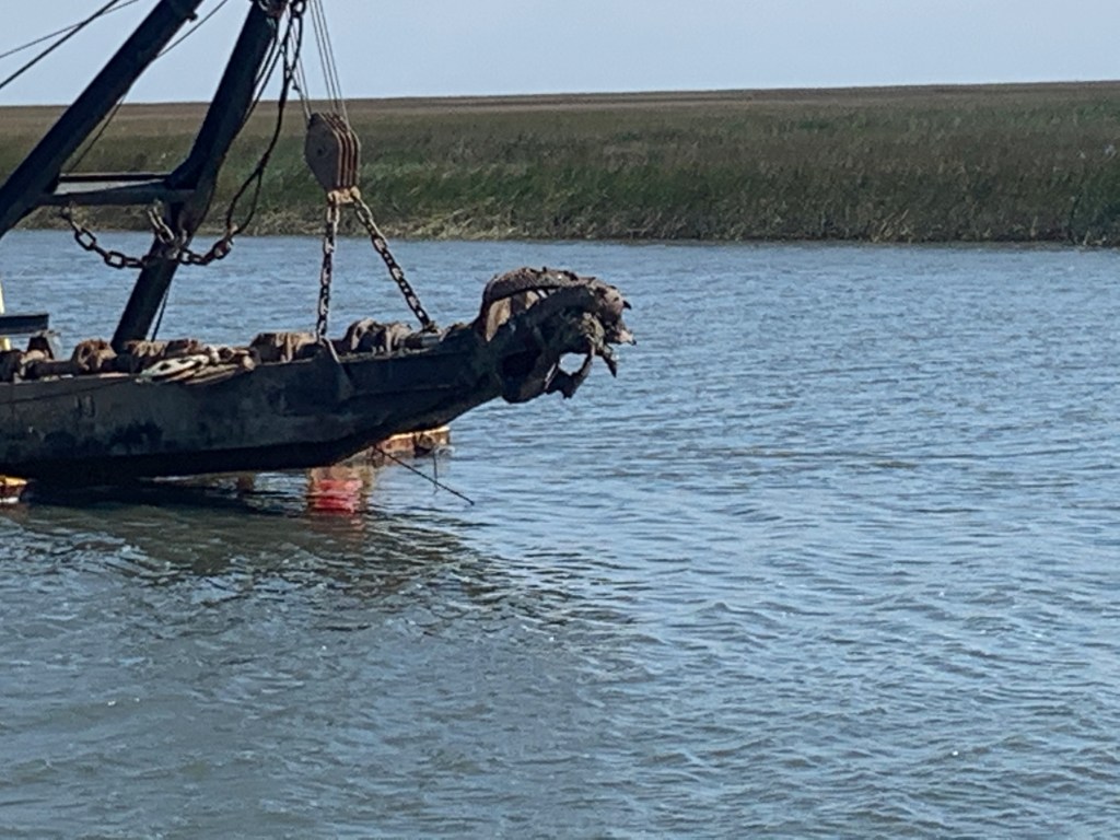
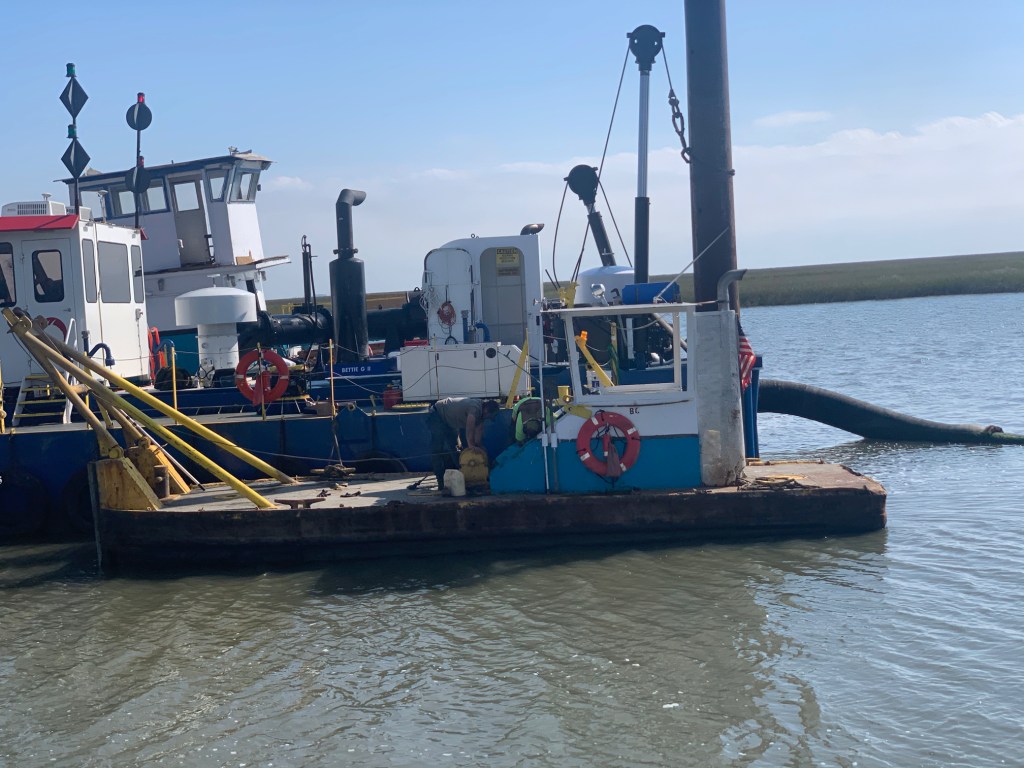
There was a dredge on site that was trying to make the passageway deeper. We hailed them on VHF CH#13 and asked the proper path to get by them. Dredge replied “go between the red buoy and the dredge”.
Approaching Dredge
Dredge
Dredge Bit
Dredge Bit Closeup
Passing Dredge
Dredge Pipe floated with Barrels
Luckily for us we were passing through McClellanville at mid-tide.
We were looking to anchor in Charleston Harbor but the winds were blowing over the long fetch that crosses the harbor. We would have rocked & rolled all night. Instead we kept moving down the ICW cutting through a dingy regatta on the way.
Dinghy Sailors
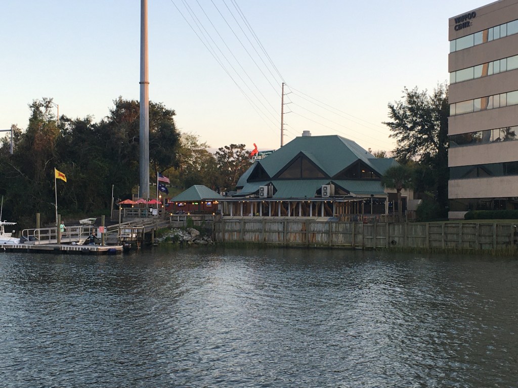
Next we passed the Charleston Crab House in Wappoo Creek. I’ll have to stop at one day.
Charleston Crab House
We made it to our chosen anchorage just as the sun had set.
Garmin inReach display of our track to the anchorage
It was time for a beer and I had the perfect one.
A great Hazy IPA
A short time later we took out two cigars that were given to us by Eric from MV Tapestry before we left. It seemed like a perfect time to celebrate the trip. What goes with cigars? Cognac of course.
It was hard to leave St. James Plantation Marina as we were all having so much fun. I did capture a nice video of what I think is a great blue heron on the dock next to our boat.
Great Blue Heron or as I like to say “I ain’t Scared of you Monkey Bird”
As you head south of Southport, NC you pass several Atlantic Ocean inlets. Lockwood Lockwoods Folly inlet is pictured below and we could see the ocean waves as we motored past.
Looking out to Sea Through Lockwoods Folly Inlet
The ICW can be very shallow around these inlets as the strong currents deposit sand and silt creating shoals and shallows that you must stay clear of. I use an iPad app called Aqua Map and pay for the premium service called Aqua Map Master that displays the recent Army Corp of Engineers colorful sounding charts of these tricky locations. The sounding charts are color coded and red is the shallowest with blue being the deepest. Below you can see what it looks like to pick a safe path through the shallows.
Shallotte Inlet USACE Sonar Charts
Shallotte Inlet was next and it too has a colorful sounding chart
03
When we got to Little River inlet we passed a commercial boat that has been wasting away on the shore for some time. I’m always amazed that it is still there when I come up in the Spring or down each Fall.
Little River Inlet Sunken Vessel
Along with navigating your way through the shallows you must request several bridge openings. This bridge used to be called the “Captain Poo” swing bridge. I hailed the bridge tender on the VHF and he responded with “Little River” swing bridge. I personally enjoyed hailing “Capt. Poo, Capt. Poo!” over the new name.
Capt. Poo Swing Bridge
Our day underway was overcast and for a brief period it rained. Boating in the rain is not much fun unless you have a warm pilothouse. We were warm and dry while underway and for that I was happy.
Rainy Day in the Pilothouse
There were many beautiful sights to see along the route to Myrtle Beach.
Myrtle Beach Light house
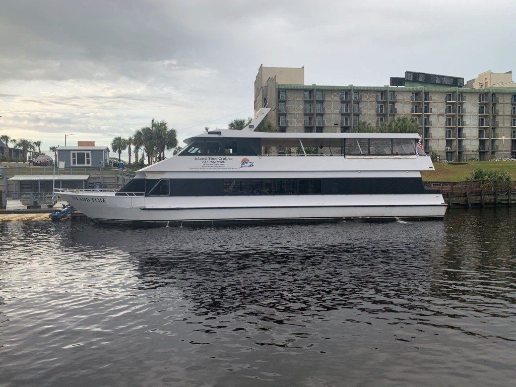
MV Island Time
Holden Beach Home
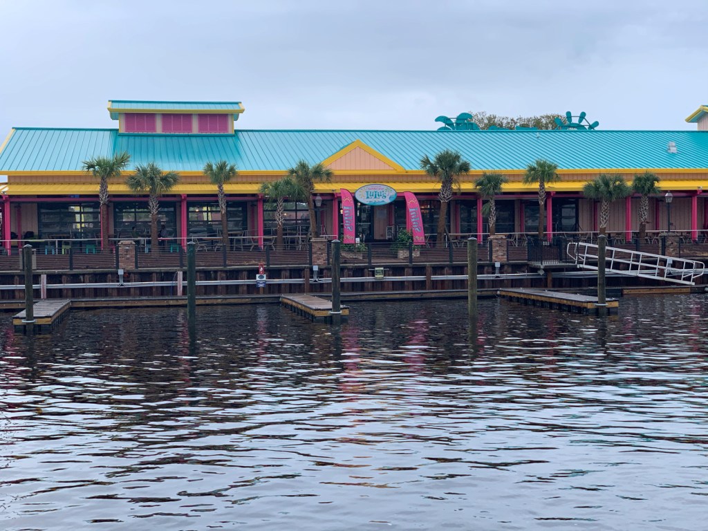
Lu Lu’s Restaurant
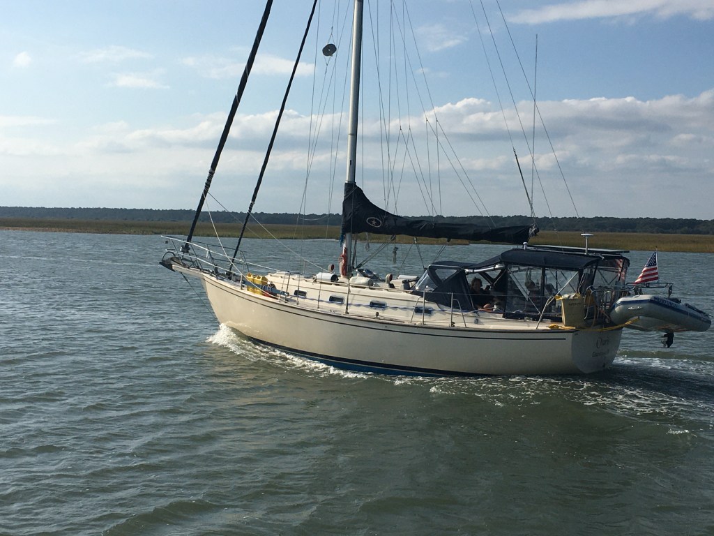
We passed this sexy sailboat
This beautiful home appears to have an infinity pool.
Infinity Pool
We had made reservations at Osprey Marina and we were pushing hard to make it there before dark. As we went through the Socastee swing bridge the sun was getting low.
Socastee Swing Bridge
We were now in the Waccamaw River swamp and it can be beautiful as fog and mist light up in the setting sun.
Waccamaw River Swamp
We arrived at Osprey Marina while the sun was still up. We turned down the entrance channel and snapped a few photos of some interesting boats.
Osprey Marina Entrance Channel
One particular catamaran had an etched window that was different.
Troubled Pirates
Soon we were tied up and checked in for the night. I soon discovered that there was no WiFi! NO WIFI!!! Time to put on a movie to entertain the crew. Tonight’s movie …
We opt’d for a late 11AM departure from Beaufort, SC. When we went to leave the current was pushing us so hard against the dock that our bow & stern thrusters were not able to move us away from the dock. A fellow boater on SV Bay Dreaming came over and held our spring line so I could motor the stern off the dock and then back into the current. Amazing how strong the current can be in this area with 7-8′ tides.
Soon we were at the Southern tip of Paris Island.
Our friends Ann & Todd’s son Conner is there going through boot camp as we pass. We are reminded by the sounds of freedom (Jets screaming overhead).
Semper Fi
My brother just let me know that yesterday a guy caught a 17′, 3500lb. great white shark off Hilton Head Island.
17′ 3,500 lb Great White Shark Caught off Hilton Head Island on 12/4/18
Today’s trip was short and we only passed a few sights pictured below
Soon we were dropping anchor in the 20 kts winds and it surprised me when after lining up bow into the wind we quickly spun around in the strong current with our stern facing the wind.
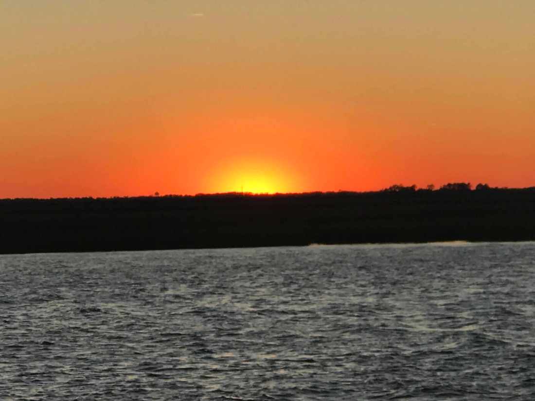
The sunset’s here in the lowlands of South Carolina are amazing.
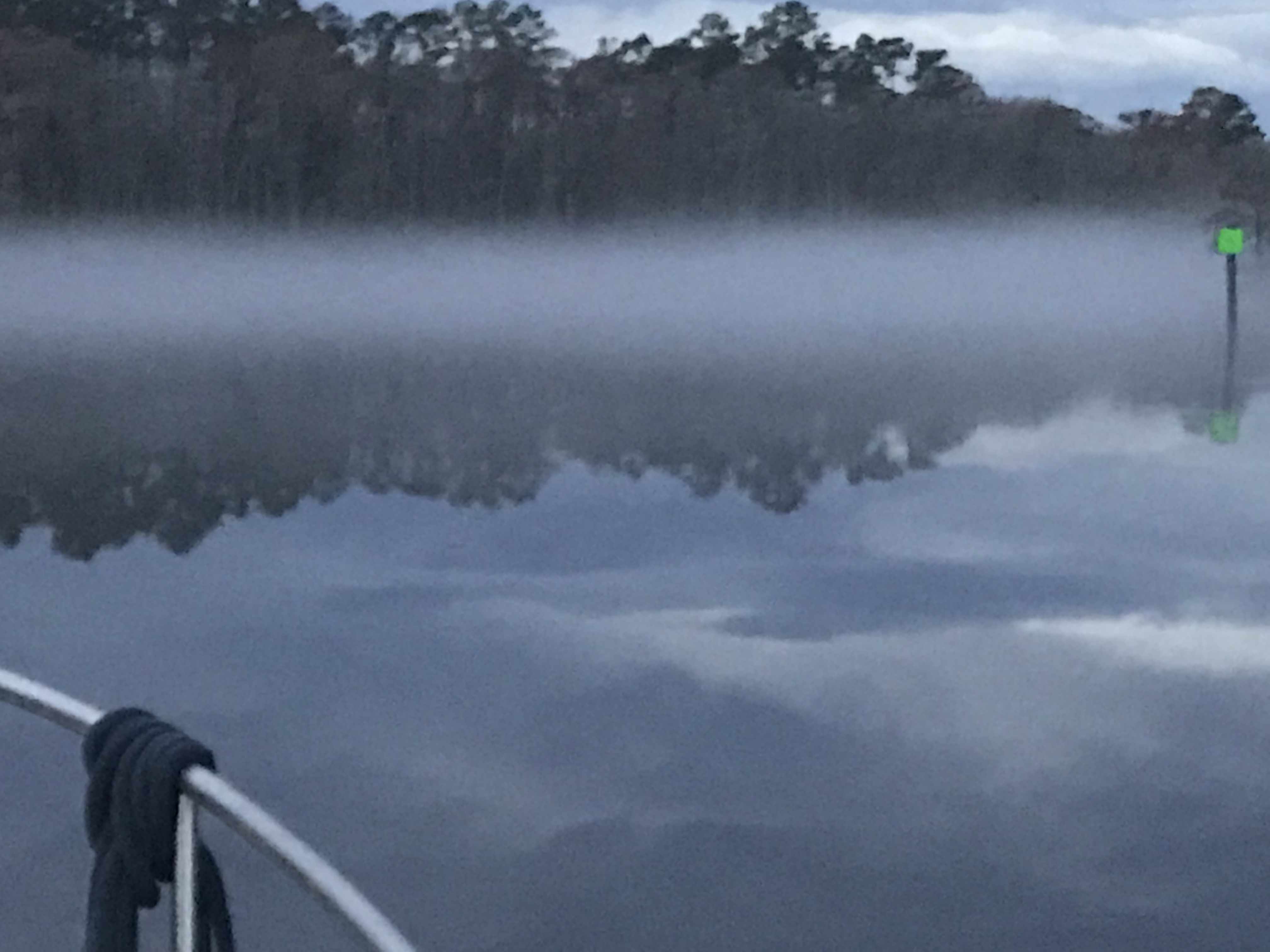
We weighed anchor at first light in the Waccamaw River and it was foggy.
Waccamaw River Fog
Looking down the ICW
Closing in on us
I felt bad that we had to put on our automatic fog horn so early in the morning as there were other boats sleeping on anchor (or at least they were sleeping). At times the fog was thick enough that you would not be able to see the small duck hunting boats that zip around in this area.
It rained all day. Not good for the folks who lived along the river banks. The river had already overrun its banks and many of the riverbank homes were dealing with flooding. More rain was the last thing they needed.
Rain on the pilothouse all day
Then the fog would return.
ICW Fog
Fog Bank
Daymarks Easily Seen
Looking for Duck Hunting Boats
Fog Horn was Blowing..
When it was clear we got to see the lowlands of South Carolina. Beautiful grasses that extend out to the Atlantic Ocean.
Lowlands of SC
Along the way we passed a steel hulled sailboat that was anchored in the same location as when we came up this part of the ICW in the spring. I guess like many is just permanently anchored along the ICW?
SV Steel Away Permanently Anchored
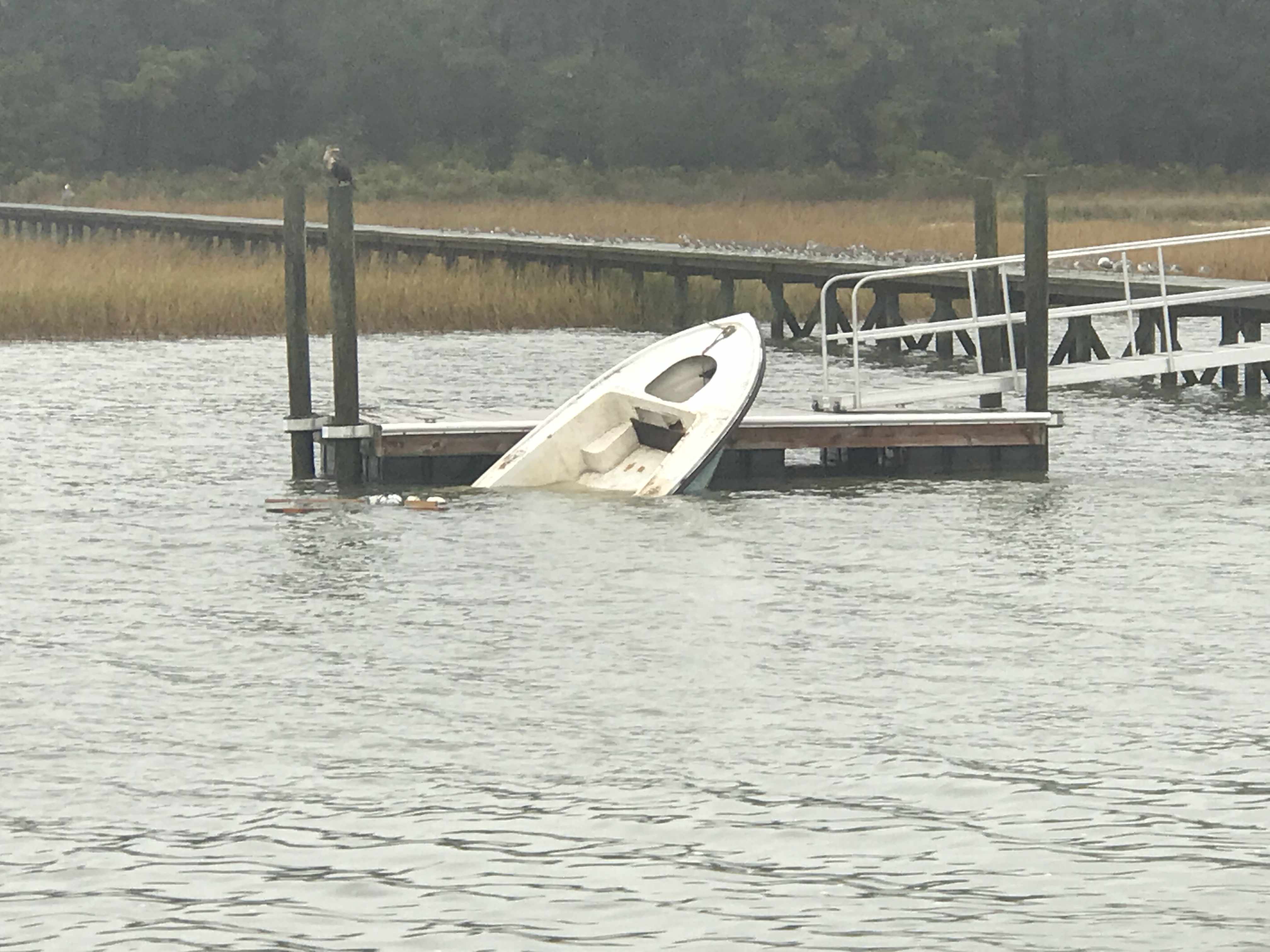
We passed someone’s boat that was still tied to the dock but had sunk for some reason or another.
Sunken Boat Still Tied to Dock
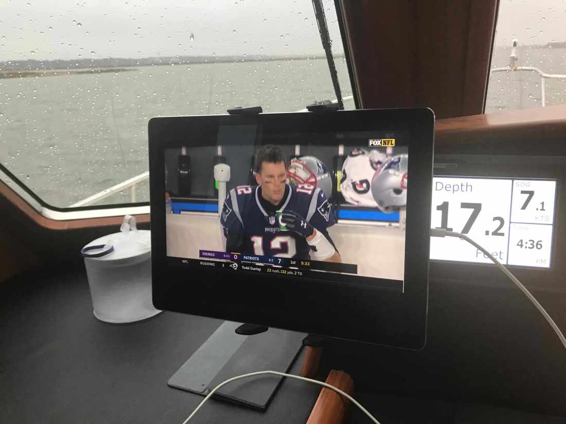
Our plan for today was to attempt to make it all the way to Charleston, SC. The currents were helping us along and there was not traffic or bridges to slow us down. We ran right up until dark and had to settle on a wide open commercial anchorage just off Fort Johnson in Charleston Harbor. Kelly asked that we pick an anchorage that had cellular service as it was football and she had been watching the Giants / Bears game but the Patriots game was on next.
Kelly Enjoying the Game
Patriots Game @7 Kts.
We anchored next to a large sailing catamaran and the winds were blowing. The weather was bad as there were thunderstorms moving through that were bring wind gusts up to 55 MPH. A quick look at my weather apps showed them passing directly over us on anchor.
Storm Radar
While on anchor I captured some of the storm.
Our leg today looked something like this … (80 NM)


You must be logged in to post a comment.