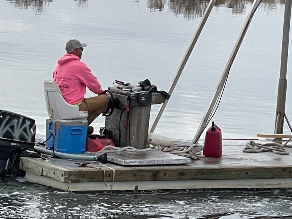
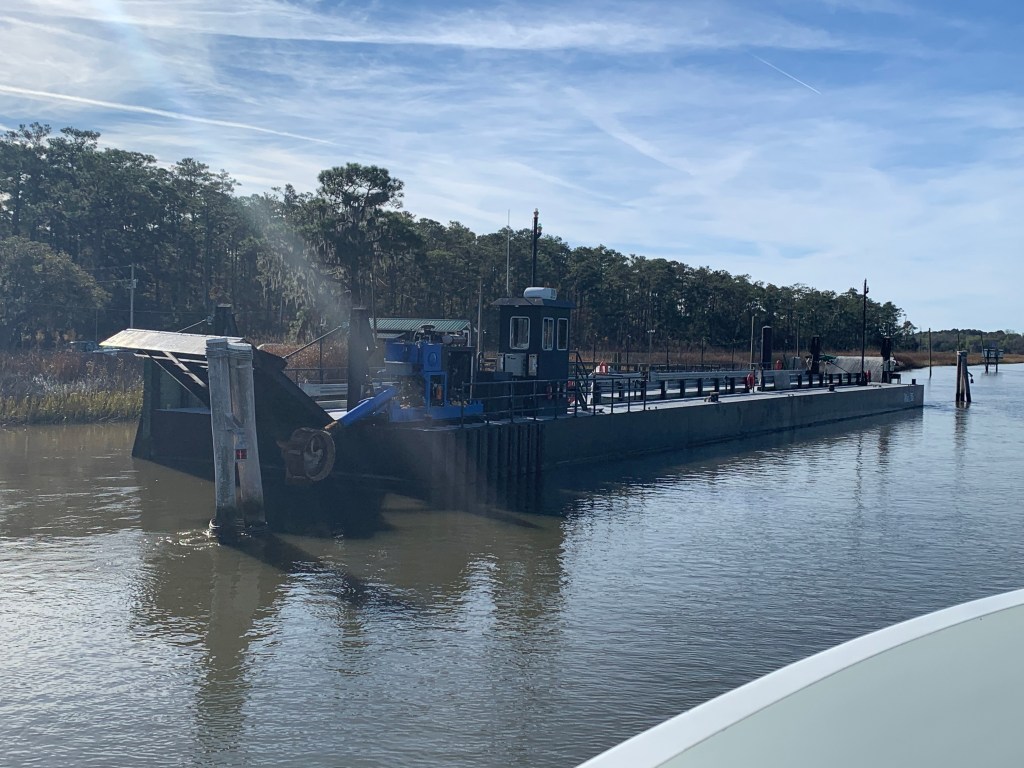
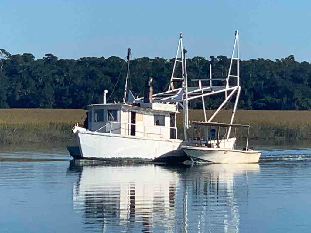
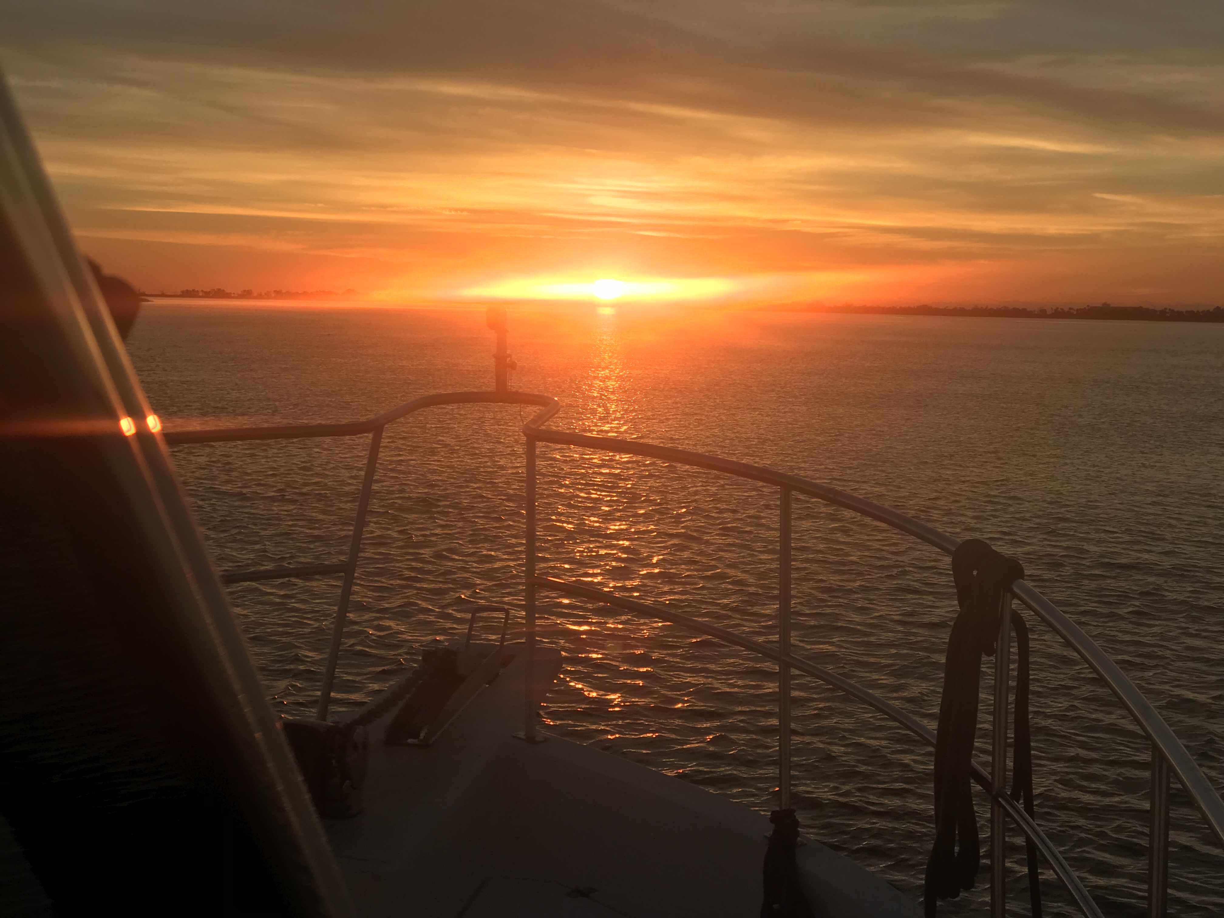
We were on our way to Southport, NC to see our friends Jim & Wende. We had to slow down to no wake speed to keep from swamping this fella who was motoring a small work barge down the ICW.
Cooler Seat Captain
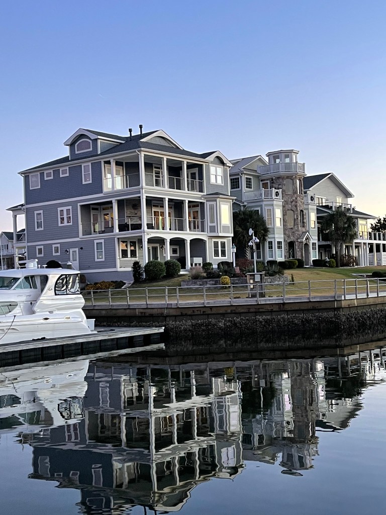
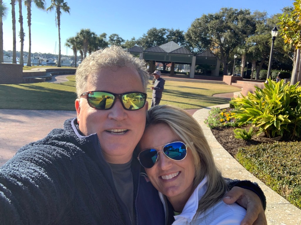
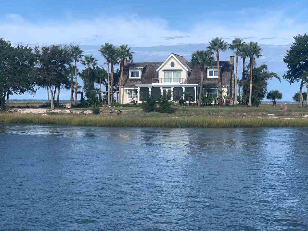
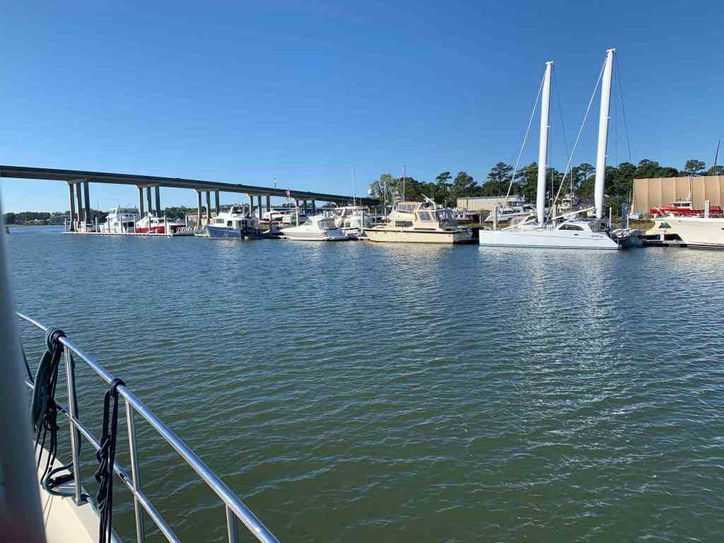
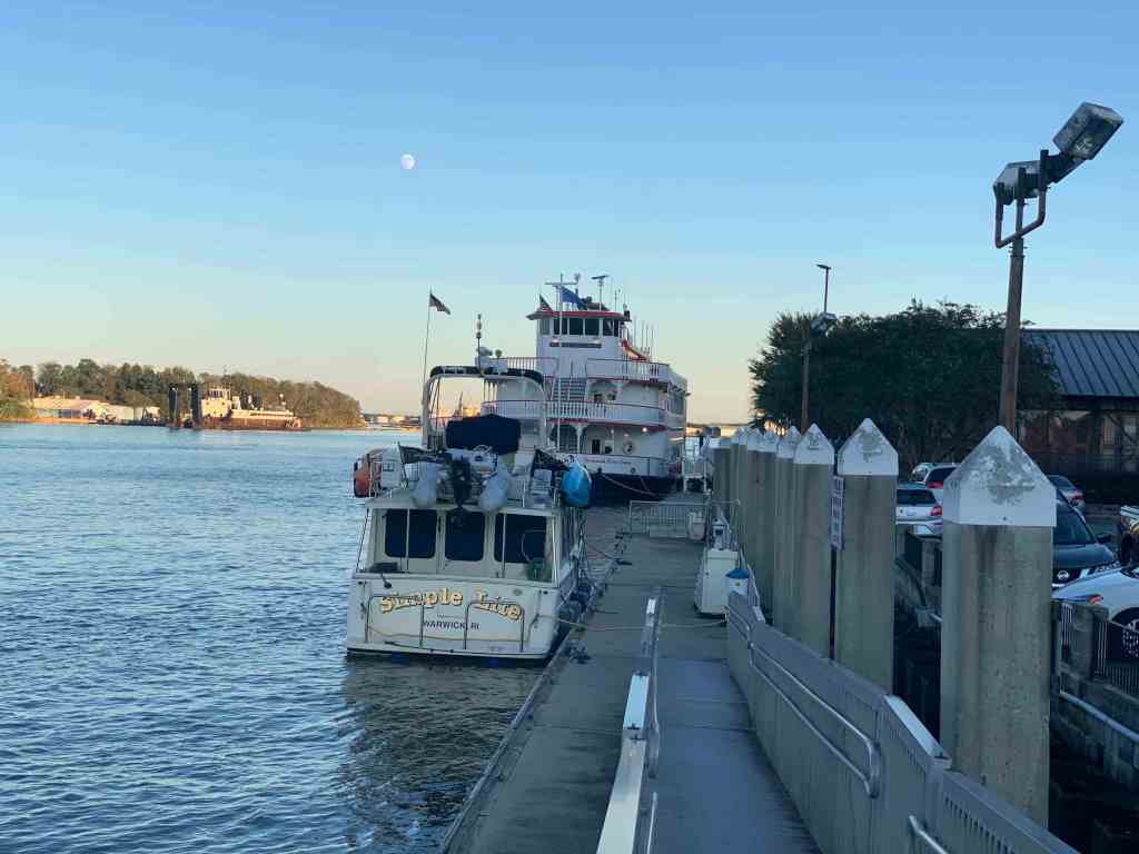
We arrived at St. James Plantation Marina just before sundown. The homes along the harbor are beautiful.
St. James Plantation Marina
The Big 😀
Jim and Wende let us use their truck to reprovision which was perfect as it was the day before Thanksgiving and we needed TURKEY!
Later that night Jim & Wende took us to dinner at a Joseph’s Italian Bistro @ Safe Harbor Marina. We had dinner with some good local IPAs & lots of laughs. I wish we had taken a photo but I think we were just having too much fun. Jim and Wende told us all about their trip back from Buzzards Bay, MA to Southport, NC in their new Pursuit OS 355. The weather was a bit ruff off the RI coast but they made great time with stops in places like Atlantic City.
Capt Jim & Wende
In the AM we were off and Capt T was at the helm.
Capt T @Helm
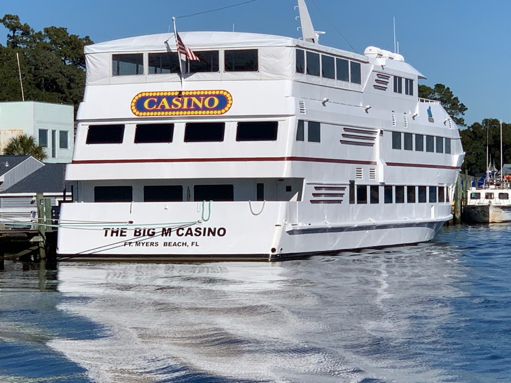
We passed a boat dock that was more boat than dock. Capt T thought she recognized a casino boat as we passed and sure enough the “Big M” hailed from Fort Myers, FL.
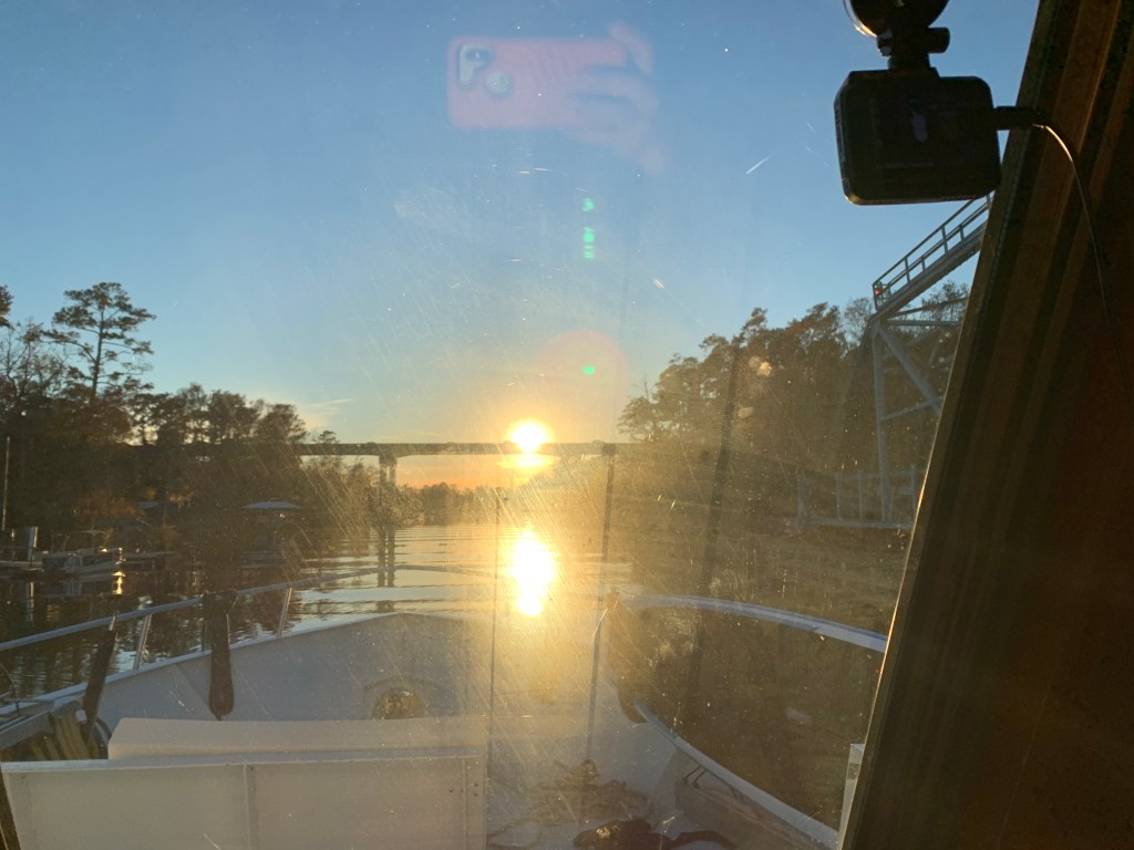
As we made our way into the Waccamaw River preserve we had to get through the Socastee swing bridge but we were staring straight into the sun. The best we could do was go slow and use the radar to see in front of the boat.
Camera may see the swing bridge on the right but we only saw a bright spot looking out the pilothouse
We anchored in what I call the Waccamaw River (ie. swamp) and it’s beautiful. We had a great night on anchor as the high trees provide protection from everything but the cold.
It was COLD.
Cape Coral, FLConway, SCFoxboro, MaWarwick, RIHere in Conway, SC it’s the same freezing temp as back home in Foxboro, MA
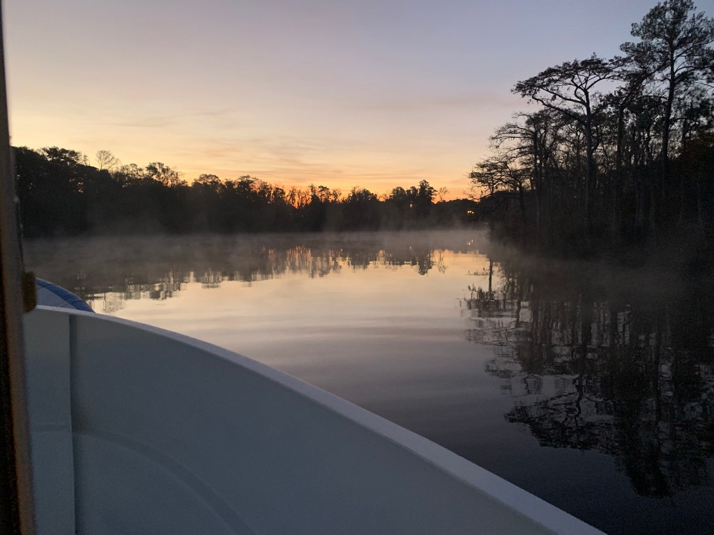
We weighed anchor at first light and the swamp was steaming due to early morning low temps.
Waccamaw River pre-dawn
We had to slow to no wake so as to not disturb this Nordhavn anchored right off the main ICW route.
Peaceful Anchorage
The next swing bridge is actually a floating swing bridge. Very cool. It simply uses drop-able drive-on ramps and a huge tilt-able bow thruster.
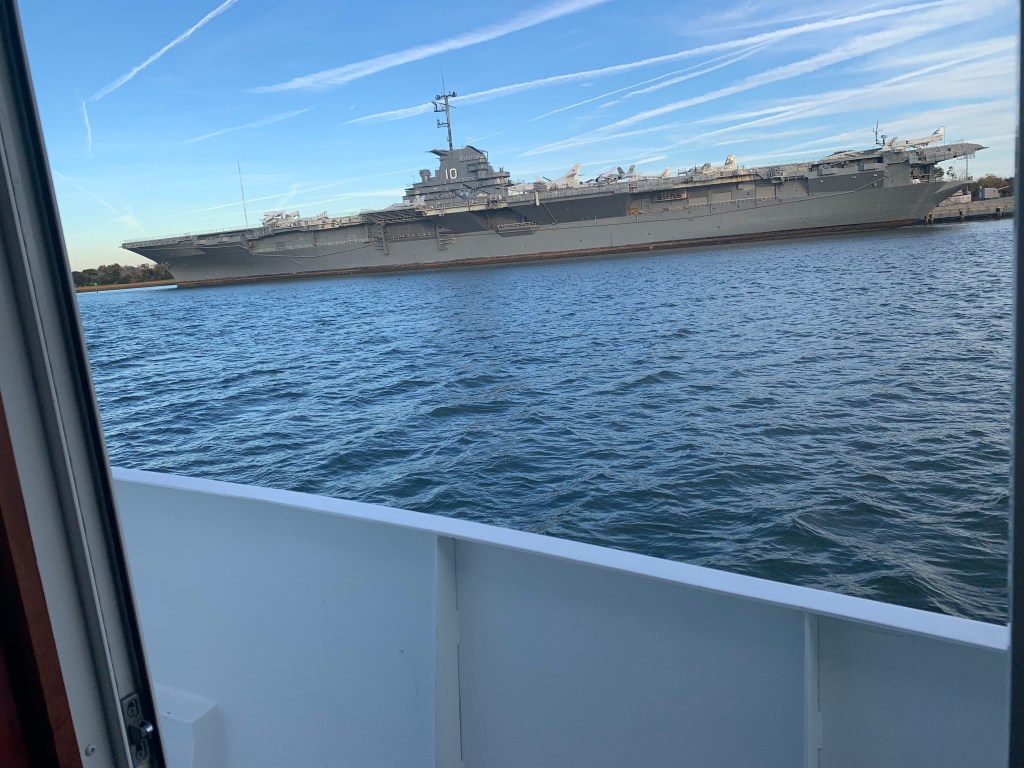
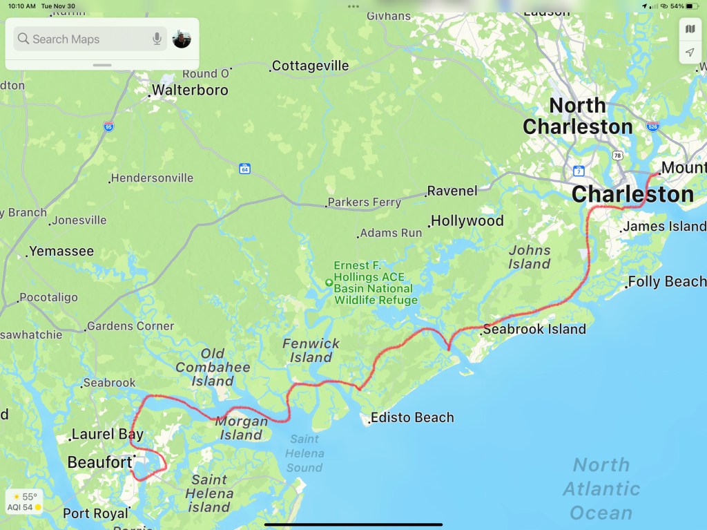
We arrived in Charleston, SC and the marina we requested a slip from had us “wait-listed”. We anchored for the night next to the USS Yorktown.
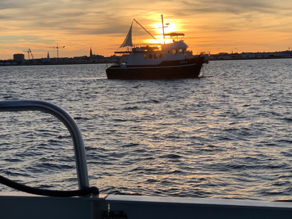
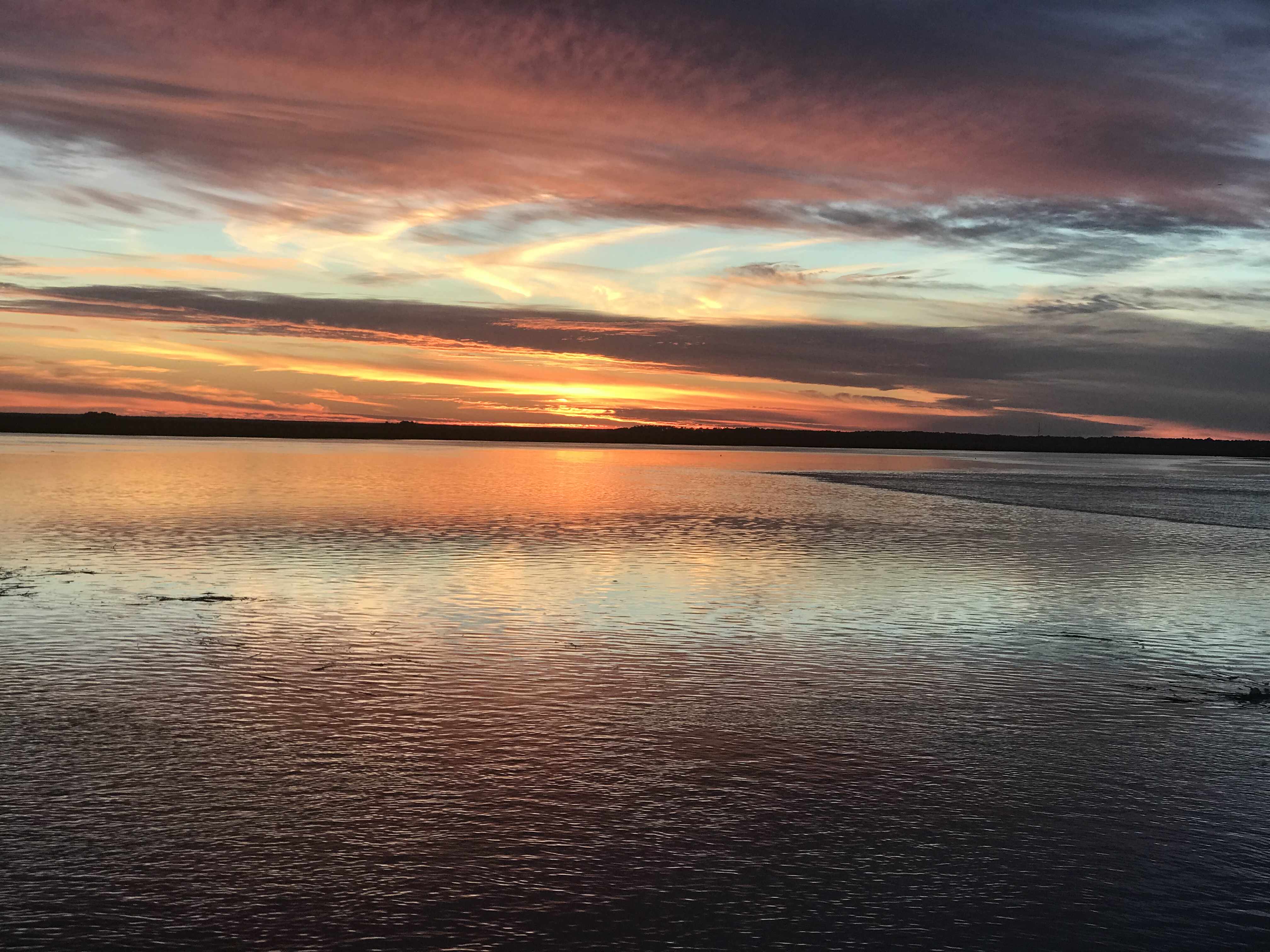
The sun was setting on Charleston.
Sunrise in the AM and we were off… bound for Beaufort, SC
Sunrise in Charleston, SC
We anchored in Beaufort with hopes of getting off the waitlist for the marina. In the AM we called and they found a spot for us on the outer face dock.
Docked at Safe Harbor Beaufort, SC
Beaufort is a fun town and we wasted no time getting ashore at Plums Restaurant for some lunch.
Plums in Beaufort, SC
We napped after lunch and made a second run on the town before we would leave in the AM. Beaufort has a great outside park area right in front of the marina.
Beaufort ParkSwings along the Water
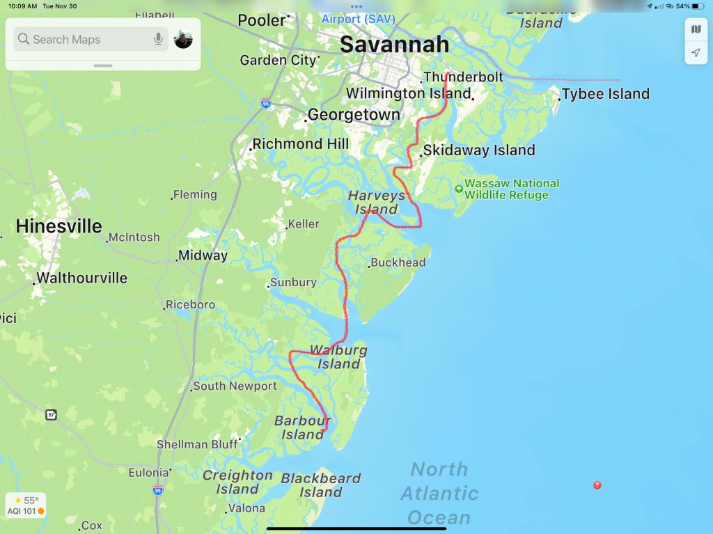
In the morning we were off to Savannah, GA. Last time I docked right in downtown around River Street but felt it a bit seedy at night. We decided to stay at Thunderbolt Marina and Uber’d into town for a Savannah pub crawl.
Are impromptu pub crawl consisted of the following venues:
Spanky’s
Boar’s Head Grill
The Cotton Exchange
Huey’s
The Warehouse Bar
We ended the night singing Journey.
Up early to a Whiskey Sunrise & potato pancakes and off to Fernandina Beach, FL
This post consists of 5 legs of our journey
Leg 15 – Waccamaw River, SC to Charleston, SCLeg 16 – Charleston, SC to Beaufort, SCLeg 17 – Beaufort, SC to Thunderbolt Marina, GALeg 18 – Thunderbolt Marina to St. Catherine’s Island, GALeg 19 – St. Catherine’s Island, GA to Ferdandina Beach, FL
We hope everyone had a great Thanksgiving with family!!!
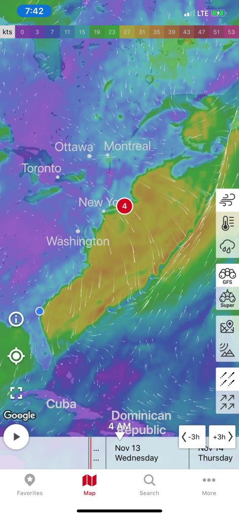
4AM and my iPhone alarm is buzzing. I need to weigh anchor and get underway before the 4:38AM start of the Winyah Bay inlet’s flood current. Somehow I lose track of time and don’t get underway till 5AM.
Flood Current in Winyah Bay Inlet
First light won’t occur until 6:24AM.
First Light is 6:24AM
I weave my way through the other anchored boats quietly without shining my spotlight directly on them. It’s dark but the radar and spotlight are helping me find the daymarks and buoys that line the channel out the inlet and into the Atlantic.
Now at 6:05, 19 minutes before first light, if I look to the east, I can differentiate sky from the sea.
Darkness is lifting
Moments later and First Light has arrived.
First Light on the Atlantic
Now it’s 7AM and at the sun is looking like a giant lightbulb on the eastern horizon.
Giant glowing lightbulb
Friends have found me.
I am amazed that they appear to glide without tail movements for quite some time
As the day goes on the following sea can be felt. As I walk through the salon I can hear the rhythmic sound of my wine glasses rocking back and forth in their upside down holder.
Wine Glasses making squeaking sounds
I open the back door to get a better look at the following sea.
Following Sea is catching me
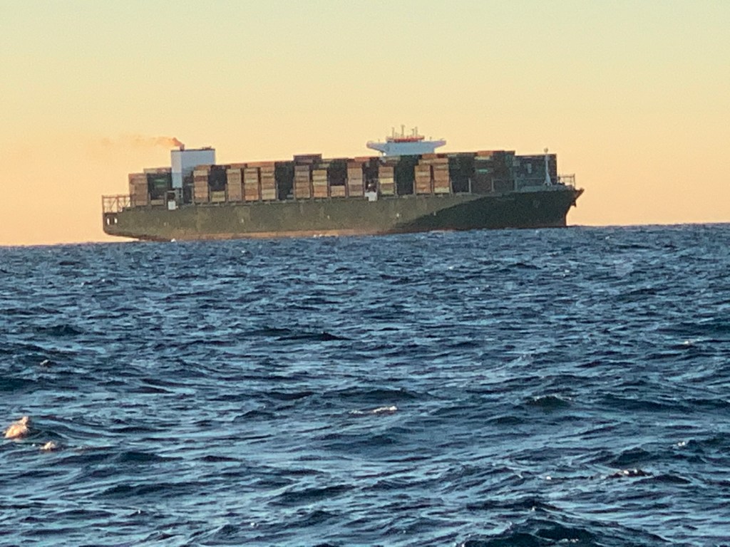
I spot my first ship around 2PM.
First ship spotted
It’s cargo vessel Triton and it will pass less than a mile from me with our current course and speeds.
1211′ long and moving at 20.2kts
Though I will not pass any other recreational traffic this far out I do come upon a second, equally as massive container ship on a crossing path.
Container Ship crossing my path
I decide to spend some time on the bow and video as I go
20NM East of Charleston, SC
The sun has begun to set.
Sunset on the Atlantic
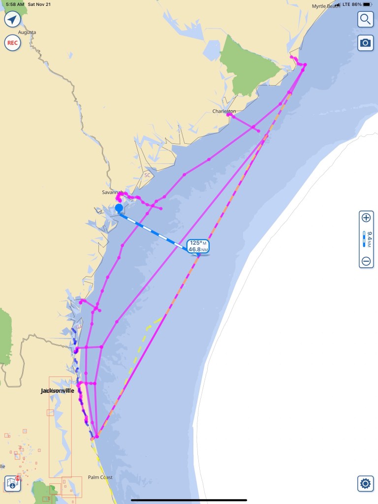
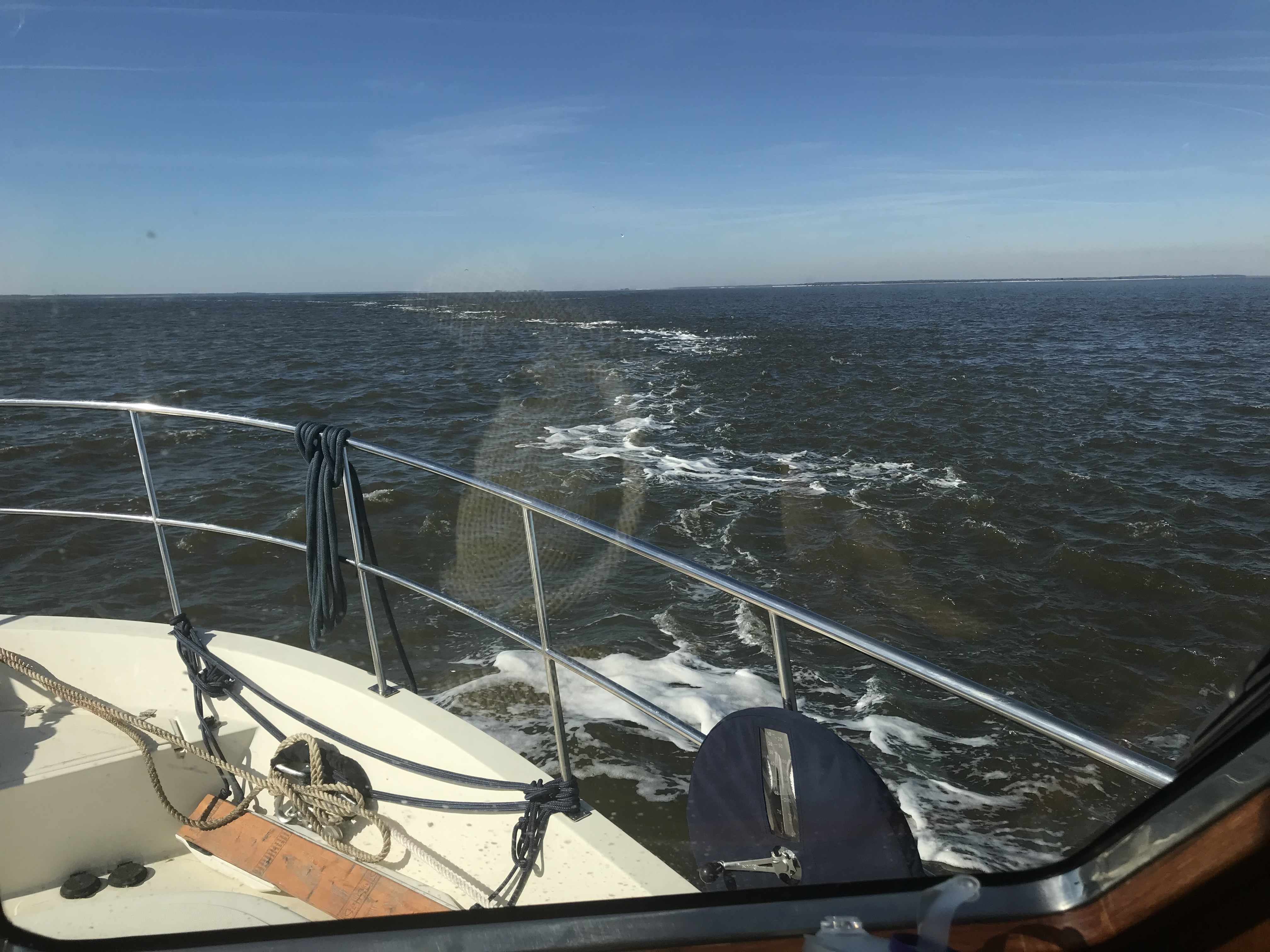
I settle in for the long night. When I go offshore as opposed to running in the ICW or “The Ditch” as it is called, there isn’t much to do. I plan my route and set my course and speed. The autopilot is engaged so no need to hold the helm. I do however need to maintain a constant watch for buoys or passing ships. My chosen route is a rhumb line between Winyah Bay Inlet and St. Augustine Inlet. Rhumb lines are courses navigators use to make it easy on themselves. A rhumb line only requires the captain to steer a constant magnetic bearing. I can hear the geometry nerds shouting… “The shortest route on the surface of a sphere is actually the arc of a great circle!”. On mercator projection charts a rhumb line is a straight line. My rhumb line route takes me about 45NM offshore.
Shoreline Route is the closest, St. Mary’s Inlet route middle and St. Augustine Route is the furthest offshore. Bailout routes in the inlets have been platted as well
Explained another way… If you stare at the picture of “globe Earth” below, keep this in mind. The longitudinal lines come together at the North Pole. If you are sailing either of the two routes drawn below, your compass needle’s would align to the longitude lines. The “rhumb line” route you steer a constant heading according to the compass while the shorter “great circle” route has you starting out at one compass heading and constantly steering more east as you go from left to right.
I don’t anticipate seeing many ships or buoys this far out. My watch duties are reduced to:
Scanning the horizon
Checking radar
Checking my boats position to my route every three minutes or so.
Note: you can see I zoomed way in and make small adjustments to the autopilot to stay close to my route line.
With minimal watch required it’s time to watch movies while at the helm. I preload media onto my iPads so when a cell signal is nowhere to be found… I still have entertainment.
Red Alert!
Tonight’s Sunset is a burning sky.
As the sun sets… the burning sky gives way to a night sky. This is why we boat. This is an addicting drug.
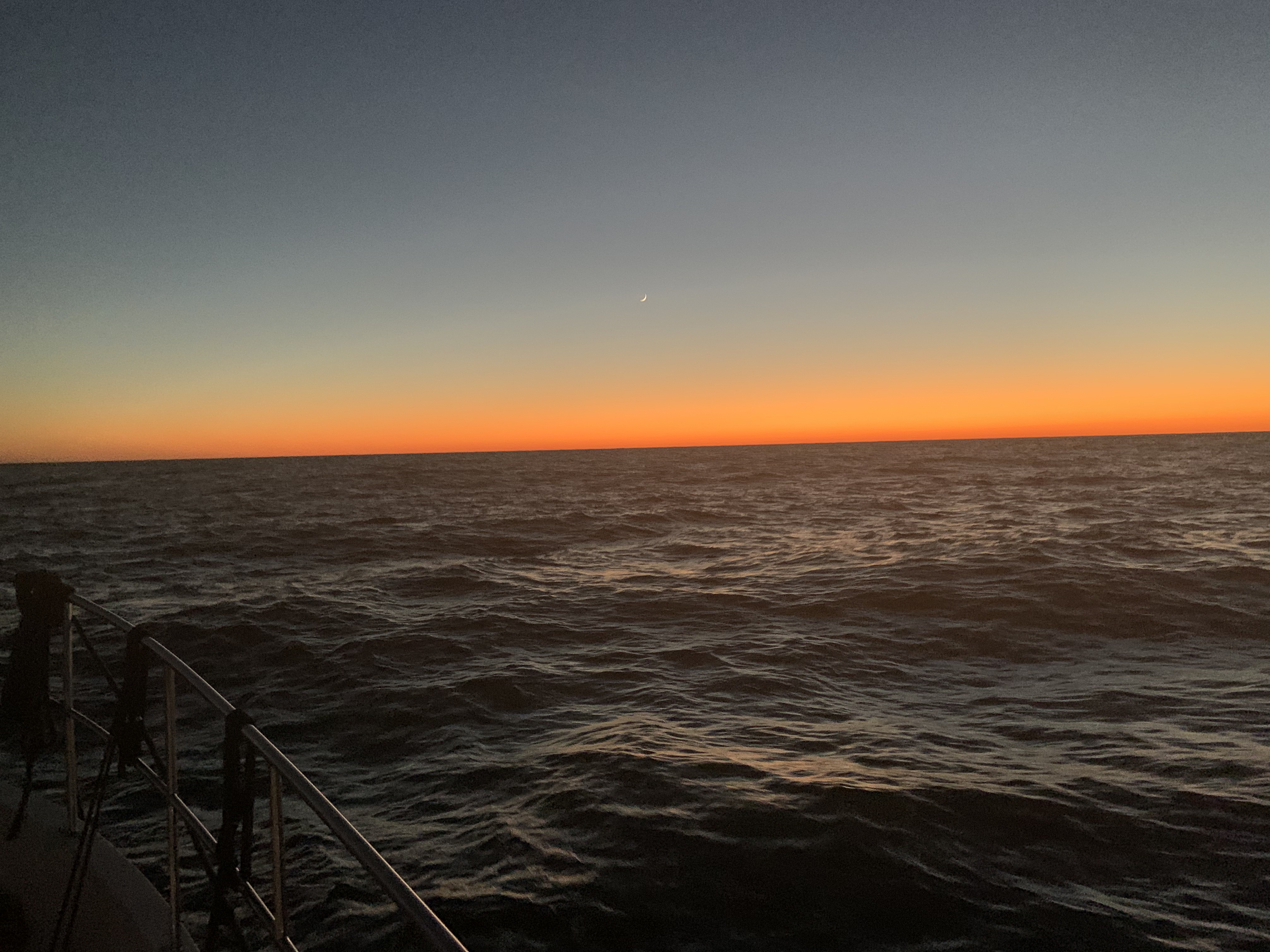
Crescent moon hangs over a horizon of fire
The sun slides beneath the waves. A waxing crescent, hangs above the flames of a burning horizon. I’m sure I’ve seen this surreal painting. An artist’s dream or mine? In a mere hour’s time, the moon follows her partner beneath that distant horizon. The boat surges forward with each wave, piercing the black velvet bedsheet stretched before her. The blackness offers up a gift. The stars are the only things left around. This far out to sea, the glow from land is all but snuffed out. The moment is now. I douse all the lights aboard and run to the bow. My bare feet upon the cold salty deck. The diesel’s growl is but a whisper to the parting ocean that crashes to both sides of me. The deck pitches, yaws and rolls and I am forced to a seated position. Forward facing into a brisk invisible wind. I lay prone. Above me the stars fixed in their galactic positions sway to and fro. It’s an undeniable existential moment. Your presence in this universe comes rushing into your headspace. Why am I here? I am here! I am certain my presence is to be the mirror mother universe uses to gaze upon herself.
CaptMahty
At night when I’m underway laying on the bow my steaming light illuminates the American flags I fly on my VHF antennas.
Steaming light on the American flags
Sometimes If I want to be seen, I turn on my flybridge lights to better illuminate for passing ships.
Flydeck lights on
As I look down at my iPhone’s moon app. I notice that as the boat is rocking the app developers have coded the moon app’s background to move with the iPhone’s accelerometer. The apps stars appear to sway like the ones above my head.
iPhone Accelerometer
The night was long and dark. The 5’ following sea could occasionally be seen as its white froth breaks and roars past the front of the boat. I cannot keep pace with the following sea so each wave lifts the boat’s stern and eventually I slide down the face of the wave as it slips past me.
When Sunrise comes my weariness subsides and I feel a second-wind.
I welcome the arrival of the sun
Friends are here.
They glide through the water with so little effort
Now 3PM, I’m making my way into St. Augustine Inlet. Hurricane Dorian wiped out all the inlet markers so there are no buoys found marking the channel. No worries though as with the incoming waves it’s not hard to spot where the shoals are.
Shoals on the South side of the STA Inlet entrance
As I make my way in the inlet a beautiful Palm Beach motor yacht passes me.
STA Inlet Palm Beach yacht
Once inside the jetty walls I find a sailboat peacefully making way.
Peaceful
I have been told that St. Augustine is a favorite by many a cruiser. Seems every time I arrive here I’m in a hurry to be someplace else. This time is no different. As I pass St. Augustine’s City Marina I view this beautiful yacht resting against the outer dock.
I wonder what the make of this beautiful yacht is?
The Sun is getting low as I make my way south of St. Augustine, FL.
Sun is setting.. better find a place to anchor
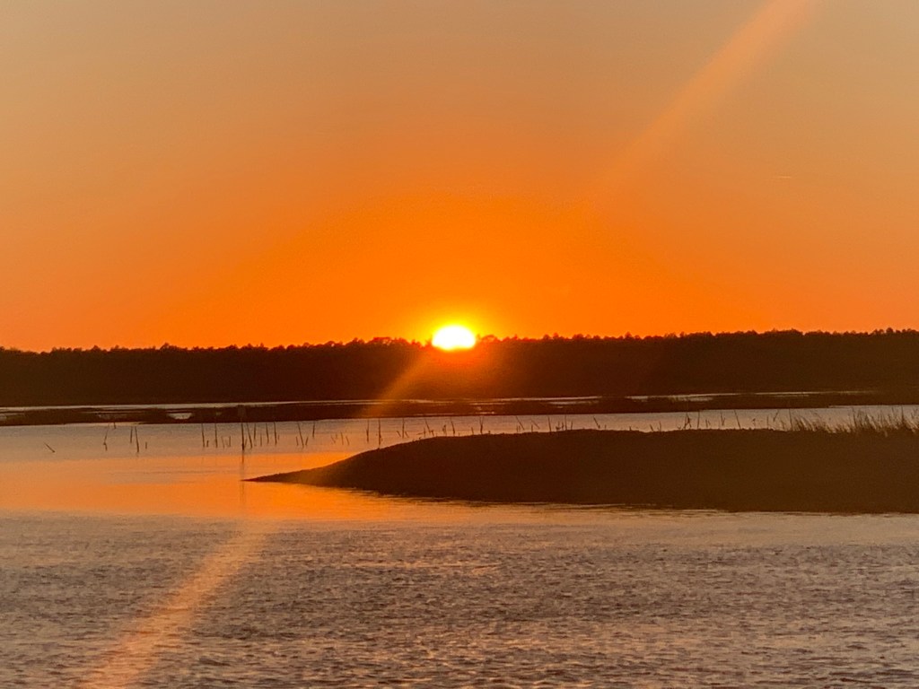
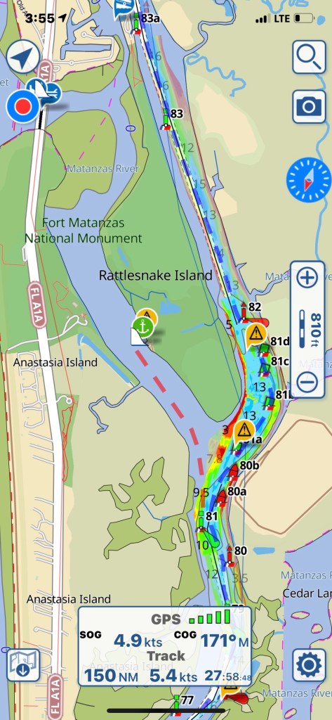
My anchorage for the night is Matanzas as it puts me close to where I want to be around noon tomorrow.
Anchorage off Rattlesnake Island
Now with the anchor down I can finally relax and close my eyes.
I can finally stop driving the boat and close my eyes
If you read the last post, I wrote about how 50 NM / day can be done but you have to get an early start. Well, I didn’t.
9:20AM Weighing of the Anchor
Tortoise and the Hare
Right of the bat I had a much faster boat pass me by. I’m sure he gets his 50NM in before noon.
Raised Salon Cruiser
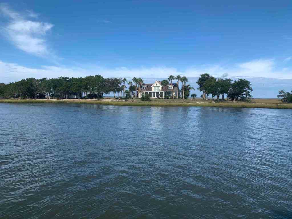
Anyone Home?
I found this home on a small island interesting as I passed.
House on a Small Island
House Close Up
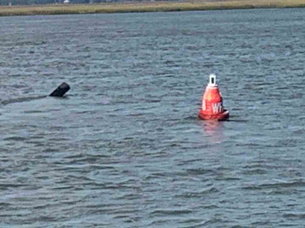
ATONs
ATONs (Aids TO Navigation) or buoys if you will, are important things to pay attention to on the ICW.
deadhead sticking up behind a buoy.
World is Ablaze
As I was approaching Brunswick, GA it looked like the world was burning.
No idea what was burning but there was a lot of smoke
Traffic
I hailed this tug & barge on the VHF and let him know that I would push over to the edge of the channel as soon as I rounded a narrow bend in the river.
Tug & Barge
T&B Close Up
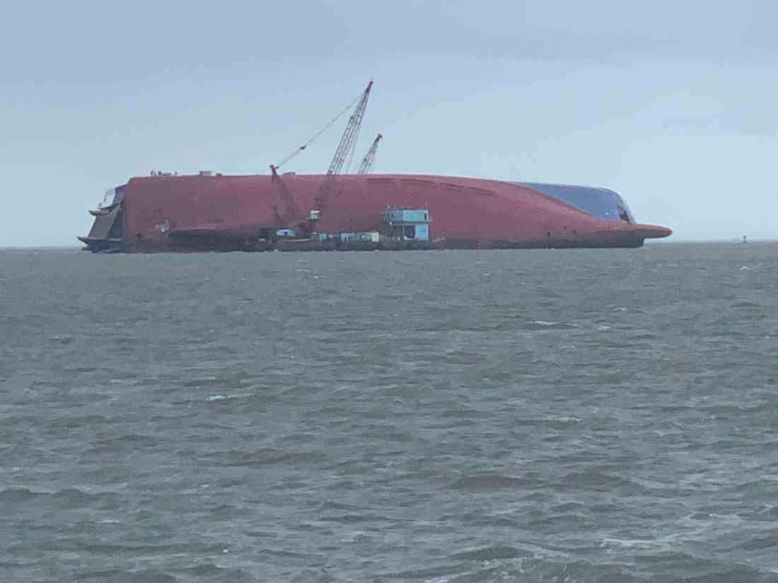
The Unexpected
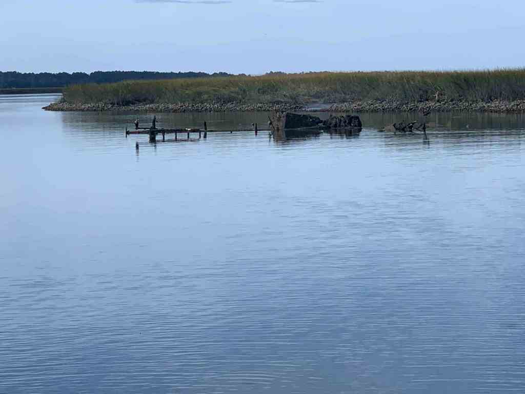
Next came something I did not expect. When I first saw it I had no idea what it was. I spy’d it with my binoculars but I still could not identify it.
What is that?
Turns out this is the underside of the 656 foot long Korean RoRo cargo ship called “Golden Ray” that capsized in Cumberland Sound on September 8th, 2019. While 4 of the 24 crew members were missing 3 were later rescued and even the 4th was pulled out alive. They were trapped with a fire that was roasting them alive while they were stuffing their pockets with ice to stay cool.
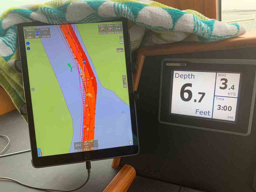
Slow as She Shallows
I was making my way down Jekyll Creek just off Jekyll Island. I found shallows.
Note the slow speed for shallow water
Foreboding
As I glanced up at the sky I could see that it was getting lower and darker.
A darkened sky ahead
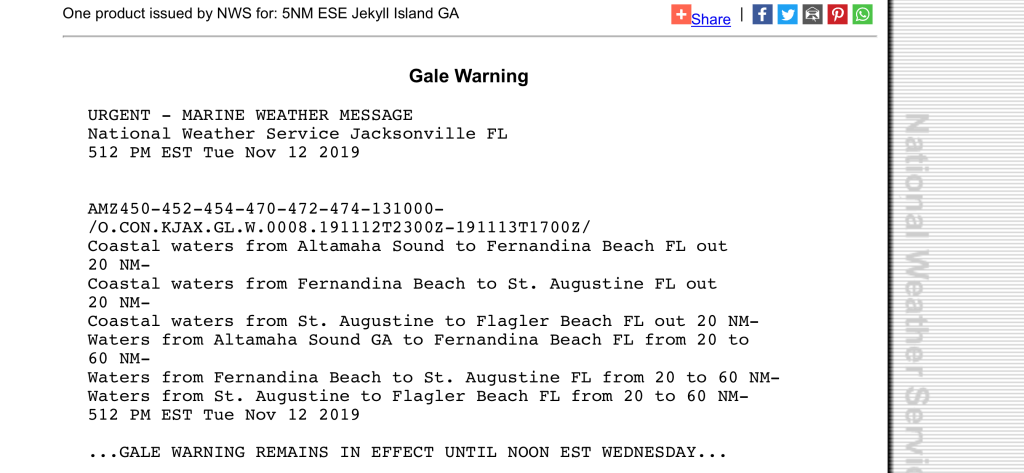
Time to stop being a lazy captain and check the weather.
Gale Warning starting at … Well NOWOffshore Weather Front
You Ain’t Be Around if You Ain’t Been Aground
I was happy that my anchorage was quickly approaching. However, before I could get to my chosen anchor location I came around a turn in the bend to find this trawler aground.
Like I always say, “If you want to know where it’s shallow… it’s where the birds are standing”
Have You Been Paying Attention?
Have you have been paying attention? Did you read my last blog post about how I plan on making 50NM legs like this leg shown below?
W03L017 Crescent River Anch – Delaroche Creek Anch
Well I got a late start, I ran into shallow water, Gale Warnings, slowed for all kinds of things like trawlers aground. When did I get to my anchorage? In the dark with gale warnings. OK, It may have been gale warnings out on the ocean but only strong gusty winds where I was anchoring. That said, I’m in the Georgia low lands. Nothing sticks up high enough to buffer the winds. I did not snap a pic while anchored because it was just black out. Anchoring did not go smoothly. I had a strong wind perpendicular to a strong current and I was challenged to find a spot that did not have the wind swinging Simple Life onto the creek bank. It’s going to be a long night on anchor. Now where did I put those IPAs?
I was in Savannah. It was 6AM. My guests had departed. I had rented the slip till checkout at 11AM. I wanted so bad to spend my morning strolling around Savannah but the currents were already building against the back of the boat. When you are single handed, a strong current like that can pin you to the dock or worse send you smashing into it. Leaving early before the current got too strong was the right choice. As I pulled away from the dock, I reflected for a moment and thought… “I’ll be back”.
As I headed back down the Savannah River I chose a short cut that leads back to the ICW but further south. I had never taken this short cut and it turned out to be a wise move cutting maybe 40 minutes off my day’s leg.
Fuel Conservation and Distance Traveled
From this point on I would plan my routes to only 50NM a day. I would run at only 1400 RPM and burn around 2 gallons of diesel an hour or about $6/hr. Which is much better than the roughly $18/hr I had been running.
1.9 Gallons of Diesel an Hour
Leaving the throttle at this RPM means my speed will change as the currents are either with me 8 kts or against me 4 kts. Taking an average of 6 kts x 10 hours of daylight for these latitudes / season is 60NM in a single day.
Delays! Think about what slows you down.
Bad weather – Wind against you.
Bad luck hitting currents mostly against you.
Shallow areas where you must slow down to prevent running the boat aground at speed.
Late starts means not pulling up the anchor right at sunrise.
Time spent waiting for bridges to open and let you pass under.
No Wake Zones – Near marinas, anchored boats, homes with boats in the water, kayakers, paddle boarders, etc.
Arriving at your intended anchorage and it’s full meaning you must push on to the next anchorage. Sometimes this is over an hour away.
I have found that 50NM / day can at times mean arriving at your intended anchorage in the dark if you are not timely.
South of Savannah
One of the first spots you come to is Thunderbolt, GA. Here I pass the Hinkley Yacht Services and their docks. There are always pretty boats to be seen.
Benateau 50′ Swift Trawler
55′ Azimut
Catamaran Ashling with dual masts?
MV SiSiSi – Sexy
Thunderbolt, GA
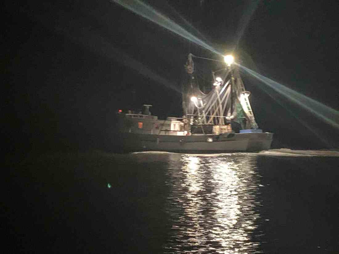
I pass many commercial fisherman.
Catching bait fish with small throwable nets
Who was towing who?
Commercial Fishermen
When I arrived at the Crescent River where I intended to anchor, the last bit of light was fading. I snapped a picture but I think the video captured more of its beauty.
Day Two in the Crescent River
I awoke in the AM and just decided I was not going to leave. I thought… why not spend a quiet day on anchor?
Early this morning a commercial fishing boat gently passed by me at around 4AM.
4AM pass by me on anchor
I was relaxing when I thought did I hear a knock on my hull? I opened the back door to find a fellow cruiser in his dinghy asking me if I wanted an shrimp from the local fish market that he was going to. I replied, thanks but I was not in the mood for shrimp (after all you have to cook those things). We chatted for a while about where he was going (Exumas, Bahamas) and he dashed away in his dinghy.
The tides run about 8 feet in these parts of Georgia. You must be careful when you anchor at high tide that six hours later you won’t swing into a shallow and ground yourself. I had circled my chosen anchor drop location to test the depths out to a radius of my intended anchor rode length + boat length to make sure. My notes about this location marked an old dock hidden beneath the waters so I made sure to anchor away from it. In the morning it was low tide and I saw that the location was not where the previous captain had stated but in fact was very close to where I anchored. I updated the hazard location in the database for future captains that might choose to anchor here.
Old Dock of sorts a distance off the shore and exposed at low tide
I use an anchor alarm app called “Anchor!” on my iPhone and it showed that while I move with the switching current I stayed parallel to the river bank. That is usually the case when you don’t have a strong crosswind.
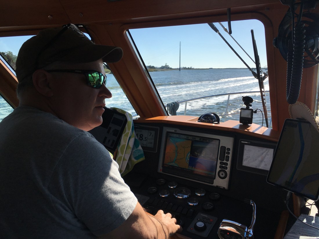
We pulled out of Beaufort, SC and I was at the helm again.
At the Helm
Listening to USCG hazard to navigation broadcasts about a submerged object.
We had dolphins off the bow as we passed Hilton Head Island.
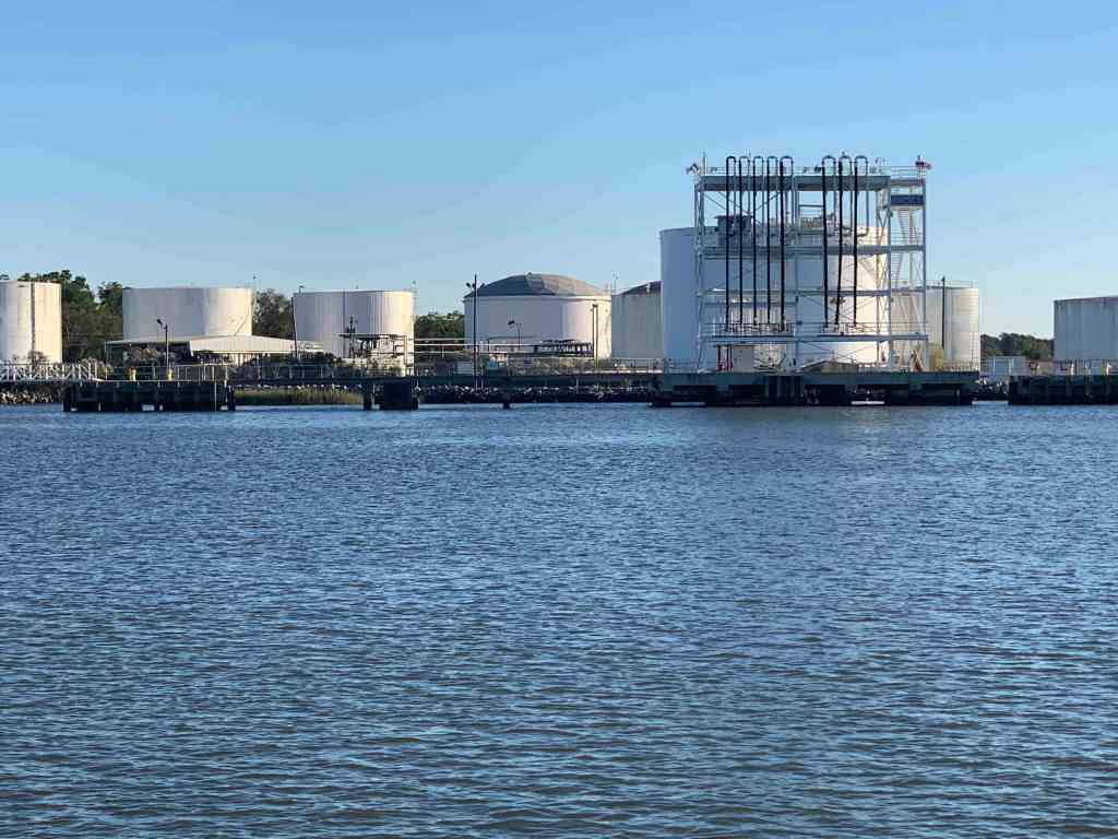
As made our way down the Savannah river you notice that the banks for the river have been artificially made high and that there are large gas tanks and other industrial structures along the shore.
Fort of some kind
Tanks line the shore
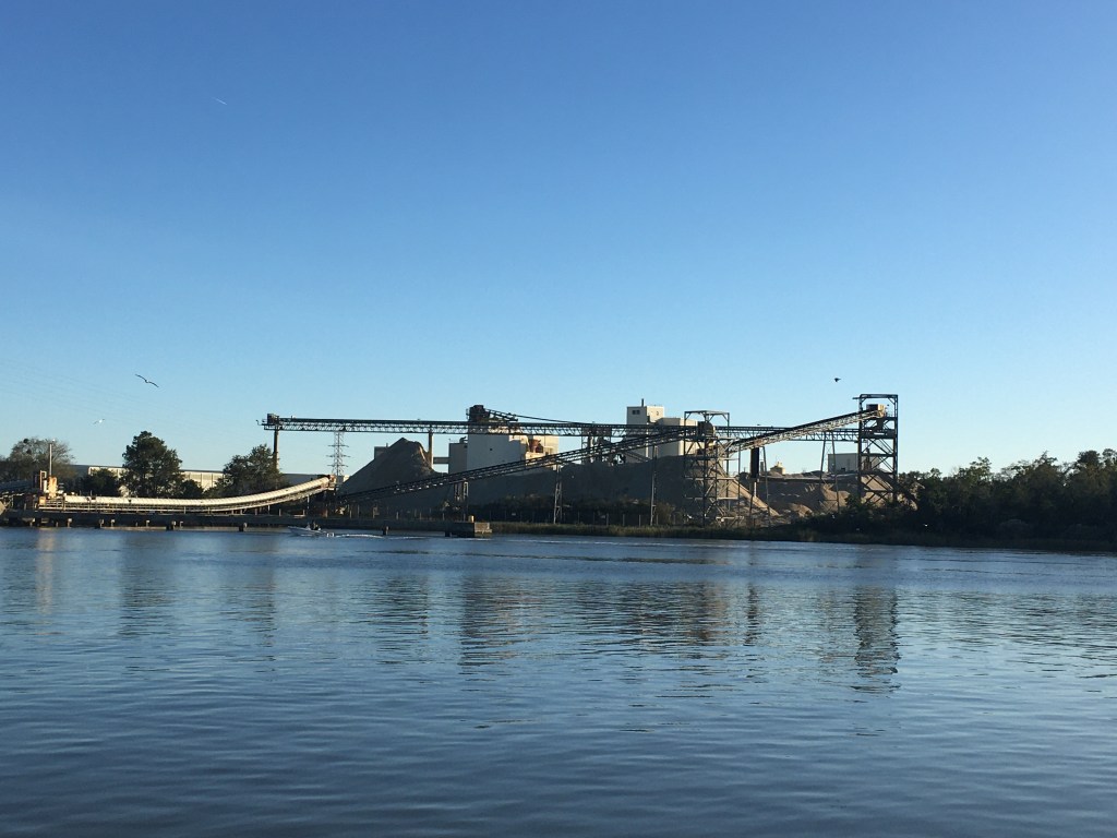
Conveyor Belts
Gas Tanks of sorts
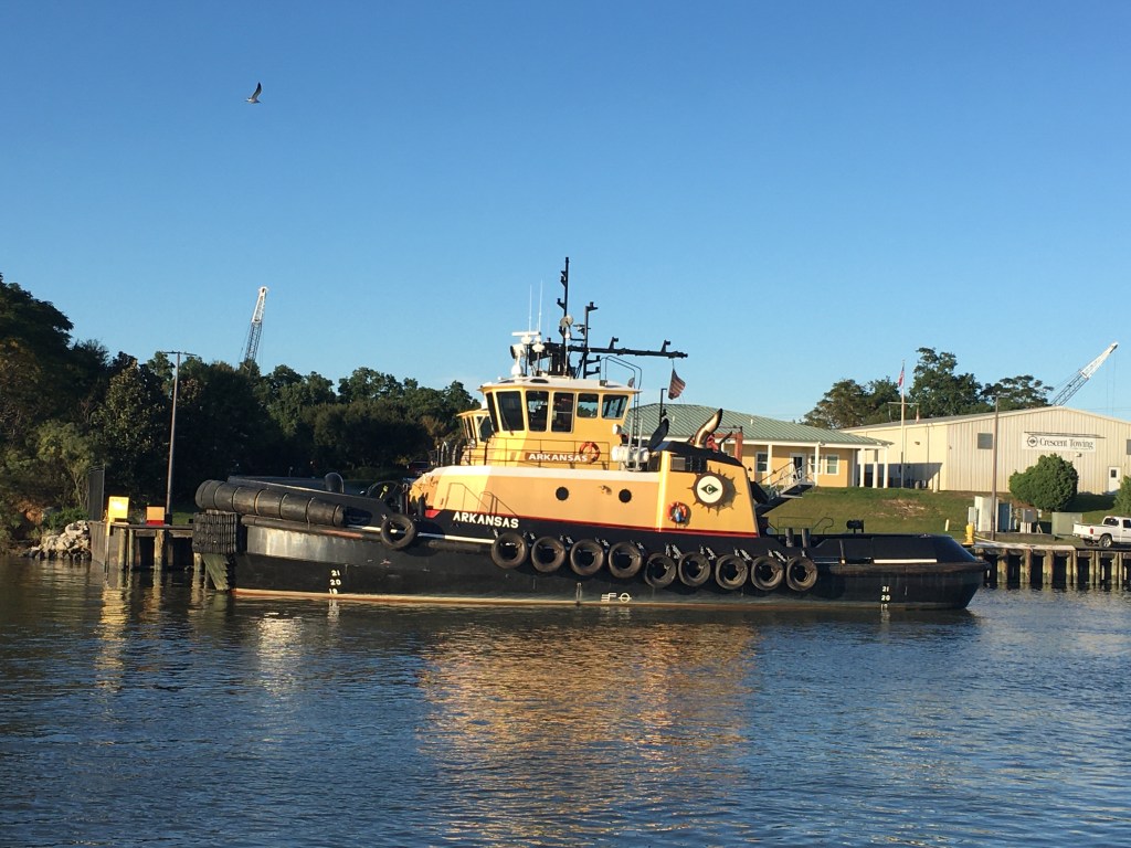
There are many tug boats in the river to assist the large tankers and container ships that seem to be everywhere in the river.
Edward J Moran
Tug
Laura K Moran
Tanker
High Bridge for them to tuck under
The Mighty Tug
Just another big ship
Stern full of containers
I think I can
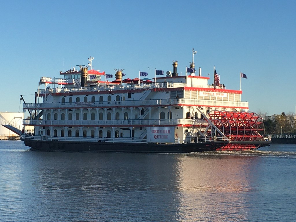
Several passenger ferries past us as well.
Georgia Queen
Savannah Belles Ferry
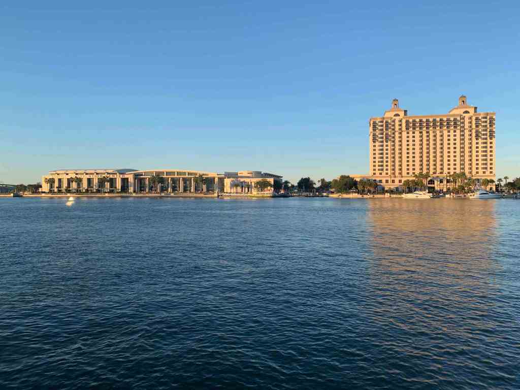
I had called the Westin hotel earlier in the day to reserve a slip in front of their hotel but the woman who answered the phone kept trying to rent me a hotel room. I kept explaining that we were a boat and needed a slip at their marina but she just did not seem to understand. Oh well.
Savannah Convention Center & Westin Hotel
I called a River Street Dock just across the river and it worked out great. Turns out it’s right in the heart of everything.
The Savannah River was full of huge container ships that if they ever took the turn wide they’d crush us flat.
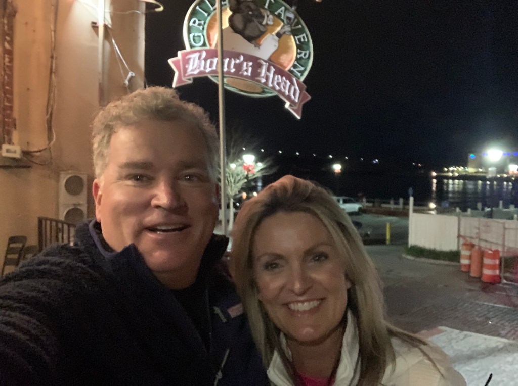
Rather than Spanky’s, we chose instead to go to the Boar’s Head Grill & Tavern for dinner. It turned out to be a great choice. The food was excellent and the beer brought to me made me laugh. I asked Charlene “Shaalean” our waitress for the double IPA “Beeyah” (with my Boston accent). She came back with a different IPA called “Damn Yankee”. Should have seen that coming.
After a boat-load of Damn Yankee’s we came back to find the current slamming into the stern hard enough to push debris onto the swim platform.
Early the next morning it was time for my guests to depart. We had so much fun in the short time they were aboard. I will miss their laughter and amazing meals they made. They were even kind enough to cook up some dishes and put them in the freezer for me. I look forward to seeing them when I return to RI.
Uber driver showed early in the AM
Oh, I almost forgot the best part, Buddy wrote a MV Simple Life theme song!
MV Simple Life Theme Song
Simple Life
When enough ain’t enough You’re just talking about stuff, And your stuff is wearing you down. It’s time for a change, Time to rearrange Your position that’s got you all wound.
You can learn from the man Who finally understands You can ditch the traffic and strife. Take the soft way through the world And another will unfurl, You can live the Simple Life.
Sell it all but the boat And what you require for the float Leave the shore, your troubles behind. Authentic is real. You must believe what you feel, The Simple Life always feels fine.
From the man who knows, When you’re caught in the throes Of the rat race that you’ll never win. There’s another choice, Trust your inner voice, Cast your doubts to the following wind.
Cast off your ways, Imagine simpler days. Cruise in a way that rewards. Make dozens of friends, Share beers in the wind, Find your world without discord.
Breathe deeply the air, Feel the salt in your hair, Know that you’re doing it right. Bring your girl (or your wife) You’ll never feel more alive Softly living the Simple Life.
I awoke at 4AM before any of the crew. Neither Happy or Brody came out from under the covers to join me. We are in Georgia and it’s only 40 degrees when I awoke.
Heck, the temps were going to fall deeper before the 7:13AM sunrise.
Underway in the dark 6:14AM
By 6:30AM the sky was starting to lighten up on the ICW.
Looking East where the sun will rise
I decided to walk out on the bow while underway and snap a picture and a quick video before sunrise.
Not quite Sunrise
Once the sun rose you could see it burning the face of the daymarks as we passed.
It’s high tide and the rivers are swollen around here. Daymark almost underwater.
When you are at the helm for hours the internet is your entertainment. I was watching Mike-the-Drunken-Donkey from Mike’s Weather Page broadcasting FB Live video stream. I tuned in as Mike taught about weather and what to expect from the winter storm making its way across the US.
Thankfully, MV Simple Life will be in Florida by the end of the day
We were amazed at how flat calm the ICW was as we pushed along at 7 knots.
Not a frozen Lake but contrails in the reflected sky
Daymarks Reflected
Flotsam in the sky
Flotsam everywhere
My reflection as I snap a picture of the bow’s wake
At the helm I’m wearing my work pajamas because it’s still a bit chilly even with the diesel heat on. Happy just figured out that there is HEAT coming out of that little black round duct below the AC panel door. She parked herself right under my feet to steal all the heat.
Heat Hog
We were making incredible time as we approached Cumberland Island in Georgia.
SOG (Speed Over Ground) = 10.4 knots
10.4 knots because we were enjoying a strong current on our stern.
Then as we looked out, we could see a current line on the surface of the water.
Opposing currents meeting causing white chop
We feared as soon as we crossed this line that our 10.4 knot speed would begin to erode. We could never have guessed just how much.
Strong Current on the nose. 10.4 => 3.9 knots
Knowing we would face this current from our trip around Cumberland Island we attempted to ride close to shore looking for an eddy current (reverse direction). But alas it was no use. We had a long slow ride around the island.
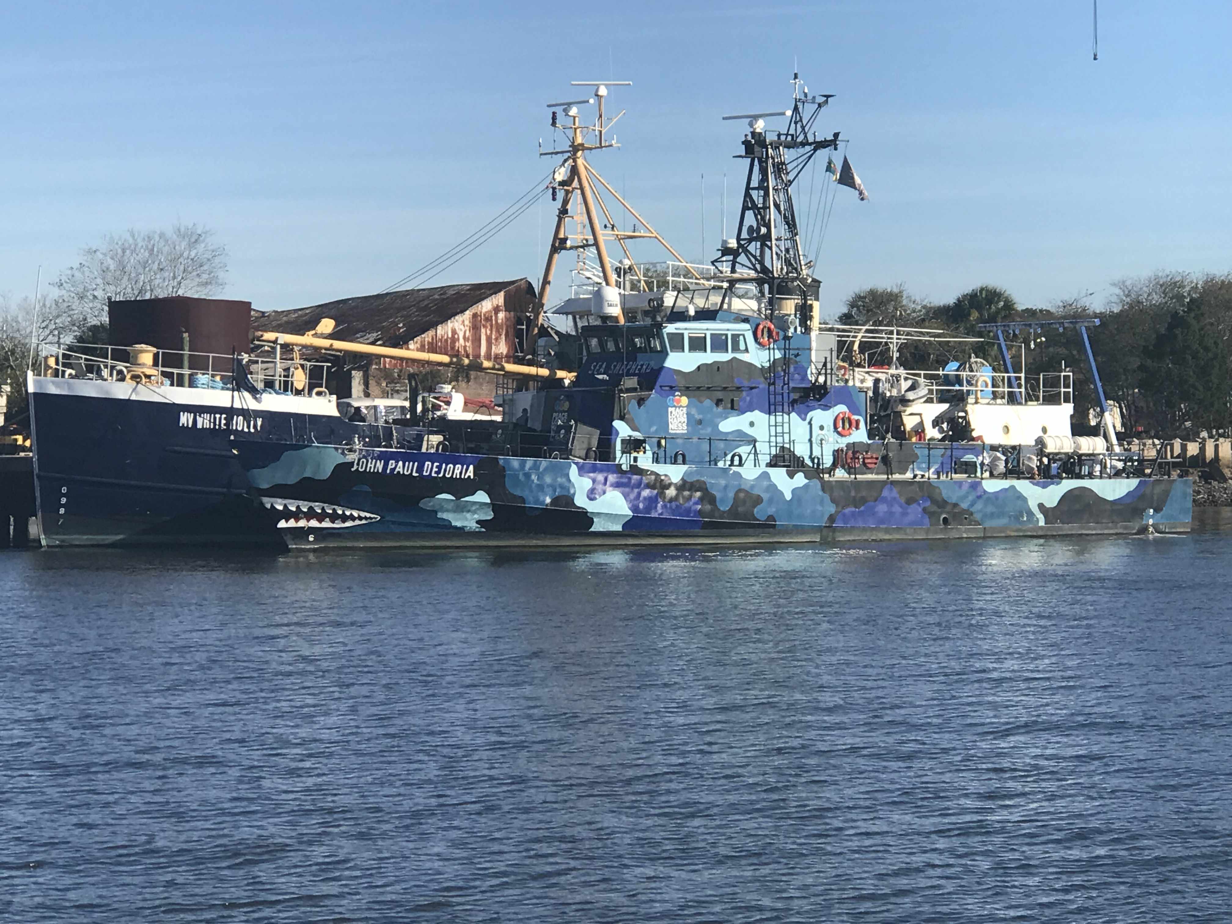
Then it happened. We crossed over the state line into Florida’s Amelia Island A.K.A. Fernandina Beach. As we passed we saw a ship that looked like a member of the Sea Shepherd fleet. We snapped a photo on the way by and low & behold, it was a Sea Shepherd ship.
Sea Shepherd’s – MV John Paul Dejoria
Kelly & I have always been fans of ocean conservation and the crew of Sea Shepherd work hard to keep our oceans and their inhabitants safe.
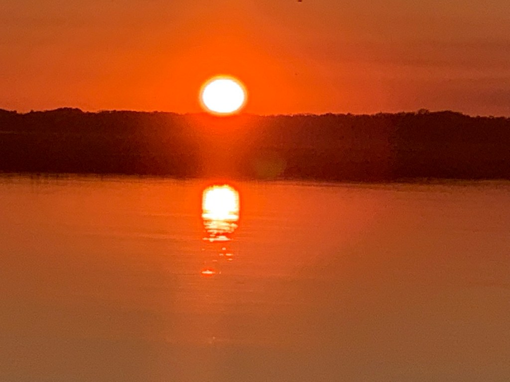
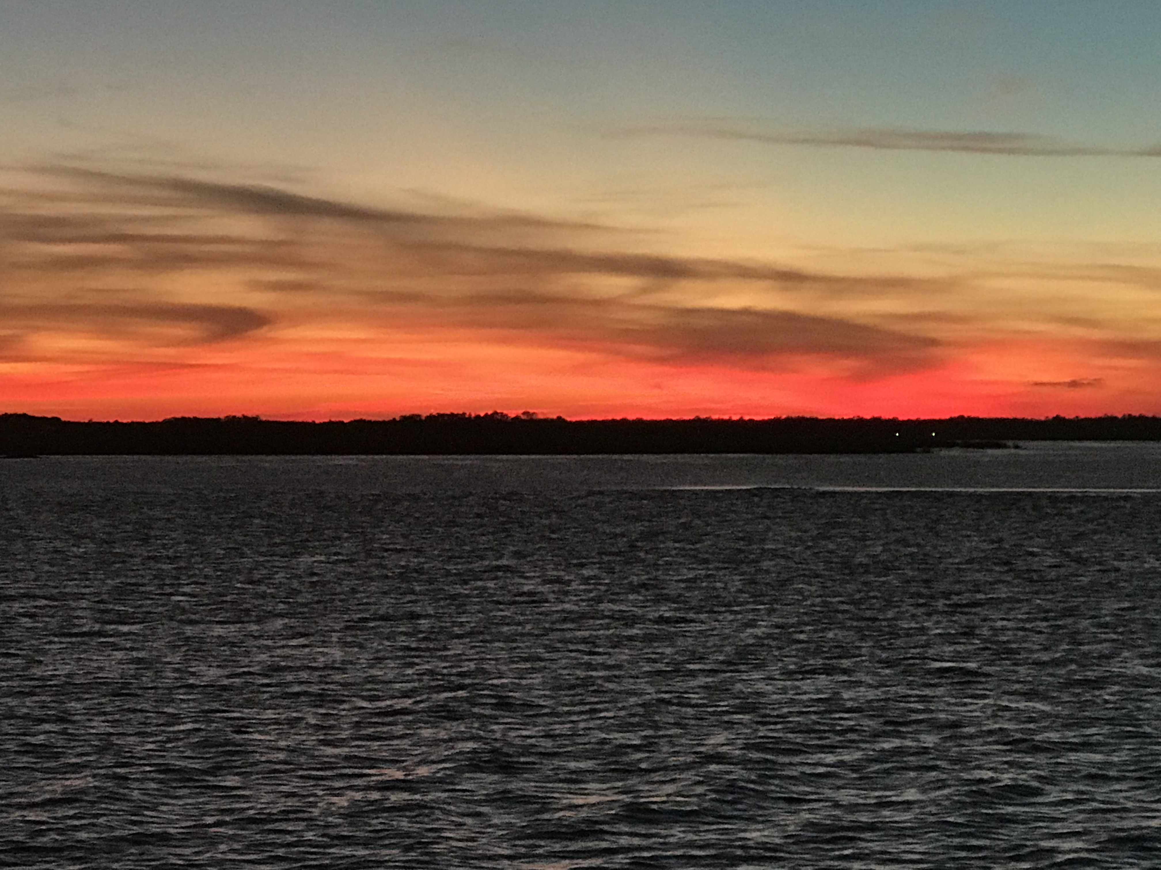
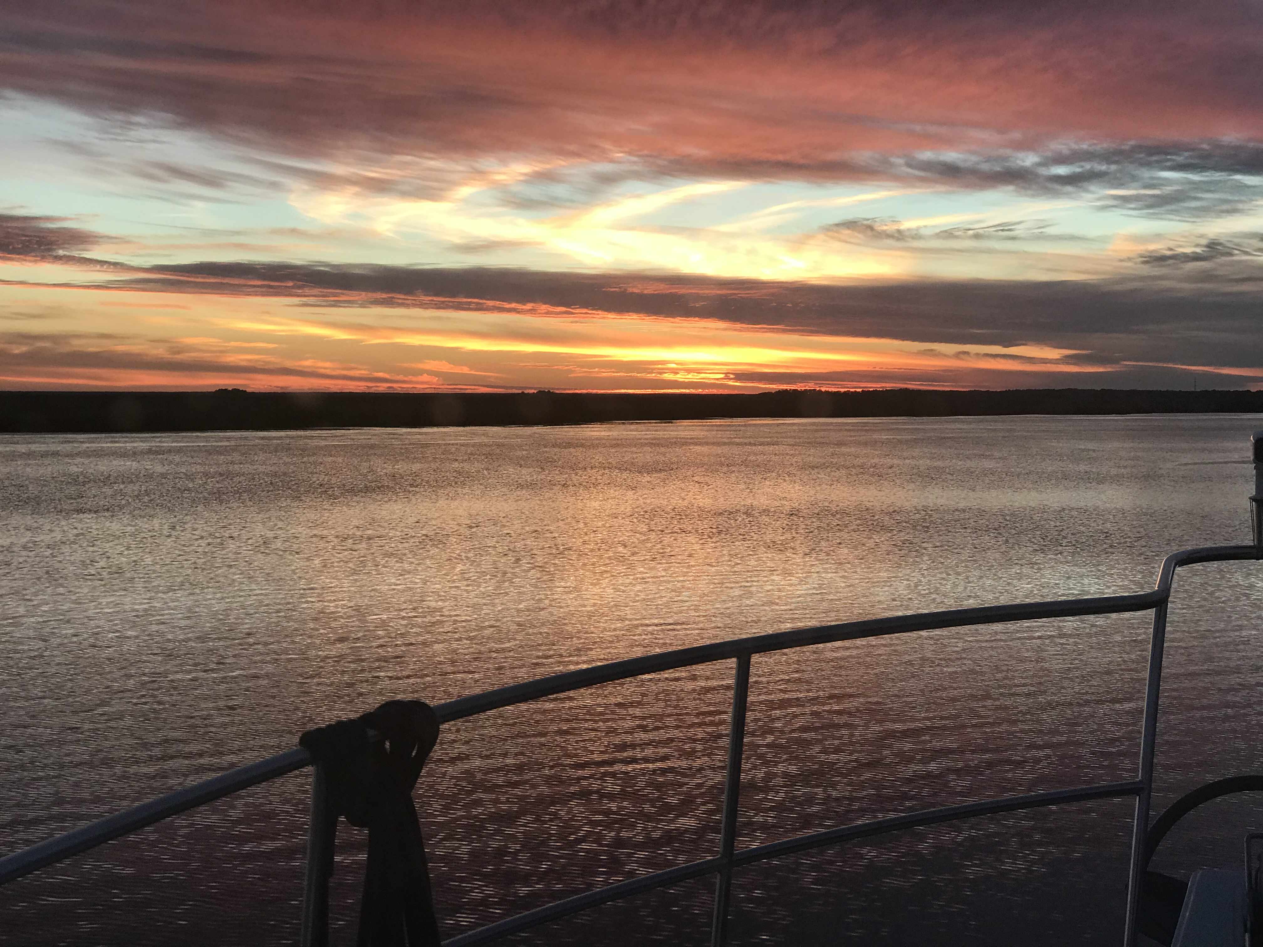
We are currently anchored in the Amelia River just over the GA-FL state line.
Sun is setting in the Amelia River as I finish this post
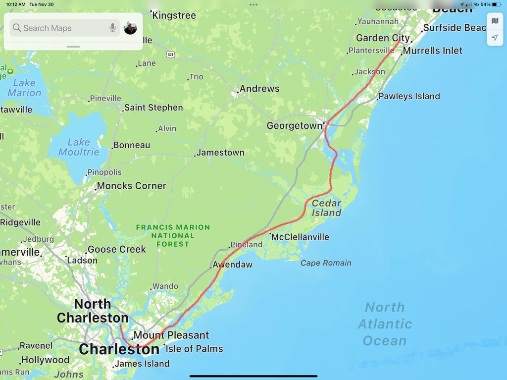
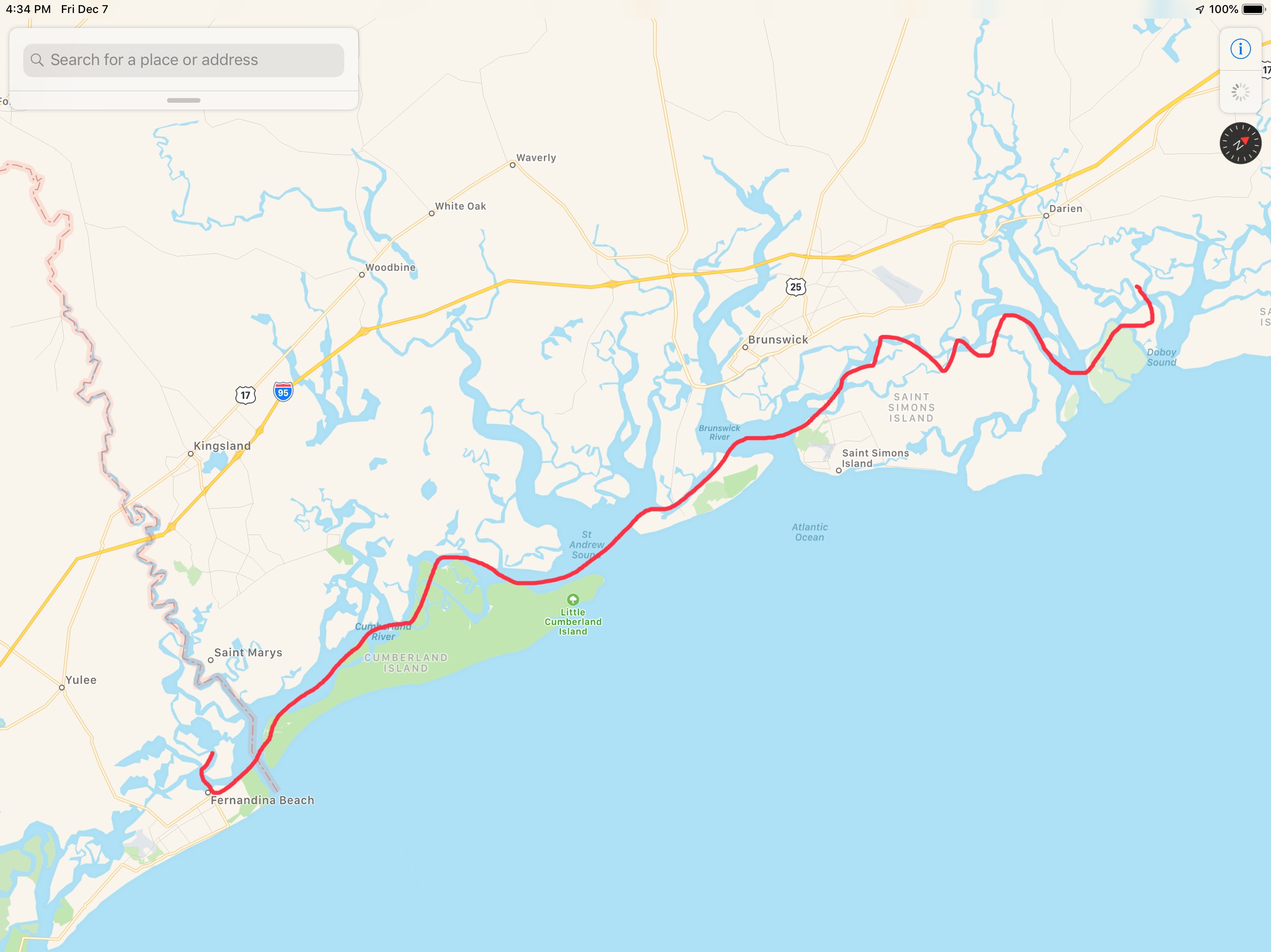
Today’s leg looked something like this finger drawn route.
We awoke on anchor just South of Turtle Island in SC. It’s a tiny uninhabited island that is on the Atlantic Ocean. There is hardly any light at night so the stars just pop out at you. They seem so much brighter and like you could reach up an touch them. Seeing the cosmos this way makes you realize that your consciousness is contemplating your existence on a small planet in the Milky Way galaxy. I wish there was a way to capture it in a picture but alas I have not found a way.
Cold. It’s F’n cold when I stand outside and watch the sunrise. It’s part of the experience but it’s also the whole reason we left New England and have been boating for the last 180 hours. Getting away from the cold means traveling further South than you would think. It’s only 36 degree as I stand out there watching the sunrise. 36 degrees and I’m on the edge of Georgia! Time to simply weigh anchor and go..
Turtle Island is South of Hardeeville but I’m guessing this weather app has no data for Turtle Island.
When anchored in weather like this you need a 12V heater as there are no long extension cords leading to the boat. Kelly & I installed a Espar D8LC 27K BTU diesel-fired forced-hot-air heater and mornings like this I realize we would never live on a boat without HEAT.
Espar D8LC Diesel-Fired Forced Hot Air Heater Schematic
Georgia has enormous tides and strong currents.
Riding a high Tide
We were riding an 8′ high tide so we were unstoppable. Well, I mean unstoppable in the sense we probably won’t run into a shoal and be stopped dead in our tracks.
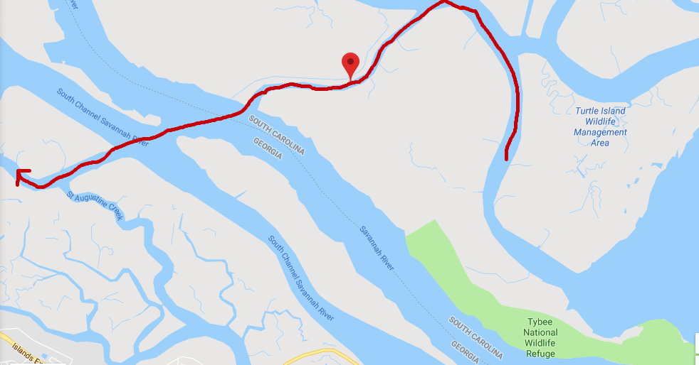
Field’s Cut is just before the ICW crosses the Savannah River and we had to cruise fast to get ahead of the oncoming container ship that just issued a ‘securite’ warning that they were on incoming on the Savannah River and approaching Fields Cut. You need to listen to these securite calls from large ships if you don’t want to wind up on the wrong end of them. We’d have snapped a photo but we were more concerned with staying out of their way. We hailed the ship and let them know that we would be crossing in front of their bow and that we would not be in their way.
Finger drawn route of us crossing Savannah River into GA from Fields Cut in SC
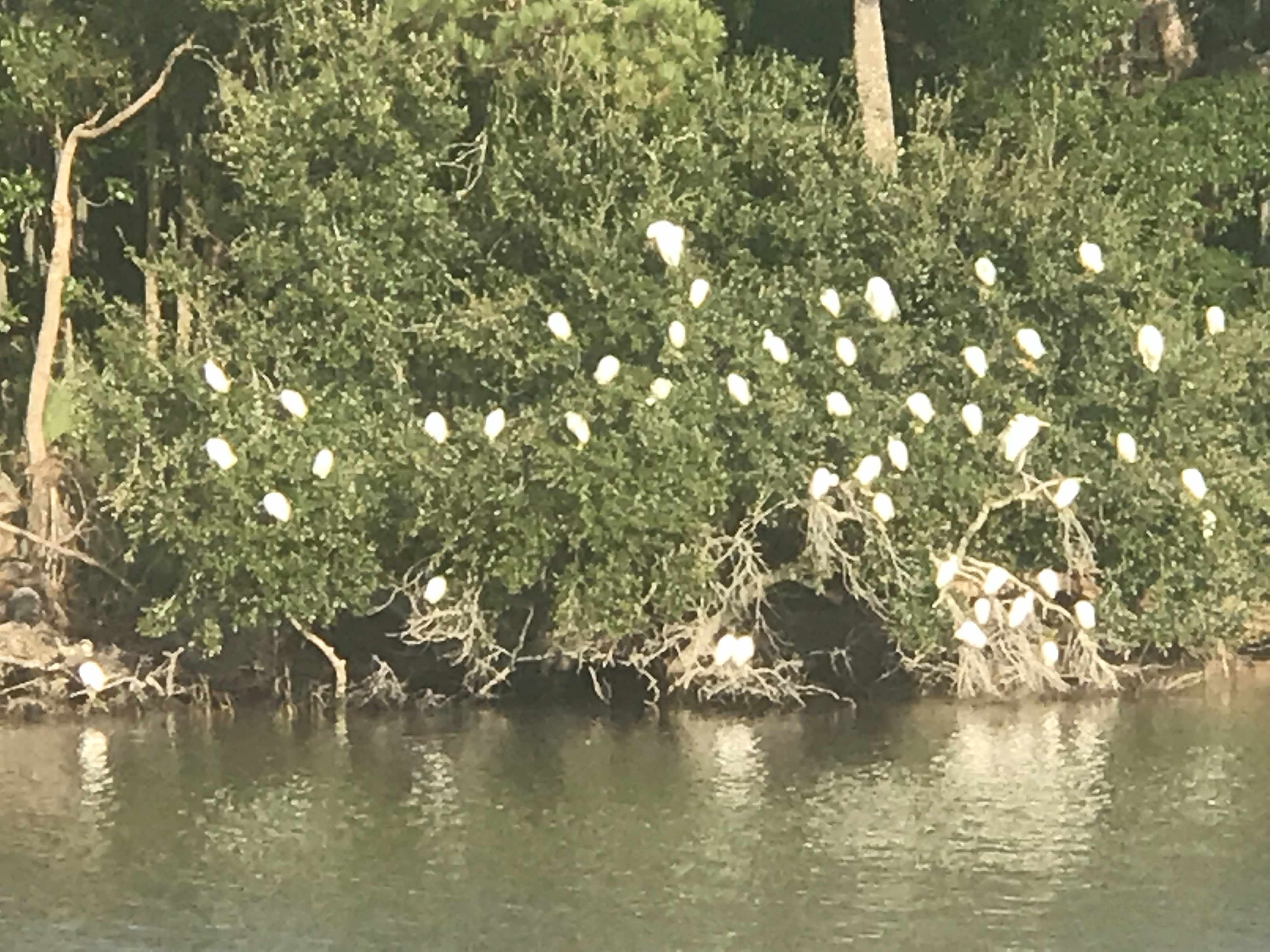
We call this picture “Bush of White Birds” cuz we so creative.
Looked funny from a distance
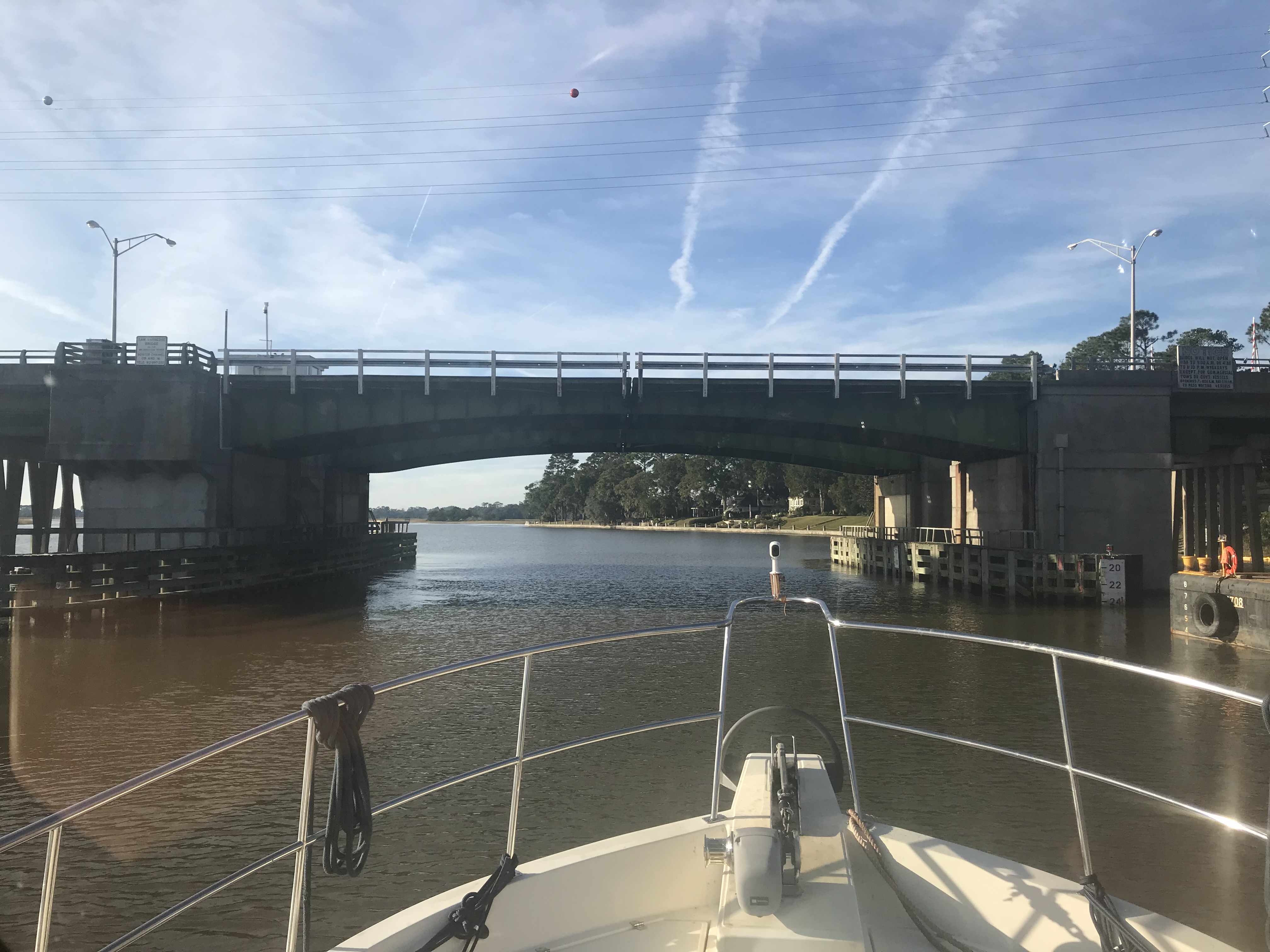
We slipped under this bridge carefully as we just fit beneath.
Low bridges that boat traffic must wait on openings are being replaced by tall 65′ high bridges. That’s a good thing for boaters and motorists alike.
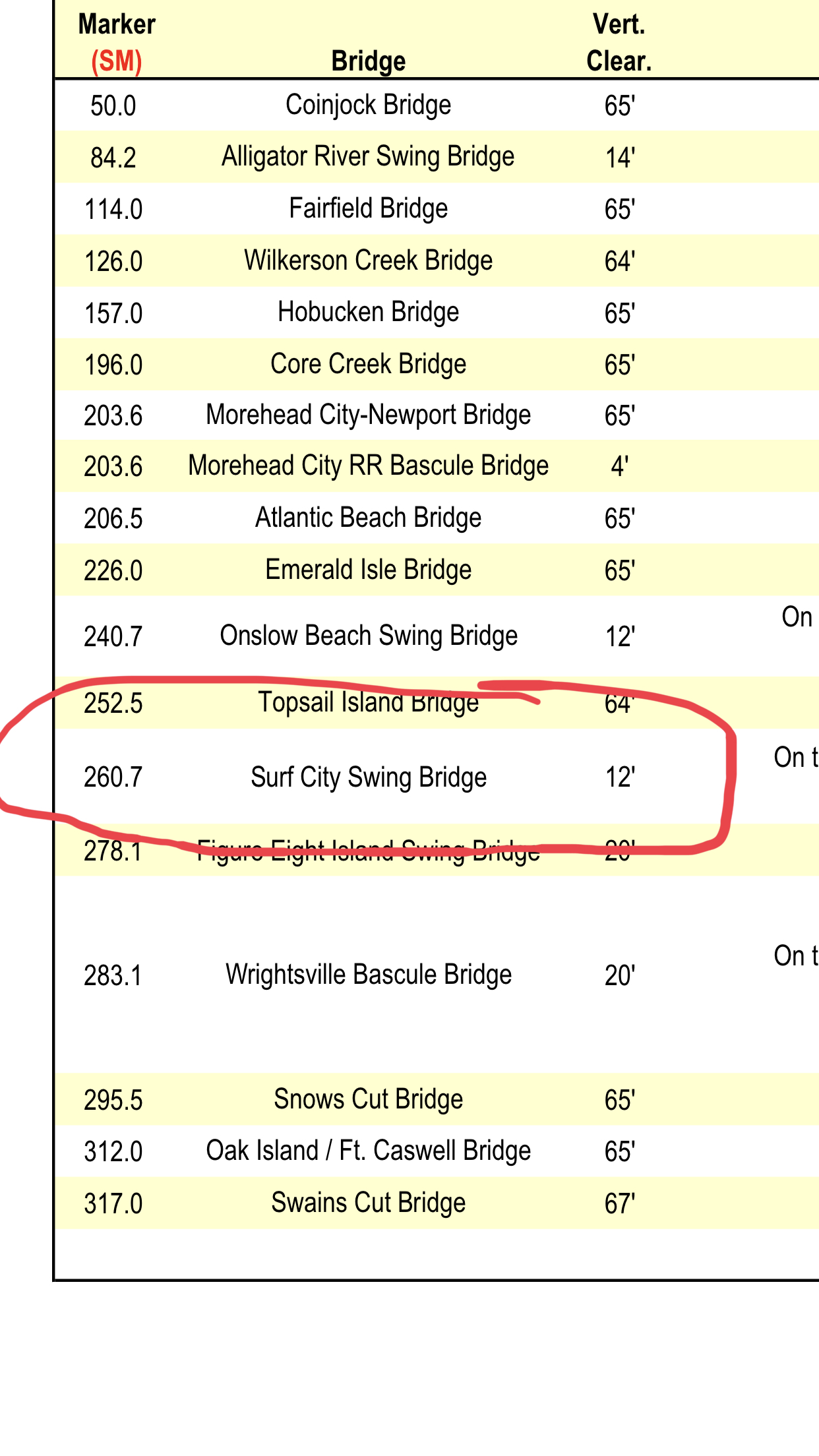
I learned today that the Surf City Swing Bridge was just replaced by a full-height Bridge. Time to update my bridge list.pdf
Kelly has a thing for wooden transom boats so we snapped these pics of MV Sandrita as she was being hauled via a marine travel lift. We had to slow down to no wake speed as these dock workers were trying to load her in the slings.
Going into the Slings
Don’t you just love a Wooden transom?
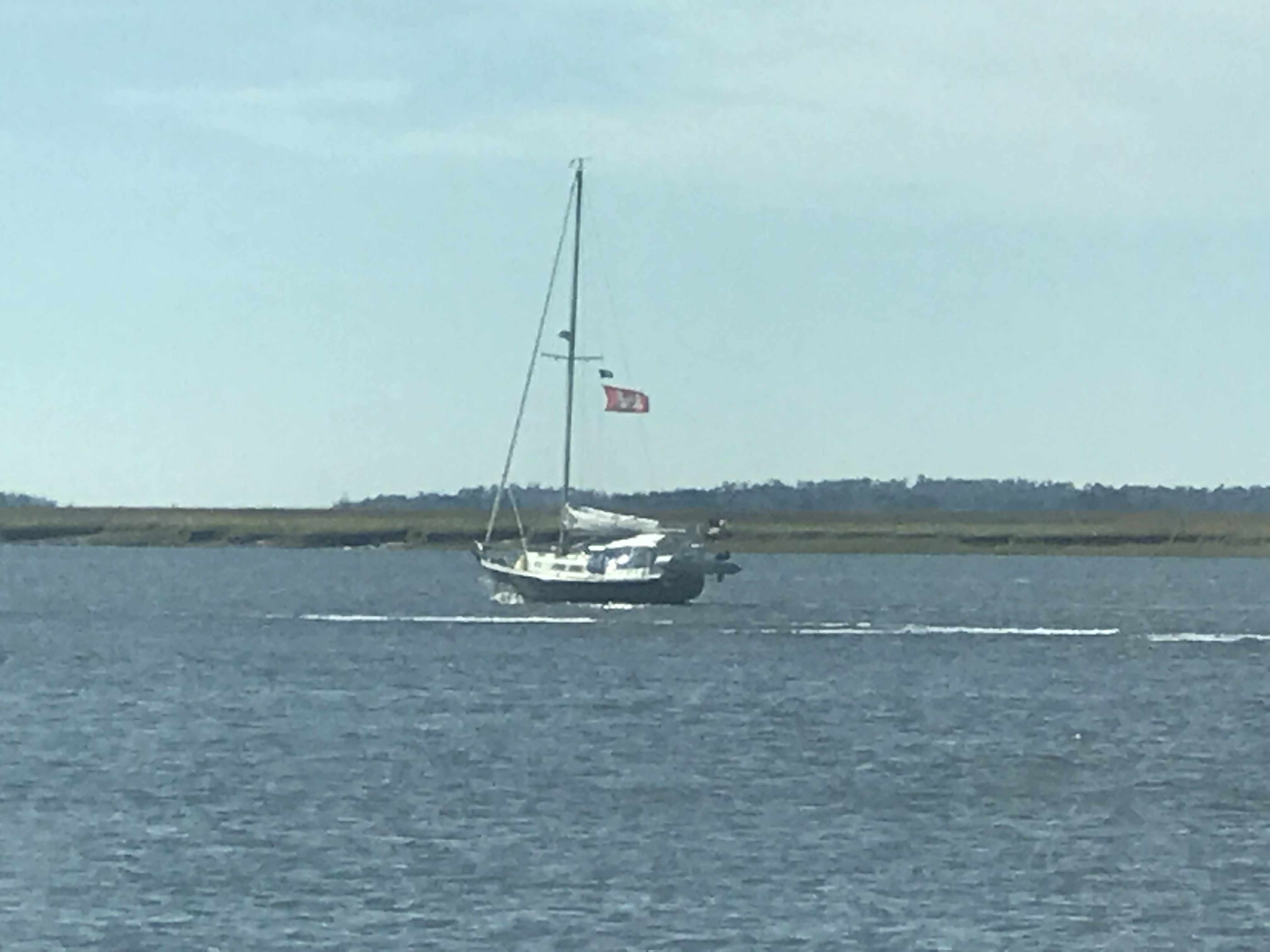
We hailed this blue-hulled sailboat to warn them they were approaching a shoal. They had already figured it out but thanked us as they backed out of the channel they were in. Captains on the water are kind and always offer help if they see another boater doing something that might get them into trouble. I’ve had captains hail me and say… Simple Life, you need to keep that red tight to port to clear that shoal”. Kelly & I feel lucky to be apart of a group that looks out for one another.
Approaching Hell’s Gate – a notorious shallow cut that leaves boats aground
Kelly & I each bought Florida saltwater fishing licenses today. We’ll be in Florida for a minimum of 3 weeks while we prepare for our Bahamas departure.
If we catch a single edible fish, We’ll have paid $130.70 for it 😉 Should have gone to the Capital Grille and just ordered the fish special.
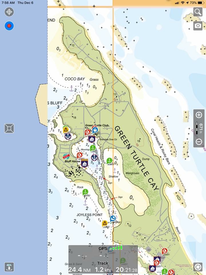
I am on many Facebook Boating groups and love the discussions about the Aqua Maps Explorer Bahamas charts. Folks complaining about the fact that they are raster (bitmap) charts vs vector charts which use math equations to draw the charts at each particular zoom level. It’s interesting to me not just because they pictured Green Turtle Cay where Kelly & I have wanted to visit but that I just am drawn to nautical charts. We hung one on the 275 gallon oil tank in our old house that we sold. It took me hours to print each individual 8″x11″ chart and piece them all together to have a huge chart of Narragansett Bay. I enjoy staring at paper charts like they are artwork for ship captains. Vector charts lack the beauty of raster (paper-style) charts.
Raster Charts
Vector Chrts
We passed a beautiful fishing trawler as we got close to our final anchor location for the night.
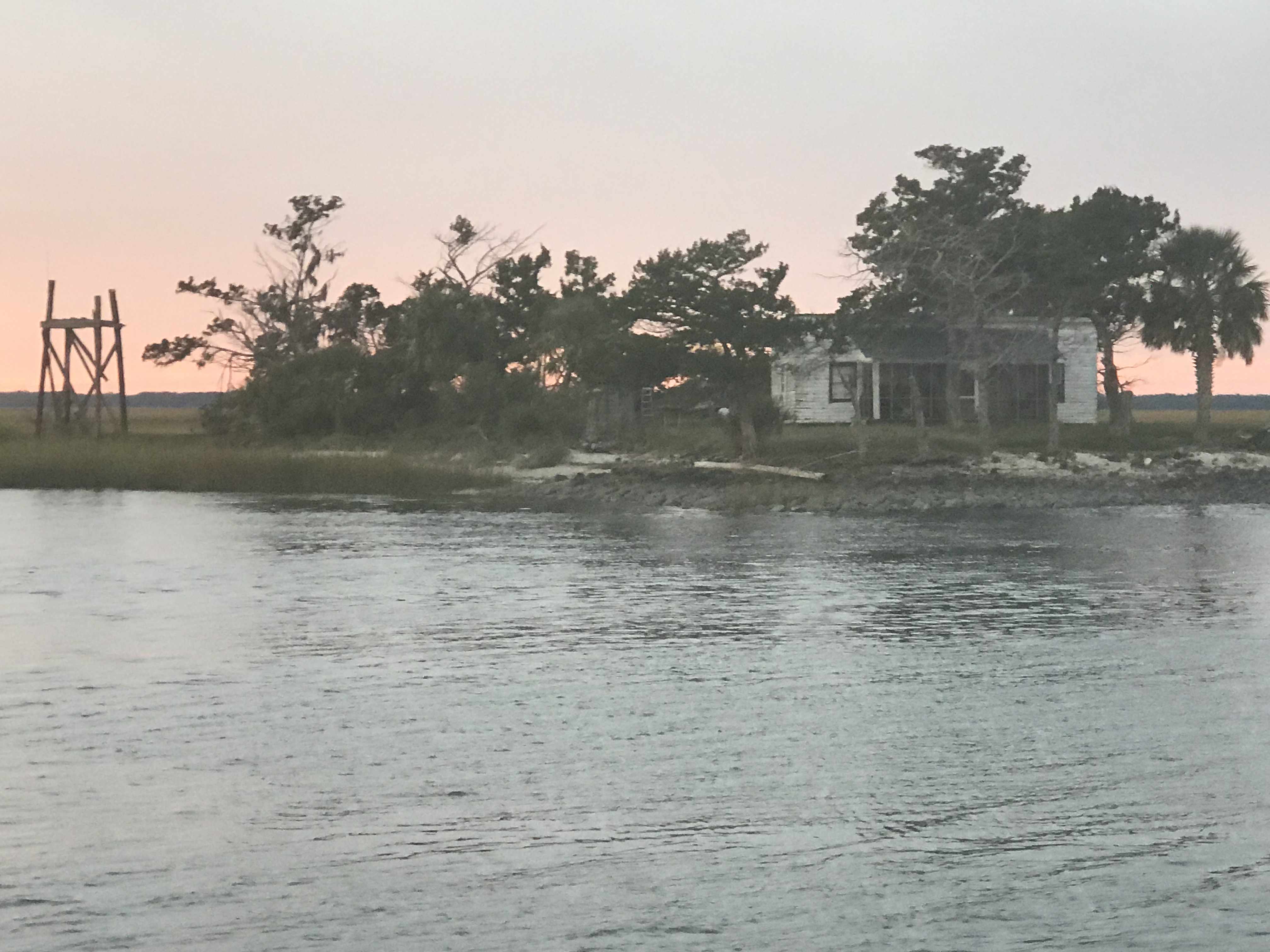
Soon we were passing this cool little house on an island along the banks of the ICW in Georgia.
If we’d had a canvas we’d paint it.. somehow
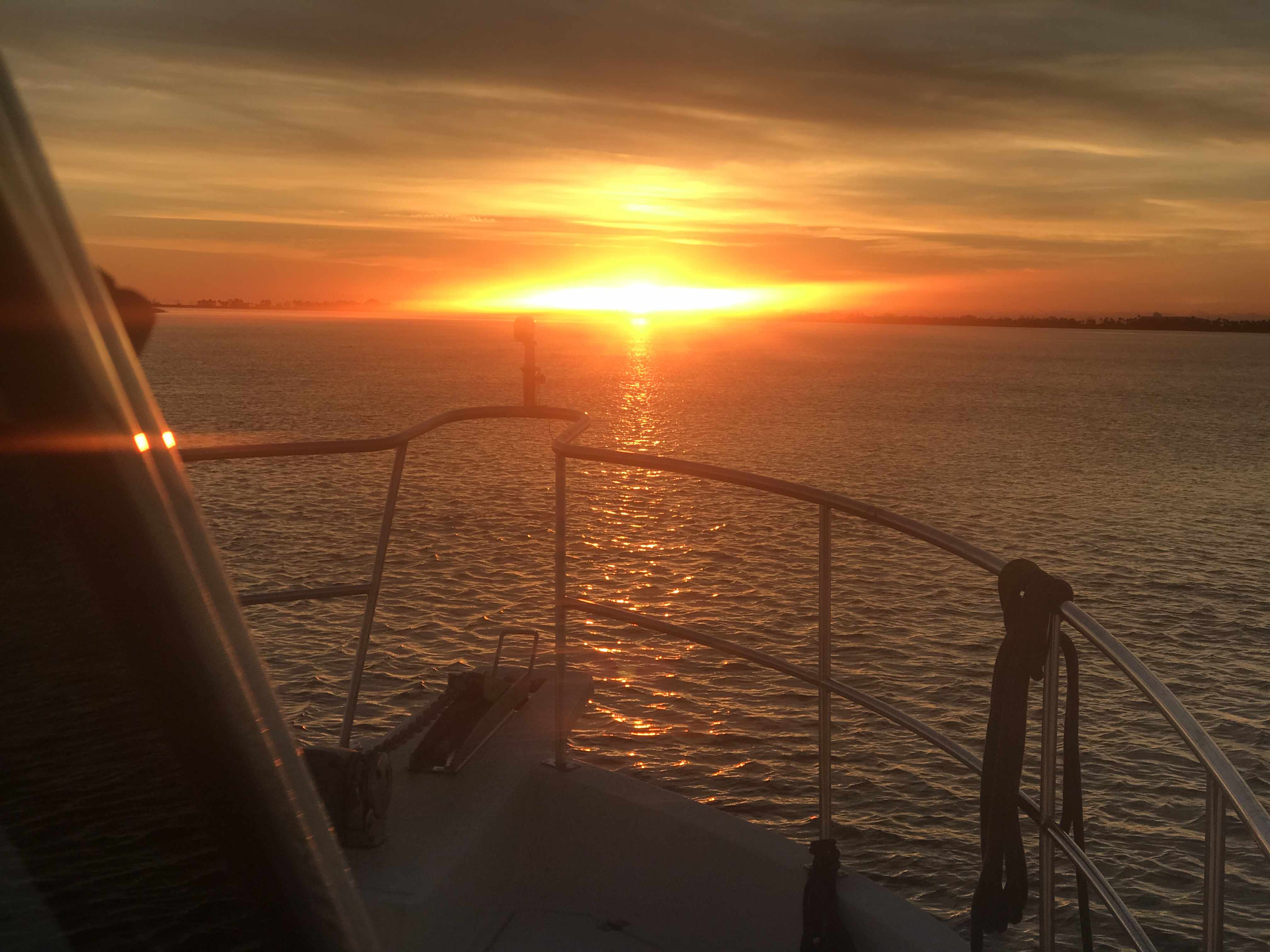
The sun was quickly setting on us and it was spectacular.
As we pulled into the creek where we’d drop our anchor for the night it was last light.
Today’s leg looked something like this… Not really as the ICW snakes its way through countless creeks in Georgia.
An multi-IPA finger drawn chart of today’s leg.. yeah that’s bad
We had reservations to be at Downtown Marina in Beaufort, SC and the weather was not looking good. With 25 knot winds and gusts to 35 knots.
35 knots = 40 MPG Gusts
As we rounded Hilton Head Island the only thing my radar saw was rain.
That Magenta on the screen is rain reflecting my radar
Our route would look something like this:
Our Route from New River to Beaufort, SC
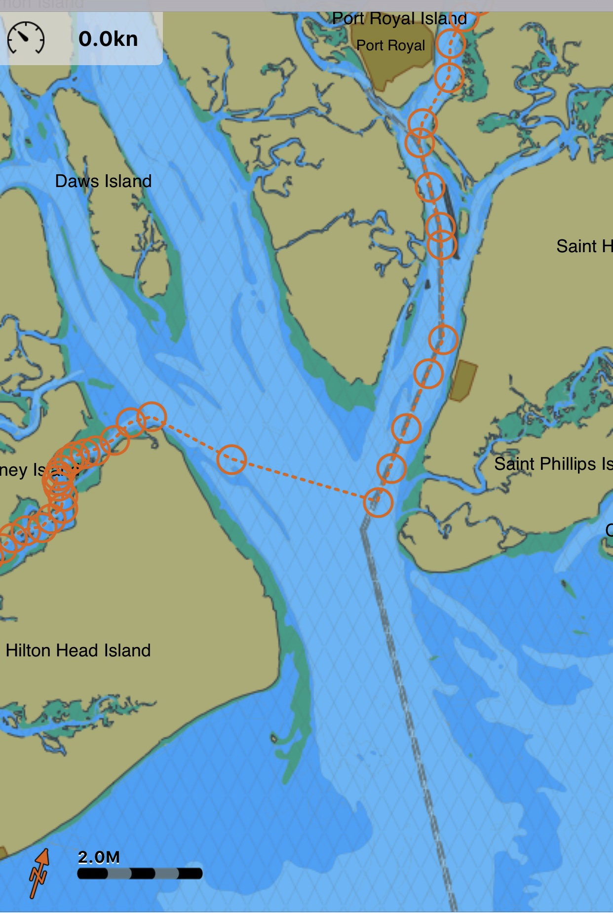
There were only a few locations where I knew we would have to face the wind if just for a short bit. When we rounded Hilton Head and came out of Skull Creek to cross Port Royal Sound inlet was one of them.
Skull Creek along HH Island into Port Royal Sound Inlet and then up the Beaufort River
The weather worsened just as we were crossing Port Royal Sound Inlet. High winds shutdown the Lady Island swing bridge but luckily we have a reservation @ Downtown Marina in Beaufort, SC just feet from the shutdown bridge.
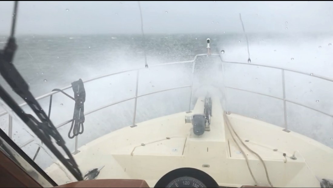
Waves maybe 3-5’ with the occasional 6-7’. The challenge was that I was hitting each new wave in under 2 seconds and having to work the throttle to slow down from say 6 kts to 4 kts for the larger waves. Being an unstabilized trawler we headed into the waves (rather take them on the beam) till we got a little shelter from the Northern side of the Inlet. Then we had to turn and run at 10 kts with the waves on our stern.
As we approached Downtown Marina the Lady Island Swing bridge was shutdown due to high winds. Docking in high winds and strong currents makes for an interesting learning experience but the dockhands and fellow boaters came out in the driving rain to help catch lines. We had to put out extra fenders to keep the waves from smashing us into dock but it was time for a beer and to sit back and watch the storm.
The next day we observed the rushing sounds of water around the boat and took a short video of the current alongside the dock.
Beaufort, SC is a wonderful stop and we always enjoy the local restaurants like Plum and the gastro pub, Old Bull Tavern
We’ll use the time here to re-provision the boat and get ready for another week of anchoring out as we attempt to push North into North Carolina.
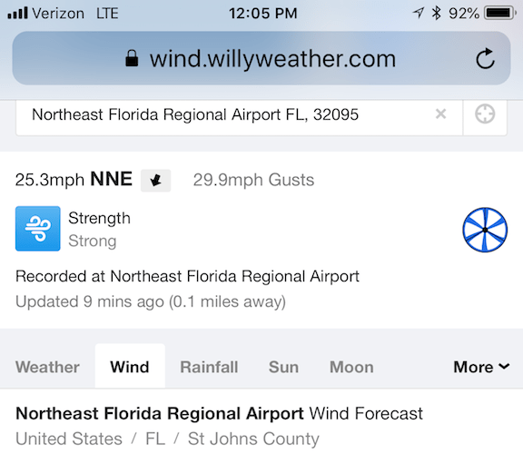
As we weighed anchor in Robinson’s Creek you could feel the power of the wind. The airport wind speed last showed a 30 MPH gust.
25 MPH Winds with 30 MPH Gusts as we passed NE Florida Regional Airport
Even with the strong winds a pair of US Custom agent boats zoomed by, unaffected.
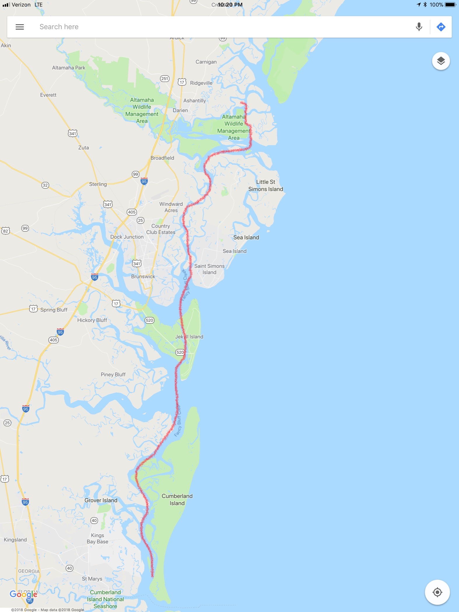
Our route would look something like this:
Our Route from an anchorage in St Augustine to Cumberland Island Anchorage
We would avoid many shoals:
Shoal near South Sapelo River.
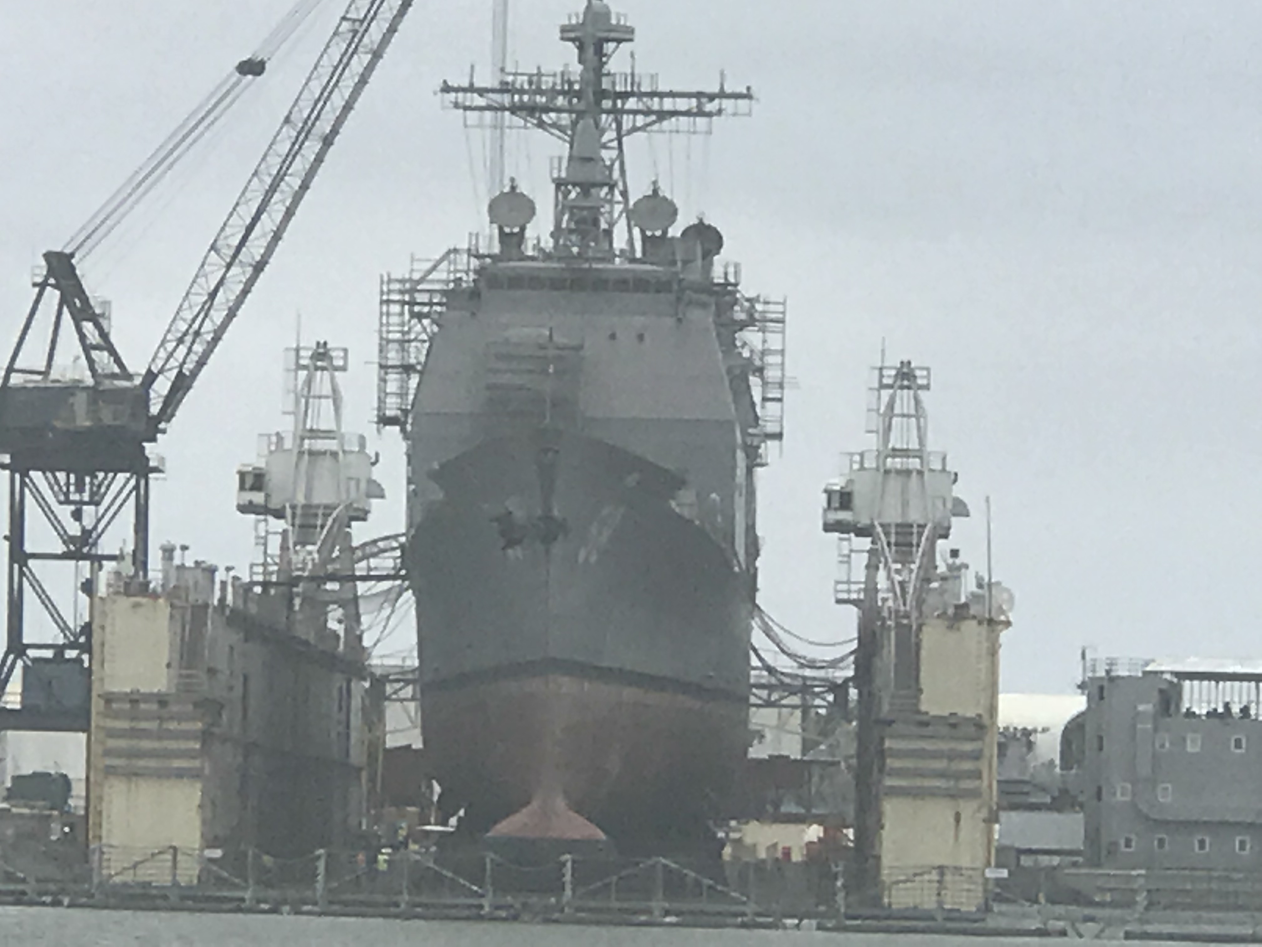
We would cross over the St. John River in Jacksonville, FL and see sights such as this Navy ship in dry dock. What a narrow beam and sharp bow these attack vessels have.
Navy Ship in Dry Dock
I had always wondered what a trawler would look like with a wind generator mounted on the fly deck and I just have to say I can’t imagine ever doing this..
A trawler with 3 Wind Generators on the Flydeck
The free overnight dock in Jacksonville had a spot open but we were determined to use what we had left of the light and cover more ground. Our plan was to cross over the Savannah River and into GA.
Once in the Savannah River we saw that many of the river banks had been built up possibly for storm surge.
Lone Tree standing proud on the banks of the Savannah River
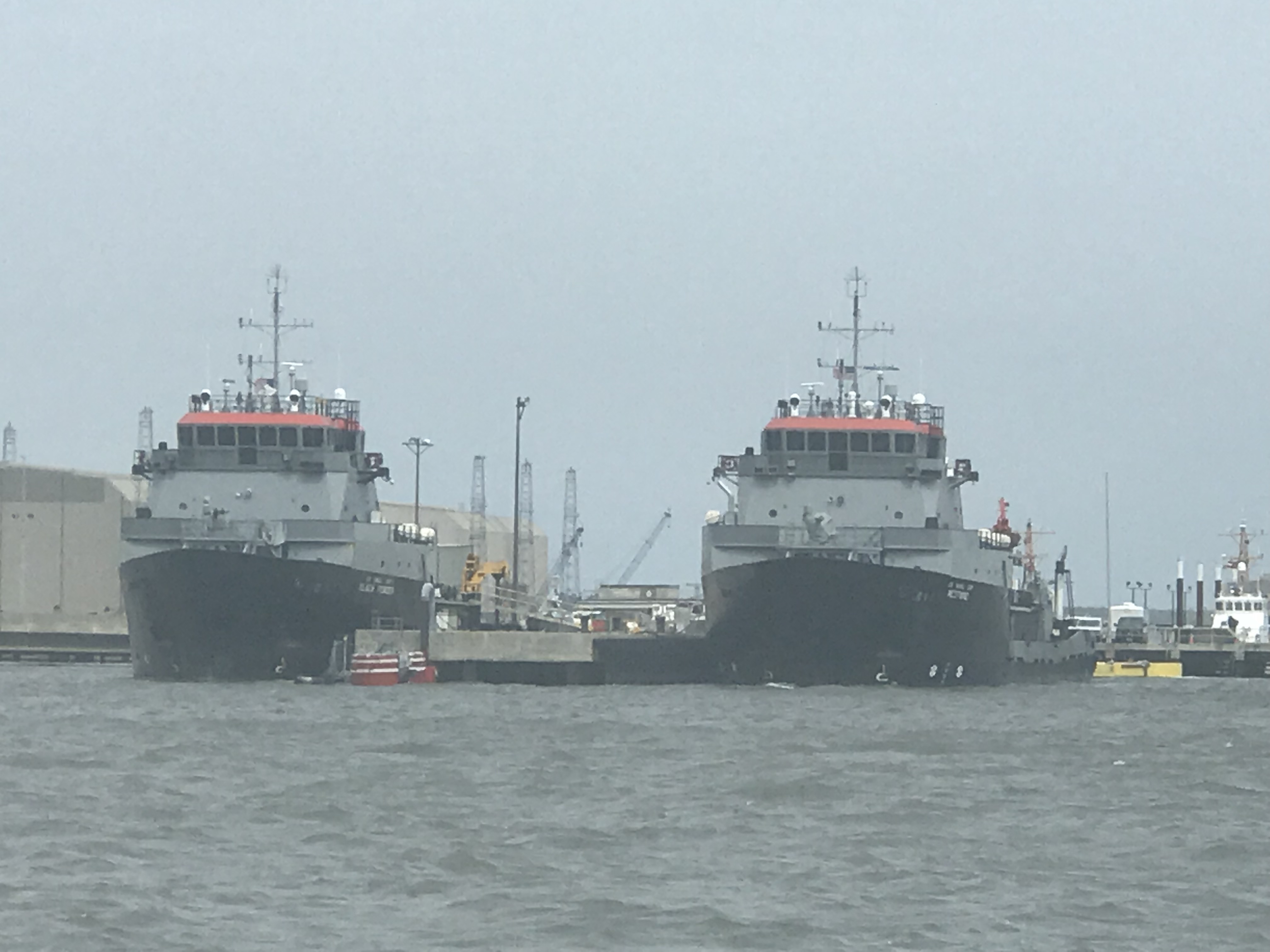
As you approach Cumberland Island there is a heavy Navy presence in the area. We passed these two big Navy ships in port.
Navy Ships near Cumberland Island
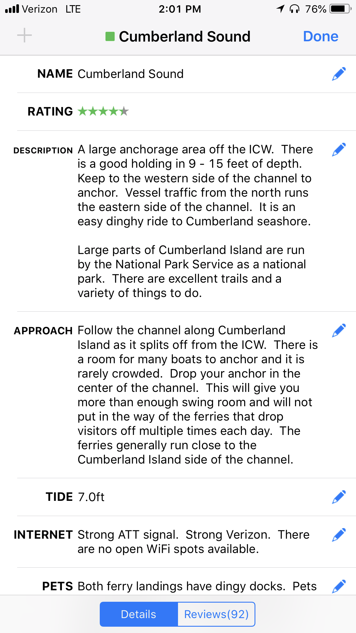
We read the writeup on the Cumberland Island Anchorage.
AC Cumberland Sound Anchorage writeup
We chose this anchorage because it offered a lee in the face of strong winds.
Our Anchor spot in Cumberland Sound
The anchorage was quite busy and the only spot we found was one tucked between two other anchored boats. I had to anchor in an area that had oyster shells and mud. Not a strong seabed for anchoring. The anchored dragged a bit as we set it at 700 RPM. I backed off a little on the throttle and this would have to do for the night. I was tired and needed sleep.
I set the anchor alarm app on my phone and drifted off to sleep.
Anchor Alarm App plays warning sounds if you drag outside of the red circle


You must be logged in to post a comment.