Cape May and Beyond

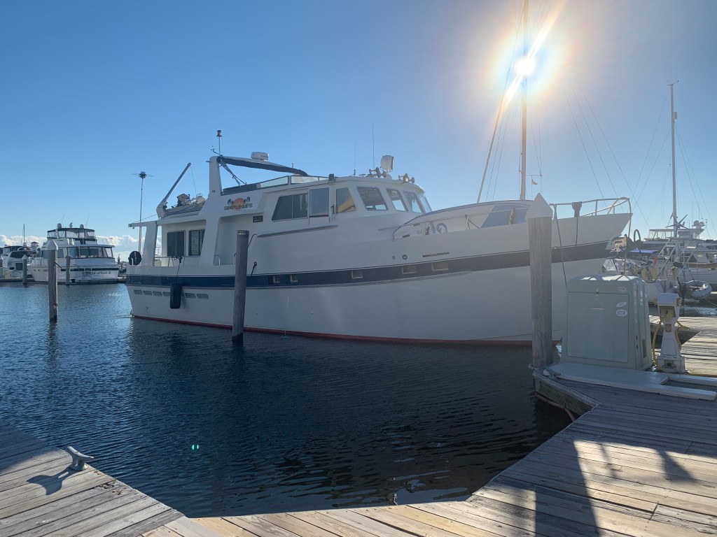
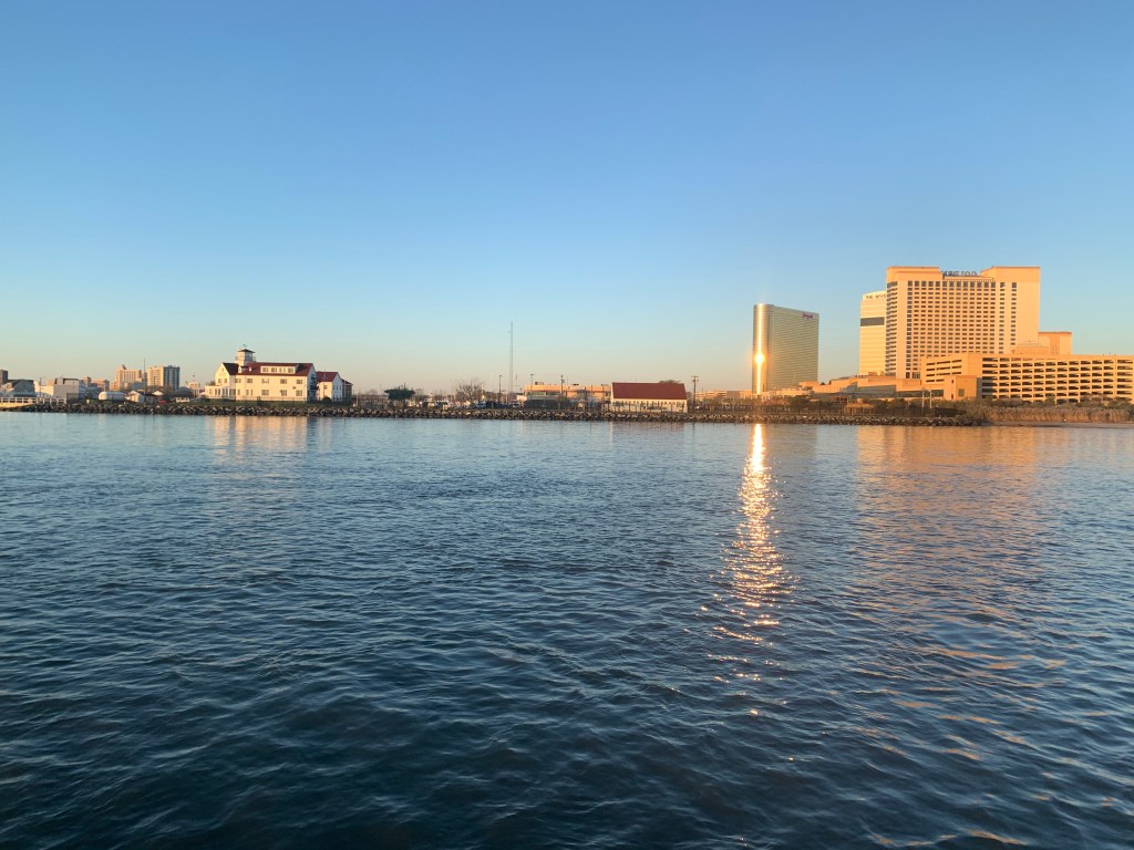
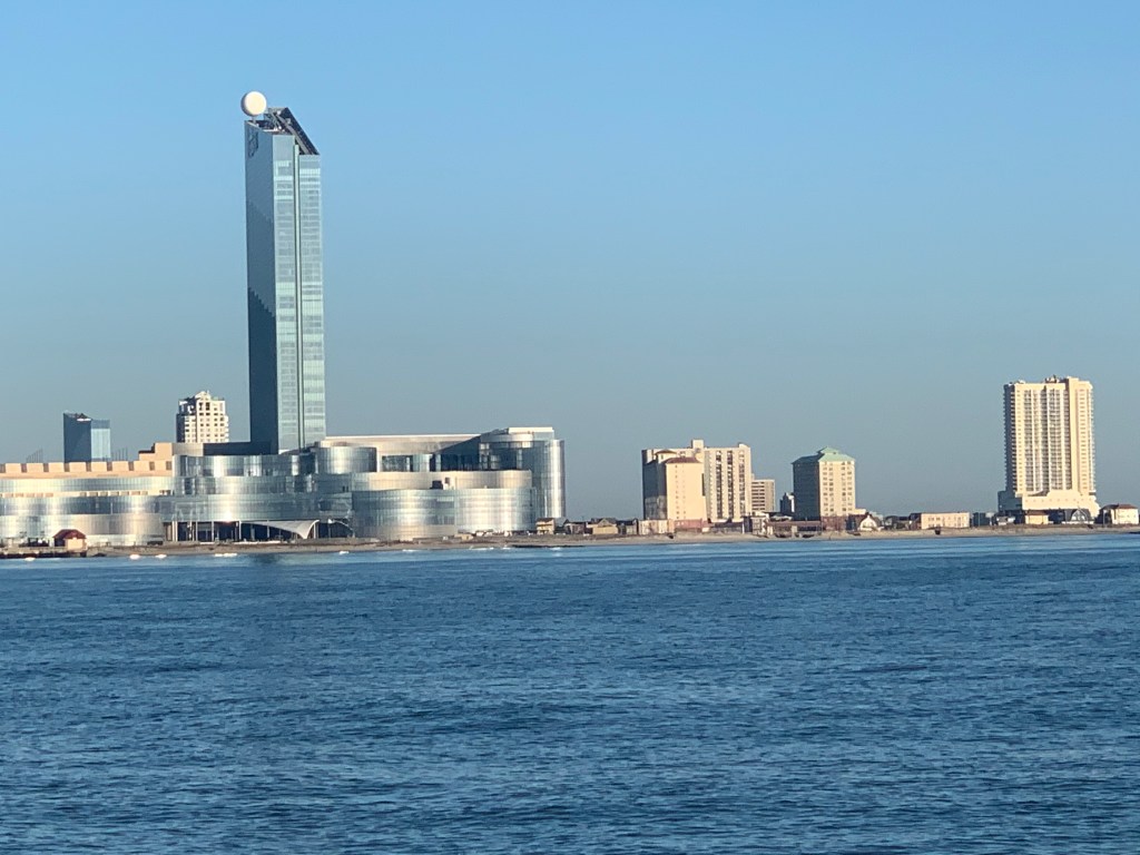
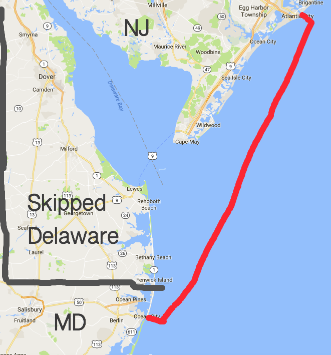
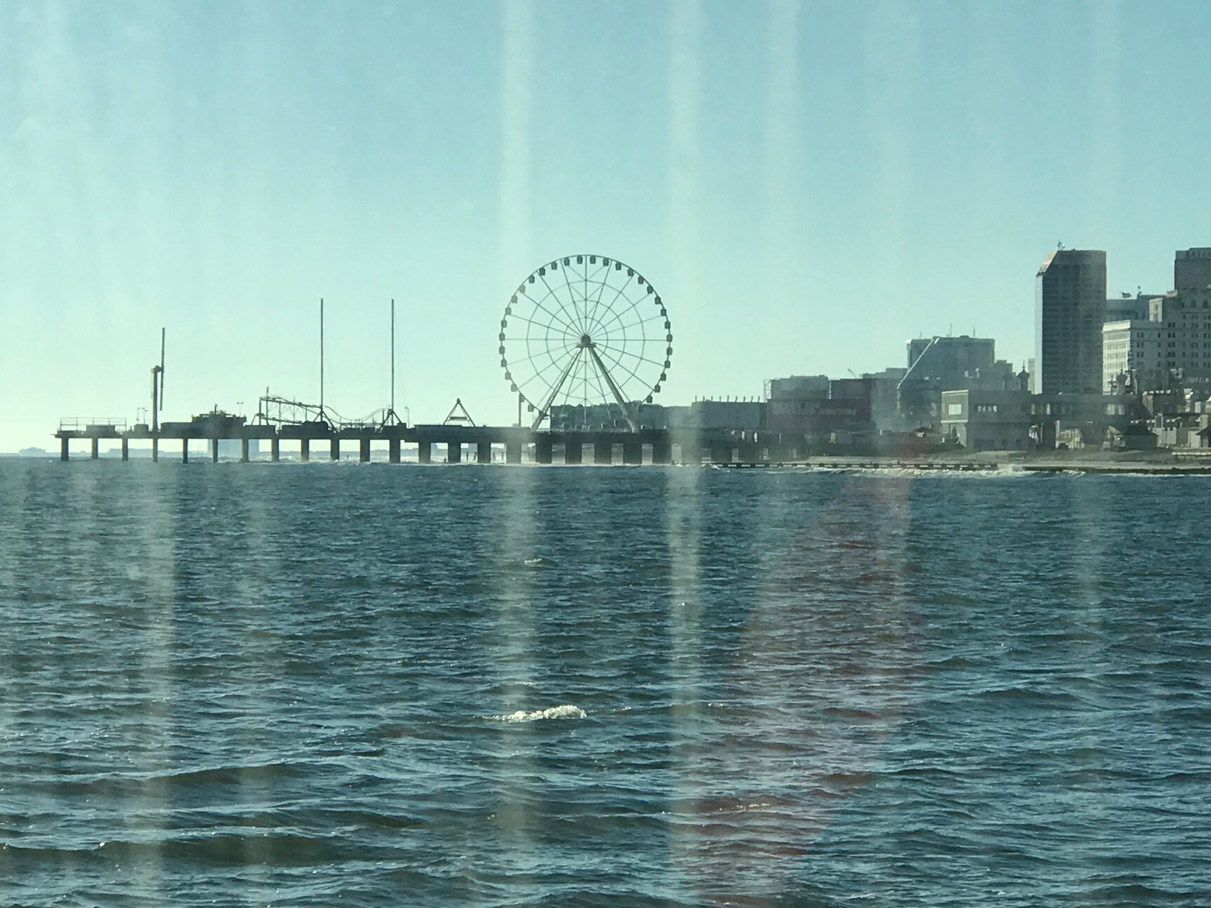
Leaving Atlantic City, the predicted forecast was for 4-5′ waves on our stern as we travel south to Cape May. Normally we wait for 2-3′ waves as 4-5 footers can be uncomfortable especially if they are on your beam. However, if we didn’t get out of AC on this particular day… the Atlantic zone between AC and Cape May will have waves in the 7’+ range which is nothing we wanted to travel in. So… Off we went…

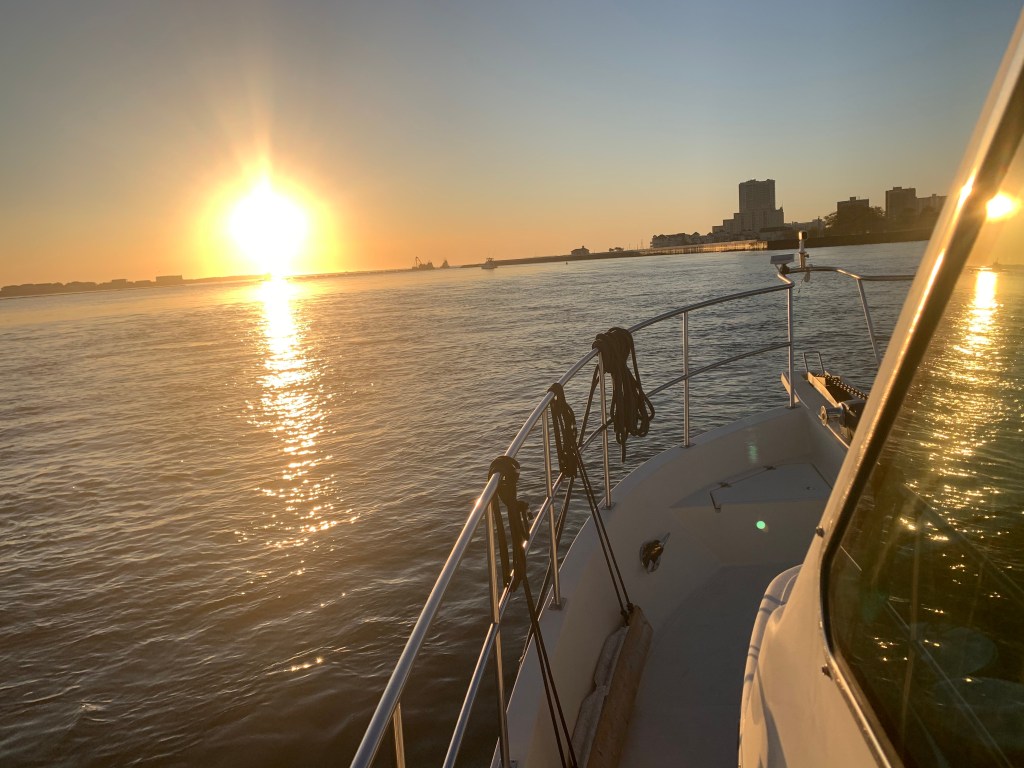
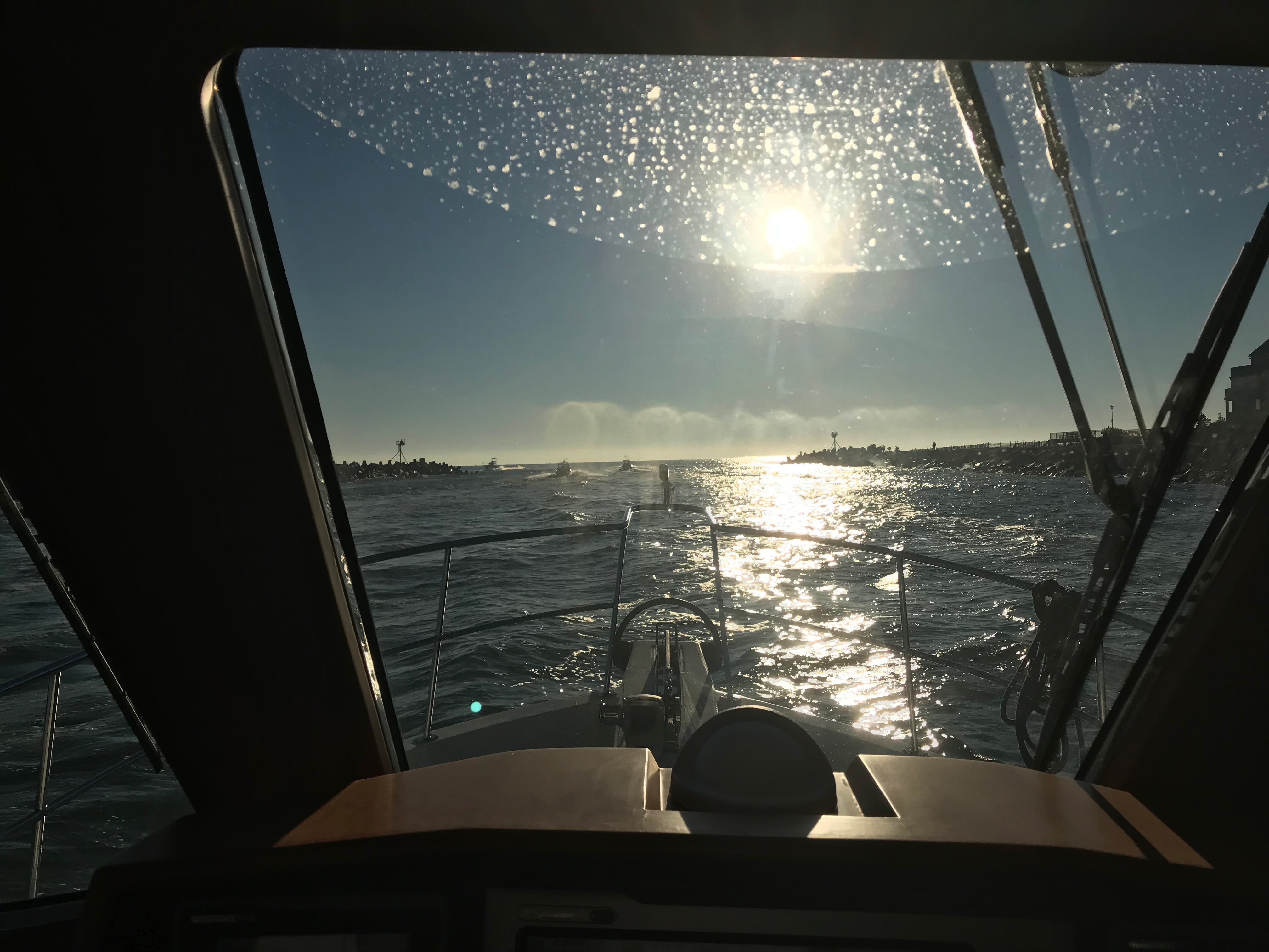
The waves heights turned out to be OK and I grabbed a video of our bow wake as we headed out of Atlantic City.

We made good time heading south down the Jersey Shore. We increased speed to 12kts to add more stability to the boat.

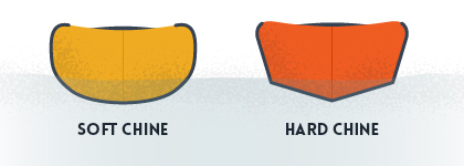
Like most trawlers or motor yachts Simple Life has a square (hard chined) hull when you move aft. This is very common as most boats have a sharp V shape under the water at the bow and those steep V hull sides slowly turn horizontal or flat bottomed as you move from the bow to the stern of the boat. This means that the where the sides of the hull meet the bottom of the hull in the aft (rear) of the boat you have a near 90 degree corner.

Have you ever stuck you flattened out hand into the water moving past you while on a boat? If you have, your hand was thrust up and out of the water by the force of the water hitting your hand. If you try pushing your hand deeper into the water it gets pushed back up even harder. As the boat heels to one side or the other… one side of the boat is forced deeper into the water while the other side is lifted out of the water. The faster the oncoming water is hitting the bottom of the boat on the heeled-side the stronger it feels pushed back up, This has the effect of reducing the heeling motion. Likewise the side of the boat that is being lifted out of the water feels less buoyancy force pushing it up by the smaller section of hull still submerged. The forces work to return the boat to level.

Righting Moments

If you take your captains class you will use a diagram like this with metacentric heights and righting moments. It’ll be a more formal discussion like the one found here.

https://en.wikipedia.org/wiki/Metacentric_height

Some times I just like to watch the prop wash that pops back to the surface after being pushed down by the boat riding over it.

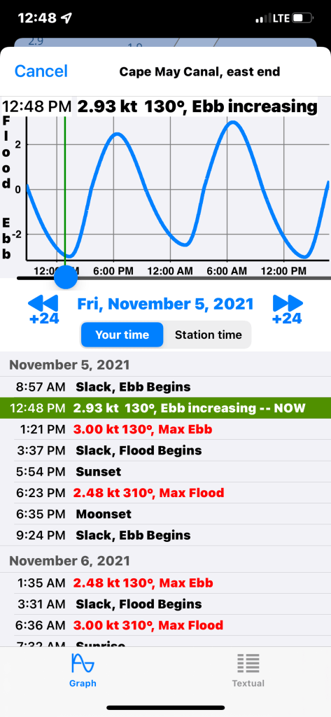
We were approaching the Cape May inlet and we already knew that we would hit the Cape May Canal as it approached maximum ebb current. Not much we could do about that other than throttle up and push through.

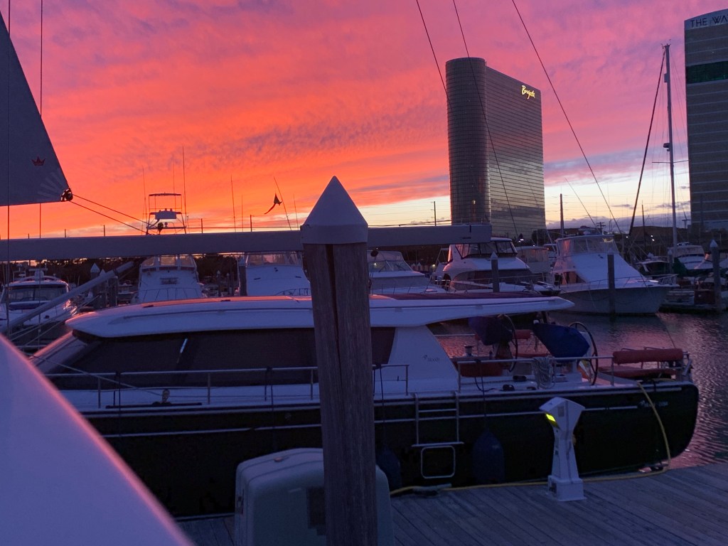
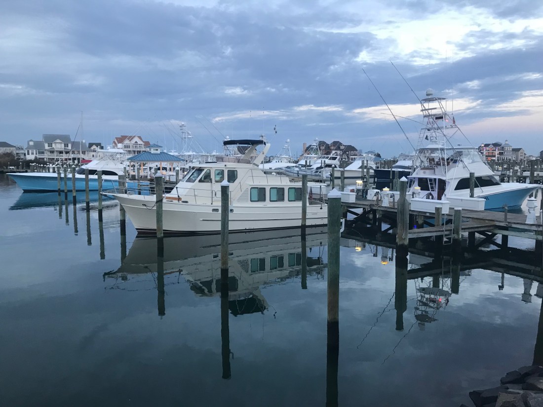
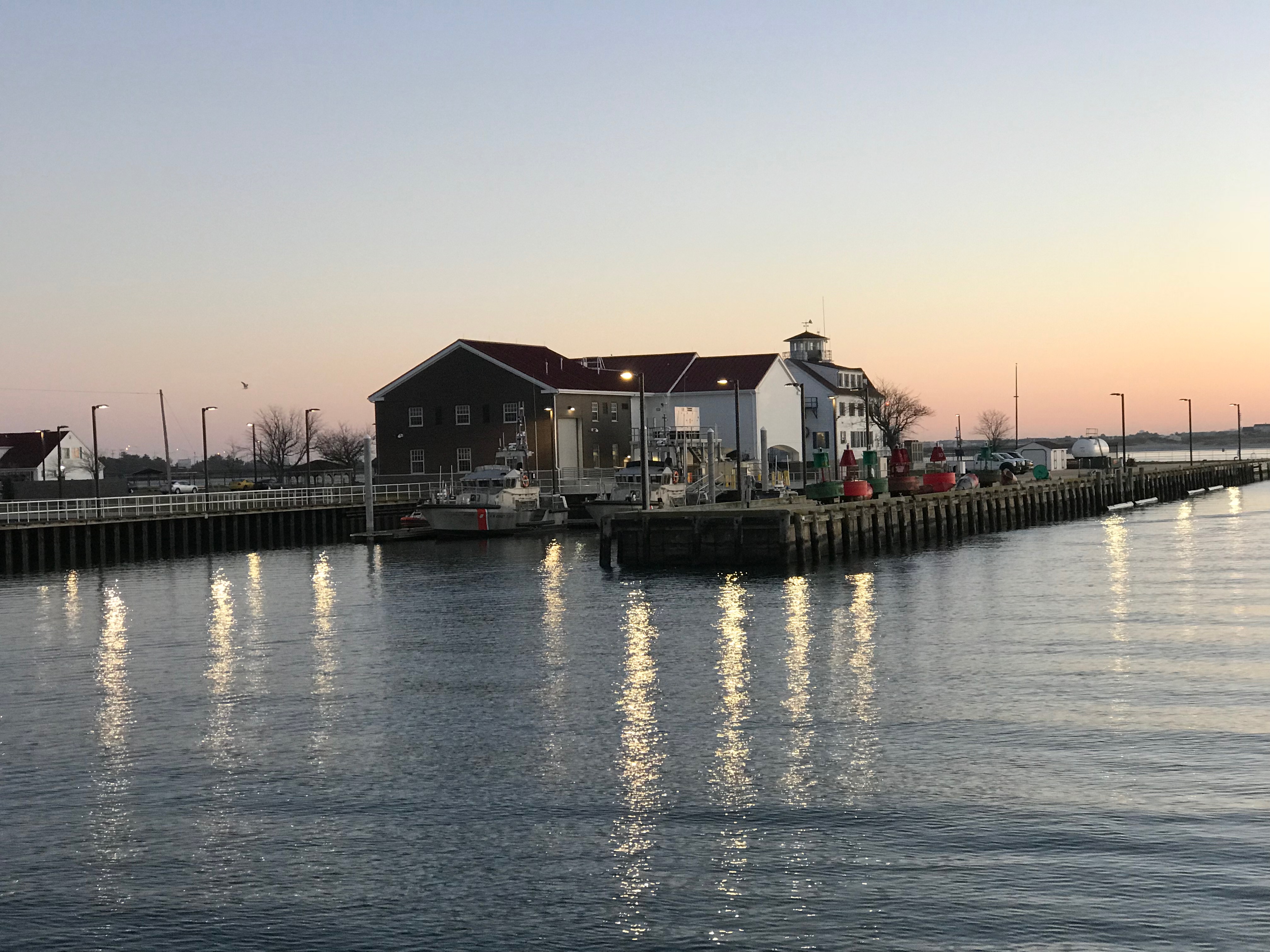
We exited the Cape May Canal and made our way up the Delaware Bay. The ride north up Delaware Bay was uneventful and we passed almost no other boat traffic. Soon we were approaching our chosen anchorage in the Cohansey River. We circled for a bit checking depths before we dropped the hook for the night. We were treated to an amazing red sunset.

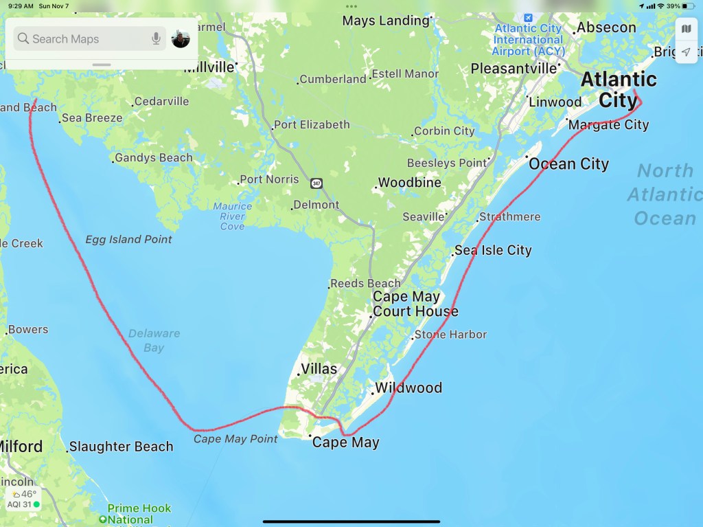
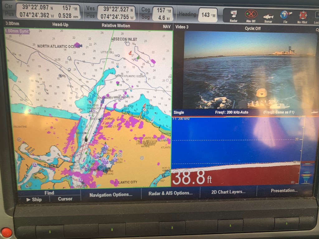
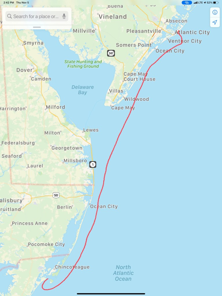
Our route for Winter 05 – Leg 006 looked something like this.

City of the Atlantic

We awoke on anchor in Sandy Hook, NJ. We weighed anchor and got underway by 8AM. The trip down the Jersey shore was peaceful with 2-3′ waves and a 15kts of wind. We cruised south staying about 2 miles off the beach.

We did not see much boat traffic other than small fishing boats that huddled around Manasquan & Barnegat Inlets.

Barnegat light is very conspicuous from this close distance.

Barnegat light

Barge on a Wire

Atlantic City Skyline Tallest skyscrapers

We docked at the Farley State Marina in slip E17.

Farley State Marina Map

Simple Life

Here at the marina, Simple Life was not the only yacht hailing from a port in Massachusetts.

MV Seaductress

The sun was setting as we tied up the boat.

We were just feet from the Golden Nugget Casino.

MV Neoprene docked in front of the Golden Nugget

MV Neoprene is a like a fart in the shower… it just can’t be ignored.

Gambling is not our thing but we would not miss out on hitting the casino. Even if trying to enter the casino felt like we were in Alfred Hitcock’s “The Birds”.

The Birds

In went us…

We played some blackjack and the slots for a bit before loosing enough money to feel like gamblers.

Time to hit the Chart House for a good steak. Our table overlooked the docks and you could see the cobalt blue lights of MV Simple Life through the window.

This leg of our journey looked something like this..

W05L005 Route

Who wants a Wallop?

When my youngest sister, Janet & I were acting bad, our Dad would simply state “Who wants a wallop?” My first thought was “What’s a wallop?” Later I learned… It was code for you better starting acting right or Dad’s gonna straighten you out like a piece of wire. Lucky for us, it was rare he ever had to make good on that threat because we knew enough to stop.

You may be thinking… why is he talking about about getting a wallop? Well… ADD aaannnd tonight’s anchorage will be Wallop’s Island. There are not many places to anchor along Virginia’s Atlantic coast but this is one of the few.

Wallop’s Island along Virginia’s Atlantic Coast

Absecon Inlet

I only slept for 2 hours and awoke at first light. It’s amazing how refreshed you feel even after as little as 2 hours sleep. As I look out the pilothouse windows I can see a bright spot of sun on the metal exterior of the 430′ high Borgata Hotel Casino & Spa.

Borgata Hotel Casino & Spa

As I glance out the other side of the boat I see Ra, the ancient Egyptian sun god, has just started his journey across the cloudless sky.

Ra’s Journey Has Begun

I am not alone. Last night I weaved through three sailboats to find an empty spot to drop my anchor. I wonder if they will even know I was here?

We are not Alone

When I finally retrieve my anchor into it’s bow roller I see that it’s covered with sea lettuce. Well I’m sure there is a more technical term but I’m sure the strong current was trapping the lettuce against my anchor chain like lettuce blowing in the wind.

Fresh Salad aboard MV Simple Life

As I look in my review camera I am reminded of how deep Absecon Inlet is.

Almost 40′ deep inside Absecon Inlet

As deep as it is inside the inlet there is quite a bit of shoaling going on around it’s entrance. The Aqua Maps chart plotter view below shows a few of my past tracks entering and leaving Absecon Inlet. The pink track entering from the left of the picture was my track coming in at 3:11AM on 11/4/20. While the charts show depths like 20′ and 15′, reality was much closer to 9′ as I came across that shoal. Whenever you are navigating inlets your chart depths are not to be trusted. If you have any ocean swell action going on you’ll often see breakers wherever the shoals exist.

Brigantine Bay anchorage on left, Absecon anchorage in middle and Farley State Marina on the right

As I make my way out of the inlet I am bucking the incoming tide and it slows my normal 6.5 kt speed down to a plodding 4.6kts.

Fighting Absecon Inlet Current

Atlantic City Architecture

As I leave Atlantic City I look back at both the 710′ high Ocean Casino Resort and The Wheel @ Steel Pier (227′ high). Both of these object are lit up at night and can be seen for miles as you approach on a dark night. The ball at the top of the Ocean Casino Resort (The former Revel Casino Hotel) glows with changing colors.

Ocean Casino Resort
The Wheel
A glowing Wheel

Digital Selective Calling

The next hours many hours were spent cruising the coast with hardly a boat to be found. Then suddenly the VHF radio sprang to life.

Me ACK’ing a DSC distress message with no LAT/LON or nature of distress info in the message

VHF radios have evolved to use DSC or Digital Selective Calling which allows for making calls to select individuals or groups using their MMSI number (Maritime Mobile Service Identity). DSC also allows for making a digital distress call like the one I received. After ACK’ing the call I received, I immediately entered the boat’s MMSI number and called them back directly. No response! I tried several times for about 30 minutes while I scanned the horizon with my binoculars for any signs of boats or activity. Nothing. Other boaters have told me stories about how the distress button gets accidentally pushed on radios and when someone calls back the people won’t answer your call. Often after you accidentally push the distress button, many boaters attempt to call you back and having to repeatedly tell each of them that you accidentally pushed the button can be a humiliating experience.

Learn From My Mistakes

All that said… I still wish I had notified the USCG.

At the time I thought… there was no location or nature of distress information included in the DSC message. So I would simply be telling them that I received a message with no other info. BTW, the location information is probably one of the greatest reasons for DSC distress in the first place. You simply hookup a NMEA (National Marine Electronics Association) data wire from your Chartplotter/GPS to your VHF and the VHF automatically sends your LAT & LON coordinates as part of the digital distress message. Had the location info been sent I could have gone to the location given.

Even though I know…

  1. Buttons get pushed by accident
  2. I could see no boats or activity
  3. Whomever pushed the button never answered my reply

I realize it was a mistake not to inform the Coast Guard that I received a message. Next time, I will be prepared on how to handle this situation. Boating is a learning experience. I make mistakes and I learn everyday.

Night Approaches

The sun was setting. I settled back into my captain’s chair and prepared for dark. There was a half moon tonight but moonrise would not occur until around 8PM. I let the flybridge lights so that I would be seen by others and between radar and occasionally spotlighting I felt good as I cruised on into the night.

Tonight’s sunset behind Fenwick Island near Ocean City, MD

I adjusted the brightness of my chart plotter & instruments as well as set dark mode on my iPads. Nothing can be seen outside but the reflection of my instruments in the pilothouse windows.

I arrived at Wallop’s Island around midnight. It was a long 17 hours at the helm. I’ll be up at first light but I’m sure I won’t have any issues getting to sleep tonight!

Winter 2020 – 115NM Leg 004 looked something like this…

Atlantic City NJ to Ocean City MD & CathyPaul

We left Atlantic City @ sunrise.

AC Night 1
Atlantic City @ Night

Sun at 7AM
7AM off the Coast of Atlantic City, NJ

Kelly promised a breakfast “to die for” and delivered in every way.

My favorite. Corn beef hash (“ova ah’d” as I say) with eggs a bit “sunny” and American Cheese on toasted wheat bread.

“Wheat bread” said with the emphasis on the “H” like how Stewie from Family Guy would say it. It sounds like an “Haach”.

Breakfast
Epic Egg & Cheese with Corned Beef Hash & Stubbs Sweet Heat BBQ Sauce

Here is a video of us leaving AC. It was so calm that I simply untied the boat, stepped on and put it in forward to leave the slip.

We slipped past the Atlantic City USCG station where their rescue boat sat quietly.


AC CG Station
USCG Station Atlantic City

The dogs like the cockpit grass and they often they need me take them there while we are underway.

Pups.JPG
Don’t tell them this ain’t real grass

While underway we were happy to find the sea state somewhat tame for the end of November. Our passage to Ocean city, MD was 9 knots the whole way.

While we did not have to slow down, the 25 knots winds made for a wet ride. Thankfully I stayed dry & never had to change out of my PJs and slippers.

The boat feels heavier than normal since we have her loaded with more stuff than usual. Even the bow spray seems to throw further.

Every marina we have visited thus far seemed to be shutting down due to the freezing temps.


This presents a challenge for us as there has not been any water to wash the boat or top off the water tanks. Thankfully, MV Simple Life has ~450 gallons of water aboard in her two tanks. As long as Kelly is not doing laundry (she loves doing laundry on the boat), water is not an issue.

The ride from AC to OC left plenty of dried salt crystals on the boat. Our salty windshield

glistened like a diamond in the sun.

salt good.JPG
Salty Boat

Today’s trip was about 70 miles. That’s about an 8 hour trip. This late in the season you only have about 90 minutes more of daylight.

Leg AC OC.png
Today’s Route Skipped over Delaware

Upon arrival I was a bit embarrassed to have to hail the marina and ask where they were located. My Navionics chart chip from 2012 had the marina in a different location. The marina is actually very protected once you slip past daymarkers 1,2,3 & 4. Austin the dockhand was there to catch a line for us and hand us the diesel hose to top off our tanks. I added 350 gallons of diesel @ $3/gal.

That means we made it from Wickford, RI to Ocean City, MD on roughly 350 gallons of diesel. Not too shabby though if I were slowing down I could use half that.

Here are some pics us at the docks.


After a long day I needed to sneak away to a bar called the Sunset Grille.

Sunset Grille.JPG
Sunset Grille in Ocean City, MD

We enjoyed happy hour with new friends “CathyPaul”. It’s actually Cathy & Paul but I’m sure I heard them combine themselves into a single name, “CathyPaul”.  They were lots of fun and kept me entertained the whole time.

They also taught me how to say the name of the island that I hope to anchor at tomorrow morning. It’s called Chincoteague Island “Chinko Tee gah”. Tomorrow’s trip there will look something like this..

Chincoteague Island Anchorage

The anchorage is exposed to the Atlantic but in a NW or W wind, I believe it will do just fine. I must say that after studying the charts there are very few inlets at this point in the trip. The inlets that you do find caution mariners about unmarked shoals, breakers over sandbars and shallows everywhere. If we had a faster boat we’d have more options to skip over the more challenging inlets. Instead we often must either stop sooner than we’d like or try to use all of the daylight to make it to the next anchorage or marina.

I found this webpage for  Chincoteague & Assateague Island . It talks about wild ponies on the island.. Maybe I should take the dink ashore and let the Chief Martin Brody and his sister Happy run with the ponies?

Ponies in the water
Ponies rather than horses? Is that what you call em?

Well it’s late and I better hit the sack. These days we are running from sun up to sun down and it’s leaving us wanting more downtime.

Good night for now and Kelly & I want to give a shout out to all our high school classmates who had a reunion tonight.  We wish we could have made it but we left New England too late as it was.


Atlantic City for Happy Hour

So we started out of the Manasquan River shortly after sunrise and ran aground before my coffee got cold. The captain was not paying attention as used some excuse about being by the morning sun. “Crappy Captain!” is what we shout whenever I do something stupid. I still have much to learn. It was a sand bar @ 4ft and far from what my charts showed. We backed up and pushed our way off the sandy bar and the rest of the trip was without incident.

Right away we were forced to wait @ the Manasquan River railroad bridge which was closed for a train crossing. We waited with 20 or so boats for the bascule bridge to reopen. When it did open, it was “every boat for themselves”. It felt like being at the Raynham, MA dog track… “There goes Rusty”. I think that was the rabbit’s name?

As we passed through the narrow opening for the railroad bridge I felt compelled to snap a pic out the pilothouse door to show how tight the passage feels.

RR Bridge Close
Tight Squeeze to Starboard

The last challenge to get through was the Manasquan inlet which was displaying a phenomenon called “reflected waves”. These are wakes from boats (zipping by us) that are being reflected back off the inlet walls. It’s like having your head above water in a washing machine; there is no rhyme or reason to the direction of the waves.


Reflected Waves 2
Reflected Waves

The cruise South was smooth as the period between the ocean swell was long, 10 seconds or so. This made for a gentle 3-4 foot swell. We made our way South down the NJ coast and as we passed Atlantic inlets we dodged the many sport fishing boats that were fishing atop of one another. We listened on the VHF as they stood holding a rod on the back of a boat at the end of November.

When it was not fishermen we were seeing it was a porpoise or two. Here is a short video of what I think was a porpoise but I’m sure one of you will chime in about what species owns the dorsal fin in the video?

As we approached, Atlantic City could soon be seen in the distance.


Ac
AC Boardwalk

Coming into AC was easy as far as NJ inlets go. With the exception of having to stay clear of the bar that can be understood when you see the breaking waves atop of it.

AC Chart bar

The Absecon Inlet is wide and the ebbing current was only about 1.5 kts against us. Just inside the entrance, we turned to port we left the wind & current behind. As we hailed Farley State Marina and VHF channel 65 as Kelly reminded me to loose my Boston accent and hail “FaRRRley Marina” instead of “Fahlee Marina”. The VHF radio crackled back and they told us to head down the fairway between docks echo and foxtrot and simply pick any slip we liked. We chose a slip close to the Chart House restaurant an 1st mate jumped into action as we backed her down into the slip. Kelly great about waiting till I bring the boat alongside the floating dock before attempting to jump off onto the dock. A miscalculation could lead to winding up in the water between the dock and the 30,000 lb boat as it kisses the dock. This docking however was easy-peezee. The wind was buffeted by the highrise hotel and dockside current was zero.


Simple Life AC
1st Mate Kelly

We tied up quickly and raised a toast to AC.  Thankfully the night before I had walked the path from the boat, under the bridge and to the liquor store to buy MORE IPA beer. I learned beer is always a mix of malty barley vs. bitter hops. Like all IPA enthusiasts, the more bitter the better. My IPA of choice is a “West Coast” style IPA that has IBU (International Bitterness Units) between 50-100 and with a citrus pop like grapefruit or mango, etc. Anyway… the liquor store had Stone Brewing’s “Delicious” IPA and I have to say…YUMMMM, what a great IPA.

Stone Delicious IPA
YuMM

As for Atlantic City, well…  we were starving and decided to go to the Chart House.

AC Night 1
Atlantic City Water Club

The Chart House was great. We caught happy hour and it was Capt & margaritas! & filet & fish tacos.

We are planning a sunrise departure again but I convinced Kelly to do a quick Casino tour. Thirty feet into the casino and the cigarette smoke made us change our minds. Tonight we’ll finish happy hour on the boat while I write this blog update and do some chart plotting before bed.

Tonight I will be scouring every maritime website / app for any & all information I can about the Delaware coast. Today’s Captain is digital. It used to be an old guy who looked like the Gorton fisherman but now it’s a millennial with the charting, piloting, tide, moon phases, sunrise times and weather apps on multiple digital devices.

Gorton Fisherman
Gorton vs. Millennials

Though I must admit…a captain is only as good as his/her experience. I have been boating 20+ years and still feel like a noob at times. I imagine that becoming a full-time cruiser will give me the time to read such maritime tomes as Chapman Piloting and Bowditch – The American Practical Navigator.


Every captain make mistakes… which we’ll call wisdom later on 😉

That’s all for now. Kelly & I hope everyone had a great Thanksgiving.

Happy THANKSGIVING-BEACH