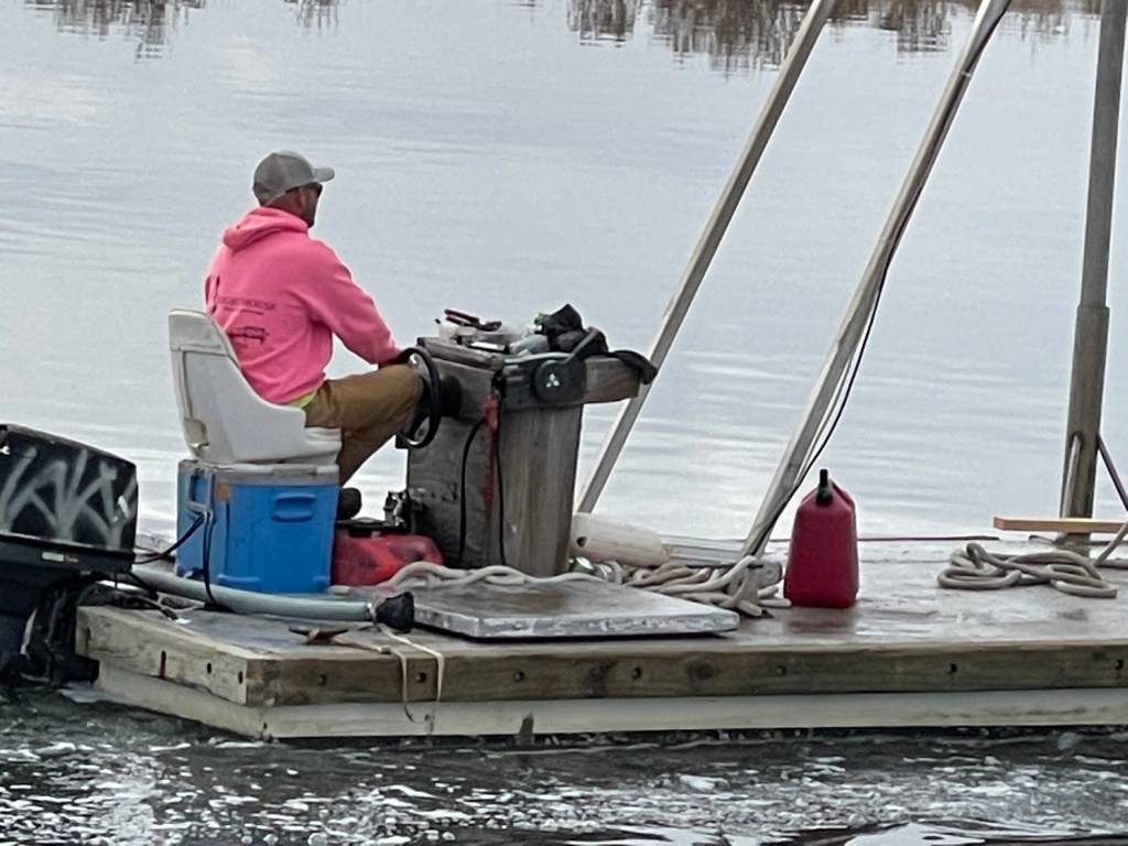
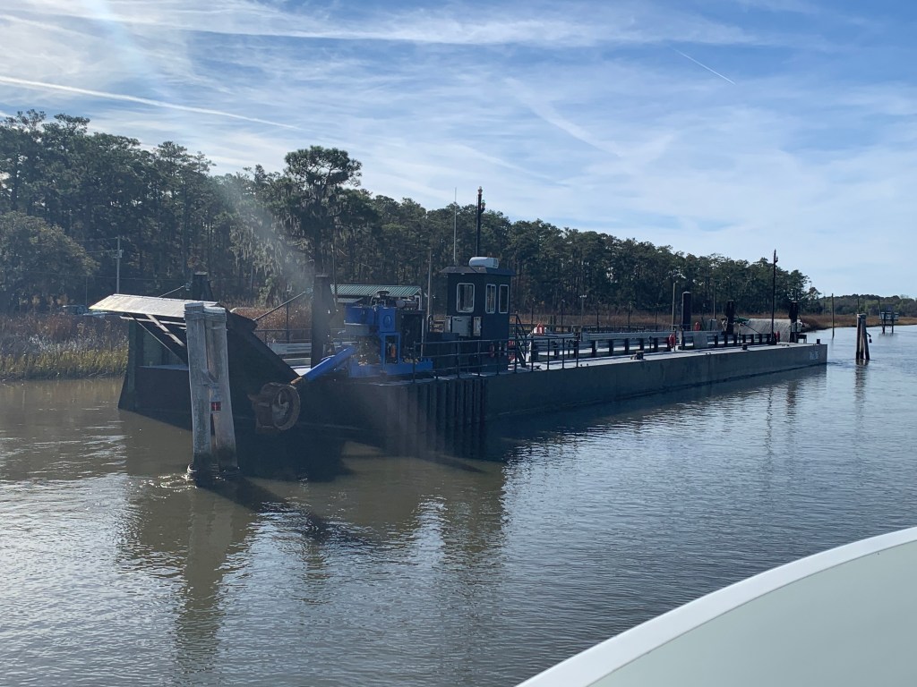
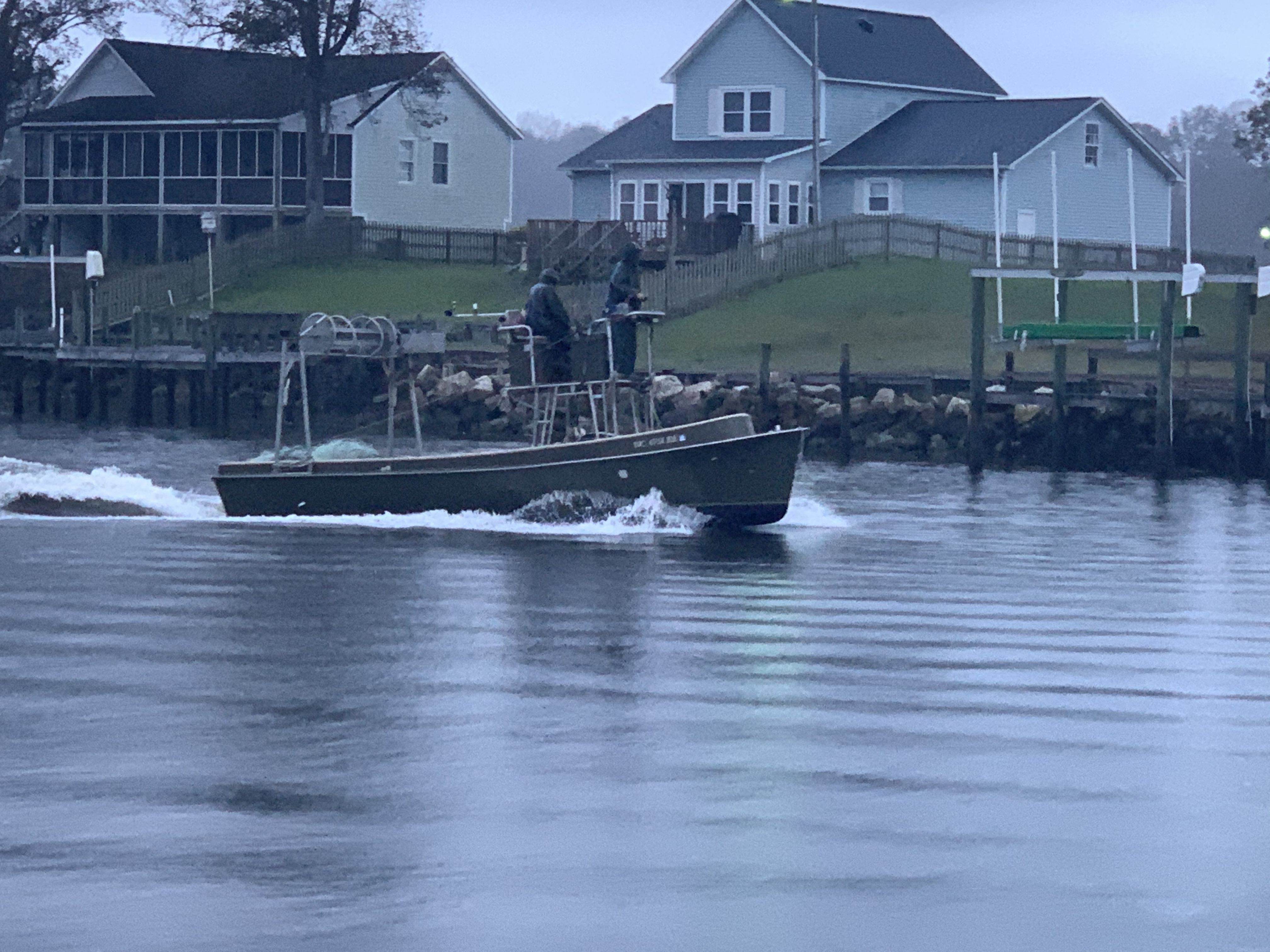
We were on our way to Southport, NC to see our friends Jim & Wende. We had to slow down to no wake speed to keep from swamping this fella who was motoring a small work barge down the ICW.
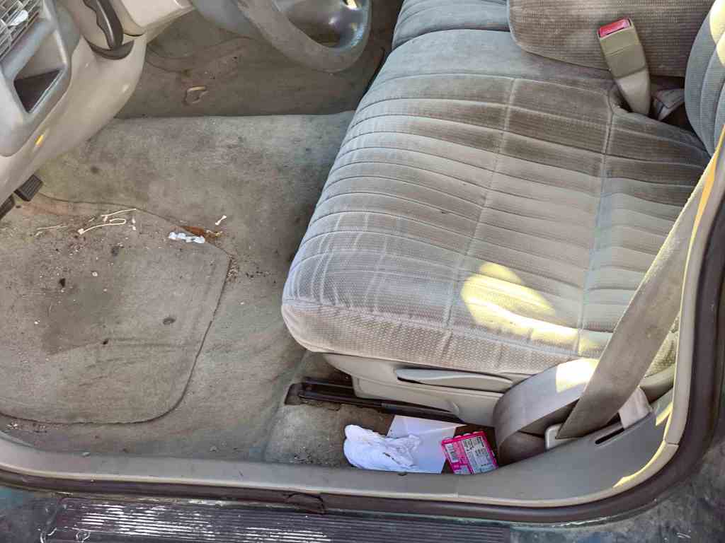
Cooler Seat Captain
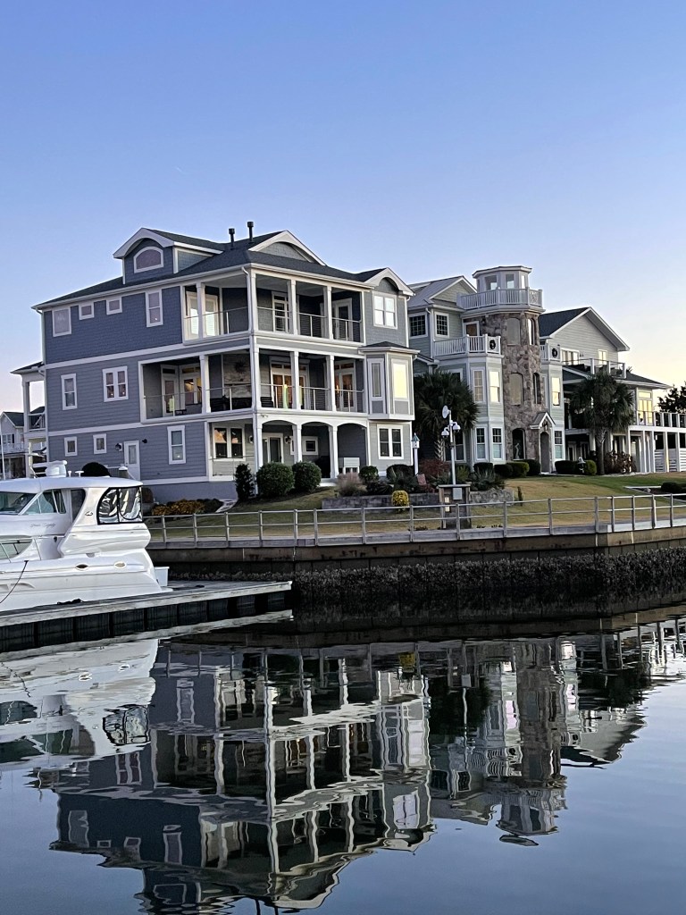
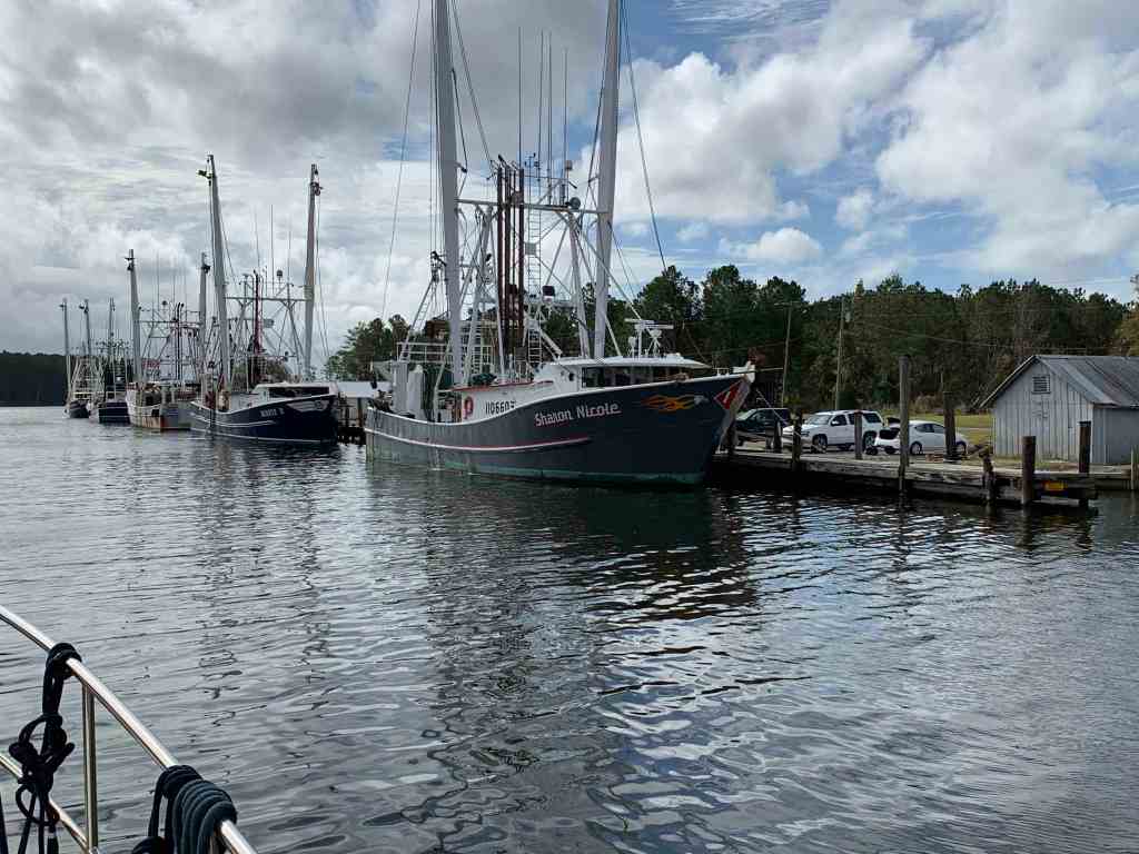
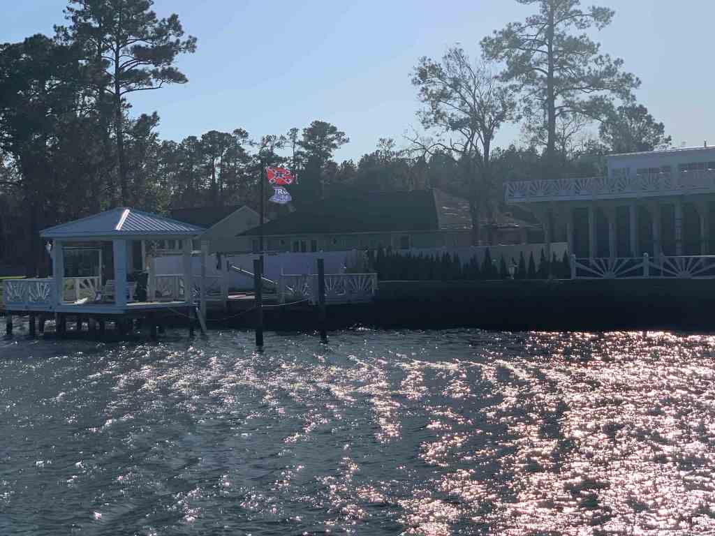
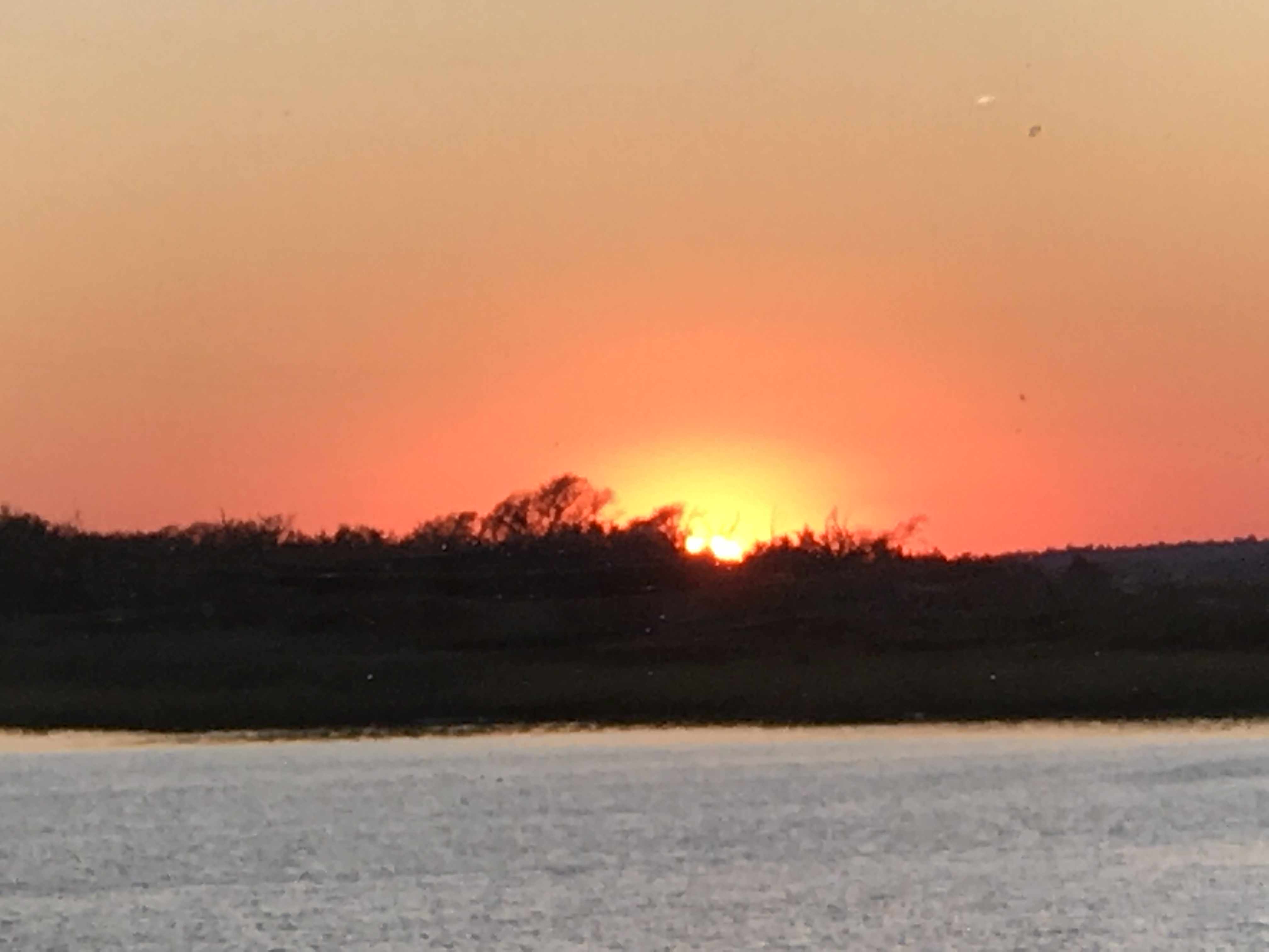
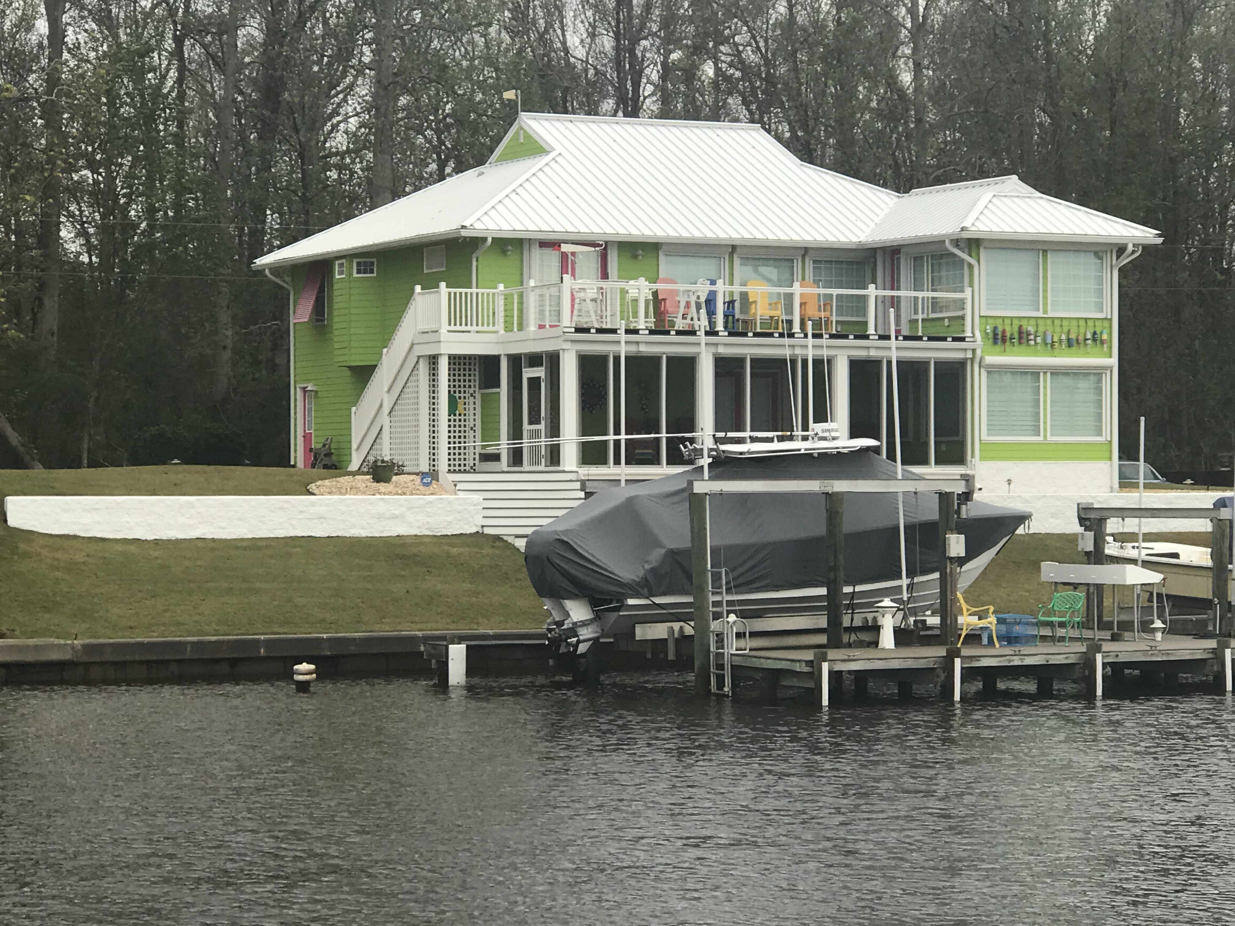
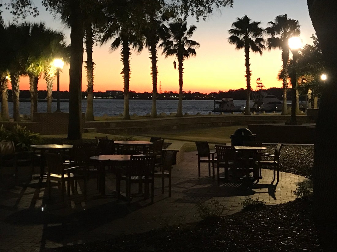
We arrived at St. James Plantation Marina just before sundown. The homes along the harbor are beautiful.
St. James Plantation Marina
The Big 😀
Jim and Wende let us use their truck to reprovision which was perfect as it was the day before Thanksgiving and we needed TURKEY!
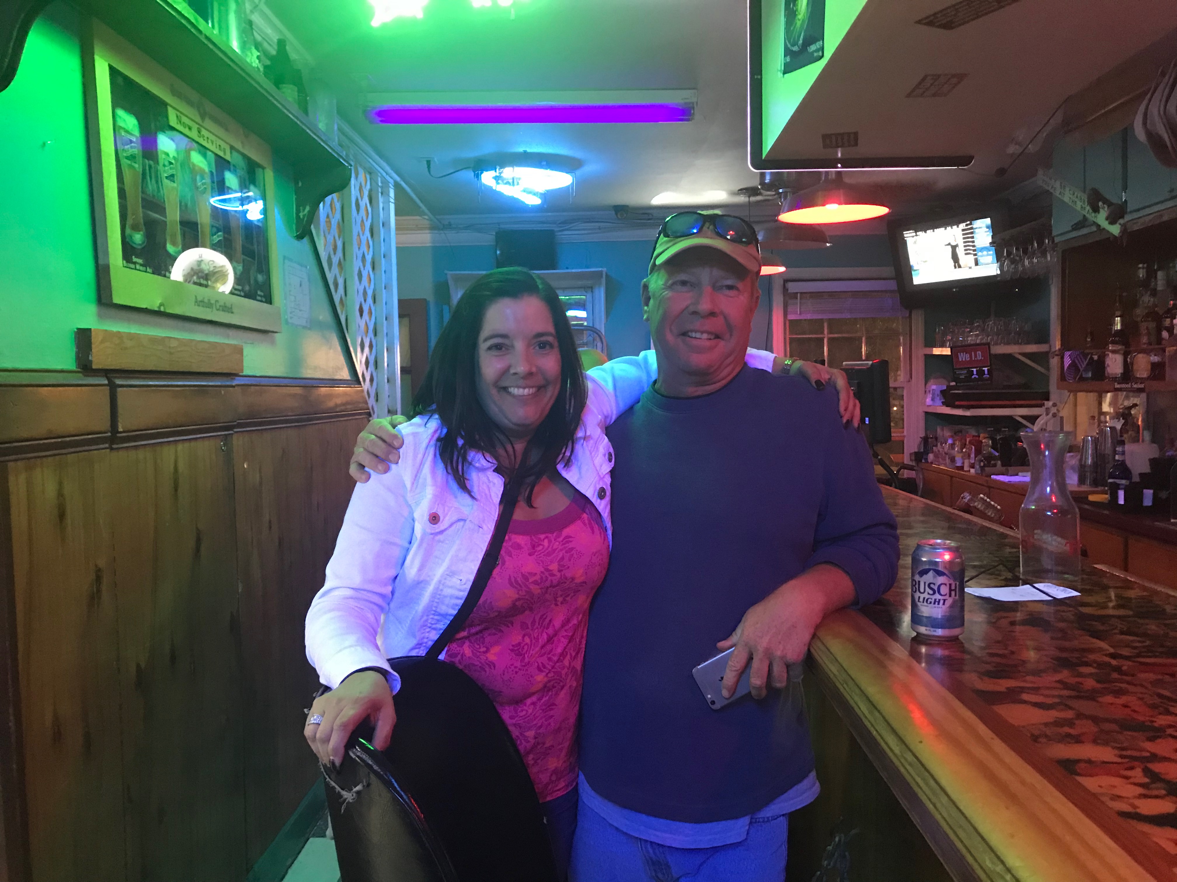
Later that night Jim & Wende took us to dinner at a Joseph’s Italian Bistro @ Safe Harbor Marina. We had dinner with some good local IPAs & lots of laughs. I wish we had taken a photo but I think we were just having too much fun. Jim and Wende told us all about their trip back from Buzzards Bay, MA to Southport, NC in their new Pursuit OS 355. The weather was a bit ruff off the RI coast but they made great time with stops in places like Atlantic City.
Capt Jim & Wende
In the AM we were off and Capt T was at the helm.
Capt T @Helm
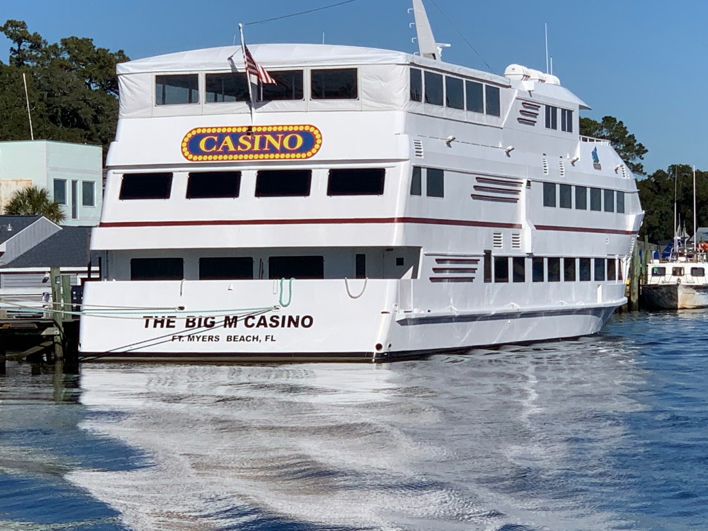
We passed a boat dock that was more boat than dock. Capt T thought she recognized a casino boat as we passed and sure enough the “Big M” hailed from Fort Myers, FL.
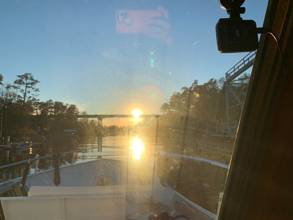
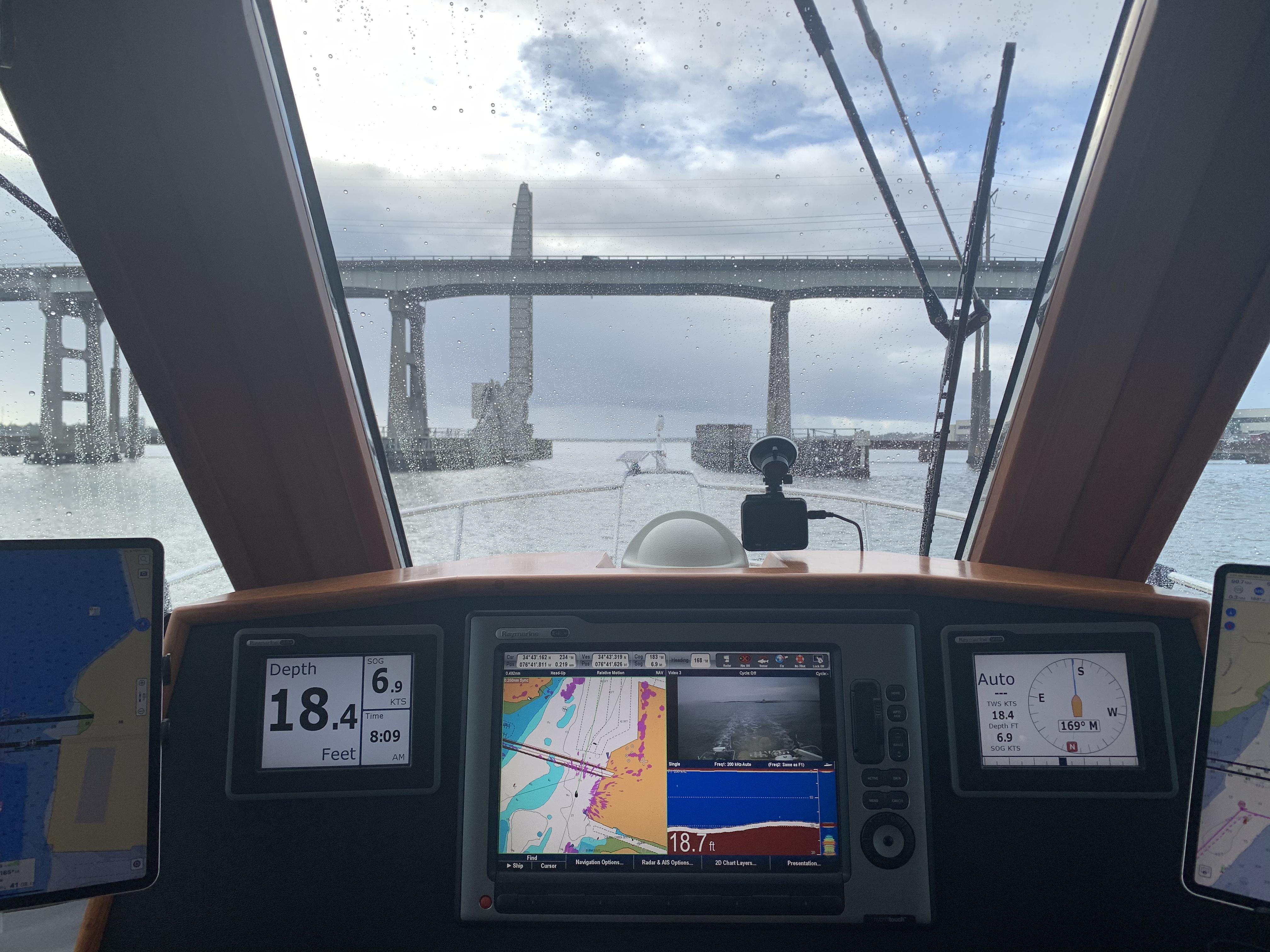
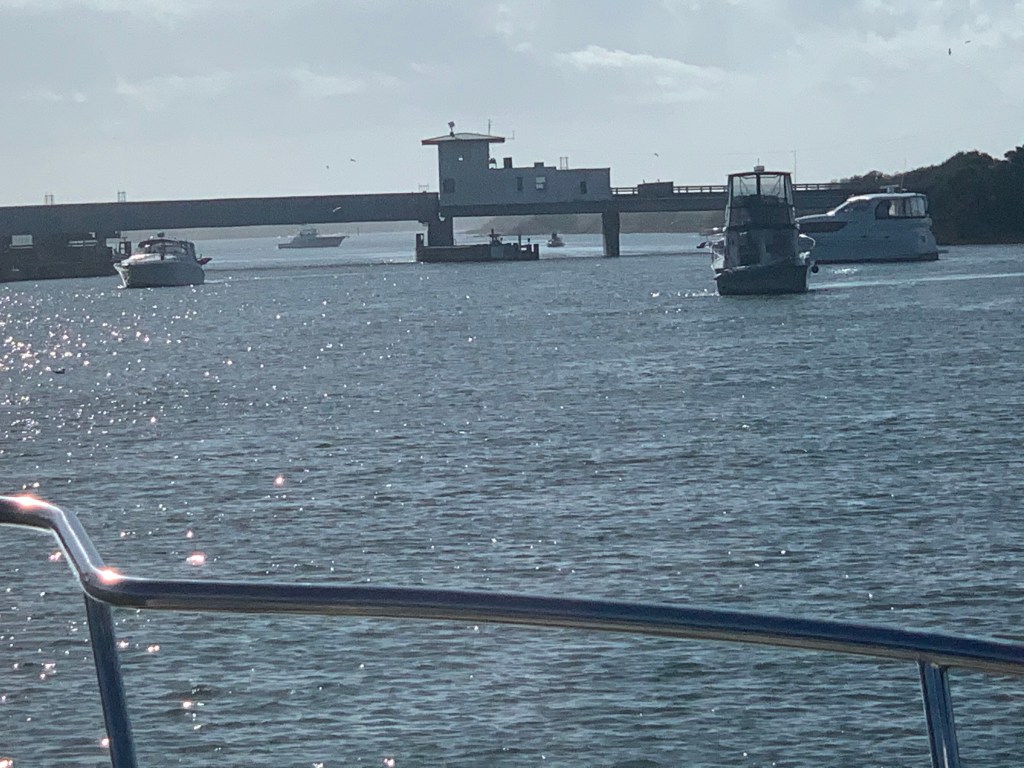
As we made our way into the Waccamaw River preserve we had to get through the Socastee swing bridge but we were staring straight into the sun. The best we could do was go slow and use the radar to see in front of the boat.
Camera may see the swing bridge on the right but we only saw a bright spot looking out the pilothouse
We anchored in what I call the Waccamaw River (ie. swamp) and it’s beautiful. We had a great night on anchor as the high trees provide protection from everything but the cold.
It was COLD.
Cape Coral, FLConway, SCFoxboro, MaWarwick, RIHere in Conway, SC it’s the same freezing temp as back home in Foxboro, MA
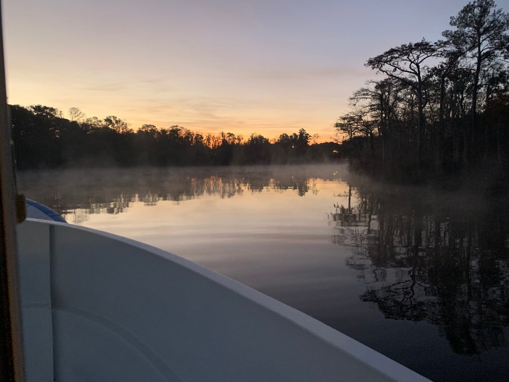
We weighed anchor at first light and the swamp was steaming due to early morning low temps.
Waccamaw River pre-dawn
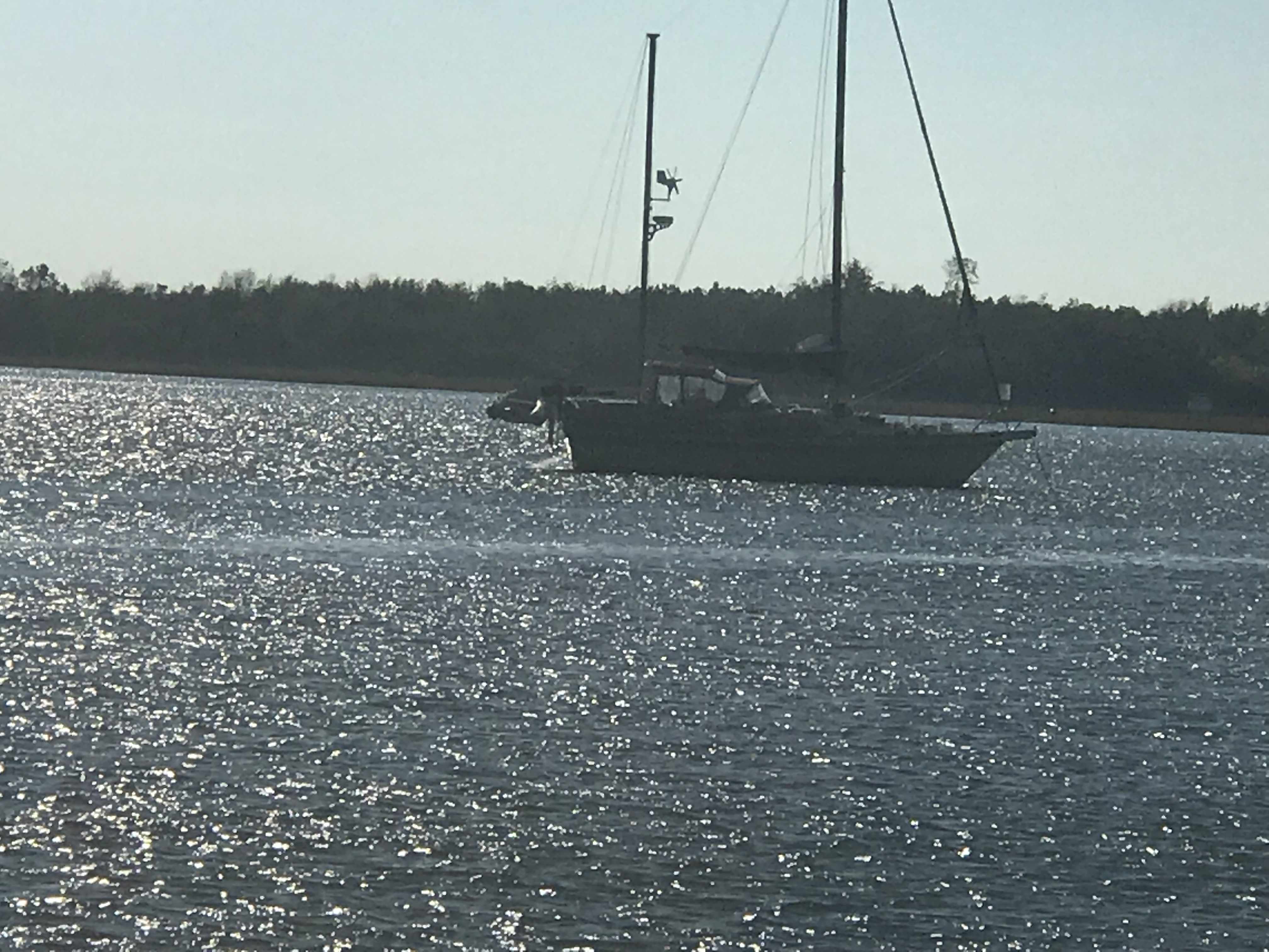
We had to slow to no wake so as to not disturb this Nordhavn anchored right off the main ICW route.
Peaceful Anchorage
The next swing bridge is actually a floating swing bridge. Very cool. It simply uses drop-able drive-on ramps and a huge tilt-able bow thruster.
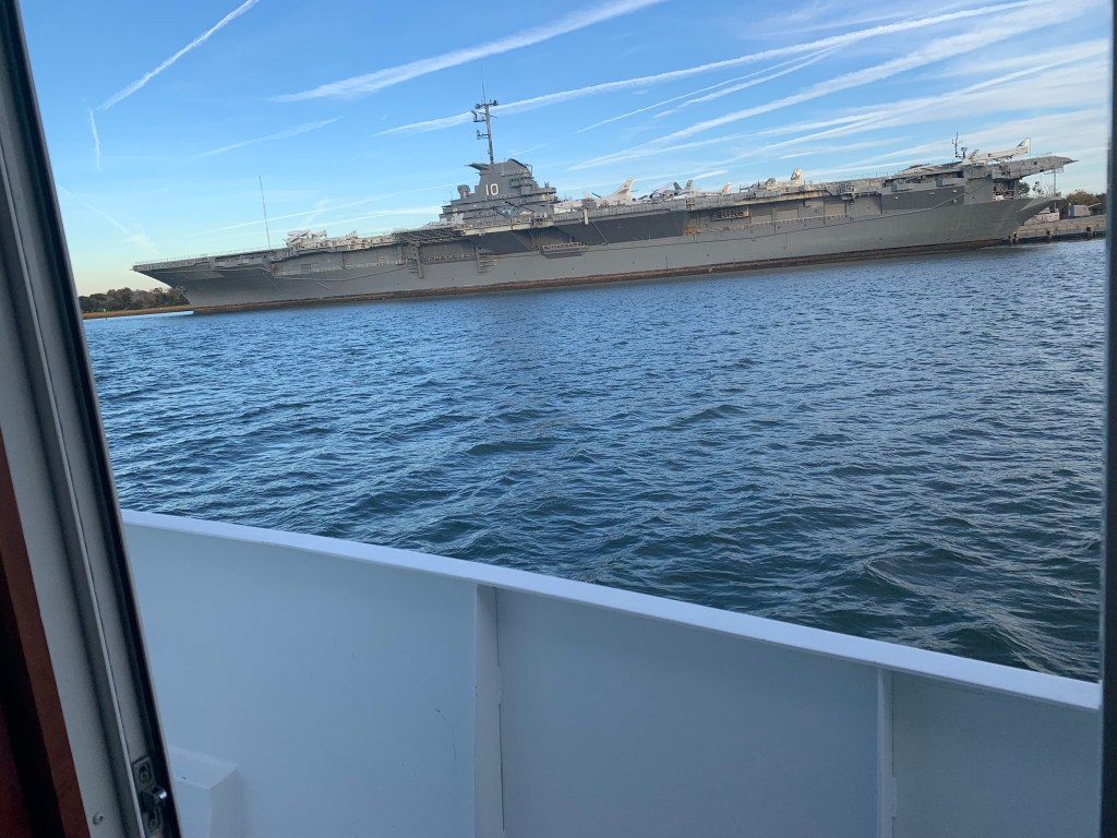
We arrived in Charleston, SC and the marina we requested a slip from had us “wait-listed”. We anchored for the night next to the USS Yorktown.
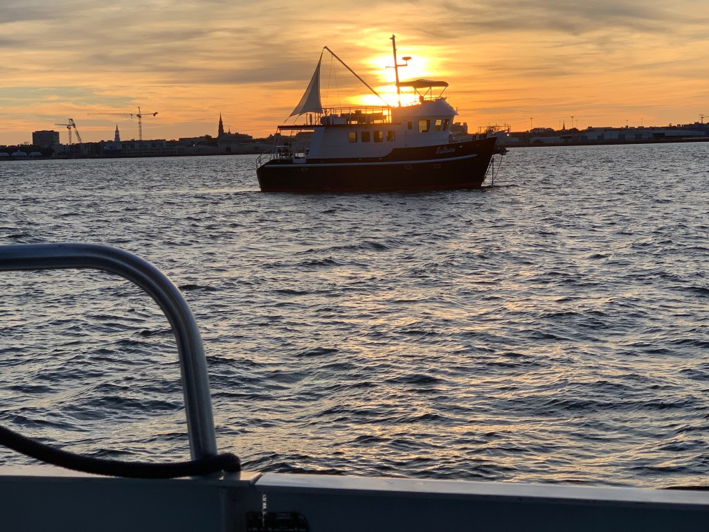
The sun was setting on Charleston.
Sunrise in the AM and we were off… bound for Beaufort, SC
Sunrise in Charleston, SC
We anchored in Beaufort with hopes of getting off the waitlist for the marina. In the AM we called and they found a spot for us on the outer face dock.
Docked at Safe Harbor Beaufort, SC
Beaufort is a fun town and we wasted no time getting ashore at Plums Restaurant for some lunch.
Plums in Beaufort, SC
We napped after lunch and made a second run on the town before we would leave in the AM. Beaufort has a great outside park area right in front of the marina.
Beaufort ParkSwings along the Water
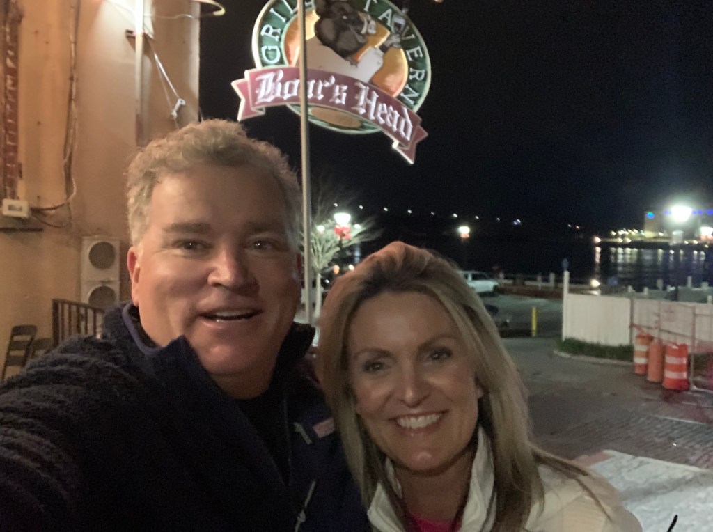
In the morning we were off to Savannah, GA. Last time I docked right in downtown around River Street but felt it a bit seedy at night. We decided to stay at Thunderbolt Marina and Uber’d into town for a Savannah pub crawl.
Are impromptu pub crawl consisted of the following venues:
Spanky’s
Boar’s Head Grill
The Cotton Exchange
Huey’s
The Warehouse Bar
We ended the night singing Journey.
Up early to a Whiskey Sunrise & potato pancakes and off to Fernandina Beach, FL
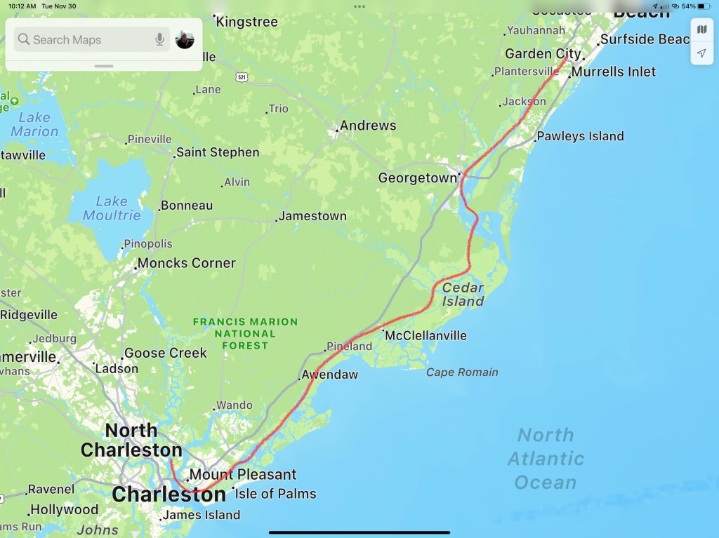
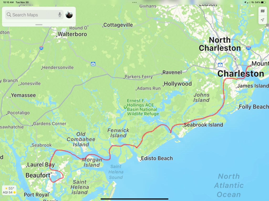
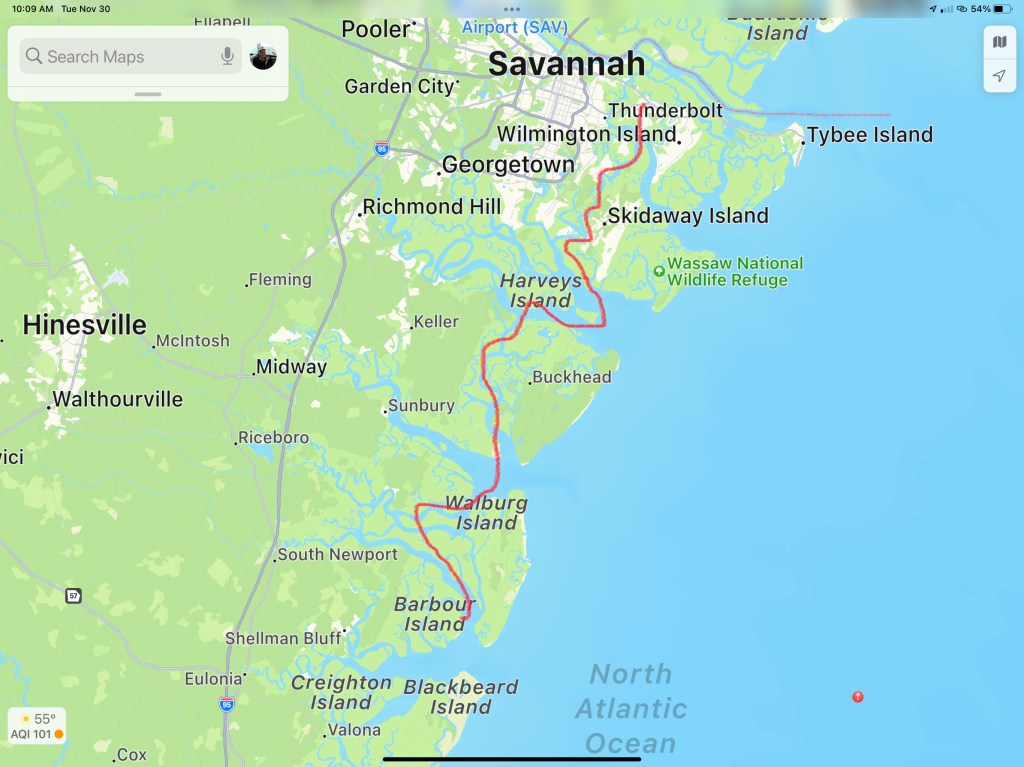
This post consists of 5 legs of our journey
Leg 15 – Waccamaw River, SC to Charleston, SCLeg 16 – Charleston, SC to Beaufort, SCLeg 17 – Beaufort, SC to Thunderbolt Marina, GALeg 18 – Thunderbolt Marina to St. Catherine’s Island, GALeg 19 – St. Catherine’s Island, GA to Ferdandina Beach, FL
We hope everyone had a great Thanksgiving with family!!!
Floating above the seabed,
Chained to the ground,
Waves of energy roll through me,
Riding the edge of sleep.
First Light
I awake. It’s still dark. Why I can’t sleep late? Instead, the smell of coffee wafts.
Blue Light of Early Morning
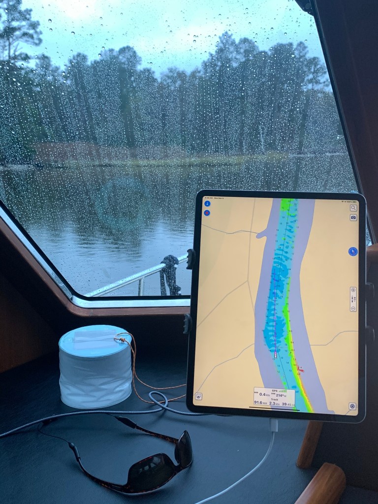
Drizzle Smizzle
As I make my way down Adam’s Creek the drizzle can be seen on the pilothouse glass.
Drizzle
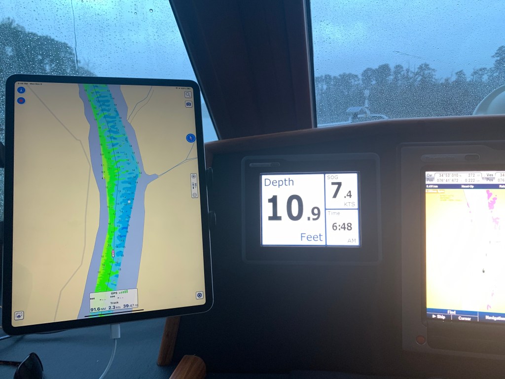
I’m feeling pushed… Pushed along to 7.4kts
1400 RPM should push me along at 6.5kts but I’m feeling the current on my stern.
As I make my way down Adam’s Creek I pass many boats on this drizzly morning.
As I approach the Core Creek Bridge the creek narrows and the water speeds up in an effort to squeeze through.
Newport Marshes
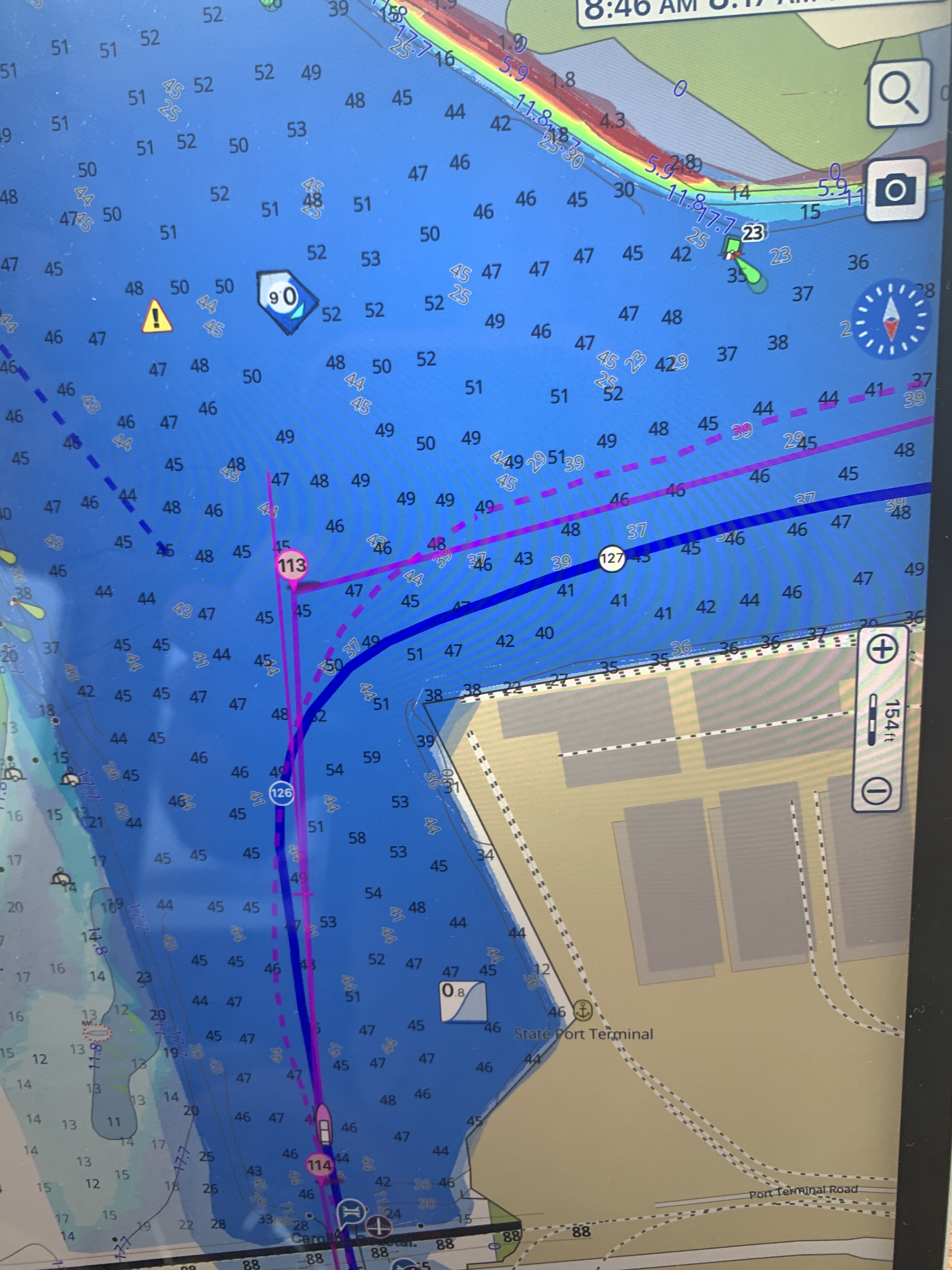
The Newport Marshes are just inland from Moorehead City and Beaufort. There is an area that can be confusing as the channel bifurcates. The Russell Slough Channel is a secondary channel that goes into the backside of Beaufort and the ICW channel breaks off to starboard when you are heading south to Florida. You must be careful to respect the ATONs (Aids TO Navigation) ie. buoys. I see a trawler approaching heading north and he notices that he is on the wrong side of the red buoy and performs a hard-over helm correction before getting right back on course. There is also a tiny anchorage right at the split. I have been tempted to use it but have always chickened out because there is a 4.9′ depth that I fear swinging into at low tide and resting on the bottom. I always keep that anchorage in mind if I’m in a pinch.
As I approach Moorehead City I must pass through a narrow rail bridge.
Hang a Roger @Moorehead City
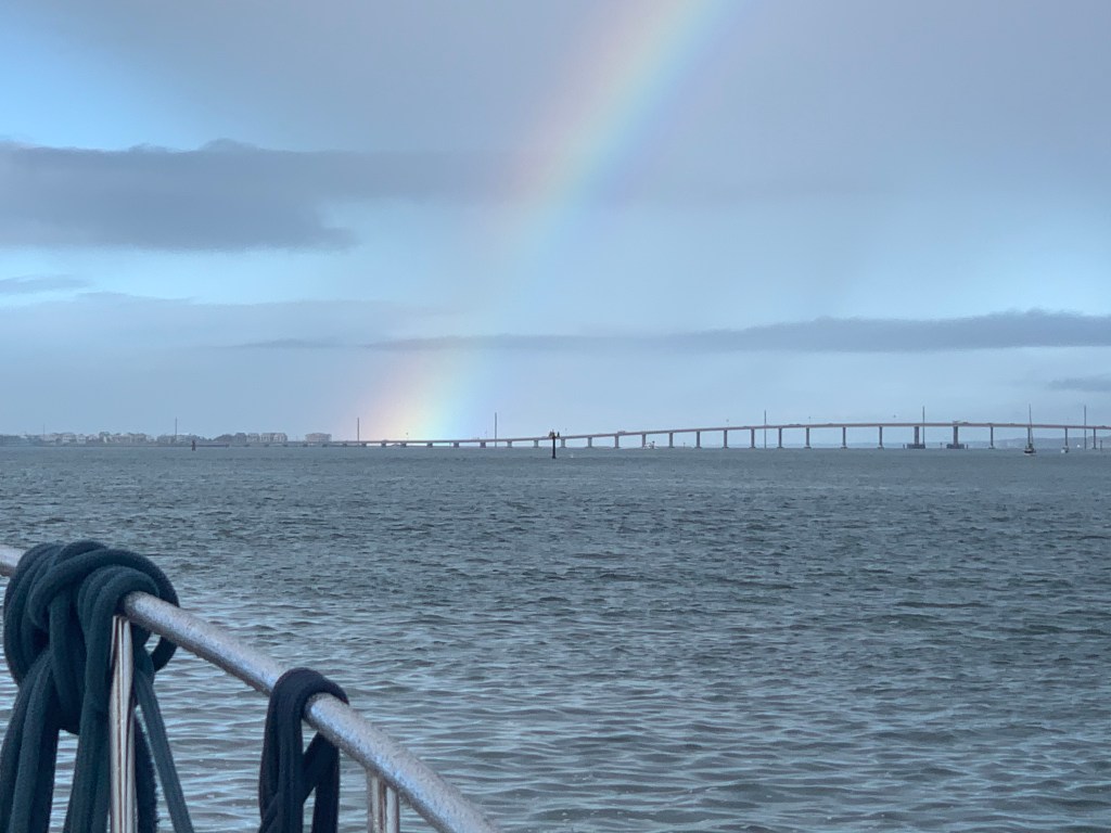
When you get to Moorehead City you turn 90 degrees around a large building.
After making that turn I was greeted by a rainbow
Rainbow over Bogue Sound
As I travel through Bogue Sound I’m reminded that today’s run will go through many traditionally shallow locations and I’ll have to stay tight to my line to not bump the bottom.
Shallow & narrow in Bogue Sound
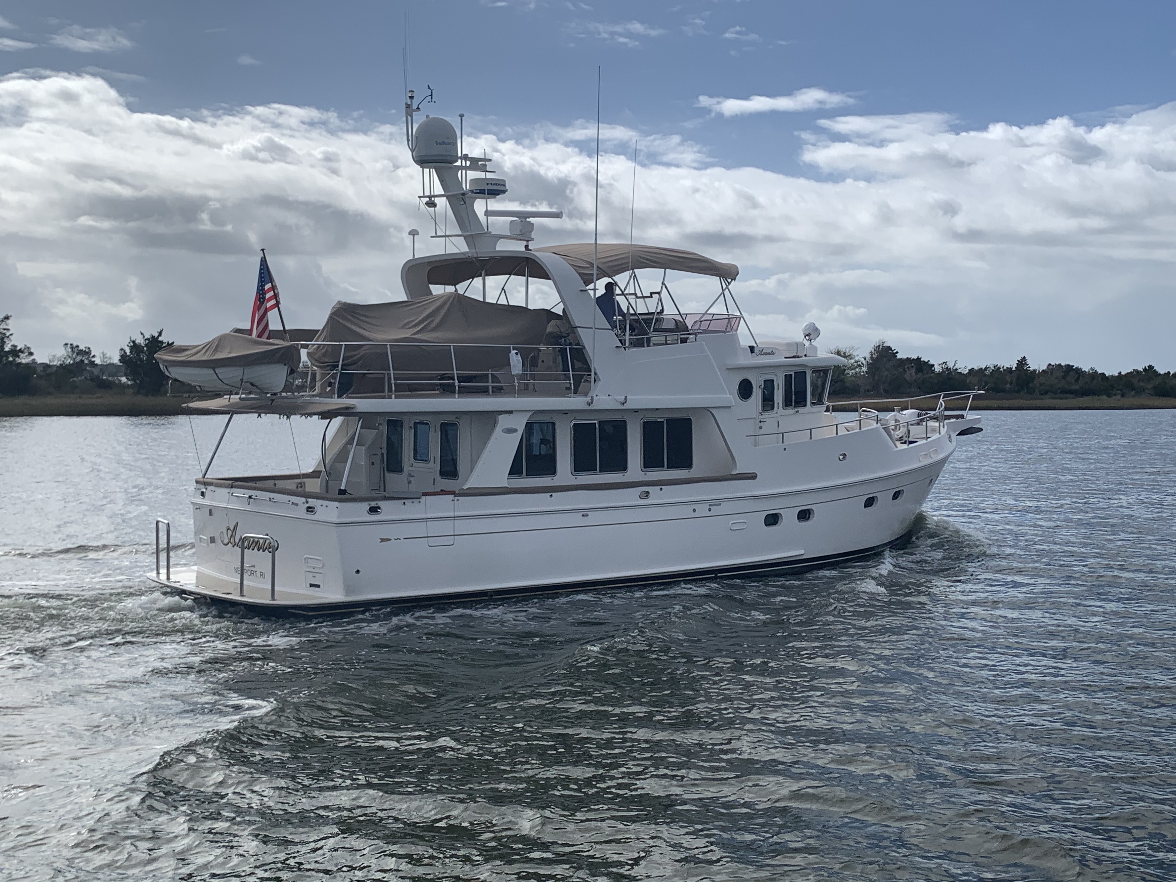
Boat Porn
As I go along I repeatedly have to pull the throttle back to idle to allow boats to give me a slow pass.
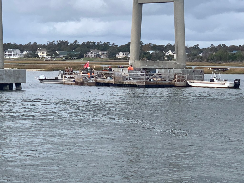
I almost missed slowing down for this diver down flag where these men were working on the bridge.
Diver Down
Divers Under the bridge
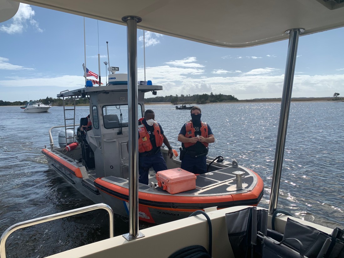
USCG Boarding
As I came into Swansboro I watched a USCG inflatable with three team members pass me and take up a course on my stern. Moments later they hailed me to tell me they wanted to board Simple Life. I cut speed to minimum make-way speed and explained that the best location to come along side and have crew jump aboard would be my stern swim platform. I felt only a slight bump and heard two Coasties coming through my salon. They greeted me warmly and asked if I was alone. I responded “yes” to which they replied … “oh, OK I guess you’ll have to keep piloting the boat and we’ll do our thing. They were doing a safety inspection which includes me showing them everything from sound devices, PFDs, throwable PFDs, signaling equipment, a digital copy of the USCG ColRegs. They also performed an engine room and bilge check as well as asked for my license and boat documentation. They were very professional and polite about searching through my current home. They gave me a passing grade and handed my my yellow boarded slip to keep for my records. I asked if I could take a picture for my blog and they said “No Problem”.
USCG Boarding Team
I like to keep everything digital on Simple Life.
Digital copy of the USCG ColRegs
Keep the Water Out
Sometimes it’s a challenge keeping the water out.
Sad to see
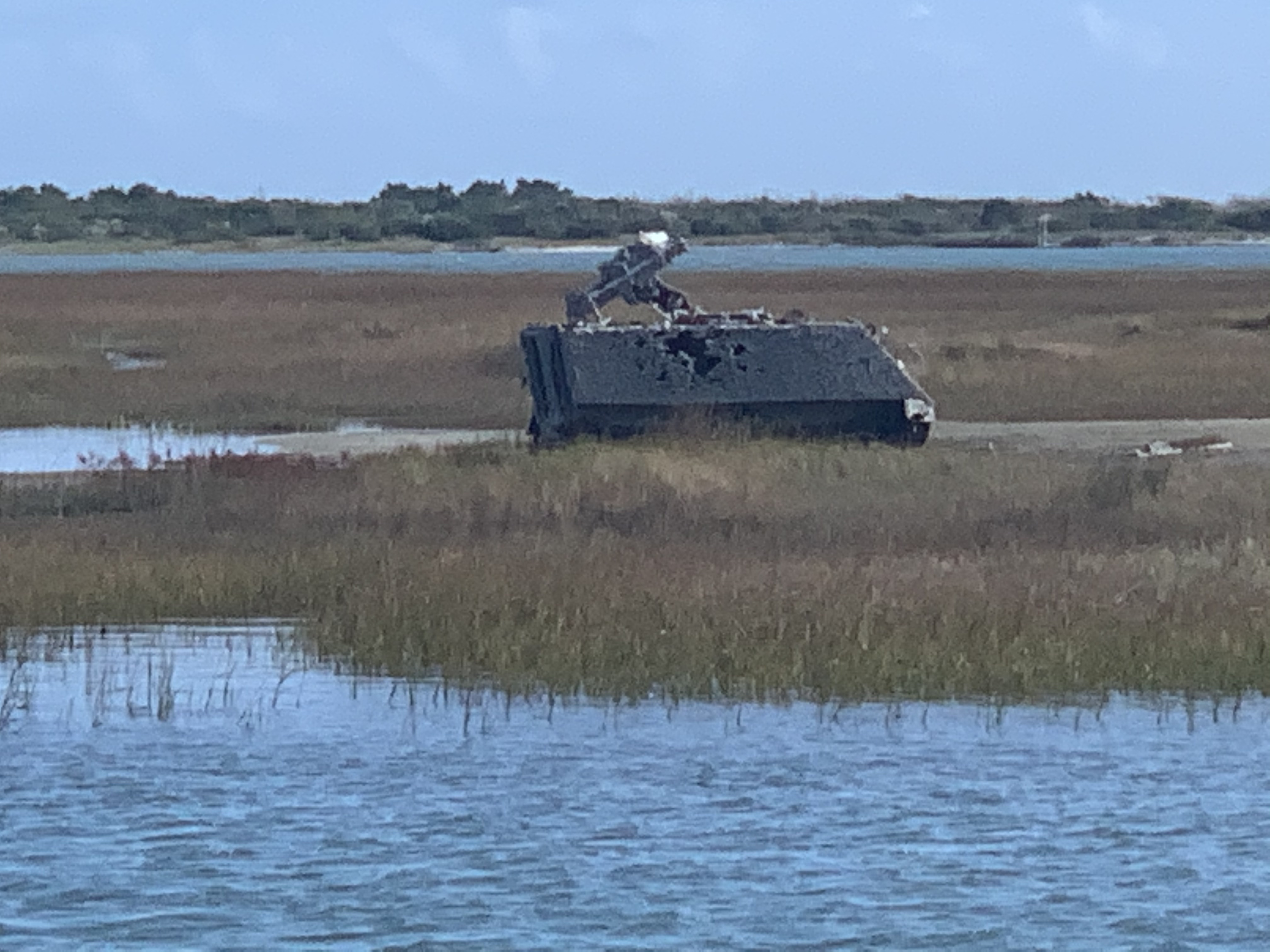
Marine Base Camp Lejeune
As I pass ICW statue mile 235, the shot up military vehicles and V22 Osprey aircraft overhead remind me that I’m approaching Marine Base Camp LeJeune.
Onslow Beach
As I arrive at the Onslow Beach Bridge I must wait in traffic for the next opening. The current was on my stern so I made sure to take a visual fix on land and hold my position fixed. Boats who were coming up behind were being pushed by the current past me. They are all faster than me so whenever faster traffic lines up behind me at a bridge I find it easier to let them pass you in line so that you can avoid the inevitable pass after the bridge. I backed my way into the current until I was the last in line. I watched as the boats swarmed like bees attempting not to hit one another.
Onslow Beach Bridge
Eyeballs Be Burning
As the sun gets low you’ll be seeing spots
Need to Hook Up
Now passing one of my favorite anchorages called Mile Hammocks Bay. The boat in front of me Kismet turns in. For a moment I start to follow but think… there is still three hours of daylight left. That said, the challenge with continuing on is… there is probably only one suitable anchorage within 3 hours range called Sloop Creek. If it’s full I could be running into the night looking for somewhere to drop the hook. I have never been to this anchorage so I study the entrance and make note of my expected arrival time which is after sunset. I decide to go for it.
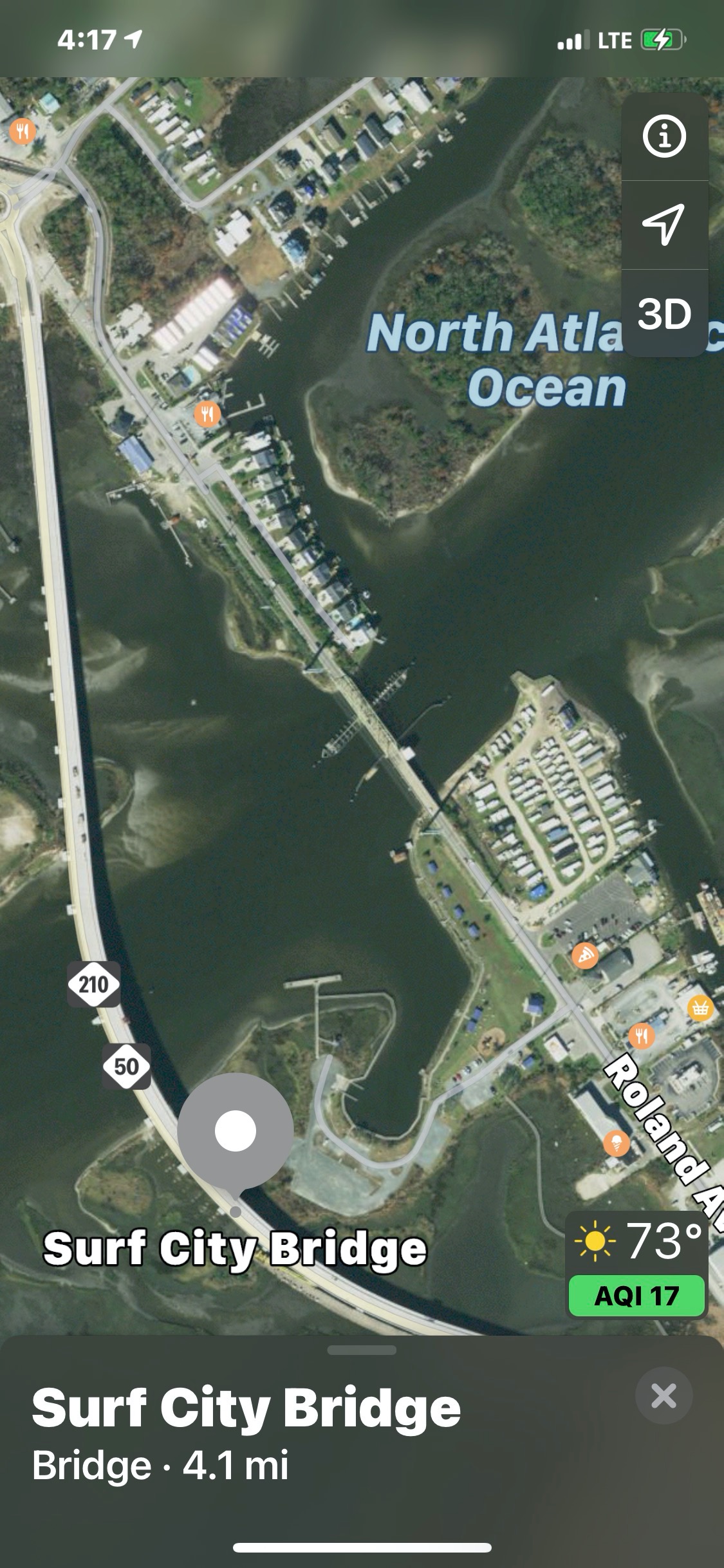
When in route I can’t remember if the Surf City Swing Bridge has been replaced with a 65′ high fixed bridge. I use Apple Maps and it shows it in place. I switch to Google Maps and see it missing.
While enroute to the anchorage, I hear MV Doghouse hail me on the VHF. “Simple Life, do you know where there is an anchorage around here?”. I reply, Sloop Creek and they ask if they can follow me there. I jump at the chance to be helpful and reply “follow me”. We arrive at the anchorage. I do a quick circle to check the depths. It’s not deep or wide but… it’ll do for tonight.
The sound of the anchor weighing lets you know that a new leg of the journey has begun.
First LightLooking Back
The forecast for today included a fresh breeze. We understood that meant we’d be salting up the boat with the spray kicked up from the wind.
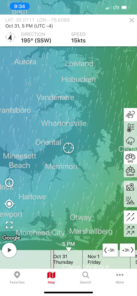
Pamlico River Wind Speed & DirectionNeuse River Wind Speed & Direction
Underway in the Neuse River
The trip to Beaufort, NC looked something close to this.
Alligator River Pungo River – Beaufort, NC
Buddy & Renee placed the anniheim, poblano & jalapeño peppers & onions in the stove for today’s green chile soup.
Green Chile Soup
Soon we were passing the USCG station in Hobucken, NC.
USCG station in Hobucken, NC
Just next door is the R.E. Mayo Seafood company with its fleet of commercial boats.
R.E. Mayo Seafoof
Commercial Boats
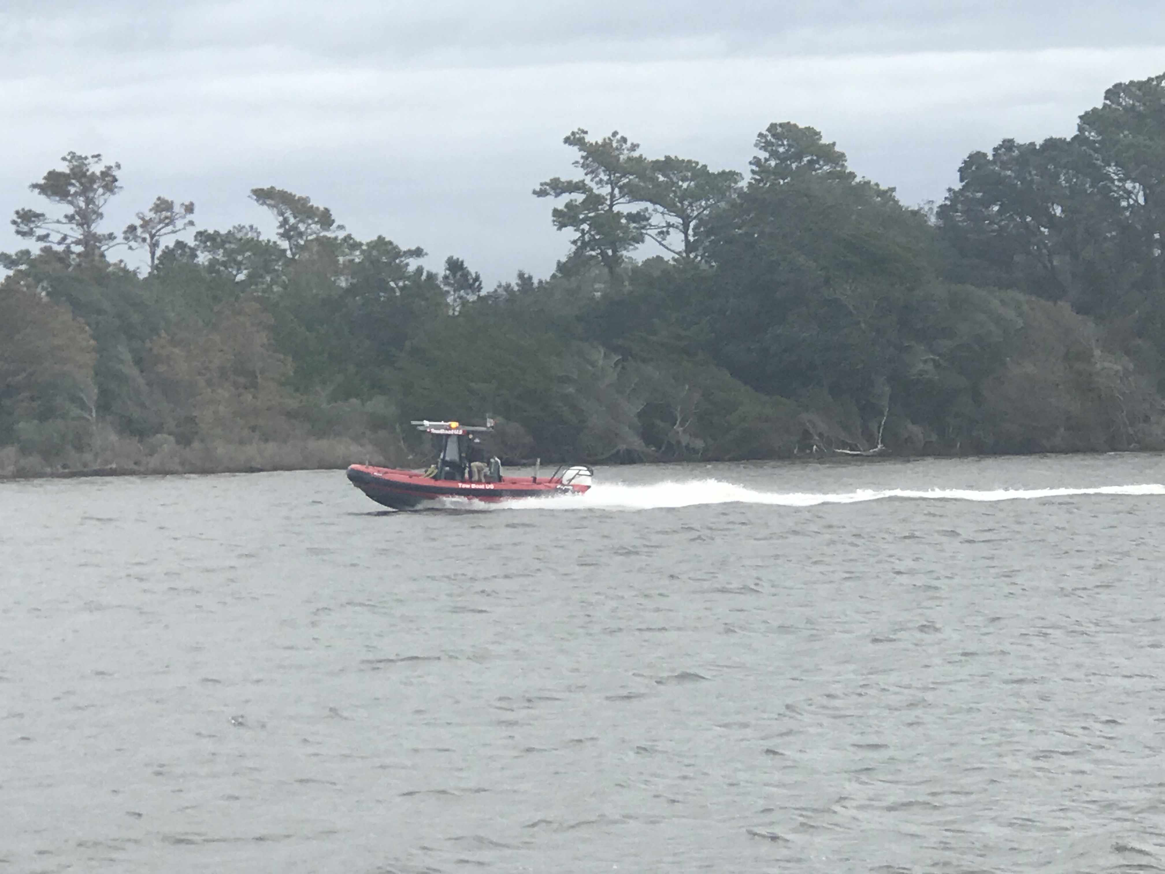
We entered Adam’s Creek and found a beautiful Kadey Krogen being pulled off a shoal by a tow boat. It’ looked like an ant pulling a boulder on a string.
Tow Boat US
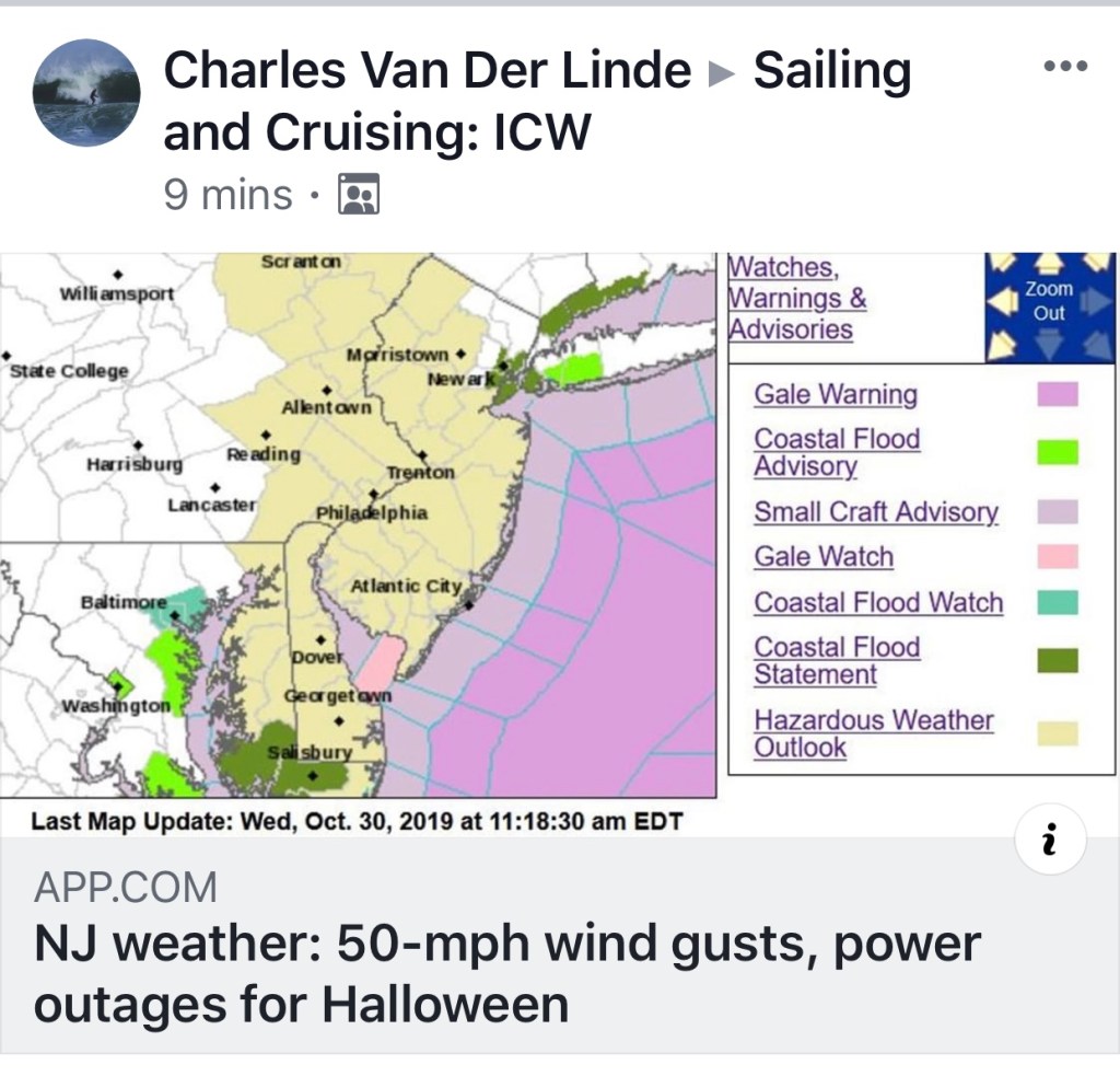
Once in Adam’s Creek we passed another ICW statute mile marker as well as beautiful homes and yachts.
At this point I happened to see a Facebook group post about 50MPH gusts off the Jersey Coast. This made me smile thinking we made the right decision not to stop in NYC and get trapped by weather.
As we came into Beaufort, NC the wind was gusting and the current was flowing fast past the docks. Docking was challenging but we managed to back her into the slip with some assistance from the dock-hands.
MV Simple Life Slipped at Beaufort Docks
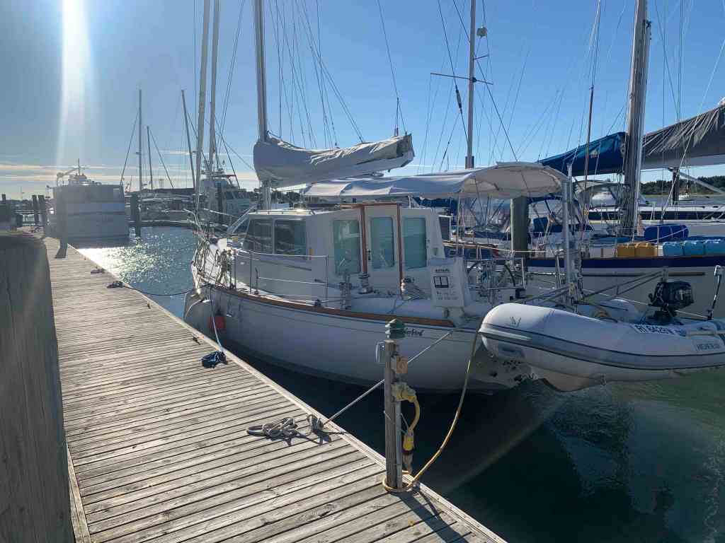
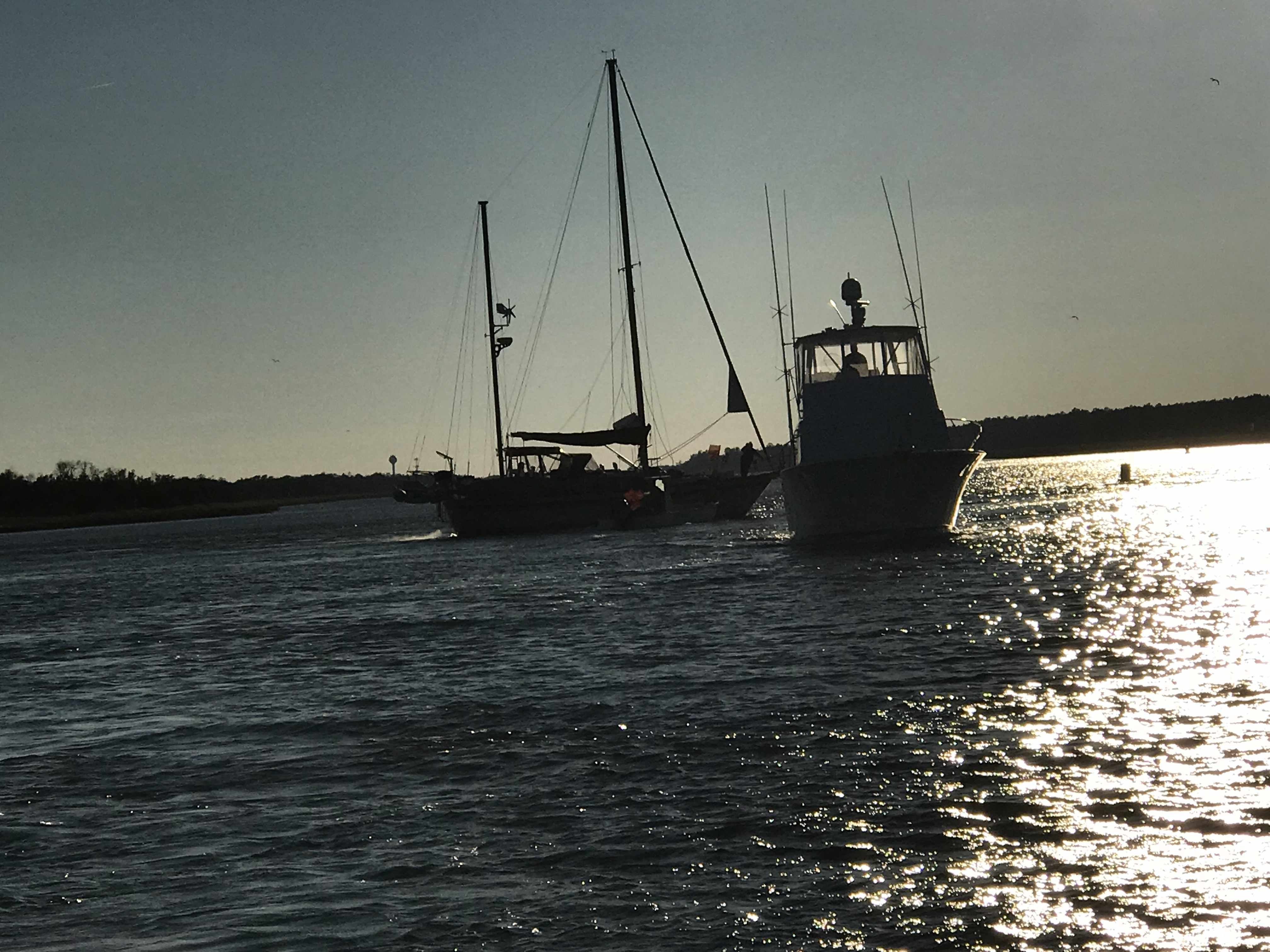
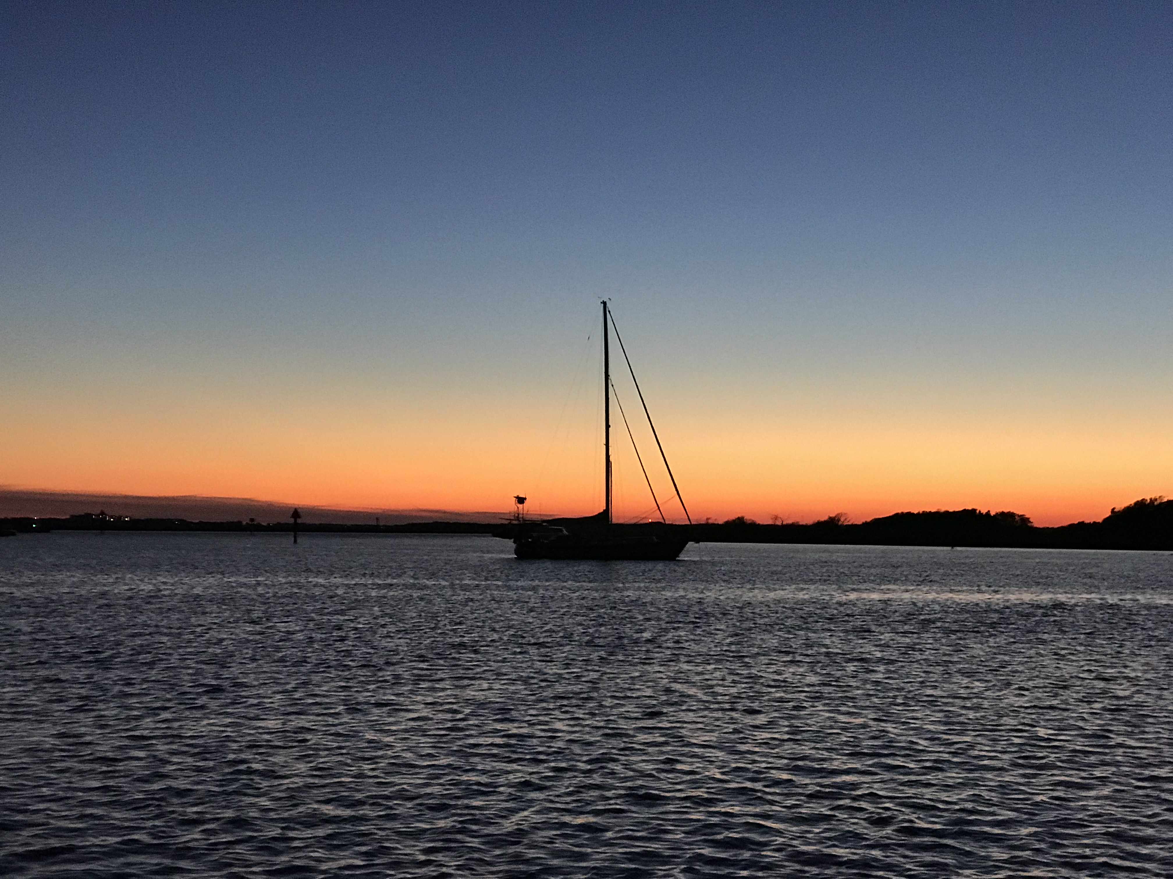
This pilothouse sailboat caught my eye and the yacht hailed from East Greenwich, RI. E. Greenwich is around the corner from where I spend my summers. Beaufort Docks Marina seems to always be chock full of northern boats.
Hailing from East Greenwich
Pilothouse Sailboat
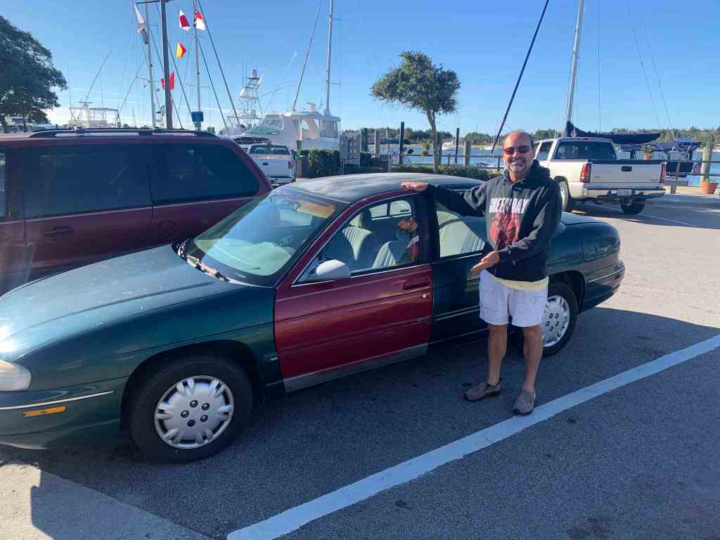
Once in the slip it was time to check in and request use the sporty loaner car for provisioning.
Don’t lock the doors
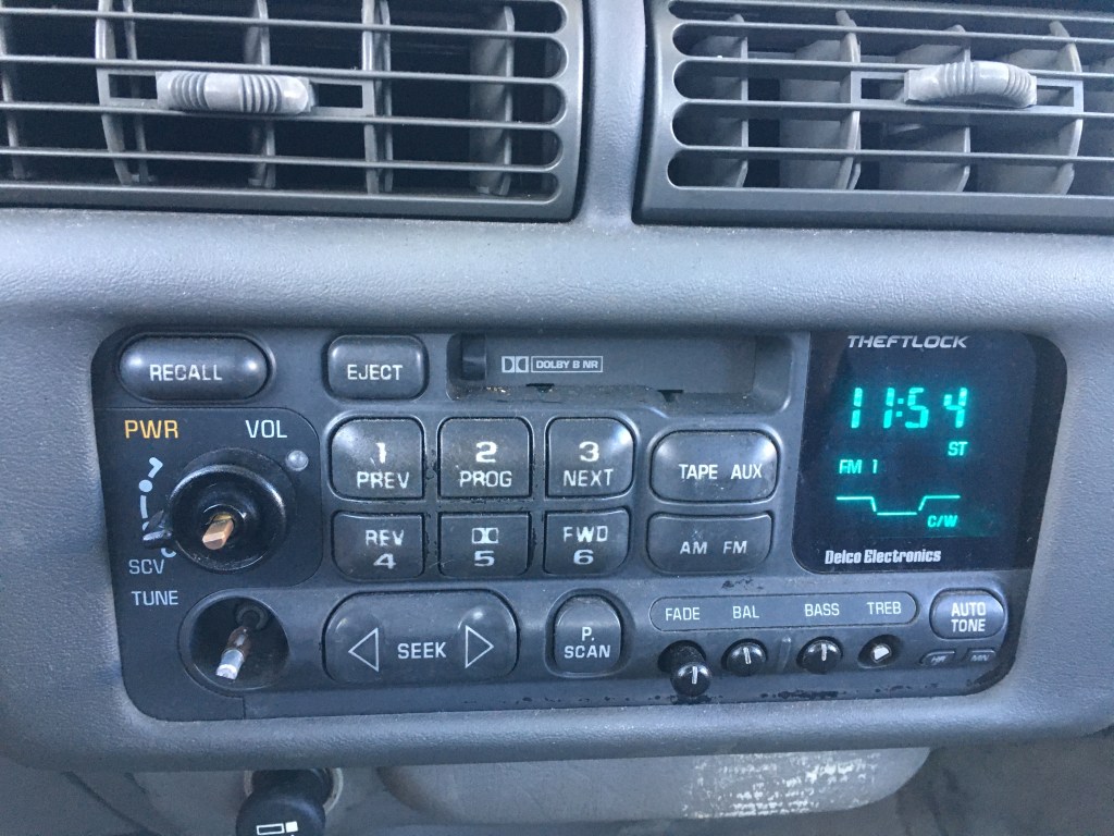
Missing Stereo Knobs
Replace the Gas!
Two-Tone Paint
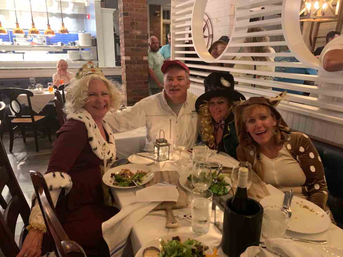
Now provisioned it was time to walk to Moonrakers for some Halloween dinner & drinks.
Renee & Tim
Buddy, Renee & Will
Buddy, Renee & Will
Buddy, Renee & Will
Buddy, Renee & Will
I got the special
Wee bit blurry
Marty goes down the rabbit hole into Wonderland
I snapped a few quick pictures on our walk back to Simple Life.
We loved our stay in Beaufort, NC but we awoke to 34 degrees and it was time to leave.
We had lots of fun in Beaufort riding around in the sexy loaner car. The car was green but the door was red. You had to pump the breaks to slow down and it had a death rattle sound as you drove down the road. We loved it. It was FREE.
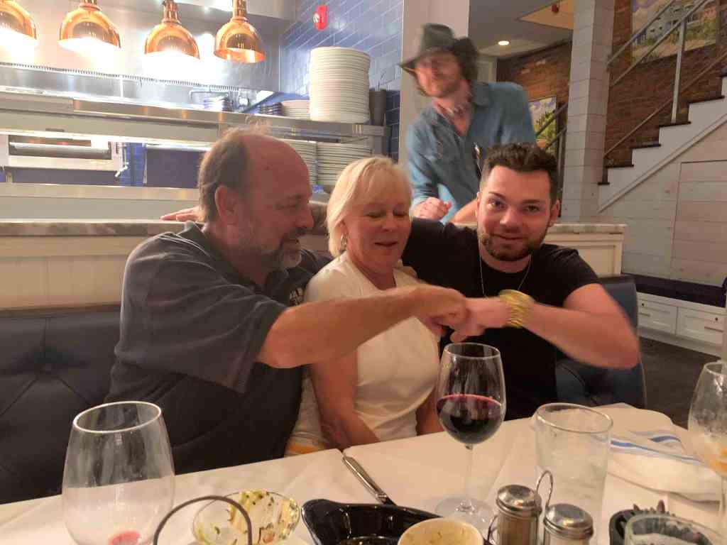
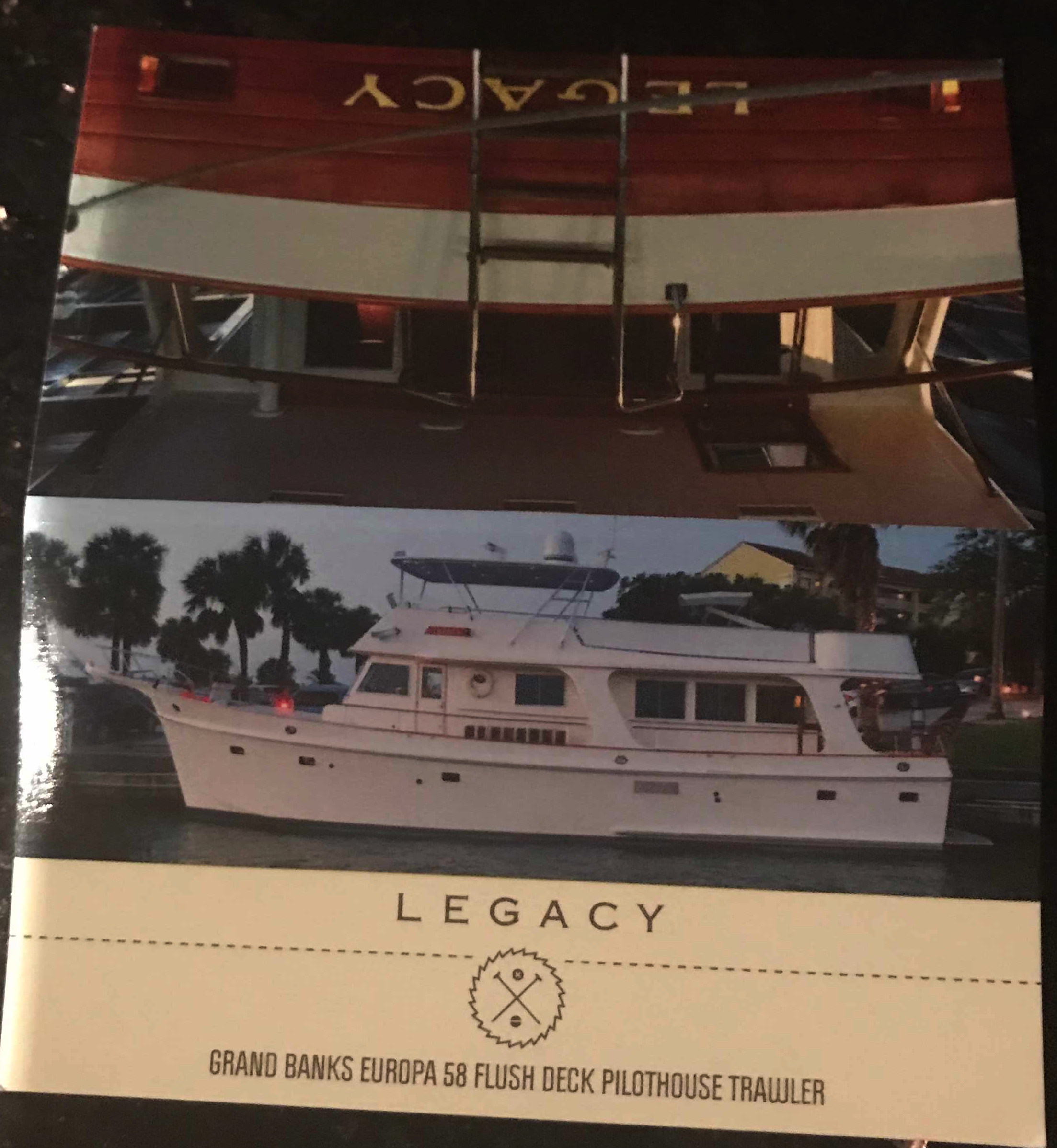
We decided to do a pub crawl through Beaufort but we only made it to the Black Sheep Bar which was 20 feet from our boat. We met Capt. Scott from MV Legacy (58′ Grand Banks). Capt Scott kept us entertained with stories about his grandparents yacht that he was now the captain of. Capt Scott even gave me a tour of MV Legacy when we left the bar and she was very impressive.
Our GPS tracker was capturing our journey as we headed South. It clearly was not recording where the straight lines are shown but it gives a reader an interesting view of our last few days of travel.
I met another fella who said he noticed my Boston accent as he was also from that part of town. When I said well I’m from Foxboro (home of the Patriots to be exact) he mentioned someone he knew from Foxboro and it turned out to be a childhood friend of mine (Small World). Turns out we knew many of the same folks from back home. I snapped a selfie as it seemed like the right thing to do in the moment.
As we made our way out of Beaufort we passed a buoy tender with two gentleman who looked quite cold.
It was a small craft advisory and the whitecaps were appearing even in the small body of water we were in.
As we made our way down Bogue Sound I hailed a boat that was anchored in the channel. Turns out they were having engine trouble but were not in need of assistance.
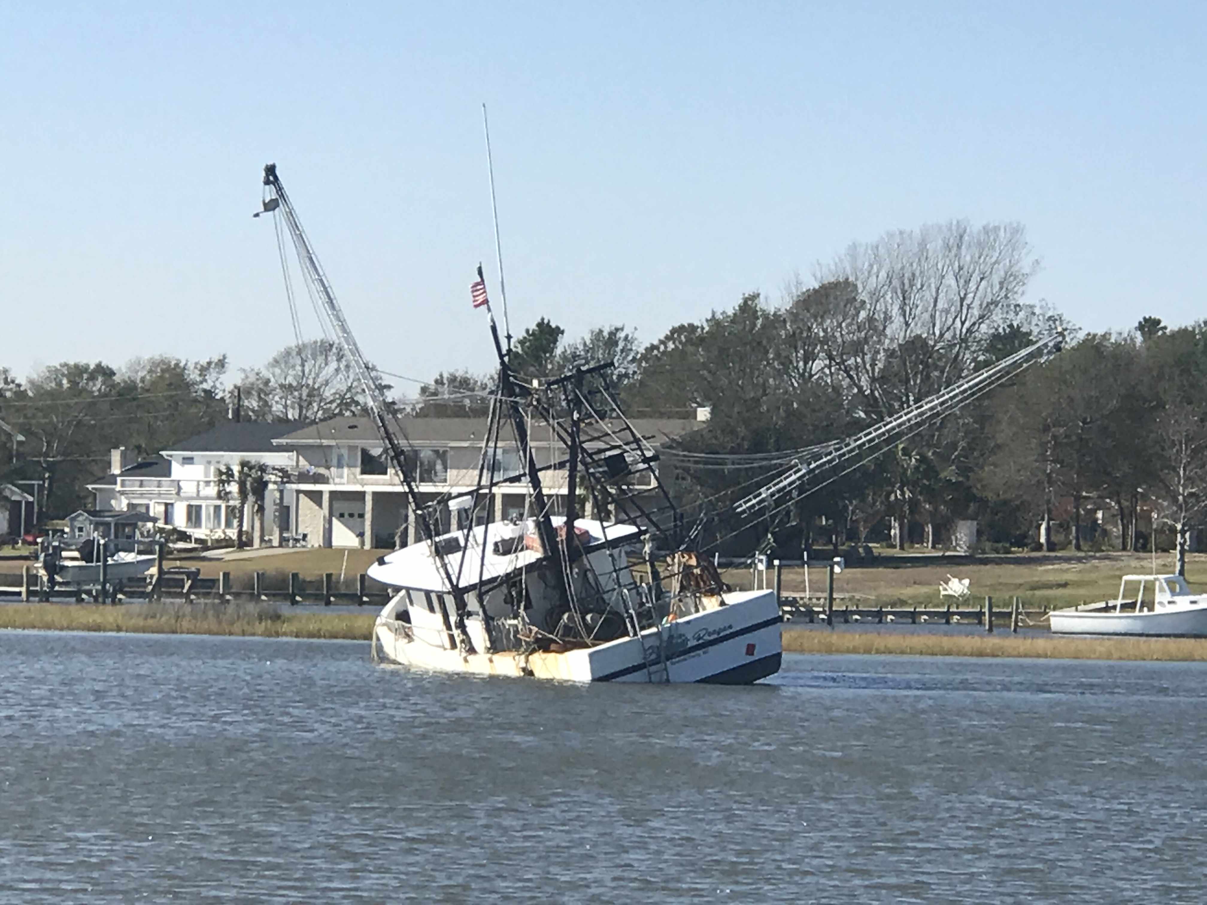
We passed this fishing vessel that had clearly sunk in the shallow waters.
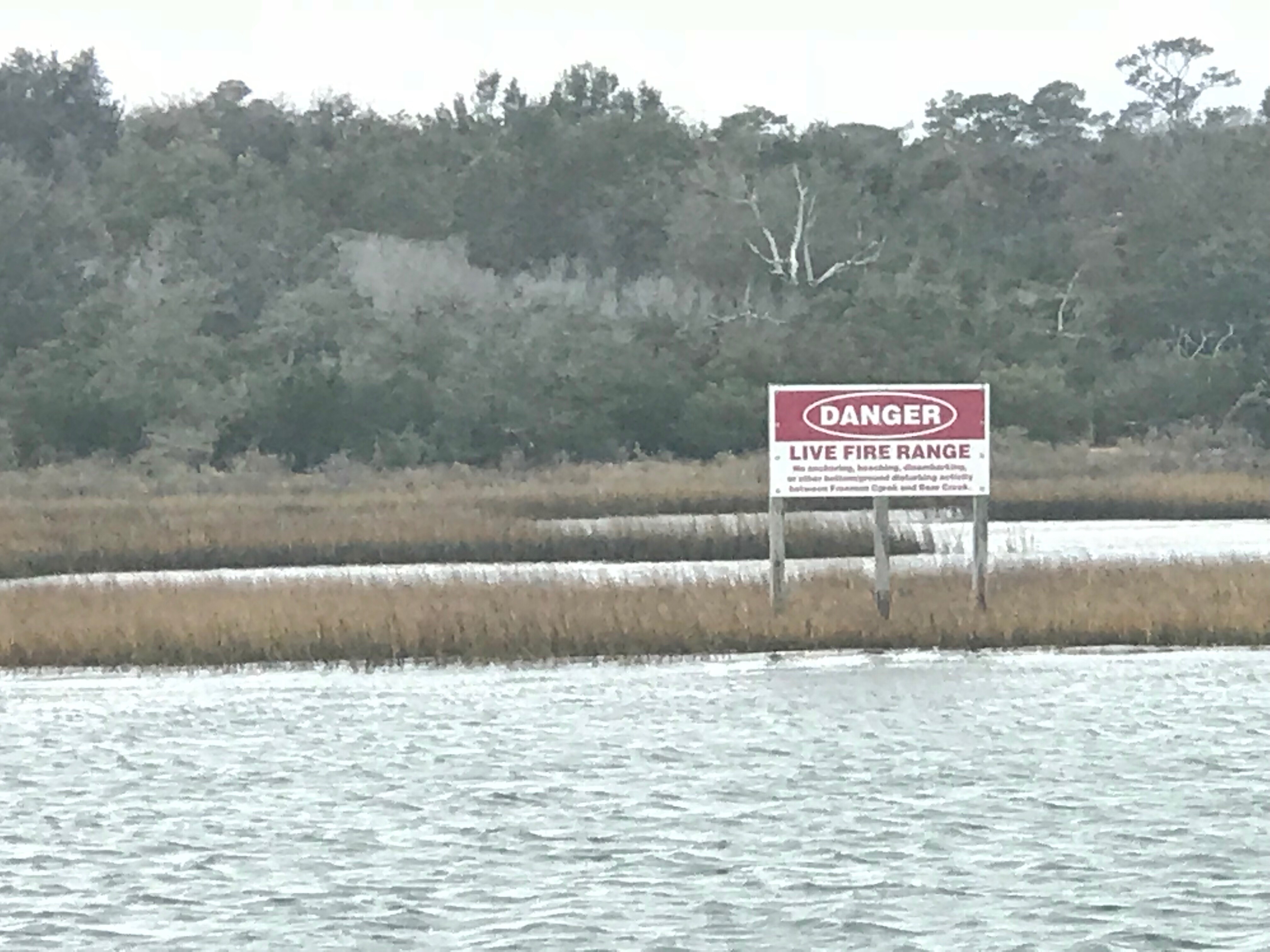
And around the next corner was the Marines Camp Lejeune. They were doing live fire exercises to we were forced to stop and drop anchor.
We dropped anchor believing that no traffic could pass during the exercises but soon a tug boat was passing us on anchor. Maybe he was just slow making his way out of the firing zone?
When we were finally allowed to continue down the ICW we and all the other boats were racing to make it to the only decent anchorage within range. You must be careful when you run fast down the ICW because if you run up on a shoal going fast you may not be able to back off of it. Soon the sailboat behind us ran aground and they asked us if we would turn around and come back and wake them as hard as we could to possibly rock them off the shoal that had them stuck. We agreed knowing that it was risky as in order to wake them we’d have to run fast right next to the shoal they were stuck on. We did our best but in the end a local crab boat was the one who deserves the credit for pulling them off.
We were thrilled to see them free as it was still 2 hours away from low tide and if they had not gotten off that shoal quickly they were going to sit there into the night.
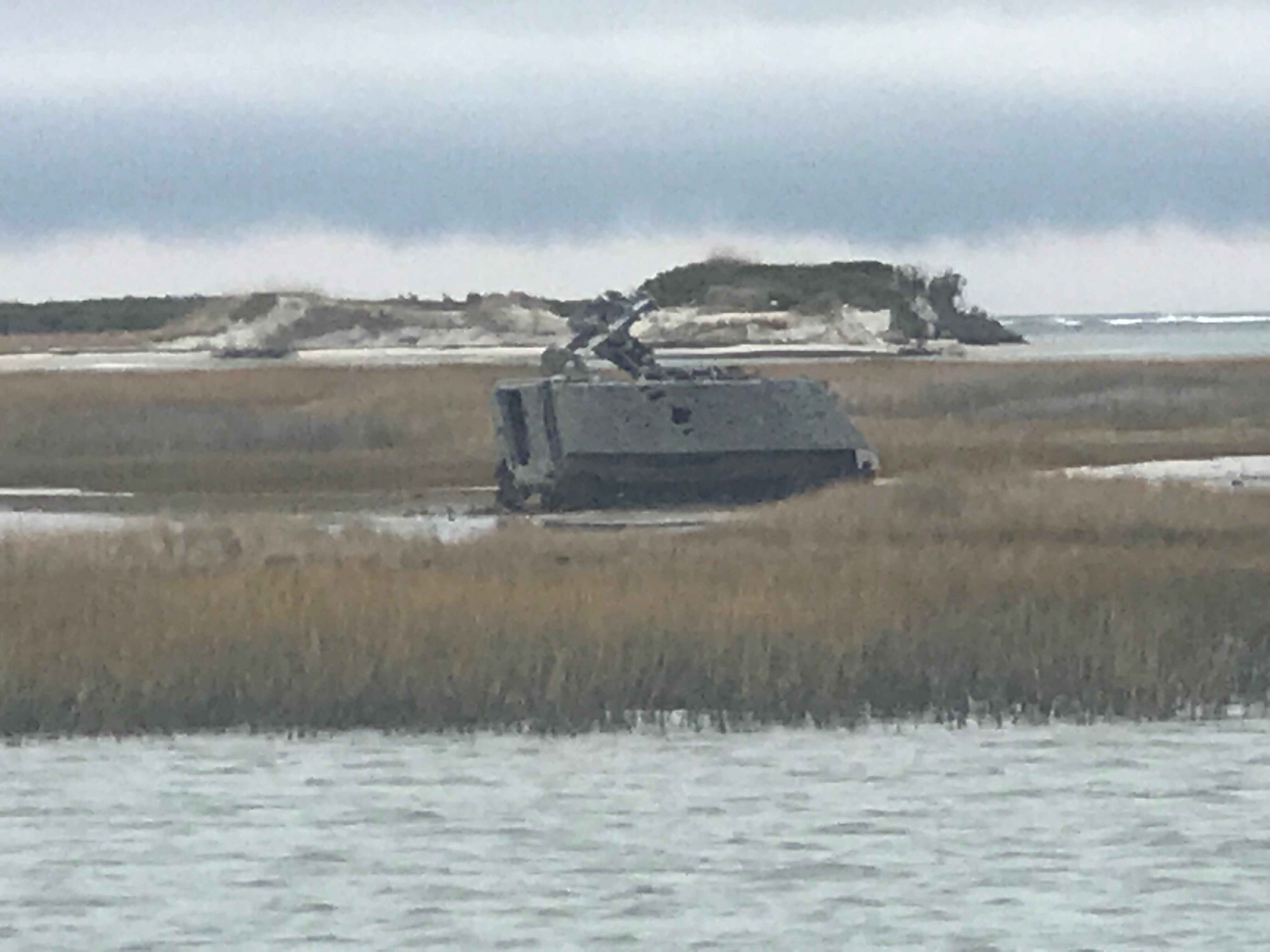
As we made our way to the anchorage at Camp Lejeune we passed many bullet riddled targets on shore.
At least until this fellow came blasting through..
Once the morning’s parade of boats down Adam’s Creek began, it was time to weigh anchor.
As you make your way down Adam’s Creek you’ll love the beautiful homes and boats along the water’s edge.
House had it Own Helicopter
House Painted Like it’s in the FL Keys
Red Right Returning from Sea – You did it Wrong!
Morning Girl is a Sexy Commercial Sport Fishing Boat
Adam’s Creek Wavy Bottom due to Strong Tidal Currents
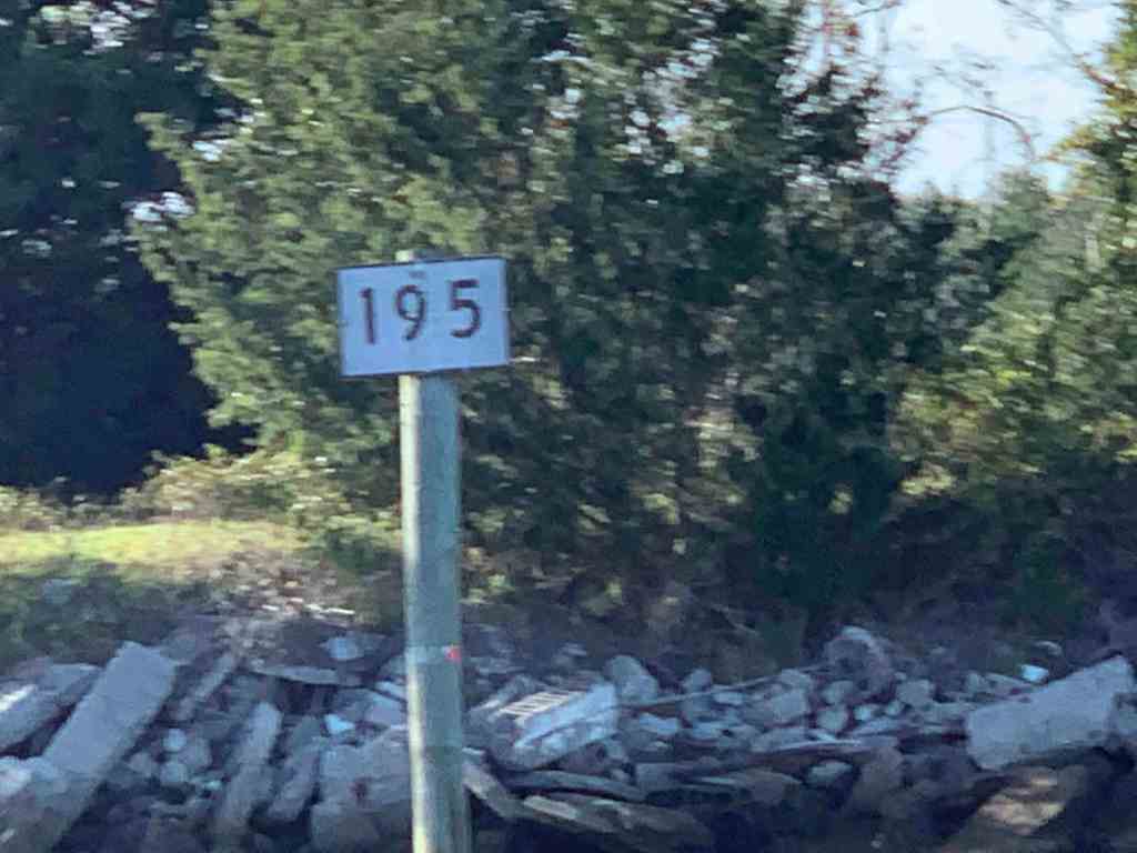
Somewhere along Adam’s Creek it turns into Core Creek where we passed more ICW statute mile markers and a derelict sailboat.
ICW MM 195
Delelict Sailboat (no dinghy = nobody aboard)
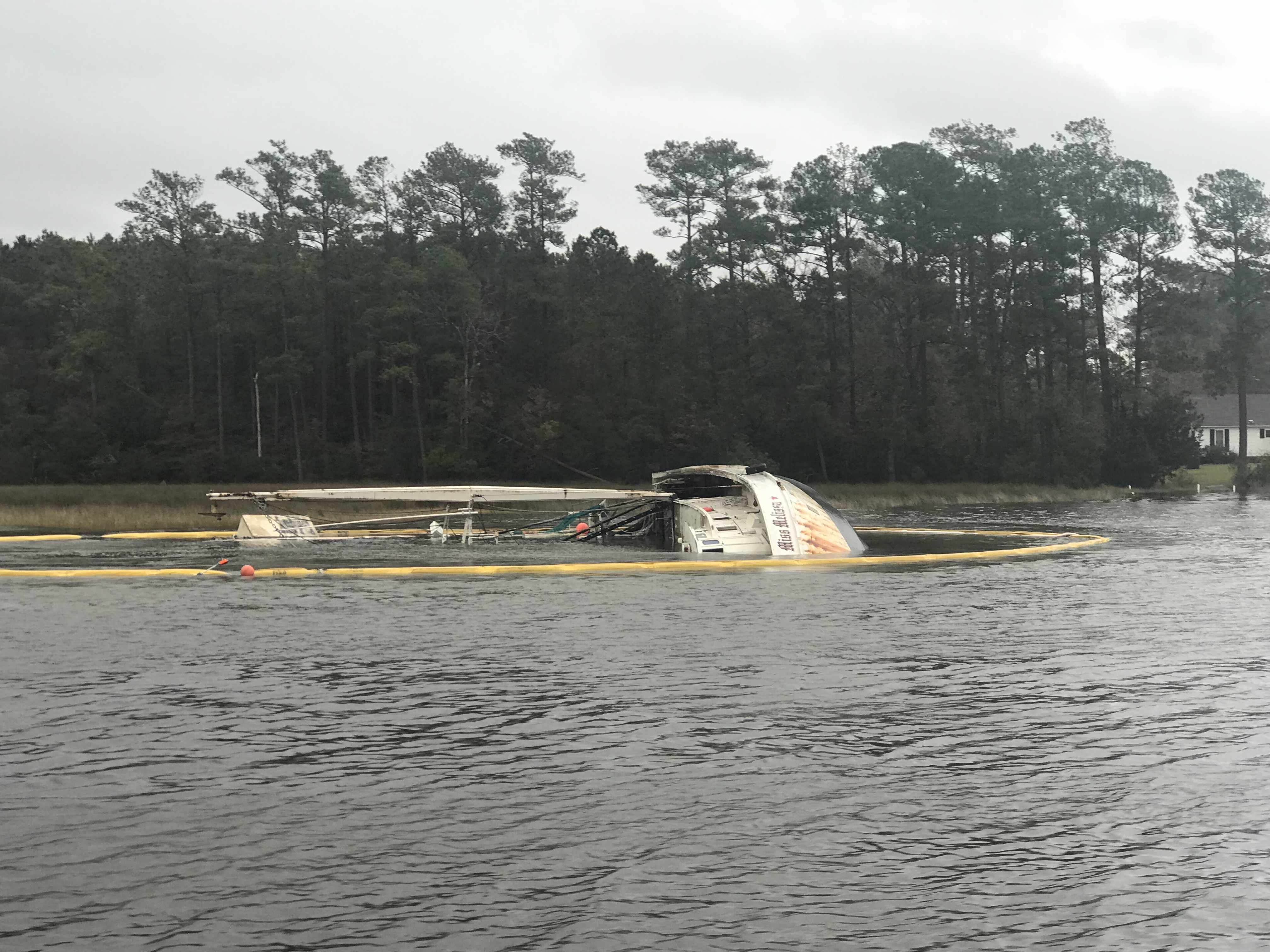
We were aware from the USCG securite warnings broadcasts that there was a 61′ capsized fishing trawler in Core Creek. When I had to dodge floating rope and netting coming down the river, I knew we were close. Then it appeared.
Boom Netting to Contain debris
Resting on her Side
FV Miss Melissa
Soon we were heading into an area called the Newport Marshes named after the nearby city of Newport, NC. This area can be a bit tricky as the channel bifurcates and we stay to starboard. I believe there is deeper water to starboard.
Crabber Working the Marshes in the Rain
Tow Boat US Racing to Pull a Baot off a Shoal
For a brief moment we had a motoring sailboat attempt to cross our bow from the port-side. We were on a collision course so I gave them a single blast of our air horns to indicate a one-whistle-pass (meaning port to port like driving a car on the road in the US). They did not alter their course so it was time to blast it again! That did it. They waved as we passed and the rain. The rain covered dodger and a crowded cockpit were probably the reason for the distracted captain.
Morehead City, NC was next and the clouds were getting dark with rain and even some lightning strikes.
Near Morehead City NC
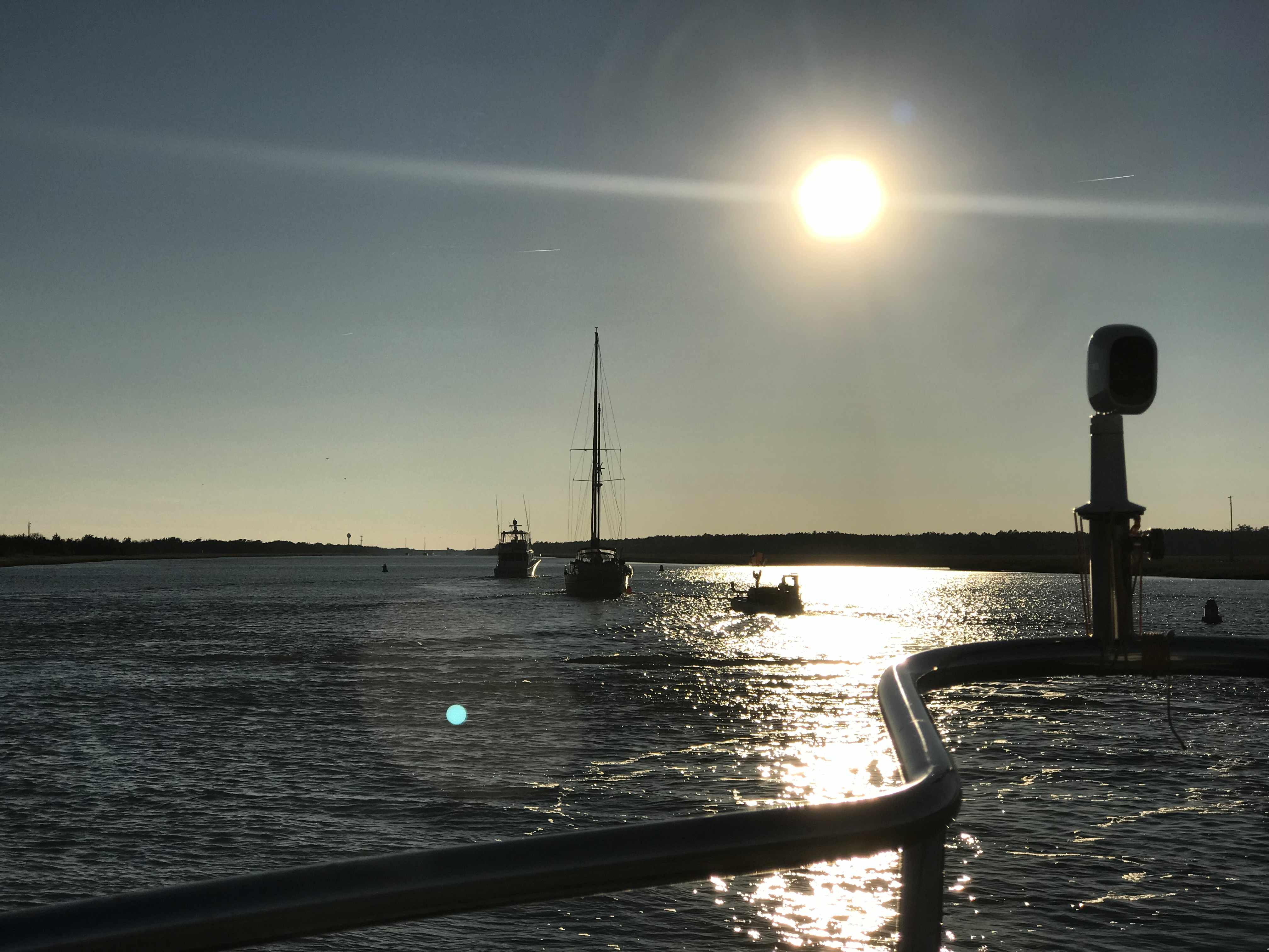
We were fast approaching Beaufort Inlet and the strong wind could be felt. Our rearview camera’s view of our flag atop our VHF antennas showed the flag whipping around.
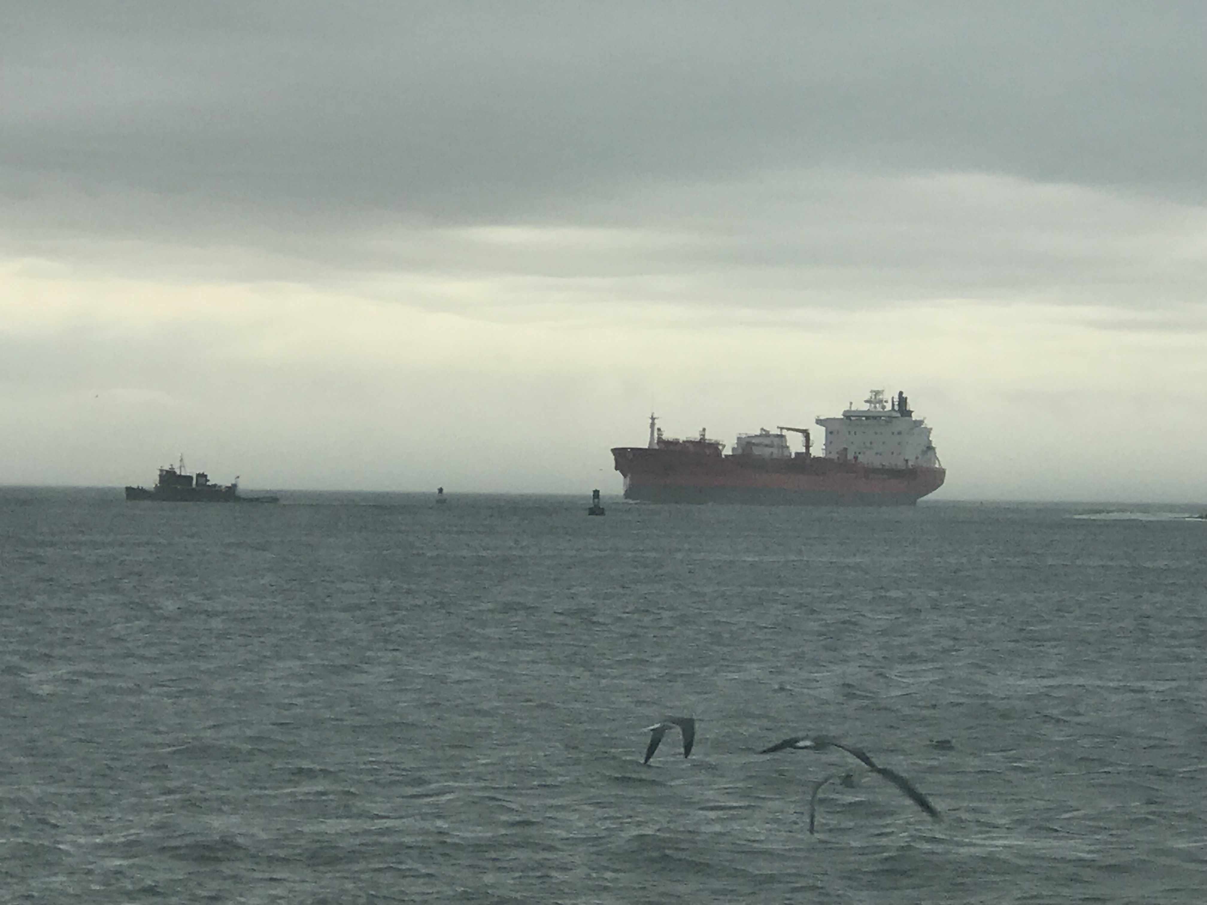
To get into Beaufort using the East side entrance you need to head like your exiting Beaufort Inlet then turn hard to port after going by Radio Island. We did this as quickly as we could as a large cargo ship was fast approaching. Even the two tugs were joking on the VHF about “giving it all she had” to get out of the way of the large ship. The tug hailed the ship saying… he would have to point his bow directly at the ship but not to worry as he was crabbing his way in the wind and would soon be out of their path. On a boat unlike a car sometimes even though your bow is pointing in one direction, the wind and current can be moving you in a straight line that is not where your bow is pointing.
Large Cargo Ship Coming in Through Beaufort Inlet, NC
We had timed our arrival into Beaufort at slack current. Last time we were here we docked in a max ebb current and it took all my skill to keep MV Simple Life from crashing into other boats at the docks. A full keel trawler at 90 degrees to a strong current moves down-current quickly. It’s not something that your thrusters can overcome.
We were thankful for our pilothouse as the rain was coming down pretty good at this point.
We passed Moonrakers and some sexy boats tied up in port.
“Moonrakers,” named after the rectangle sail flown at the uppermost height of a three-mast 17th-century ship
Nordhavn Trawler in Port
Sexy British Sailing Yacht
The Beaufort Docks Dockmaster had assigned us a great slip all the way in right next to the restaurant. The docking was a “breeze”, no literally, we simply turned sideways and let the breeze blow us sideways into the dock. Worked beautifully and Kelly was soon tossing our stern line to the dockhand.
1995 Saberline 43 Green Hulled Trawler Next to Us
Note our Flags Indicating a Beam Breeze
Once in our slip we quickly jumped ashore and walked the docks.
Mums Line the Docks
Walk the Docks
Betting that is the Marina Loaner Car
Santa’s Workshop in Beaufort NC
I almost forgot there was one casualty along this trip and it was my slippers. Kelly demanded that my stinky slippers stay in Beaufort, NC. I will miss my favorite slippers but our boat and crew would thank me for giving them up.
I’ll Miss You, Comfy Slippers
I checked in at the dockhouse, paid the bill, got the WiFi password and two beer tokens! My favorite part is taking those wooden tokens straight to the sailor bar at the Dock House and enjoying a well-deserved beer. We were sharing dog pics with Shelby, our bartender. She showed us pics of her 3 new hunting hounds that her dad had given to her.
Have a Draft on Us – Dock House
Welcome Shipmates
Sailor Bar Closed so we got to use the more Upscale Bar Upstairs
Clawson’s bartender, Kayla set me up with a great Hazy NE IPA and life was great.
The bar itself dates back to 1905 and Kayla was entertaining us with ghost stories about the ghost-like little girl on the third floor. She offered to take us up to the 3rd floor to look for her but we chickened out 😉
Clawson’s Bar
Ghosts Straight out of 1905
Deer head amongst Boating Motif
We are thrilled to spend two nights in Beaufort, NC.
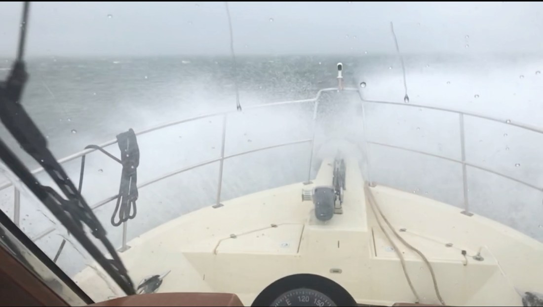
We had reservations to be at Downtown Marina in Beaufort, SC and the weather was not looking good. With 25 knot winds and gusts to 35 knots.
35 knots = 40 MPG Gusts
As we rounded Hilton Head Island the only thing my radar saw was rain.
That Magenta on the screen is rain reflecting my radar
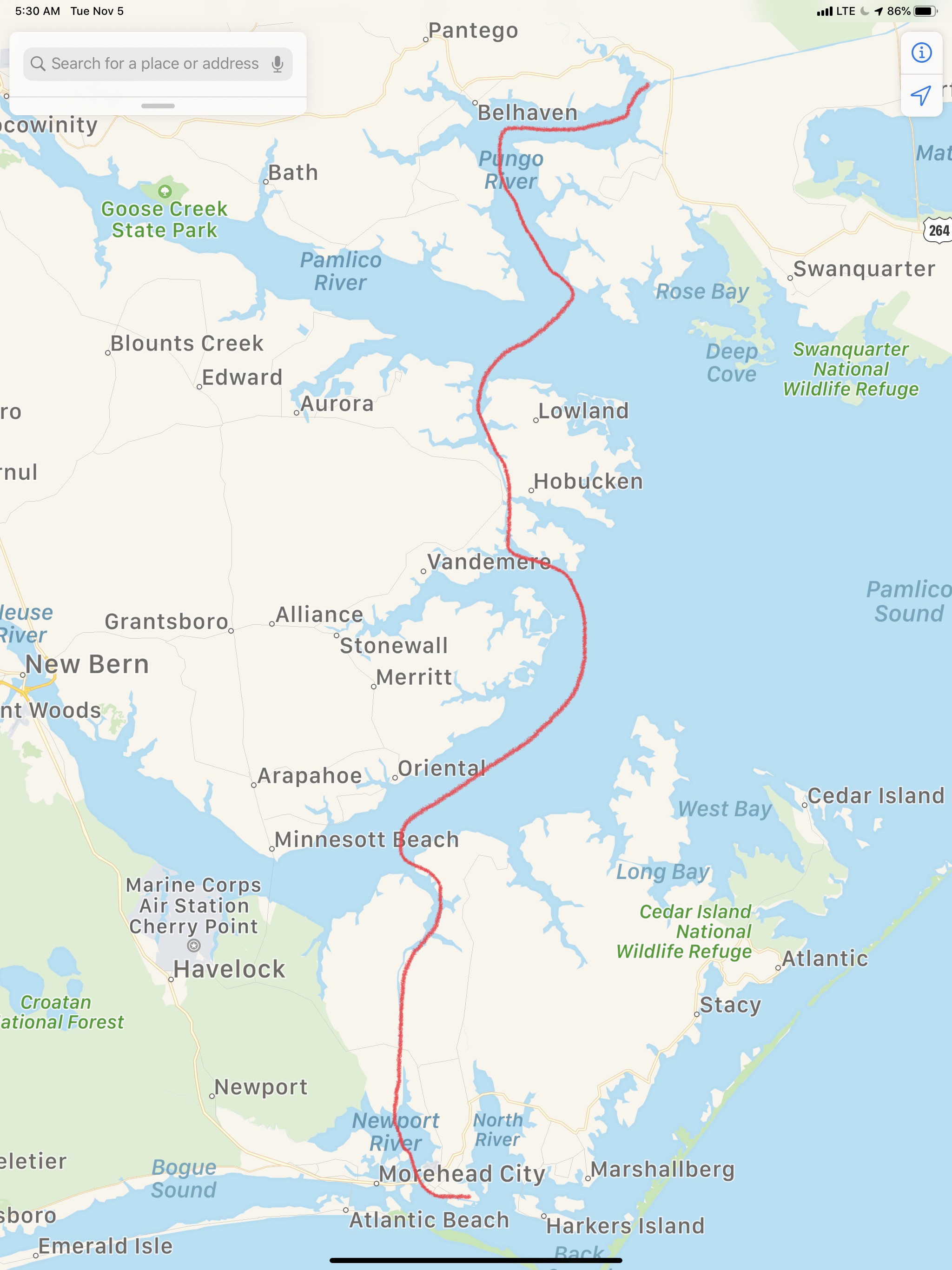
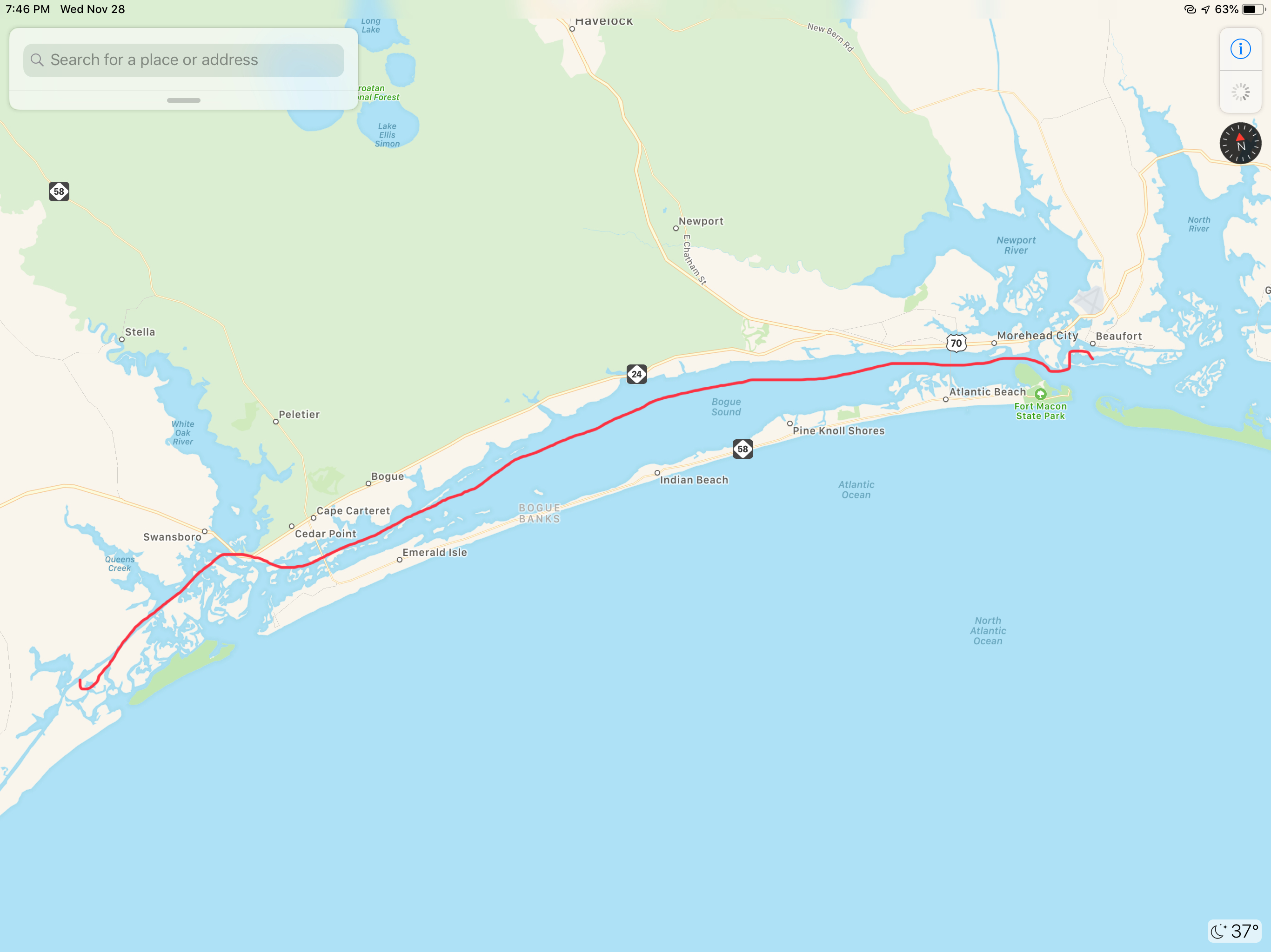
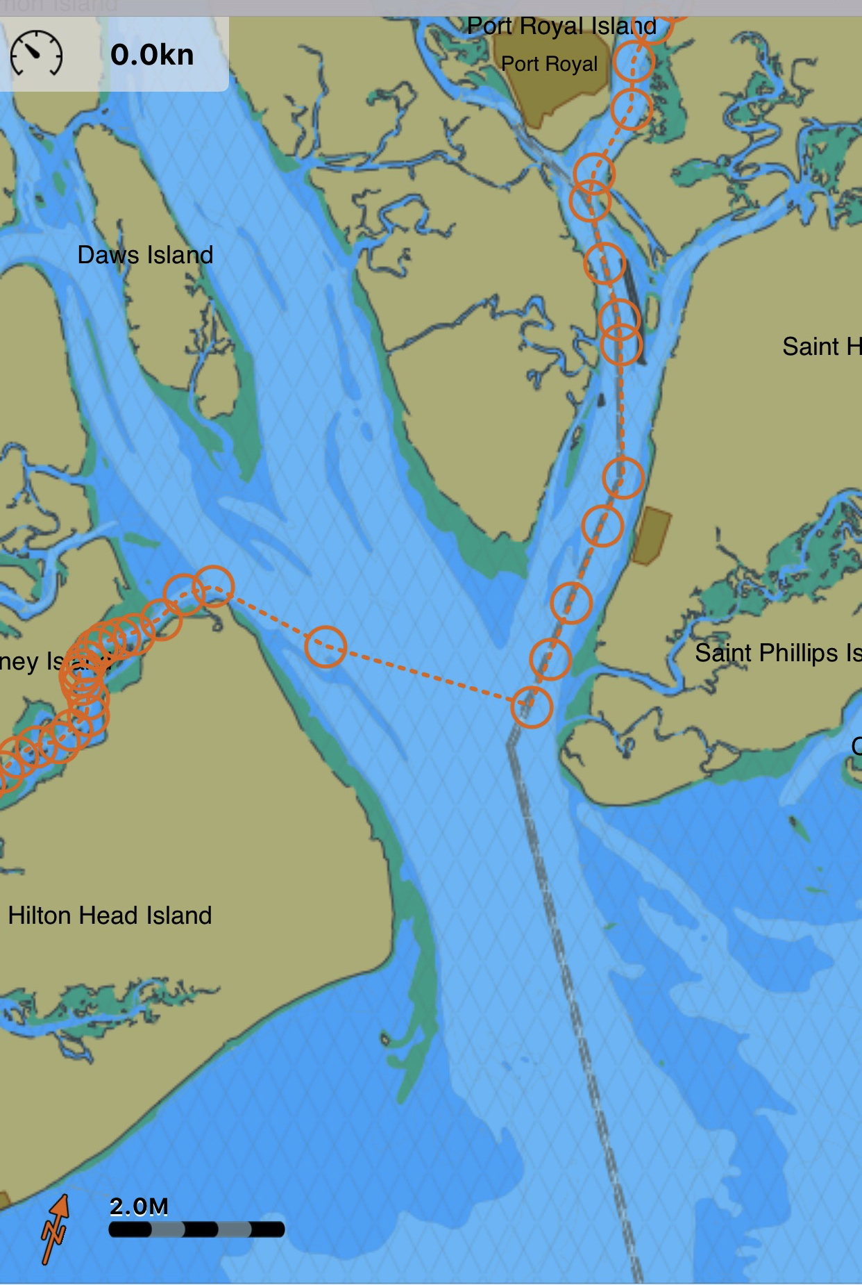
Our route would look something like this:
Our Route from New River to Beaufort, SC
There were only a few locations where I knew we would have to face the wind if just for a short bit. When we rounded Hilton Head and came out of Skull Creek to cross Port Royal Sound inlet was one of them.
Skull Creek along HH Island into Port Royal Sound Inlet and then up the Beaufort River
The weather worsened just as we were crossing Port Royal Sound Inlet. High winds shutdown the Lady Island swing bridge but luckily we have a reservation @ Downtown Marina in Beaufort, SC just feet from the shutdown bridge.
Waves maybe 3-5’ with the occasional 6-7’. The challenge was that I was hitting each new wave in under 2 seconds and having to work the throttle to slow down from say 6 kts to 4 kts for the larger waves. Being an unstabilized trawler we headed into the waves (rather take them on the beam) till we got a little shelter from the Northern side of the Inlet. Then we had to turn and run at 10 kts with the waves on our stern.
As we approached Downtown Marina the Lady Island Swing bridge was shutdown due to high winds. Docking in high winds and strong currents makes for an interesting learning experience but the dockhands and fellow boaters came out in the driving rain to help catch lines. We had to put out extra fenders to keep the waves from smashing us into dock but it was time for a beer and to sit back and watch the storm.
The next day we observed the rushing sounds of water around the boat and took a short video of the current alongside the dock.
Beaufort, SC is a wonderful stop and we always enjoy the local restaurants like Plum and the gastro pub, Old Bull Tavern
We’ll use the time here to re-provision the boat and get ready for another week of anchoring out as we attempt to push North into North Carolina.
We weighed anchor in the AM and headed out of Toogoodo Creek. We followed the sinuous path that was spotted with shoals. During a VHF communication with a passing boat, the captain warned of shoals of only three feet ahead. We quipped back that MV Simple Life has a 4’10” draft (actually 4’8″ dry but after filling the tanks she sits a bit lower in the water) and that out to make things interesting. There were times when we were down to 3 kts as we hunted for deeper water but we made it to the Coosaw River as planned. What I had not planned on were the 25 knot wind whipped waves. Making matters worse, the current was flowing against the waves making them steep and breaking. Happy, our Boston Terrier, was not “happy”. She hates a lumpy ride. I had not bothered to check the weather in the AM. I was proceeding with the belief that while we were on the ICW, I could simply check the weather periodically. Even though I was aware of the Small Craft Advisory, I figured we’d never feel the full force of it while running “inside”. I was wrong. The Coosaw River runs West directly into where the 25 knot winds were coming from. We were forced to slog our way 8 miles in about an hour as the windshield wipers washed away the spray off the pilothouse windows. Not a bad ride thanks to the pilothouse.
Once we turned to port into the Beaufort River the tree-lined banks offered us some wind protection. Though even in the Beaufort River, the flags on the banks were out-straight.
When we hailed Downtown Marina in Beaufort, SC. Dockhand Troy gave us our slip assignment and caught lines as we neared the dock. We slipped just in front of the beautiful sport-fishing boat pictured below.
Without hesitation we hopped off the boat and ran for some refreshments. We found Luther’s to be an amusing bar where the locals were.
First IPA of the day and it put the smile back on my face.
We decided to check out a few more places so we hit up a fancy place called “Saltus River Grill” and while Kelly was eying their filet mignon, the only IPA on tap was terrible so I cleverly talked her into a restaurant called “Plums” that was two buildings away and served Stone IPA. Plums had amazing food and when we could not eat another bite, it was time to stroll back to the boat and check on the dogs. On our way we walked through Henry C. Chambers Waterfront Park. I snapped the pics below as the light got low.
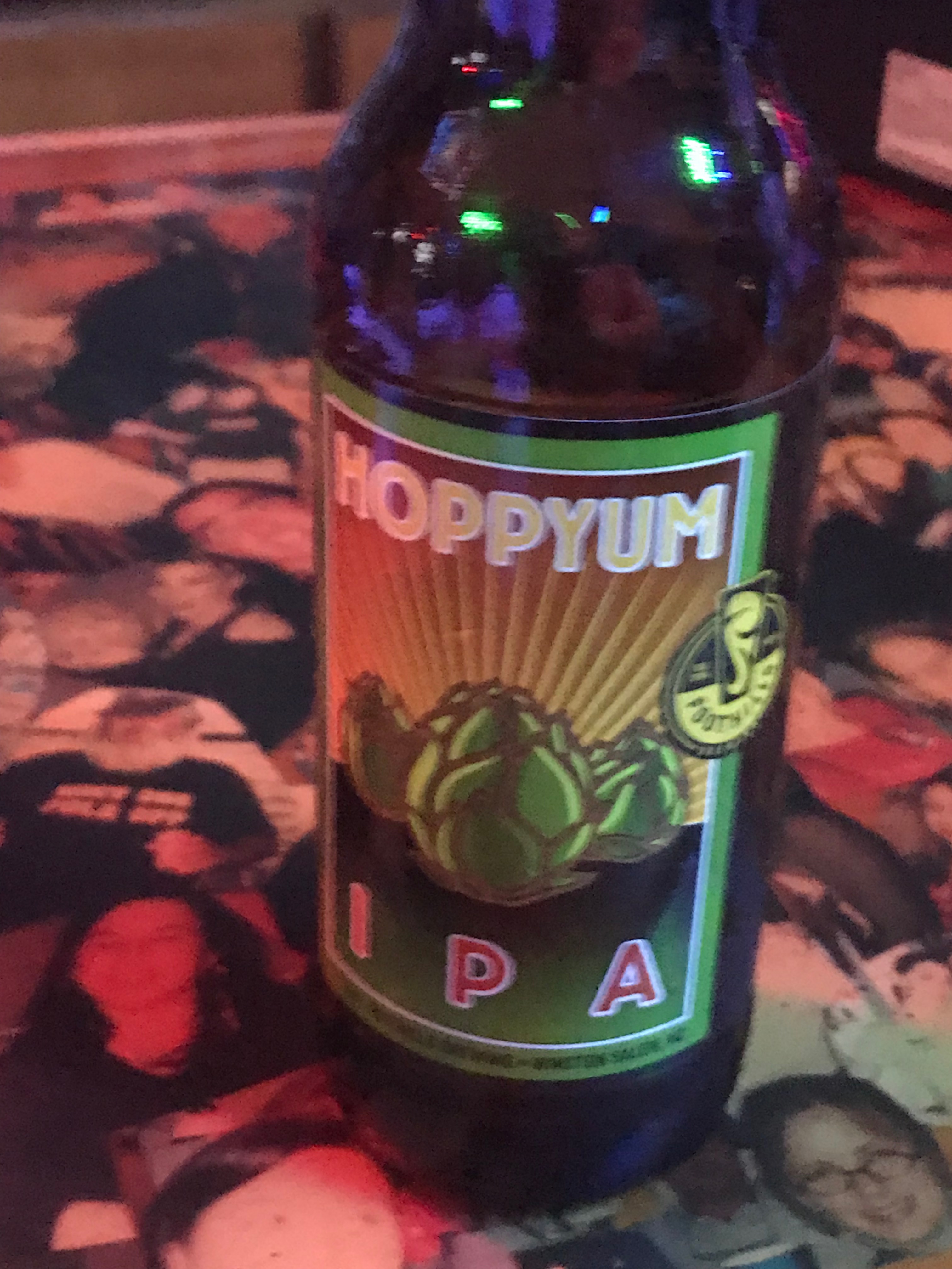
The next day I used the “courtesy car” to run to a local liquor store to stock up on Captain Morgan & some local IPAs
Precious cargo secured and it was time to replenish the fuel I used and get back home. For my brew-night pals, here is the list of local IPAs that I will be sampling and then reviewing using the Untappd app.
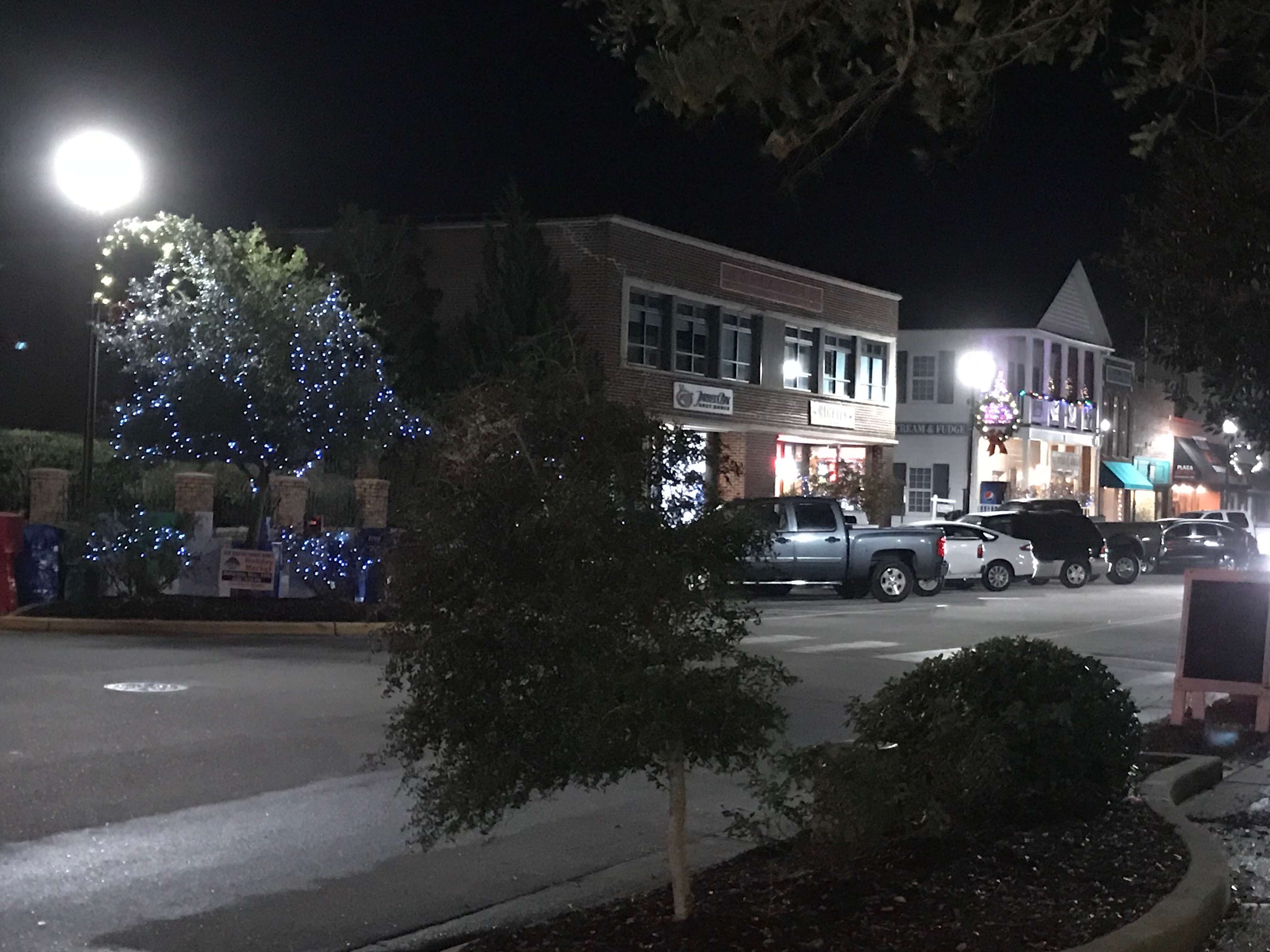
Beaufort, North Carolina is your quintessential small southern town. It is the 3rd oldest town in North Carolina and as you walk through this quaint small town, you can’t help be taken a back by it’s charm.
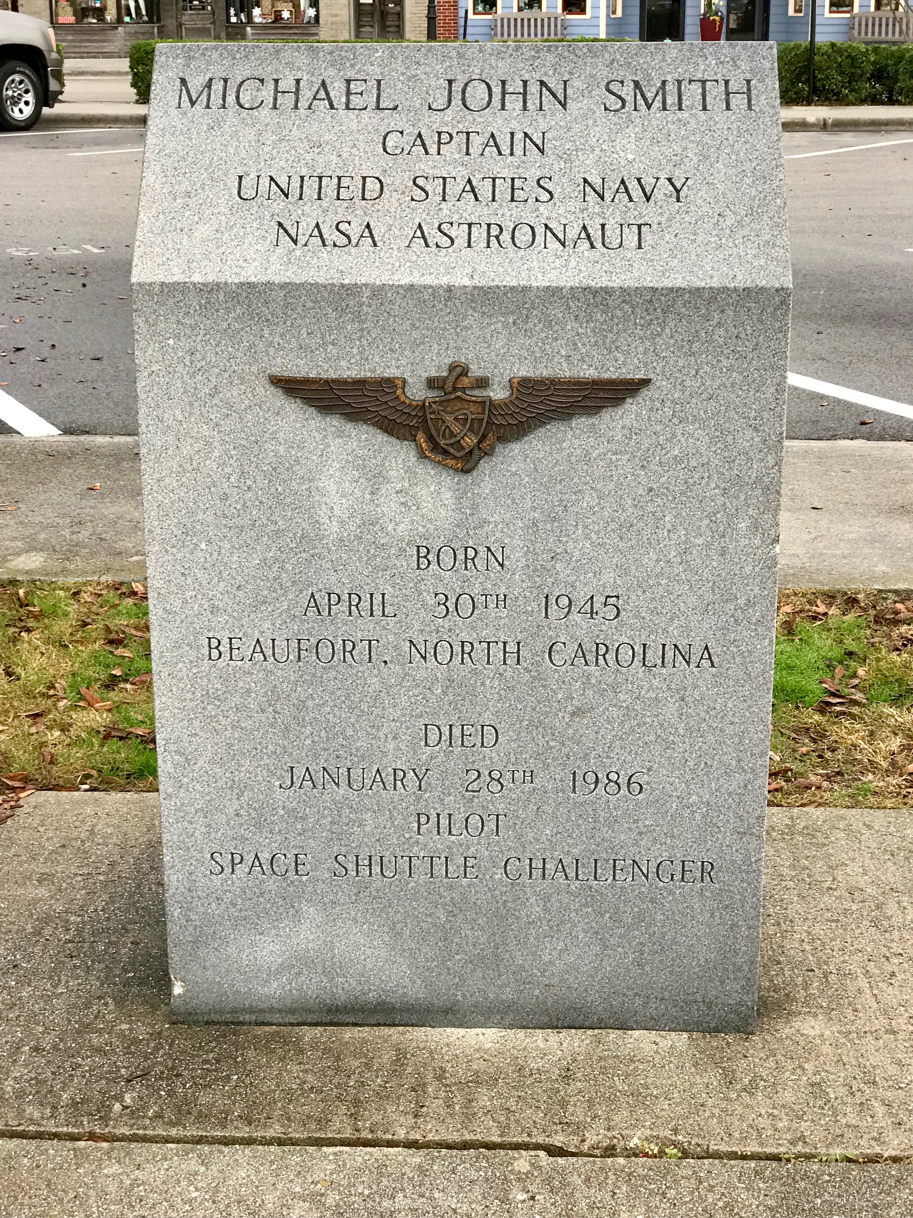
As we came ashore there were two monuments to local heroes within feet of where we landed. The first was Michael John Smith who gave his life for the pursuit of space exploration. Michael was a NASA space astronaut. Like so many, I believe that every human owes a great debt to astronauts who risk their lives so that the human race may have a better chance at surviving this hostile universe. They take risks that many of us might think too great. Michael was aboard the Challenger space shuttle when it exploded only 73 seconds after launch. The entire nation stood in horror at that moment, Like so many of you, I recall the shock and disbelief of this tragedy. The whole nation was forced to mourn the loss of these 7 heroes.
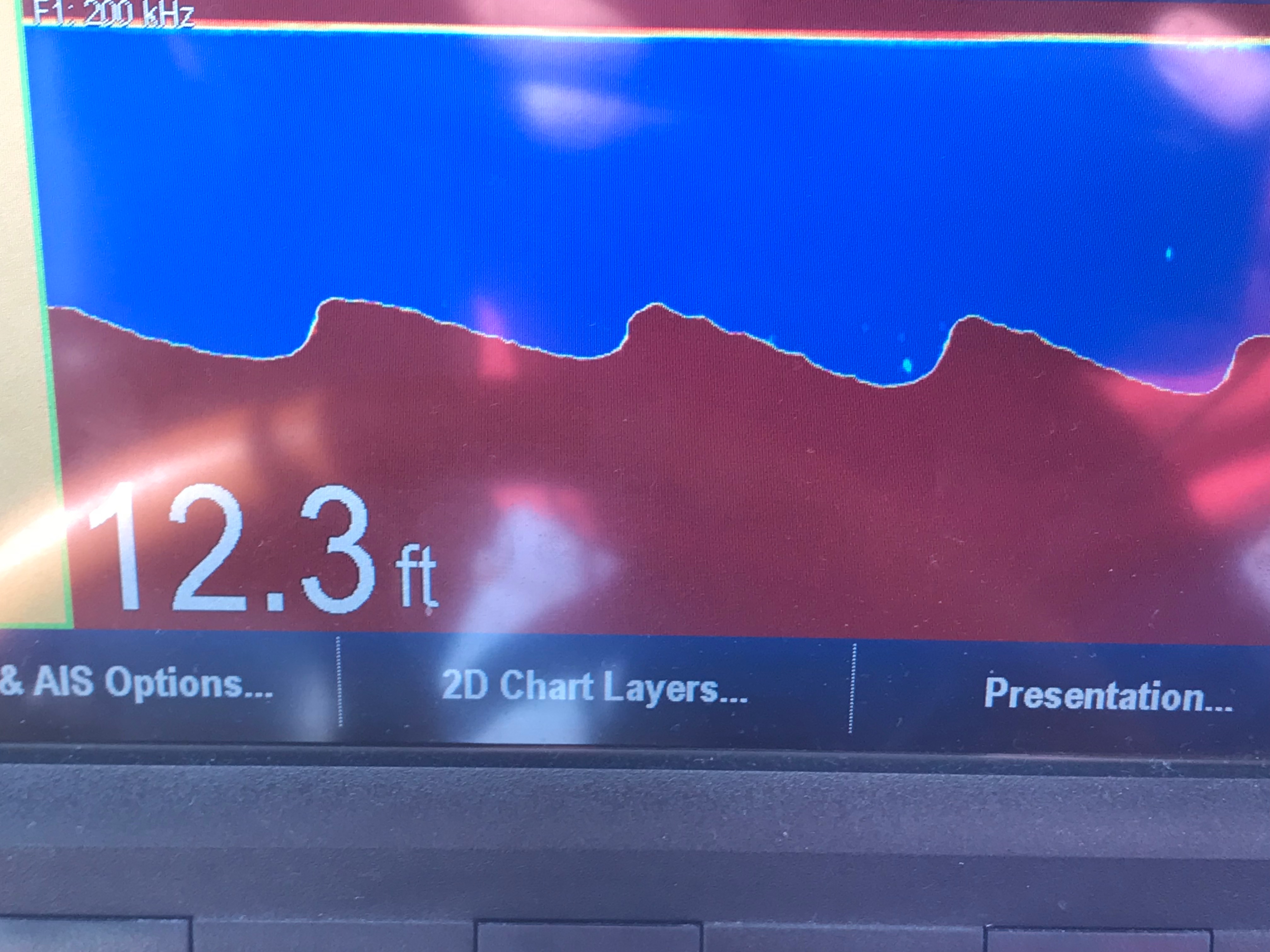
The second memorial stone was dedicated to a local oceanographer named John G Newton who discovered the U.S.S. Monitor using side scan sonar technology. Side scan sonar is an improvement on the DSM (Depth Sounder Module) that MV Simple Life uses to determine our depth as we came into Beaufort.
Leaving Beaufort was as tricky as getting in. The currents here in Beaufort are swift. When we arrived, I had to swing MV Simple Life into a narrow fairway with an extra strong 3 knot current directly on our beam. Simple Life’s full keel gives that current a flat surface to push her down-current quickly. With some fast movements at the helm and some help from the thrusters we landed her gently into our assigned slip. The trip out of the slip was made easier by the fact the strong current was on our bow. I nudged her out of the slip and simply swung the bow a few degrees off the current and she quickly pointed out of the fairway.
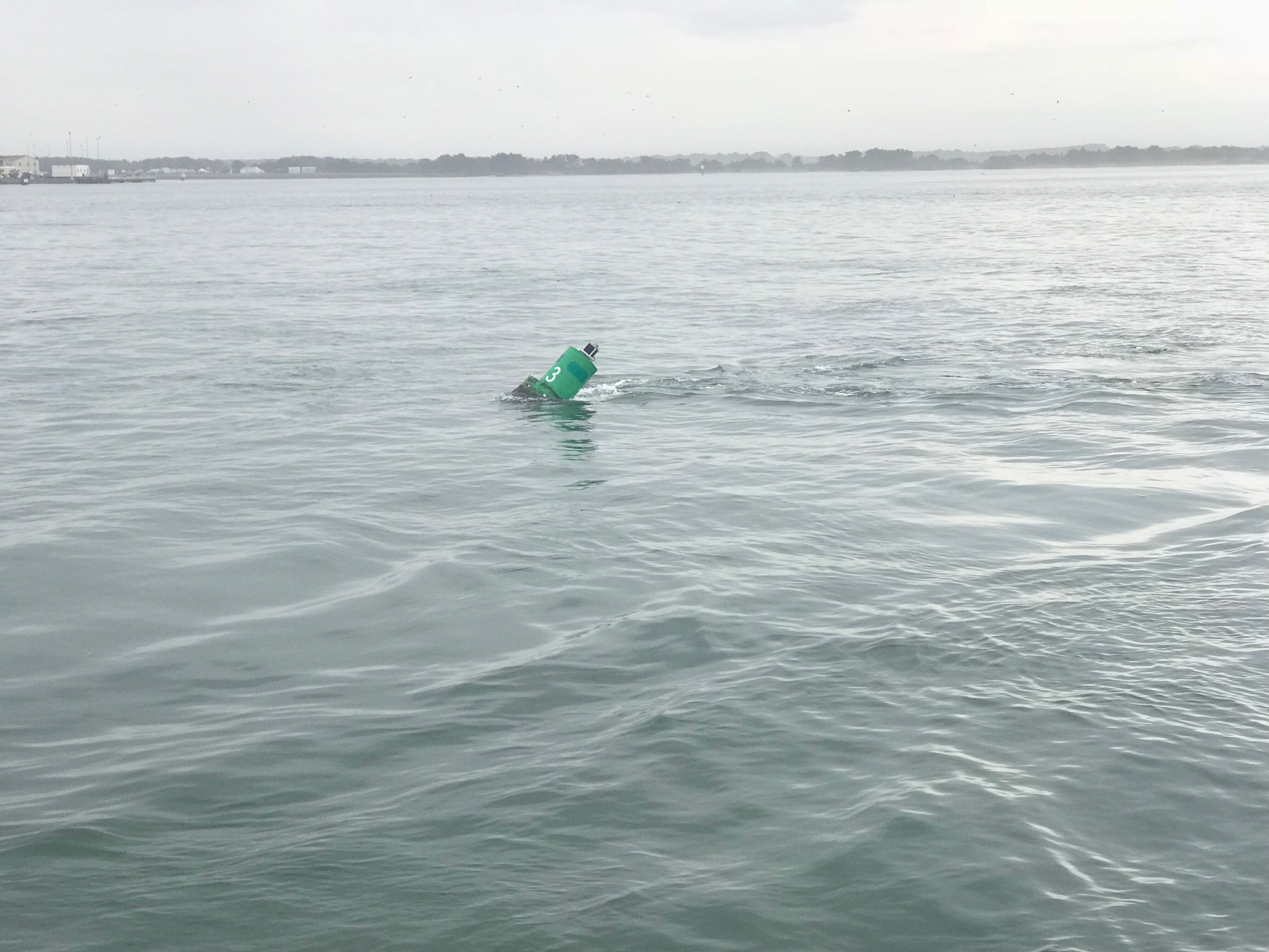
The currents can be seen pulling this green can under as we were exiting Beaufort and rounding the Southern point of Radio Island.
Currents are brought on by the tides and our friend Rebecca informed us the the movie “Prince of Tides” was filmed on location here in Beaufort. Knowing now that the movie was fillmed in Beaufort, maybe it’ll make a good first-time watch while on anchor?
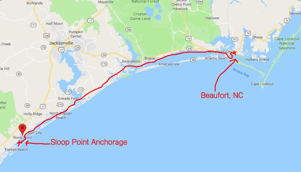
Our last night in Beaufort was a late one and the morning’s light was unwelcomed. We had a long trip ahead of us if we were to make Sloop Point anchorage by sunset.
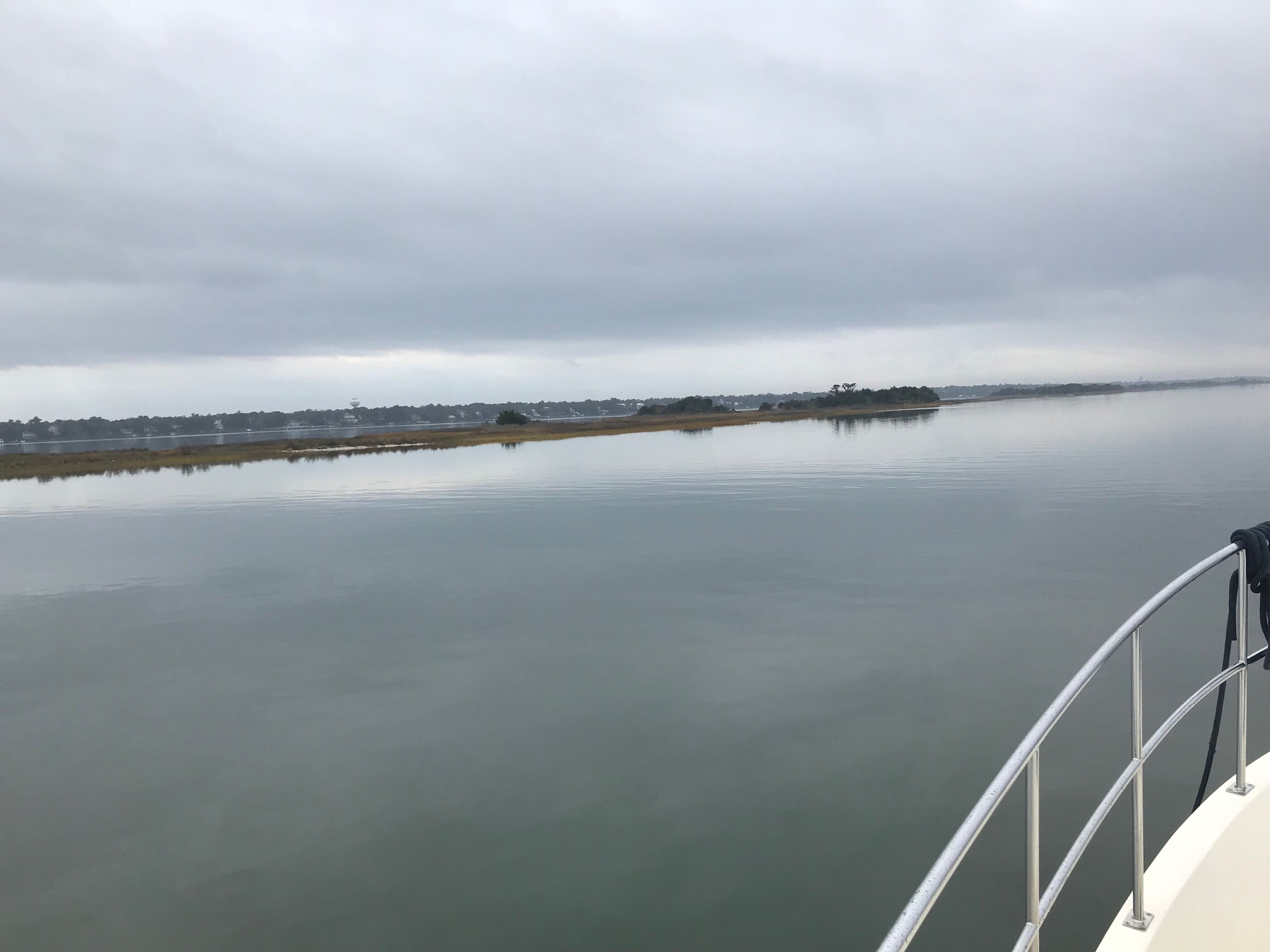
We needed to make up time so we used the fast currents to our advantage and raced westward through Bouge Sound.
Bouge Sound is an East-West body of water trapped between main land North Carolina and a set of barrier islands. The sound has a narrow channel and marshy islands that abound. While the ocean was lumpy, Bouge Sound was a flat and reflective, like a mirror.
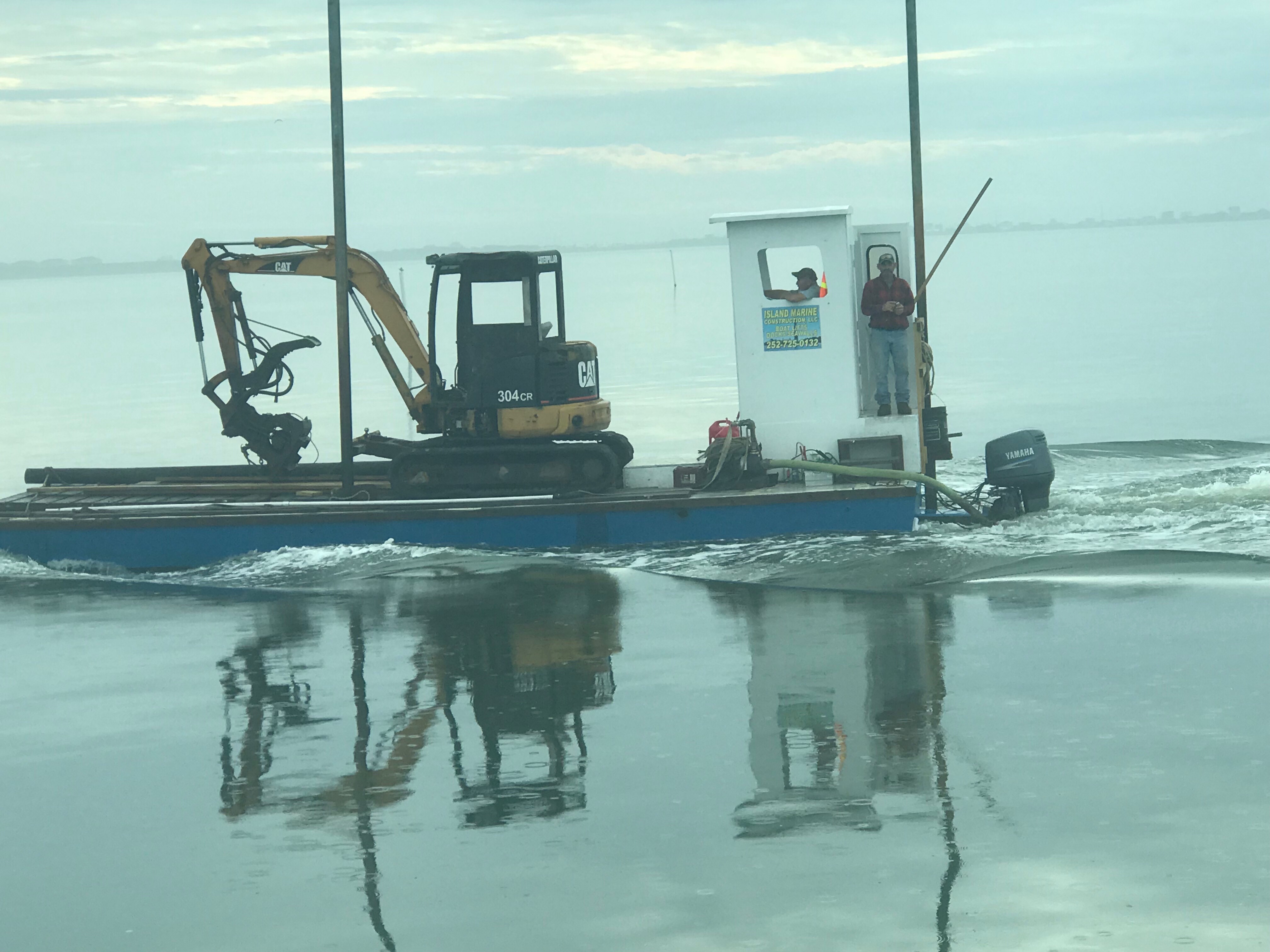
The only boat traffic we passed was a tiny little tug and barge with a piece of heavy equipment on it as well as one of those awkward looking front-loaded boats where you drive from the bow.
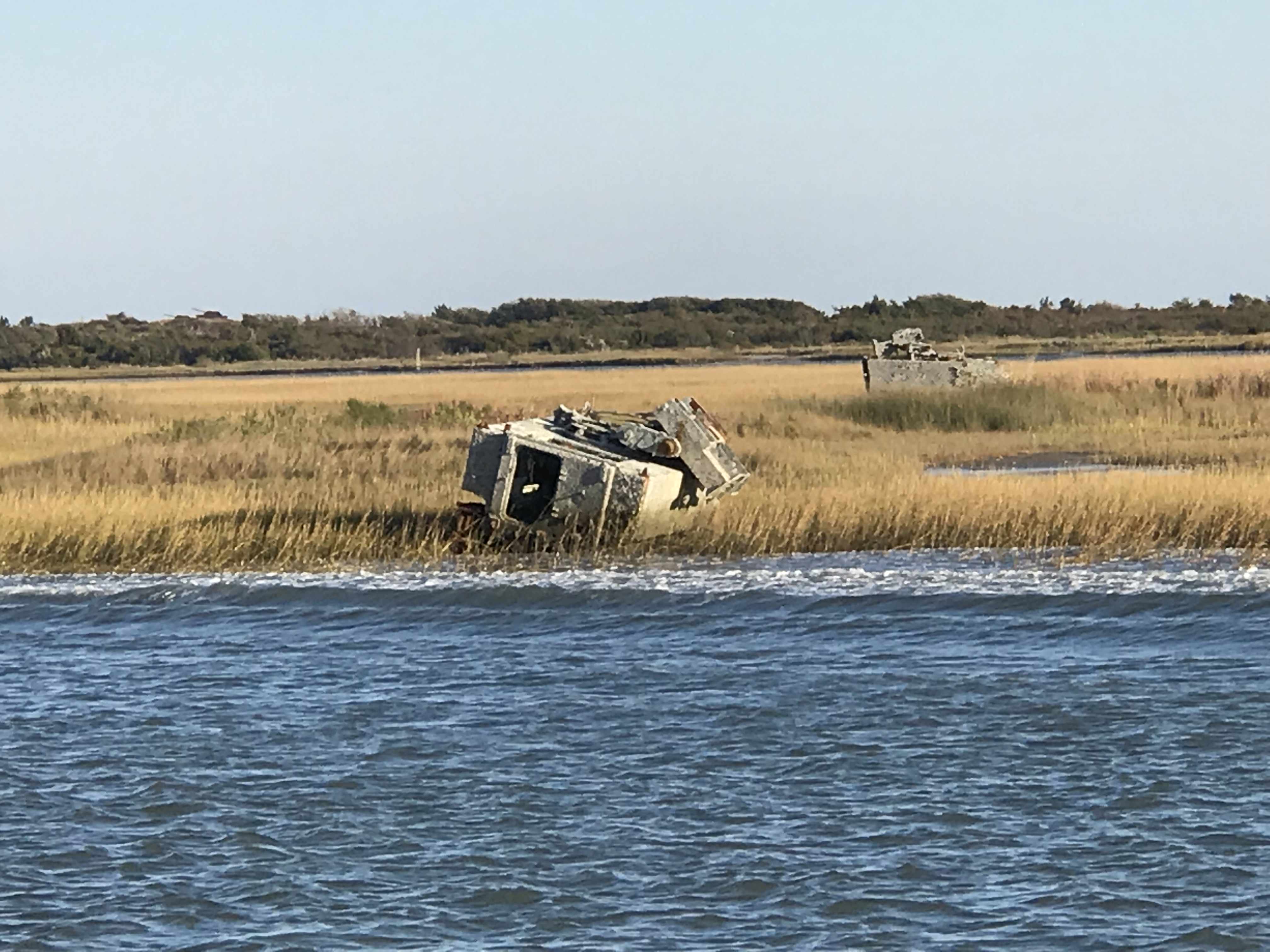
A little further South and we were reminded that Camp Legune is around us. Signs along the river warn of possible live fire events.
This picture of a shelled APC (I’m just guessing this was an armored personnel carrier, military expertise needed here) reminds me of a Monet or maybe a watercolor painting. The marshy grasses in the foreground simply mush together while the island and threatening clouds in the background appear to bleed and wash out the watercolors on a canvas.
With sunset approaching we had to race to make it through the restricted Onslow Beach swing bridge.
Every morning we research where the shoals are along the ICW. It seems the ICW’s bottom is in a constant state of evolution. You need to use sites like activecaptain.com/livemap/ to be able to use the knowledge other ICW boaters have posted to avoid running aground like this poor sailboat did.
We anchored in Sloop Point behind green daymark 15 and it was a peaceful night as we listed to the rain pitter-patter on the boat. The perfect background noise as we whisked off to the master stateroom.
Yesterday morning we awoke before sunrise and got underway to Beaufort, NC.
The first & last supermoon of 2017 was helping slice through the dark as we pushed away from the dock.
Supermoon Reflecting the Sun’s Rays
Supermooninfographic
Supermoons happen when a full moon approximately coincides with the moon’s perigee, or a point in its orbit at which it is closest to Earth. This makes the moon appear up to 14 percent larger and 30 percent brighter than usual.
December’s supermoon is actually the first of three back-to-back supermoon full moons to come in the next two months. On Jan. 1 and Jan. 31, the full moon will also occur near the moon’s arrival at perigee, according to NASA, which billed the line up as a supermoon trilogy. The Jan. 31 supermoon is also the second full moon of January, making it a Blue Moon, and also occurs during a total lunar eclipse.
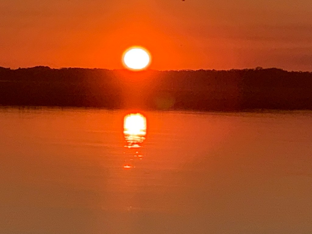
As the sun got ready to sneak over the horizon there was a beautiful orange-pink hue reflecting off the water.
Before Sunrise
Today’s leg of our journey takes us from Hobucken, NC to Beaufort, NC
The Beaufort of coastal North Carolina is “BOH-fert”. The Beaufort of South Carolina is pronounced “BYOO-fert”. Established in 1709, Beaufort is the third-oldest town in North Carolina.
Beaufort Leg of Journey
As we made our way out of Goose Creek and into Pamlico Sound, the only traffic we passed was a tug pushing a barge.
YATPB – Yet Another Tug Pushing Barge
The dominant wave set was coming from the NE and that meant we had a following sea as we turned and made our way down the Neuse River. A following sea that is slightly to one side of the stern can be annoying when you are at the helm. The waves catch up to the boat from behind and lift the stern pushing it to port or starboard. This can swing the bow as much as 30 degrees at times and it starts to feel like you are pointing the boat all over the place. I made a quick adjustment to increase the autopilot’s response rate and the bow heading deflection lessened considerably. Being a slow boat (6-9 knots) you are often at the helm from sun-up to sundown to make your destination. Autopilot is an electronic device with some firmware loaded on it that drives a hydraulic pump which turns the rudder. There are many settings that you can control but the response rate is the one you will want to adjust so that the rudder position changes are swift or slow enough for how you want the boat to point.
Autopilot Control
Autopilot Display
As weekend boaters, we were boating in destinations like Block Island, Nantucket or Provincetown. These locations are anywhere between 6-12 hours from our home port in Warwick, RI. We would be forced to run the boat at 8.5 knots and only get about 1 MPG. Now that we are full-time boaters, we slow the boat to about 6 knots and get 4 MPG. You can go 4X farther if you simply reduce your speed by 2.5 knots. (Recall 1 knot = 1.15 MPH so approximately every 6 knots you would simply add 1 to get the speed in MPH).
Even knowing this, we made the decision to up the speed to 8.5 knots and reduce the amount of time spent in the following sea.
Happy and Chief Martin Brody appreciated that we burned a a bit more fuel for their comfort.
Chief Martin Brody and his Big Sister Happy
Wake in the Neuse River
As we turned into Adam’s Creek the ride smoothed out and we dropped back down to 6 knots. The current in Adam’s Creek was swift and the DSM (Depth Sounder Module aka. Fish Finder) was showing asymmetric rippling of the creek bottom. I believe this is caused by a swift bottom current.
Asymmetric Rippled Bottom of Adams Creek
The fish finder was also well, finding fish. The DSM uses sonar or high frequency sound generated by a device that protrudes through the hull and is sending a column of sound waves straight down beneath the boat. These sound waves not only reflect off the bottom but when they hit a fish the sound resonates in the fish’s swim bladder (a small air-filled sack that helps control a fish’s buoyancy) and this echo is detected and colored sharply to allow you to spot fish on the screen.
Look Swim Bladders
Adam’s Creek is a lovely place with lots of sights to see.
Bonus Points for Parking Your Helicopter in Front of Your Mobile Home
Boat Slip only $75K
I’m Pretty Sure The War Over Slavery Ended?
Adams Creek spills out into the Newport River and it’s marshes and shallows are something that you will want to avoid.
Newport Marshes as you Head South to Beaufort
Kelly & I Often Joke… “If You Want to Know Where it’s Shallow; it’s Where the Birds are Standing”
As we pulled into our slip in Beaufort we hailed the dockmaster who warned us about the swift current running transverse to the slip we were assigned. As we pulled in to the fairway the current slammed into our full keel and began to push the boat toward the bows of the boats across the fairway. I was forced to back out quickly and reposition so that I could now take the swift current into account and position the boat for rapid spin and quick back into our slip. Kelly was quick to toss lines to the dockhands and soon we were checked in and given the keys to a “courtesy car”. Up North, I’ve never stayed at a marina that offers a fee courtesy car to marina guests. The car was a welcome treat and we put it to good use re-provisioning the boat with more food & beer.
Courtesy Car – We Got Wheels!
With all our chores completed we quickly made off to the marina bar for happy hour and spent time chatting with Bartender Kristen and fellow bar patron, Dan. Dan was an amazing fellow who told us stories of his solo sailing around the world in a small boat. He offered us some local knowledge about wild horses that roam the islands around here. I KNOW more wild horses to find!
Kelly & Sailor Dan
After I consumed as many 50 cent pork sandwiches as a man can eat and washed them down with a great local IPA it was time to retire to the boat.
We were no sooner readying for bed when we were accosted by “Monkey Bird”. This vile creature had a penetrating stare and an awful cry. I spent sometime staring into this monster’s gaze and knew it was time to lock the door and keep the crew of Simple Life safe.


You must be logged in to post a comment.