We awoke this morning at sunrise and the Waccamaw River was still.
Only after looking at Google Maps did I become aware that the creek that we anchored in was really the Waccamaw National Wildlife Refuge in South Carolina.
Along the route to Georgetown, SC there were many hazards dotting the ICW.
We did not see many other boats as we traveled along. We did see this steel hulled schooner called SV Steel Away. Nice vessel for the ocean and anchoring in.
We saw mossy trees.
As well as duck hunters in the mashes that lined the ICW.
When we arrived in Georgetown, the air was scented with the smell of a paper manufacturing plant. We made the decisions to continue on.
As the sun began to set we were forced to find an anchorage and we picked this one on the Atlantic Ocean just a 1/2 mile off the ICW.
We dropped the hook just as the sun was setting and it was beautiful.
There was one other boat anchored with us which was about the only other boat we saw. This sailboat was from South Carolina so we are not even sure if they are snowbirds like us?
The last thing to do after a full day at the helm was to cook up some steaks on the griddle and sit back and relax.
We got a late start leaving St. James Plantation Marina in North Carolina. I think we were enjoying ourselves and were just slow getting moving in the AM. Kelly eventually woke and made an amazing breakfast on the griddle and I filled the water tanks, emptied the trash and pulled the boat over the pump-out and we were off.
Pulling out of the marina we were reminded how beautiful the houses are and what a great place this is.
As we exited into the ICW and headed South, we were reminded that this area has strong currents and tricky shoals that form around both Lockwood Folly Inlet and Shallotte’s Inlet. To offset the danger of running aground on a shoal we spent the wee hours downloading the US ACE (Army Corp of Engineering) navigation hydrologic maps of the inlets. What a great job the ACE does surveying these tricky inlets and making the sounding maps available for FREE to snowbirds like us. Thank you.
Current rip in the inlets. Each Division / District has its own website so you’ll have to spend some time finding the hydrologic maps from each ACE District. That’s a narrow drugged channel that you must stay inside of Stay to Port.
As we headed South we saw many beautiful sights.
We have no idea what species of bird this is but we are committed to learning more about the aquatic bird species that inhabit the ICW.
This lighthouse was somewhere around Myrtle Beach. It’s though to see but there were Christmas lights strung off the walkway around the light.
An Atlantic Ocean inlet. Maybe this was around Lockwood Folly Inlet?
We find the breaking waves beautiful. What a great beach for walking the dog or just contemplating life.I think the sign said something like Greg Norman’s Australian grilleWe love that this guy was taking his dog for a ride. Man’s best friend loves the boat says Happy & Chief Martin Brody. “Born 200 years too late” – Jimmy BuffettSomewhere Myrtle BeachClose Encounters or an airport building, you decide.Who wants to walk under this rack with high winds and a 10K lb boat resting 80′ over your head?
There are many dangers along the ICW..
Slow down and read the signs of life… they point toward safetyLogs are the bumps in road of life They thud your hull or fold your wheel (that’s a propeller for the un-initiated)We hate to see beautiful commercial fishing boats listing on the bottom. We joke that we’d love to pull her up drain her beige, gut her and rebuild her giving her a sexy teak makeover. Kelly reminds me that the stink of a fishing boat is not washed off with soap. Ouch!
Heart breaking.
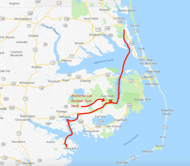
Well, we anchored in a narrow creek tonight. It’s inky black and a bit windy but we buried the 90 pound and 3/8 chain anchor deep by backing down on it. We were forced to only let out a short scope of rode. Any more and when the tide reverses we’ll swing into the banks of this narrow creek. So we’ll call it a night and make our way to Georgetown, SC in the AM.
Beaufort, North Carolina is your quintessential small southern town. It is the 3rd oldest town in North Carolina and as you walk through this quaint small town, you can’t help be taken a back by it’s charm.
As we came ashore there were two monuments to local heroes within feet of where we landed. The first was Michael John Smith who gave his life for the pursuit of space exploration. Michael was a NASA space astronaut. Like so many, I believe that every human owes a great debt to astronauts who risk their lives so that the human race may have a better chance at surviving this hostile universe. They take risks that many of us might think too great. Michael was aboard the Challenger space shuttle when it exploded only 73 seconds after launch. The entire nation stood in horror at that moment, Like so many of you, I recall the shock and disbelief of this tragedy. The whole nation was forced to mourn the loss of these 7 heroes.
The second memorial stone was dedicated to a local oceanographer named John G Newton who discovered the U.S.S. Monitor using side scan sonar technology. Side scan sonar is an improvement on the DSM (Depth Sounder Module) that MV Simple Life uses to determine our depth as we came into Beaufort.
Leaving Beaufort was as tricky as getting in. The currents here in Beaufort are swift. When we arrived, I had to swing MV Simple Life into a narrow fairway with an extra strong 3 knot current directly on our beam. Simple Life’s full keel gives that current a flat surface to push her down-current quickly. With some fast movements at the helm and some help from the thrusters we landed her gently into our assigned slip. The trip out of the slip was made easier by the fact the strong current was on our bow. I nudged her out of the slip and simply swung the bow a few degrees off the current and she quickly pointed out of the fairway.
The currents can be seen pulling this green can under as we were exiting Beaufort and rounding the Southern point of Radio Island.
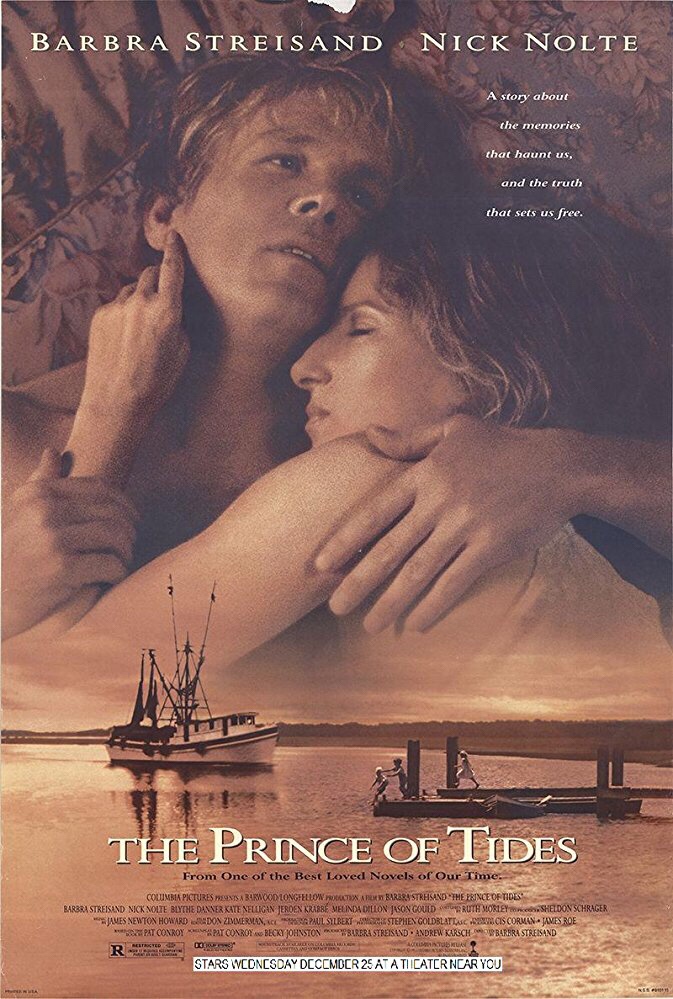
Currents are brought on by the tides and our friend Rebecca informed us the the movie “Prince of Tides” was filmed on location here in Beaufort. Knowing now that the movie was fillmed in Beaufort, maybe it’ll make a good first-time watch while on anchor?
Our last night in Beaufort was a late one and the morning’s light was unwelcomed. We had a long trip ahead of us if we were to make Sloop Point anchorage by sunset.
We needed to make up time so we used the fast currents to our advantage and raced westward through Bouge Sound.
Bouge Sound is an East-West body of water trapped between main land North Carolina and a set of barrier islands. The sound has a narrow channel and marshy islands that abound. While the ocean was lumpy, Bouge Sound was a flat and reflective, like a mirror.
The only boat traffic we passed was a tiny little tug and barge with a piece of heavy equipment on it as well as one of those awkward looking front-loaded boats where you drive from the bow.
A little further South and we were reminded that Camp Legune is around us. Signs along the river warn of possible live fire events.
This picture of a shelled APC (I’m just guessing this was an armored personnel carrier, military expertise needed here) reminds me of a Monet or maybe a watercolor painting. The marshy grasses in the foreground simply mush together while the island and threatening clouds in the background appear to bleed and wash out the watercolors on a canvas.
With sunset approaching we had to race to make it through the restricted Onslow Beach swing bridge.
Every morning we research where the shoals are along the ICW. It seems the ICW’s bottom is in a constant state of evolution. You need to use sites like activecaptain.com/livemap/ to be able to use the knowledge other ICW boaters have posted to avoid running aground like this poor sailboat did.
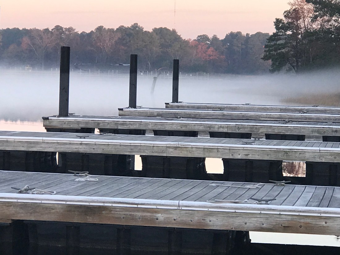
We anchored in Sloop Point behind green daymark 15 and it was a peaceful night as we listed to the rain pitter-patter on the boat. The perfect background noise as we whisked off to the master stateroom.
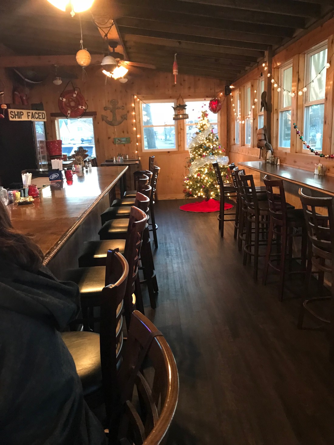
Coinjock Marina is a great place to stop along the ICW. The Sandbar even had an Xmas tree up.
Too Early?
While we were at the pier a 1998 Bayliner 4788 arrived during the night and as they passed us we saw the severe damage to their bow.
Hope Nobody was Injured
It was a reminder about how dangerous boating down the ICW can be (especially when traveling at night). I hope nobody was seriously hurt. After having a crash like that you’d think you’d stay far away from everyone but as they passed us I thought for a second that they might hit us.
Yikes – This Pic Snapped Out My Pilothouse Window!
At that moment I went out in my PJs and attached two fenders to the canal side (just in case 😉 )
When we left Coinjock Marina it was foggy.
Coinjock Pier Looking Off our Stern
Even as we headed down the canal we had to rely on our radar to see any far out vessels.
Fog Was Worse Than This at Times
As you travel down these canals you will find homes along the canal and people going about their daily business.
Me Waving from the Pilothouse to the Locals
As we traveled along we saw several boats anchored just outside the channel. Being anchored well after sunrise is a sign that someone is having a peaceful morning enjoying their coffee.
Peaceful Morning on Anchor
We continued South down the North River and into Albemarle Sound. There was not a single boat to be found in the sound. We had the crossing to ourselves. While approaching the mouth of Alligator River I saw, what I thought were boats but upon closer binocular examination, I see they are some sort of mini islands? I’m not sure of their purpose? They look to big to be duck blinds?
I Need to Figure Out What These Are?
We anchored at the head of the Alligator River as we lost daylight. The anchorage was quiet with no boats passing but the cellular signal was dead. During much of the transit we would see our cell signal go from LTE => 3G => Extended 1X => blank. At times we would be excited to see 3G and upon trying to connect, we’d see the signal instantly drop to “Extended 1X” which did not work at all.
What Kind of Tomfoolery is this?
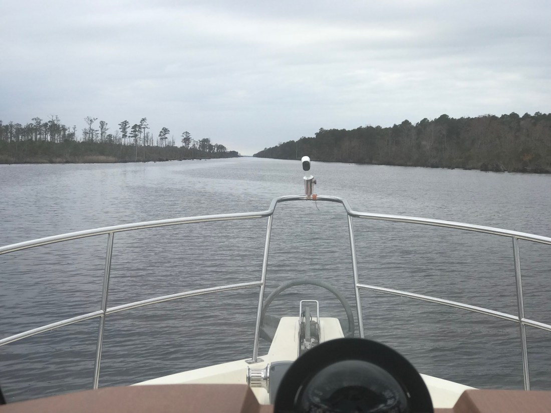
The Alligator River – Pungo River Canal was long and straight.
I Can See For Miles
Along the banks of this canal you can see the erosion from passing wakes.
Geology Experts of the Future Will be Doing Molecular Analysis on That Green Line
You will see many birds as you float along. It’s a reminder to me to improve my ornithological skills.
Where are my Ornithology experts?
Where is His Beak?
You’ll see other things that you’ll want to stay clear of like …
Fishing Nets
Sticks = Hazard
Are We Too Heavy for This Dock?
At times this can be difficult as you run straight down the sun heading South. While the camera does well looking into the sun, I was struggling at times.
Staring Match With The Sun
We arrived in Hobucken, NC and tied to an old dock for the night.
2 Days Journey
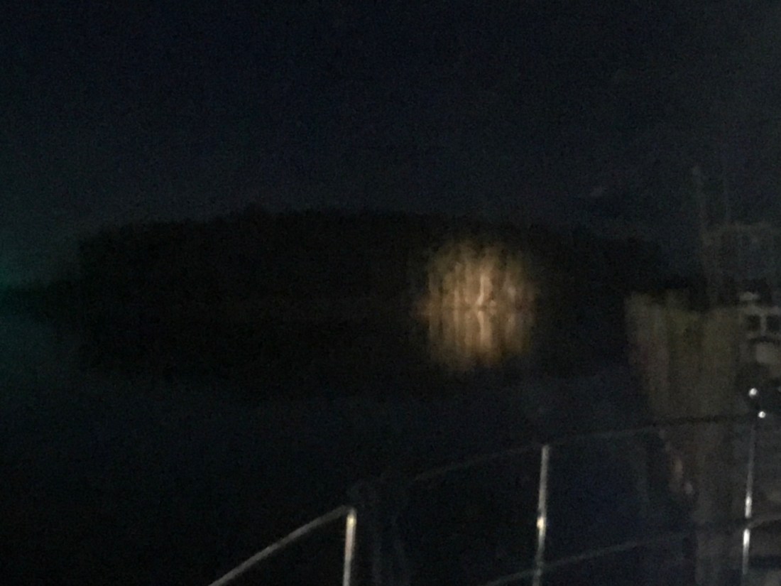
It’s been quiet here except for the passing tug pushing a barge down the river at night. At one point I was staring at a stand of tall trees that were illuminated on the shore and I could not for the life of me see the source of that light?
A Stand of Trees Illuminated
It became apparent moments later that it was the spotlight of an approaching tug and we braced for it’s passing wake.
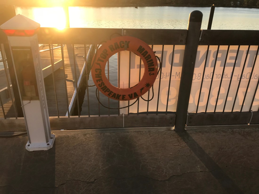
We spent two nights at the Top Rack Marina (ICW Statute Mile 8.8) in Chesapeake, VA.
Top Rack Marina – a nice stop along the ICW
What a great place to stop. When we arrived at the marina, Ben was there to catch our lines and greet us with a some Virginian southern hospitality. Top Rack Marina is a “dry rack storage” marina. These style of marinas store their customer’s boats on indoor racks rather than floating in a traditional “wet slip”. Customers simply call and request their boat dropped into one of the dozen or so wet slips in the marina’s water edge.
Kelly relaxing in the cockpitIndoor racks hold boats like a grocery store shelfOutdoor racks act as staging locations as boats are washed, flushed and prepped
Their giant fork truck moves boats effortlessly and can be intimidating as it whirls around with a boat high in the air.
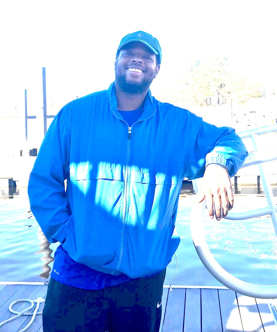
We decided to stay for two nights and re-provision the boat. Usually we would have to grab a Uber to a nearby grocery store but we have found that grocery delivery services are a much faster, cheaper and a far simpler way to restock. When we were in Brick, NJ we used Peapod from Stop & Shop but here in Chesapeake, VA we used Farm Fresh Supermarket.
Jaquay was our designated shopper and he would text us with pics of substitutions for any out of stock items on our list. Jaquay picked our order, drove dockside and was kind enough to help carry our groceries aboard. Thanks Jaquay.
Jaquay
The marina has a great ship store and Deli and as I checked in with Brian at the front desk, Brittany was there to help me select a local IPA beer called “El Guapo IPA”. El Guapo is brewed locally in Norfolk, VA by O’Connor Brewery
In Spanish El Guapo is a beautiful guy, a well looking male
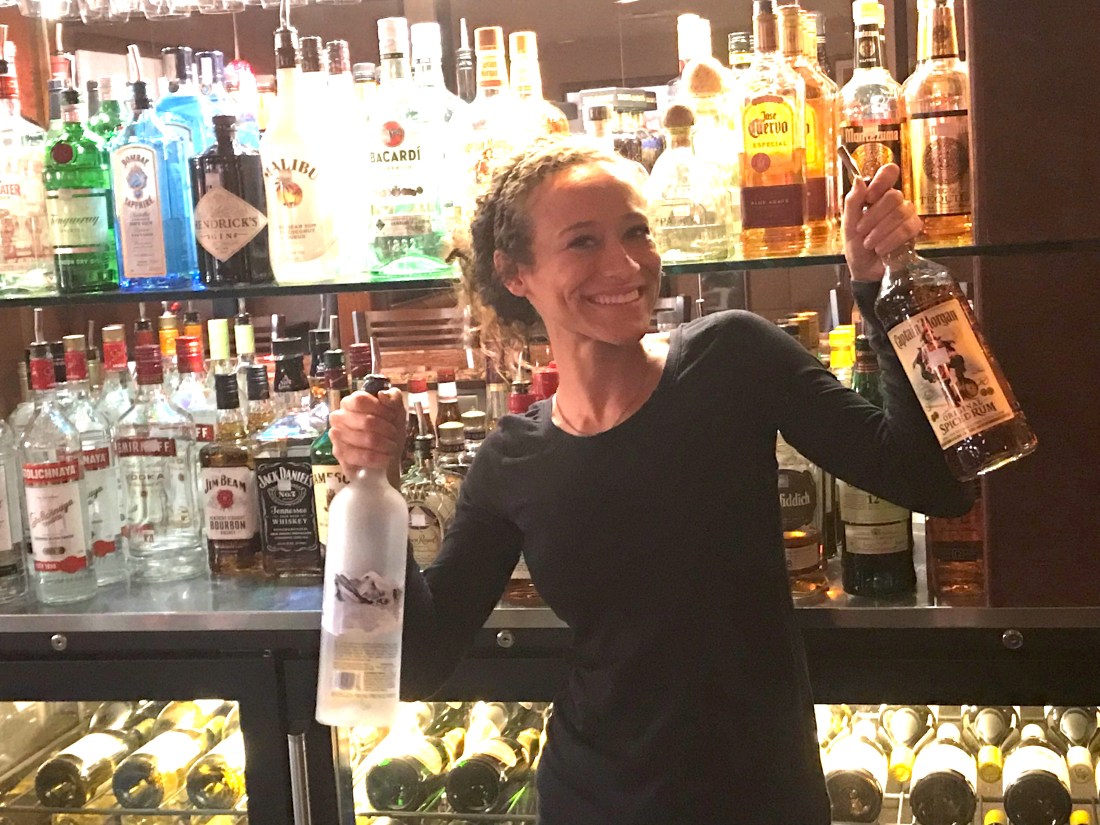
Then it was on to dine at the Amber Lantern Restaurant. We stepped out of the elevator and hostess Courtney warmly greeted us. We got an early start at the docks and by the time the restaurant opened at 4PM, we simply poured ourselves into seats at the bar. Bartender Sydney kept us smiling the whole night.
Sydney’s smile could warm the heart of even the crustiest sailorDynamic Duo: Sydney and Courtney
Being first into the restaurant, we had the chef to ourselves and the food was amazing. We had our fill and retired back to the boat only to wake up at the witching hour of 3AM and sing along with YouTube videos from artists in the “Forever 27 Club”. I recall some Janis Joplin was echoing out over the river… “Freedom’s just another word for nothing left to lose”…
We awoke to a ghostly fog creeping down the river and we quickly shoved off to race and catch the Great Bridge Lock opening at half-past-every-hour.
ICW fog
Once at the Lock we tied up to the Southern wall, waited for the lock doors to silently close and watched as it lowered us gently down to the height of the water on the Albemarle Sound side of the lock. I find it interesting that while the Elizabeth River side of the lock is tidal and varies about 2.7 feet the Albemarle Sound side varies only due to the winds that drive water up or out of the river. Equally as amazing is the age of the machinery that drives these locks. You watch as giant gates and machinery, built using simple principles of engineering mastered many years ago, silently close.
We kept the ICW-bridge-list.pdf displayed on the iPad we’d have the requisite knowledge at our fingertips. As you pilot the ICW you will want to be aware of such things as… What bridges are around the bend? Can you safely pass under their vertical height? Are they restricted in opening times? How to contact the bridge tender on to request an opening?
ICW bridge list for all 1,243-miles of ‘inland’ waterway
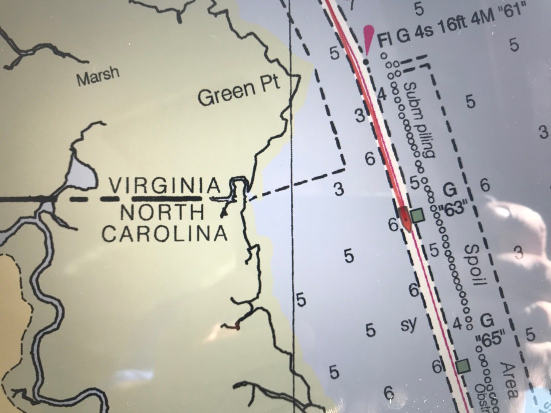
As you make your way down the Albemarle Chesapeake Canal you can’t help but notice it’s as straight as spaghetti. The Canal was originally conceived of in 1772 but had to wait until technology advances (circa 1856) that allowed steam-powered mechanical dredges to cut through the land. While the canal is over 70 miles long, there is only 14 miles of excavated land. There are really two different “cuts”. The 8.5 mile long Virginia Cut which connects the Elizabeth River with the North Landing River in Virginia and the North Carolina Cut which is 5 miles long and slices across the Currituck Peninsula at the village of Coinjock to enter the North River, flowing south into the Albemarle Sound.
Historic chart denoting the Virginia and NC cuts
This canal is a wonderful part of American history. During the U.S. Civil War, when the Union Army commandeered the canal, nearly 9,000 vessels made the transit. After the War, traffic continued to increase as the waterway took over practically all of the trade passing between the Albemarle Sound and Norfolk, Virginia.
As we meander down the ICW at a leisurely pace of 6 knots (4.5 MPG) we noted the passing from Virginia into NC. Then just a short while later, we were stumped to explain why this looping side canal was littered with wrecks? How did this happen?
VA / NC State Line – ICW statute mile marker 34How did this happen?Gently used boat for saleMaybe this cannon we passed was responsible for the wrecks 😉
The scenery at this point in the ICW is amazing! The waterway is lined with tall grass and you’ll watch as the local duck hunters race by you in camouflaged flat bottom boats. We’d pass the occasional duck blind hidden in the grass and Kelly & I would jabber about the moral issues of tricking ducks with decoys into becoming dinner. I’m always intrigued by the human race’s dilemma between a desire to coexist peacefully with all the other animals on planet Earth and our need for subsistence.
We soon arrived at Coinjock Marina where dock hand, JD quickly moored us to the wall and we scurried off to the Sand Bar for an IPA, some buffalo wings and a filet mignon for Kelly.
A typical sailor bar along the ICWThe restaurant is known for their amazing prime rib
Inside the bar we met Bartender Jason and shared stories with other cruisers going South down the ICW. The three captains of a brand new 45′ Hatteras sport fishing boat that was making its way South sat next to us. They showed us video of their 30 knot trip South and we joked about their 80+ g/hr burn rate vs. our 1.2 g/hr rate. “Time is money” said one of the captains as they hurried out of the bar joking that they would not wake us at sunrise as their sprint South continued. Well it’s 6:30AM and we just watched them depart silently. I’m sure today will be another fun time here in Coinjock, NC.
Route from The Great Machipongo Inlet to Top Rack Marina, Chesapeake, VA
Well we woke up early and left The Great Machipongo Inlet. The dolphins once again escorted us out and I turned South with the sun streaming in the port side pilothouse windows so hard I had to close the curtains and use the radar alone to tell what was on that side of the boat.
The sea was as flat as a model’s tummy so I lowered the RPMs on the diesel to get 2 MPG rather than 1 MPG. Simply by slowing the boat 1.3 knots we double our fuel efficiency! Don’t you wish that were the case for your car?
You can see the barrier fence that they stretch across the opening and that fence line is protected by a Navy Patrol boat with a machine gun on the bow.
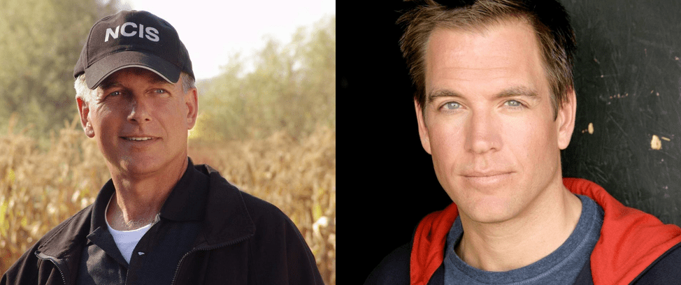
A local news story revealed just a few months ago there were six bomb threats called in to the naval station and you can call NCIS if you know anything. I wonder if you can call and ask for “Leroy Jethro Gibbs” or “Tony DiNozzo”?
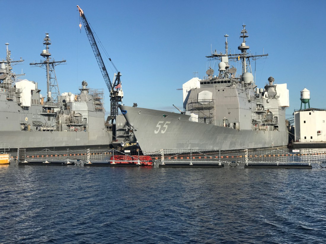
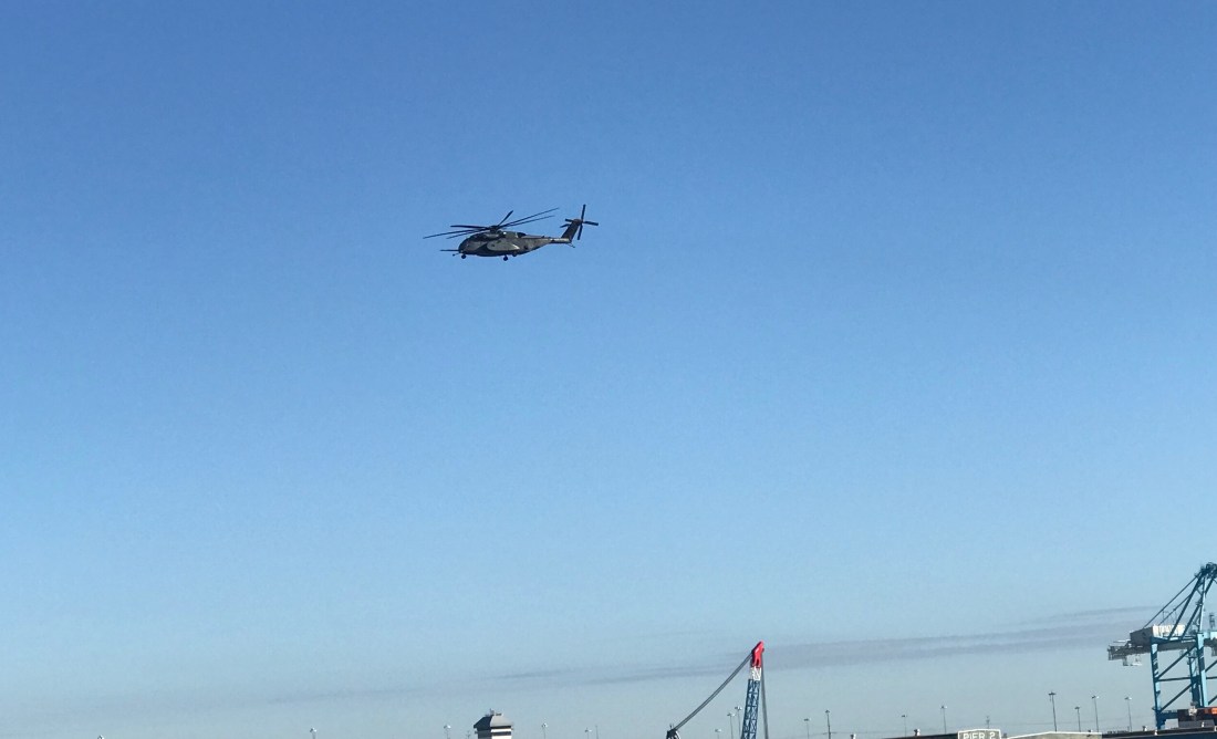
USNS William McLean (T-AKE 12) – Military Sealift CommandUSS Leyte Gulf (CG-55) – Ticonderoga-Class Guided Missile CruiserUSS San Jacinto (CG-56) – Ticonderoga-Class CruiserMH-53E Sea Dragon Buzzed Us From OverheadAIS (Automated Information System) Alarm on my Chartplotter warning of other AIS traffic that has a narrow CPA (Closest Point of Approach)
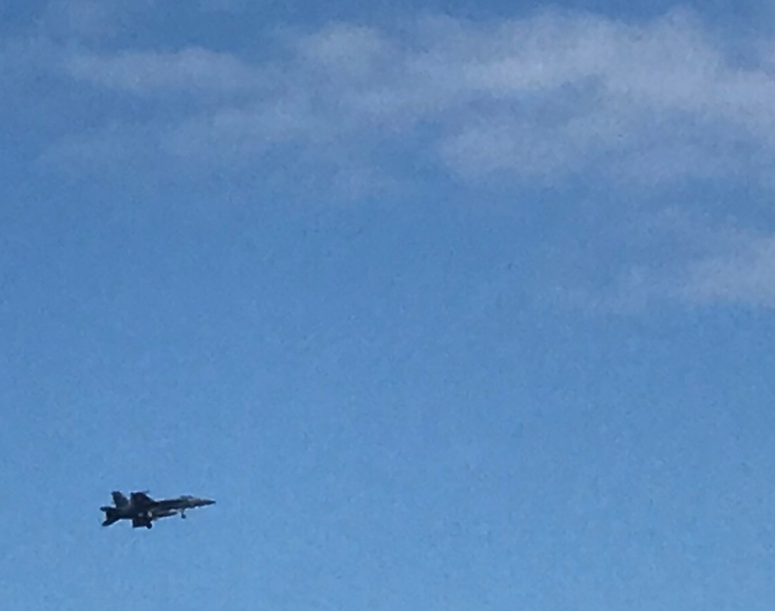
As the Sea Dragon buzzed us my navigation system popped up forcing me to ACKNOWLEDGE the fact that there was a “Dangerous Target” nearby. The Helicopter was not alone and there were a pair of jets making that deafening sound that seems to well up from a simple background rumble to a roar.
McDonnell Douglas F/A-18 Hornet – Screeching Across the Sky
I believe that is a McDonnell Douglas F/A-18 Hornet? Maybe one of our military aficionados will comment if I got any of this incorrect?
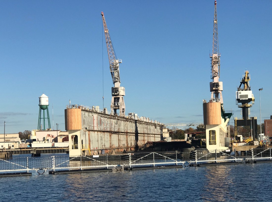
Norfolk Virginia Dry Dock
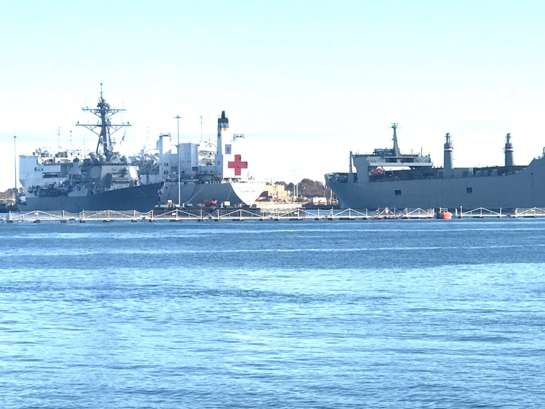
I Believe this is the Stern of a Amphibious Transport Ship?USS Jason Dunham (DDG-109) – Arleigh Burke-Class Destroyer Alongside The Hospital Ship Comfort
The Hospital Ship Comfort made it’s way down to Puerto Rico as part of the relief efforts.
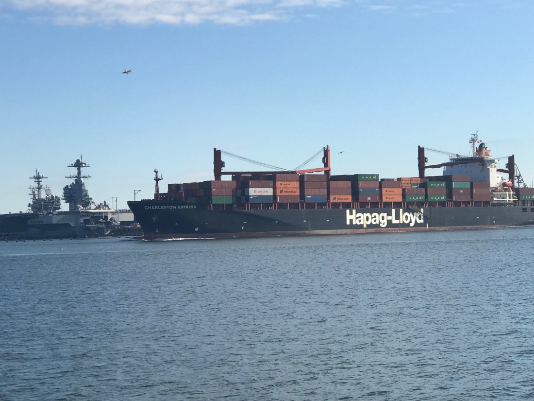
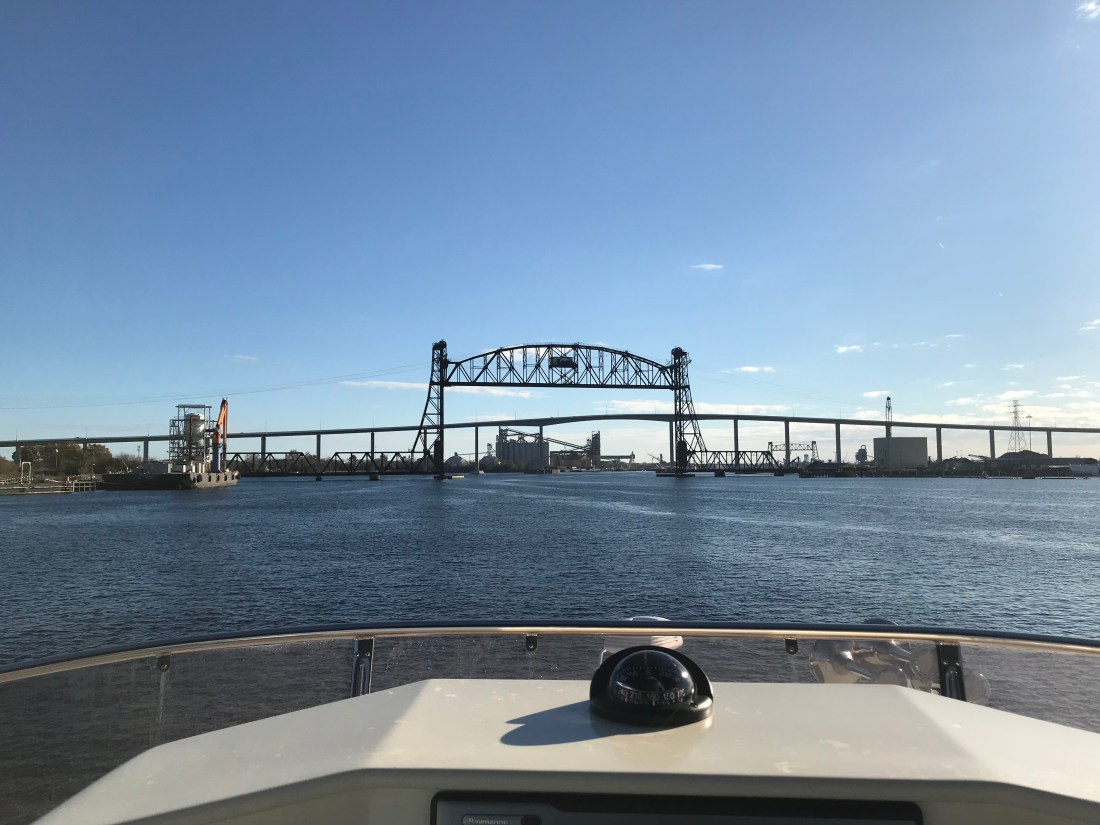
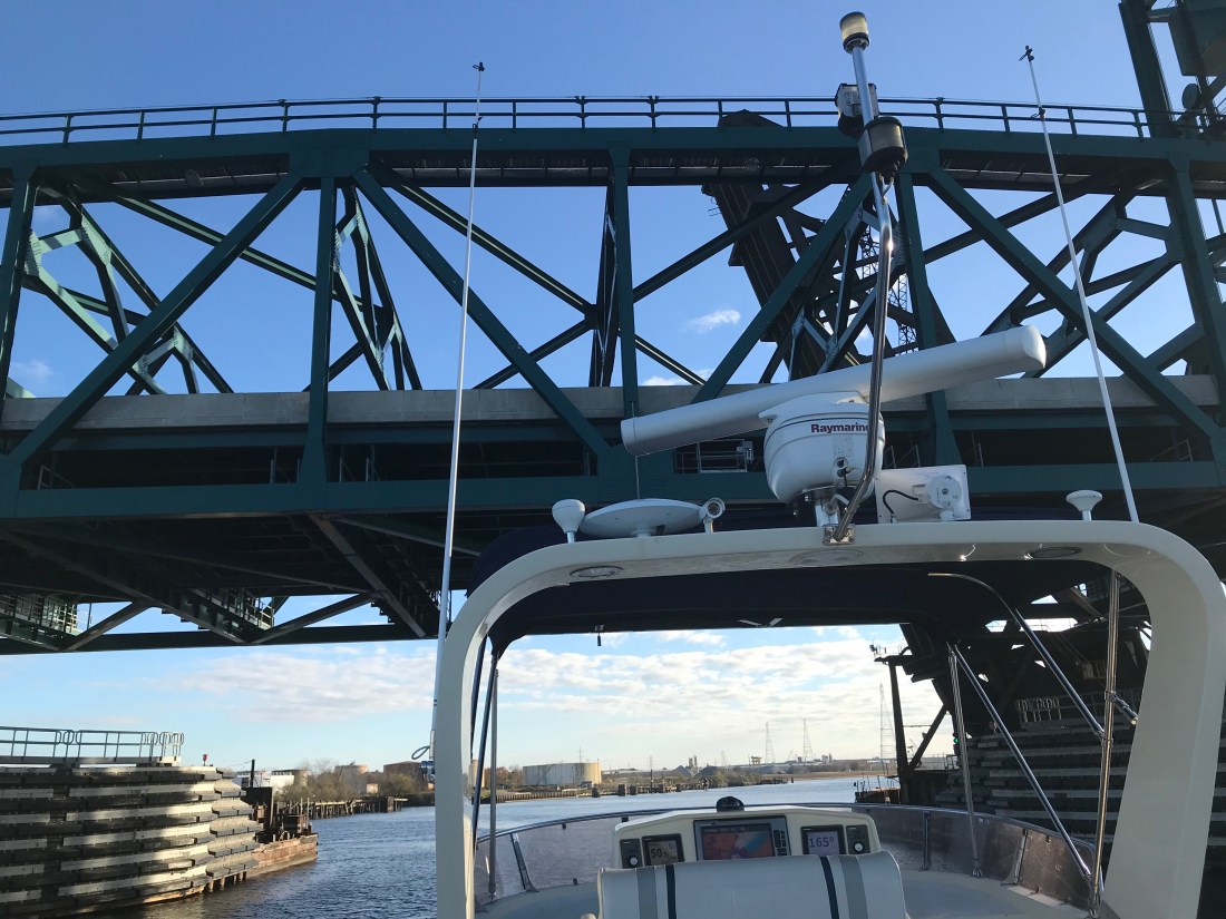
So after navigating past all the warships and being careful to keep our distance it’s on to the Norfolk International Terminals and the Virginia Port Authority.
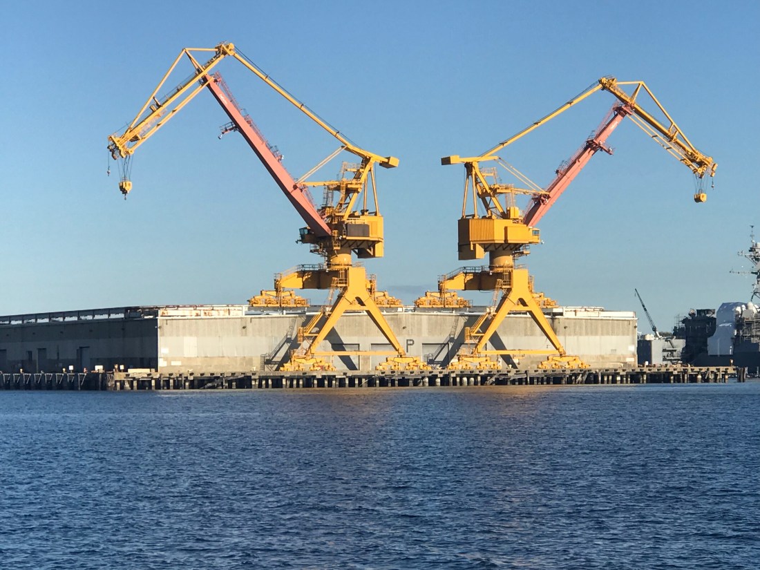
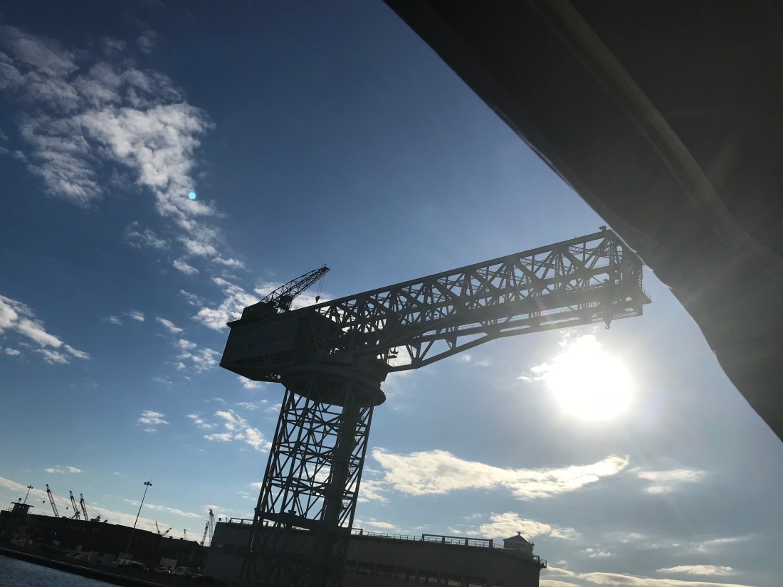
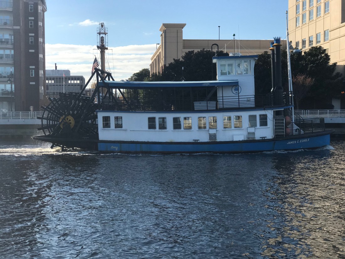
Star Wars AT-AT Walkers were all I could think about.Large Cranes Loom OverheadHapag-Lloyd Container Ship Passing ByNorth PBL RR Bridge and Jordan Fixed Bridge, ICW’s First Set of Bridges – Many More to ComeNorfolk Southern Railway Bridge @36 Feet – Room to SparePaddle Wheel James C Echoles 2 Passing us By
You can’t help but notice that everywhere along the shore seems posted “WARNING – US Government Property – Restricted Area – KEEP OUT”
US Gov Manned Towers with searchlights Guard Wharf Entrances
Finally, we arrived at our chosen destination, Top Rack Marina.
Top Rack Marina in the Setting Sun
I promise to post more about this terrific marina and the on site restaurant called the Amber Lantern that we plan on having dinner at tonight.
YCWe awoke while it was still dark. Checked the forecast one last time. Active gale warnings withstanding, we decided that there was a short weather window. A few hours in the early morning to make our passage South down the Jersey shore.
Small Weather Window Early Sat Morning
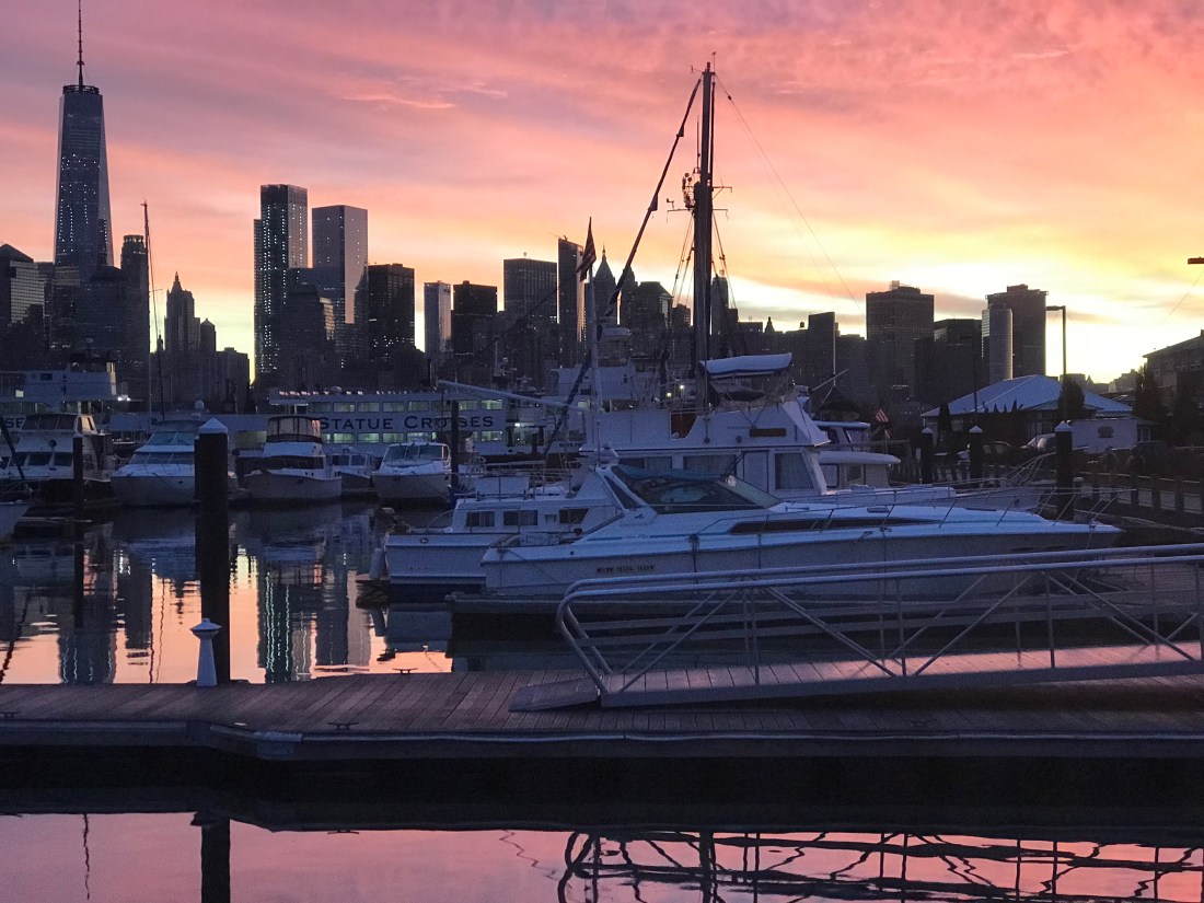
We left NYC @ Sunrise. I returned our dock key, untied our lines and crept out of our slip before anyone knew we were gone. There was a beautiful sunrise over NYC Harbor.
Manhattan Skyline @ Sunrise
We quickly headed out of NYC Harbor which was littered with commercial traffic (tugs, barges, tankers, cruise ships, etc).
Passing a Tanker Entering NYC Harbor
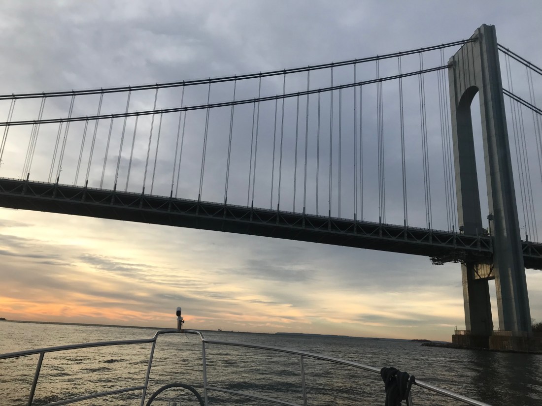
Under the Verrazano Narrows bridge and out to sea.
Passing Under the Verrazano Narrows Bridge
This was Leg 4 of our journey South looked like below
Leg 4 of our Southbound Journey
The sea conditions were great but as early morning gave way to late morning the sea state started to deteriorate a bit as the winds backed around to the South.
We made a steady 9 kts down the coast and arrived @ Manasquan River Inlet just in time for max ebb.
Max Ebb 11:31AM
Entering an inlet off the Atlantic ocean can be hazardous due to currents, standing waves, shoaling, etc. The best time to enter most inlets is during slack current but max ebb is better than max flood. It’s better to have the current rushing under your bow and pushing you backward than running under your stern and pushing you forward.
Every boater has had that nightmare where the currents are pushing you fatefully towards a narrow or too low bridge! Piloting can get tricky.
Manasquan River Inlet Satellite
We chose a North Pacific Yachts raised pilot house 43 for many reasons but the one I’ll talk about now was the full keel. North Pacific 43 Pilothouse
A full keel is reassuring when you run the Manasquan River channel that at times almost dragged our keel on the bottom. While offshore boaters would be horrified at the though of “running aground”, in the ICW it’s simply a fact of life. Dredging the channels to keep a controlled depth of 6′ is costly and difficult to keep up with. MV Simple Life has a draft of
4’6″ dry but closer to 5′ loaded the way we are. If you must run aground, do it with a full keel and skeg like ours to protect the running gear (propeller and rudder) from damage.
That said when the current is pushing you the full keel can get caught in the current and cause the boat to veer to port & starboard. Our Raymarine auto pilot has a “response” setting that when set to “9” will turn the rudder as fast as it can to keep the bow pointed straight ahead. Switching to auto pilot to standby (off) in favor of hand steering can be even more harrowing. As we passed through the Manasquan River Railroad bridge @ max ebb we were forced to throttle up to avoid an untimely bow swing that could bring the boat close to the bridge abutments.
Manasquan River Railroad Bridge
While the river is full of passing traffic and shallows we made it to Crystal Point Marina and Dockmaster Todd caught a line for us as we pulled into our slip.
Kelly joking that she would likely fall in the cold water
Right away we spotted the Captain Morgan behind the bar and knew we had landed in the right place 😉
Kelly’s Down with the Captain
There was a local artist playing acoustic guitar in the corner and they had Sculpin IPA on tap! We had a great dinner & drinks and made it back under the bridge to retire for the night.


 Each Division / District has its own website so you’ll have to spend some time finding the hydrologic maps from each ACE District.
  That’s a narrow drugged channel that you must stay inside of
  Stay to Port.
 We have no idea what species of bird this is but we are committed to learning more about the aquatic bird species that inhabit the ICW.


 I think the sign said something like Greg Norman’s Australian grille
 We love that this guy was taking his dog for a ride. Man’s best friend loves the boat says Happy & Chief Martin Brody.
  “Born 200 years too late” – Jimmy Buffett
 Somewhere Myrtle Beach
 Close Encounters or an airport building, you decide.
 Who wants to walk under this rack with high winds and a 10K lb boat resting 80′ over your head?
 Logs are the bumps in road of life They thud your hull or fold your wheel (that’s a propeller for the un-initiated)
 We hate to see beautiful commercial fishing boats listing on the bottom. We joke that we’d love to pull her up drain her beige, gut her and rebuild her giving her a sexy teak makeover. Kelly reminds me that the stink of a fishing boat is not washed off with soap.
 Ouch!
Ouch!


You must be logged in to post a comment.