Sunshine Highway

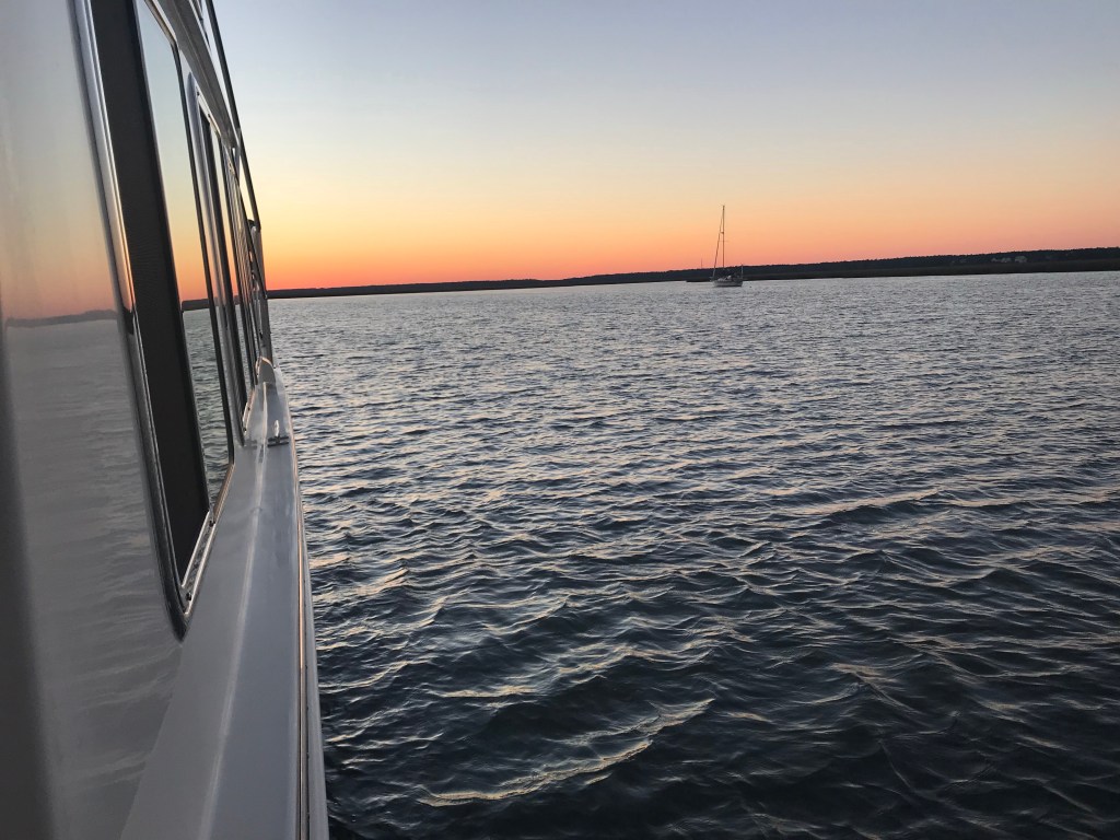
We got a lazy start and the boat that was anchored next to us (captured in the photo below taken just after anchoring) was long gone by the time we weighed anchor.

Atlantic Ocean anchorage in South Carolina

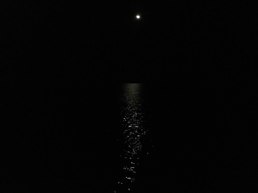
Last night’s view of the sky was amazing. The stars popped like I have never seen. It would seem that being devoid of any extraneous light makes the cosmos seem even larger and us even smaller.

Moon

We navigated beneath several bridges.

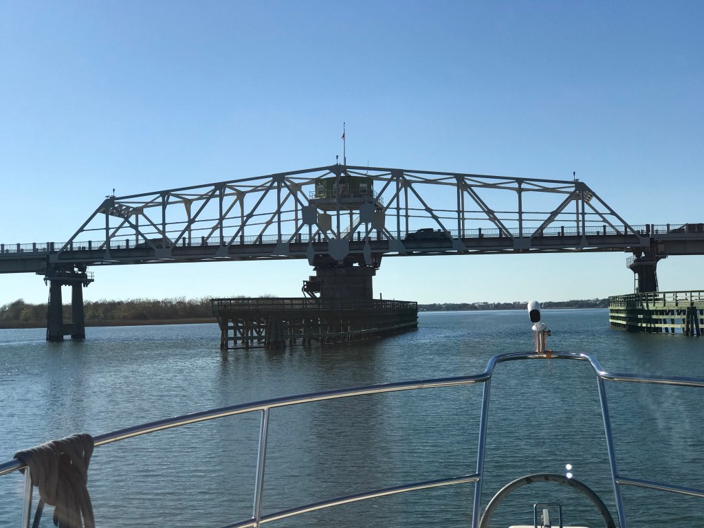
Ben Sawyer Swing Bridge located at SM 462 along the ICW in Sullivan’s Island South Carolina.

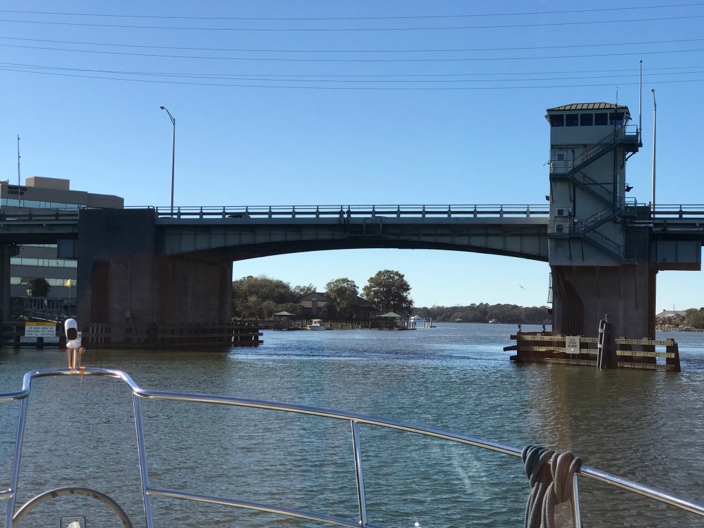
Wappoo Bascule Bridge located at SM 470 along the ICW in South Carolina. Bridge height board

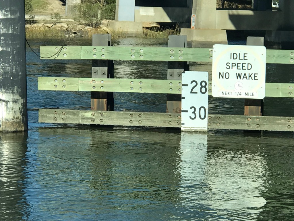
Both of these bridges had about 30′ of vertical clearance so no need to hail the bridge tender for an opening.

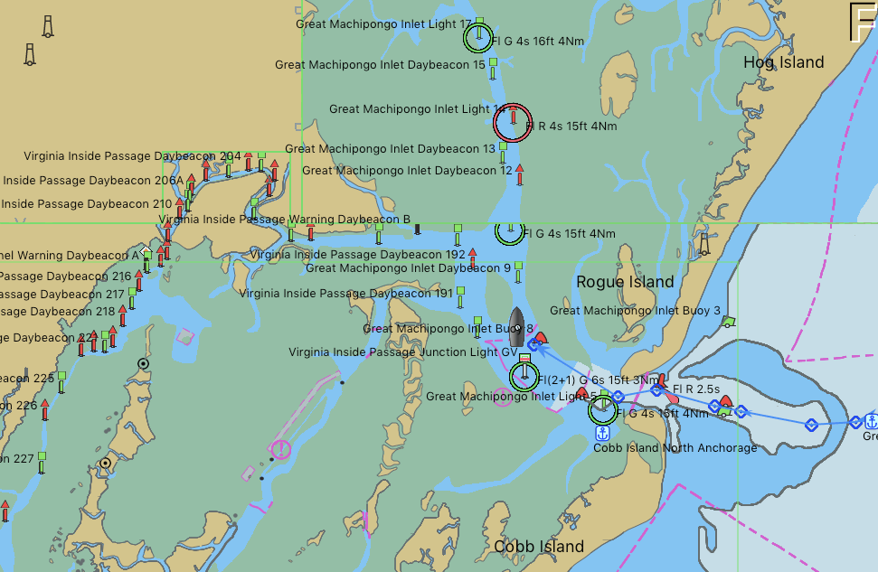
We also passed several ADVs (Abandoned or Derelict Vessels) along the way.

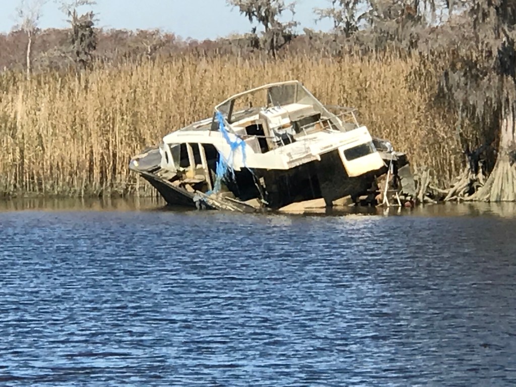
NOAA has a website dedicated to helping with ADVs.

Abandoned boats are a problem everywhere. When she is new everyone flocks to see her. When she falls into disrepair, her value can be upside down. The cost to junk an old boat or the salvage fee after an accident or storm only adds to the abandonment problem.

As we sailed into Charlestown, SC, you could see the tall steeple of what I think might be St. Philip’s Church built in 1836.

Charleston’s shoreline

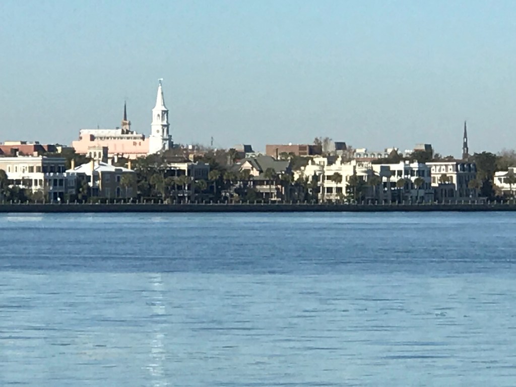
While the thought of exploring Charleston was buzzing in our heads, we remarked that we could stop on the return trip. There are so many great stops along the ICW but if we stopped at all of them we’ll never make it to Florida.

The moss on the trees reminds you that this is South Carolina and not Rhode Island.

The type of tree that surround this home are everywhere along the shore. Maybe a type of oak tree?

I’m dying to see one of those live oaks that look like something out of a fairytale down here.

We passed many crab boats that would race between the crab pot floats that line the channel. You can always tell the boat up ahead is a crab boat because the birds follow them wherever they go. As the pot is pulled to the surface, the crabs are measured and those to small are discarded back into the sea. The flock of sea birds use this opportunity to nab an easy lunch.

Crab Boat

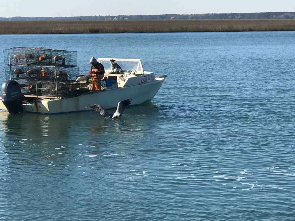
Don’t you just love that man’s best friend is tucked up behind the windshield absorbing whatever warmth from the sun could be found?

Kelly & I got a kick out of seeing this “flats boat” with a man on the back pushing it through the shallows with a push pole. I could only imagine how difficult it must be to balance on that small platform as the boat rocks. We slowed as we passed so our wake would not flick him into the cold water.

As the sun got low in the sky it became clear that I needed to pick which anchorage I was going to drop the hook in tonight. Kelly requests that I research anchorages ahead of time that have strong Verizon cellular signal strength so she can watch the football games using the NFL Mobile app on her iPhone. While cruising we consume cellular data like teenagers stranded at the adult party.

We anchored in a creek called Toogoodoo just in time to watch the Patriots game.

Toogoodoo Creek

Great Machipongo Inlet – Anchored For the Night

This morning started with a great breakfast on the griddle. I have always loved breakfast  diners so having a griddle onboard is perfect for corned beef hash with eggs on buttered toast, cheese and BBQ sauce. I love this exact breakfast and for me, it’s cook, eat, repeat day after day. Why change what makes you happy?

Breakfast 1
I need the egg rings because as the boat rocks the eggs would run away

We did not leave our anchorage till almost 10AM and while I was still dying to drop the dink and make a run around the island to find the wild ponies, I told myself I’ll come back for the ponies!

So I weighed anchor and got underway. The trip was a simple one, South down the coast. I had plotted a short 37 nautical mile course that took me from Chincoteague Island to the Great Machipongo Inlet in Virginia. Even with the late start I was not in danger of having the sun set on me so I slowed down and trolled a line…

Trolling 1
Deep dive bill mackerel lure @5.8 knots – me thinks 4 knots would be better.

My Dad took me fishing off Sandy Neck beach as a child.  I recall sitting by the Colman lantern and just loving it as beetles and moths bombed in from the darkness only to slam into the lantern and spin around in the sand. When I got older, Dad entered me in the MBBA’s (Mass Beach Buggy Association) casting tournaments on Scusett Beach. My Dad would let me use his prized 13′ surf rods with weighted sinkers. He would show me how to put everything I had into the perfect cast and how to release the line at the perfect flex point in the rod. I  won trophies and was hooked. My first summer girlfriend came after winning a trophy 😉 We flew kites, it was pretty simple back then.

If I wasn’t fishing on the beach, I was down the Cape Cod Canal as a 20-something fishing for stripers with Timmy & Tommy or Greg (AKA. Maca, Gratty and Rooster). Growing up, we never called each other by our given names.. I’m assuming it’s like that everywhere. Anyway… I outfitted Simple Life with plenty of rods and fishing gear for times like this cruising down the coast. Problem is.. I never seem to catch anything.. It’s kind of a running joke. I need to up my fishing game. Anyone want to come South and show me some pointers? I could use some. My friend John has a great Cabo sport fishing boat and if I was not so preoccupied with taking my own boat out, I’d have spent more time learning on his. Well, needless to say.. No fish.. But I’m committed to catching something great SOON!

On our way into Machipongo Inlet we were visited by dolphins. It did not take them long to come over and start rubbing our bow.


I reconfigured my Raymarine E140 chartplotter’s page to display 3 different windows. I chose a half window of charts, a two quarter windows, one of a camera feed behind me and one of the depth sounder readout (see pic).  I did this because as I am traversing these tricky Atlantic inlets which are full of shoals and sandbars, it makes you want to see the depth trend. I mean having a history of the last few seconds of bottom depth gives you a much better clue that you are running up the slope of a shoal. While the water around the shoal may be deep as you approach,  you can see the steep upward angle of the sea floor. When I was entering the Great Machipongo Inlet there is a horseshoe shaped bar that blankets the inlet.  (see pic below)

Sandbar1

I plotted a course (the red line) that allowed me to approach straight on through the deeper sections and wasn’t really surprised that the depths did not match my 2012 Navionics chart chip bathometric data.

I use many charting tools to navigate and the chart chip in my chartplotter has data from 2012. So believe it or not.. I’m staring at my iPhone NOAA raster charts which are more up to date as I enter.. That said,  the GPS location accuracy of an iPhone is not the same as my Raymarine GPS. You really have to be careful when you enter an Atlantic inlet like this .. Look at all the green (land that is exposed at low tide). While I came in at high tide and it was water everywhere, just wait till low tide 😉

Great Machipongo Inlet

Well I read all the Internet reviews I could (only 2 of them) to gain some kind of local knowledge before entering this inlet. One review said it was horrible and the other said it was OK. So far I have no complaints. After all look at this sunset video I took once I anchored. It’s just peaceful in here.

I’ll end with this sunset video. There is something great about finishing a journey, dropping the hook and enjoying an IPA & sunset. I think it’s what humans were supposed to do.. OK after cavemen figured out the whole boating thing.

https://youtu.be/9P-T2ckm-wEe