Atlantic City 4AM

Sleeping In

I purposely got a late departure from the marina in Port Washington because I wanted to catch a fair current. When I went to leave my slip the gale force winds were on my beam. When you are solo you must untie and leave only a front a back looped over the cleat so you can climb aboard and flick the lines off and go. The problem this morning was that after I flicked off the stern line and ran through the boat to get to the bow line I’m sure the boat would be sideways in the slip. I opted to tie the boat with a single line, jump aboard, flick the line of the cleat and try to get out of of my slip before the wind had it’s way with me. Lucky for me the slips are very wide as were the fairways.

Pulling out of Port Washington a sailboat was following me.

Blue-hulled sailboat reminds me of my old Hunter sailboat before I bought my trawler

Port Washington is just around the corner from the east end of the East River.
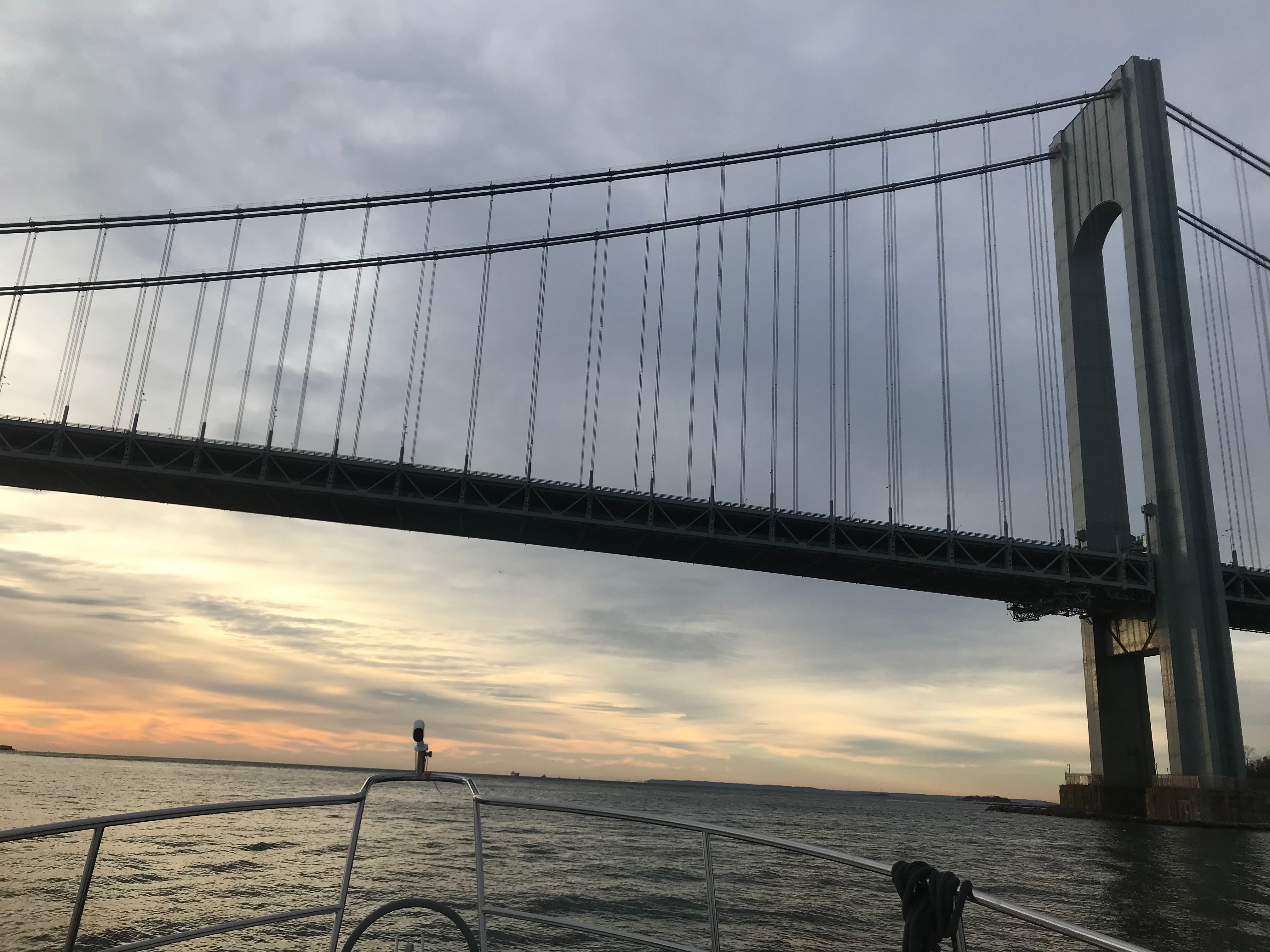
Port Washington is a great staging location to wait for a fair current

Under Bridges

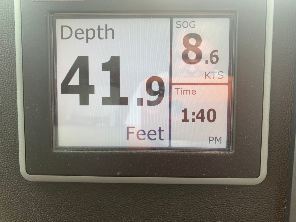
Throgs Neck Bridge is the first bridge as you enter the E. River. You can see the Bronx – Whitstone bridge behind it. The fair current boosts my speed from 6.5kts to 8.6kts as I zip along under the bridge.

Throgs Neck Bridge East end of the E. River
8.6 kts thanks to the current

Passing Traffic

Almost immediately I’m being passed by USCG & NYPD boats as well as other boat traffic. They are everywhere as you navigate the East River.
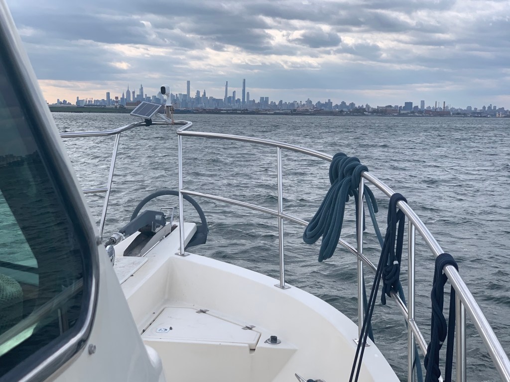
Dystopia

The NYC skyline can be seen in the distance. On this cold grey day I can help but think it looks like a scene from some dystopian future SciFi flick.

Dystopian future skyline

Push Me Along

As I approach the infamous Hell’s Gate where the E. river & Harlem river converge my speed jumps to 11kts.

work pajamas on feet in the helm

Right of Way

Soon I had an oncoming boat that was crossing my port bow. They were on a collision course so I sounded my airhorn for a 1 whistle pass. They did not change speed or direction. I blew my horn again and again with no reaction from the oncoming boat. I finally laid on the horn turned to starboard. We exchange some hand waving before the captain got on the VHF calling me a moron. I simply explained that he did not have the right of way. He was on a collision course. He did not respond to my sound signal and left me no choice but to stop. No response.

Staten Island Ferry

As I pass the souther tip of Manhattan I see the ferry terminal and the Staten Island ferry docked.

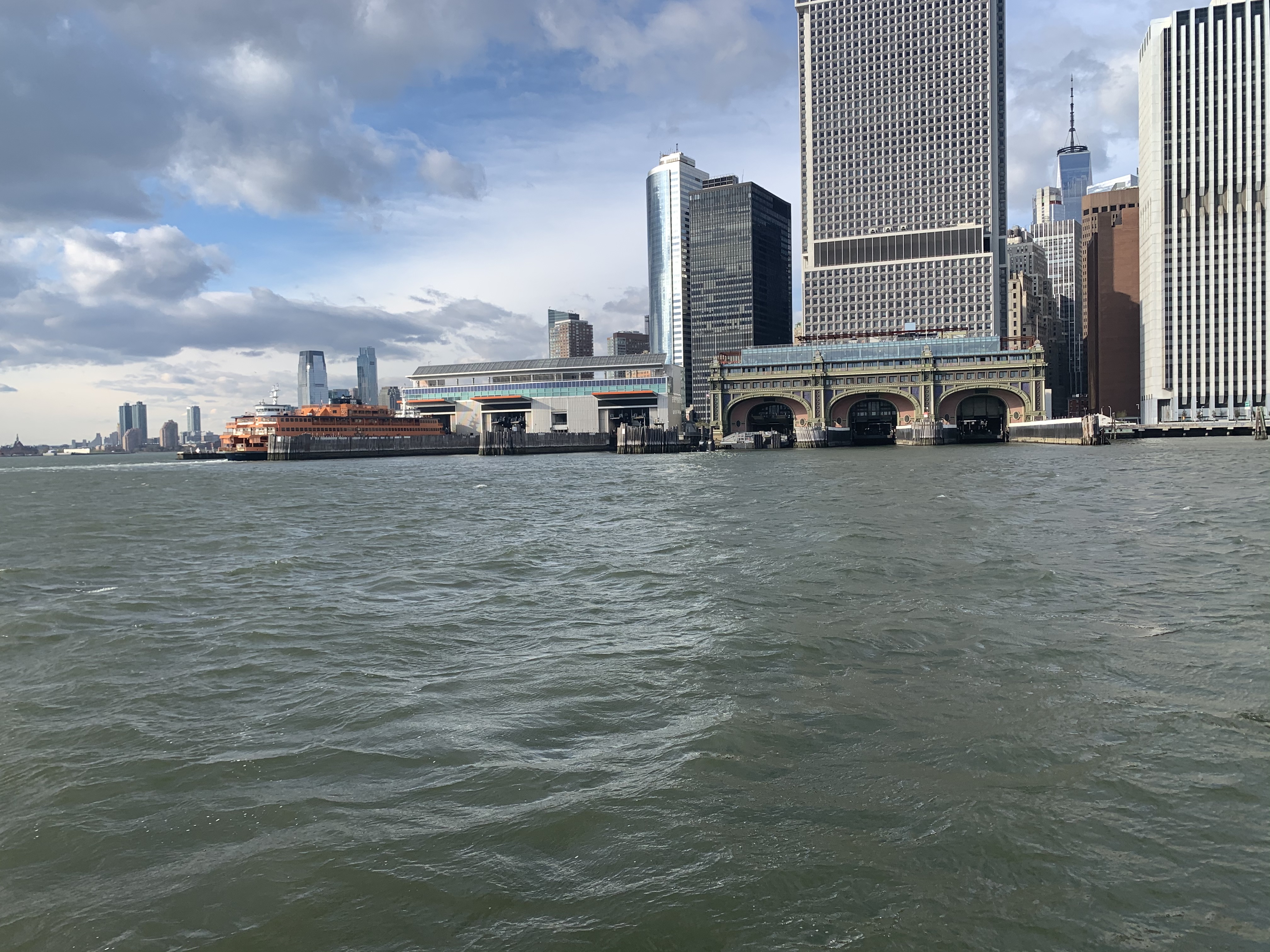
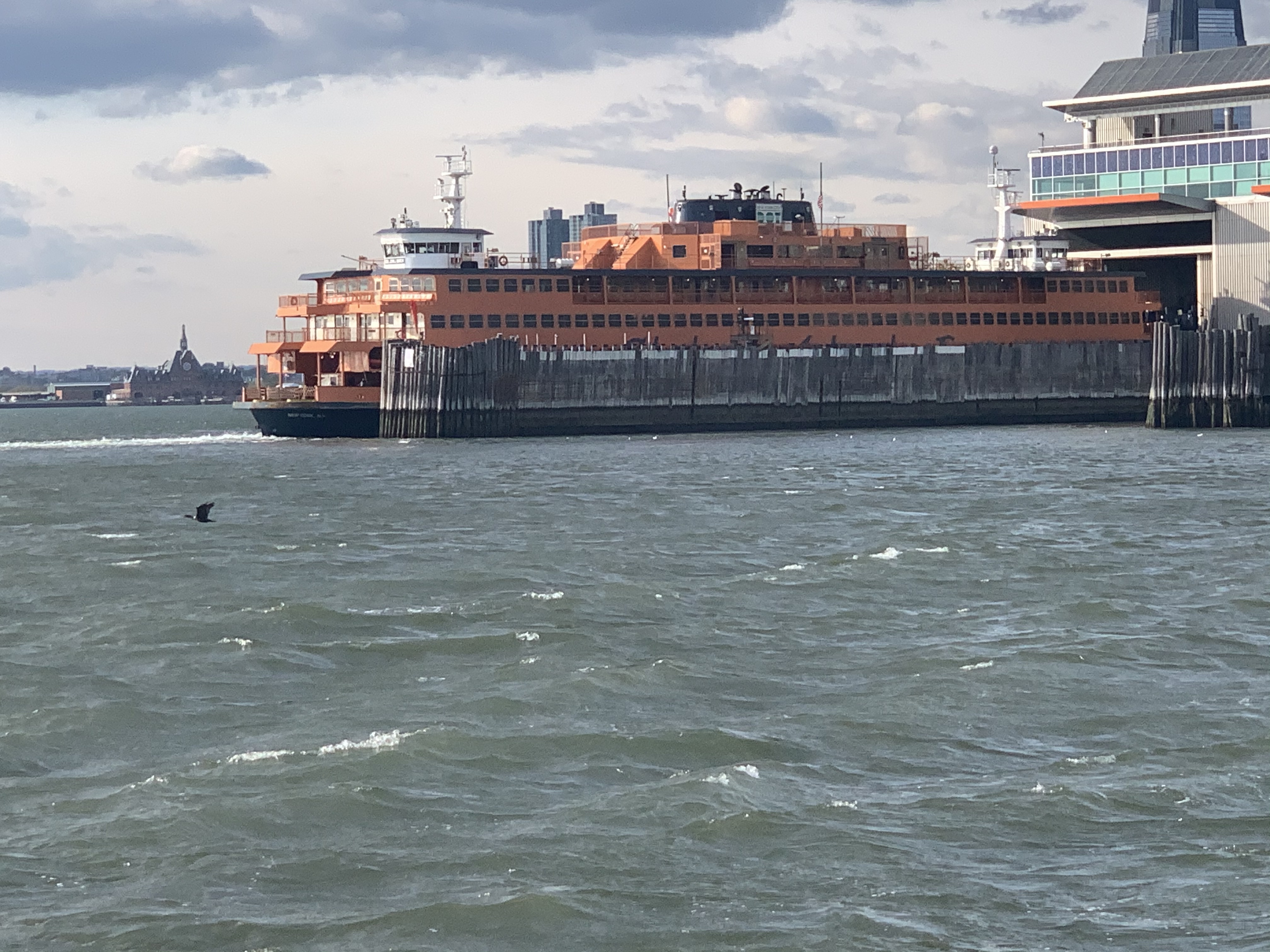
They never stay docked very long. NYC’s fast pace as passengers rushing off and on and they are underway again passing me.

A Sexy Girl goes Past

As I’m passing the Statue of Liberty I see a radar return for something passing me on my starboard side. She’s a beauty. MV Arriva from England.

Hustle and Bustle of NYC

This is the busy part of NYC harbor and all sorts of traffic is passing me.

USACE (US Army Corp of Engineers)
Maersk Containership entering NYC harbor

The Jersey Shore

As I pass under the Verrazanno Bridge and past Sandy Hook the sun is setting and at first it’s a beautiful yellowish orange.

Yellowish, orange sunset off Sandy Hook

But minutes later it’s very pink

Pink sunset off Sandy Hook

Serenity

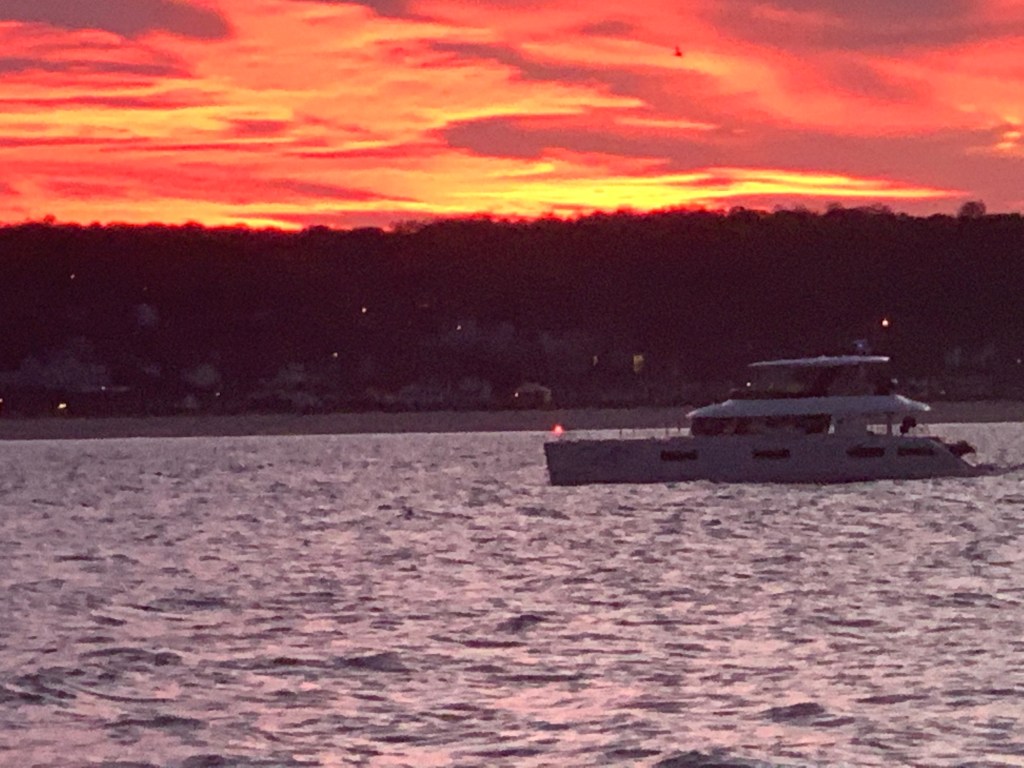
My AIS shows a 66′ foot yacht approaching from my stern.

AIS info transmitted between boats digitally over VHF CH#70

hmmm… 33 feet of beam I think as I wait to snap a photo of this boat with the sunset above. MV Serenity VII is a Lagoon 63 – 4 cabin, crewed power catamaran for charter. You can reserve it here for about 30K/week in the Bahamas if you like? I’d guess the crew are bringing the boat south to the Bahamas for the start of the chartering season.
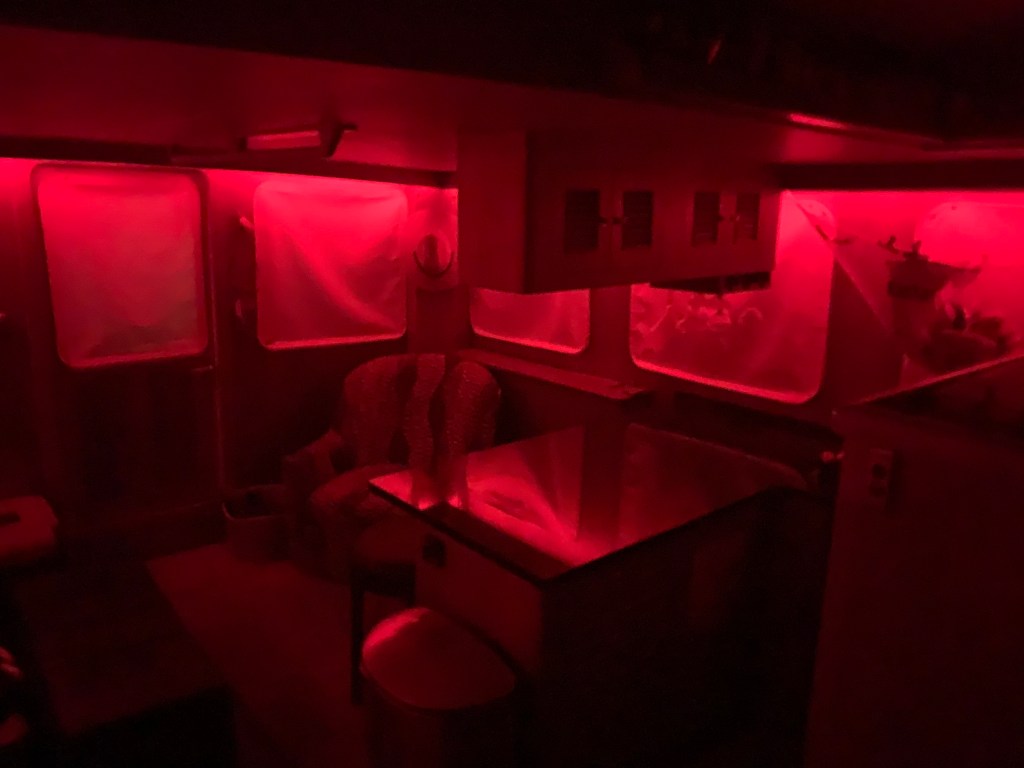
Red Light District

As the sun sets I swap my salon LED lighting from blue over to red to keep my night vision.

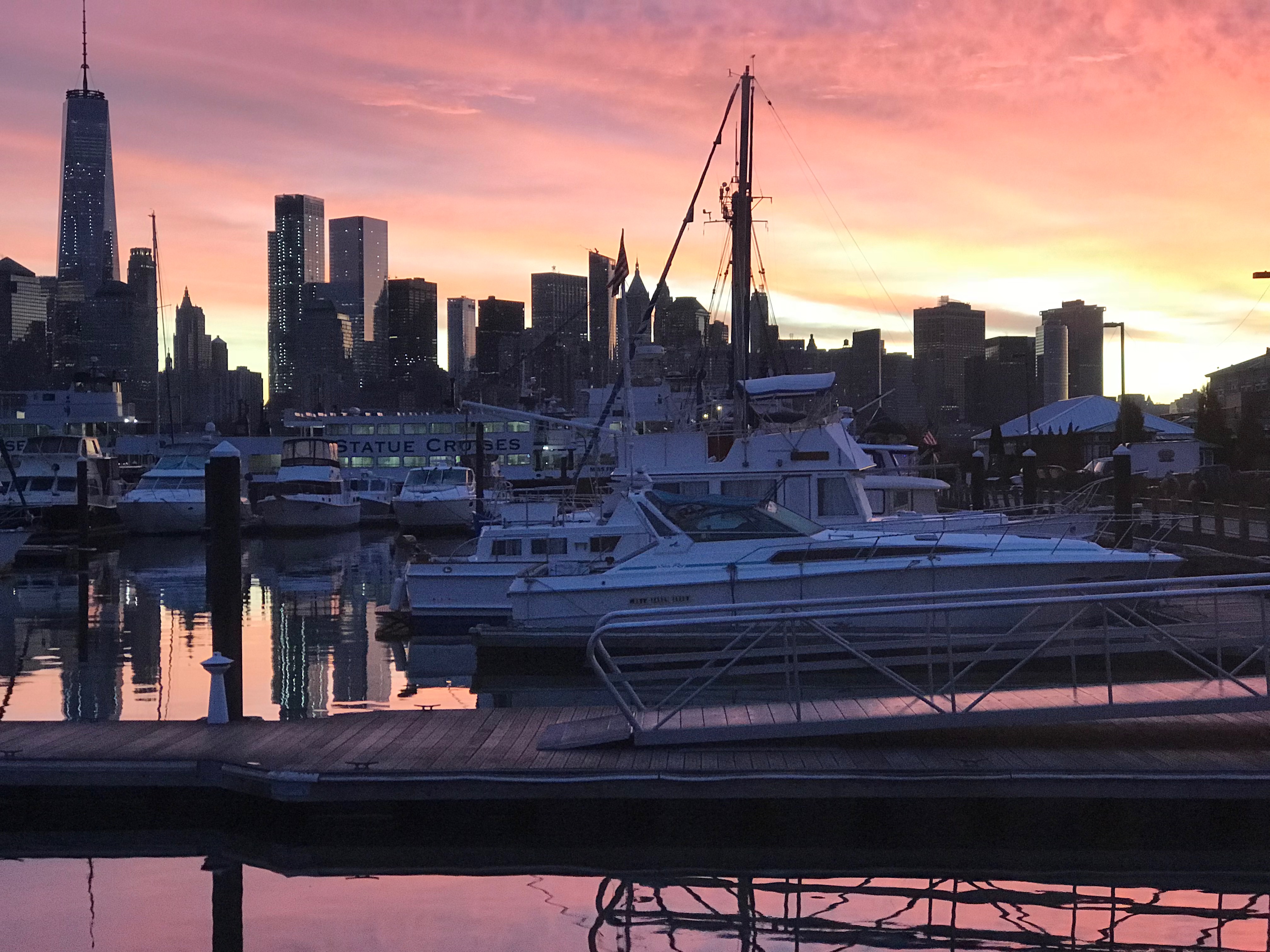
The rest of the trip was a long dark ride to Atlantic City. The sea was calm and I was scheduled to arrive around 4AM. This leg of the journey was 16 hours. I had planned to anchor in Brigantine Bay but it was dead low tide when I arrived and every attempt at getting in the narrow entrance channel ended with the bow slowly riding up on a muddy silty shoal. Being as tired as I was, I simply found a place to drop the hook near the Golden Nugget. The anchor was no sooner set and I curled up on the pilothouse berth and was sound asleep. I plan to wake in 2 hours when the sun comes up and as I have another long 100+ NM day.
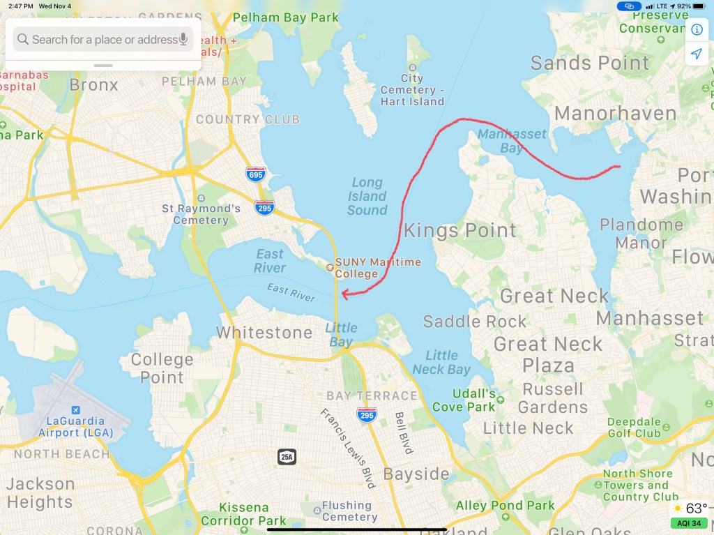
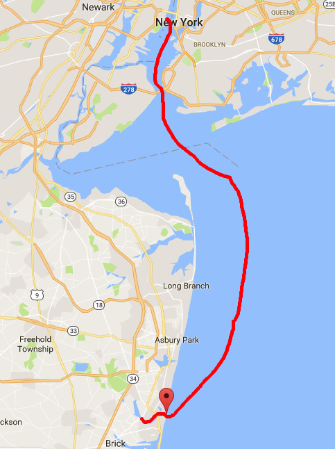
W04L003

The 113NM third leg of my Winter 2020 journey looked something like this.

W04L003

Gale Winds and Manasquan River Inlet

YCWe awoke while it was still dark. Checked the forecast one last time. Active gale warnings withstanding, we decided that there was a short weather window. A few hours in the early morning to make our passage South down the Jersey shore.

forecast Manasqan
Small Weather Window Early Sat Morning

We left NYC @ Sunrise. I returned our dock key, untied our lines and crept out of our slip before anyone knew we were gone. There was a beautiful sunrise over NYC Harbor.

Liberty Landing Sunrise
Manhattan Skyline @ Sunrise

We quickly headed out of NYC Harbor which was littered with commercial traffic (tugs, barges, tankers, cruise ships, etc).

Tanker NYC
Passing a Tanker Entering NYC Harbor

Under the Verrazano Narrows bridge and out to sea.

Verrazano Narrows Bridge
Passing Under the Verrazano Narrows Bridge

This was Leg 4 of our journey South looked like below

Leg 4
Leg 4 of our Southbound Journey

The sea conditions were great but as early morning gave way to late morning the sea state started to deteriorate a bit as the winds backed around to the South.

We made a steady 9 kts down the coast and arrived @ Manasquan River Inlet just in time for max ebb.

Manasquan River Inlet Current arrival
Max Ebb 11:31AM

Entering an inlet off the Atlantic ocean can be hazardous due to currents, standing waves, shoaling, etc. The best time to enter most inlets is during slack current but max ebb is better than max flood. It’s better to have the current rushing under your bow and pushing you backward than running under your stern and pushing you forward.
Every boater has had that nightmare where the currents are pushing you fatefully towards a narrow or too low bridge! Piloting can get tricky.

manasquan_satellite2
Manasquan River Inlet Satellite

We chose a North Pacific Yachts raised pilot house 43 for many reasons but the one I’ll talk about now was the full keel. North Pacific 43 Pilothouse


A full keel is reassuring when you run the Manasquan River channel that at times almost dragged our keel on the bottom. While offshore boaters would be horrified at the though of “running aground”, in the ICW it’s simply a fact of life. Dredging the channels to keep a controlled depth of 6′ is costly and difficult to keep up with. MV Simple Life has a draft of
4’6″ dry but closer to 5′ loaded the way we are. If you must run aground, do it with a full keel and skeg like ours to protect the running gear (propeller and rudder) from damage.
That said when the current is pushing you the full keel can get caught in the current and cause the boat to veer to port & starboard. Our Raymarine auto pilot has a “response” setting that when set to “9” will turn the rudder as fast as it can to keep the bow pointed straight ahead. Switching to auto pilot to standby (off) in favor of hand steering can be even more harrowing. As we passed through the Manasquan River Railroad bridge @ max ebb we were forced to throttle up to avoid an untimely bow swing that could bring the boat close to the bridge abutments.

Manasquan River Railroad Bridge2
Manasquan River Railroad Bridge

While the river is full of passing traffic and shallows we made it to Crystal Point Marina and Dockmaster Todd caught a line for us as we pulled into our slip.

Crystal Point Marina 1
MV Simple life Slipped @ Crystal Point Marina

After a short walk under a bridge we arrived at River Rock Bar in Brick, NJ. River Rock Bar in Brick, NJ

Bridge Fall
Kelly joking that she would likely fall in the cold water

Right away we spotted the Captain Morgan behind the bar and knew we had landed in the right place 😉

River Rock Marina Bar 2
Kelly’s Down with the Captain

There was a local artist playing acoustic guitar in the corner and they had Sculpin IPA on tap! We had a great dinner & drinks and made it back under the bridge to retire for the night.

Shortest Ferry Ride Ever

We are still here at Liberty Landing Marina in Jersey City, NJ.
It’s a beautiful marina in the shadow of Lady Liberty. From the boat you can see the NYC skyline of lower Manhattan.

Freedom Tower
View of the Freedom Tower from the Boat

Kelly stayed behind while I took an Uber to the market to purchase turkey, cranberry sauce and stuffing for Thanksgiving. Much to my chagrin the market that the marina recommended was an Asian market and it seems Thanksgiving was nowhere to be found. I must have spent 10 minutes staring at the store’s spice display rack trying to find Cumin, Sage and Rosemary.

Asian Spice
Where is the Sage?

After coming home to the boat defeated we decided that we’d go out in Jersey City for a drink or two. The marina manager told us about a great place called White Star Bar and it was just a short ferry ride away. So off we ran to catch the ferry. We no sooner boarded the ferry and it pulled away from the dock. We heard the loud bow thruster spin us around 180 degrees. Suddenly the ferry lurched forward and docked on the other side of the channel 50 feet away. We were told to pay our $2 & exit. It was then that we knew our NYC water taxi experience had been ripped from us.

littlelady-photo-homepage
Picture Shows How Far the ferry Ride Was

We hurried down the cold street in wearing the warmest clothes we have aboard. There are no ski jackets or gloves aboard Simple Life. The bar was warm and we enjoyed dinner and drinks. Though they got Kelly’s Captain/Diet Pepsi/NFL (No Freaking Lime) wrong TWICE.  Once it was scotch & Pepsi and the other some vanilla liquor & Pepsi. The waitress could not explain it but we were just happy to be in off the cold street.

As for getting further South… The active gale warning has given way to a gale watch for the waters off Manasquam River Inlet.

forecast
Forecast for waters 25 NM South of NYC

With this in mind we’ll be checking the forecast tomorrow as well as the real-time buoy data. Fingers crossed that we can again make our way South to warmer weather.

WhiteStar
White Star Pub