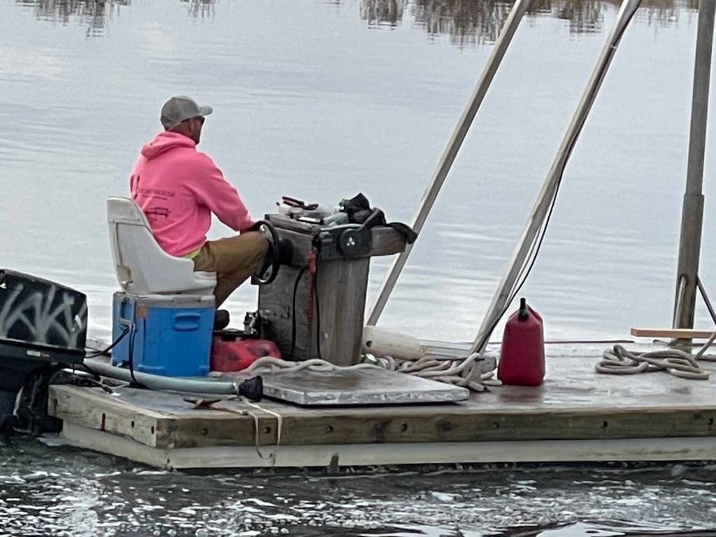
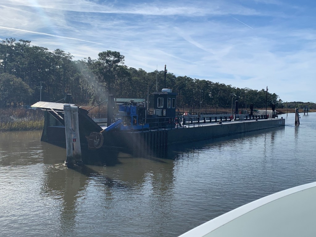
We were on our way to Southport, NC to see our friends Jim & Wende. We had to slow down to no wake speed to keep from swamping this fella who was motoring a small work barge down the ICW.
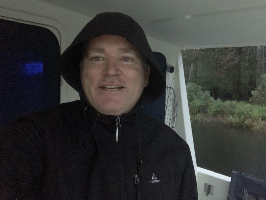
Cooler Seat Captain
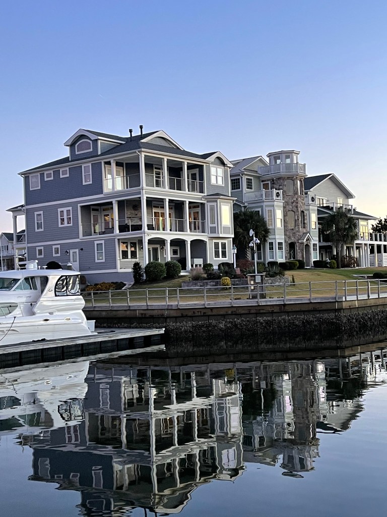
We arrived at St. James Plantation Marina just before sundown. The homes along the harbor are beautiful.
St. James Plantation Marina
The Big 😀
Jim and Wende let us use their truck to reprovision which was perfect as it was the day before Thanksgiving and we needed TURKEY!
Later that night Jim & Wende took us to dinner at a Joseph’s Italian Bistro @ Safe Harbor Marina. We had dinner with some good local IPAs & lots of laughs. I wish we had taken a photo but I think we were just having too much fun. Jim and Wende told us all about their trip back from Buzzards Bay, MA to Southport, NC in their new Pursuit OS 355. The weather was a bit ruff off the RI coast but they made great time with stops in places like Atlantic City.
Capt Jim & Wende
In the AM we were off and Capt T was at the helm.
Capt T @Helm
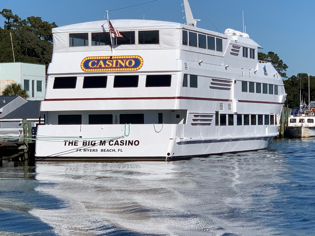
We passed a boat dock that was more boat than dock. Capt T thought she recognized a casino boat as we passed and sure enough the “Big M” hailed from Fort Myers, FL.
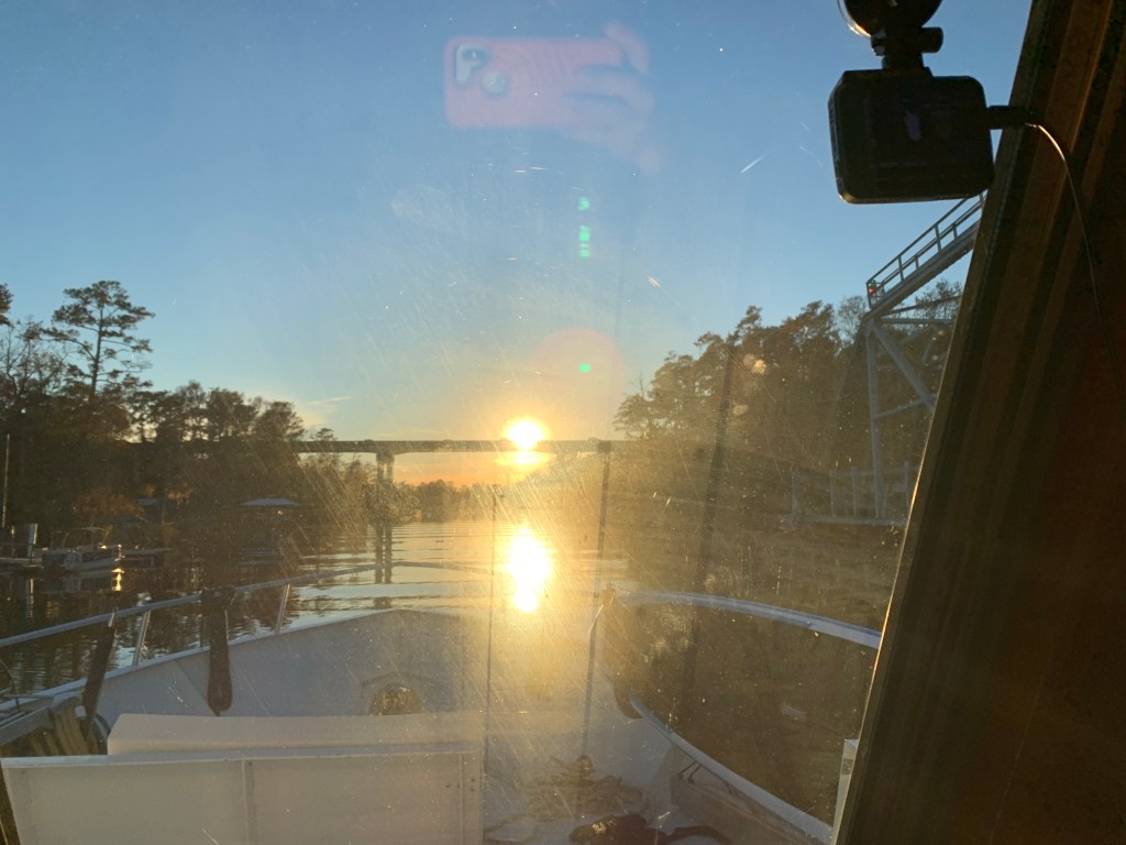
As we made our way into the Waccamaw River preserve we had to get through the Socastee swing bridge but we were staring straight into the sun. The best we could do was go slow and use the radar to see in front of the boat.
Camera may see the swing bridge on the right but we only saw a bright spot looking out the pilothouse
We anchored in what I call the Waccamaw River (ie. swamp) and it’s beautiful. We had a great night on anchor as the high trees provide protection from everything but the cold.
It was COLD.
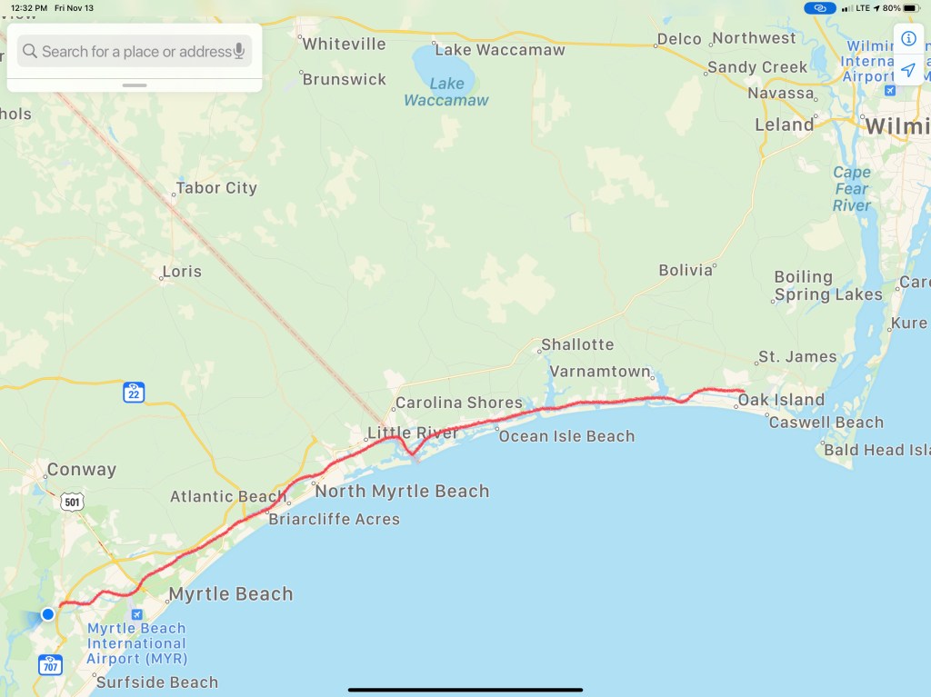
Cape Coral, FLConway, SCFoxboro, MaWarwick, RIHere in Conway, SC it’s the same freezing temp as back home in Foxboro, MA
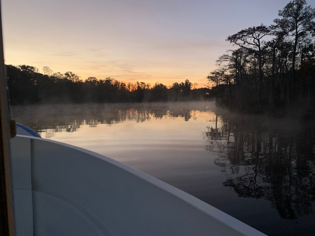
We weighed anchor at first light and the swamp was steaming due to early morning low temps.
Waccamaw River pre-dawn
We had to slow to no wake so as to not disturb this Nordhavn anchored right off the main ICW route.
Peaceful Anchorage
The next swing bridge is actually a floating swing bridge. Very cool. It simply uses drop-able drive-on ramps and a huge tilt-able bow thruster.
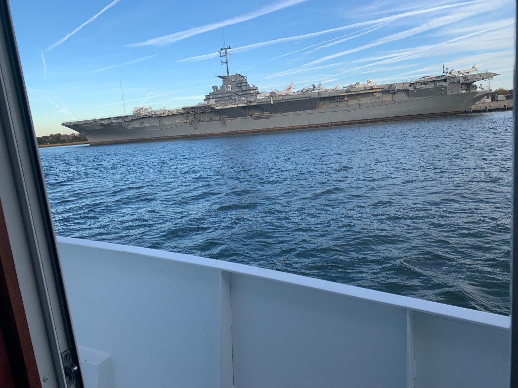
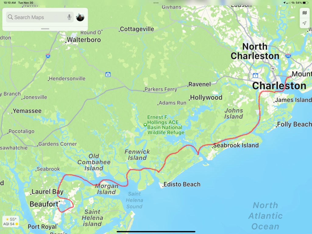
We arrived in Charleston, SC and the marina we requested a slip from had us “wait-listed”. We anchored for the night next to the USS Yorktown.
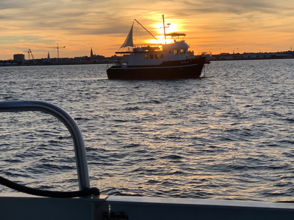
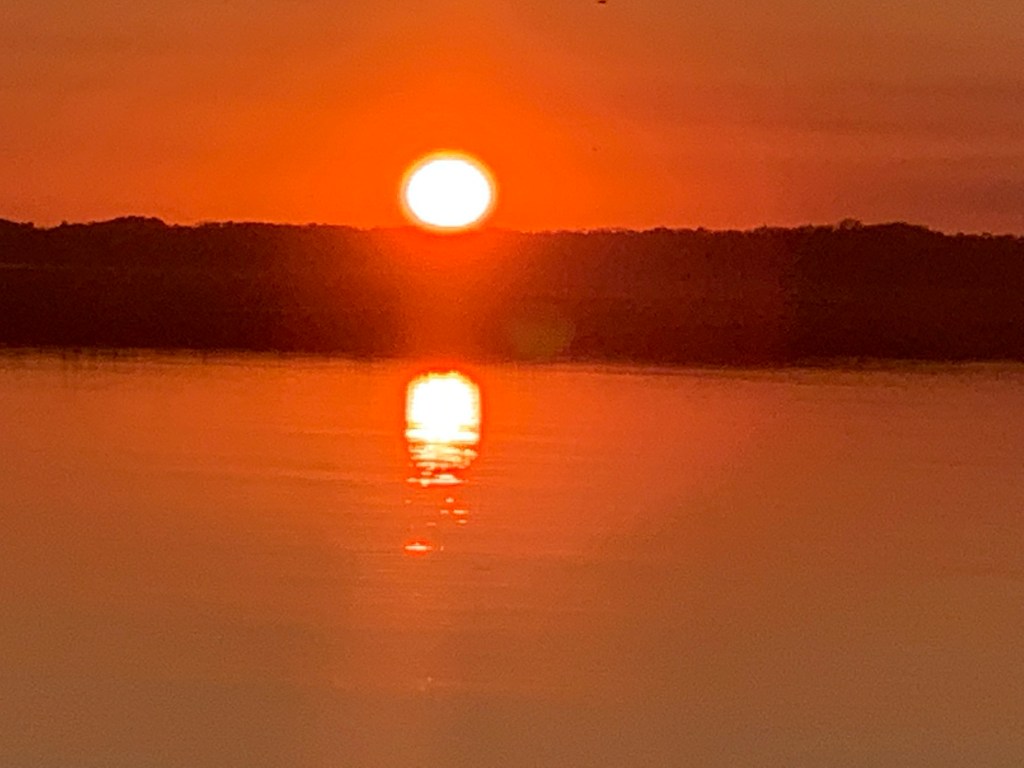
The sun was setting on Charleston.
Sunrise in the AM and we were off… bound for Beaufort, SC
Sunrise in Charleston, SC
We anchored in Beaufort with hopes of getting off the waitlist for the marina. In the AM we called and they found a spot for us on the outer face dock.
Docked at Safe Harbor Beaufort, SC
Beaufort is a fun town and we wasted no time getting ashore at Plums Restaurant for some lunch.
Plums in Beaufort, SC
We napped after lunch and made a second run on the town before we would leave in the AM. Beaufort has a great outside park area right in front of the marina.
Beaufort ParkSwings along the Water
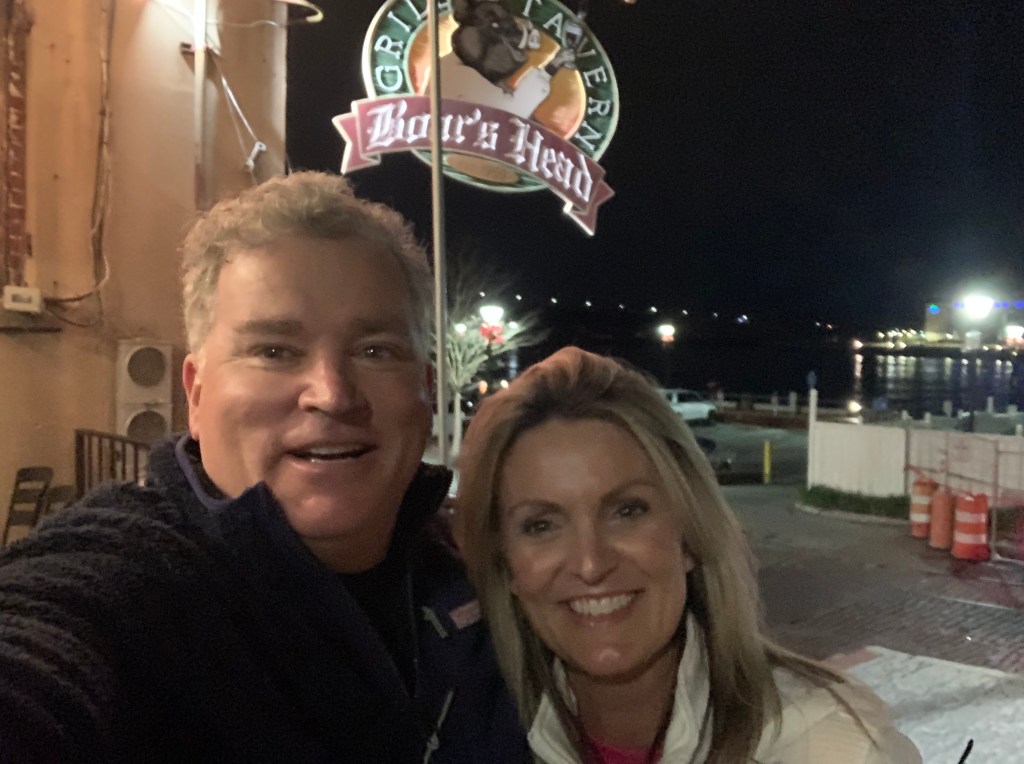
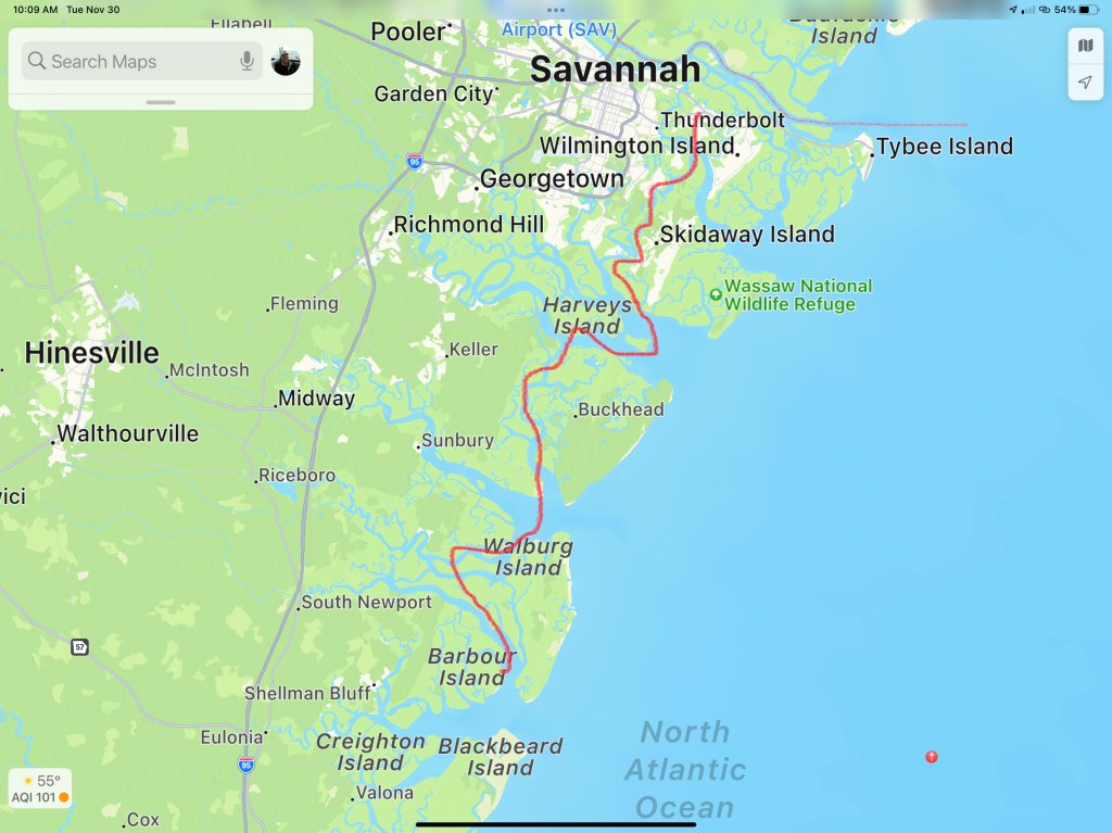
In the morning we were off to Savannah, GA. Last time I docked right in downtown around River Street but felt it a bit seedy at night. We decided to stay at Thunderbolt Marina and Uber’d into town for a Savannah pub crawl.
Are impromptu pub crawl consisted of the following venues:
Spanky’s
Boar’s Head Grill
The Cotton Exchange
Huey’s
The Warehouse Bar
We ended the night singing Journey.
Up early to a Whiskey Sunrise & potato pancakes and off to Fernandina Beach, FL
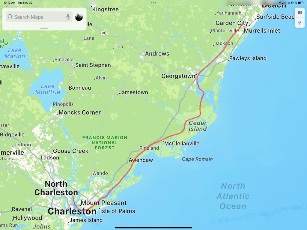
This post consists of 5 legs of our journey
Leg 15 – Waccamaw River, SC to Charleston, SCLeg 16 – Charleston, SC to Beaufort, SCLeg 17 – Beaufort, SC to Thunderbolt Marina, GALeg 18 – Thunderbolt Marina to St. Catherine’s Island, GALeg 19 – St. Catherine’s Island, GA to Ferdandina Beach, FL
We hope everyone had a great Thanksgiving with family!!!
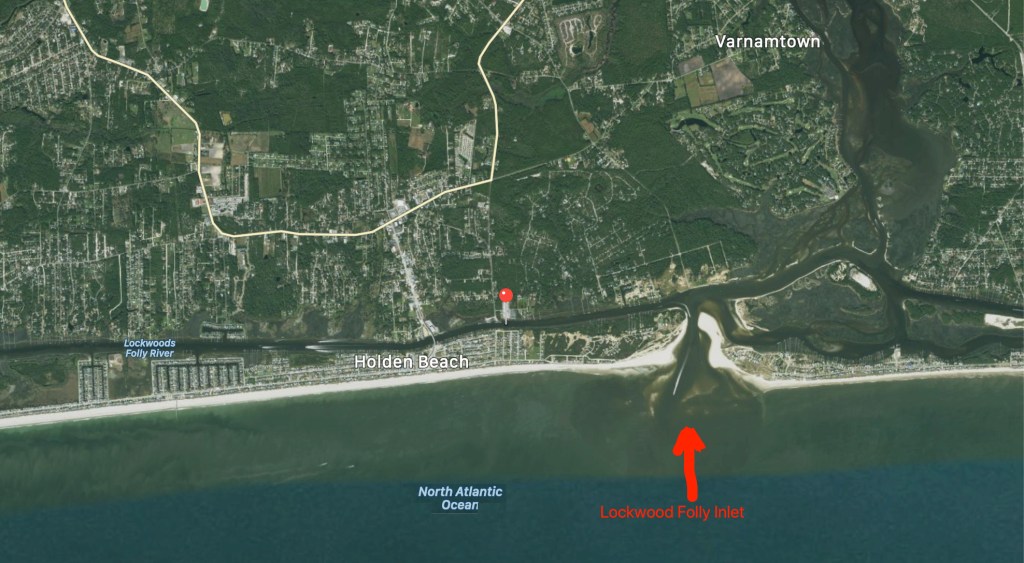
Lockwood’s Folly inlet comes upon you quickly after leaving SJP Marina and heading south.
Lockwood’s Folly is a known trouble spot for ICW shoaling. Every year, I download Bob Sherer’s (AKA Bob423) track that he uploads for free to his Facebook group called ICW Cruising Guide by Bob423 and his Fleetwing Blog. I used to stay up late each night after anchoring while I plotted my route for the next morning. Then a few years ago, I came across Bob posting his track online in a downloadable .GPX file format. I downloaded it and realized that he was quite skilled at making routes that avoided the many ICW hazards. I quickly realized the value in using his month-old track as well as Bob423’s 2020 ICW Cruising Guide. I’m on my fourth year of navigating from RI to the FL Keys. After eight years of doing the same, Bob joined the Waterway Guide, another popular ICW guide book/website.
Bob423’s Track
Bob’s track seen below in dark blue. It shows the proper shore-side route through Lockwood’s Folly.
Bob423’s Lockwood’s Folly route
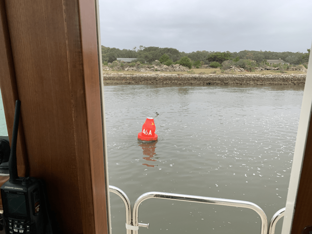
The tide is two hours before low as I make my way south.
I play “hug a buoy” as I pass closely by a red buoy.
ATON 46A in Lockwood’s Folly
You can see the Atlantic Ocean as you look east out the inlet.
Atlantic Ocean surf can be heard as I pass
Rough Atlantic
Hearing the surf, I think… I’m glad I did not exit Southport this morning and take my chances running the outside. When making the inside vs. outside decision, I use apps like the NOAA Marine Forecast & Weather app on my iPhone.
As I travel through Holden Beach I can’t help but notice what appears to be storm damage possibly from Hurricane Isaias back in August of 2020?
I’m not sure I can blame Hurricane Isaias for the fishing boat pictured below. The Second Law of Thermodynamics is at work here. Even Mother Nature has to follow the rules!
Increasing Entropy
Shallotte Inlet
The next inlet is Shallotte Inlet and it’s the same shallow story replayed.
USACE Hydrology coloring overplayed on charts using Aqua Map iPad app
If you want to know where it’s shallow… it’s where the birds are standing!
Sea birds facing into the wind
Beware of Boaters
Traveling the ICW you will encounter many boats that pass you in ways you don’t appreciate. Many times it is simply because the captain was not paying attention leading up your meeting. I’m guilty of loosing focus myself. Traveling solo in the helm seat for 10+ hours a day you can imagine I have zoned out quite a few times only to look up surprised by an oncoming boat.
I see a boat that is not staying “Right of Center” like you do on any road in America. I think to myself the captain will get right of center as we near each other.
Please keep right of center
I used to be bothered by this but it happens multiple times on every trip. You need to be ready to come to a complete stop if you must to avoid others on the ICW.
Less than an hour later I notice a small fishing boat crossing in front of me in the channel.
Small boat crossing ICW channel
As I approach they don’t make any gestures to alert me to the fact that they appear to be towing what I think was a net behind them in the channel. Luckily for me, they had a buoy marking the net’s approximate location in the water behind them. As I turned to avoid the net I heard my low water alarm go off and the boat start to slow as it plowed into the silty bottom. I quickly backed out and as I passed I heard someone from the small boat yell “sorry”.
Sexy Ladies
These sexy ladies passed me near Sunset Beach, NC. I believe they were a Hinckley, a Lazzara and an Outer Reef. The extra frothy wake from the Hinckley made me suspect a jet drive system rather than propeller?
Welcome to South Carolina
Finally I crossed into South Carolina. I like to acknowledge crossing state boarders even if… I am the only one aboard.
Just over the border
I am now cruising on a rising tide as I pass Little River Inlet.
Dunn Sound
More increasing entropy.
Every year I see less and less of this fishing boat still standing
Captain Poo
I made my way through the Little River Swing Bridge or as it is formally known since 2018, Captain Archie Neil Poo McLauchlin Swing Bridge. It’s named in honor of a local North Myrtle Beach boat captain who the locals enjoyed so much they nicknamed him Poo?
Cap’n Poo Bridge
Tropical Storm Eta
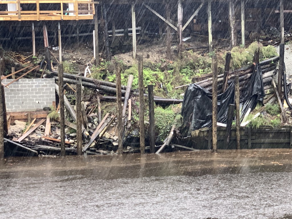
Tropical Storm Eta has the winds swirling and rain coming down at all angles today.
Winds from Eta as she passes near Myrtle Beach, SC
Sadly, multiple deaths from Eta flooding have been reported in the sounding area.
Eta was a lethal tropical storm for North Carolinians
As I travel down this stretch of the ICW, you can watch the storm water as it finds its way from the watershed to the river.
There is a lot of debris floating down the river. I’ve seen everything from a pumpkin float by…
Not sure why my iPhone photo coloring is so off?
… to full trees resting near the channel’s edge.
As I go by pilings sitting on the river’s bank, you can easily imagine these objects floating from the bank as the river rises.
hard rain washing objects into ICW
Rains from Tropical Storm Eta are falling like bullets on glass.
Bullet proof glass
#BigDeckEnergy
I go by this deck and grin.
All the confidence of a man in full control of his lawn …
#BigDeckEnergyFeeling confident Captain 😉
Pronounced Sock-Ass-Tee
As I arrive at the 11 ft high Socastee Swing I am aware that it will not open with sustained winds 25+ mph. The bridge tender is not keen on letting me through but does.
Stock photo from a beautiful day unlike today
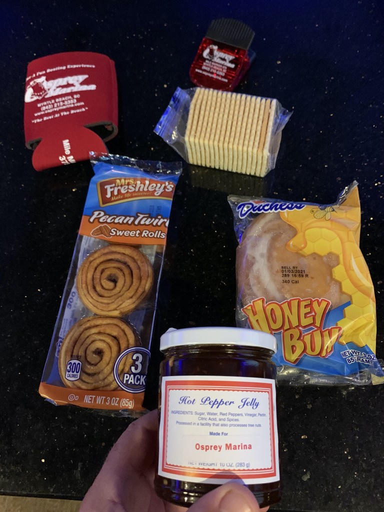
Osprey Marina
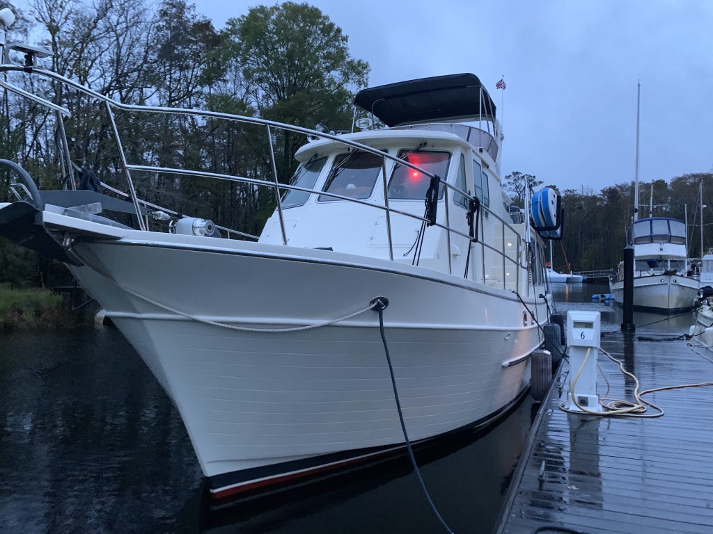
Rather than anchor in the Wacamaw river, I opt to stop at Osprey Marina.
Osprey Marina docks in the rainEta is not damping the mood aboard Simple Life. It is IPA O’clock!
Hot Pepper Jelly
I have stayed here several times before and I waste no time checking in so I can get my Osprey Marina goodie bag that always contains some crackers and yummy hot pepper jelly!
Osprey Marina Goodie bag contains their coveted Hot Pepper JellySignage in the Osprey Marina dock house of the Hot Jelly Ladies
Winter 04 – Leg 011
The eleventh leg of my journey looked something like this…
It was hard to leave St. James Plantation Marina as we were all having so much fun. I did capture a nice video of what I think is a great blue heron on the dock next to our boat.
Great Blue Heron or as I like to say “I ain’t Scared of you Monkey Bird”
As you head south of Southport, NC you pass several Atlantic Ocean inlets. Lockwood Lockwoods Folly inlet is pictured below and we could see the ocean waves as we motored past.
Looking out to Sea Through Lockwoods Folly Inlet
The ICW can be very shallow around these inlets as the strong currents deposit sand and silt creating shoals and shallows that you must stay clear of. I use an iPad app called Aqua Map and pay for the premium service called Aqua Map Master that displays the recent Army Corp of Engineers colorful sounding charts of these tricky locations. The sounding charts are color coded and red is the shallowest with blue being the deepest. Below you can see what it looks like to pick a safe path through the shallows.
Shallotte Inlet USACE Sonar Charts
Shallotte Inlet was next and it too has a colorful sounding chart
03
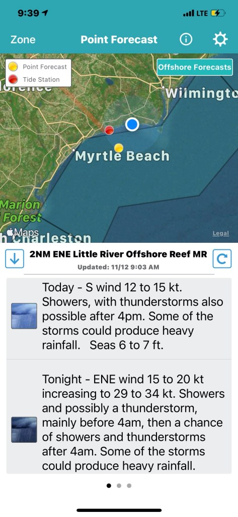
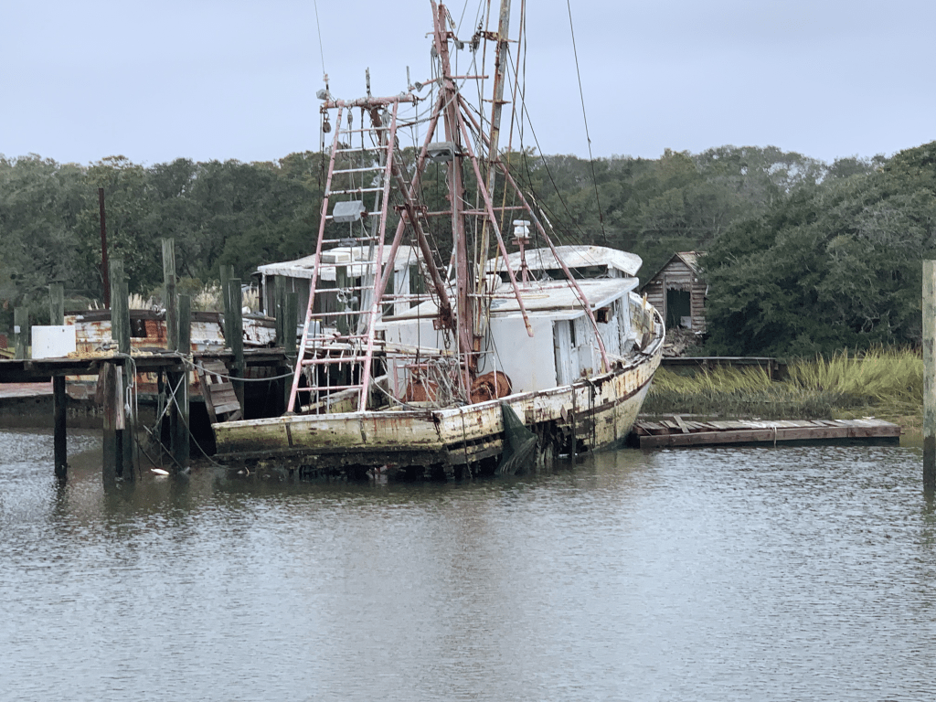
When we got to Little River inlet we passed a commercial boat that has been wasting away on the shore for some time. I’m always amazed that it is still there when I come up in the Spring or down each Fall.
Little River Inlet Sunken Vessel
Along with navigating your way through the shallows you must request several bridge openings. This bridge used to be called the “Captain Poo” swing bridge. I hailed the bridge tender on the VHF and he responded with “Little River” swing bridge. I personally enjoyed hailing “Capt. Poo, Capt. Poo!” over the new name.
Capt. Poo Swing Bridge
Our day underway was overcast and for a brief period it rained. Boating in the rain is not much fun unless you have a warm pilothouse. We were warm and dry while underway and for that I was happy.
Rainy Day in the Pilothouse
There were many beautiful sights to see along the route to Myrtle Beach.
Myrtle Beach Light house
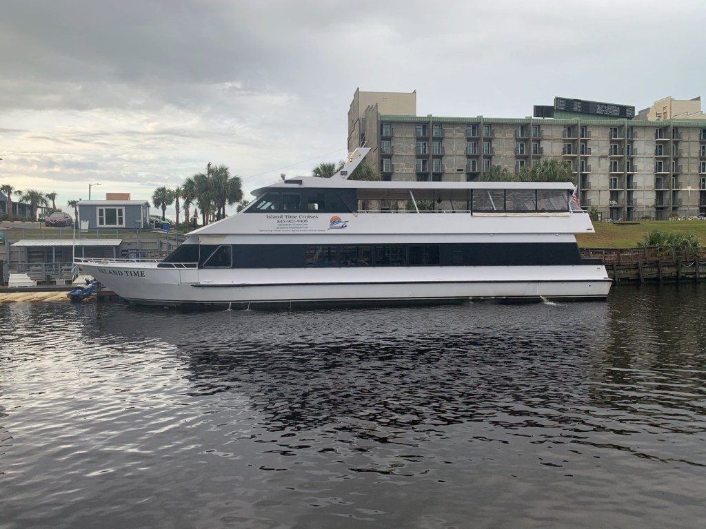
MV Island Time
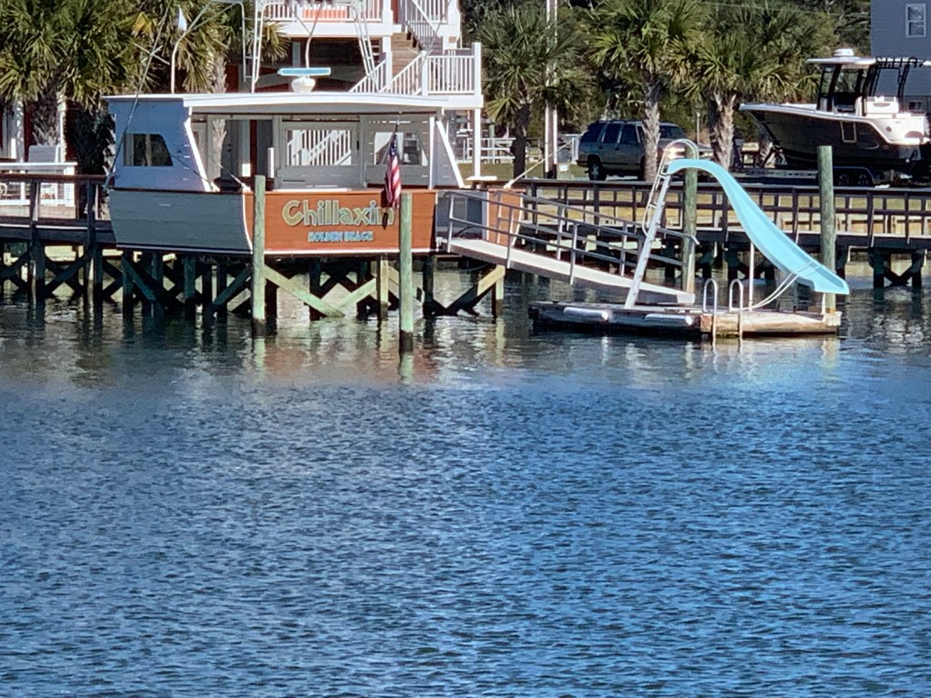
Holden Beach Home
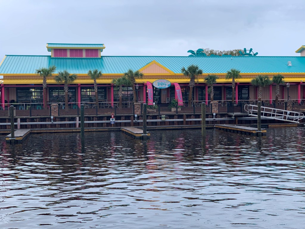
Lu Lu’s Restaurant
We passed this sexy sailboat
This beautiful home appears to have an infinity pool.
Infinity Pool
We had made reservations at Osprey Marina and we were pushing hard to make it there before dark. As we went through the Socastee swing bridge the sun was getting low.
Socastee Swing Bridge
We were now in the Waccamaw River swamp and it can be beautiful as fog and mist light up in the setting sun.
Waccamaw River Swamp
We arrived at Osprey Marina while the sun was still up. We turned down the entrance channel and snapped a few photos of some interesting boats.
Osprey Marina Entrance Channel
One particular catamaran had an etched window that was different.
Troubled Pirates
Soon we were tied up and checked in for the night. I soon discovered that there was no WiFi! NO WIFI!!! Time to put on a movie to entertain the crew. Tonight’s movie …


You must be logged in to post a comment.