Run to Georgetown SC

Before leaving Osprey Marina I figured I ought to get some Simple Life maintenance done.

I pulled back the rug and removed the teak & holly access panel to expose my Cummins 5.9L QSB diesel. You can see the hose dropped down into the engine room so that I can clean the bilge.

Teak & Holly floor covered since new with carpet and pad

Sitting in the engine room doing maintenance was hot so I decided that I would use up any non-IPA beers in the bottom of my fridge.

Those are work Pajamas

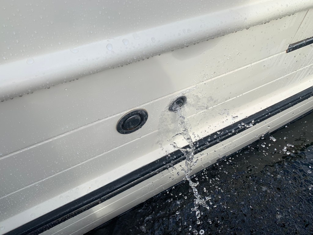
Simple Life carries 340 gallons of potable water. Depending on use, that should last a month but might as well fill the tanks while I’m at the dock. When I fill my water tanks I like to use a portable water filter from Home Depot. I also overfill the tanks so that water is pushed out the breather tube. Any tank that you fill must have a breather to allow the air being replaced to escape and on boats that tube exits on the outside of the boat high enough so that when the boat heals over you don’t have seawater intrusion. Little flying things can attempt to enter the breathers so flushing them with each fill is a good idea even though multiple filters catch anything in the tanks.

Flush out your water tank breather lines

Along with boat maintenance I was upgrading my MacBook Air to Big Sur. If you are a Apple Mac fan you know Apple just announced their new line of Macs that run on their new Apple silicon processors. This is big news for apple and will align their Mac computers with iPhone and iPad which already run Apple silicon. Why is this important? Well for starters iPhone and iPad apps which were written to run on Apple silicon can now be run on Mac computers to make Mac users like me happy that we can use similar apps across the three different platforms.

Before taking off I sat down to plot my next leg of the trip. I generally plan for 50NM each day. That is a very conservative estimate as I often run 80NM / day or more.

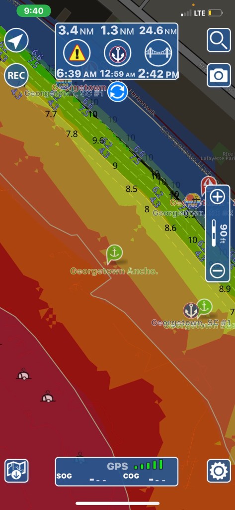
I decide to anchor in Georgetown, SC. I have always wanted to visit Georgetown. A quick check of the harbor shows several anchorages in very shallow water.

Red is a no-go and I stay out of orange areas if I can help it.

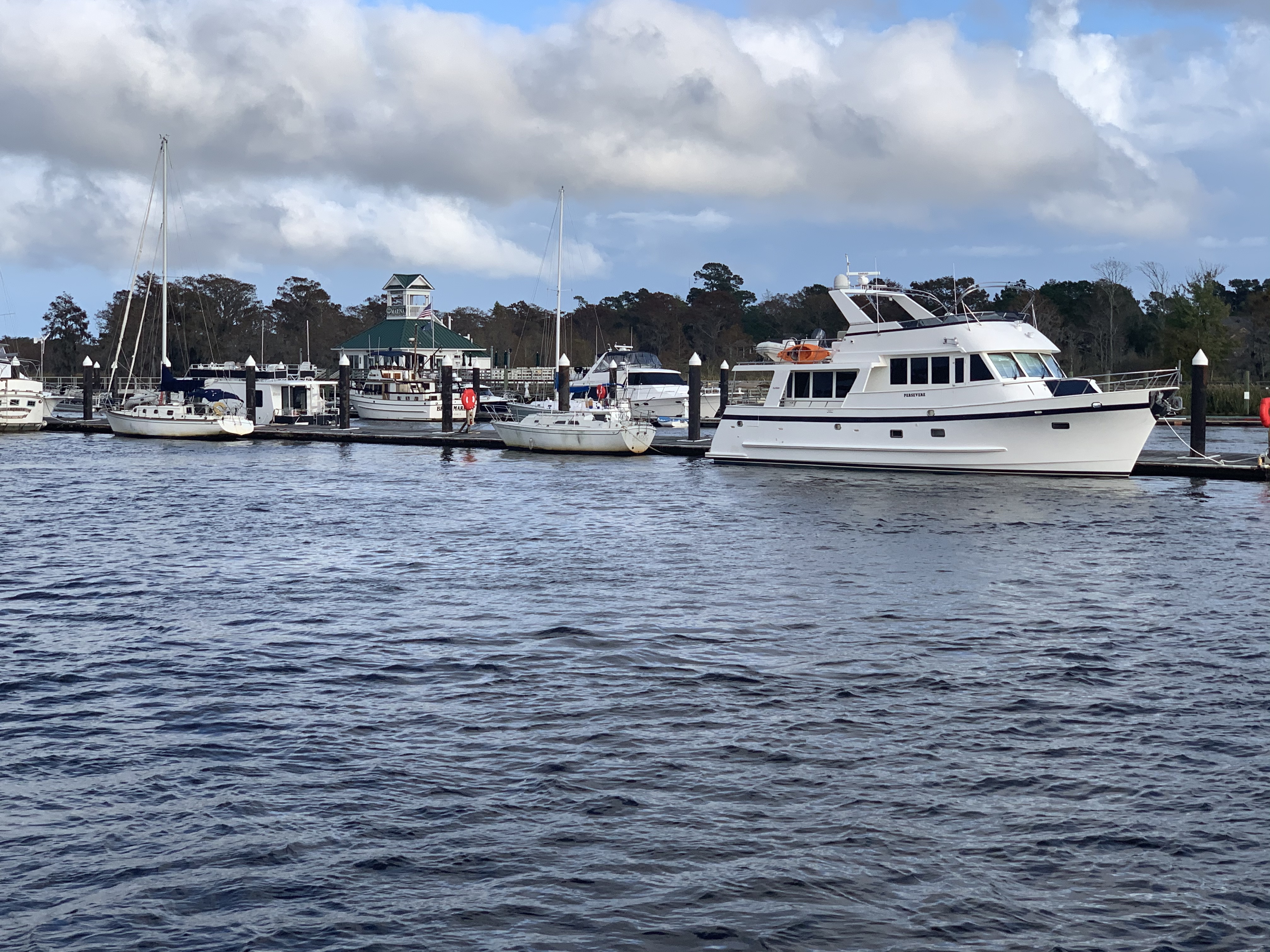
I untie my lines, jump aboard and put her in gear as I say my goodbye to Osprey Marina. Traveling south down the Waccamaw River, I pass marinas as well as people just pulling up to the banks to party.

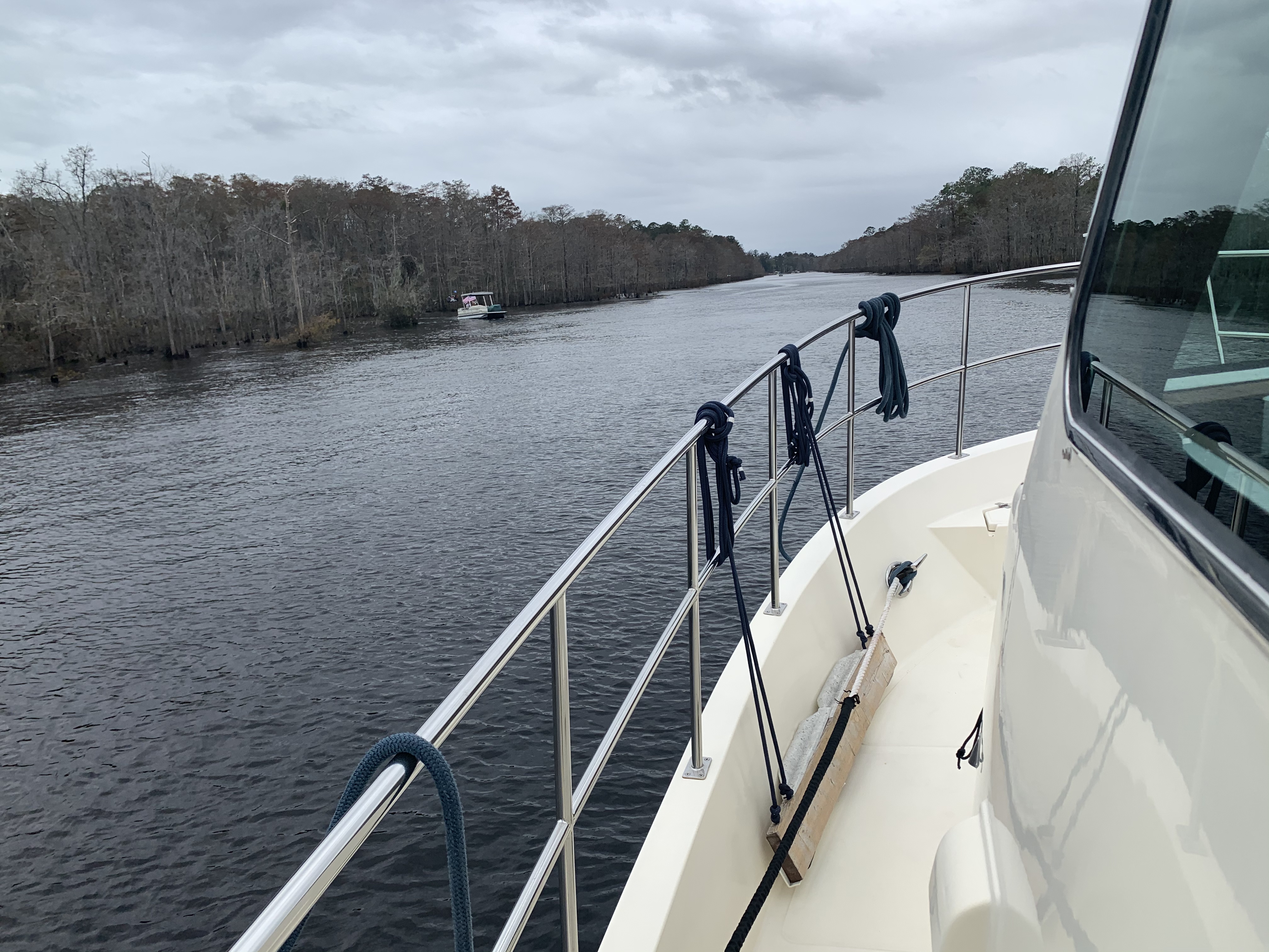
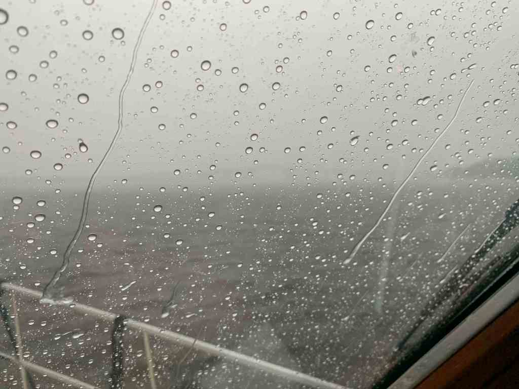
The Waccamaw River is deep and the current (seen pushing over the no wake buoy above) is pushing me along at 7.8 knots. It’s raining but I enjoying the day in the pilothouse.

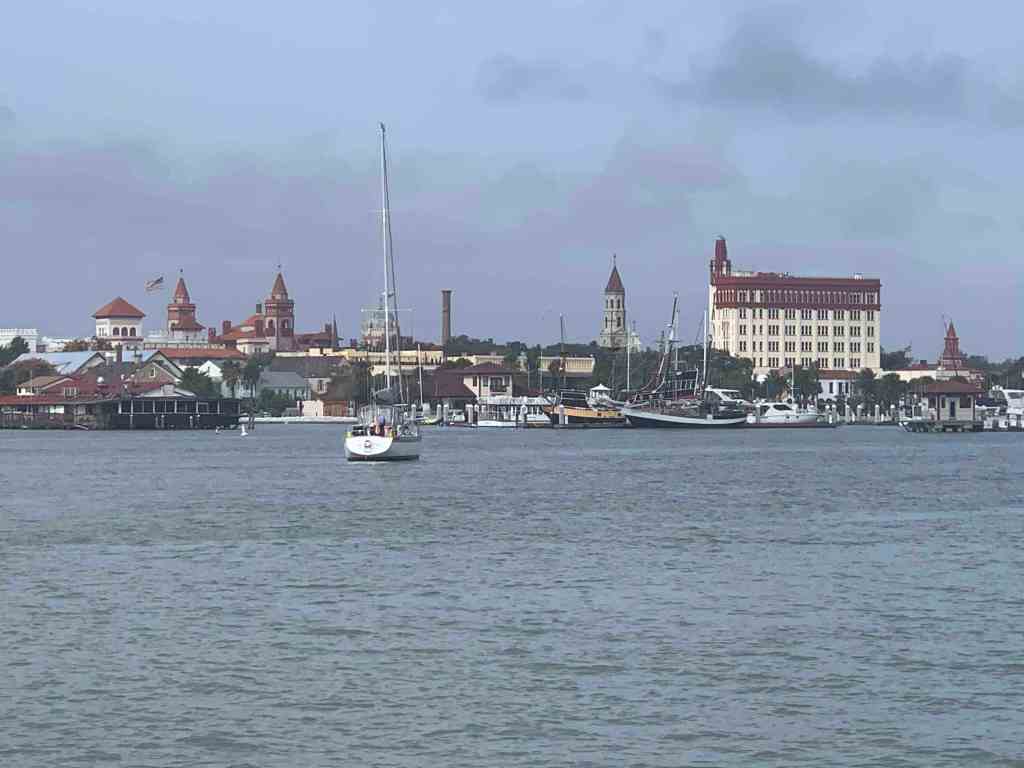
As I pass under Ocean Highway Bridge the entrance to Georgetown will be on my starboard side.

Near Georgetown, South Carolina

You can see the position of the sun in the video above and there is still more time in the day. I start thinking… Maybe I’ll push on and find an anchorage further south down the ICW?

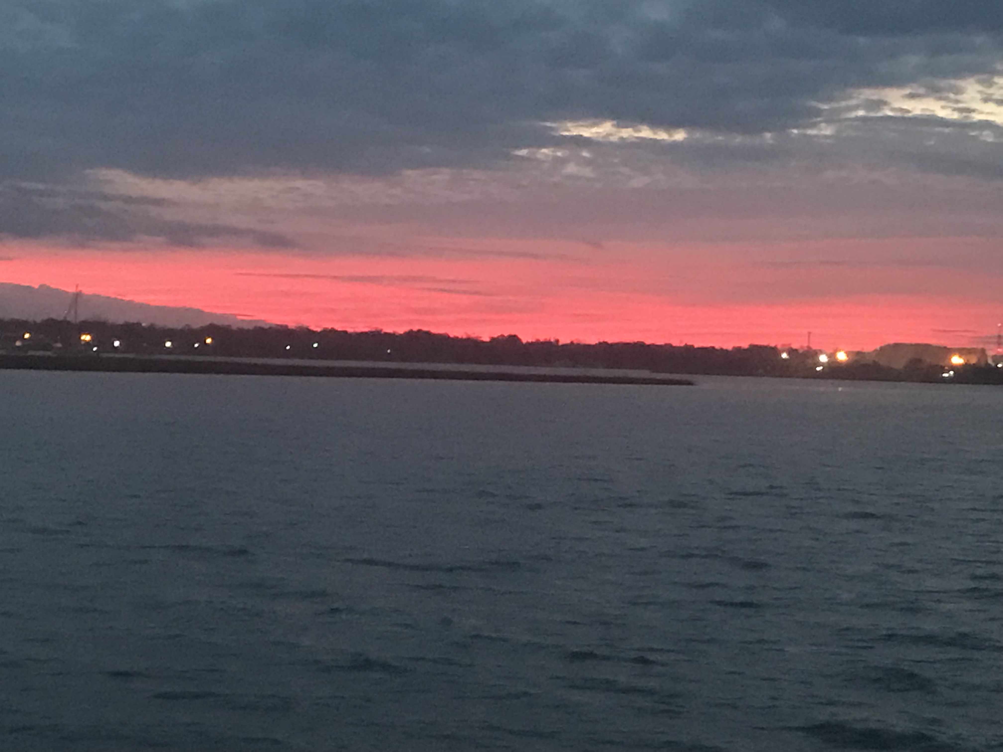
I push on through Winyah Bay until the sun sets.

Sunset in Winyah Bay, South Carolina

I settle on an anchorage just before the ICW takes a 90 degree turn leaving Winyah Bay. The anchorage is protected by a small, low island called Middle Ground and ithas plenty of water and swing room.

Good Anchorage

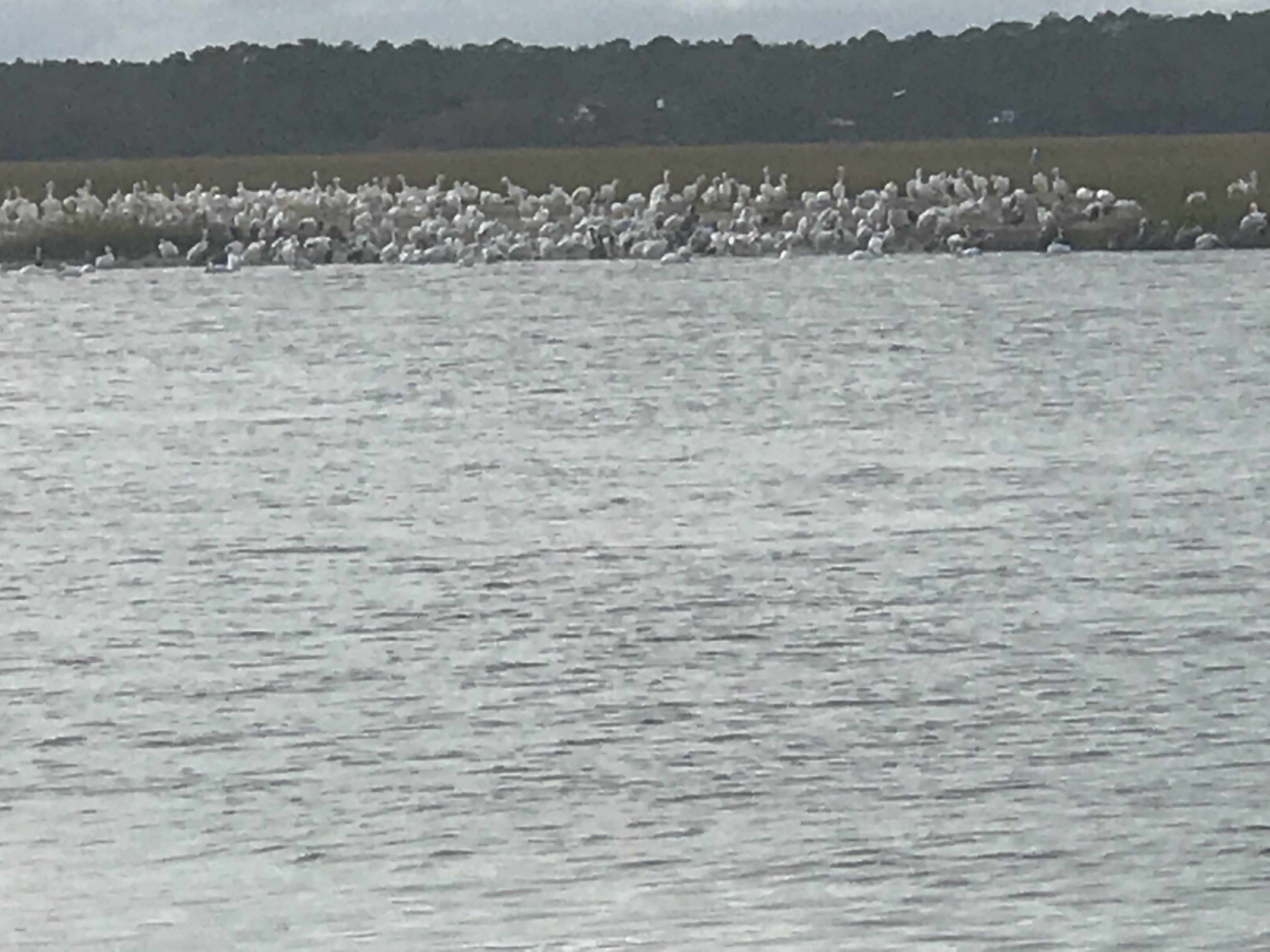
This anchorage is large for the ICW and several sailboats have already dropped anchor.

Sailboats anchored off my bow

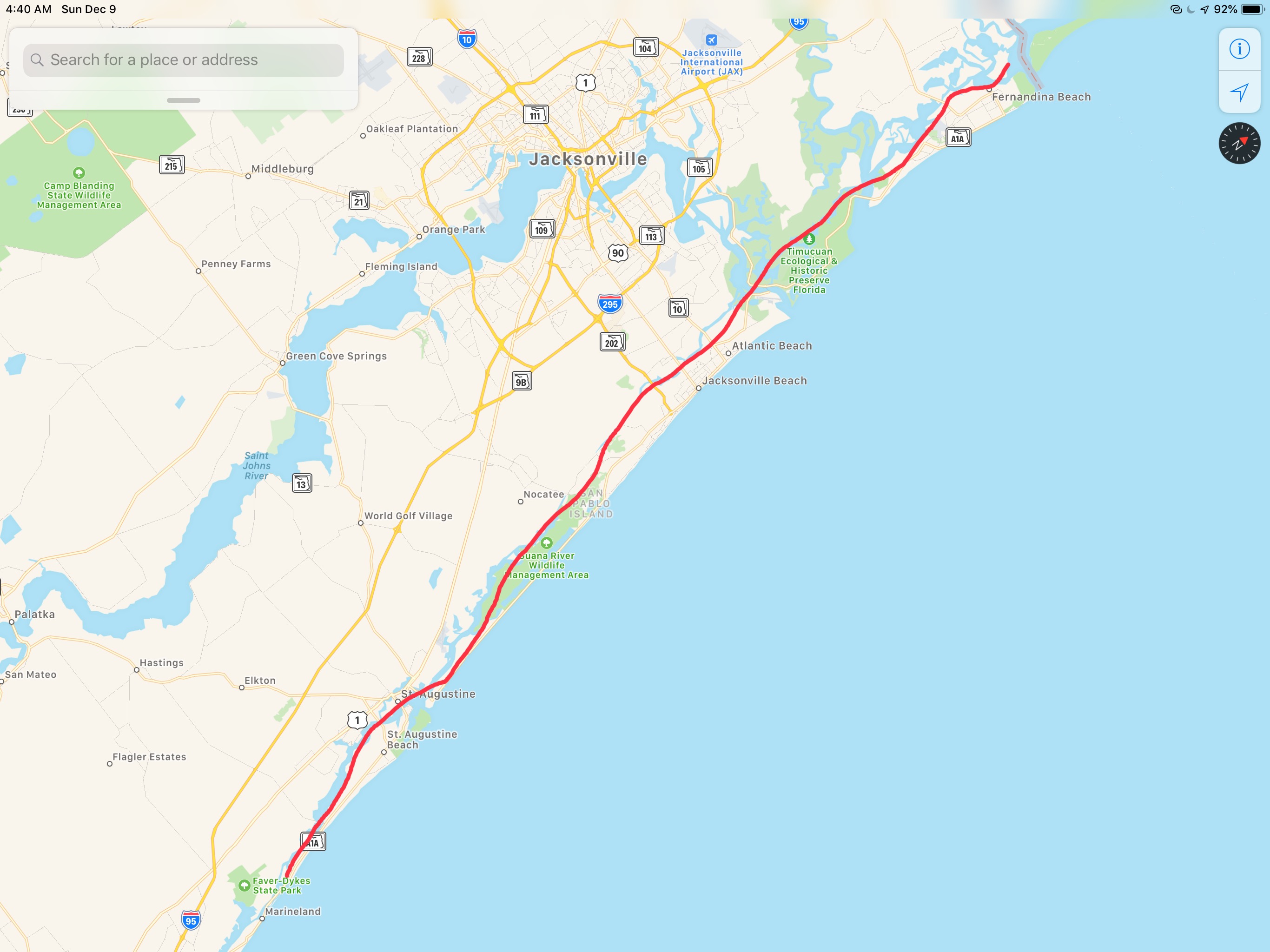
My plan was to anchor here for the night before heading on to Charleston, South Carolina. However, plans are made to be broken. I instead do a quick check of the weather offshore and decide to make a 36 hour run offshore to St. Augustine, FL. This long voyage will skip over the rest of South Carolina as well as Georgia and the very northern part of Florida. Georgia passed an anchoring law last year with draconian rules about where you can anchor. Some people just don’t like boats anchoring anywhere near their waterfront homes. Skipping Georgia has the side-effect of avoiding all their confusing anchoring laws.

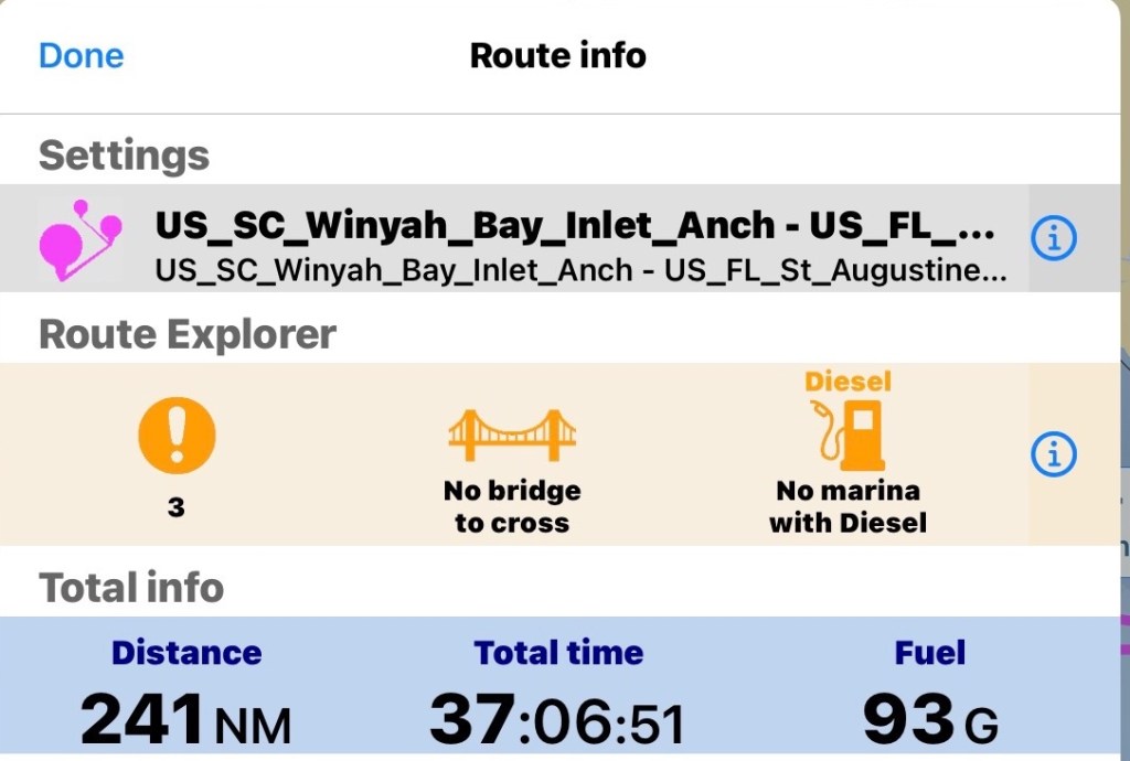
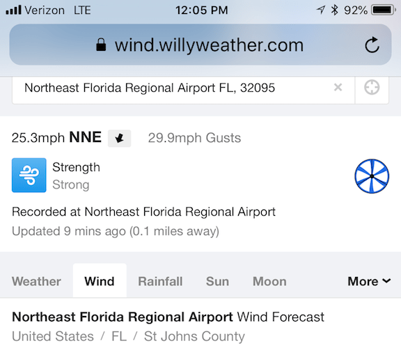
I prepare my route for the next day. I add a lay line run straight from Winyah Bay, SC to St. Augustine, FL. I notice the sea is expected to be 3-4′ waves and increasing to 5′ over time. I add a second direct route to Saint Mary’s Inlet right at the GA/FL line. If it’s nasty I’ll know it pretty quickly and I’ll divert to this shorter route. I also plot out routes going in each navigable inlet as premade bailout routes incase anything goes wrong. Doing long solo offshore runs you need to be prepared incase I injure myself underway and need to get back inland quick.

St. Mary’s Inlet route breaks off around even with Charleston, SC

The math for the St. Augustine’s run looks like this.

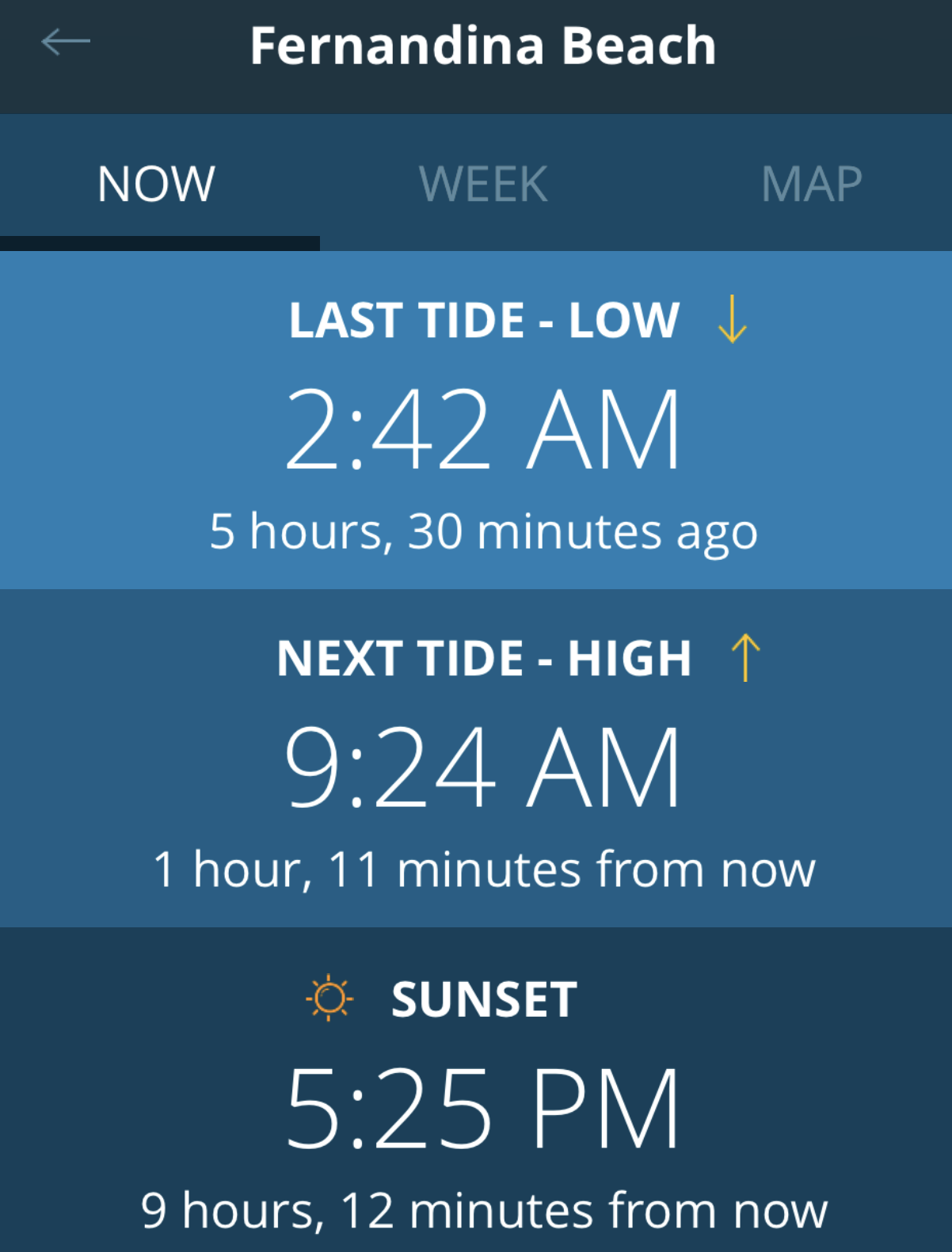
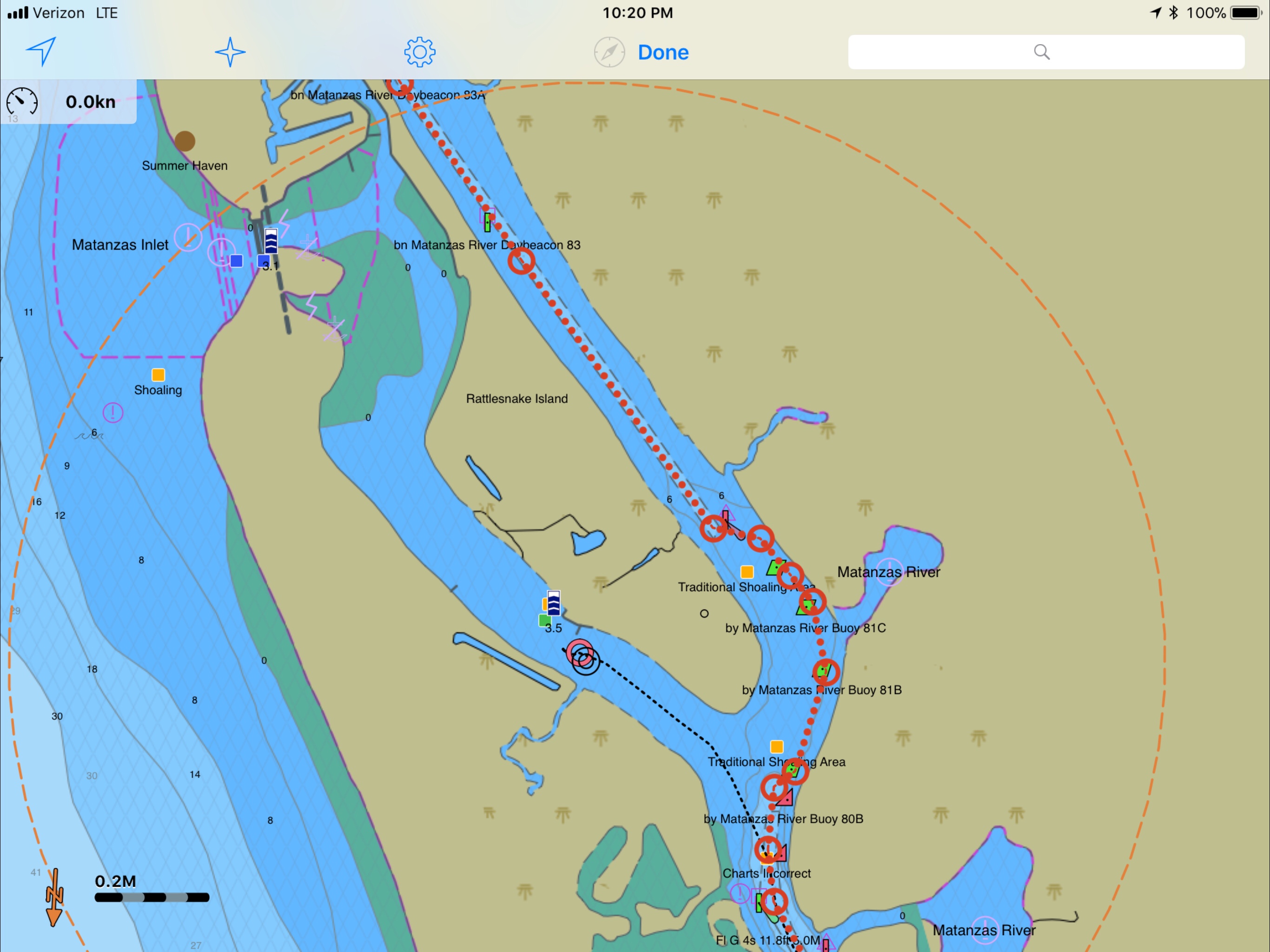
I do a check of the currents leaving the Winyah Bay Inlet and find that if I don’t want to fight the 7:14AM Max flood current getting out I better leave soon after the 4:38AM start to flood.

We just had a new moon tonight so navigating tomorrow morning, you won’t get any help from the moon.

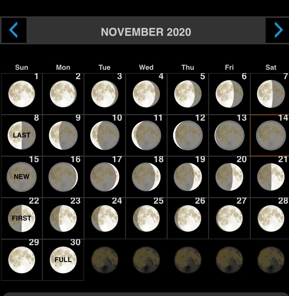
I settle on a 5AM weigh anchor time and decide to navigating the inlet in the dark is better than waiting till first light and fighting the current to get out.

I’ll be out of the inlet before first light

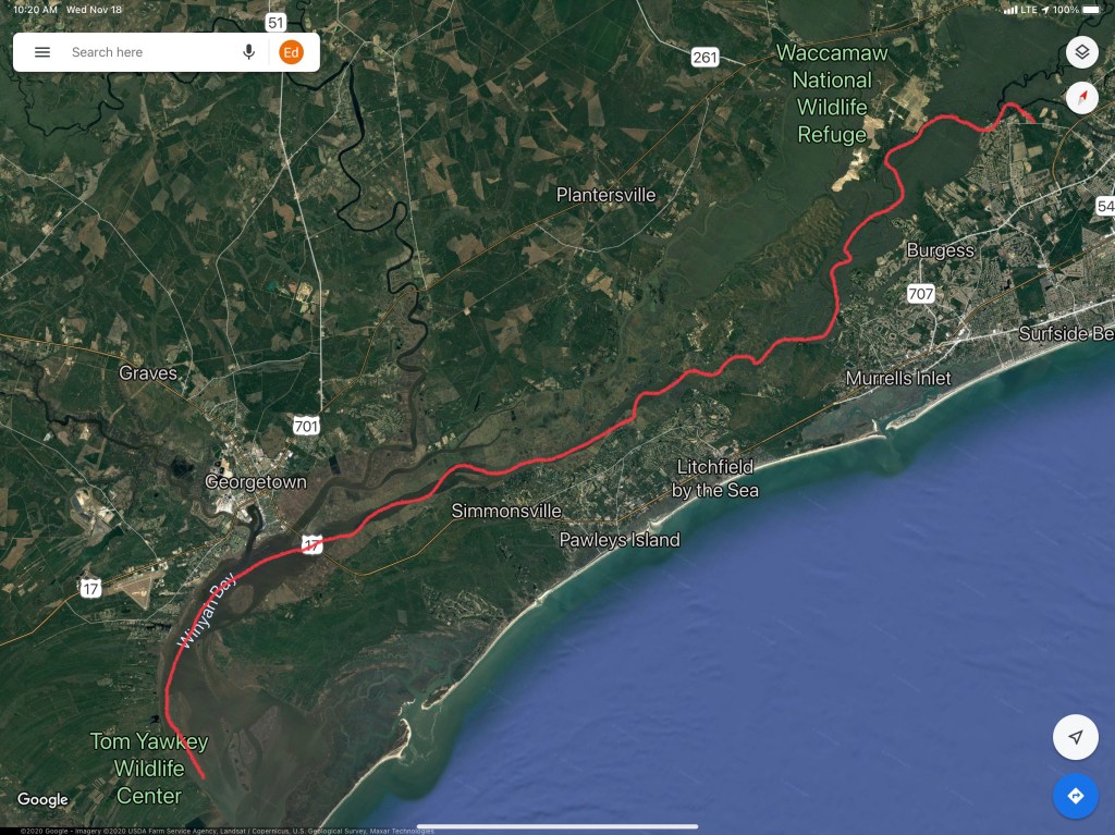
This leg of the journey looked something like this…

W04L012 – Run to Georgetown SC

Memorial Bridge Anchorage

The trip from my Pine Island which is just north of St. Augustine, FL to Daytona, FL looked something like this.

W03L019 Leg

As I came into St. Augustine there were surfers who were catching some pretty good waves in the St. Augustine inlet. I tried to video the surfers but with the current on my stern, I was passing a bit too fast to capture it.

Next I had to hail the famous Bridge of Lions in St. Augustine on VHF CH#09 to let them know I would be waiting on their next opening.

The Bridge of Lions bridge tender let me know that only half of the bridge would be opening. This meant that with a strong current and only one side of the bridge opening, I’d have to hail any north-bound vessels and arrange which boats go through the narrow opening first. The rarely known convention is that the vessels with the current on their stern go through first.

While passing through St. Augustine I had a nice view of the city and some boats.

Just south of Flagler Beach, FL I came across this amphibious excavator driving on the water.

Amphibious Excavator on the ICW

The weather was warm but showed the next few days were going to be cold.

Warm today, cold next few days

I was coming to Daytona, FL to hopefully meet up with an old friend from high school as well as pickup a childhood friend who was flying into Daytona airport to come aboard and travel south with me for a week or more. I chose this anchorage (located just south of the closest ICW bridge to the airport, Memorial Bridge) because it is only 5 miles or so from Daytona International Airport.

The weather when I awoke on anchor was cold and rainy.

Rainy View from the Pilothouse

Storms were moving across the area.

Storms passing through

But my anchor was holding fast. This screen capture of my Anchor alarm app shows the boats motion as I swing back and forth with the wind & current on anchor.

Screen Capture of my Anchor! iPhone App. The colored lines are my path as I swing about on anchor.

While I sat on anchor I was treated to the woman’s crew team rowing by for most of the day. I’m not sure if this woman’s crew were affiliated with Embry-Riddle Aeronautical University or the Halifax Rowing Association? Update: After actually watching the video and seeing the “H” on their oars… I’m going with Halifax Rowing Association (grin).

Woman’s Crew Team

Now off to find my friend Jay…

Fort Matanzas

We had a peaceful night on anchor in the Amelia River. We awoke early before the sunrise.

6:50AM Anchored on the Amelia River

Somehow we did not get moving till 8AM. We have a thing about trying to cover as many miles as we can each day and that means you need to use all the daylight there is on the ICW. Not so much this morning. The good news was that we were leaving on a high tide so little worry of running into a shoal with the added 5′ of tide.

Two tugs raced past us and I was reminded that you can tell when a full displacement boat is running at near ‘Hull Speed‘ by simply looking at the bow wake length vs the boat length. You can see the smaller tug’s bow wake dips and then crests almost at the stern of the tug. They were running hard and burning fuel. They must be in a hurry to get to the next job cuz running fast = diesel = $ = expenses for them. 

Where the ICW crosses the St. Johns River in Jacksonville we always see large ships either underway or being repaired in the boatyards dotting the shore. 

Last year we passed this sailboat on a small island and it still looks out of place. How’d it get up on the island? I can only assume a barge with a crane placed it there to keep it out of the way of navigation but why leave it there?

Derelict Sailboat on stands on small island

We passed this other sailboat that was using their dingy to reset their anchor. Their sailboat was too close to the ICW channel.

There are some beautiful homes along the banks and this was just one of them.

Home Along the ICW

As we approached this bridge in Isle of Palms, FL we noticed 3 16YOish boys tied their boat to the bridge and were fishing beneath the support. This is a NO-NO in the boating world. It’s a federal law that you cannot tie a boat to any navigational buoy or bridge’s fender system (the boards that protect the bridge supports from boats as they pass through the center span).  

Boys tied to bridge

As a boater you must treat bridges with special attention. When you pass under a bridge you must do so at no wake speed (about 6.4 knots for MV Simple Life). For the boats hanging out under bridges (usually fishing) you must not block the marked channel through the center span. You must also be careful as boats passing through the fender boards may not see you if you are hidden by the boards or bridge supports.  Also after 9/11/2001 Homeland Security legally restricted areas under certain bridges and it’s a felony if you break that law. Individual states may have laws about simply being near any bridge in their state.

Florida Statute 327.44 refers to interference with navigation and states that anchoring underneath a bridge or adjacent to heavily traveled channels constitutes interference if unreasonable under the prevailing circumstances. There’s a lot of gray area here and not everyone has the same understanding of “unreasonable interference,” but you likely won’t get in trouble for anchoring under a bridge if you are well out of the way.

FWC (Fish & Wildlife Conservation) officers may stop you if you attempt to anchor under the bridge. It should be noted that the area around a bridge is more likely to have un underwater cable that either brings power to a lift or swing bridge or simply crosses over to the island. You don’t want to hook your anchor on these power cables. 

Aside from all the bridge rules of boating, I was more interested in the expansion joint on this bridge. 

Bridge Expansion

We pass many engineering structures like bridges and this pier. I’m sure the first piers were only for boats to dock but soon “pleasure piers” emerged that were simply for people to stroll out onto or fish off.

I guess they want boats to know the name of this pier?

We find it interesting that “birds of a feather flock together”. It’s like all these white pelicans said … “Hey, why don’t we all me on the banks of the ICW over where Jimmy found that big pile or old crab shells tomorrow?”.  They clearly enjoy each other’s company. 

White Pelicans crowded together

Soon we were waiting for Saint Augustine’s ‘Bridge of Lions‘ to open (every 30 minute openings). In line in front of us was a boat called ‘Yellow Bird” from Cape Cod.

MV Yellow Bird – Cape Cod @Bridge of the Lions St Augustine FL

We attempted to get a mooring ball in  Saint Augustines FL but alas the City Marina only had balls for boats with drafts under 3′. I hear it’s a fun town but our plan is to continue on tonight and find a quiet place to anchor. As the sun was setting we settled on anchoring just off Fort Matanzas. Fort Matanzas was built by the Spanish in 1742 to guard Matanzas Inlet. 

Our Sunset @Fort Matanzas did not disappoint 

Our leg today looked something like this…

W02L022 – Ferdandina Beach FL – Fort Matanzas FL

Cumberland Sound Anchorage

As we weighed anchor in Robinson’s Creek you could feel the power of the wind. The airport wind speed last showed a 30 MPH gust.

30 mph Wind Gusts at NE FL Regional Airport
25 MPH Winds with 30 MPH Gusts as we passed NE Florida Regional Airport


Even with the strong winds a pair of US Custom agent boats zoomed by, unaffected.

Our route would look something like this:

Route 4 - Robinson Creek - Cumberland Sound
Our Route from an anchorage in St Augustine to Cumberland Island Anchorage

We would avoid many shoals:

South Sapelo River
Shoal near South Sapelo River.

We would cross over the St. John River in Jacksonville, FL and see sights such as this Navy ship in dry dock. What a narrow beam and sharp bow these attack vessels have.

St Johns River Battleship
Navy Ship in Dry Dock

I had always wondered what a trawler would look like with a wind generator mounted on the fly deck and I just have to say I can’t imagine ever doing this..

Trawler 3 Wind Generators
A trawler with 3 Wind Generators on the Flydeck

The free overnight dock in Jacksonville had a spot open but we were determined to use what we had left of the light and cover more ground. Our plan was to cross over the Savannah River and into GA.

Once in the Savannah River we saw that many of the river banks had been built up possibly for storm surge.

Savannah River Tree
Lone Tree standing proud on the banks of the Savannah River

As you approach Cumberland Island there is a heavy Navy presence in the area. We passed these two big Navy ships in port.

Cumberland Island Navy
Navy Ships near Cumberland Island

We read the writeup on the Cumberland Island Anchorage.

Cumberland Sound
AC Cumberland Sound Anchorage writeup

We chose this anchorage because it offered a lee in the face of strong winds.

Cumberland Sound Anchorage
Our Anchor spot in Cumberland Sound

The anchorage was quite busy and the only spot we found was one tucked between two other anchored boats. I had to anchor in an area that had oyster shells and mud. Not a strong seabed for anchoring. The anchored dragged a bit as we set it at 700 RPM. I backed off a little on the throttle and this would have to do for the night. I was tired and needed sleep.

I set the anchor alarm app on my phone and drifted off to sleep.

Anchor Alarm
Anchor Alarm App plays warning sounds if you drag outside of the red circle


Robinson Creek Anchorage

Making our way North our next anchorage, a little creek called Robinson Creek. This spot lies just North of Comanche Cove Marina in St. Augustine, FL. We stopped at Camanchee Cove for a few days on the way down.

Robinson Creek
Robinson Creek Anchorage

Our route would look something like this.

Route 3 Oak Hill - Robinson Creek
Route from Oak Hill to Robinson Creek

On our way there we passed through Daytona Beach and the airport had lots of planes flying overhead.


There were other hazards to watch for like this sunken sailboat. Just look for the mast 😉

Sunken Sailboat Daytona
Sunken Sailboat near Daytona Beach

As we traveled I trawled a fishing line from outside the pilothouse door. I heard the drag on my reel start zzz-zing and reeled in a what I would later identify as a “Ladyfish”. I quick fish app check and this is an unregulated species with poor edibility.

in New Smyrna Beach we had to pass under a few low bridges.  Our 22’ air draft it made for a tight squeeze. Luckily the bridge is a bit taller in the middle than what is reflected by the height board.

New Smyrna N Causeway Bridge_7968
New Smyrna North Causeway Bridge on the ICW


As we approached a bend in the ICW we saw two boats blocking our path to the North. One looks like they have thrown out an anchor to stop from getting pushed further ashore or a possible kedging off attempt. The other was in the process of being pulled off by TowBoatUS. We contacted the Towboat Captain on VHF and treaded water for about 20 minutes until the first boat was pulled clear and we could continue. The trick needed to pass was to hug the reds as close as 10′ abeam. Seems odd that the deeper water would be on the inside of the bend but was where you needed to be. This is location is right near Fort Matanzas South of St. Augustine, FL

The song playing in the pilothouse is “Devil’s Dance Floor” by Flogging Molly. A great Celtic band out of LA.


Every captain knows when you traverse the ICW, the shallow channel depths mean that you could run aground if you drift out of the channel. For this reason oncoming boats must stay “Right of Center”. This fellow captain seemed oblivious to that rule judging by the wave he gave after forcing us out of the channel. We were riding the right edge of the channel and had no choice but to either hold our ground and use sound signals (1 short blast for a 1-whistle pass – port to port) or simply move over. If you don’t know to stay right of center you wont know your sound signals either 😉

As we approached St. Augustine we saw a large trawler aground.

Trawler Aground_8030
Large trawler aground just South of St Augustine, FL

We passed the magnificent schooner Freedom

Freedom

The night ended with a warm orange-pink sunset.

Robinson Creek_Sunset
Sunset at anchor in Robinson Creek

St. Augustine, FL

Well, the no name island anchorage in Jacksonville, FL turned out to be very peaceful. Thankfully the strong current of the St. James River was not an issue behind the island.

We left that peaceful anchorage and retraced our path back over the 4′ bank that was not a problem this time due to the high tide that we left on.

As we made our way back down the St. James River we were reminded of all the commercial shipping that lined the river banks.

Our trip from Jacksonville to St. Augustine looked something like this.

As we departed the St. James River and got back onto the ICW we saw a ship in dry dock that had it’s bridge tower staged and shrink wrapped. It looked a lot like the navy vessels that were being worked on in Norfolk, VA.

A bit further down the ICW and it was back to beautiful homes lining the river banks.

We loved that someone put a festive scarf on their T-Rex. Who has a T-Rex in their backyard?

After a short trip down the ICW we came to Camachee Cove Yacht Harbor. A great little marina along the ICW.

We had reservations at the marina but when I hailed them on the VHF radio the let us know that we would have to anchor for an hour and wait for the tide to come in a bit before we could enter the marina. The entrance channel did not have enough water for our 5′ draft due the the tides and the recent West winds. When the wind blows from the West it pushes all the water in the ICW out of the inlets and back into the Atlantic Ocean. We decided that after 5 nights being on anchor we would spend the next two nights in a marina. We waisted no time and found a great little restaurant that was within walking distance called the Kingfish Grill. They had a great shrimp & scallop Alla vodka for me and an angus burger for Kelly. Below is the Kingfish Grill’s outdoor garden that was lit up for the holidays.

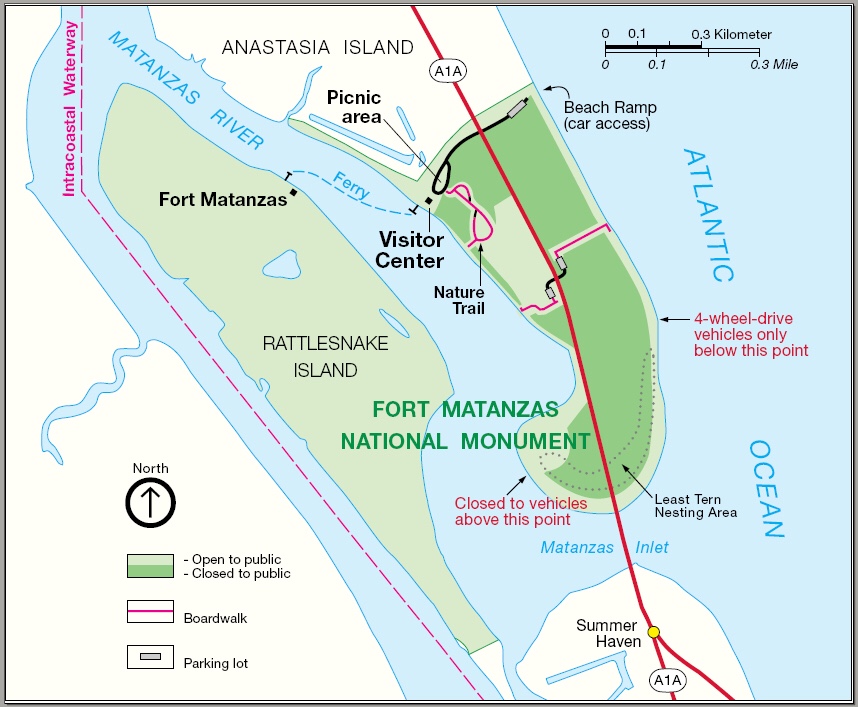
The next morning we re-provisioned the boat using a grocery delivery service. Kelly used her iPhone to place her order and set the delivery time the night before. We awoke to texts from our personal shopper texting us that she was on her way to the marina and and she would be the “girl in the gray Toyota”. After re-provisioning we spent the day taking on some more water and while Kelly cleaned the inside of the boat, I washed the outside. It was 80 something degrees out and seemed odd as Christmas is just a few days away. The next morning we shoved off and had no sooner started South down the ICW and we ran into a restricted bascule bridge and had to anchor for 45 minutes while we waited for it’s 12:30PM opening. Along the river bank you could see the fortress called
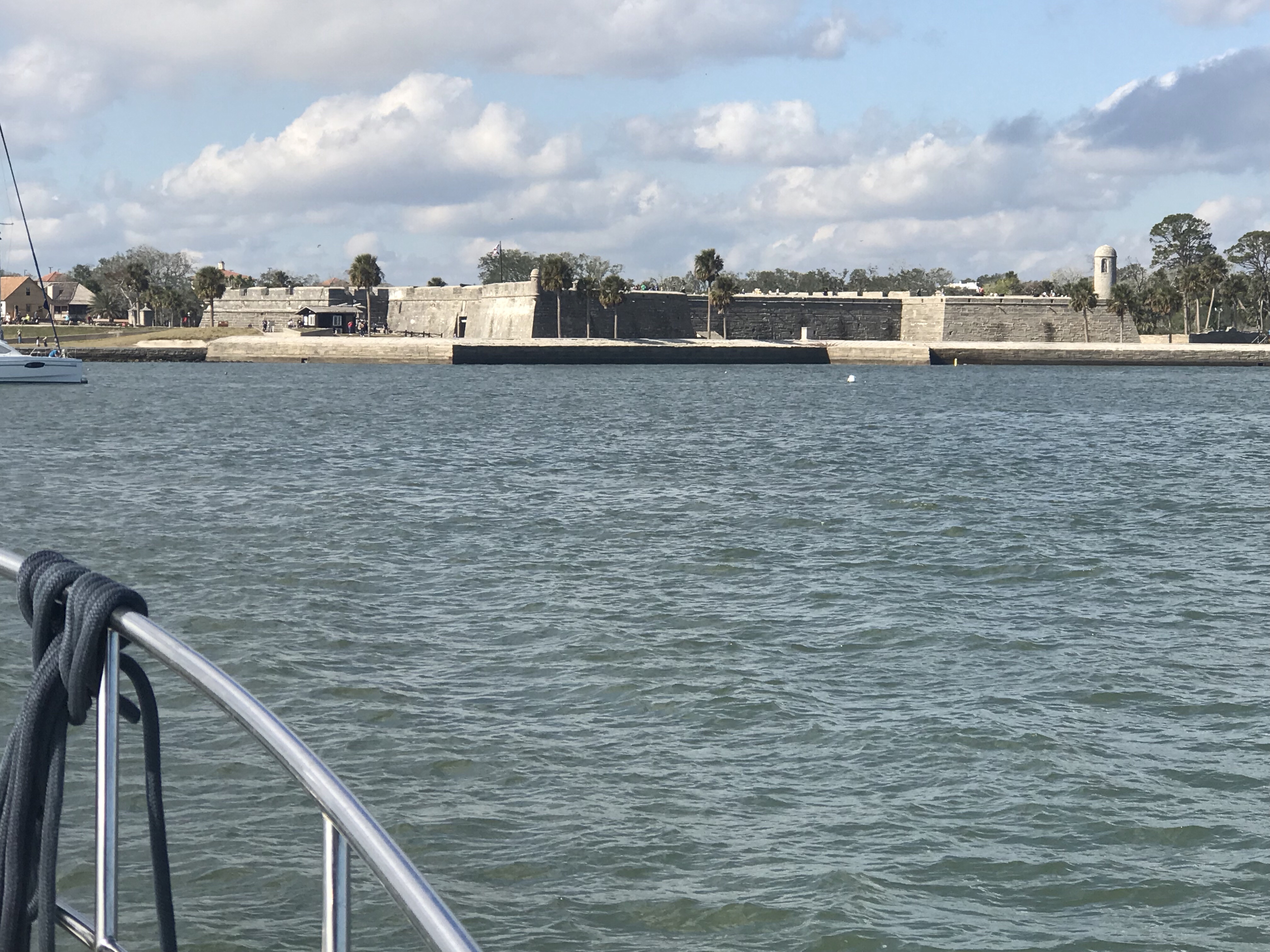
 Castillo De San Marco I snapped the picture below.

Below is a picture of a scenic tour boat that passed with it’s fenders permanently hung off their port side. Their pilothouse looked more like a gazebo to us.

When the bridge opened we were again making way and passing what appeared to us as a collection of derelict boats anchored along the river. The boat below appeared to have someone on board due to the attached dinghy. I wonder how the state handles these anchored boats?

Eventually we made it to a nice little anchorage near the Atlantic Ocean inlet known as Matanzas Inlet.

There is a strong current in here with a rocky bottom so we let out 40 meters of chain rode and settled in for the night.

We anchored right in front of Fort Matanzas shown below.

Tomorrow it’s back down the ICW and hopefully we’ll be anchored somewhere in Daytona Beach.