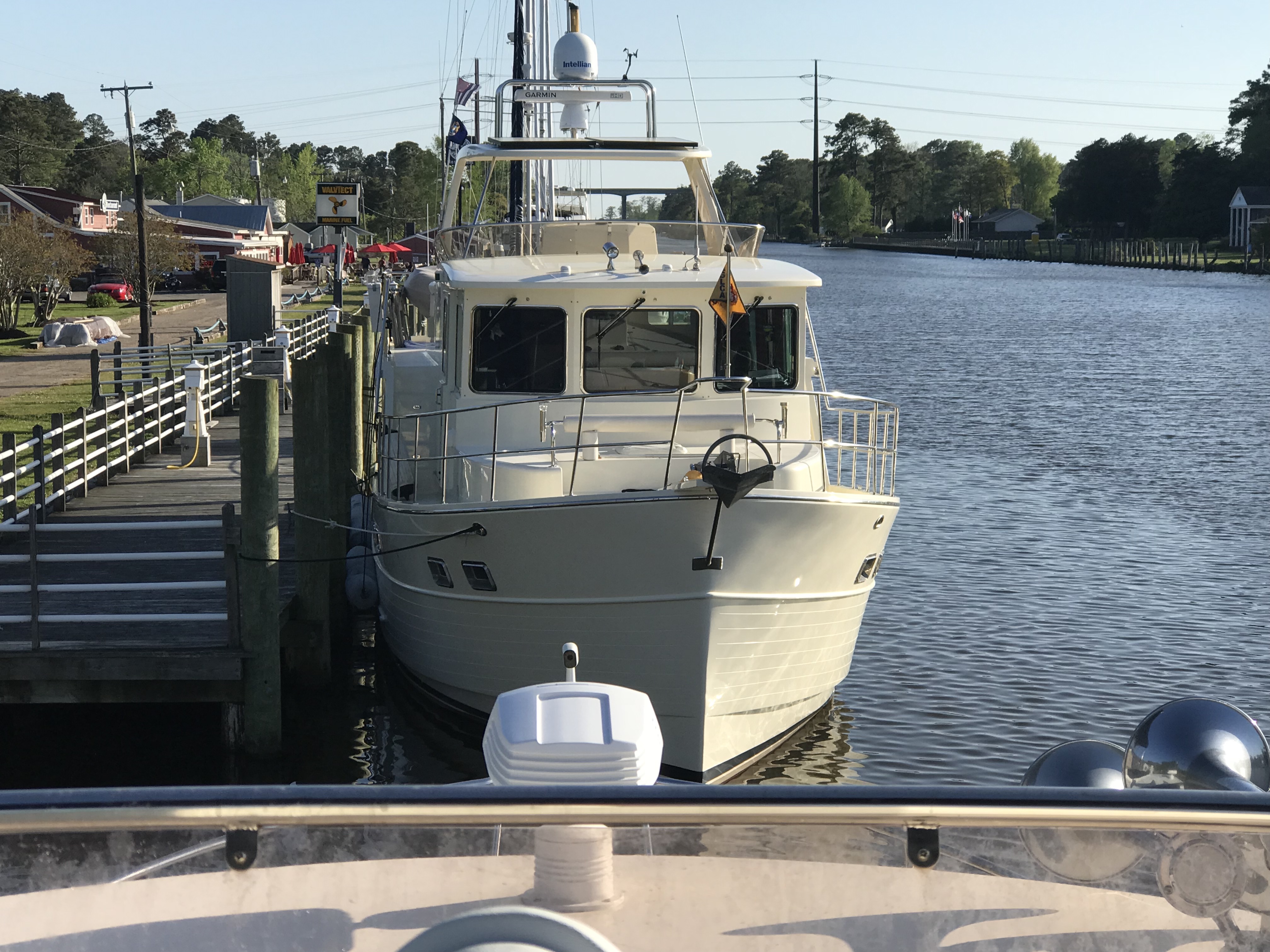
We opt’d for a late 11AM departure from Beaufort, SC. When we went to leave the current was pushing us so hard against the dock that our bow & stern thrusters were not able to move us away from the dock. A fellow boater on SV Bay Dreaming came over and held our spring line so I could motor the stern off the dock and then back into the current. Amazing how strong the current can be in this area with 7-8′ tides.
Soon we were at the Southern tip of Paris Island.
Our friends Ann & Todd’s son Conner is there going through boot camp as we pass. We are reminded by the sounds of freedom (Jets screaming overhead).
Semper Fi
My brother just let me know that yesterday a guy caught a 17′, 3500lb. great white shark off Hilton Head Island.
17′ 3,500 lb Great White Shark Caught off Hilton Head Island on 12/4/18
Today’s trip was short and we only passed a few sights pictured below
Soon we were dropping anchor in the 20 kts winds and it surprised me when after lining up bow into the wind we quickly spun around in the strong current with our stern facing the wind.
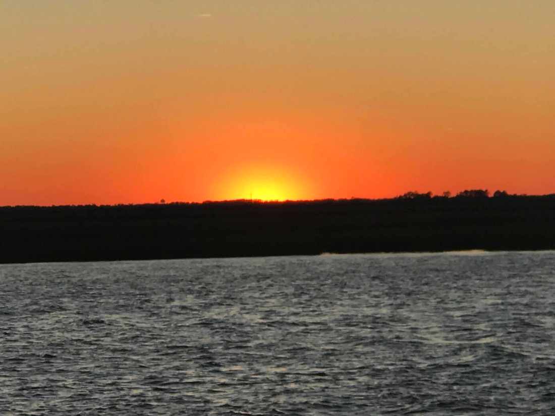
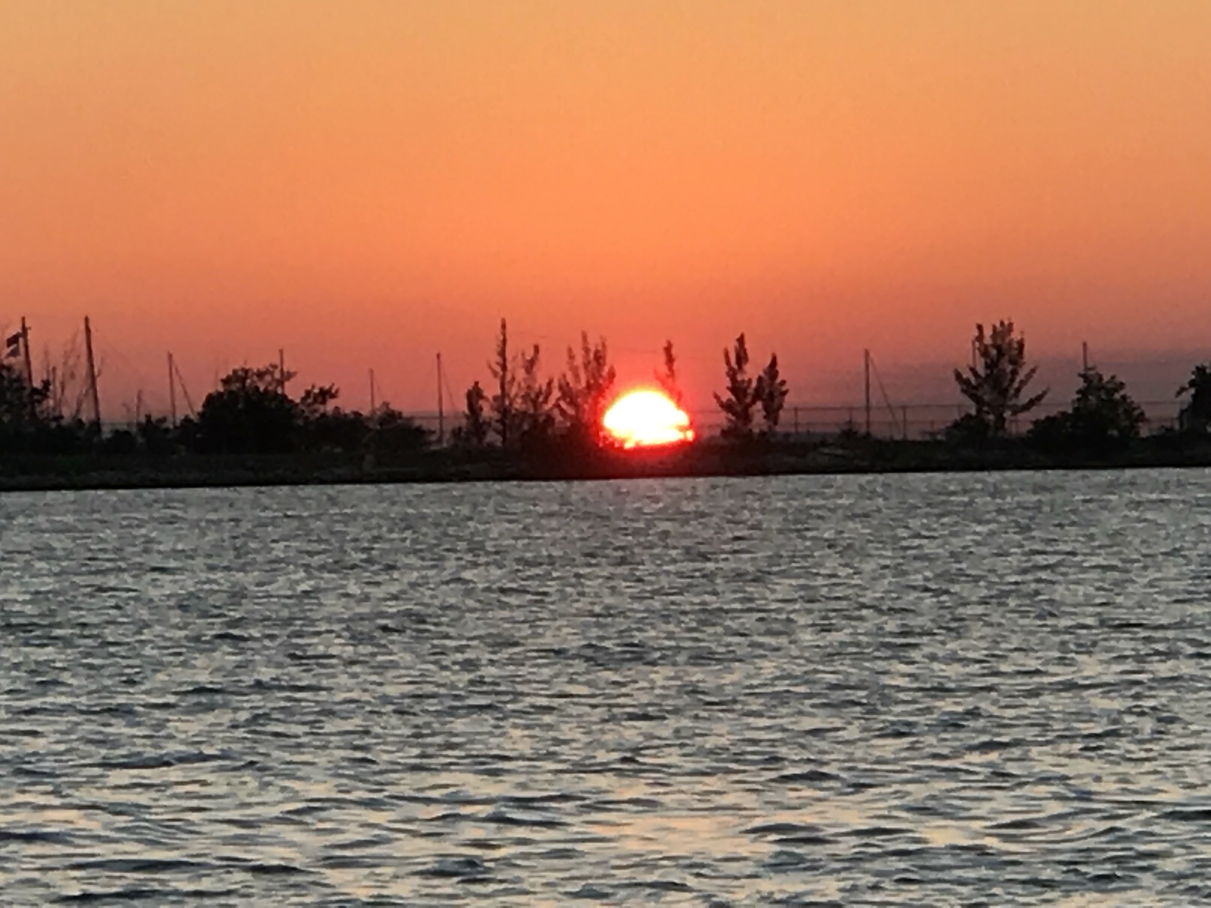
The sunset’s here in the lowlands of South Carolina are amazing.
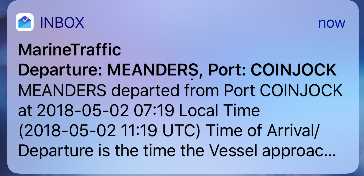
Before leaving Coinjock Marina, we received an email alert that MV Meanders had left Port: Coinjock. MV Meanders had been docked bow to bow with us. They had stealthily slipped away while we were making coffee.
Marinetraffic.com email alert for a boat as it leaves a port
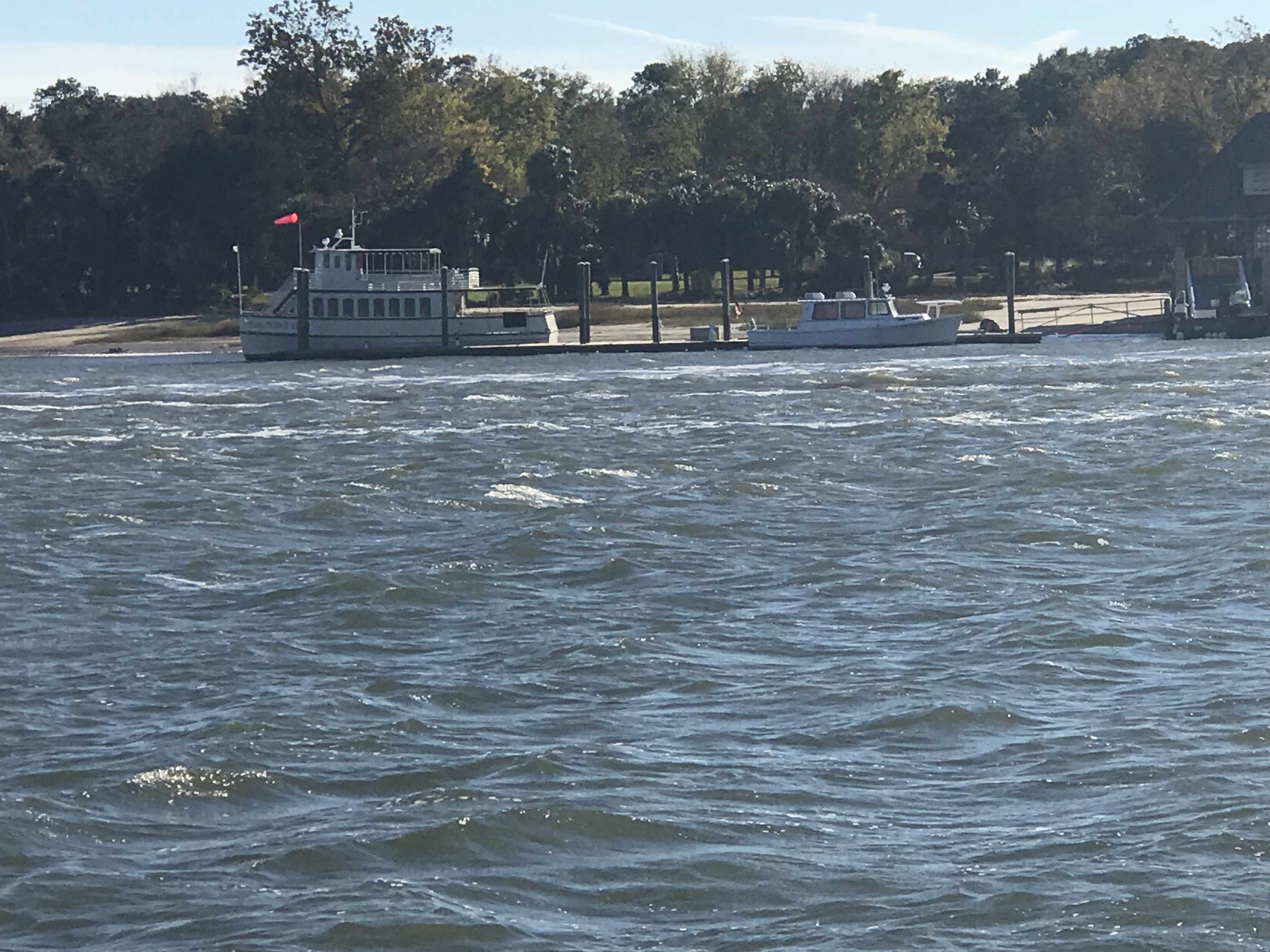
MV Meanders is a beautiful 49’ North Pacific yachts RPH trawler. She’s a bigger version of our boat with reverse raked PH windows. MV Meanders was recently sold to a nice couple named Tom & Nancy who stopped to say “hi” when they saw our NP43 fueling up on the docks. Meanders was previously owned by friends of ours, Andy & Marty. Andy was my boat broker and took me for my first ride in their NP43. I was smitten. I setup the MarineTraffic alert when Andy & Marty were living aboard their boat and traveling to many different ports. At that time, I was working and enjoyed getting alerts about all the interesting places they were visiting. I would think to myself.. “soon that will be Kelly & I and the dogs”.
MV Meanders a 49′ NP RPH docked off our bow in Coinjock, NC
We had to delay our departure momentarily to allow for a passing tug pushing not one but two barges. We don’t want to be in the way of something like this.
Tug Pushing 2 Barges up the ICW
As we traveled down the ICW were chasing a 1935 boat called “MV NAN” out of Osterville, MA. A beautiful old boat that hails out of a marina that we have visited once or twice.
1935 MV Nan
Chasing Nan North up the ICW
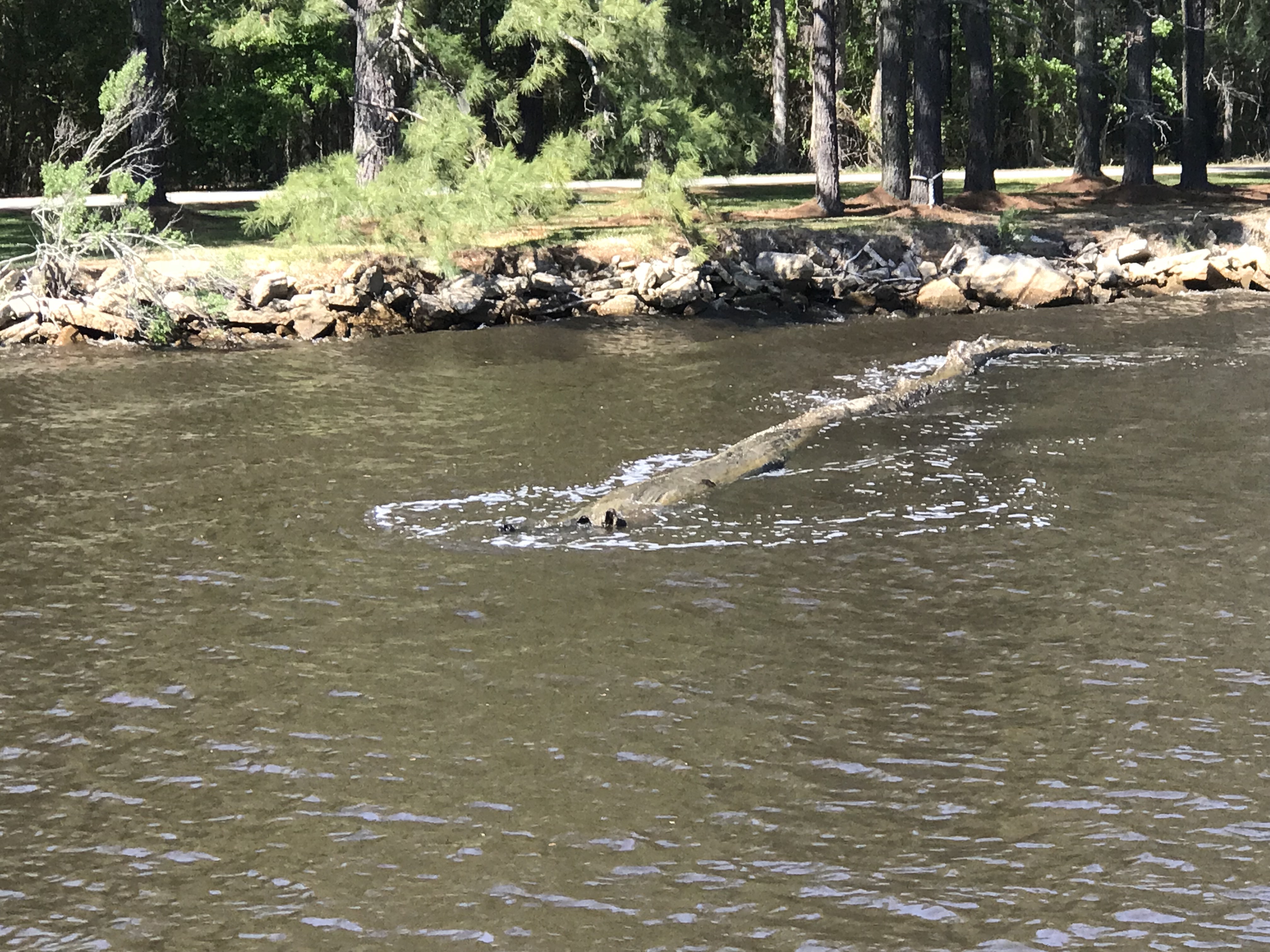
At the helm, I was using my iPhone’s charting app to measure distances to restricted bridges and locks. Many bascule, lift or swing bridges only operate at certain times like “top of the hour” or on the “half hour”. You need to measure the distance to the next bridge opening and adjust your speed to arrive on time. If you don’t you’ll find yourself treading water till the next opening. As I looked up from my iPhone, I saw this log floating down the river and had to swerve to avoid hitting it. iPhones make it even easier to run into a hazard on the ICW.
Hazards to Navigation are everywhere in the ICW
Just before arriving at Top Rack Marina you pass this school bus hanging precariously over a precipice. They put a sign in the window that says, “Fire Rescue Training in Progress”. I imagine they added that after someone called 911 to say that “a school bus was about to fall into the ICW!”
Fire & Rescue Training Using a School Bus About to Plunge into the ICW
Soon we were at Top Rack Marina and enjoying a well deserved dinner at the Amber Lantern Restaurant. What great food this restaurant has. Kudos to the Chef.
Amber Lantern Bar
When we awoke in the AM we could not depart due to an emergency! We were out of dog food! I hailed an Uber with the app and raced off to the local Petco. Dogs fed; we untied and headed North to Norfolk, VA.
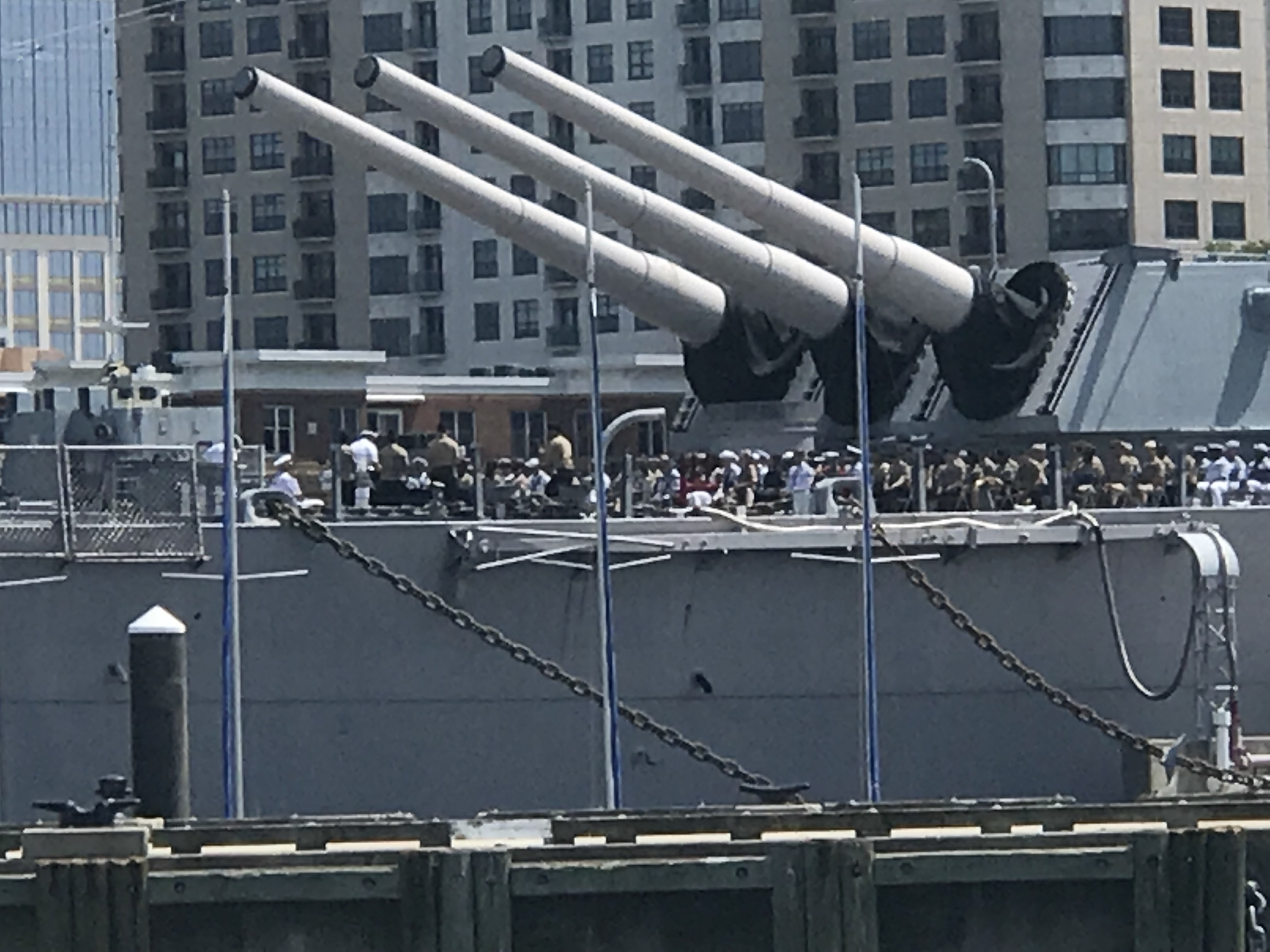
Coming into Norfolk you feel small compared to the many warships lining the channel.
Warship IKE
68 & 69
Warship 72
Warship 77
Navy Soldier on Guard with AR15 on Bow
Warship IKE
How cool is it to have a Navy ceremony seated beneath the “Big Guns”?
Navy Ceremony – Battleship Wisconsin?
I always admire this thing as if it was a cool sculpture of sorts.
Star Wars?
One large container ship appeared to be washing their anchor. I wish I had a dedicated anchor wash system. Sometimes when our anchor comes up, it can be covered in muck from the sea bottom.
Anchors Getting Washed
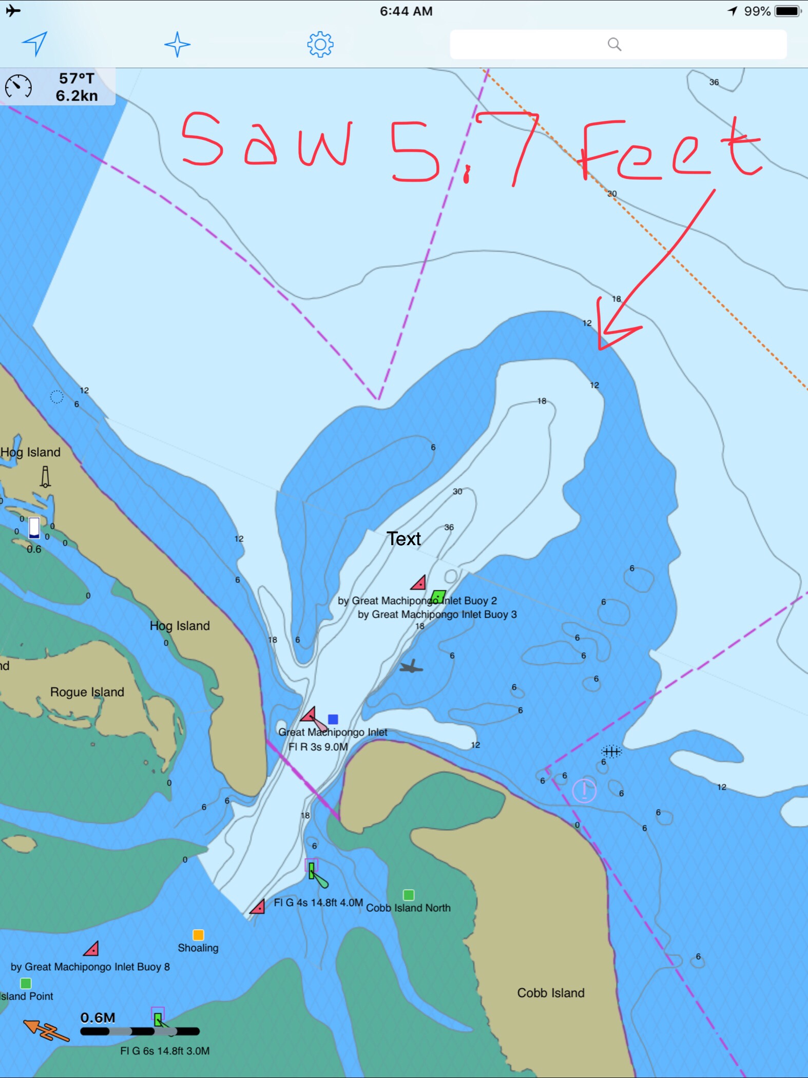
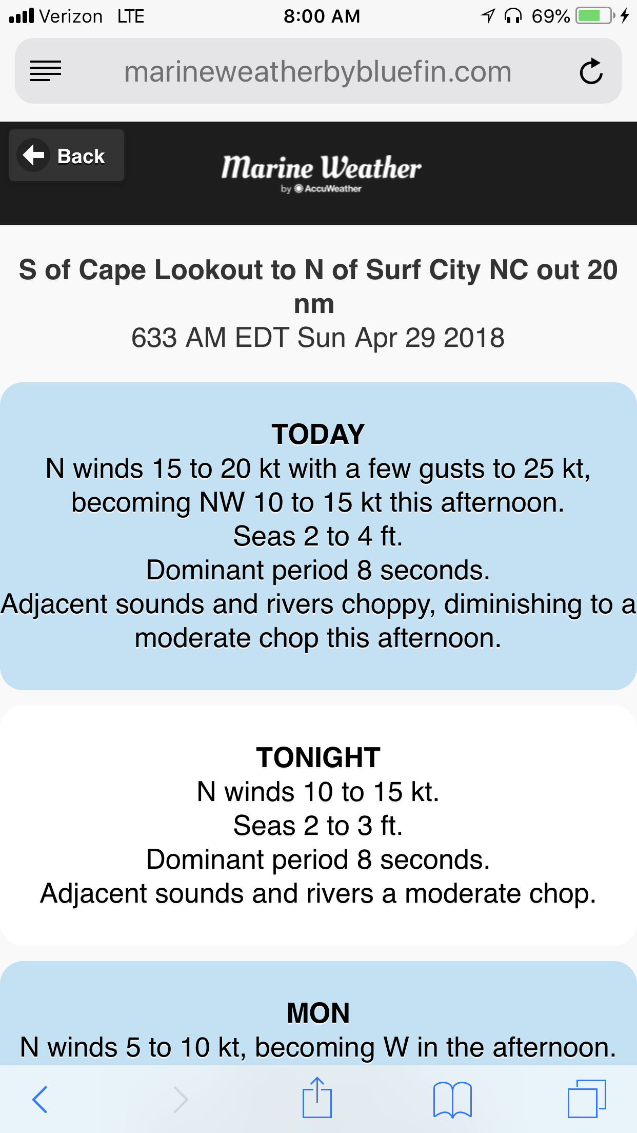
We exited Norfolk harbor and pointed the boat up the coast. The weather was supposed to be 2-4 ft with 20kt winds.
We soon realized that the waves which were on our beam were far larger than predicted and made for a miserable ride. When we arrived at our planned anchorage which was just inside the “Great Machipongo Inlet”. We had only to cross over the bar shoal at the entrance. By now the waves had built into large breaking waves that were pushing us from behind toward the bar. As we progressed slowly over the bar I watched the depths with dread. 10’, 9’, 8’, 7, 6’!!! When I saw 5.7, we did an immediate hard spin and raced back out to sea the way we came in. You don’t want to run aground in breakers 30 miles from anyone.
As the spray from the waves washed over the pilothouse, Kelly & I had an emergency discussion about what to do?
We had 4 Options:
Hold the bow into the large waves until the tide rises and attempt to cross the bar again. It would probably be dark before we got enough lift from the tide.
Continue North 70+ miles to Ocean City, MD. I was exhausted and did not think I could make it another 10 hours into the night.
Continue North 30+ miles to the MARS anchorage. Zero protection against the large waves would have made for an unbearable night on anchor and the next day was predicting 25 kt winds and larger waves.
Return the 30+ miles back the way we came and tuck around Fisherman’s Island and into Chesapeake Bay to find an anchorage.
We chose option 4. This was hard for me because I often say to Kelly, “I hate moving backward or retracing steps”. I think this comes from a combination of being A.D.D and always not wanting to go backwards for something that you forgot and just a desire to never see the same scenery twice. Always seeing something new brings happiness.
As we made our way back into the bay, the sea began to soften and the ride became smoother.
Sunset off Fisherman’s Island, VA
We selected an anchorage called Sunset Grille Anchorage. As we approached it was very overcast and dark. Radar pings were showing two docks extending far out from shore on either side of our intended anchorage spot. If we didn’t approach from exactly perpendicular to the shore we’d have slammed into these pilings on this dark night. Thankfully we have radar and a remote searchlight to identify hazards the radar pings.
We anchored and tried to get some sleep.
1AM and the boat was ROCKING. The wind had picked back up and the current had aligned us so the waves were on our beam. The boat was rocking violently. So much so that eventually, I had to start the boat and pull anchor and leave into the blackness. It’s always better to stay on anchor than attempt to navigate an unfamiliar harbor on a black night. But spend 4 hours in a boat that is rocking like an amusement ride and you’ll take your chances underway.
The wind had picked up and we were on the wrong side of a 20 mile fetch of water that was now battering us with large waves. We fought our way to the calmer side of the bay and then turned North looking for an anchorage that would give us protection against the strong Southerly wind and waves. We motored our way to Godfrey Bay and anchored in a calm protected bay, safe from the day’s harsh weather. It was only 11AM and I could barely keep my eyes open even with the 3 cups of coffee I had pumped into myself.
As we entered the anchorage, we passed this classic Chesapeake crab boat.
Looks like a painting I’d hang on my wall
Now peacefully on anchor. We are plotting a new course that takes us up the Chesapeake Bay.
We’ll traverse the C&D canal and then have to sail down Delaware Bay, round Cape May and go North up the coast toward NYC.
Because it was a 98.8% full moon, we pulled up the anchor and got underway before the sun had even risen.
Wrightsville Beach Anchor Location
As we skirted our way up the coast, we tried to minimize the length of fetch as the winds were blowing 20 kts from the NW (with gusts to 25 kts). Recall: a fetch is a distance of water that the wind has been given to blow over the top of. Wave heights build wave heights with distance.
25kt Gusts
Along the way we saw beach homes like these near Surf City
Surf City Beach Homes
Surf City Beach Homes
We saw a giant ocean-side pier near Top Sail Beach.
Top Sail Beach Pier
As we go, I’m always watching the depth sounder, ie sonar. It pings high frequency sound (like a dolphin) off the sea floor and displays the depth as a graphical chart over the last 60 seconds. It is very important to understand not just the instantaneous depth but also how the depths are trending over time. You need this info to ascertain quickly if you are running off a downhill slope or running aground. The steeper the incline, the faster in time the sea floor is rising up to meet you, metaphorically speaking. While watching the sonar, I repeatedly saw objects between the boat and ocean floor. I believe these depictions to be “bait balls” or schools of bait fish in a tight spherical grouping. Sometimes they are formed into these ball formations by preditors such as dolphins.
I’m no expert at reading the fish finder / depth sounder’s visually displayed ping returns, however, I also saw this fishing boat hauling a net.
Small Trawler Netting Bait Fish
The trawler’s size makes me think that they are hauling a small net sized for bait fish.
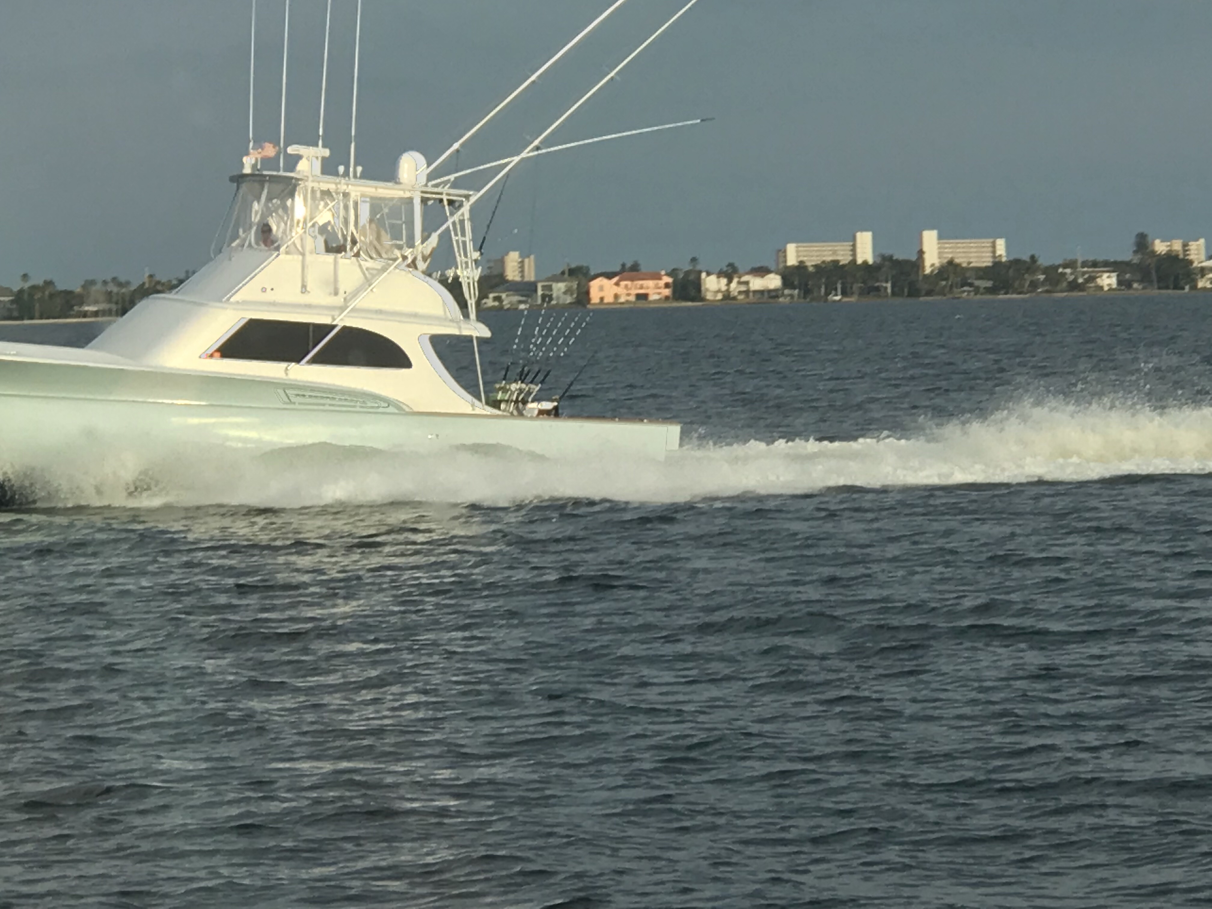
A moment later, we were passed by this Italian designed Azimut luxury motor yacht. She clearly has some horsepower in her diesels since… as big as she was, she was just skimming over Mother Ocean.
Azimut on plane
As we approached Beaufort, NC, we passed Brown’s Inlet. The ActiveCaptain description for this inlet simply says: “Browns Inlet is unmarked and used by local boats only;not recommended to strangers.”
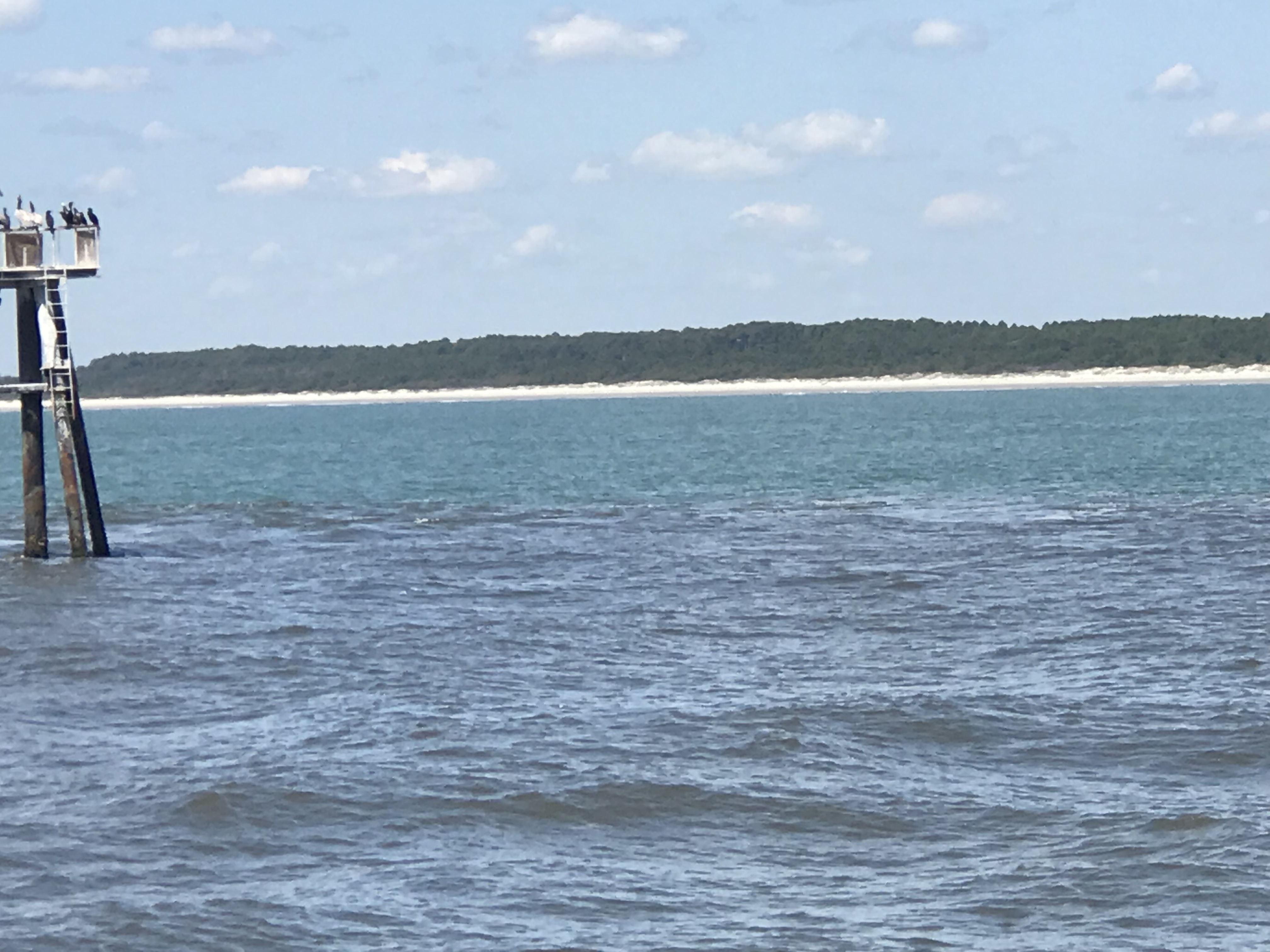
Soon we were off Fort Macon State Park Beach which is just before Beaufort inlet, NC.
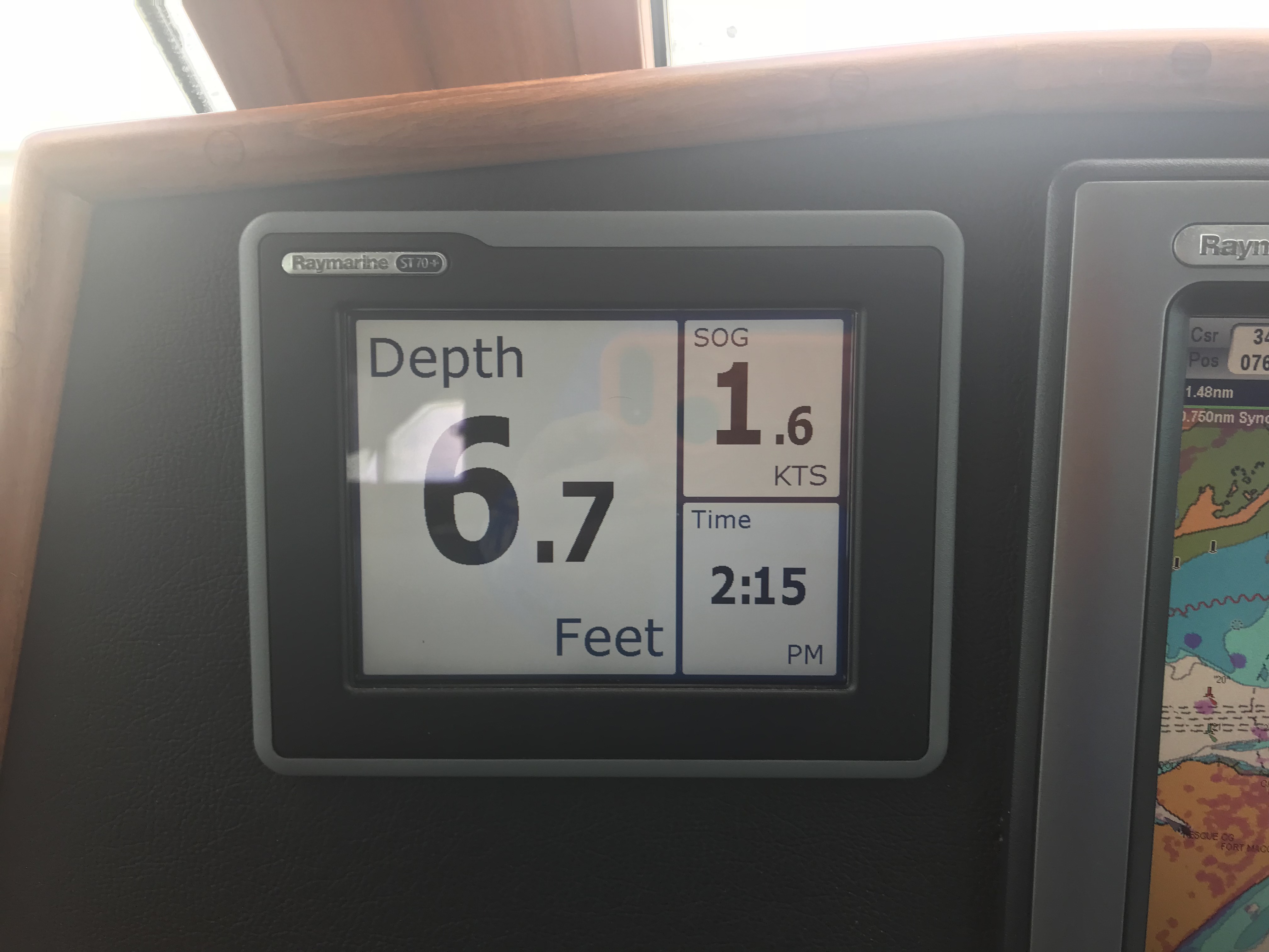
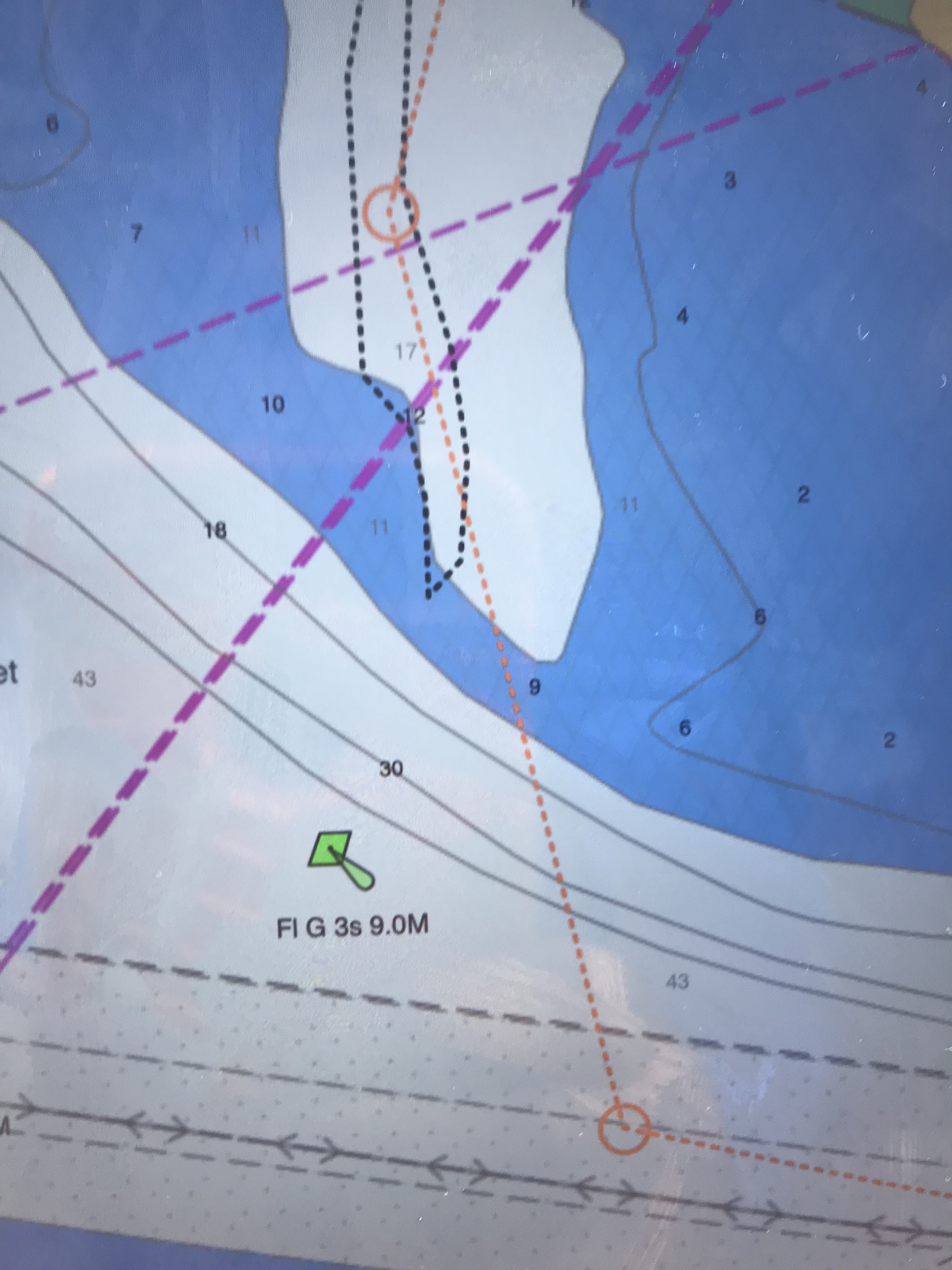
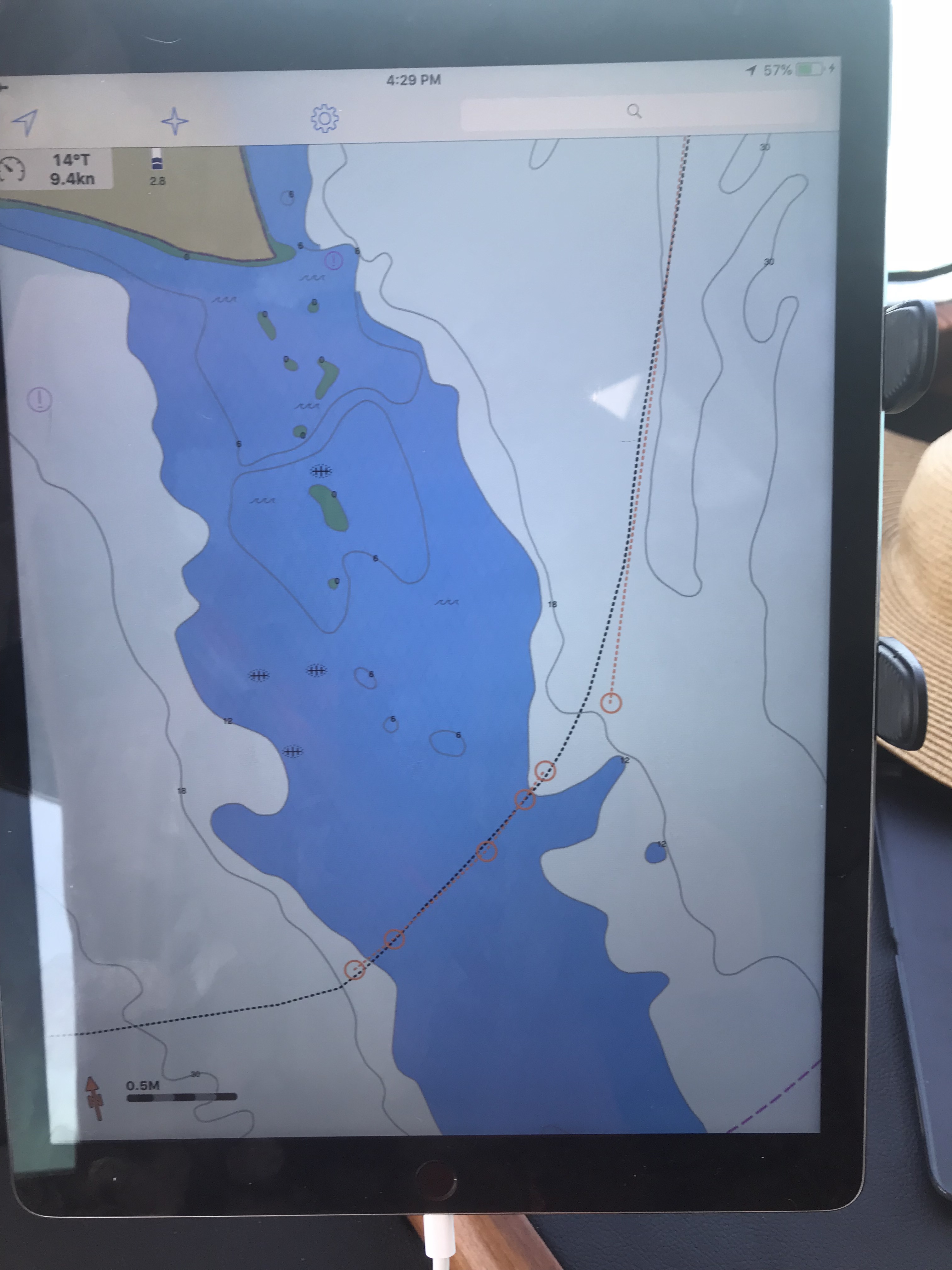
Running a dynamic inlet whose shoals change with each storm is not advisable as even the latest published charts with depth soundings will likely be incorrect. That said, we attempted to use the latest NOAA charts to sneak into Beaufort Inlet via a narrow channel close to shore. It was low tide so you don’t get any added water depth over the low water spot soudings. We entered the narrow natural channel displayed on our chartplotter. I checked the accuracy of the spot soundings (depth numbers) and the actual depths (reported by the sonar) were 3’ shallower than what my recently updated chart displayed. That was not comforting, but I still proceeded slowly at only 1.7 kts.
1.6 kts is slow forward
We will run aground at about 5’ and I was already in only 6.7’. To make matters worse, there was an ocean swell that was lifting and dropping the boat above and below the static ocean surface. I was confident that however “skinny”, “thin” or simply “shallow” the depths got that we would make it. After all my charts showed a low of about 10’ and we only needed 5’.
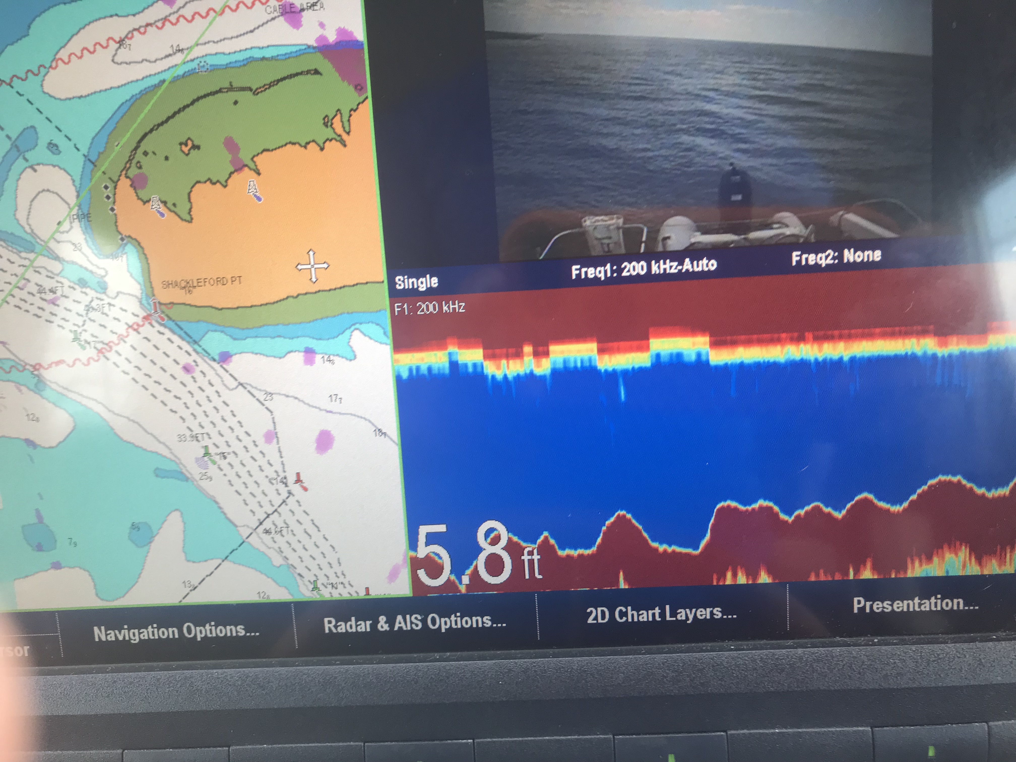
Well, we made it about 10’ from crossing into the deep channel when we bumped the bottom. You have to tell yourself: “resist the temptation to simply push the throttle forward and plow the next 10’ to the deep channel”. You just can’t know how shallow those next 10’ are. You could be pushing your boat up onto a shoal so shallow that the diesel engine / propeller combo won’t have the bite on the water needed to either push or pull you off the shoal. I opted to put her in reverse and spin her back the other way. We knew if we didn’t hit on the way in, we would not hit leaving.
5.8 is Shallow
10′ more and we could have made it into the deep channel
Note: The top picture showing the chart with 5.8’ depths displayed is not as recent as the chart depicted in the picture below it. We were literally 1/4 of a boat length from making it into the deep channel. You can see our track as we backed out. FYI: track = a black, dotted line or bread crumb path of where your boat has been. The dashed orange line with circular junction points is our plotted course. We backed out and came in the inlet via the mid-channel / safe water buoy. This buoy marks the center of the entrance channel. Line up with this vertical red-white striped buoy and you are heading directly in the inlet.
Confidence is a good thing as a captain but … so is restraint 😉
I was emailing with a fellow boater who was getting ready to come North from Vero Beach. They have owned their blue water trawler and traveled up and down the coast. However, I still added the below statements to my reply. I did so because, I myself, am often curious where other sailors draw the line at the decision to “go offshore or not”?
3. Six seconds is a rather short period. I’m picturing steep waves. Your boat is stabilized, ours is not. I would not want 6 second period, 5′ possibly 7’ waves on my beam.
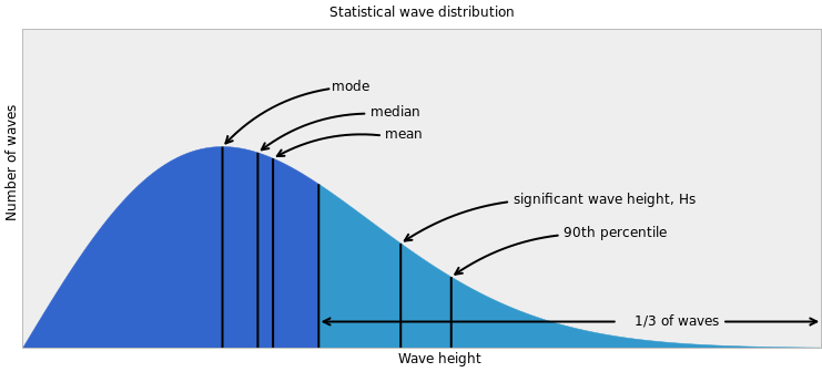
When you study the densely displayed data given by this app,you see that the waves during the daylight hours will be… at worst 4.5’, out of the NE with a 6 second period. The tide will go low about an hour before the sun sets (read that as… “about when you are entering the shoaling inlet from the sea”).
Then you say “4.5’ waves are not that bad”. However, that wave height forecast is based on a statistical wave distribution.
The average of the biggest 1/3 of the waves you’ll see are much larger, possibly to the height of 6.5’. That is uncomfortable to most crew in an un-stabilized trawler. Note: Blue water, top-heavy, flybridge trawlers often use active fins beneath the waterline to oppose the roll of the vessel to port or starboard. This can dramatically improve the conditions underway in a sea. Naiad is one such company who manufactures marine stabilizers.
After making our way in the inlet we passed ICW statute mile marker 200. Note: Mile 0 starts in Norfolk, VA and the ICW milage progress to statute mile 1243 in Key West.
ICW Mile Marker 200
We made it into Adam’s Creek before having to anchor up for the night. Adam’s creek offered us the last anchoring spotbefore we enter Pamlico Sound and must travel the next 25 or so nautical miles to the Goose Creek anchorages.
Our current anchorage does not offer wind or wave protection but the holding is good. The NE winds are forecast to be light, at only 10kts.
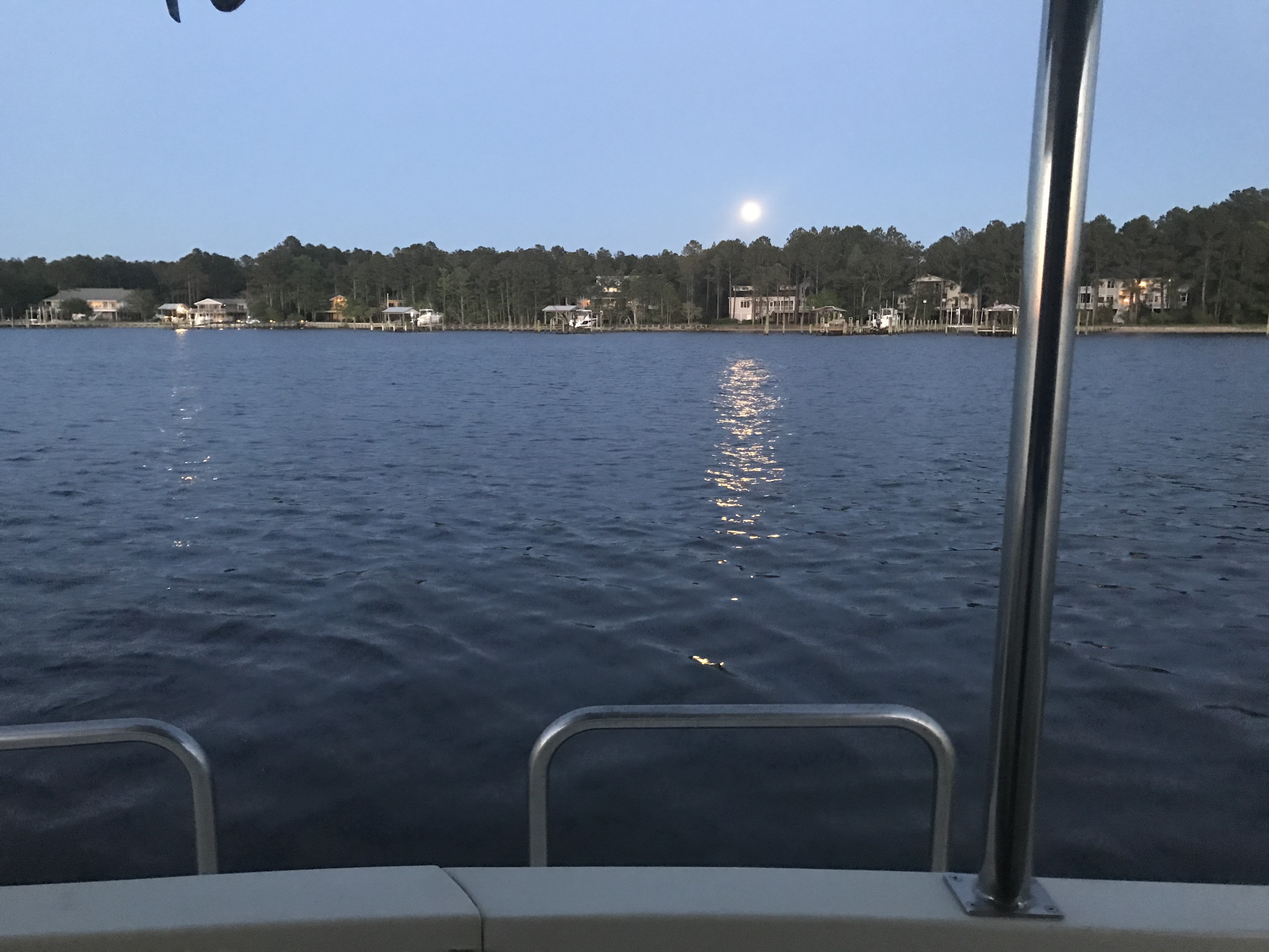
I found it interesting that we had a full moon rise off the stern and a simultaneous sunset off the bow.
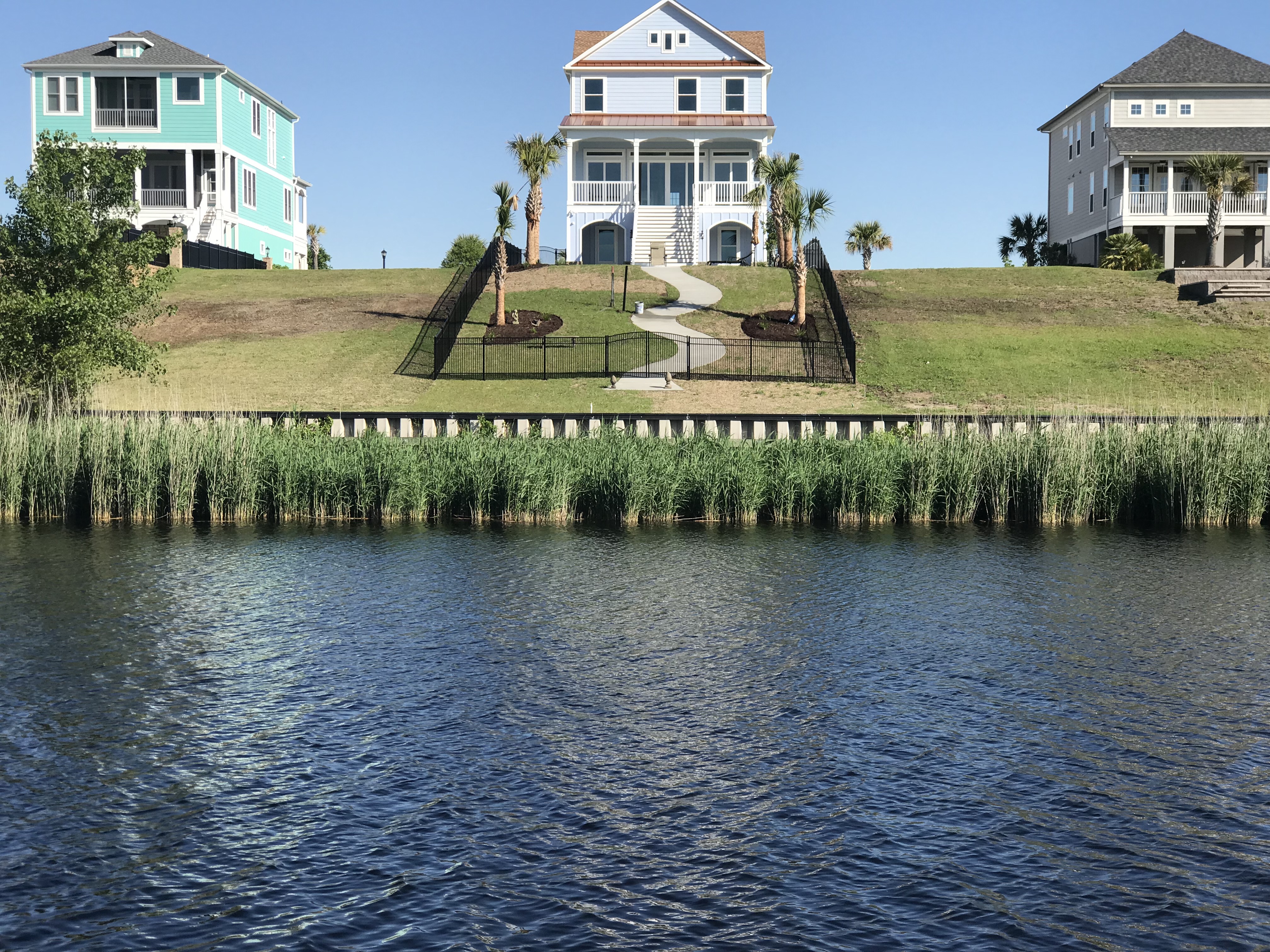
We got underway early, leaving the Waccamah River behind us. Alongside the ICW we found houses like this one. This home just stood out against the others. Why? Crazy downhill fence, twisty walkway? Sawgrass? 2nd level stairway? The palm trees? Or does it all work together?
Breathtaking, like that Seinfeld episode with the ugly baby
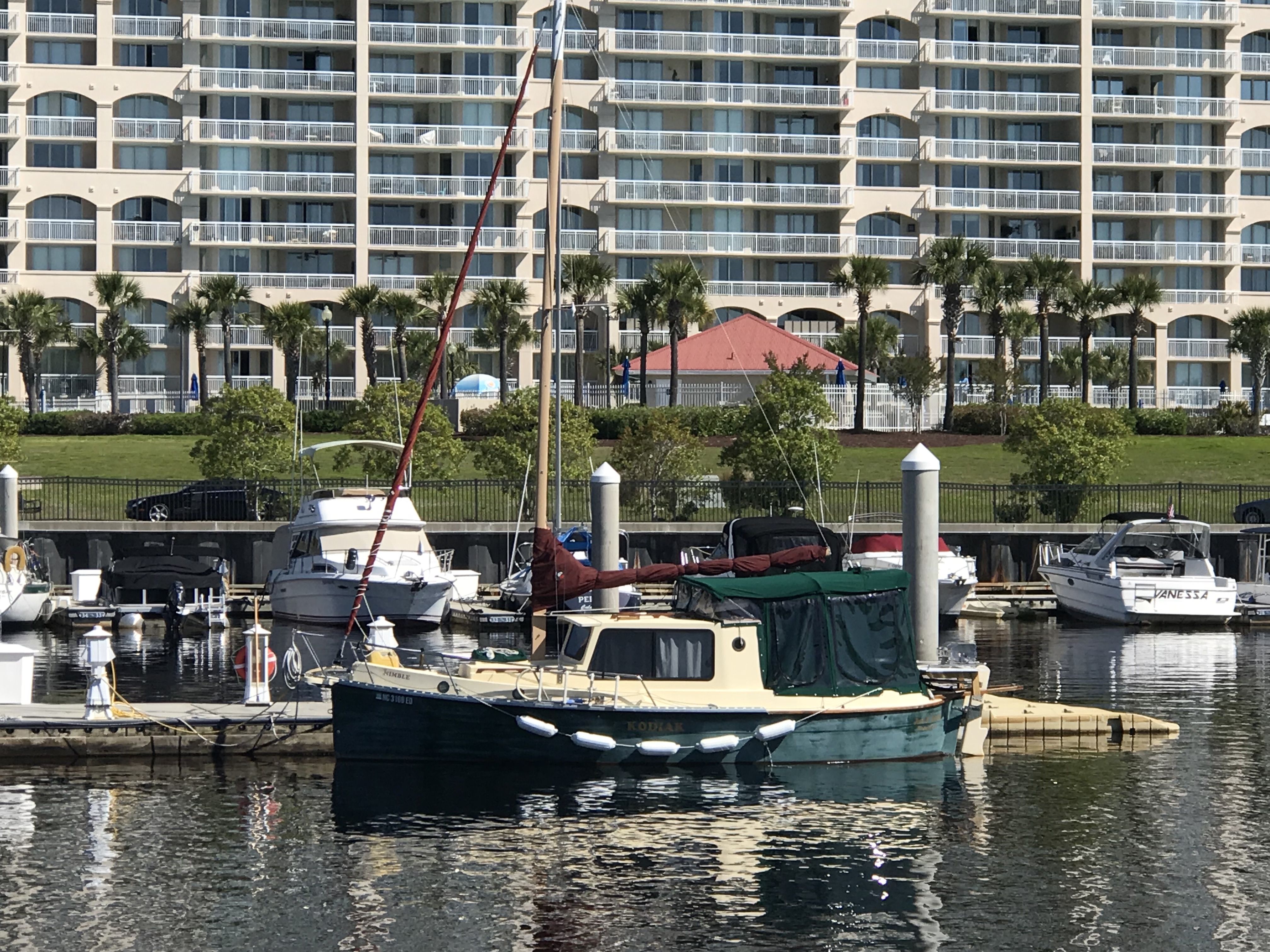
Then I passed this 27′ trailerable Nimble Kodiak motorsailer. Interesting little boat. Here is a link to a random 2002 Nimble Kodiak for sale on Yachtworld.com
27′ Nimble Kodiak trailerable motorsailer
We passed the “Sombrero thing” that I could not quite figure out what this place was on our way down the ICW. Now we are heading back and I still have not looked it up.
Sombrero thing and Yes there are propeller eating rocks on the ICW
We passed the Myrtlewood golf course right on the ICW. I’m thinking how many boats get hit with golf balls?
We also passed a home or restaurant that had all these HUGE ocean buoys all around their lot. I love red buoys and green cans but I’m not sure I’d want them as yard ornaments?
Big Red Buoy
Green Bell
Then we came to “Little River Inlet”. You can’t miss it because it has this commercial fishing boat marking the entrance off the ICW.
I guess even the pros can have an oops moment?
Kelly & I recall this inlet as one that we ducked into on our old sailboat, Skull & Swords. We were getting beaten up in a storm off Cape Fear and the moment we tucked into Little River Inlet it provided us with a place to anchor for the night.
The ebbing current was running strong as we never hit 11 kts.
11 kts SOG – Speed Over Ground (GPS calculated)
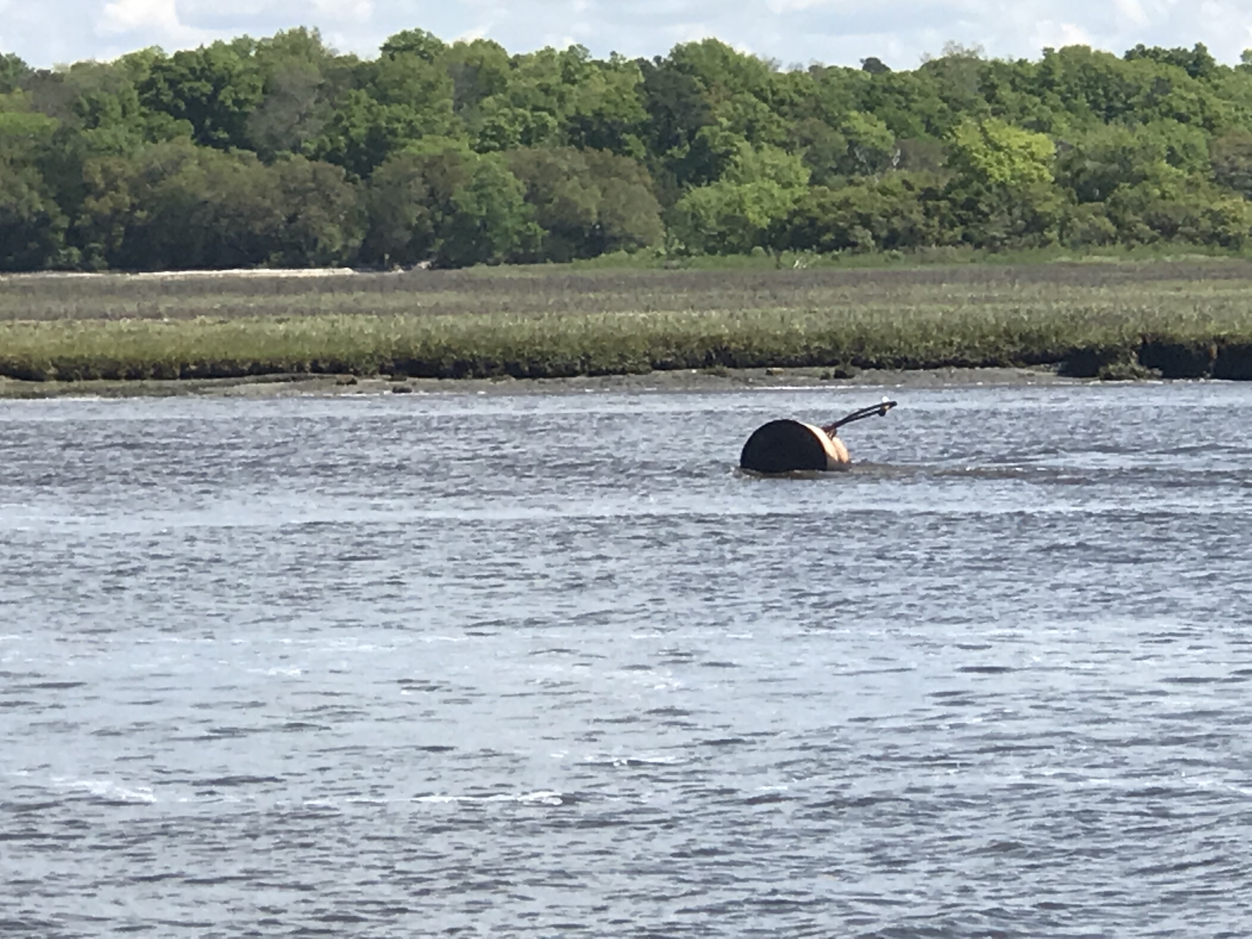
As you twist your way out to sea be careful of the floating steel drums that are just outside the channel.
Would not want to hit that at night
Little River Inlet twists a sinuous path to the ocean.
Snaking it’s way to the ocean
The strong outflow created a distinct boundry between the brown, full of sediment water rushing out and the green water off the coast of NC.
Sediment laden waters flowing into the green sea
Friends of ours, Jimmy and Wende had just taken their fishing boat out of Lockwood Folly Inlet and were chatting with us on the VHF. I had to raise my 45 degree lowered antennas to the upright position to get better reception. On the ICW you must lower your antennas to fit under low bridges. The reduced reception does not matter as you are really just communicating with a passing boat or a marina that you are next to. They were quick to end the call reminding me to put my antennas back up, which I just did after writing that 😉
The inlet they came out of might scare anyone who looks at it on the charts. When you see a bunch of shipwrecks dotting the inlet it might be telling you something about the inlet.
That’s a lot of boat bones
We had planned to go offshore at Little River Inlet and run the 25 or so NM to Cape Fear. However once we were outside we were enjoying making over 9 kts.
Making good time
We decided to see if we could find a way through Frying Pan Shoals rather than around them. I spent some time plotting a course that in the end had us seeing 8.7′ at the lowest. Normally we would simply plot a course around Frying Pan Shoals but the added distance could mean a nighttime arrival. A check of the tides showed that we were not going to get much of a lift from the tide.
Barely 2 hours after a negative low. won’t add much water to the chart soundings
The swell presented a bit of a challenge as well. Ocean swell can push a boat closer to the sea bottom when you slide into the trough of a swell. The swell also can cause “breakers” (think breaking wave tops) where the shoals are shallow. Today however, as we cautiously motored over the shoals our path was uneventful. If you want to cross the shoal there is a path that lies about 3 nautical miles off the point of Bald Head Island. Just take your draft and everything else into consideration before you attempt.
Our Actual Path over Frying Pan Shoals – 3 miles out
Once we rounded Cape Fear we were making good progress toward Masonboro Inlet and Wrightsville Beach. You can see on our iPad navigation app the boat icon that is us, a black dotted track line that is where we were as well as the magenta 3 mile offshore dashed line.
Us rounding Cape Fear
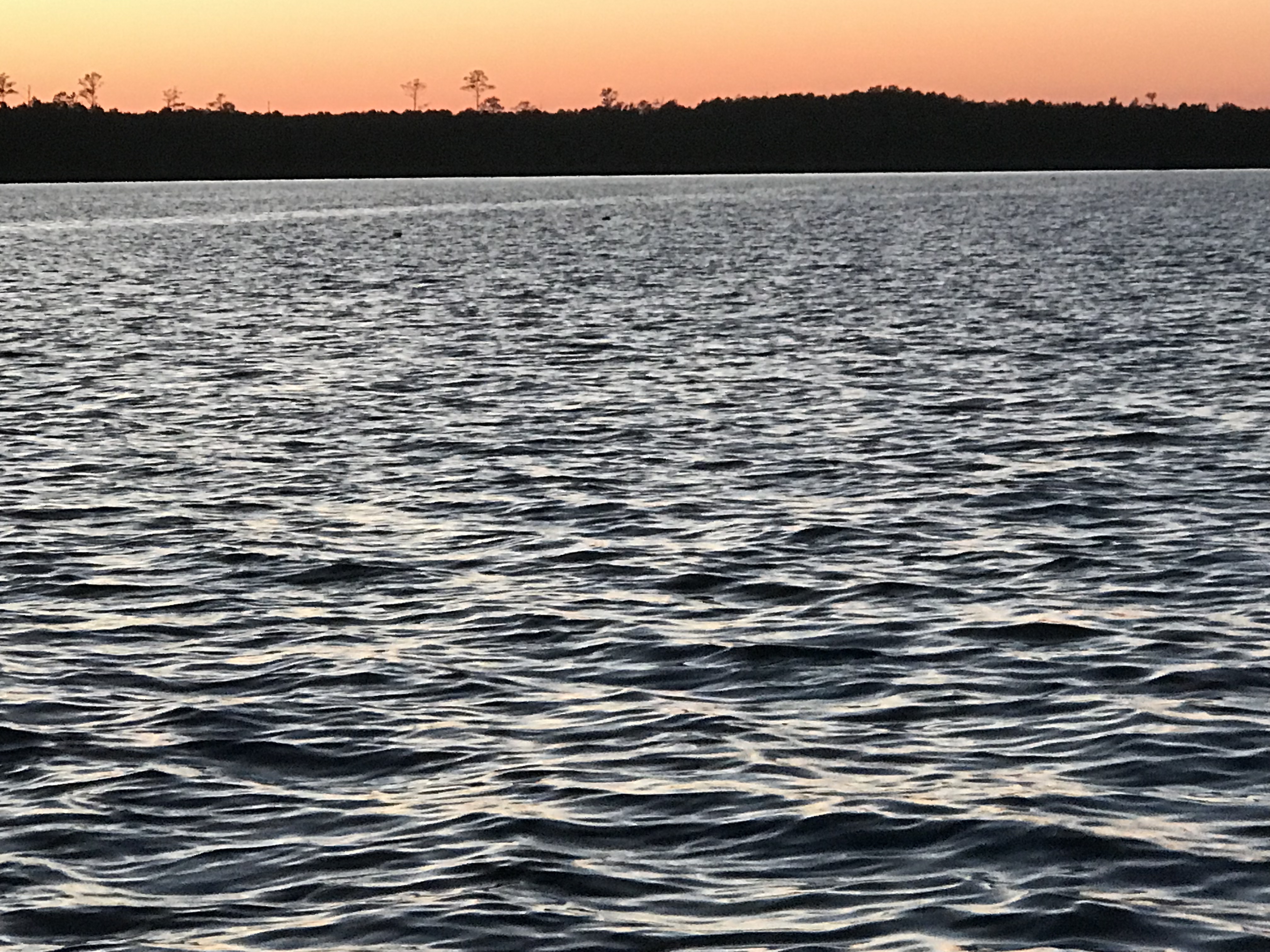
Once inside the inlet we quickly anchored up and watched the sun go down
Setting sun
Dipping below the horizon
Gone
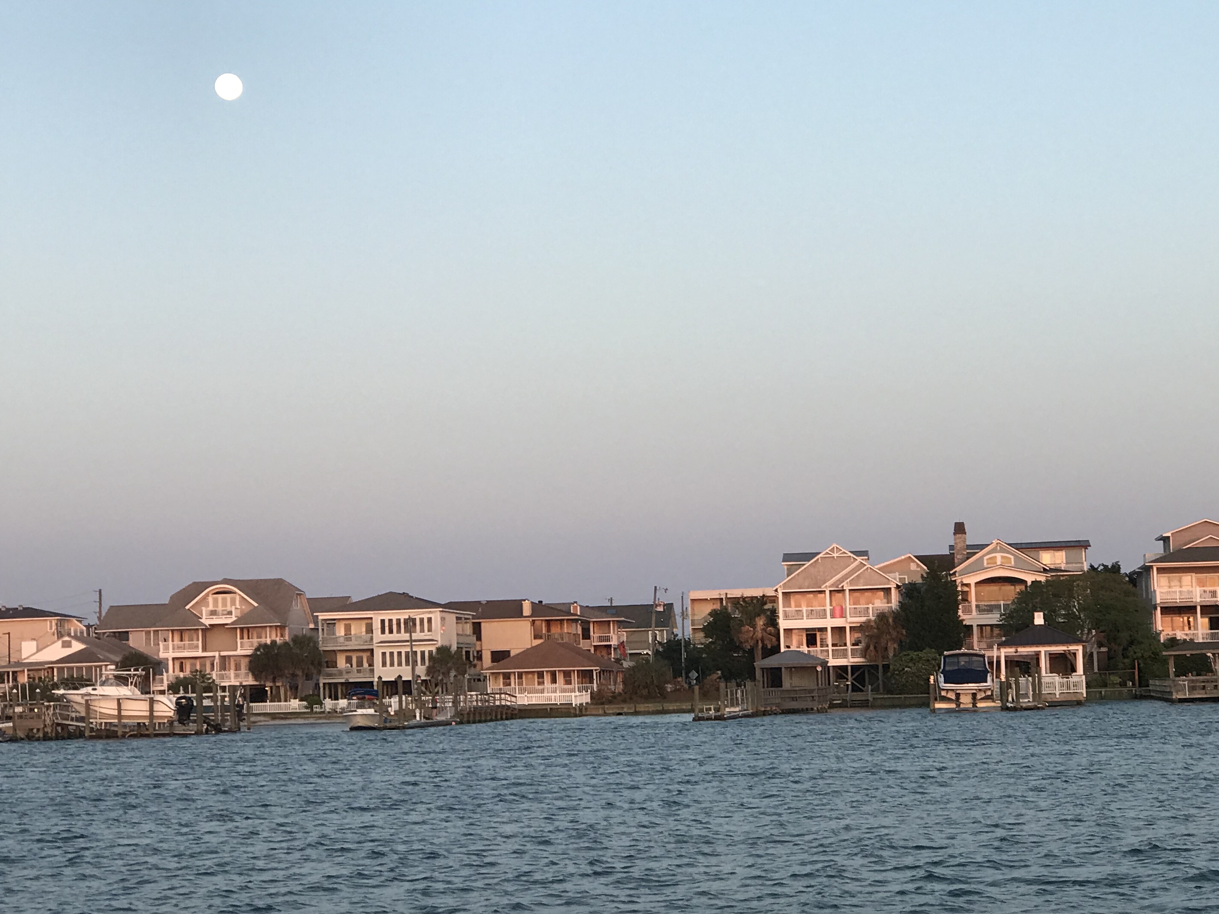
While the sun was setting the full moon was already up.
OK, it’s not technically a full moon but 98.8% is close enough. Tomorrow we’ll have a full moon.
The trip down to Key West was full of things to see. It started with an overturned vessel. We saw a diver in the water possibly attempting to flip it? Hope nobody was injured?
There was a diver in the water hooking lines to the overturned hull
As we got closer to Key West, the water became a beautiful green-blue color.
We passed SV Toucan, a 40’ Manta catamaran underway and hailed them on the VHF offering to take some pics of them. Capt. Elizabeth thanked us and returned the favor.
The crew of Toucan would later invite us for a “Sundowner” which is live-aboard speak for why don’t you dinghy over to our boat just before the sun sets and we’ll do drinks and appetizers. They were terrific hosts and I enjoyed getting a tour of their amazing catamaran. If I get a copy of the selfie we took, I’ll post it here.
MV Simple Life underway to Key West
SV Toucan Underway
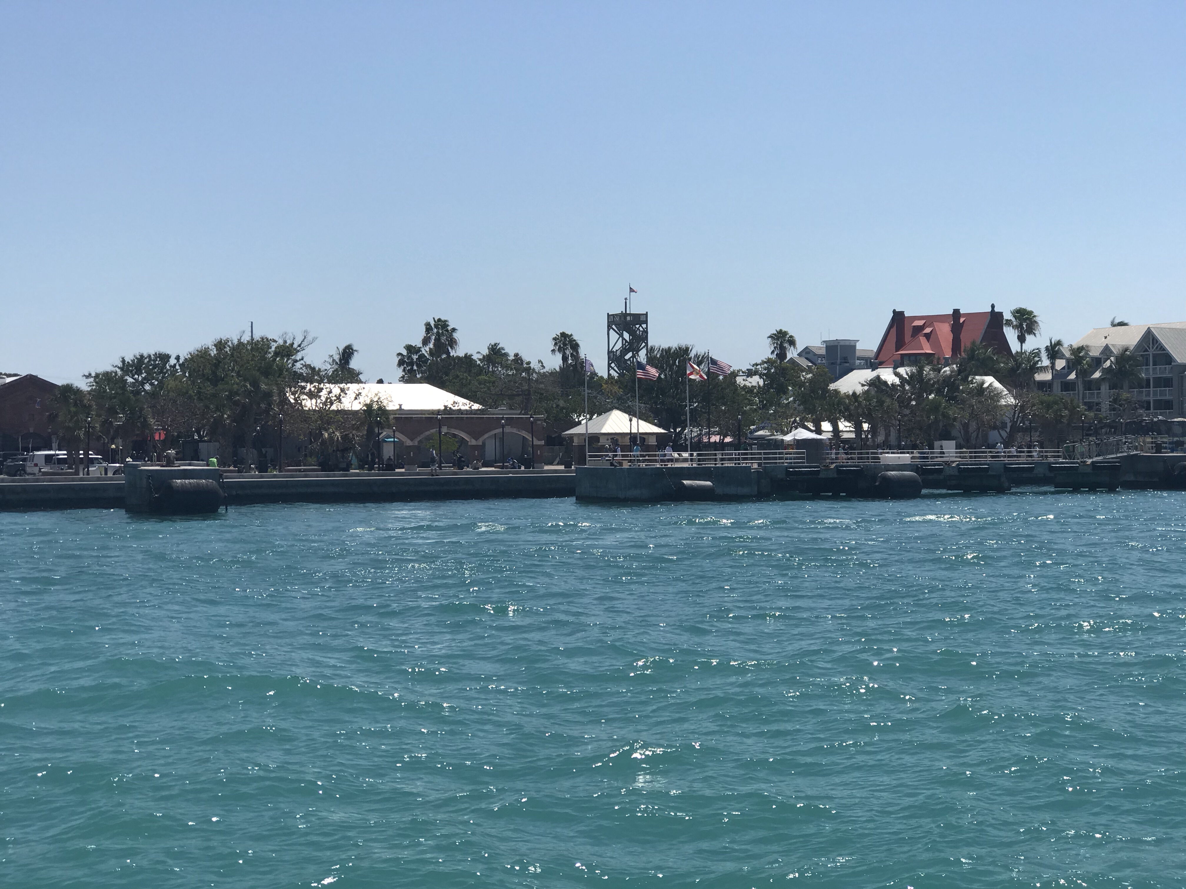
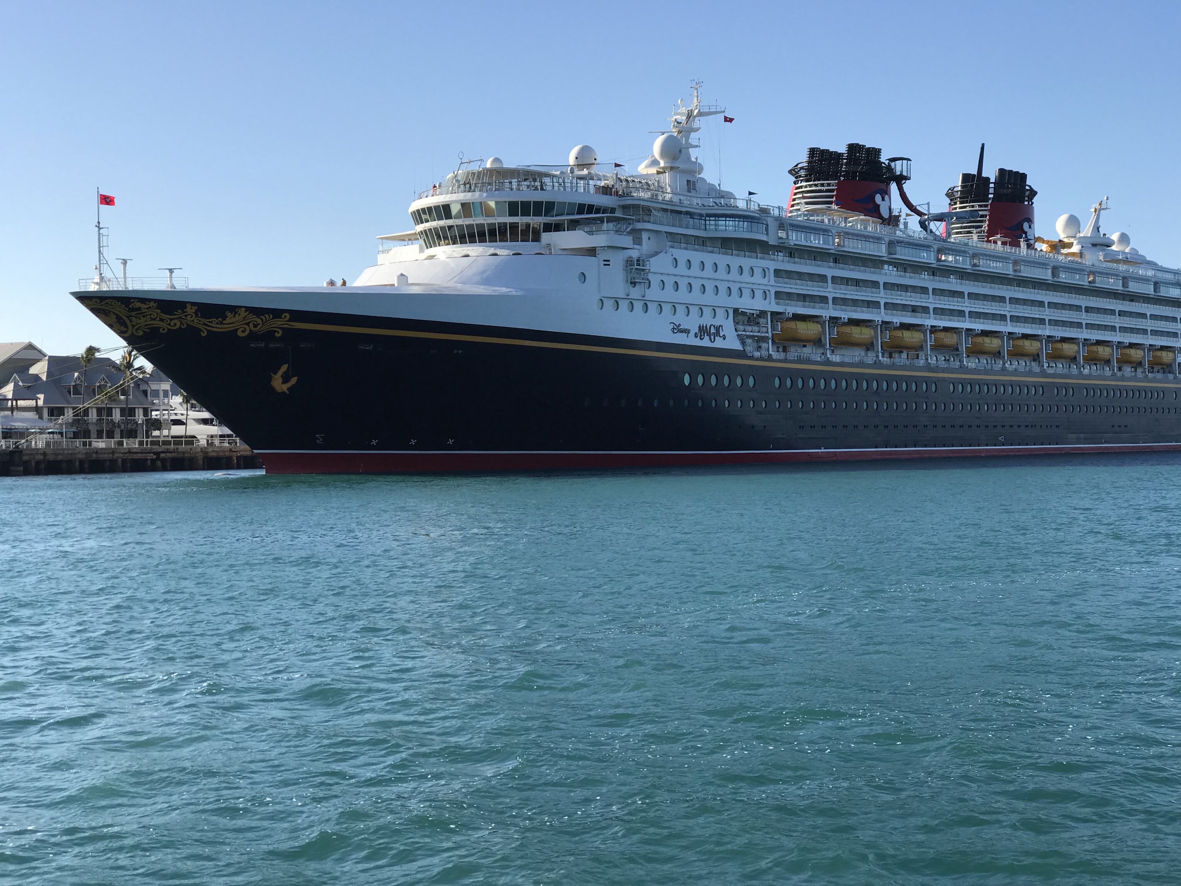
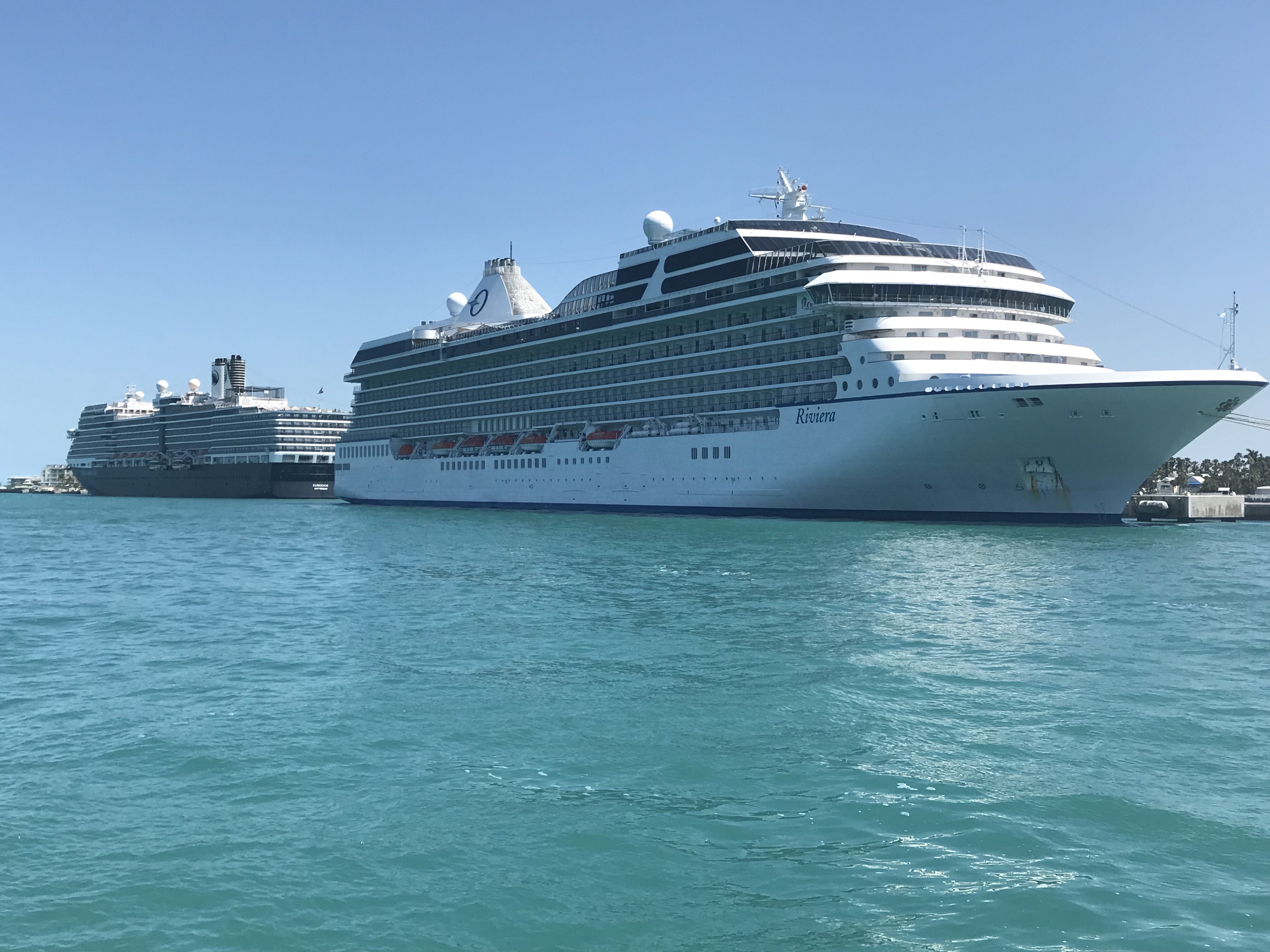
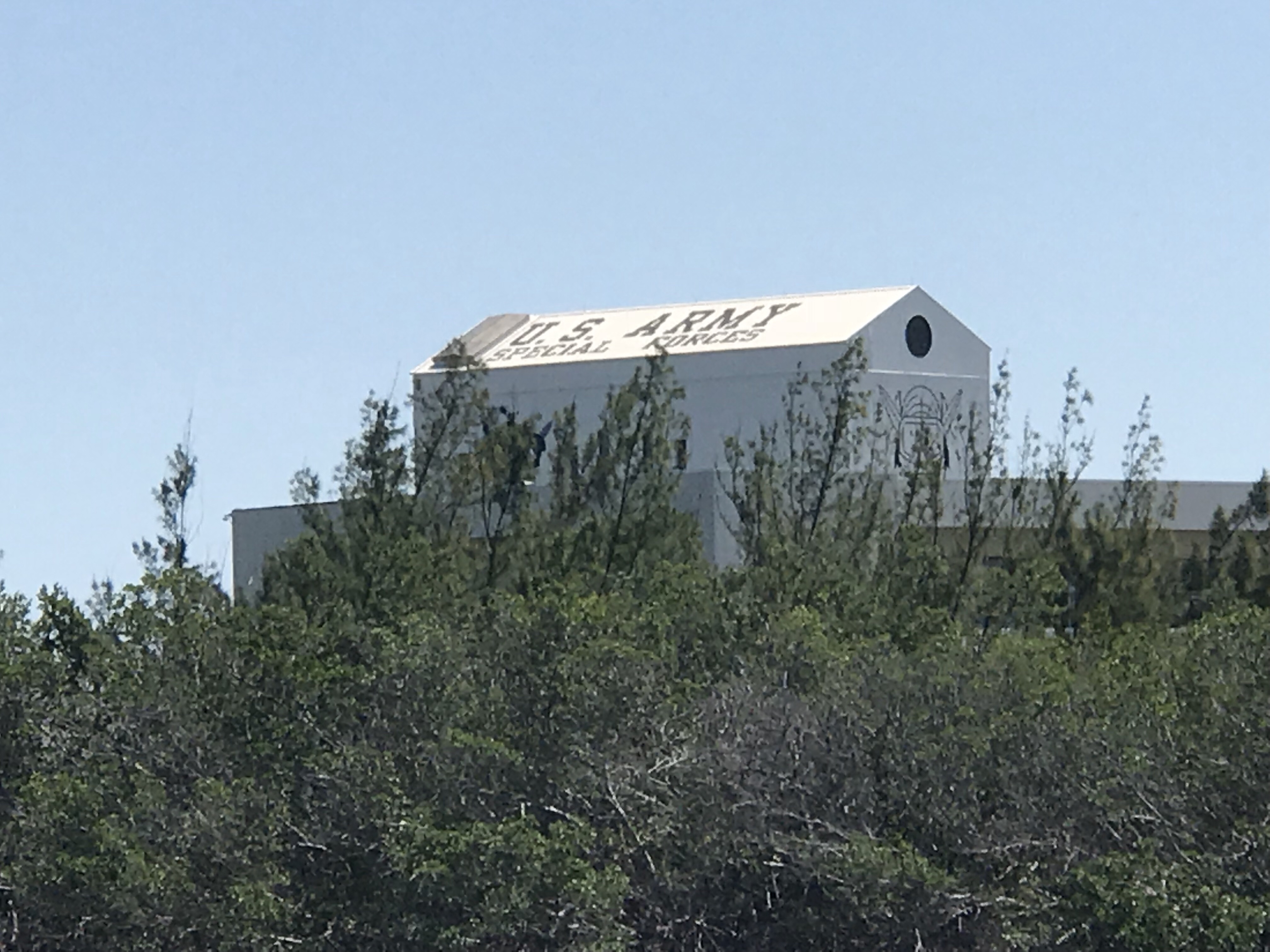
When you approach Key West from Hawk’s Channel (ocean side) you see sights such as huge cruise ships underway in the channel and others docked.
US Army Special Forces Underwater Operations building logo
US ARMY Special Forces
At one point a couple of inflatables with Army Special Forces motored by.
We grabbed a mooring ball in Garrison Bight Mooring field rather than fight the crowds in the different anchoring locations. Garrison Bight is the only real transient mooring field that I am aware of here in KW. The mooring field is run by Key West City Marina. Getting onto the mooring is a lot like in Boot Key Harbor where the mooring ball has a short pennant line that comes up from below the ball (rather than on the top of the mooring ball as it’s better to keep the scope angle low leading to the mooring anchor itself). Up North in Rhode Island, most mooring ball pennant lines are mounted on the top and have either a single long pennant line or a single that spits into two lines with loops for throwing over your bow cleats. Here in Key West the mooring pennant line is very short with a thimble that you must thread two of your own dock lines through. They ask that you keep a minimum of 10 feet between the boat and the thimble. The winds can really blow down here and they don’t want you short tying to the ball and potentially dragging the mooring anchor.
Dock lines through mooring pennant with thimble at end
Once tied up it was a bit of long dinghy ride into the marina office which is located in a different location than the transient dinghy dock.
Dinking it in to the dock
Key West City Marina Dinghy Docks
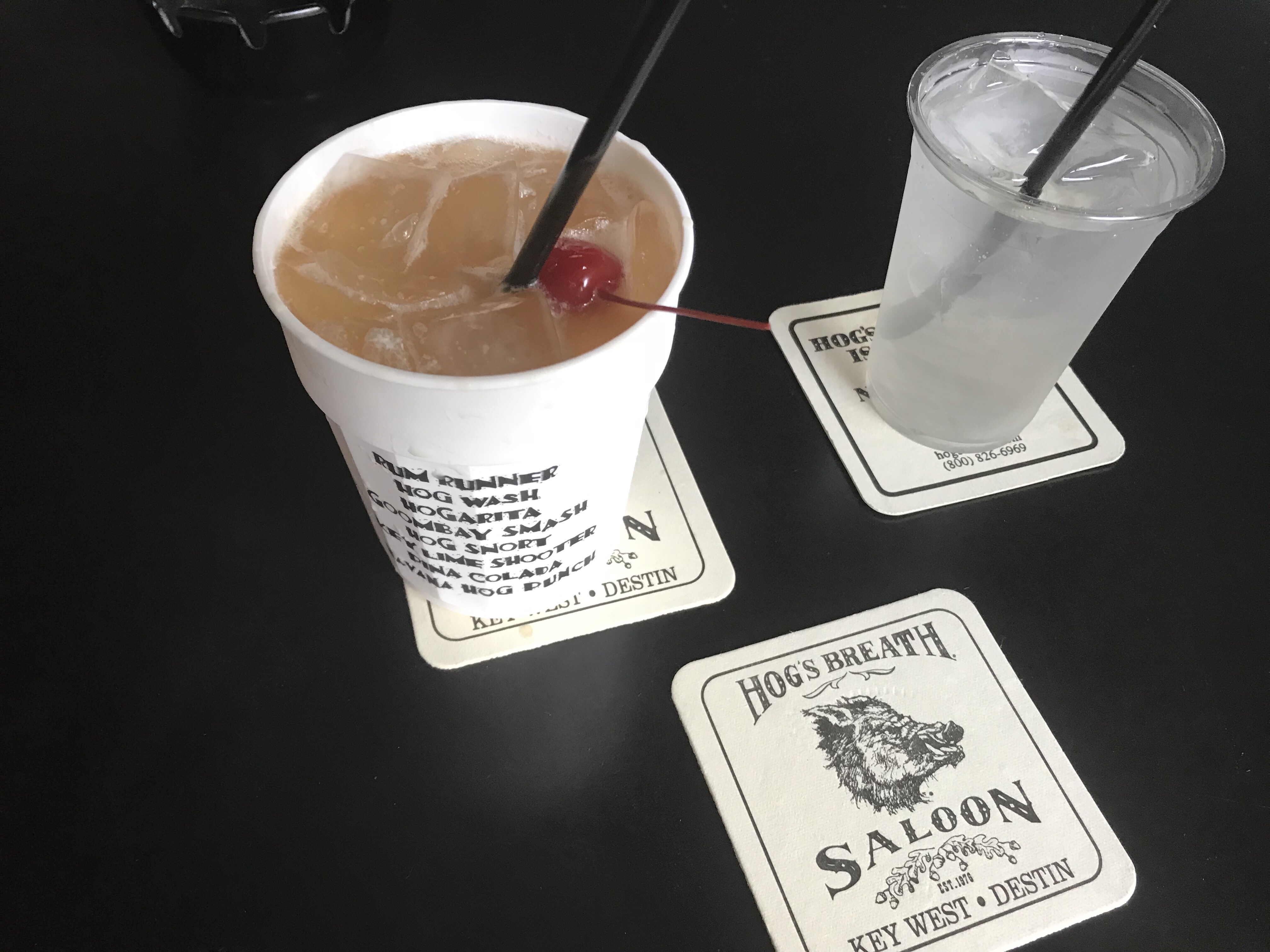
We arrived on St. Paddy’s day so we wasted no time getting an Uber to Duval St. and hitting some of the local watering holes like Hog’s Breath Saloon. Want to see the drink menu? It’s on your plastic cup (not a bad idea). I had to do a Gumbash Smash just to make Danny & Dina smile. (Inside joke)
Hog’s Breath Saloon off the main street
Every bar should do this. Starting at the top…
We found that the Sunset Pier had a good band playing and spent some time there taking selfies and enjoying the cool breeze off the ocean.
Selfies @ Sunset Pier
Don’t you just love a round bar?
We ate at Margaritaville’s and found it was less crowded than adjacent restaurants due to the St. Paddy’s day crowds. The food & drinks were good.
Food was great
The dinghy ride back to the boat was hysterical as we had not paid enough attention to where we left the big boat and we were driving around in the dink trying to find Simple Life. Fish were jumping out of the water as we skimmed over the shallows at high speed.
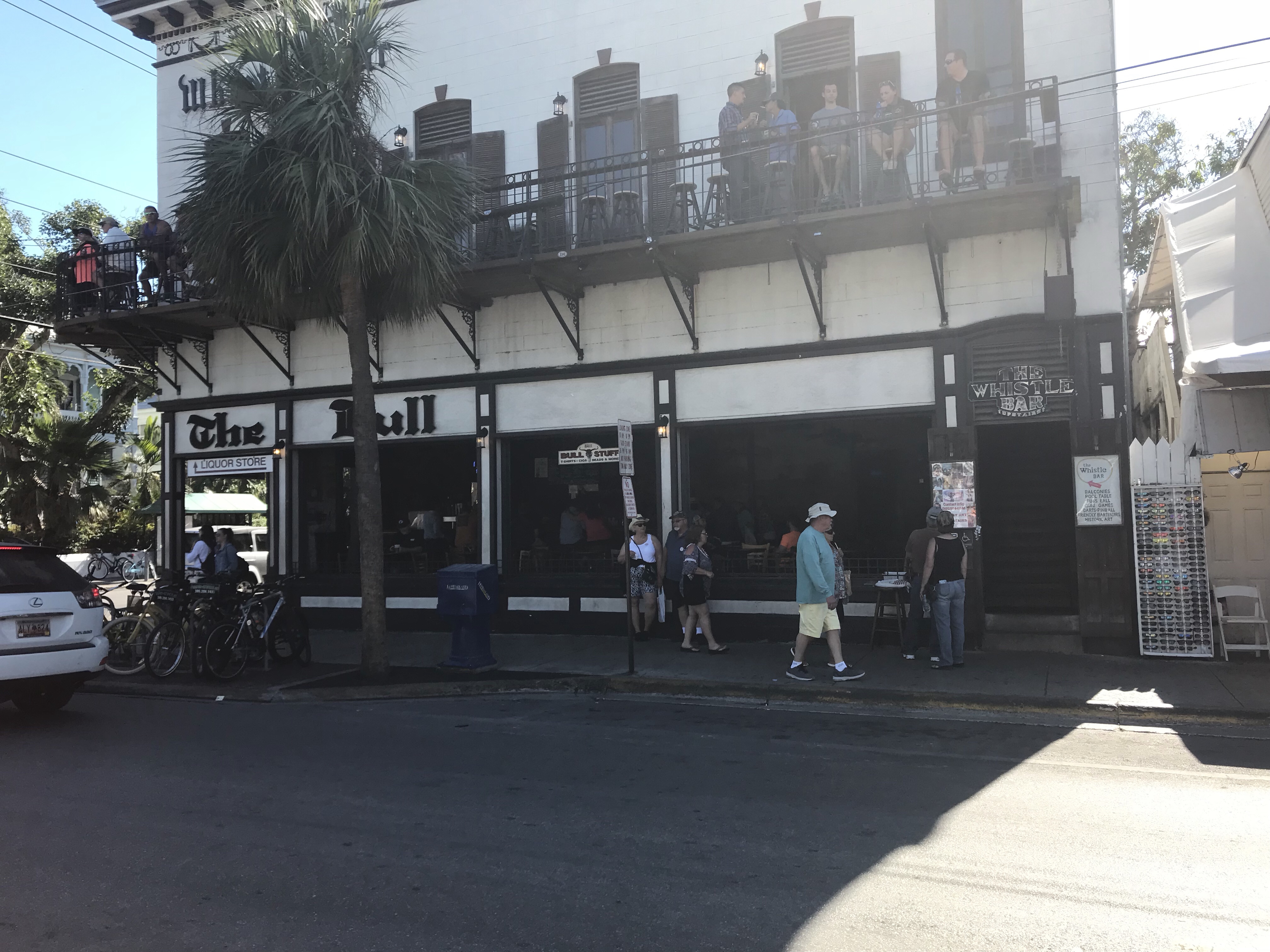
Is it the “Whistle Bar” or “The Bull”? – Branding issues?
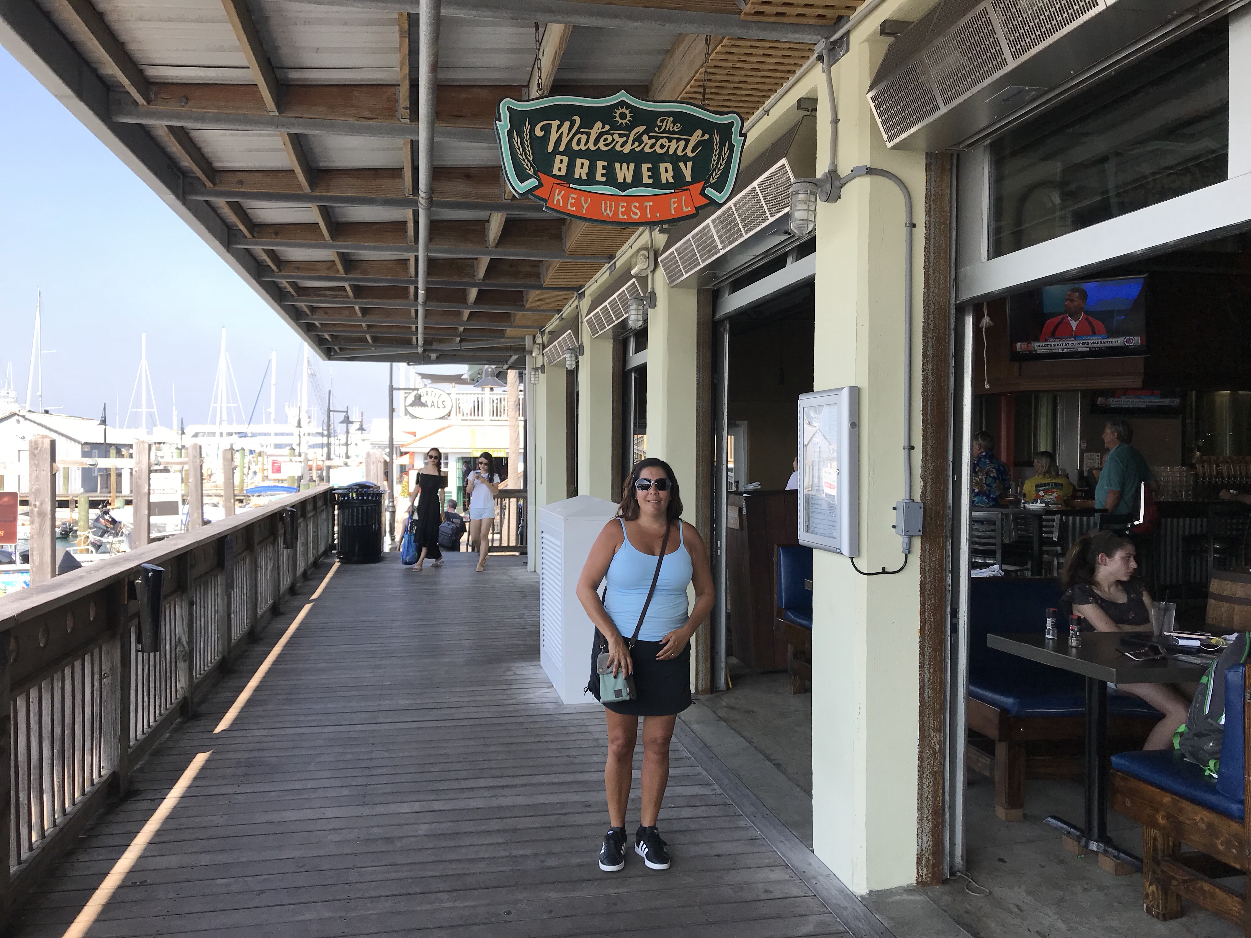
We joined the 1st ever Key West Cruisers Net Social at Key West Waterfront Brewery (right on the water). We had lots of fun sharing drinks and stories with other live-aboard cruisers.
They teased me a bit being a live-aboard cruiser on a trawler vs. Sailboat but I like to tease them back a bit 😉
Waterfront Brewery right on the water, nice breeze
Lots of fun drinking & chatting with the other cruisers
We made the first ever Official KWCN Social
Don’t you just love the banter between sailors and those who went to the dark-side?
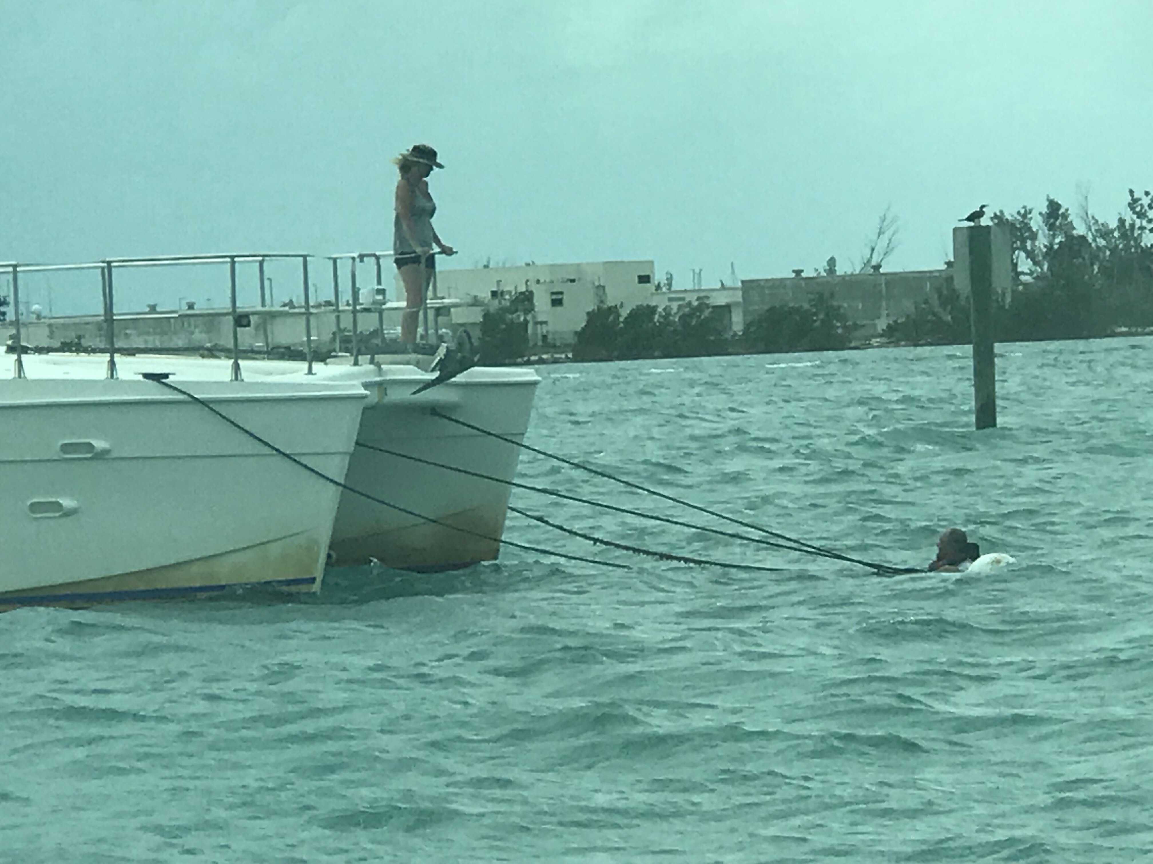
Some nights were dead calm which can get hot aboard without a breeze. Other nights the breeze was blowing in through the hatch and you needed a blanket to keep your toes warm. The funny thing about no wind is… the boats tend to spin randomly rather than all lining up with the wind. Our neighbors on a Manta 44 power catamaran had to jump in the water to untangle their mooring line that was wrapped around their mooring ball.
I offered help but they wanted to fix on their own. He’s a trooper
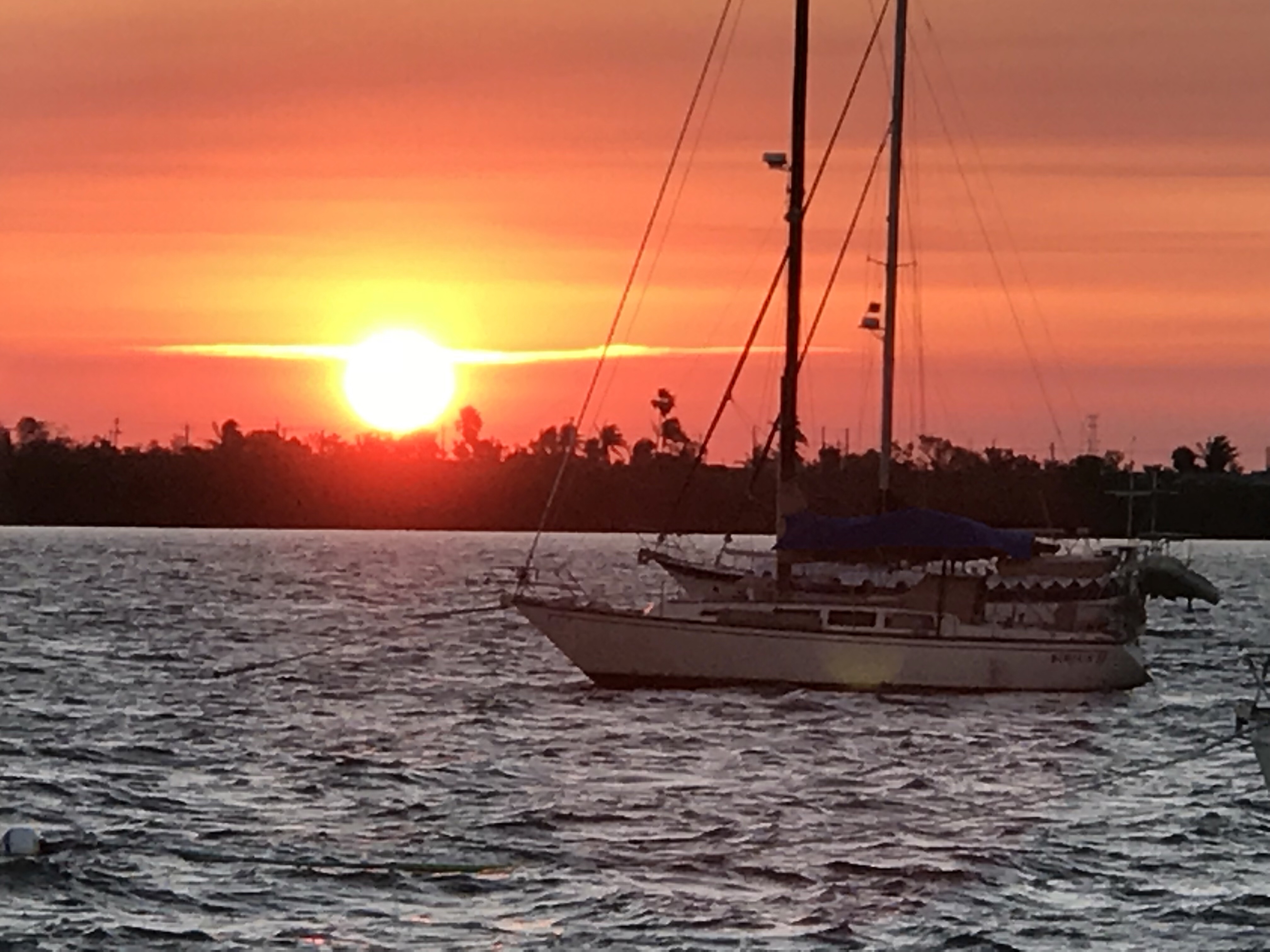
At night we would see amazing sunsets as we relaxed in the aft cockpit with a drink or two.
Kelly & I have been enjoying quiet nights on anchor and tonight will be spent on anchor in Delaroche Creek.
Below are the last 4 spots we have chosen to anchor.
Kelly & I both confessed that we like to anchor more than we like to stop at marinas. There is just something nice about being alone.
I have used the time to catch up on the walking dead.
I also got to watch “Anchorman” while on anchor. I think I laughed so hard I almost cried.
As we traveled down the ICW the weather just kept getting warmer. While it may have only been 65 degrees out, it was over 80 in the pilothouse.
Chief Martin Brody, our Boston Terrier, loves to lay on a pillow covered by his favorite Afghanistan and soak up the sun.
Along the way we were followed by bottle nose dolphins.
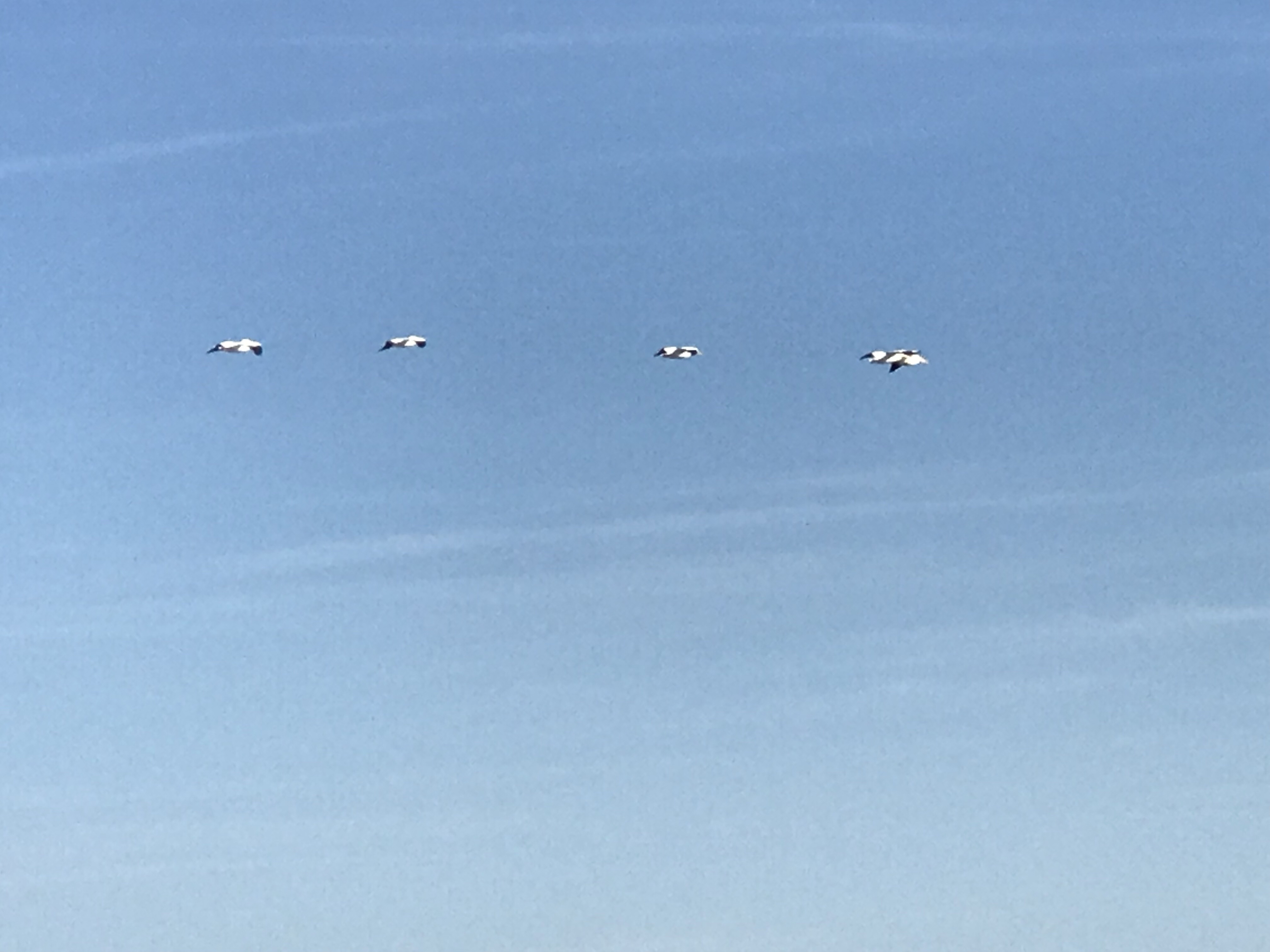
Many different sea birds.
The last picture is of these large white birds with black tipped wings. We keep trying to capture them up close but keep missing them.
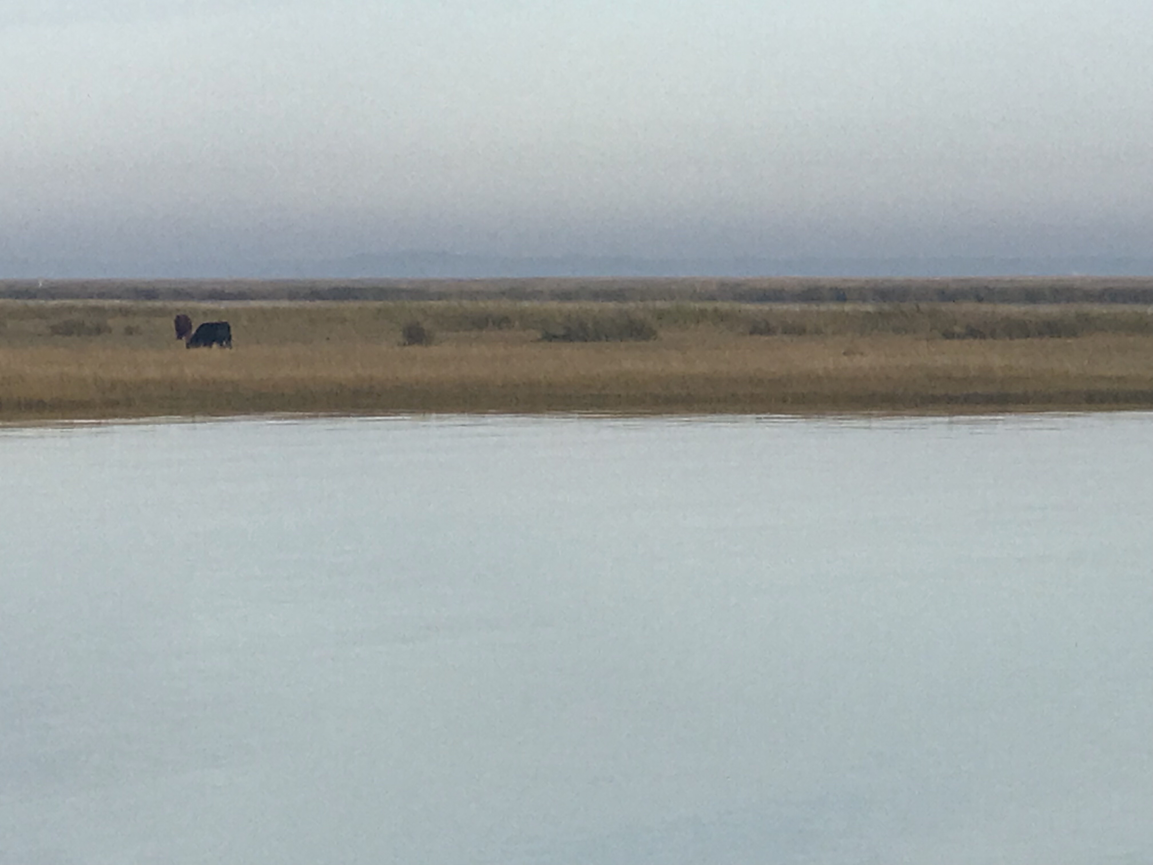
We also saw cows grazing along the deserted islands.
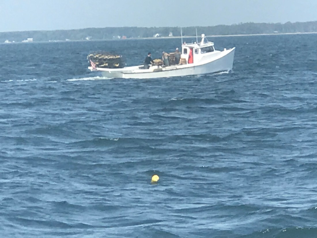
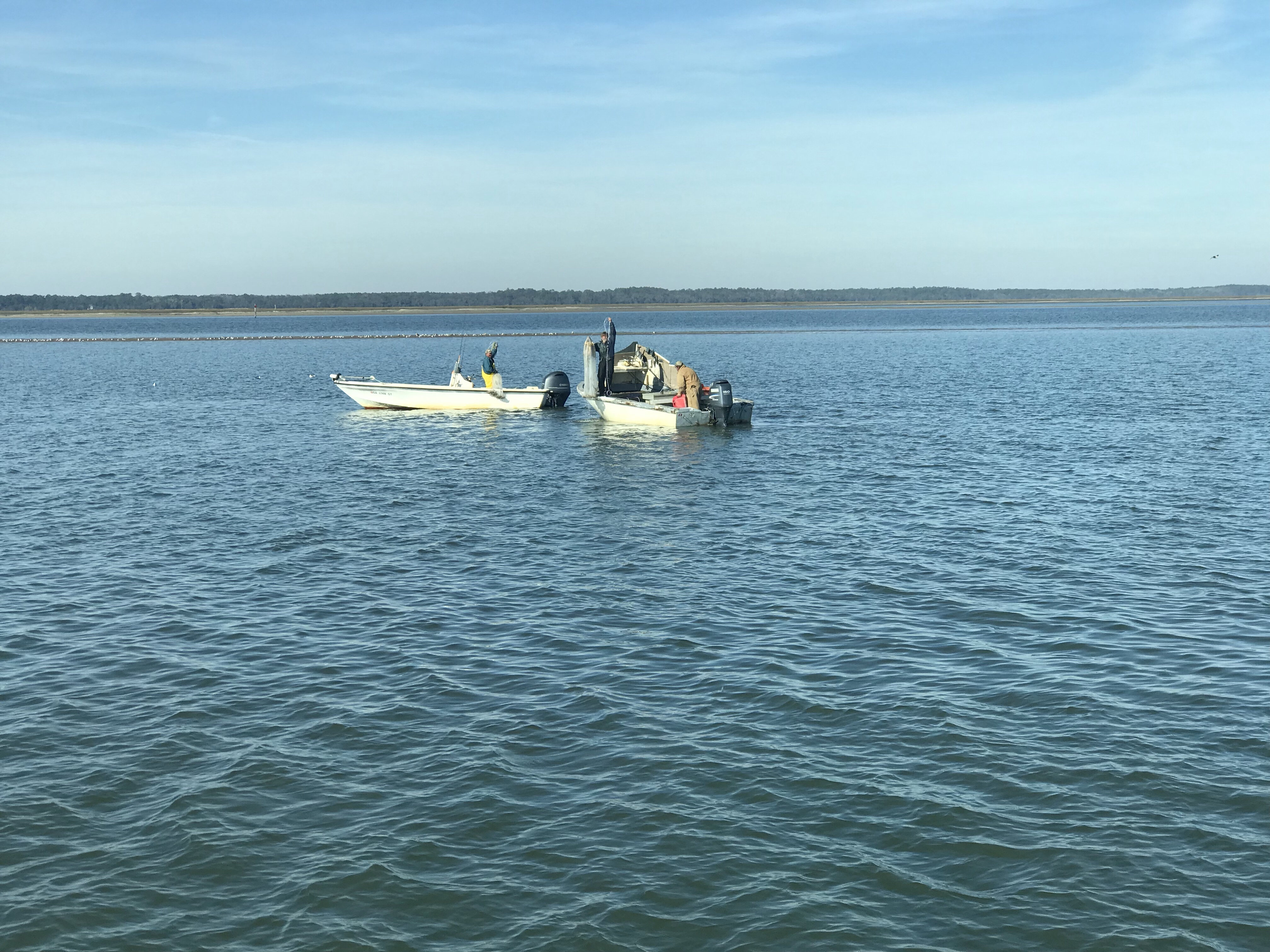
We only passed 5 or so boats. We passed these fishermen who where combining their efforts to catch bait fish using a cast-able net.
This faster trawler passed us.
Heck, even the towboat who was engaged in an active tow passed us. We figured 6 knots isn’t exactly fast.
The towboat captain was quite friendly and chatted with us on the VHF for a bit. He warned us about the upcoming shallows in Jekyll Creek that goes around Jekyll Island. He was not wrong. We were approaching simultaneously with low tide. We thought we might anchor before the worst of it but instead pushed on and made it past Jekyll Island to Cumberland Island further South. Tonight we anchored in Delaroche Creek about halfway down Cumberland Island. It’s a tight fit in here. I had to shorten the anchor rode more than I wanted to keep from swinging into the banks of the creek. I snapped a pic just to show how close the edge of the creek is in here.
Last night’s anchor in the Darien River was a bit wider and lucky for that as the local Darien shrimp boats had to squeeze by us.
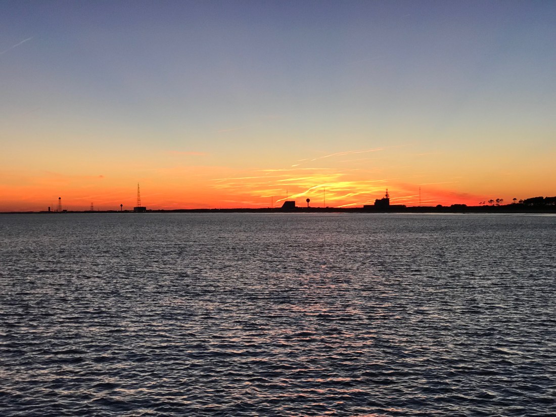
So tonight as we get ready to watch the Patriots play we’ll enjoy yet another beautiful sunset.
We awoke around 4AM this morning and I began pouring over the charts until I felt comfortable that we could safely make the passage down the outside passage to Norfolk, VA in 4 separate legs. By staying outside we will save days if not a week of traveling inside through the Chesapeake. While we would like nothing more than to spend months exploring all the great places in Chesapeake Bay, right now we could go for some Key West sunshine.
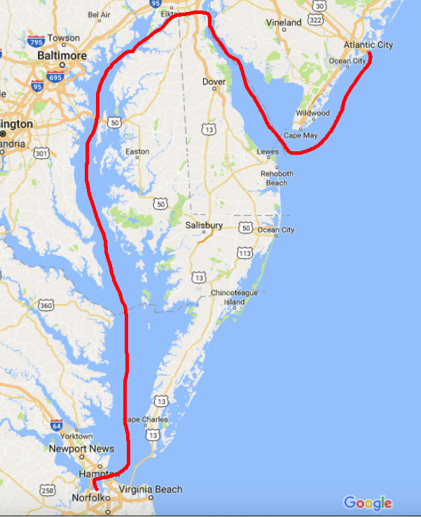
The other day we left Atlantic City and motored past the mouth of Delaware bay, I just could not bear to make a starboard turn and head up the Delaware Bay. This would mean heading North rather that South. In order to take the inside passage you must first run North up the Delaware Bay till you get to the C&D canal that connects the head of Delaware bay with the head of Chesapeake Bay. Once in Chesapeake Bay you again start heading South. It’s quite a bit longer than simply staying outside in the Atlantic Ocean. It’s also more work for the captain, who must stay vigilant to avoid other boat traffic as well as steer around lobster pots. Nobody likes getting a lobster pot line wrapped around their propeller. We installed a “shark” pot cutter in front of our propeller to hopefully chop any lines that tangle in our propeller.
“Shark” Pot Cutter in Front of Propeller (Similar to MV Simple Life’s Setup)
Inside Passage – Up Delaware Bay, Through C&D Canal and down Chesapeake Bay
Outside Passage – 4 Legs, 2 Anchorages
The more we studied the few inlets along the outside passage, the more we realized that many of them were possibly full of shoals and shallows to be worth trying to enter. There were some that if we did enter the inlet, it was clear that once inside it we could easily run aground due to the shallows that abounded. It was also very evident to us that our 2012 electronic charts no longer match the current depths and shoal locations. I use the charts as a “guide” but keep a close eye out for breaking waves where a new shoal may have formed due to recent storm activity.
We arrived at Chincoteague Island sometime around 1PM. The journey here was pretty uneventful. We saw only one other boat and it was a large sport fishing yacht moving at twice our speed South down the coast. We studied the charts and found a nice spot to drop hook, close to the shore. MV Simple life has a 90 lb. Rocna, plow style anchor and 300′ of 3/8″ chain. I let out almost 120′ which was a ridiculous amount of scope (“anchor scope” is a ratio like 7 to 1: length of chain compared to depth of water). If we were in a crowded anchorage we’d never be able to let out that much scope as when the wind changed direction we’d swing into other boats. Along this coast there is not another boat in sight. After the anchor hooked up I applied some throttle in reverse (+200 above idle, or 800 RPM) which combined with the strong wind, buried the anchor. The extra throttle lifted the chain straight out of the water with no bounce. We believe you should always “back down” on your anchor and watch to see if the chain jumps up/down which is a clear indication that the anchor is dragging along the bottom. This can happen for many reasons but some possible causes can be the seabed could have eel grass that stops the anchor from “digging in” or the bottom might not be sandy but instead a super soft silt that is like pushing a potato chip through whip cream instead of thick cheese. Better to have your anchor drag while you’re backing down on it than when the wind picks up in the middle of the night and you are fast asleep.
Red X is Where we Anchored – Off Wallops Island. Chincoteague outlined in Red
After reading about the wild ponies on Chincoteague Island, I made up my mind to use the crane and drop the dinghy in the water to go find them ponies. I had no sooner raced off on the dinghy before I thought.. I’m freezing & I’m zipping along over the shallow shore and could easily run aground at full speed and wind up taking a dip in the cold Atlantic. So I put a lifejacket on and turned around and made it back to the Simple Life. DAMN, NO PONIES!!!
Back at the boat the heater was on and I quickly put the dinghy back on the flybridge and warmed up to an IPA 😉 That brings me to where I am now.. sitting in the pilothouse enjoying a beer or two. We’ll leave you with our sunset view — good night.


You must be logged in to post a comment.