Geo-Rida

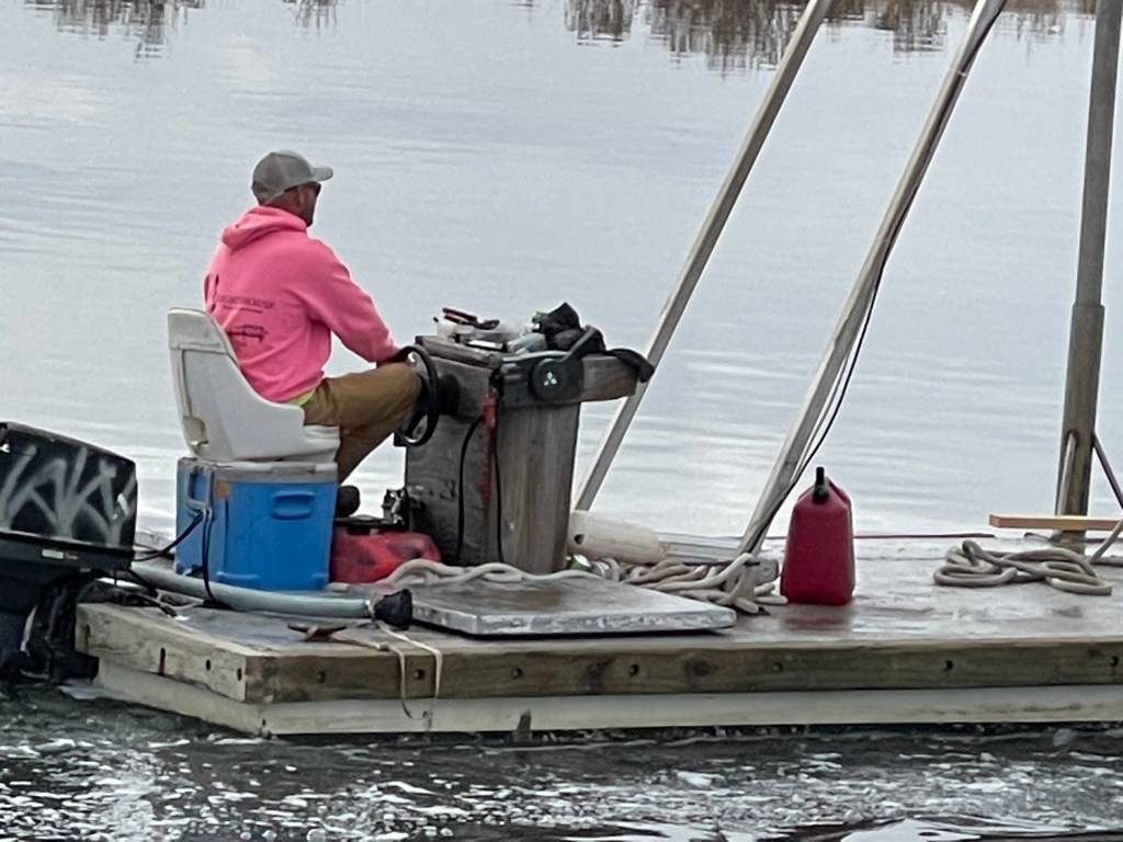
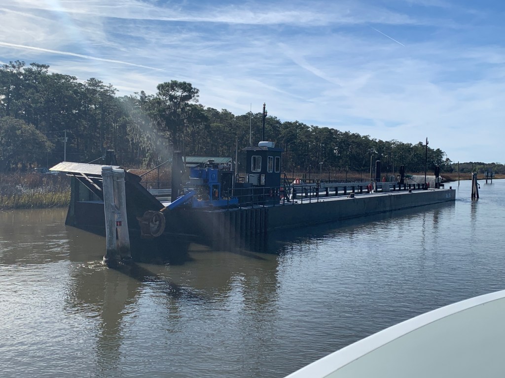
We were on our way to Southport, NC to see our friends Jim & Wende. We had to slow down to no wake speed to keep from swamping this fella who was motoring a small work barge down the ICW.

Cooler Seat Captain

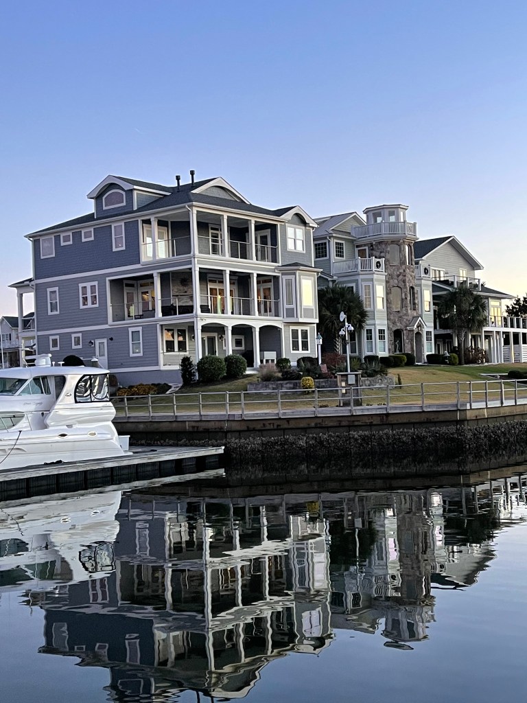
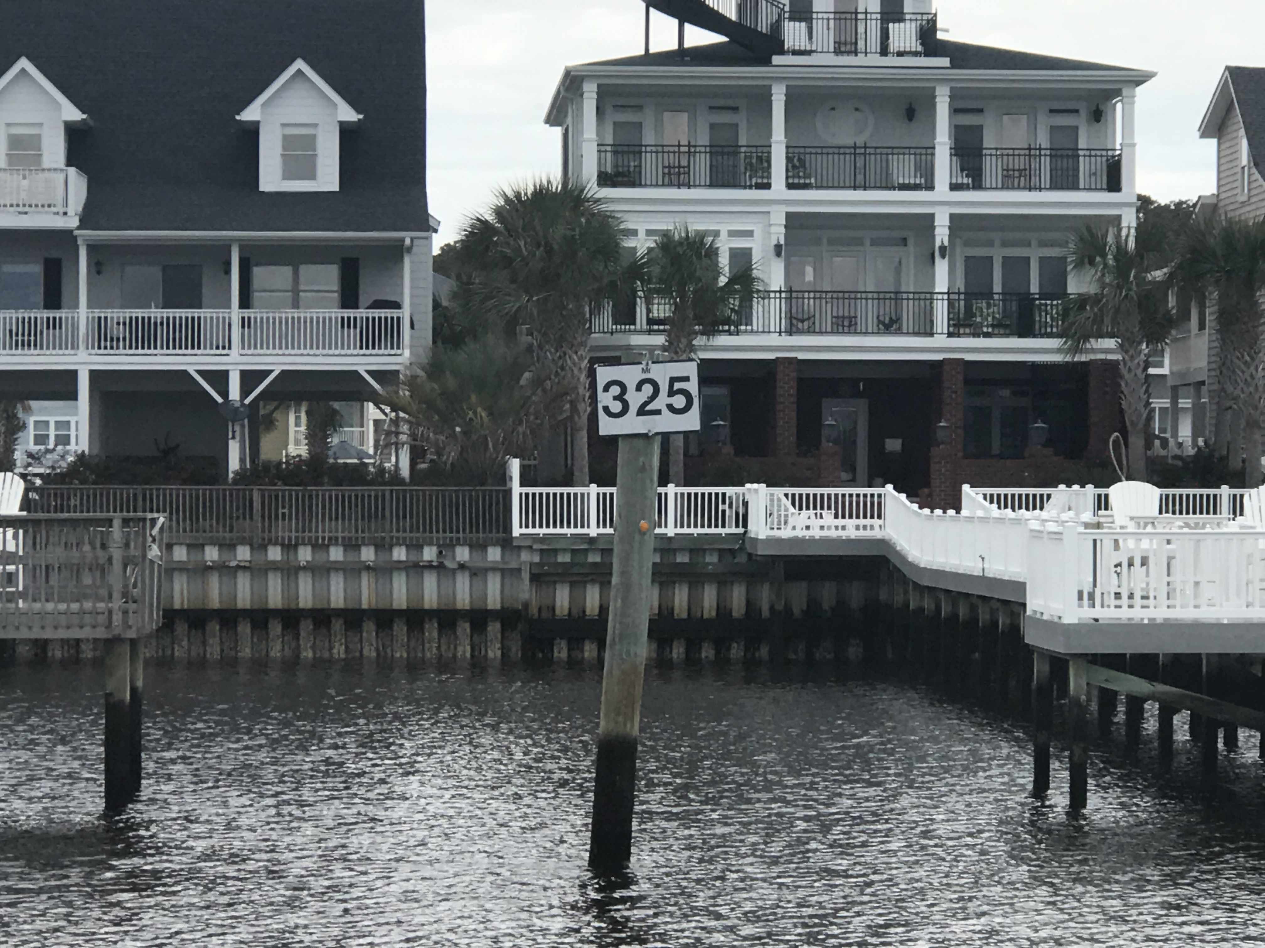
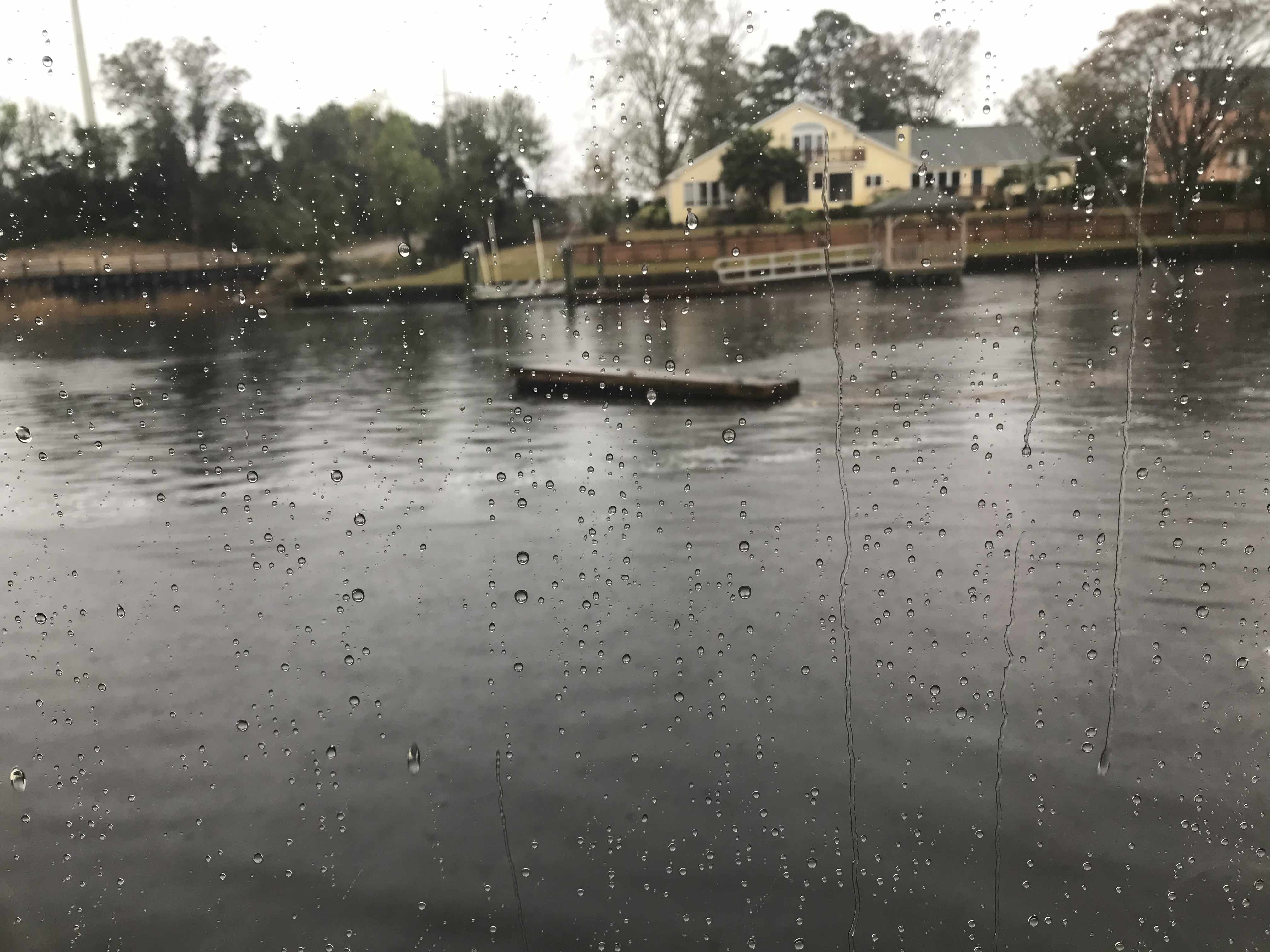
We arrived at St. James Plantation Marina just before sundown. The homes along the harbor are beautiful.

The Big 😀

Jim and Wende let us use their truck to reprovision which was perfect as it was the day before Thanksgiving and we needed TURKEY!

Later that night Jim & Wende took us to dinner at a Joseph’s Italian Bistro @ Safe Harbor Marina. We had dinner with some good local IPAs & lots of laughs. I wish we had taken a photo but I think we were just having too much fun. Jim and Wende told us all about their trip back from Buzzards Bay, MA to Southport, NC in their new Pursuit OS 355. The weather was a bit ruff off the RI coast but they made great time with stops in places like Atlantic City.

Capt Jim & Wende

In the AM we were off and Capt T was at the helm.

Capt T @Helm

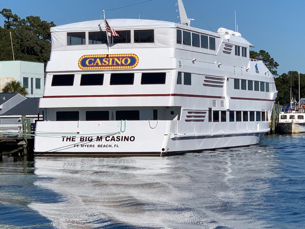
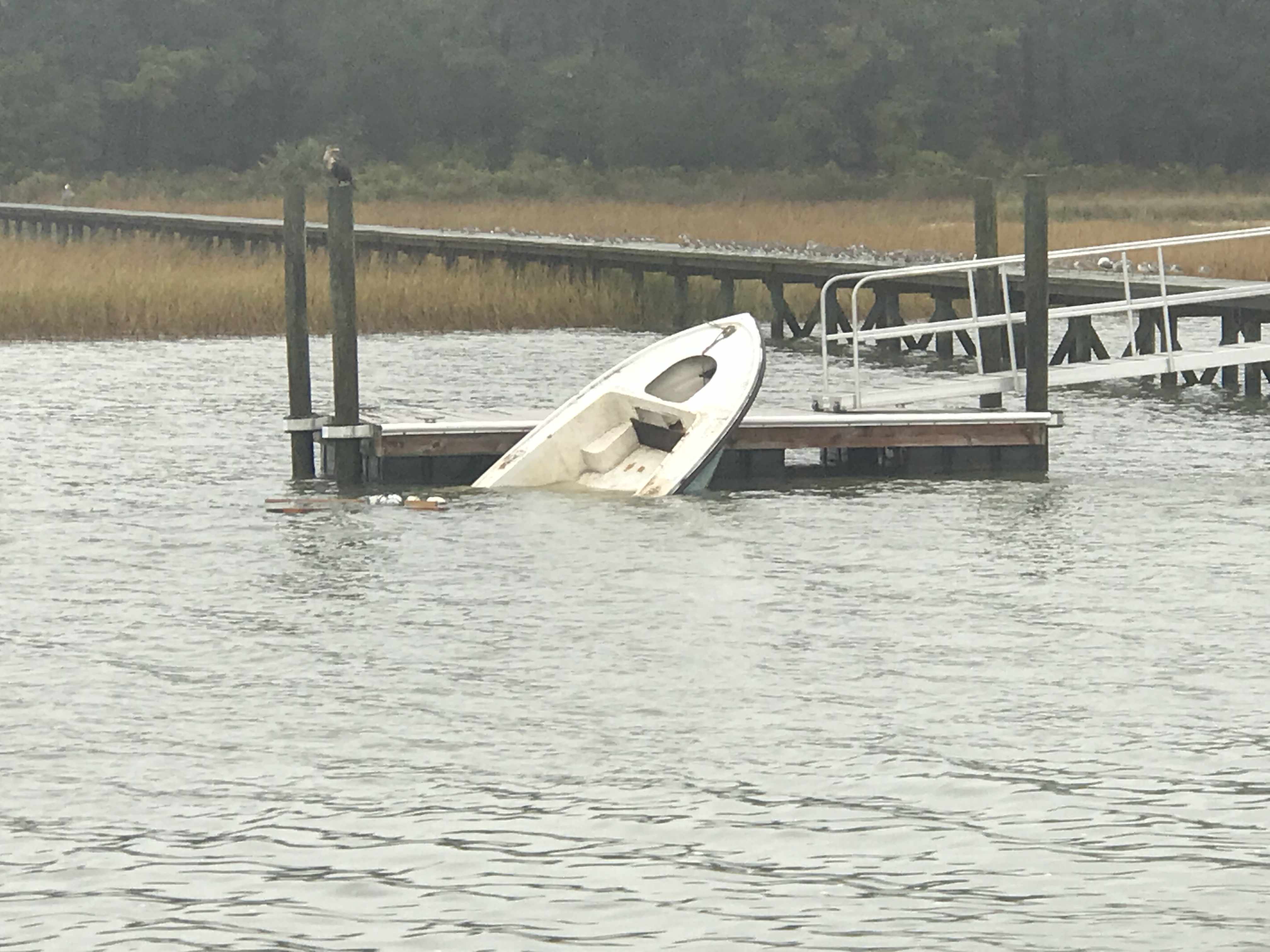
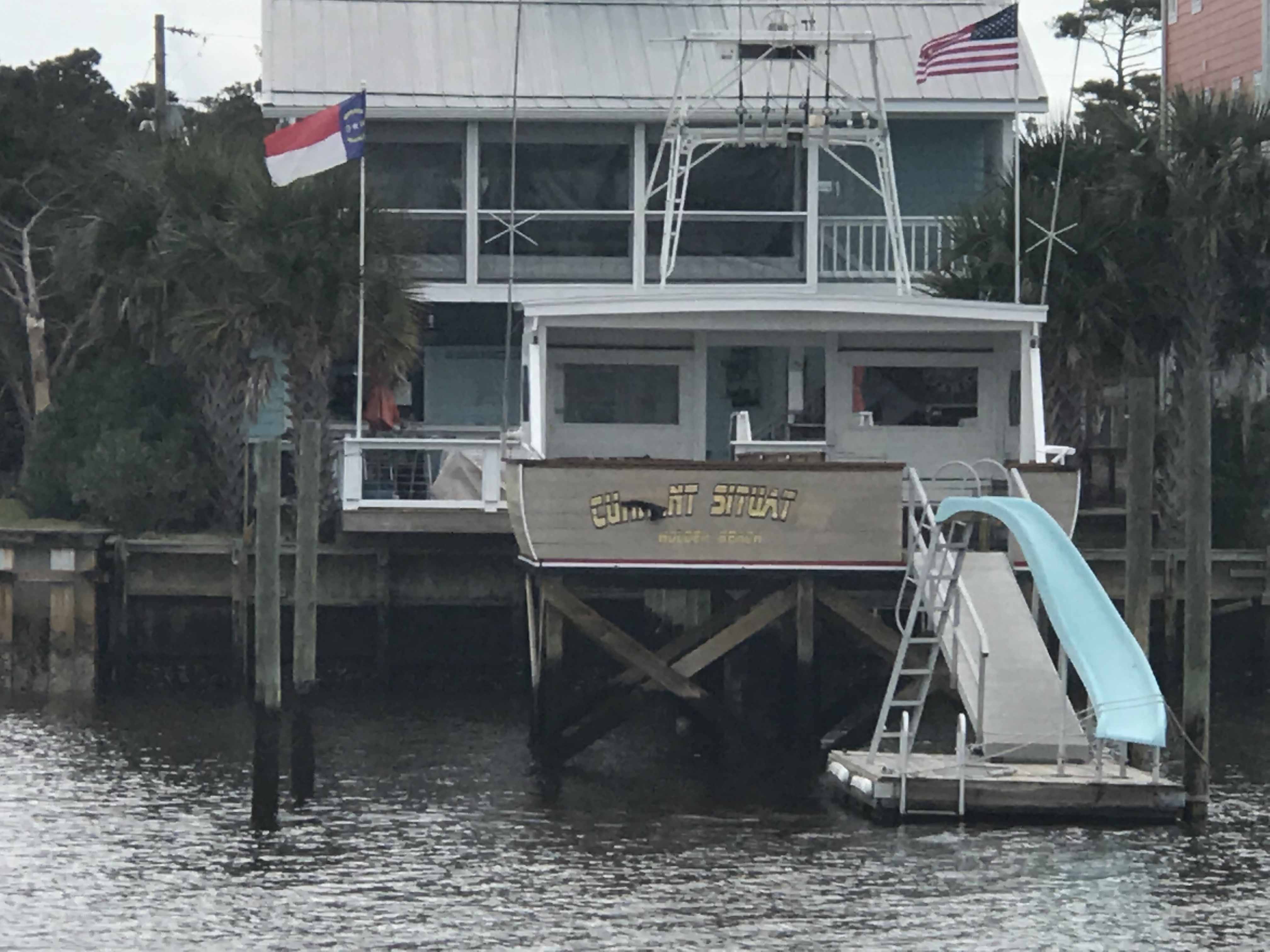
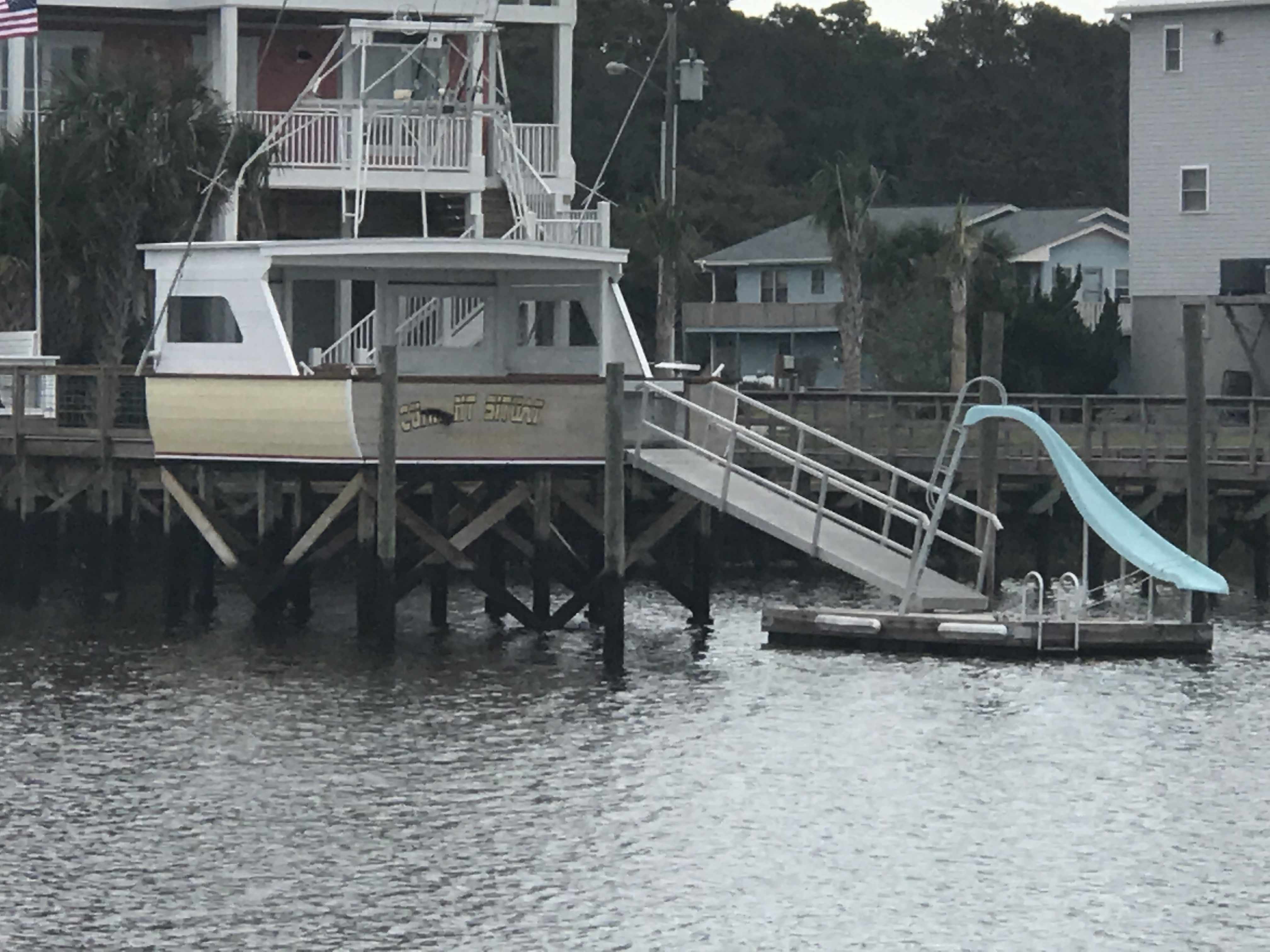
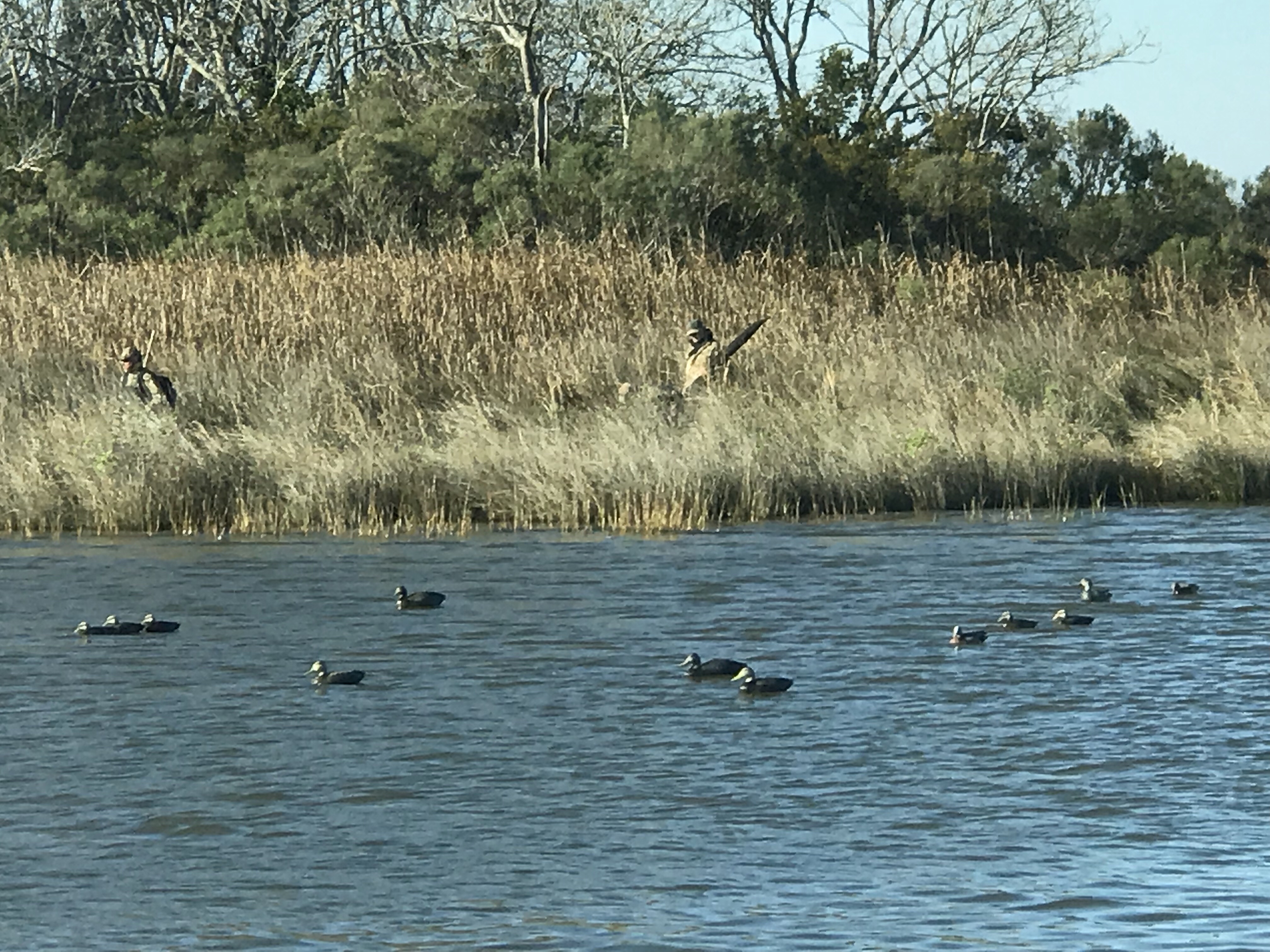
We passed a boat dock that was more boat than dock. Capt T thought she recognized a casino boat as we passed and sure enough the “Big M” hailed from Fort Myers, FL.

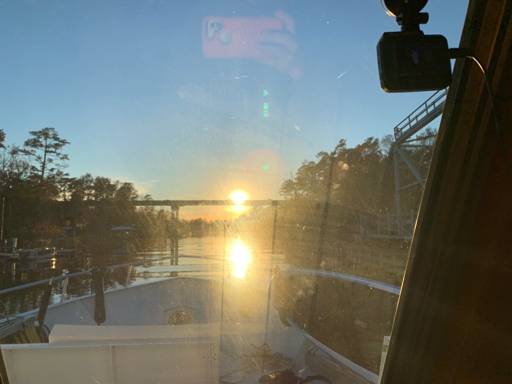
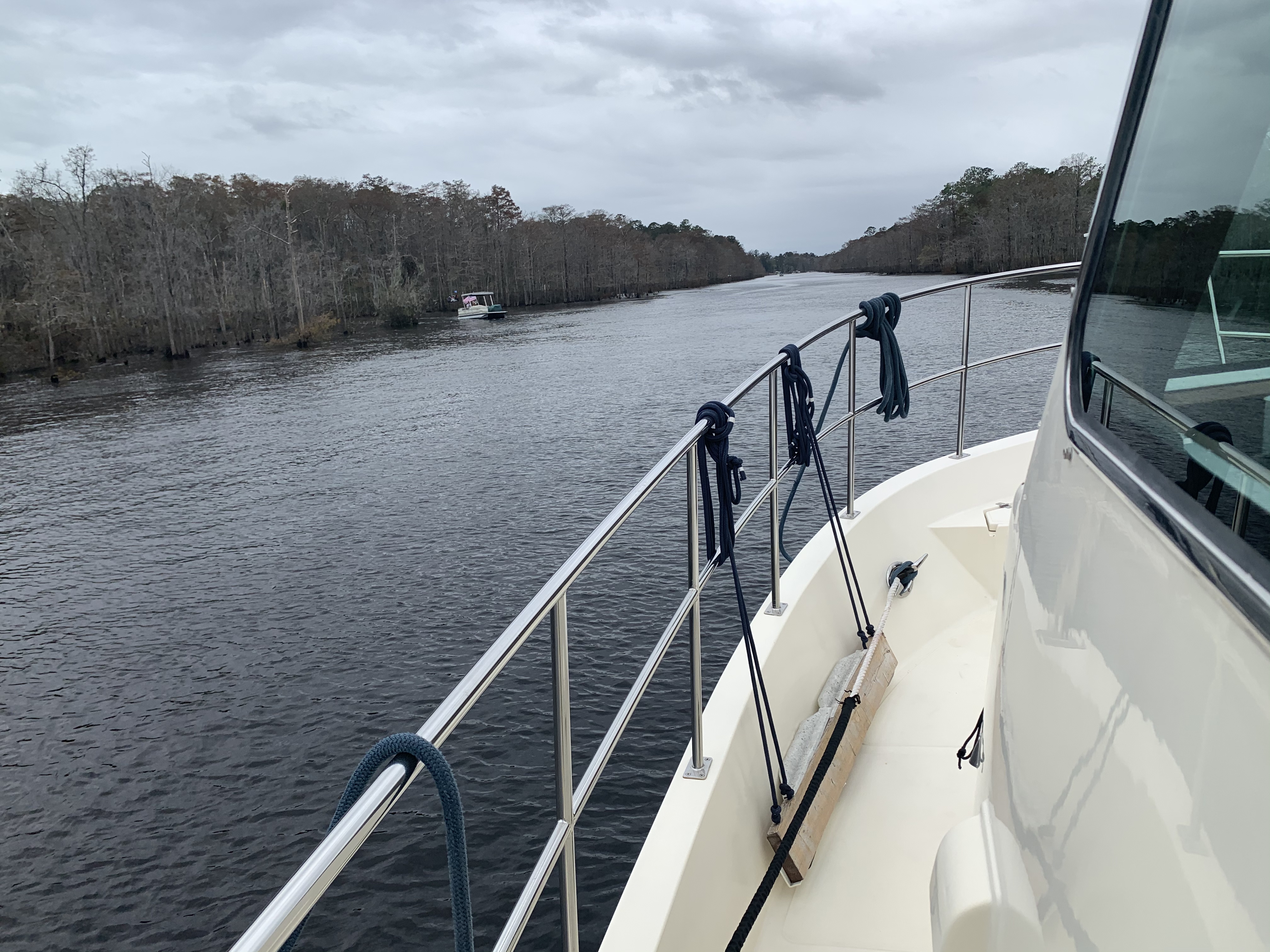
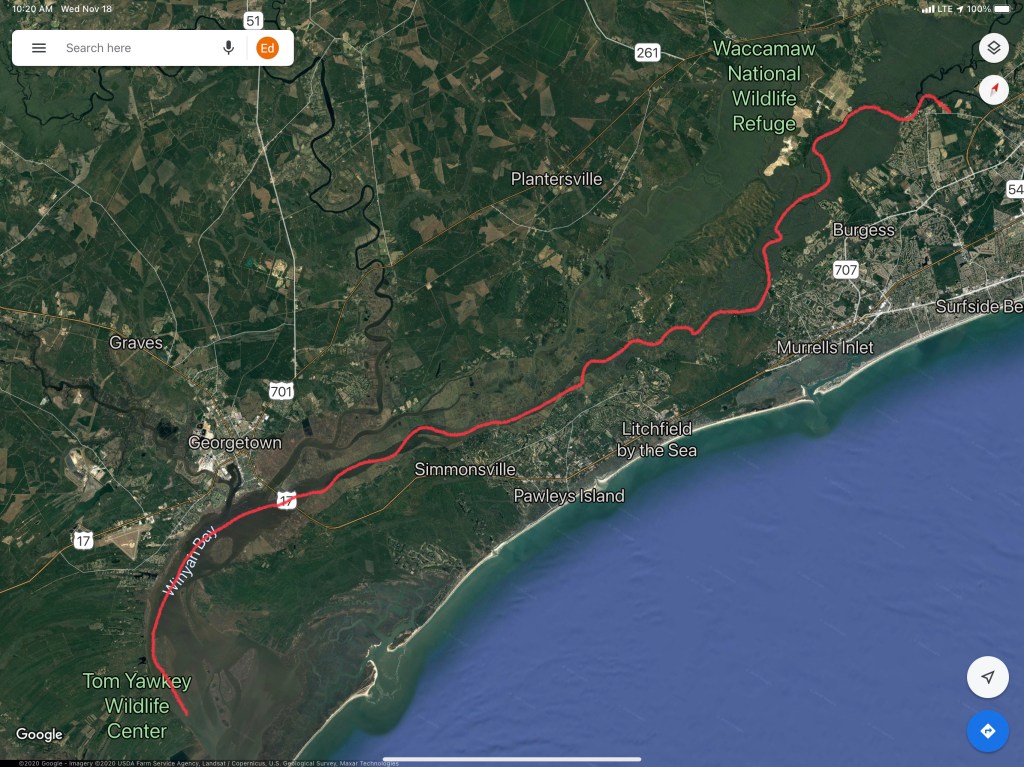
As we made our way into the Waccamaw River preserve we had to get through the Socastee swing bridge but we were staring straight into the sun. The best we could do was go slow and use the radar to see in front of the boat.

Camera may see the swing bridge on the right but we only saw a bright spot looking out the pilothouse

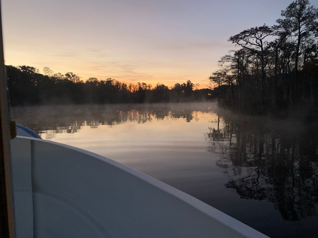
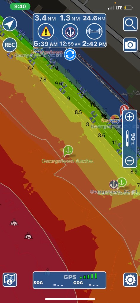
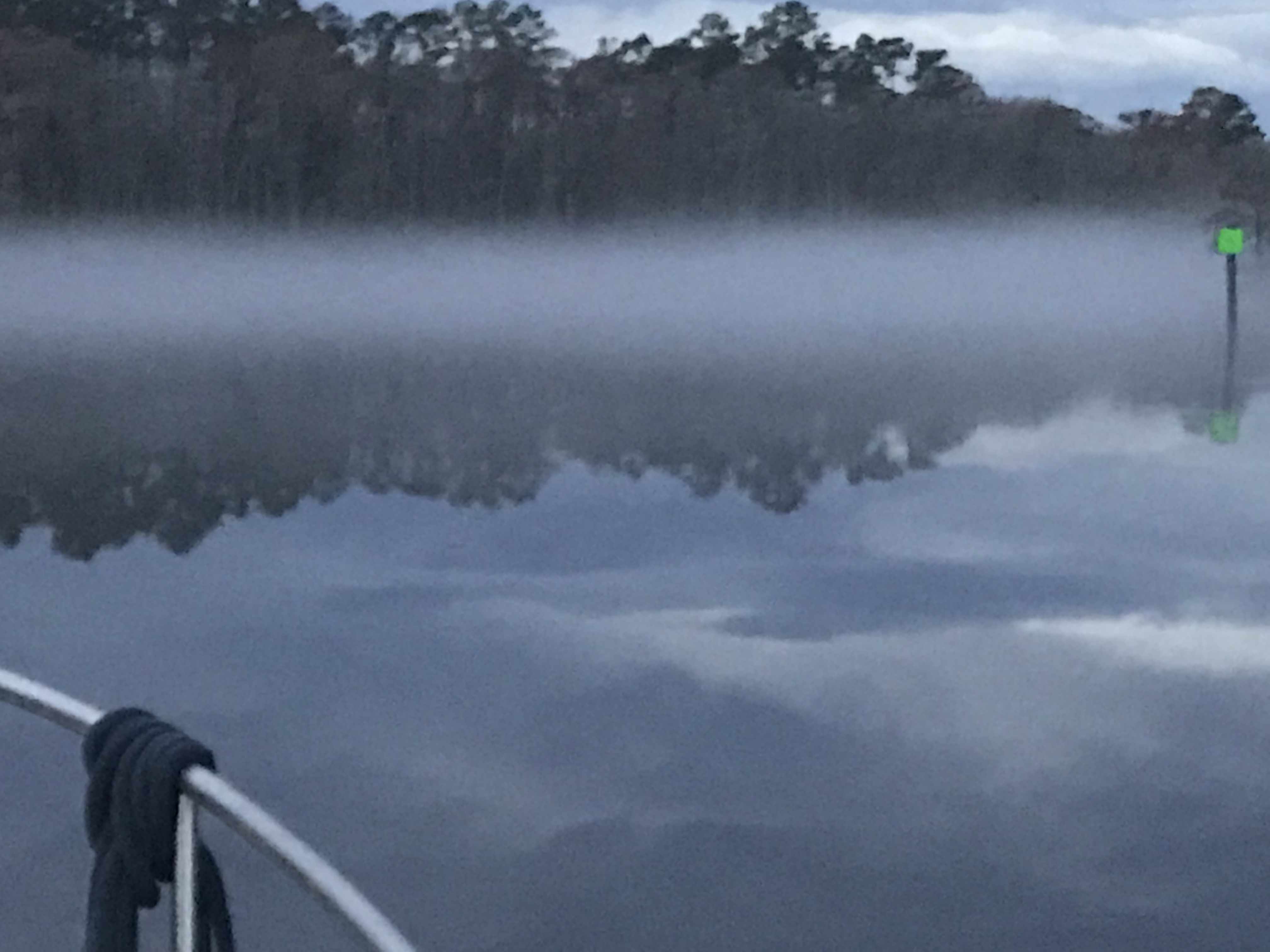
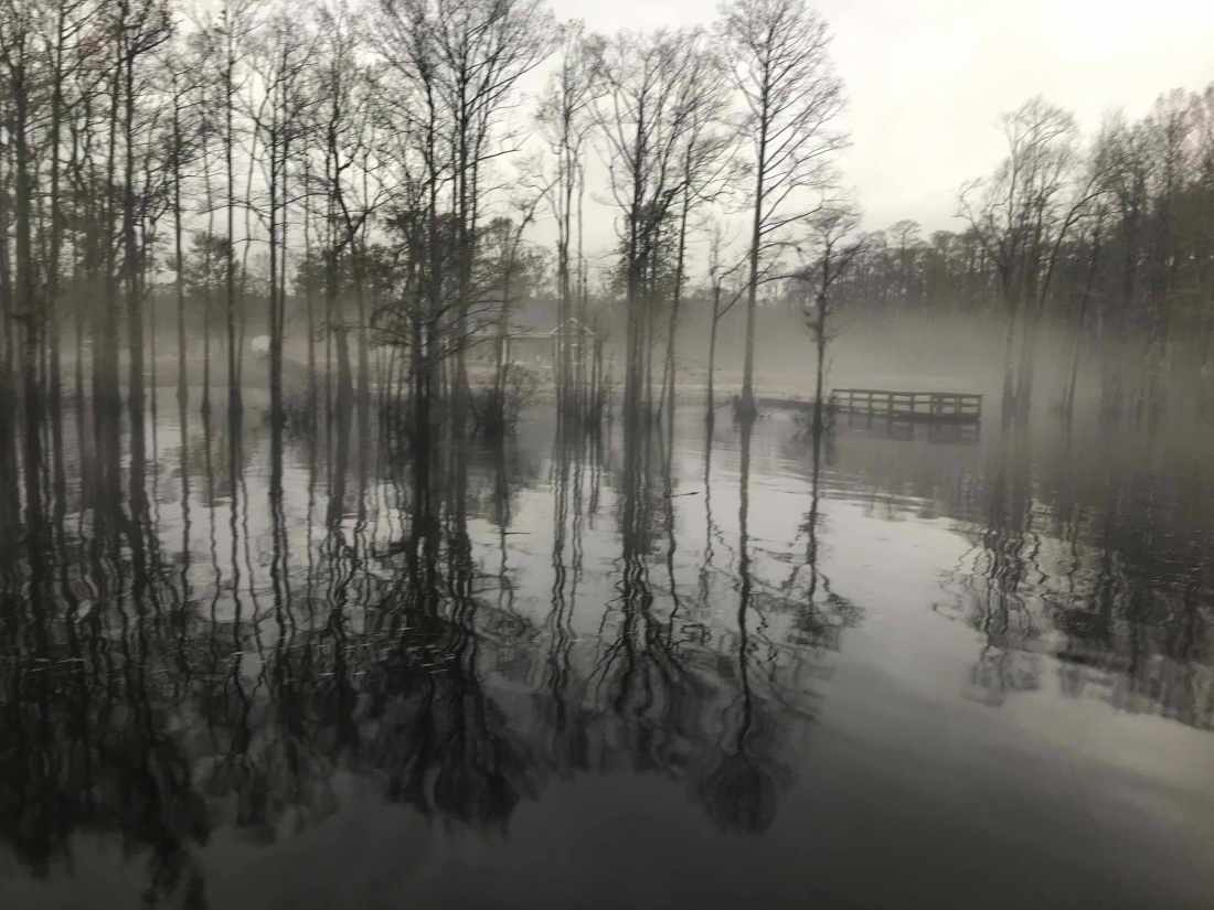
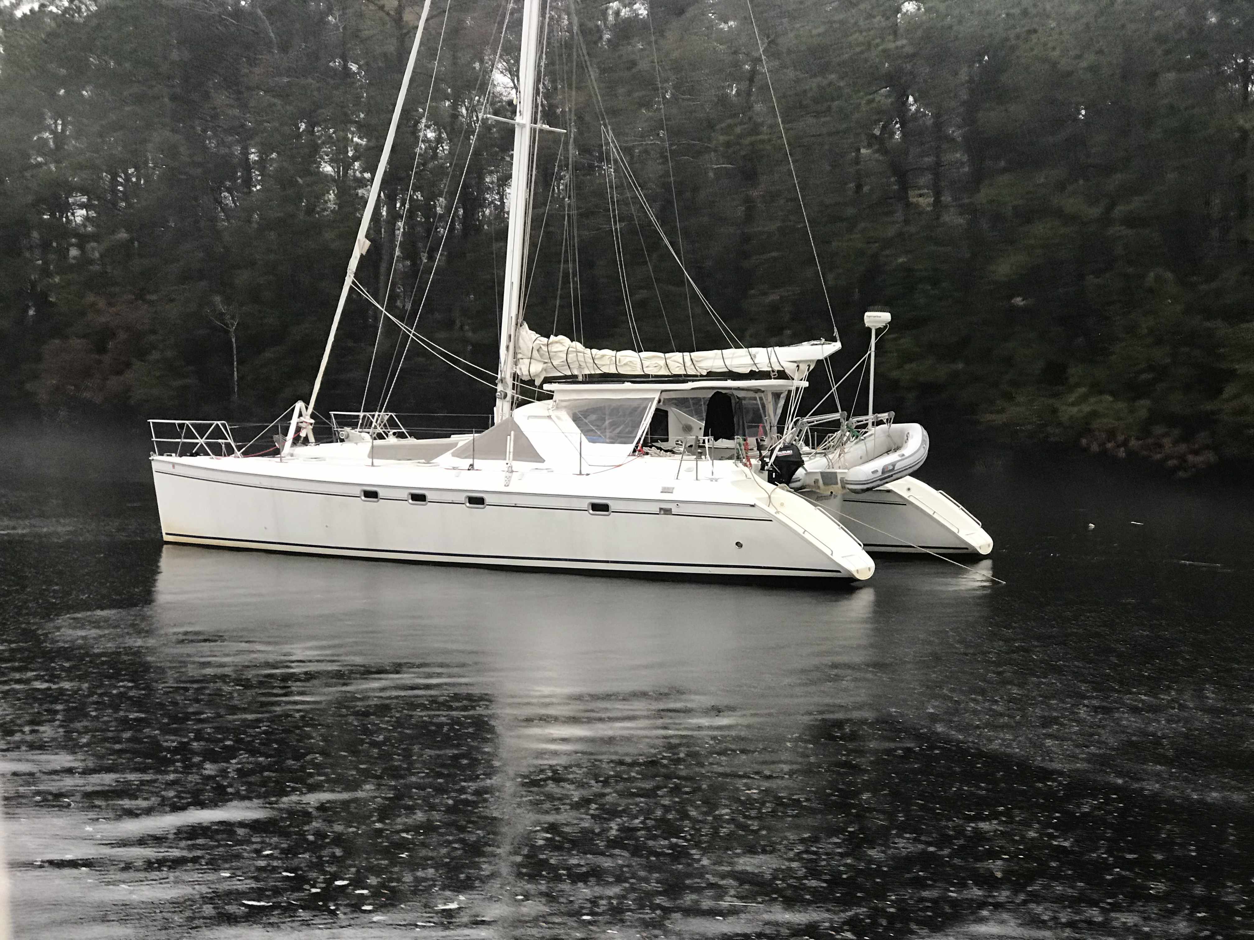
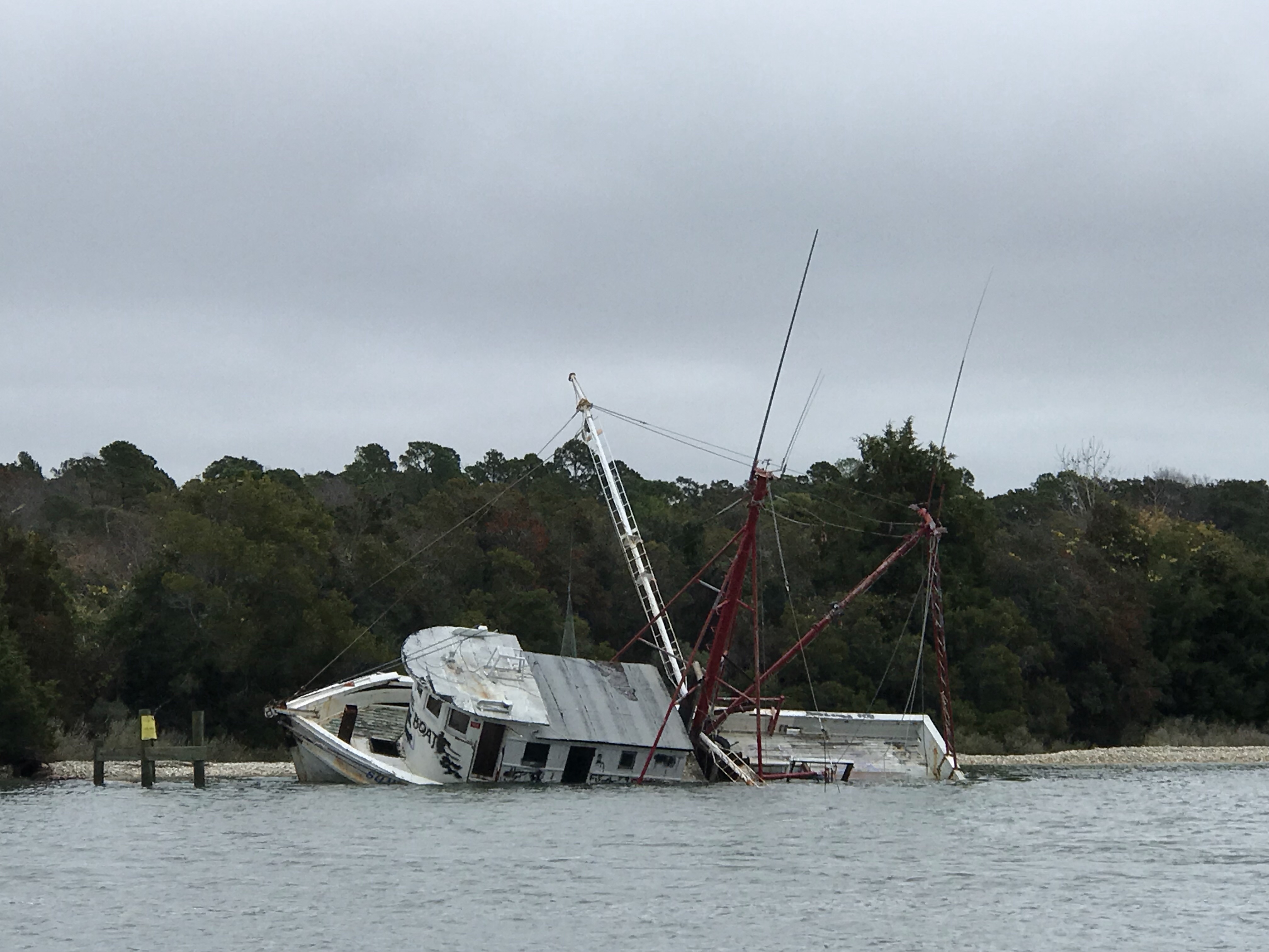
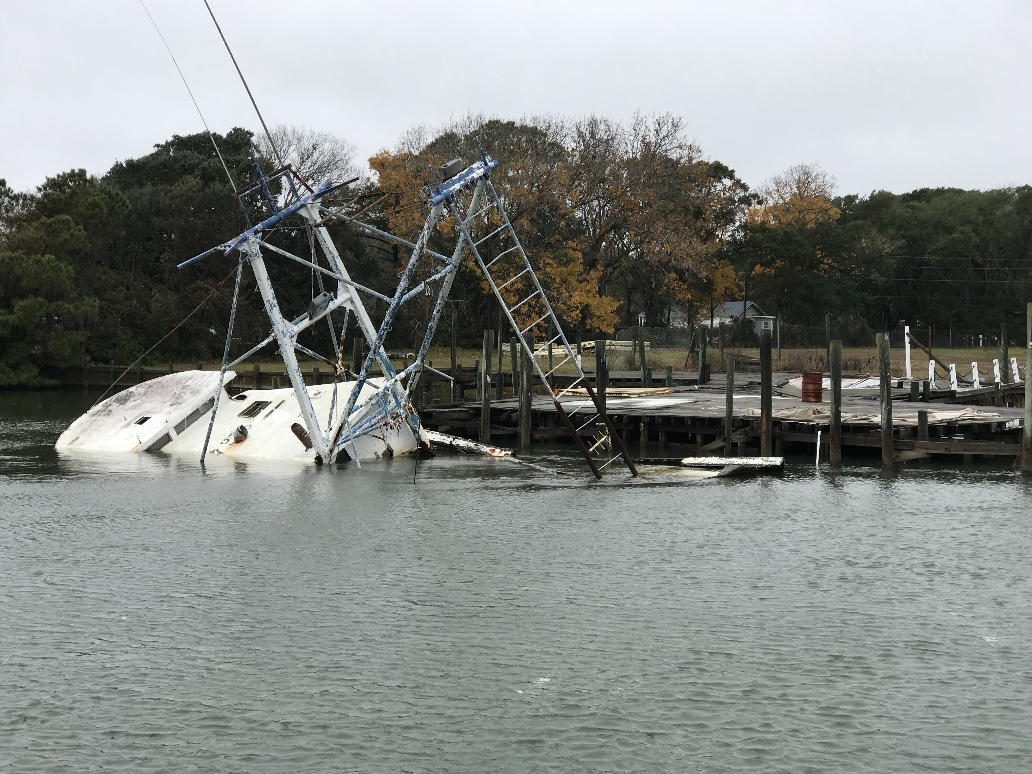
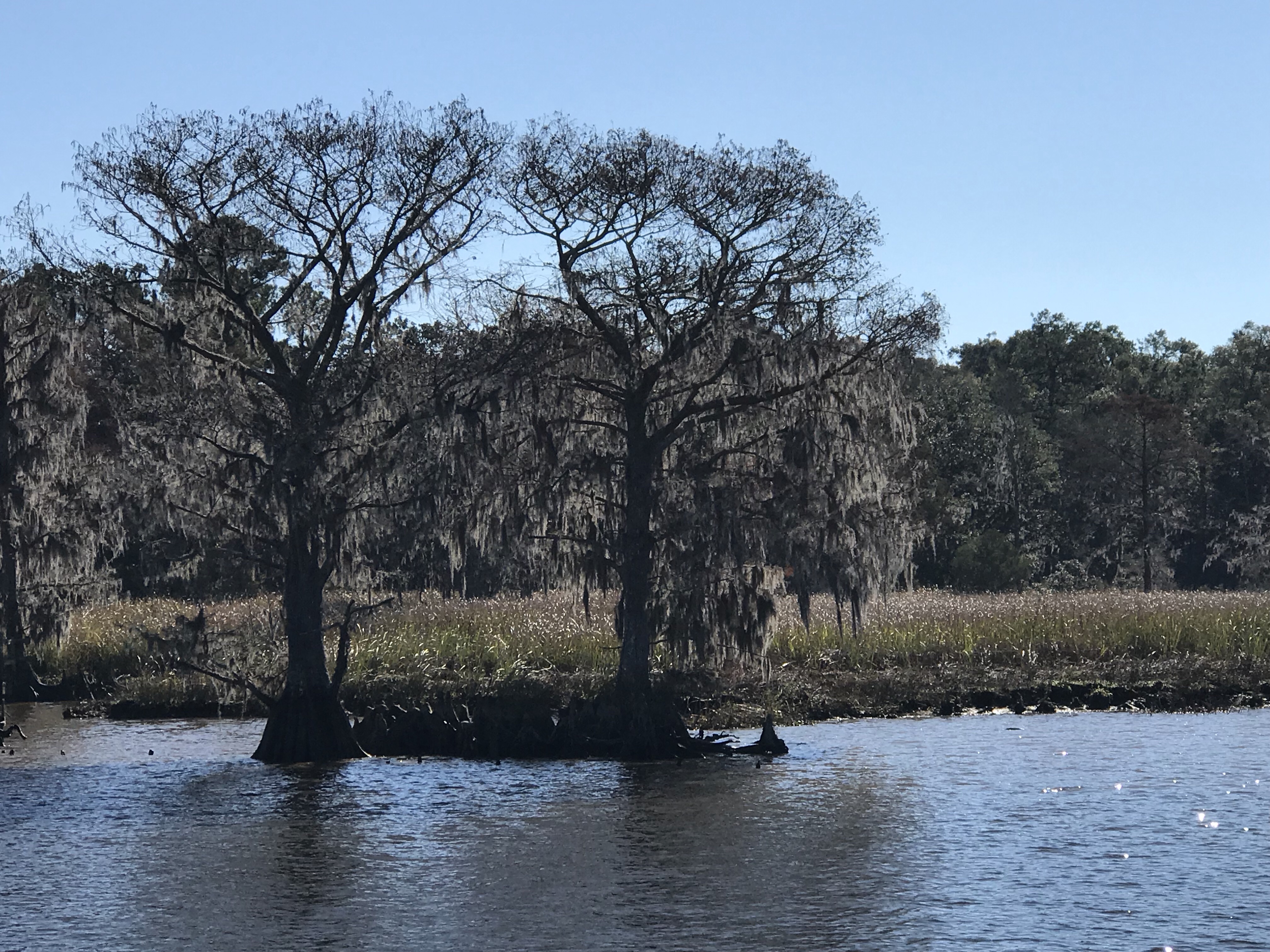
We anchored in what I call the Waccamaw River (ie. swamp) and it’s beautiful. We had a great night on anchor as the high trees provide protection from everything but the cold.

It was COLD.

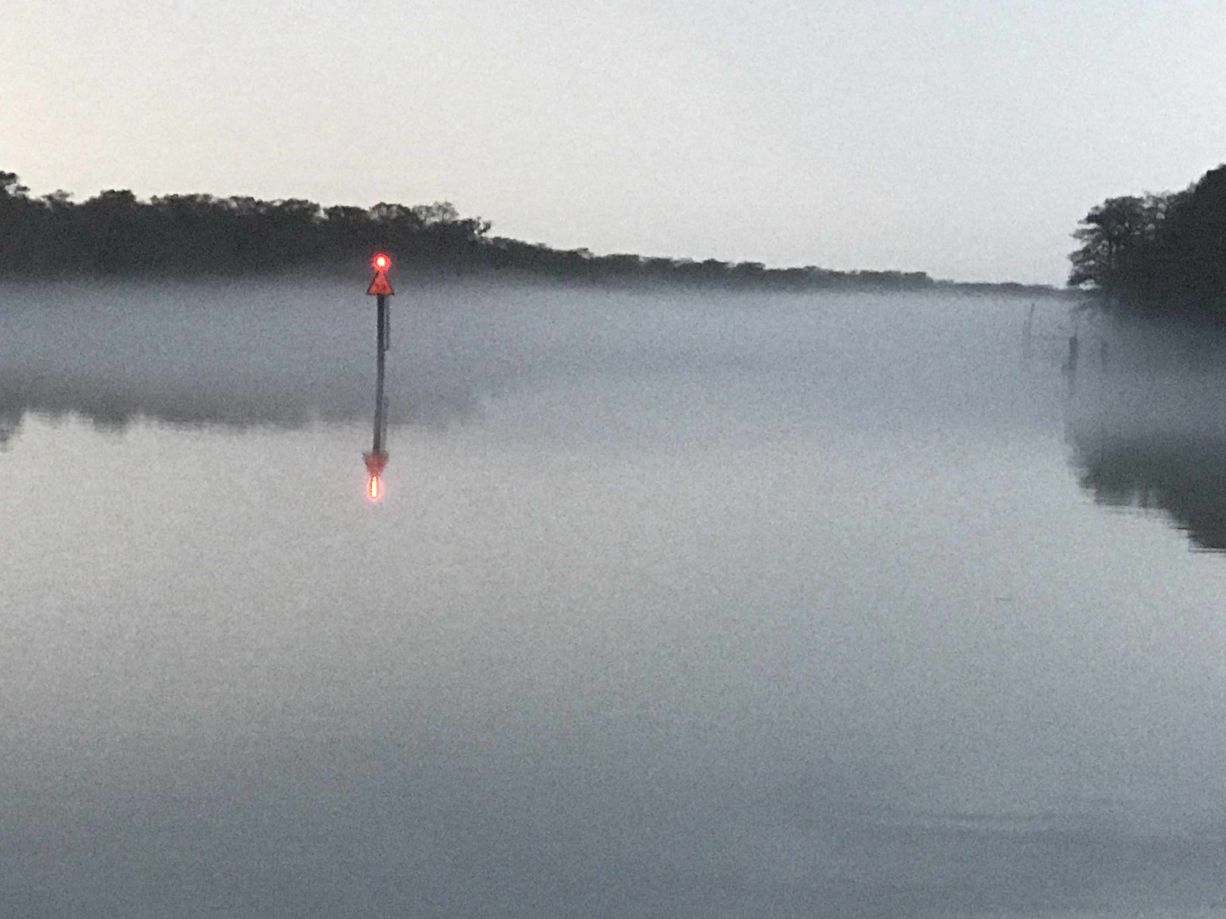
We weighed anchor at first light and the swamp was steaming due to early morning low temps.

Waccamaw River pre-dawn

We had to slow to no wake so as to not disturb this Nordhavn anchored right off the main ICW route.

Peaceful Anchorage

The next swing bridge is actually a floating swing bridge. Very cool. It simply uses drop-able drive-on ramps and a huge tilt-able bow thruster.

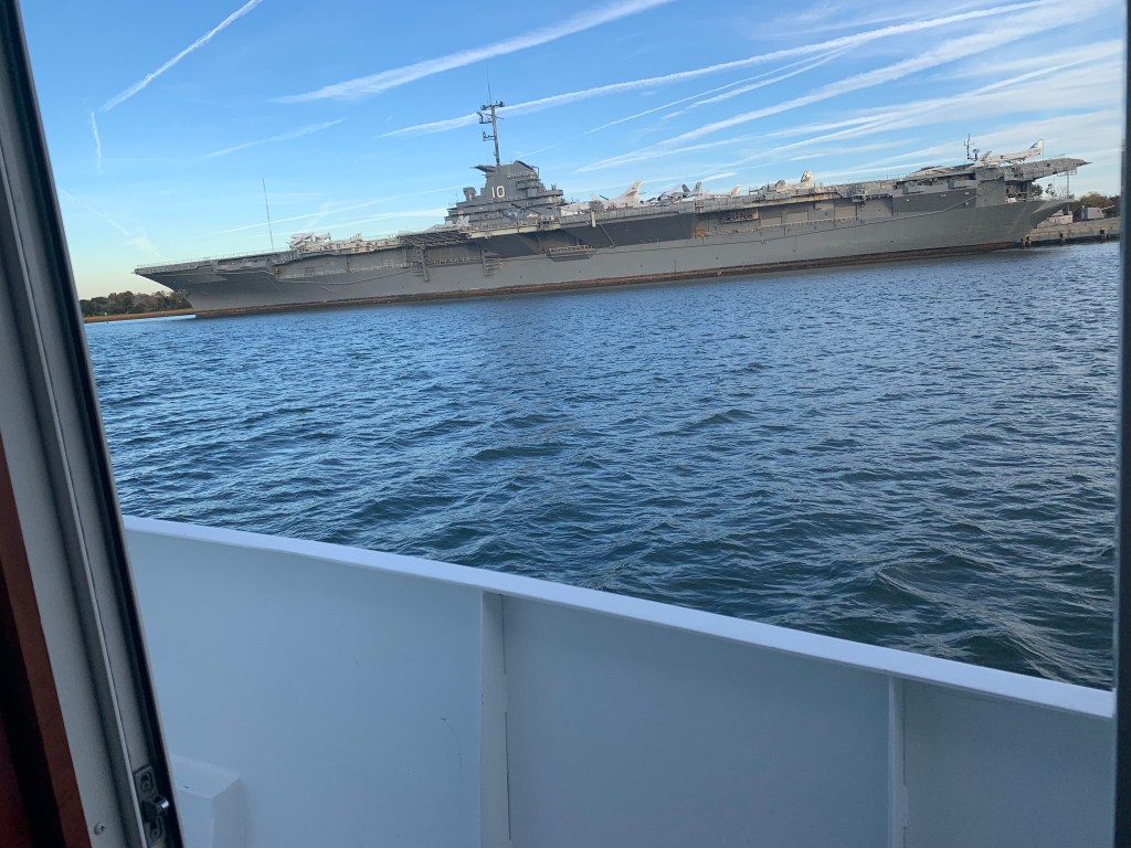
We arrived in Charleston, SC and the marina we requested a slip from had us “wait-listed”. We anchored for the night next to the USS Yorktown.

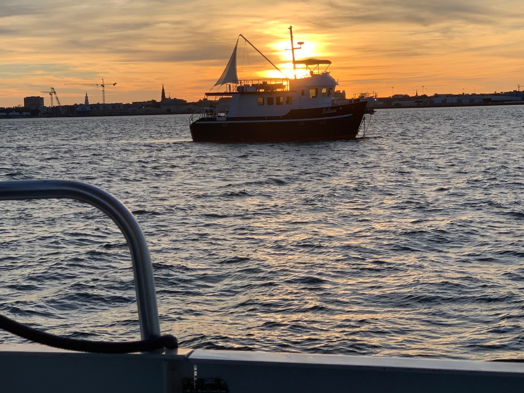
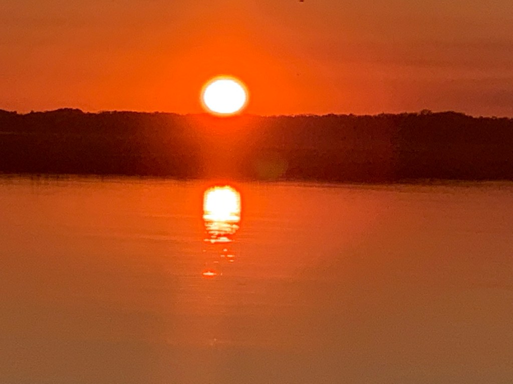
The sun was setting on Charleston.

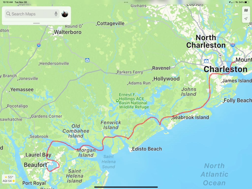
Sunrise in the AM and we were off… bound for Beaufort, SC

Sunrise in Charleston, SC

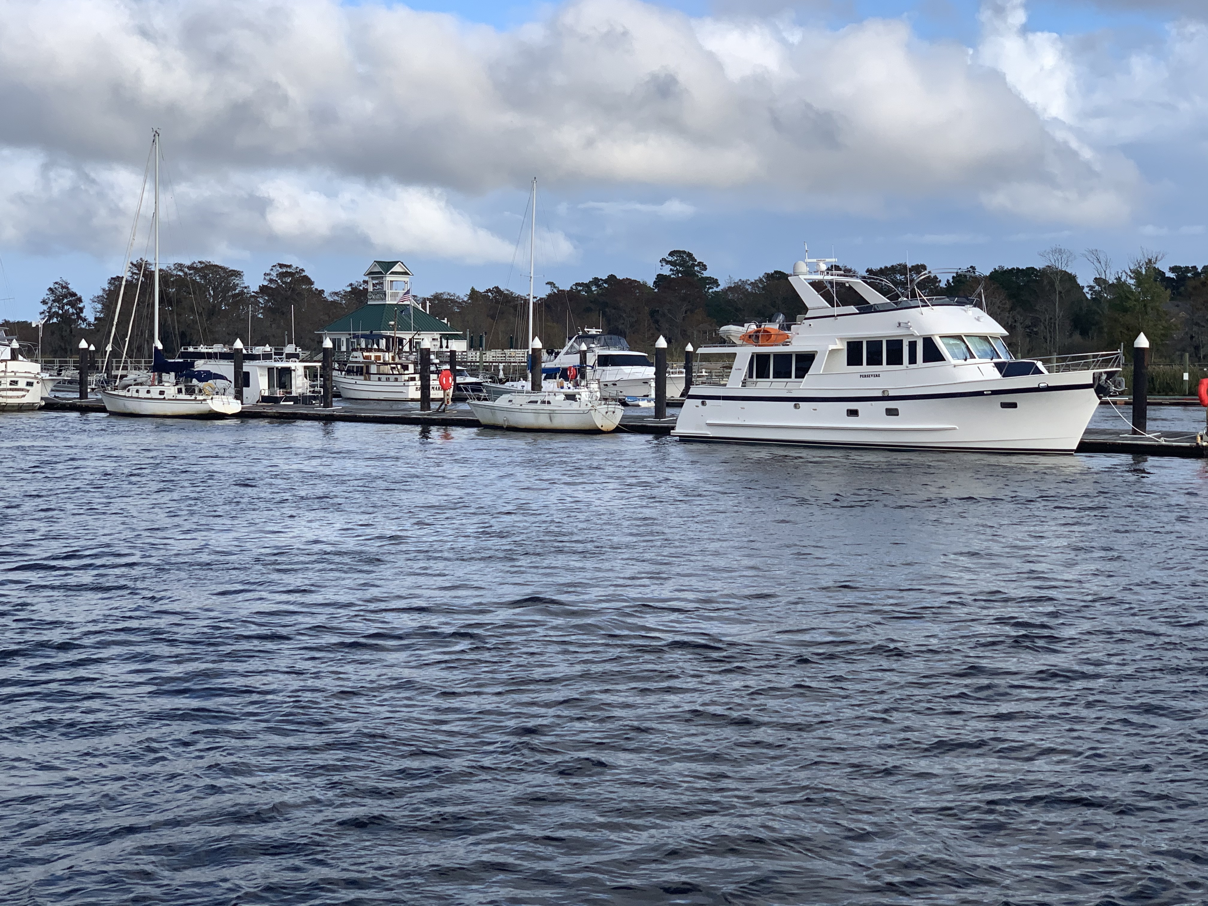
We anchored in Beaufort with hopes of getting off the waitlist for the marina. In the AM we called and they found a spot for us on the outer face dock.

Docked at Safe Harbor Beaufort, SC

Beaufort is a fun town and we wasted no time getting ashore at Plums Restaurant for some lunch.

Plums in Beaufort, SC

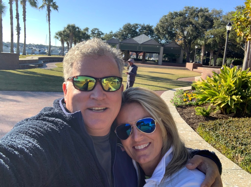
We napped after lunch and made a second run on the town before we would leave in the AM. Beaufort has a great outside park area right in front of the marina.

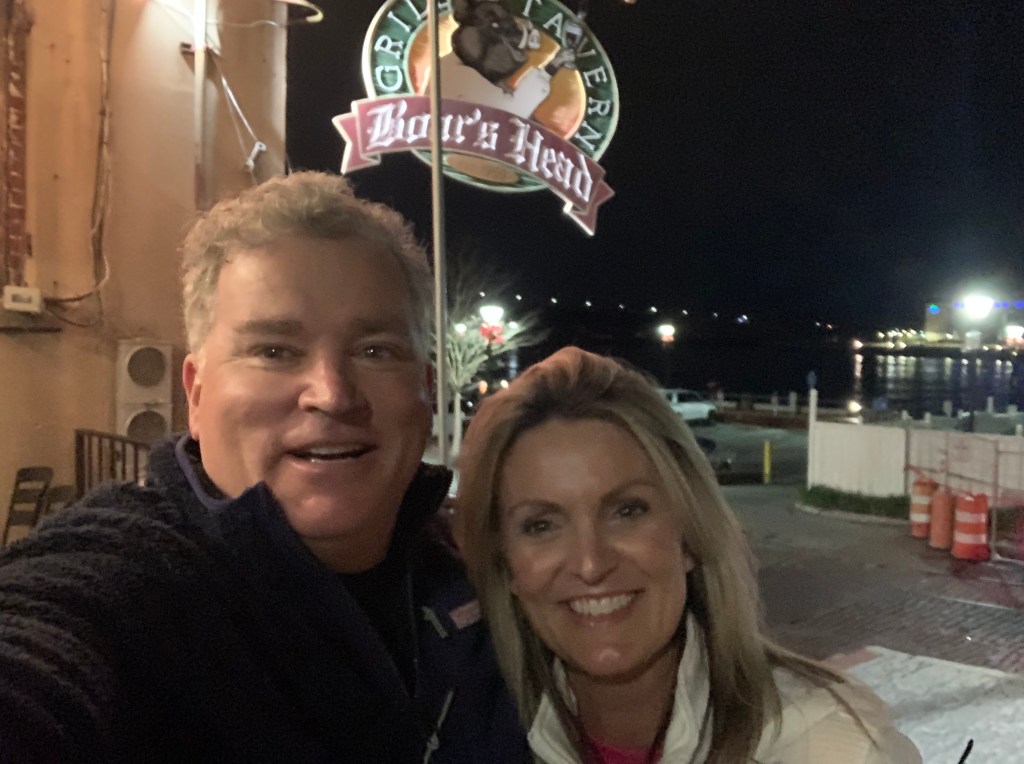
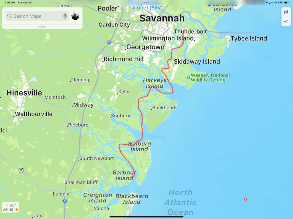
In the morning we were off to Savannah, GA. Last time I docked right in downtown around River Street but felt it a bit seedy at night. We decided to stay at Thunderbolt Marina and Uber’d into town for a Savannah pub crawl.

Are impromptu pub crawl consisted of the following venues:

  • Spanky’s
  • Boar’s Head Grill
  • The Cotton Exchange
  • Huey’s
  • The Warehouse Bar

We ended the night singing Journey.

Up early to a Whiskey Sunrise & potato pancakes and off to Fernandina Beach, FL

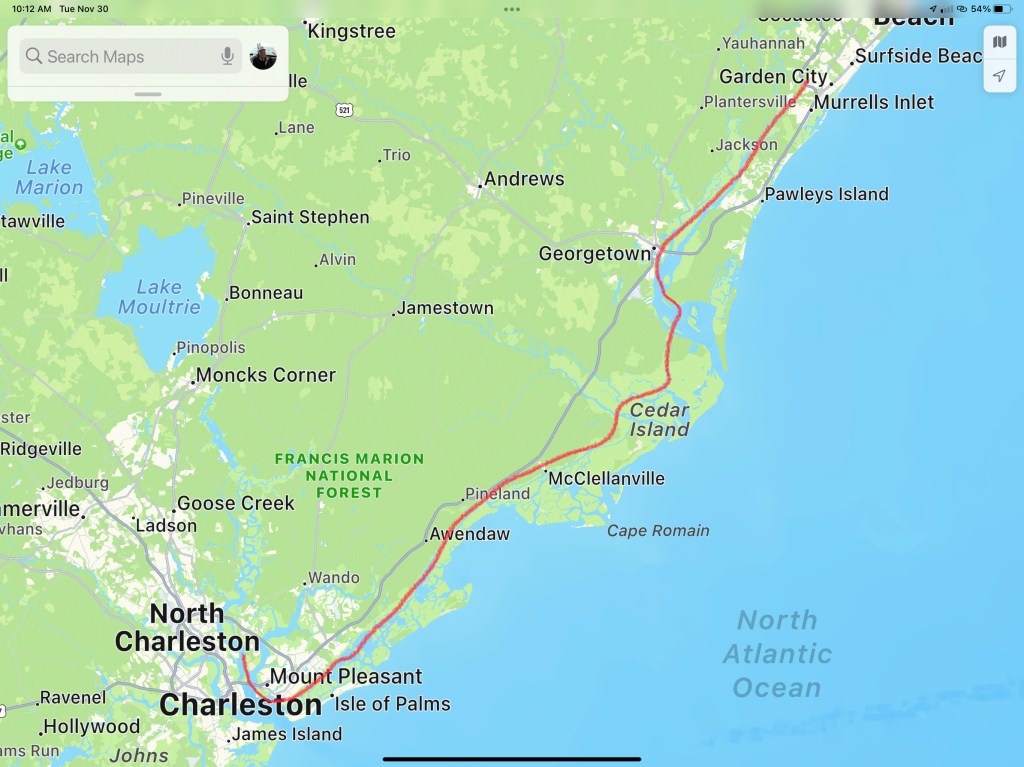
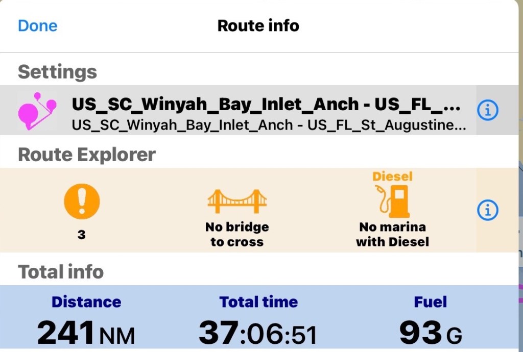
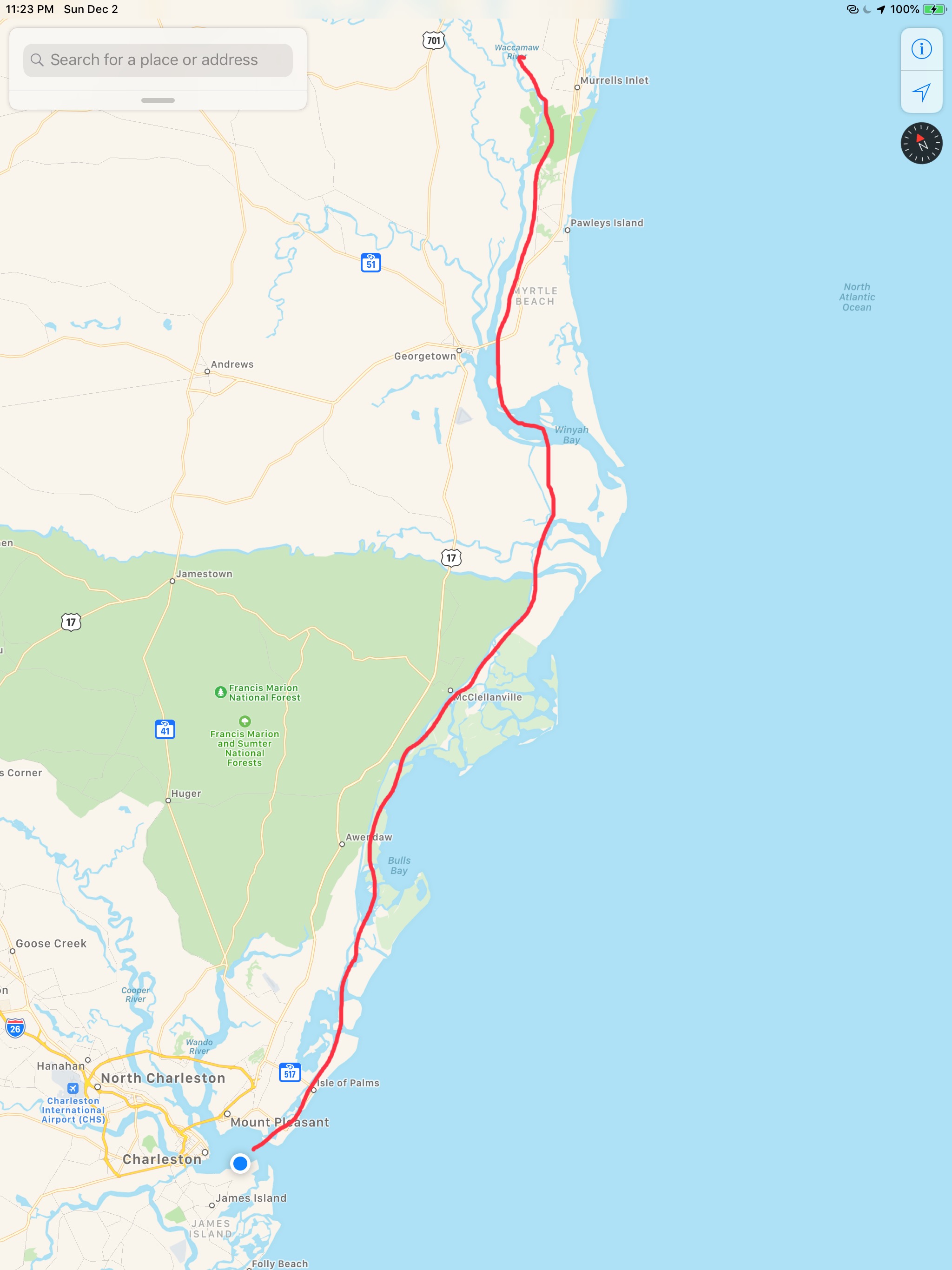
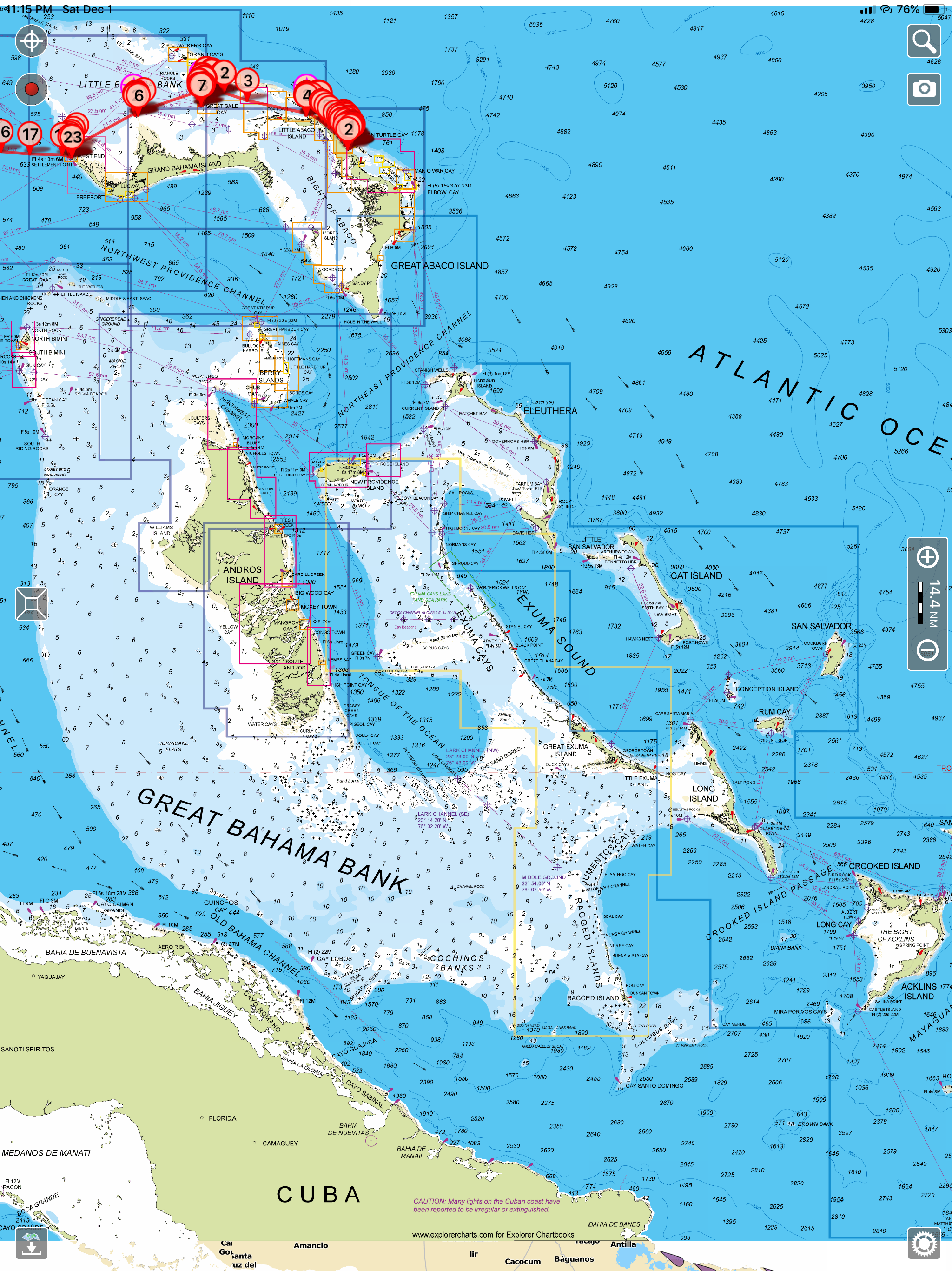
This post consists of 5 legs of our journey

We hope everyone had a great Thanksgiving with family!!!

Run to Georgetown SC

Before leaving Osprey Marina I figured I ought to get some Simple Life maintenance done.

I pulled back the rug and removed the teak & holly access panel to expose my Cummins 5.9L QSB diesel. You can see the hose dropped down into the engine room so that I can clean the bilge.

Teak & Holly floor covered since new with carpet and pad

Sitting in the engine room doing maintenance was hot so I decided that I would use up any non-IPA beers in the bottom of my fridge.

Those are work Pajamas

Simple Life carries 340 gallons of potable water. Depending on use, that should last a month but might as well fill the tanks while I’m at the dock. When I fill my water tanks I like to use a portable water filter from Home Depot. I also overfill the tanks so that water is pushed out the breather tube. Any tank that you fill must have a breather to allow the air being replaced to escape and on boats that tube exits on the outside of the boat high enough so that when the boat heals over you don’t have seawater intrusion. Little flying things can attempt to enter the breathers so flushing them with each fill is a good idea even though multiple filters catch anything in the tanks.

Flush out your water tank breather lines

Along with boat maintenance I was upgrading my MacBook Air to Big Sur. If you are a Apple Mac fan you know Apple just announced their new line of Macs that run on their new Apple silicon processors. This is big news for apple and will align their Mac computers with iPhone and iPad which already run Apple silicon. Why is this important? Well for starters iPhone and iPad apps which were written to run on Apple silicon can now be run on Mac computers to make Mac users like me happy that we can use similar apps across the three different platforms.

Before taking off I sat down to plot my next leg of the trip. I generally plan for 50NM each day. That is a very conservative estimate as I often run 80NM / day or more.

I decide to anchor in Georgetown, SC. I have always wanted to visit Georgetown. A quick check of the harbor shows several anchorages in very shallow water.

Red is a no-go and I stay out of orange areas if I can help it.

I untie my lines, jump aboard and put her in gear as I say my goodbye to Osprey Marina. Traveling south down the Waccamaw River, I pass marinas as well as people just pulling up to the banks to party.

The Waccamaw River is deep and the current (seen pushing over the no wake buoy above) is pushing me along at 7.8 knots. It’s raining but I enjoying the day in the pilothouse.

As I pass under Ocean Highway Bridge the entrance to Georgetown will be on my starboard side.

Near Georgetown, South Carolina

You can see the position of the sun in the video above and there is still more time in the day. I start thinking… Maybe I’ll push on and find an anchorage further south down the ICW?

I push on through Winyah Bay until the sun sets.

Sunset in Winyah Bay, South Carolina

I settle on an anchorage just before the ICW takes a 90 degree turn leaving Winyah Bay. The anchorage is protected by a small, low island called Middle Ground and ithas plenty of water and swing room.

Good Anchorage

This anchorage is large for the ICW and several sailboats have already dropped anchor.

Sailboats anchored off my bow

My plan was to anchor here for the night before heading on to Charleston, South Carolina. However, plans are made to be broken. I instead do a quick check of the weather offshore and decide to make a 36 hour run offshore to St. Augustine, FL. This long voyage will skip over the rest of South Carolina as well as Georgia and the very northern part of Florida. Georgia passed an anchoring law last year with draconian rules about where you can anchor. Some people just don’t like boats anchoring anywhere near their waterfront homes. Skipping Georgia has the side-effect of avoiding all their confusing anchoring laws.

I prepare my route for the next day. I add a lay line run straight from Winyah Bay, SC to St. Augustine, FL. I notice the sea is expected to be 3-4′ waves and increasing to 5′ over time. I add a second direct route to Saint Mary’s Inlet right at the GA/FL line. If it’s nasty I’ll know it pretty quickly and I’ll divert to this shorter route. I also plot out routes going in each navigable inlet as premade bailout routes incase anything goes wrong. Doing long solo offshore runs you need to be prepared incase I injure myself underway and need to get back inland quick.

St. Mary’s Inlet route breaks off around even with Charleston, SC

The math for the St. Augustine’s run looks like this.

I do a check of the currents leaving the Winyah Bay Inlet and find that if I don’t want to fight the 7:14AM Max flood current getting out I better leave soon after the 4:38AM start to flood.

We just had a new moon tonight so navigating tomorrow morning, you won’t get any help from the moon.

I settle on a 5AM weigh anchor time and decide to navigating the inlet in the dark is better than waiting till first light and fighting the current to get out.

I’ll be out of the inlet before first light

This leg of the journey looked something like this…

W04L012 – Run to Georgetown SC

Movie Night at Osprey Marina

It was hard to leave St. James Plantation Marina as we were all having so much fun. I did capture a nice video of what I think is a great blue heron on the dock next to our boat.

Great Blue Heron or as I like to say “I ain’t Scared of you Monkey Bird”

As you head south of Southport, NC you pass several Atlantic Ocean inlets. Lockwood Lockwoods Folly inlet is pictured below and we could see the ocean waves as we motored past.

Looking out to Sea Through Lockwoods Folly Inlet

The ICW can be very shallow around these inlets as the strong currents deposit sand and silt creating shoals and shallows that you must stay clear of. I use an iPad app called Aqua Map and pay for the premium service called Aqua Map Master that displays the recent Army Corp of Engineers colorful sounding charts of these tricky locations. The sounding charts are color coded and red is the shallowest with blue being the deepest. Below  you can see what it looks like to pick a safe path through the shallows.

02 Lockwood Folly Shallow small
Shallotte Inlet USACE Sonar Charts

Shallotte Inlet was next and it too has a colorful sounding chart

03

When we got to Little River inlet we passed a commercial boat that has been wasting away on the shore for some time. I’m always amazed that it is still there when I come up in the Spring or down each Fall.

Little River Inlet Sunken Vessel

Along with navigating your way through the shallows you must request several bridge openings.  This bridge used to be called the “Captain Poo” swing bridge. I hailed the bridge tender on the VHF and he responded with “Little River” swing bridge. I personally enjoyed hailing “Capt. Poo, Capt. Poo!” over the new name.

Capt. Poo Swing Bridge

Our day underway was overcast and for a brief period it rained. Boating in the rain is not much fun unless you have a warm pilothouse. We were warm and dry while underway and for that I was happy.

Rainy Day in the Pilothouse

There were many beautiful sights to see along the route to Myrtle Beach.

This beautiful home appears to have an infinity pool.

Infinity Pool

We had made reservations at Osprey Marina and we were pushing hard to make it there before dark. As we went through the Socastee swing bridge the sun was getting low.

Socastee Swing Bridge

We were now in the Waccamaw River swamp and it can be beautiful as fog and mist light up in the setting sun.

Waccamaw River Swamp

We arrived at Osprey Marina while the sun was still up. We turned down the entrance channel and snapped a few photos of some interesting boats.

Osprey Marina Entrance Channel

One particular catamaran had an etched window that was different.

Troubled Pirates

Soon we were tied up and checked in for the night. I soon discovered that there was no WiFi! NO WIFI!!! Time to put on a movie to entertain the crew. Tonight’s movie …

Gone with the Wind (All 4 hours of it)

Scarlett and Rhett

Tomorrow we are bound for Charleston, SC

Charleston SC Thunderstorms

We weighed anchor at first light in the Waccamaw River and it was foggy. 

I felt bad that we had to put on our automatic fog horn so early in the morning as there were other boats sleeping on anchor (or at least they were sleeping). At times the fog was thick enough that you would not be able to see the small duck hunting boats that zip around in this area. 

It rained all day. Not good for the folks who lived along the river banks. The river had already overrun its banks and many of the riverbank homes were dealing with flooding. More rain was the last thing they needed. 

Rain on the pilothouse all day

Then the fog would return.

When it was clear we got to see the lowlands of South Carolina. Beautiful grasses that extend out to the Atlantic Ocean. 

Lowlands of SC

Along the way we passed a steel hulled sailboat that was anchored in the same location as when we came up this part of the ICW in the spring. I guess like many is just permanently anchored along the ICW?

SV Steel Away Permanently Anchored

We passed someone’s boat that was still tied to the dock but had sunk for some reason or another. 

Sunken Boat Still Tied to Dock

Our plan for today was to attempt to make it all the way to Charleston, SC. The currents were helping us along and there was not traffic or bridges to slow us down. We ran right up until dark and had to settle on a wide open commercial anchorage just off Fort Johnson in Charleston Harbor. Kelly asked that we pick an anchorage that had cellular service as it was football and she had been watching the Giants / Bears game but the Patriots game was on next. 

We anchored next to a large sailing catamaran and the winds were blowing. The weather was bad as there were thunderstorms moving through that were bring wind gusts up to 55 MPH. A quick look at my weather apps showed them passing directly over us on anchor. 

Storm Radar

While on anchor I captured some of the storm.

Our leg today looked something like this … (80 NM)

Waccamaw River

We had spent a fun two nights at St. James Marina with friends. Kelly & Wende got to compare charity bracelets made by their niece, Michaela over drinks. 

Ladies were both wearing their favorite bracelets

While we were at the dock I watched a sailboat snap a piling off. I felt bad for the captain as there was some mis-communication that had the sailboat backing out of a fairway in the marina and then incorrectly tying up to a T-dock that was reserved for a similar sized sailboat that had just entered the marina’s entrance. The captain quickly untied from the T-dock and attempted to back up but while he must have thought he had shifted from reverse into neutral, was clearly still accelerating in reverse. He hit the piling and snapped it off without putting a single scratch in his boat. I don’t know what the manufacturer of this sailboat is but that’s a solid boat.

After that excitement, I spent some time finding an iPad app that would give me detailed charts of the Bahamas. I settled on the Aqua Map app. I had been using Charts & Tides by Navionics.

I was not happy that when Garmin bought ActiveCaptain.com they killed the integration with other iPad navigation apps in favor of integration with their own chartplotters.

I had been using Charts & Tides for the last 15 months because it was not very expensive to purchase the Navionics charts for the US & Canada ($30 or so) and the app gave me ActiveCaptain integration. ActiveCaptain.com was a web page that had a live map and a database of crowd sourced data and reviews of marinas, anchorages, local knowledge and hazards to navigation. Better yet iPad navigation apps could download the ActiveCaptain database of information for offline display in any compatible iPad navigation app. ActiveCaptain integration is a must for cruising the ICW. It puts small icons right on your navigation screen that show you marinas, places to anchor, hazards to navigation and local knowledge of inlets and difficult areas. Charts alone don’t list the nearest place to anchor when it’s dark and you need to stop for the night. Knowing there is a shoal around the next bend in the ICW and the only way to safely get past it is to hug the red daymark to within 30 ft is knowledge that active captain gives to you right on the navigation app’s screen (if the app has active captain integration). The Charts & Tides app which is extremely easy to use and very intuitive had ActiveCaptain integration until Garmin bought them and they seem very slow to fix the broken integration. You can however buy a Garmin Chartplotter and get ActiveCaptain. hmmmm?

Before the Garmin acquisition, ActiveCaptain used to be Open and Free

I did not want to be forced to buy an expensive Garmin chartplotter.  When we purchased MV Simple Life we chose to outfit our trawler with Raymarine electronics for navigation. Expensive navigation electronics like chartplotters, radar, depth and AIS are essential but when cruising the ICW you need to use an iPad with a navigation app that supports ActiveCaptain.  

Aqua Map has ActiveCaptain integration and also allows you to purchase the very detailed Explorer charts for the Bahamas. I have never sailed around the Bahamas so step one was to purchase the charts and start studying the different islands and cays to plot my own safe routes to anchor locations of interest. 

When we awoke our friends Jim & Wende had left squid wings and fishing tackle on our swim platform. I had been asking Jim for tips on catching fish in this area of the Atlantic and advice from someone who fishes the area is exactly what we need. 

Soon we were making our way past ICW MM 325

Statute Mile 325 on the ICW – Southern NC

We made it through the Lockwood Folly section of the ICW without touching bottom near low tide. 

View from the ICW out Lockwood Folly Inlet to the Atlantic Ocean

We passed many amusing sights along the ICW shore.

We passed this sailing catamaran that must have just gotten to tired to continue or find a place to anchor off the ICW so they just dropped anchor on the edge of the ICW. They used both a bow & stern anchor to prevent swinging into the channel but I would not be comfortable with the fog that another boat would not hit us. 

Bow & Stern Anchored in the ICW

There were hazards that were floating down the ICW like this dock.

Floating Hazards

As we came into Myrtle Beach area we started to see lighthouses & golf courses.

It was raining and foggy. 

Somewhere on the ICW around Myrtle Beach, SC

Soon we were tucking into the Waccamaw River to anchor for the night.

Just outside of the Waccamaw River 
Kelly made an amazing chicken fajita dinner to enjoy as the sun was setting in our swampy anchorage. It was yummy!

Our leg today looked something like this.

Anchor to Anchor in South Carolina

We awoke this morning at sunrise and the Waccamaw River was still.

Only after looking at Google Maps did I become aware that the creek that we anchored in was really the Waccamaw National Wildlife Refuge in South Carolina.

Our Anchorage in the Waccamaw National Wildlife Refuge

Along the route to Georgetown, SC there were many hazards dotting the ICW.

We did not see many other boats as we traveled along. We did see this steel hulled schooner called SV Steel Away. Nice vessel for the ocean and anchoring in.

Steel Schooner Steel Away

We saw mossy trees.

Mossy Trees

As well as duck hunters in the mashes that lined the ICW.

Duck Hunting with Decoys

When we arrived in Georgetown, the air was scented with the smell of a paper manufacturing plant. We made the decisions to continue on.

Paper Plant in Georgetown, SC

As the sun began to set we were forced to find an anchorage and we picked this one on the Atlantic Ocean just a 1/2 mile off the ICW.

Our Anchorage Near Georgetown, SC

We dropped the hook just as the sun was setting and it was beautiful.

On Anchor Near Georgetown, SC

There was one other boat anchored with us which was about the only other boat we saw. This sailboat was from South Carolina so we are not even sure if they are snowbirds like us?

The last thing to do after a full day at the helm was to cook up some steaks on the griddle and sit back and relax.

Steak on the Griddle