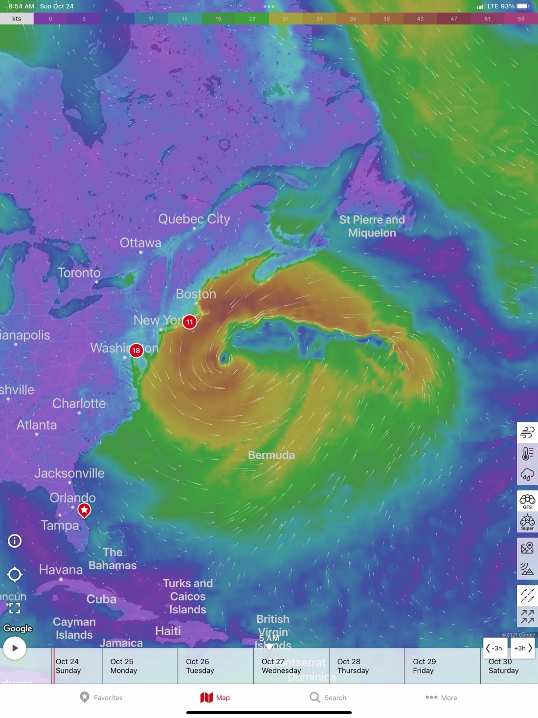
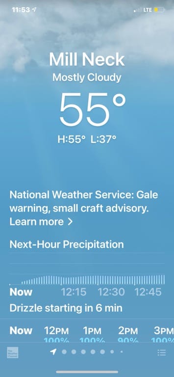
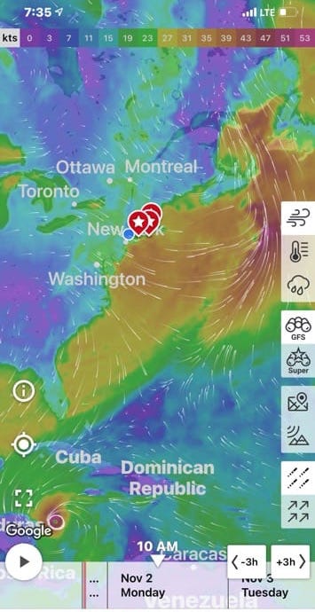
We are keeping our eye on the weather. The current wind forecast shows that in 48 hours or so the conditions will deteriorate to what is shown above.
When this low moves out to sea there is another cold front that will be right on top of us in Long Island.
A smaller disturbance joins as the previous one moves East
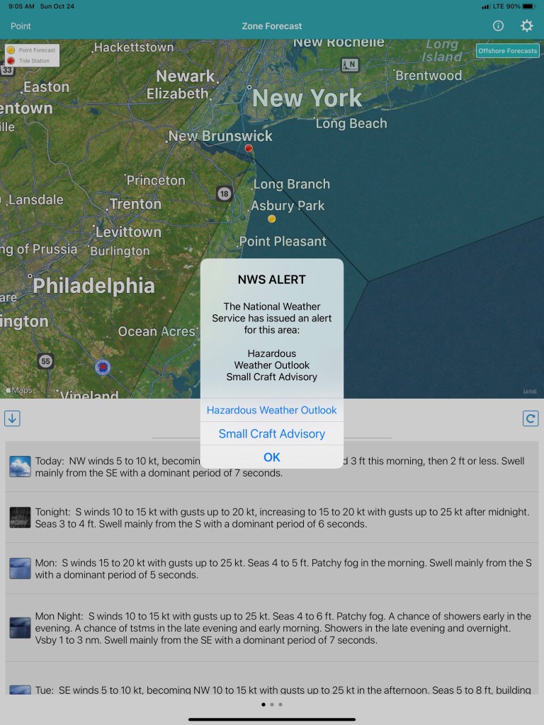
National Weather Service – Hazardous Weather Outlook…
Gale-force winds and/or very rough seas are forecast on Tuesday.
Gale-force winds and/or very rough seas are forecast on Wednesday.
Gale-force winds and/or very rough seas are forecast on Thursday.
Gale-force winds and/or very rough seas are forecast on Friday.
Gale-force winds and/or very rough seas are forecast on Saturday.
Hazardous Weather Outlook
The waves heights for the Jersey Shore go from their current 2′ to around 8′ or more.
Wave Heights
We decided to book a night @ a Safe Harbor marina in Stratford, CT and the following 5 nights at another Safe Harbor marina further west in Port Washington, NY. This would allow us to allow the weather to clear before running the Jersey shore. We are hoping for a 2-3 days of flat seas to run south and into the Delaware Bay.
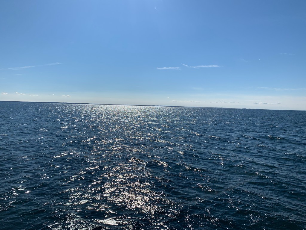
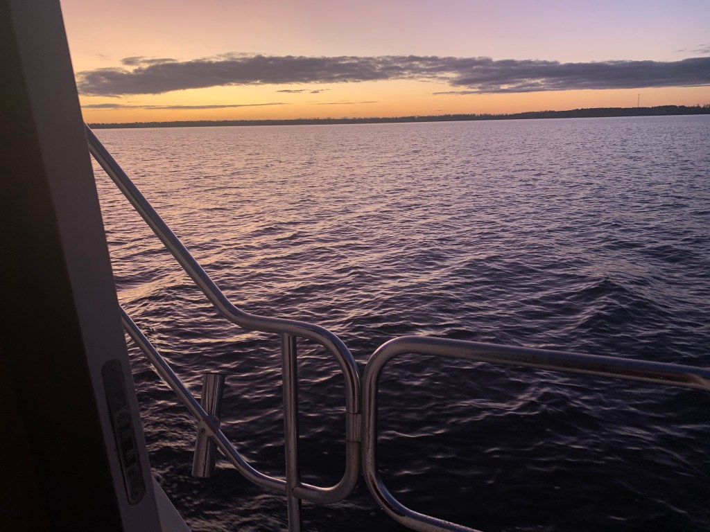
The future weather looks bad but this morning we awoke to a nice “sun up” view and a calm anchorage.
Sun’s Up
As we motor west down LIS the waves are small and the sun is shining.
calm seasSide Walkways while underway
Prop wash behind our Bruce Roberts TY57
We passed Falkner Island off the the Connecticut coast. What an odd looking island.
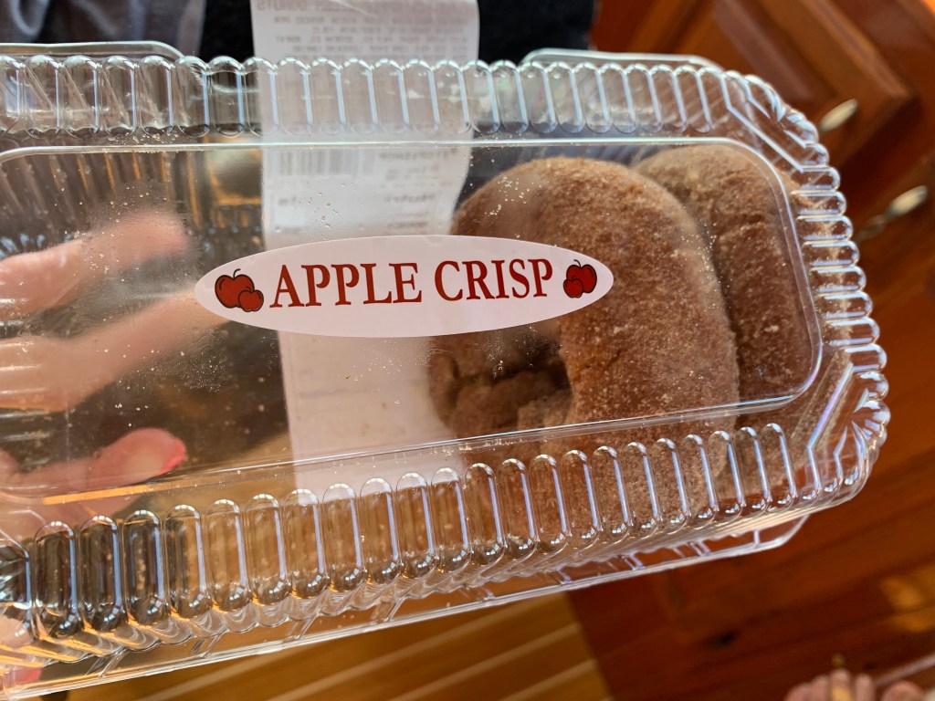
We loaded the boat up with drugs before we left, a.k.a. apple cider donuts These things are crack!
Illicit Donuts
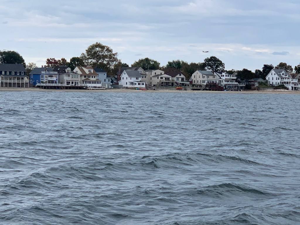
We had booked our slip using the Dockwa app and were disappointed when it was declined. I think the larger boat is going to present a challenge at many of the smaller marinas that I will seek a slip. We made a last minute decision to anchor in Morris Cove New Haven, CT.
Morris Cove Homes
Today’s trip salted up the pilothouse windows after I spent a while cleaning all the salt off of them. I’m leaving them salty till tomorrow morning when I deal with them again.
I spent the morning enjoying my coffee and checking the weather.
Winds are Still Honking
The winds off the coast are still blowing. A quick check on the Marine Zone forecast and I see that the winds have not abated and are driving the seas into the 6′-9′ range. Times like this if it were not for the ICW I’d be trapped in port.
Wifi Encryption – Known Exploits and Keeping things Private
I use the in-slip time to wash the salt off the boat and modify the encryption settings on my router. Somehow I have accidentally set my internal WiFi to WPA/WPA2 and WPA (Version 1) has a known exploit when it comes to TPIK (Temporal Key Integrity Protocol)
My iPhone is smart enough to alert me that the Wifi network I connected to supports WPA which is not secure
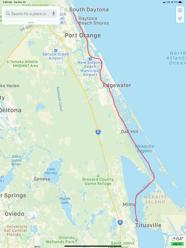
It’s 11AM and my time at the dock has run out. I cast my lines off and pull away from the dock with a bit more throttle than usual as the wind is blowing hard on my beam. Over to fuel dock to fuel up before heading south towards my intended destination of Titusville, FL.
New Smyrna Beach
As I pass an anchorage in New Smyrna Beach I pass several anchored sailboats. New Smyrna Beach is in Volusia County. According to the International Shark Attack File maintained by the University of Florida, in 2007, Volusia County had more confirmed sharkbites than any other region in the world.
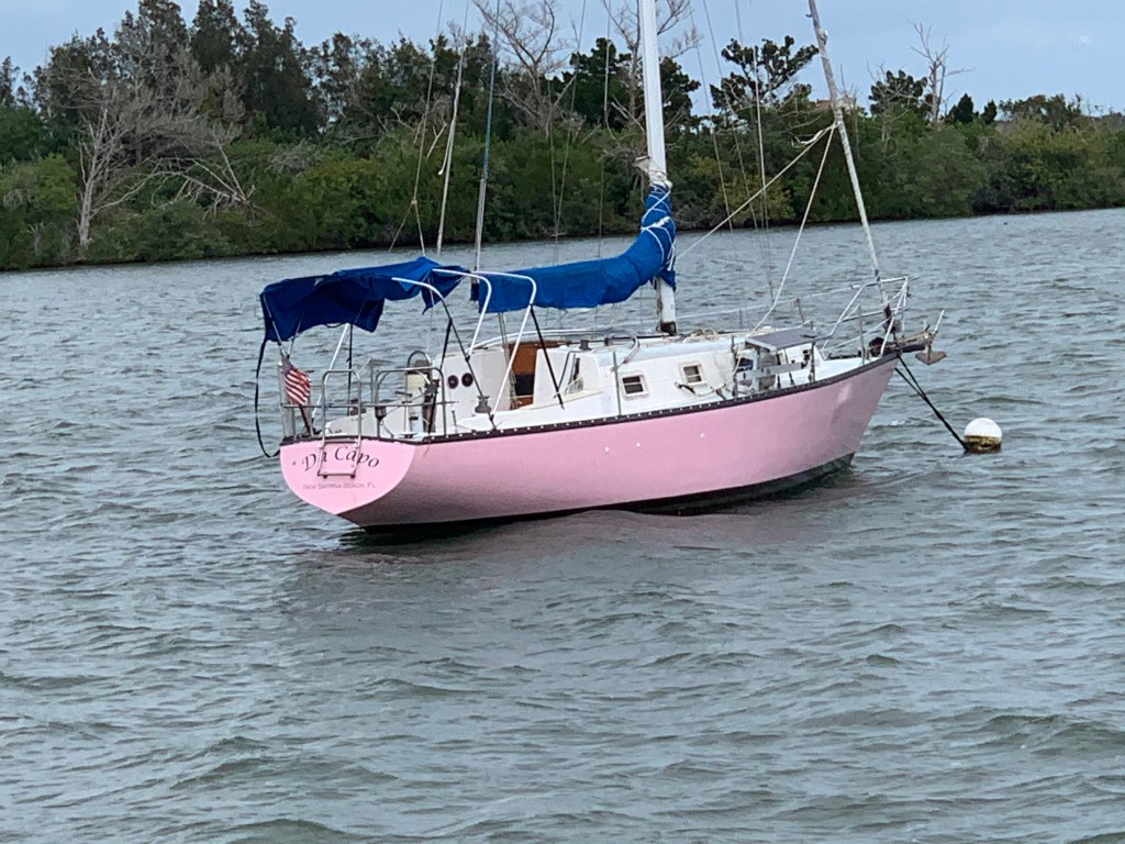
Then I come upon SV Da Capo. That’s quite a pink hull!
SV Da Capo
Big Motor Yachts Look Comfy
Soon this large, comfortable-looking, motor yacht was passing me. Hatteras I believe?
Dredge Islands?
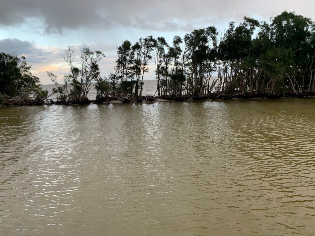
As I make my way through Haulover Canal there is a thin strip of land that is lined with small trees. This kind of natural geography seems odd to me but I encounter it often. I have always believed that you see these thin continuous strips of land along-side canals which are frequently dredged to keep a minimum center channel depth. I have always imagined that it must be far cheaper for the dredge to push the dredged material through a short outflow pipe that starts to build a new island alongside the channel. I have no specific knowledge or experience with dredging so If you do, please comment on this.
Haulover Canal is tree-lined (barely)
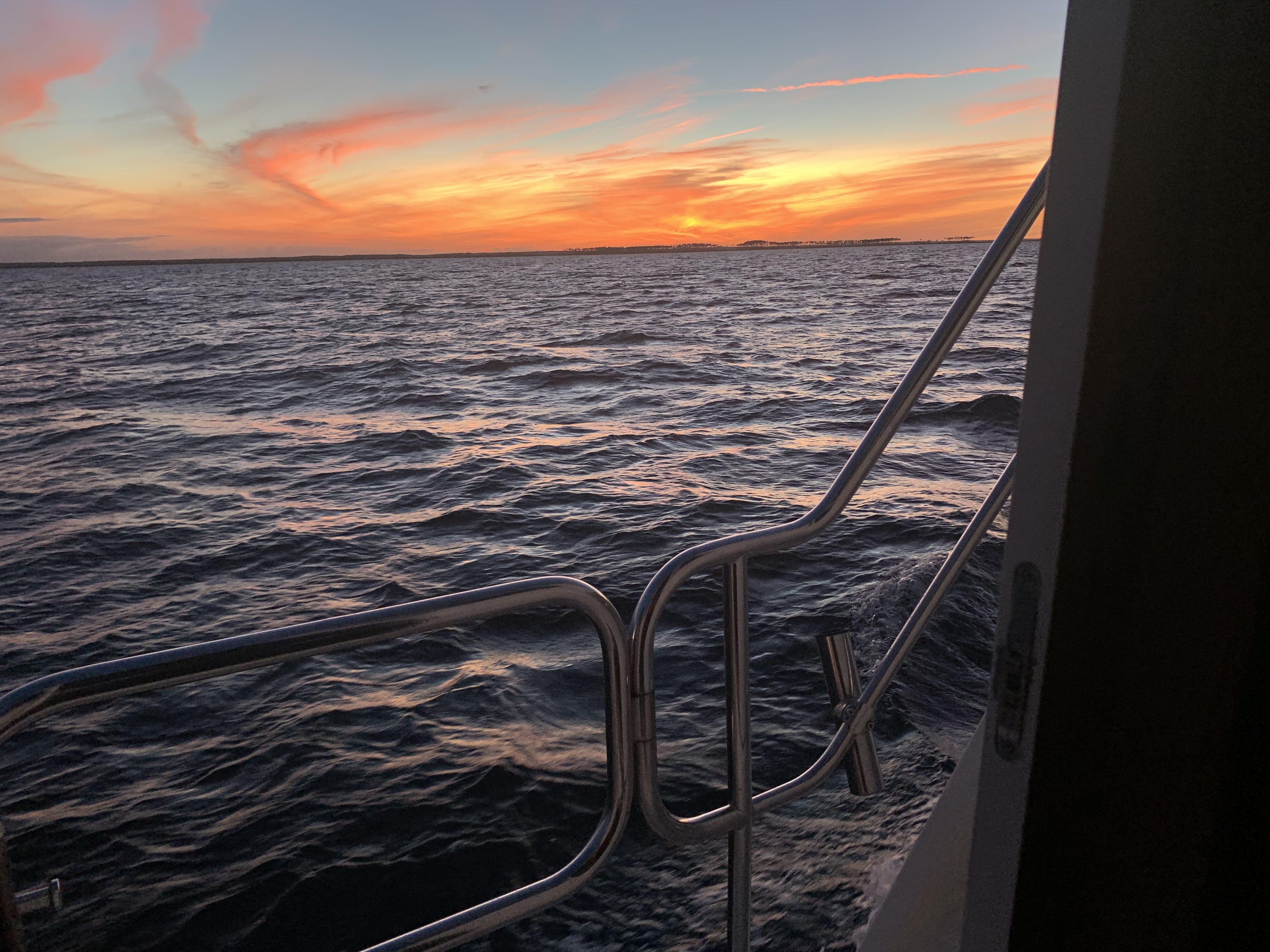
I watch as the sun sets.
Sunset leaving Haulover Canal
Burn More Diesel or Arrive at Night?
In this moment I start doing some quick calculations and realize that it’ll be dark before I reach Titusville, FL where I plan to anchor. Luckily this section of the ICW is pretty open and easy to navigate at night. I find my anchorage and let out about 70′ of anchor which is plenty for the 6′ of water I’m in. Coming in in the dark you don’t expect many ICW boats to arrive after you. The winds are forecast to be steady in their direction through the night. I won’t swing around and there is plenty of room between me and my neighbors anchored next to me.
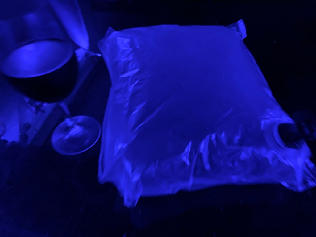
Refined Tastes of Yacht Living
I’m tired and figure I should finish off my fanciest bag of wine before hitting the rack 😉
Today’s route looked something like this…
W04L015 Route
Random Thoughts
This is a new section that I thought I would add since being ADD & extraverted I often have random thoughts bouncing around in my head that I feel a need to talk about. Today’s thought is for any fellow boaters reading my blog.
Diesel Efficiency
Today’s thought was on Diesel efficiency. Before owning my 1st trawler, I owned three sailboats. As a sailboat owner, I never thought about fuel economy. Now diesel fill ups can cost as much as $1000 rather than $100. This, because my trawler style motor yacht by design has large diesel tanks for long-range cruising. It’s tempting to discuss the days that the wind was pushing my sailboat along for free but this is not about sailboats vs. trawlers. Instead, I’d like to talk about trawler diesel engine power and hull shape. I’m not an expert or this subject it’s just something I have some thoughts on.
Slow or Fast?
There are two kinds of trawlers.
Slow full-displacement
Fast semi-displacement
Every boat’s hull displaces it’s weight in water. The more stuff you put into your boat it sinks a little lower in the water. Ancient Greek mathematician and inventor Archimedes first screamed “Eureka! Eureka!” when he discovered this. This is known as Archimedes’ principle.
To push the hull through the water you must push the water in front of the boat down as well as part it to the sides. When it comes to the force required to move a hull forward, hull shape matters. It should seem obvious as you try to push a boat forward quickly that a slender hull with a narrow angled bow and stern will separate the water gently and then put the water back together gently without causing much swirling drag forces at the stern. A hull with a blunt bow and square stern will plow into the water at the bow and have it come crashing back together behind the stern causing eddys or swirling motions that cause the boat to be pulled backwards by drag forces.
Full Displacement Hulls
Slow trawlers are full displacement hulls and their maximum hull speed is easily calculated by this equation and the length of their waterline (the length from when the hull first splits the water to where it recombines it).
Full displacement hull shapes tend to be very round or semi-hemispherical and create little drag. They require a smaller force to push them through the water. However this round hull shape overs little resistance to healing (rocking of the boat). So you often find these hulls using ballast or weight added to the bottom of the hull to keep them upright. Since 1933 fin stabilizers such as Wesmar have been used to stabilize boats. The most modern solutions are active gyro stabilizers such as SeaKeeper. Fin stabilizers require power to move them and create drag in the water. Gyro stabilizers require running a diesel generator to keep them spinning. Full displacement may be the most economical hull shape but stabilization often requires diesel burn.
If you have a full displacement hull you only need a Diesel engine with enough HP to push it along at near it’s hull speed. If you put a larger HP diesel in the boat you will destroy your fuel economy and never go faster than hull speed. Full displacement trawlers will give you the best fuel economy due to tiny fuel sipping diesels. Full displacement trawlers with active fin stabilizers and large fuel tanks can cross oceans. Nordhavn is a popular trawler brand that comes to mind in this moment.
Semi Displacement Hulls
Semi-displacement hull shapes are designed to push water not just aside but down at a rapid rate. The water being pushed down forces the hull up out of the water. Less hull in the water means less drag and you can exceed the max hull speed for the length of your hull’s waterline. This extra downward push of the water means you need to put more HP behind the diesel. You are trading fuel economy for speed. When the waves are not exceeding large, speed can get you out of the weather and to a safe port sooner. You can also move at speeds below your hull speed and be almost as fuel efficient as a full displacement hull. Semi-displacement trawlers will have sharp angles called “chines” in the hull shape that help to create active resistance to healing. Think of a basket ball with a child’s action figure on top of it floating in your bathtub. Your basketball hull form is semi-hemispherical. The round basketball offers no resistance to heal and will likely just roll over with the first wave. Now place a box with square 90 chines at the edges of it’s hull in the bathtub. That same hull shape resists leaning to either side because to do so would displace less water on the side lifting up and more water on the side being pushed down into the water. Recall from Archimedes’ principle that displacing water creates an upward buoyancy force.
Fuel Burn per HP
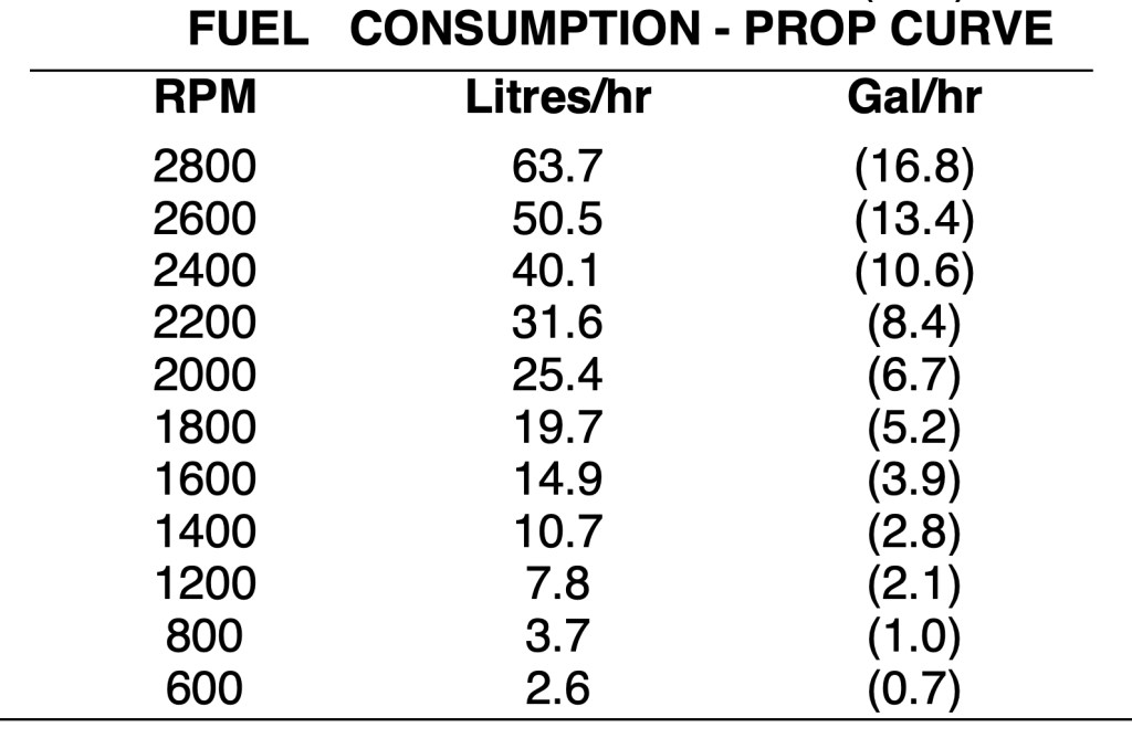
A rule of thumb often used is that modern diesels burn about 1GPH for each 20HP produced. This number is a rough estimate of how much of your diesel engine’s power (force) you are using to push your trawler’s hull form through the water at the speed you are going. You can double check this number against your diesel engine’s HP/RPM curve.
Slow or Fast Religion
What type of boat you choose is often like choosing a religion. Once you decide you often find yourself defending your decision with great fervor. Debates rage on but I’m just trying to discuss just the basics of the science behind the debate. Often I hear other boaters with much larger boats with twin diesels compared to my single diesel tell me they get twice the fuel economy as me. Hyperbole or magic? I often state that my Cummins Mercruiser Smart Craft display of fuel burn is 2 GPH at about 1400 RPM or 6.5kts of boat speed. This is a rough estimate of course since there are currents, wind forces, drag due to hull fouling, propeller diameter and pitch, etc. that come into play here.
My Cummins SmartCraft GPH DisplayCummins Manufacturer Specs on my 2012 QSB 5.9L Diesel’s Fuel Consumption to RPM CurvePropeller Curve (lower) is based on a typical fixed propeller demand curve using a 2.7 exponent. Propeller Shaft Power is approximately 3% less than rated crankshaft power after typical reverse/reduction gear losses and may vary depending on the type of gear or propulsion system used.
Final Thoughts
There is no perfect boat. Every boat is a compromise. The discussion above is only about the tradeoff between economy and speed. I gave up economy for speed when I went with a semi-displacement trawler. I’m OK with my choice. I understand why others chose full displacement trawlers. Chose your religion wisely!
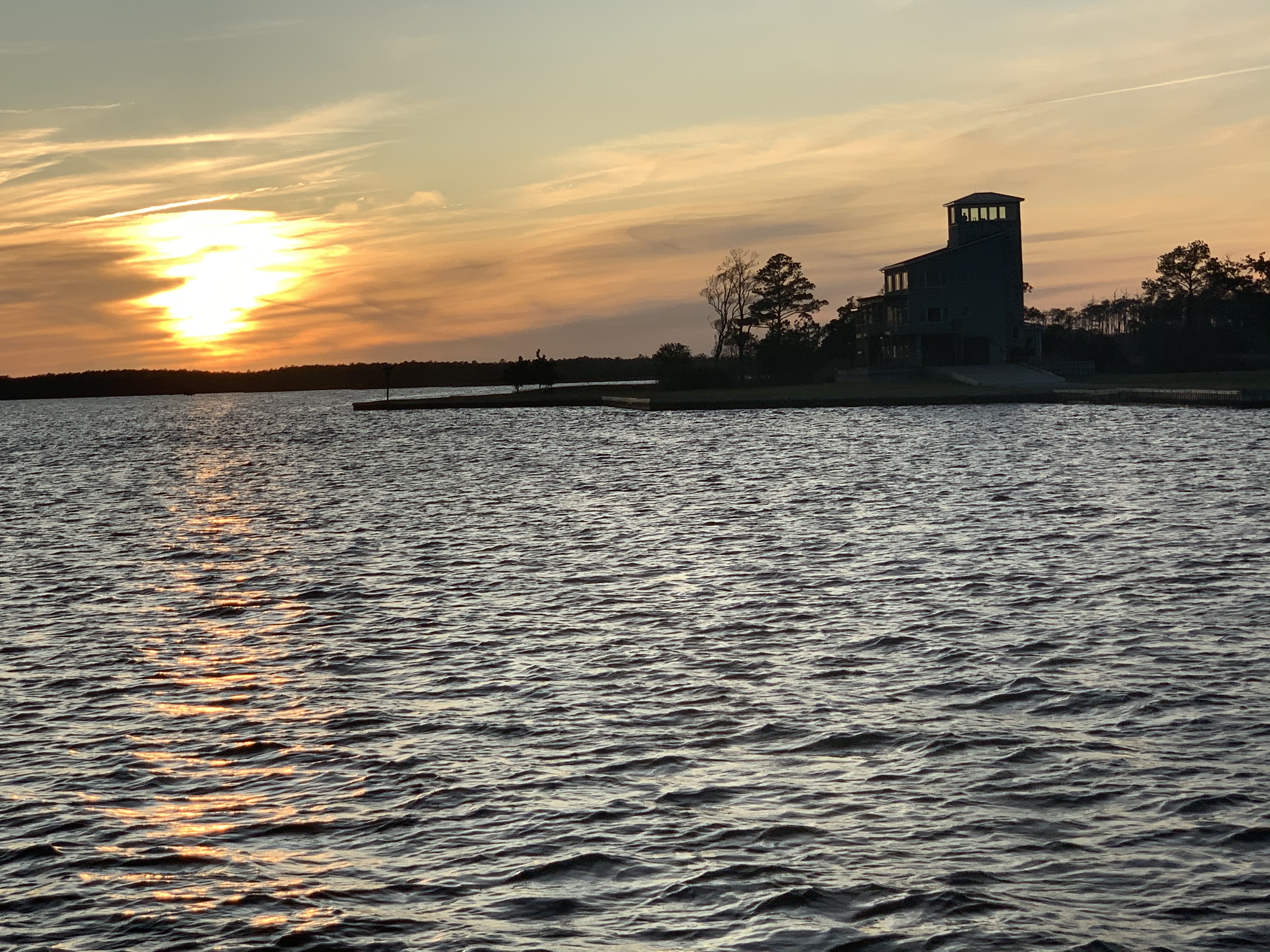
First light while anchored in the Alligator River is a nice way to start your day.
Anchored off East Lake, NC in the Alligator River
Getting Loopy
Last nights anchorage was peaceful. There was a light wind so we anchored far from the only lodge you can see lit up on the shore of East Lake, NC. I weigh anchor and do a loop around Effervescence IV.
A loop around Effervescence IV and heading for the deep area and the bridge
Debbie calls out “Good Morning” while standing on her bow. Glen and her are prepped to weigh anchor as we are looking to get underway before sunrise.
Effervescence IV at first light
Back in the Channel
As we make our way back to the channel and the Alligator River Swing Bridge the horizon starts to glow.
The sun is a coming…
Planned Route
The planned route for today is to travel at Simple Life’s efficient 6.5kts which will put us in Gale Creek as the sun sets. If we anchor in Gale Creek, in the morning we will motor out of the creek and into the Bay River => Neuse River => Adam’s Creek => Core Creek = Newport Marshes => Morehead City, NC and then south down Bogue Sound.
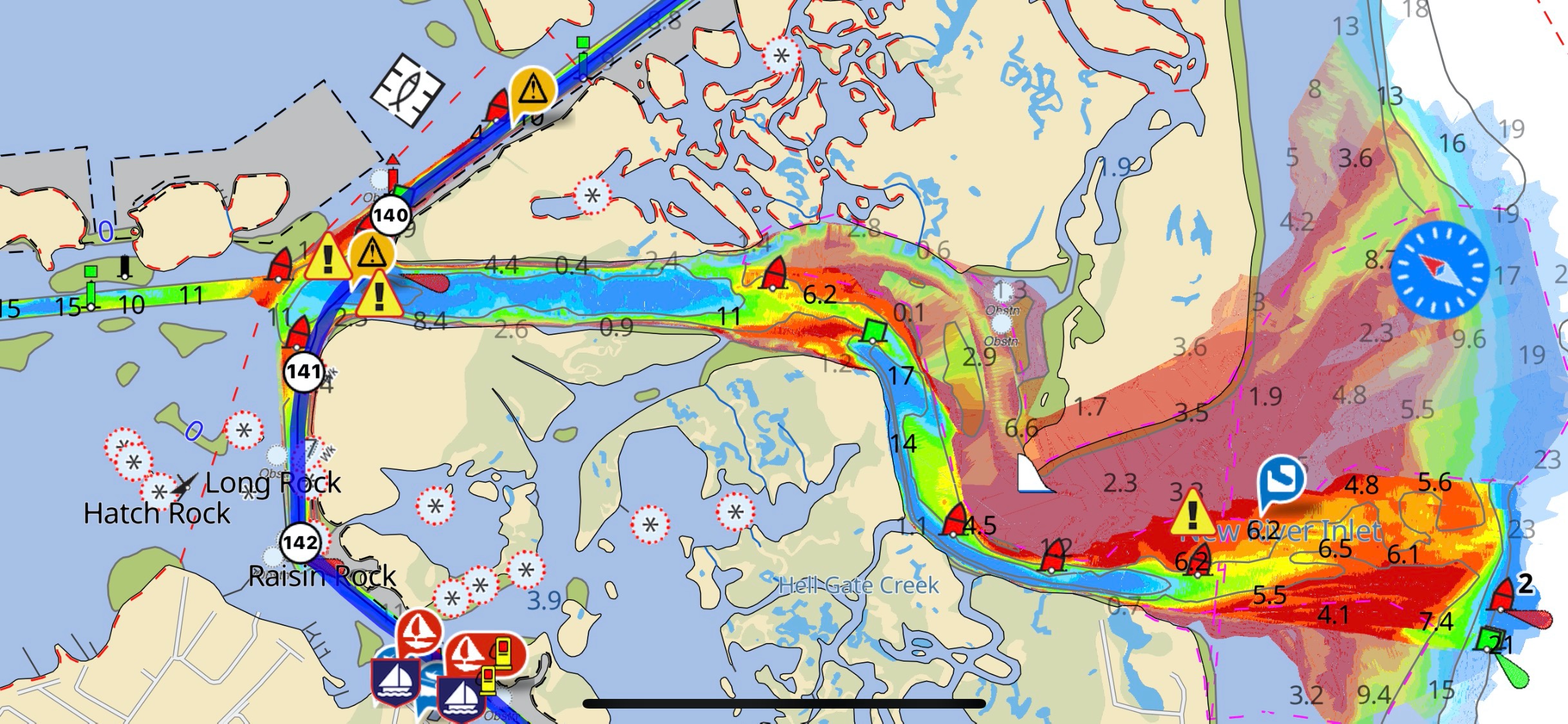
Morehead City is right next to Beaufort, NC where I often stop for an IPA in one of the many sailor bars there. Sometimes I opt to go out Beaufort entrance channel and run outside in the Atlantic down to Masonboro Inlet. I like to do this as it cuts out a few ICW areas where shoaling hazard occur. The hazzard areas correlate to where some of the inlets carry silt into the ICW. Inlets such as New River Inlet and New Topsail Inlet for instance.
This year Mother Ocean is not going to allow an outside transit as Hurricane Eta is raging in the Florida Keys and even this far north the forecast is for 5+ footers.
Near-shore forecast off Beaufort, NC
Hurricane Eta near the Florida Keys
As we approach the end of the Alligator River we make our way into the aptly named “Alligator River Pungo River Canal”. It’s a man-made cut through the land and I love to set my autopilot and see how long I can go before I have to make a correction.
AR-PR Canal
Parting Ways
While heading down the canal I can see my speed drop from 6.5kts to 6.1kts as we buck a current. It’s at this point that MV Effervescence IV hails me on the VHF asking if we can pick up the pace. I am aware that my pace is too slow for Glen and Debbie. Going this slow they will drop down to running on a single engine with the rudder over to keep her straight. At this point we decide that they will pass me and travel at a speed that is more appropriate for them. We wave and promise to find each other at some point further south.
Debbie snapped a photo and text’d it to me as she passed. Picture thanks to Debbie Purcell
Dead Zone
The cell phone coverage is terrible in the canal. However, as expected, when you get close to either of the two bridges that cross you will get a signal while passing under.
Brief cell data connection
When you are at the helm and starring down at your phone, don’t forget to look up and spot these deadheads. Not the kind smoking weed at a Grateful Dead concert but the tree stump kind that just barely stick up out of the water.
Deadhead
The weather is amazing as I cruise along with both pilothouse doors open and Tyler Childers blaring out into the nothing that surrounds the canal.
A far cry from the snowy boat deck back in Warwick 8 days ago.
I find myself scratching my head as I pass this dock.
Hey Mr Builder, can you add a little more pitch to this corner of the roof?
A few days back was my post entitled ICW MM 0 and now I am passing a new ICW distance marker.
ICW Statute Mile 125
Easy Peasy Lemon Squeezy
Taking a boat south for the winter in the ICW is easy once you figure out the new methods of how to navigate the constantly changing ICW path. Just as I type and state how easy it is… I look up from my MacBook and see a depth of only 6.4′! Yikes, I was not paying attention while on autopilot and had slowly motored outside the narrow channel. A quick pull back of the throttle and course correction of 60 degree to port and I’m back safely in the channel.
I believe most groundings on the ICW happen as a result of lack of focus, distraction and not purposeful bad decisions. When you are navigating solo at a snails pace for 10-16 hours, day after day with little sleep, it’s easy to lose focus and run aground. When I read a Facebook Boating Group post about a captain running aground, I think… that could easily be me. I promised long ago never to snicker when hearing others throw shade at a captain who ran aground. There is a saying… “if you ain’t been aground, you ain’t been around”. Truth!
Aground on the ICW
The challenge to doing the ICW is… It’s a marathon not a sprint! Four years ago when I retired and set out running the ICW each Fall & Spring I could not wait to leave the bitter cold NE for warm and sunny Florida or the Bahamas. You spend sun up to sun down with your ass in the captains chair. Your desire to get there, has you pushing the throttle down. When you try to slow down you feel like …”I’m never going to get there!”. The trick is to relax and enjoy the ride. It took about two years for me to relax and just put-put along. When I’m foolish enough to give myself a schedule, I have learnt the proper way to “rush” is… not to go faster but… run longer into the day or night.
Finding Happiness
It takes time to slow down. I’m not laid-back but easy-going. Laid back people just don’t care about anything. I’m easy-going which is simply a way of saying rarely does anything bother me and when it does I usually say something like F-it and just go back to finding happiness some other way.
MBTI Perceiving or Judging?
Retirement gave me pause. Time to focus on understanding myself and what makes me happy. When you are so busy doing all the things that you “must do” you never know what you really “want to do”. Part of gaining a better understanding into who I am is studying personality profiling methods such as the MBTI (Myers-Briggs Type Indicator). I am a strongly-typed ENFP. Want to know what you are? Here is a free 100 question MBTI test that will tell you.
16 Personality Types – What type are you?
I always believed that everyone was obsessed like me with understanding the world around them and the meaning of life. I realize now that many spend their lives avoiding such questions as they just don’t have time or desire to seek such answers. I believe the answer is personal and everyone sees it different. Understanding the world around you and what’s inside of you will bring you happiness. For me … the meaning of life = pursuit of happiness. Knowing this helps me focus on living my best life. A simple Life. If you care to read about my Simple Life Philosophy, here is a link to it.
Simple Life
Once you begin to understand yourself and what you want out of life you can build yourself a mantra to act as a compass. This mantra is a quick way to remember how to make the many decisions you make each day.
Simple Life’s Mantra
Free Will Trumps Destiny – Nothing happens for a reason. You cannot direct the winds but you can adjust your sails.
Seek Truth – Understand the world and those around you. Tell the truth and seek those to offer you their true feelings. If you don’t know the truth, you can’t make a good decision.
Stay Away From Stupid People – People who are acting stupid just don’t get it. They will cause you harm by simply being near them. Surround yourself with good people and they will bring happiness to your life.
Well anyway, back to my story about yesterday’s journey….
It’s getting late in the day. The sun is sinking low as I pass the RE Mayo Seafood company. I love seeing the large shrimp boats tied to their docks.
RE Mayo Seafood
As I make my way out into the Bay River the skyline is colorful.
Neuse River
I have decided to travel into the night to cover more ground. The moon will not rise in time so my trip down the Neuse River will be dark.
Neuse River at Night
I had to adjust my course a bit to avoid a beam sea as the winds blowing over Pamlico Sound have had a long fetch to build. Soon I am using my remote spotlight to spot pilings as I enter Adam’s Creek.
Red Daymarker Piling glowing in the dark when spotted.
I pull into tonights anchorage and it’s real shallow.
Danger Will Robinson!
Dead Low
I check the nearest tide station at the Core Creek Bridge to see if it will drop any lower leaving me aground?
I have arrived at dead low tide. Great news! Now anchored it’s time to enjoy a cold IPA and relax for the night.
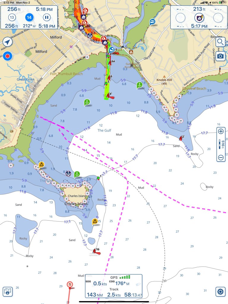
After being awake for 20 hours, I caught about 3 hours sleep before waiting for first light to weigh anchor. Last night’s anchorage served it’s purpose. It was only 10 minutes off my path and was an easy-in / easy-out in the dark.
You can see my track – easy in – easy out
I headed west down Long Island Sound toward NYC. The wind was blowing from the south so the waves were building as they crossed over from Long Island to the Connecticut coast where I was. It made for a choppy wet ride. I decided to cross to the LI side before turning again to the west. This made for a much more comfortable ride heading west.
Demonic Possession
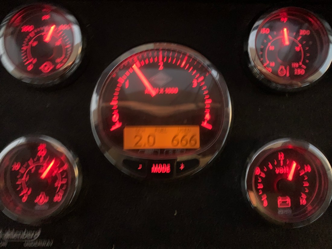
I always set Simple Life’s throttle to 1400 RPM which is 2 gallons/hr burn rate. Depending on the currents I average around 6kts. Doing the math, that’s 3NM to the gallon or about $1/mile. I’ve always thought it’s a pretty inexpensive mode to travel since you are moving you and your 40,000 lb home. However this home might need an exorcism?
Cummins smart craft tachometer showing my 2.0 gal/hr burn rate and 666 gallons burned.
Wait… They don’t go to Heaven?
I cringe when I watch people release mylar ballons to go to heaven in the name of a lost loved one.
They don’t go to heaven
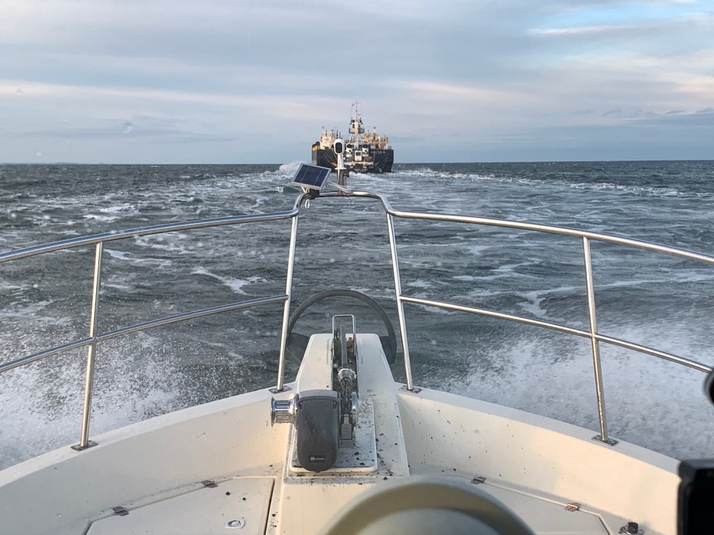
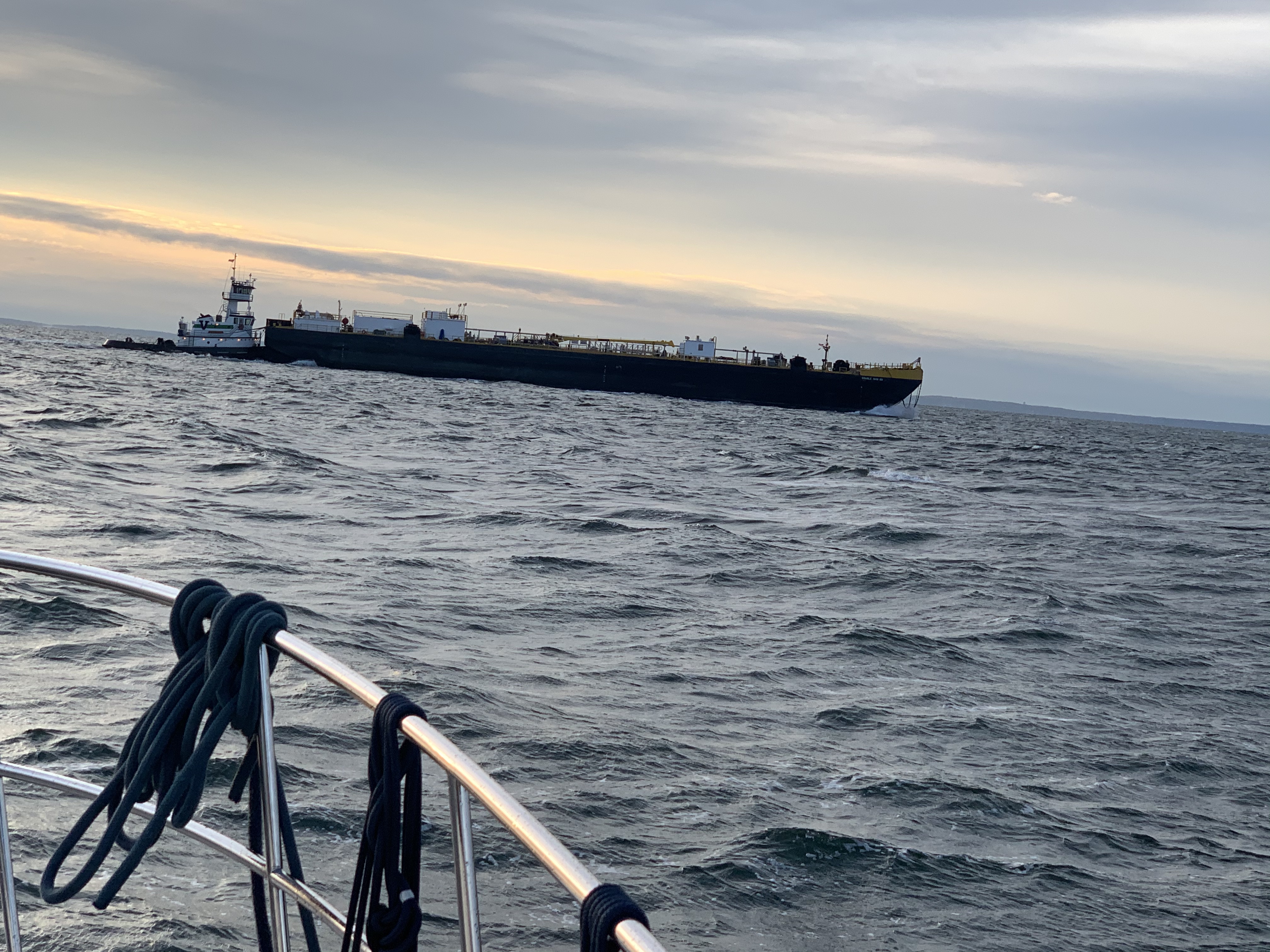
Traffic Jam
At one point I had to change course to take the stern of a tug pushing a barge. I thought maybe I could follow the barge close and let her flatten out the sound but alas at 8.5kts I was burning a lot more fuel and salting up the topsides.
Salt spray was washing my muddy anchor pulpit
I no sooner gave up on following the tug and I was dodging other traffic.
Pilothouse Pleasures
As I plod along I am happy that I am inside on this cold rainy day.
I had left my marina in Warwick, RI on the same day as another B-Dock member, MV Leap of Faith. I had managed to slip ahead of them but not for long as I watched them speed past me.
Girl Power
Soon I pass an overturned sailboat. I think to myself… wow that must be cold as you swim back to the boat and attempt to right it. As I pass I see that it’s two women sailors. I feel a little like a woosie as I wrap a afghan over my feet which feel cold just watching them.
Route Planning
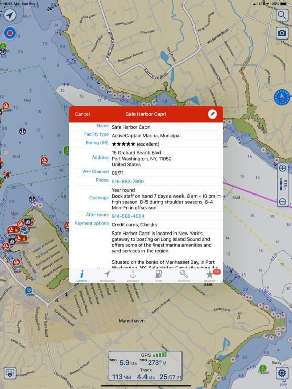
As I get closer to the west end of Long Island Sound I start to plan my upcoming routes. A quick check of the weather tells me I might enjoy the next two nights in a marina rather than anchored at the foot of the Statue of Liberty as planned.
Marina Hideout
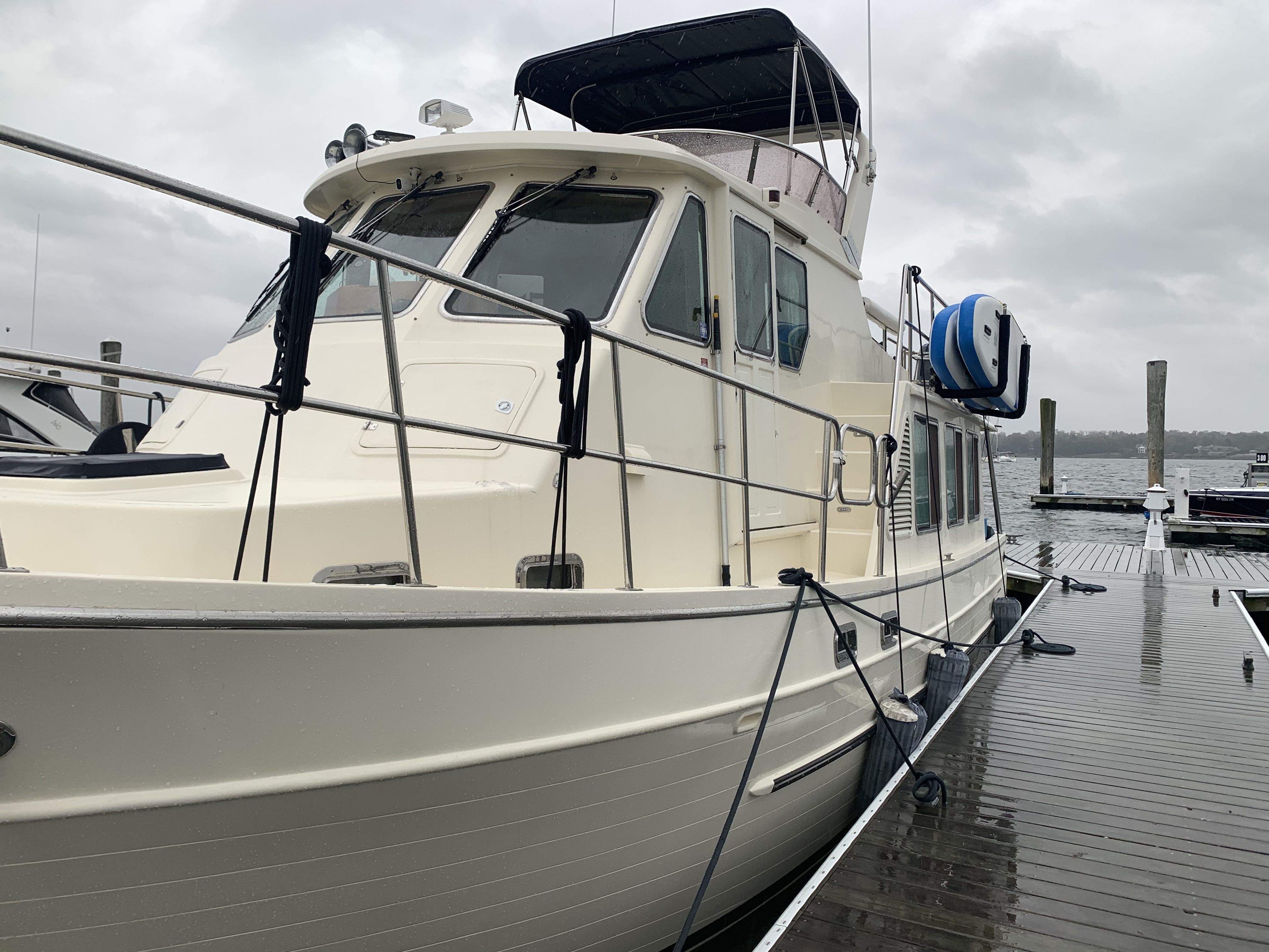
I found a great marina called Safe Harbor Capri in Port Washington. I’ve stayed here before and the Dockmaster Rob is very accommodating. Nice place to sit out the wind & rain.
As I pull in there is a dock hand there to catch a line for me. It’s raining hard so I make sure to tip him well. The slips here are large and it looks as if you could dock another boat in my slip right alongside Simple Life.
As I sit and eat some spaghetti I pull out my laptop to renew my EPIRB (Emergency Position Indicating Radio Beacon) with Search & Rescue for the next two years. I have emergency contacts incase it should ever be automatically triggered by a sinking.
As I sit inside, the wind is trying to blow the dog off the chain. I step out and see that as protected as this marina is… there are still waves rocking the boat.
At the end of the video, you see a sailboat on a mooring whose main sail has unfurled and is flogging. Not good.
Man of Leisure
My new Apple Watch gives me a haptic nudge. I glance down and see that all the boats rocking has tricked my watch into thinking I’m exercising. It believes I’ve just had my longest “move streak” to date. I chuckle to myself and think … I’m a man of leisure.
Apple Watch 6 thinks I have my longest move streak
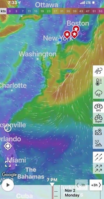
Weather Window
Now checking the weather I can see it’s going to get worse for the next two days but there appears to be a 5-6 day weather window for running the coast starting Tuesday afternoon.
The weather has been very stormy lately. I would have expected all the tropical storm activity to have ceased but even now in November there are storms forming in the Caribbean.
Go With the Flow
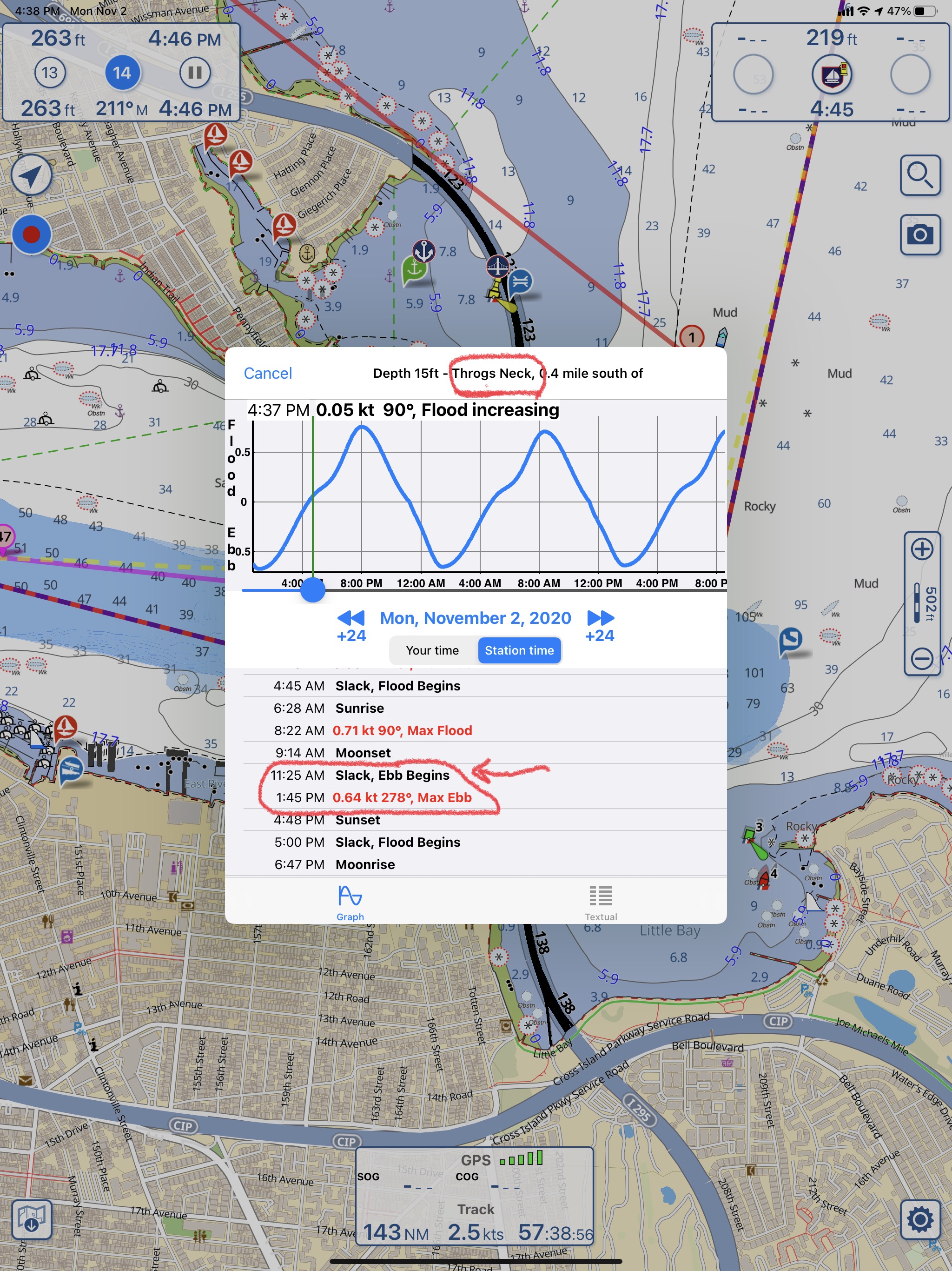
I now need to plan my exit to align with an ebbing current in the East River. Throgs Neck Bridge current station is right at the entrance to the East end of the East River. It’s sort of broad there so you don’t expect too strong a current. However, at Hell’s Gate where the East River and the Harlem River come together you can see there is a 4.73kt max current. The last thing I check is the timing of the currents at The Narrows which is just before I duck under the Verrazano bridge and out into the Atlantic Ocean.
W04L002 is in the Books
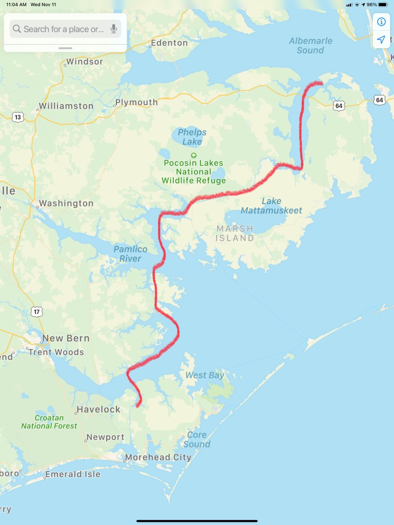
Leg #2 of my Winter 2020 journey was only 46.4NM and looked something like this.
We are still here at Crystal Point Marina in Point Pleasant, NJ. It’s a rainy day – perfect for writing a blog update.
Rainy Day in the Pilothouse
Correction, I think the marina’s official address is in Brick, NJ but it’s right on the town line. While we wait I am catching up on “The Walking Dead” and “Mr. Robot” while Kelly is watching “Blue Bloods”.
We are waiting for a weather window to proceed south to the next leg of our journey – Atlantic City, NJ. The NWS Marine Weather Forecast is showing Friday @sunrise to be our best bet.
FORECAST FOR COASTAL WATERS FROM MANASQUAN INLET TO LITTLE EGG INLET NJ OUT 20 NM
If you want to feel like you are on the water with your VHF radio tuned to the WX channels (first 5 or so channels on a VHF Marine Radio) check out this live stream of the Tom’s River NWR Station
NOAA Weather Radio Frequencies
162.400 MHz (WX2)
162.425 MHz (WX4)
162.450 MHz (WX5)
162.475 MHz (WX3)
162.500 MHz (WX6)
162.525 MHz (WX7)
162.550 MHz (WX1)
Channel numbers, e.g. (WX1, WX2) etc. have no special significance but are often designated this way in consumer equipment. Other channel numbering schemes are also prevalent.
I feel like all the other “Snowbirds” have left before us and I am like the main character of the book my mother would read to me, “The Poky Little Puppy”. She would joke that I was a “lollygagger”. I suppose it’s my right as the last-born.
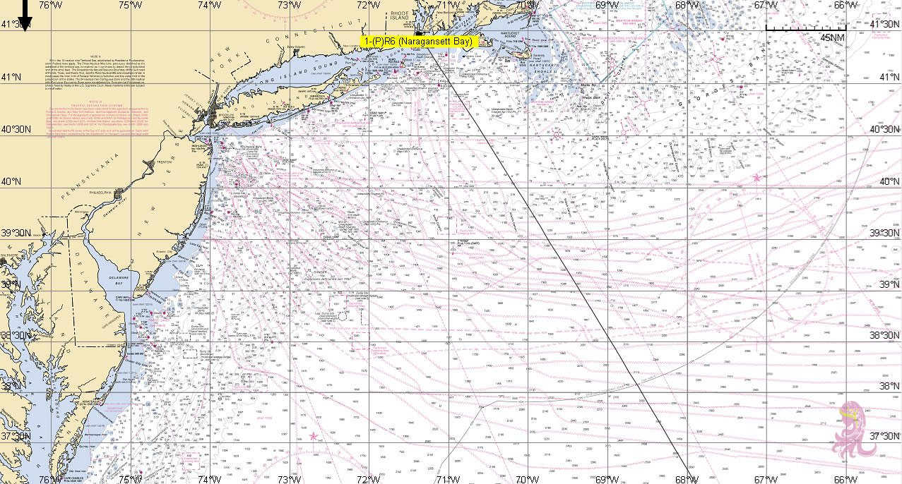
Snowbirds go south and there is more than one route to take. If you have a “Blue Water” boat and enjoy open ocean you may simply wait for a weather window and set a rhumb line straight from Newport, RI to Bermuda. This route is what the sailors of the bi-annual Newport to Bermuda sailboat race take. From Bermuda, its due South straight to St. Thomas in the Caribbean.
Rhumb line from Newport, RI to Bermuda
Caribbean Route Options
This route is only taken by larger sailing vessels and long-range stabilized trawlers such as a “Nordhavn”. Speaking of Nordhavn Yachts… in 2011, I flew down to Jacksonville, FL to purchase a Nordhavn 43. The marine broker met me at the boat which was “priced right” but as soon as I toured the vessel it was clear that she had not been properly maintained. Maybe in the future?
Nordhavn 43 Raised Pilothouse
While we initially looked at buying a blue water trawler we realized that it did not match the type of cruising that we would be doing. We settled on a long-range trawler that was perfect for the kind of coastal cruising that we do. Coastal cruising means that you generally cruise from one port to the next never exceeding 10-12 hours at the helm. Blue water cruising means 24-7 motion with 3 hours “watches” while the other crew are sleeping in their bunks. We settled on a North Pacific Yachts 43 (45 LOA) with a raised pilothouse design and many options that we hand selected. I will save the details for an upcoming blog post about the boat itself.
Weather:
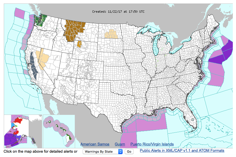
When you become a full-time cruiser you start to focus your efforts on learning more about weather. You find yourself spending a lot of time on the NWS (National Weather Service) Marine Weather Forecast website learning about all the information that it can give you. Not just forecasts but real-time observations from ships and weather buoys.
Map showing the different weather “zones” – use link below for clickable version
from the link above, you can select from a graphical map, the coastal forecast for the “zone” that you are in. The coastal forecasts are broken up into small rectangular sections of coastal waters that are roughly 20 miles on most sides. There is an offshore forecast for fisherman who fish the “Canyons” which are the deep underwater valleys that you see when you look at a bathymetric chart that shows the underwater topology (sea mounts and valleys).
Canyons South of Block Island and Nantucket
There are also inshore forecasts as well that show the weather inside the bays. I have always had a keen interest in meteorology and understanding weather. I was smitten with weather the very first time a meteorologist came to give a lecture at UMB (Umass/Boston) and I swear every other term I needed to lookup the meaning. More recently, I signed up for a 2-day “Marine Weather Workshop” at the annual Newport RI Boat Show. I imagined that the class was going to talk about how to read the weather by looking at the skies around the boat. I was thrilled when it turned out to be a much more science based talk about wet & dry adiabatic charts and surface pressure charts built from daily weather balloon launches, etc.
The presenter was Lee Chesneau and you can find his Marine weather page here.
I’ll post more about weather as we go and maybe spend some time talking about the many different aspects of understanding weather. For now, my plan is to shelter-in-place (unfortunately, that word has a more recent meaning) and wait for the northerly winds that often follow a cold front.


You must be logged in to post a comment.