Supermoon Where Are You?

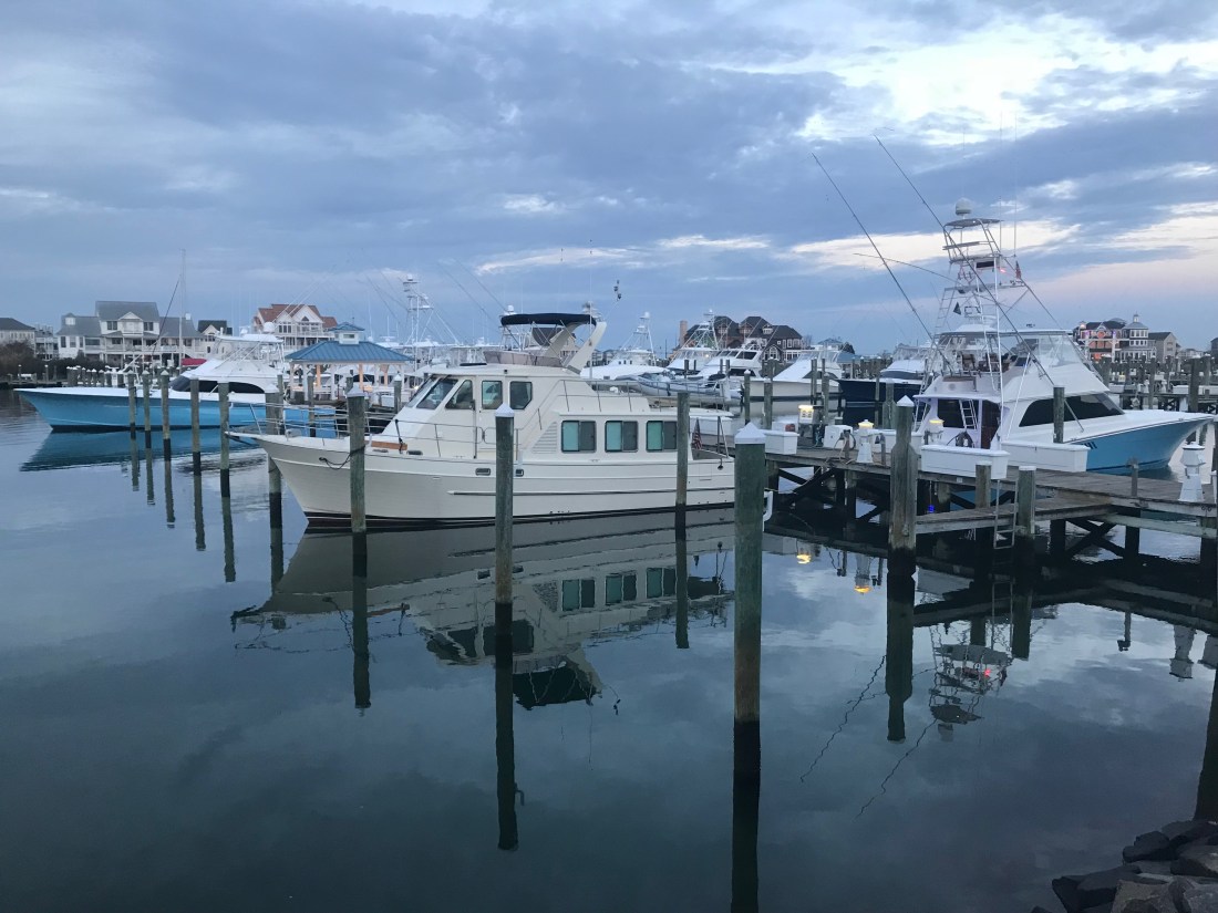
Yesterday morning we awoke before sunrise and got underway to Beaufort, NC.

The first & last supermoon of 2017 was helping slice through the dark as we pushed away from the dock.

Supermoon 2017
Supermoon Reflecting the Sun’s Rays


Supermoon infographic
Supermooninfographic

Supermoons happen when a full moon approximately coincides with the moon’s perigee, or a point in its orbit at which it is closest to Earth. This makes the moon appear up to 14 percent larger and 30 percent brighter than usual.

December’s supermoon is actually the first of three back-to-back supermoon full moons to come in the next two months. On Jan. 1 and Jan. 31, the full moon will also occur near the moon’s arrival at perigee, according to NASA, which billed the line up as a supermoon trilogy. The Jan. 31 supermoon is also the second full moon of January, making it a Blue Moon, and also occurs during a total lunar eclipse.


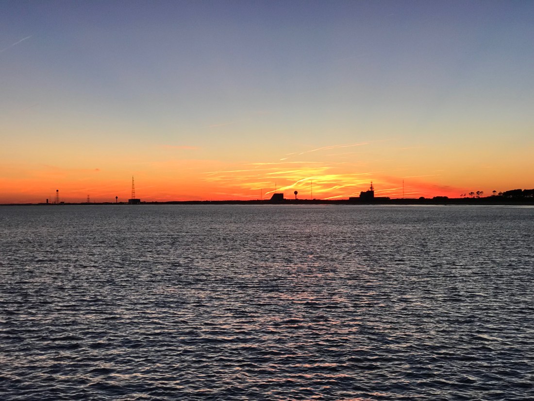
As the sun got ready to sneak over the horizon there was a beautiful orange-pink hue reflecting off the water.

Before Sunrise
Before Sunrise

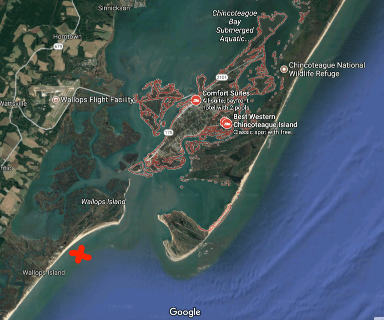
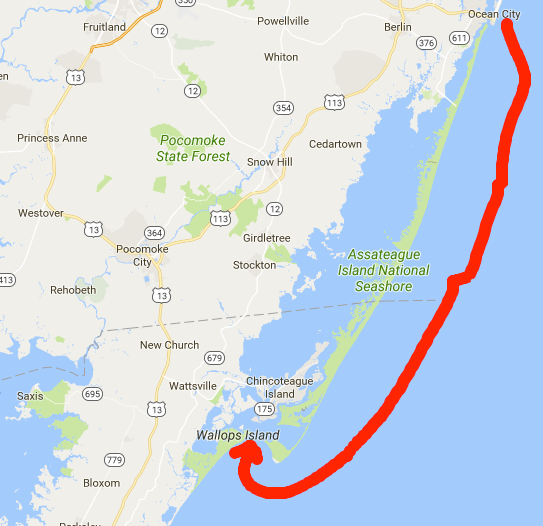
Today’s leg of our journey takes us from Hobucken, NC to Beaufort, NC

The Beaufort of coastal North Carolina is “BOH-fert”. The Beaufort of South Carolina is pronounced “BYOO-fert”. Established in 1709, Beaufort is the third-oldest town in North Carolina.

Leg Beaufort
Beaufort Leg of Journey

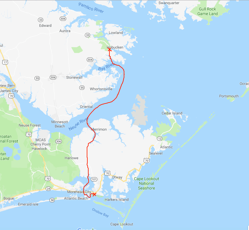
As we made our way out of Goose Creek and into Pamlico Sound, the only traffic we passed was a tug pushing a barge.

Tug and Barge
YATPB – Yet Another Tug Pushing Barge

The dominant wave set was coming from the NE and that meant we had a following sea as we turned and made our way down the Neuse River. A following sea that is slightly to one side of the stern can be annoying when you are at the helm. The waves catch up to the boat from behind and lift the stern pushing it to port or starboard. This can swing the bow as much as 30 degrees at times and it starts to feel like you are pointing the boat all over the place. I made a quick adjustment to increase the autopilot’s response rate and the bow heading deflection lessened considerably. Being a slow boat (6-9 knots) you are often at the helm from sun-up to sundown to make your destination. Autopilot is an electronic device with some firmware loaded on it that drives a hydraulic pump which turns the rudder. There are many settings that you can control but the response rate is the one you will want to adjust so that the rudder position changes are swift or slow enough for how you want the boat to point.

As weekend boaters, we were boating in destinations like Block Island, Nantucket or Provincetown. These locations are anywhere between 6-12 hours from our home port in Warwick, RI. We would be forced to run the boat at 8.5 knots and only get about 1 MPG. Now that we are full-time boaters, we slow the boat to about 6 knots and get 4 MPG. You can go 4X farther if you simply reduce your speed by 2.5 knots. (Recall 1 knot = 1.15 MPH so approximately every 6 knots you would simply add 1 to get the speed in MPH).

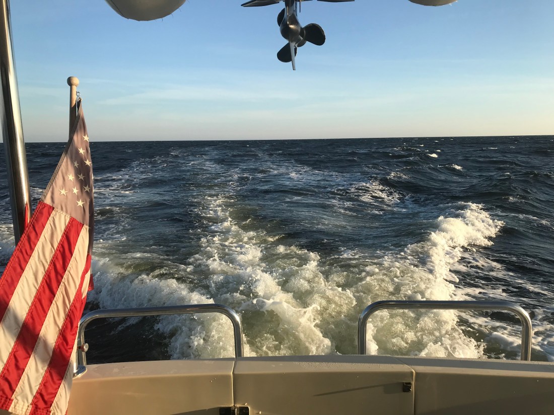
Even knowing this, we made the decision to up the speed to 8.5 knots and reduce the amount of time spent in the following sea.

Happy and Chief Martin Brody appreciated that we burned a a bit more fuel for their comfort.

Brody and Happy
Chief Martin Brody and his Big Sister Happy
Wake
Wake in the Neuse River

As we turned into Adam’s Creek the ride smoothed out and we dropped back down to 6 knots. The current in Adam’s Creek was swift and the DSM (Depth Sounder Module aka. Fish Finder) was showing asymmetric rippling of the creek bottom. I believe this is caused by a swift bottom current.

Adams Creek Rippled Bottom
Asymmetric Rippled Bottom of Adams Creek

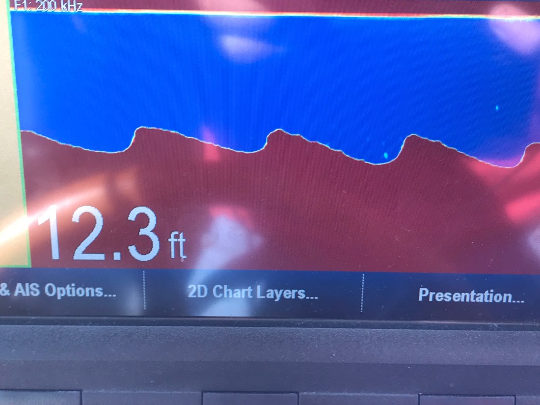
The fish finder was also well, finding fish. The DSM uses sonar or high frequency sound generated by a device that protrudes through the hull and is sending a column of sound waves straight down beneath the boat. These sound waves not only reflect off the bottom but when they hit a fish the sound resonates in the fish’s swim bladder (a small air-filled sack that helps control a fish’s buoyancy) and this echo is detected and colored sharply to allow you to spot fish on the screen.

DSM Fish
Look Swim Bladders

Adam’s Creek is a lovely place with lots of sights to see.

Youtube Video of Bald Eagle in Adams Creek

Adams Creek spills out into the Newport River and it’s marshes and shallows are something that you will want to avoid.

Newport River
Newport Marshes as you Head South to Beaufort
Shallow Birds Standing.JPG
Kelly & I Often Joke… “If You Want to Know Where it’s Shallow; it’s Where the Birds are Standing”

As we pulled into our slip in Beaufort we hailed the dockmaster who warned us about the swift current running transverse to the slip we were assigned. As we pulled in to the fairway the current slammed into our full keel and began to push the boat toward the bows of the boats across the fairway. I was forced to back out quickly and reposition so that I could now take the swift current into account and position the boat for rapid spin and quick back into our slip. Kelly was quick to toss lines to the dockhands and soon we were checked in and given the keys to a “courtesy car”. Up North, I’ve never stayed at a marina that offers a fee courtesy car to marina guests. The car was a welcome treat and we put it to good use re-provisioning the boat with more food & beer.

Courtesy Car Kelly
Courtesy Car – We Got Wheels!

With all our chores completed we quickly made off to the marina bar for happy hour and spent time chatting with Bartender Kristen and fellow bar patron, Dan. Dan was an amazing fellow who told us stories of his solo sailing around the world in a small boat. He offered us some local knowledge about wild horses that roam the islands around here. I KNOW more wild horses to find!

Kelly and Dan
Kelly & Sailor Dan

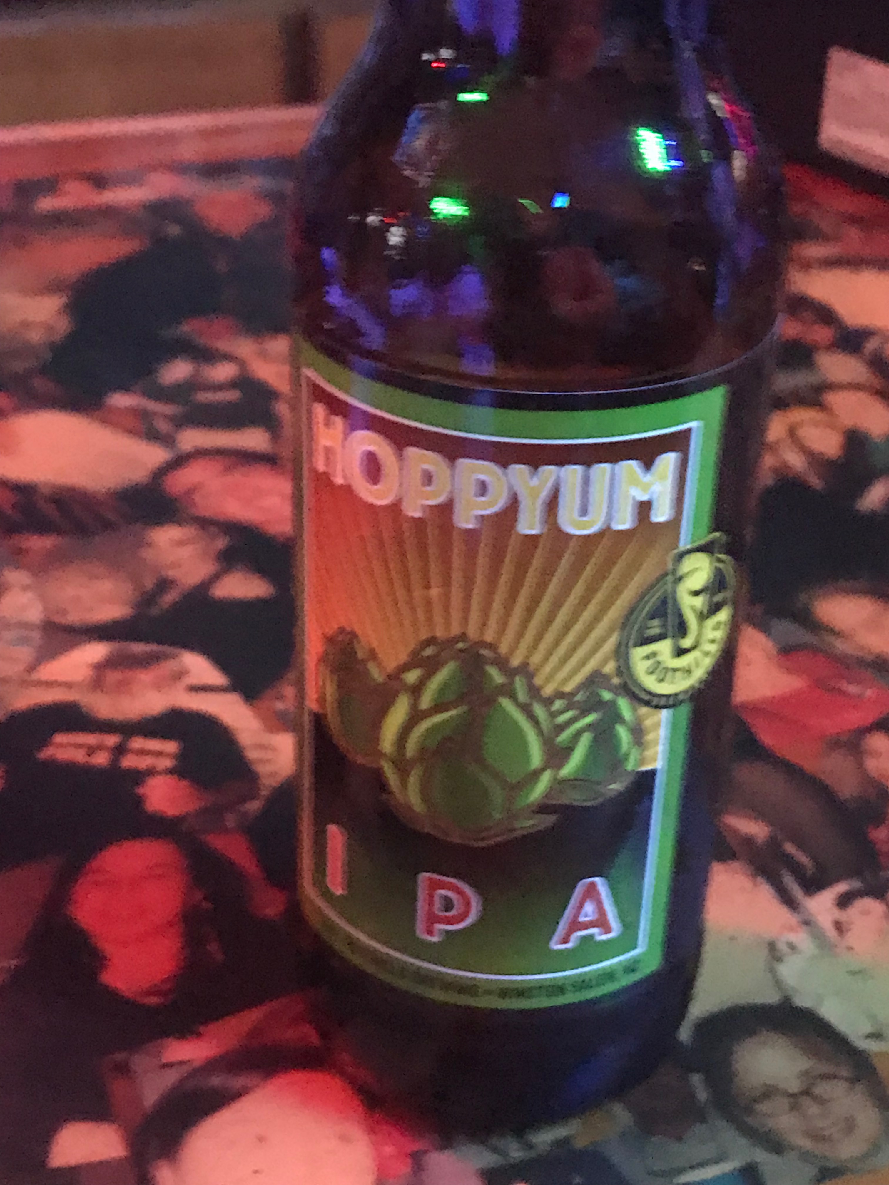
After I consumed as many 50 cent pork sandwiches as a man can eat and washed them down with a great local IPA it was time to retire to the boat.

Hoppyum IPA.JPG
Great Local IPA From Foothills Brewery

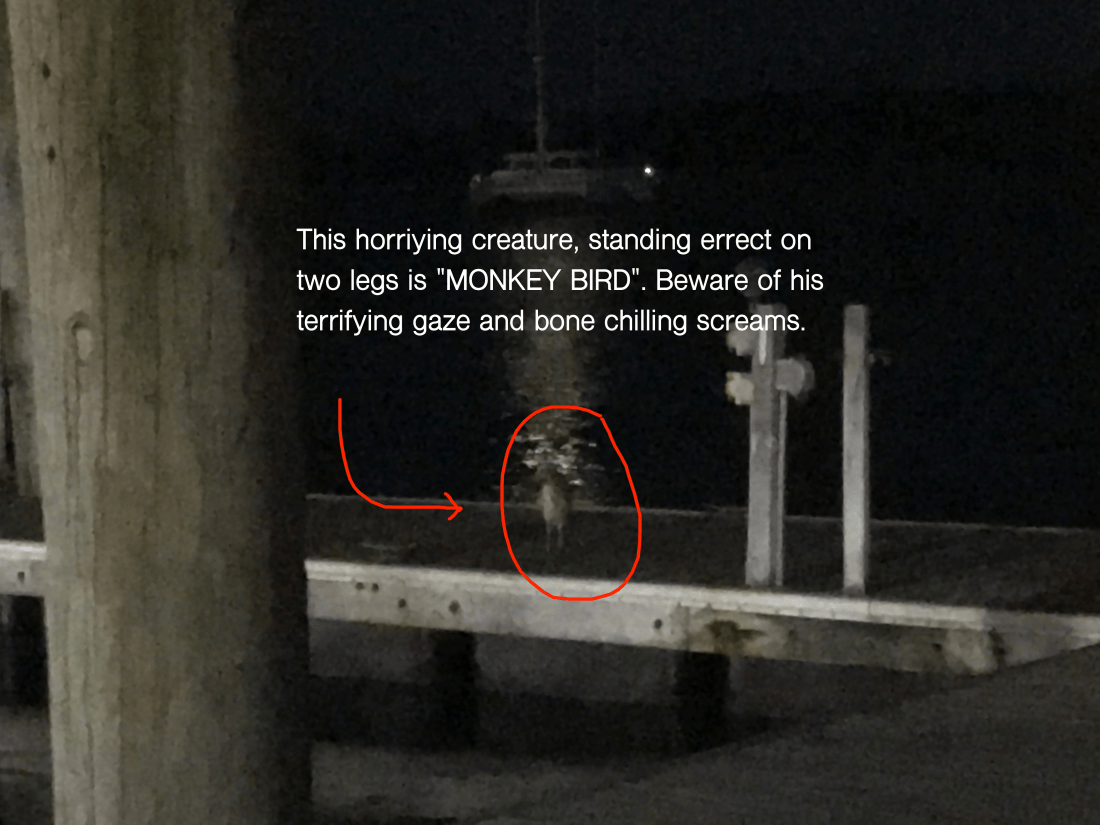
We were no sooner readying for bed when we were accosted by “Monkey Bird”. This vile creature had a penetrating stare and an awful cry. I spent sometime staring into this monster’s gaze and knew it was time to lock the door and keep the crew of Simple Life safe.

So it’s off to bed.

Monkey Bird Standing.png
Monkey Bird Prowling the Docks


Chincoteague Island, VA – Where are the Ponies?

We awoke around 4AM this morning and I began pouring over the charts until I felt comfortable that we could safely make the passage down the outside passage to Norfolk, VA in 4 separate legs. By staying outside we will save days if not a week of traveling inside through the Chesapeake. While we would like nothing more than to spend months exploring all the great places in Chesapeake Bay, right now we could go for some Key West sunshine.

The other day we left Atlantic City and motored past the mouth of Delaware bay, I just could not bear to make a starboard turn and head up the Delaware Bay. This would mean heading North rather that South. In order to take the inside passage you must first run North up the Delaware Bay till you get to the C&D canal that connects the head of Delaware bay with the head of Chesapeake Bay. Once in Chesapeake Bay you again start heading South. It’s quite a bit longer than simply staying outside in the Atlantic Ocean.  It’s also more work for the captain, who must stay vigilant to avoid other boat traffic as well as steer around lobster pots. Nobody likes getting a lobster pot line wrapped around their propeller. We installed a “shark” pot cutter in front of our propeller to hopefully chop any lines that tangle in our propeller.

shaft shark
“Shark” Pot Cutter in Front of Propeller (Similar to MV Simple Life’s Setup)
Inside Passage Map
Inside Passage – Up Delaware Bay, Through C&D Canal and down Chesapeake Bay
4 legs map
Outside Passage – 4 Legs, 2 Anchorages

The more we studied the few inlets along the outside passage, the more we realized that many of them were possibly full of shoals and shallows to be worth trying to enter. There were some that if we did enter the inlet, it was clear that once inside it we could easily run aground due to the shallows that abounded. It was also very evident to us that our 2012 electronic charts no longer match the current depths and shoal locations. I use the charts as a “guide” but keep a close eye out for breaking waves where a new shoal may have formed due to recent storm activity.

We arrived at Chincoteague Island sometime around 1PM. The journey here was pretty uneventful. We saw only one other boat and it was a large sport fishing yacht moving at twice our speed South down the coast.  We studied the charts and found a nice spot to drop hook, close to the shore. MV Simple life has a 90 lb. Rocna, plow style anchor and 300′ of 3/8″ chain. I let out almost 120′ which was a ridiculous amount of scope (“anchor scope” is a ratio like 7 to 1: length of chain compared to depth of water). If we were in a crowded anchorage we’d never be able to let out that much scope as when the wind changed direction we’d swing into other boats. Along this coast there is not another boat in sight. After the anchor hooked up I applied some throttle in reverse (+200 above idle, or 800 RPM) which combined with the strong wind, buried the anchor. The extra throttle  lifted the chain straight out of the water with no bounce. We believe you should always “back down” on your anchor and watch to see if the chain jumps up/down which is a clear indication that the anchor is dragging along the bottom. This can happen for many reasons but some possible causes can be the seabed could have eel grass that stops the anchor from “digging in” or the bottom might not be sandy but instead a super soft silt that is like pushing a potato chip through whip cream instead of thick cheese. Better to have your anchor drag while you’re backing down on it than when the wind picks up in the middle of the night and you are fast asleep.

Chinoteague map
Red X is Where we Anchored – Off Wallops Island. Chincoteague outlined in Red

After reading about the wild ponies on Chincoteague Island, I made up my mind to use the crane and drop the dinghy in the water to go find them ponies. I had no sooner raced off on the dinghy before I thought.. I’m freezing & I’m zipping along over the shallow shore and could easily run aground at full speed and wind up taking a dip in the cold Atlantic. So I put a lifejacket on and turned around and made it back to the Simple Life. DAMN, NO PONIES!!!

Back at the boat the heater was on and I quickly put the dinghy back on the flybridge and warmed up to an IPA 😉 That brings me to where I am now.. sitting in the pilothouse enjoying a beer or two. We’ll leave you with our sunset view — good night.

Wallop Island Sunset

Atlantic City NJ to Ocean City MD & CathyPaul

We left Atlantic City @ sunrise.

AC Night 1
Atlantic City @ Night
Sun at 7AM
7AM off the Coast of Atlantic City, NJ

Kelly promised a breakfast “to die for” and delivered in every way.

My favorite. Corn beef hash (“ova ah’d” as I say) with eggs a bit “sunny” and American Cheese on toasted wheat bread.

“Wheat bread” said with the emphasis on the “H” like how Stewie from Family Guy would say it. It sounds like an “Haach”.

Breakfast
Epic Egg & Cheese with Corned Beef Hash & Stubbs Sweet Heat BBQ Sauce

Here is a video of us leaving AC. It was so calm that I simply untied the boat, stepped on and put it in forward to leave the slip.

We slipped past the Atlantic City USCG station where their rescue boat sat quietly.


AC CG Station
USCG Station Atlantic City

The dogs like the cockpit grass and they often they need me take them there while we are underway.

Pups.JPG
Don’t tell them this ain’t real grass

While underway we were happy to find the sea state somewhat tame for the end of November. Our passage to Ocean city, MD was 9 knots the whole way.

While we did not have to slow down, the 25 knots winds made for a wet ride. Thankfully I stayed dry & never had to change out of my PJs and slippers.

The boat feels heavier than normal since we have her loaded with more stuff than usual. Even the bow spray seems to throw further.

Every marina we have visited thus far seemed to be shutting down due to the freezing temps.


This presents a challenge for us as there has not been any water to wash the boat or top off the water tanks. Thankfully, MV Simple Life has ~450 gallons of water aboard in her two tanks. As long as Kelly is not doing laundry (she loves doing laundry on the boat), water is not an issue.

The ride from AC to OC left plenty of dried salt crystals on the boat. Our salty windshield

glistened like a diamond in the sun.

salt good.JPG
Salty Boat

Today’s trip was about 70 miles. That’s about an 8 hour trip. This late in the season you only have about 90 minutes more of daylight.

Leg AC OC.png
Today’s Route Skipped over Delaware

Upon arrival I was a bit embarrassed to have to hail the marina and ask where they were located. My Navionics chart chip from 2012 had the marina in a different location. The marina is actually very protected once you slip past daymarkers 1,2,3 & 4. Austin the dockhand was there to catch a line for us and hand us the diesel hose to top off our tanks. I added 350 gallons of diesel @ $3/gal.

That means we made it from Wickford, RI to Ocean City, MD on roughly 350 gallons of diesel. Not too shabby though if I were slowing down I could use half that.

Here are some pics us at the docks.


After a long day I needed to sneak away to a bar called the Sunset Grille.

Sunset Grille.JPG
Sunset Grille in Ocean City, MD

We enjoyed happy hour with new friends “CathyPaul”. It’s actually Cathy & Paul but I’m sure I heard them combine themselves into a single name, “CathyPaul”.  They were lots of fun and kept me entertained the whole time.

They also taught me how to say the name of the island that I hope to anchor at tomorrow morning. It’s called Chincoteague Island “Chinko Tee gah”. Tomorrow’s trip there will look something like this..

Chincoteague Island Anchorage

The anchorage is exposed to the Atlantic but in a NW or W wind, I believe it will do just fine. I must say that after studying the charts there are very few inlets at this point in the trip. The inlets that you do find caution mariners about unmarked shoals, breakers over sandbars and shallows everywhere. If we had a faster boat we’d have more options to skip over the more challenging inlets. Instead we often must either stop sooner than we’d like or try to use all of the daylight to make it to the next anchorage or marina.

I found this webpage for  Chincoteague & Assateague Island . It talks about wild ponies on the island.. Maybe I should take the dink ashore and let the Chief Martin Brody and his sister Happy run with the ponies?

Ponies in the water
Ponies rather than horses? Is that what you call em?

Well it’s late and I better hit the sack. These days we are running from sun up to sun down and it’s leaving us wanting more downtime.

Good night for now and Kelly & I want to give a shout out to all our high school classmates who had a reunion tonight.  We wish we could have made it but we left New England too late as it was.