
When my youngest sister, Janet & I were acting bad, our Dad would simply state “Who wants a wallop?” My first thought was “What’s a wallop?” Later I learned… It was code for you better starting acting right or Dad’s gonna straighten you out like a piece of wire. Lucky for us, it was rare he ever had to make good on that threat because we knew enough to stop.
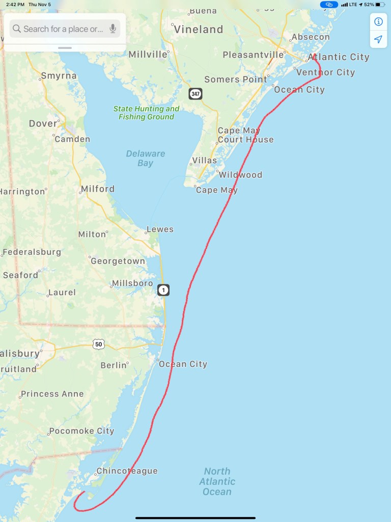
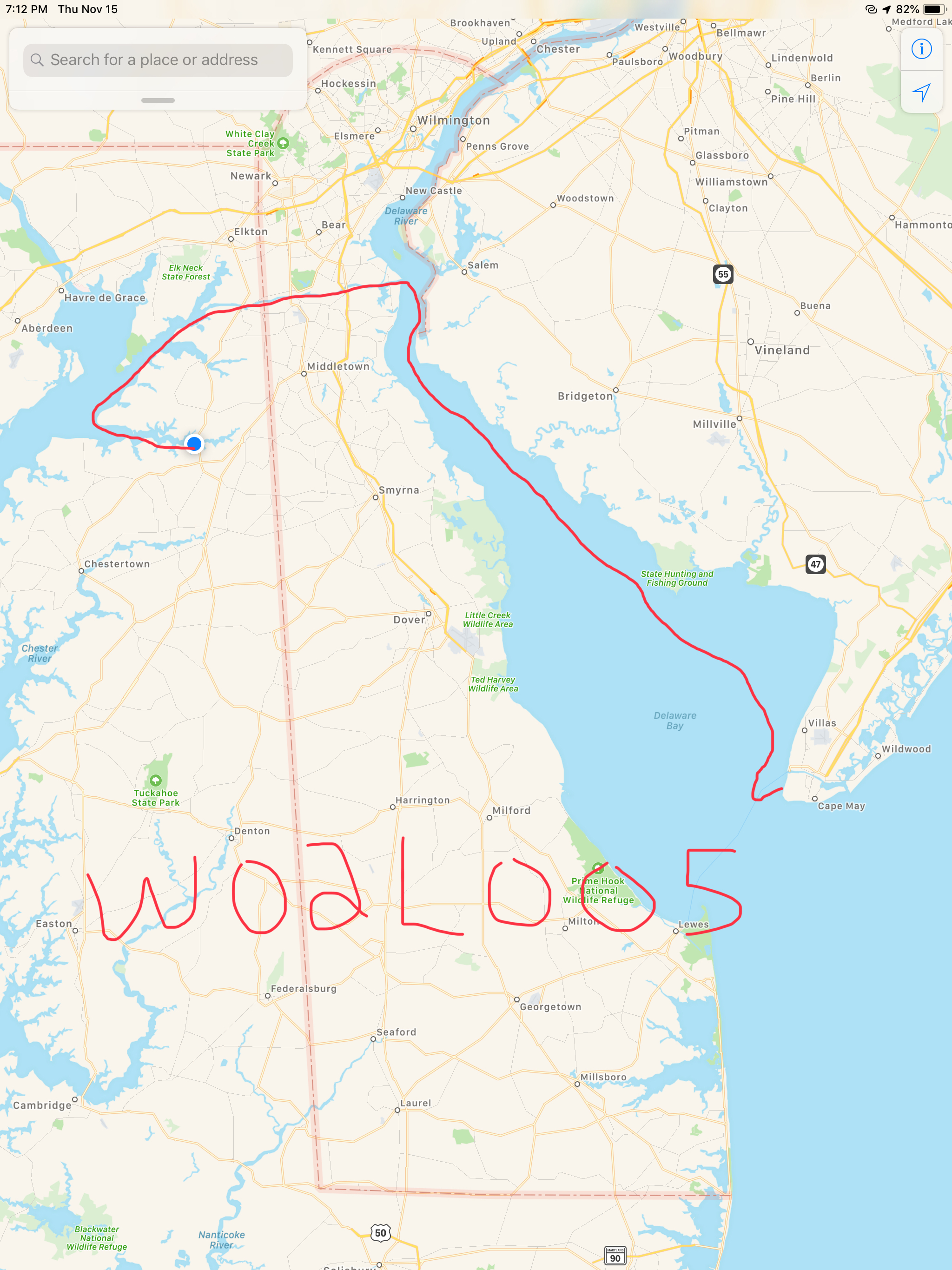
You may be thinking… why is he talking about about getting a wallop? Well… ADD aaannnd tonight’s anchorage will be Wallop’s Island. There are not many places to anchor along Virginia’s Atlantic coast but this is one of the few.

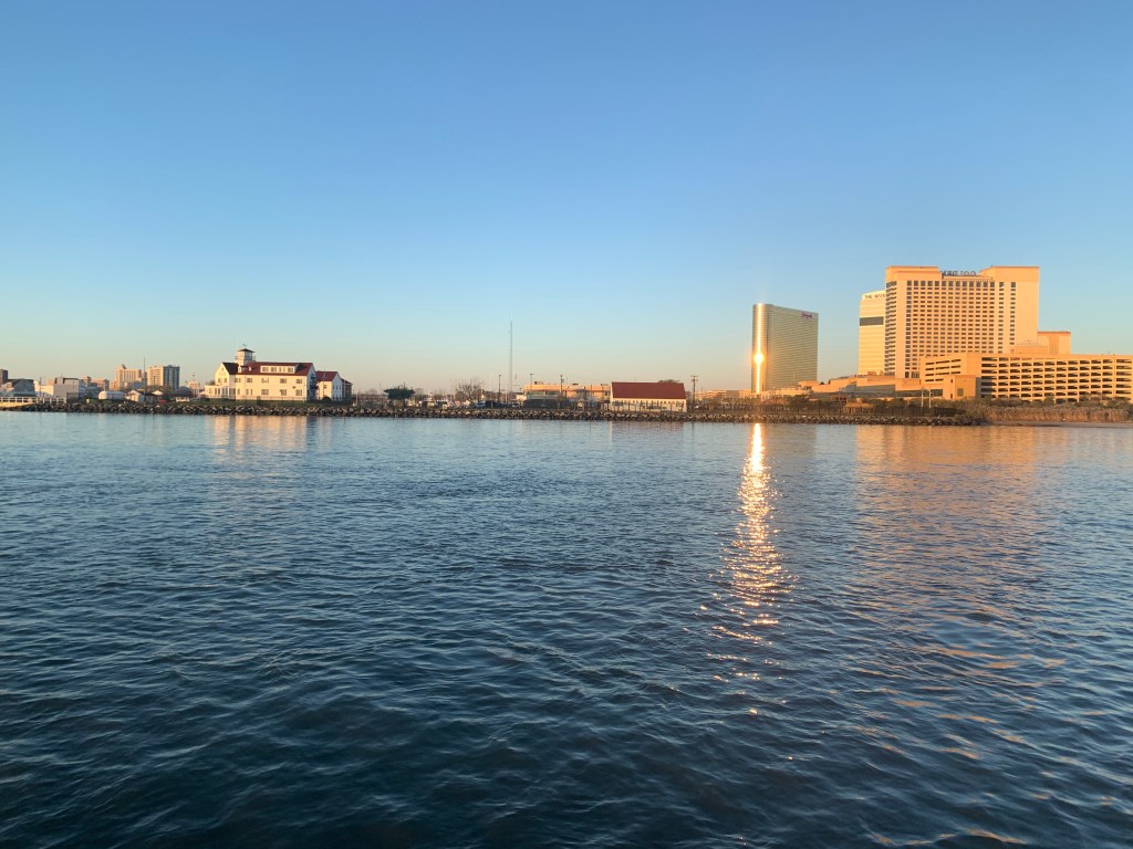
Absecon Inlet
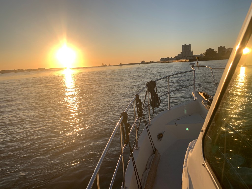
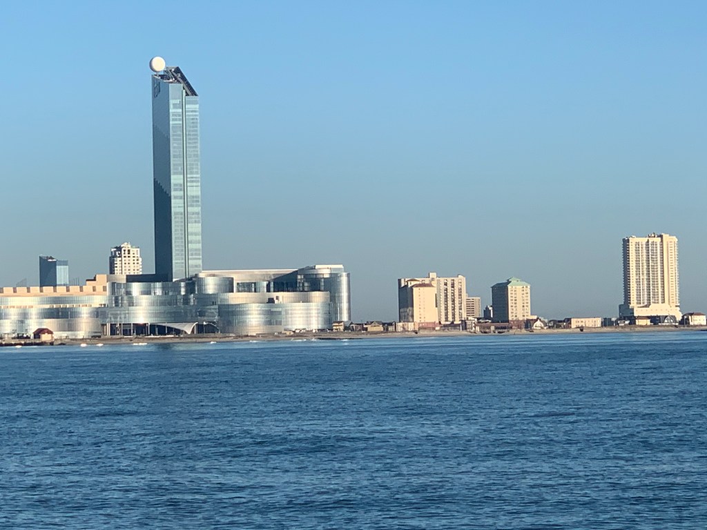
I only slept for 2 hours and awoke at first light. It’s amazing how refreshed you feel even after as little as 2 hours sleep. As I look out the pilothouse windows I can see a bright spot of sun on the metal exterior of the 430′ high Borgata Hotel Casino & Spa.
As I glance out the other side of the boat I see Ra, the ancient Egyptian sun god, has just started his journey across the cloudless sky.
I am not alone. Last night I weaved through three sailboats to find an empty spot to drop my anchor. I wonder if they will even know I was here?

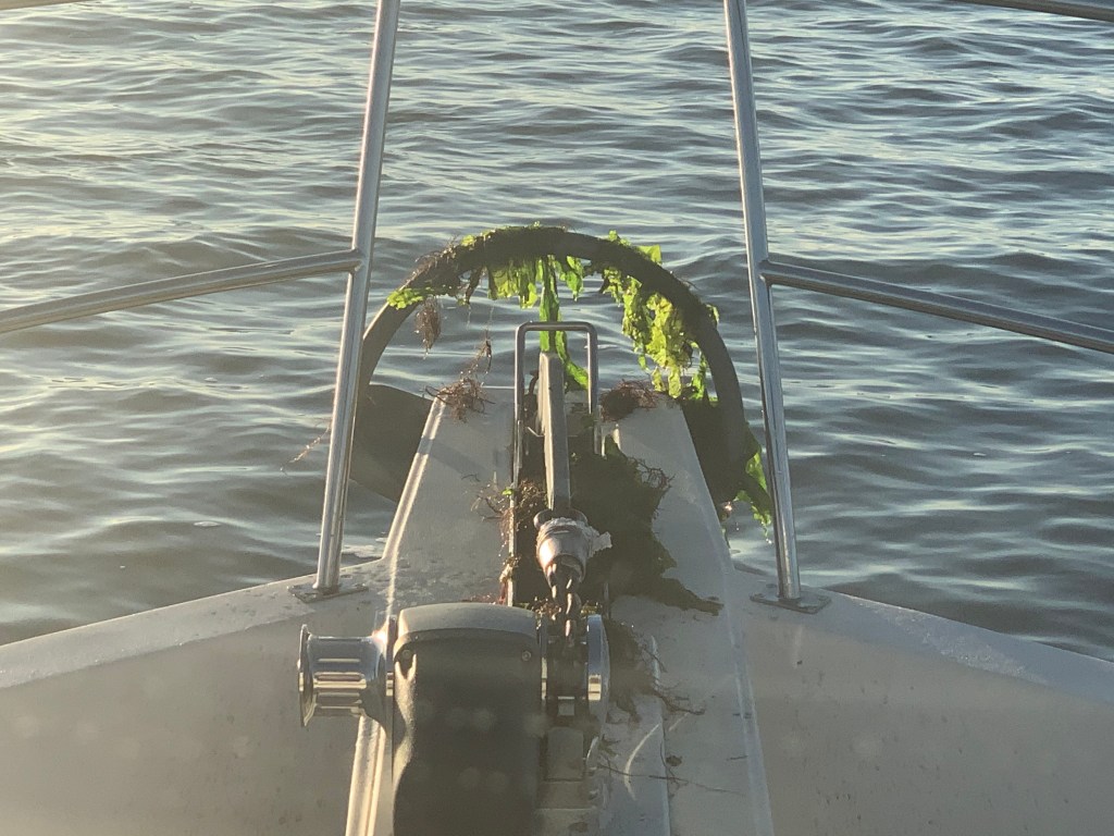
When I finally retrieve my anchor into it’s bow roller I see that it’s covered with sea lettuce. Well I’m sure there is a more technical term but I’m sure the strong current was trapping the lettuce against my anchor chain like lettuce blowing in the wind.
As I look in my review camera I am reminded of how deep Absecon Inlet is.
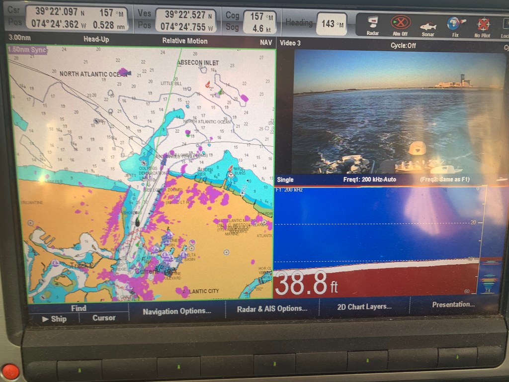
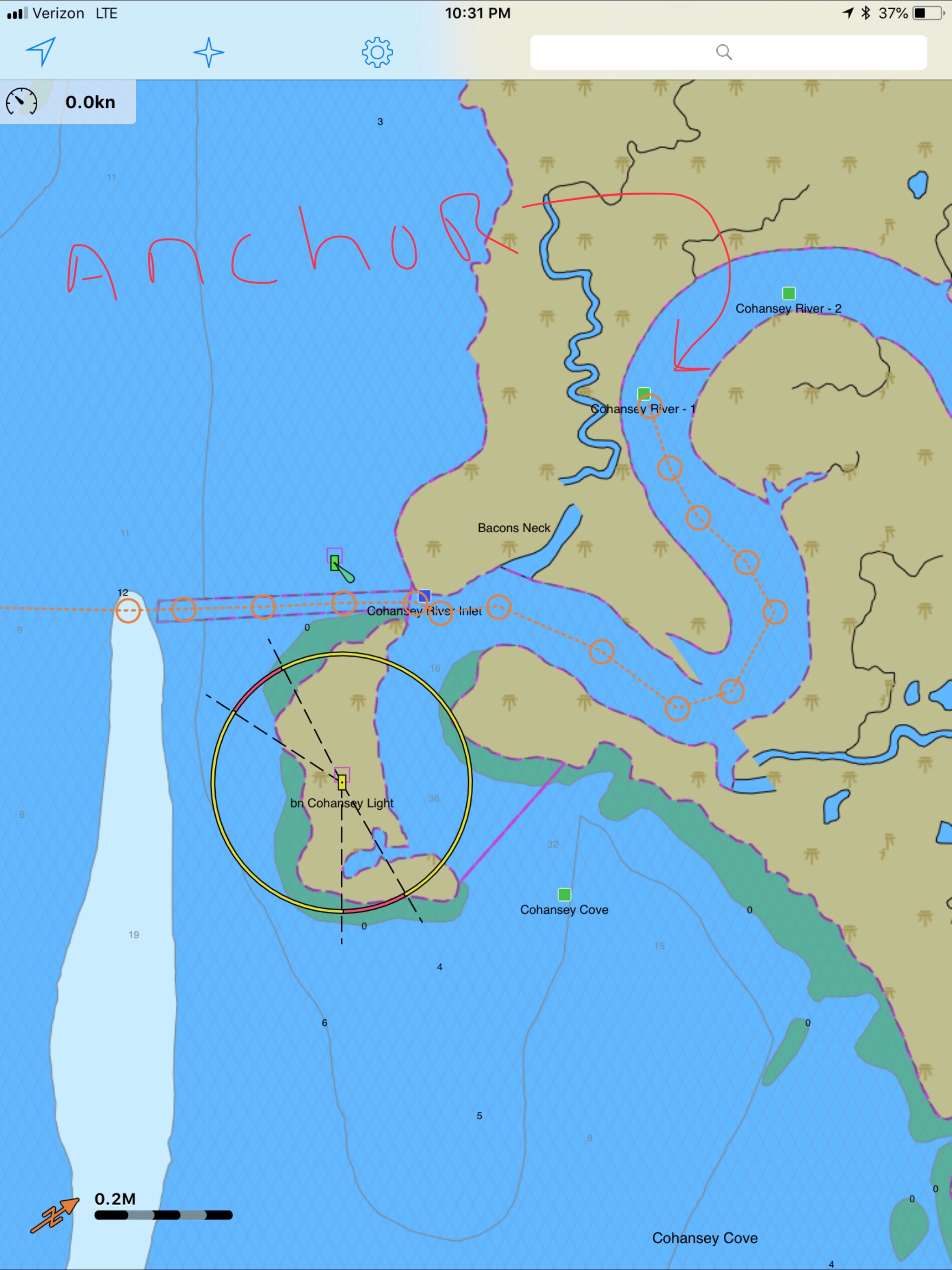
As deep as it is inside the inlet there is quite a bit of shoaling going on around it’s entrance. The Aqua Maps chart plotter view below shows a few of my past tracks entering and leaving Absecon Inlet. The pink track entering from the left of the picture was my track coming in at 3:11AM on 11/4/20. While the charts show depths like 20′ and 15′, reality was much closer to 9′ as I came across that shoal. Whenever you are navigating inlets your chart depths are not to be trusted. If you have any ocean swell action going on you’ll often see breakers wherever the shoals exist.

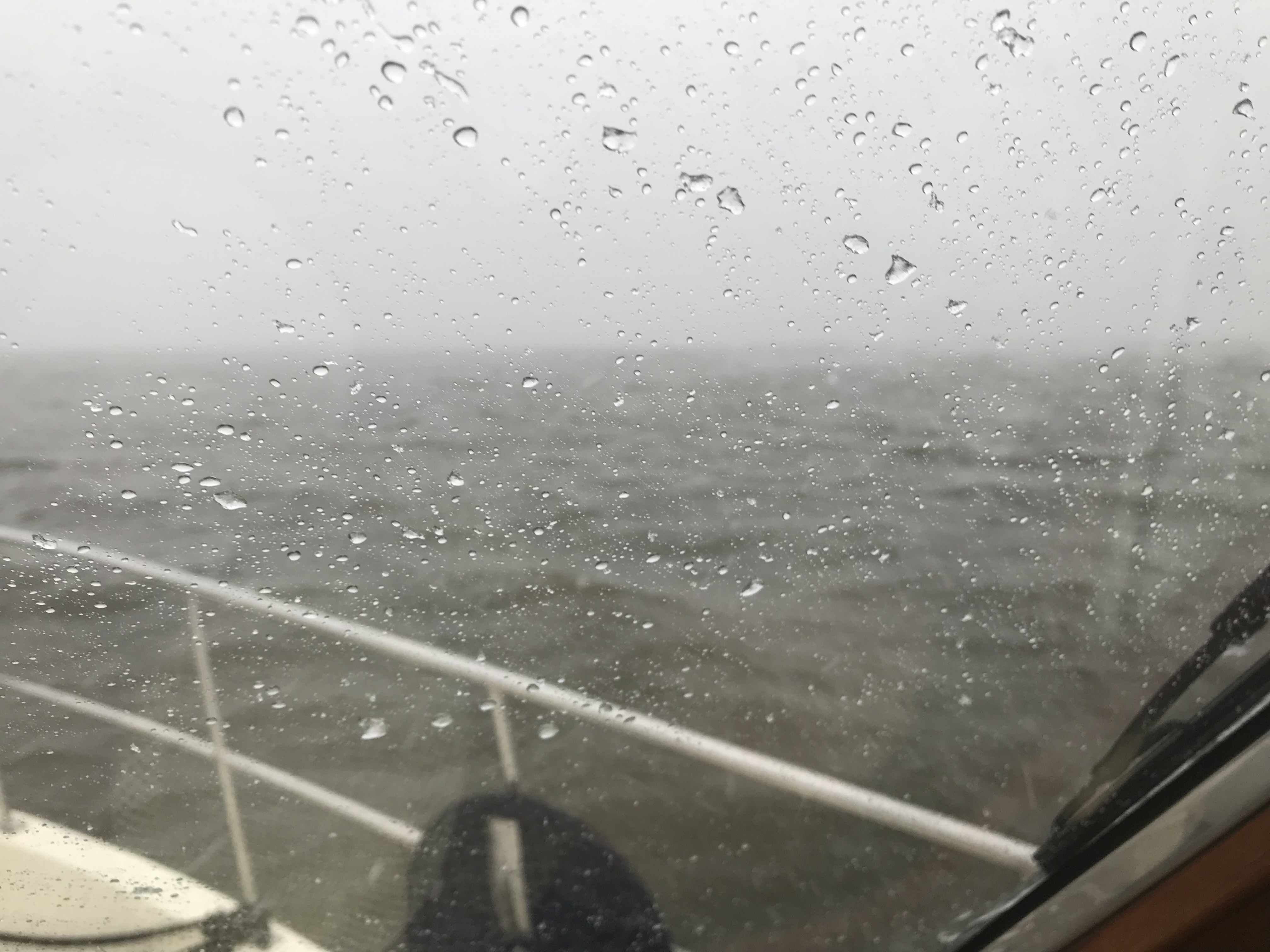
As I make my way out of the inlet I am bucking the incoming tide and it slows my normal 6.5 kt speed down to a plodding 4.6kts.

Atlantic City Architecture
As I leave Atlantic City I look back at both the 710′ high Ocean Casino Resort and The Wheel @ Steel Pier (227′ high). Both of these object are lit up at night and can be seen for miles as you approach on a dark night. The ball at the top of the Ocean Casino Resort (The former Revel Casino Hotel) glows with changing colors.


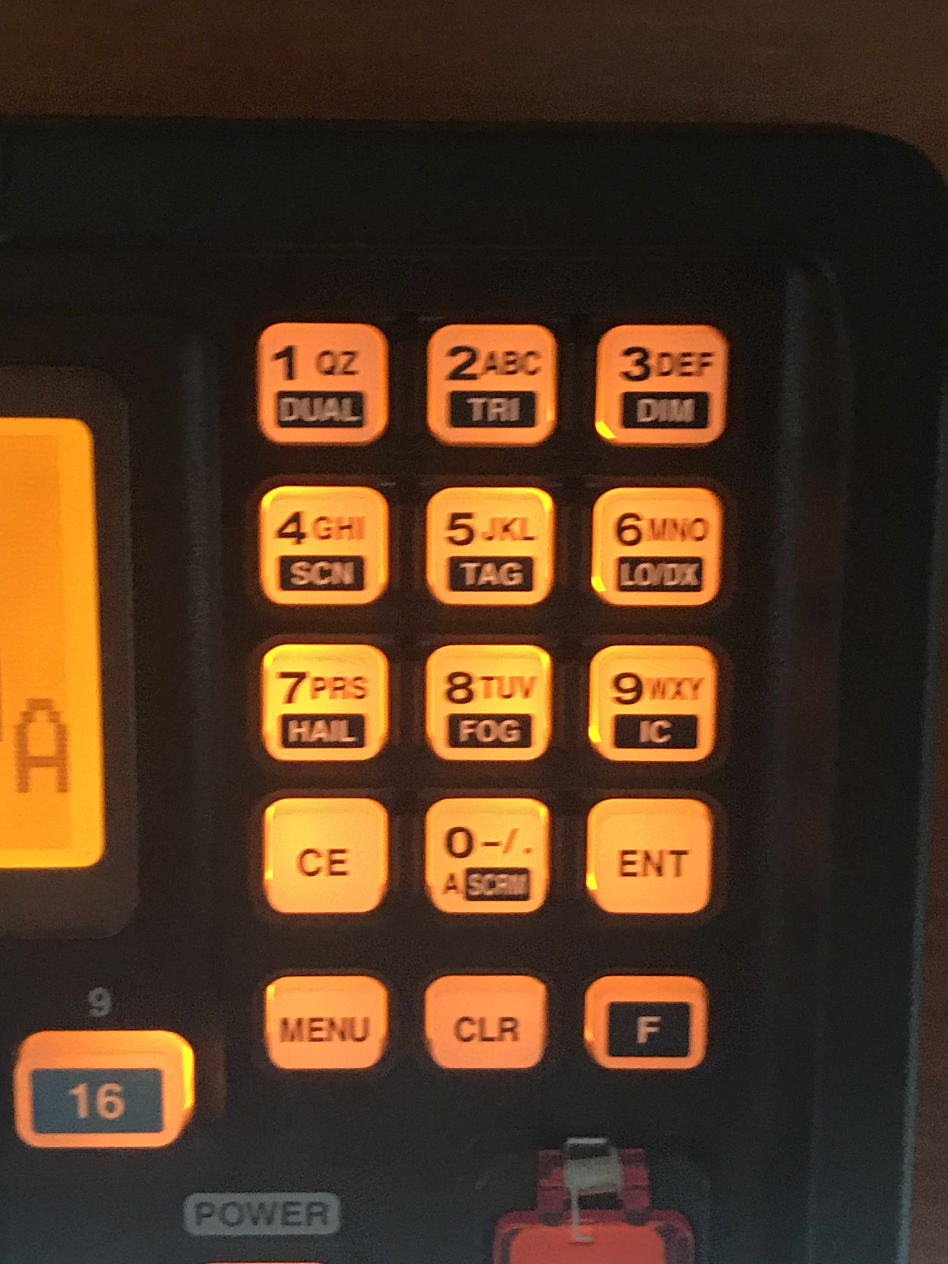
Digital Selective Calling
The next hours many hours were spent cruising the coast with hardly a boat to be found. Then suddenly the VHF radio sprang to life.
VHF radios have evolved to use DSC or Digital Selective Calling which allows for making calls to select individuals or groups using their MMSI number (Maritime Mobile Service Identity). DSC also allows for making a digital distress call like the one I received. After ACK’ing the call I received, I immediately entered the boat’s MMSI number and called them back directly. No response! I tried several times for about 30 minutes while I scanned the horizon with my binoculars for any signs of boats or activity. Nothing. Other boaters have told me stories about how the distress button gets accidentally pushed on radios and when someone calls back the people won’t answer your call. Often after you accidentally push the distress button, many boaters attempt to call you back and having to repeatedly tell each of them that you accidentally pushed the button can be a humiliating experience.
Learn From My Mistakes
All that said… I still wish I had notified the USCG.
At the time I thought… there was no location or nature of distress information included in the DSC message. So I would simply be telling them that I received a message with no other info. BTW, the location information is probably one of the greatest reasons for DSC distress in the first place. You simply hookup a NMEA (National Marine Electronics Association) data wire from your Chartplotter/GPS to your VHF and the VHF automatically sends your LAT & LON coordinates as part of the digital distress message. Had the location info been sent I could have gone to the location given.

Even though I know…
- Buttons get pushed by accident
- I could see no boats or activity
- Whomever pushed the button never answered my reply
I realize it was a mistake not to inform the Coast Guard that I received a message. Next time, I will be prepared on how to handle this situation. Boating is a learning experience. I make mistakes and I learn everyday.
Night Approaches
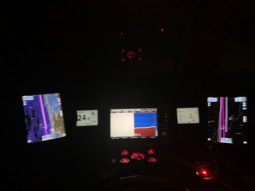
The sun was setting. I settled back into my captain’s chair and prepared for dark. There was a half moon tonight but moonrise would not occur until around 8PM. I let the flybridge lights so that I would be seen by others and between radar and occasionally spotlighting I felt good as I cruised on into the night.

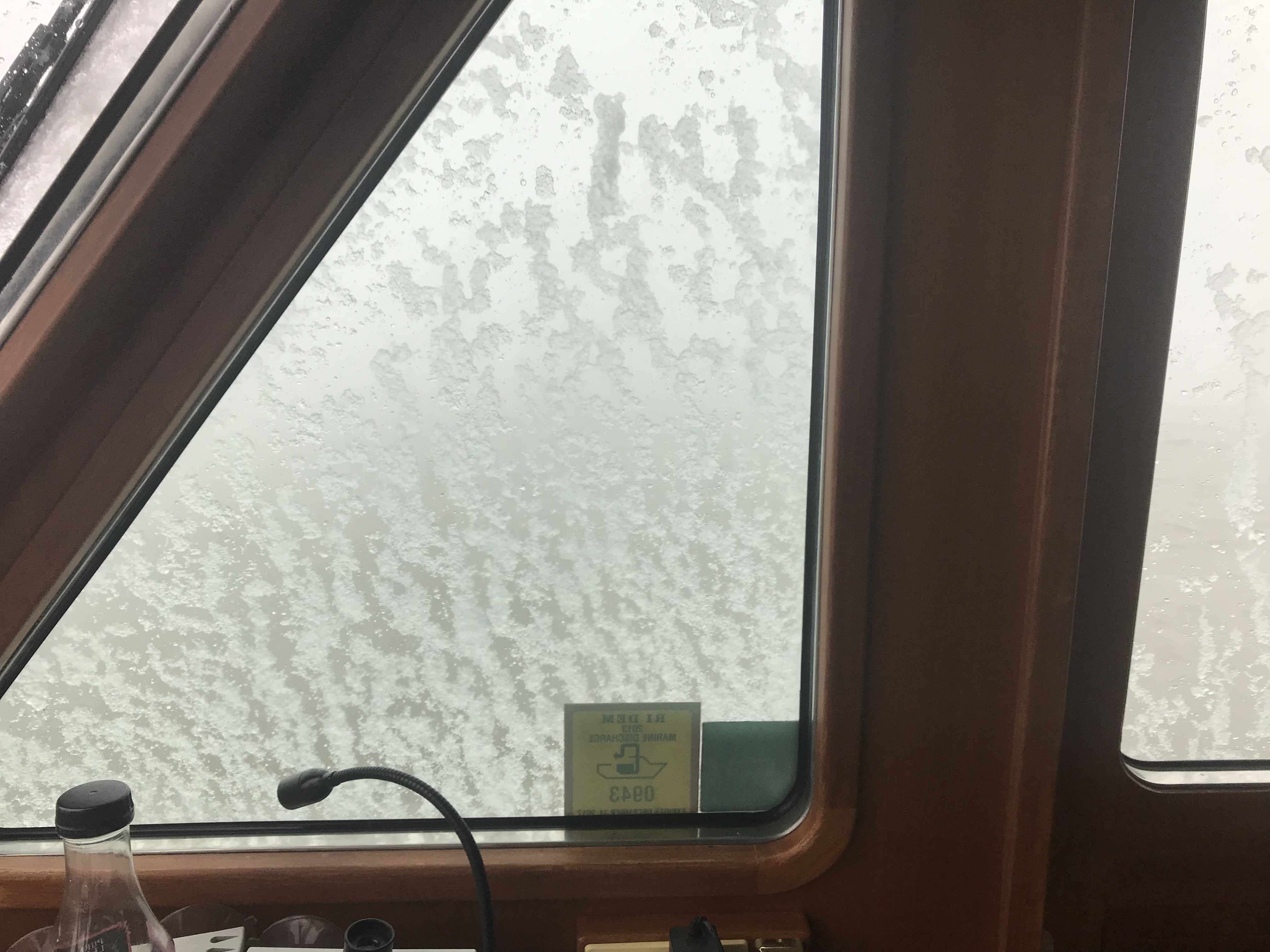
I adjusted the brightness of my chart plotter & instruments as well as set dark mode on my iPads. Nothing can be seen outside but the reflection of my instruments in the pilothouse windows.
I arrived at Wallop’s Island around midnight. It was a long 17 hours at the helm. I’ll be up at first light but I’m sure I won’t have any issues getting to sleep tonight!
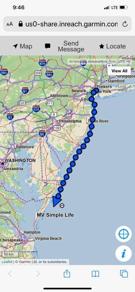
Winter 2020 – 115NM Leg 004 looked something like this…


You must be logged in to post a comment.