I love me some Muddy Waters. This morning’s coffee just tastes better with Muddy Waters playing on my Macbook.
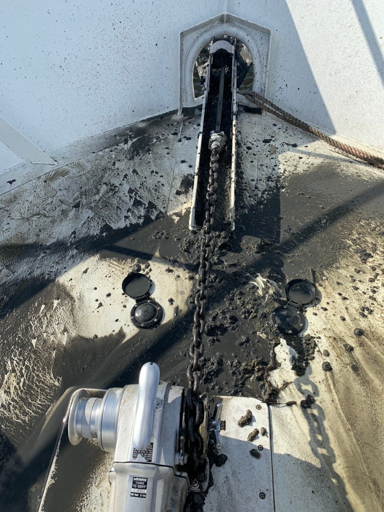
As much as I love Muddy Waters… Anchoring in these muddy waters… less so. This Maryland black mud clings to and comes up with the anchor chain. I have yet to design a proper solution/method of dealing with this mud. Washing it off with a deck hose is just not working. The mud covers the foredeck and this is not mud you want to track into the boat.
Muddy Decks
Muddy Decks
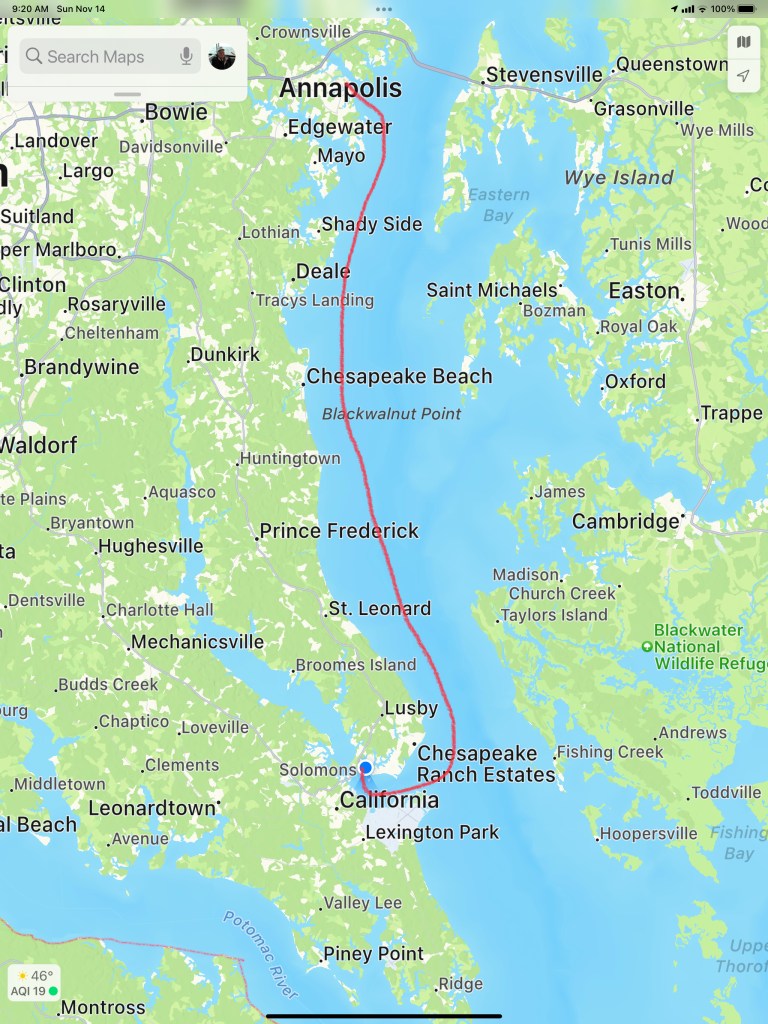
Cruise To Solomons Island
I think these are floating hay bails
We shoved off from Annapolis and made a 6 hour 50NM run south to Solomons Island. Captain Teresa was at the helm for this trip south. It was great to sit in the 1st Mate chair and just relax as Teresa studied the route on the chartplotter and worked the helm to stay on course.
As we turned into Solomons Island we passed floating hay bails?
Anchored
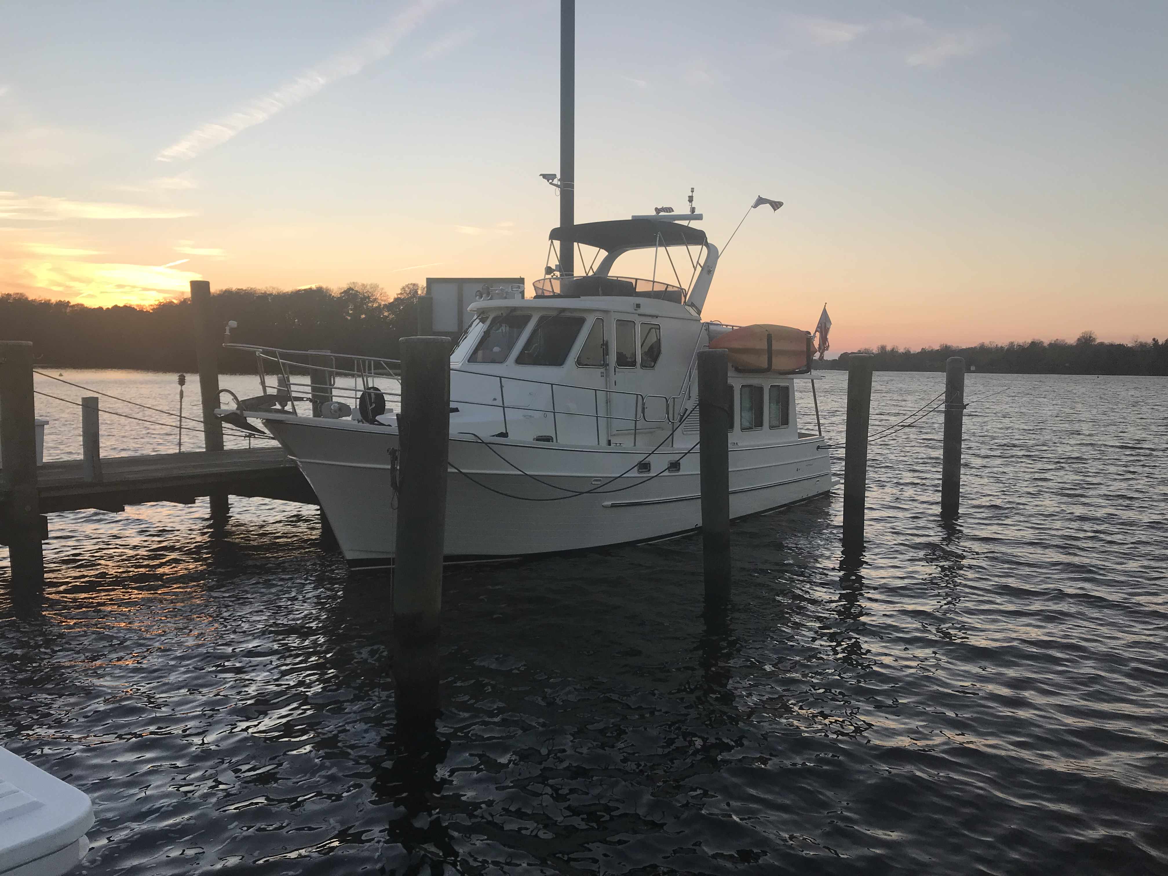
We had made reservations to spend the weekend at a marina in Solomons Island but left a day early as the weather would be better a day early. We slipped past Safe Harbor Marina and further up the Back River until there was nowhere else to go. A dead end. We squeezed Simple Life into a small cove surrounded by beautiful homes.
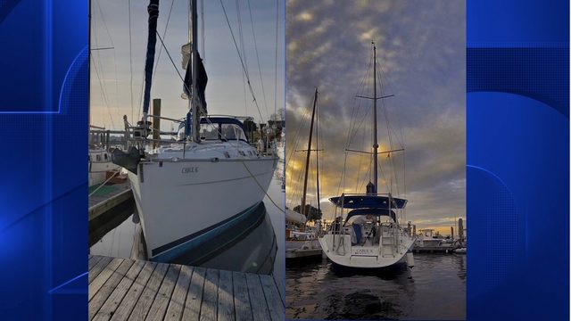
SV Alexandra
In the morning we weighed anchor and headed for the marina. As we hailed them on the VHF to find where are assigned slip was… They said the T-head of K dock.. I started to explain that without any letters on the docks I was not really sure where K-Dock was? I started to call out the names of the boats that were off my port and starboard bow. As I said the name of the second sailboat off my starboard bow, I paused. Our friends are here! We docked directly behind SV Alexandra.
SV Alexandra Docked in Maryland
We had planned to hit the Tiki Bar in Solomons Island but cleaning the decks would have to come first. While I worked the pressure washer, Teresa was baking my favorite Chocolate Chip Oatmeal cookies inside. Ain’t nothing like walking into a warm boat with the smell of cookies.
I was out on the docks when I heard my friend Carolyn yell “Marty”! Soon Carolyn and her captain Tim appeared and we made plans to catch up in Virginia while we enjoyed cookies.
The next morning we awoke to the boat rocking and realized that the wind was gusting to 20kts. A great day to stay inside and binge on the TV show Friends. We are almost done with Season 1.
Altered Carbon
I have been trying to blend in watching a SciFi show called Altered Carbon. If you are a SciFi fan like me… the storyline is amazing. It’s set in the future when human consciousness can be downloaded into cortical stacks as DHF (Digital Human Freight) allowing your consciousness can be “re-sleeved” into numerous bodies. Takeshi Kovacs battles the Protectorate as he seeks his lover from hundreds of years ago.
What Ifs?
The imagined world includes holographic AI’s, synthetic bodies, beaming consciousness across the galaxy as well as raises questions of what if…
What if you could come back in any body when your current body wears out? What if your lover came back in the different body? How would you feel looking into the eyes of an body unfamiliar knowing it’s your lover behind them?
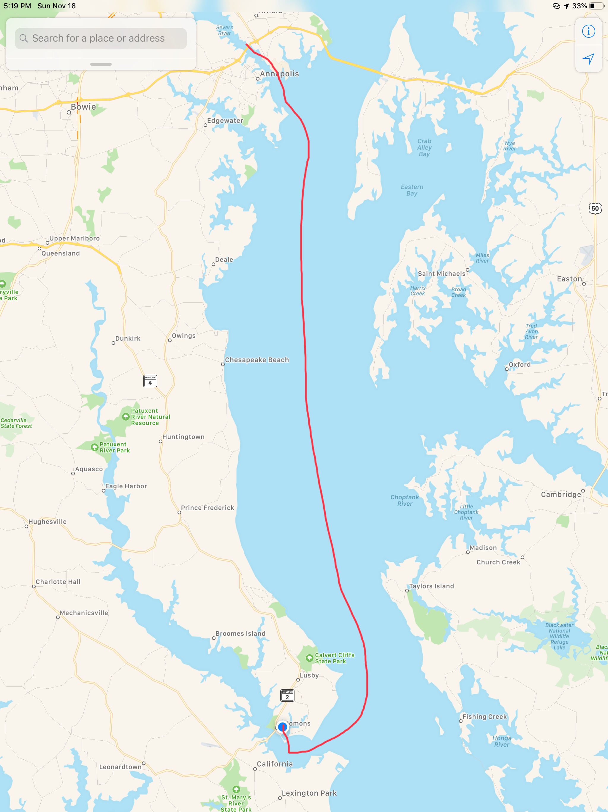
Our trip down mid Chesapeake Bay looked something like this.
We scooted off the Chesapeake City town dock in the AM and made our way south down Chesapeake Bay towards Annapolis. We dodged lots of floating objects along the way most of which turned out to simply be seaweed.
The trip down the Chesapeake was uneventful and looked something like this…
W05L008 to from Chesapeake City, MD to Annapolis, MD
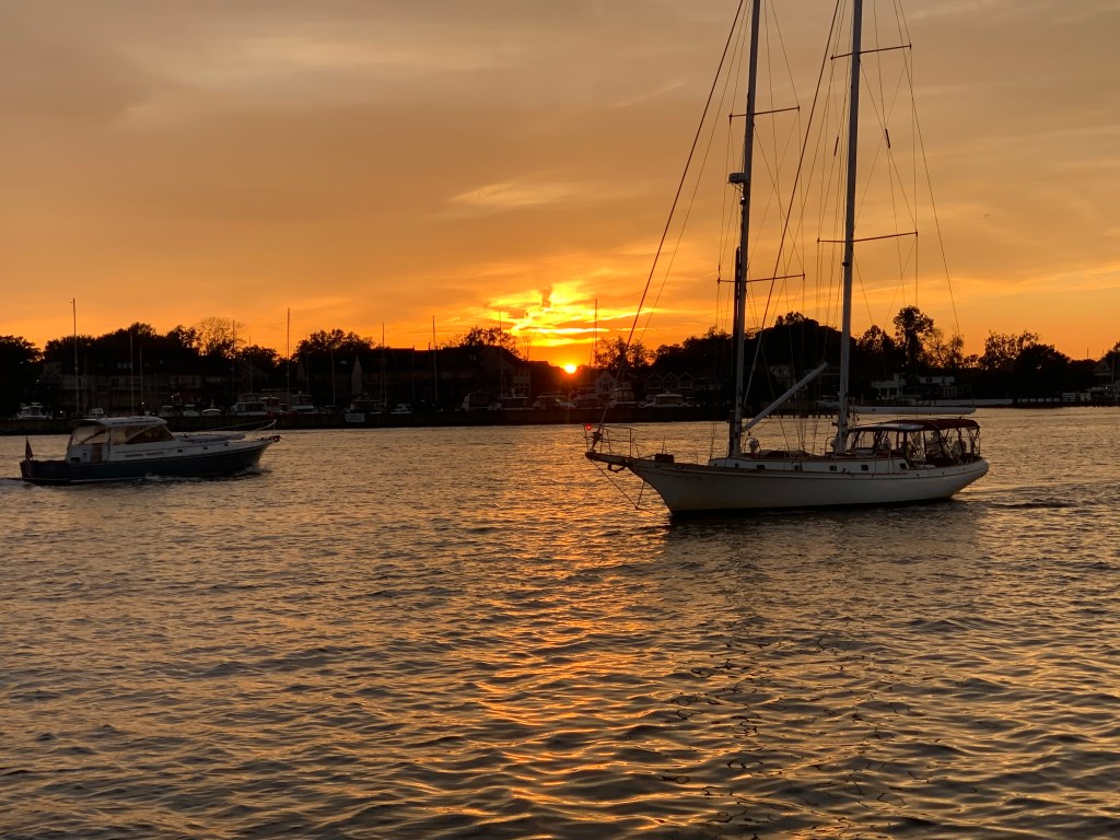
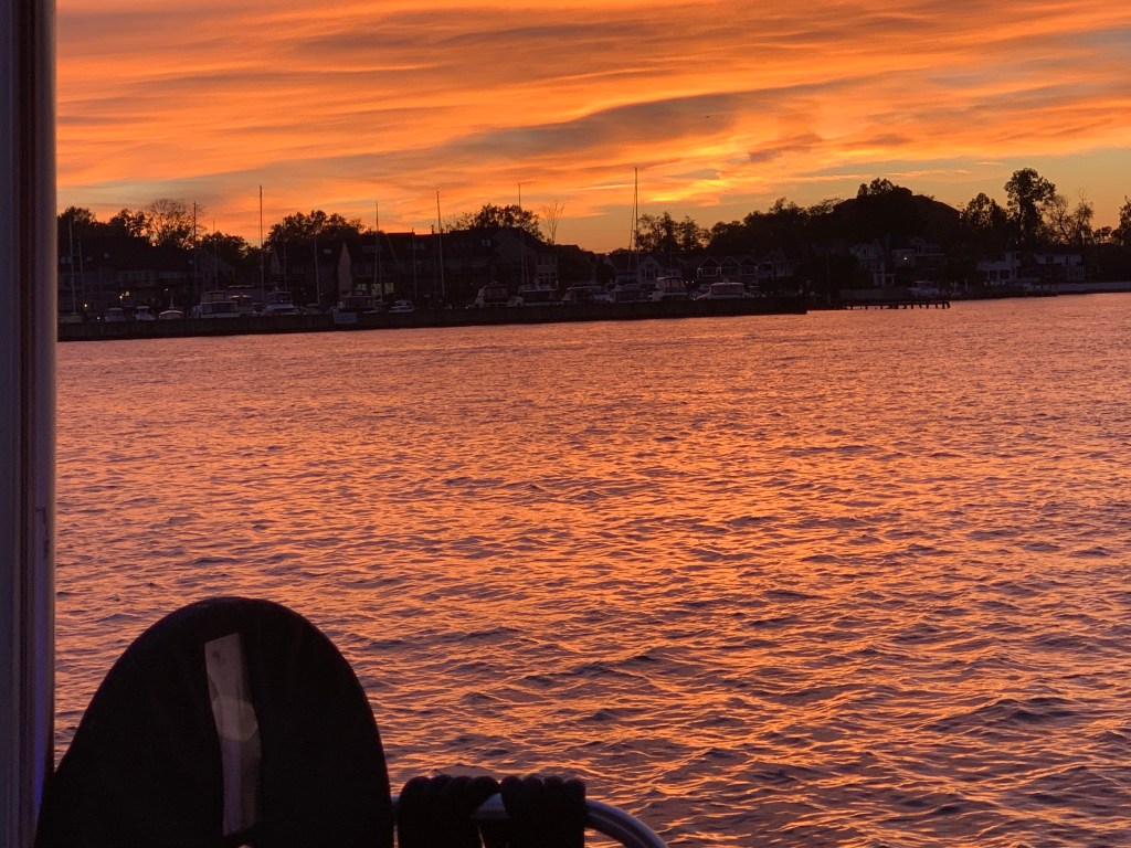
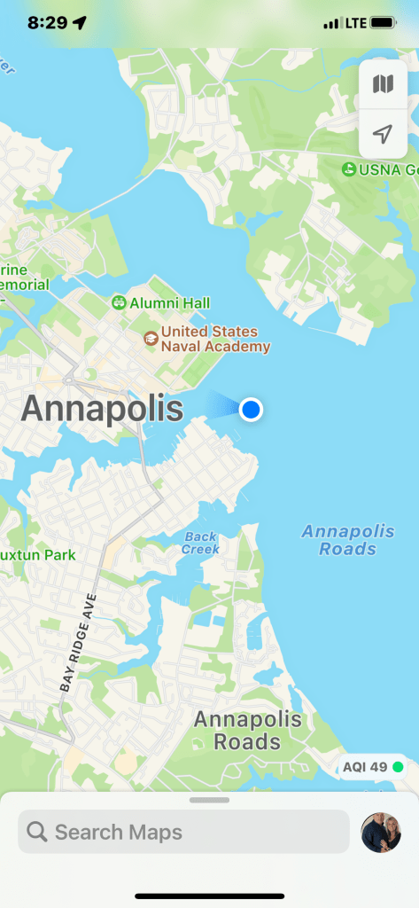
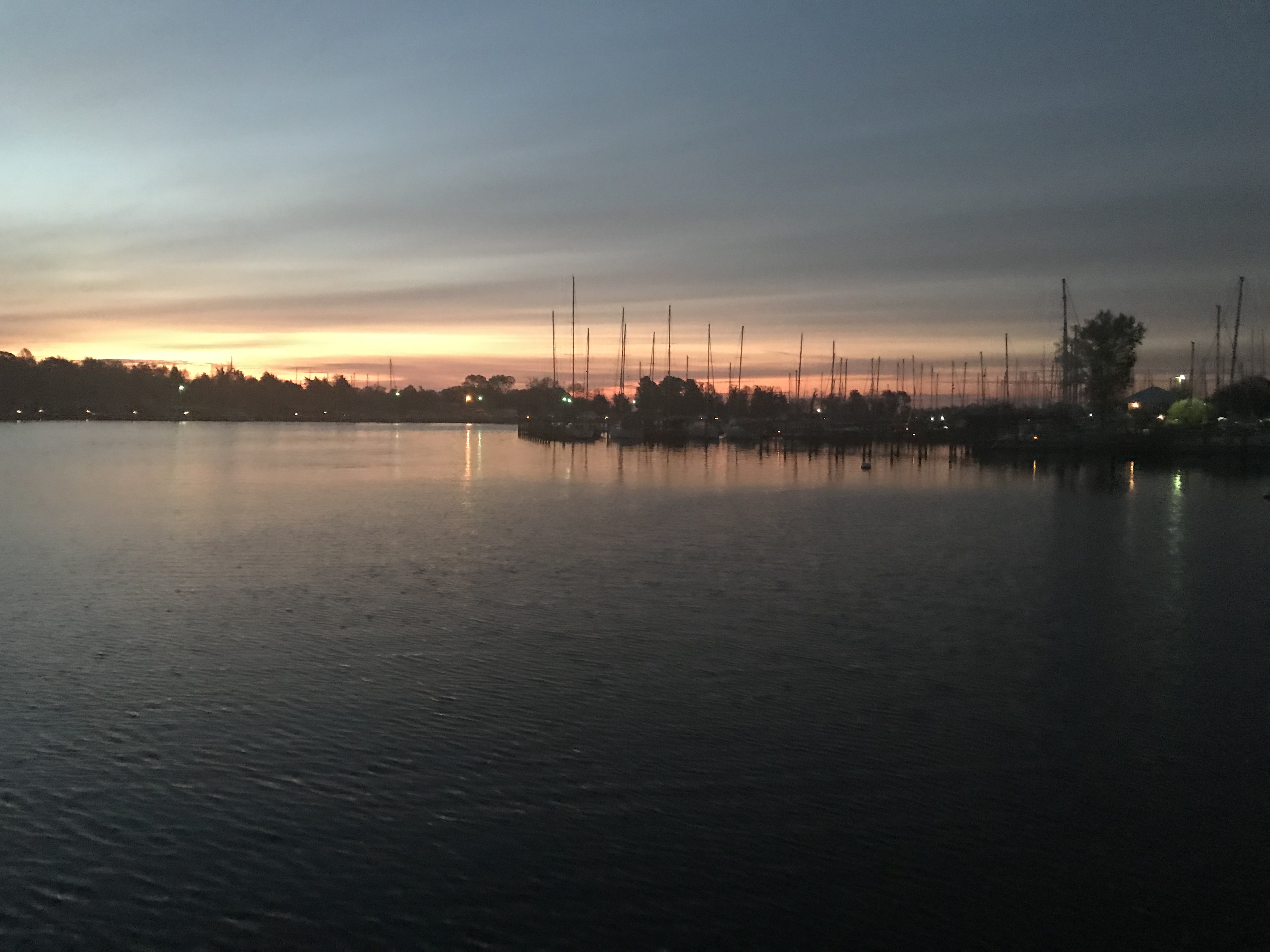
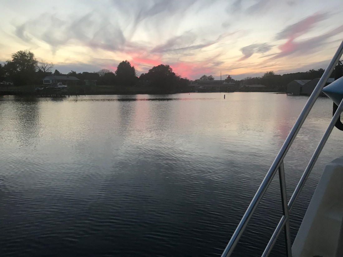
Soon we were dropping anchor in Annapolis’s outer harbor just as the sun was setting.
Boats Cruising the Anchorage
Sunset Annapolis
Simple Life Anchored Position
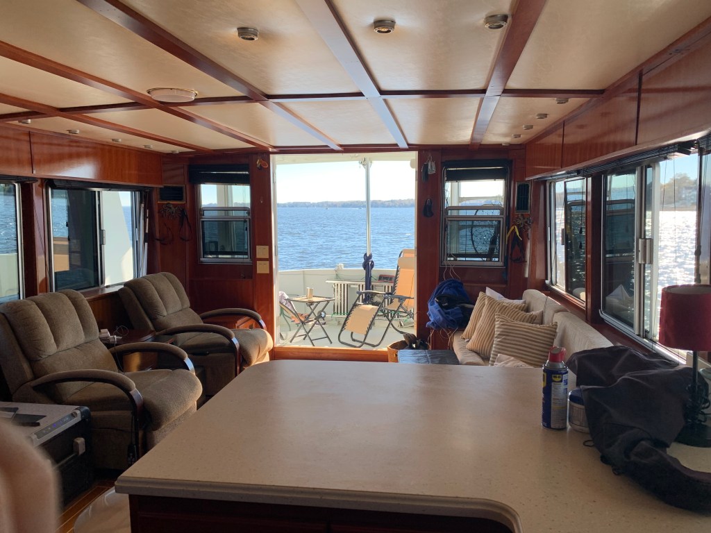
In the morning we opened all the doors and windows and enjoyed what was a great day on anchor.
Doors and Windows Open on Anchor
Kenny Chesney
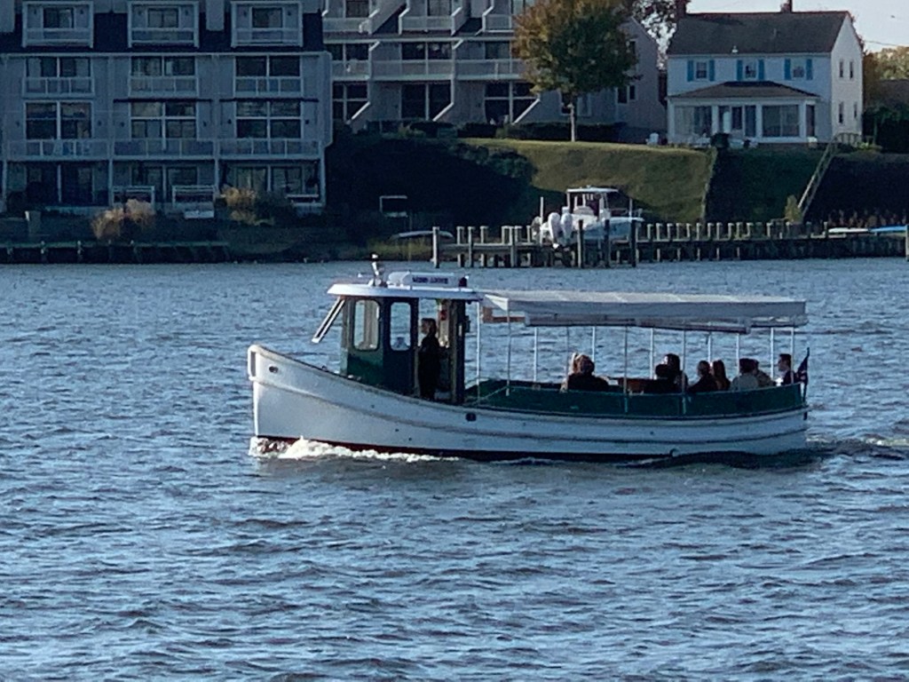
In the harbor we watched as Navy ships and passenger ferry boats glided by.
Passenger Ferry
Navy Ship
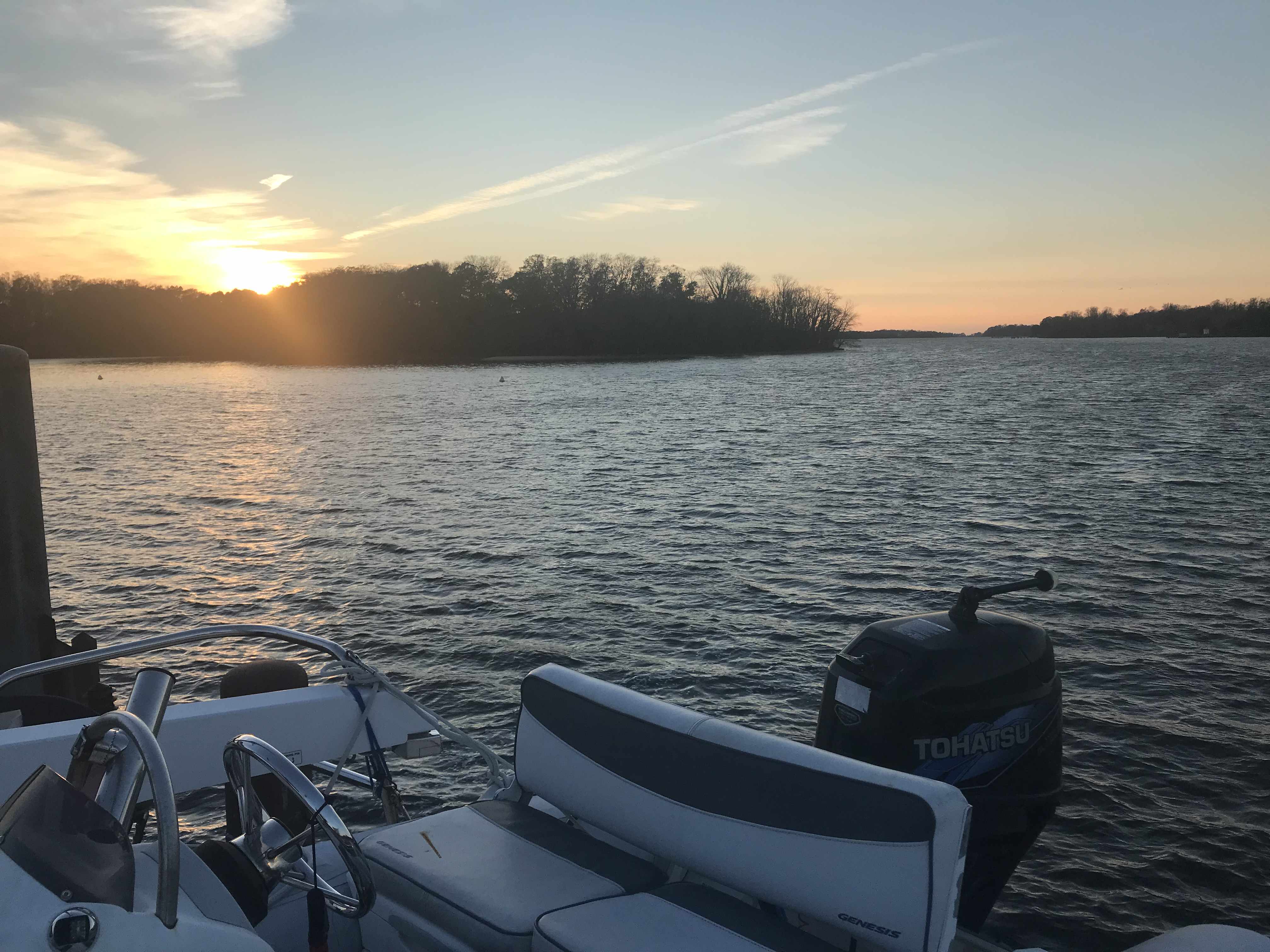
We could not wait to drop the dink and head into downtown Annapolis. I snapped a quick photo of Simple Life as we motored away from her.
Simple Life a Bruce Roberts TY57 Aluminum Hulled Motor Yacht
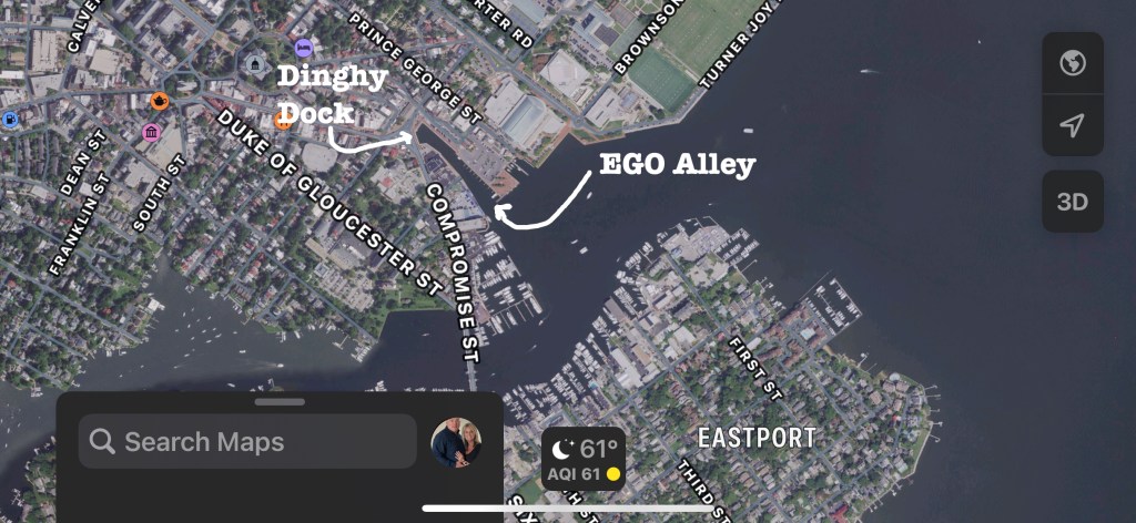
Annapolis allows free dinghy dockage at the end of “Ego Alley” as it’s called right in the heart of downtown Annapolis.
Ego Alley Free Dinghy Dock
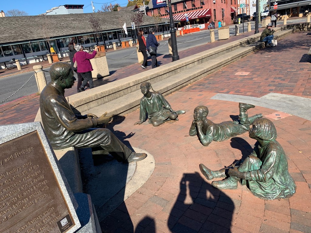
Once we tied up the dinghy you are right at the Alex Haley Roots statue.
Children Listening to the Story of Roots
Alex Haley
We spied a Starbucks and Teresa smiled and took off like a shot to order her favorite espresso drink.
Starbucks
T All Smiles
As we wandered around the city we snapped random photos of the sights we saw.
We finished up our dinner and raced back to Simple Life to prepare for our good friends Buddy & Renee. There is nothing better than pulling into a distant port and getting to spend time with your cruising friends. Soon Buddy & Renee were tying up their dinghy on our stern and we enjoyed a sunset together.
Sundowner on the Flydeck with Sailing regatta going on in the background
Somehow a bottle of moonshine came out and Buddy said he could make a flamethrower… Teresa and I were thinking… we had never heard of this drink until Buddy lit up the night with his flamethrower.
We got to spend three memorable days enjoying dinner & laughs with Buddy & Renee. We look forward to when we are reunited again…
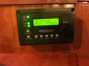
We awoke on anchor and I started the genset to recharge our house battery bank. Standing there in the pilothouse, I could not resist getting into the setup of the Magnum Energy Inverter Charger controller. There are just so many electronic gizmos aboard each with a plethora of controllable settings. Just then the power went out. Coincidence or should I stop randomly changing controller settings to observe the effect?
It took me a while of searching but I found the culprit…
a tripped circuit breaker. My guess… we are running the reverse cycle heat on the 240V AC compressors and the startup of the compressor draws a lot of juice.
Nuclear Power
Our trip up Delaware Bay sent us by the Salem & Hope Creek nuclear power plants. Their cooling tower belching puffy steam clouds set against a blue sky. There are two different nuclear power generating plants next to one another. Salem which has two pressurized water reactors (PWR) and Hope Creek which has one boiling water reactor (BWR). The main difference between a BWR and PWR is that in a BWR, the reactor core heats water, which turns to steam and then drives a steam turbine. In a PWR, the reactor core heats water, which does not boil. This hot water then exchanges heat with a lower pressure water system, which turns to steam and drives the turbine.Together these power generation stations share a large artificial island at the head of Delaware Bay. With it’s combined output of 3,572 megawatts, the Salem-Hope Creek complex is the largest nuclear generating facility in the Eastern United States and the second largest nationwide.
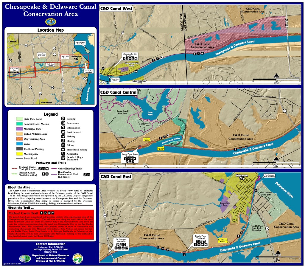
C&D Canal
C&D Canal Location
When you reach the head of Delaware Bay, there is a man-made land-cut called the the C&D Canal (shown as the red line in the picture on the right).
The Chesapeake and Delaware (C&D) Canal connects the Delaware River to the Chesapeake Bay. The C&D Canal system provides a continuous sea level channel (ie. no locks needed) connecting the Port of Baltimore to the ports of Wilmington (DE), Philadelphia, and the northern trade routes.
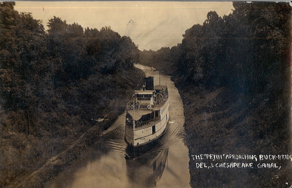
I believe the canal originally opened in 1829. I have included a picture of the steamship Penn as it traversed this early version of the C&D Canal.
Circa 1829
Steamship era Penn making her way down the early C&D circa 1829
This canal is currently a government 1935 authorized project given to the US Army Corp of Engineers (USACE).
The waterway channel is 35 feet deep and 450 feet wide, extending from Reedy Point on the Delaware River, about 46 miles below Philadelphia, PA, through a land-cut westward to Elk River and onto deep water near Pooles Island in the upper Chesapeake Bay.
Delmarva
I suppose it makes the DelMarVa (DELeware, MARyland, VirginA) peninsula more of an island? The Delmarva is a peninsular region 180 miles (290 km) long in the eastern US that includes Delaware, the Eastern Shore of Maryland, and a small strip of Virginia; it separates Chesapeake Bay from the Atlantic Ocean.
C&D Canal Map
C&D Canal East End
As turned to port and entered the C&D Canal. There were many locals walking the banks of the canal.
The towns have set aside the area along the bans as conservation land. It’s a peaceful area with the land high above you blocking the wind as you walk the banks waving to passing yachts.
We toot our air horns and receive waves from the locals as they stroll along.
Free Dock
We planned to dock at the free town dock in Chesapeake city. The town set this small dock aside for boating visitors to their town. Simple Life’s 58′ LOA makes her tougher than her previous namesake to slip into open space at a face dock. As luck would have it… We found an opening and eased her up to the dock and had to lasso the cleats from on board as our decks are too high to simply jump down onto the dock.
Chesapeake Town Dock – Are those Xmas lights?
Downtown
We quickly jumped off and wandered the pocket-sized downtown area.
Chesapeake City downtown
Where to Grab Dinner?
Chowder
We walked into a restaurant called Prime 225 that a friend told us to visit but sadly… it was a 3 hour wait!
A block away we discovered a quaint local hangout call The Tap Room. I grabbed a burger and T had the chowder. Food was good but it wasn’t the right vibe and their Goose Island IPA is OK but not my favorite.
Where to next?
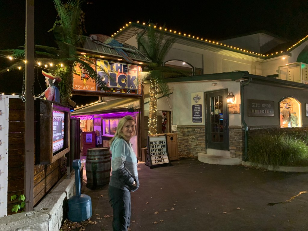
When we landed on the town dock we could see a marina restaurant just 400 feet away on the tiny harbor. We walked in that direction till we saw…
The Deck
The Deck
As we passed beneath the sign we were greeted with the sounds of a live band singing some Fleetwood Mac – Dreams.
We band was good and the IPA was better 😉 As the band played we played “Name that tune” while I shot out to a quick lead with Fleetwood Mac it seems the band conspired with Teresa to play her music and I believe she won by a landslide in the end.
The walk back to Simple Life was short and we where thankful for that.
La Mañana Siguiente
The town dock is free but if you plug into electricity like we did you must pay the town hall just 1 block away. So off I went to stuff an envelope of cash through their mail slot as it was Sunday.
Leg Seven
The seventh leg of our journey south looked something like this…
When my youngest sister, Janet & I were acting bad, our Dad would simply state “Who wants a wallop?” My first thought was “What’s a wallop?” Later I learned… It was code for you better starting acting right or Dad’s gonna straighten you out like a piece of wire. Lucky for us, it was rare he ever had to make good on that threat because we knew enough to stop.
You may be thinking… why is he talking about about getting a wallop? Well… ADD aaannnd tonight’s anchorage will be Wallop’s Island. There are not many places to anchor along Virginia’s Atlantic coast but this is one of the few.
Wallop’s Island along Virginia’s Atlantic Coast
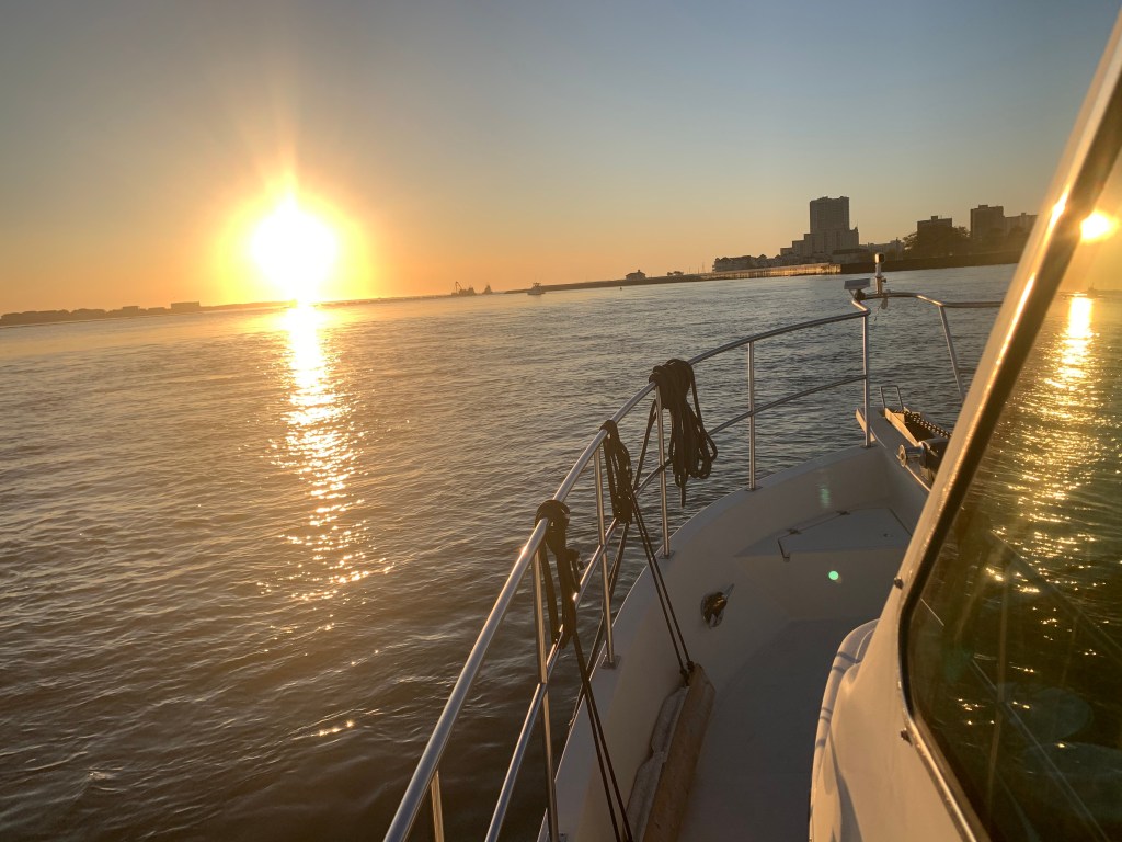
Absecon Inlet
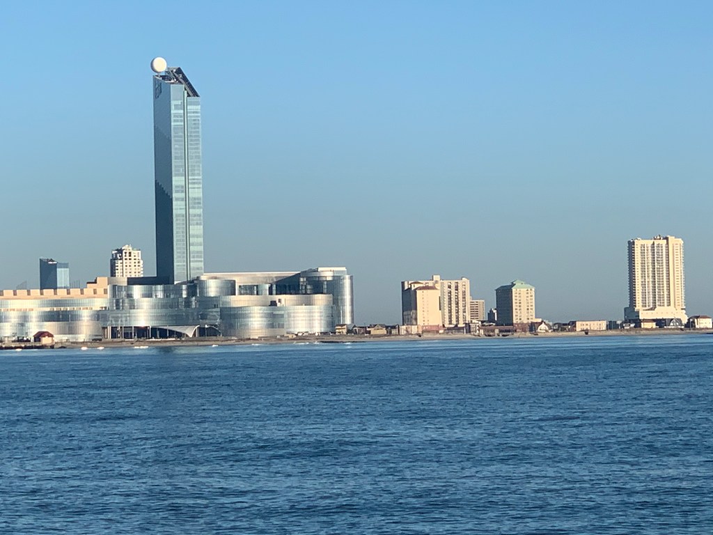
I only slept for 2 hours and awoke at first light. It’s amazing how refreshed you feel even after as little as 2 hours sleep. As I look out the pilothouse windows I can see a bright spot of sun on the metal exterior of the 430′ high Borgata Hotel Casino & Spa.
Borgata Hotel Casino & Spa
As I glance out the other side of the boat I see Ra, the ancient Egyptian sun god, has just started his journey across the cloudless sky.
Ra’s Journey Has Begun
I am not alone. Last night I weaved through three sailboats to find an empty spot to drop my anchor. I wonder if they will even know I was here?
We are not Alone
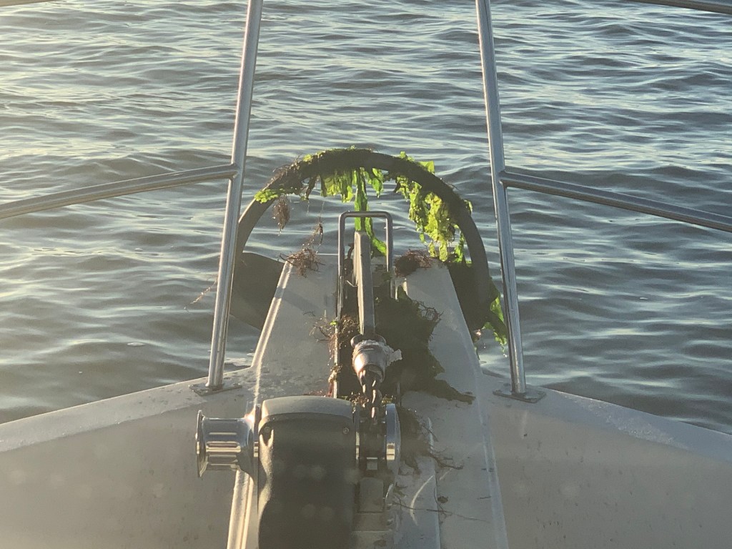
When I finally retrieve my anchor into it’s bow roller I see that it’s covered with sea lettuce. Well I’m sure there is a more technical term but I’m sure the strong current was trapping the lettuce against my anchor chain like lettuce blowing in the wind.
Fresh Salad aboard MV Simple Life
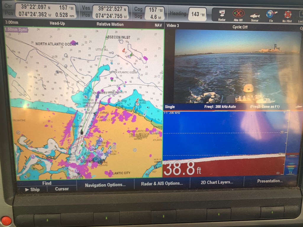
As I look in my review camera I am reminded of how deep Absecon Inlet is.
Almost 40′ deep inside Absecon Inlet
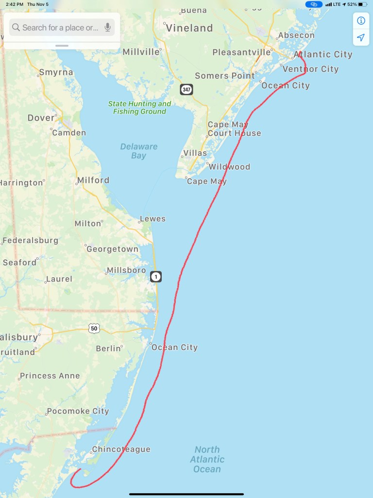
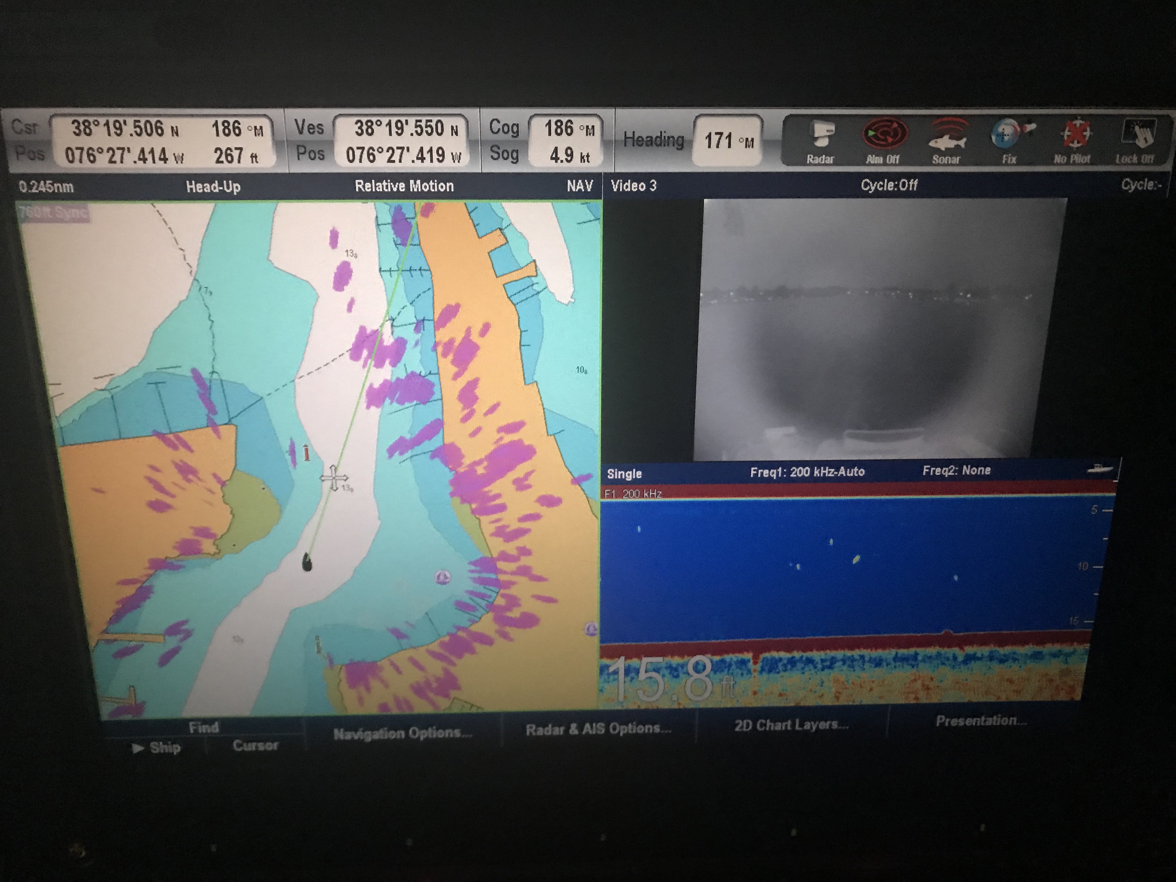
As deep as it is inside the inlet there is quite a bit of shoaling going on around it’s entrance. The Aqua Maps chart plotter view below shows a few of my past tracks entering and leaving Absecon Inlet. The pink track entering from the left of the picture was my track coming in at 3:11AM on 11/4/20. While the charts show depths like 20′ and 15′, reality was much closer to 9′ as I came across that shoal. Whenever you are navigating inlets your chart depths are not to be trusted. If you have any ocean swell action going on you’ll often see breakers wherever the shoals exist.
Brigantine Bay anchorage on left, Absecon anchorage in middle and Farley State Marina on the right
As I make my way out of the inlet I am bucking the incoming tide and it slows my normal 6.5 kt speed down to a plodding 4.6kts.
Fighting Absecon Inlet Current
Atlantic City Architecture
As I leave Atlantic City I look back at both the 710′ high Ocean Casino Resort and The Wheel @ Steel Pier (227′ high). Both of these object are lit up at night and can be seen for miles as you approach on a dark night. The ball at the top of the Ocean Casino Resort (The former Revel Casino Hotel) glows with changing colors.
Ocean Casino ResortThe WheelA glowing Wheel
Digital Selective Calling
The next hours many hours were spent cruising the coast with hardly a boat to be found. Then suddenly the VHF radio sprang to life.
Me ACK’ing a DSC distress message with no LAT/LON or nature of distress info in the message
VHF radios have evolved to use DSC or Digital Selective Calling which allows for making calls to select individuals or groups using their MMSI number (Maritime Mobile Service Identity). DSC also allows for making a digital distress call like the one I received. After ACK’ing the call I received, I immediately entered the boat’s MMSI number and called them back directly. No response! I tried several times for about 30 minutes while I scanned the horizon with my binoculars for any signs of boats or activity. Nothing. Other boaters have told me stories about how the distress button gets accidentally pushed on radios and when someone calls back the people won’t answer your call. Often after you accidentally push the distress button, many boaters attempt to call you back and having to repeatedly tell each of them that you accidentally pushed the button can be a humiliating experience.
Learn From My Mistakes
All that said… I still wish I had notified the USCG.
At the time I thought… there was no location or nature of distress information included in the DSC message. So I would simply be telling them that I received a message with no other info. BTW, the location information is probably one of the greatest reasons for DSC distress in the first place. You simply hookup a NMEA (National Marine Electronics Association) data wire from your Chartplotter/GPS to your VHF and the VHF automatically sends your LAT & LON coordinates as part of the digital distress message. Had the location info been sent I could have gone to the location given.
Even though I know…
Buttons get pushed by accident
I could see no boats or activity
Whomever pushed the button never answered my reply
I realize it was a mistake not to inform the Coast Guard that I received a message. Next time, I will be prepared on how to handle this situation. Boating is a learning experience. I make mistakes and I learn everyday.
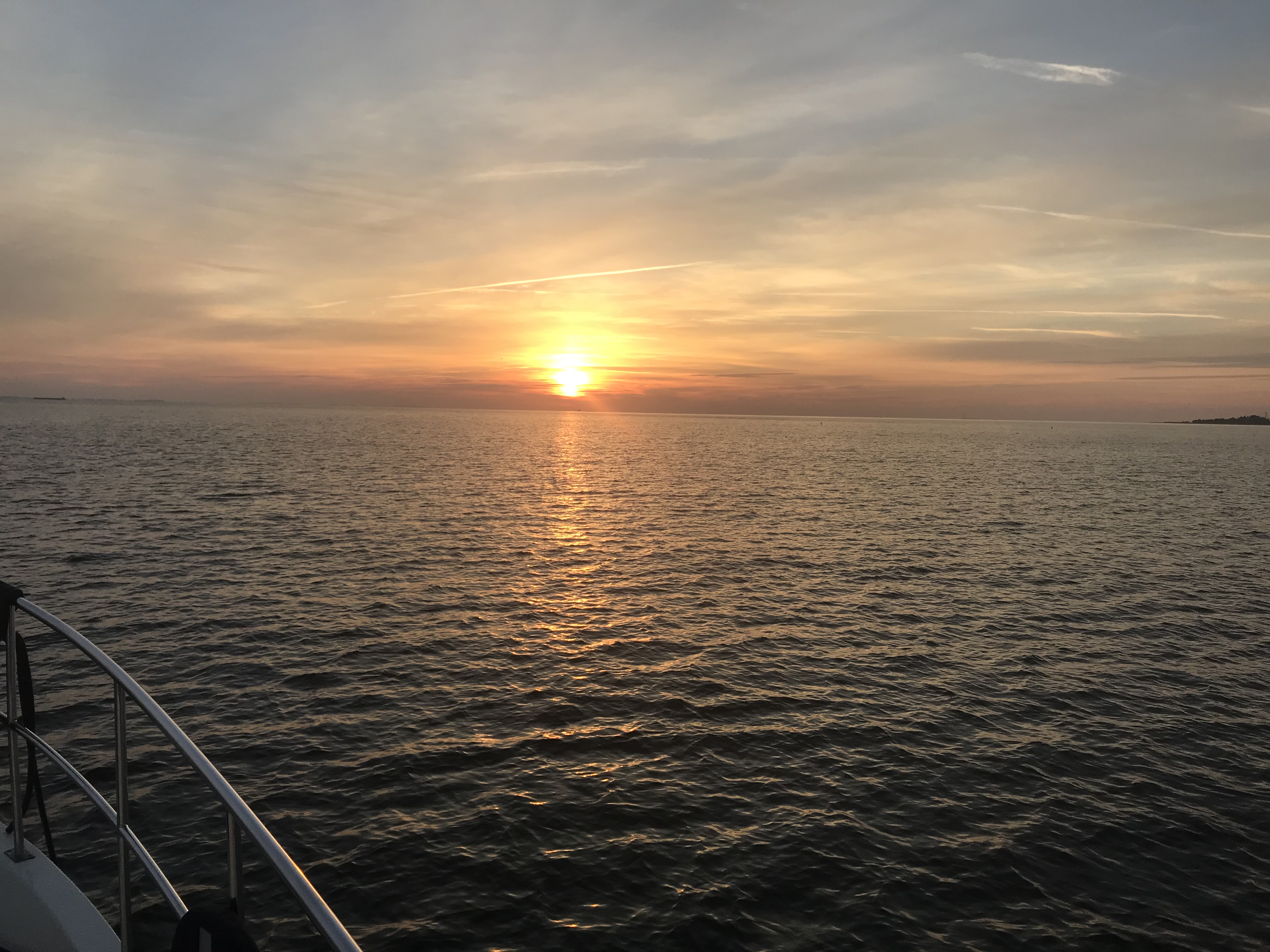
Night Approaches
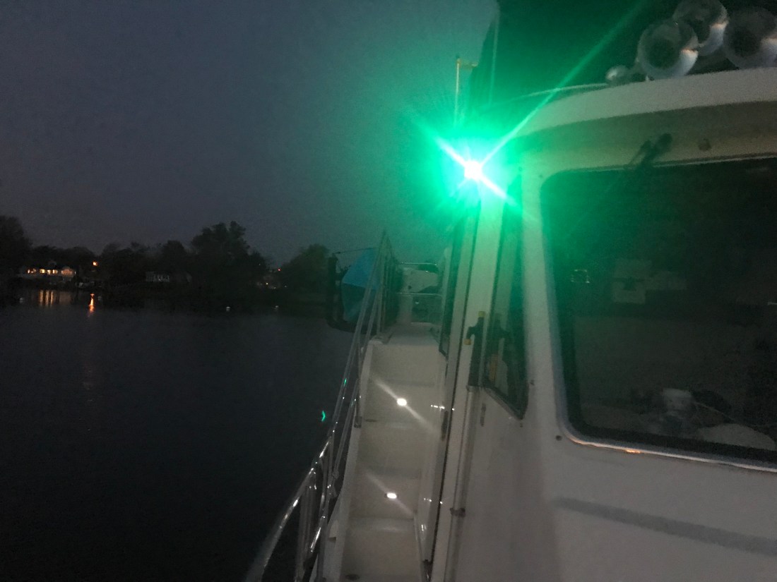
The sun was setting. I settled back into my captain’s chair and prepared for dark. There was a half moon tonight but moonrise would not occur until around 8PM. I let the flybridge lights so that I would be seen by others and between radar and occasionally spotlighting I felt good as I cruised on into the night.
Tonight’s sunset behind Fenwick Island near Ocean City, MD
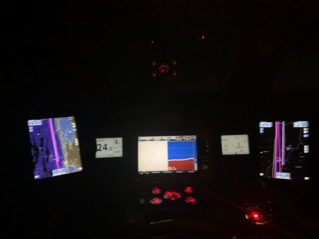
I adjusted the brightness of my chart plotter & instruments as well as set dark mode on my iPads. Nothing can be seen outside but the reflection of my instruments in the pilothouse windows.
I arrived at Wallop’s Island around midnight. It was a long 17 hours at the helm. I’ll be up at first light but I’m sure I won’t have any issues getting to sleep tonight!
Winter 2020 – 115NM Leg 004 looked something like this…
We departed Port Washington and perfectly timed our arrival to the east end of the East River. We had a fair current giving us a strong push on our stern all the way through the East River and into NYC Harbor.
East River
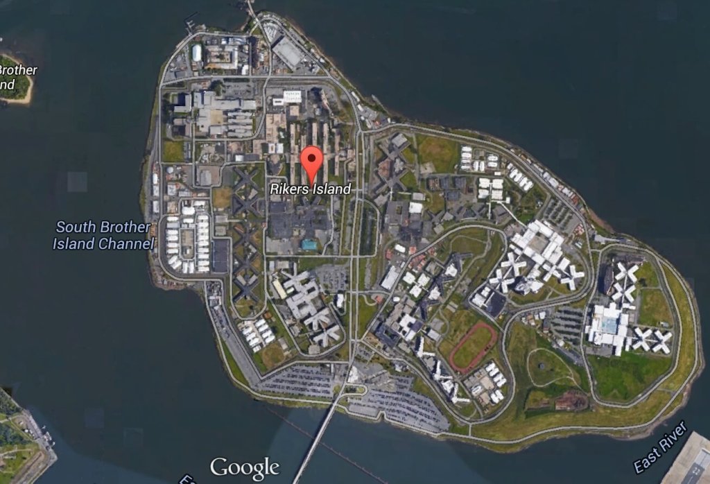
Once in the East River you come upon Laguardia airport and Rikers Island.
A wee bit further down the East River and you come to an infamous location known as Hell’s Gate. This is where the Harlem River dumps into the East River. Our planning placed us here at max ebb current because it’s a great feeling being pushed in such a strong current.
Buddy was at the helm calmly making helm corrections as quickly as possible to keep the pointy end of the boat pointing in the right direction.
We had planned on spending a couple days in NYC harbor and visiting Manhattan but our weather heading down the NJ coast looked great for the next 38 hours. We had a quick discussion at the helm and decided that we would go offshore. Stopping in NYC would have meant being trapped for the foreseeable forecast.
Sunday 4-6′ Seas
Need to be South of NYC by Sunday
Offshore Voyage to Norfolk, VA
Going offshore to Norfolk would require a helm watch schedule. We like to call it a port & starboard watch meaning that there would be two teams. Team 1 = Buddy & Renee. Team 2 = Marty. When you’re on “helm watch” the other team is relieved of any responsibilities other than to rest up for when your watch starts.
Night watches means keeping an eye out the pilothouse windows for any lights. The moons phase was only a sliver of a crescent and it did not rise till 4AM. We chose a route between 2-3 NM off the coast and that allowed us to see the twinkling lights of shore as we made way south.
For those uninitiated in night watches you will have to become comfortable with staring intently at your radar screen while you push into the blackness. Looking forward out the pilothouse windows all you see is black and the few instrument lights that reflect off the inside of the glass. You’ll need to determine if any of those red, green or white lights are coming from a boat or a buoy. If the light blinks, it’s a buoy. If it’s solid, it’s a boat.
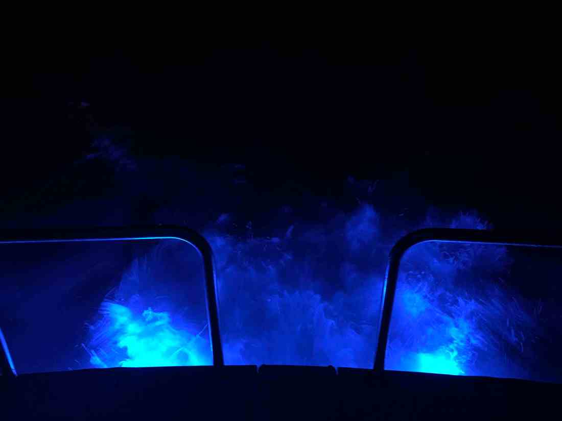
One night I come off watch and lit the underwater lights so I could stand on the stern as the propeller wash boils up from below as the lights of shore pass.
Here is a short video of a boat passing on our starboard side. You can clearly see the other vessel’s red-portside-light as well as it’s white-steaming light. When I zoom in the camera was able to pickup the white water wake in their stern light.
When I left my home port in Warwick, RI, a few fellow boaters, friends were also making the trip south for the winter. MV Ship Happens, a large sport-fishing boat, was heading south and we had been communicating thinking we’d cross paths eventually. I received a photo via text from Capt. Dan and to my surprise it was of MV Simple Life as they zoomed past us. Although MV Ship Happens left port days after us, she has a much faster cruise and eventually overtook us.
Capt. Dan snapped this pic of us on the way past us
During the day we were graced with the presence of whales. I captured a short video of a whale coming to the surface off our starboard side.
Whales off the Jersey Coast
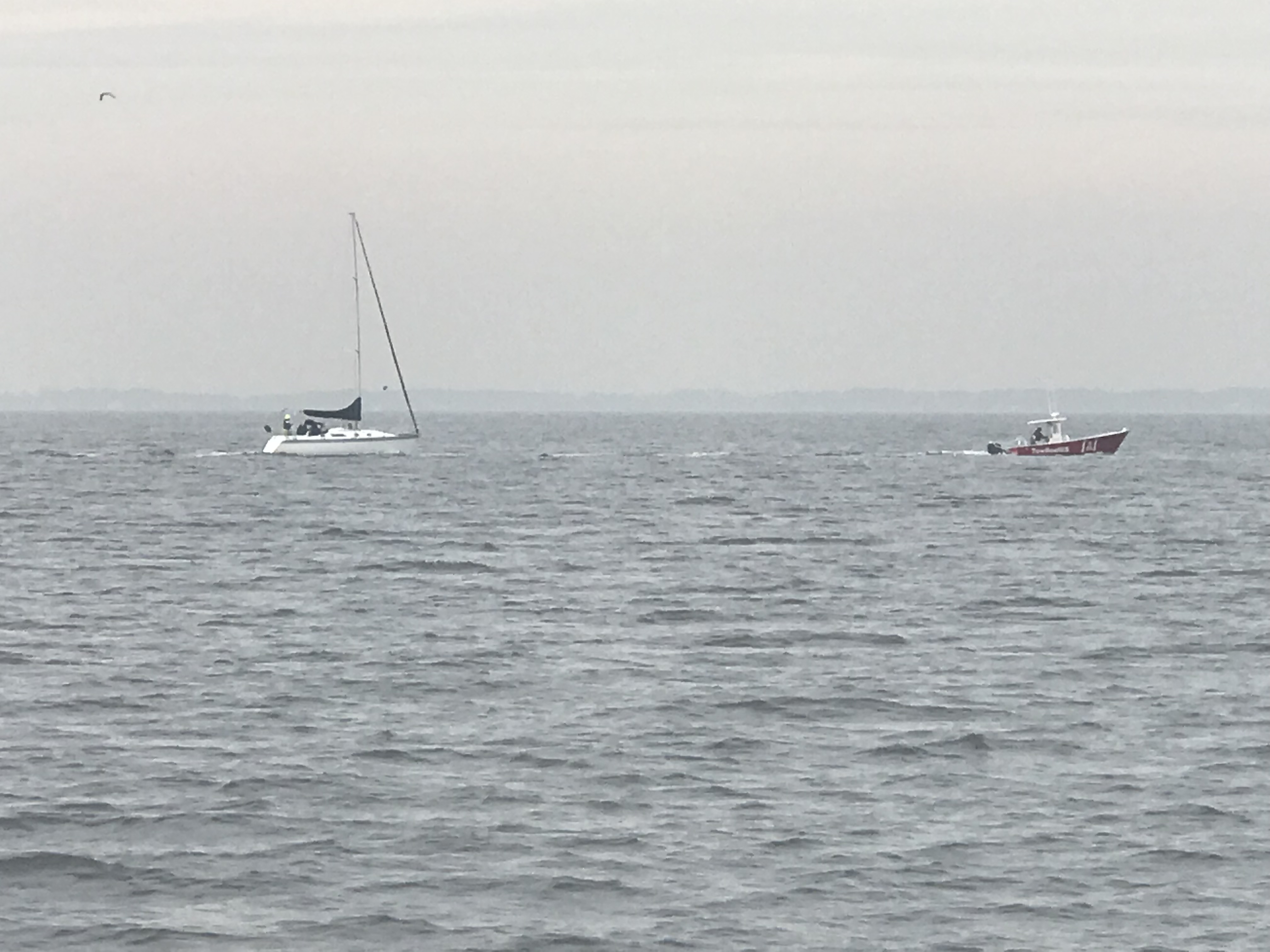
While we were off the coast, our VHF crackled to life with the USCG issuing a securite broadcast about an overdue 43′ Benneteau sailing vessel out of Jamestown, RI called the “Carol K”. They had left before us and were somewhere along the coast with us. We attempted to hail the Carol K but got no response. We hoped that they would be found safe and several days later they were found 100 miles of Cape Henry, VA.
The trip down the busy channel into Norfolk, VA is best done in the daylight. I could tell you a story about nearly getting run over by a warship a few years back but that story is best told over a few beers. 😉
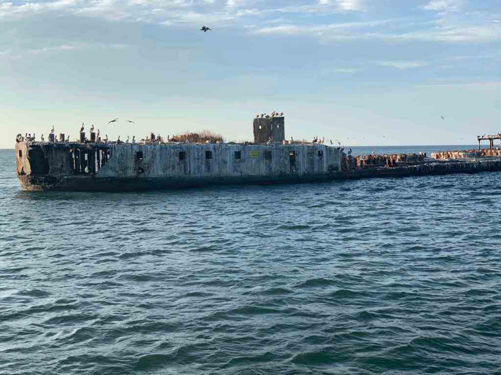
We searched our Aqua Maps charting app for an Active Captain anchorage and found one called “Concrete Ships”. The wind was out of the east but the forecast predicted the wind would clock around to the south and strengthen. This particular anchorage offered the best lee from the wind within the distance we were willing to travel.
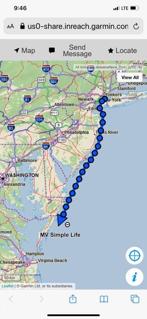
My website/blog has a button that you can click to see the real-time location of MV Simple Life. Here are some pics of that my Garmin InReach Satellite communications device makes available to you.
Working our way down the East Coast
Arriving at the Concrete Ships Anchorage
Days past, I have made the trip south from Cape May, NJ to Norfolk, VA by going outside along the coast before. Those times, I had chosen to anchor nightly along the coast. There are few decent anchorages along this stretch of coast. One anchorage I have used before was inside the Great Machipongo Inlet. I recall how tricky getting through the shifting shoals dotting the inlet was. As we passed, I could not help but notice that the latest update of the NOAA charts shows a similar sized vessel to MV Simple Life wrecked on those same shoals. (Me thinks…) I’m happy I bailed on my inlet entry that stormy night.
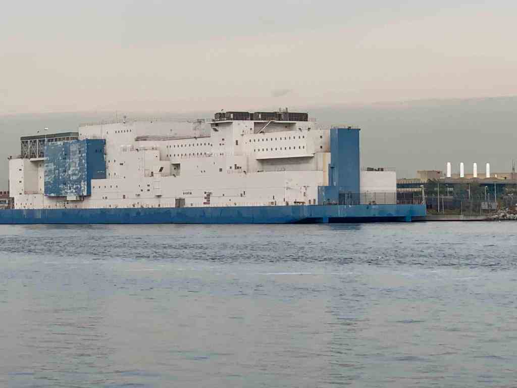
Ghost Ships
When it comes to ship building there are many hull materials to select from. One such material/method is ferrocement construction. It’s a cheap way to build a hull/boat but has fallen out of favor with the advent of materials such as FRP (Fiberglass Reinforced Plastic).
We had arrived at our anchorage with plenty daylight left. We shot some video and snapped a few pics of the ships as we arrived.
Standing on the bow at night in the breeze we were flanked by ghost ships with their ghostly pale white shapes faintly materializing though the inky black of night.
We awoke to realize the sun was already up and rising above the Navy bridge we anchored behind.
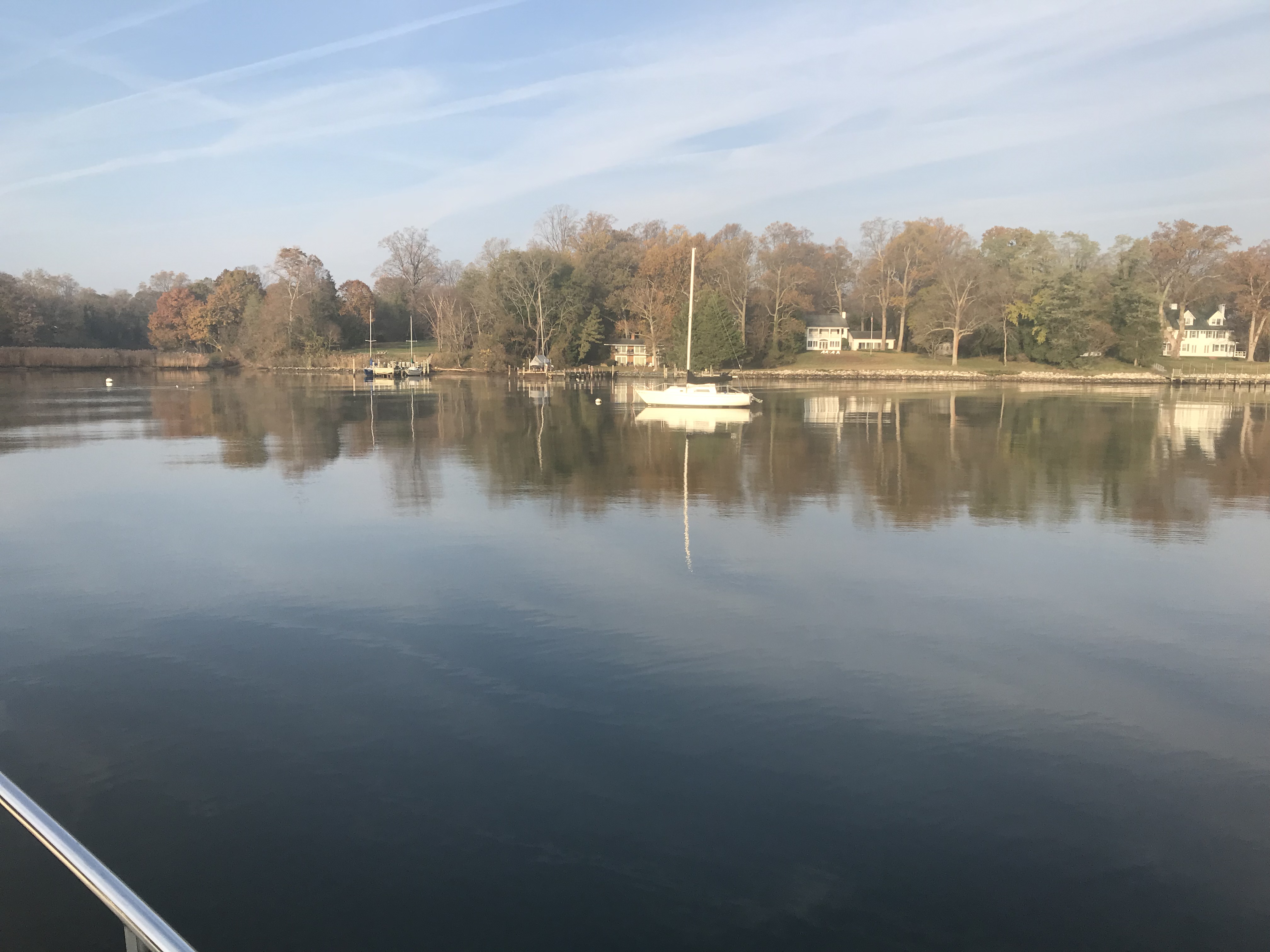
There was one other sailboat on a mooring ball in front of a home and some great foliage.
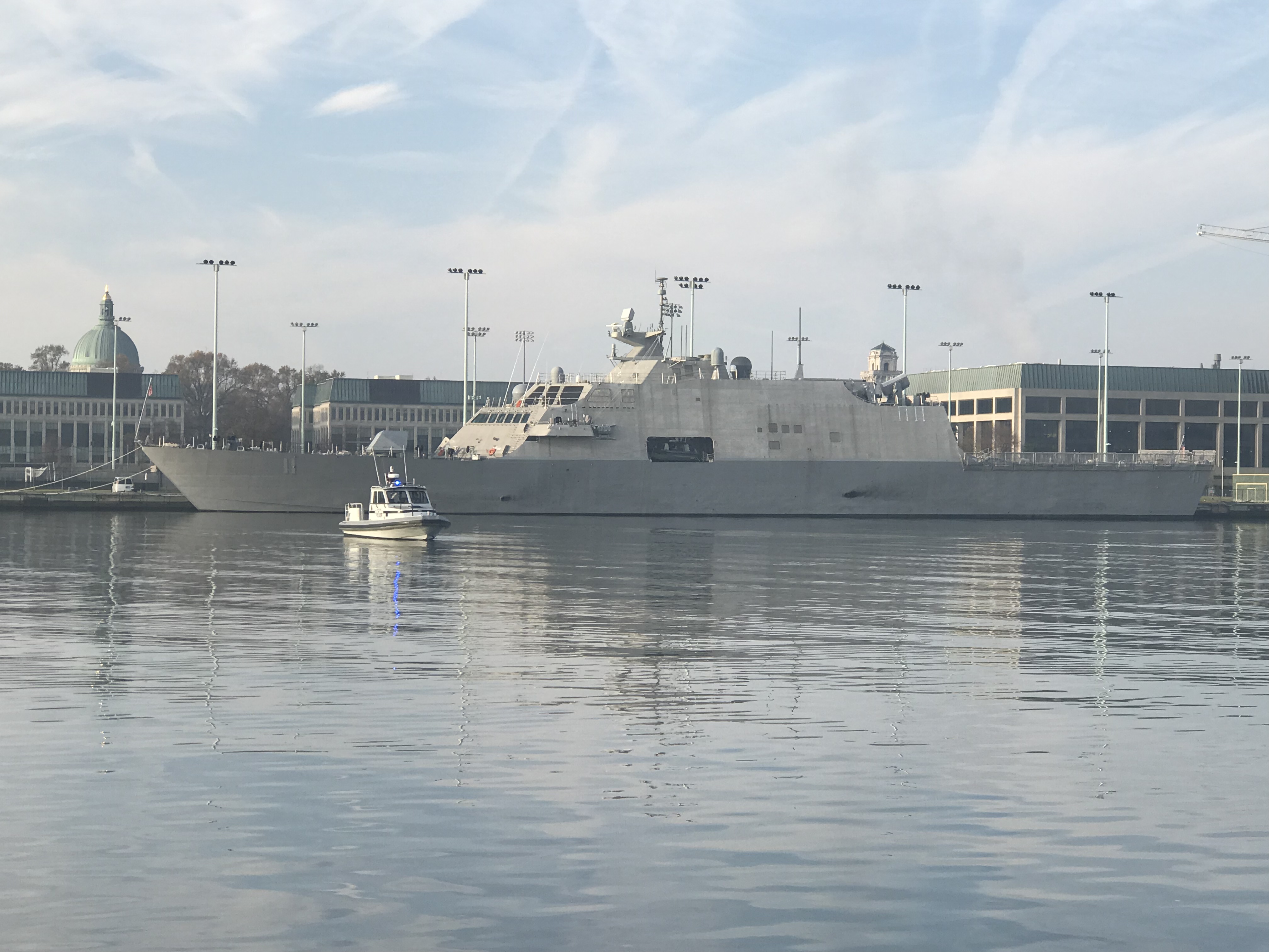
When we arrived in Annapolis we anchored right next to a brand new UUS Sioux City (LCS 11) Navy warship.
The future USS Sioux City (LCS 11), a Freedom-class Littoral Combat Ship, will be commissioned a United States Ship (USS) on November 17, 2018 in Annapolis, Maryland. More than 5,000 people are expected to attend the commissioning ceremony at the United States Naval Academy….
The patrol boat was actively keeping any boats from getting close but we were able to snap this photo on our way past.
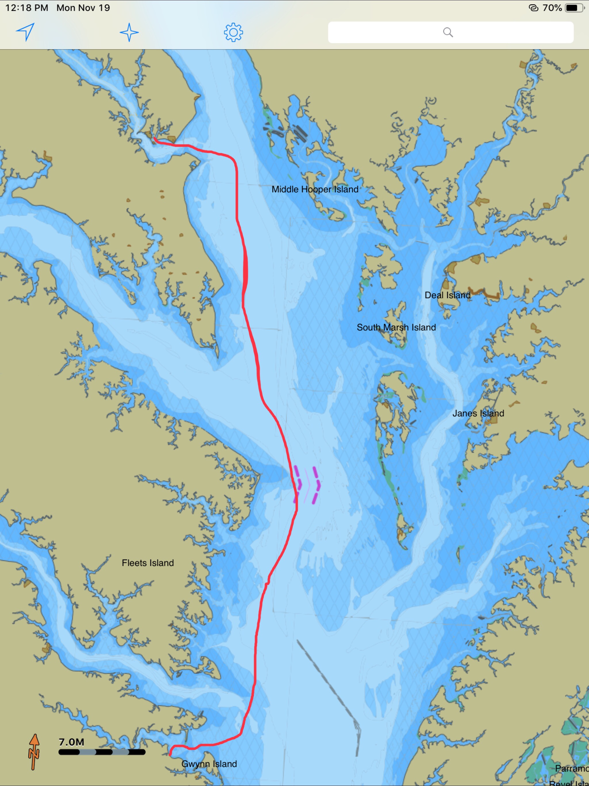
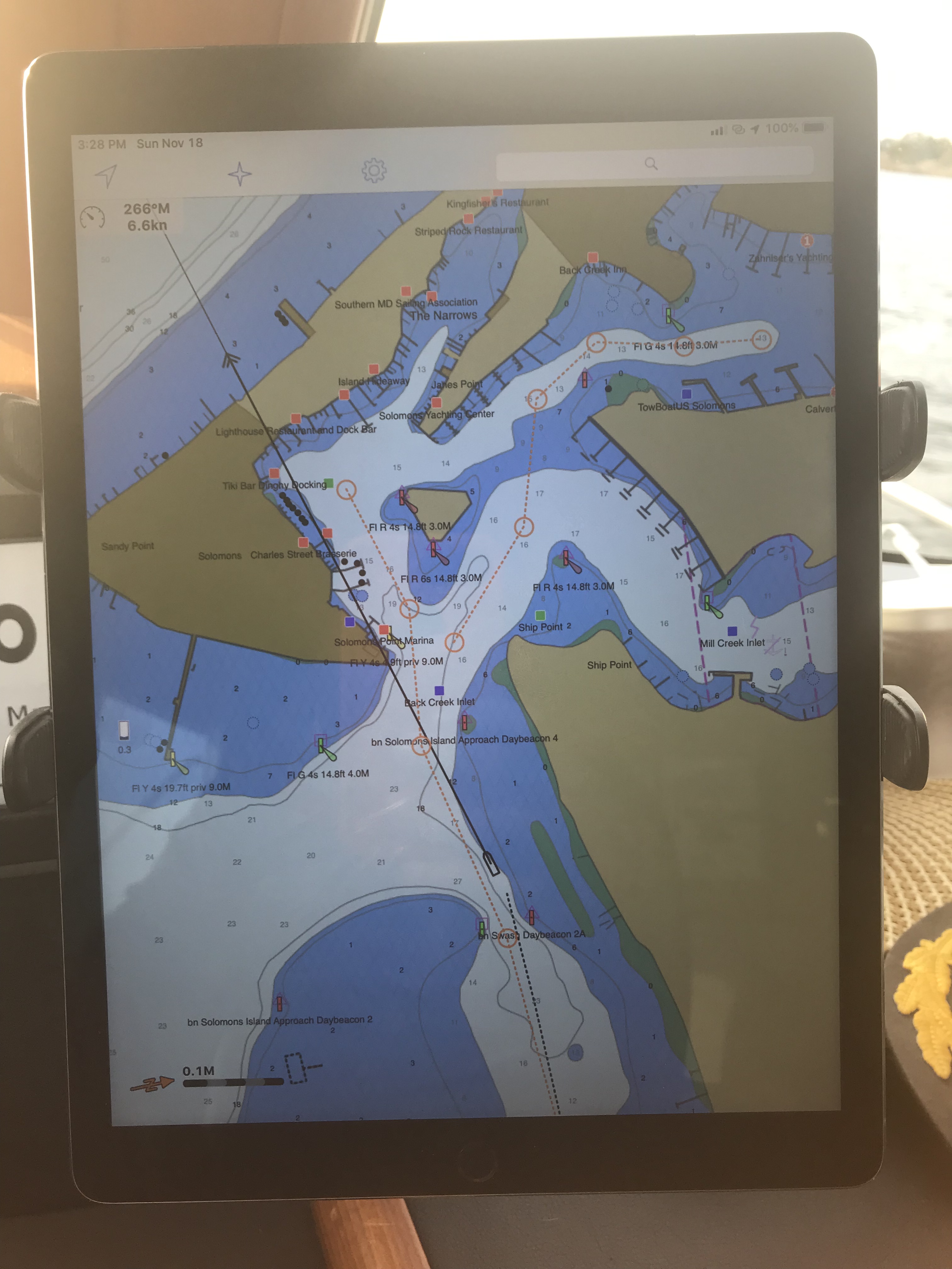
The trip down to Solomon’s Island was smooth and we came in and around the triangular island before finding a spot to drop anchor.
Well sadly Old Glory did not survive the strong winds we went through getting up Delaware Bay. I was thinking of retiring it before the storm made my decision for me.
We had to retire Old Glory after the storm tore it up
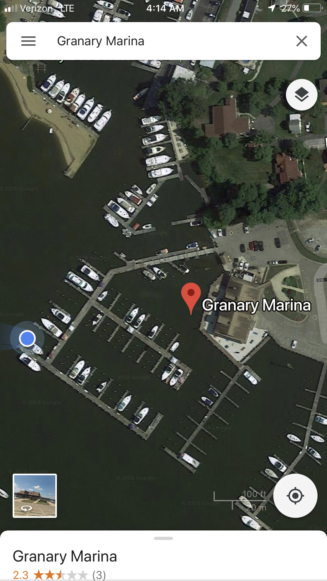
We enjoyed our two night stay at the Granary Marina in Fredericksburg, MD.
MV Simple Life was safely tied in her slip
MV Simple Life at Granary Marina
The marina was empty as it was mid-November.
Granary Marina Empty in Mid-November
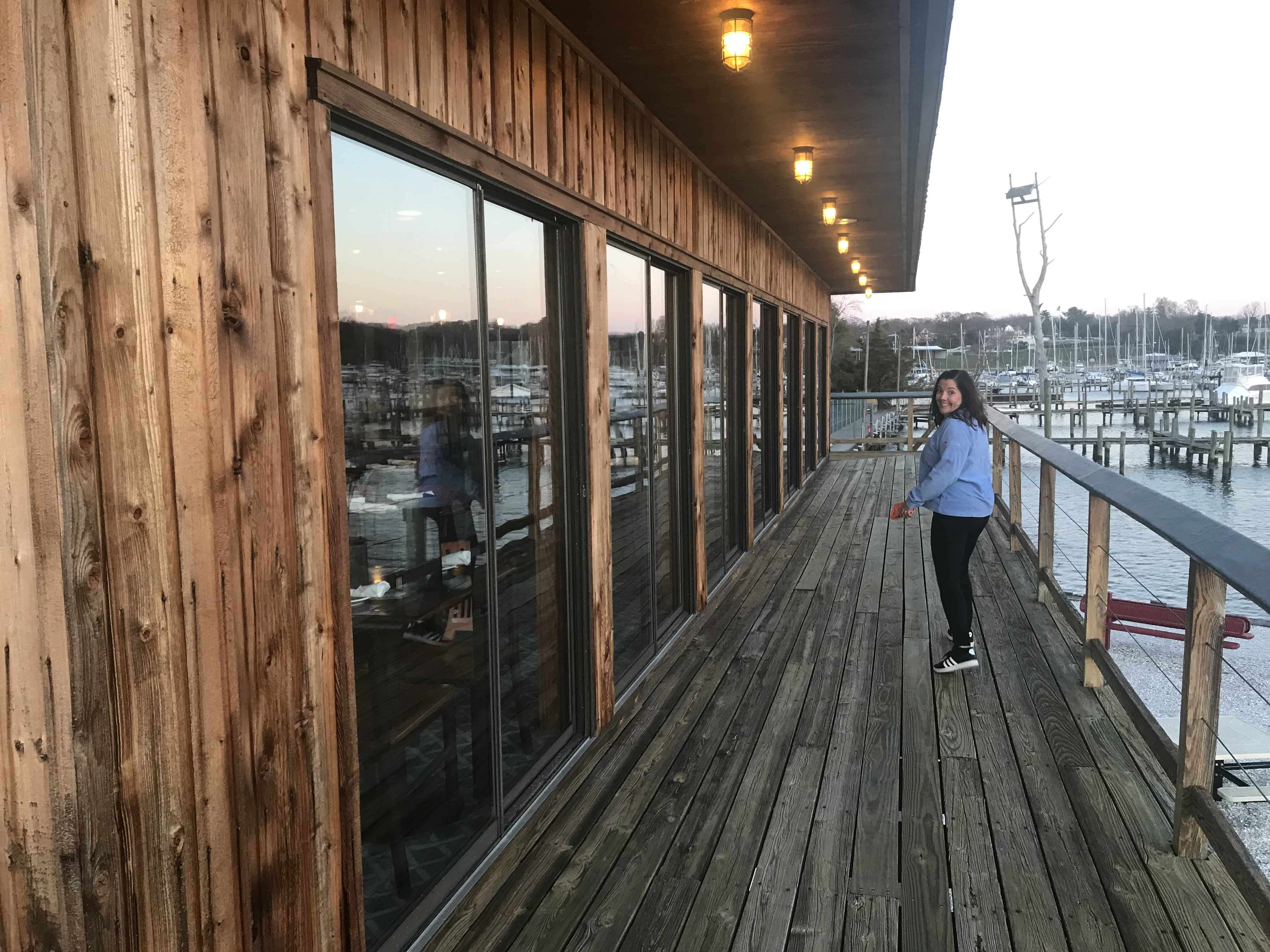
The sun was setting on the Sassafras River so that meant it was Happy Hour @ the Granary Restaurant.
It was a cold walk and Kelly was telling me to hurry it up. Restaurant has a great outer deck overlooking the marina & river.
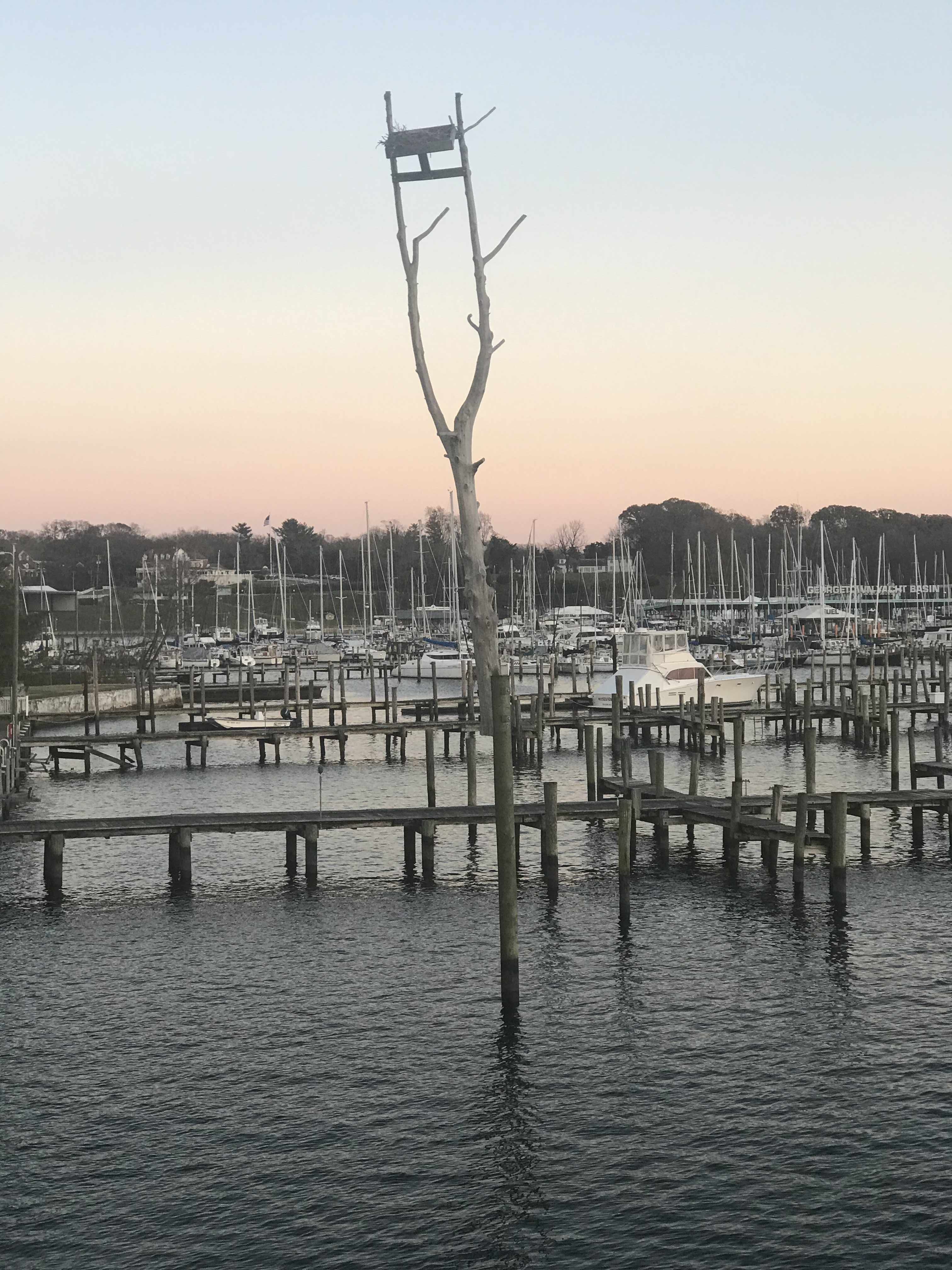
I loved that someone bolted an old dead tree to the top of a marina piling and put an eagle’s nest on top.
Rather than getting underway before sunrise we slept in and took our time leaving.
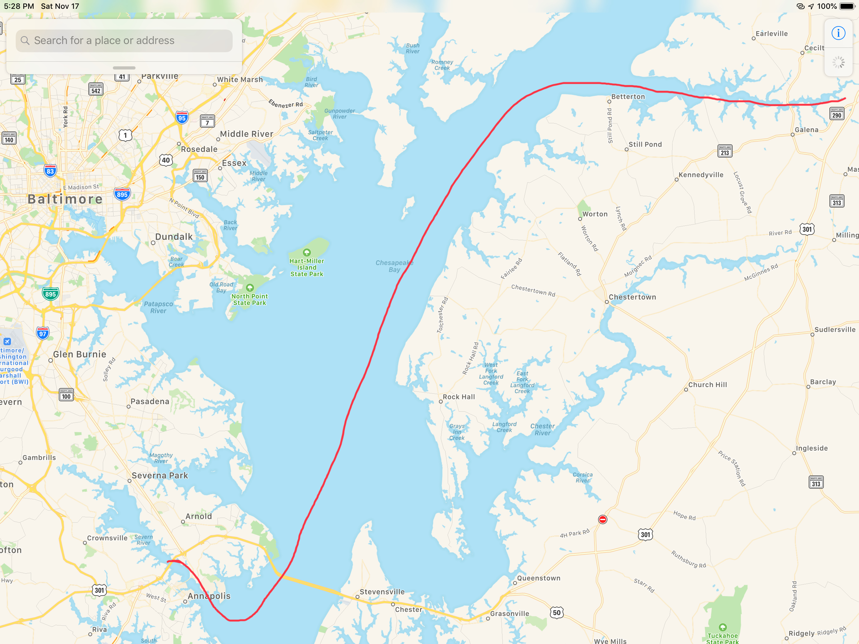
Soon we were making our way down the sinuous 10 mile stretch of the Sassafras river to the Chesapeake Bay.
Beautiful Home on the Sassafras River
When we came in the river at night we had to dodge these fish weirs that extend out from the banks. Easy to spot this morning…
I wonder how well these weirs work?
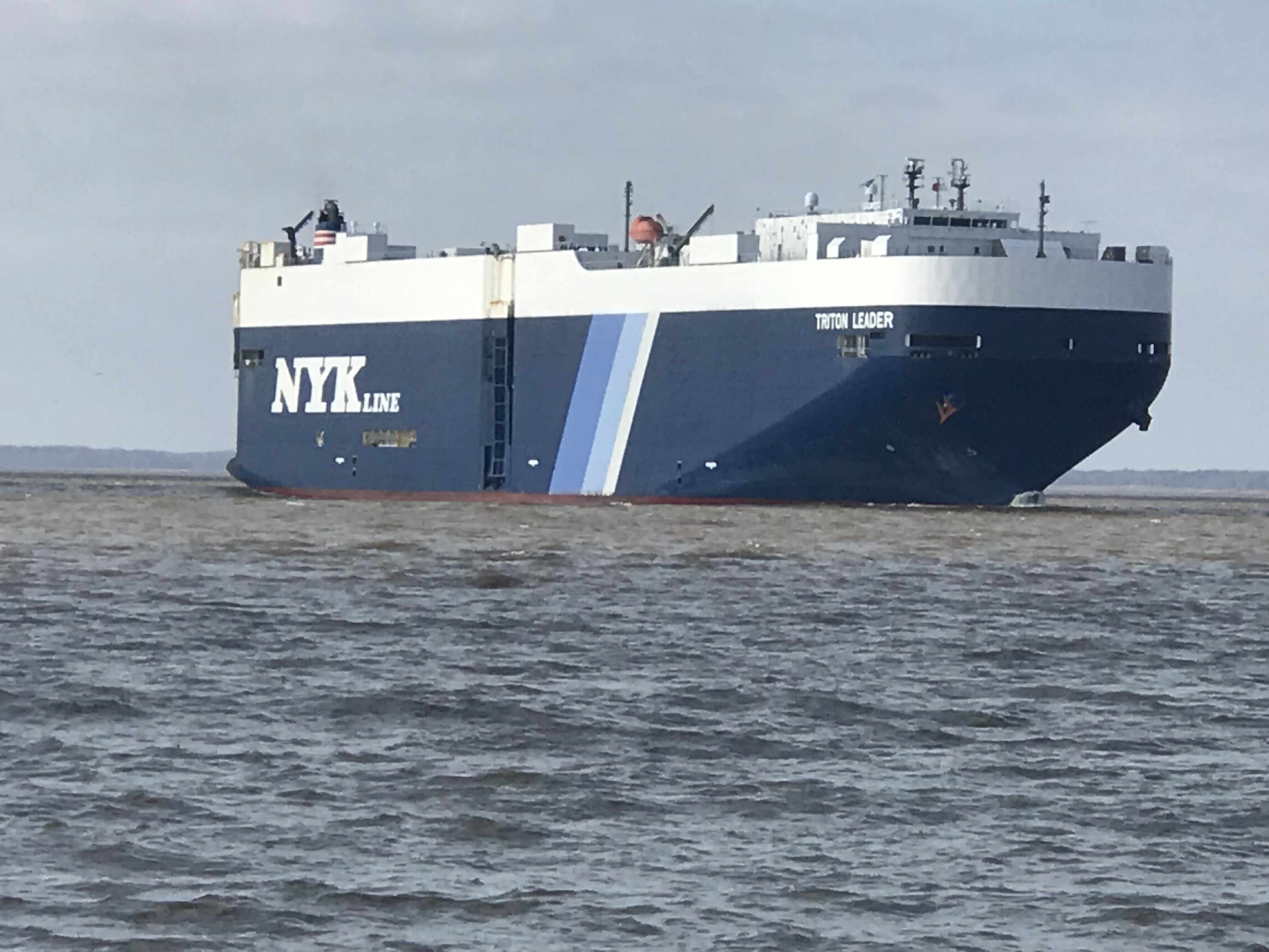
Heading down the Chesapeake we passed a huge car carrier called the Triton Leader.
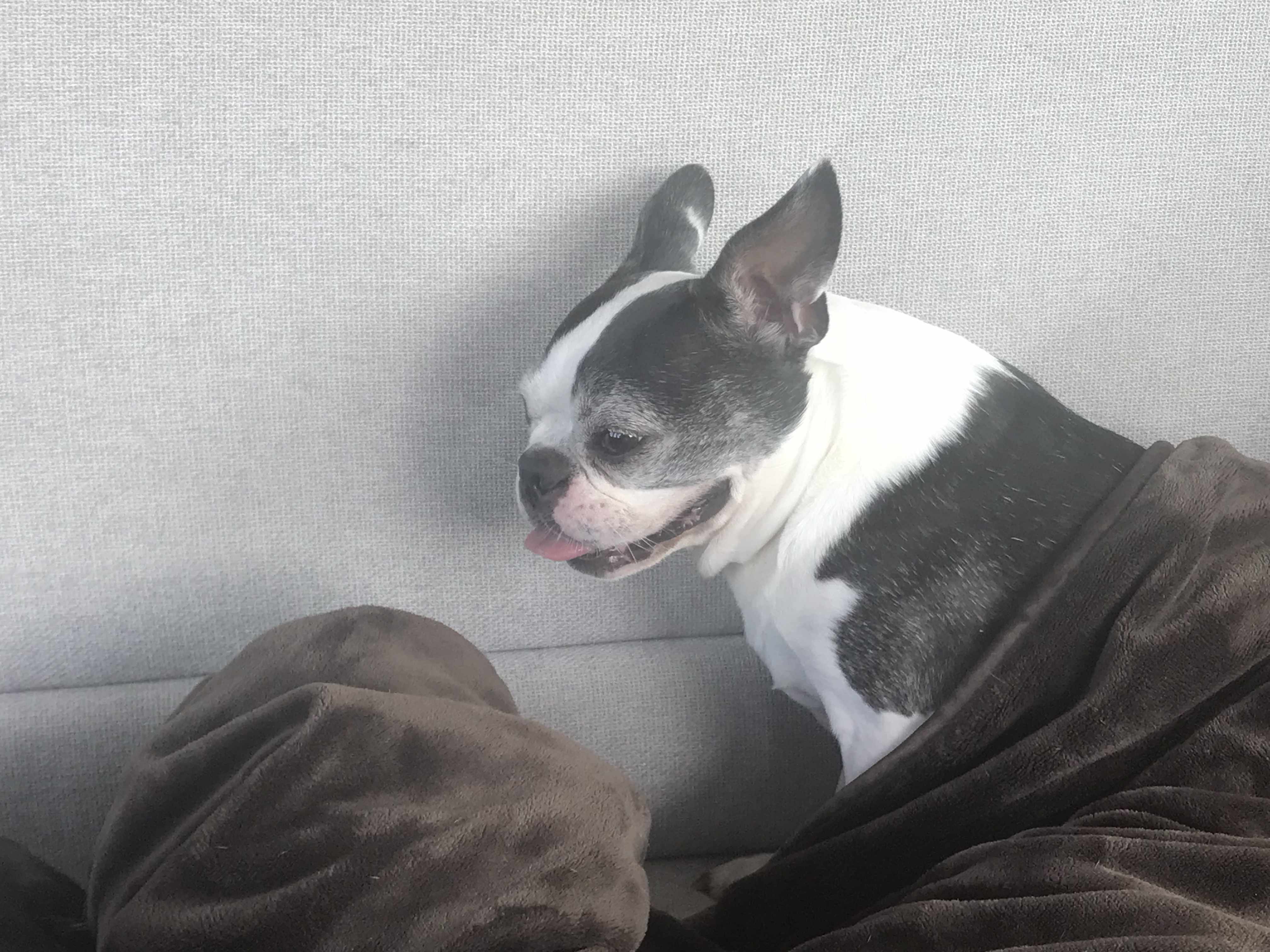
The dogs were happy that today’s leg of our journey was calm and flat.
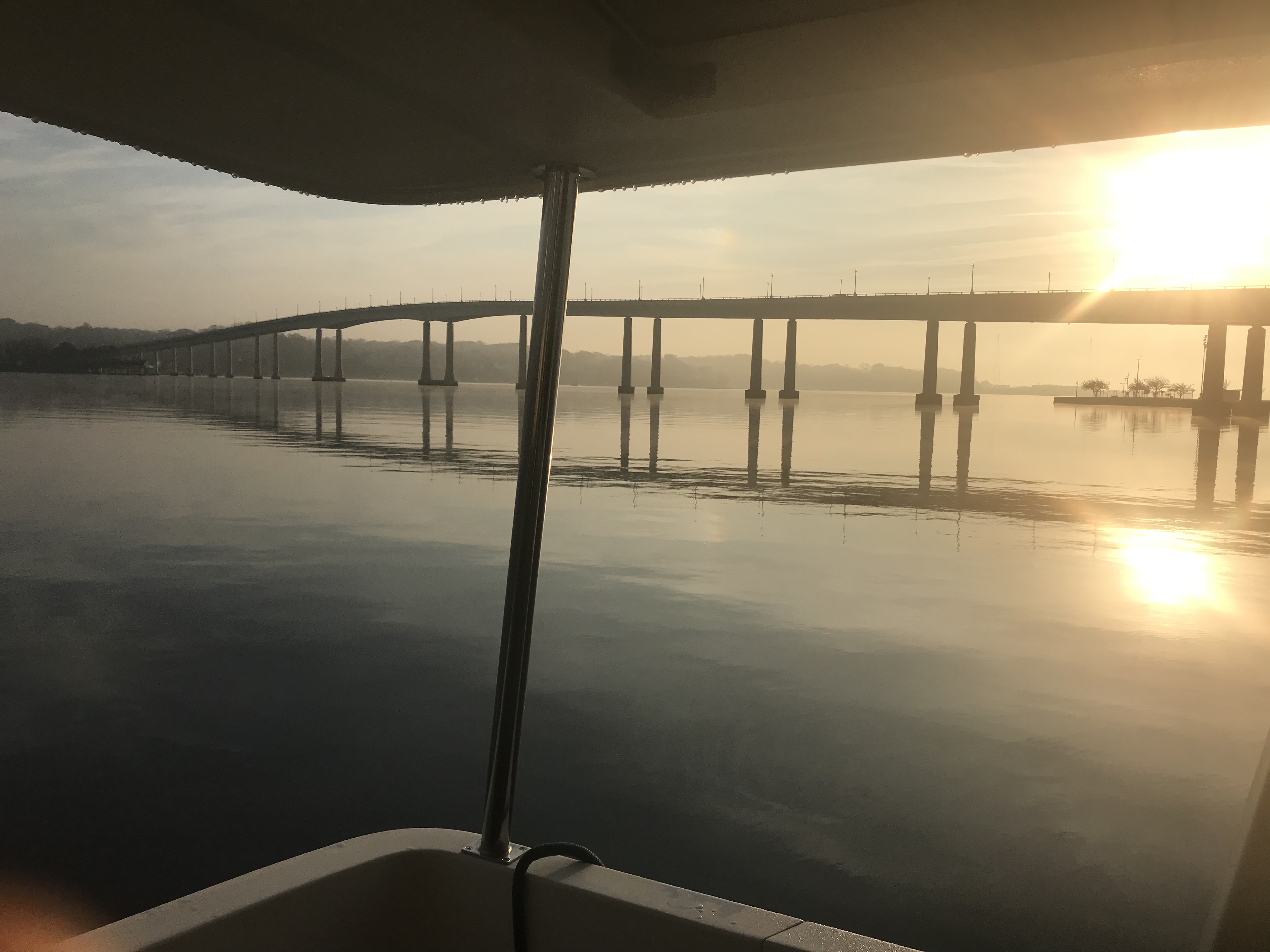
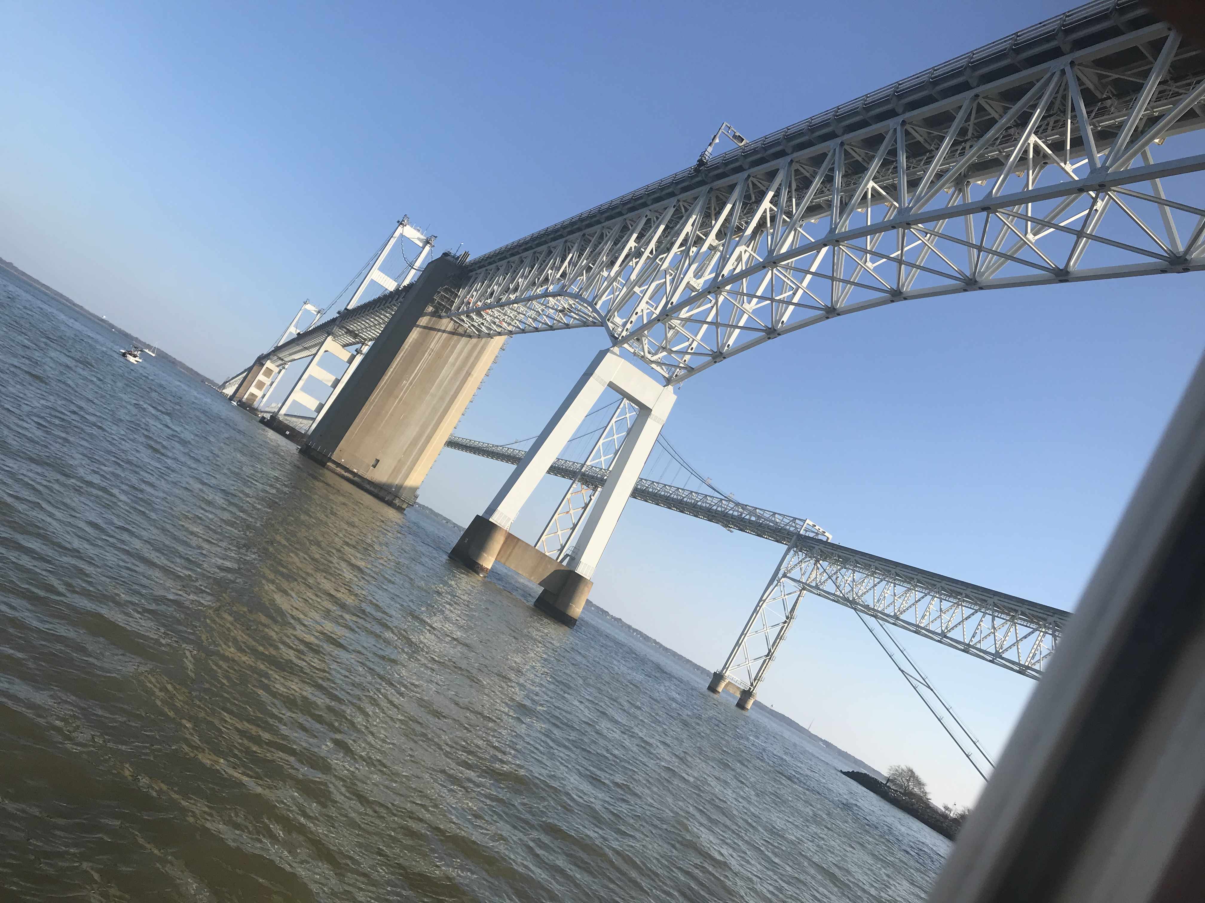
Soon we were passing under the famous Chesapeake Bay Bridge.
two bridges side by side
Soon we were anchored behind the Navy Bridge. We had the whole anchorage to ourselves.
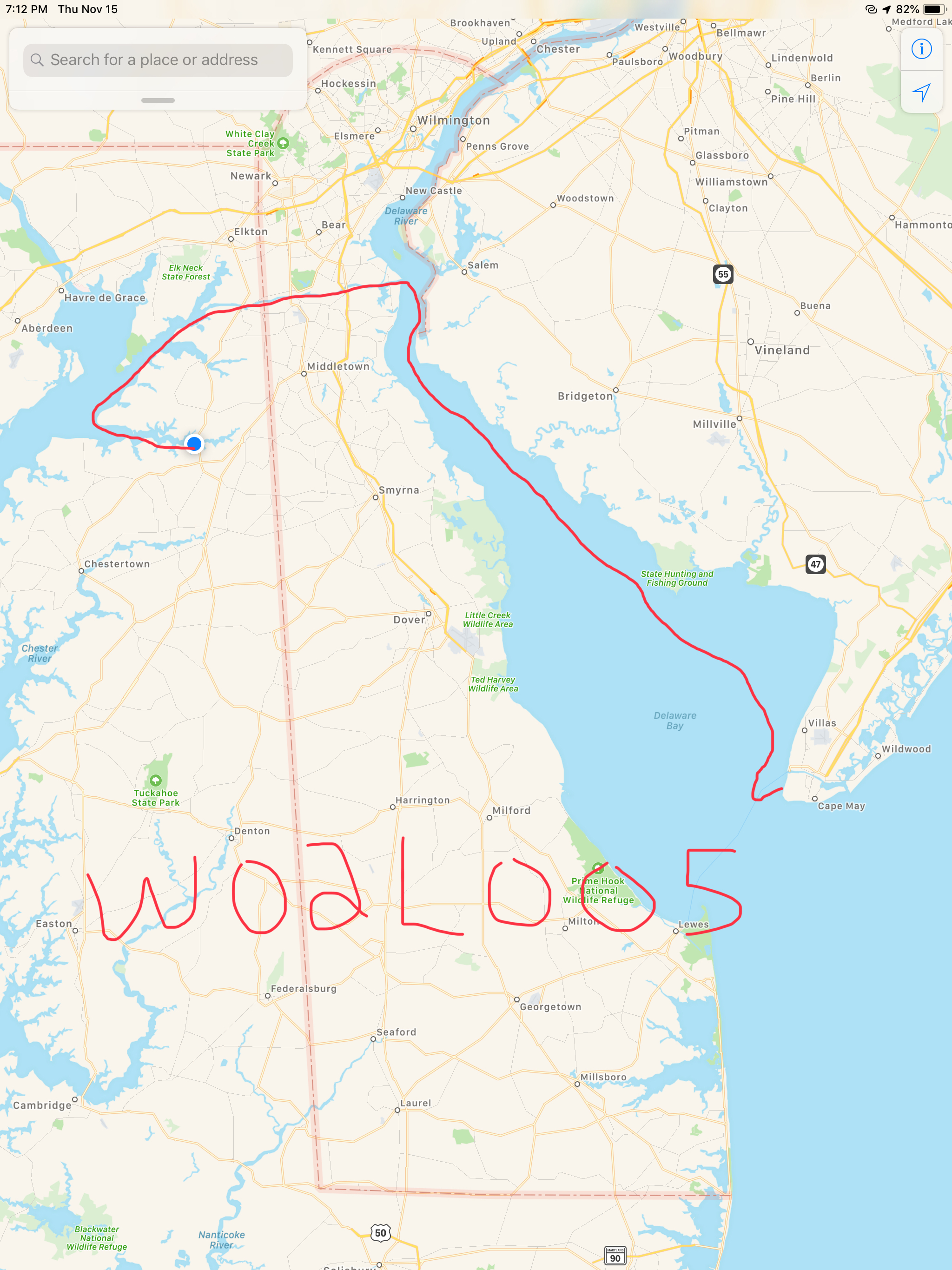
W02L006 (Leg 6 of our second winter living aboard) looked something like this.
We anchored in Cape May at night and the wind was whipping. We tried to tuck in behind the Cape May canal Jetty to get some protection but alas the boat was a rocking.
I finally had to get out of bed, weigh the anchor and re-drop as close as I could get to the jetty. It worked. Well it worked a little. We did not sleep much.
Next morning we left before sunrise because I just was not sleeping anyway. The gale warning winds were nipping at our heels as we worked our way North up Delaware Bay.
The blue dot is MV Simple Life and the red-purple are 30-40 MPH winds
A quick check on the weather back in Warwick, RI showed it was even colder than what we were feeling in Delaware Bay.
Warwick, RI Nov 15th Temps
The water in Delaware Bay was cold. Not something you want to fall overboard into.
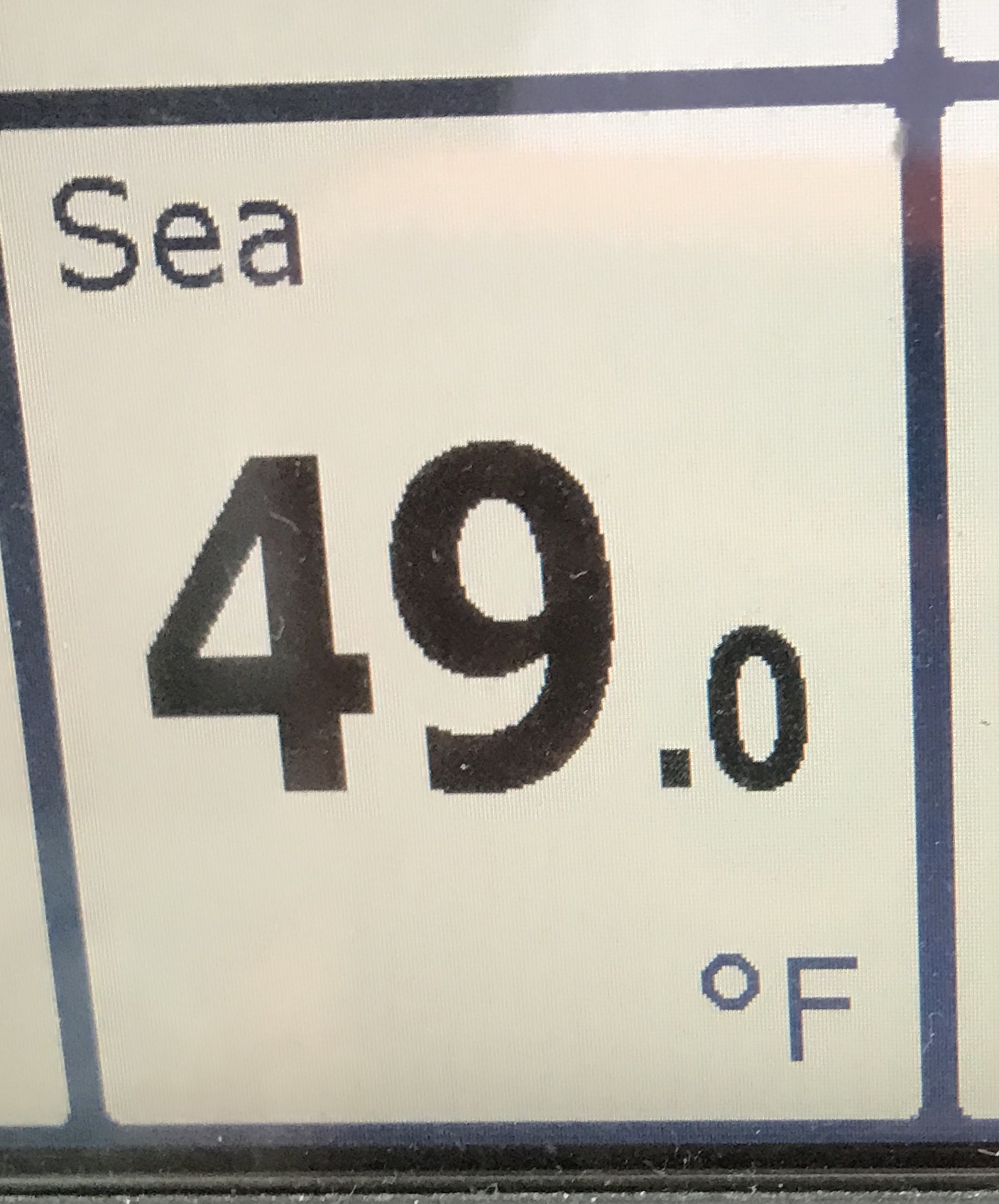
Delaware Bay Sea Temp
Traffic was hard to find. This Chiquita banana container ship passed us as we slipped out of the channel to give her space. I think only 2 other boats passed us on this gusty, snowy, foggy day.
Container ship passing us in Delaware Bay
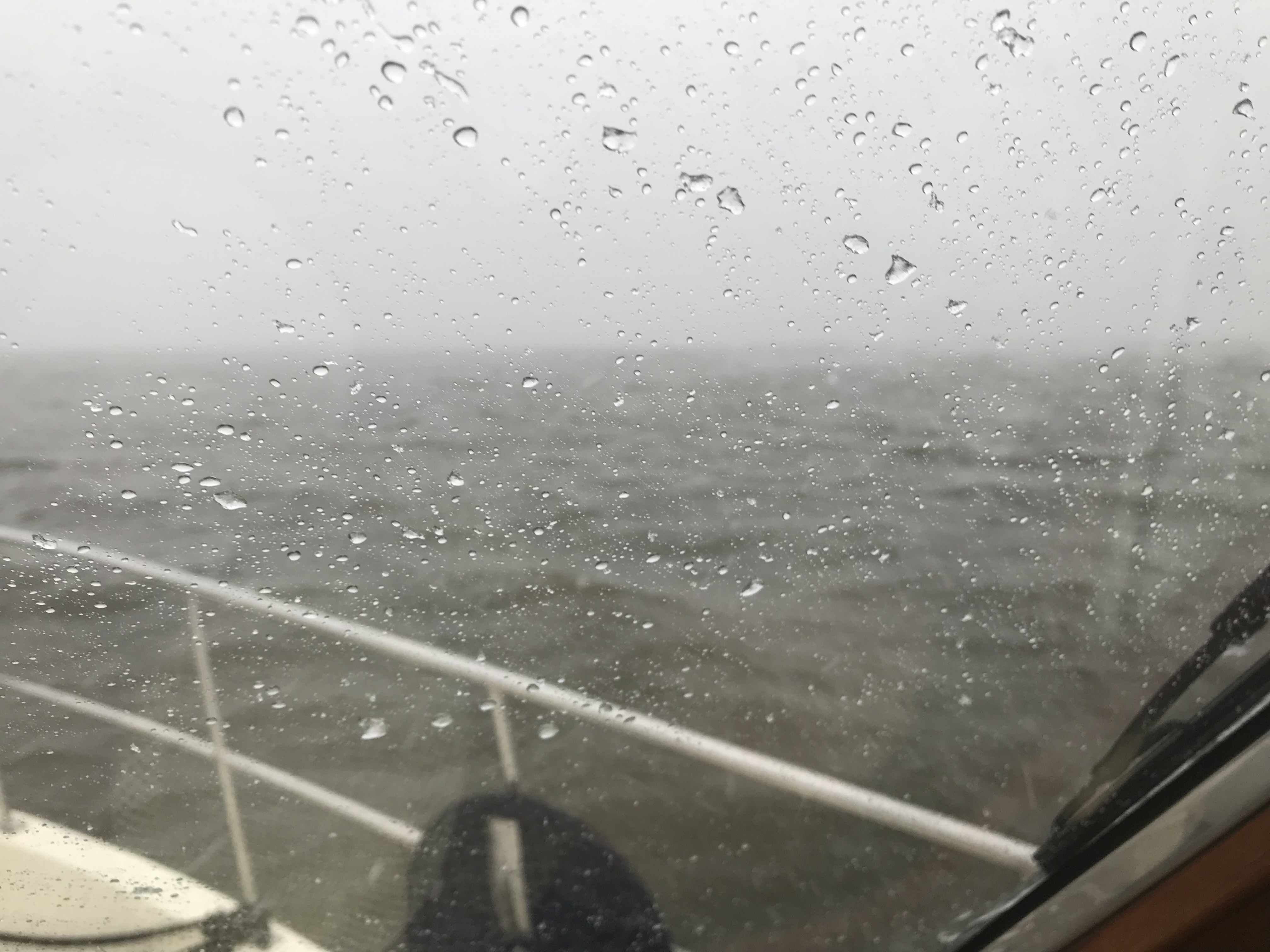
As we made our way up Delaware Bay the wind and waves were on our beam. The wind alone was giving us quite a list to port. A beam sea is never fun in a flybridge trawler with a 400lb dingy and two kayaks on the flydeck. eek.
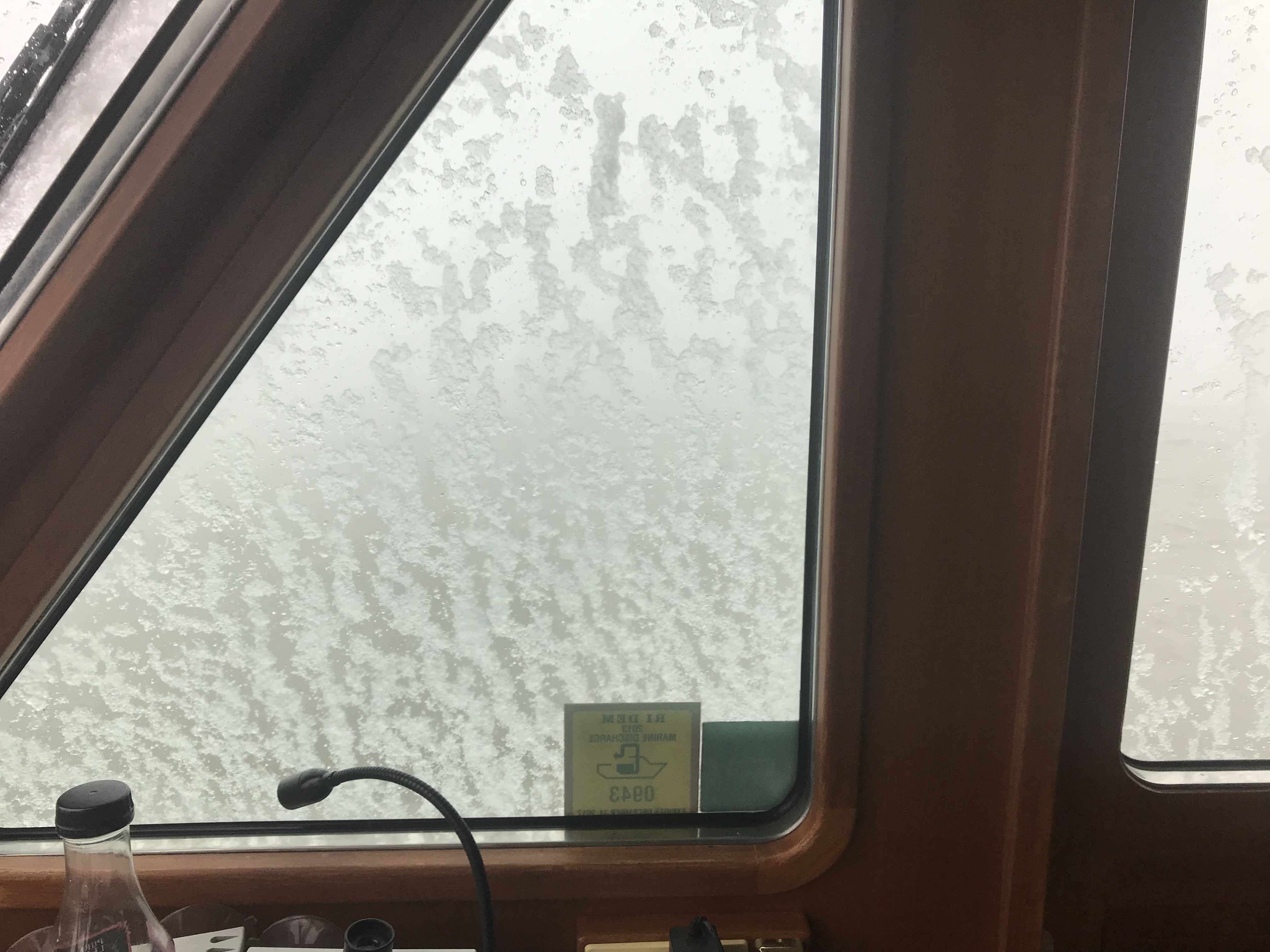
As the fog crept in on us it was time to turn on our Khalenberg automatic fog horn. If you are ever near MV Simple Life in the fog you’d think a giant tanker was bearing down on you. What made me laugh was… it stopped working in the freezing snow. With each blow of the horn it iced up more and more until it just stopped working.
Wind on the beam, Fog closed in around the boat Fog Horn wasn’t frozen yet.
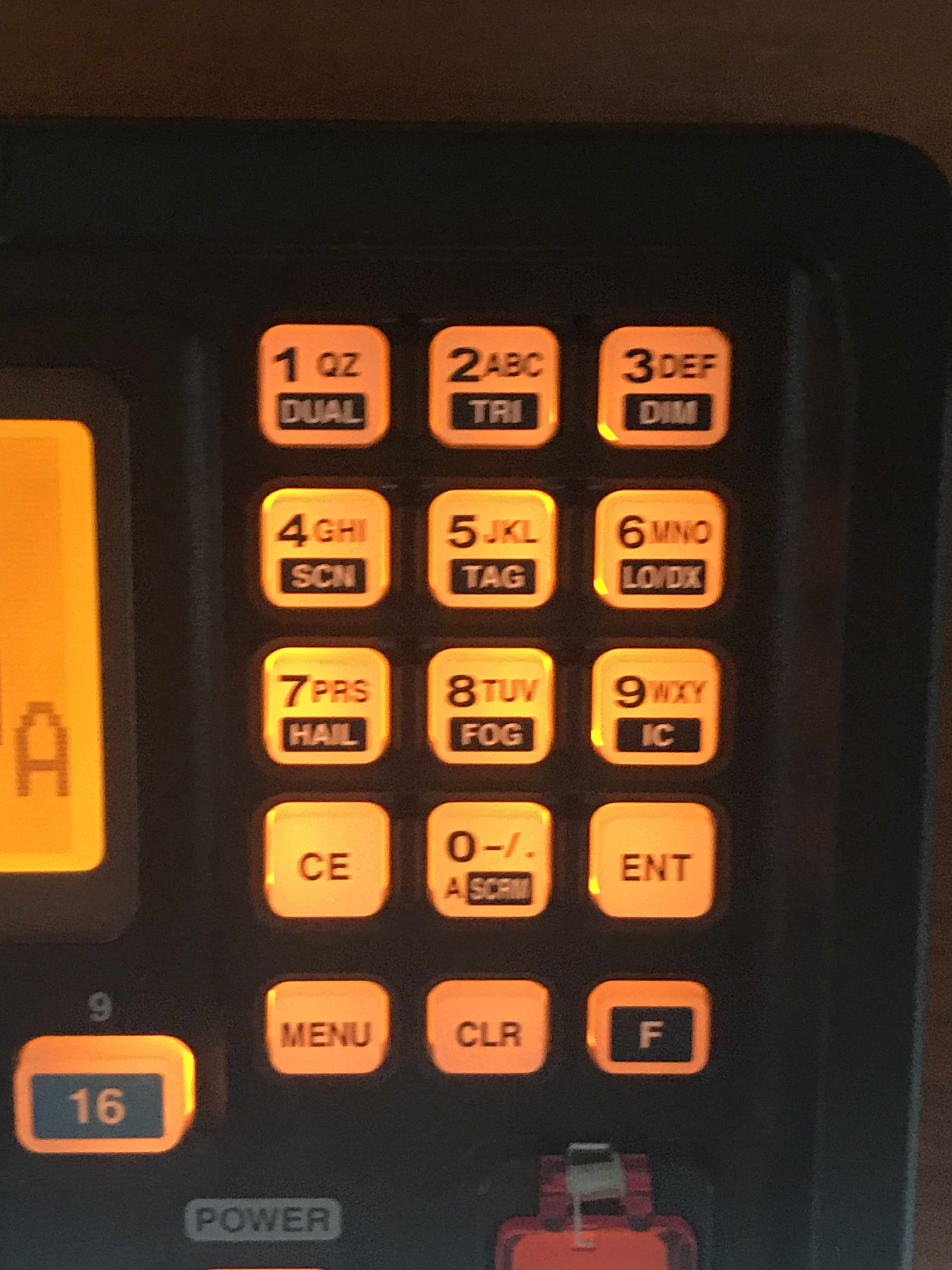
Once the Fog horn froze up and stopped working it was time to go to my backup fog horn. Yes, my VHF’s loud hailer fog horn played but in the wind and snow I’m sure nobody was hearing it. Heck, there wasn’t another boat out on this day anyway.
Function + 8 plays the ICOM VHF fog horn
The fog had closed in so tight to the boat that we could only see a single boat length in any direction. Thankfully, we have a 4′ open array Digital HD radar with overlay right on our chart plotter that helps us identify boats from buoys. We also rely heavily on AIS (Marine Automated Identification System) to make sure we show up on the chart plotters of other boats as well as us having all the details about the boats around us (boat name, course, speed, MMSI#, etc.
We soldiered on with the idea that once we made it into the C&D canal that the weather conditions would improve. They did!
The visibility returned and the winds and waves were held at bay by the high canal hill sides.
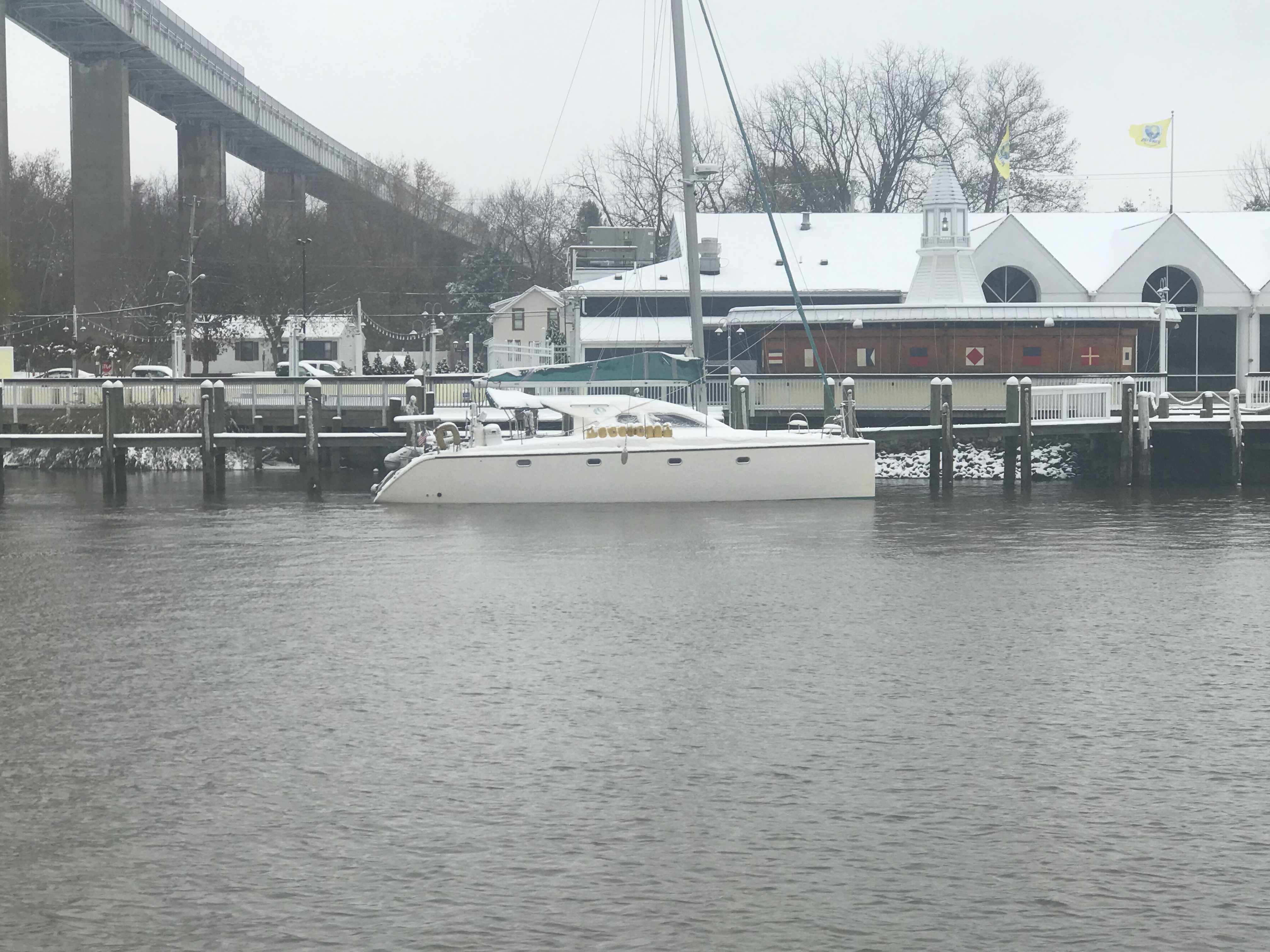
Soon we were passing marinas where the boats were covered in snow.
Snowy Catamaran
When we exited the C&D canal into the head of the Chesapeake Bay the wind was whipping up a following sea so we decided to anchor in the Bohemia River. Great plan until the depth alarms went wild when the depth dipped below 6 feet. This was not good concidering we were only minutes away from high tide. Not wanting to run aground or get stuck waiting for high-tide to return we decided to push on further to the Sassafras River.
The sun set and we watched as the last light disappeared as we entered the Sassafras River. It’s a long trip up the river to the Granary Marina but we decided with the strong winds and rain it would be nice to sleep tied to a dock. Neither of us wanted to spend another night trying to brace ourselves in the bunk.
The dockmaster left for the night and left us directions on how to find our assigned slip. That plan failed when we could not find our slip using our searchlight. The wind and the rain were coming down sideways and driving from the pilothouse in the dark is not a place you want to be poking down random fairways trying to find a slip. So we decided to grab any open slip and call it a night.
Docking alone in that wind was difficult enough but when I jumped out of the pilothouse to tie up I almost slipped on the snow and wound up going swimming.
My boat hook was buried in snow
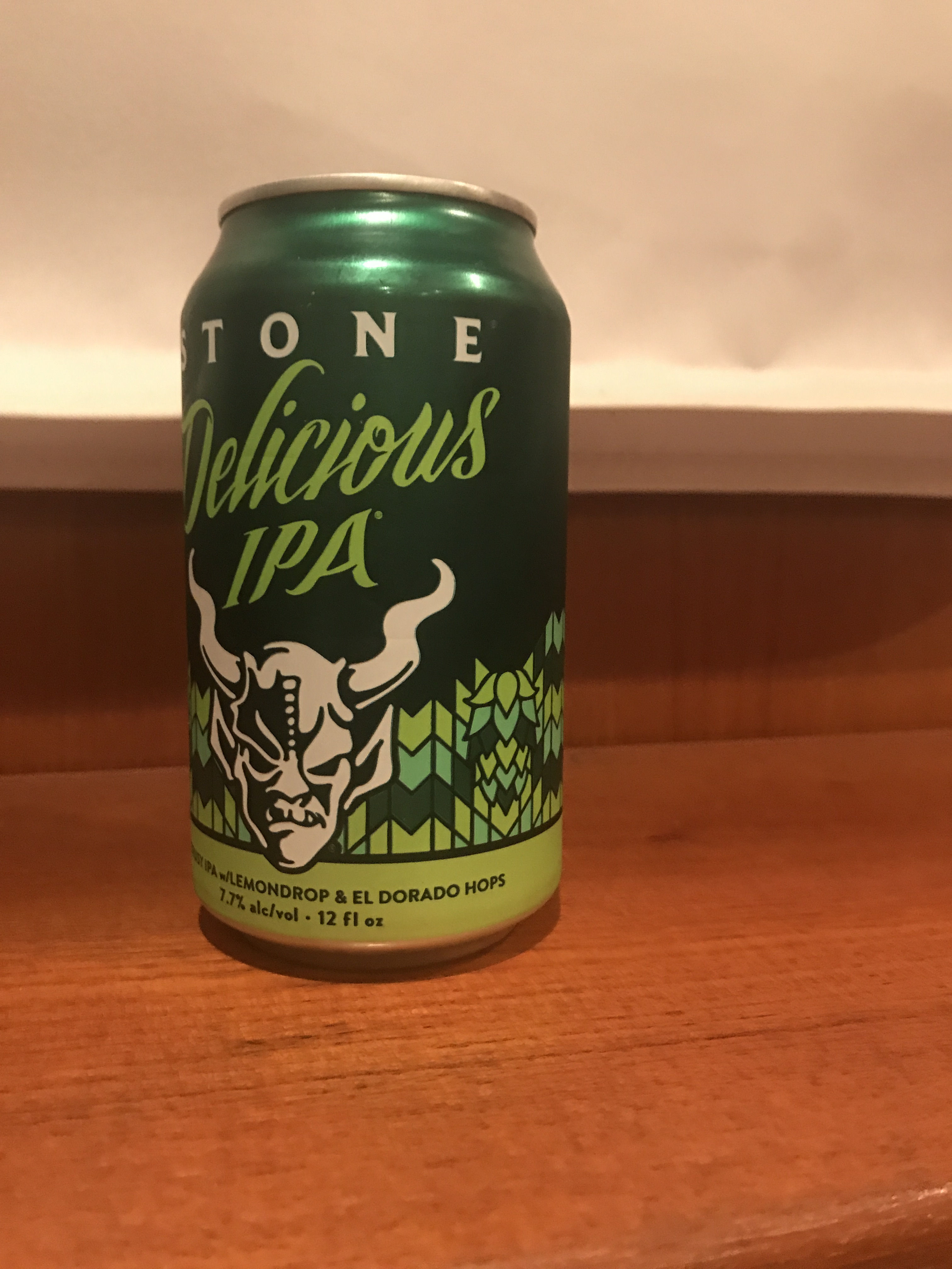
Soon we were tied up and I was changing out of my work pajamas, kicking my snow filled crocs off my frozen feet and thawing my toes by the heater while enjoying a well-deserved IPA
After 13 hours at the helm, this IPA tastes great 😉
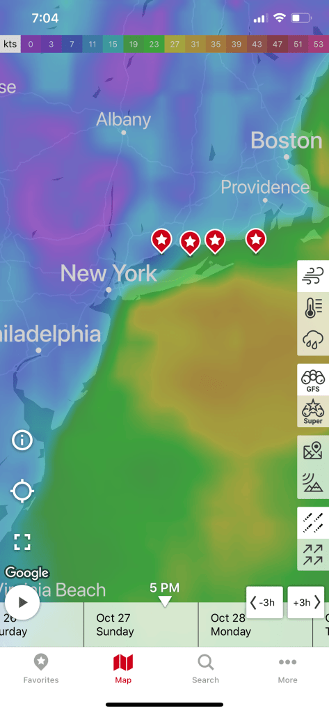
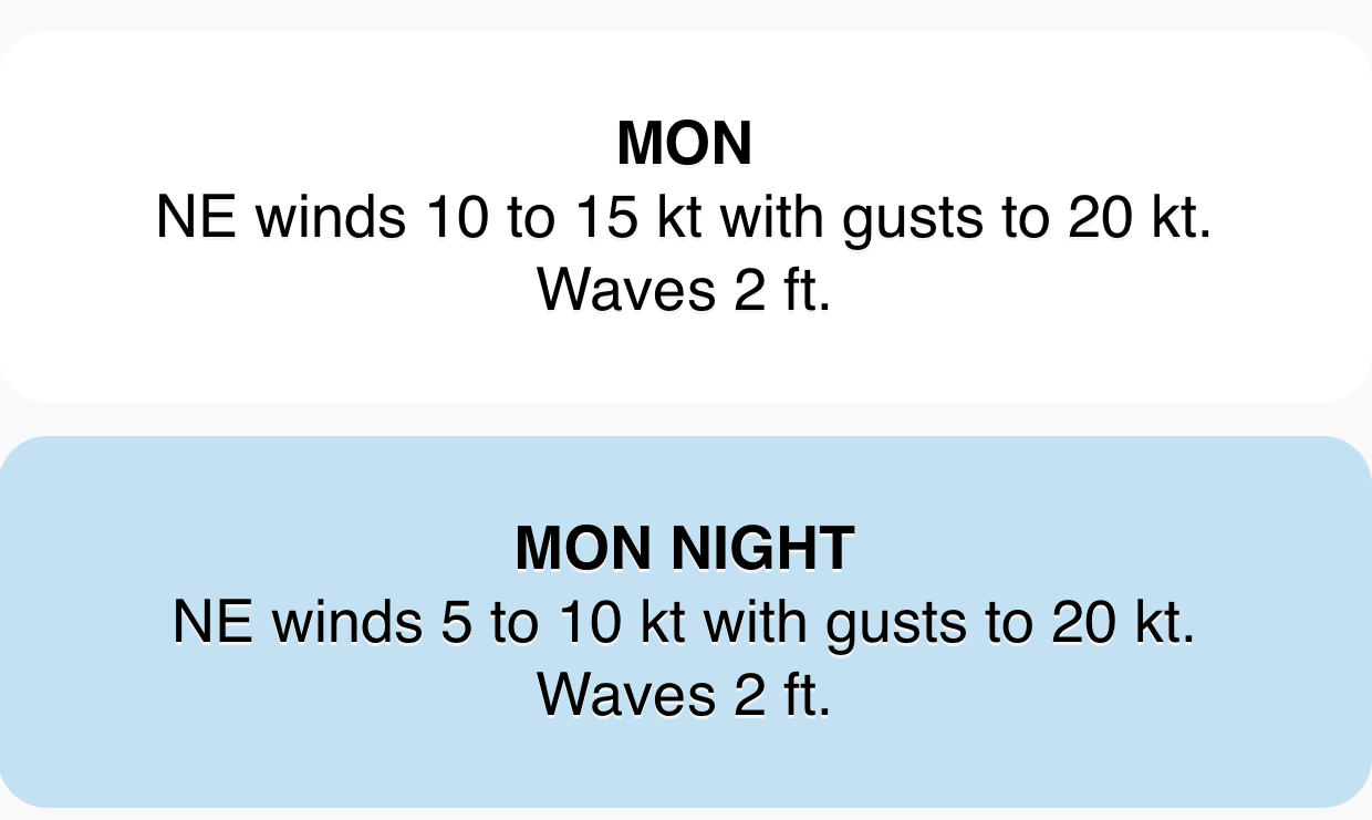
Leaving Solomons Island we checked the weather and saw that there was a SCA (Small Craft Advisory) in effect. Thankfully we were getting higher up in the Chesapeake Bay. As you approach the head of the Chesapeake the fetch (amount of water the wind has to blow on) shrinks.
SCA due to a low and a cold front
Small waves with gusts
The trip North had us staying out of the way of many large ships which we would see again anchored just outside of Annapolis. Maybe they wanted some shore leave in Annapolis too?
Sliding Down
Pushing up
I thought it would be more interesting if the ocean was not flat and these ships could simply slide down or be forced to push up hill.
There were many interesting structures in the bay like this lighthouse.
Lighthouse in Chesapeake Bay
Rays from above
Upon arrival in Annapolis we grabbed a mooring and I dropped the dinghy and raced off to do a one-man pub crawl of Annapolis.
1st stop Pussers.
Pusser’s Landing
Dinghy Dock for tie ups
Luckily all the canals in Annapolis offer free dinghy tie ups.
Docked in the canal
Canal end
2nd stop Dock Street.
Dock Street
3rd stop Middleton Tavern.
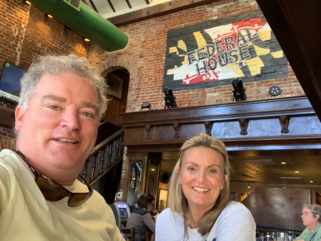
4th stop Federal House.
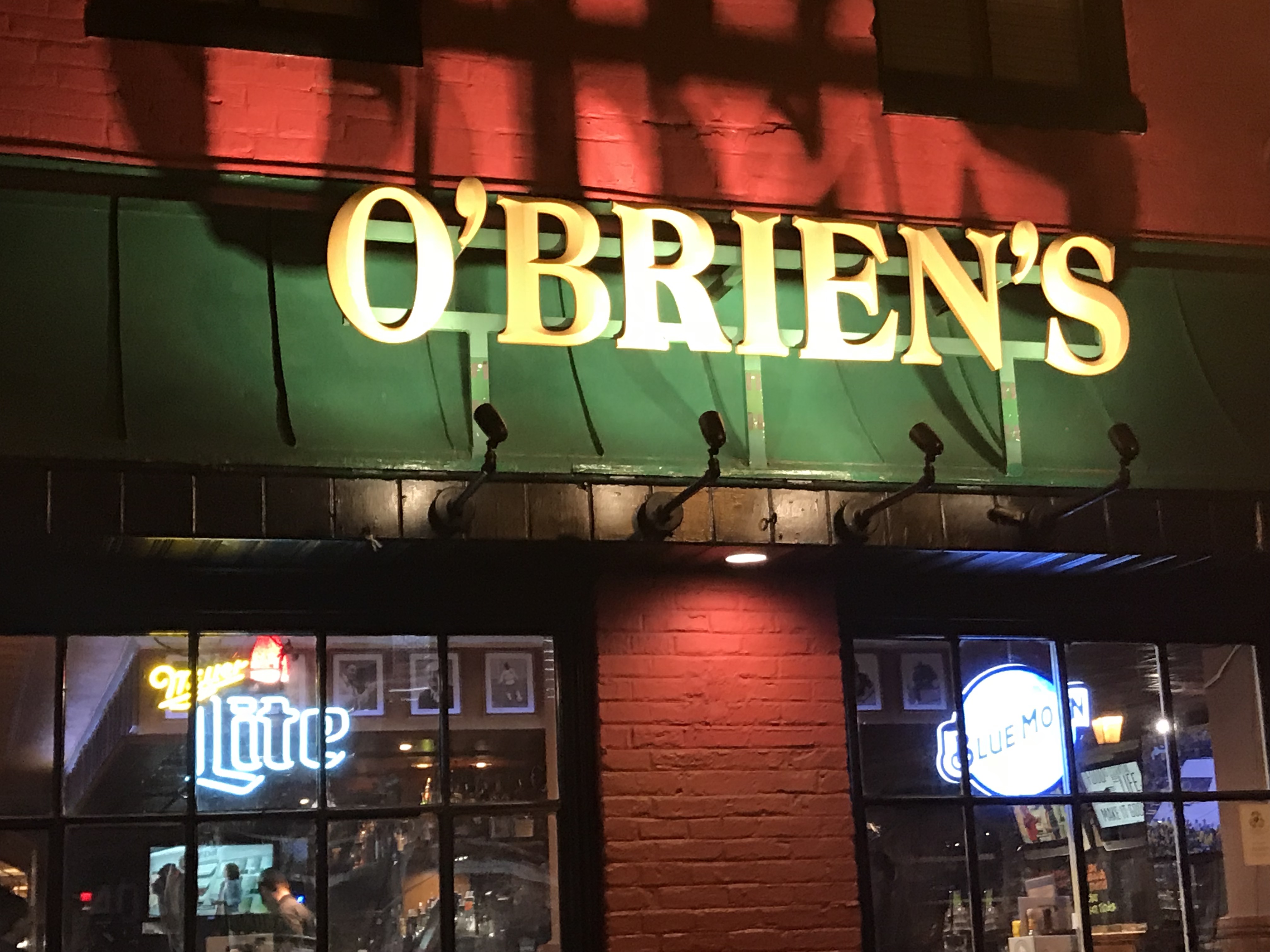
5th stop O’Brien’s.
6th stop ACME.
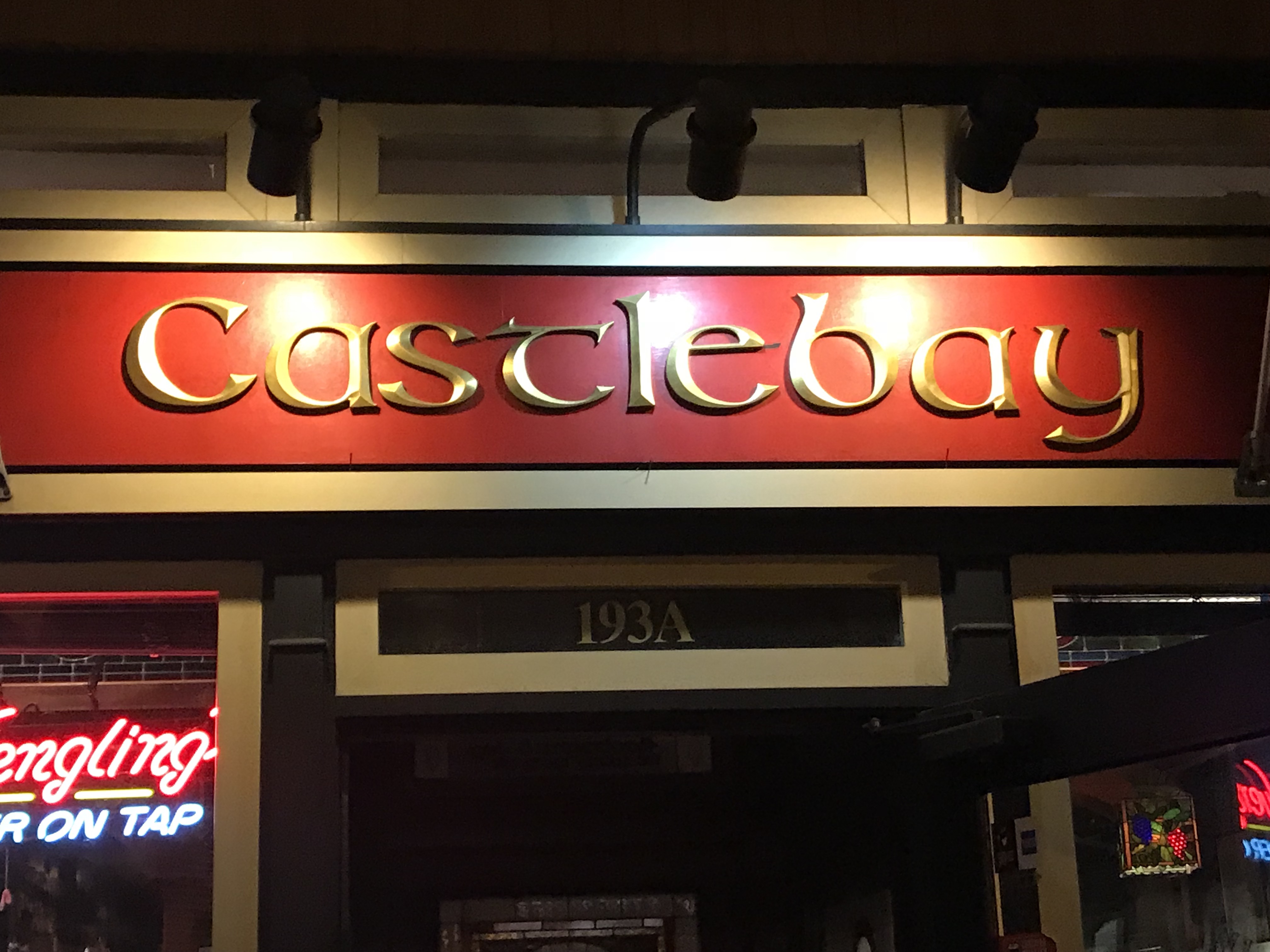
7th and final stop Castlebay.
Castlebay was alive with karaoke.
As I made my way back to the dinghy at the end of the canal I recalled seeing this Alex Haley’s Roots statue the last time I was here.
Alex Haley Roots
Plaque
Children listening
And just like that I was returning to MV Simple Life and would sleep like a rock.


You must be logged in to post a comment.