Entering the ICW

Norfolk Leg
Route from The Great Machipongo Inlet to Top Rack Marina, Chesapeake, VA

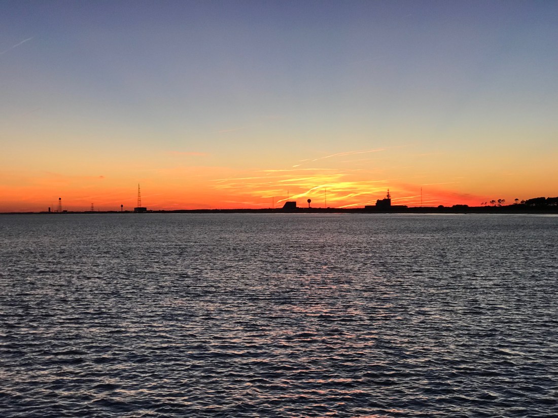
Well we woke up early and left The Great Machipongo Inlet. The dolphins once again escorted us out and I turned South with the sun streaming in the port side pilothouse windows so hard I had to close the curtains and use the radar alone to tell what was on that side of the boat.

The sea was as flat as a model’s tummy so I lowered the RPMs on the diesel to get 2 MPG rather than 1 MPG. Simply by slowing the boat 1.3 knots we double our fuel efficiency! Don’t you wish that were the case for your car?

Thimble Shoal Light - Norfolk VA
Thimble Shoal Light

In a few hours we had snuck through the Chesapeake Bay Bridge Tunnel, past Thimble Shoal lighthouse and we were approaching Norfolk Navel Station.


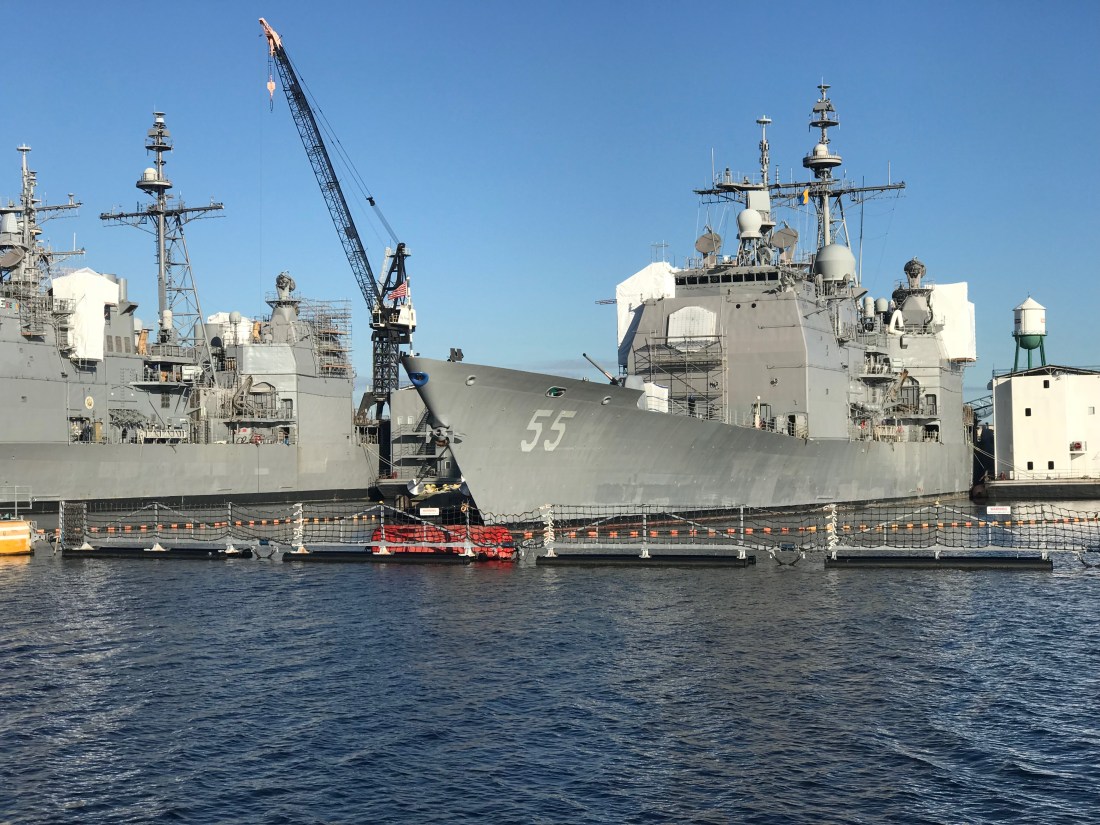
What an amazing sight to get to these American Navy ships up close.

Warship 19
USS Mesa Verde (LPD 19) – Amphibious Transport Dock Ship

You can see the barrier fence that they stretch across the opening and that fence line is protected by a Navy Patrol boat with a machine gun on the bow.

Navy Patrol boat

A local news story revealed just a few months ago there were six bomb threats called in to the naval station and you can call NCIS if you know anything. I wonder if you can call and ask for “Leroy Jethro Gibbs” or “Tony DiNozzo”?

Jethro and Tony

USNS William McLean (T-AKE 12) - Military Sealift Command
USNS William McLean (T-AKE 12)
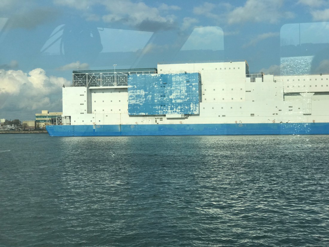
– Military Sealift Command
USS Leyte Gulf (CG-55)
USS Leyte Gulf (CG-55) – Ticonderoga-Class Guided Missile Cruiser
USS San Jacinto CG-56
USS San Jacinto (CG-56) –  Ticonderoga-Class Cruiser
MH-53E Sea Dragon
MH-53E Sea Dragon Buzzed Us From Overhead
Dangerous Target
AIS (Automated Information System) Alarm on my Chartplotter warning of other AIS traffic that has a narrow CPA (Closest Point of Approach)

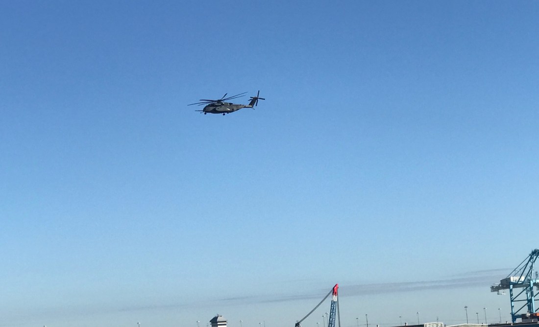
As the Sea Dragon buzzed us my navigation system popped up forcing me to ACKNOWLEDGE the fact that there was a “Dangerous Target” nearby. The Helicopter was not alone and there were a pair of jets making that deafening sound that seems to well up from a simple background rumble to a roar.

Jet
McDonnell Douglas F/A-18 Hornet – Screeching Across the Sky

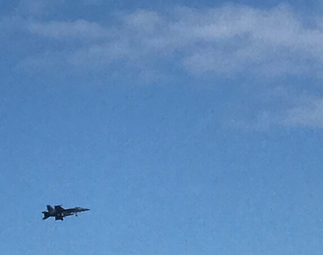
I believe that is a McDonnell Douglas F/A-18 Hornet? Maybe one of our military aficionados will comment if I got any of this incorrect?

DryDock 2
Norfolk Virginia Dry Dock


Dry dock ship
I Believe this is the Stern of a Amphibious Transport Ship?
Medical Ship
USS Jason Dunham (DDG-109) – Arleigh Burke-Class Destroyer Alongside The Hospital Ship Comfort

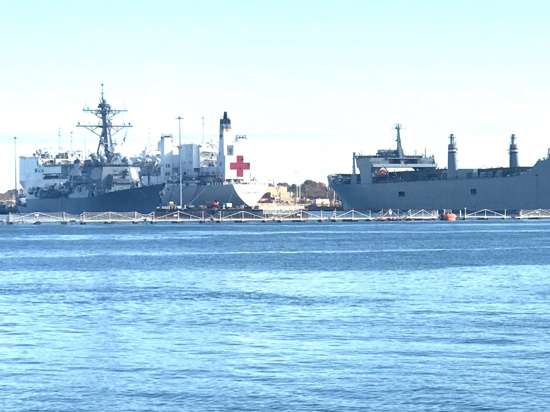
The Hospital Ship Comfort made it’s way down to Puerto Rico as part of the relief efforts.

News Story about Hospital ship and it’s relief efforts.

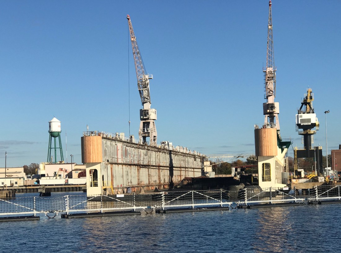
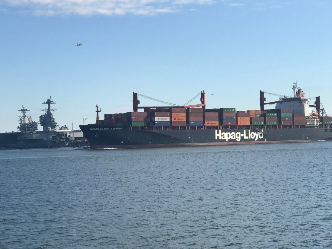
So after navigating past all the warships and being careful to keep our distance it’s on to the Norfolk International Terminals and the Virginia Port Authority.

Star Wars
Star Wars AT-AT Walkers were all I could think about.
Crane
Large Cranes Loom Overhead
Hapag-Lloyd Passing By
Hapag-Lloyd Container Ship Passing By
North PBL RR Bridge and Jordan Fixed Bridge
North PBL RR Bridge and Jordan Fixed Bridge, ICW’s First Set of Bridges – Many More to Come
Norfolk Southern Railway Bridge 36 Feet
Norfolk Southern Railway Bridge @36 Feet – Room to Spare
Paddle Wheel James C Echoles 2
Paddle Wheel James C Echoles 2 Passing us By

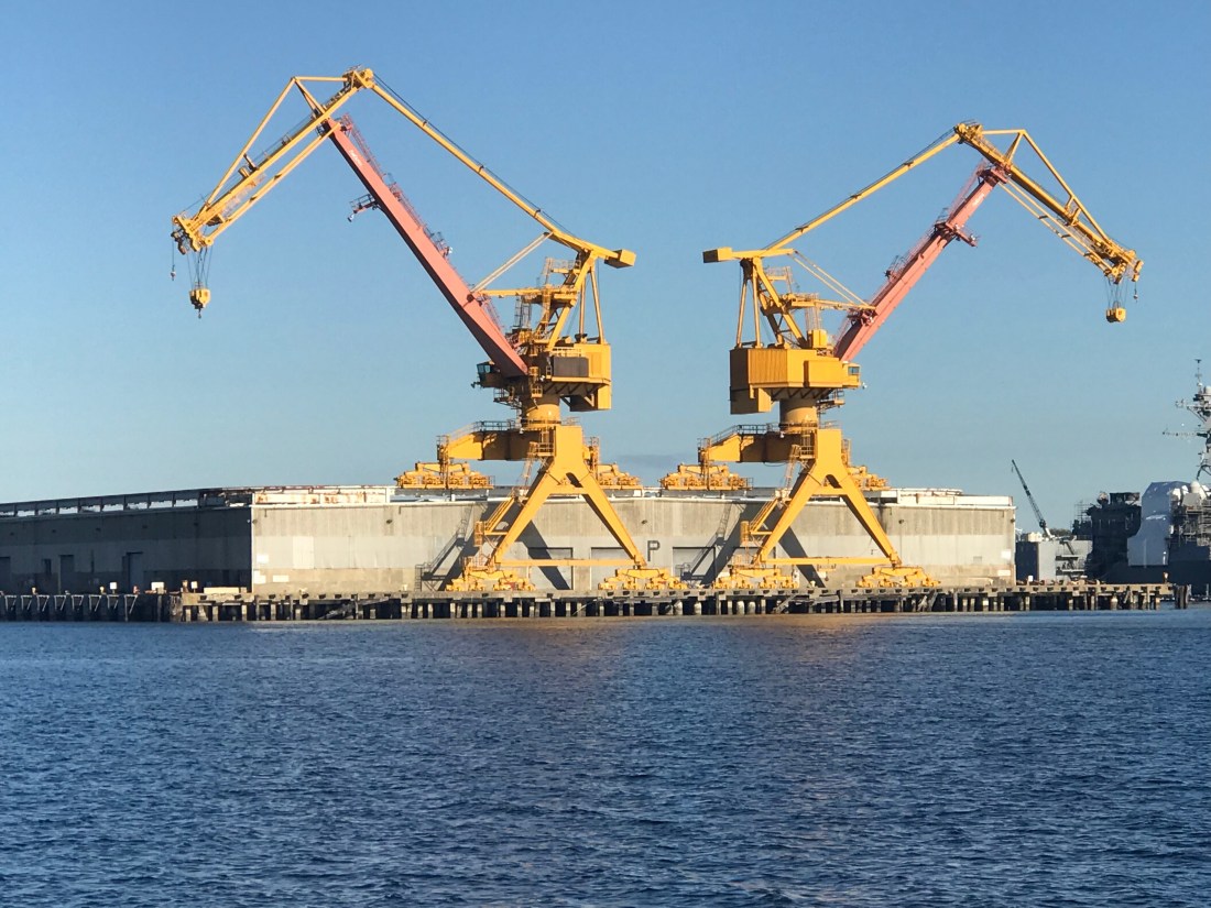
You can’t help but notice that everywhere along the shore seems posted “WARNING – US Government Property – Restricted Area – KEEP OUT”

Tower
US Gov Manned Towers with searchlights Guard Wharf Entrances

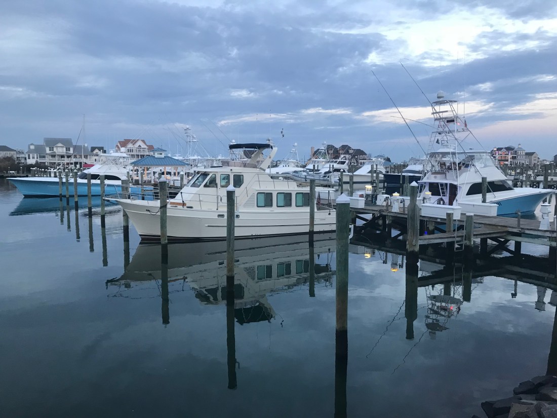
Finally, we arrived at our chosen destination, Top Rack Marina.

Top Rack Marina setting sun
Top Rack Marina in the Setting Sun

I promise to post more about this terrific marina and the on site restaurant called the Amber Lantern that we plan on having dinner at tonight.

Great Machipongo Inlet – Anchored For the Night

This morning started with a great breakfast on the griddle. I have always loved breakfast  diners so having a griddle onboard is perfect for corned beef hash with eggs on buttered toast, cheese and BBQ sauce. I love this exact breakfast and for me, it’s cook, eat, repeat day after day. Why change what makes you happy?

Breakfast 1
I need the egg rings because as the boat rocks the eggs would run away

We did not leave our anchorage till almost 10AM and while I was still dying to drop the dink and make a run around the island to find the wild ponies, I told myself I’ll come back for the ponies!

So I weighed anchor and got underway. The trip was a simple one, South down the coast. I had plotted a short 37 nautical mile course that took me from Chincoteague Island to the Great Machipongo Inlet in Virginia. Even with the late start I was not in danger of having the sun set on me so I slowed down and trolled a line…

Trolling 1
Deep dive bill mackerel lure @5.8 knots – me thinks 4 knots would be better.

My Dad took me fishing off Sandy Neck beach as a child.  I recall sitting by the Colman lantern and just loving it as beetles and moths bombed in from the darkness only to slam into the lantern and spin around in the sand. When I got older, Dad entered me in the MBBA’s (Mass Beach Buggy Association) casting tournaments on Scusett Beach. My Dad would let me use his prized 13′ surf rods with weighted sinkers. He would show me how to put everything I had into the perfect cast and how to release the line at the perfect flex point in the rod. I  won trophies and was hooked. My first summer girlfriend came after winning a trophy 😉 We flew kites, it was pretty simple back then.

If I wasn’t fishing on the beach, I was down the Cape Cod Canal as a 20-something fishing for stripers with Timmy & Tommy or Greg (AKA. Maca, Gratty and Rooster). Growing up, we never called each other by our given names.. I’m assuming it’s like that everywhere. Anyway… I outfitted Simple Life with plenty of rods and fishing gear for times like this cruising down the coast. Problem is.. I never seem to catch anything.. It’s kind of a running joke. I need to up my fishing game. Anyone want to come South and show me some pointers? I could use some. My friend John has a great Cabo sport fishing boat and if I was not so preoccupied with taking my own boat out, I’d have spent more time learning on his. Well, needless to say.. No fish.. But I’m committed to catching something great SOON!

On our way into Machipongo Inlet we were visited by dolphins. It did not take them long to come over and start rubbing our bow.


I reconfigured my Raymarine E140 chartplotter’s page to display 3 different windows. I chose a half window of charts, a two quarter windows, one of a camera feed behind me and one of the depth sounder readout (see pic).  I did this because as I am traversing these tricky Atlantic inlets which are full of shoals and sandbars, it makes you want to see the depth trend. I mean having a history of the last few seconds of bottom depth gives you a much better clue that you are running up the slope of a shoal. While the water around the shoal may be deep as you approach,  you can see the steep upward angle of the sea floor. When I was entering the Great Machipongo Inlet there is a horseshoe shaped bar that blankets the inlet.  (see pic below)

Sandbar1

I plotted a course (the red line) that allowed me to approach straight on through the deeper sections and wasn’t really surprised that the depths did not match my 2012 Navionics chart chip bathometric data.

I use many charting tools to navigate and the chart chip in my chartplotter has data from 2012. So believe it or not.. I’m staring at my iPhone NOAA raster charts which are more up to date as I enter.. That said,  the GPS location accuracy of an iPhone is not the same as my Raymarine GPS. You really have to be careful when you enter an Atlantic inlet like this .. Look at all the green (land that is exposed at low tide). While I came in at high tide and it was water everywhere, just wait till low tide 😉

Great Machipongo Inlet

Well I read all the Internet reviews I could (only 2 of them) to gain some kind of local knowledge before entering this inlet. One review said it was horrible and the other said it was OK. So far I have no complaints. After all look at this sunset video I took once I anchored. It’s just peaceful in here.

I’ll end with this sunset video. There is something great about finishing a journey, dropping the hook and enjoying an IPA & sunset. I think it’s what humans were supposed to do.. OK after cavemen figured out the whole boating thing.

We Anchored on MARS!

Sitting here on anchor at Wallops Island you can’t help but look out at the few structures on shore. I thought they looked kind of “military” and figured Norfolk Naval base is just a bit South down the coast. However, after pulling up Google Maps you find MARS! OK it’s the Mid-Atlantic Regional Spaceport.

Launch Pad
We are Anchored Right Next to this Launch Pad

I now see we are anchored off a Virginia space center with a rocket launch pad. Vector Space Systems has teamed up with MARS and is comprised of many folks from both the aerospace (SpaceX cofounders) and tech industries (Shaun Coleman – VMWare VDI/View & Cofounder of CloudVolumes)

vector_at_mars640
Vector Systems Vector-R Launch Vehicle

I think we may have missed an earlier rocket launch on Nov 11th. Too bad, We would have stuck around to watch that. Kelly & I talk quite a bit about the cosmos and we both believe that the human race’s primary purpose should be to explore the cosmos.

01 Cosmos Consciousness

We are all conscious (some more than others). Last night standing in the cockpit and looking up at the stars you can’t help but feel small. My visual view of the world is centered from inside my own head. We are all aware that we walk (or boat) the surface of this planet with other conscious beings who are centered in their own heads. Many of them are kind souls who find a purpose in helping others in need. However like many others,  I am sometimes bothered by the human need to fight with one another instead of seek intelligent life as well as a second habitable planet for plan B. This planet has a few people that I hope don’t make the trip to Earth 2.0.  The Kepler space telescope has now found ..”219 planets, 10 are thought to host conditions similar to Earth”…

Earth2.0
Earth & Earth 2.0

So WHEN DO WE LEAVE and Who wants to come?

Look again at that dot. That’s here. That’s home. That’s us. On it everyone you love, everyone you know, everyone you ever heard of, every human being who ever was, lived out their lives. The aggregate of our joy and suffering, thousands of confident religions, ideologies, and economic doctrines, every hunter and forager, every hero and coward, every creator and destroyer of civilization, every king and peasant, every young couple in love, every mother and father, hopeful child, inventor and explorer, every teacher of morals, every corrupt politician, every “superstar,” every “supreme leader,” every saint and sinner in the history of our species lived there–on a mote of dust suspended in a sunbeam.

The Earth is a very small stage in a vast cosmic arena. Think of the rivers of blood spilled by all those generals and emperors so that, in glory and triumph, they could become the momentary masters of a fraction of a dot. Think of the endless cruelties visited by the inhabitants of one corner of this pixel on the scarcely distinguishable inhabitants of some other corner, how frequent their misunderstandings, how eager they are to kill one another, how fervent their hatreds.

Our posturings, our imagined self-importance, the delusion that we have some privileged position in the Universe, are challenged by this point of pale light. Our planet is a lonely speck in the great enveloping cosmic dark. In our obscurity, in all this vastness, there is no hint that help will come from elsewhere to save us from ourselves.

The Earth is the only world known so far to harbor life. There is nowhere else, at least in the near future, to which our species could migrate. Visit, yes. Settle, not yet. Like it or not, for the moment the Earth is where we make our stand.

It has been said that astronomy is a humbling and character-building experience. There is perhaps no better demonstration of the folly of human conceits than this distant image of our tiny world. To me, it underscores our responsibility to deal more kindly with one another, and to preserve and cherish the pale blue dot, the only home we’ve ever known.

— Carl Sagan, Pale Blue Dot, 1994

Chincoteague Island, VA – Where are the Ponies?

We awoke around 4AM this morning and I began pouring over the charts until I felt comfortable that we could safely make the passage down the outside passage to Norfolk, VA in 4 separate legs. By staying outside we will save days if not a week of traveling inside through the Chesapeake. While we would like nothing more than to spend months exploring all the great places in Chesapeake Bay, right now we could go for some Key West sunshine.

The other day we left Atlantic City and motored past the mouth of Delaware bay, I just could not bear to make a starboard turn and head up the Delaware Bay. This would mean heading North rather that South. In order to take the inside passage you must first run North up the Delaware Bay till you get to the C&D canal that connects the head of Delaware bay with the head of Chesapeake Bay. Once in Chesapeake Bay you again start heading South. It’s quite a bit longer than simply staying outside in the Atlantic Ocean.  It’s also more work for the captain, who must stay vigilant to avoid other boat traffic as well as steer around lobster pots. Nobody likes getting a lobster pot line wrapped around their propeller. We installed a “shark” pot cutter in front of our propeller to hopefully chop any lines that tangle in our propeller.

shaft shark
“Shark” Pot Cutter in Front of Propeller (Similar to MV Simple Life’s Setup)
Inside Passage Map
Inside Passage – Up Delaware Bay, Through C&D Canal and down Chesapeake Bay
4 legs map
Outside Passage – 4 Legs, 2 Anchorages

The more we studied the few inlets along the outside passage, the more we realized that many of them were possibly full of shoals and shallows to be worth trying to enter. There were some that if we did enter the inlet, it was clear that once inside it we could easily run aground due to the shallows that abounded. It was also very evident to us that our 2012 electronic charts no longer match the current depths and shoal locations. I use the charts as a “guide” but keep a close eye out for breaking waves where a new shoal may have formed due to recent storm activity.

We arrived at Chincoteague Island sometime around 1PM. The journey here was pretty uneventful. We saw only one other boat and it was a large sport fishing yacht moving at twice our speed South down the coast.  We studied the charts and found a nice spot to drop hook, close to the shore. MV Simple life has a 90 lb. Rocna, plow style anchor and 300′ of 3/8″ chain. I let out almost 120′ which was a ridiculous amount of scope (“anchor scope” is a ratio like 7 to 1: length of chain compared to depth of water). If we were in a crowded anchorage we’d never be able to let out that much scope as when the wind changed direction we’d swing into other boats. Along this coast there is not another boat in sight. After the anchor hooked up I applied some throttle in reverse (+200 above idle, or 800 RPM) which combined with the strong wind, buried the anchor. The extra throttle  lifted the chain straight out of the water with no bounce. We believe you should always “back down” on your anchor and watch to see if the chain jumps up/down which is a clear indication that the anchor is dragging along the bottom. This can happen for many reasons but some possible causes can be the seabed could have eel grass that stops the anchor from “digging in” or the bottom might not be sandy but instead a super soft silt that is like pushing a potato chip through whip cream instead of thick cheese. Better to have your anchor drag while you’re backing down on it than when the wind picks up in the middle of the night and you are fast asleep.

Chinoteague map
Red X is Where we Anchored – Off Wallops Island. Chincoteague outlined in Red

After reading about the wild ponies on Chincoteague Island, I made up my mind to use the crane and drop the dinghy in the water to go find them ponies. I had no sooner raced off on the dinghy before I thought.. I’m freezing & I’m zipping along over the shallow shore and could easily run aground at full speed and wind up taking a dip in the cold Atlantic. So I put a lifejacket on and turned around and made it back to the Simple Life. DAMN, NO PONIES!!!

Back at the boat the heater was on and I quickly put the dinghy back on the flybridge and warmed up to an IPA 😉 That brings me to where I am now.. sitting in the pilothouse enjoying a beer or two. We’ll leave you with our sunset view — good night.

Wallop Island Sunset

Atlantic City NJ to Ocean City MD & CathyPaul

We left Atlantic City @ sunrise.

AC Night 1
Atlantic City @ Night
Sun at 7AM
7AM off the Coast of Atlantic City, NJ

Kelly promised a breakfast “to die for” and delivered in every way.

My favorite. Corn beef hash (“ova ah’d” as I say) with eggs a bit “sunny” and American Cheese on toasted wheat bread.

“Wheat bread” said with the emphasis on the “H” like how Stewie from Family Guy would say it. It sounds like an “Haach”.

Breakfast
Epic Egg & Cheese with Corned Beef Hash & Stubbs Sweet Heat BBQ Sauce

Here is a video of us leaving AC. It was so calm that I simply untied the boat, stepped on and put it in forward to leave the slip.

We slipped past the Atlantic City USCG station where their rescue boat sat quietly.


AC CG Station
USCG Station Atlantic City

The dogs like the cockpit grass and they often they need me take them there while we are underway.

Pups.JPG
Don’t tell them this ain’t real grass

While underway we were happy to find the sea state somewhat tame for the end of November. Our passage to Ocean city, MD was 9 knots the whole way.

While we did not have to slow down, the 25 knots winds made for a wet ride. Thankfully I stayed dry & never had to change out of my PJs and slippers.

The boat feels heavier than normal since we have her loaded with more stuff than usual. Even the bow spray seems to throw further.

Every marina we have visited thus far seemed to be shutting down due to the freezing temps.


This presents a challenge for us as there has not been any water to wash the boat or top off the water tanks. Thankfully, MV Simple Life has ~450 gallons of water aboard in her two tanks. As long as Kelly is not doing laundry (she loves doing laundry on the boat), water is not an issue.

The ride from AC to OC left plenty of dried salt crystals on the boat. Our salty windshield

glistened like a diamond in the sun.

salt good.JPG
Salty Boat

Today’s trip was about 70 miles. That’s about an 8 hour trip. This late in the season you only have about 90 minutes more of daylight.

Leg AC OC.png
Today’s Route Skipped over Delaware

Upon arrival I was a bit embarrassed to have to hail the marina and ask where they were located. My Navionics chart chip from 2012 had the marina in a different location. The marina is actually very protected once you slip past daymarkers 1,2,3 & 4. Austin the dockhand was there to catch a line for us and hand us the diesel hose to top off our tanks. I added 350 gallons of diesel @ $3/gal.

That means we made it from Wickford, RI to Ocean City, MD on roughly 350 gallons of diesel. Not too shabby though if I were slowing down I could use half that.

Here are some pics us at the docks.


After a long day I needed to sneak away to a bar called the Sunset Grille.

Sunset Grille.JPG
Sunset Grille in Ocean City, MD

We enjoyed happy hour with new friends “CathyPaul”. It’s actually Cathy & Paul but I’m sure I heard them combine themselves into a single name, “CathyPaul”.  They were lots of fun and kept me entertained the whole time.

They also taught me how to say the name of the island that I hope to anchor at tomorrow morning. It’s called Chincoteague Island “Chinko Tee gah”. Tomorrow’s trip there will look something like this..

Chincoteague Island Anchorage

The anchorage is exposed to the Atlantic but in a NW or W wind, I believe it will do just fine. I must say that after studying the charts there are very few inlets at this point in the trip. The inlets that you do find caution mariners about unmarked shoals, breakers over sandbars and shallows everywhere. If we had a faster boat we’d have more options to skip over the more challenging inlets. Instead we often must either stop sooner than we’d like or try to use all of the daylight to make it to the next anchorage or marina.

I found this webpage for  Chincoteague & Assateague Island . It talks about wild ponies on the island.. Maybe I should take the dink ashore and let the Chief Martin Brody and his sister Happy run with the ponies?

Ponies in the water
Ponies rather than horses? Is that what you call em?

Well it’s late and I better hit the sack. These days we are running from sun up to sun down and it’s leaving us wanting more downtime.

Good night for now and Kelly & I want to give a shout out to all our high school classmates who had a reunion tonight.  We wish we could have made it but we left New England too late as it was.


Atlantic City for Happy Hour

So we started out of the Manasquan River shortly after sunrise and ran aground before my coffee got cold. The captain was not paying attention as used some excuse about being by the morning sun. “Crappy Captain!” is what we shout whenever I do something stupid. I still have much to learn. It was a sand bar @ 4ft and far from what my charts showed. We backed up and pushed our way off the sandy bar and the rest of the trip was without incident.

Right away we were forced to wait @ the Manasquan River railroad bridge which was closed for a train crossing. We waited with 20 or so boats for the bascule bridge to reopen. When it did open, it was “every boat for themselves”. It felt like being at the Raynham, MA dog track… “There goes Rusty”. I think that was the rabbit’s name?

As we passed through the narrow opening for the railroad bridge I felt compelled to snap a pic out the pilothouse door to show how tight the passage feels.

RR Bridge Close
Tight Squeeze to Starboard

The last challenge to get through was the Manasquan inlet which was displaying a phenomenon called “reflected waves”. These are wakes from boats (zipping by us) that are being reflected back off the inlet walls. It’s like having your head above water in a washing machine; there is no rhyme or reason to the direction of the waves.


Reflected Waves 2
Reflected Waves

The cruise South was smooth as the period between the ocean swell was long, 10 seconds or so. This made for a gentle 3-4 foot swell. We made our way South down the NJ coast and as we passed Atlantic inlets we dodged the many sport fishing boats that were fishing atop of one another. We listened on the VHF as they stood holding a rod on the back of a boat at the end of November.

When it was not fishermen we were seeing it was a porpoise or two. Here is a short video of what I think was a porpoise but I’m sure one of you will chime in about what species owns the dorsal fin in the video?

As we approached, Atlantic City could soon be seen in the distance.


Ac
AC Boardwalk

Coming into AC was easy as far as NJ inlets go. With the exception of having to stay clear of the bar that can be understood when you see the breaking waves atop of it.

AC Chart bar

The Absecon Inlet is wide and the ebbing current was only about 1.5 kts against us. Just inside the entrance, we turned to port we left the wind & current behind. As we hailed Farley State Marina and VHF channel 65 as Kelly reminded me to loose my Boston accent and hail “FaRRRley Marina” instead of “Fahlee Marina”. The VHF radio crackled back and they told us to head down the fairway between docks echo and foxtrot and simply pick any slip we liked. We chose a slip close to the Chart House restaurant an 1st mate jumped into action as we backed her down into the slip. Kelly great about waiting till I bring the boat alongside the floating dock before attempting to jump off onto the dock. A miscalculation could lead to winding up in the water between the dock and the 30,000 lb boat as it kisses the dock. This docking however was easy-peezee. The wind was buffeted by the highrise hotel and dockside current was zero.


Simple Life AC
1st Mate Kelly

We tied up quickly and raised a toast to AC.  Thankfully the night before I had walked the path from the boat, under the bridge and to the liquor store to buy MORE IPA beer. I learned beer is always a mix of malty barley vs. bitter hops. Like all IPA enthusiasts, the more bitter the better. My IPA of choice is a “West Coast” style IPA that has IBU (International Bitterness Units) between 50-100 and with a citrus pop like grapefruit or mango, etc. Anyway… the liquor store had Stone Brewing’s “Delicious” IPA and I have to say…YUMMMM, what a great IPA.

Stone Delicious IPA
YuMM

As for Atlantic City, well…  we were starving and decided to go to the Chart House.

AC Night 1
Atlantic City Water Club

The Chart House was great. We caught happy hour and it was Capt & margaritas! & filet & fish tacos.

We are planning a sunrise departure again but I convinced Kelly to do a quick Casino tour. Thirty feet into the casino and the cigarette smoke made us change our minds. Tonight we’ll finish happy hour on the boat while I write this blog update and do some chart plotting before bed.

Tonight I will be scouring every maritime website / app for any & all information I can about the Delaware coast. Today’s Captain is digital. It used to be an old guy who looked like the Gorton fisherman but now it’s a millennial with the charting, piloting, tide, moon phases, sunrise times and weather apps on multiple digital devices.

Gorton Fisherman
Gorton vs. Millennials

Though I must admit…a captain is only as good as his/her experience. I have been boating 20+ years and still feel like a noob at times. I imagine that becoming a full-time cruiser will give me the time to read such maritime tomes as Chapman Piloting and Bowditch – The American Practical Navigator.


Every captain make mistakes… which we’ll call wisdom later on 😉

That’s all for now. Kelly & I hope everyone had a great Thanksgiving.

Happy THANKSGIVING-BEACH


Weather Windows for the Poky Little Puppy

At the Marina:

We are still here at Crystal Point Marina in Point Pleasant, NJ. It’s a rainy day – perfect for writing a blog update.

RainyDayPilotHouse
Rainy Day in the Pilothouse

Correction, I think the marina’s official address is in Brick, NJ but it’s right on the town line. While we wait I am catching up on “The Walking Dead” and “Mr. Robot” while Kelly is watching “Blue Bloods”.

TVShows


We are waiting for a weather window to proceed south to the next leg of our journey – Atlantic City, NJ. The NWS Marine Weather Forecast is showing Friday @sunrise to be our best bet.

Forecast
FORECAST FOR COASTAL WATERS FROM MANASQUAN INLET TO LITTLE EGG INLET NJ OUT 20 NM

If you want to feel like you are on the water with your VHF radio tuned to the WX channels (first 5 or so channels on a VHF Marine Radio) check out this live stream of the Tom’s River NWR Station

NOAA Weather Radio Frequencies

162.400 MHz   (WX2)
162.425 MHz   (WX4)
162.450 MHz   (WX5)
162.475 MHz   (WX3)
162.500 MHz   (WX6)
162.525 MHz   (WX7)
162.550 MHz   (WX1)
Channel numbers, e.g. (WX1, WX2) etc. have no special significance but are often designated this way in consumer equipment. Other channel numbering schemes are also prevalent.

I feel like all the other “Snowbirds” have left before us and I am like the main character of the book my mother would read to me, “The Poky Little Puppy”.  She would joke that I was a “lollygagger”. I suppose it’s my right as the last-born.

ThePokyLittlePuppy
Mom’s Bedtime Story

Snowbirds:

Snowbirds go south and there is more than one route to take. If you have a “Blue Water” boat and enjoy open ocean you may simply wait for a weather window and set a rhumb line straight from Newport, RI to Bermuda. This route is what the sailors of the bi-annual Newport to Bermuda sailboat race take. From Bermuda, its due South straight to St. Thomas in the Caribbean.

Bermuda-Rhumbline
Rhumb line from Newport, RI to Bermuda
routes
Caribbean Route Options

This route is only taken by larger sailing vessels and long-range stabilized trawlers such as a “Nordhavn”. Speaking of Nordhavn Yachts… in 2011, I flew down to Jacksonville, FL to purchase a Nordhavn 43. The marine broker met me at the boat which was “priced right” but as soon as I toured the vessel it was clear that she had not been properly maintained. Maybe in the future?

Nordhavn
Nordhavn 43 Raised Pilothouse

While we initially looked at buying a blue water trawler we realized that it did not match the type of cruising that we would be doing. We settled on a long-range trawler that was perfect for the kind of coastal cruising that we do. Coastal cruising means that you generally cruise from one port to the next never exceeding 10-12 hours at the helm. Blue water cruising means 24-7 motion with 3 hours “watches” while the other crew are sleeping in their bunks.  We settled on a North Pacific Yachts 43 (45 LOA) with a raised pilothouse design and many options that we hand selected. I will save the details for an upcoming blog post about the boat itself.

Weather:

When you become a full-time cruiser you start to focus your efforts on learning more about weather. You find yourself spending a lot of time on the NWS (National Weather Service) Marine Weather Forecast website learning about all the information that it can give you. Not just forecasts but real-time observations from ships and weather buoys.

NWS Weather Zones
Map showing the different weather “zones” – use link below for clickable version

http://www.nws.noaa.gov/om/marine/home.htm

from the link above, you can select from a graphical map, the coastal forecast for the “zone” that you are in. The coastal forecasts are broken up into small rectangular sections of coastal waters that are roughly 20 miles on most sides. There is an offshore forecast for fisherman who fish the “Canyons” which are the deep underwater valleys that you see when you look at a bathymetric chart that shows the underwater topology (sea mounts and valleys).

Canyons Block Island
Canyons South of Block Island and Nantucket

There are also inshore forecasts as well that show the weather inside the bays.  I have always had a keen interest in meteorology and understanding weather. I was smitten with weather the very first time a meteorologist came to give a lecture at UMB (Umass/Boston) and I swear every other term I needed to lookup the meaning. More recently, I signed up for a 2-day “Marine Weather Workshop” at the annual Newport RI Boat Show. I imagined that the class was going to talk about how to read the weather by looking at the skies around the boat. I was thrilled when it turned out to be a much more science based talk about wet & dry adiabatic charts and surface pressure charts built from daily weather balloon launches, etc.

The presenter was Lee Chesneau and you can find his Marine weather page here.

I’ll post more about weather as we go and maybe spend some time talking about the many different aspects of understanding weather. For now, my plan is to shelter-in-place (unfortunately, that word has a more recent meaning) and wait for the northerly winds that often follow a cold front.

Gale Winds and Manasquan River Inlet

YCWe awoke while it was still dark. Checked the forecast one last time. Active gale warnings withstanding, we decided that there was a short weather window. A few hours in the early morning to make our passage South down the Jersey shore.

forecast Manasqan
Small Weather Window Early Sat Morning

We left NYC @ Sunrise. I returned our dock key, untied our lines and crept out of our slip before anyone knew we were gone. There was a beautiful sunrise over NYC Harbor.

Liberty Landing Sunrise
Manhattan Skyline @ Sunrise

We quickly headed out of NYC Harbor which was littered with commercial traffic (tugs, barges, tankers, cruise ships, etc).

Tanker NYC
Passing a Tanker Entering NYC Harbor

Under the Verrazano Narrows bridge and out to sea.

Verrazano Narrows Bridge
Passing Under the Verrazano Narrows Bridge

This was Leg 4 of our journey South looked like below

Leg 4
Leg 4 of our Southbound Journey

The sea conditions were great but as early morning gave way to late morning the sea state started to deteriorate a bit as the winds backed around to the South.

We made a steady 9 kts down the coast and arrived @ Manasquan River Inlet just in time for max ebb.

Manasquan River Inlet Current arrival
Max Ebb 11:31AM

Entering an inlet off the Atlantic ocean can be hazardous due to currents, standing waves, shoaling, etc. The best time to enter most inlets is during slack current but max ebb is better than max flood. It’s better to have the current rushing under your bow and pushing you backward than running under your stern and pushing you forward.
Every boater has had that nightmare where the currents are pushing you fatefully towards a narrow or too low bridge! Piloting can get tricky.

manasquan_satellite2
Manasquan River Inlet Satellite

We chose a North Pacific Yachts raised pilot house 43 for many reasons but the one I’ll talk about now was the full keel. North Pacific 43 Pilothouse


A full keel is reassuring when you run the Manasquan River channel that at times almost dragged our keel on the bottom. While offshore boaters would be horrified at the though of “running aground”, in the ICW it’s simply a fact of life. Dredging the channels to keep a controlled depth of 6′ is costly and difficult to keep up with. MV Simple Life has a draft of
4’6″ dry but closer to 5′ loaded the way we are. If you must run aground, do it with a full keel and skeg like ours to protect the running gear (propeller and rudder) from damage.
That said when the current is pushing you the full keel can get caught in the current and cause the boat to veer to port & starboard. Our Raymarine auto pilot has a “response” setting that when set to “9” will turn the rudder as fast as it can to keep the bow pointed straight ahead. Switching to auto pilot to standby (off) in favor of hand steering can be even more harrowing. As we passed through the Manasquan River Railroad bridge @ max ebb we were forced to throttle up to avoid an untimely bow swing that could bring the boat close to the bridge abutments.

Manasquan River Railroad Bridge2
Manasquan River Railroad Bridge

While the river is full of passing traffic and shallows we made it to Crystal Point Marina and Dockmaster Todd caught a line for us as we pulled into our slip.

Crystal Point Marina 1
MV Simple life Slipped @ Crystal Point Marina

After a short walk under a bridge we arrived at River Rock Bar in Brick, NJ. River Rock Bar in Brick, NJ

Bridge Fall
Kelly joking that she would likely fall in the cold water

Right away we spotted the Captain Morgan behind the bar and knew we had landed in the right place 😉

River Rock Marina Bar 2
Kelly’s Down with the Captain

There was a local artist playing acoustic guitar in the corner and they had Sculpin IPA on tap! We had a great dinner & drinks and made it back under the bridge to retire for the night.

Shortest Ferry Ride Ever

We are still here at Liberty Landing Marina in Jersey City, NJ.
It’s a beautiful marina in the shadow of Lady Liberty. From the boat you can see the NYC skyline of lower Manhattan.

Freedom Tower
View of the Freedom Tower from the Boat

Kelly stayed behind while I took an Uber to the market to purchase turkey, cranberry sauce and stuffing for Thanksgiving. Much to my chagrin the market that the marina recommended was an Asian market and it seems Thanksgiving was nowhere to be found. I must have spent 10 minutes staring at the store’s spice display rack trying to find Cumin, Sage and Rosemary.

Asian Spice
Where is the Sage?

After coming home to the boat defeated we decided that we’d go out in Jersey City for a drink or two. The marina manager told us about a great place called White Star Bar and it was just a short ferry ride away. So off we ran to catch the ferry. We no sooner boarded the ferry and it pulled away from the dock. We heard the loud bow thruster spin us around 180 degrees. Suddenly the ferry lurched forward and docked on the other side of the channel 50 feet away. We were told to pay our $2 & exit. It was then that we knew our NYC water taxi experience had been ripped from us.

littlelady-photo-homepage
Picture Shows How Far the ferry Ride Was

We hurried down the cold street in wearing the warmest clothes we have aboard. There are no ski jackets or gloves aboard Simple Life. The bar was warm and we enjoyed dinner and drinks. Though they got Kelly’s Captain/Diet Pepsi/NFL (No Freaking Lime) wrong TWICE.  Once it was scotch & Pepsi and the other some vanilla liquor & Pepsi. The waitress could not explain it but we were just happy to be in off the cold street.

As for getting further South… The active gale warning has given way to a gale watch for the waters off Manasquam River Inlet.

forecast
Forecast for waters 25 NM South of NYC

With this in mind we’ll be checking the forecast tomorrow as well as the real-time buoy data. Fingers crossed that we can again make our way South to warmer weather.

WhiteStar
White Star Pub

The Winds of November Came Early

We left Morris Cove Anchorage at 5:30AM. It was dark, very dark. We had woken up around 4 AM.  I had pulled up the anchor, spun the boat around and MV Simple Life started going bow up, bow down.  I thought… the winds were not supposed to increase until Thursday afternoon (per the NWS – National Weather Service Gale Warning).  In the words of Gordon Lightfoot, “The winds of November came early”. We used our searchlight to spot the buoys on our way out of New Haven Harbor’s channel.

Jay Marques, you asked for video in addition to photos so these links are for you.

Leaving Morris Cove Anchorage – Low Light

Sorry, that video is the lightest of the three I recorded. With the winds out of the south it meant that the 16 mile fetch of water from the NY side to the CT side was making the CT side of the sound lumpy. I heard the VHF radio crackle alive with a tugboat captain complaining that the winds had been honking all night long. Here is a video after the sun came up and we were slogging our way South across Long Island Sound from New Haven, CT to Long Island’s Huntington Bay area.

Slogging our way South Across LIS

When Kelly & I first met I had a 1998 35′ Beneteau 352 Oceanis ,S/V Saltyhacker, (I’ll upload a pic of SV Saltyhacker later) that had only a dodger (the see-thru plastic and canvas that covers the companionway opening into the boat. We sold her to a great couple from Canada and bought a 2001 45′ Hunter 450 Center Cockpit. (I’ll upload a pick of SV Skull & Swords later, promise). The Hunter was owned by friends of ours who were living aboard her in Exuma Key, Bahamas and ever since we’ve said someday we’ll spend a few months on anchor there.  We loved the Hunter for it’s liveaboardness;  for it’s fully enclosed cockpit and interior space but Kelly would often quip that unless we are sitting in the outside cockpit you don’t get to enjoy the scenery. So we decided to buy a new boat that met our mutual demands. Kelly wanted a boat that was easier to move around in (Kelly has a habit of twisting / breaking ankles when underway or simply aboard). After spending 10 hour days at the helm outside and often cold, I was fancy on an enclosed pilot house. In the video above you will just have to imagine as the cold sea spray is hitting the pilothouse windows that I’m sipping my coffee in my PJs at the helm (smile).

Todays trip looked something like this..

Leg3

As you approach the East-end of LIS you enter into the East River that takes you from the Bronx to the Statue of Liberty. As many times as we have made this trip we still find ourselves taking pictures of the scenery as we go down the river. Below are some of the photos we snapped along the way…

Prison
After going by Riker’s Island Jail you pass the Vernon C. Bain Correctional Center. This is a 47,000-ton, five-story barge with 800 beds spread over 16 “dormitories” and 100 proper jail cells. At 625 feet in length and 125 feet wide, it also holds a gym, a basketball court, a library, three chapels, a rooftop exercise area
Broklyn Bridge
Brooklyn Bridge – built in 1870
Helicopter
Whirly Birds buzz the East River and land just North of Battery March
Water Taxi
Water Taxis are everywhere and as a captain you must be alert and ready to dodge them

We timed our trip down the East River to make sure we caught favorable currents that saved us easily an hour during our transit. After arriving in NYC harbor we hailed Liberty Landing Marina and requested our slip assignment. The wind was gusting but an attendant met us at the slip and caught the lines that 1st Mate Kelly threw to him.

LibertyLandingMarina
MV Simple Life tied off at Liberty Landing Marina

Tomorrow we’ll take the water taxi and find somewhere to grab a IPA & Capt-Pepsi -NFL (No-Flipping-Lime) & a bite. Tonight we’ll just relax 😉