Atlantic City for Happy Hour

So we started out of the Manasquan River shortly after sunrise and ran aground before my coffee got cold. The captain was not paying attention as used some excuse about being by the morning sun. “Crappy Captain!” is what we shout whenever I do something stupid. I still have much to learn. It was a sand bar @ 4ft and far from what my charts showed. We backed up and pushed our way off the sandy bar and the rest of the trip was without incident.

Right away we were forced to wait @ the Manasquan River railroad bridge which was closed for a train crossing. We waited with 20 or so boats for the bascule bridge to reopen. When it did open, it was “every boat for themselves”. It felt like being at the Raynham, MA dog track… “There goes Rusty”. I think that was the rabbit’s name?

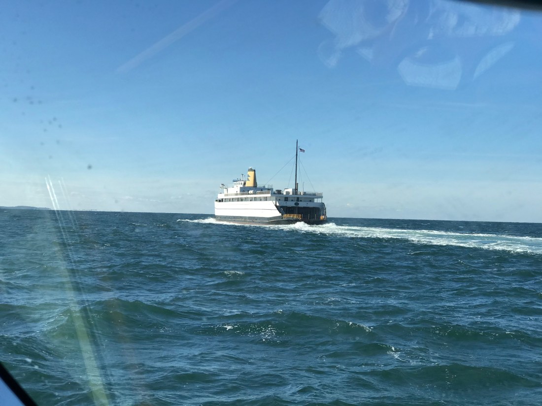
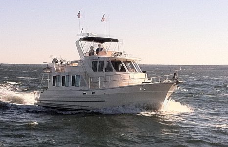
As we passed through the narrow opening for the railroad bridge I felt compelled to snap a pic out the pilothouse door to show how tight the passage feels.

RR Bridge Close
Tight Squeeze to Starboard

The last challenge to get through was the Manasquan inlet which was displaying a phenomenon called “reflected waves”. These are wakes from boats (zipping by us) that are being reflected back off the inlet walls. It’s like having your head above water in a washing machine; there is no rhyme or reason to the direction of the waves.


Reflected Waves 2
Reflected Waves

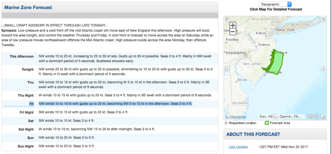
The cruise South was smooth as the period between the ocean swell was long, 10 seconds or so. This made for a gentle 3-4 foot swell. We made our way South down the NJ coast and as we passed Atlantic inlets we dodged the many sport fishing boats that were fishing atop of one another. We listened on the VHF as they stood holding a rod on the back of a boat at the end of November.

When it was not fishermen we were seeing it was a porpoise or two. Here is a short video of what I think was a porpoise but I’m sure one of you will chime in about what species owns the dorsal fin in the video?

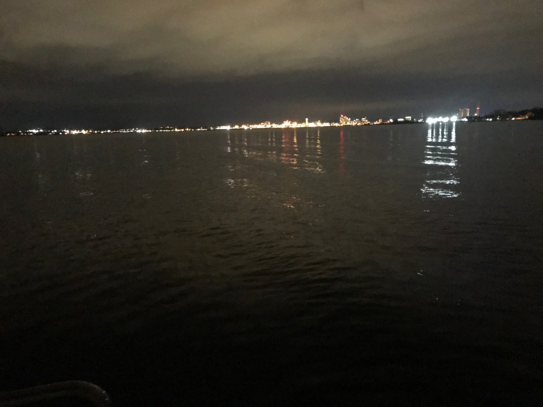
As we approached, Atlantic City could soon be seen in the distance.


Ac
AC Boardwalk

Coming into AC was easy as far as NJ inlets go. With the exception of having to stay clear of the bar that can be understood when you see the breaking waves atop of it.

AC Chart bar

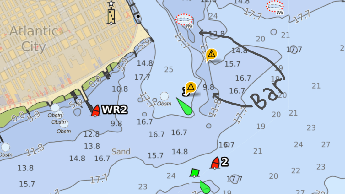
The Absecon Inlet is wide and the ebbing current was only about 1.5 kts against us. Just inside the entrance, we turned to port we left the wind & current behind. As we hailed Farley State Marina and VHF channel 65 as Kelly reminded me to loose my Boston accent and hail “FaRRRley Marina” instead of “Fahlee Marina”. The VHF radio crackled back and they told us to head down the fairway between docks echo and foxtrot and simply pick any slip we liked. We chose a slip close to the Chart House restaurant an 1st mate jumped into action as we backed her down into the slip. Kelly great about waiting till I bring the boat alongside the floating dock before attempting to jump off onto the dock. A miscalculation could lead to winding up in the water between the dock and the 30,000 lb boat as it kisses the dock. This docking however was easy-peezee. The wind was buffeted by the highrise hotel and dockside current was zero.


Simple Life AC
1st Mate Kelly

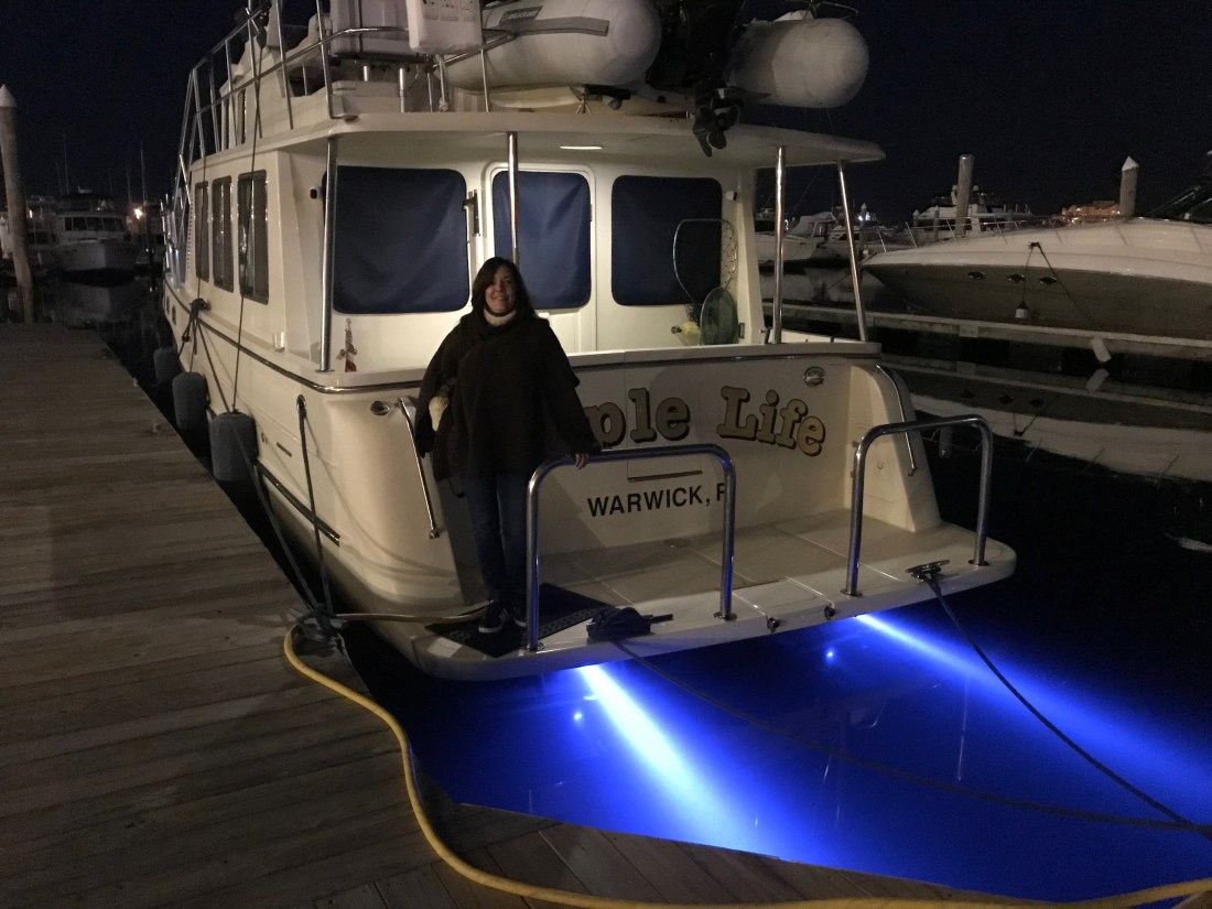
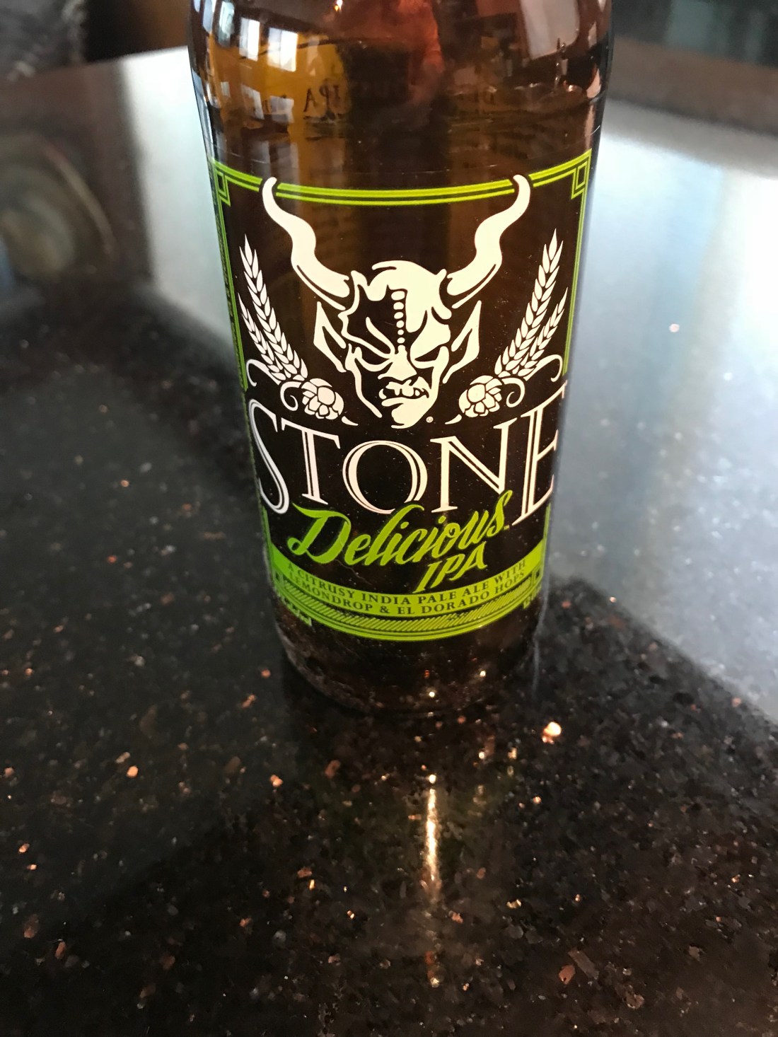
We tied up quickly and raised a toast to AC.  Thankfully the night before I had walked the path from the boat, under the bridge and to the liquor store to buy MORE IPA beer. I learned beer is always a mix of malty barley vs. bitter hops. Like all IPA enthusiasts, the more bitter the better. My IPA of choice is a “West Coast” style IPA that has IBU (International Bitterness Units) between 50-100 and with a citrus pop like grapefruit or mango, etc. Anyway… the liquor store had Stone Brewing’s “Delicious” IPA and I have to say…YUMMMM, what a great IPA.

Stone Delicious IPA
YuMM

As for Atlantic City, well…  we were starving and decided to go to the Chart House.

AC Night 1
Atlantic City Water Club

The Chart House was great. We caught happy hour and it was Capt & margaritas! & filet & fish tacos.

We are planning a sunrise departure again but I convinced Kelly to do a quick Casino tour. Thirty feet into the casino and the cigarette smoke made us change our minds. Tonight we’ll finish happy hour on the boat while I write this blog update and do some chart plotting before bed.

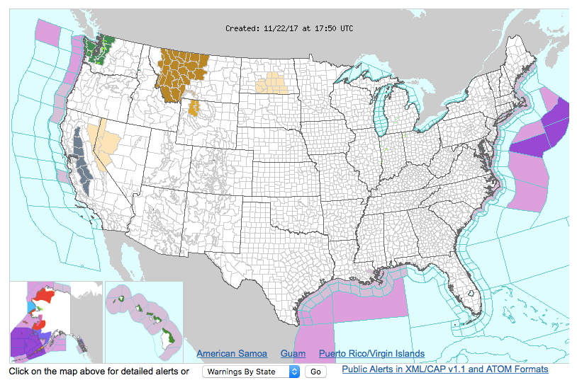
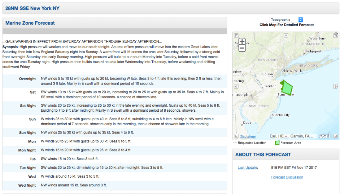
Tonight I will be scouring every maritime website / app for any & all information I can about the Delaware coast. Today’s Captain is digital. It used to be an old guy who looked like the Gorton fisherman but now it’s a millennial with the charting, piloting, tide, moon phases, sunrise times and weather apps on multiple digital devices.

Gorton Fisherman
Gorton vs. Millennials

Though I must admit…a captain is only as good as his/her experience. I have been boating 20+ years and still feel like a noob at times. I imagine that becoming a full-time cruiser will give me the time to read such maritime tomes as Chapman Piloting and Bowditch – The American Practical Navigator.


Every captain make mistakes… which we’ll call wisdom later on 😉

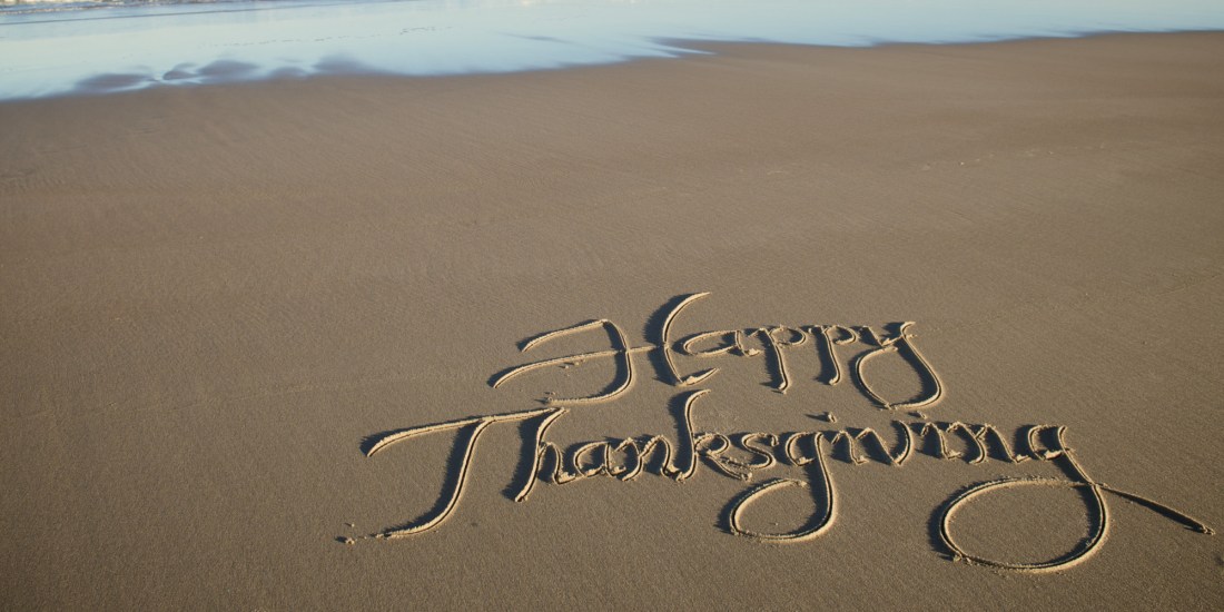
That’s all for now. Kelly & I hope everyone had a great Thanksgiving.

Happy THANKSGIVING-BEACH


Weather Windows for the Poky Little Puppy

At the Marina:

We are still here at Crystal Point Marina in Point Pleasant, NJ. It’s a rainy day – perfect for writing a blog update.

RainyDayPilotHouse
Rainy Day in the Pilothouse

Correction, I think the marina’s official address is in Brick, NJ but it’s right on the town line. While we wait I am catching up on “The Walking Dead” and “Mr. Robot” while Kelly is watching “Blue Bloods”.

TVShows


We are waiting for a weather window to proceed south to the next leg of our journey – Atlantic City, NJ. The NWS Marine Weather Forecast is showing Friday @sunrise to be our best bet.

Forecast
FORECAST FOR COASTAL WATERS FROM MANASQUAN INLET TO LITTLE EGG INLET NJ OUT 20 NM

If you want to feel like you are on the water with your VHF radio tuned to the WX channels (first 5 or so channels on a VHF Marine Radio) check out this live stream of the Tom’s River NWR Station

NOAA Weather Radio Frequencies

162.400 MHz   (WX2)
162.425 MHz   (WX4)
162.450 MHz   (WX5)
162.475 MHz   (WX3)
162.500 MHz   (WX6)
162.525 MHz   (WX7)
162.550 MHz   (WX1)
Channel numbers, e.g. (WX1, WX2) etc. have no special significance but are often designated this way in consumer equipment. Other channel numbering schemes are also prevalent.

I feel like all the other “Snowbirds” have left before us and I am like the main character of the book my mother would read to me, “The Poky Little Puppy”.  She would joke that I was a “lollygagger”. I suppose it’s my right as the last-born.

ThePokyLittlePuppy
Mom’s Bedtime Story

Snowbirds:

Snowbirds go south and there is more than one route to take. If you have a “Blue Water” boat and enjoy open ocean you may simply wait for a weather window and set a rhumb line straight from Newport, RI to Bermuda. This route is what the sailors of the bi-annual Newport to Bermuda sailboat race take. From Bermuda, its due South straight to St. Thomas in the Caribbean.

Bermuda-Rhumbline
Rhumb line from Newport, RI to Bermuda
routes
Caribbean Route Options

This route is only taken by larger sailing vessels and long-range stabilized trawlers such as a “Nordhavn”. Speaking of Nordhavn Yachts… in 2011, I flew down to Jacksonville, FL to purchase a Nordhavn 43. The marine broker met me at the boat which was “priced right” but as soon as I toured the vessel it was clear that she had not been properly maintained. Maybe in the future?

Nordhavn
Nordhavn 43 Raised Pilothouse

While we initially looked at buying a blue water trawler we realized that it did not match the type of cruising that we would be doing. We settled on a long-range trawler that was perfect for the kind of coastal cruising that we do. Coastal cruising means that you generally cruise from one port to the next never exceeding 10-12 hours at the helm. Blue water cruising means 24-7 motion with 3 hours “watches” while the other crew are sleeping in their bunks.  We settled on a North Pacific Yachts 43 (45 LOA) with a raised pilothouse design and many options that we hand selected. I will save the details for an upcoming blog post about the boat itself.

Weather:

When you become a full-time cruiser you start to focus your efforts on learning more about weather. You find yourself spending a lot of time on the NWS (National Weather Service) Marine Weather Forecast website learning about all the information that it can give you. Not just forecasts but real-time observations from ships and weather buoys.

NWS Weather Zones
Map showing the different weather “zones” – use link below for clickable version

http://www.nws.noaa.gov/om/marine/home.htm

from the link above, you can select from a graphical map, the coastal forecast for the “zone” that you are in. The coastal forecasts are broken up into small rectangular sections of coastal waters that are roughly 20 miles on most sides. There is an offshore forecast for fisherman who fish the “Canyons” which are the deep underwater valleys that you see when you look at a bathymetric chart that shows the underwater topology (sea mounts and valleys).

Canyons Block Island
Canyons South of Block Island and Nantucket

There are also inshore forecasts as well that show the weather inside the bays.  I have always had a keen interest in meteorology and understanding weather. I was smitten with weather the very first time a meteorologist came to give a lecture at UMB (Umass/Boston) and I swear every other term I needed to lookup the meaning. More recently, I signed up for a 2-day “Marine Weather Workshop” at the annual Newport RI Boat Show. I imagined that the class was going to talk about how to read the weather by looking at the skies around the boat. I was thrilled when it turned out to be a much more science based talk about wet & dry adiabatic charts and surface pressure charts built from daily weather balloon launches, etc.

The presenter was Lee Chesneau and you can find his Marine weather page here.

I’ll post more about weather as we go and maybe spend some time talking about the many different aspects of understanding weather. For now, my plan is to shelter-in-place (unfortunately, that word has a more recent meaning) and wait for the northerly winds that often follow a cold front.

Old Dogs and New Tricks

Happy Brody Cockpit Grass

I wanted to provide an update on the dogs and the poop situation!  The great news is they have both learned to successfully use the artificial turf!  I guess you can teach old dogs new tricks!  Happy, our 7 year old and Chief Brody, our 6 year old Boston Terriers are now signaling when they need to go out back and do their “business!”  We’ve temporarily called the companionway the “Poop Deck.”

In naval architecture, a poop deck is a deck that forms the roof of a cabin built in the rear, or “aft”, part of the superstructure of a ship.[1]

The name originates from the French word for stern, la poupe, from Latin puppis. Thus the poop deck is technically a stern deck, which in sailing ships was usually elevated as the roof of the stern or “after” cabin, also known as the “poop cabin”. In sailing ships, with the helmsman at the stern, an elevated position was ideal for both navigation and observation of the crew and sails.

I really thought it meant something else but that’s my juvenile humor!  Regardless, the captain is thrilled to leave the dingy safely on the fly bridge and let them do their business on the “Poop Deck!”  Then we’re running around for treats like they are puppies again while congratulating them for going to their designated area!!!  Boy, they have it made!

Gale Winds and Manasquan River Inlet

YCWe awoke while it was still dark. Checked the forecast one last time. Active gale warnings withstanding, we decided that there was a short weather window. A few hours in the early morning to make our passage South down the Jersey shore.

forecast Manasqan
Small Weather Window Early Sat Morning

We left NYC @ Sunrise. I returned our dock key, untied our lines and crept out of our slip before anyone knew we were gone. There was a beautiful sunrise over NYC Harbor.

Liberty Landing Sunrise
Manhattan Skyline @ Sunrise

We quickly headed out of NYC Harbor which was littered with commercial traffic (tugs, barges, tankers, cruise ships, etc).

Tanker NYC
Passing a Tanker Entering NYC Harbor

Under the Verrazano Narrows bridge and out to sea.

Verrazano Narrows Bridge
Passing Under the Verrazano Narrows Bridge

This was Leg 4 of our journey South looked like below

Leg 4
Leg 4 of our Southbound Journey

The sea conditions were great but as early morning gave way to late morning the sea state started to deteriorate a bit as the winds backed around to the South.

We made a steady 9 kts down the coast and arrived @ Manasquan River Inlet just in time for max ebb.

Manasquan River Inlet Current arrival
Max Ebb 11:31AM

Entering an inlet off the Atlantic ocean can be hazardous due to currents, standing waves, shoaling, etc. The best time to enter most inlets is during slack current but max ebb is better than max flood. It’s better to have the current rushing under your bow and pushing you backward than running under your stern and pushing you forward.
Every boater has had that nightmare where the currents are pushing you fatefully towards a narrow or too low bridge! Piloting can get tricky.

manasquan_satellite2
Manasquan River Inlet Satellite

We chose a North Pacific Yachts raised pilot house 43 for many reasons but the one I’ll talk about now was the full keel. North Pacific 43 Pilothouse


A full keel is reassuring when you run the Manasquan River channel that at times almost dragged our keel on the bottom. While offshore boaters would be horrified at the though of “running aground”, in the ICW it’s simply a fact of life. Dredging the channels to keep a controlled depth of 6′ is costly and difficult to keep up with. MV Simple Life has a draft of
4’6″ dry but closer to 5′ loaded the way we are. If you must run aground, do it with a full keel and skeg like ours to protect the running gear (propeller and rudder) from damage.
That said when the current is pushing you the full keel can get caught in the current and cause the boat to veer to port & starboard. Our Raymarine auto pilot has a “response” setting that when set to “9” will turn the rudder as fast as it can to keep the bow pointed straight ahead. Switching to auto pilot to standby (off) in favor of hand steering can be even more harrowing. As we passed through the Manasquan River Railroad bridge @ max ebb we were forced to throttle up to avoid an untimely bow swing that could bring the boat close to the bridge abutments.

Manasquan River Railroad Bridge2
Manasquan River Railroad Bridge

While the river is full of passing traffic and shallows we made it to Crystal Point Marina and Dockmaster Todd caught a line for us as we pulled into our slip.

Crystal Point Marina 1
MV Simple life Slipped @ Crystal Point Marina

After a short walk under a bridge we arrived at River Rock Bar in Brick, NJ. River Rock Bar in Brick, NJ

Bridge Fall
Kelly joking that she would likely fall in the cold water

Right away we spotted the Captain Morgan behind the bar and knew we had landed in the right place 😉

River Rock Marina Bar 2
Kelly’s Down with the Captain

There was a local artist playing acoustic guitar in the corner and they had Sculpin IPA on tap! We had a great dinner & drinks and made it back under the bridge to retire for the night.

Shortest Ferry Ride Ever

We are still here at Liberty Landing Marina in Jersey City, NJ.
It’s a beautiful marina in the shadow of Lady Liberty. From the boat you can see the NYC skyline of lower Manhattan.

Freedom Tower
View of the Freedom Tower from the Boat

Kelly stayed behind while I took an Uber to the market to purchase turkey, cranberry sauce and stuffing for Thanksgiving. Much to my chagrin the market that the marina recommended was an Asian market and it seems Thanksgiving was nowhere to be found. I must have spent 10 minutes staring at the store’s spice display rack trying to find Cumin, Sage and Rosemary.

Asian Spice
Where is the Sage?

After coming home to the boat defeated we decided that we’d go out in Jersey City for a drink or two. The marina manager told us about a great place called White Star Bar and it was just a short ferry ride away. So off we ran to catch the ferry. We no sooner boarded the ferry and it pulled away from the dock. We heard the loud bow thruster spin us around 180 degrees. Suddenly the ferry lurched forward and docked on the other side of the channel 50 feet away. We were told to pay our $2 & exit. It was then that we knew our NYC water taxi experience had been ripped from us.

littlelady-photo-homepage
Picture Shows How Far the ferry Ride Was

We hurried down the cold street in wearing the warmest clothes we have aboard. There are no ski jackets or gloves aboard Simple Life. The bar was warm and we enjoyed dinner and drinks. Though they got Kelly’s Captain/Diet Pepsi/NFL (No Freaking Lime) wrong TWICE.  Once it was scotch & Pepsi and the other some vanilla liquor & Pepsi. The waitress could not explain it but we were just happy to be in off the cold street.

As for getting further South… The active gale warning has given way to a gale watch for the waters off Manasquam River Inlet.

forecast
Forecast for waters 25 NM South of NYC

With this in mind we’ll be checking the forecast tomorrow as well as the real-time buoy data. Fingers crossed that we can again make our way South to warmer weather.

WhiteStar
White Star Pub

The Winds of November Came Early

We left Morris Cove Anchorage at 5:30AM. It was dark, very dark. We had woken up around 4 AM.  I had pulled up the anchor, spun the boat around and MV Simple Life started going bow up, bow down.  I thought… the winds were not supposed to increase until Thursday afternoon (per the NWS – National Weather Service Gale Warning).  In the words of Gordon Lightfoot, “The winds of November came early”. We used our searchlight to spot the buoys on our way out of New Haven Harbor’s channel.

Jay Marques, you asked for video in addition to photos so these links are for you.

Leaving Morris Cove Anchorage – Low Light

Sorry, that video is the lightest of the three I recorded. With the winds out of the south it meant that the 16 mile fetch of water from the NY side to the CT side was making the CT side of the sound lumpy. I heard the VHF radio crackle alive with a tugboat captain complaining that the winds had been honking all night long. Here is a video after the sun came up and we were slogging our way South across Long Island Sound from New Haven, CT to Long Island’s Huntington Bay area.

Slogging our way South Across LIS

When Kelly & I first met I had a 1998 35′ Beneteau 352 Oceanis ,S/V Saltyhacker, (I’ll upload a pic of SV Saltyhacker later) that had only a dodger (the see-thru plastic and canvas that covers the companionway opening into the boat. We sold her to a great couple from Canada and bought a 2001 45′ Hunter 450 Center Cockpit. (I’ll upload a pick of SV Skull & Swords later, promise). The Hunter was owned by friends of ours who were living aboard her in Exuma Key, Bahamas and ever since we’ve said someday we’ll spend a few months on anchor there.  We loved the Hunter for it’s liveaboardness;  for it’s fully enclosed cockpit and interior space but Kelly would often quip that unless we are sitting in the outside cockpit you don’t get to enjoy the scenery. So we decided to buy a new boat that met our mutual demands. Kelly wanted a boat that was easier to move around in (Kelly has a habit of twisting / breaking ankles when underway or simply aboard). After spending 10 hour days at the helm outside and often cold, I was fancy on an enclosed pilot house. In the video above you will just have to imagine as the cold sea spray is hitting the pilothouse windows that I’m sipping my coffee in my PJs at the helm (smile).

Todays trip looked something like this..

Leg3

As you approach the East-end of LIS you enter into the East River that takes you from the Bronx to the Statue of Liberty. As many times as we have made this trip we still find ourselves taking pictures of the scenery as we go down the river. Below are some of the photos we snapped along the way…

Prison
After going by Riker’s Island Jail you pass the Vernon C. Bain Correctional Center. This is a 47,000-ton, five-story barge with 800 beds spread over 16 “dormitories” and 100 proper jail cells. At 625 feet in length and 125 feet wide, it also holds a gym, a basketball court, a library, three chapels, a rooftop exercise area
Broklyn Bridge
Brooklyn Bridge – built in 1870
Helicopter
Whirly Birds buzz the East River and land just North of Battery March
Water Taxi
Water Taxis are everywhere and as a captain you must be alert and ready to dodge them

We timed our trip down the East River to make sure we caught favorable currents that saved us easily an hour during our transit. After arriving in NYC harbor we hailed Liberty Landing Marina and requested our slip assignment. The wind was gusting but an attendant met us at the slip and caught the lines that 1st Mate Kelly threw to him.

LibertyLandingMarina
MV Simple Life tied off at Liberty Landing Marina

Tomorrow we’ll take the water taxi and find somewhere to grab a IPA & Capt-Pepsi -NFL (No-Flipping-Lime) & a bite. Tonight we’ll just relax 😉

New Haven CT & Gale Warnings

PtJudithSunrise2
Pt. Judith, RI – Harbor of Refuge @ Sunrise

We departed Harbor of Refuge @ sunrise this morning. We felt a sense of urgency due to a gale warning (gusts to 35 knots) which is in effect beginning Thursday afternoon. The cause is two separate low pressures that are having a complex interaction West of our current location.


GaleWatch
NWS Gale Warning NYC

Below is a rough depiction of our second leg of our journey South. Our course took us from Pt. Judith’s Harbor of Refuge, outside Fishers Island to Morris Cove Anchorage in New Haven, CT.

Leg2
Leg #2 of #Run2Sun2017

Today’s cruise was long but relaxing. The sun was streaming in windows making the pilothouse warm as we made way @ 8.5kts West down Long Island Sound.

We saw only a few sport fishing boats and had to dodge the occasional ferry crossing our path.

Ferry
Ferry Crossing Long Island Sound

Every captain knows it’s better to take the stern of larger vessels rather than attempt to cross her bow. Ten or so years ago I had a close with a US battleship @3AM in pea-soup fog in Norfolk, Virginia’s entrance channel. Our close call was not a crossing issue but instead the warship was inbound in the channel and was not basting fog signals. After they suddenly appeared on radar from under the Chesapeake Bay bridge/tunnel we quickly blasted our horn. When they responded with their horn I swear my ears blew out. The warship quickly passed us not 100′ off our port beam (frightening in the fog). A shout out to that day’s offshore crew – Eddie, Sean and Amy who can attest to this poop-your-pants experience.

warship
Stay Clear of Warships
Kahlenberg Air Horns

After this harrowing experience, we installed Kahlenberg triple trumpet air horns as well as AIS (Automatic Identification System) in Simple Life.

AIS
How AIS Works


AIS equipped vessels can each view on their chart plotter the other’s vessel name, size, speed, heading and course-magnetic. AIS works by sending & receiving digital data over VHF channel 70 so that two ships can see each other on their chartplotter screens even without radar. I  have also learned to that programming your marine VHF with a MMSI # make ship2ship communications easier when it’s dark or foggy.


Hells Gate
Hell’s Gate Current Table

Tomorrow our plan is to push west down the coast of Connecticut with hopes of catching the 4.8kt ebb tide through the East River (where the dead bodies are found on many Law & Order episodes). Kelly & I always enjoy the East River’s Hell’s Gate (where the Harlem River meets the East River). Hell’s Gate is infamous due to the strong currents that mix in the way a washing machine mixes water.

We hope to make the Liberty Island Marina in Jersey City by sunset on Thursday. We’ll spend two nights at the marina while we wait for more favorable weather for our trip down the Jersey coast. Until then we’ll just sit on anchor watching the lights from New Haven.

New Haven at Night
Lights of New Haven as seen from Morris Cove


Point Judith & Waiting on Poop

Our departure was later than expected but Steve Harding and Sean Flynn helped us get out before the sun set. Thank you both.

Before leaving the marina we stopped to fill up the water tanks with 450 gallons of water. The water was turned off on our dock due to the recent freezing temps and the next fill will have to be further South.

IMG_2767
Taking on Water Before Departing Warwick, RI

The seas were fine in the bay, not bad (for mid-November) after taking on 350 gallons of diesel @ Wickford Cove, RI . We proceeded to run into the darkness until anchoring in Pt Judith’s Harbor of Refuge. The dogs don’t like the swell but are happy now that they are on anchor. The only issue we have is PooP.

Poop2
We prefer the beach for pooping

We made the decision that the dogs will do “their business” on the artificial grass we placed in the cockpit. This saves me from making beach runs every morning and night to let the dogs have their time ashore. While I usually enjoy these dinghy rides… it is November. One of the best features we added to the boat was diesel-fired forced-hot-air heating that is ducted throughout the boat. The ride here was warm and dry in the raised pilothouse. Our plan is to celebrate our first night on anchor and awake with the sunrise & get underway. We are the only boat in the anchorage and with the moon being a waning crescent and overcast skies the anchorage is dark.

Pt Judith2
Dark Anchorage lit only by the lights from shore

Tomorrow, we want to put as much water under the keel as we can.
Getting South to warmer weather is our priority. We really appreciate all the great comments from our friends & family and hope you continue to enjoy our blog. We will do our best to post as often as we can.

IMG_9396
Steaming Through Narragansett Bay

Every Journey Begins With a First Step

So we finally did it! What you say? Our goal of living aboard a sailboat and sailing the world. Ok, It’s not a sailboat and it’s not the world but only the East coast. But we DID IT! Tonight we finished moving everything out of the house and onto the boat. Yes, the boat is now full of our stuff. Your whole life is about collecting stuff. I never realized how true that is till now. Stuff that you thought would make your short stay on this Earth more meaningful but when it’s gone… you feel free. Your possessions weigh you down. I spent 3 months Craigslisting most of what I collected over my life. I feel FREE. We chose the name “Simple Life”.  “Sell everything you own except the boat and have the simple life”. I suppose it’s a philosophical statement about focusing more on the experience of life and less on the materialistic aspects. I hope that this odyssey is all that we’d imagined.

95Sheldonville
Casa Lonergan North
cropped-img_2037.jpg
Casa Lonergan South