It felt wonderful waking up after a good five hours or so of sleep. The sun was peaking above the horizon and I realize that my life while underway is a cycle of sunrises and sunsets. It’s enjoyable to contemplate the start of each day.
Sunrise over Chincoteague Island
Warmer as You Go
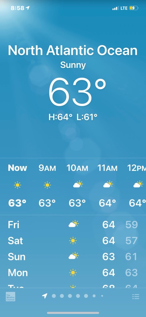
It’s almost 9AM now and as I cruise south down the Atlantic, I’m happy that my nights & days are getting warmer.
Back home in Foxboro the temp hit 70 but the nights are colder due to not being on the water
Flat Ocean is a Happy Ocean
My anchorage was flat water but even now out in the unprotected Atlantic I find it almost as flat.
Flat ocean makes for a peaceful cruise
Italian Yachts
I’m not the only one out here enjoying the flat sea. This sexy Azimut passed me like I was standing still.
I like the unbroken salon window look
Flat like a Bedsheet
As I cruise the sea gets ridiculously flat. I stop to make a video of just how calm it is.
The Atlantic coast of Virginia is looking the pool water
Fisherman’s Island
I’m now rounding Fisherman’s Island on the southern tip of Cape Charles. I glance up at my iPad to see my expected ETA is slipping. I’m fighting the tide which is exiting Chesapeake Channel.
Cape Charles, VA
I care about my ETA because I’d like to get on anchor before it’s dark.
Last Light is 5:30PM
I realize that in order to make last light I need to shorten my route or speed up. I decide to “cut the corner” a bit. Cutting the corner can get you in trouble with running aground if you are not careful as depths around inlets are often different than your charts. I cut the corner with a close eye on the trending depths displayed on my instruments.
Careful rounding too close to Fisherman’s Island. It’s low tide and there is a 3.9′ sounding
As I’m rounding the corner, Flipper & friends pay me a visit.
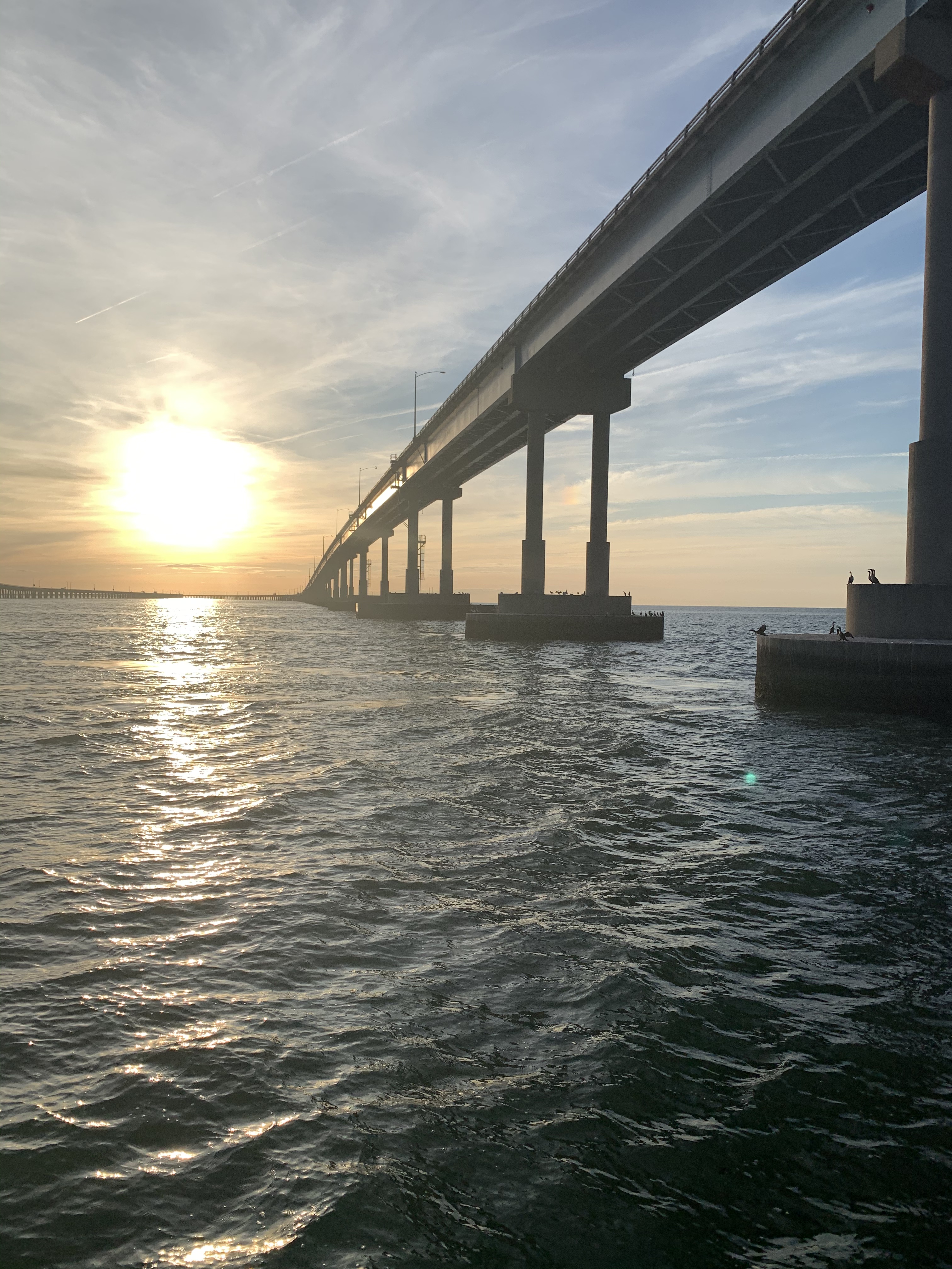
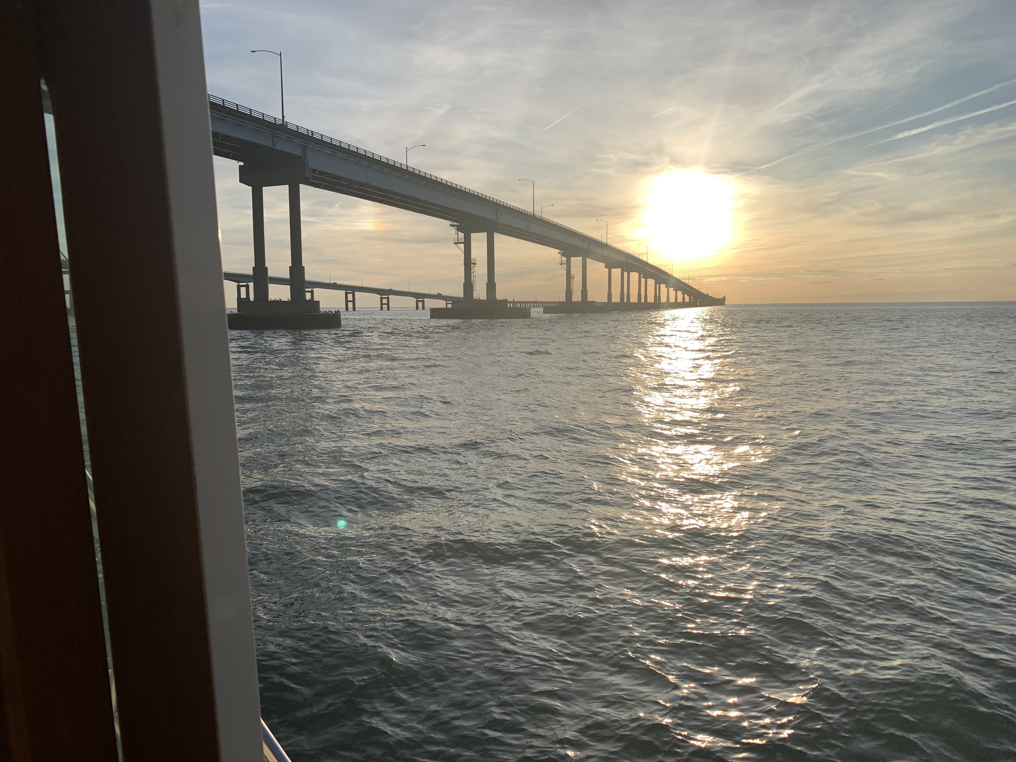
I no sooner round the corner and I’m passing under The Chesapeake Bay Bridge-Tunnel. It is a four-lane 20-mile-long vehicular toll crossing that provides direct access from Southeastern Virginia to the Delmarva Peninsula (Delaware plus the Maryland and Virginia Eastern Shore).
Chesapeake Bay Bridge-Tunnel
Passing under the bridges you realize how much work went into their construction.
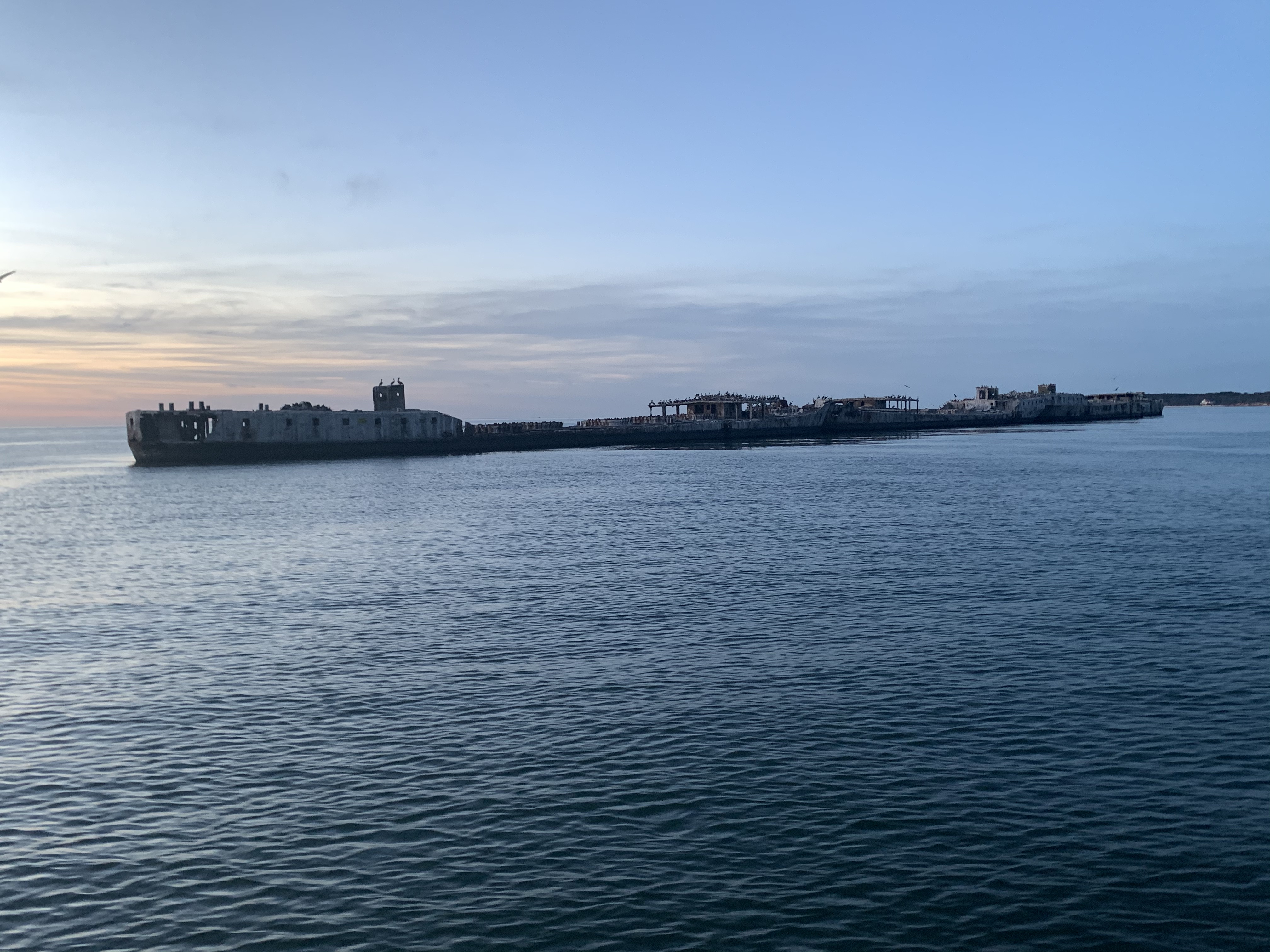
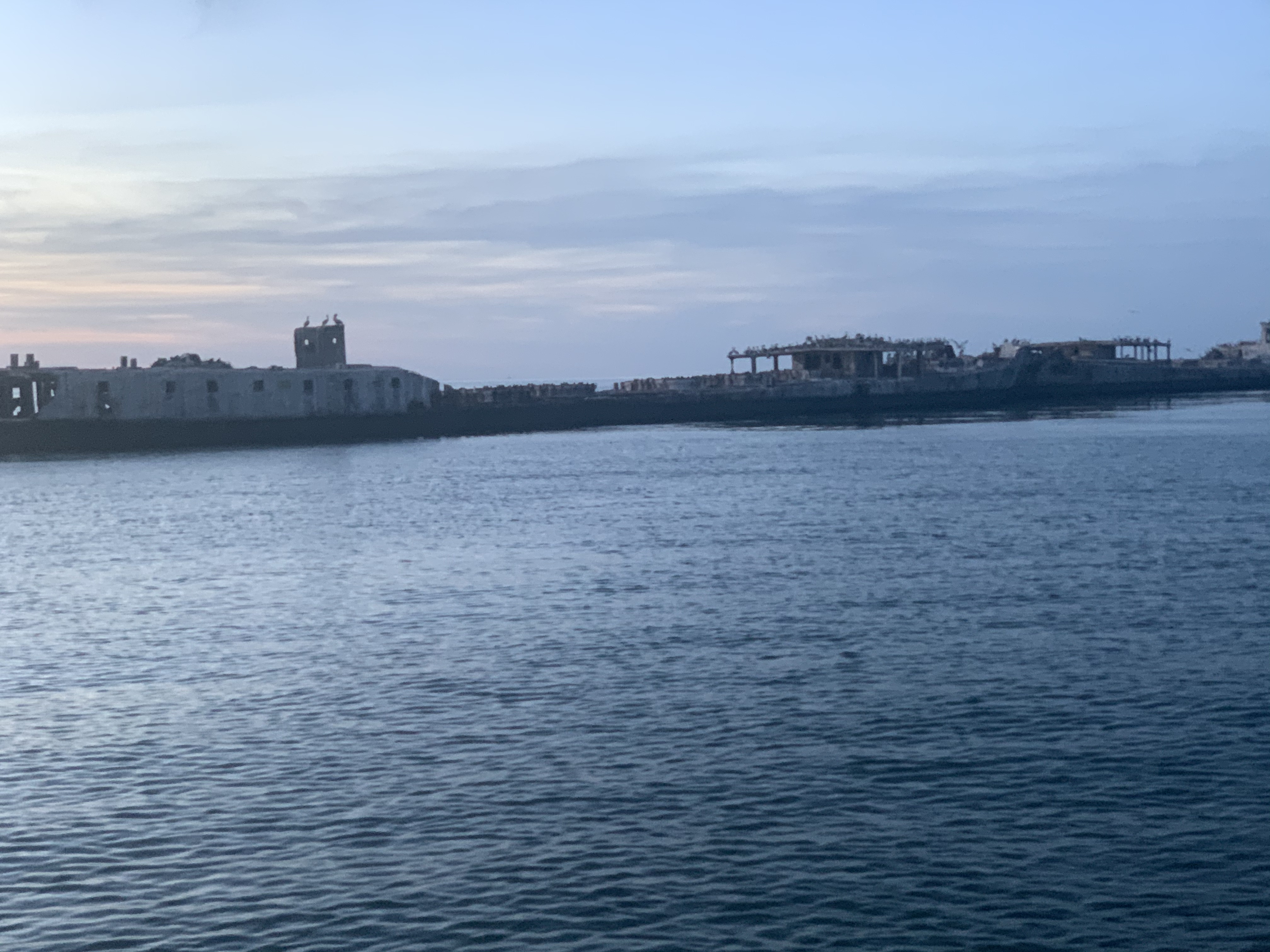
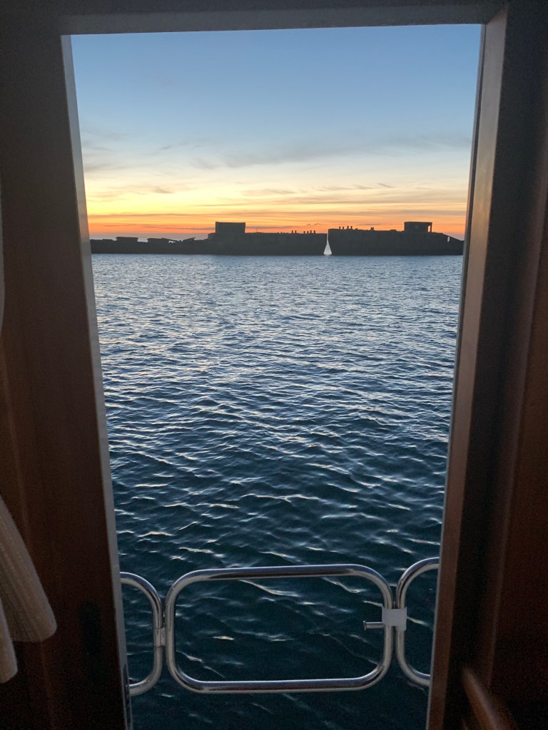
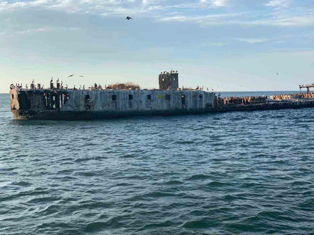
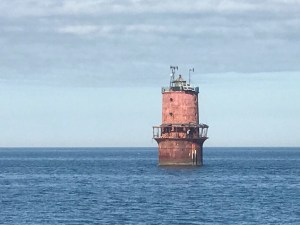
Concrete Ships Anchorage
The sun has set but my cutting the corner has resulting in Simple Life’s arrival at the Concrete Ships Anchorage before dark. I snap a few pictures of the ships before I lose last light.
As I cruise past, a USCG patrol boat is moving slowly alongside the concrete ships and shining their spotlight into the openings of the ships. I think to myself … “Are people living inside the ships?” Why else would they be so interested in looking inside?
Anchored Fast
I quickly chose a good anchor spot by studying the depths and drop anchor.
There is no wind at all so I backdown at a full 830 RPMs to set the anchor.
Cummins SmartCraft Display shows me my RPM Digitally
A check of my GPS SOG (Speed Over Ground) shows the anchor is not budging.
GPS SOG = Zero
I snap a quick photo of the sunset over the concrete ships and settle in for the night.
We departed Port Washington and perfectly timed our arrival to the east end of the East River. We had a fair current giving us a strong push on our stern all the way through the East River and into NYC Harbor.
East River
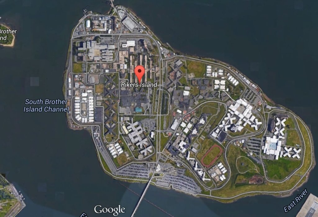
Once in the East River you come upon Laguardia airport and Rikers Island.
A wee bit further down the East River and you come to an infamous location known as Hell’s Gate. This is where the Harlem River dumps into the East River. Our planning placed us here at max ebb current because it’s a great feeling being pushed in such a strong current.
Buddy was at the helm calmly making helm corrections as quickly as possible to keep the pointy end of the boat pointing in the right direction.
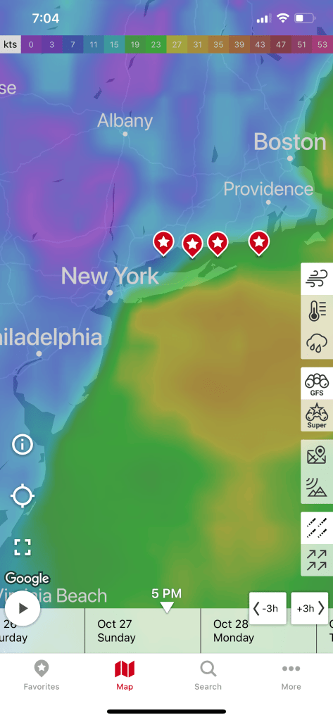
We had planned on spending a couple days in NYC harbor and visiting Manhattan but our weather heading down the NJ coast looked great for the next 38 hours. We had a quick discussion at the helm and decided that we would go offshore. Stopping in NYC would have meant being trapped for the foreseeable forecast.
Sunday 4-6′ Seas
Need to be South of NYC by Sunday
Offshore Voyage to Norfolk, VA
Going offshore to Norfolk would require a helm watch schedule. We like to call it a port & starboard watch meaning that there would be two teams. Team 1 = Buddy & Renee. Team 2 = Marty. When you’re on “helm watch” the other team is relieved of any responsibilities other than to rest up for when your watch starts.
Night watches means keeping an eye out the pilothouse windows for any lights. The moons phase was only a sliver of a crescent and it did not rise till 4AM. We chose a route between 2-3 NM off the coast and that allowed us to see the twinkling lights of shore as we made way south.
For those uninitiated in night watches you will have to become comfortable with staring intently at your radar screen while you push into the blackness. Looking forward out the pilothouse windows all you see is black and the few instrument lights that reflect off the inside of the glass. You’ll need to determine if any of those red, green or white lights are coming from a boat or a buoy. If the light blinks, it’s a buoy. If it’s solid, it’s a boat.
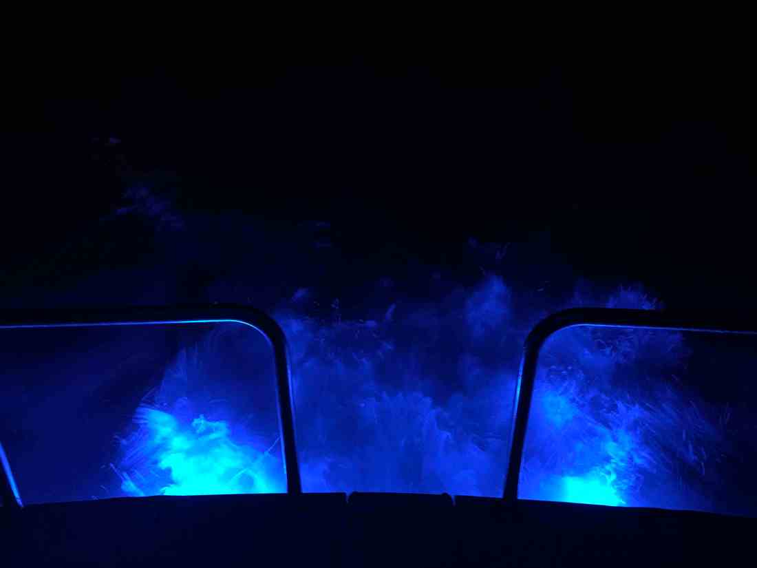
One night I come off watch and lit the underwater lights so I could stand on the stern as the propeller wash boils up from below as the lights of shore pass.
Here is a short video of a boat passing on our starboard side. You can clearly see the other vessel’s red-portside-light as well as it’s white-steaming light. When I zoom in the camera was able to pickup the white water wake in their stern light.
When I left my home port in Warwick, RI, a few fellow boaters, friends were also making the trip south for the winter. MV Ship Happens, a large sport-fishing boat, was heading south and we had been communicating thinking we’d cross paths eventually. I received a photo via text from Capt. Dan and to my surprise it was of MV Simple Life as they zoomed past us. Although MV Ship Happens left port days after us, she has a much faster cruise and eventually overtook us.
Capt. Dan snapped this pic of us on the way past us
During the day we were graced with the presence of whales. I captured a short video of a whale coming to the surface off our starboard side.
Whales off the Jersey Coast
While we were off the coast, our VHF crackled to life with the USCG issuing a securite broadcast about an overdue 43′ Benneteau sailing vessel out of Jamestown, RI called the “Carol K”. They had left before us and were somewhere along the coast with us. We attempted to hail the Carol K but got no response. We hoped that they would be found safe and several days later they were found 100 miles of Cape Henry, VA.
The trip down the busy channel into Norfolk, VA is best done in the daylight. I could tell you a story about nearly getting run over by a warship a few years back but that story is best told over a few beers. 😉
We searched our Aqua Maps charting app for an Active Captain anchorage and found one called “Concrete Ships”. The wind was out of the east but the forecast predicted the wind would clock around to the south and strengthen. This particular anchorage offered the best lee from the wind within the distance we were willing to travel.
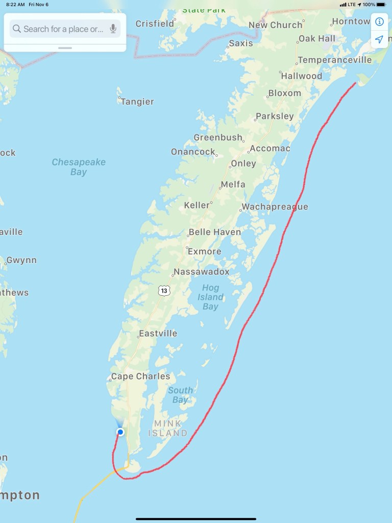
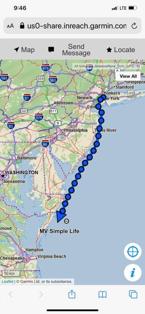
My website/blog has a button that you can click to see the real-time location of MV Simple Life. Here are some pics of that my Garmin InReach Satellite communications device makes available to you.
Working our way down the East Coast
Arriving at the Concrete Ships Anchorage
Days past, I have made the trip south from Cape May, NJ to Norfolk, VA by going outside along the coast before. Those times, I had chosen to anchor nightly along the coast. There are few decent anchorages along this stretch of coast. One anchorage I have used before was inside the Great Machipongo Inlet. I recall how tricky getting through the shifting shoals dotting the inlet was. As we passed, I could not help but notice that the latest update of the NOAA charts shows a similar sized vessel to MV Simple Life wrecked on those same shoals. (Me thinks…) I’m happy I bailed on my inlet entry that stormy night.
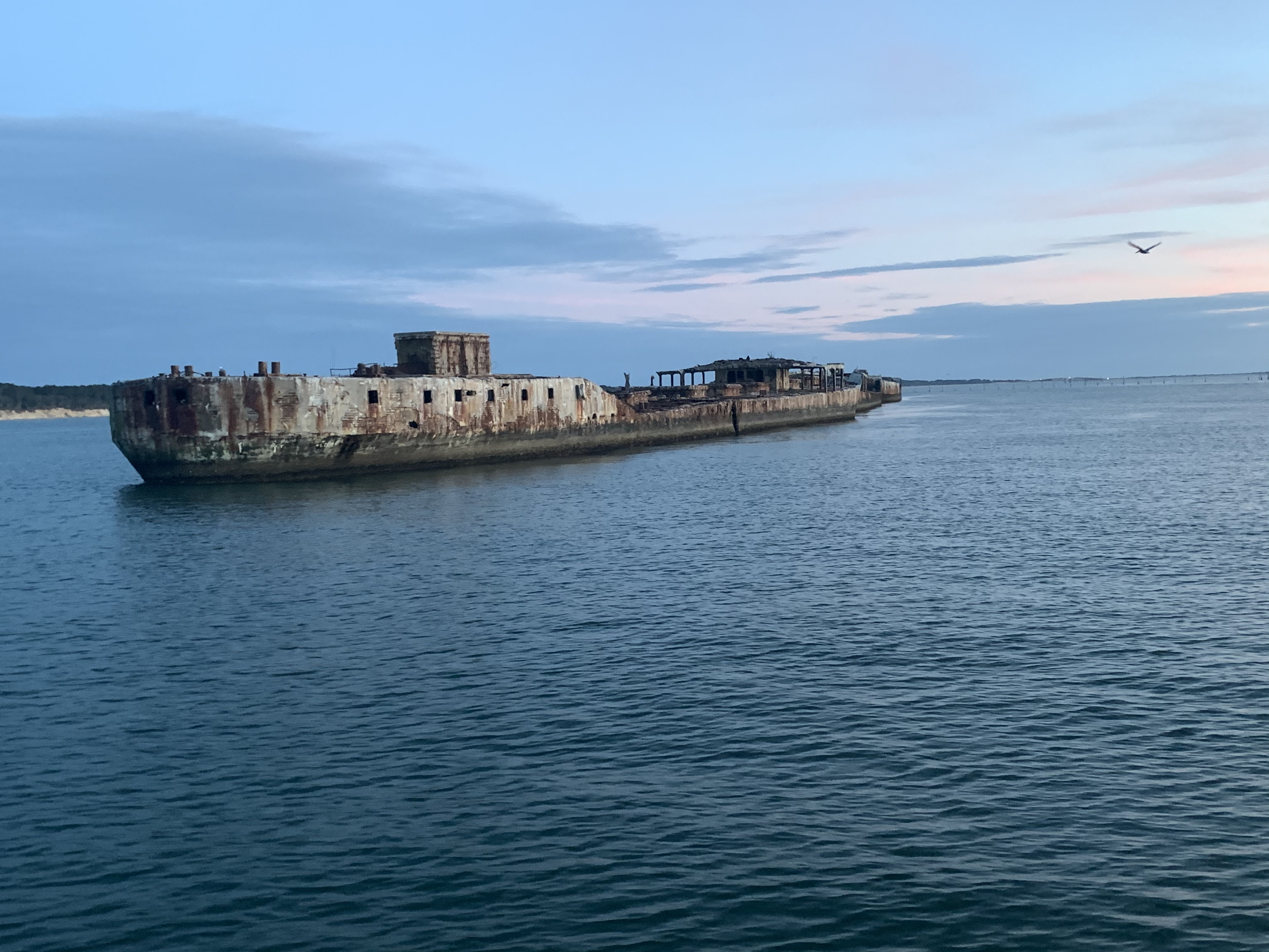
Ghost Ships
When it comes to ship building there are many hull materials to select from. One such material/method is ferrocement construction. It’s a cheap way to build a hull/boat but has fallen out of favor with the advent of materials such as FRP (Fiberglass Reinforced Plastic).
We had arrived at our anchorage with plenty daylight left. We shot some video and snapped a few pics of the ships as we arrived.
Standing on the bow at night in the breeze we were flanked by ghost ships with their ghostly pale white shapes faintly materializing though the inky black of night.
Route from The Great Machipongo Inlet to Top Rack Marina, Chesapeake, VA
Well we woke up early and left The Great Machipongo Inlet. The dolphins once again escorted us out and I turned South with the sun streaming in the port side pilothouse windows so hard I had to close the curtains and use the radar alone to tell what was on that side of the boat.
The sea was as flat as a model’s tummy so I lowered the RPMs on the diesel to get 2 MPG rather than 1 MPG. Simply by slowing the boat 1.3 knots we double our fuel efficiency! Don’t you wish that were the case for your car?
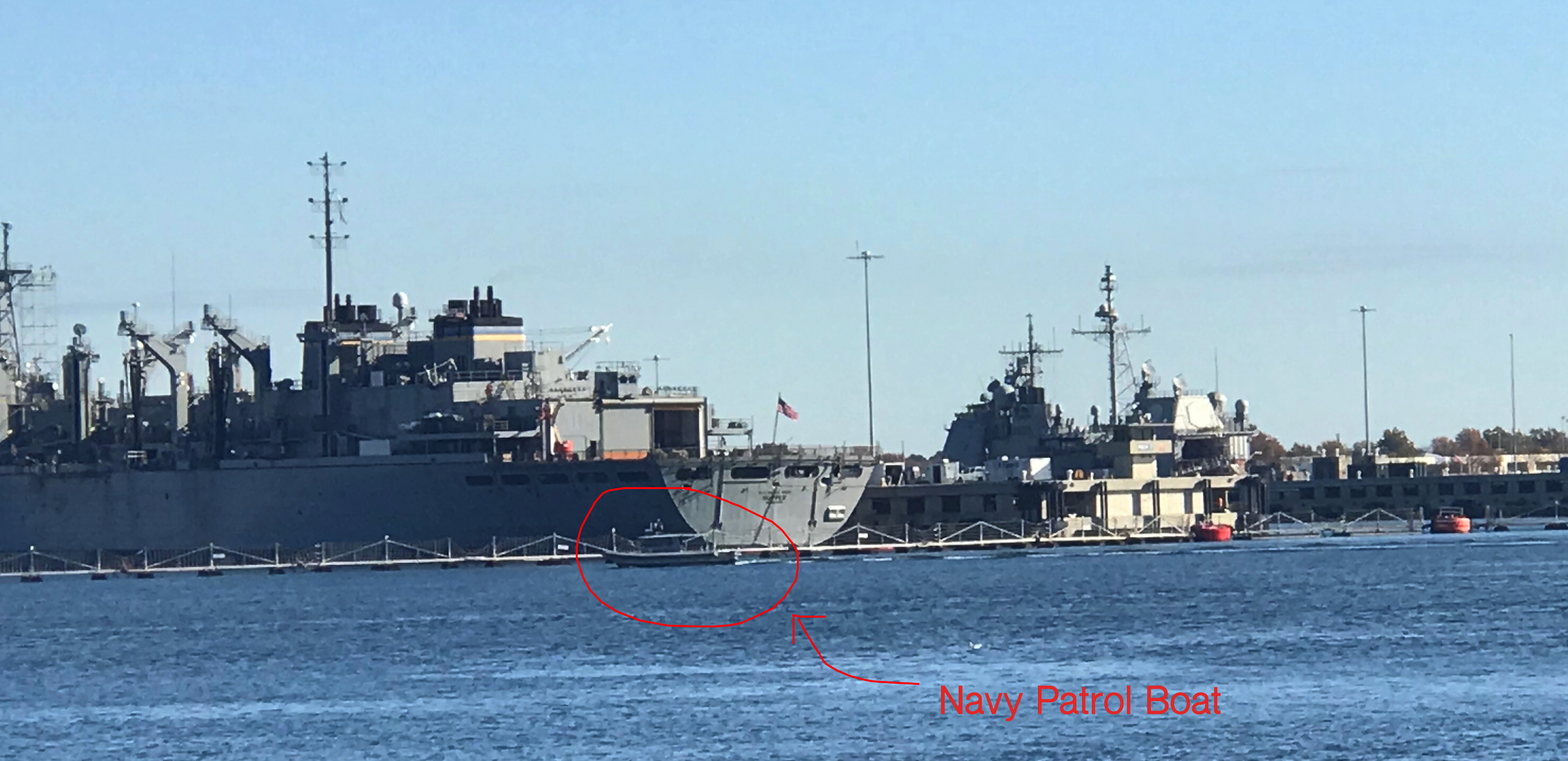
You can see the barrier fence that they stretch across the opening and that fence line is protected by a Navy Patrol boat with a machine gun on the bow.
A local news story revealed just a few months ago there were six bomb threats called in to the naval station and you can call NCIS if you know anything. I wonder if you can call and ask for “Leroy Jethro Gibbs” or “Tony DiNozzo”?
USS Leyte Gulf (CG-55) – Ticonderoga-Class Guided Missile Cruiser
USS San Jacinto (CG-56) – Ticonderoga-Class Cruiser
MH-53E Sea Dragon Buzzed Us From Overhead
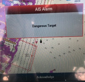
AIS (Automated Information System) Alarm on my Chartplotter warning of other AIS traffic that has a narrow CPA (Closest Point of Approach)
As the Sea Dragon buzzed us my navigation system popped up forcing me to ACKNOWLEDGE the fact that there was a “Dangerous Target” nearby. The Helicopter was not alone and there were a pair of jets making that deafening sound that seems to well up from a simple background rumble to a roar.
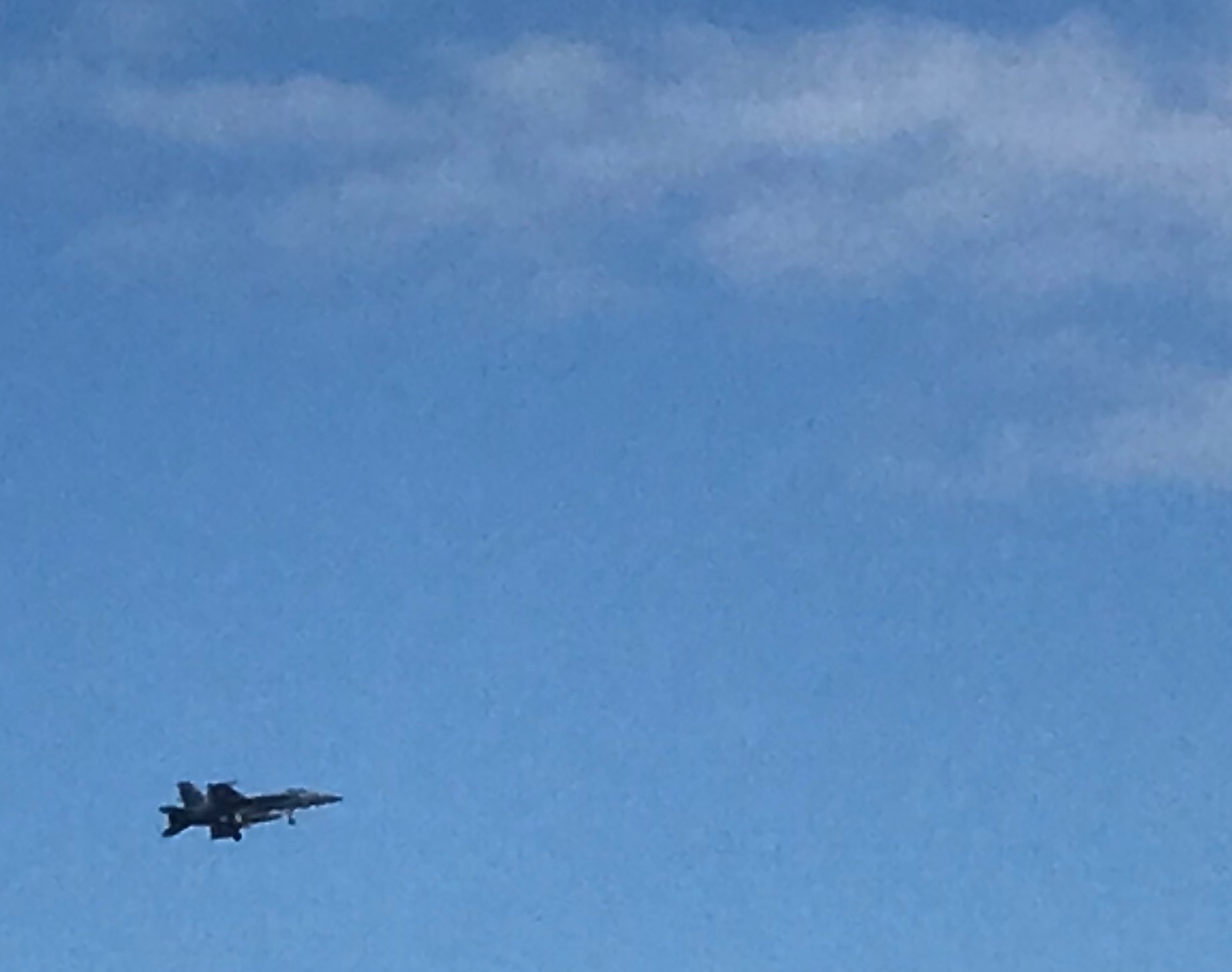
McDonnell Douglas F/A-18 Hornet – Screeching Across the Sky
I believe that is a McDonnell Douglas F/A-18 Hornet? Maybe one of our military aficionados will comment if I got any of this incorrect?
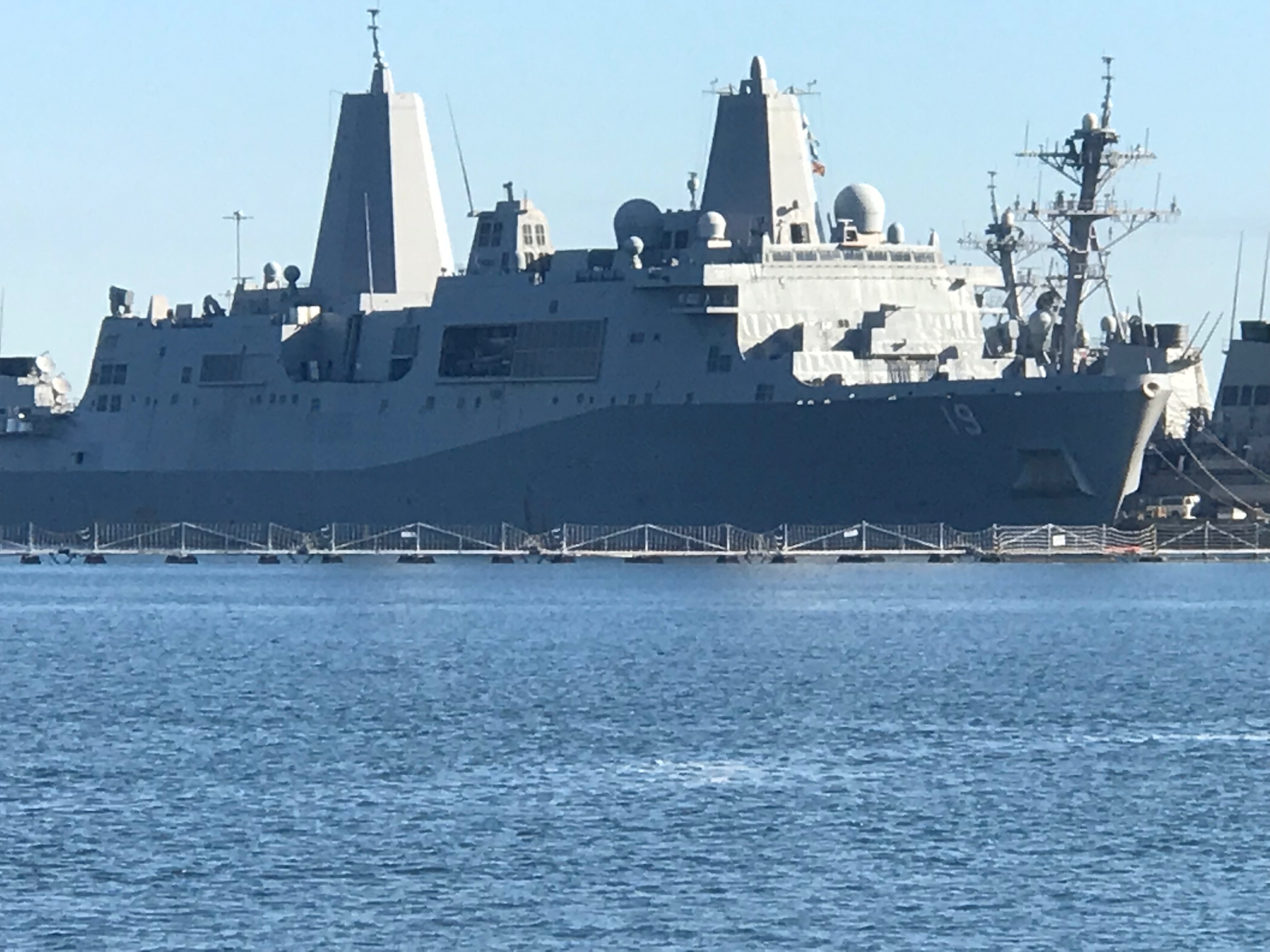
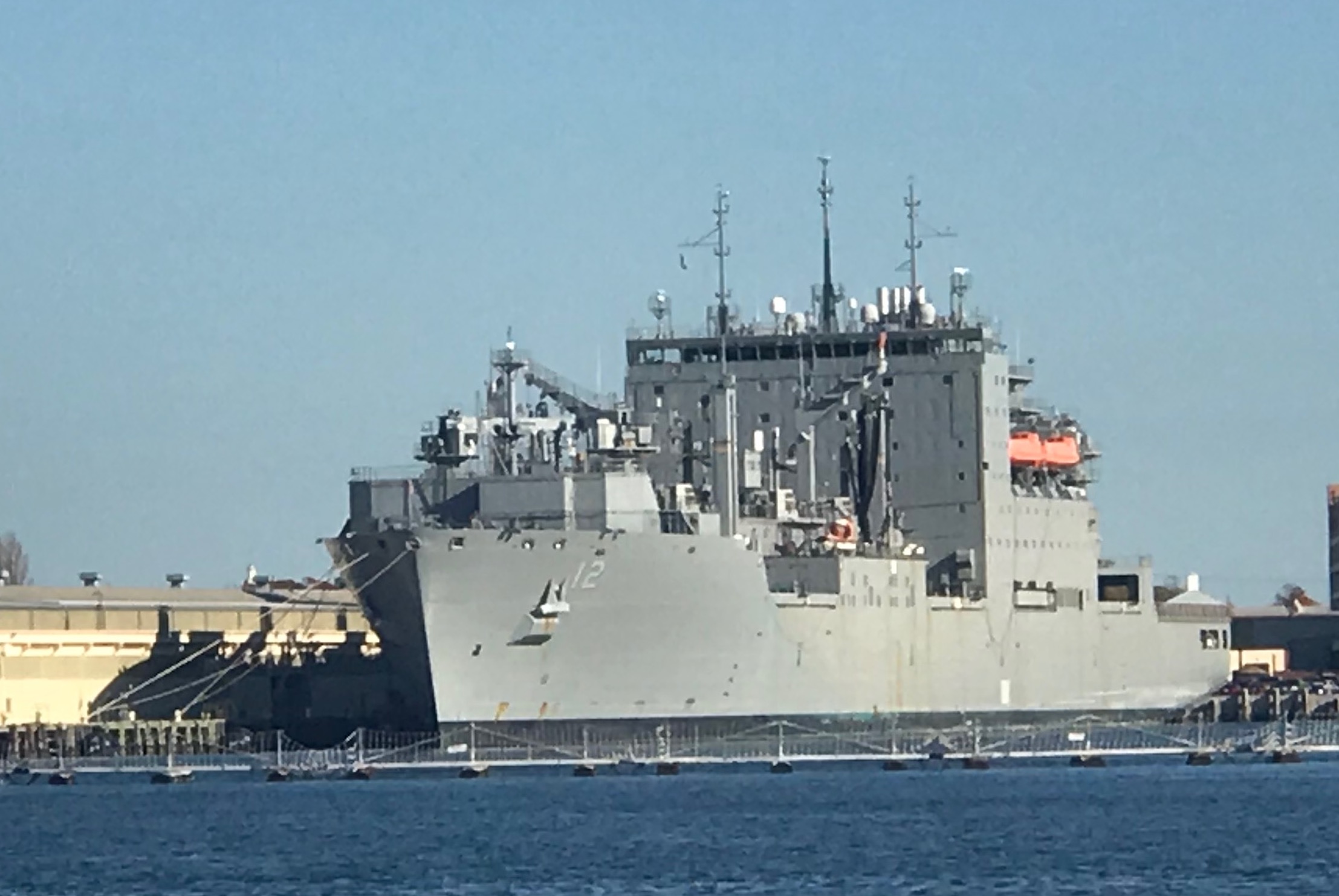
Norfolk Virginia Dry Dock
I Believe this is the Stern of a Amphibious Transport Ship?
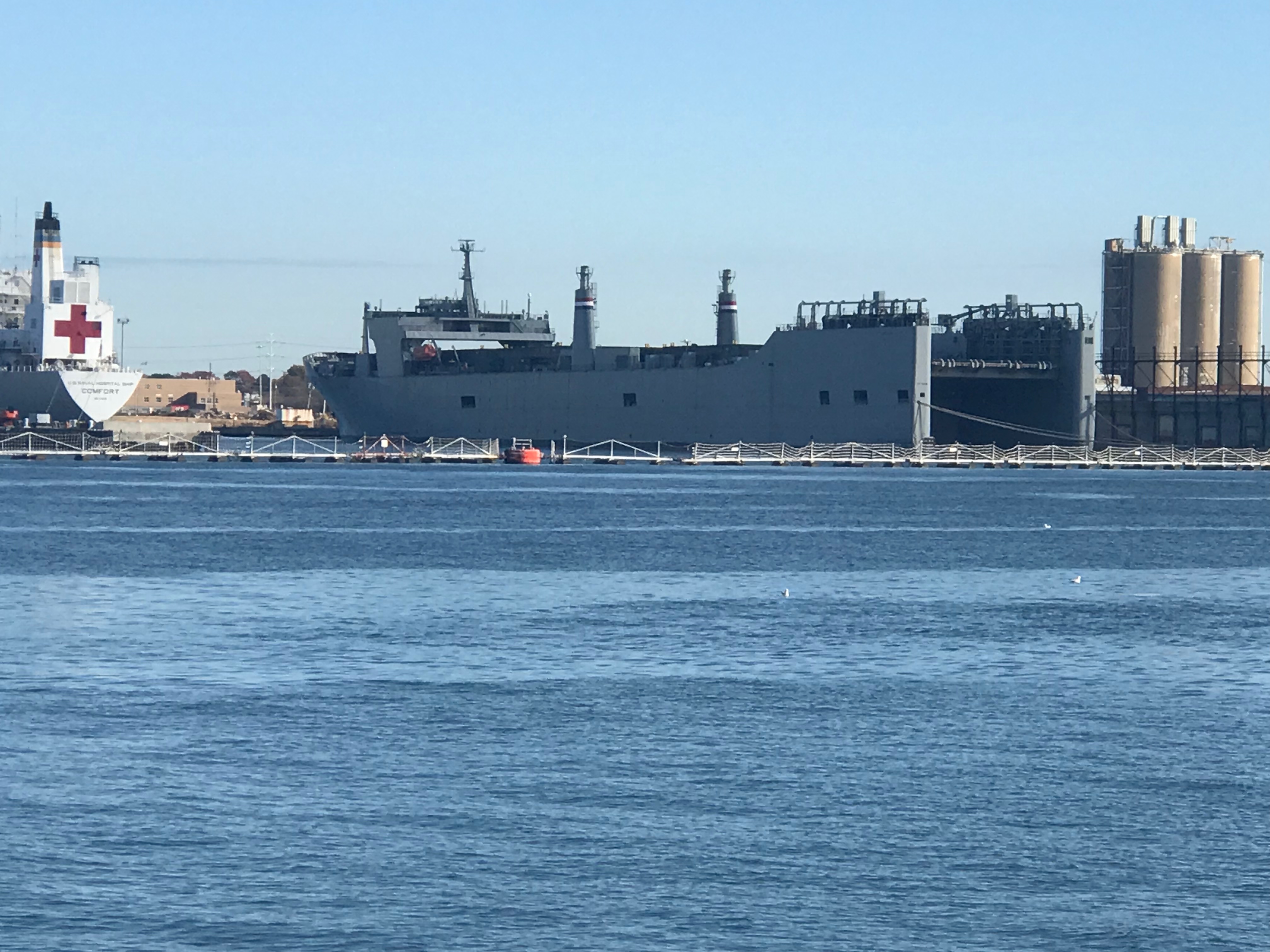
USS Jason Dunham (DDG-109) – Arleigh Burke-Class Destroyer Alongside The Hospital Ship Comfort
The Hospital Ship Comfort made it’s way down to Puerto Rico as part of the relief efforts.
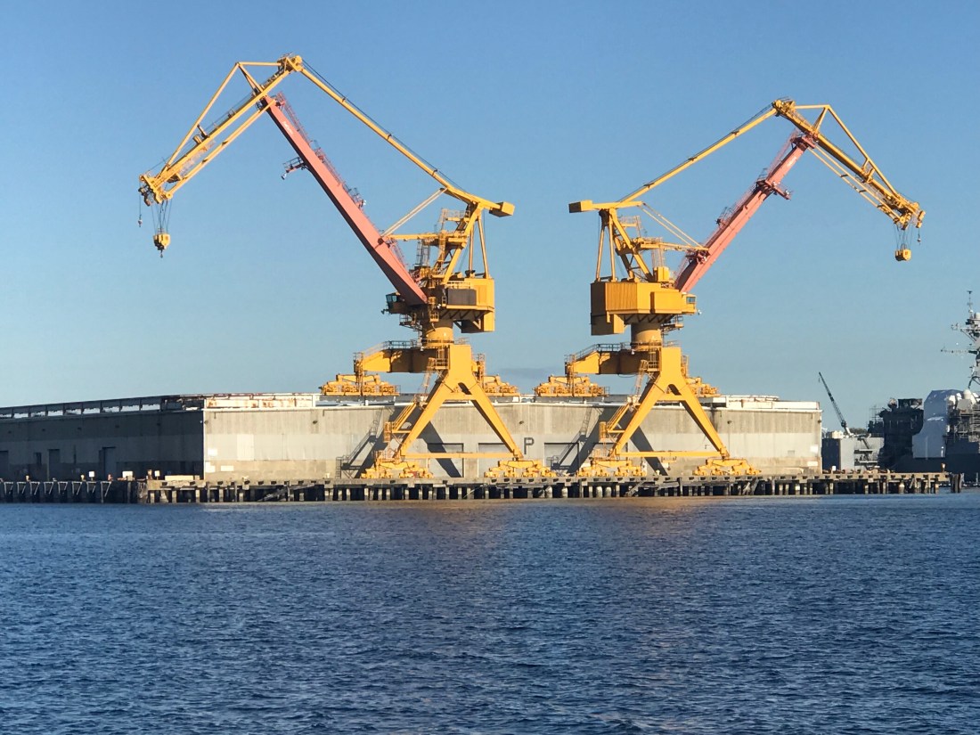
So after navigating past all the warships and being careful to keep our distance it’s on to the Norfolk International Terminals and the Virginia Port Authority.
Star Wars AT-AT Walkers were all I could think about.
Large Cranes Loom Overhead
Hapag-Lloyd Container Ship Passing By
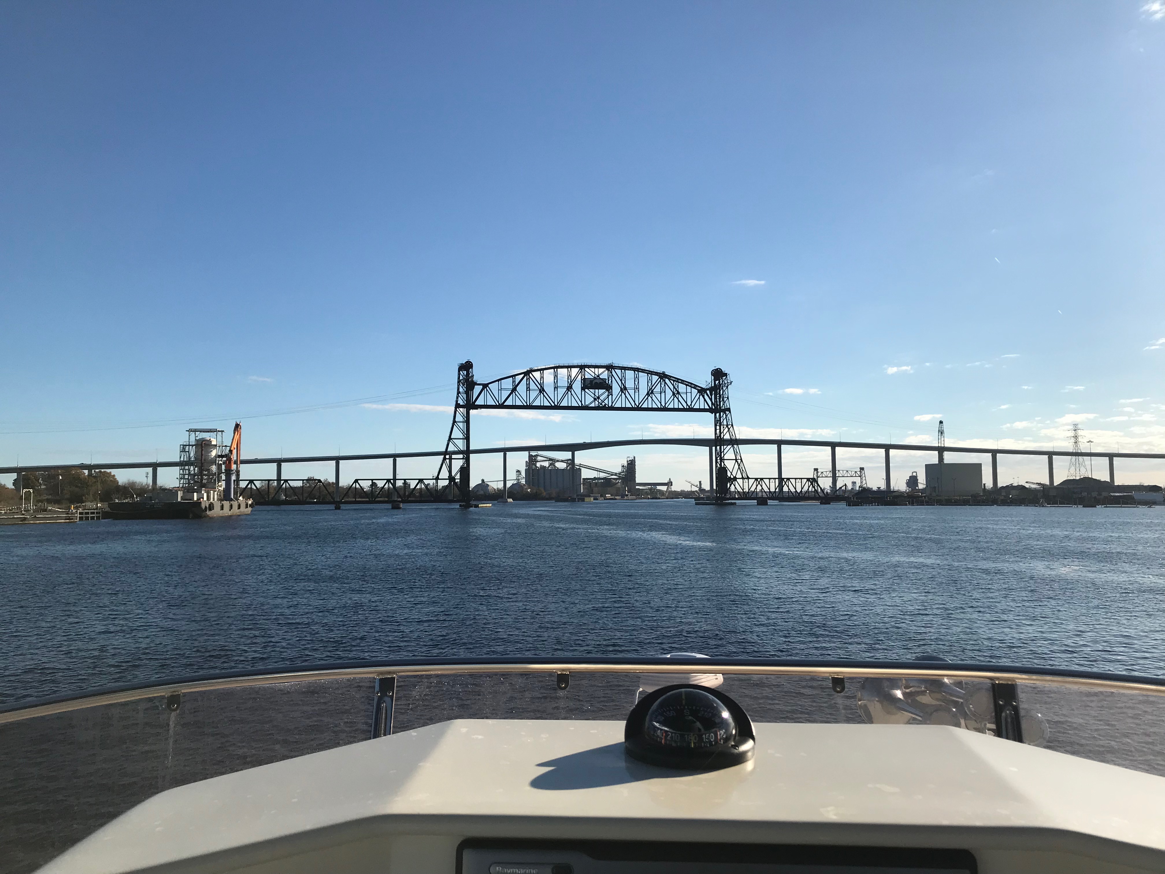
North PBL RR Bridge and Jordan Fixed Bridge, ICW’s First Set of Bridges – Many More to Come
Norfolk Southern Railway Bridge @36 Feet – Room to Spare
Paddle Wheel James C Echoles 2 Passing us By
You can’t help but notice that everywhere along the shore seems posted “WARNING – US Government Property – Restricted Area – KEEP OUT”
US Gov Manned Towers with searchlights Guard Wharf Entrances
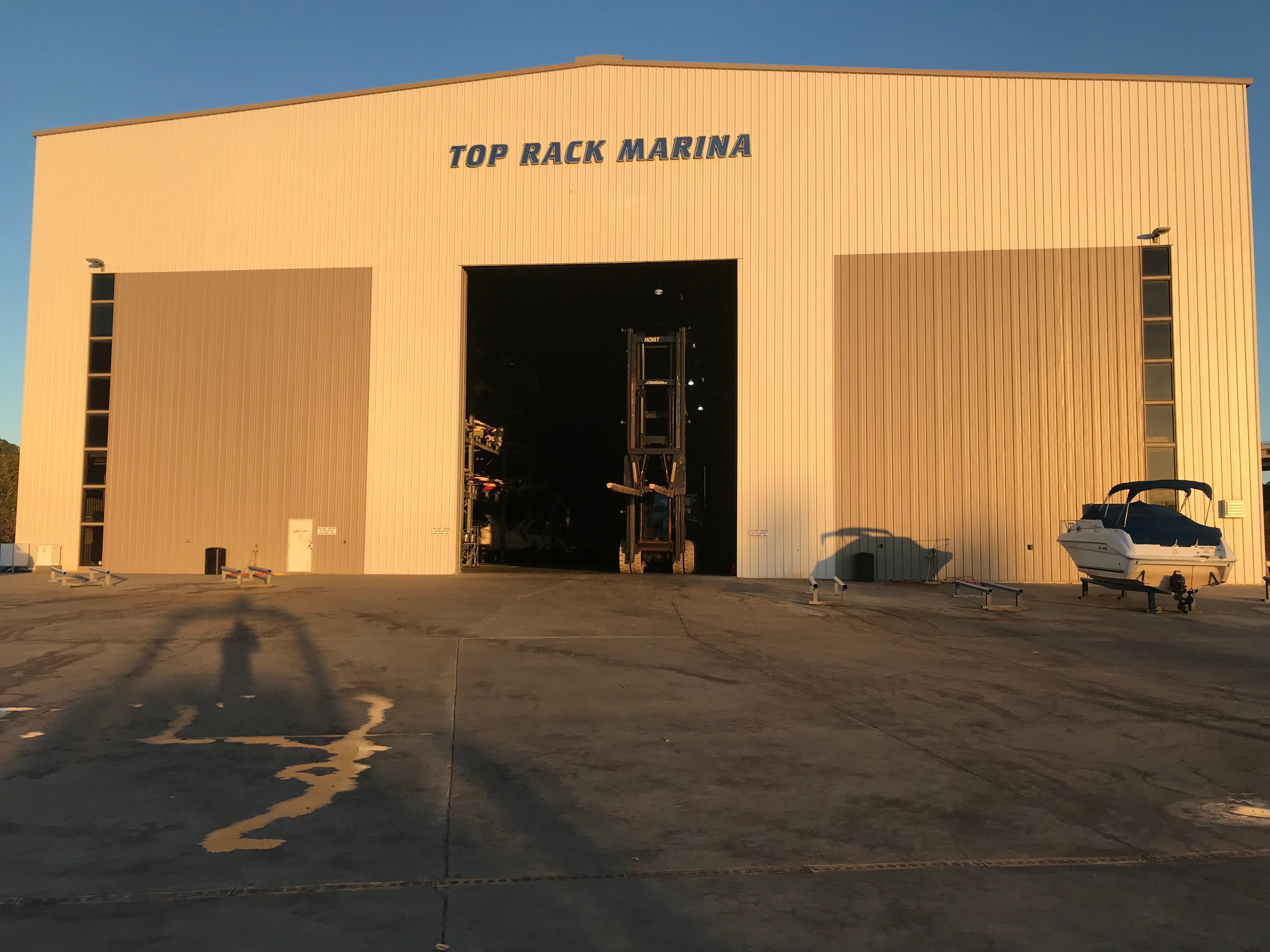
Finally, we arrived at our chosen destination, Top Rack Marina.
Top Rack Marina in the Setting Sun
I promise to post more about this terrific marina and the on site restaurant called the Amber Lantern that we plan on having dinner at tonight.


You must be logged in to post a comment.