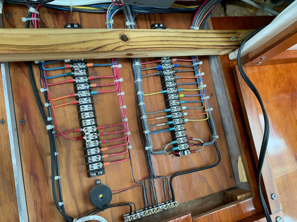
The repair of the radar turned into the install of a radome a wind transducer and a second MFD (Multi-Function Display ie. Chartplotter). This required several electric kick-scooter trips to West Marine for miscellaneous switches, cables, etc. We had to pull the inside roof of the pilothouse down in order to snake cables between the two helms (Pilothouse & Flyberidge). This took several days.
PH Wiring
Flybrridge Break Out Panel
We met our neighbors Capt. John and Charlie who were bringing a 55′ Sunseeker Manhattan to Florida. If you are interested it’s for sale on YW (YachtWorld.com). $2.25M
2021 Sunseeker Manhattan 55 For Sale
Capt John was very knowledgable about boating technology and we discussed everything from LiPO4 batteries & BMS (Battery Management Systems) to Chinese diesel fired heaters. Capt. John had many projects going on with his own one-off sailing yacht called Myth.
SV Myth
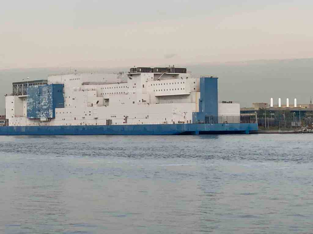
We got a late start but it felt good to be moving again. We slipped past a lonely lighthouse before entering the East River. Soon we were passing the massive prison ship in the Bronx. Vernon C. Bain Correctional Center (VCBC)
Prison Ship
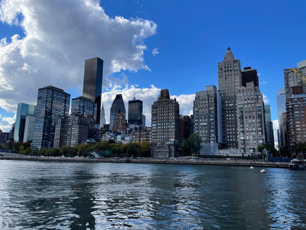
The clouds looked like cotton balls as we cruised West down the East River.
Lady Liberty always reminds me freedom is what everyone wants in this world.
Our Lady Liberty
Freedom
As we scooted beneath the Verrazzano Bridge we passed a large container ship entering NYC harbor.
Cargo Ship
As the day came to an end we decided to drop the hook behind Sandy Hook, NJ for the night. As the sun disappeared beneath the horizon we tucked in for the night.
I purposely got a late departure from the marina in Port Washington because I wanted to catch a fair current. When I went to leave my slip the gale force winds were on my beam. When you are solo you must untie and leave only a front a back looped over the cleat so you can climb aboard and flick the lines off and go. The problem this morning was that after I flicked off the stern line and ran through the boat to get to the bow line I’m sure the boat would be sideways in the slip. I opted to tie the boat with a single line, jump aboard, flick the line of the cleat and try to get out of of my slip before the wind had it’s way with me. Lucky for me the slips are very wide as were the fairways.
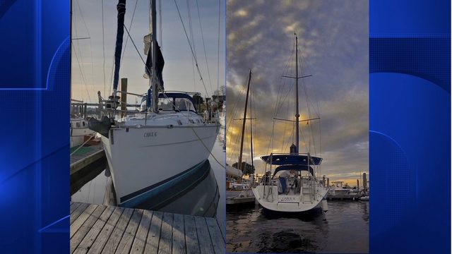
Pulling out of Port Washington a sailboat was following me.
Blue-hulled sailboat reminds me of my old Hunter sailboat before I bought my trawler
Port Washington is just around the corner from the east end of the East River.
Port Washington is a great staging location to wait for a fair current
Under Bridges
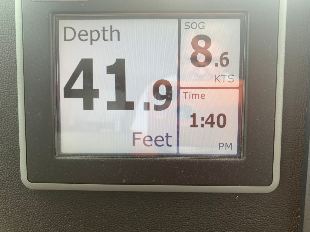
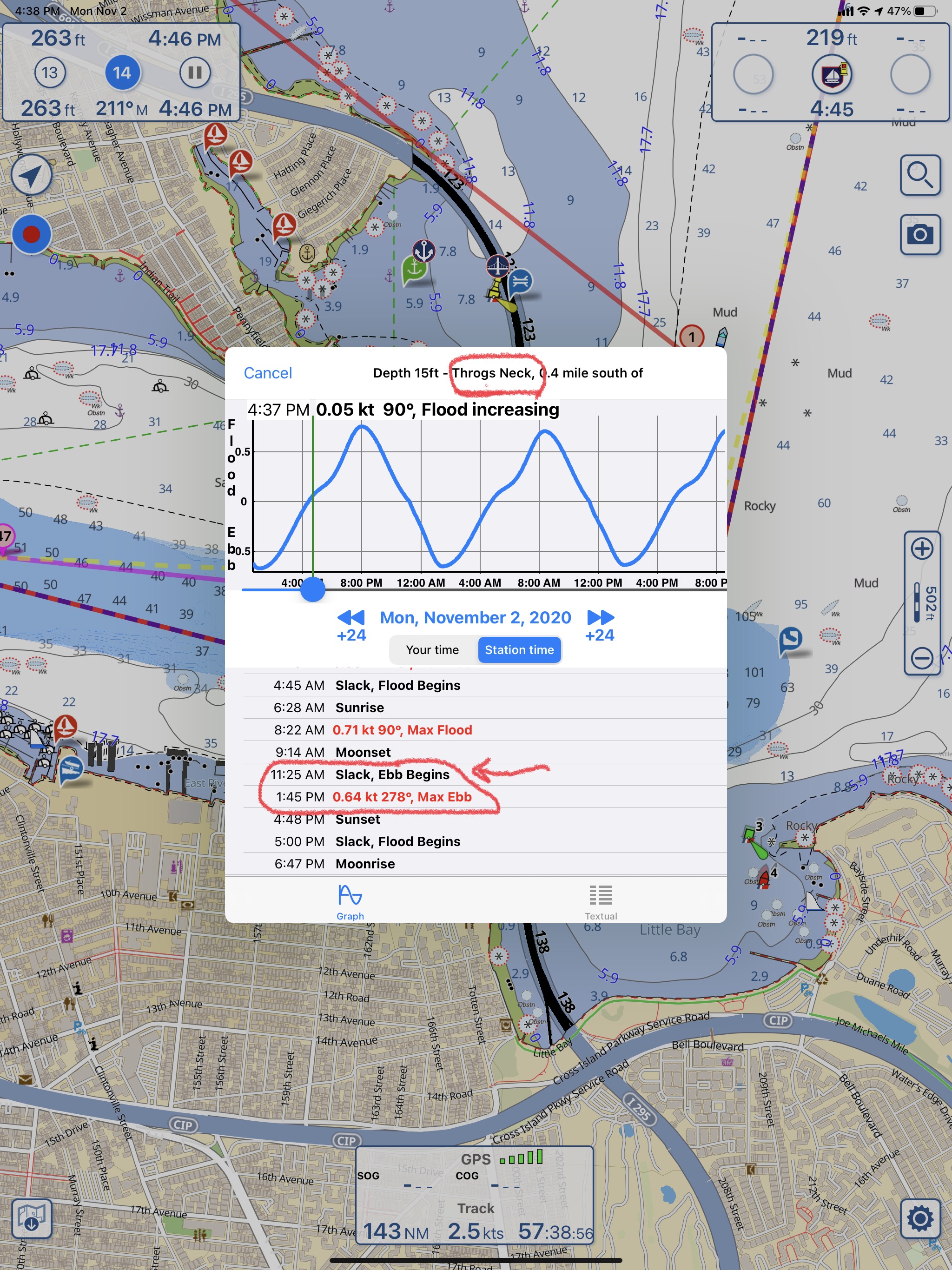
Throgs Neck Bridge is the first bridge as you enter the E. River. You can see the Bronx – Whitstone bridge behind it. The fair current boosts my speed from 6.5kts to 8.6kts as I zip along under the bridge.
Throgs Neck Bridge East end of the E. River8.6 kts thanks to the current
Passing Traffic
Almost immediately I’m being passed by USCG & NYPD boats as well as other boat traffic. They are everywhere as you navigate the East River.
Dystopia
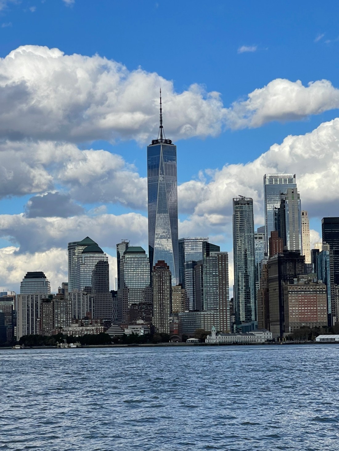
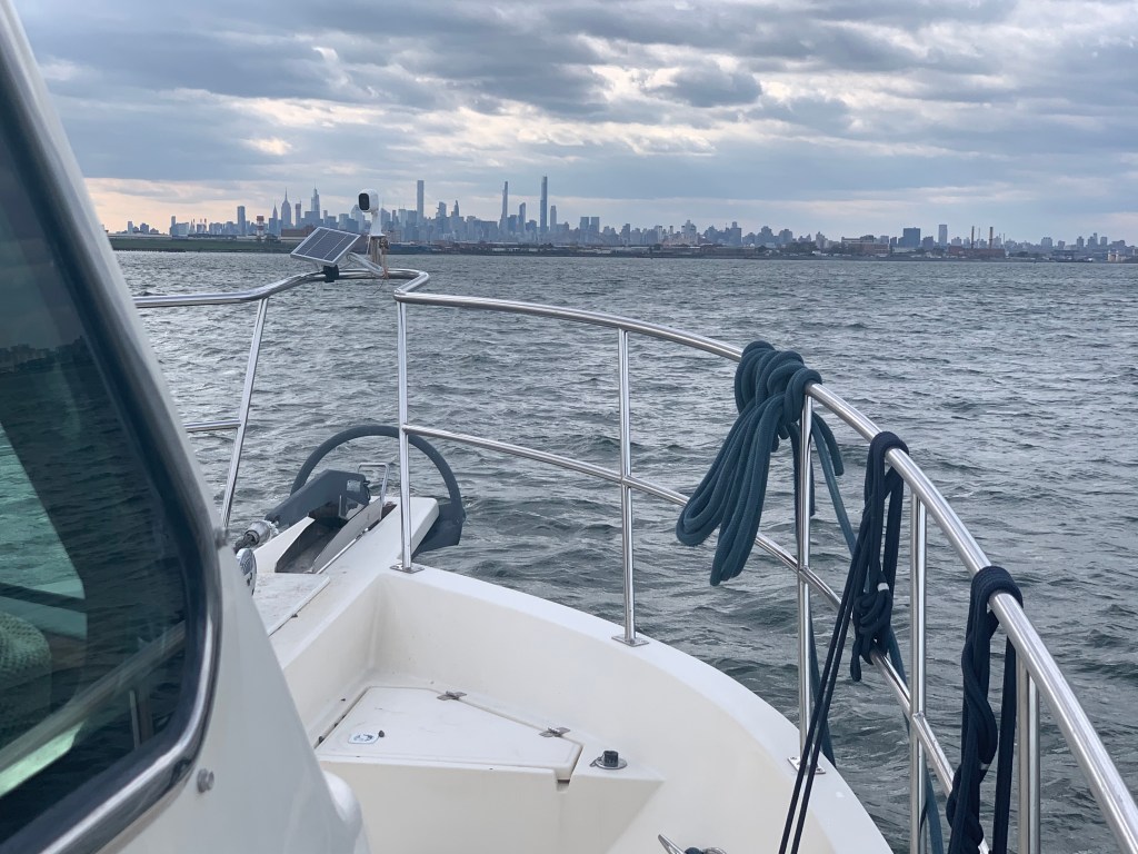
The NYC skyline can be seen in the distance. On this cold grey day I can help but think it looks like a scene from some dystopian future SciFi flick.
Dystopian future skyline
Push Me Along
As I approach the infamous Hell’s Gate where the E. river & Harlem river converge my speed jumps to 11kts.
work pajamas on feet in the helm
Right of Way
Soon I had an oncoming boat that was crossing my port bow. They were on a collision course so I sounded my airhorn for a 1 whistle pass. They did not change speed or direction. I blew my horn again and again with no reaction from the oncoming boat. I finally laid on the horn turned to starboard. We exchange some hand waving before the captain got on the VHF calling me a moron. I simply explained that he did not have the right of way. He was on a collision course. He did not respond to my sound signal and left me no choice but to stop. No response.
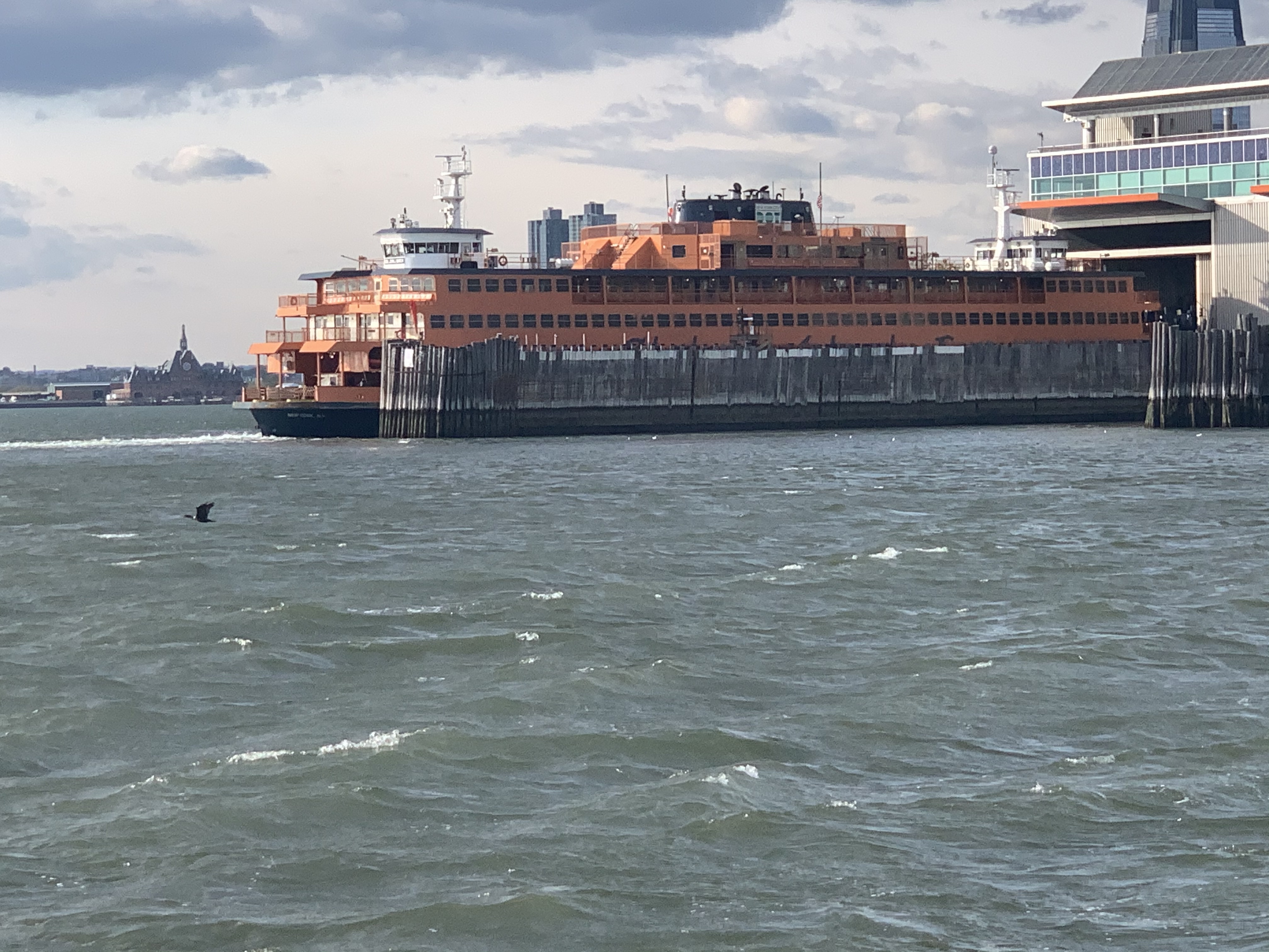
Staten Island Ferry
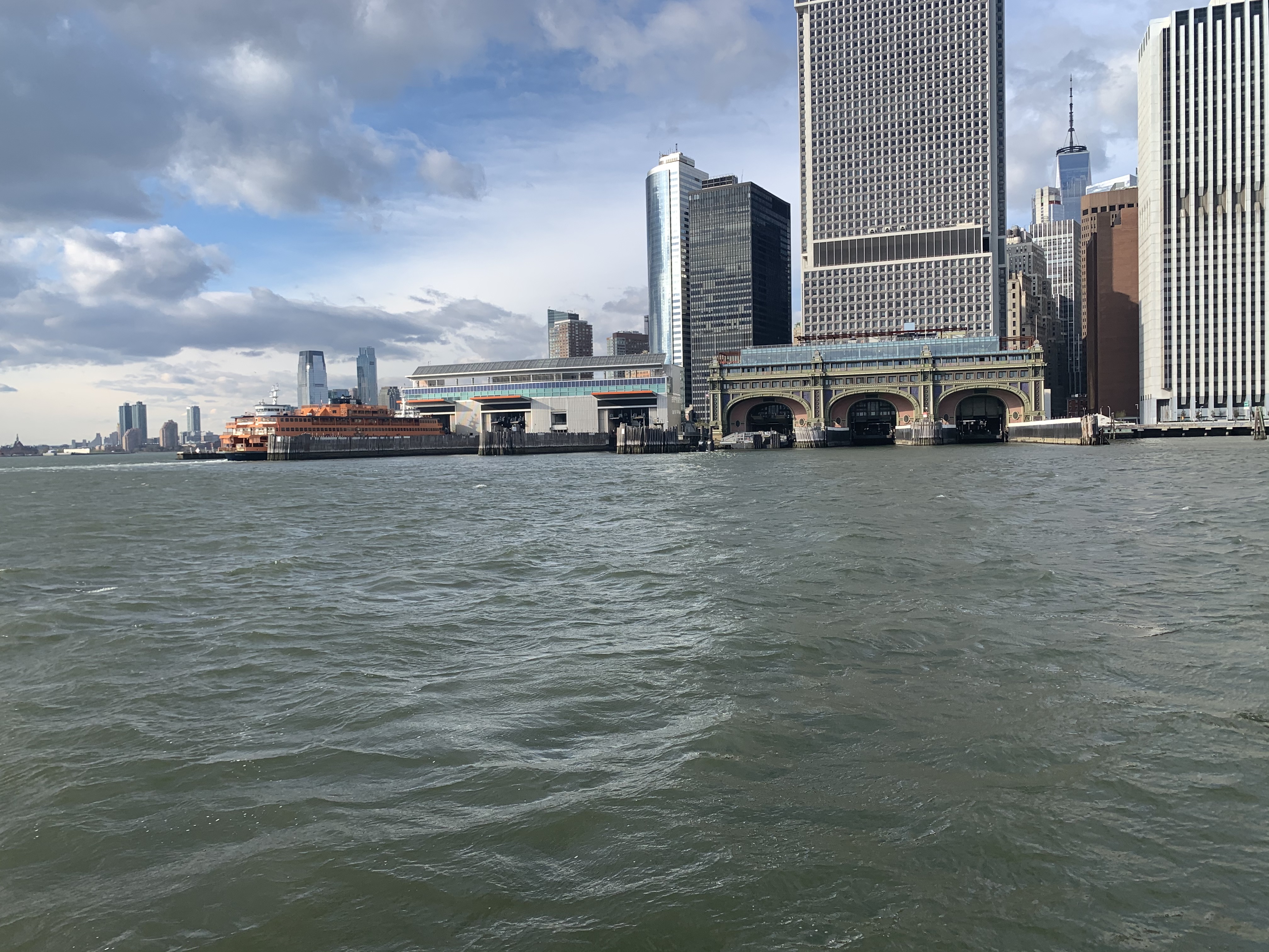
As I pass the souther tip of Manhattan I see the ferry terminal and the Staten Island ferry docked.
They never stay docked very long. NYC’s fast pace as passengers rushing off and on and they are underway again passing me.
A Sexy Girl goes Past
As I’m passing the Statue of Liberty I see a radar return for something passing me on my starboard side. She’s a beauty. MV Arriva from England.
Hustle and Bustle of NYC
This is the busy part of NYC harbor and all sorts of traffic is passing me.
USACE (US Army Corp of Engineers)
Maersk Containership entering NYC harbor
The Jersey Shore
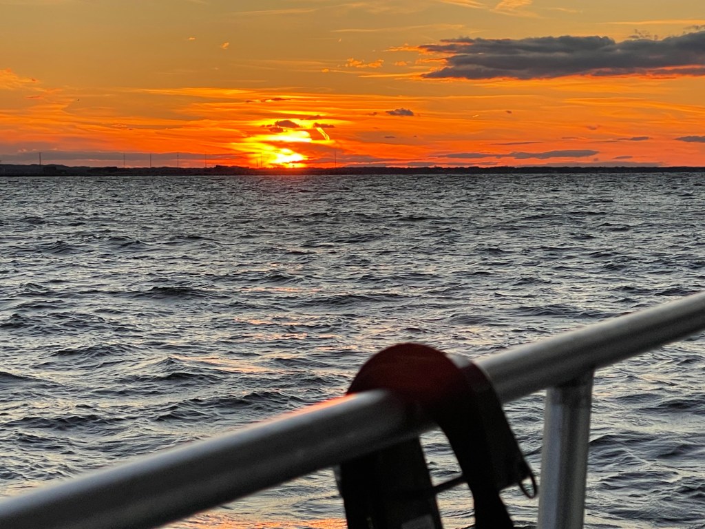
As I pass under the Verrazanno Bridge and past Sandy Hook the sun is setting and at first it’s a beautiful yellowish orange.
Yellowish, orange sunset off Sandy Hook
But minutes later it’s very pink
Pink sunset off Sandy Hook
Serenity
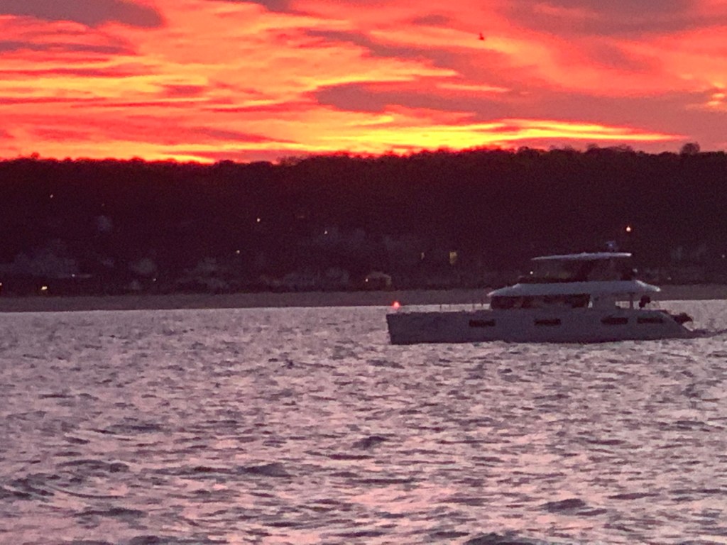
My AIS shows a 66′ foot yacht approaching from my stern.
AIS info transmitted between boats digitally over VHF CH#70
hmmm… 33 feet of beam I think as I wait to snap a photo of this boat with the sunset above. MV Serenity VII is a Lagoon 63 – 4 cabin, crewed power catamaran for charter. You can reserve it here for about 30K/week in the Bahamas if you like? I’d guess the crew are bringing the boat south to the Bahamas for the start of the chartering season.
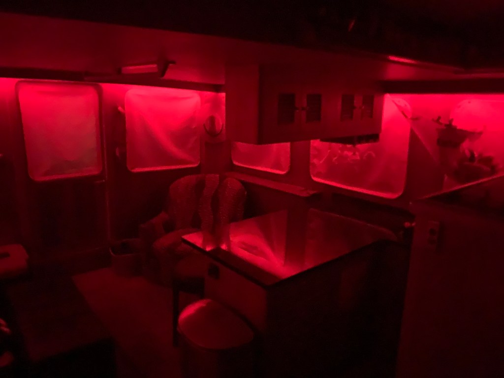
Red Light District
As the sun sets I swap my salon LED lighting from blue over to red to keep my night vision.
The rest of the trip was a long dark ride to Atlantic City. The sea was calm and I was scheduled to arrive around 4AM. This leg of the journey was 16 hours. I had planned to anchor in Brigantine Bay but it was dead low tide when I arrived and every attempt at getting in the narrow entrance channel ended with the bow slowly riding up on a muddy silty shoal. Being as tired as I was, I simply found a place to drop the hook near the Golden Nugget. The anchor was no sooner set and I curled up on the pilothouse berth and was sound asleep. I plan to wake in 2 hours when the sun comes up and as I have another long 100+ NM day.
W04L003
The 113NM third leg of my Winter 2020 journey looked something like this.
After being awake for 20 hours, I caught about 3 hours sleep before waiting for first light to weigh anchor. Last night’s anchorage served it’s purpose. It was only 10 minutes off my path and was an easy-in / easy-out in the dark.
You can see my track – easy in – easy out
I headed west down Long Island Sound toward NYC. The wind was blowing from the south so the waves were building as they crossed over from Long Island to the Connecticut coast where I was. It made for a choppy wet ride. I decided to cross to the LI side before turning again to the west. This made for a much more comfortable ride heading west.
Demonic Possession
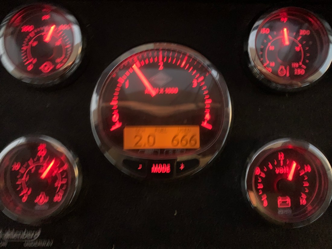
I always set Simple Life’s throttle to 1400 RPM which is 2 gallons/hr burn rate. Depending on the currents I average around 6kts. Doing the math, that’s 3NM to the gallon or about $1/mile. I’ve always thought it’s a pretty inexpensive mode to travel since you are moving you and your 40,000 lb home. However this home might need an exorcism?
Cummins smart craft tachometer showing my 2.0 gal/hr burn rate and 666 gallons burned.
Wait… They don’t go to Heaven?
I cringe when I watch people release mylar ballons to go to heaven in the name of a lost loved one.
They don’t go to heaven
Traffic Jam
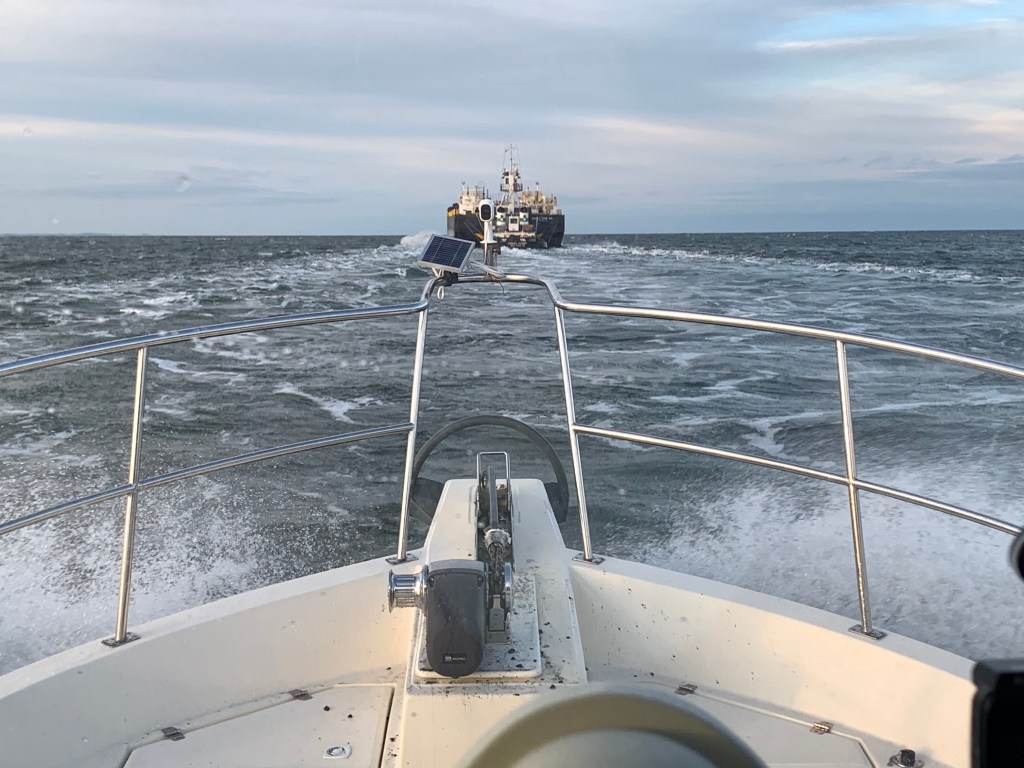
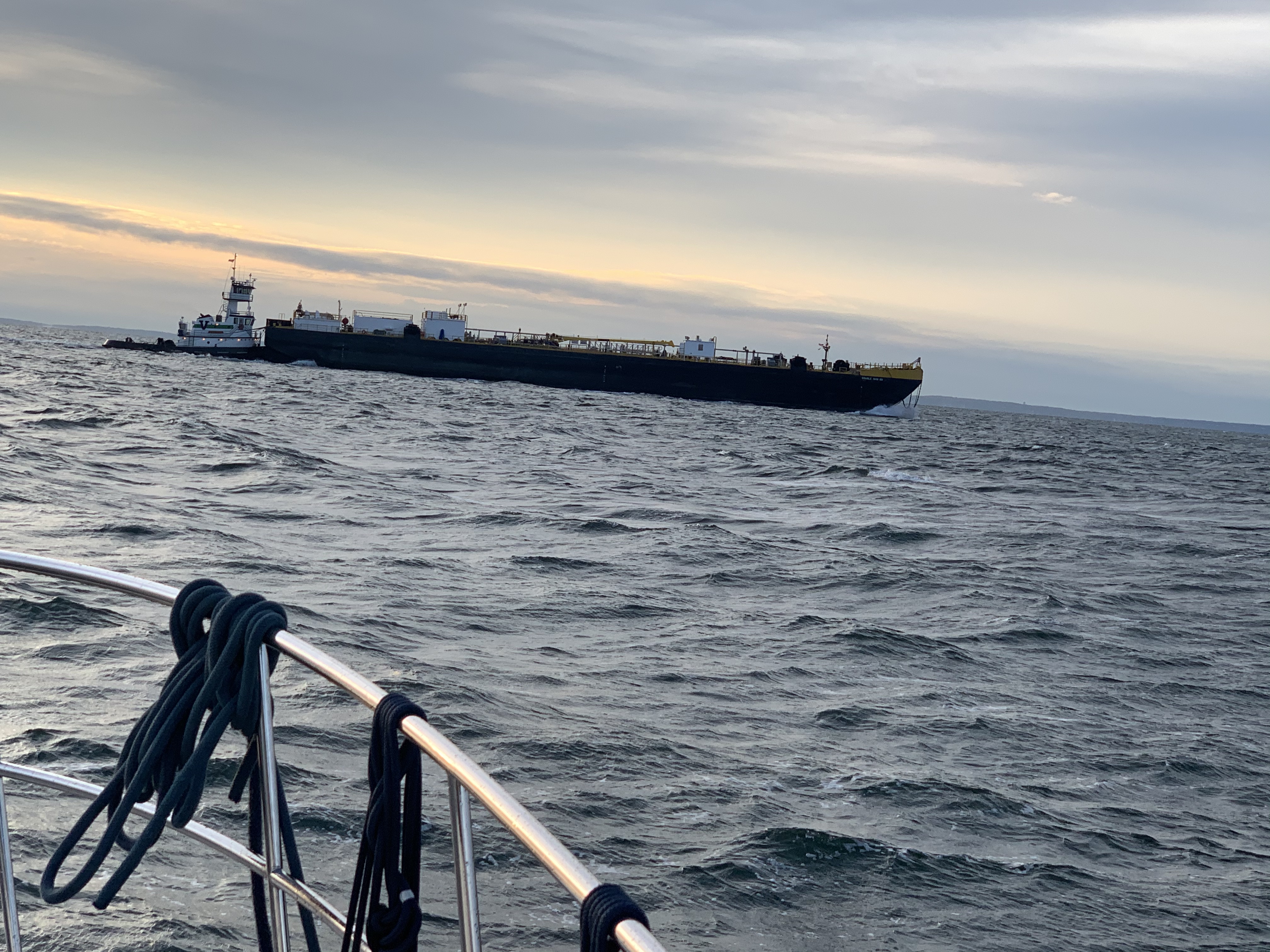
At one point I had to change course to take the stern of a tug pushing a barge. I thought maybe I could follow the barge close and let her flatten out the sound but alas at 8.5kts I was burning a lot more fuel and salting up the topsides.
Salt spray was washing my muddy anchor pulpit
I no sooner gave up on following the tug and I was dodging other traffic.
Pilothouse Pleasures
As I plod along I am happy that I am inside on this cold rainy day.
I had left my marina in Warwick, RI on the same day as another B-Dock member, MV Leap of Faith. I had managed to slip ahead of them but not for long as I watched them speed past me.
Girl Power
Soon I pass an overturned sailboat. I think to myself… wow that must be cold as you swim back to the boat and attempt to right it. As I pass I see that it’s two women sailors. I feel a little like a woosie as I wrap a afghan over my feet which feel cold just watching them.
Route Planning
As I get closer to the west end of Long Island Sound I start to plan my upcoming routes. A quick check of the weather tells me I might enjoy the next two nights in a marina rather than anchored at the foot of the Statue of Liberty as planned.
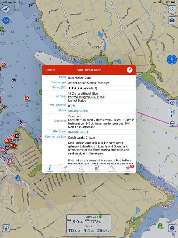
Marina Hideout
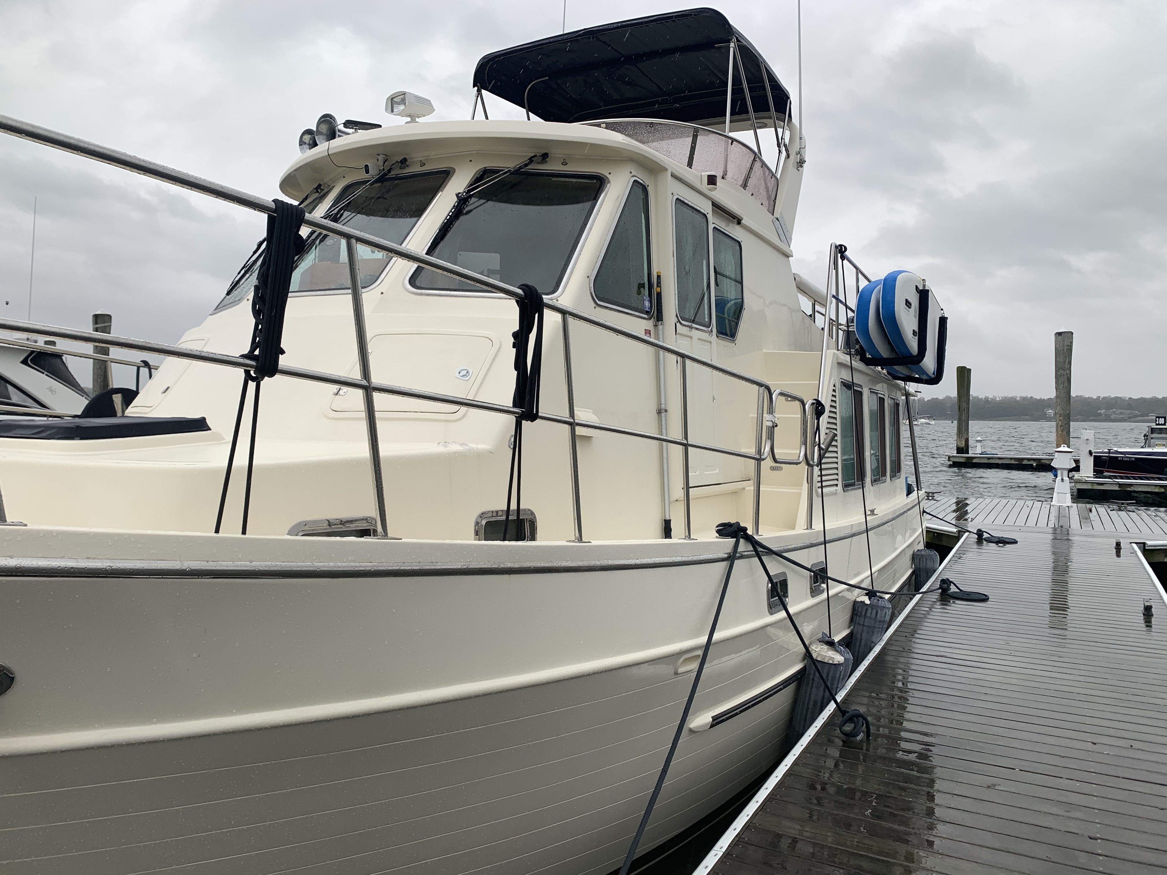
I found a great marina called Safe Harbor Capri in Port Washington. I’ve stayed here before and the Dockmaster Rob is very accommodating. Nice place to sit out the wind & rain.
As I pull in there is a dock hand there to catch a line for me. It’s raining hard so I make sure to tip him well. The slips here are large and it looks as if you could dock another boat in my slip right alongside Simple Life.
As I sit and eat some spaghetti I pull out my laptop to renew my EPIRB (Emergency Position Indicating Radio Beacon) with Search & Rescue for the next two years. I have emergency contacts incase it should ever be automatically triggered by a sinking.
As I sit inside, the wind is trying to blow the dog off the chain. I step out and see that as protected as this marina is… there are still waves rocking the boat.
At the end of the video, you see a sailboat on a mooring whose main sail has unfurled and is flogging. Not good.
Man of Leisure
My new Apple Watch gives me a haptic nudge. I glance down and see that all the boats rocking has tricked my watch into thinking I’m exercising. It believes I’ve just had my longest “move streak” to date. I chuckle to myself and think … I’m a man of leisure.
Apple Watch 6 thinks I have my longest move streak
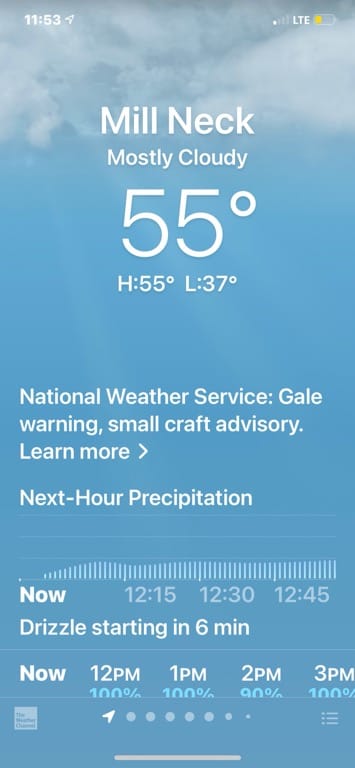
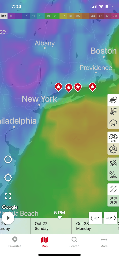
Weather Window
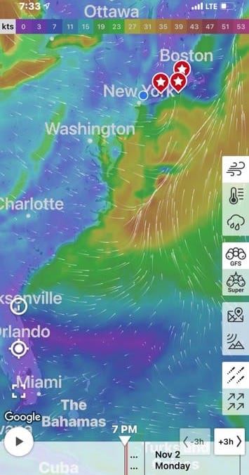
Now checking the weather I can see it’s going to get worse for the next two days but there appears to be a 5-6 day weather window for running the coast starting Tuesday afternoon.
The weather has been very stormy lately. I would have expected all the tropical storm activity to have ceased but even now in November there are storms forming in the Caribbean.
Go With the Flow
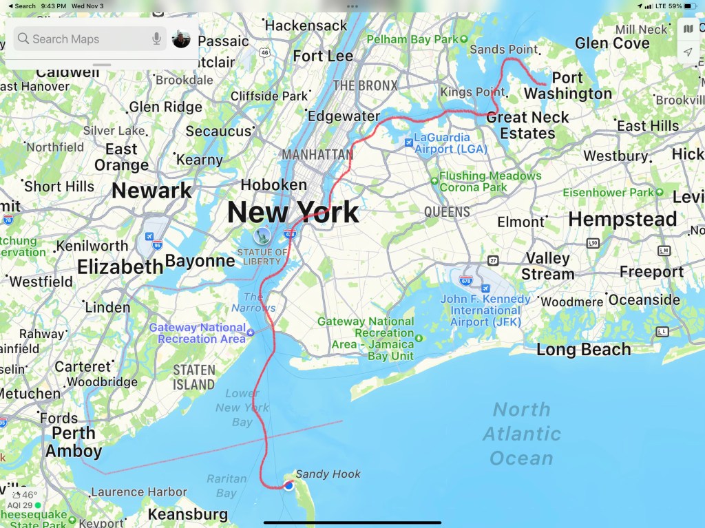
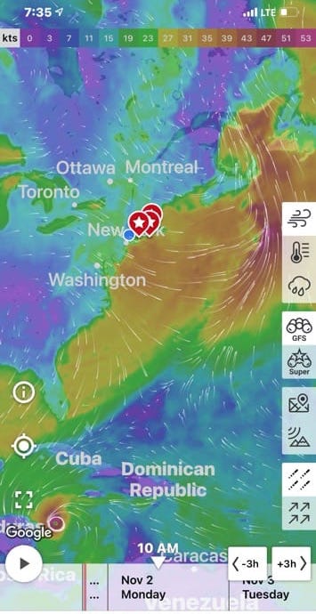
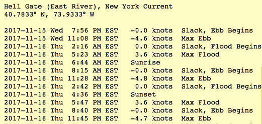
I now need to plan my exit to align with an ebbing current in the East River. Throgs Neck Bridge current station is right at the entrance to the East end of the East River. It’s sort of broad there so you don’t expect too strong a current. However, at Hell’s Gate where the East River and the Harlem River come together you can see there is a 4.73kt max current. The last thing I check is the timing of the currents at The Narrows which is just before I duck under the Verrazano bridge and out into the Atlantic Ocean.
W04L002 is in the Books
Leg #2 of my Winter 2020 journey was only 46.4NM and looked something like this.
We departed Port Washington and perfectly timed our arrival to the east end of the East River. We had a fair current giving us a strong push on our stern all the way through the East River and into NYC Harbor.
East River
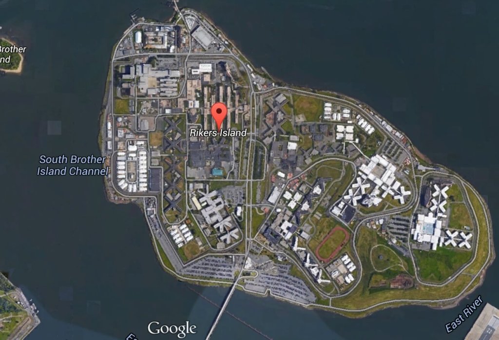
Once in the East River you come upon Laguardia airport and Rikers Island.
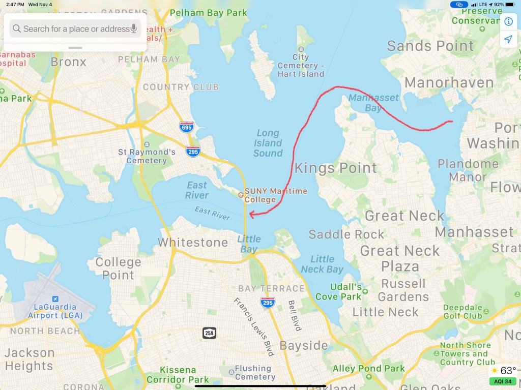
A wee bit further down the East River and you come to an infamous location known as Hell’s Gate. This is where the Harlem River dumps into the East River. Our planning placed us here at max ebb current because it’s a great feeling being pushed in such a strong current.
Buddy was at the helm calmly making helm corrections as quickly as possible to keep the pointy end of the boat pointing in the right direction.
We had planned on spending a couple days in NYC harbor and visiting Manhattan but our weather heading down the NJ coast looked great for the next 38 hours. We had a quick discussion at the helm and decided that we would go offshore. Stopping in NYC would have meant being trapped for the foreseeable forecast.
Sunday 4-6′ Seas
Need to be South of NYC by Sunday
Offshore Voyage to Norfolk, VA
Going offshore to Norfolk would require a helm watch schedule. We like to call it a port & starboard watch meaning that there would be two teams. Team 1 = Buddy & Renee. Team 2 = Marty. When you’re on “helm watch” the other team is relieved of any responsibilities other than to rest up for when your watch starts.
Night watches means keeping an eye out the pilothouse windows for any lights. The moons phase was only a sliver of a crescent and it did not rise till 4AM. We chose a route between 2-3 NM off the coast and that allowed us to see the twinkling lights of shore as we made way south.
For those uninitiated in night watches you will have to become comfortable with staring intently at your radar screen while you push into the blackness. Looking forward out the pilothouse windows all you see is black and the few instrument lights that reflect off the inside of the glass. You’ll need to determine if any of those red, green or white lights are coming from a boat or a buoy. If the light blinks, it’s a buoy. If it’s solid, it’s a boat.
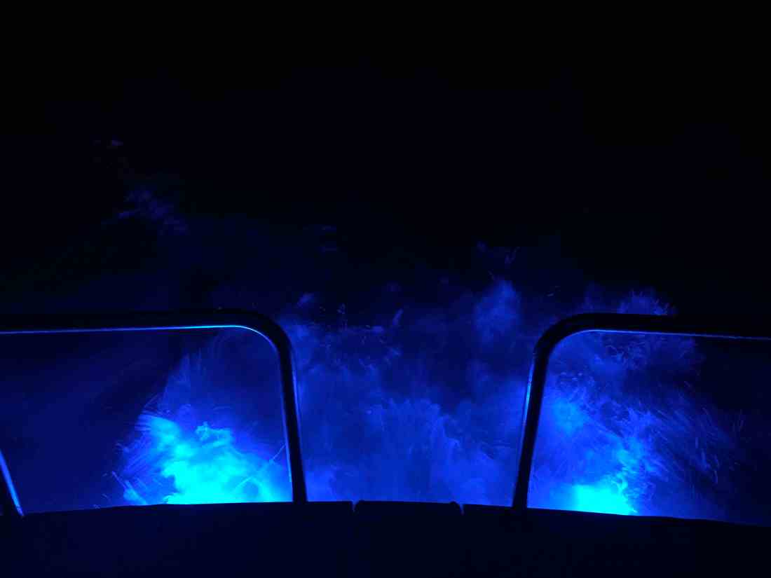
One night I come off watch and lit the underwater lights so I could stand on the stern as the propeller wash boils up from below as the lights of shore pass.
Here is a short video of a boat passing on our starboard side. You can clearly see the other vessel’s red-portside-light as well as it’s white-steaming light. When I zoom in the camera was able to pickup the white water wake in their stern light.
When I left my home port in Warwick, RI, a few fellow boaters, friends were also making the trip south for the winter. MV Ship Happens, a large sport-fishing boat, was heading south and we had been communicating thinking we’d cross paths eventually. I received a photo via text from Capt. Dan and to my surprise it was of MV Simple Life as they zoomed past us. Although MV Ship Happens left port days after us, she has a much faster cruise and eventually overtook us.
Capt. Dan snapped this pic of us on the way past us
During the day we were graced with the presence of whales. I captured a short video of a whale coming to the surface off our starboard side.
Whales off the Jersey Coast
While we were off the coast, our VHF crackled to life with the USCG issuing a securite broadcast about an overdue 43′ Benneteau sailing vessel out of Jamestown, RI called the “Carol K”. They had left before us and were somewhere along the coast with us. We attempted to hail the Carol K but got no response. We hoped that they would be found safe and several days later they were found 100 miles of Cape Henry, VA.
The trip down the busy channel into Norfolk, VA is best done in the daylight. I could tell you a story about nearly getting run over by a warship a few years back but that story is best told over a few beers. 😉
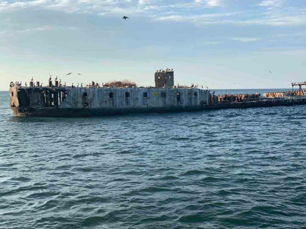
We searched our Aqua Maps charting app for an Active Captain anchorage and found one called “Concrete Ships”. The wind was out of the east but the forecast predicted the wind would clock around to the south and strengthen. This particular anchorage offered the best lee from the wind within the distance we were willing to travel.
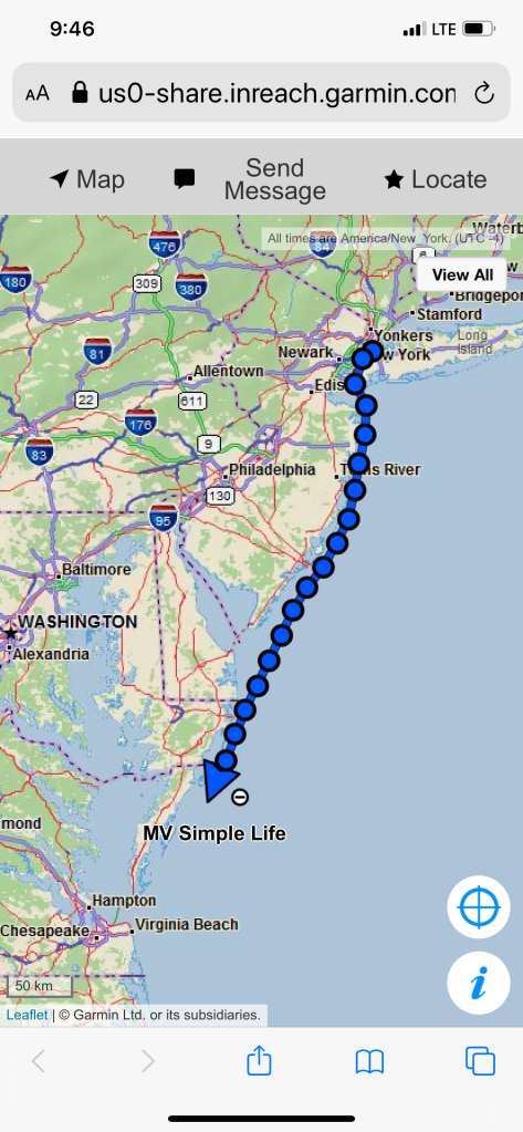
My website/blog has a button that you can click to see the real-time location of MV Simple Life. Here are some pics of that my Garmin InReach Satellite communications device makes available to you.
Working our way down the East Coast
Arriving at the Concrete Ships Anchorage
Days past, I have made the trip south from Cape May, NJ to Norfolk, VA by going outside along the coast before. Those times, I had chosen to anchor nightly along the coast. There are few decent anchorages along this stretch of coast. One anchorage I have used before was inside the Great Machipongo Inlet. I recall how tricky getting through the shifting shoals dotting the inlet was. As we passed, I could not help but notice that the latest update of the NOAA charts shows a similar sized vessel to MV Simple Life wrecked on those same shoals. (Me thinks…) I’m happy I bailed on my inlet entry that stormy night.
Ghost Ships
When it comes to ship building there are many hull materials to select from. One such material/method is ferrocement construction. It’s a cheap way to build a hull/boat but has fallen out of favor with the advent of materials such as FRP (Fiberglass Reinforced Plastic).
We had arrived at our anchorage with plenty daylight left. We shot some video and snapped a few pics of the ships as we arrived.
Standing on the bow at night in the breeze we were flanked by ghost ships with their ghostly pale white shapes faintly materializing though the inky black of night.
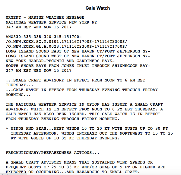
We left Morris Cove Anchorage at 5:30AM. It was dark, very dark. We had woken up around 4 AM. I had pulled up the anchor, spun the boat around and MV Simple Life started going bow up, bow down. I thought… the winds were not supposed to increase until Thursday afternoon (per the NWS – National Weather Service Gale Warning). In the words of Gordon Lightfoot, “The winds of November came early”. We used our searchlight to spot the buoys on our way out of New Haven Harbor’s channel.
Jay Marques, you asked for video in addition to photos so these links are for you.
Sorry, that video is the lightest of the three I recorded. With the winds out of the south it meant that the 16 mile fetch of water from the NY side to the CT side was making the CT side of the sound lumpy. I heard the VHF radio crackle alive with a tugboat captain complaining that the winds had been honking all night long. Here is a video after the sun came up and we were slogging our way South across Long Island Sound from New Haven, CT to Long Island’s Huntington Bay area.
When Kelly & I first met I had a 1998 35′ Beneteau 352 Oceanis ,S/V Saltyhacker, (I’ll upload a pic of SV Saltyhacker later) that had only a dodger (the see-thru plastic and canvas that covers the companionway opening into the boat. We sold her to a great couple from Canada and bought a 2001 45′ Hunter 450 Center Cockpit. (I’ll upload a pick of SV Skull & Swords later, promise). The Hunter was owned by friends of ours who were living aboard her in Exuma Key, Bahamas and ever since we’ve said someday we’ll spend a few months on anchor there. We loved the Hunter for it’s liveaboardness; for it’s fully enclosed cockpit and interior space but Kelly would often quip that unless we are sitting in the outside cockpit you don’t get to enjoy the scenery. So we decided to buy a new boat that met our mutual demands. Kelly wanted a boat that was easier to move around in (Kelly has a habit of twisting / breaking ankles when underway or simply aboard). After spending 10 hour days at the helm outside and often cold, I was fancy on an enclosed pilot house. In the video above you will just have to imagine as the cold sea spray is hitting the pilothouse windows that I’m sipping my coffee in my PJs at the helm (smile).
Todays trip looked something like this..
As you approach the East-end of LIS you enter into the East River that takes you from the Bronx to the Statue of Liberty. As many times as we have made this trip we still find ourselves taking pictures of the scenery as we go down the river. Below are some of the photos we snapped along the way…
After going by Riker’s Island Jail you pass the Vernon C. Bain Correctional Center. This is a 47,000-ton, five-story barge with 800 beds spread over 16 “dormitories” and 100 proper jail cells. At 625 feet in length and 125 feet wide, it also holds a gym, a basketball court, a library, three chapels, a rooftop exercise area
Brooklyn Bridge – built in 1870
Whirly Birds buzz the East River and land just North of Battery March
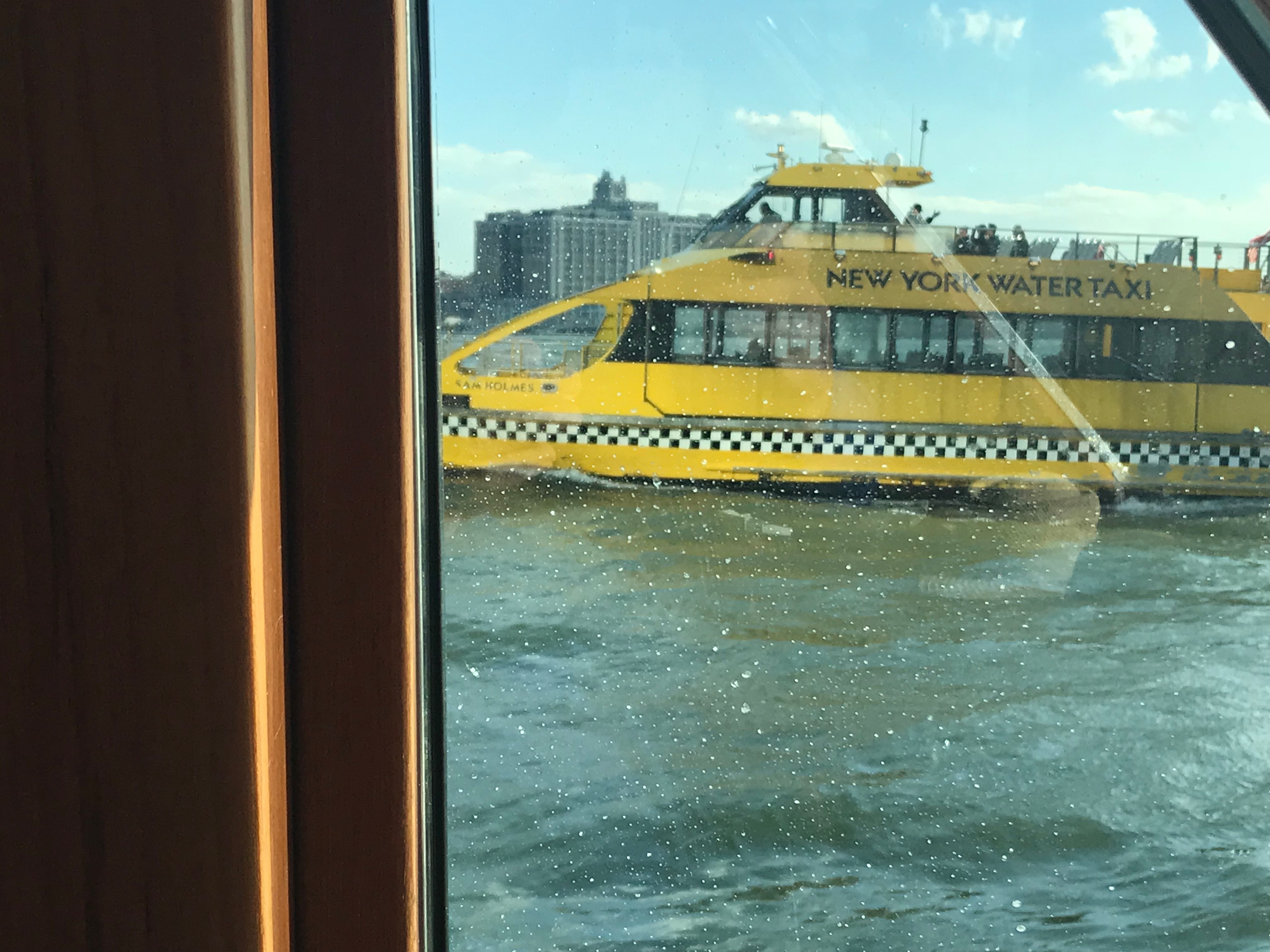
Water Taxis are everywhere and as a captain you must be alert and ready to dodge them
We timed our trip down the East River to make sure we caught favorable currents that saved us easily an hour during our transit. After arriving in NYC harbor we hailed Liberty Landing Marina and requested our slip assignment. The wind was gusting but an attendant met us at the slip and caught the lines that 1st Mate Kelly threw to him.
MV Simple Life tied off at Liberty Landing Marina
Tomorrow we’ll take the water taxi and find somewhere to grab a IPA & Capt-Pepsi -NFL (No-Flipping-Lime) & a bite. Tonight we’ll just relax 😉
We departed Harbor of Refuge @ sunrise this morning. We felt a sense of urgency due to a gale warning (gusts to 35 knots) which is in effect beginning Thursday afternoon. The cause is two separate low pressures that are having a complex interaction West of our current location.
NWS Gale Warning NYC
Below is a rough depiction of our second leg of our journey South. Our course took us from Pt. Judith’s Harbor of Refuge, outside Fishers Island to Morris Cove Anchorage in New Haven, CT.
Leg #2 of #Run2Sun2017
Today’s cruise was long but relaxing. The sun was streaming in windows making the pilothouse warm as we made way @ 8.5kts West down Long Island Sound.
We saw only a few sport fishing boats and had to dodge the occasional ferry crossing our path.
Ferry Crossing Long Island Sound
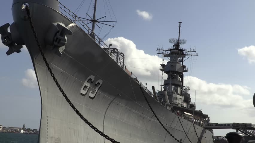
Every captain knows it’s better to take the stern of larger vessels rather than attempt to cross her bow. Ten or so years ago I had a close with a US battleship @3AM in pea-soup fog in Norfolk, Virginia’s entrance channel. Our close call was not a crossing issue but instead the warship was inbound in the channel and was not basting fog signals. After they suddenly appeared on radar from under the Chesapeake Bay bridge/tunnel we quickly blasted our horn. When they responded with their horn I swear my ears blew out. The warship quickly passed us not 100′ off our port beam (frightening in the fog). A shout out to that day’s offshore crew – Eddie, Sean and Amy who can attest to this poop-your-pants experience.
Stay Clear of Warships
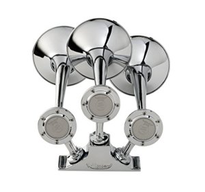
Kahlenberg Air Horns
After this harrowing experience, we installed Kahlenberg triple trumpet air horns as well as AIS (Automatic Identification System) in Simple Life.
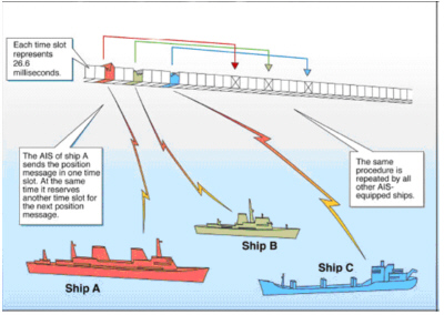
How AIS Works
AIS equipped vessels can each view on their chart plotter the other’s vessel name, size, speed, heading and course-magnetic. AIS works by sending & receiving digital data over VHF channel 70 so that two ships can see each other on their chartplotter screens even without radar. I have also learned to that programming your marine VHF with a MMSI # make ship2ship communications easier when it’s dark or foggy.
Hell’s Gate Current Table
Tomorrow our plan is to push west down the coast of Connecticut with hopes of catching the 4.8kt ebb tide through the East River (where the dead bodies are found on many Law & Order episodes). Kelly & I always enjoy the East River’s Hell’s Gate (where the Harlem River meets the East River). Hell’s Gate is infamous due to the strong currents that mix in the way a washing machine mixes water.
We hope to make the Liberty Island Marina in Jersey City by sunset on Thursday. We’ll spend two nights at the marina while we wait for more favorable weather for our trip down the Jersey coast. Until then we’ll just sit on anchor watching the lights from New Haven.


You must be logged in to post a comment.