Our 67NM trip from Point Judith to Branford, CT looked something like this.
We passed the time singing home-made songs and making each other laugh.
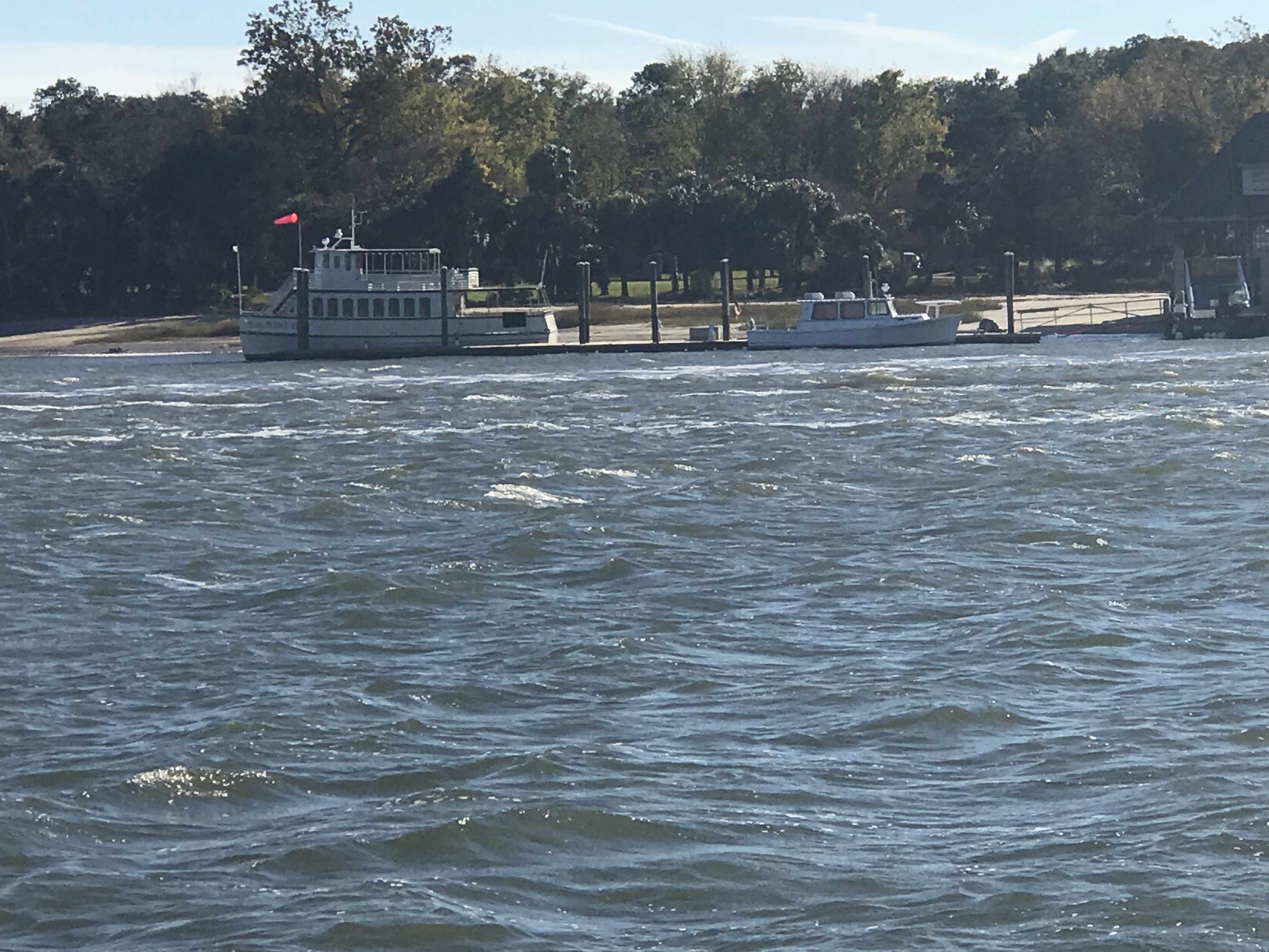
We called ahead into Safe Harbor Bruce Johnson Marina in Branford, CT and reserved a slip. We made it just in time before the dock crew went home for the night.
Skull & Swords
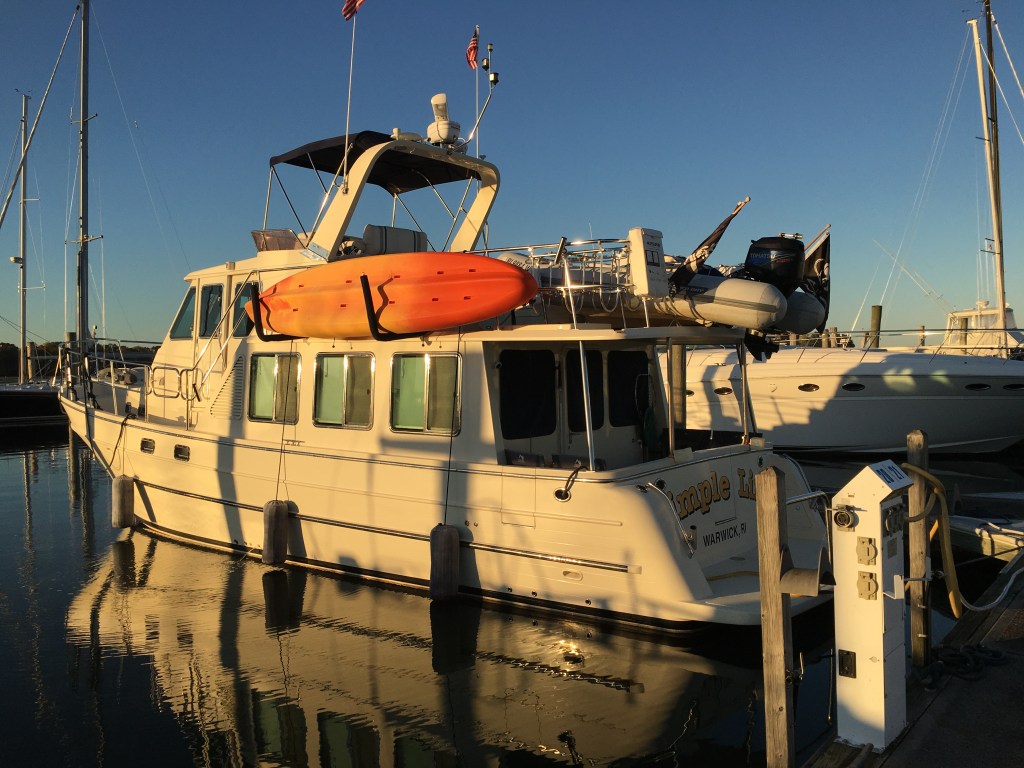
Remind me to tie that kayak on better 😉
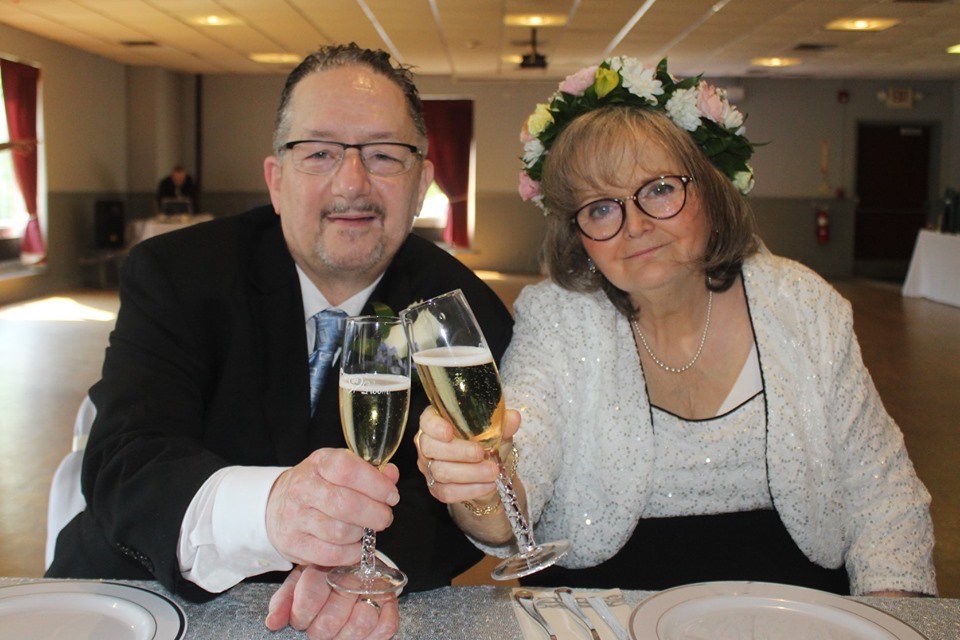
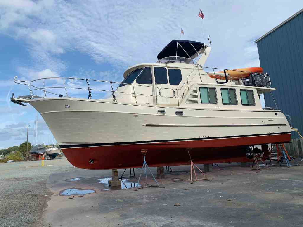
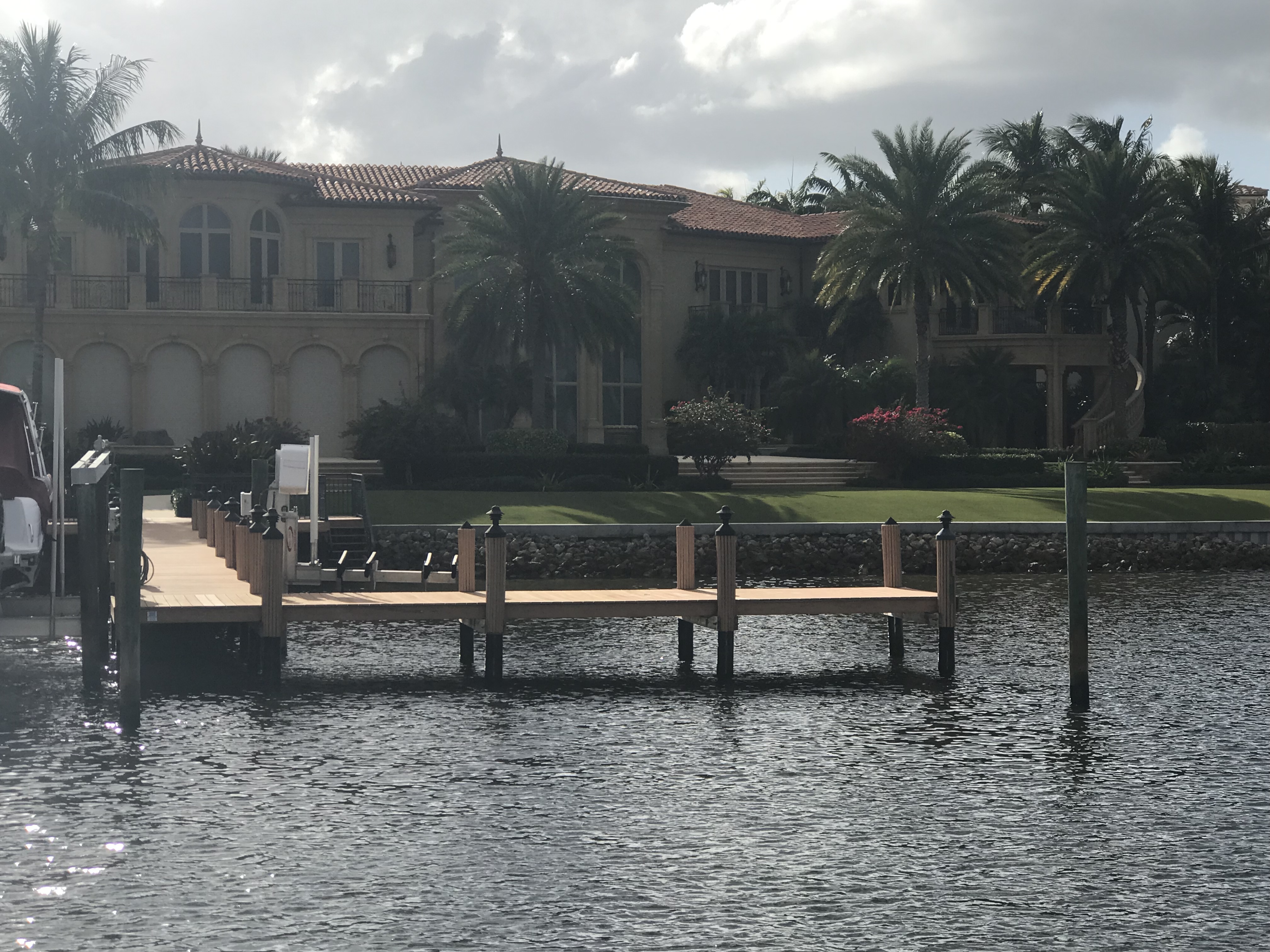
MV Simple Life docked in Branford, CT
We were greeted by a dockhand and spent some time chatting with the local boaters in the slip behind where we docked. We asked them to recommend a local restaurant within walking distance and it was clear that the crew of MV Simple Life were fans of Mexican.
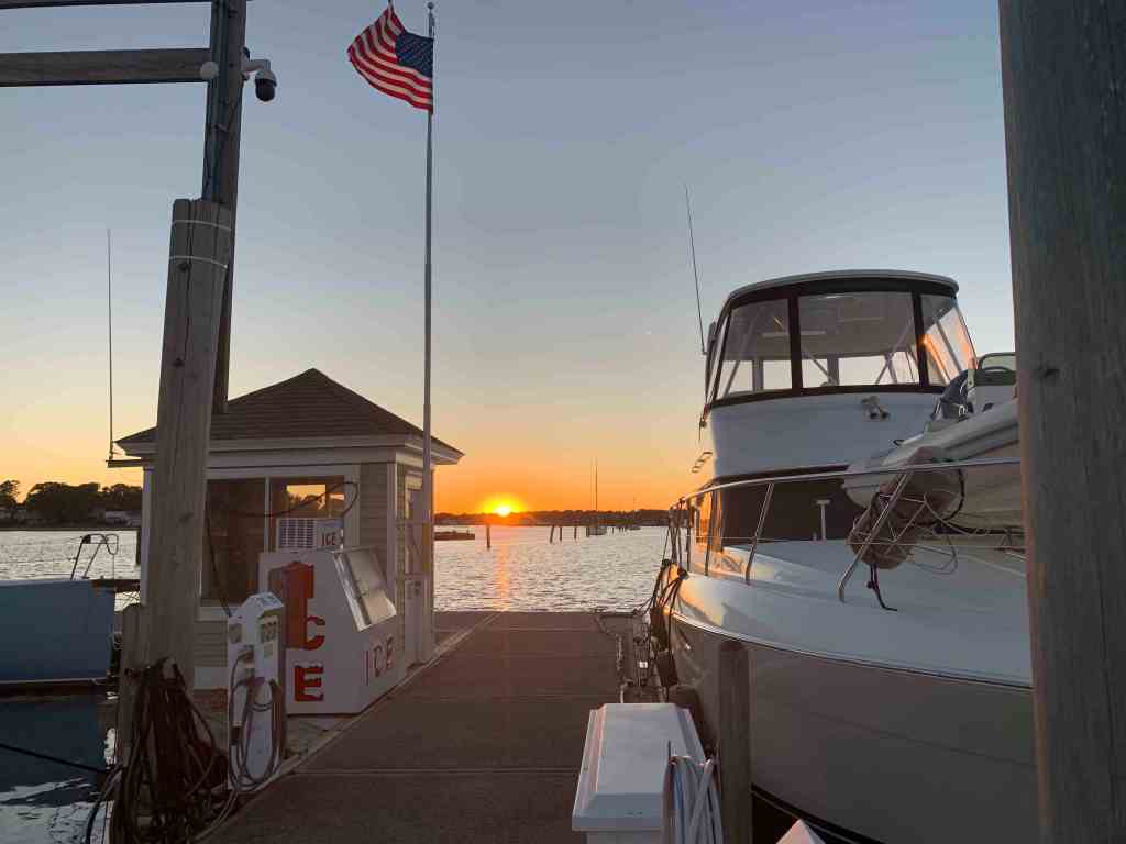
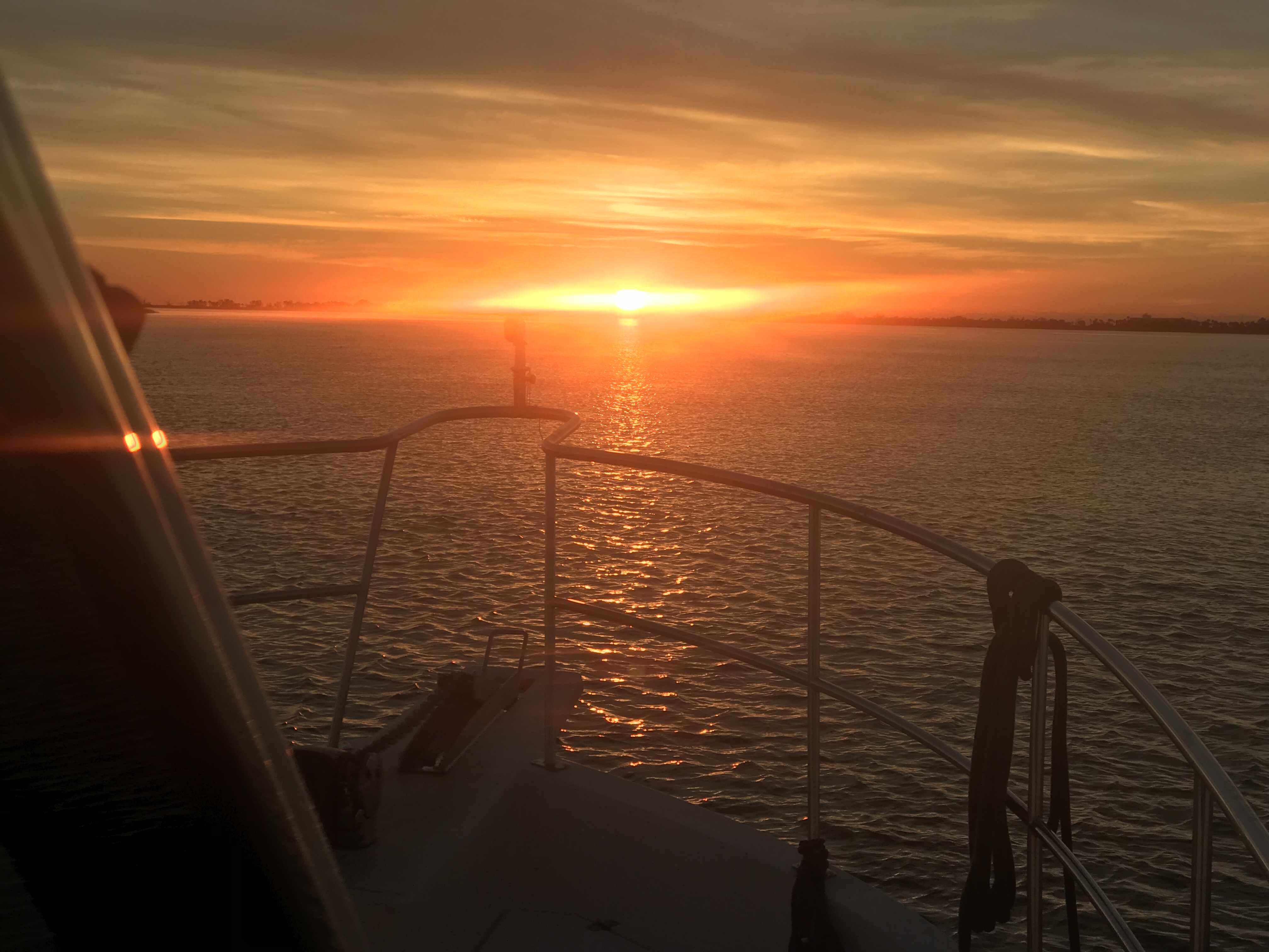
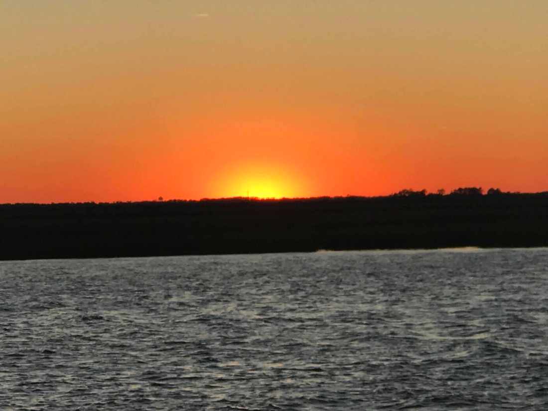
The sun was just setting so we snapped a few quick photos before we set off to find Guacamoles restaurant.
Sunset
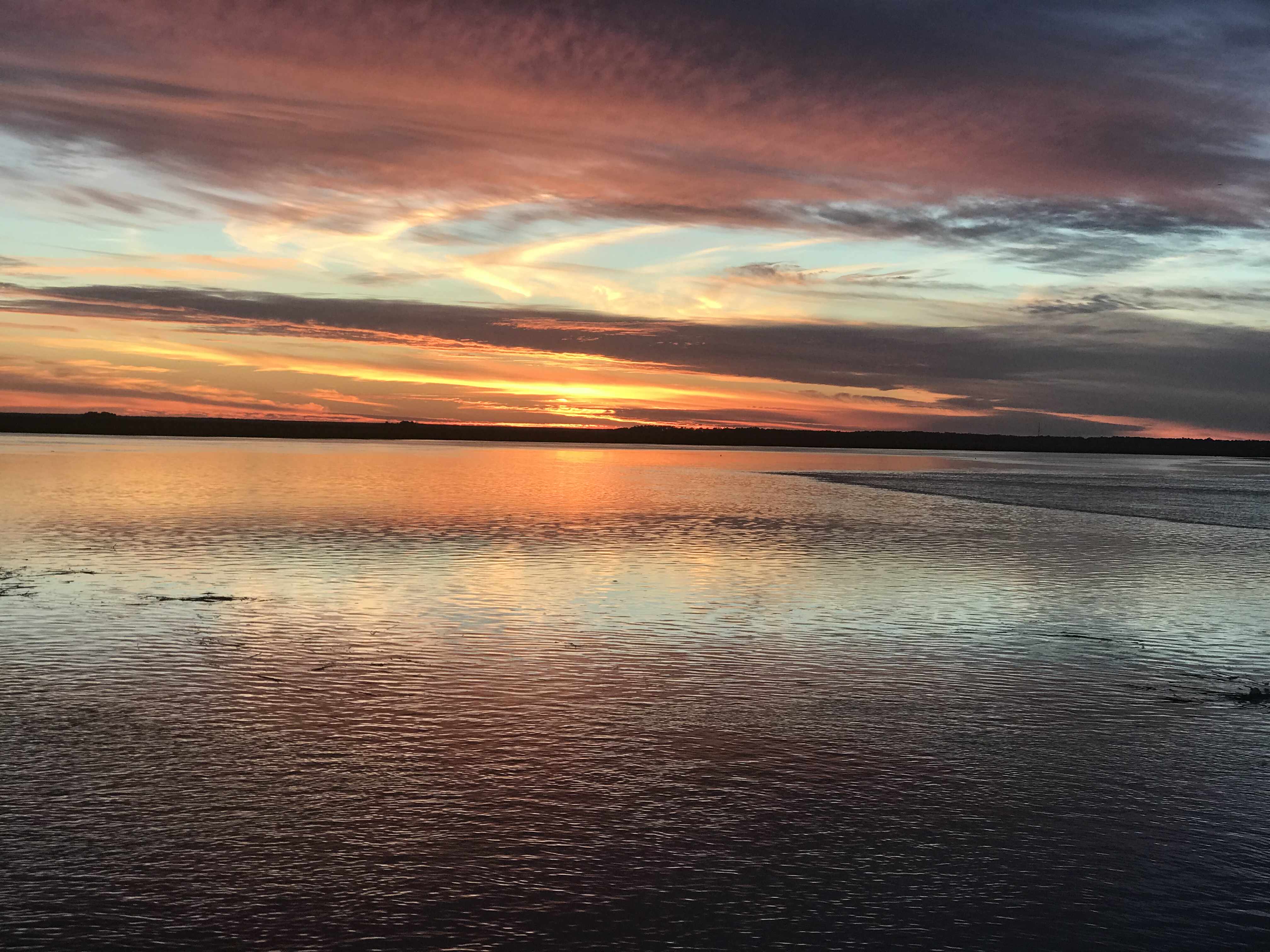
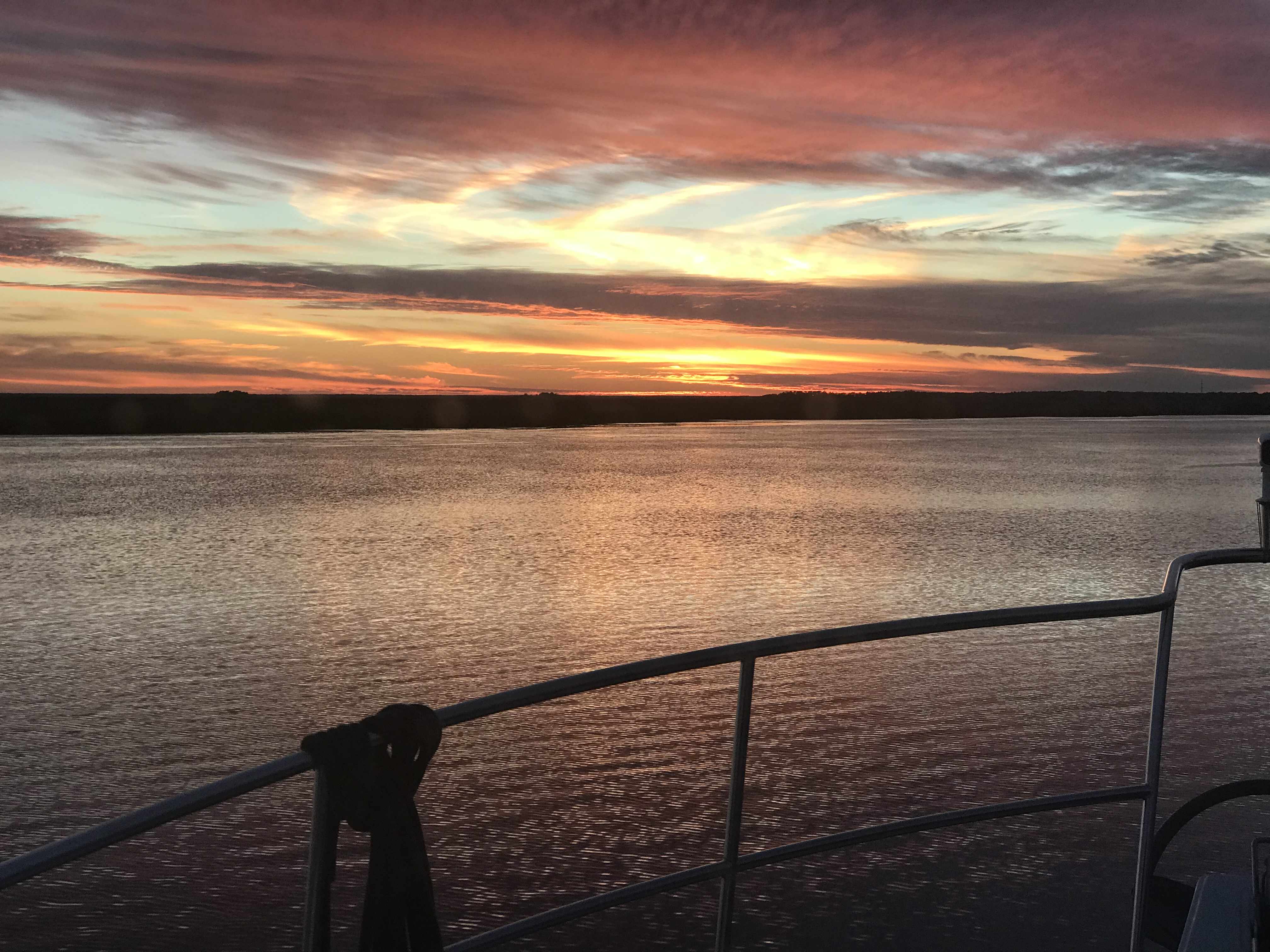
Sunset
Sunrise
Sunsets & a sunrise
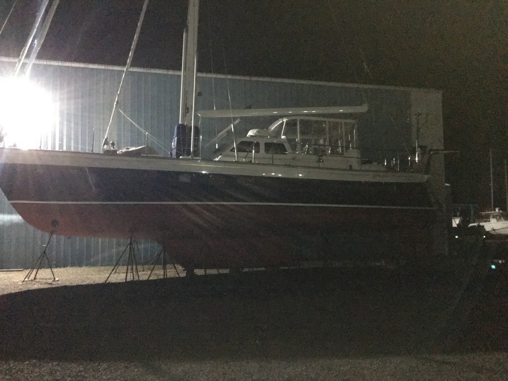
Our walk to Guacamoles turned into an adventure and we stopped to checkout a few boats sitting on the hard. This large motorsailer was a cross between my last sailboat and my current trawler. A sexy beast she was.
Sexy Motorsailer
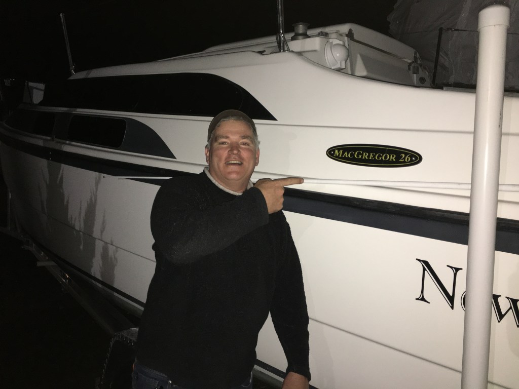
The next boat caught my eye for a different reason. It was the same model as my first sailboat. A MacGregor 26X. I always had a dream to become a sailor exploring far away islands somewhere on the globe. I had to start somewhere and the MacGregor was a boat in my budget. I smile when I think back on that boat and the good times that were had aboard.
Memories of my First Ever Sailboat
Seated at Guacamoles it was time for some table-side guacamole and Mariachi music.
Do we call this a Mariachi Band?
Renee & I posed for a quick pick before retracing our steps back to the boat and calling it a night.
The next morning I stopped to checkout a Farr 50 that was without it’s mast. Nice looking cruising boat.
Next we fired up the diesel, put her in gear and pulled out of our slip. I snapped one last photo as we passed the fuel dock on our way out. Our next destination would be Port Washington on the other side of Long Island Sound.
We ended last winter season in the Abacos, Bahamas. It was an amazing experience to be able to spend so much time exploring the Abacos. When we heard that category-5 hurricane Dorian had made landfall on Elbow Cay in the Abacos we feared for the safety and well-being of the Bahamian people. Worse yet… Dorian seemed to stall out over Freeport in Grand Bahama Island.
Category 5 Hurricane Dorian over Freeport, Grand Bahama Island, Bahamas
Treasure Cay was our favorite spot in the Abacos and we were stunned to see that little more than the concrete bar top where we sat was left standing.
Destruction of all but the Concrete Bartop at Treasure Cay in the Abacos, Bahamas Condos lining the shores of Treasure Cay, Abacos
I have been reading all the Bahamas Facebook group posts and find it inspiring to see how many US boaters are making their way back to the Abacos to help with the reconstruction efforts. If it works out, I would be proud to join the Abacos support group.
This summer was very busy for me and I only got to take the boat out for a couple of weekend trips to Newport, RI. Thanks Preppy for convincing me to stop working on projects and get out there. The rest of the summer was spent on boat projects and family matters.
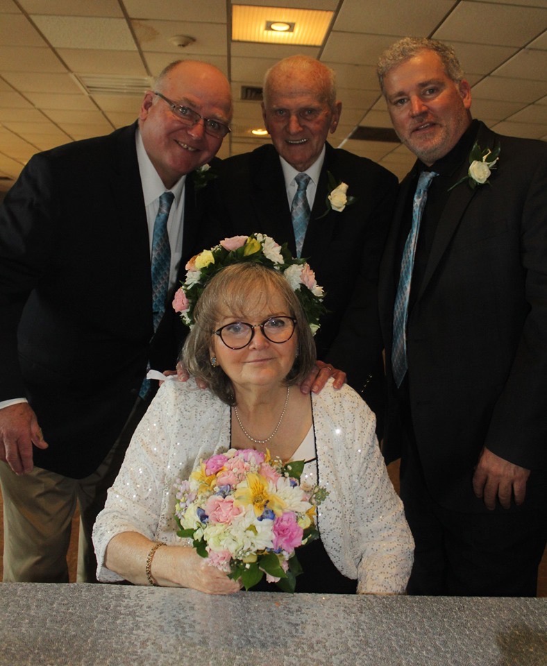
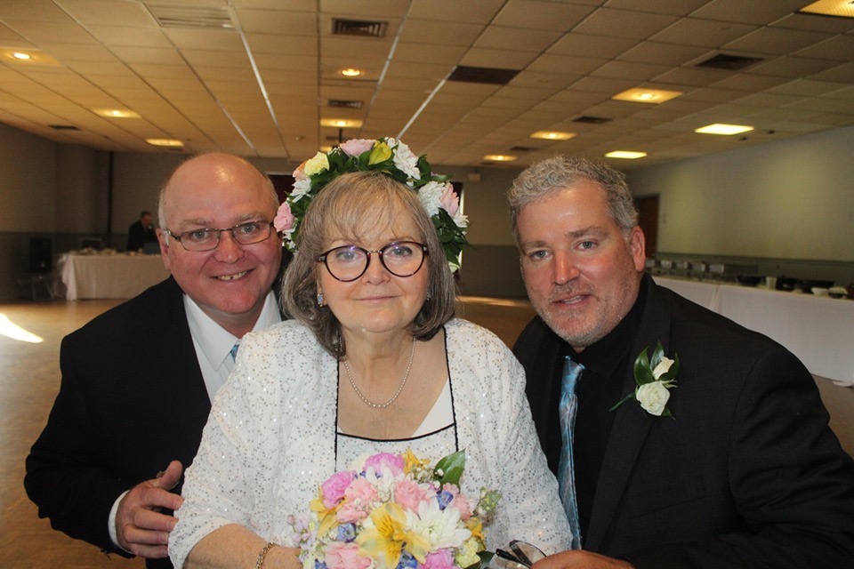
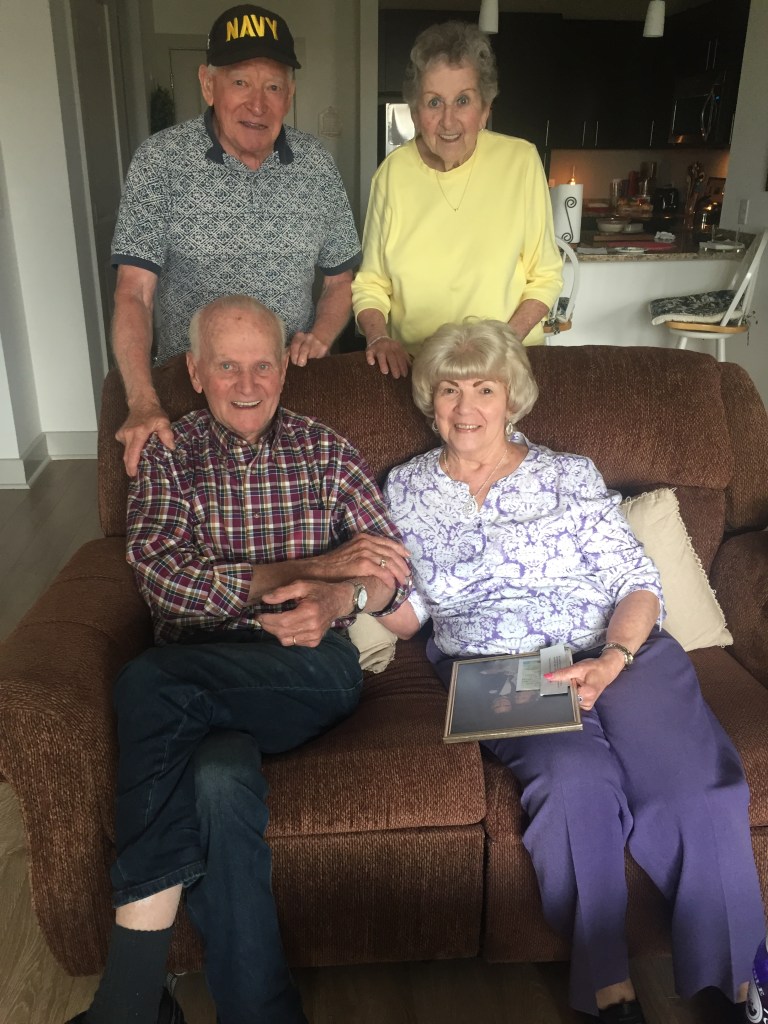
My sister got married to her boyfriend of many decades, Michael. They were kind enough to let me officiate their marriage. Just call me Father Mahty 😉
Bride & Groom
Bride and her Men
Siblings
John & Erin with the Bride & Groom
Michael & Me
Me & my Sis
Nora & Gianna just can’t get enough of Gumpy
Doreen & the Girls
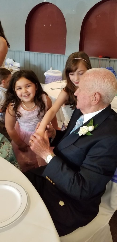
Seeing my family after being away all winter is something I look forward to.
Dad Made it to the Boat!
Whatever I’m sleeping
Where you at Dad?
This Couple Make My Trip South Possible
Dad and Me @ John & Erin’s Wedding Party
Aunts and Uncles
Spending the summer on the docks means lots of nights spent with friends.
Fishing with Friends on B-Dock
Bon Voyage Party (At least the remnants of it)
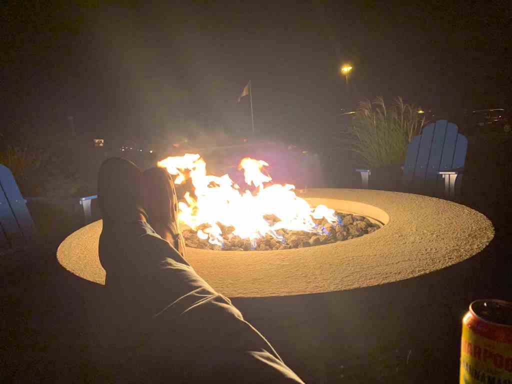
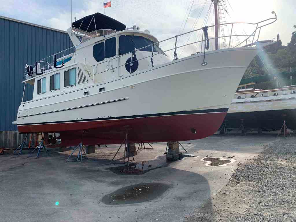
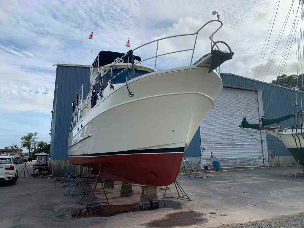
Preparing to spend all winter cruising somewhere warm means having the boat hauled and put on the hard for new bottom paint, zincs, and hull waxing. This year I was managed to get all that done is only 4 long days. Each night after the working long days under the boat, it was time to walk over to the marina fire pit and relax.
After being under the boat all day a fire & IPAs are just perfect
There is nothing like a clean bottom.
Now it was time to use the marine travel lift and splash her back in the water.
Fall 2019 Splash Down
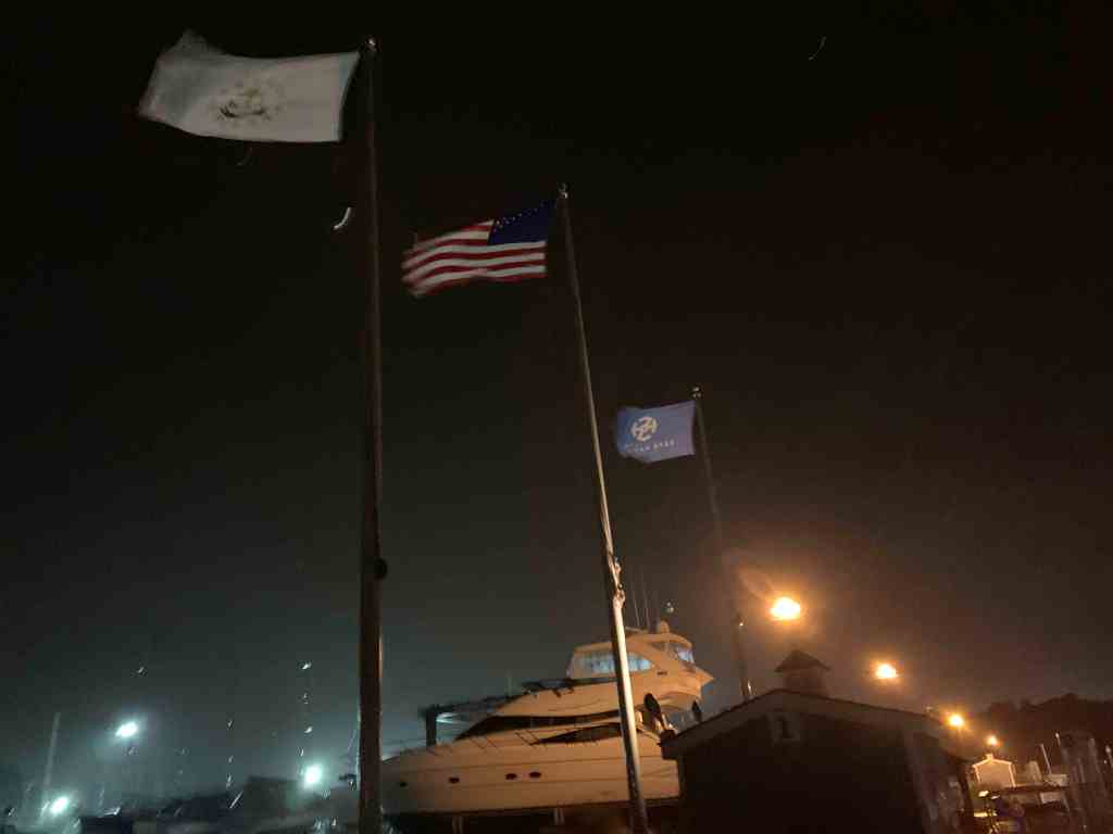
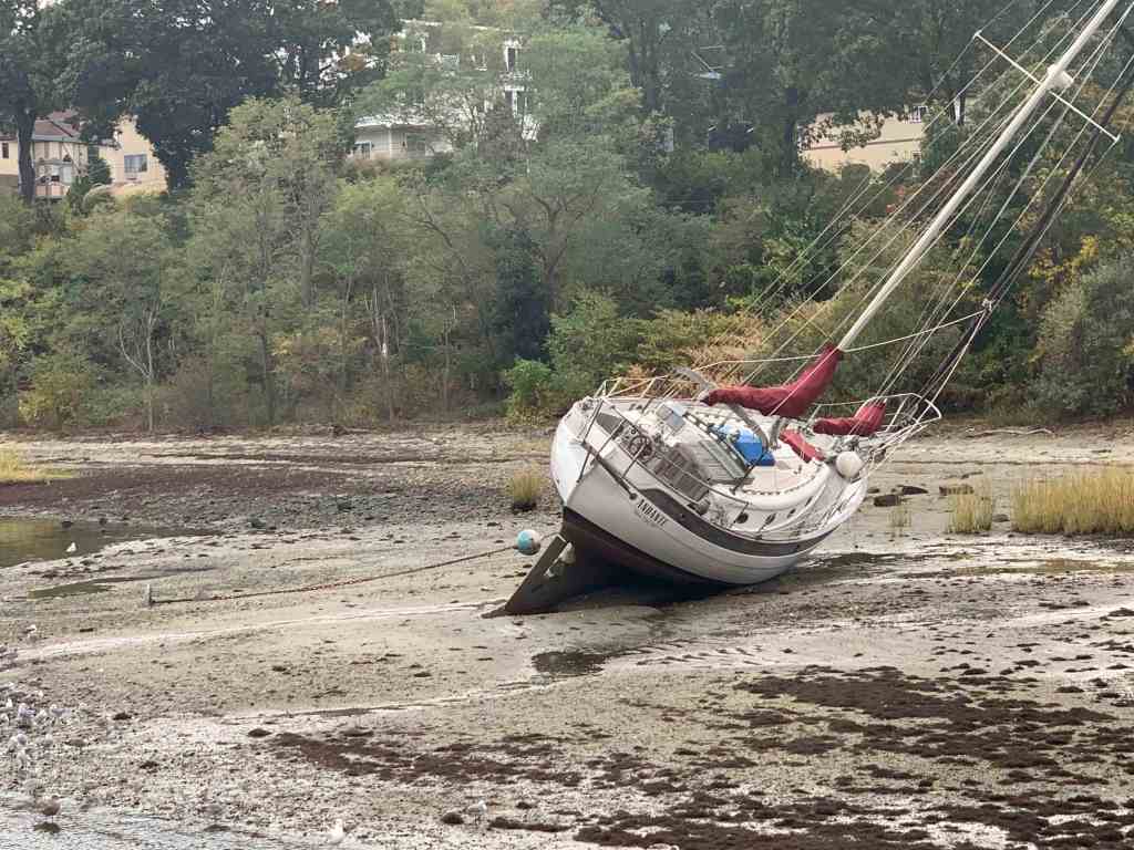
I got back into my slip just in time for a nor’easter that blew three moored boats in my marina ashore.
NorEaster
Marina Flags Are Out Straight
SV Andante Aground
SV Nepenthe Aground
I will start off this winter’s cruise with friends and fellow cruisers, Buddy & Renee. They are long-time sailors and just fun to have aboard. They put their beautiful Tartan 44 on the hard and came aboard but before casting off. … we set out to celebrate!
SV Star Watch
Thai Excursions in Warwick, RI
McKinley’s Pub in East Greenwich, RI
Now the time has come to cast off the lines so stay tuned for the next post detailing the first leg of our odyssey.
Kelly & I spent some time in Marsh Harbour (3rd largest city in the Bahamas behind Freeport & Nassau). Marsh Harbour is every cruiser’s reprovisioning stop in the Abacos. We stocked up on the items that we needed and frequented the local restaurants by dinghy.
Marsh Harbour
Enter Susan
Kelly’s sister Susan was nice enough to plan some time off and fly into Marsh Harbour to join us for the week. It’s so nice to have visitors aboard. We picked her up in the dinghy at the Union Jack Public dock on Marsh Harbour and the sisters were all smiles.
Susan Arrives
We wasted no time setting out for as many islands and cays as we could hit in a week. First stop …
Treasure Cay
Marsh Harbour to Treasure Cay
It was coming up on high tide and we made the trip over at 8.5 – 9 knots with the hopes of finding a mooring ball inside the harbour.
Welcome to TC signageTC harbour actually locks the boats in with a cable at night so be careful if you attempt to enter after 10PM!
Success. We grabbed one of the dozen or so mooring balls.
Anchored in TC with Toys still on fly deck
The water is so clear you can see the mooring block on the bottom.
Be careful not to ding a prop on the mooring blocks
We craned down the toys.
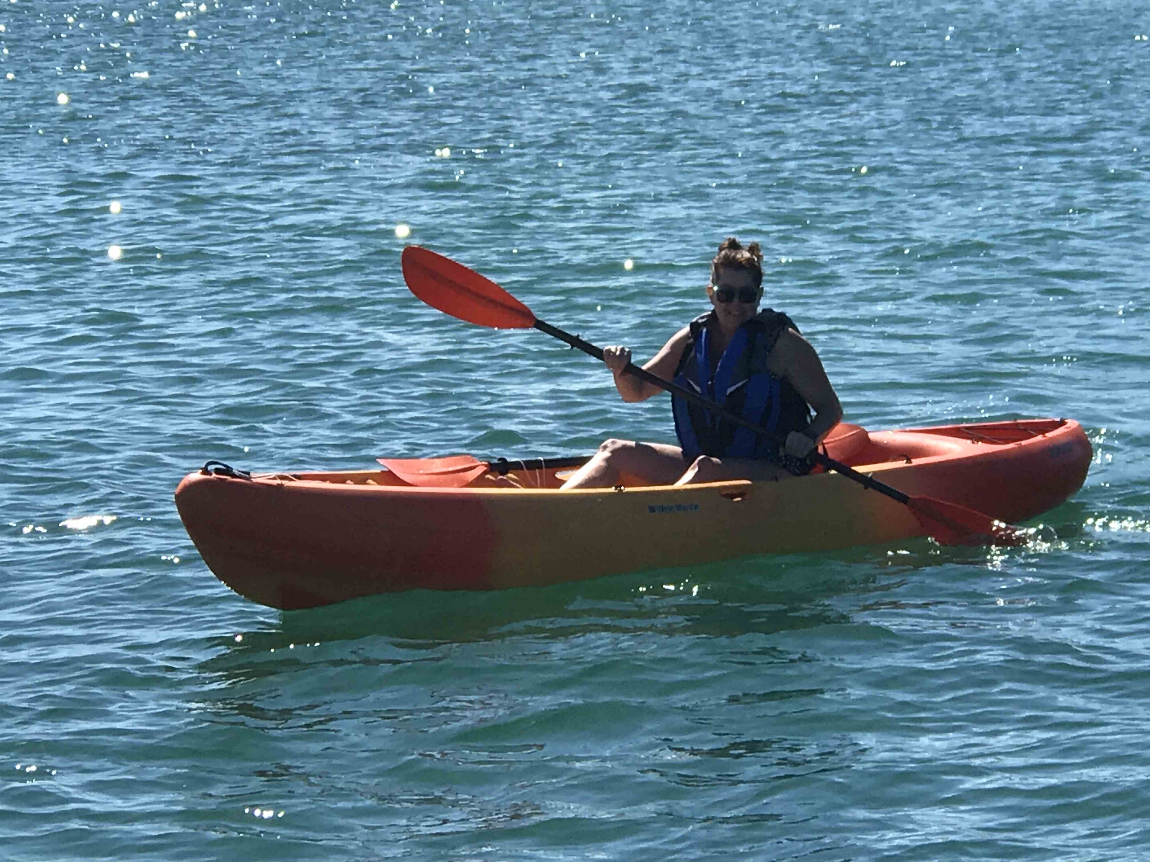
Kayaks were a new addition for the Bahamas
The girls wasted no time in trying out both kayaks.
Kayaking is hard work bring a cold drink
Paddling Susan
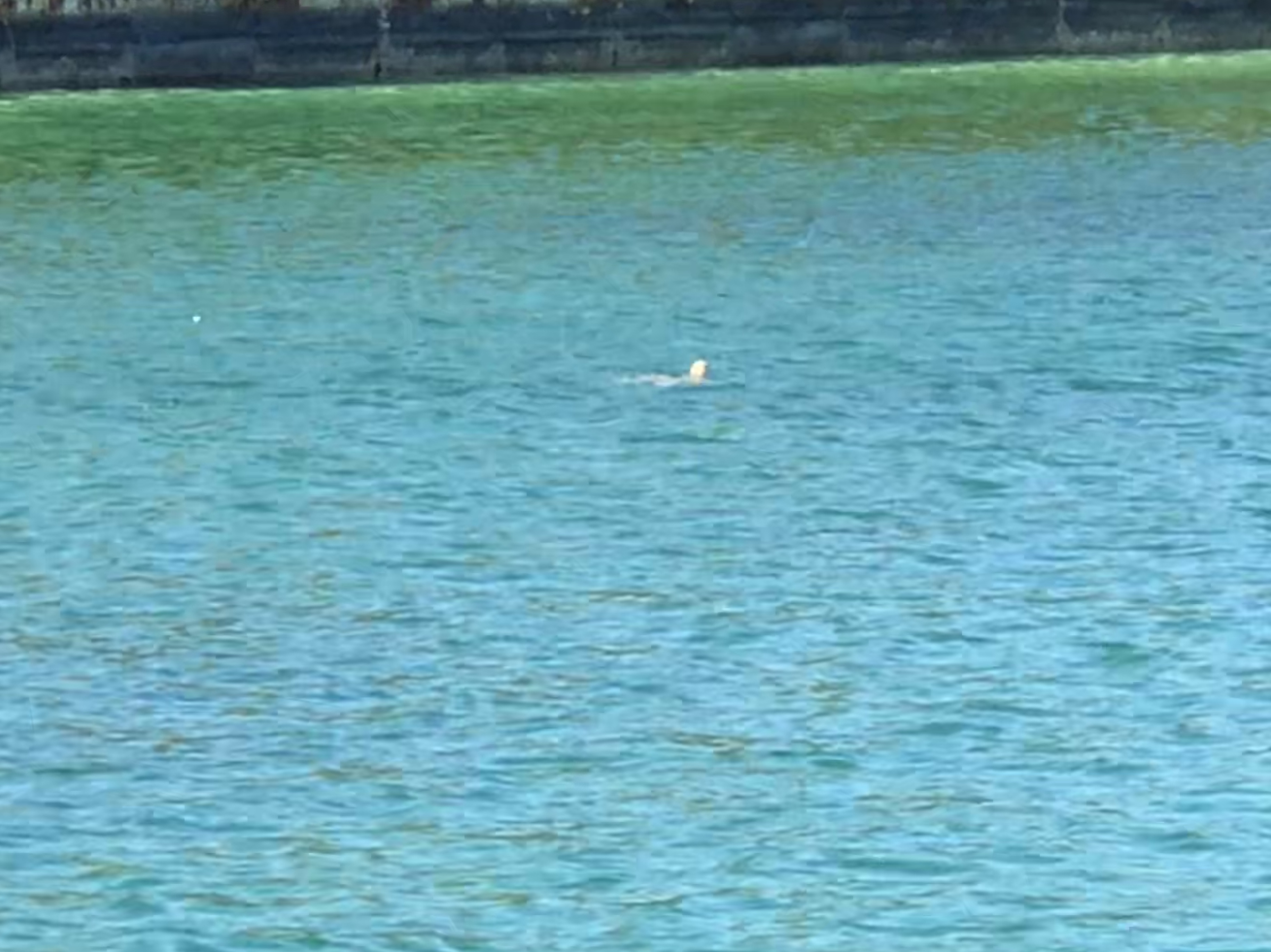
Sea turtle head
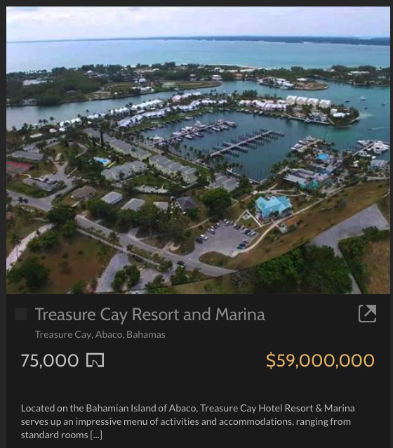
Treasure Cay Beach Marina & Golf Resort
A beautiful location and it’s for sale!
TC Marina
TC Homes
TC Marina Resort $59M
Tipsy Seagull
Frozen Drinks & Margaritas
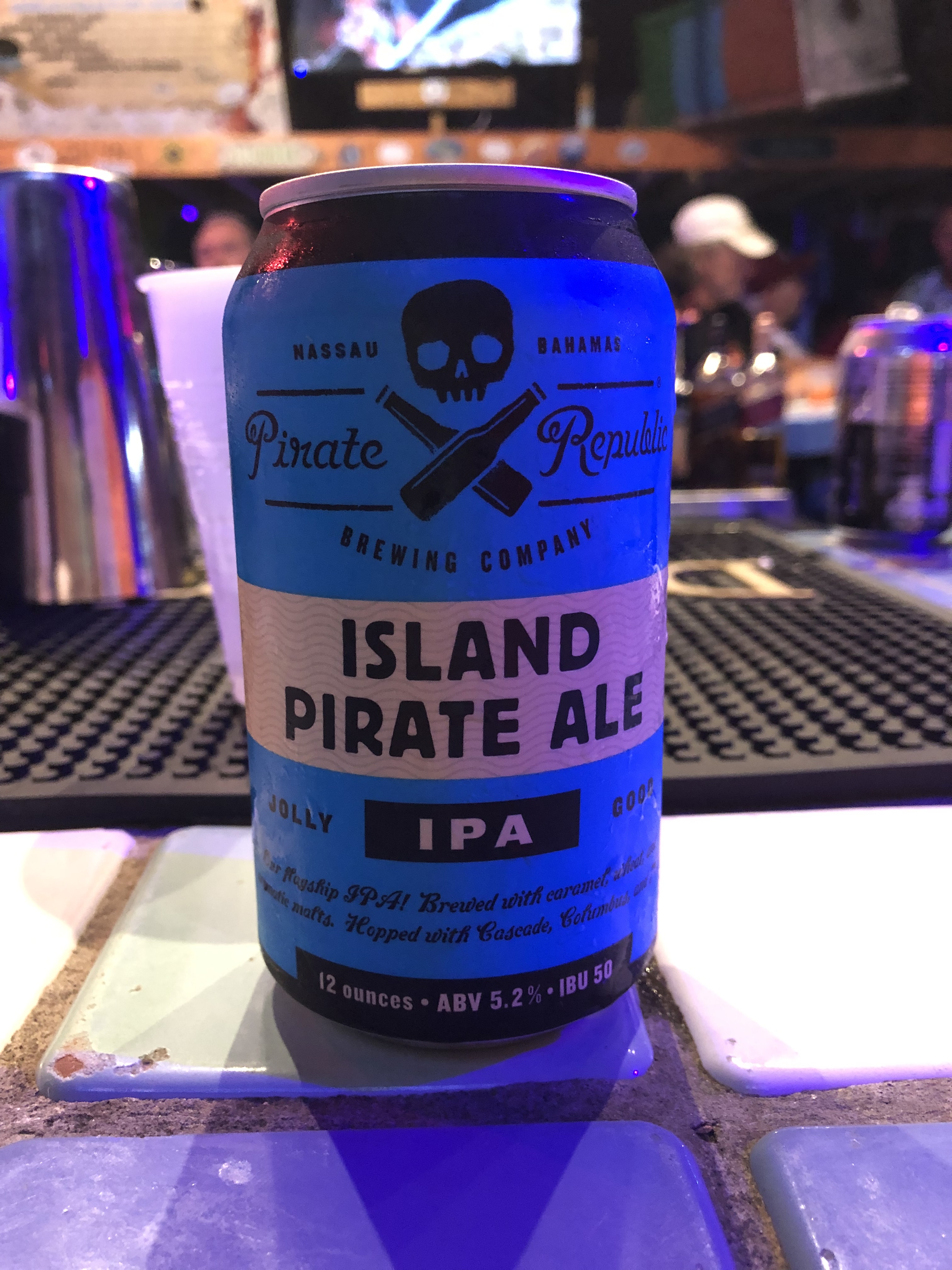
A local IPA!
Morgan Freeman’s Brother
Kelly swears this is a baby Godzilla
You giving me the stink eye?
Treasure Cay Beach
Treasure Cay has one of the top 10 beaches in the world so just a 1/4 mile walk and we had our toes in the sand.
Coco Beach Bar is here to serve you frozen drinks while you lounge under tiki huts.
Coco Beach Bar
CBB View
We spent two nights in Treasure Cay and I know why many spend their whole winters here. We had places to go so out the harbor’s entrance channel we went.
Sandy shoals encroaching on the channel
Sea of Abaco
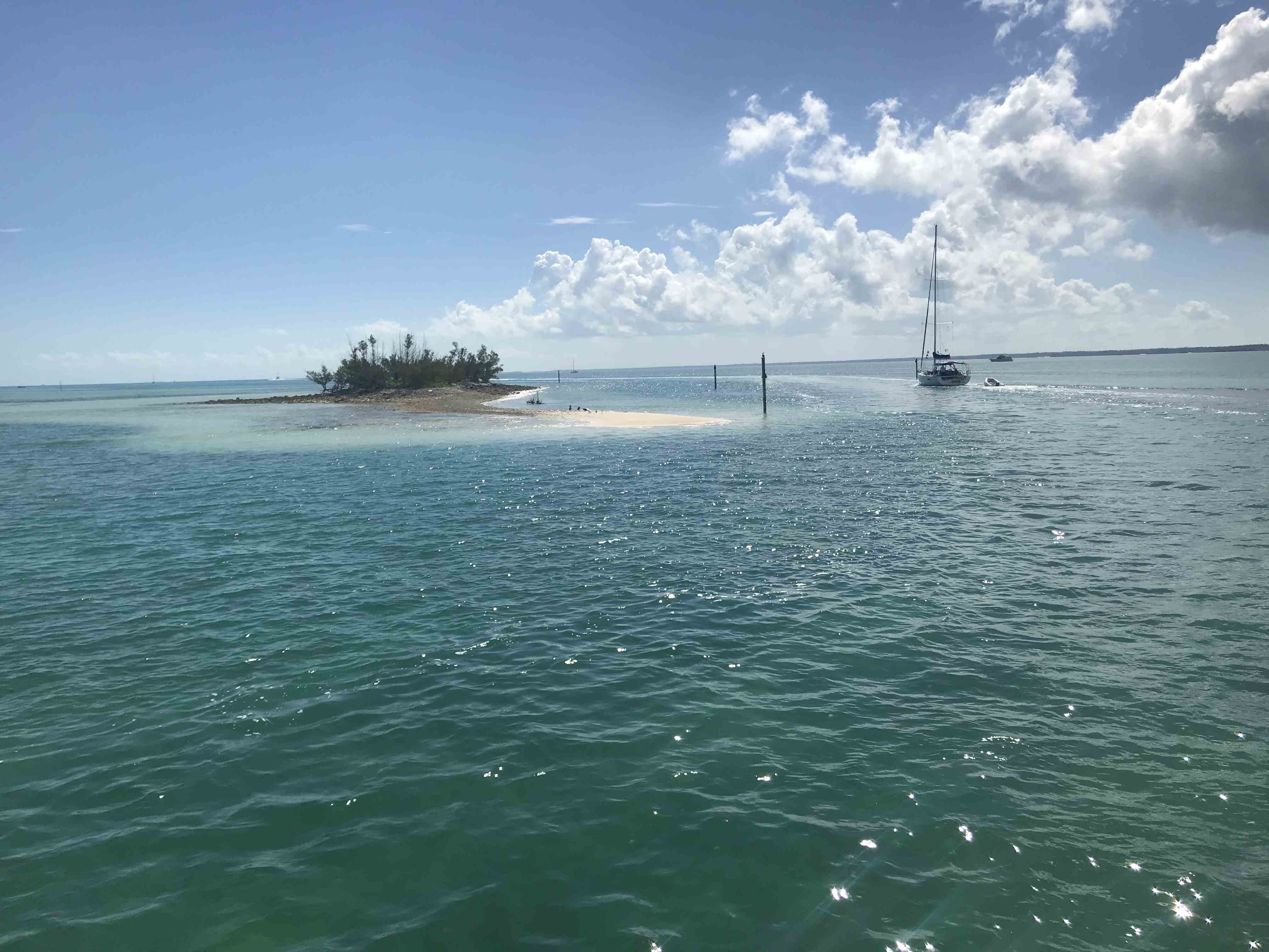
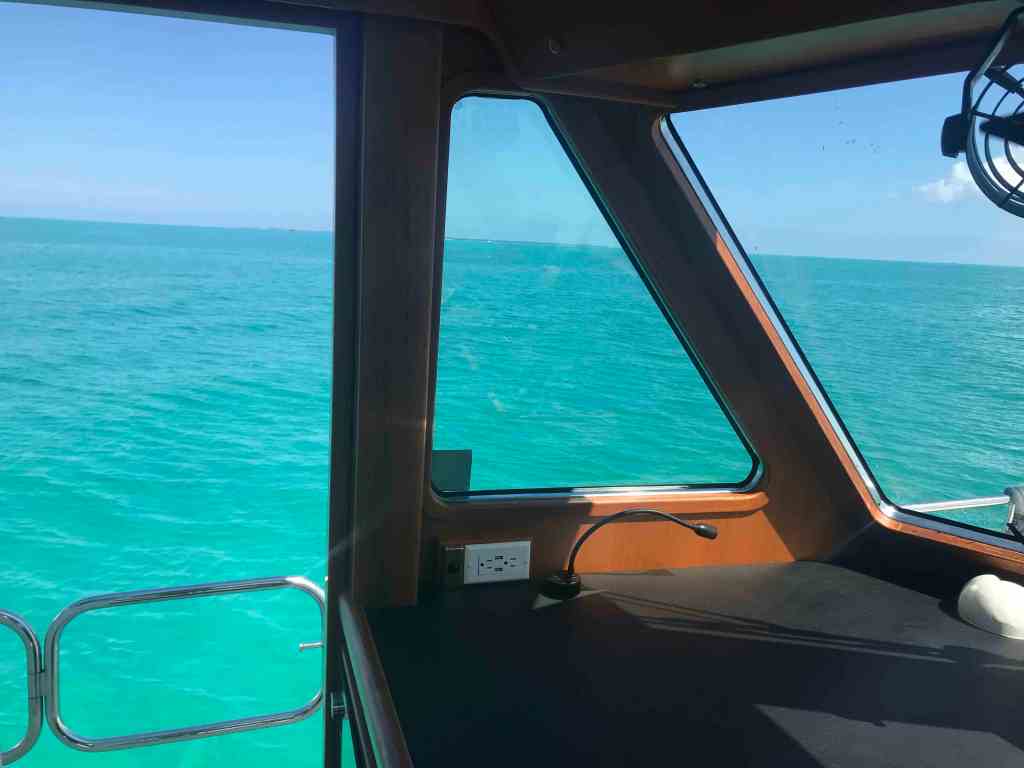
Once in the Sea of Abaco you are just blown away by its beauty.
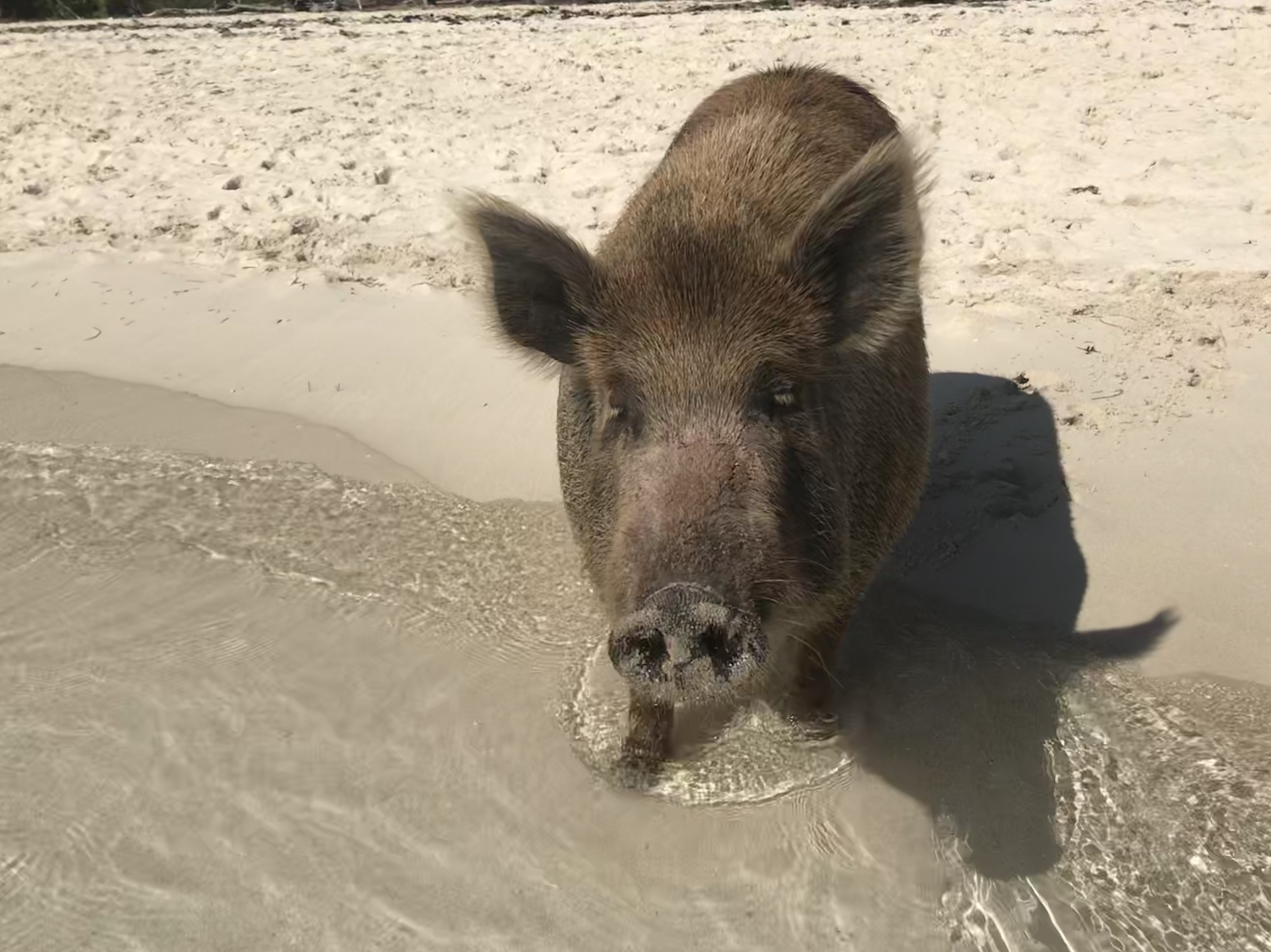
The seas were calm and we made our way through Whale Cay Cut and anchored off No Name Cay. Here we found others like us wanting to spend some time with the piggies.
Feed Me!
No Name Cay beach is beautiful and home to some friendly pigs and roosters.
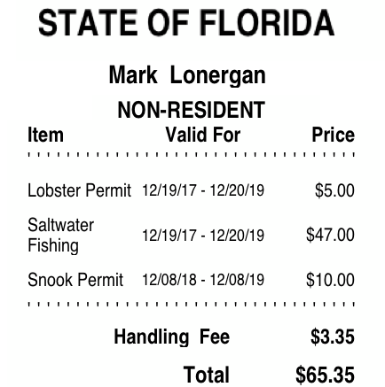
We weighed anchor and headed right next door to GTC. We passed many boats anchored off GTC and proceeded into White Sound. The narrow channel opens up and there are moorings inside if you call Donny.
However, looking around the harbour it seemed a bit quiet and with a little investigation we quickly learned why all the boats were anchored outside the harbor next to the town of New Plymouth. Out we went, dropped the hook with the rest of them and dinghed our way into the public dock in New Plymouth. We walked the narrow streets following the sound of a saxophone humming out some jazz.
Our trip down from Vero Beach yesterday looked something like this.
Leaving the Marina
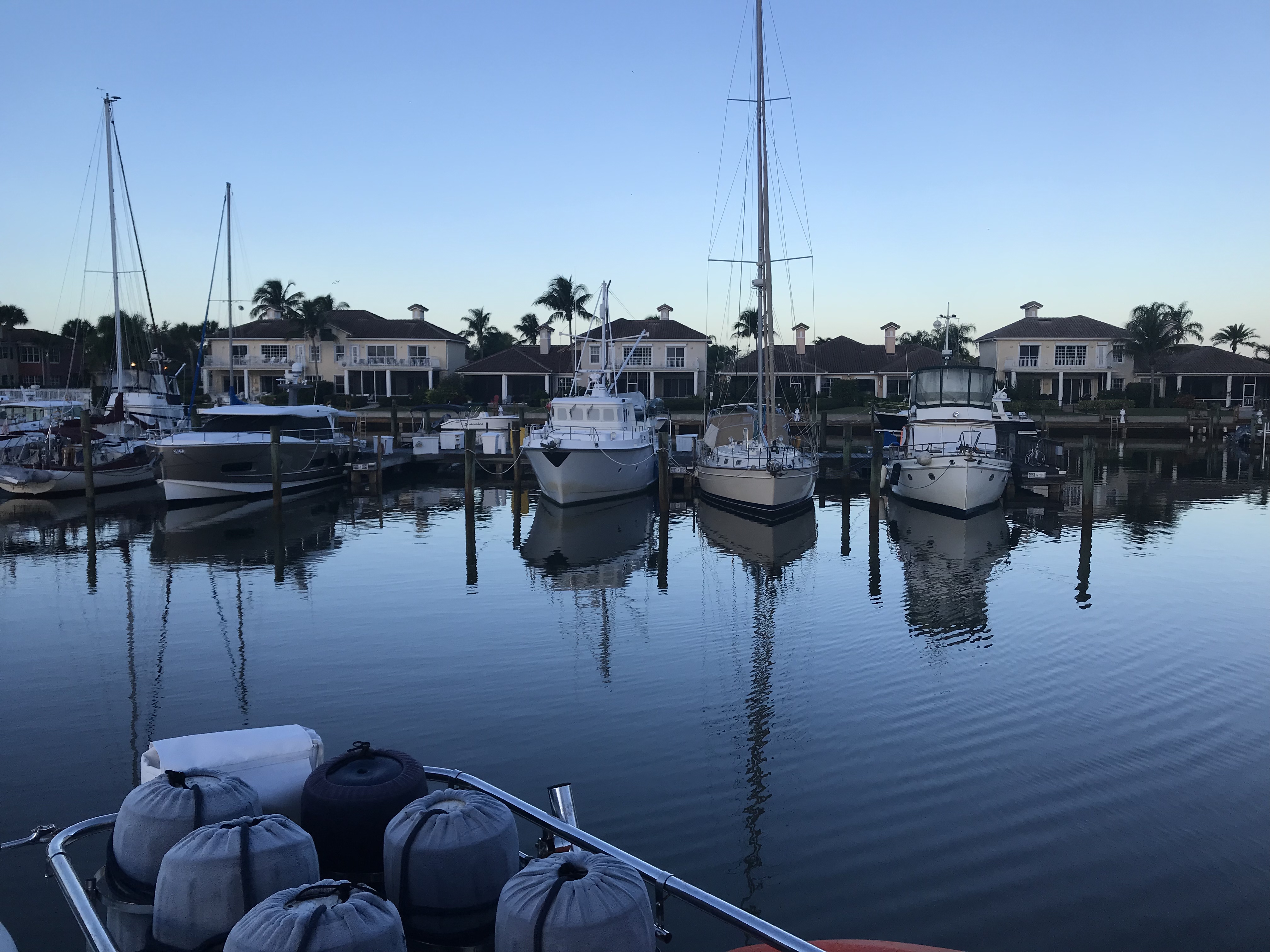
We left around 7AM as we had 60 miles to travel to our planned anchorage. After pulling out of our slip we put her in neutral to take a 360 degree view of the marina.
Looking back at our empty slip and friends Yachts
Trip Down the ICW
Low Bridges
One of many low bridges we ducked under
Duck
Beautiful Homes on the ICW
Beautiful
Corner lot
Beautiful palms
Yacht is longer than their home
Perfect lawn
Humble abode
Cool trees
Anchorage
Our anchorage for tonight
Happy & Brody are loving the sun on the cockpit grass
Moonrise pics are hard from a moving boat
Listening to the Counting Crows from the cockpit
Bahamas Bound
Tomorrow’s 4AM departure for West End Grand Bahama Island
We awoke to the sound of rain hitting the topsides of the boat. We weighed anchor in the rain and it poured for the next few hours.
Morning Ride leaving Fort Matanzas
We passed these hearty Jeepsters camping in the rain.
Myself, I prefered to tent in the dunes at the beach
The weather just hung over us all day. It did not help that we were motoring South, straight into the thick of it.
Rainy Day
The wind was on our beam and listing the boat to port. You can see the flags are flying out straight.
Flags are a flying
We passed two sunken sailboats and an aground catamaran.
Sunken Sailboat 1
Sunken Sailboat 2
Catamaran on anchor aground
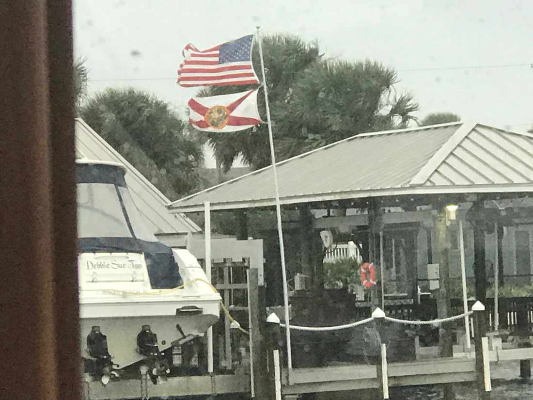
This guy wins the award for the largest boat house on the ICW today and also the most dilapidated boat house. I wonder how it’s even still standing after some of the storms?
Dilapidated Boat House
We still had a long way to go if we were going to make Titusville, FL and the sun had just set.
Sun has retired for the night
We kept on into the night while Kelly cooked an amazing steak tip dinner while underway. We may be pulling 10-12 hour days at the helm but we are eating well. Soon we picked a spot to anchor which was tucked in a corner between land and a railroad bridge. A bit shallow but well protected for a good night sleep. It’s very dark with only a thin waxing crescent moon but you could see the distant lights of Titusville.
Distant Lights of Titusville, FL
Today’s leg of our journey looked something like this finger drawn route.
We had a peaceful night on anchor in the Amelia River. We awoke early before the sunrise.
6:50AM Anchored on the Amelia River
Somehow we did not get moving till 8AM. We have a thing about trying to cover as many miles as we can each day and that means you need to use all the daylight there is on the ICW. Not so much this morning. The good news was that we were leaving on a high tide so little worry of running into a shoal with the added 5′ of tide.
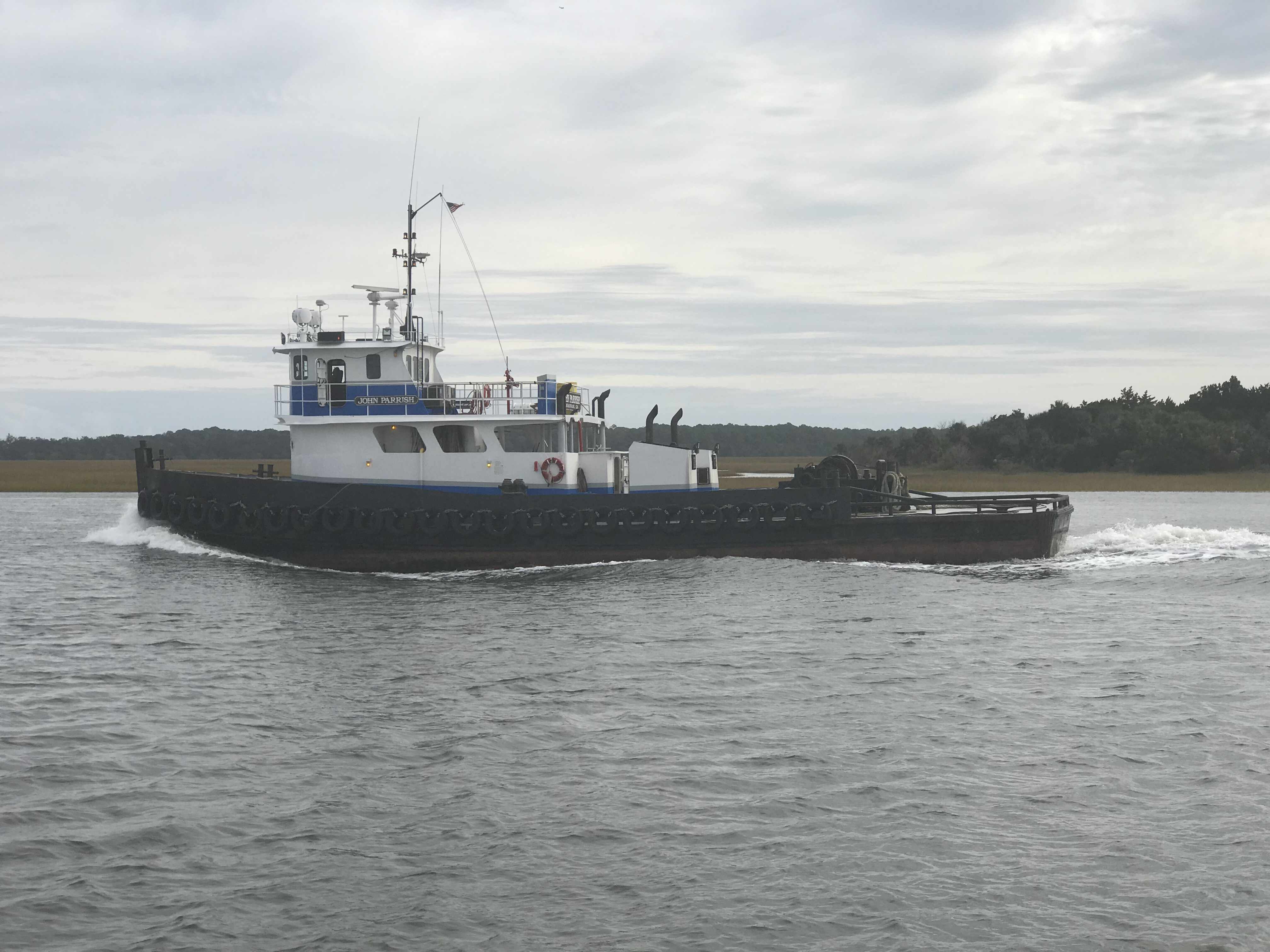
Two tugs raced past us and I was reminded that you can tell when a full displacement boat is running at near ‘Hull Speed‘ by simply looking at the bow wake length vs the boat length. You can see the smaller tug’s bow wake dips and then crests almost at the stern of the tug. They were running hard and burning fuel. They must be in a hurry to get to the next job cuz running fast = diesel = $ = expenses for them.
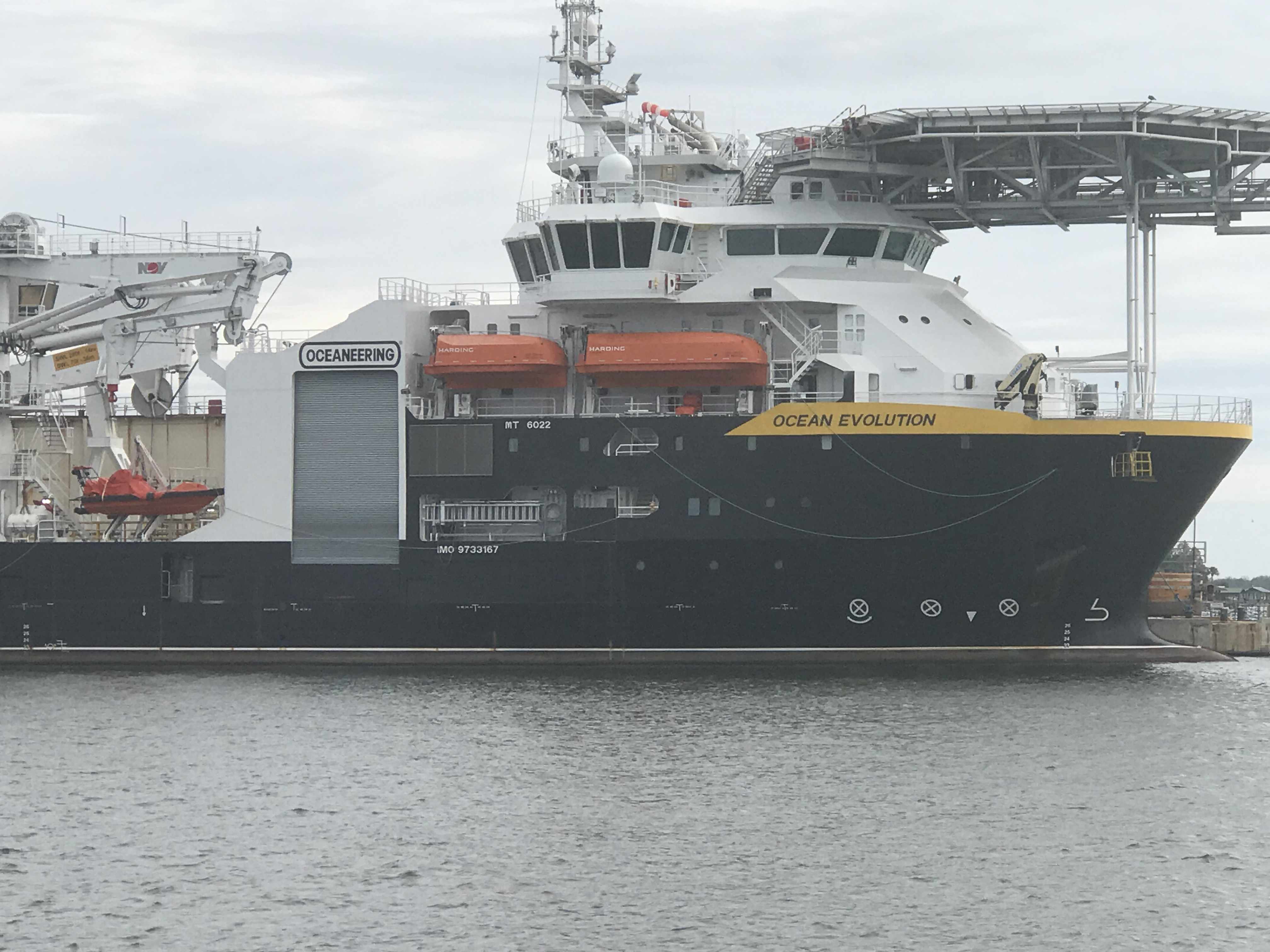
Where the ICW crosses the St. Johns River in Jacksonville we always see large ships either underway or being repaired in the boatyards dotting the shore.
MV Pegasus
Ship Ocean Evolution’s fwd heli pad
Georgia Queen in Dry Dock
Underway Ship passing drift fishing boats
Last year we passed this sailboat on a small island and it still looks out of place. How’d it get up on the island? I can only assume a barge with a crane placed it there to keep it out of the way of navigation but why leave it there?
Derelict Sailboat on stands on small island
We passed this other sailboat that was using their dingy to reset their anchor. Their sailboat was too close to the ICW channel.
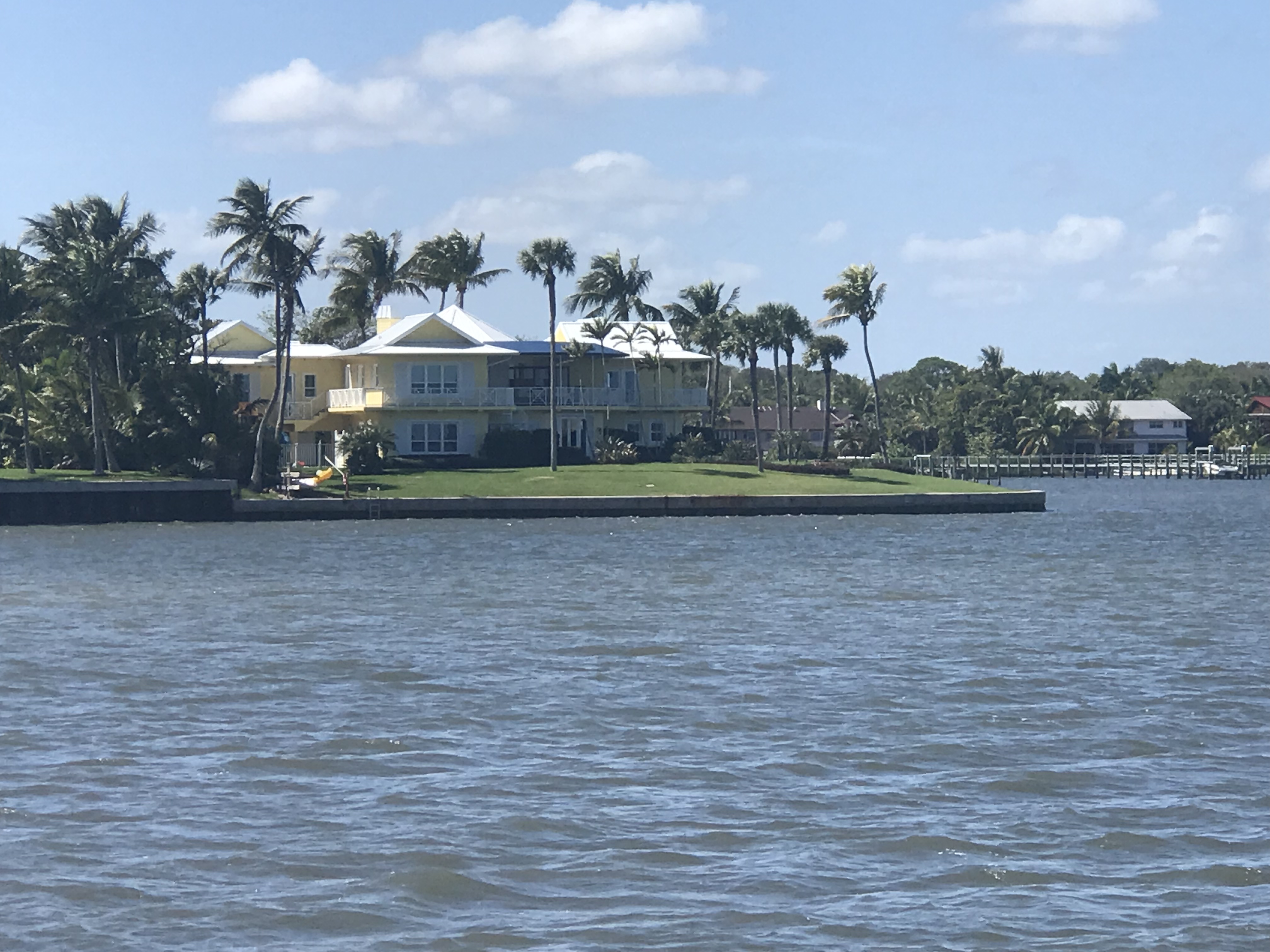
There are some beautiful homes along the banks and this was just one of them.
Home Along the ICW
As we approached this bridge in Isle of Palms, FL we noticed 3 16YOish boys tied their boat to the bridge and were fishing beneath the support. This is a NO-NO in the boating world. It’s a federal law that you cannot tie a boat to any navigational buoy or bridge’s fender system (the boards that protect the bridge supports from boats as they pass through the center span).
Boys tied to bridge
As a boater you must treat bridges with special attention. When you pass under a bridge you must do so at no wake speed (about 6.4 knots for MV Simple Life). For the boats hanging out under bridges (usually fishing) you must not block the marked channel through the center span. You must also be careful as boats passing through the fender boards may not see you if you are hidden by the boards or bridge supports. Also after 9/11/2001 Homeland Security legally restricted areas under certain bridges and it’s a felony if you break that law. Individual states may have laws about simply being near any bridge in their state.
Florida Statute 327.44 refers to interference with navigation and states that anchoring underneath a bridge or adjacent to heavily traveled channels constitutes interference if unreasonable under the prevailing circumstances. There’s a lot of gray area here and not everyone has the same understanding of “unreasonable interference,” but you likely won’t get in trouble for anchoring under a bridge if you are well out of the way.
FWC (Fish & Wildlife Conservation) officers may stop you if you attempt to anchor under the bridge. It should be noted that the area around a bridge is more likely to have un underwater cable that either brings power to a lift or swing bridge or simply crosses over to the island. You don’t want to hook your anchor on these power cables.
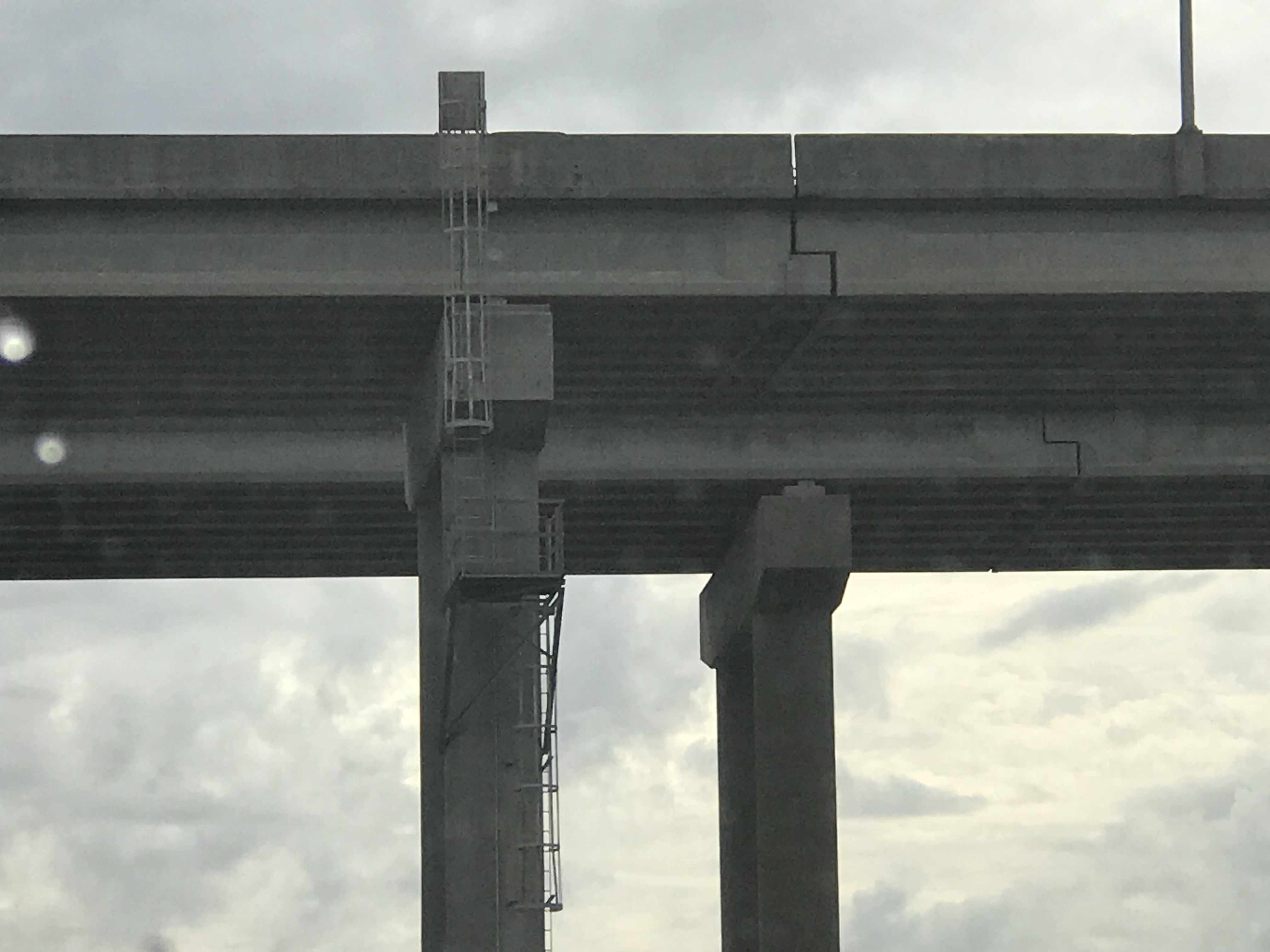
Aside from all the bridge rules of boating, I was more interested in the expansion joint on this bridge.
Bridge Expansion
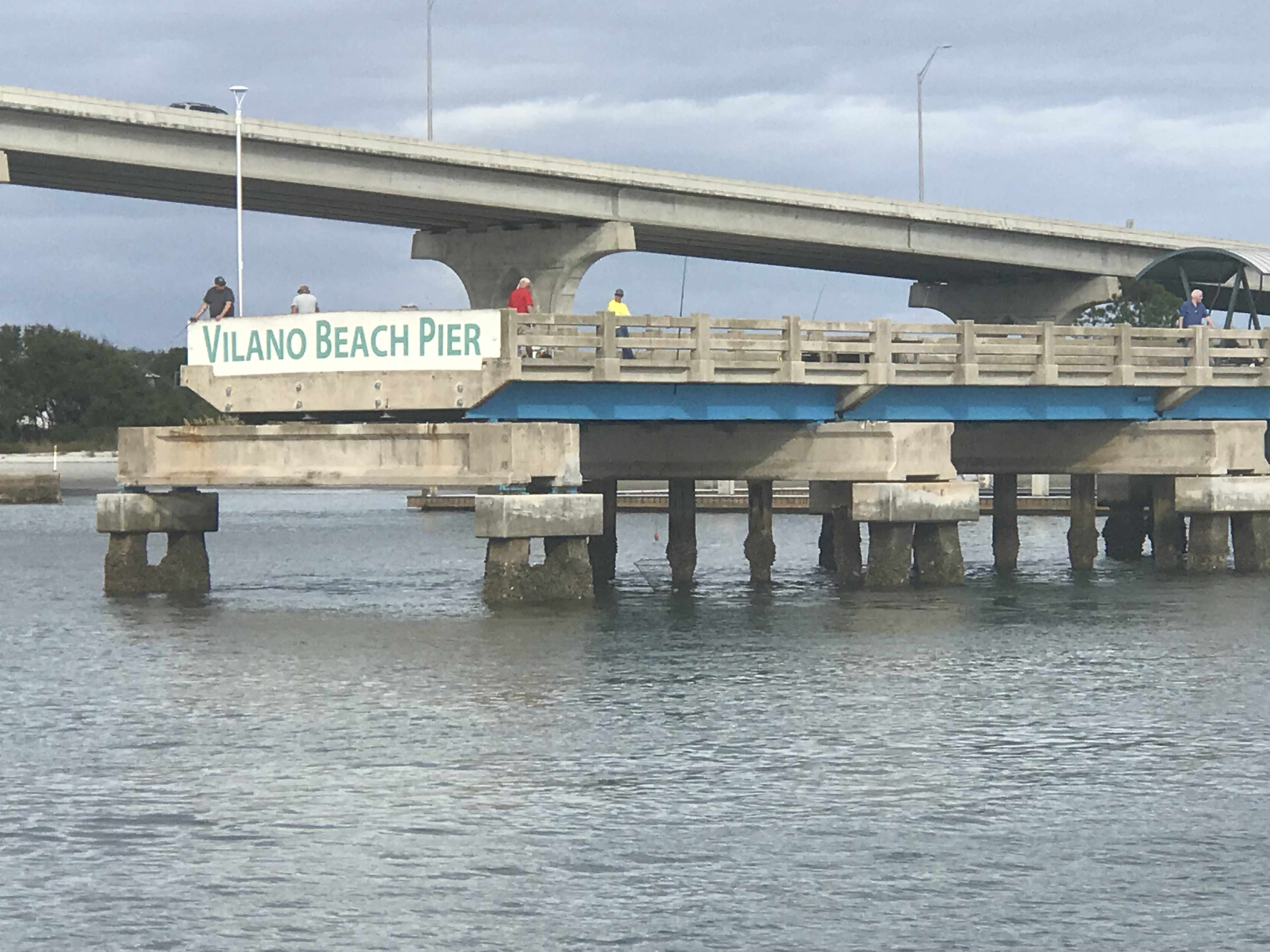
We pass many engineering structures like bridges and this pier. I’m sure the first piers were only for boats to dock but soon “pleasure piers” emerged that were simply for people to stroll out onto or fish off.
I guess they want boats to know the name of this pier?
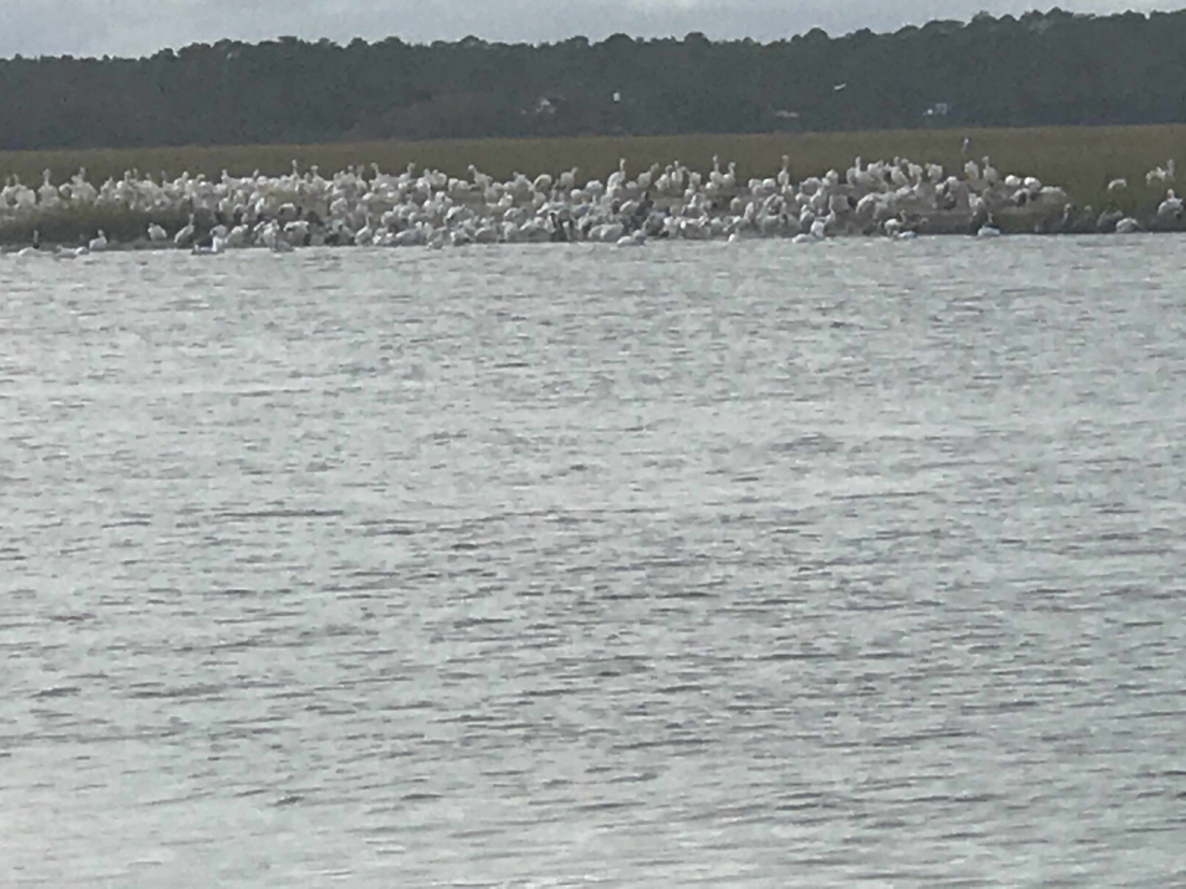
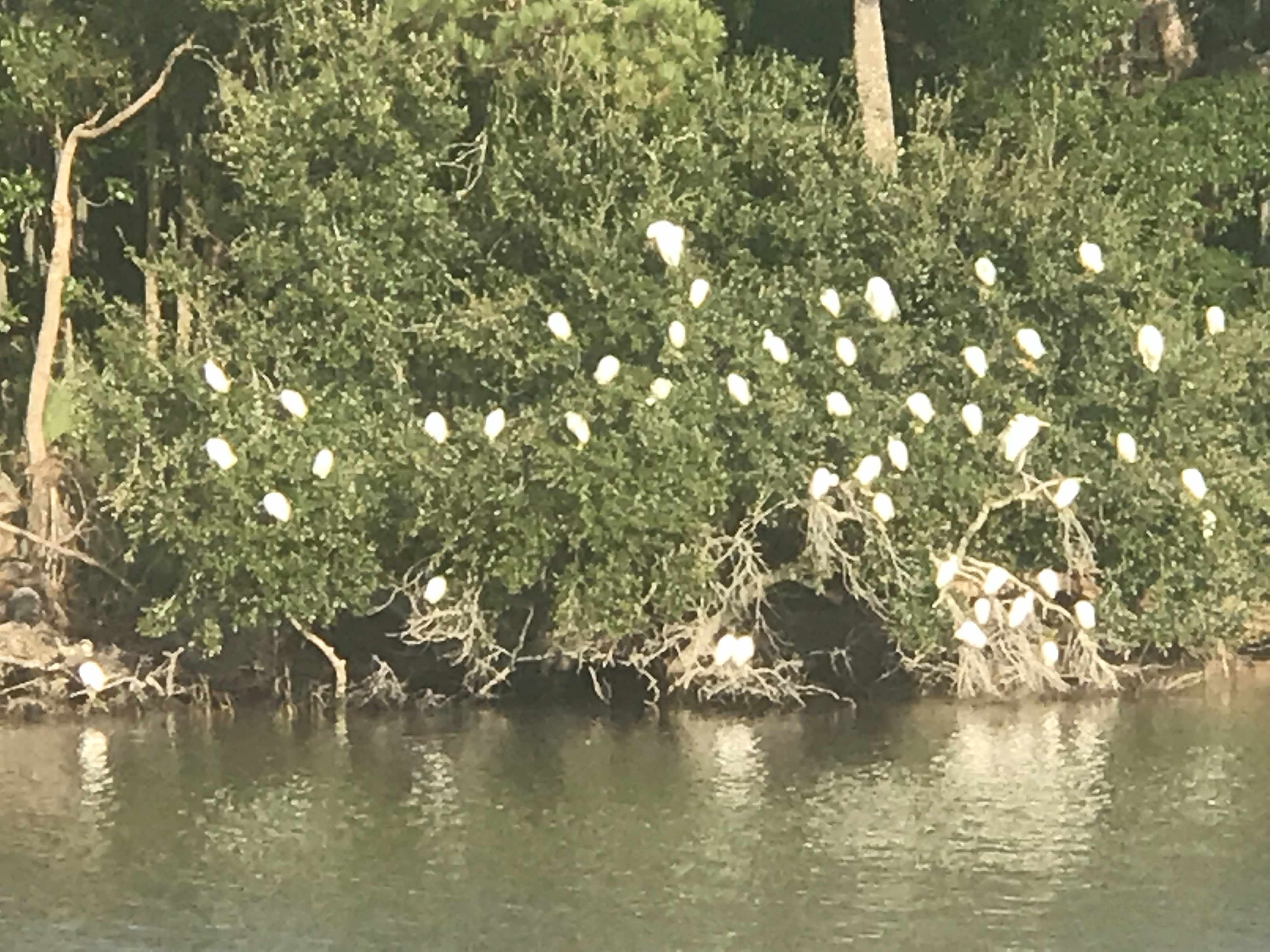
We find it interesting that “birds of a feather flock together”. It’s like all these white pelicans said … “Hey, why don’t we all me on the banks of the ICW over where Jimmy found that big pile or old crab shells tomorrow?”. They clearly enjoy each other’s company.
White Pelicans crowded together
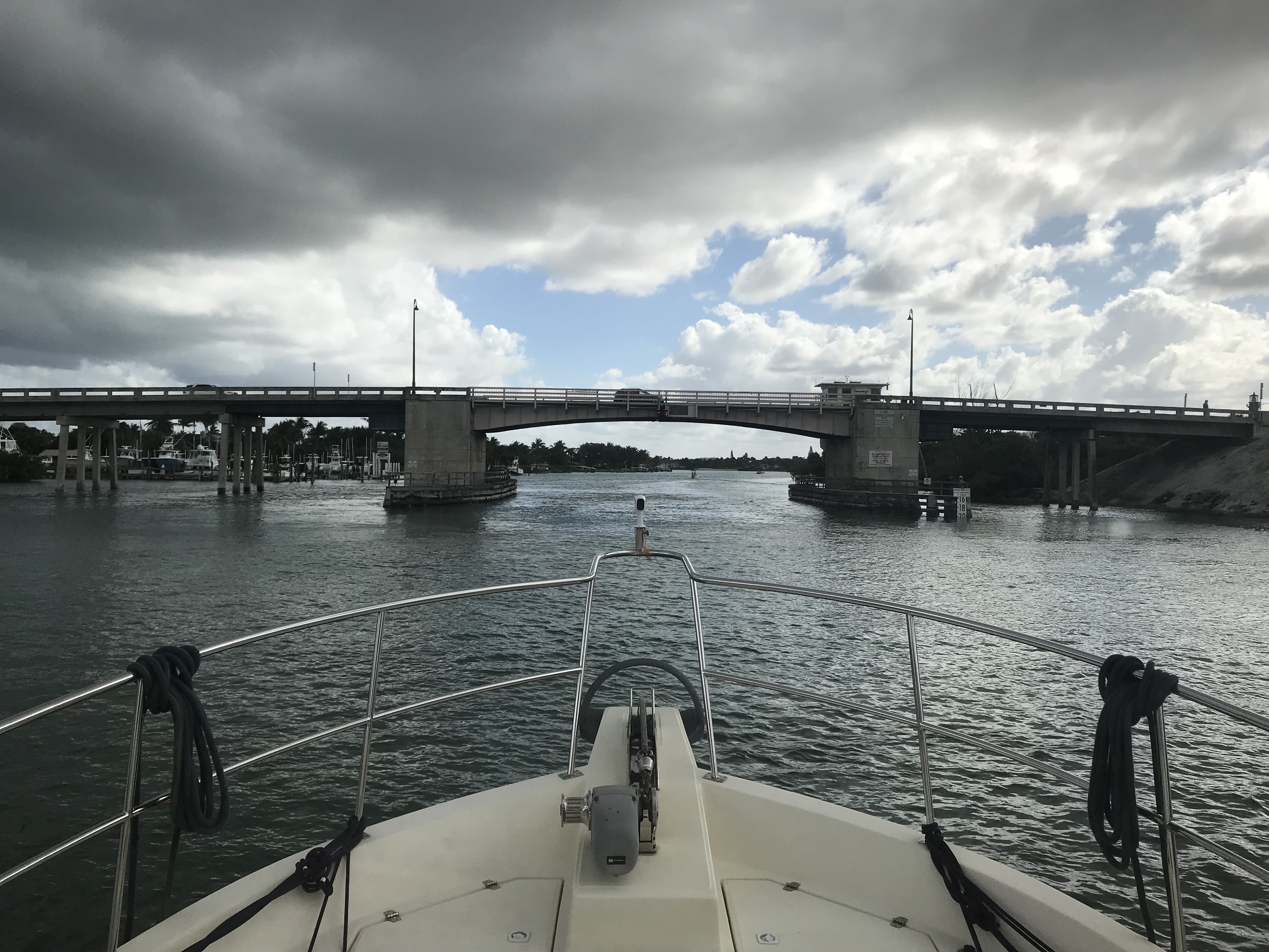
Soon we were waiting for Saint Augustine’s ‘Bridge of Lions‘ to open (every 30 minute openings). In line in front of us was a boat called ‘Yellow Bird” from Cape Cod.
MV Yellow Bird – Cape Cod @Bridge of the Lions St Augustine FL
We attempted to get a mooring ball in Saint Augustines FL but alas the City Marina only had balls for boats with drafts under 3′. I hear it’s a fun town but our plan is to continue on tonight and find a quiet place to anchor. As the sun was setting we settled on anchoring just off Fort Matanzas. Fort Matanzas was built by the Spanish in 1742 to guard Matanzas Inlet.
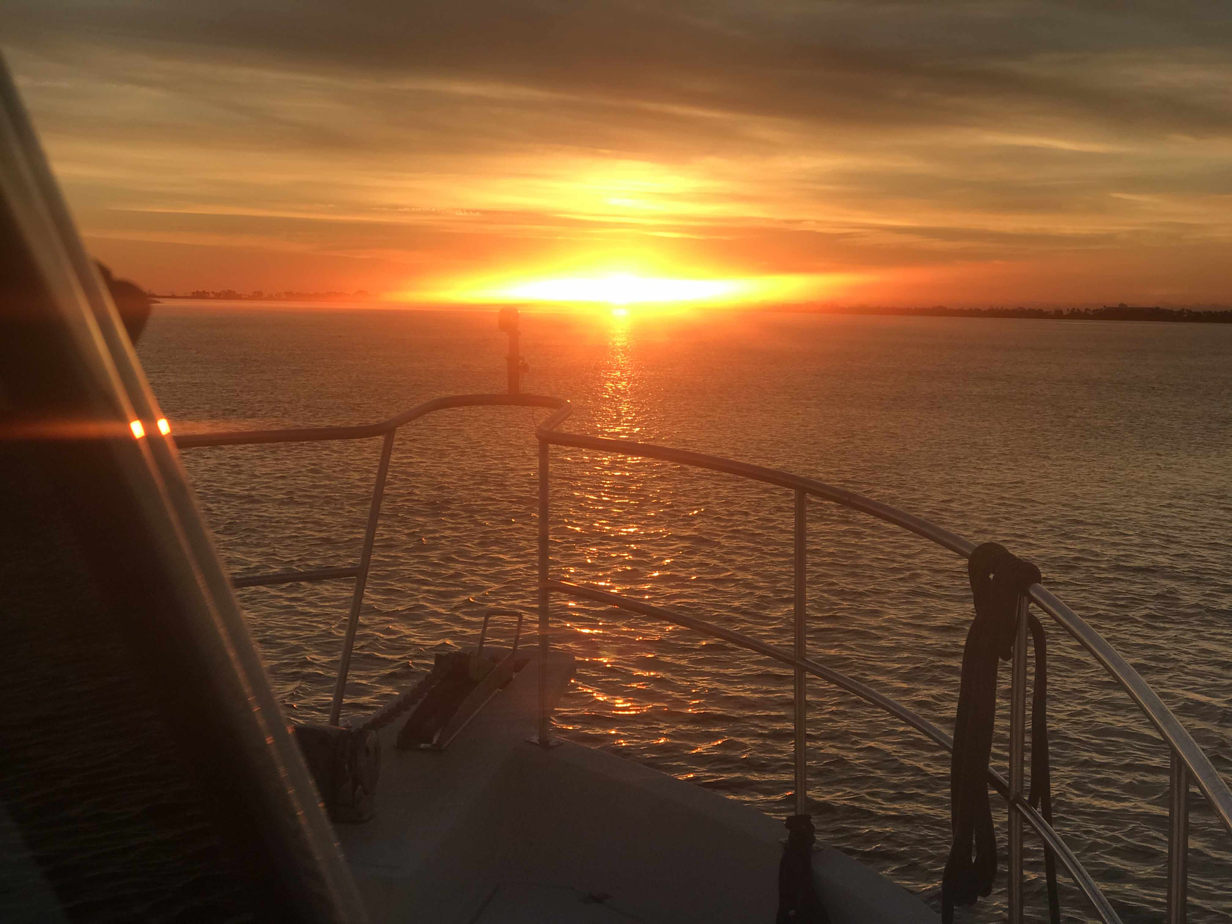
I awoke at 4AM before any of the crew. Neither Happy or Brody came out from under the covers to join me. We are in Georgia and it’s only 40 degrees when I awoke.
Heck, the temps were going to fall deeper before the 7:13AM sunrise.
Underway in the dark 6:14AM
By 6:30AM the sky was starting to lighten up on the ICW.
Looking East where the sun will rise
I decided to walk out on the bow while underway and snap a picture and a quick video before sunrise.
Not quite Sunrise
Once the sun rose you could see it burning the face of the daymarks as we passed.
It’s high tide and the rivers are swollen around here. Daymark almost underwater.
When you are at the helm for hours the internet is your entertainment. I was watching Mike-the-Drunken-Donkey from Mike’s Weather Page broadcasting FB Live video stream. I tuned in as Mike taught about weather and what to expect from the winter storm making its way across the US.
Thankfully, MV Simple Life will be in Florida by the end of the day
We were amazed at how flat calm the ICW was as we pushed along at 7 knots.
Not a frozen Lake but contrails in the reflected sky
Daymarks Reflected
Flotsam in the sky
Flotsam everywhere
My reflection as I snap a picture of the bow’s wake
At the helm I’m wearing my work pajamas because it’s still a bit chilly even with the diesel heat on. Happy just figured out that there is HEAT coming out of that little black round duct below the AC panel door. She parked herself right under my feet to steal all the heat.
Heat Hog
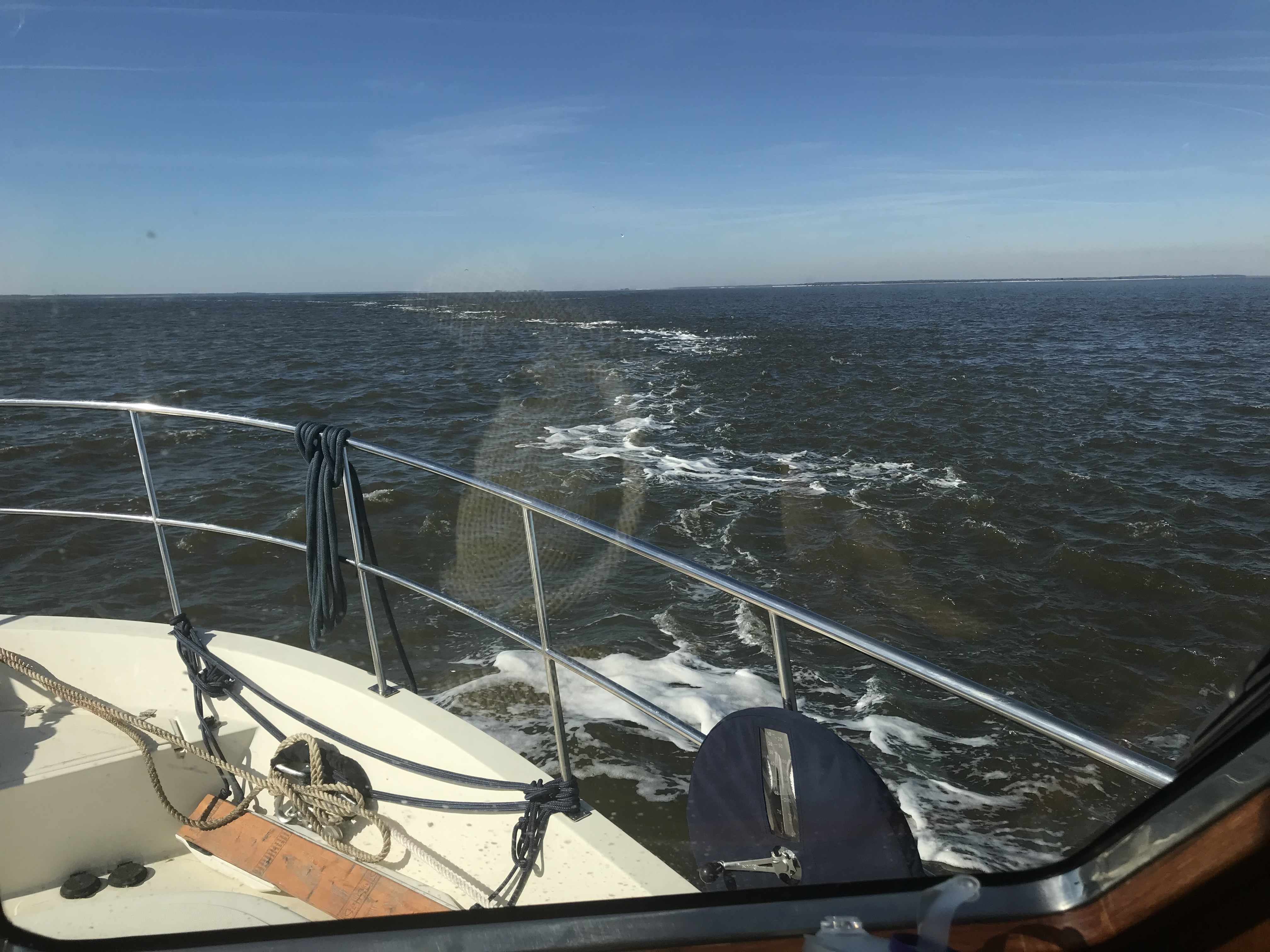
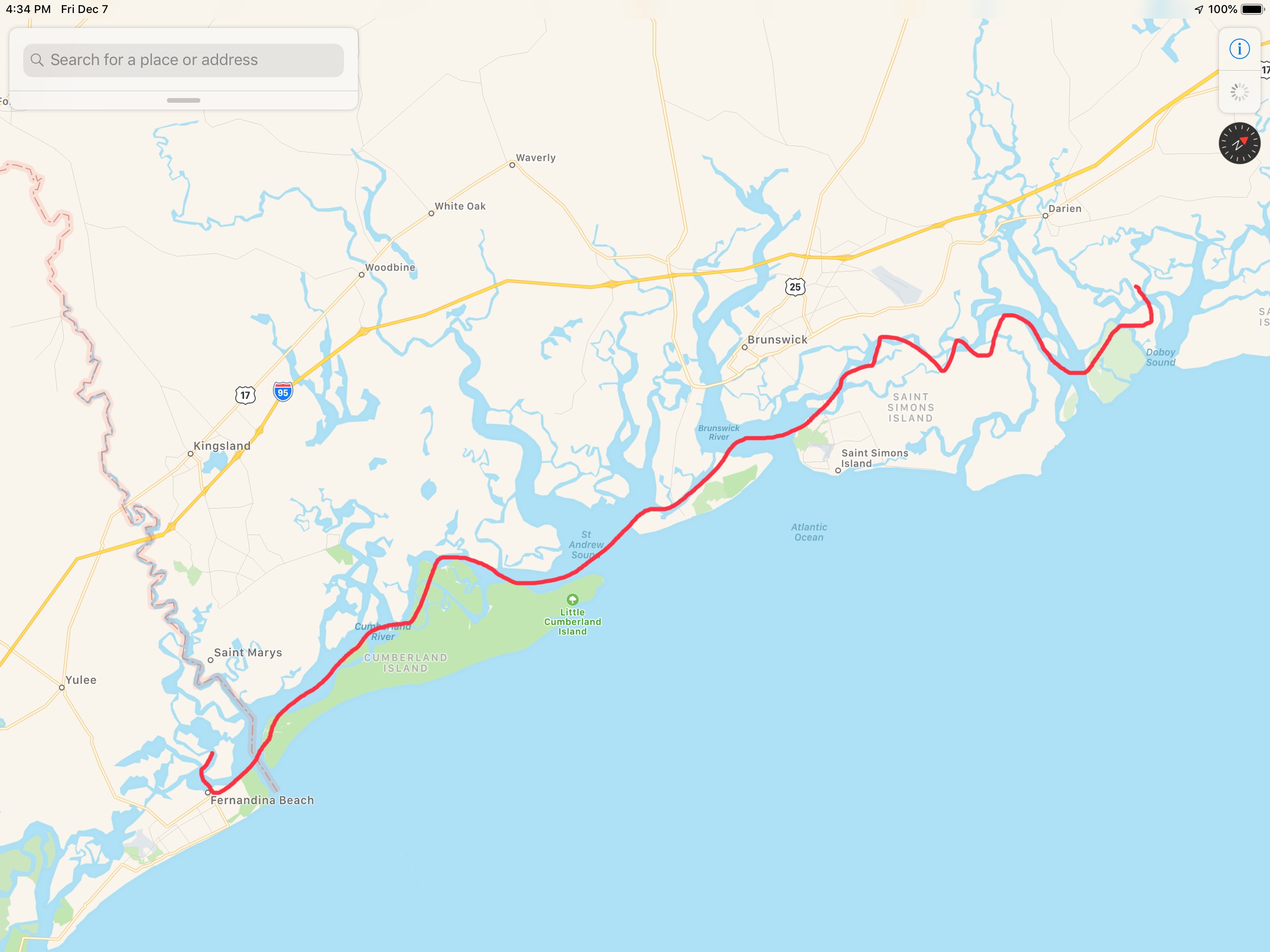
We were making incredible time as we approached Cumberland Island in Georgia.
SOG (Speed Over Ground) = 10.4 knots
10.4 knots because we were enjoying a strong current on our stern.
Then as we looked out, we could see a current line on the surface of the water.
Opposing currents meeting causing white chop
We feared as soon as we crossed this line that our 10.4 knot speed would begin to erode. We could never have guessed just how much.
Strong Current on the nose. 10.4 => 3.9 knots
Knowing we would face this current from our trip around Cumberland Island we attempted to ride close to shore looking for an eddy current (reverse direction). But alas it was no use. We had a long slow ride around the island.
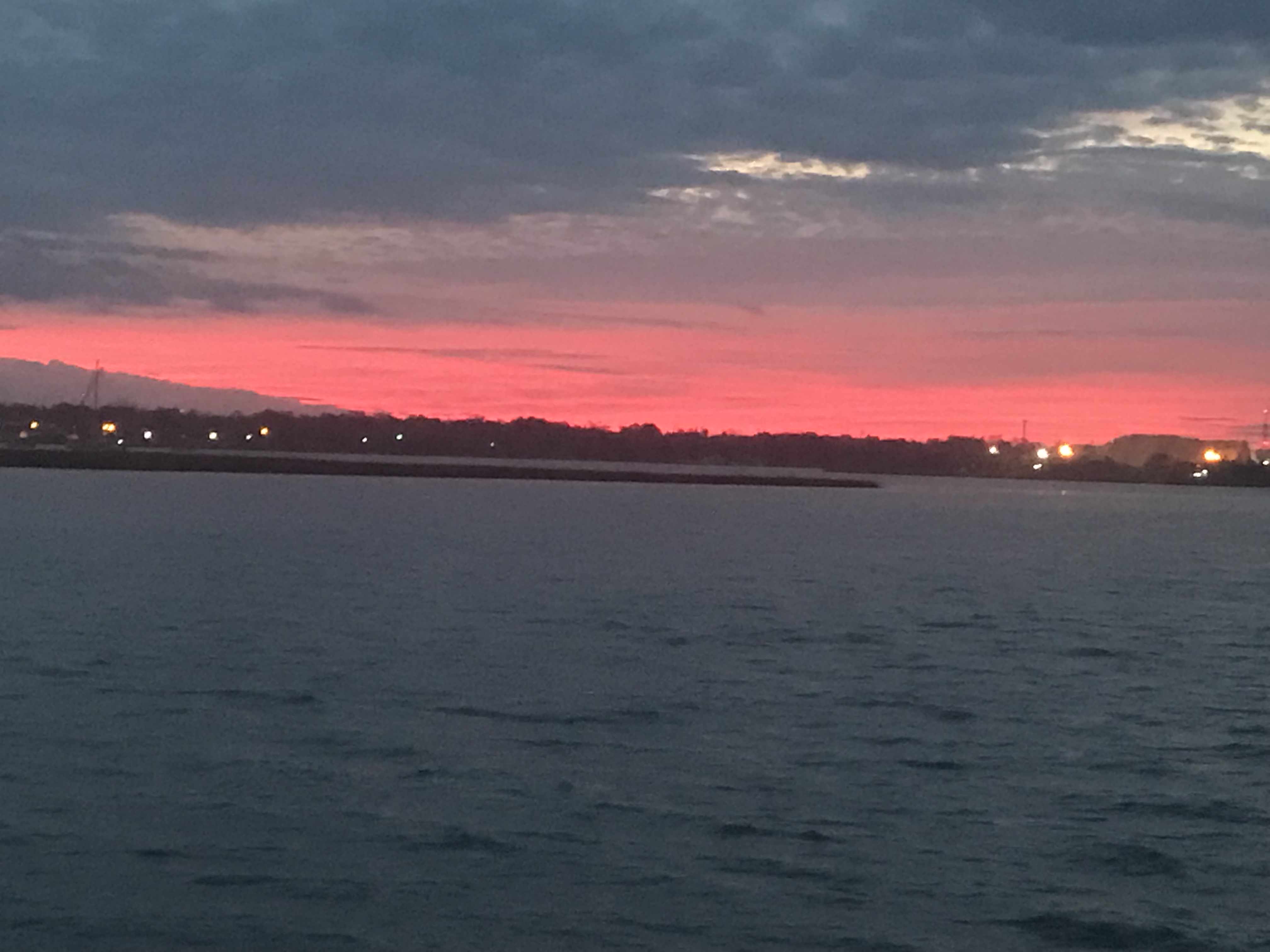
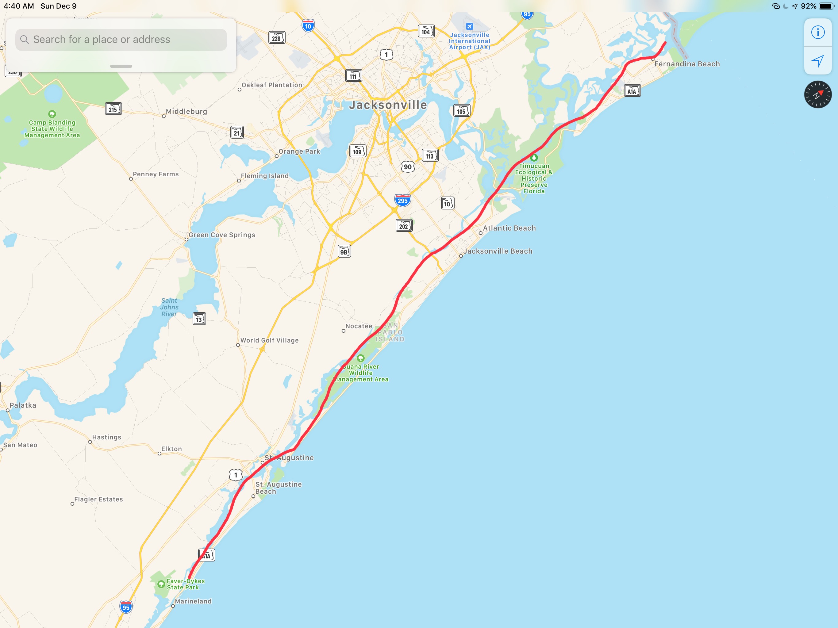
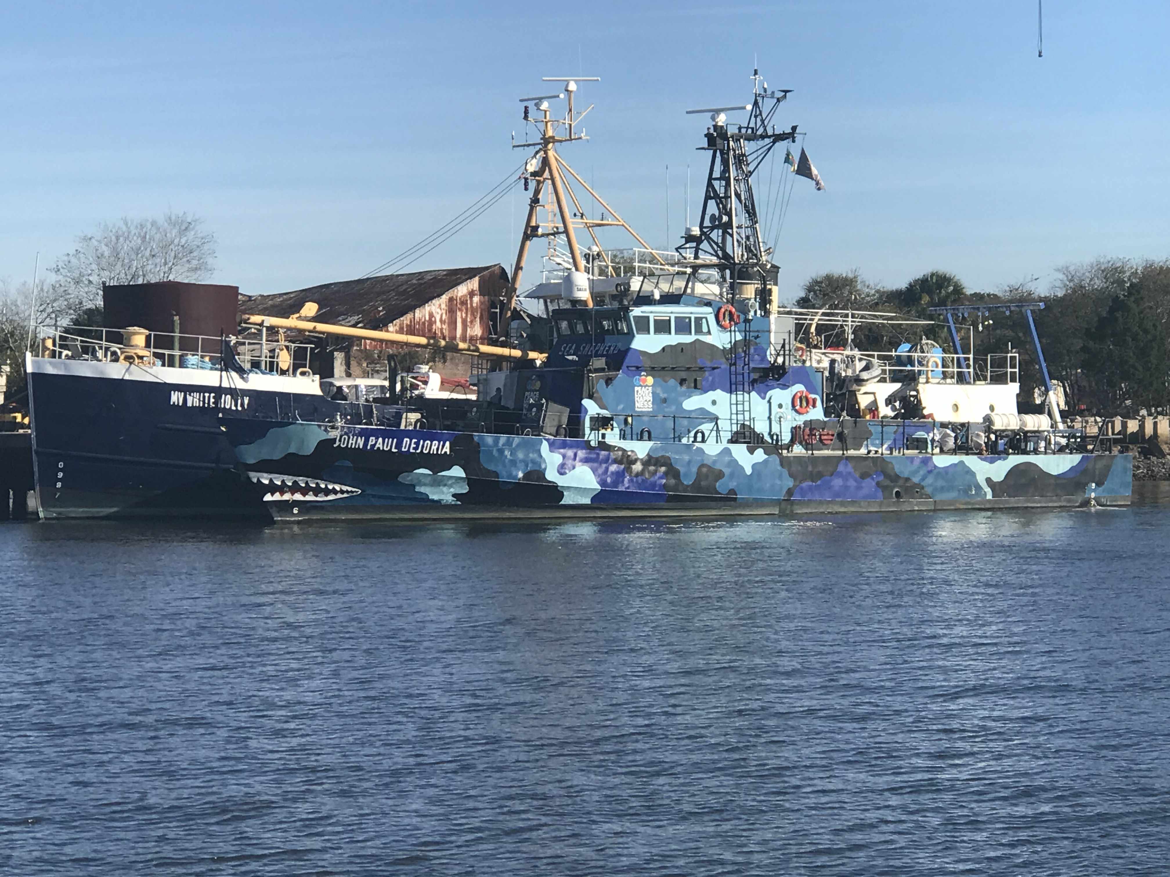
Then it happened. We crossed over the state line into Florida’s Amelia Island A.K.A. Fernandina Beach. As we passed we saw a ship that looked like a member of the Sea Shepherd fleet. We snapped a photo on the way by and low & behold, it was a Sea Shepherd ship.
Sea Shepherd’s – MV John Paul Dejoria
Kelly & I have always been fans of ocean conservation and the crew of Sea Shepherd work hard to keep our oceans and their inhabitants safe.
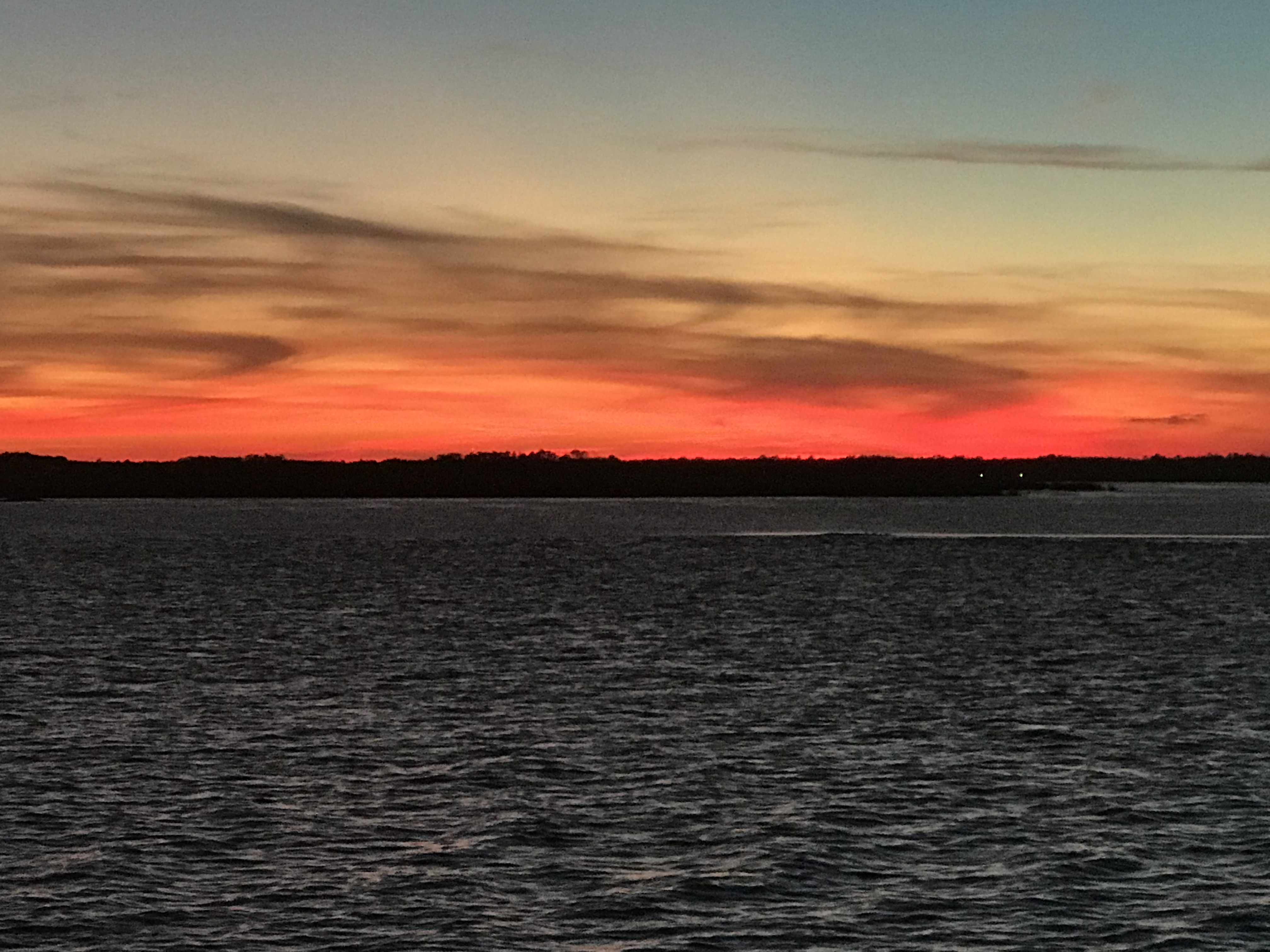
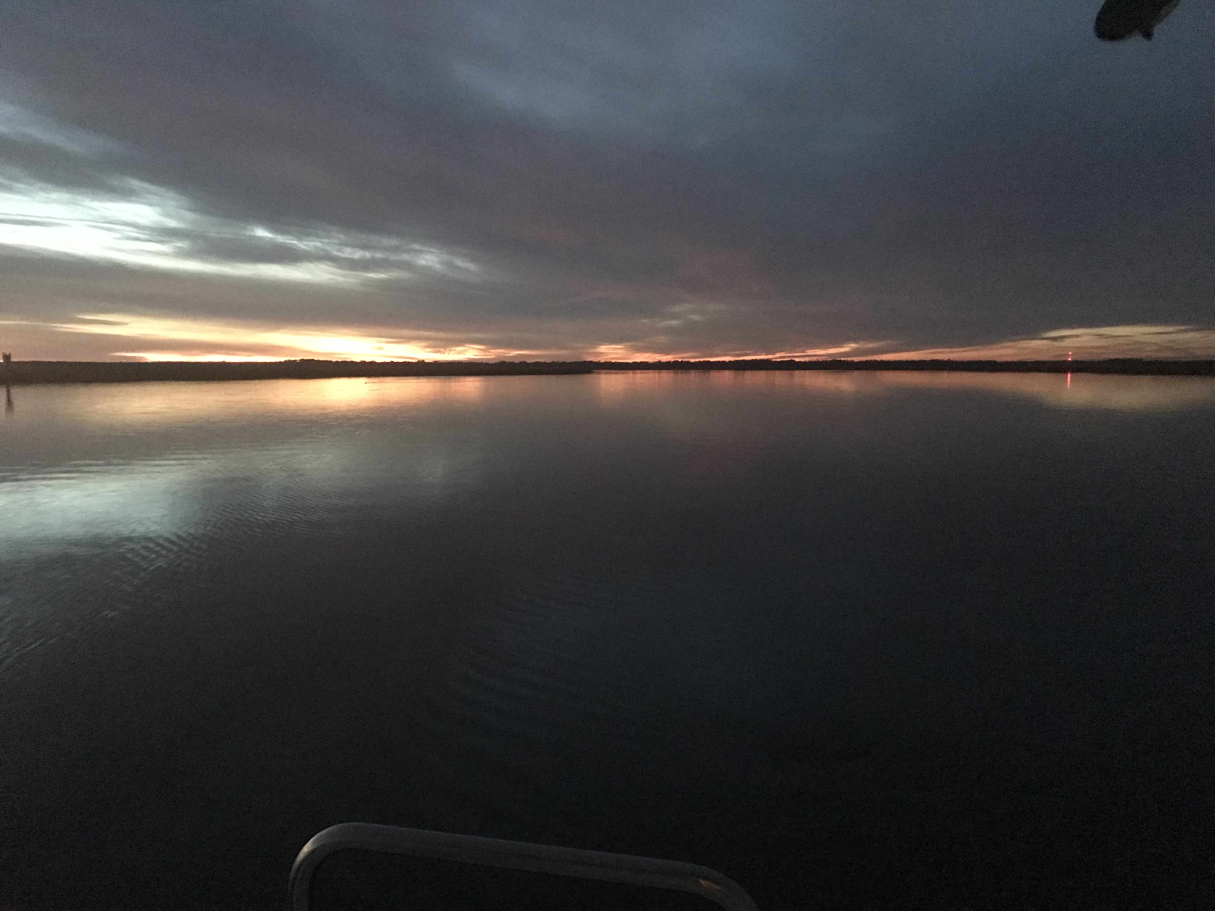
We are currently anchored in the Amelia River just over the GA-FL state line.
Sun is setting in the Amelia River as I finish this post
Today’s leg looked something like this finger drawn route.
We awoke on anchor just South of Turtle Island in SC. It’s a tiny uninhabited island that is on the Atlantic Ocean. There is hardly any light at night so the stars just pop out at you. They seem so much brighter and like you could reach up an touch them. Seeing the cosmos this way makes you realize that your consciousness is contemplating your existence on a small planet in the Milky Way galaxy. I wish there was a way to capture it in a picture but alas I have not found a way.
Cold. It’s F’n cold when I stand outside and watch the sunrise. It’s part of the experience but it’s also the whole reason we left New England and have been boating for the last 180 hours. Getting away from the cold means traveling further South than you would think. It’s only 36 degree as I stand out there watching the sunrise. 36 degrees and I’m on the edge of Georgia! Time to simply weigh anchor and go..
Turtle Island is South of Hardeeville but I’m guessing this weather app has no data for Turtle Island.
When anchored in weather like this you need a 12V heater as there are no long extension cords leading to the boat. Kelly & I installed a Espar D8LC 27K BTU diesel-fired forced-hot-air heater and mornings like this I realize we would never live on a boat without HEAT.
Espar D8LC Diesel-Fired Forced Hot Air Heater Schematic
Georgia has enormous tides and strong currents.
Riding a high Tide
We were riding an 8′ high tide so we were unstoppable. Well, I mean unstoppable in the sense we probably won’t run into a shoal and be stopped dead in our tracks.
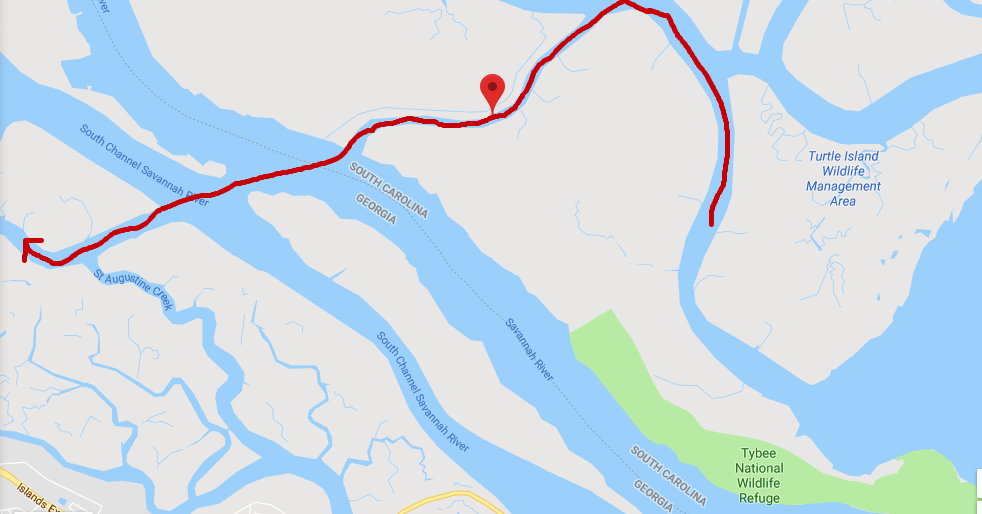
Field’s Cut is just before the ICW crosses the Savannah River and we had to cruise fast to get ahead of the oncoming container ship that just issued a ‘securite’ warning that they were on incoming on the Savannah River and approaching Fields Cut. You need to listen to these securite calls from large ships if you don’t want to wind up on the wrong end of them. We’d have snapped a photo but we were more concerned with staying out of their way. We hailed the ship and let them know that we would be crossing in front of their bow and that we would not be in their way.
Finger drawn route of us crossing Savannah River into GA from Fields Cut in SC
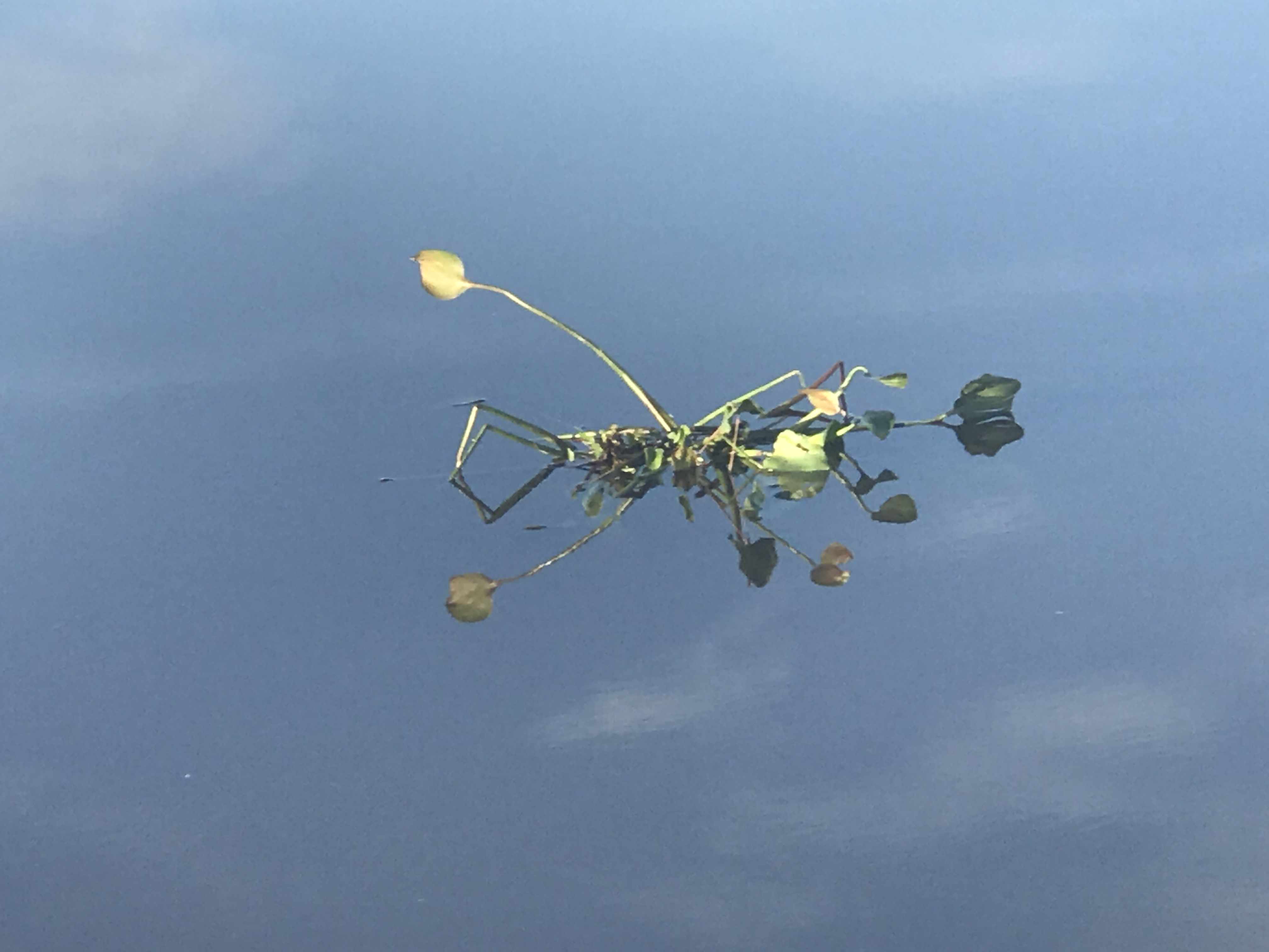
We call this picture “Bush of White Birds” cuz we so creative.
Looked funny from a distance
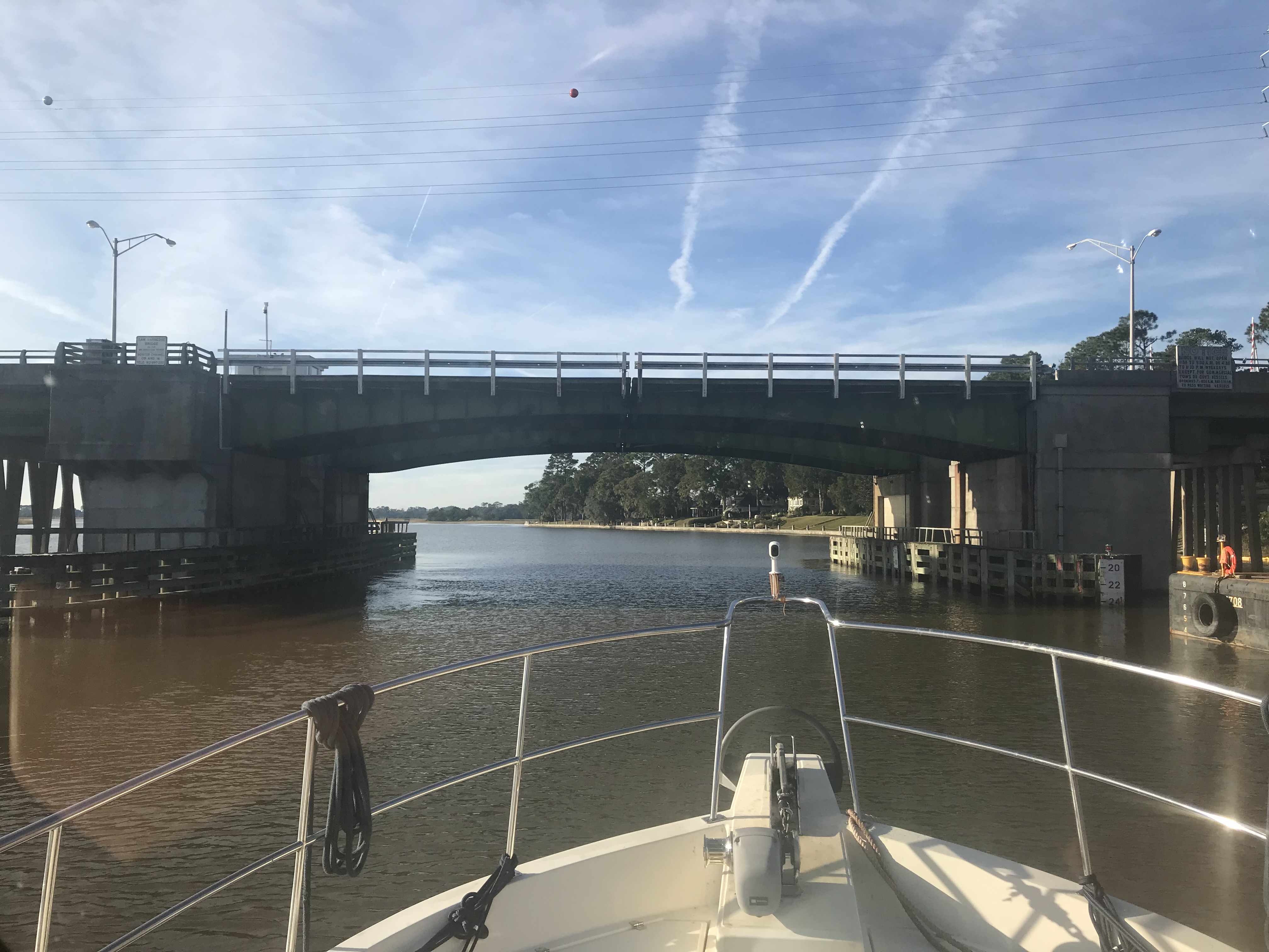
We slipped under this bridge carefully as we just fit beneath.
Low bridges that boat traffic must wait on openings are being replaced by tall 65′ high bridges. That’s a good thing for boaters and motorists alike.
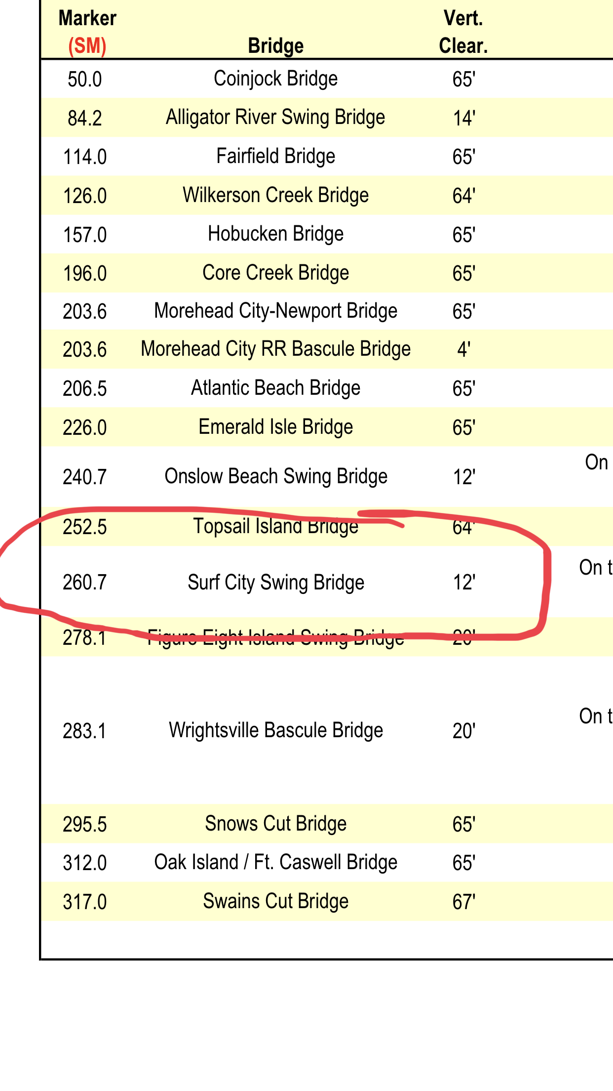
I learned today that the Surf City Swing Bridge was just replaced by a full-height Bridge. Time to update my bridge list.pdf
Kelly has a thing for wooden transom boats so we snapped these pics of MV Sandrita as she was being hauled via a marine travel lift. We had to slow down to no wake speed as these dock workers were trying to load her in the slings.
Going into the Slings
Don’t you just love a Wooden transom?
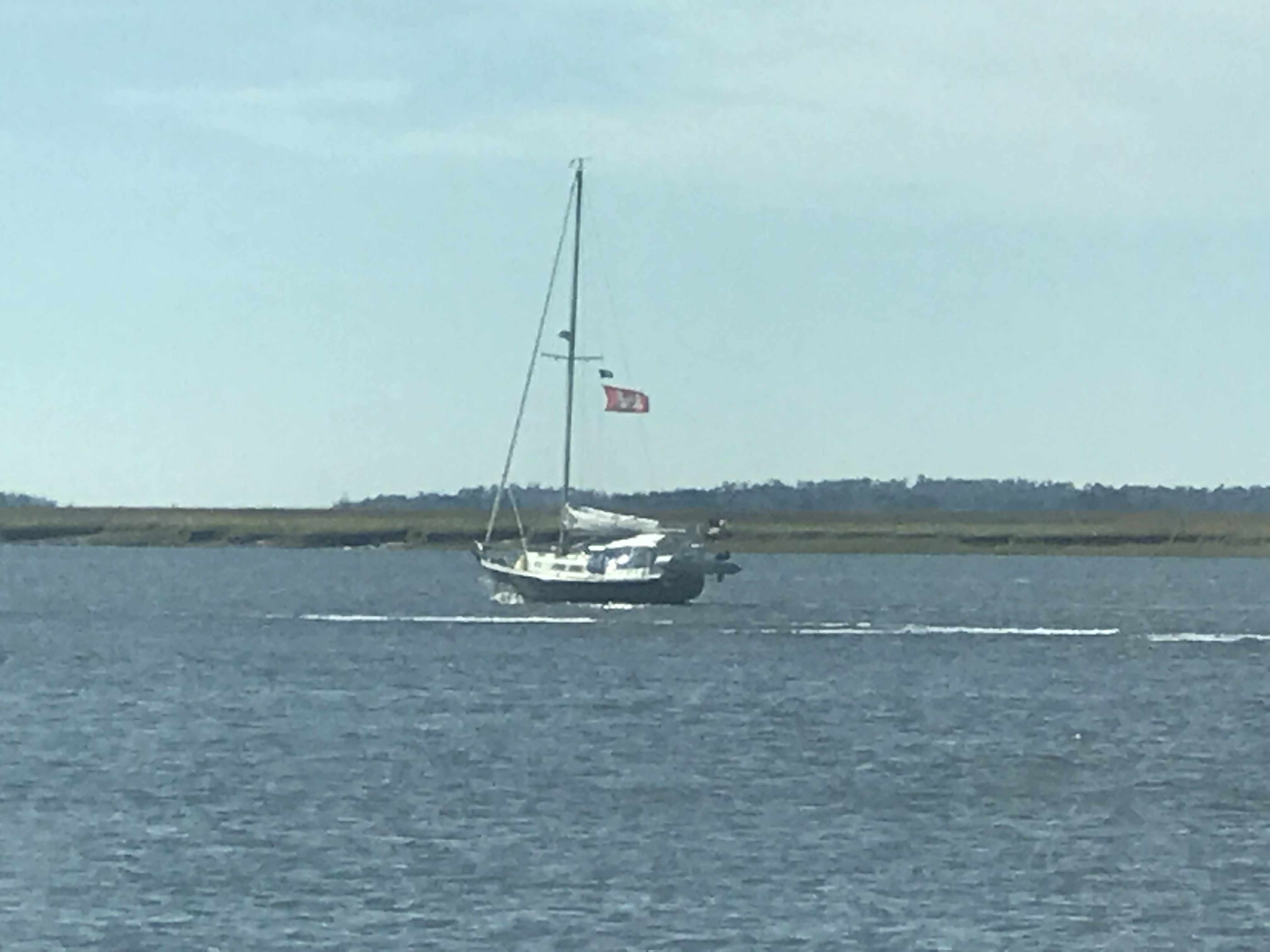
We hailed this blue-hulled sailboat to warn them they were approaching a shoal. They had already figured it out but thanked us as they backed out of the channel they were in. Captains on the water are kind and always offer help if they see another boater doing something that might get them into trouble. I’ve had captains hail me and say… Simple Life, you need to keep that red tight to port to clear that shoal”. Kelly & I feel lucky to be apart of a group that looks out for one another.
Approaching Hell’s Gate – a notorious shallow cut that leaves boats aground
Kelly & I each bought Florida saltwater fishing licenses today. We’ll be in Florida for a minimum of 3 weeks while we prepare for our Bahamas departure.
If we catch a single edible fish, We’ll have paid $130.70 for it 😉 Should have gone to the Capital Grille and just ordered the fish special.
I am on many Facebook Boating groups and love the discussions about the Aqua Maps Explorer Bahamas charts. Folks complaining about the fact that they are raster (bitmap) charts vs vector charts which use math equations to draw the charts at each particular zoom level. It’s interesting to me not just because they pictured Green Turtle Cay where Kelly & I have wanted to visit but that I just am drawn to nautical charts. We hung one on the 275 gallon oil tank in our old house that we sold. It took me hours to print each individual 8″x11″ chart and piece them all together to have a huge chart of Narragansett Bay. I enjoy staring at paper charts like they are artwork for ship captains. Vector charts lack the beauty of raster (paper-style) charts.
Raster Charts
Vector Chrts
We passed a beautiful fishing trawler as we got close to our final anchor location for the night.
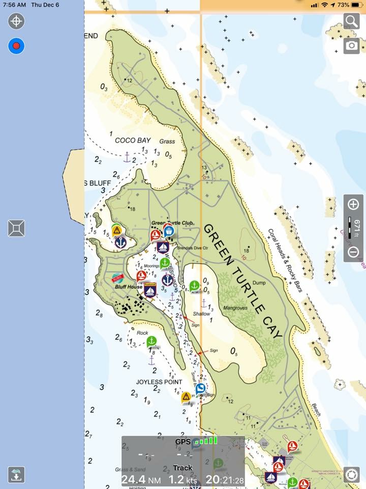
Soon we were passing this cool little house on an island along the banks of the ICW in Georgia.
If we’d had a canvas we’d paint it.. somehow
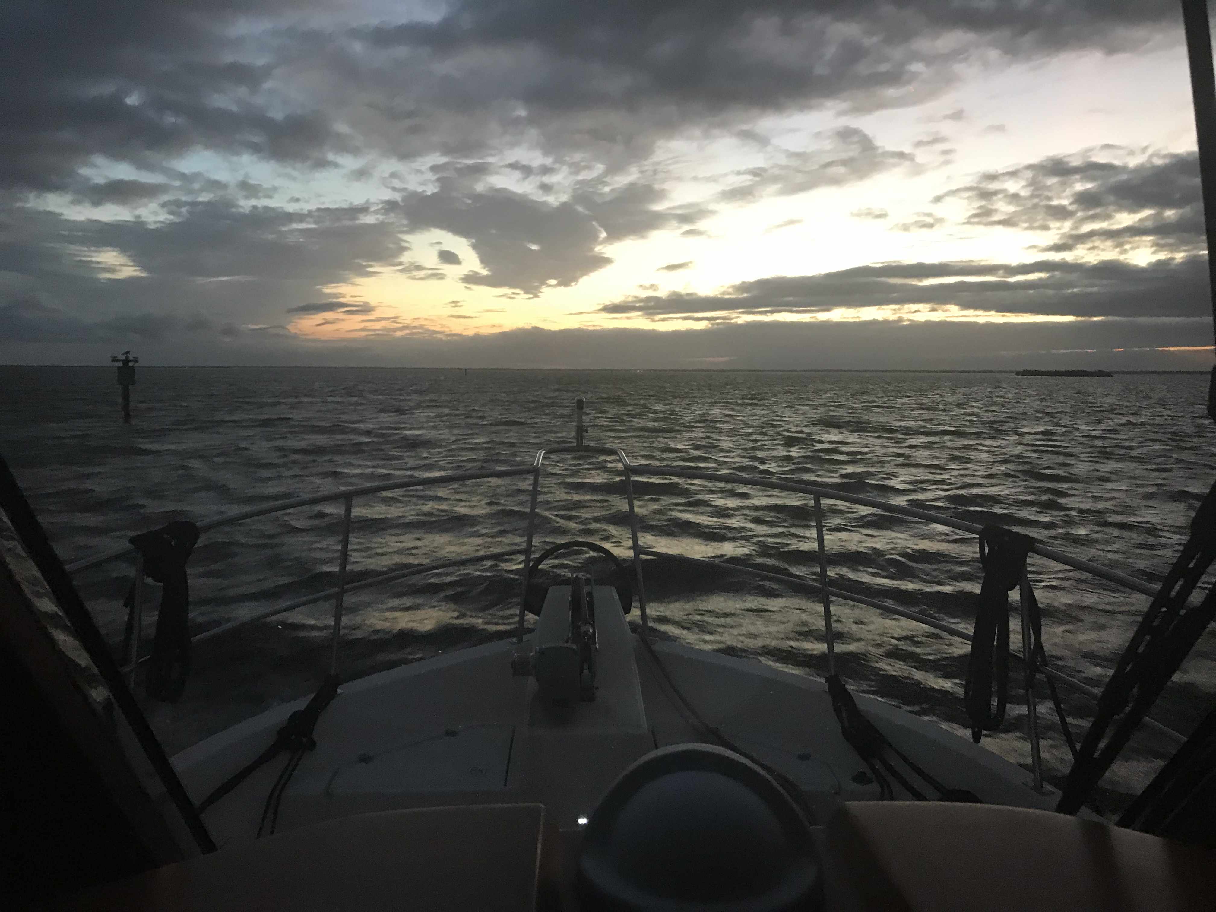
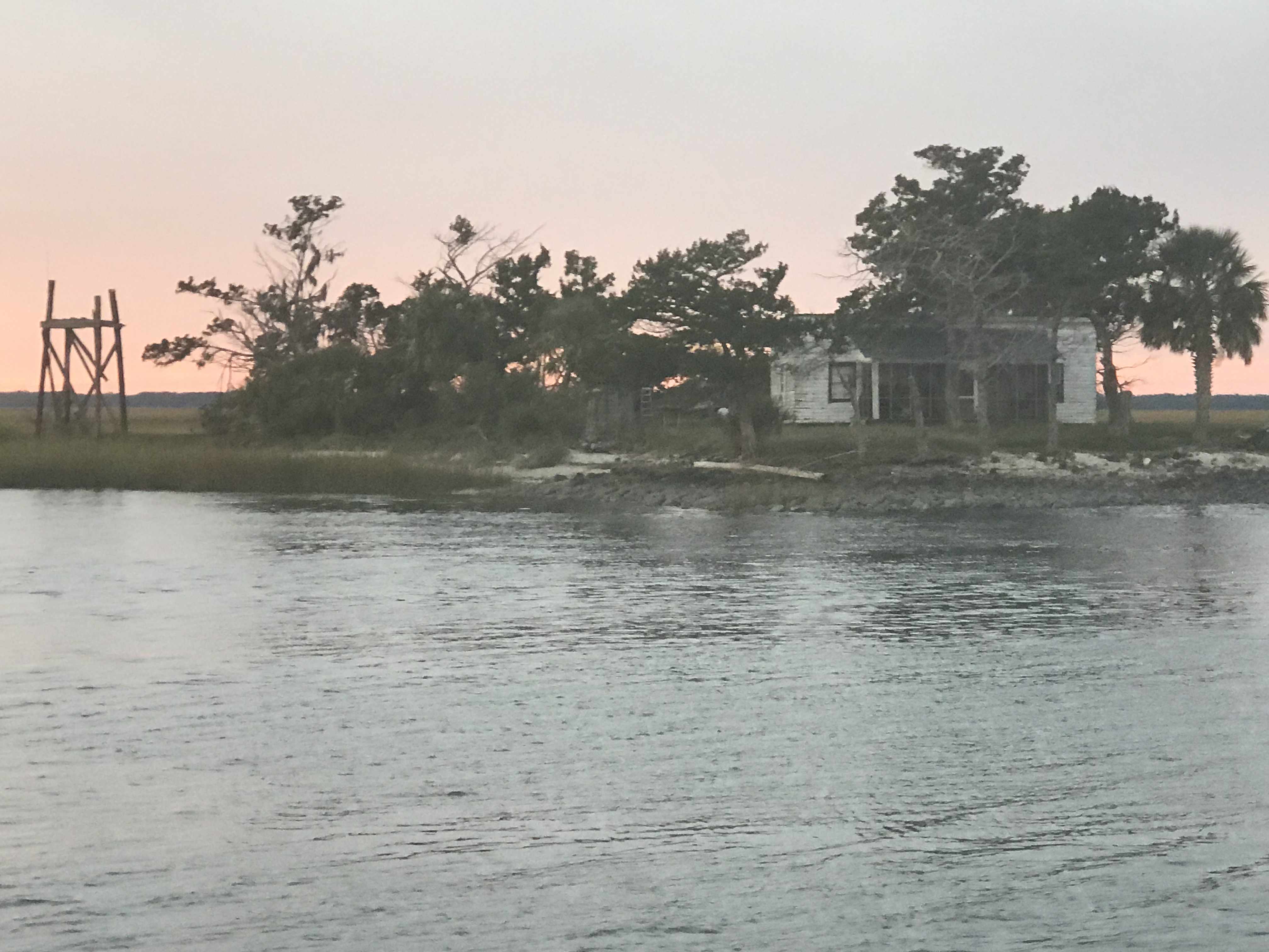
The sun was quickly setting on us and it was spectacular.
As we pulled into the creek where we’d drop our anchor for the night it was last light.
Today’s leg looked something like this… Not really as the ICW snakes its way through countless creeks in Georgia.
An multi-IPA finger drawn chart of today’s leg.. yeah that’s bad
We opt’d for a late 11AM departure from Beaufort, SC. When we went to leave the current was pushing us so hard against the dock that our bow & stern thrusters were not able to move us away from the dock. A fellow boater on SV Bay Dreaming came over and held our spring line so I could motor the stern off the dock and then back into the current. Amazing how strong the current can be in this area with 7-8′ tides.
Soon we were at the Southern tip of Paris Island.
Our friends Ann & Todd’s son Conner is there going through boot camp as we pass. We are reminded by the sounds of freedom (Jets screaming overhead).
Semper Fi
My brother just let me know that yesterday a guy caught a 17′, 3500lb. great white shark off Hilton Head Island.
17′ 3,500 lb Great White Shark Caught off Hilton Head Island on 12/4/18
Today’s trip was short and we only passed a few sights pictured below
Soon we were dropping anchor in the 20 kts winds and it surprised me when after lining up bow into the wind we quickly spun around in the strong current with our stern facing the wind.
The sunset’s here in the lowlands of South Carolina are amazing.
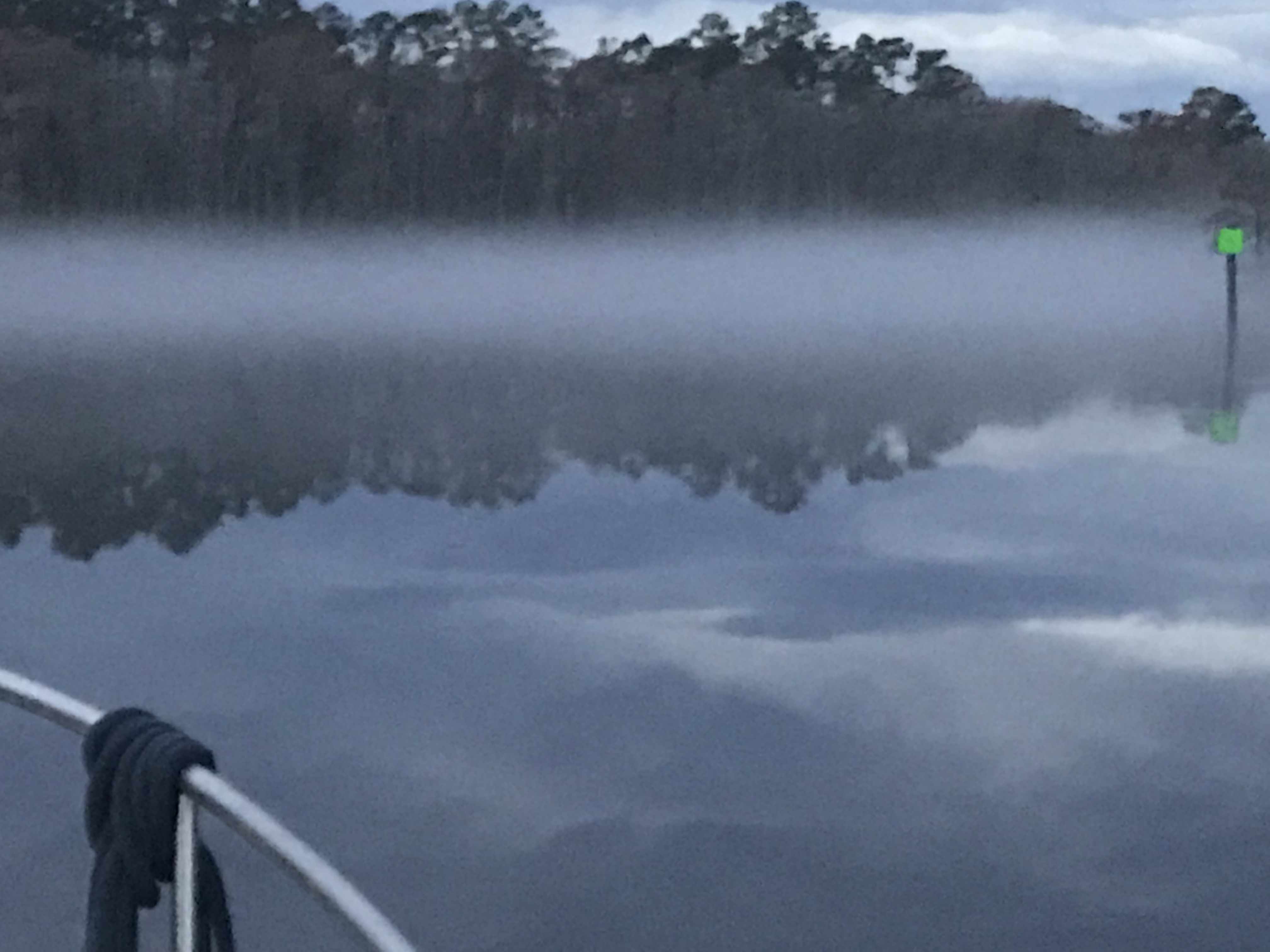
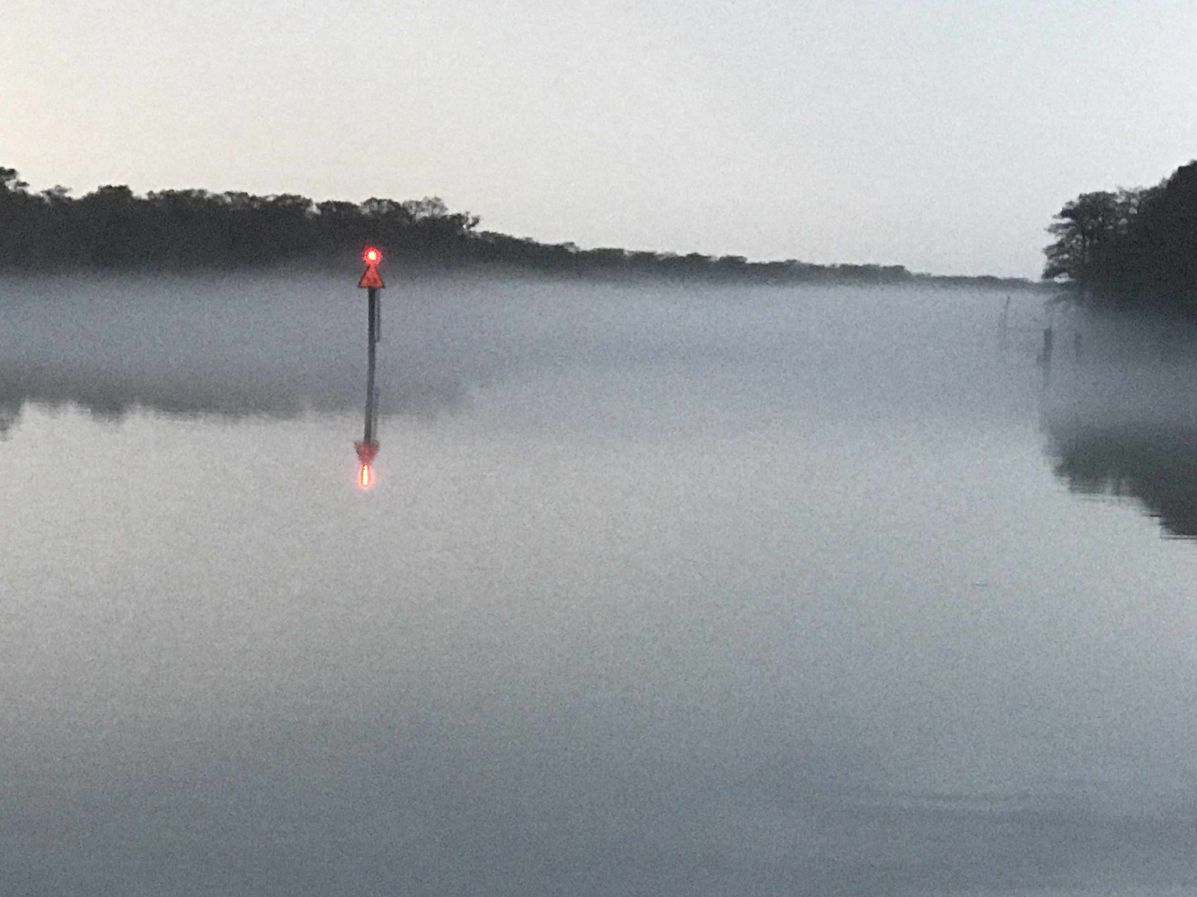
We weighed anchor at first light in the Waccamaw River and it was foggy.
Waccamaw River Fog
Looking down the ICW
Closing in on us
I felt bad that we had to put on our automatic fog horn so early in the morning as there were other boats sleeping on anchor (or at least they were sleeping). At times the fog was thick enough that you would not be able to see the small duck hunting boats that zip around in this area.
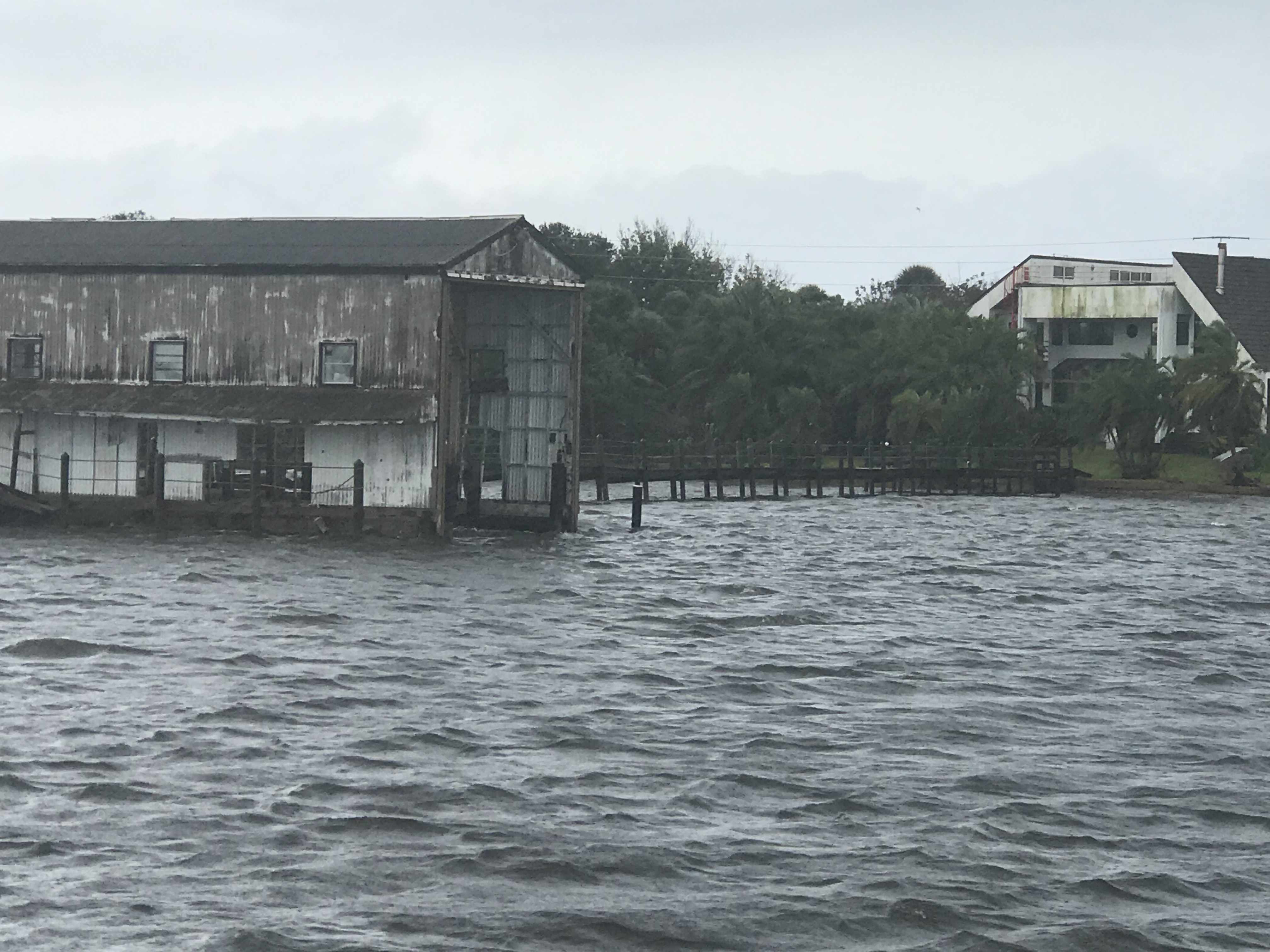
It rained all day. Not good for the folks who lived along the river banks. The river had already overrun its banks and many of the riverbank homes were dealing with flooding. More rain was the last thing they needed.
Rain on the pilothouse all day
Then the fog would return.
ICW Fog
Fog Bank
Daymarks Easily Seen
Looking for Duck Hunting Boats
Fog Horn was Blowing..
When it was clear we got to see the lowlands of South Carolina. Beautiful grasses that extend out to the Atlantic Ocean.
Lowlands of SC
Along the way we passed a steel hulled sailboat that was anchored in the same location as when we came up this part of the ICW in the spring. I guess like many is just permanently anchored along the ICW?
SV Steel Away Permanently Anchored
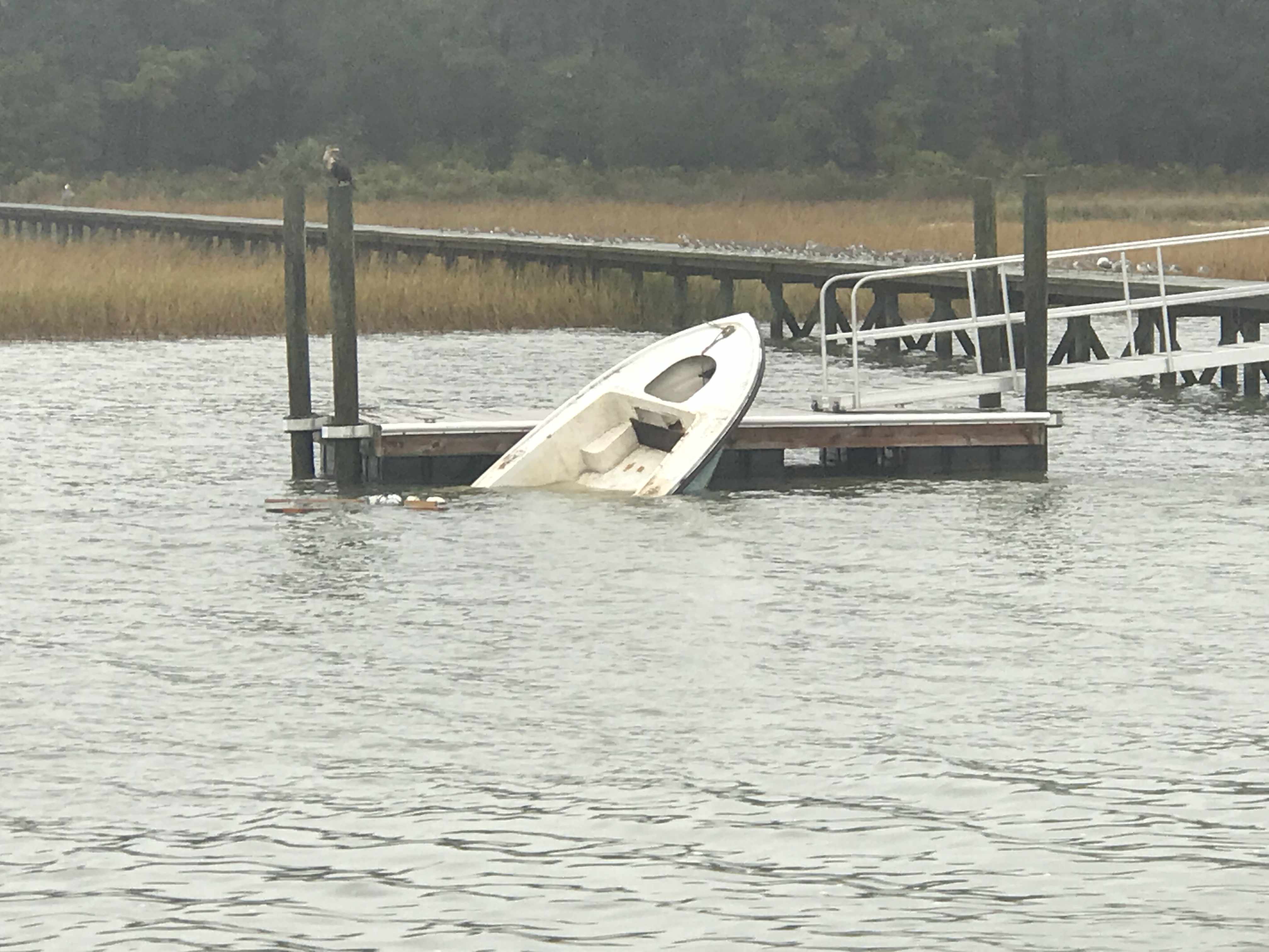
We passed someone’s boat that was still tied to the dock but had sunk for some reason or another.
Sunken Boat Still Tied to Dock
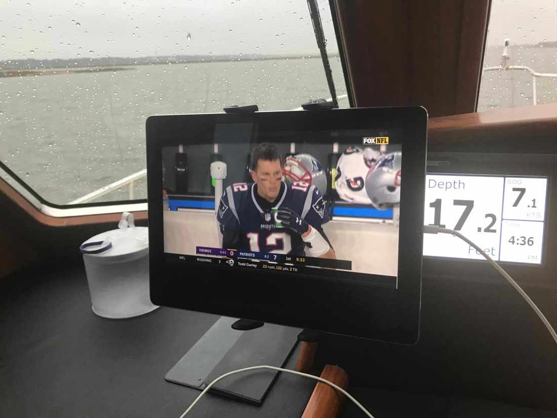
Our plan for today was to attempt to make it all the way to Charleston, SC. The currents were helping us along and there was not traffic or bridges to slow us down. We ran right up until dark and had to settle on a wide open commercial anchorage just off Fort Johnson in Charleston Harbor. Kelly asked that we pick an anchorage that had cellular service as it was football and she had been watching the Giants / Bears game but the Patriots game was on next.
Kelly Enjoying the Game
Patriots Game @7 Kts.
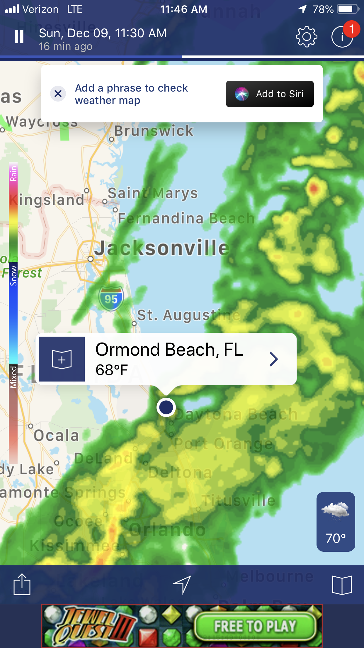
We anchored next to a large sailing catamaran and the winds were blowing. The weather was bad as there were thunderstorms moving through that were bring wind gusts up to 55 MPH. A quick look at my weather apps showed them passing directly over us on anchor.
Storm Radar
While on anchor I captured some of the storm.
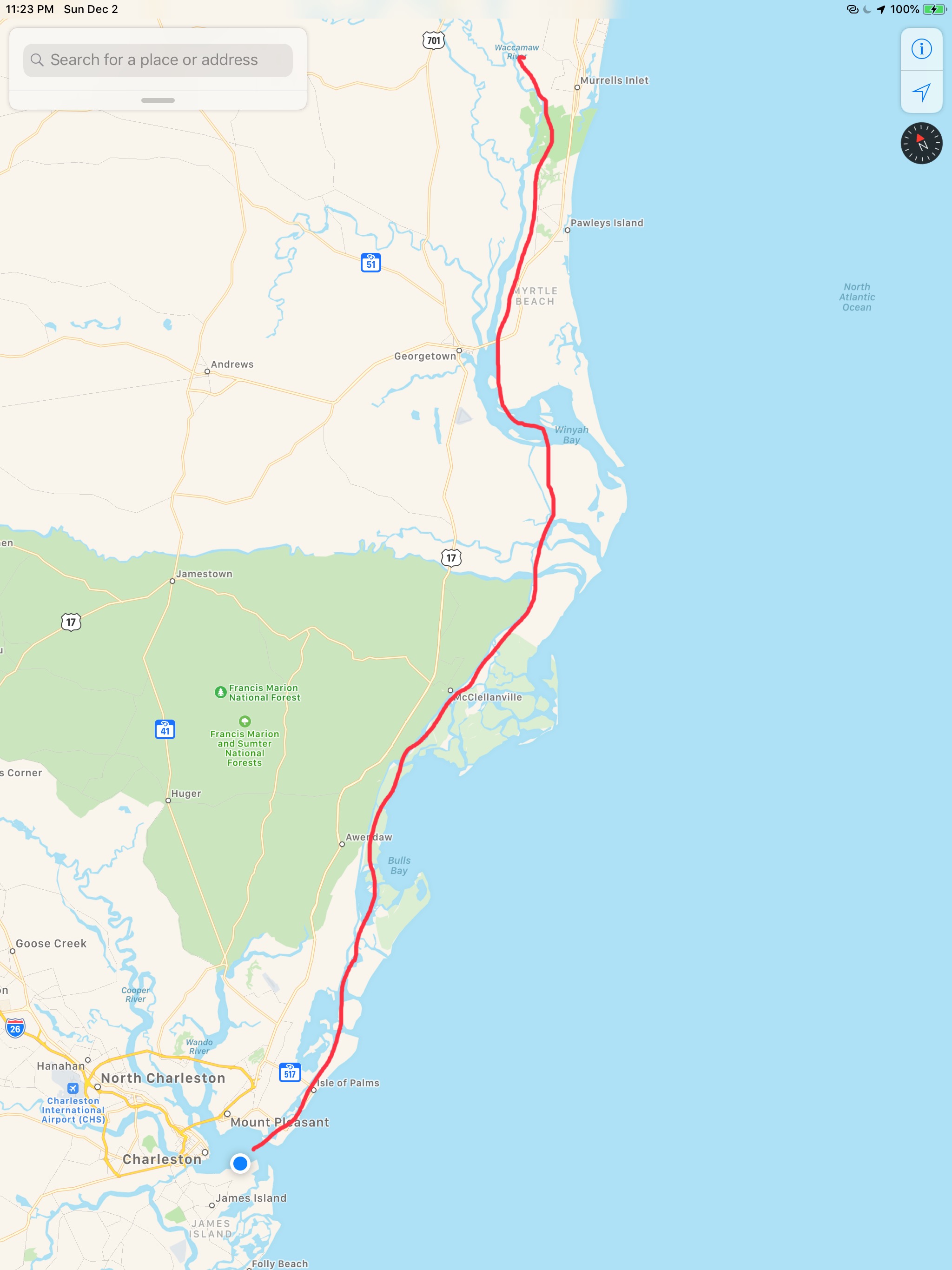
Our leg today looked something like this … (80 NM)


You must be logged in to post a comment.