Well exited the Manasquan River right at slack tide which is good for reducing the currents when trying to squeeze through the narrow railroad bridge as well as the rip at the mouth of the inlet.
Manasquan Inlet Slack in 7 minutes
NJ ICW Mile 0
As we headed out the Manasquan River we looked back and saw Point Pleasant canal which is mile 0 or the start of the NJ ICW (InterCoastal Waterway).The NJ ICW ends in the Cape May entrance channel.
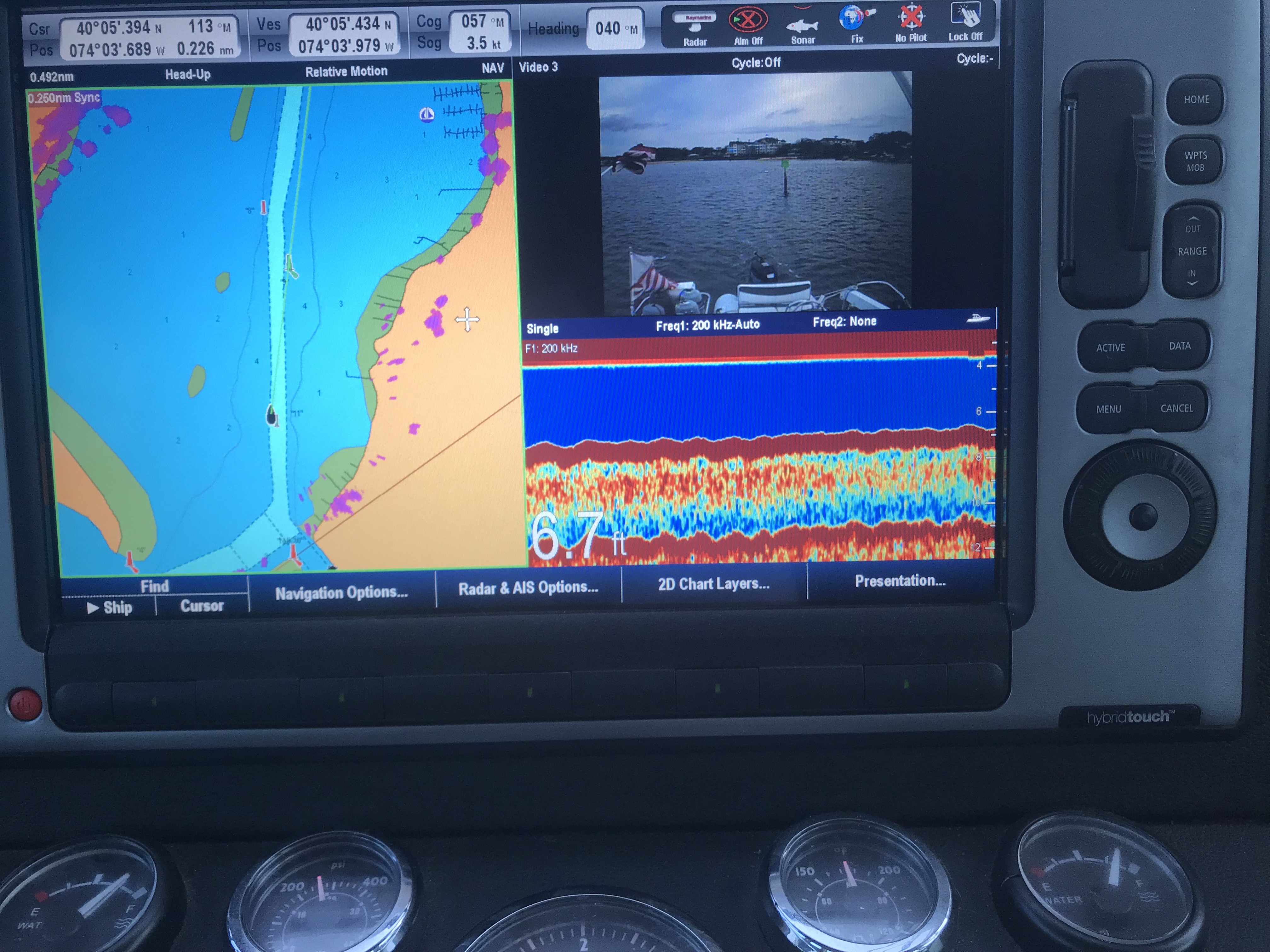
Notice the 6.7′ depth
As you work your way out of the Manasquan River be careful. My charts don’t line up perfectly with the channel’s actual location so follow the daymarks and temporary buoys and cans that are in place.
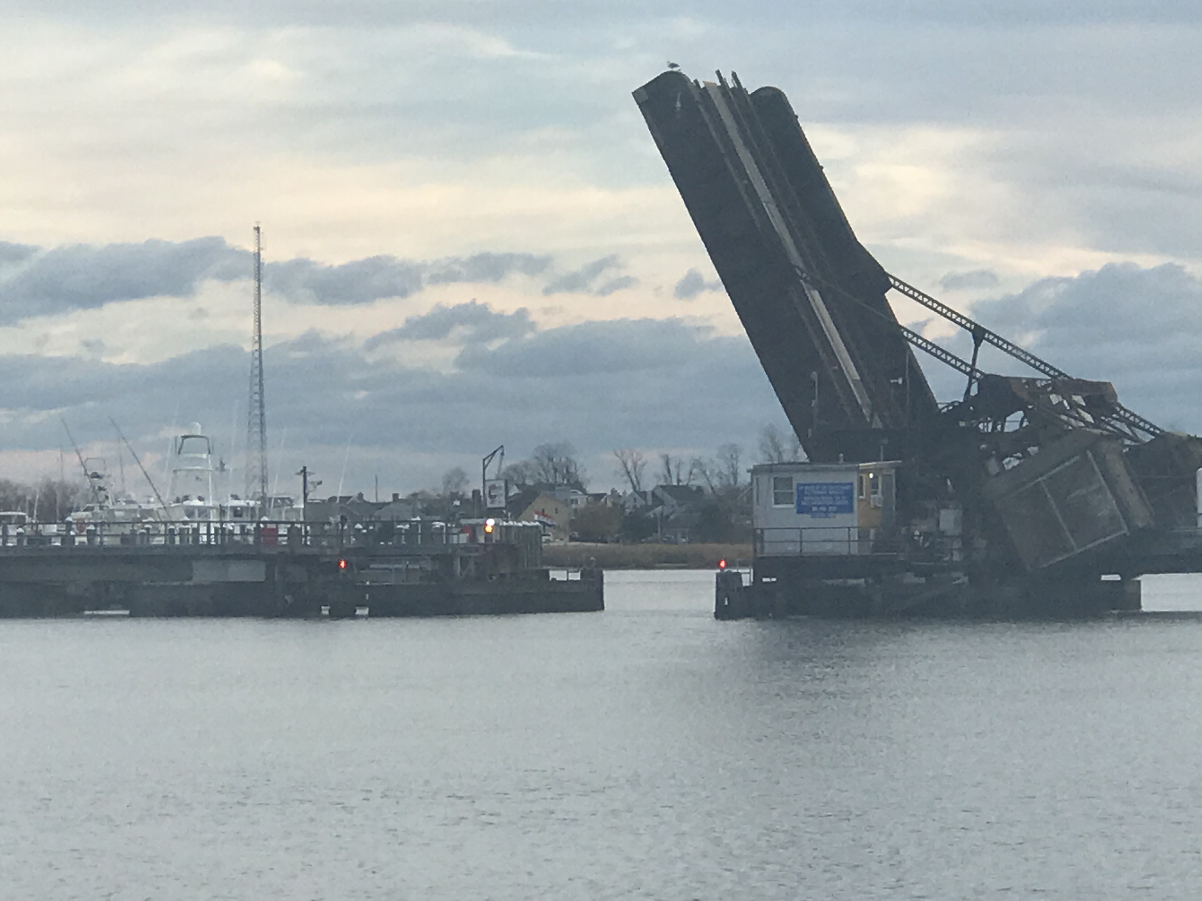
There are two bridges on Rte. 35 and the other is an automated railway bridge.
Approaching Rte 35 Bridge
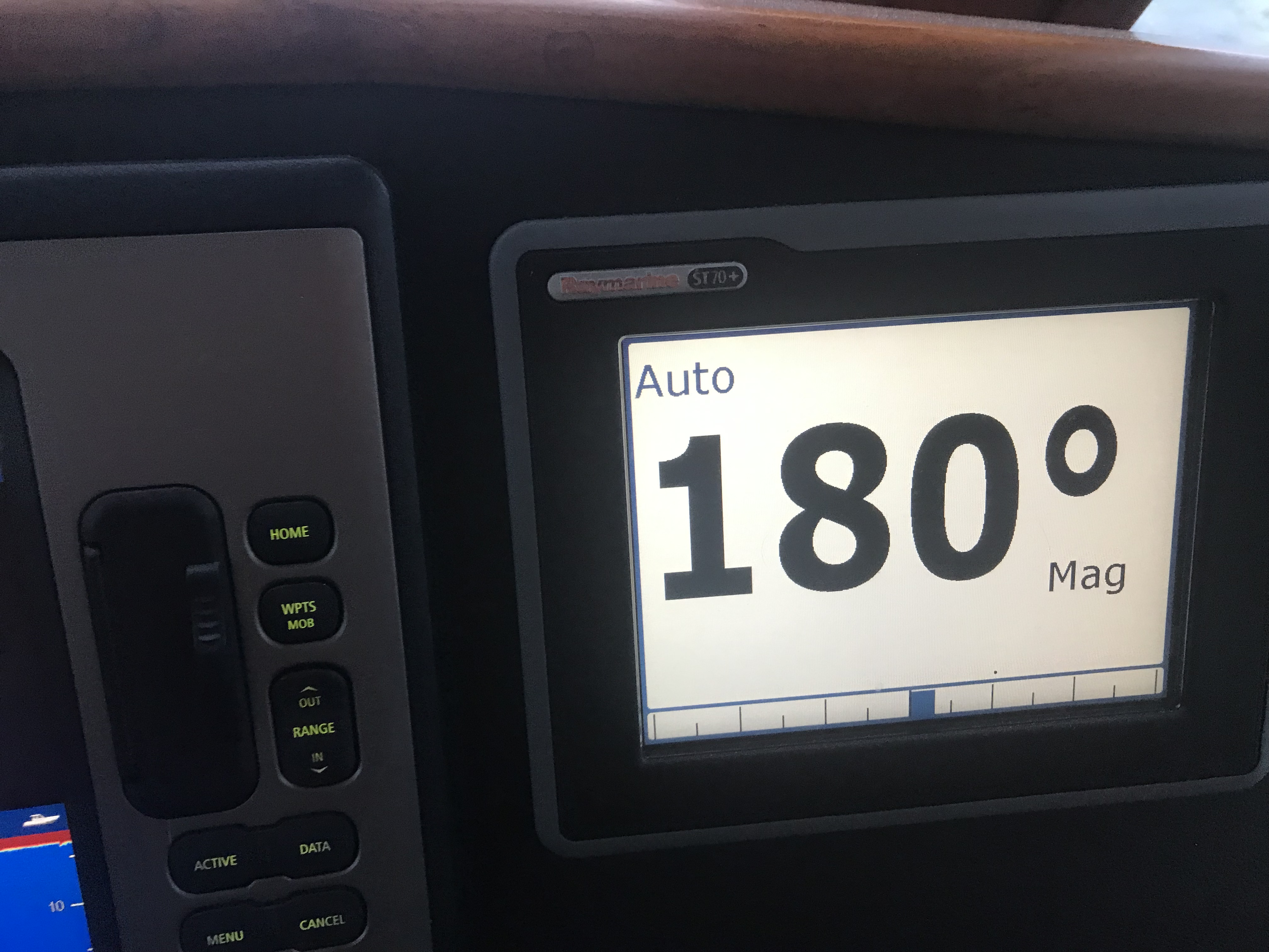
The Rte 35 bridge gets shallow just as you are about to pass under it. So when your low water alarm goes off don’t break your focus and stay straight going through.
6.6′ depth just as I’m passing under it.
Normally open Railway Bridge. I heard the opening is only 48′
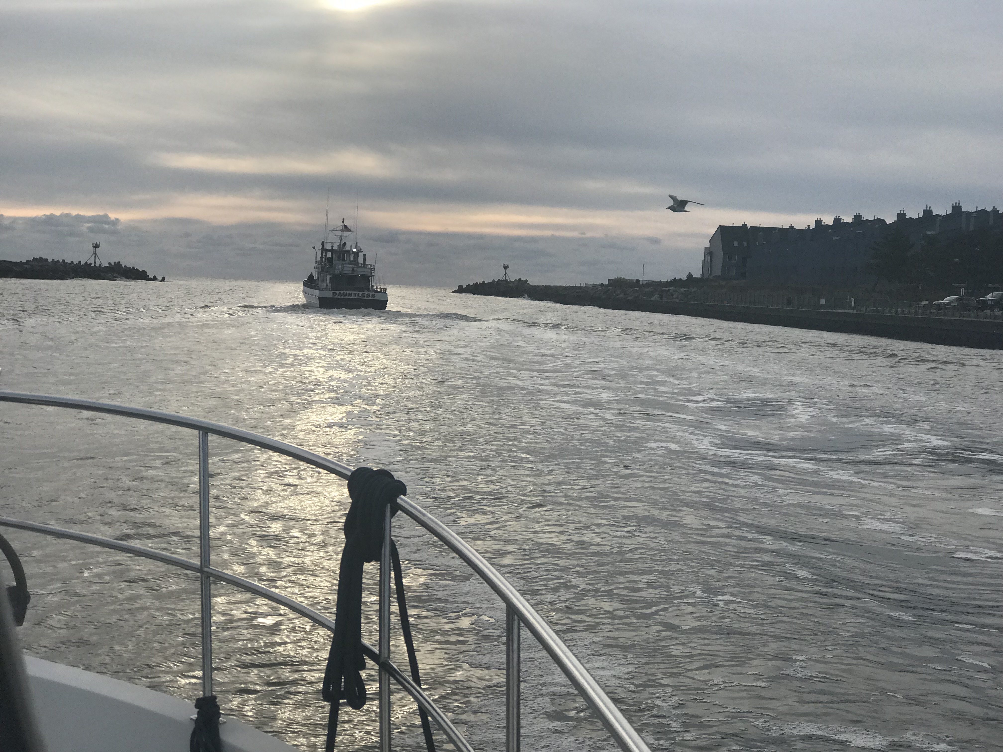
Soon we were at the inlet to the Manasquan River and we exited into the Atlantic.
Manasquan River Inlet – Leaving
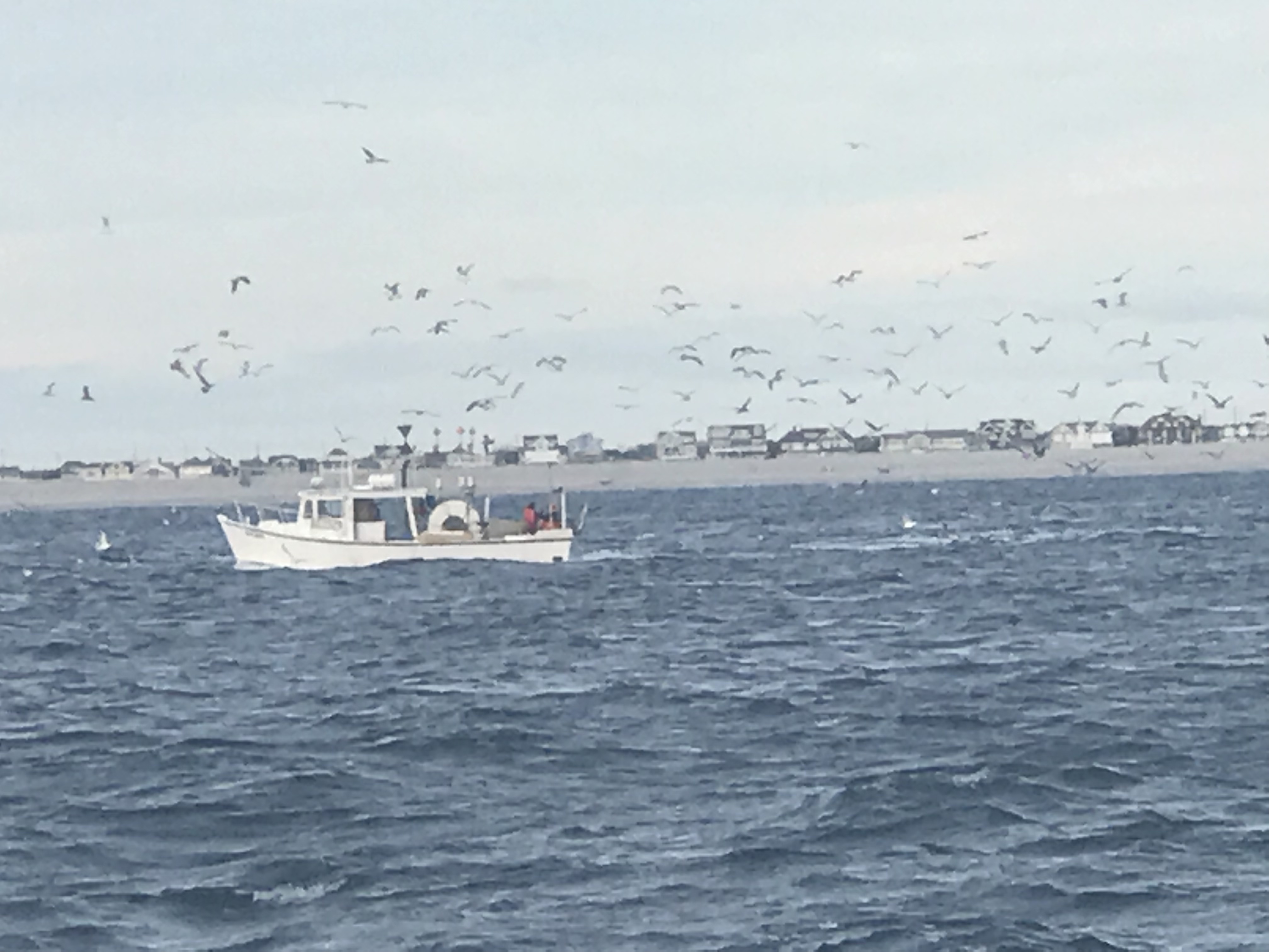
There were not many boats out on the NJ coast. It is mid-November after all.
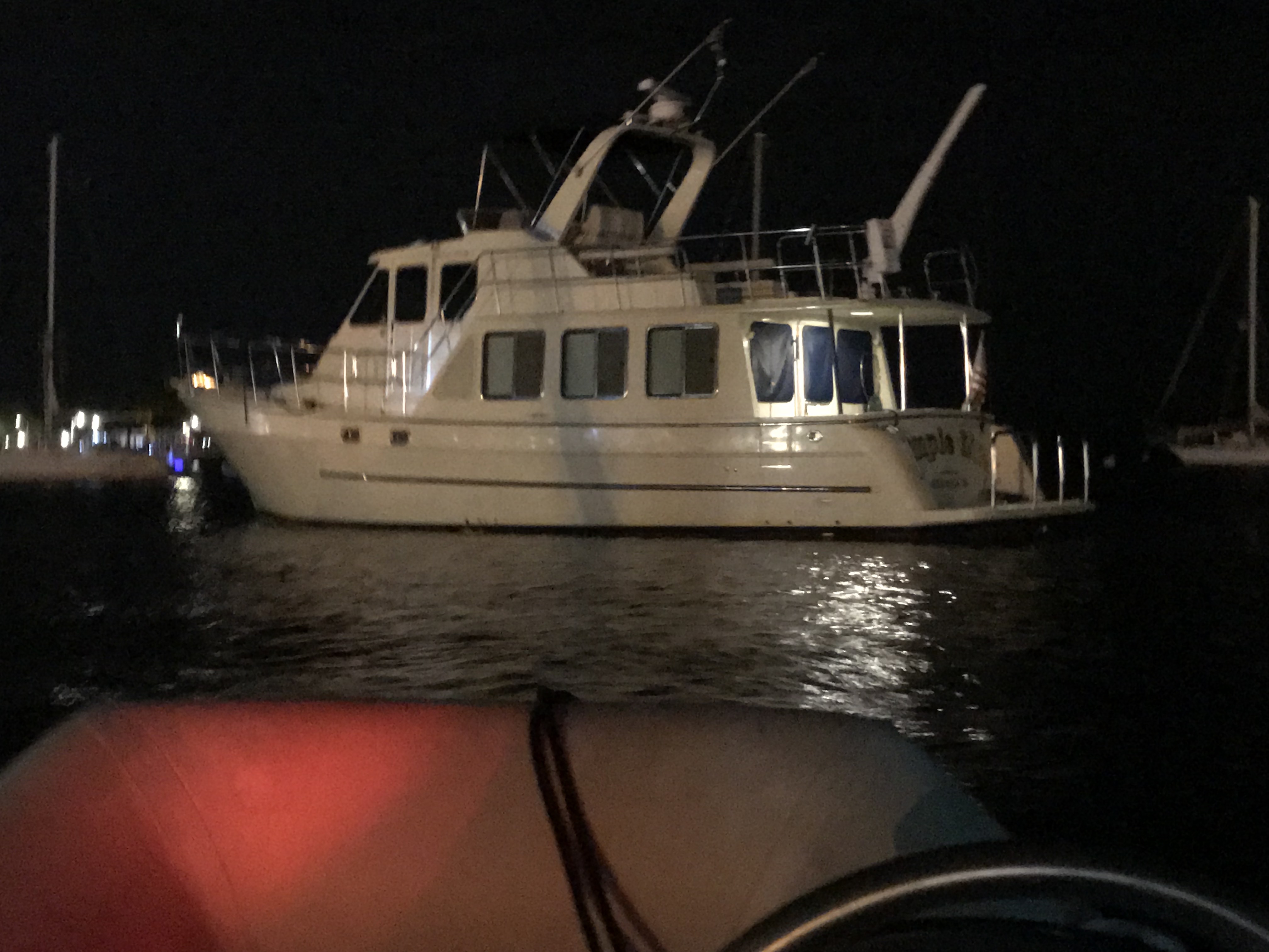
However this FV (Fishing Vessel) Webo looked like a scene from Alfred Hitchcock’s “The Birds”. Soon I found him piloting real close up the back MV Simple Life and I swear he did it to infect us with his flock of sea birds. As he pulled away the flock split and half seemed to follow us. Kelly’s not a real fan of birds something about getting caught in her hair or something … so I just did not let her know that the birds were surrounding us.
Bird Boat
FV Webo is not 70′ long!
FV Wevo on our backup cam
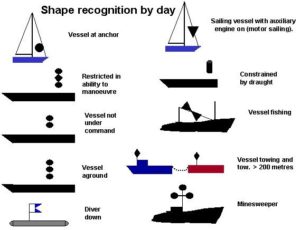
Note the double black cones day shape to designate a vessel engaged in fishing
I could not help but notice that FV Wevo was using dayshapes to let other boaters know he was engaged in fishing. Two black cones, point to point in a vertical lines designates this.
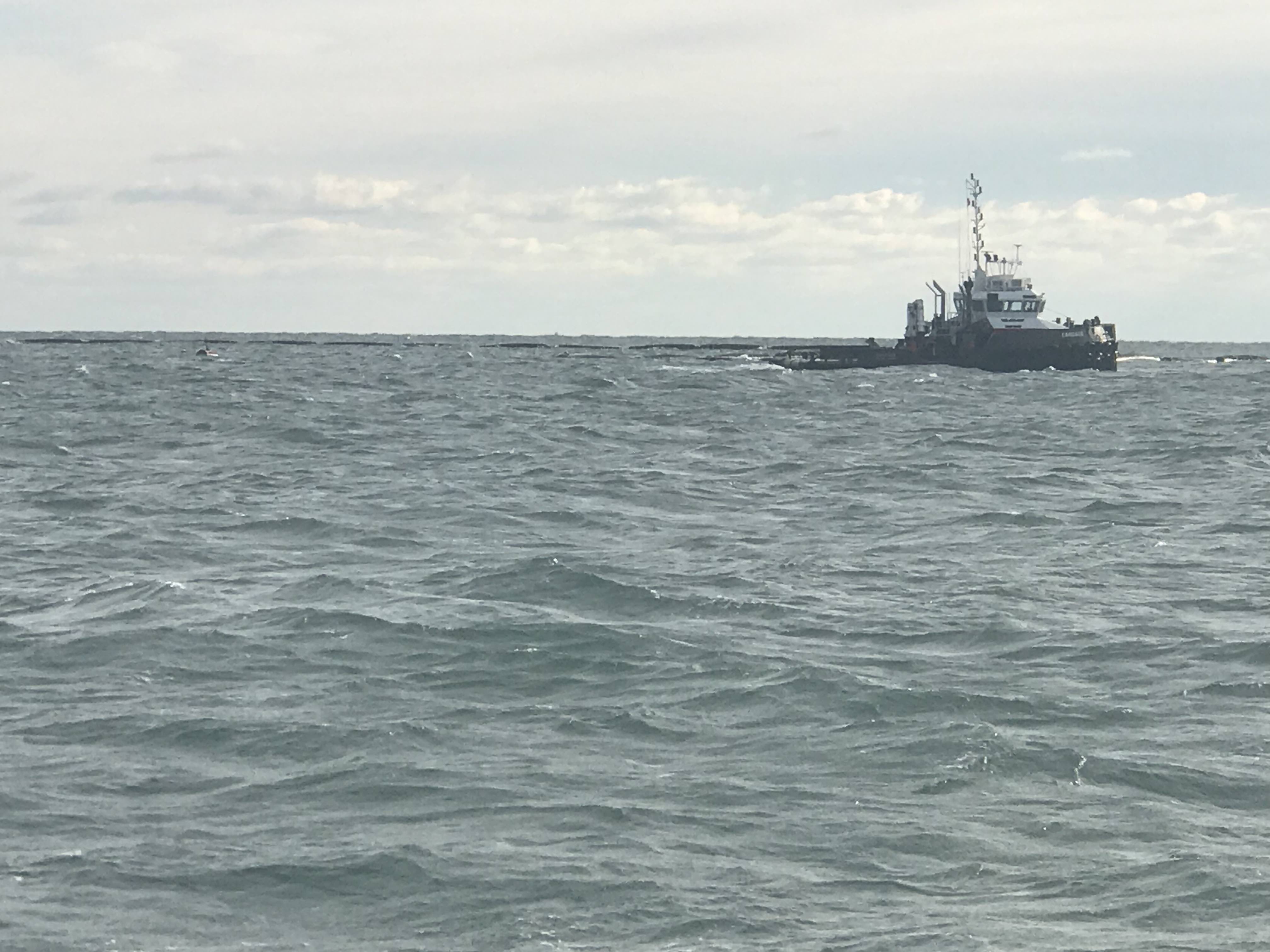
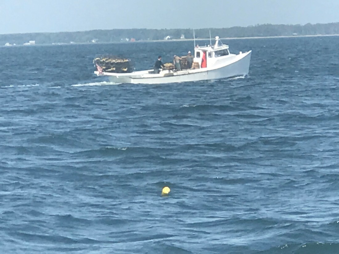
We also passed a fish farm or tug towing a fish pen. You need to be careful of running into these at night.
Tug towing a fish pen
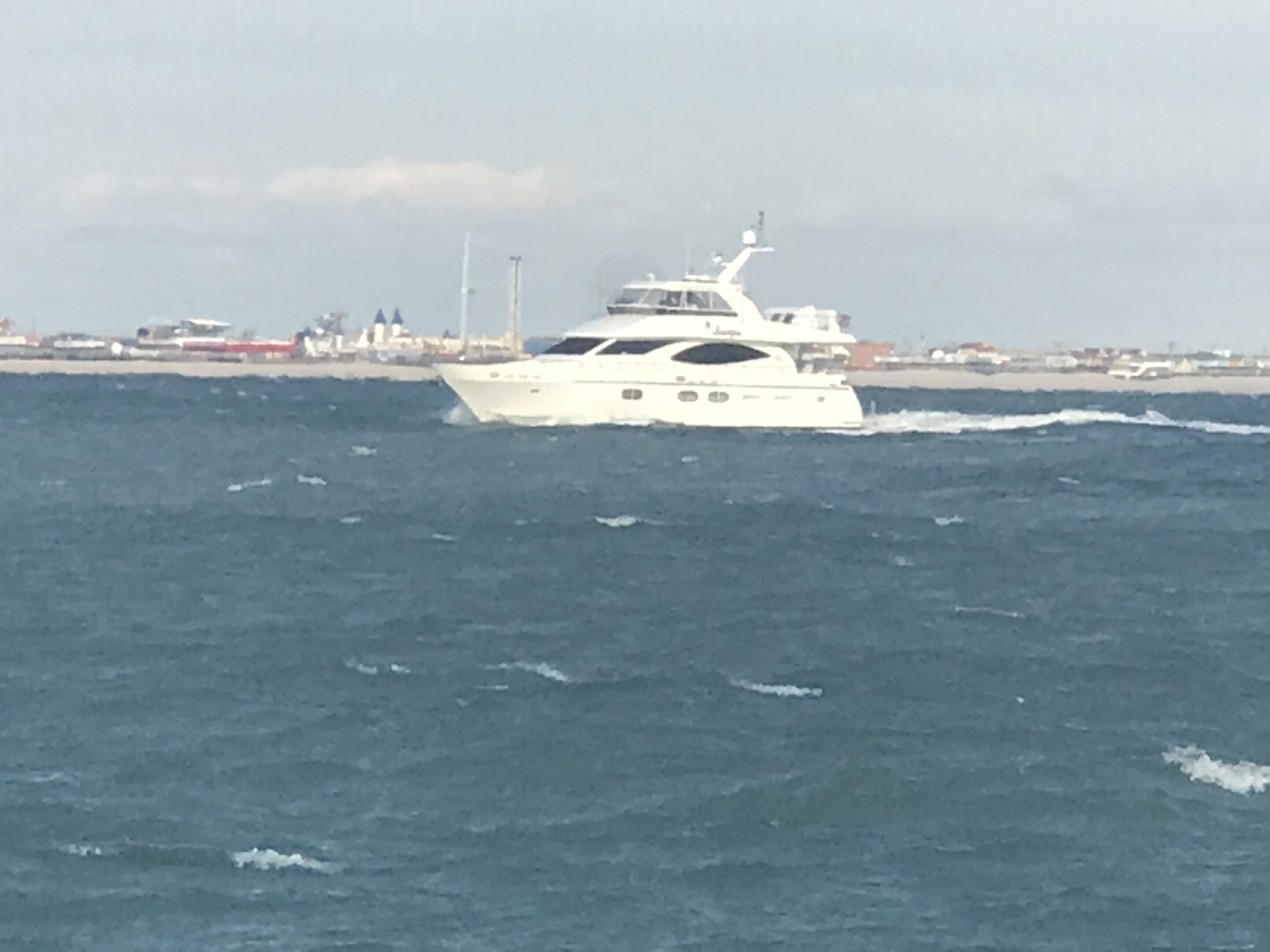
We did see one other snowbird racing south. MV Scorpio passed us doing about 11 kts compared to our 8 kts.
AIS – Automatic Identification System info on MV Scorpio
This drum hazard snuck up on us and we had to adjust course to avoid hitting it. I don’t believe it was lit so keep a good helm watch at night.
Hazard Drum
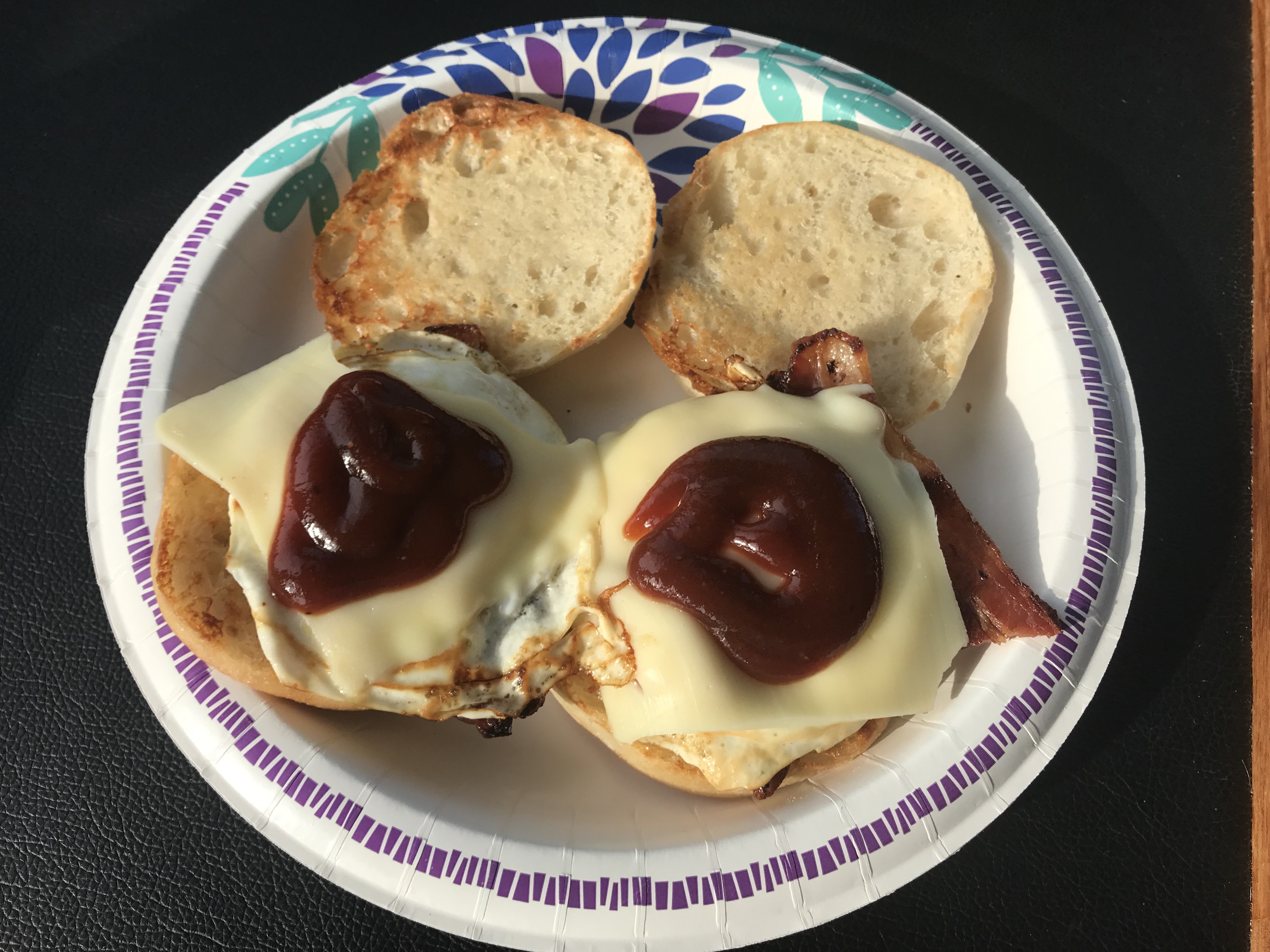
Kelly is great about cooking while underway and delivered two hot bacon, egg & cheese muffin sandwiches to the helm.
Yumm
Even the dogs were licking their chops
Happy Smells Maple BACON!!
We passed Atlantic City on our way to Delaware Bay.
Atlantic City
Soon the sun went down and the overcast sky made for a dark night on the water.
We could start to see Cape May on the horizon.
Cape May on the Horizon
When you work your way into the Cape May inlet they provide a nice red range light that you can use to keep your boat positioned in the center of the channel.
Red Range Light
You can see the split in the entrance channel and the range marker right at the split.
My heading line splits right through the range maker
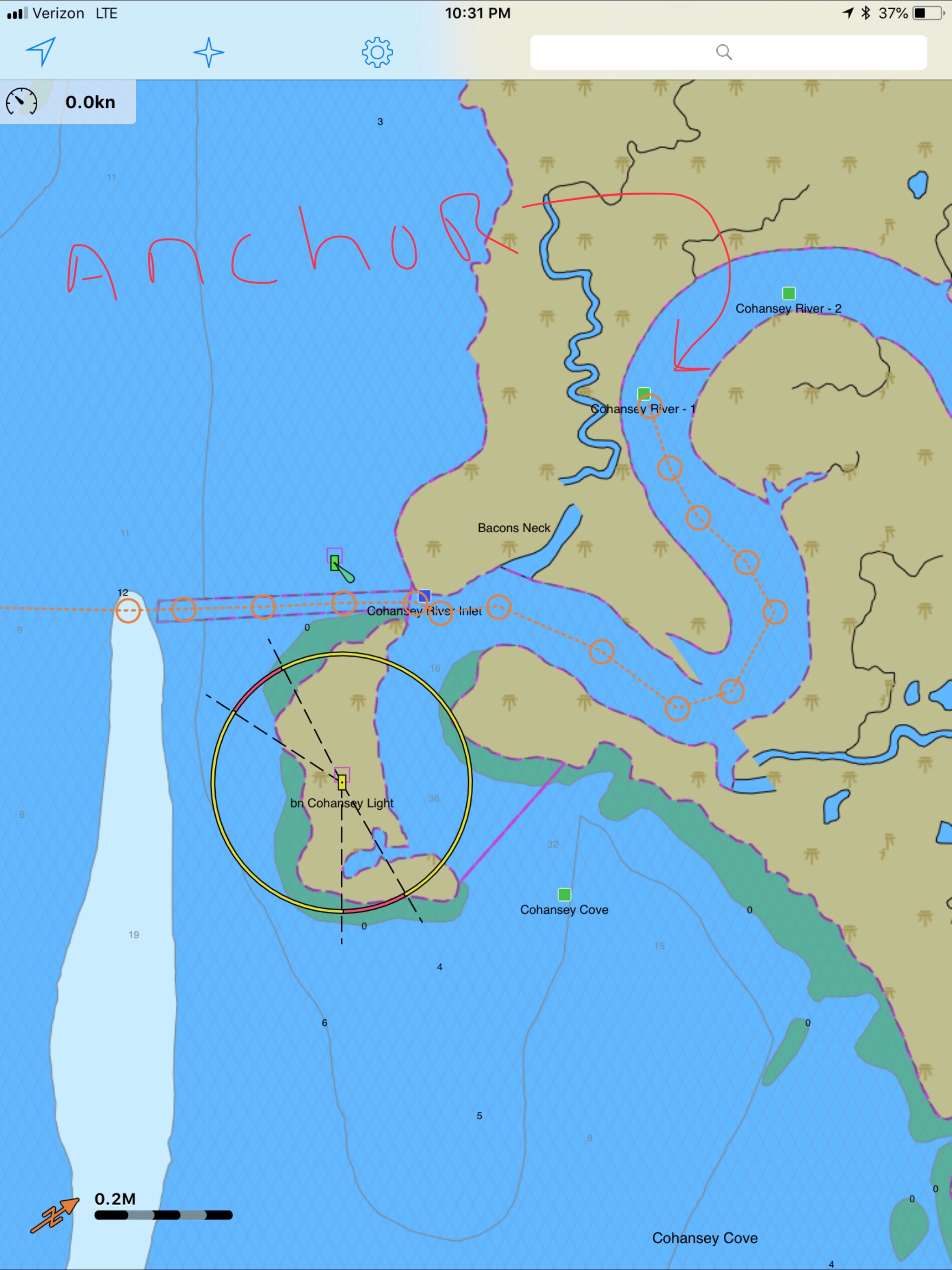
Once in Cape May Harbor we worked our way straight through and out the Cape May canal to Delaware Bay. We anchored for the night just South of the Cape May Canal jetty. A bit of a lumpy anchorage in this wind and chop but we’ll be gone at sunrise as the stormy weather is nipping at our heals.
Tomorrow’s forecast has 30-40kt winds were we are anchored tonight.Today’s Leg about 100 miles. W02L004
Along the way the sun came up in the East and since we were heading due West it was directly on our stern.
The boat was running great and it was time to drop the throttle to the pins and see what she’ll run at. I had hoped that she would reach WOT of 2800 but alas we only hit 2700. Proof that the boat is running a bit heavy and we may need to re-pitch the prop in the Spring. I almost did it this Fall but with the moving the ballast around I figured she may run a bit different at WoT (Wide Open Throttle).
2700 RPM ain’t 2800 and maybe re-pitching the prop will fix that.
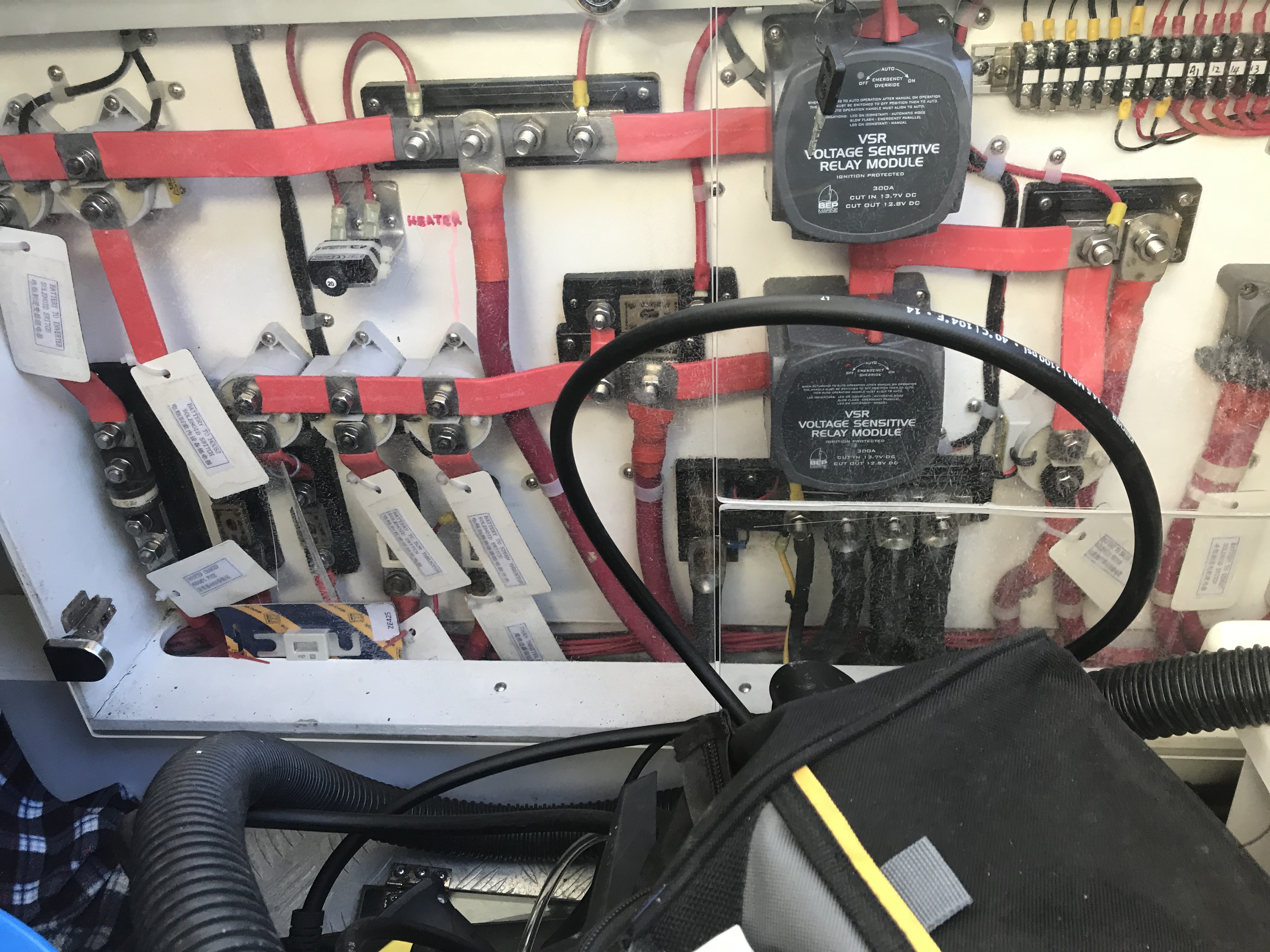
Along the way we got a “low voltage” alarm at the helm and after troubleshooting it it turned out to be the VSR (Voltage Sensititive Relay) that was not working properly. When you have a boat with 3 battery banks and 2 charging methods (alternator on the diesel & shore power battery charger) you need a VSR that combine the battery banks when there is a charging source (above 13V) and something that disconects the battery bank from the others when it drops below 12V. By isolating the battery bank you prevent all the battery banks from being depleted while allowing a single or multiple sources to charge all the battery banks at once.
Cockpit lazarette power panel. Two VSRs and 3 battery banks.
Anyway.. long story short our VSR was not combining the battery banks and I could use a manual override to force the diesel alternator to charge not just the single 8D battery for the diesel but also the Qnty 3 8D AGM (Acid Gas Mat) house batteries.
By the way. I just replaced those batteries at 160lbs a piece. I needed to be a bit younger. I’m not as strong as I was….
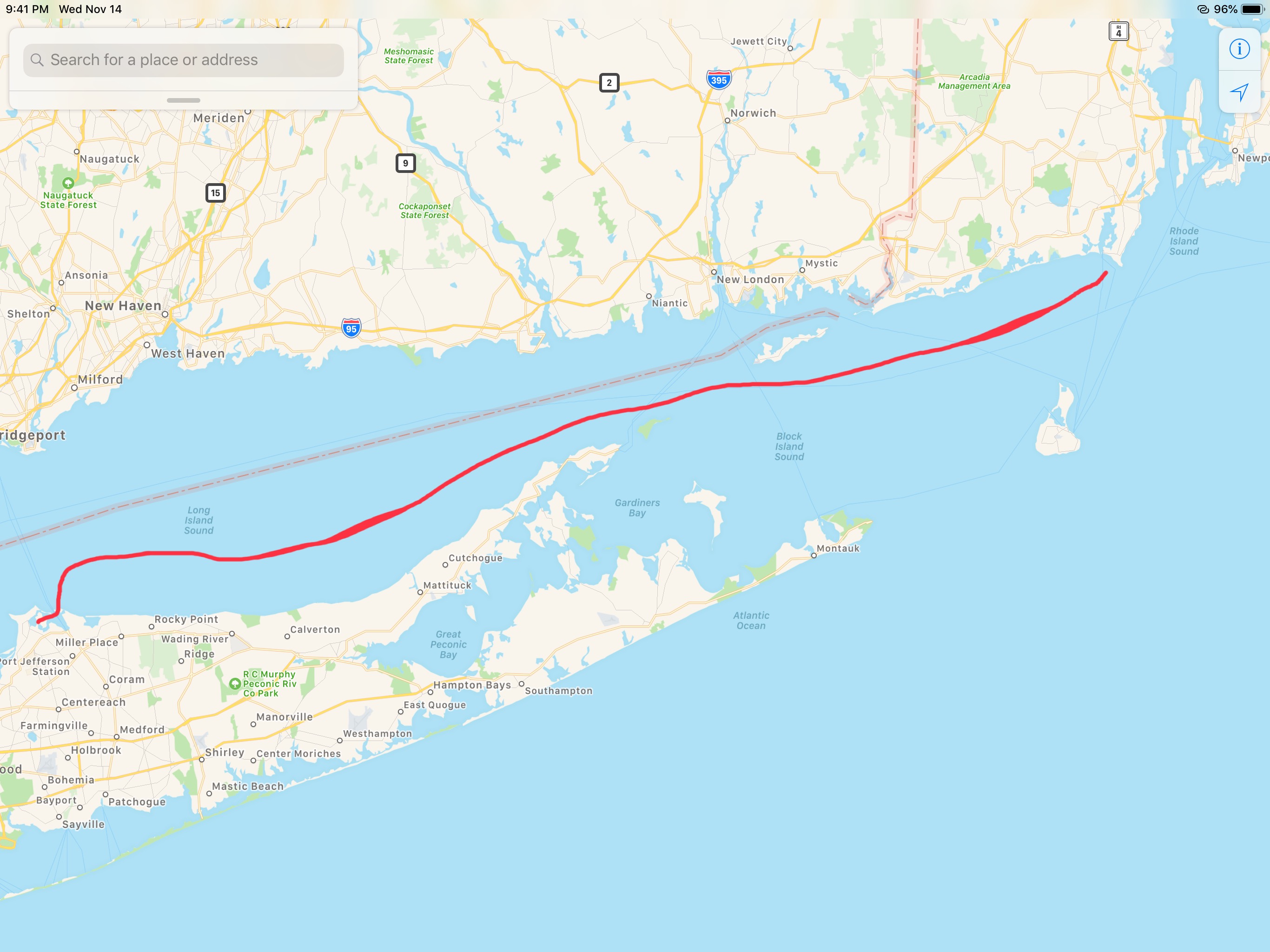
W02L02 (Winter 02, Leg 002) looked something like this…
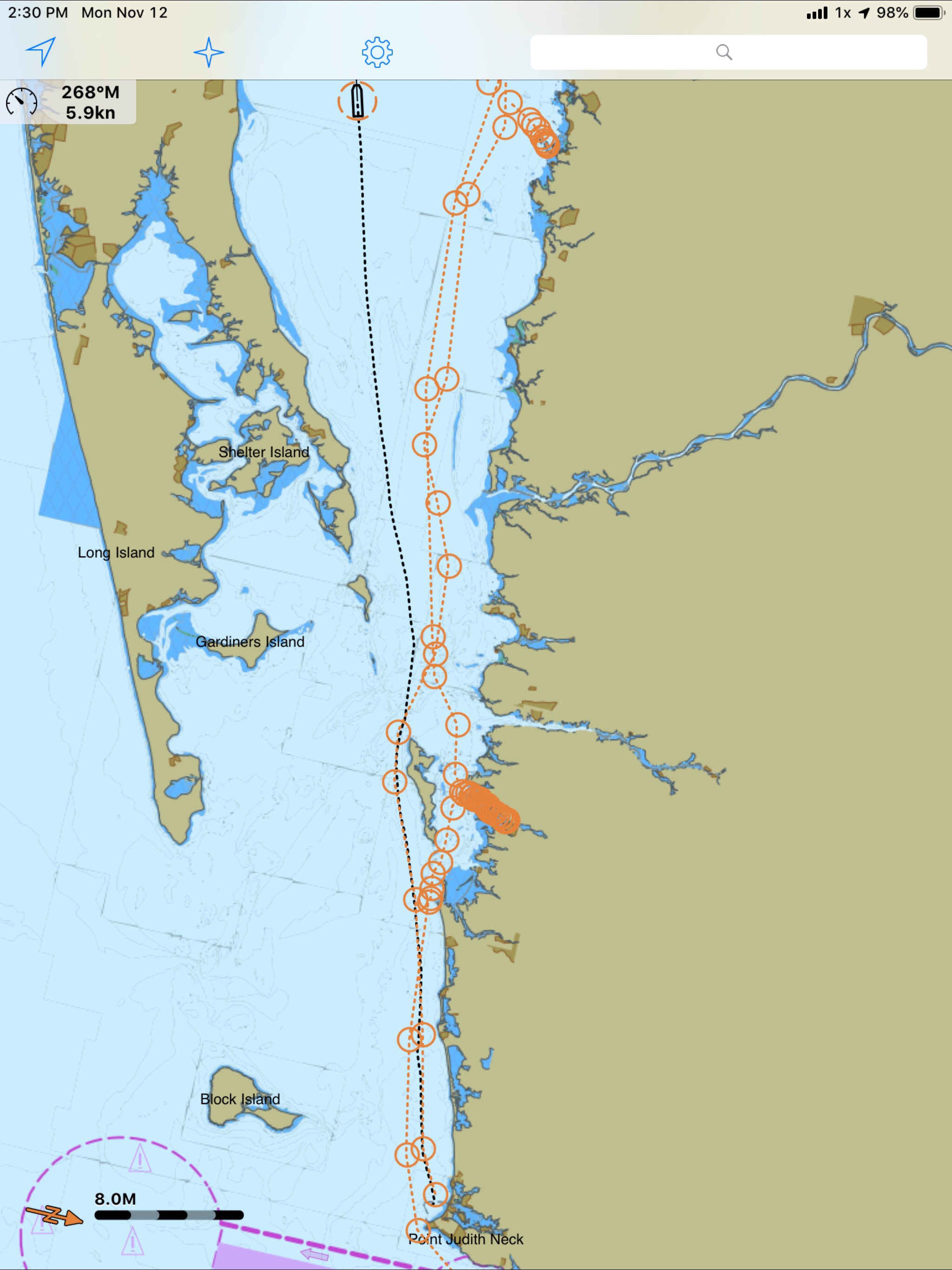
OK that does not include our nighttime arrival into Port Jefferson, NY (in Long Island).
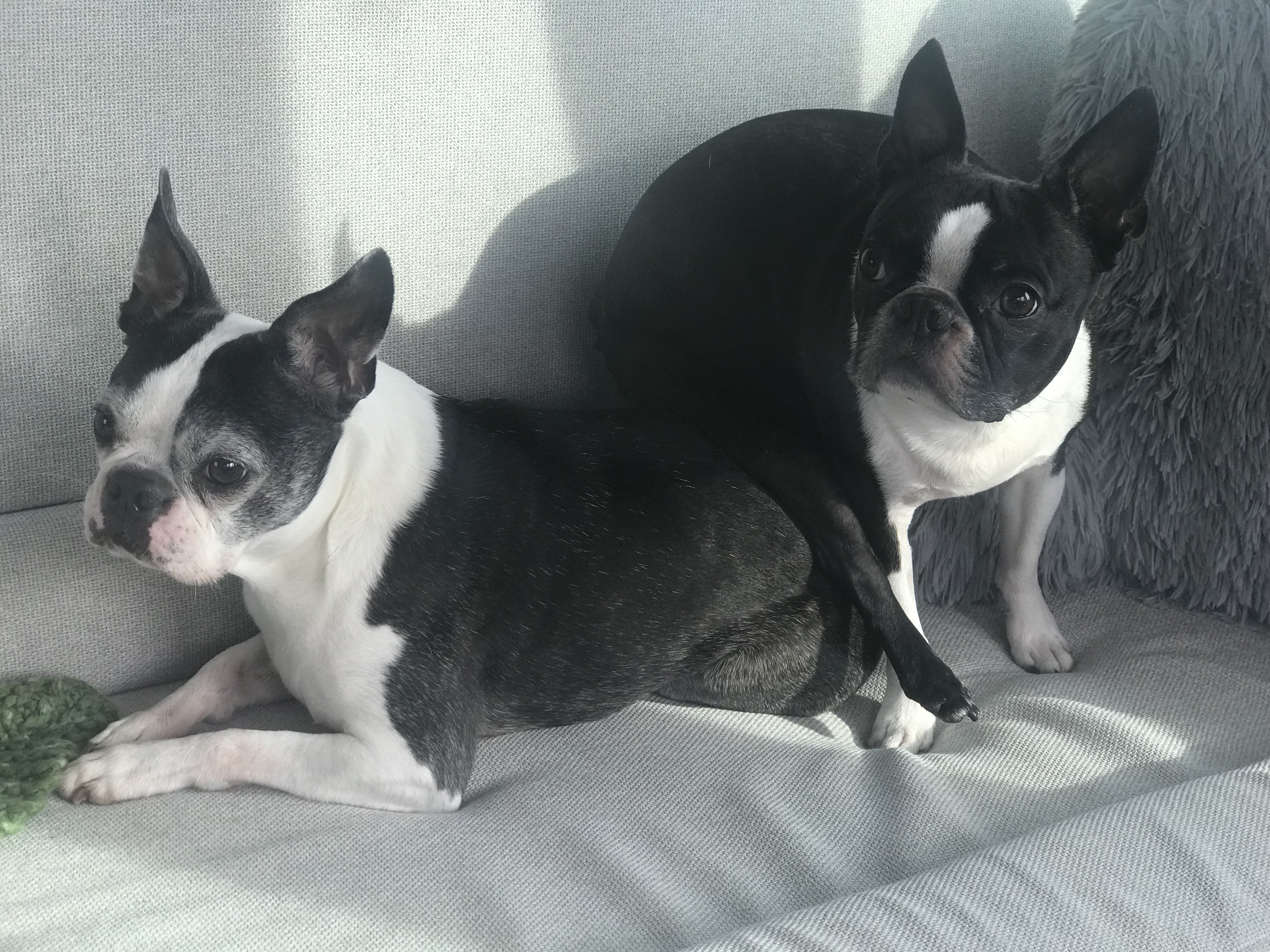
Even funnier were the dogs. They get nervous when the sea starts to get rough. That said the sea state was smooth but they were just out of practice. Chief Martin Brody was a bit nervous so by sitting on his big sister makes him relax. I’m not sure Happy agrees with this …
That’s all for tonight… I’ve been following the weather and it’s forcing us to run 12 hours days into the night to stay ahead of the NorEasters that are bringing high winds and heavy seas. We just need to get South down the Jersey coast before the Gale Force Wind warnings that are so commonplace during a NE winter…
We are anchored until sunrise @6:38AM on Tuesday. Until then.. this is our view of Port Jefferson..
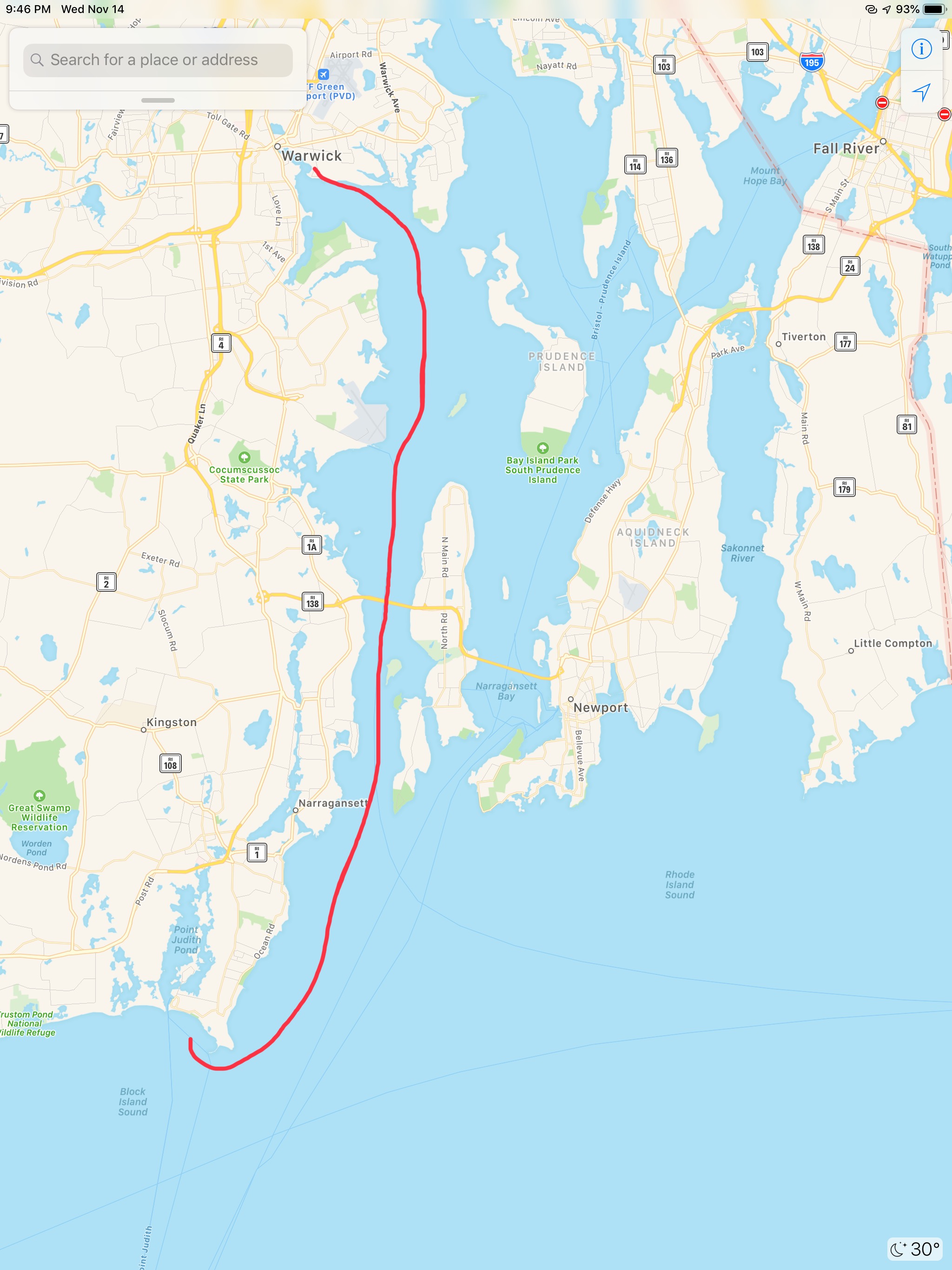
W02L002 – Leg #2 From Point Judith, RI to Port Jefferson, NY
7AM this morning was cold. There was frozen water in the dock cart and frost on the car windshield.
Dock cart full of frozen water. It’s cold this morning!Frosty windshield
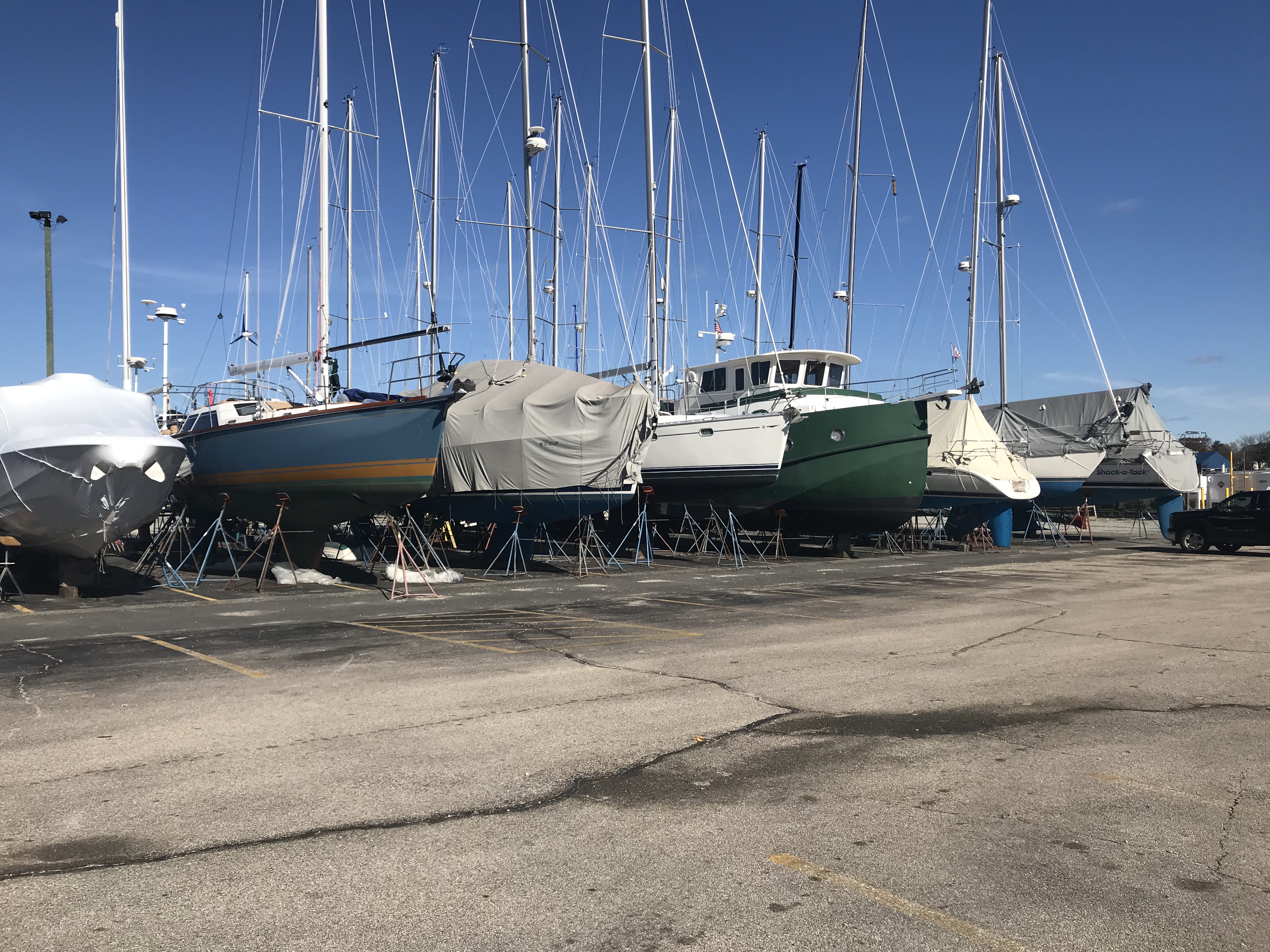
The boatyard was full of friends boats on the hard.
Buddy & Renee’s SV Star Watch with the beautiful blue hull with a gold boot stripe
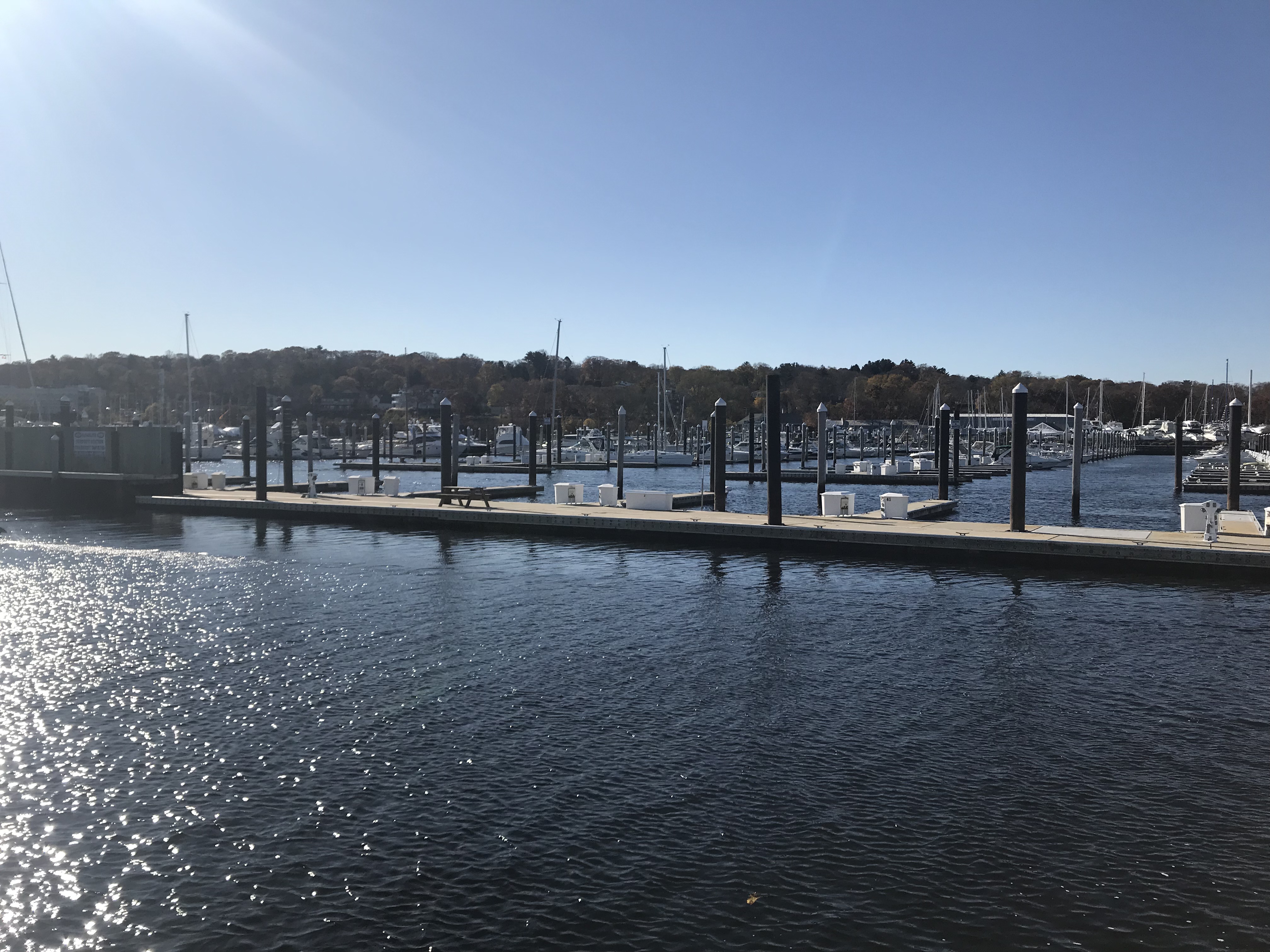
As we pulled away from the marina a look back shows just how many of the slips are empty as the boatyard crew is working overtime to get all the boats pulled and blocked on the hard for the winter.
Empty slips everywhere
Last year many people asked me questions like …
How long does it take to make it to Florida?
How many hours did you put on the diesel to get to Florida?
How many gallons of diesel did you use?
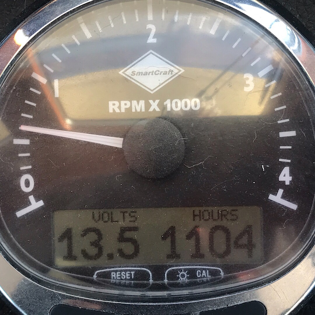
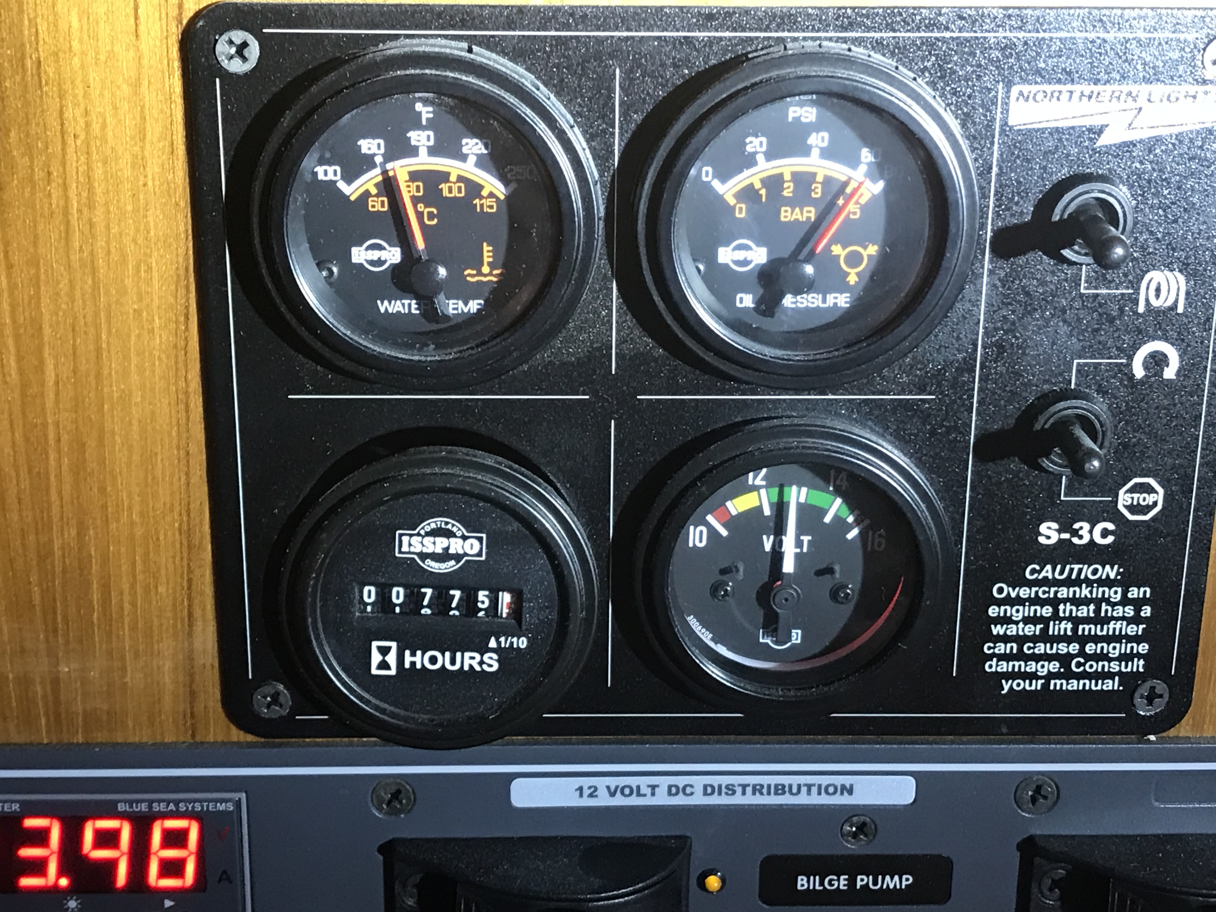
In response, I reset my “fuel used” on my Cummins Smartcraft display.
I also snapped photos below of the main and genset hour meters.
1104 hours on the Cummins QSB 5.9L 330HP diesel775 hours on the Northern Lights 9KW genset
The pilot house was warm and the sun was shining on the water.
Even on cold winter days the pilot house with all it’s windows stays toasty warm
W02L001 – Winter Season 02, Leg 001 of many looked like this…
We anchored in Point Judith’s “Harbor of Refuge” and just in time as the sun is setting.
We spent the Spring, Summer & Fall docked in Rhode Island.
Docked in RI
We grew up here and our families still live in the area. We spent much of our time catching up with friends and family which was nice after spending the entire winter in the Florida Keys.
Susan & Sean & Bently
The Lonergans
Boating on Long Lake, Maine
Shooting with friends at the range
What a great day with friends
Sam’s Party
What a great day with friends
Shooting with friends at the range
Sam’s Party
Boating on Long Lake, Maine
Susan & Sean & Bently
For me that meant lots of trips to the grave with Dad and my siblings to visit Mom.
Mom Visit
Rain or Shine
Lonergan Men
The Lonergans
First Selfie Ever
Peaceful Place
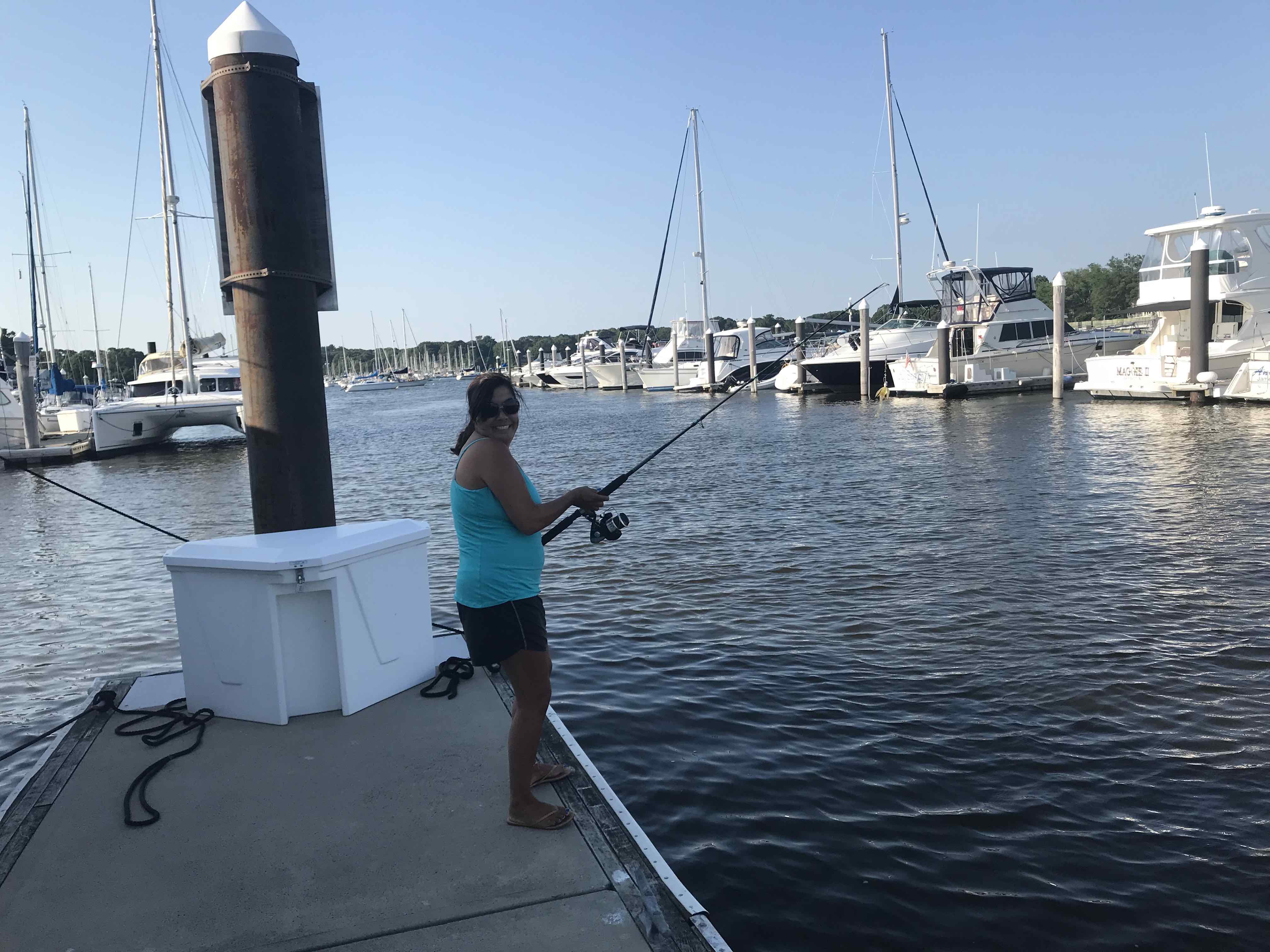
While at the dock in RI Kelly took up fishing..
Netted with a smile
Porgy = Scup
Porgy Mug Shot
Weakfish?
World’s Smallest Sea Robin?
In January of 2017 we made the decision to leave our careers in corporate America and boat full-time. While we will miss our coworkers we believe in “Sell everything but the boat and have the Simple Life”.Once retired, we took on the huge task of selling everything we own and staging our home for sale. We worked right up to the middle of November when we just had to leave because of the weather. I had no time to prepare the boat for departure we simply loaded it up and shoved off for warmer weather.
This year we spent the entire Spring, Summer and Fall completing routine maintenance & projects so the boat to be better prepared for cruising.
When you own a boat and you are not rich you must perform all the required maintenance yourself. That means you must be an electrician, plumber, HVAC/R tech, Marine electronics expert, diesel mechanic, FRP (Fiberglass Resin Plastic) and gelcoat repair technician, Carpet installer, painter, boat detailer, etc.
Maintenance projects Pictorial Guide:
Lube & Fuel Filters
Lube & Fuel Filters
Raw Water Impeller
Ready for New Impeller
Clean this Dirty Bilge!
EvapFresh Cleans AC
Matteress covers on a boat
Locker Re-Org
Baskets for Laundry Room
Storage Bins in Lazzerette
Thru-Hull Check
New Hoses
Stronger Hose Clamps
Check Belts
Turbo Aftercooler Maintenance
Heat Exchanger Maintenance
Tranny Flush
Bow Growth After 2 Years
Stern Growth After 2 Years
Micro CSC Ablative Bottom Paint
MV Simple Life on the Hard
Painted Running Gear
Hanging in the Slings – Clean and Ready
No Eels were harmed during the painting of our bottom.
Then it was time to splash the boat back in water
Then it was time to get back to more maintenance jobs:
Dryer Needed New Start Capacitor
Bad Capacitor
Rudder Post Resealed
Packing for Rudder
Repaired Drawer Latch
Repaired Halogen Lights
LED Replacement Bulbs are Cool and Bright
Glendenning Switch Replaced
Corrosion Inside switch
Adjustable Fresh Water Usage
Whale Shower Sump no Leakage into Bilge
Seal this Emergency Rudder Port
Rod Holders Everywhere
Shore Power Cord Plug Replaced
When we were not doing maintenance we were doing upgrade projects:
Arlo Pro 2 Surveillance
Bahamas, quarantine and American Flags
Abaco 13.5 Tandem Kayak
Hobie Oasis with Mirage Pedal Drive
EPA 608 Universal Certification
4 Port Manifold Gauge set Wireless
Fieldpiece Recovery Machine
Cruisair RX 16K AC Unit
AC Logic Box
AC Logic Board
AC Logic Schematic
Mantus 85# Anchor
Fortress FX-37 Anchor
Ultraline 263′ Flat Anchor line
Canvas Covered Anchor Reel
Mantus Anchor Swivel
8D AGM Battery
Batteries Behind Genset
2″ Pool Hose as Chafe Guard
Batteries Next to Engine
New Flydeck Cushions
New 95 Quart Sub-Zero 120V/12V Freezer
New Salon Carpet – Dog Approved
Gear Hammock Perfect for Chips
Under-Sink Triple Water Filter
Water Filter Drinking Faucet
Spare Pumps Lots of Them
Leather Headboard for Bed
New and Old Vetus Thrusters
When we were not busy with boat projects, with the help of my family we were able to replace my father’s Septic system
We Voted …
Standing in the Pouring Rain
Wife Smarter in Car
We Boated
We suffered “Boat Bites”…
Ouch
Stitches Don’t Hurt They Said
After we watching one of our slip neighbors depart to Martha’s Vineyard, we were saddened to hear of their boat running into the Oak Bluffs entrance jetty and sinking on the beach. Luckily, captain, wife and child were unharmed.
MV Buffalo Soldier
Craned onto Barge
And other local boating disasters…
Not sure where but How does this happen?
38′ Sport Fishing Boat Runs into Cockpit of larger Orange Commercial Fishing Boat off Cape Cod in Fog
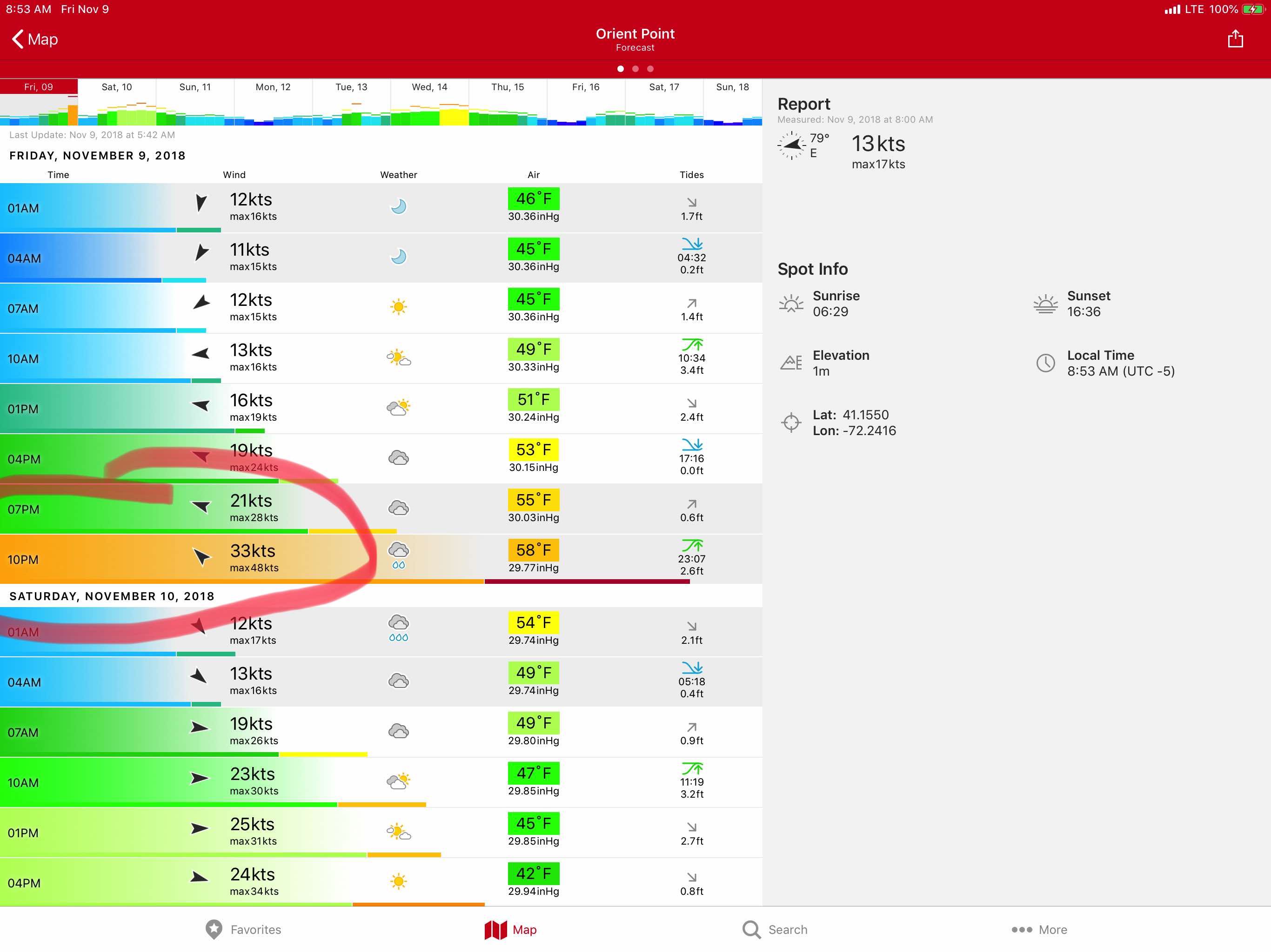
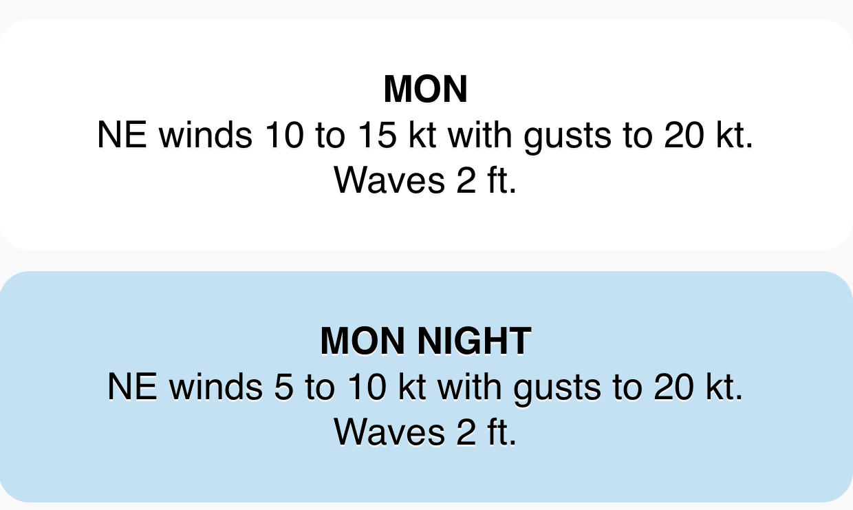
We swore that we were going to leave in mid October and now it’s approaching mid-November and the weather is not looking great.
Wind = 33 kts sustained with 48 kt gusts and 8′-10′ seas
Crew are looking forward to some warm sun in the Bahamas… Time to go…
The morning started with me readying the dinghy to be hoisted onto the flybridge. I attached the dinghy hoisting harness and untied the dinghy and walked up to the flybridge to operate the crane. I no sooner had the crane control in my hand and I looked out to see the dinghy floating away. Apparently, I had attached the lifting harness to the dinghy and not connected the crane’s hook to the harness. Oops. I had to quickly start the engine, untie from my mooring and chase the dinghy down as it was blowing across the harbor. We caught up with it just in time and used a boat hook to grab it. Crisis averted.
As we pulled out of Annapolis harbor this father, son, dog team passed us.
Father, Son, Dog Boating at it’s best
A quick check of the weather showed the SCA (Small Craft Advisory) was going to stick around for a few days.
SCA
As we proceeded North up the last bit of Chesapeake Bay you see many structures like this.
What is it? I dunno?
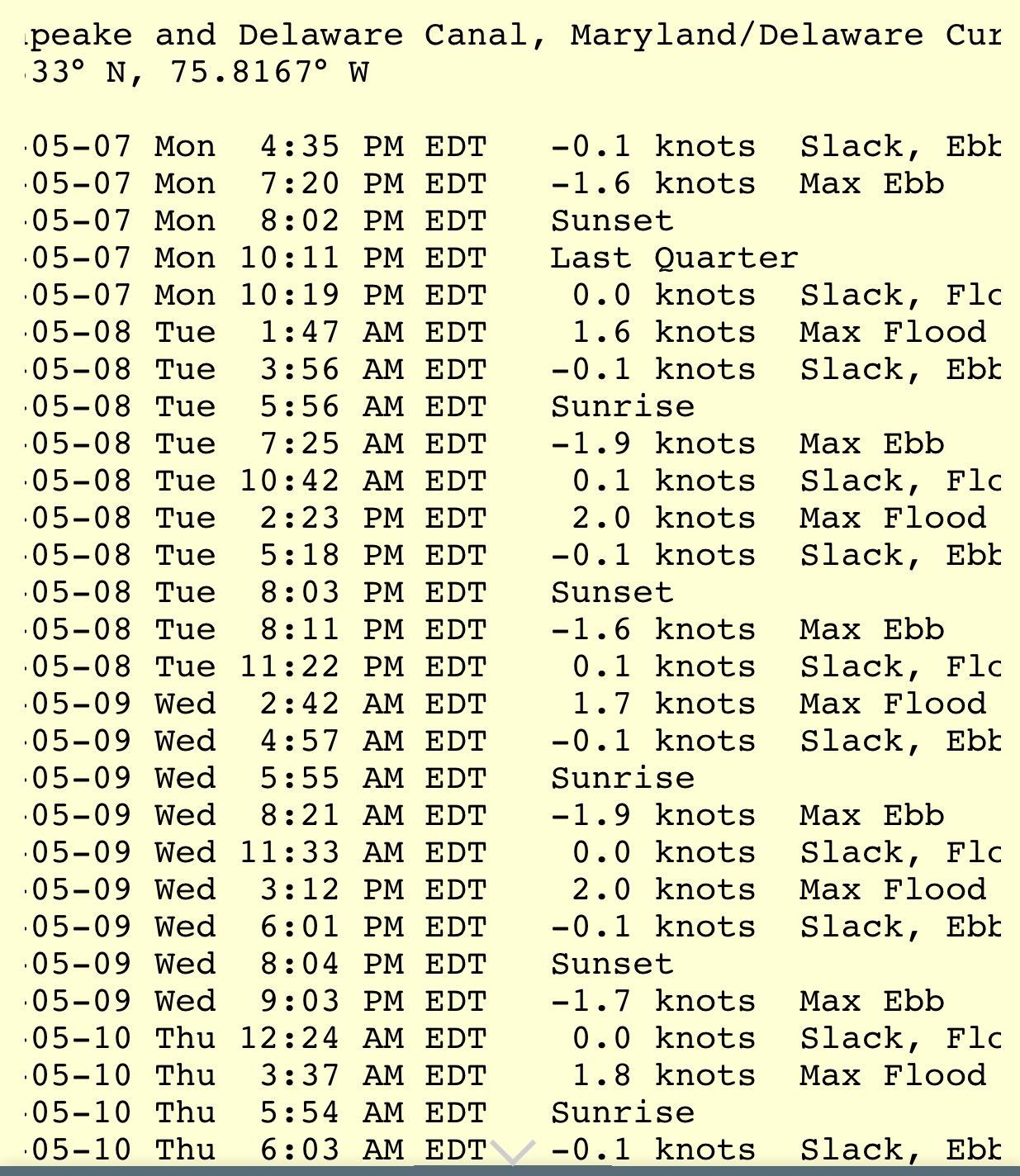
A quick check of the currents showed me that I better increase my speed to prevent an unfavorable current while transiting the C&D canal.
C&D Canal Current Table
Entering into the C&D canal you see many interesting sights.
Tugs
West End Bridge
USCG Station?
Bridge
Bridge of Blue
Bayard Restaurant
Marina
Restaurant
Chesapeake Inn
When you study the charts you’ll see things that cross canals like bridges and overhead power cables. When I saw an “overhead pipeline”, I was intrigued.
Natural Gas Overhead Pipeline Tower
Birds love it
On Approach
Tower
Plaque
I also so these lighted poles that I’m guessing make navigation easier at night. These poles will also generate radar pings in areas where the canal is shallow. Without these light poles, you could imagine a ship accidentally straying outside of the dredged channel in the areas where the shoreline extended far from the channel.
C&D Canal Lights
Soon we exited the East end of the C&D Canal and we turned South down Delaware Bay.
It’s frustrating to spend two days heading South when you are trying to get North
Cooling Tower
Reactors 2&3?
Reactors
On Approach
Power Station on Map
Website
Reactor Cooling Water?
As we approached our anchorage the sun began to set and I was so busy trying to navigate in the small cut on the West side of the barrier island that blocks the entrance to the Cohansey River. I was so busy at the helm, I could only manage a single picture.
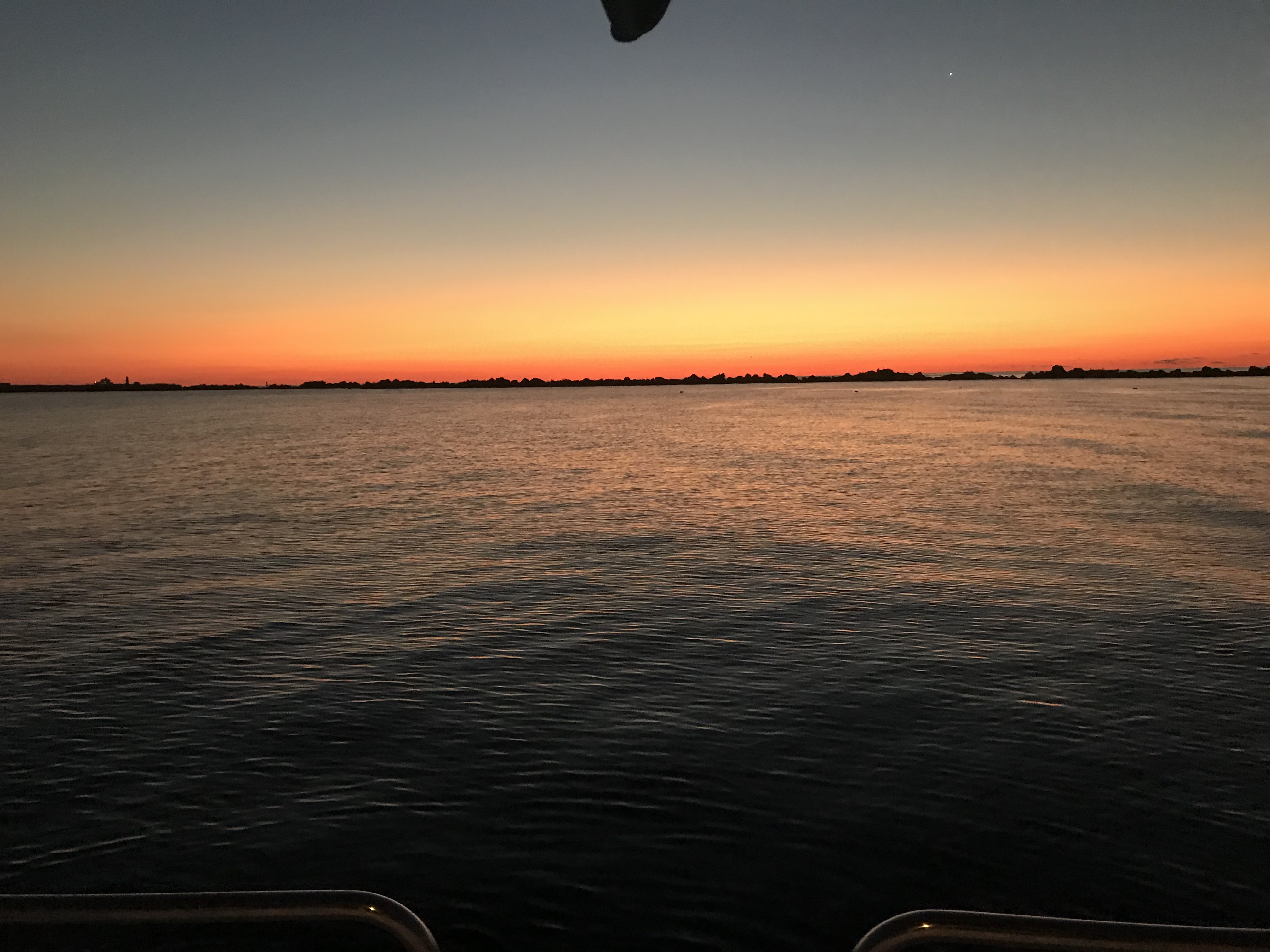
Sunset in Delaware Bay
Soon we were anchored in the Cohansey River and the waves of Delaware Bay were held at bay by the river’s banks. While the river has a strong current, the river bottom has proven to have good holding power.
Delaware Bay has some interesting facts. It is home to many horseshoe crabs and their numbers are dwindling due to horseshoe crab harvesting. Not for eating, though you can eat their eggs or roe but for their blue blood. That’s right, horseshoe crabs have brilliant blue blood due to copper that carries oxygen in their bloodstream. This is very similar to the red hemoglobin that carries oxygen in our human bloodstream. Research scientists in the medical field harvest their blue blood for it’s ability to react to the presence of bacterial endotoxins. This unique ability allows medical professionals to detect bacteria in many places.
Harvesting the Blue Blood of Horseshoe Crabs
Delaware bay is also home to the Red Knot bird. The red knot has one of the longest migrations of any bird. Every year it travels more than 9,000 mi (14,000 km) from the Arctic to the southern tip of South America. The exact migration routes and wintering grounds of individual subspecies are still somewhat uncertain.
Red Knot – A.K.A. Calidris canutus rufa
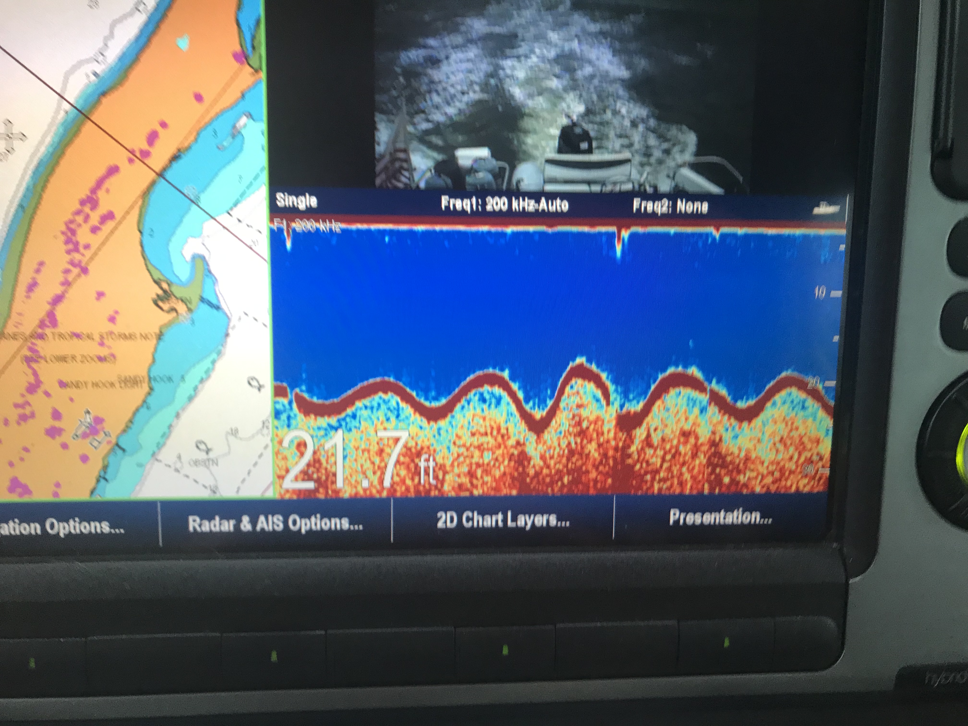
Lastly, Delaware Bay is home to a phenomenon called “Sand Waves”. This is where the sand on the bottom of the bay forms a wavy bottom surface. The wave patterns that sets up are static and have reached an equilibrium. The sand waves cause larger water waves on the surface. It’s interesting to see on your sonar picture as you go over the top of these sand waves. We saw this very same sand wave phenomenon on our sonar at the mouth of Chesapeake bay.
Leaving Solomons Island we checked the weather and saw that there was a SCA (Small Craft Advisory) in effect. Thankfully we were getting higher up in the Chesapeake Bay. As you approach the head of the Chesapeake the fetch (amount of water the wind has to blow on) shrinks.
SCA due to a low and a cold front
Small waves with gusts
The trip North had us staying out of the way of many large ships which we would see again anchored just outside of Annapolis. Maybe they wanted some shore leave in Annapolis too?
Sliding Down
Pushing up
I thought it would be more interesting if the ocean was not flat and these ships could simply slide down or be forced to push up hill.
There were many interesting structures in the bay like this lighthouse.
Lighthouse in Chesapeake Bay
Rays from above
Upon arrival in Annapolis we grabbed a mooring and I dropped the dinghy and raced off to do a one-man pub crawl of Annapolis.
1st stop Pussers.
Pusser’s Landing
Dinghy Dock for tie ups
Luckily all the canals in Annapolis offer free dinghy tie ups.
Docked in the canal
Canal end
2nd stop Dock Street.
Dock Street
3rd stop Middleton Tavern.
4th stop Federal House.
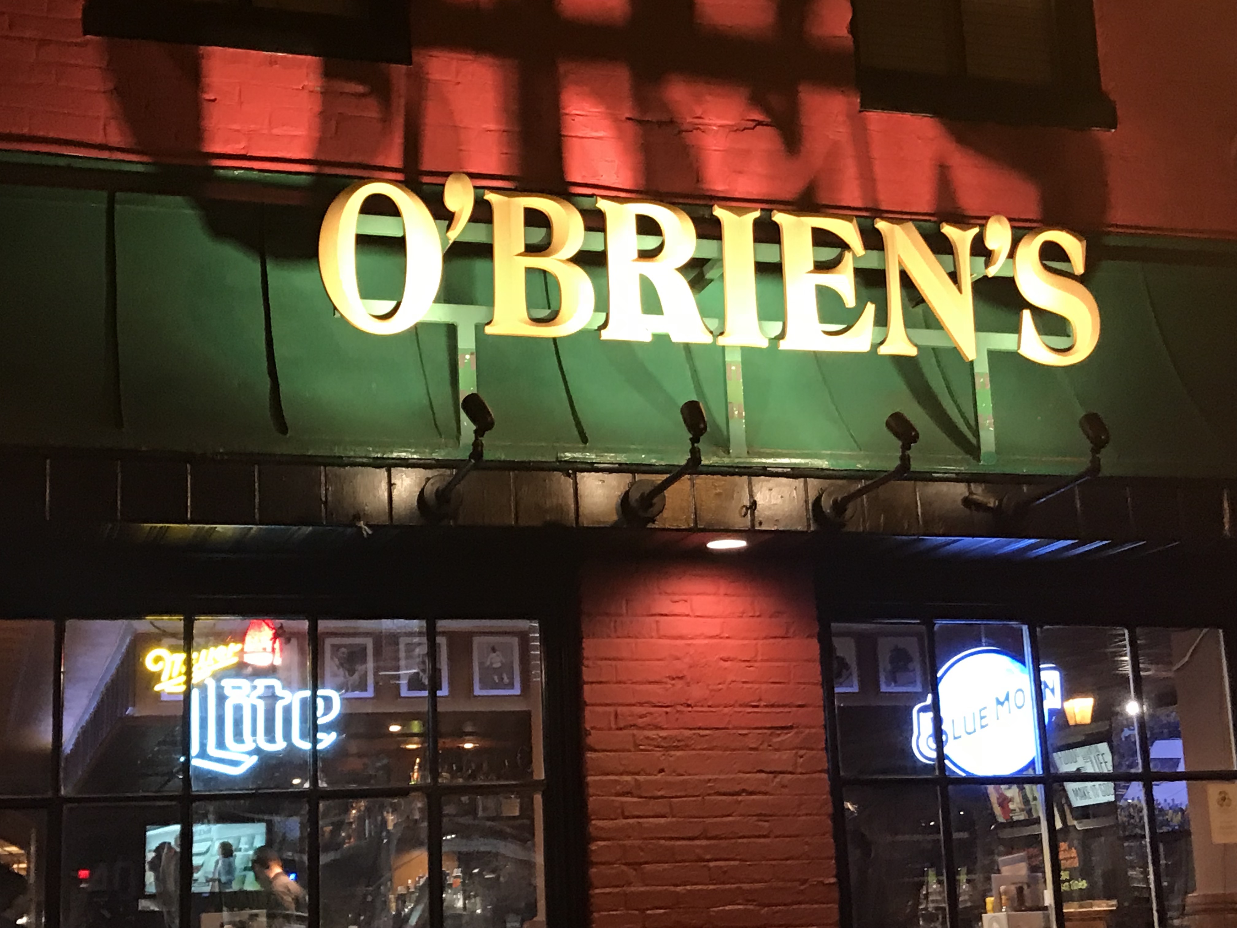
5th stop O’Brien’s.
6th stop ACME.
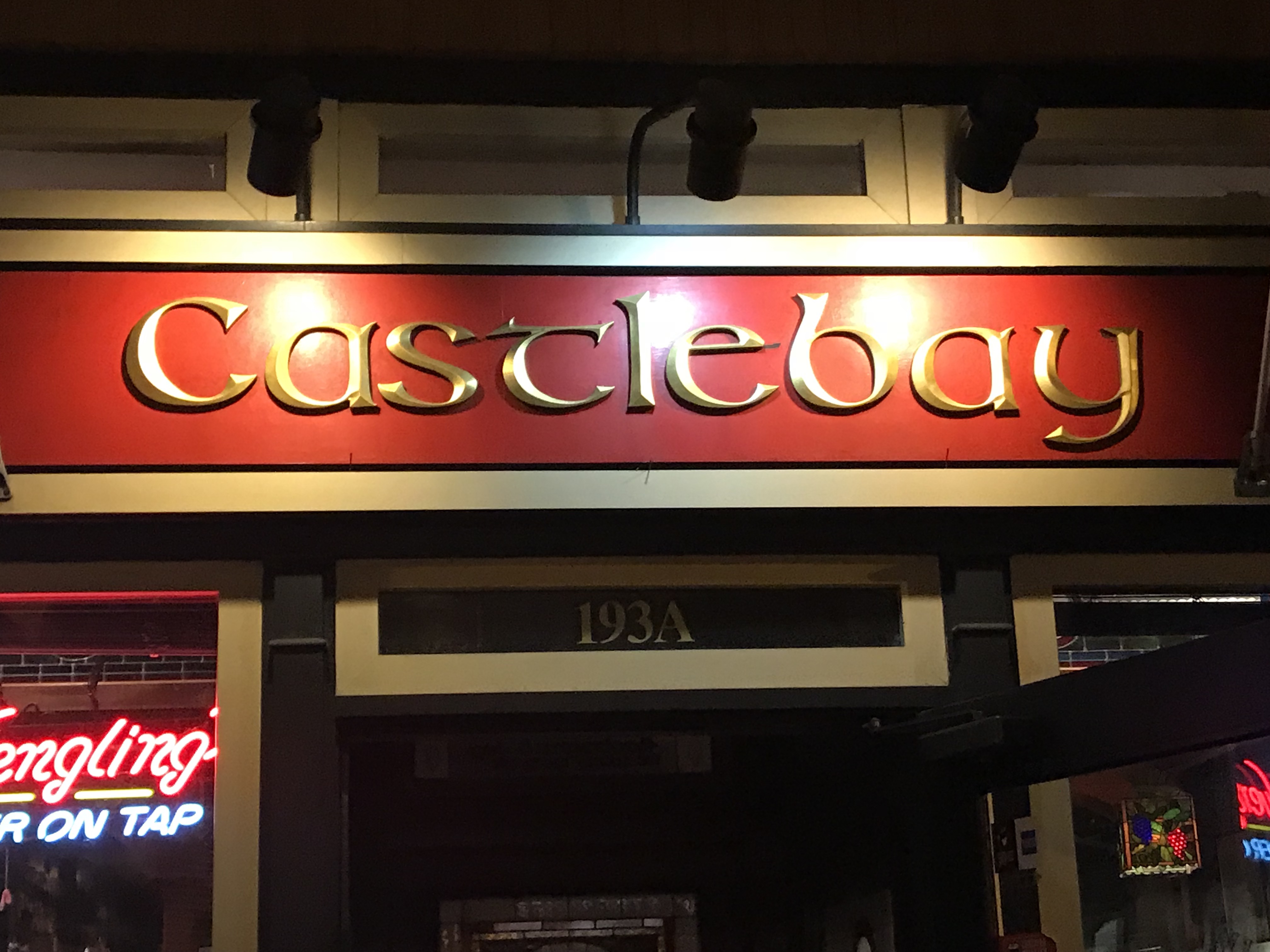
7th and final stop Castlebay.
Castlebay was alive with karaoke.
As I made my way back to the dinghy at the end of the canal I recalled seeing this Alex Haley’s Roots statue the last time I was here.
Alex Haley Roots
Plaque
Children listening
And just like that I was returning to MV Simple Life and would sleep like a rock.
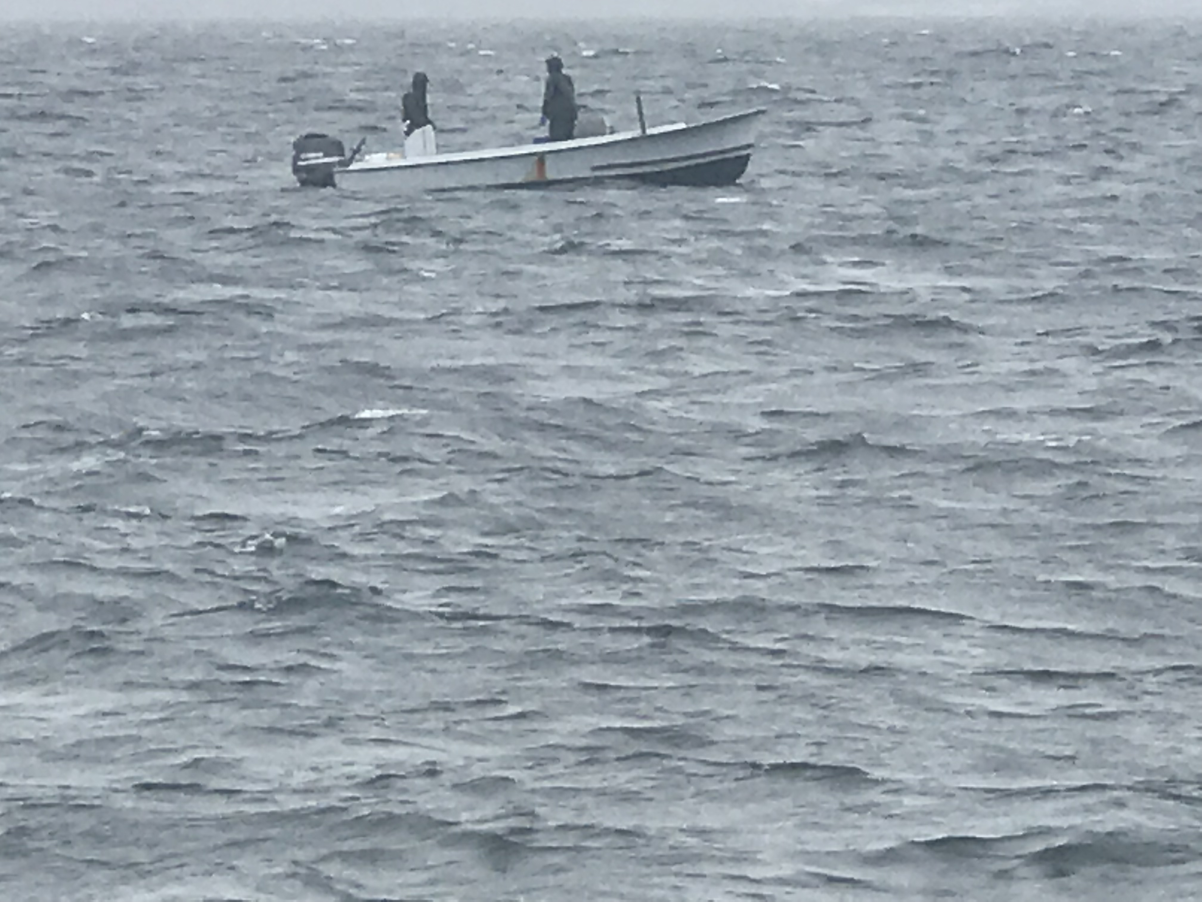
After getting some much-needed rest on anchor in Godfrey’s Bay it was time to push North to Solomon’s Island. This meant dodging the many fishing boats that dotted our path and taking in the sights along the shore. There appear to be many military type buildings which were festooned with satellite dishes and other communications equipment.
Maybe it’s just someone who wants fast internet?
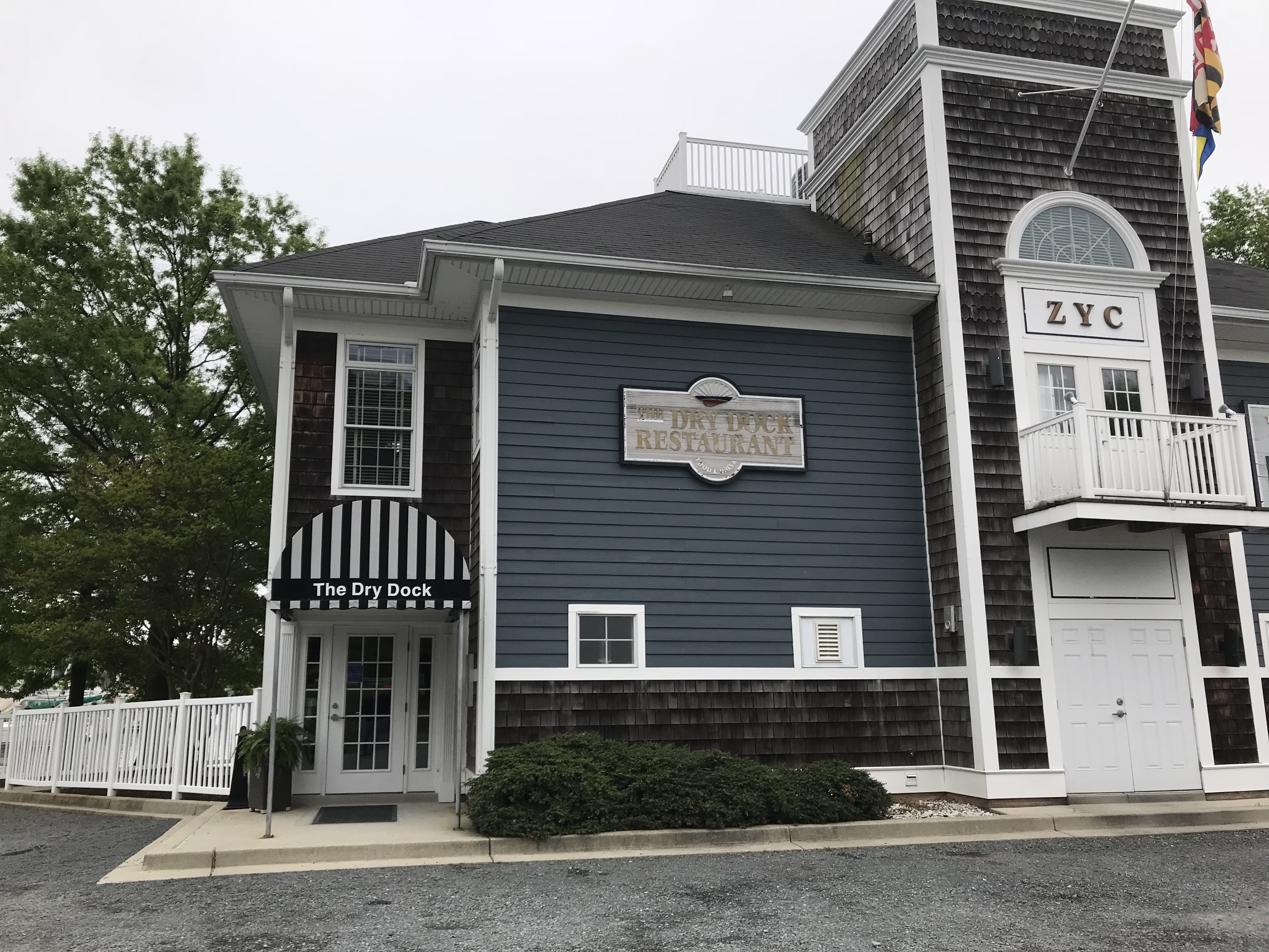
As we got close to Solomons Island, we hailed Zahniser’s Yachting Center and requested a slip for the night. With each attempted to pronounce the name right, I butchered it worse. It’s sounds something like “Anheuser” in “Anheuser-Busch beer” except starting with a “Za”. Turns out it was a Sunday and they were closing at 3PM but the dockhands would be around till 3:30PM. We pushed the throttles down and MV Simple Life roared from our usually leisurely 6.5 kts to 9.3 kts. We arrived just in time for Jason the dockhand to catch our lines and we had no sooner tied up and plugged into power and we off to dinner at the Dry Dock Restaurant.
Dry Dock Restaurant at ZYC
Bartender Timmy introduced me to a local IPA called Calvert Route 4. Apparently we were in Calvert County MD. It was great and so was dinner.
Calvert Brewing Co Route 4 IPA
We chatted a bit with some of the locals at the bar and soon we would be back aboard to race off to sleep. In the morning, I walked the dogs around the yachting center and found many interesting boats.
Hinkley named Dragonfly
You don’t see sailboats on lifts back home
SV Grey Owl on a custom trailer
Stubby shoal keel and add on bow thruster
37 foot Hunter
Sharp knife-like keel with bulb at bottom
Must be difficult to slip like this?
Chesapeake Bay Deadrise Boat
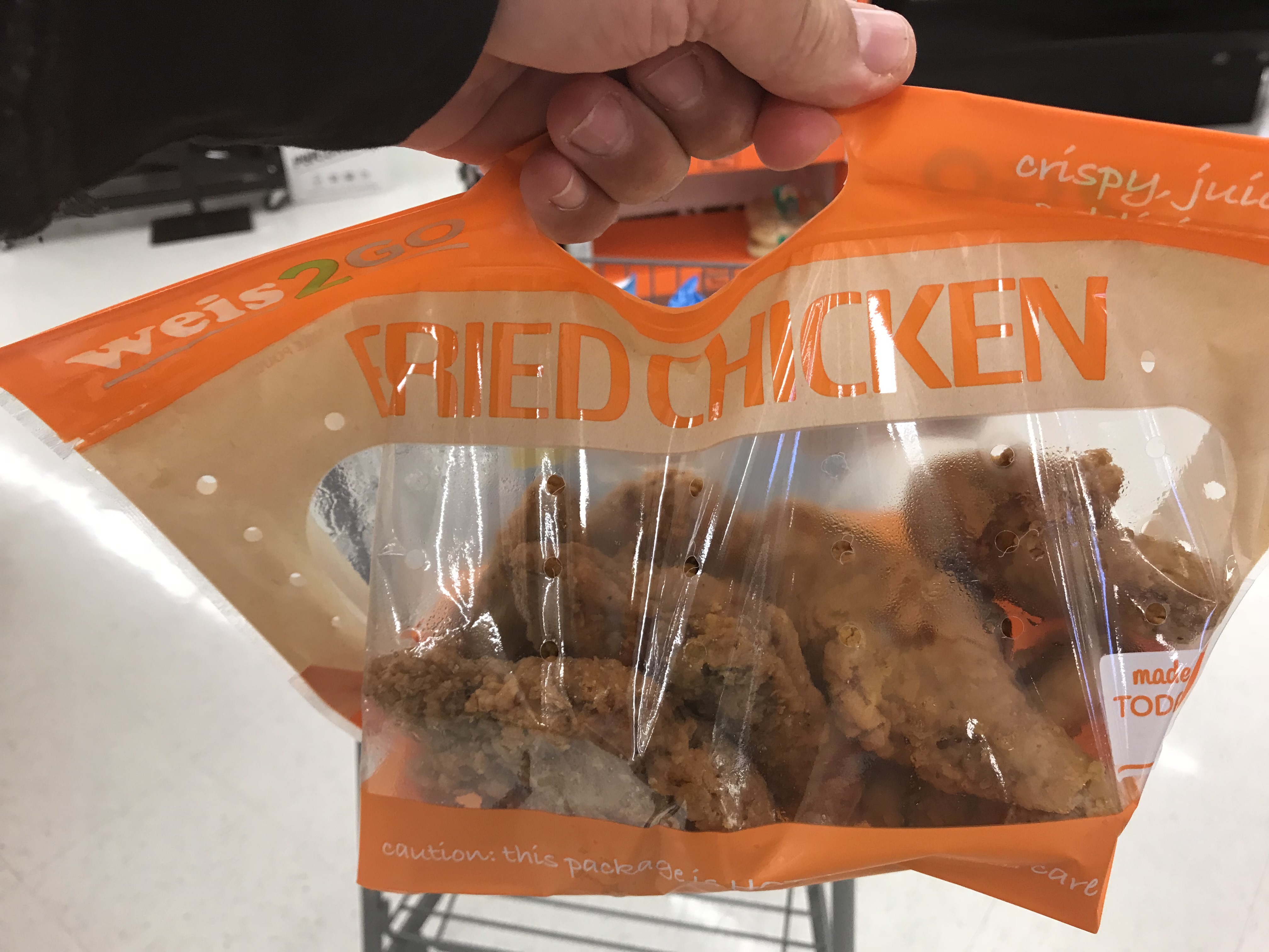
Jason the dockhand was nice enough to use the courtesy van and drive us to the local Weir grocery store to reprovision. I was starving and purchased some precooked fried chicken. As I chased Kelly around the grocery store with the carriage I kept taking bites of fried chicken. Kelly remarked that “she could find me simply by following the smell of fried chicken down the isles”. I can’t believe I ate all 8 pieces of chicken and was now in need of a napkin.
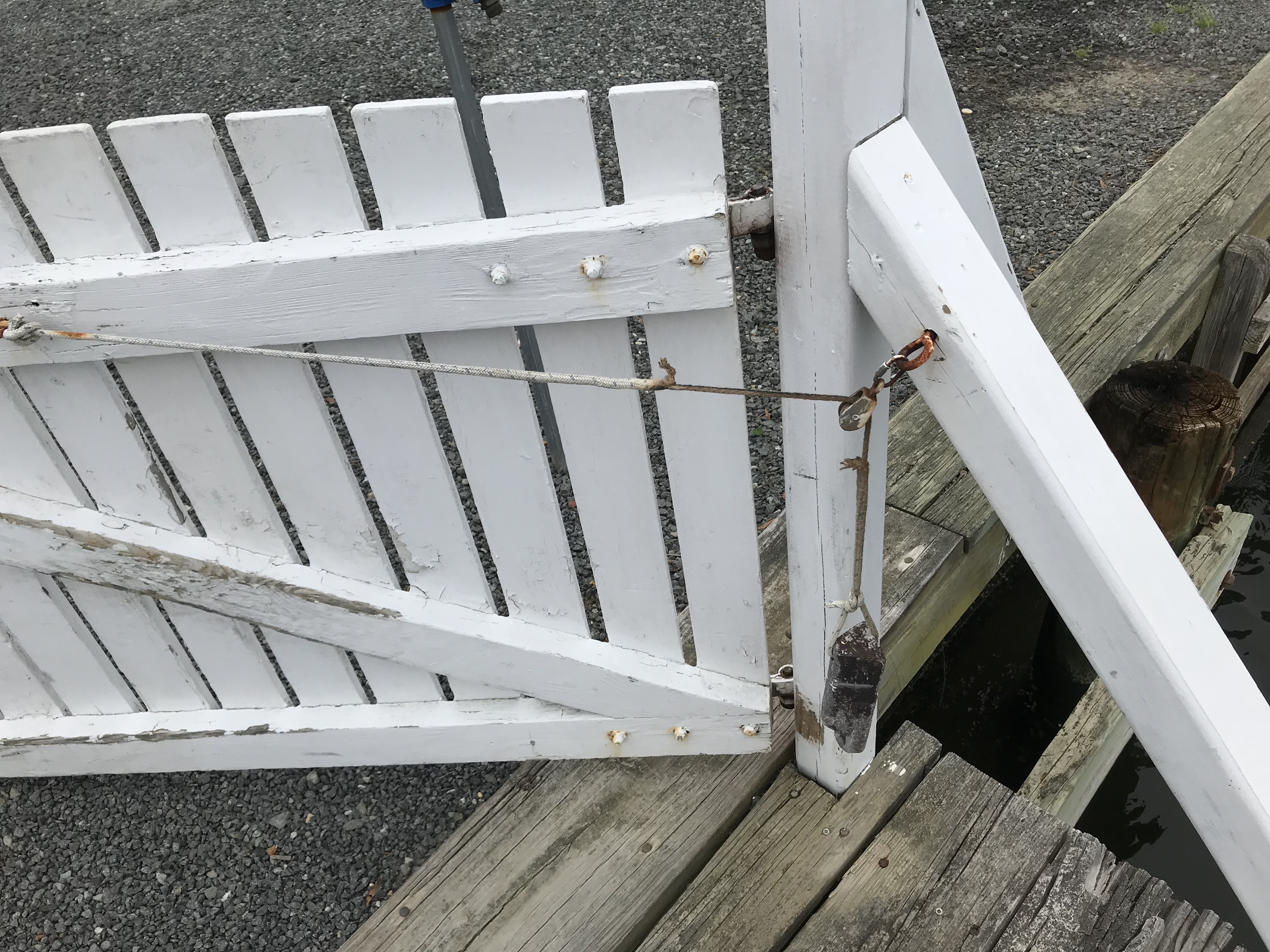
At the checkout I heard a “hello” and it was the friendly couple from the bar the night before. Calvert County seems full of very friendly people. As we made our way back onto MV Simple Life, we passed through this simply designed gate and we were gone. On to Annapolis, MD.
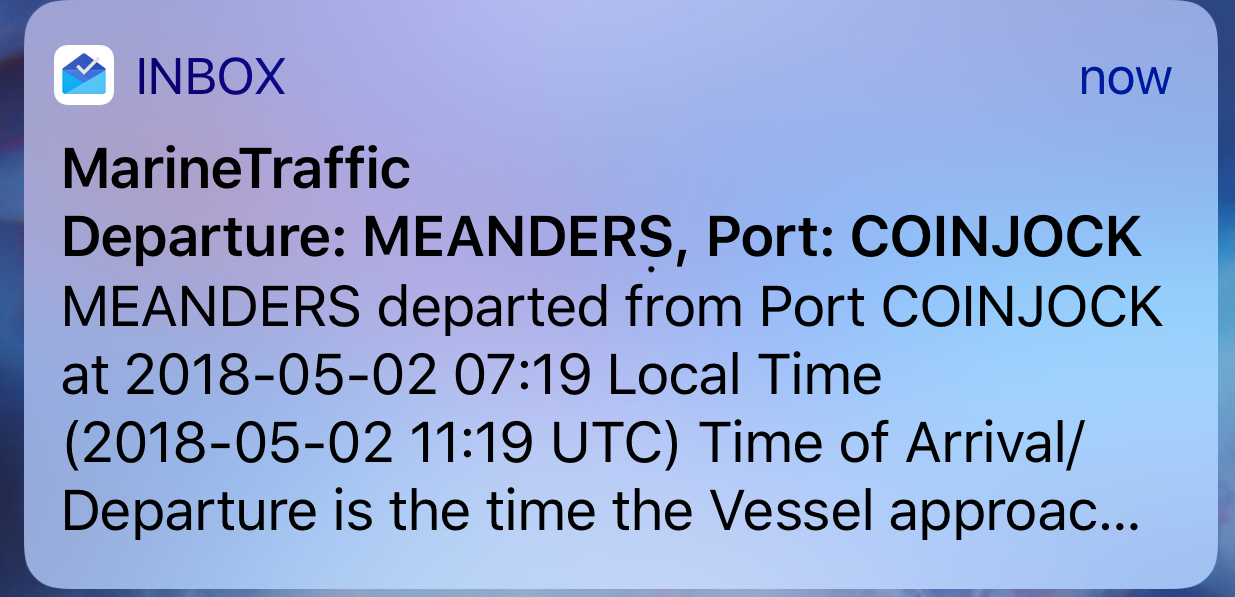
Before leaving Coinjock Marina, we received an email alert that MV Meanders had left Port: Coinjock. MV Meanders had been docked bow to bow with us. They had stealthily slipped away while we were making coffee.
Marinetraffic.com email alert for a boat as it leaves a port
MV Meanders is a beautiful 49’ North Pacific yachts RPH trawler. She’s a bigger version of our boat with reverse raked PH windows. MV Meanders was recently sold to a nice couple named Tom & Nancy who stopped to say “hi” when they saw our NP43 fueling up on the docks. Meanders was previously owned by friends of ours, Andy & Marty. Andy was my boat broker and took me for my first ride in their NP43. I was smitten. I setup the MarineTraffic alert when Andy & Marty were living aboard their boat and traveling to many different ports. At that time, I was working and enjoyed getting alerts about all the interesting places they were visiting. I would think to myself.. “soon that will be Kelly & I and the dogs”.
MV Meanders a 49′ NP RPH docked off our bow in Coinjock, NC
We had to delay our departure momentarily to allow for a passing tug pushing not one but two barges. We don’t want to be in the way of something like this.
Tug Pushing 2 Barges up the ICW
As we traveled down the ICW were chasing a 1935 boat called “MV NAN” out of Osterville, MA. A beautiful old boat that hails out of a marina that we have visited once or twice.
1935 MV Nan
Chasing Nan North up the ICW
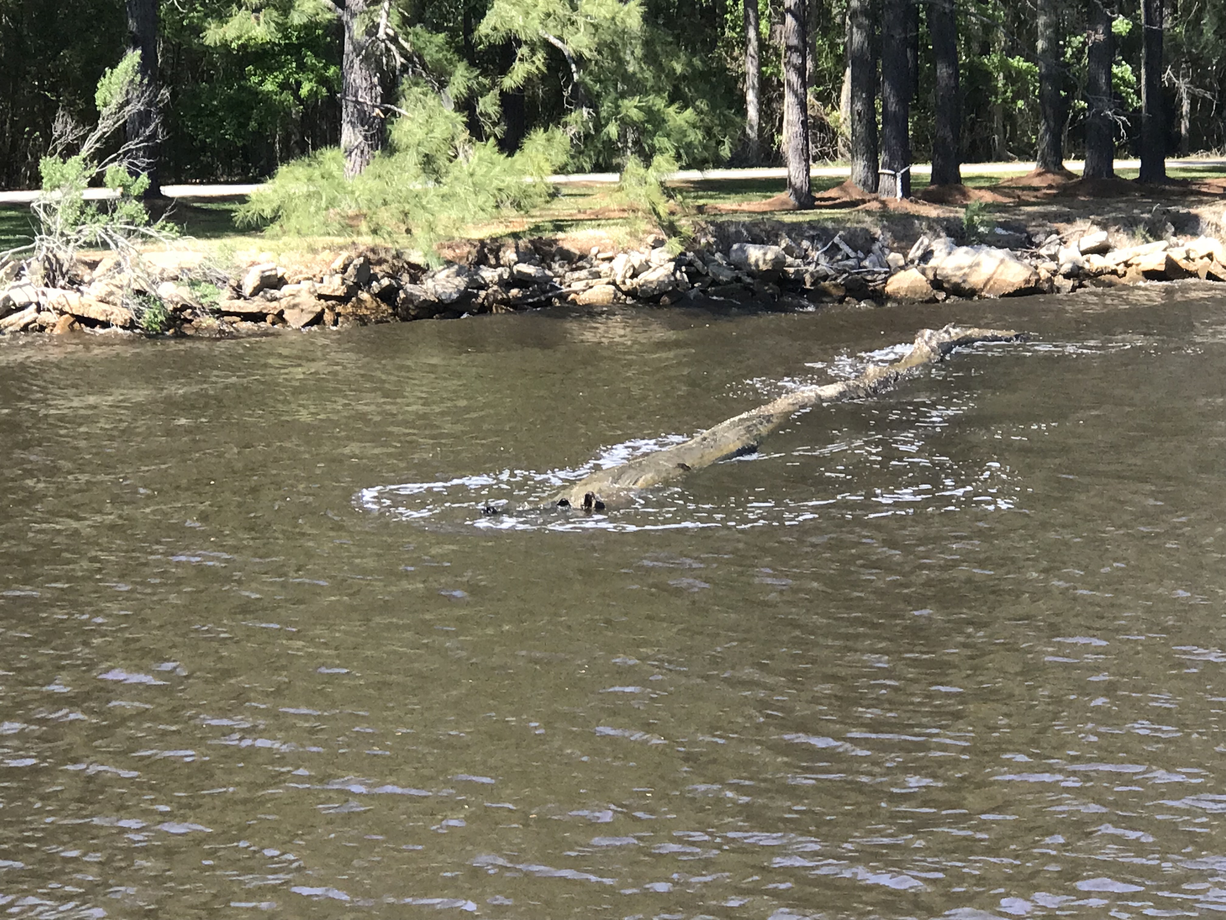
At the helm, I was using my iPhone’s charting app to measure distances to restricted bridges and locks. Many bascule, lift or swing bridges only operate at certain times like “top of the hour” or on the “half hour”. You need to measure the distance to the next bridge opening and adjust your speed to arrive on time. If you don’t you’ll find yourself treading water till the next opening. As I looked up from my iPhone, I saw this log floating down the river and had to swerve to avoid hitting it. iPhones make it even easier to run into a hazard on the ICW.
Hazards to Navigation are everywhere in the ICW
Just before arriving at Top Rack Marina you pass this school bus hanging precariously over a precipice. They put a sign in the window that says, “Fire Rescue Training in Progress”. I imagine they added that after someone called 911 to say that “a school bus was about to fall into the ICW!”
Fire & Rescue Training Using a School Bus About to Plunge into the ICW
Soon we were at Top Rack Marina and enjoying a well deserved dinner at the Amber Lantern Restaurant. What great food this restaurant has. Kudos to the Chef.
Amber Lantern Bar
When we awoke in the AM we could not depart due to an emergency! We were out of dog food! I hailed an Uber with the app and raced off to the local Petco. Dogs fed; we untied and headed North to Norfolk, VA.
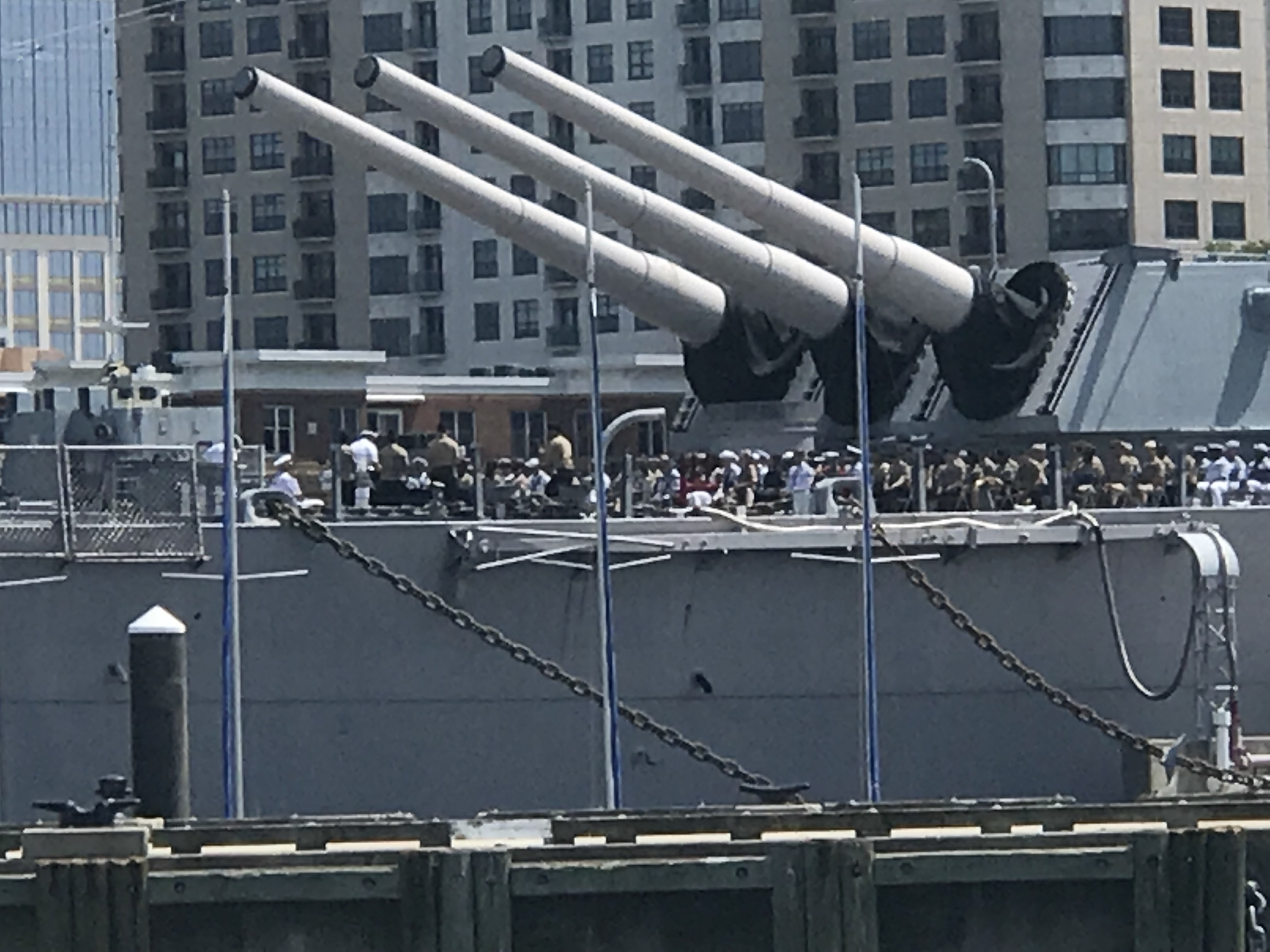
Coming into Norfolk you feel small compared to the many warships lining the channel.
Warship IKE
68 & 69
Warship 72
Warship 77
Navy Soldier on Guard with AR15 on Bow
Warship IKE
How cool is it to have a Navy ceremony seated beneath the “Big Guns”?
Navy Ceremony – Battleship Wisconsin?
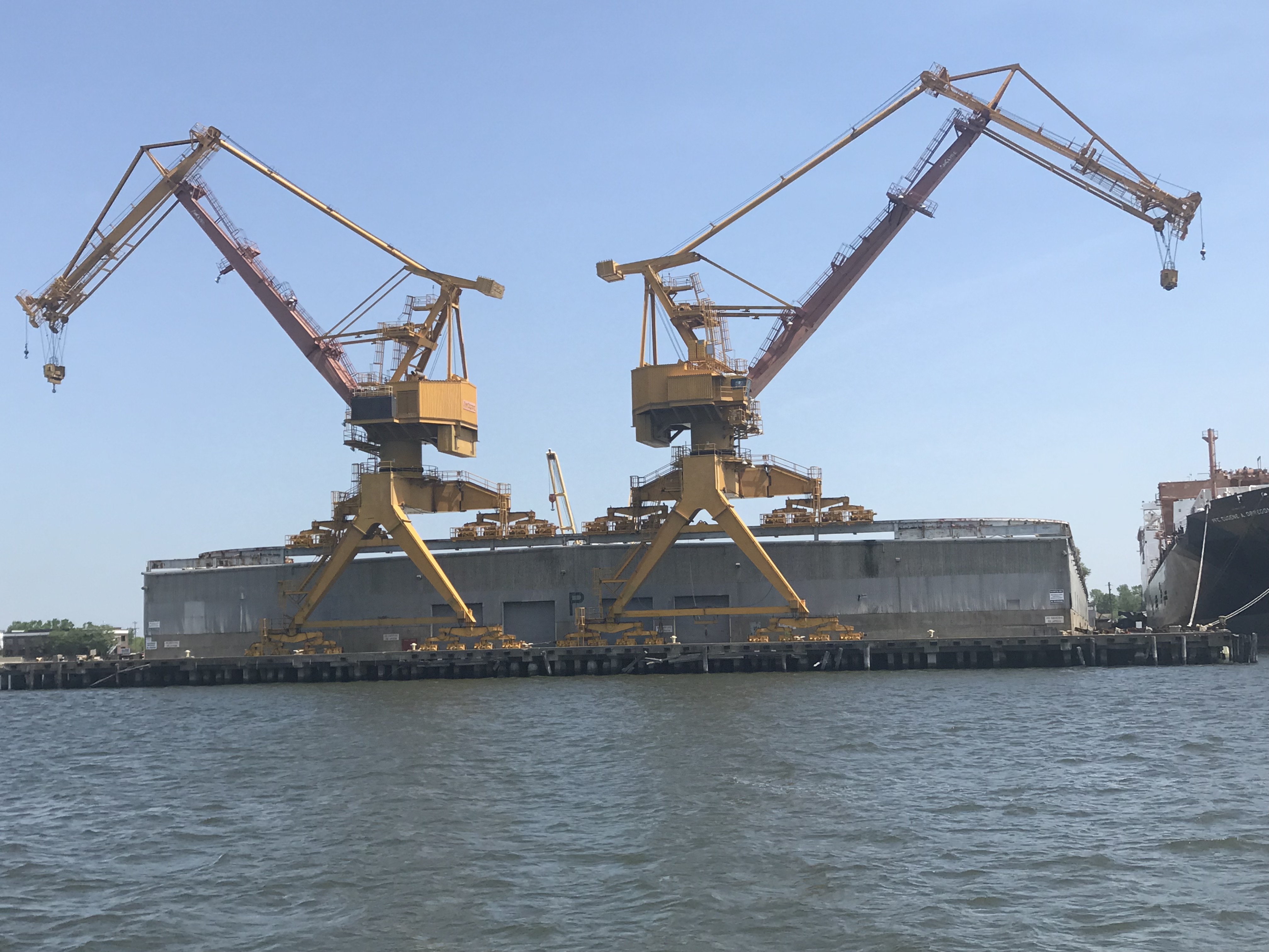
I always admire this thing as if it was a cool sculpture of sorts.
Star Wars?
One large container ship appeared to be washing their anchor. I wish I had a dedicated anchor wash system. Sometimes when our anchor comes up, it can be covered in muck from the sea bottom.
Anchors Getting Washed
We exited Norfolk harbor and pointed the boat up the coast. The weather was supposed to be 2-4 ft with 20kt winds.
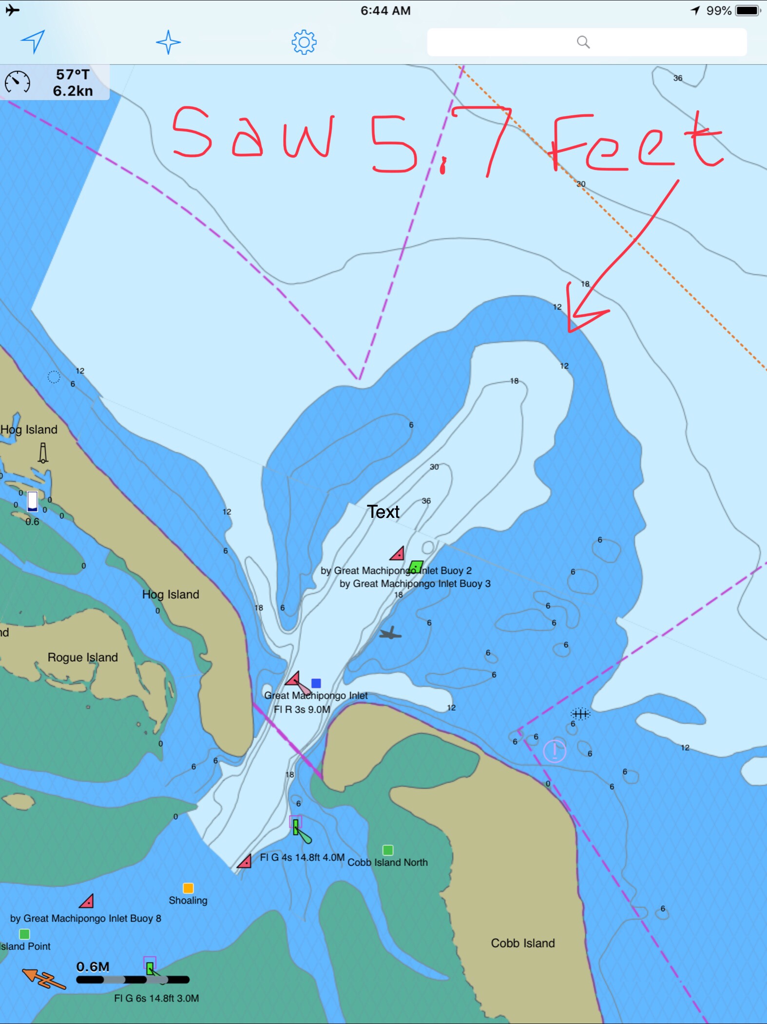
We soon realized that the waves which were on our beam were far larger than predicted and made for a miserable ride. When we arrived at our planned anchorage which was just inside the “Great Machipongo Inlet”. We had only to cross over the bar shoal at the entrance. By now the waves had built into large breaking waves that were pushing us from behind toward the bar. As we progressed slowly over the bar I watched the depths with dread. 10’, 9’, 8’, 7, 6’!!! When I saw 5.7, we did an immediate hard spin and raced back out to sea the way we came in. You don’t want to run aground in breakers 30 miles from anyone.
As the spray from the waves washed over the pilothouse, Kelly & I had an emergency discussion about what to do?
We had 4 Options:
Hold the bow into the large waves until the tide rises and attempt to cross the bar again. It would probably be dark before we got enough lift from the tide.
Continue North 70+ miles to Ocean City, MD. I was exhausted and did not think I could make it another 10 hours into the night.
Continue North 30+ miles to the MARS anchorage. Zero protection against the large waves would have made for an unbearable night on anchor and the next day was predicting 25 kt winds and larger waves.
Return the 30+ miles back the way we came and tuck around Fisherman’s Island and into Chesapeake Bay to find an anchorage.
We chose option 4. This was hard for me because I often say to Kelly, “I hate moving backward or retracing steps”. I think this comes from a combination of being A.D.D and always not wanting to go backwards for something that you forgot and just a desire to never see the same scenery twice. Always seeing something new brings happiness.
As we made our way back into the bay, the sea began to soften and the ride became smoother.
Sunset off Fisherman’s Island, VA
We selected an anchorage called Sunset Grille Anchorage. As we approached it was very overcast and dark. Radar pings were showing two docks extending far out from shore on either side of our intended anchorage spot. If we didn’t approach from exactly perpendicular to the shore we’d have slammed into these pilings on this dark night. Thankfully we have radar and a remote searchlight to identify hazards the radar pings.
We anchored and tried to get some sleep.
1AM and the boat was ROCKING. The wind had picked back up and the current had aligned us so the waves were on our beam. The boat was rocking violently. So much so that eventually, I had to start the boat and pull anchor and leave into the blackness. It’s always better to stay on anchor than attempt to navigate an unfamiliar harbor on a black night. But spend 4 hours in a boat that is rocking like an amusement ride and you’ll take your chances underway.
The wind had picked up and we were on the wrong side of a 20 mile fetch of water that was now battering us with large waves. We fought our way to the calmer side of the bay and then turned North looking for an anchorage that would give us protection against the strong Southerly wind and waves. We motored our way to Godfrey Bay and anchored in a calm protected bay, safe from the day’s harsh weather. It was only 11AM and I could barely keep my eyes open even with the 3 cups of coffee I had pumped into myself.
As we entered the anchorage, we passed this classic Chesapeake crab boat.
Looks like a painting I’d hang on my wall
Now peacefully on anchor. We are plotting a new course that takes us up the Chesapeake Bay.
We’ll traverse the C&D canal and then have to sail down Delaware Bay, round Cape May and go North up the coast toward NYC.
We had a quiet night on anchor in the Alligator River. Our anchor spot was just off the ICW and was an “easy in” and “easy out” in the morning. Note: some anchoring spots can have shallow or tricky entrances.
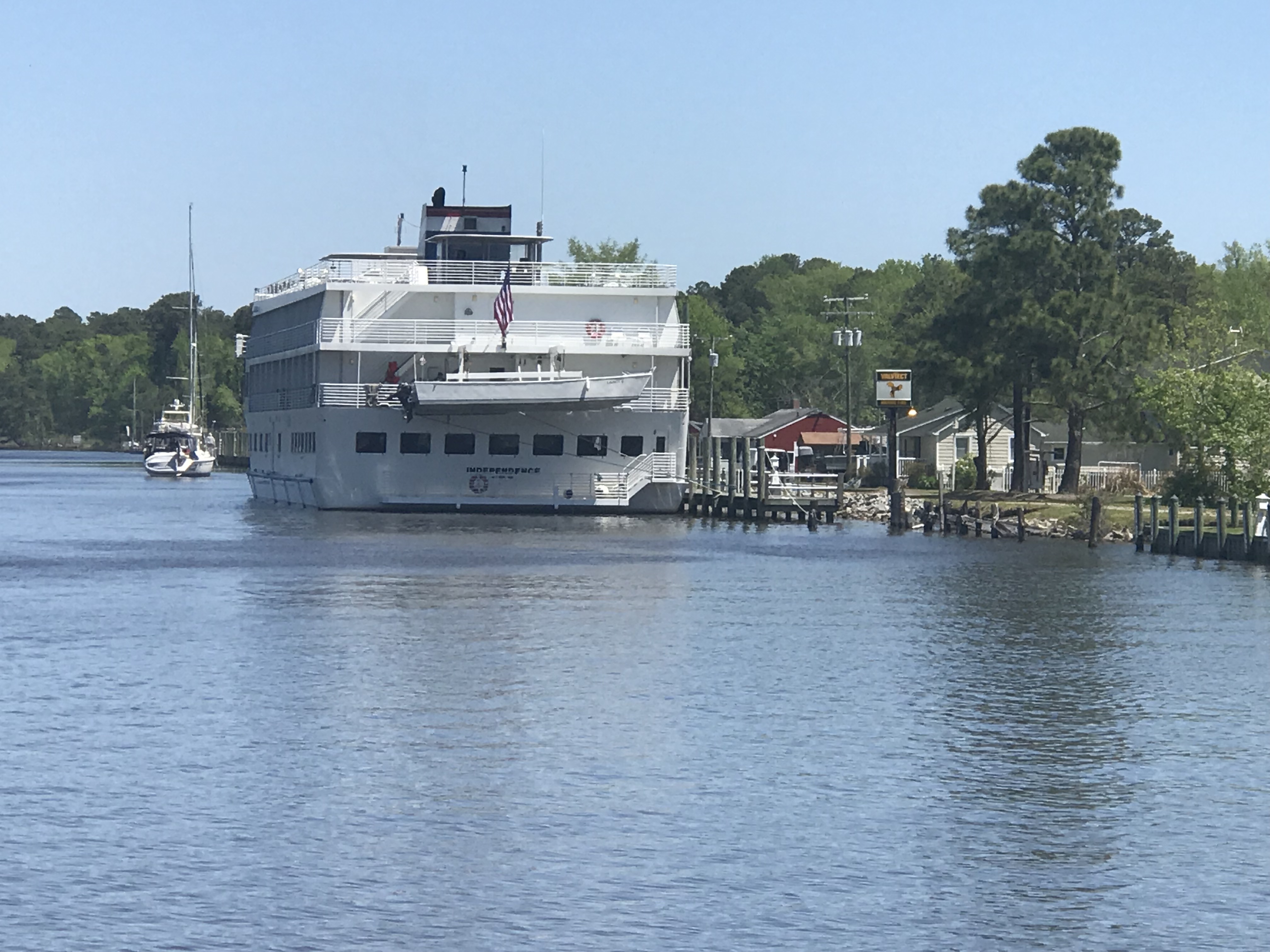
MV Independence uses AIS just like us so it was easy to acertain their ship’s name and hail them directly. I simply let the captain know that I saw they were going to overtake us and stated we would manuver to starboard and allow them exclusive use of the entire channel for a “2 whistle pass”.
American Cruise Lines, MV Independence
As the channel got narrow we had to get in line behind this sailboat who did not seem to have their VHF radio on. (repeated hails from us and the Alligator River Swing Bridge with no response). On the ICW you must monitor channel #16 (the international hailing channel).
Channel 70 (156.525 MHz) – Digital Selective Calling
DSC Discussion (skip this technical section if you like)
CH 70 or DSC or Digital Selective Calling is a new technology that uses EM wave pulses on channel 70 to send digital (1s and 0s encoded in electromagnetic pulses over a radio wave transmitted on channel #70’s designated frequency)
This channel is not for human voice transmission but for ships continually broadcasting their current position and heading. The data is received by your VHF antenna and processed by your AIS transceiver before finally being plotting on your chartplotter. Instead of just a radar blip on my chartplotter, I see a triangular icon representing the ship and if I click on it I get all sorts of info like:
Ship Name: So I can hail them by name instead of “Motor vessel off my port bow”
Heading
Speed
Ship length
MMSI #
Sail or powerboat
CPA (Closest point of approach or how close will they come to our boat if nothing changes)
CTA (at what time will they be the closest to us).
DSC also has a well hidden secret function where you can use a ship’s MMSI # (like a personal phone number) to call them directly. By this I mean you don’t hail them by name (ie. “ship name, ship name, this is motor vessel Simple Life on channel 16”. Instead you type in their MMSI number and a channel that you want their VHF radio to automatically tune to. Hit the PTT (Push To Talk) button and a loud tone plays over their VHF radio and their radio automatically jumps to the channel you wanted to communicate with them on. It’s a great feature but I must say I have not used it, nor have many other boaters. Maybe it will just take some time till the early adopters start teaching other boaters how to use it?
As we approached Coinjock, NC, there were large plumes of smoke coming from shore. I saw that the smoke which had started as grey/black was now white indicating that it was burning itself out (Where are my firefighter friends here, keep me honest).Maybe it was a controlled burn of the low lands?
Close Up
Far Away
Getting Closer
As we were pulling into Coinjock Marina, named for the NC town of the same name,we were aware that our port fuel tank was running on fumes. NOTE: we had some reserve fuel in the starboard diesel tank.
I think I need to start wiping my leather helm down with lint-free cloths 😉
We had made two long runs up the coast and at almost 9 kts and burned lots of fuel. Coinjock about 20 cents more per gallon of diesel than the marina we were heading to next. While not the cheapest place to take on over 300 gallons of diesel it was convenient. I mentioned to the dockhand that the next marina North was 20 cents cheaper a gallon and he responded, “Oh, our costs are higher because we sell more fuel than them”. I just smiled and thought, I’m pretty sure this friendly dockhand skipped school that day in business class 😉
When choosing a location for diesel be sure to chose a location that sells a lot of diesel. Common wisdom says: the more they sell, the less time the deisel sits in storage tanks acculmulating condensation water or other contaminations. If you have ever had your engine die offshore due to bad fuel you’ll agree that it’s better to spend a bit more for the likelihood of clean fuel.
The cruise ship which had passed us on the ICW was now docked in Coinjock to take on 5000 gallons of diesel.
MV Independence Docked in Coinjock NC
I believe in large ship terminology, the captain and crew talk about the amount of diesel they have in terms of weight rather than gallons. Diesel is about 7 lbs / gallon while gasoline is about 6 lbs / gallon. When you take on 5000 gallons of diesel you need to be thinking about how much that excess fuel weighs and what it does to your ship’s draft. Draft = how deep your boat sinks into the water. Air draft = how tall is your boat is above the water for fitting under low bridges.
MV Simple Life took on about 311 gallons or 2,177 lbs of diesel while we were there. We also filled our water tanks (8.3 lbs / gallon) so that adds another 3,700 lbs to our boat. If you ever read the specs for a boat it will list it’s dry weight as well as it’s water draft. Always remember that when you load your boat up with your possessions, passengers, dogs, food, fuel, water, etc that it will sink your draft a few more inches into the water. When a boat is designed they guesstimate the weight & displacement of the boat from summing up the weight of every item in the CAD drawing. This we know thanks to the ancient Greek scholar Archimedes and his “Eureka” moment when he figured out that a body (boat) displaces it’s exact weight in water.
Boats with sharp narrow hulls must sink lower in the water to float while boxy square hulls like that of a barge need only sink a small amount to displace their weight in water. The boxy square shape to the cruise ship allowed it to have ashallower draft than MV Simple life. So don’t follow the cruise ship up the ICW thinking… ”if there is enough water in the channel for them, we can easily follow them”.


You must be logged in to post a comment.